slide -2 soil...
TRANSCRIPT
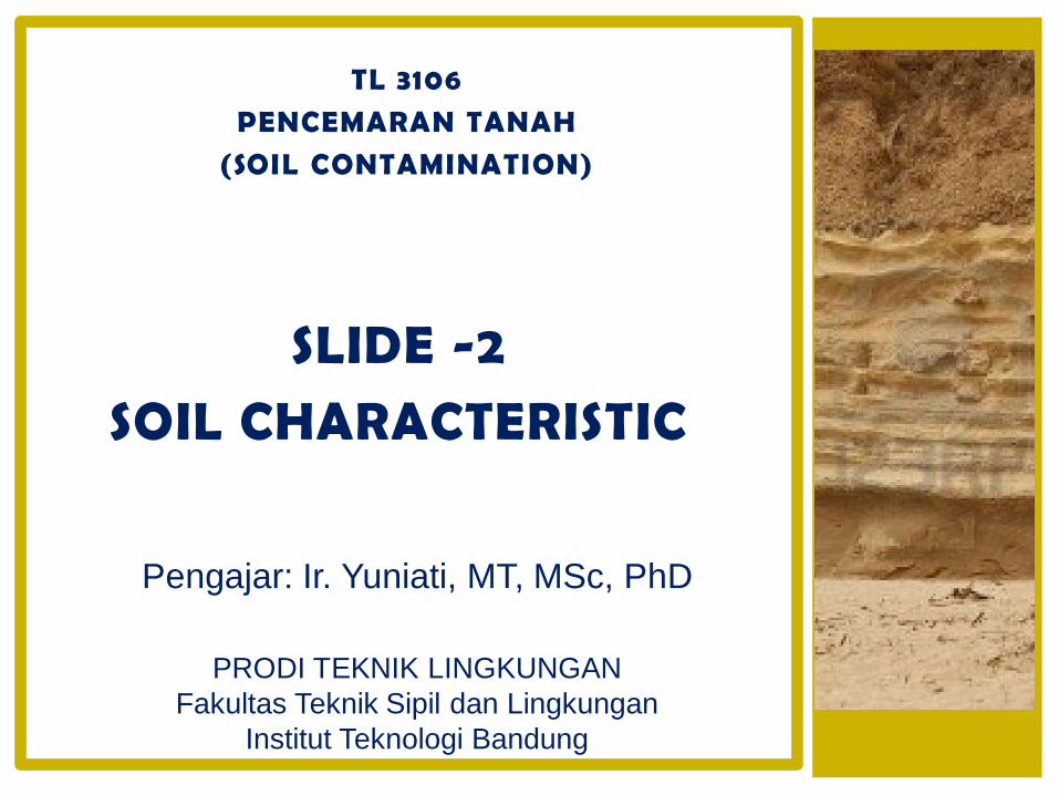
TL 3106
PENCEMARAN TANAH
(SOIL CONTAMINATION)
Pengajar: Ir. Yuniati, MT, MSc, PhD
PRODI TEKNIK LINGKUNGAN
Fakultas Teknik Sipil dan Lingkungan
Institut Teknologi Bandung
SLIDE -2
SOIL CHARACTERISTIC
Peraturan Pemerintah no 150/2000, tentang PENGENDALIAN KERUSAKAN TANAH UNTUK PRODUKSI BIOMASSA
Tanah adalah salah satu komponen lahan, berupa lapisanteratas kerak bumi yang terdiri dari bahan mineral dan bahanorganik serta mempunyai sifat fisik, kimia, biologi, danmempunyai kemampuan menunjang kehidupan manusia danmakhluk hidup lainnya;
Biomassa adalah tumbuhan atau bagian-bagiannya yaitubunga, biji, buah, daun, ranting, batang, dan akar, termasuktanaman yang dihasilkan oleh kegiatan pertanian, perkebunan, dan hutan tanaman;
Produksi biomassa adalah bentuk-bentuk pemanfaatan sumberdaya tanah untuk menghasilkan biomassa;
APA ITU TANAH?
WHAT IS SOIL?
A layer of natural materials on the earth’s surface containig both organic and inorganic materials and capable of supporting plant life.
The material covers the earth’s surface in a thin layer
It may be covered by water, or it may be exposed to the atmosphere.
Ideal soil should contain about 50% solid material and 50% pore space.
About half of the pore space should contain water and half of the space should contain air.
PARENT MATERIAL
Soil parent materials are those materials underlying the soil and from which the soil was formed.
There are five major categories of parent material:
1. minerals and rocks,
2. glacial deposits,
3. loess deposits,
4. alluvial and marine deposits and
5. organic deposits.
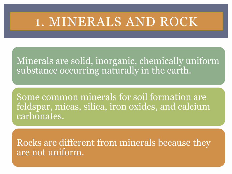
1. MINERALS AND ROCK
Minerals are solid, inorganic, chemically uniform substance occurring naturally in the earth.
Some common minerals for soil formation are feldspar, micas, silica, iron oxides, and calcium carbonates.
Rocks are different from minerals because they are not uniform.
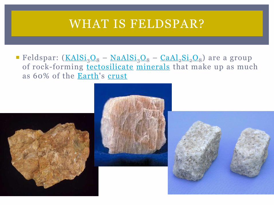
Feldspar: (KAlSi3O8 – NaAlSi3O8 – CaAl2Si2O8) are a group of rock-forming tectosilicate minerals that make up as much as 60% of the Earth's crust
WHAT IS FELDSPAR?
MINERALS AND ROCK
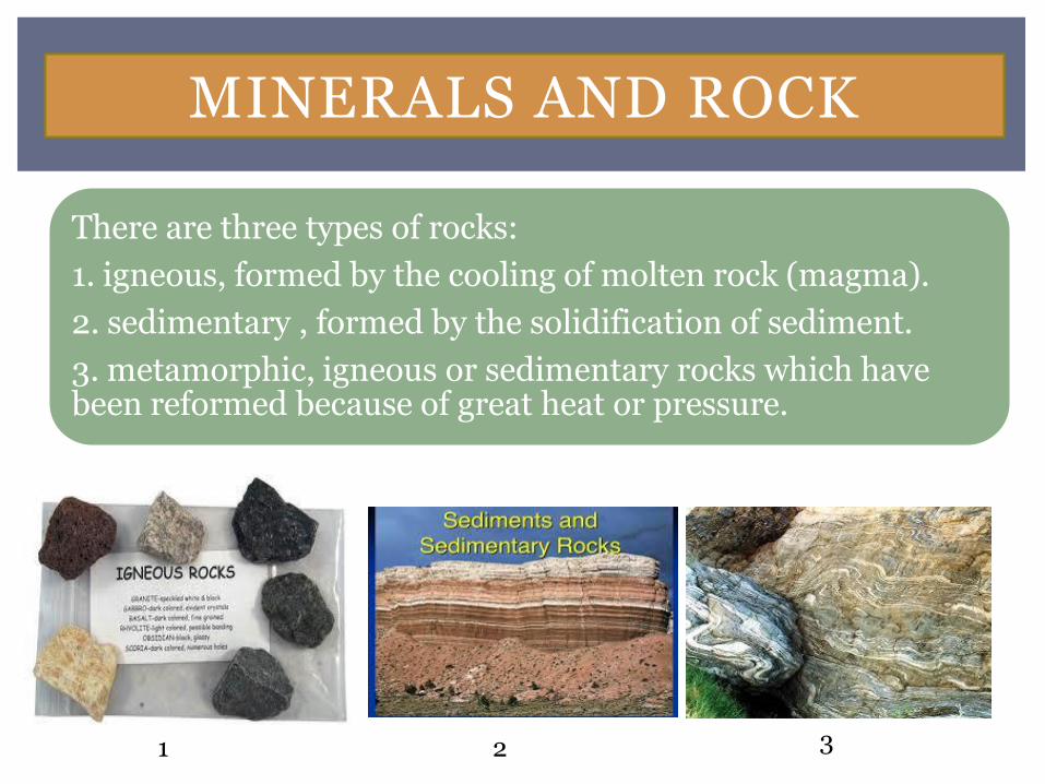
There are three types of rocks:
1. igneous, formed by the cooling of molten rock (magma).
2. sedimentary , formed by the solidification of sediment.
3. metamorphic, igneous or sedimentary rocks which have been reformed because of great heat or pressure.
1 2 3
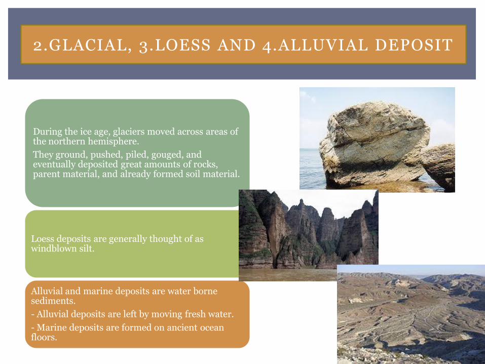
2.GLACIAL, 3.LOESS AND 4.ALLUVIAL DEPOSIT
During the ice age, glaciers moved across areas of the northern hemisphere.
They ground, pushed, piled, gouged, and eventually deposited great amounts of rocks, parent material, and already formed soil material.
Loess deposits are generally thought of as windblown silt.
Alluvial and marine deposits are water borne sediments.
- Alluvial deposits are left by moving fresh water.
- Marine deposits are formed on ancient ocean floors.
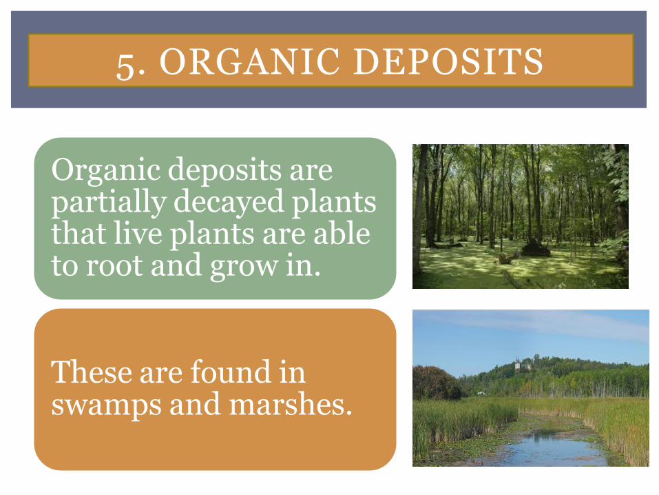
5. ORGANIC DEPOSITS
Organic deposits are partially decayed plants that live plants are able to root and grow in.
These are found in swamps and marshes.

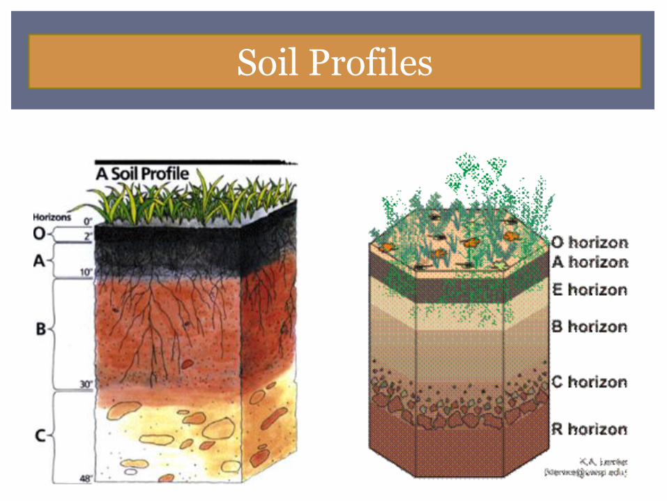
THE SOIL PROFILE
Soil Horizon, they are the layers of the different types of soil found at different depths in the soil profile.
Soil Profile, a vertical section through the soil extending into the un-weathered parent materials and exposing all the horizons .
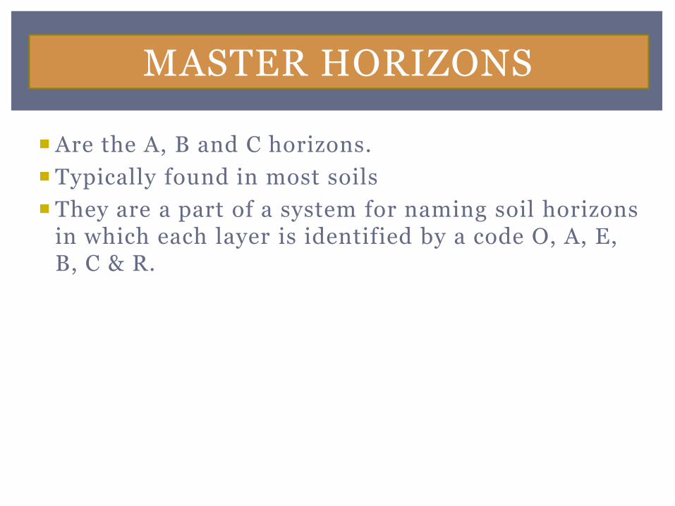
MASTER HORIZONS
Are the A, B and C horizons.
Typically found in most soils
They are a part of a system for naming soil horizons in which each layer is identified by a code O, A, E, B, C & R.
MASTER HORIZONS
Soil Profiles
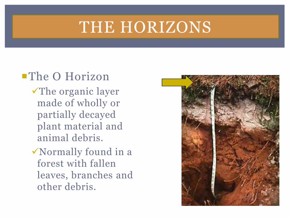
The O Horizon
The organic layer made of wholly or partially decayed plant material and animal debris.
Normally found in a forest with fallen leaves, branches and other debris.
THE HORIZONS
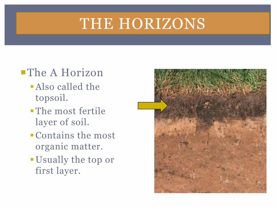
The A Horizon
Also called the topsoil.
The most fertile layer of soil.
Contains the most organic matter.
Usually the top or first layer.
THE HORIZONS
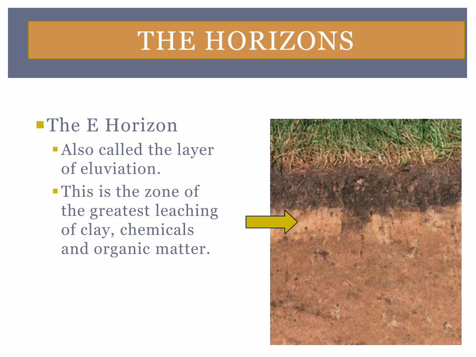
The E Horizon
Also called the layer of eluviation.
This is the zone of the greatest leaching of clay, chemicals and organic matter.
THE HORIZONS
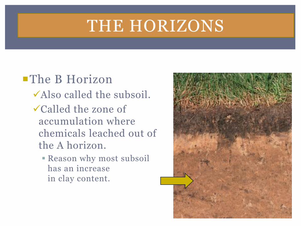
The B Horizon
Also called the subsoil.
Called the zone of accumulation where chemicals leached out of the A horizon.
Reason why most subsoil has an increase in clay content.
THE HORIZONS
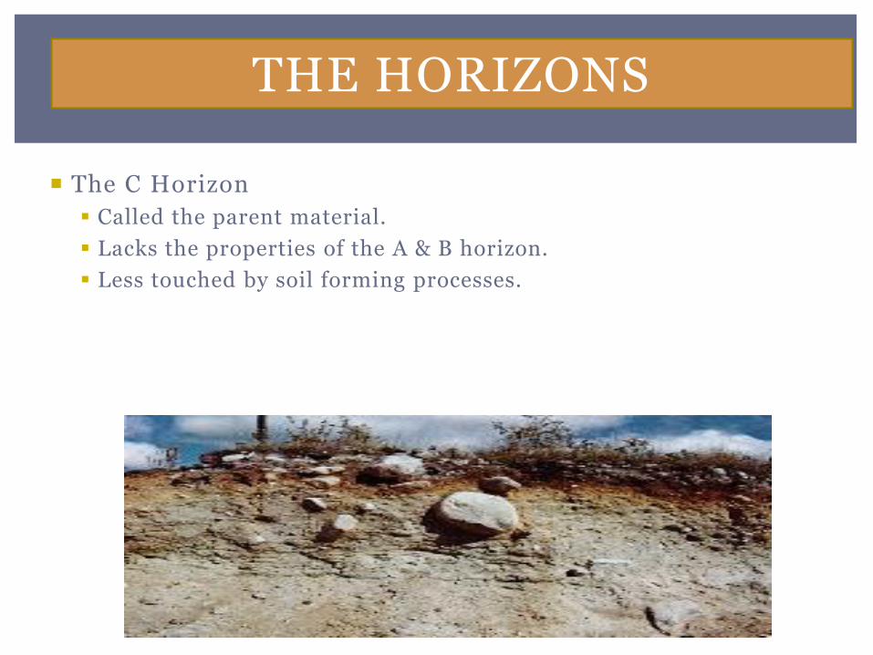
The C Horizon
Called the parent material.
Lacks the properties of the A & B horizon.
Less touched by soil forming processes.
THE HORIZONS
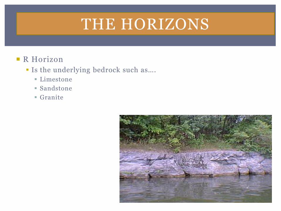
R Horizon
Is the underlying bedrock such as….
Limestone
Sandstone
Granite
THE HORIZONS
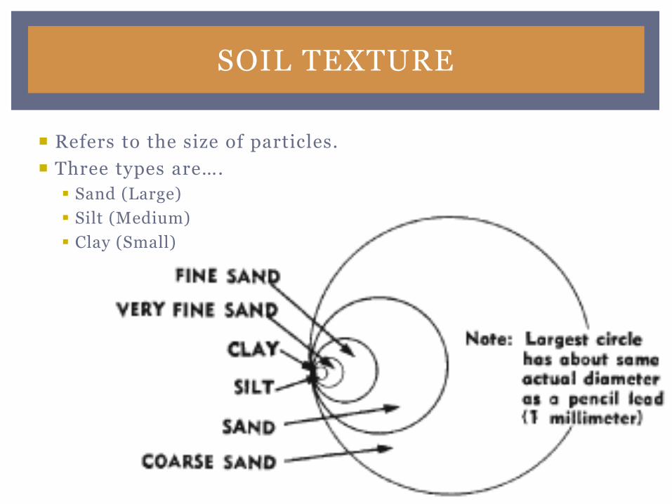
SOIL TEXTURE
Refers to the size of particles.
Three types are….
Sand (Large)
Silt (Medium)
Clay (Small)
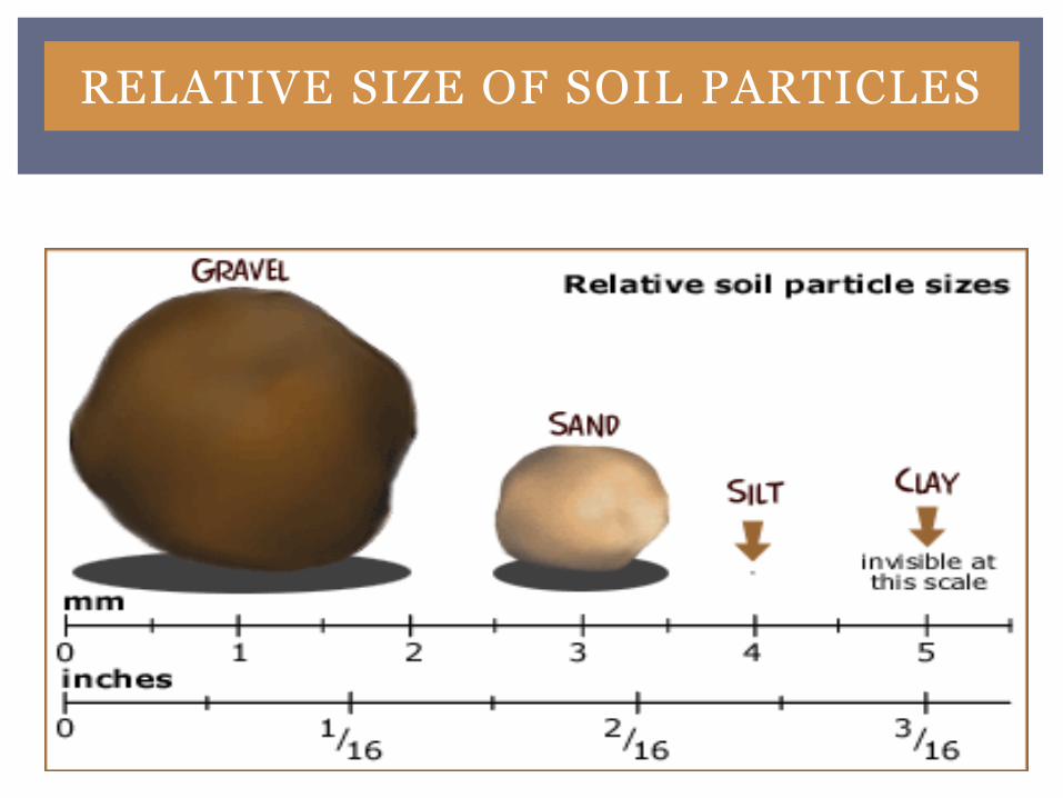
RELATIVE SIZE OF SOIL PARTICLES
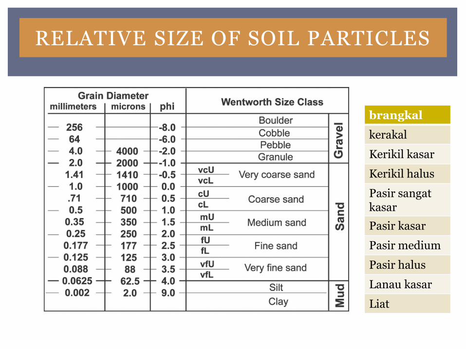
RELATIVE SIZE OF SOIL PARTICLES
brangkal
kerakal
Kerikil kasar
Kerikil halus
Pasir sangat kasar
Pasir kasar
Pasir medium
Pasir halus
Lanau kasar
Liat
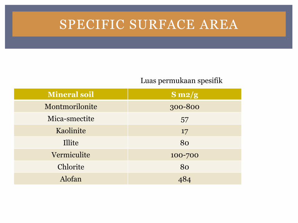
SPECIFIC SURFACE AREA
Mineral soil S m2/g
Montmorilonite 300-800
Mica-smectite 57
Kaolinite 17
Illite 80
Vermiculite 100-700
Chlorite 80
Alofan 484
Luas permukaan spesifik
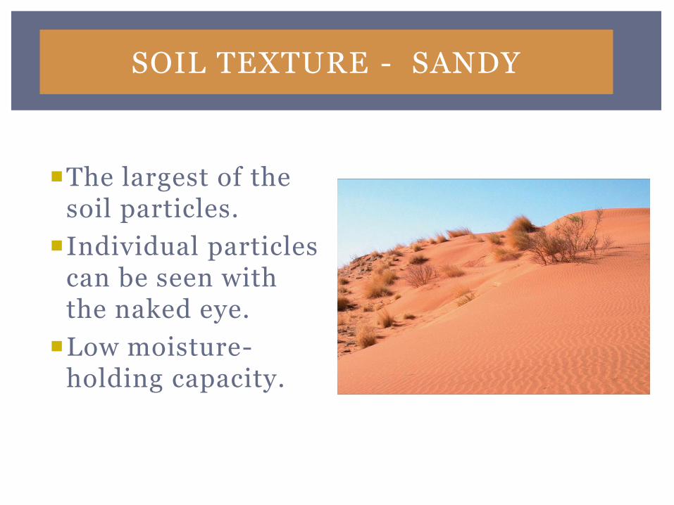
SOIL TEXTURE - SANDY
The largest of the soil particles.
Individual particles can be seen with the naked eye.
Low moisture-holding capacity.
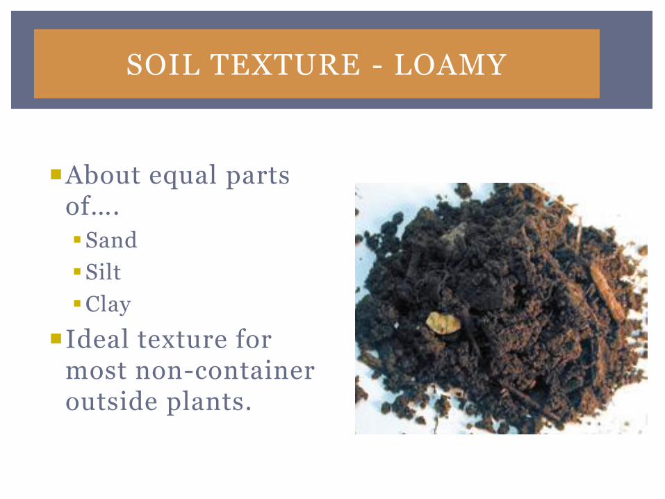
SOIL TEXTURE - LOAMY
About equal parts of….
Sand
Silt
Clay
Ideal texture for most non-container outside plants.
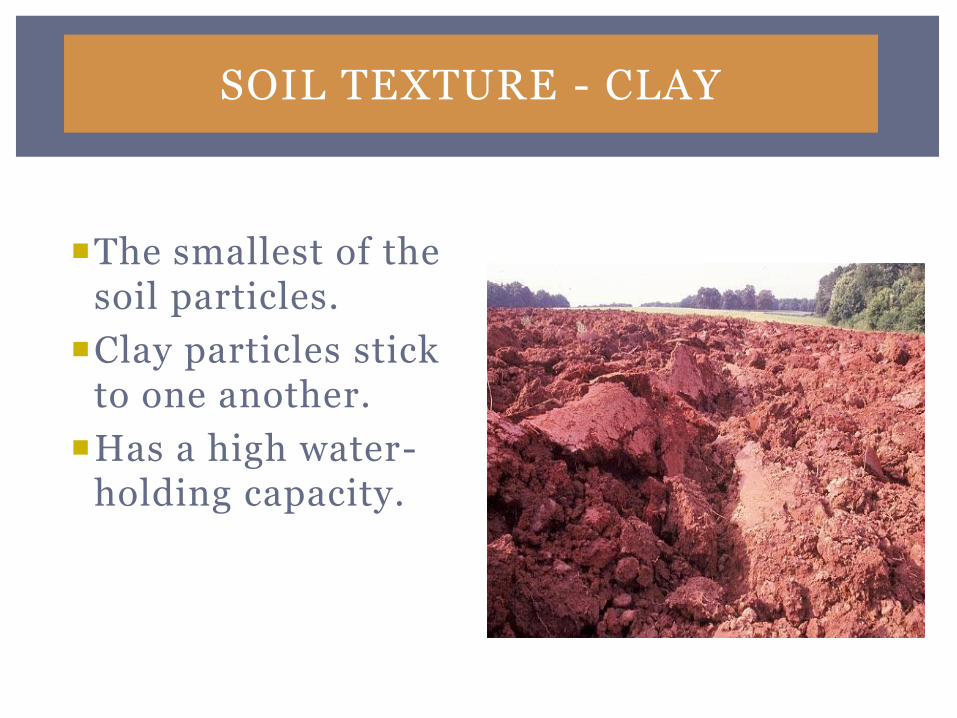
SOIL TEXTURE - CLAY
The smallest of the soil particles.
Clay particles stick to one another.
Has a high water-holding capacity.

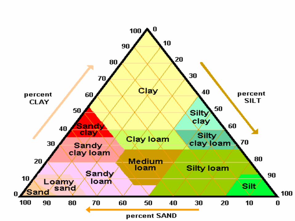
TEXTURAL CLASSES
There are 12 textural classes.
Represented on the Soil Texture Triangle.
Textural class determined by the percentage of sand, silt, & clay (pasir, lanau, liat)
Loam (lempung)
TEXTURAL CLASSES
There are 12 textural classes.
Represented on the Soil Texture Triangle.
Textural class determined by the percentage of sand, silt, & clay (pasir, lanau, liat)
Loam (lempung)
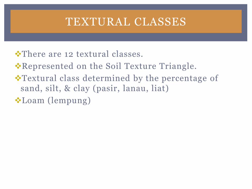
SOIL STRUCTURE
Refers to the way soil particles cling together to form soil units or aggregates, while leaving pore space to….
Store air.
Store water.
Store nutrients.
Allow root penetration.
TYPES OF SOIL STRUCTURES
There are five types of soil structures.
They are:
Single grain
Granular
Platy
Blocky
Prismatic
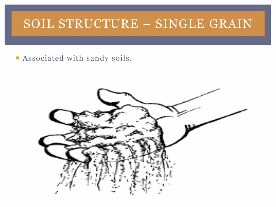
SOIL STRUCTURE – SINGLE GRAIN
Associated with sandy soils.
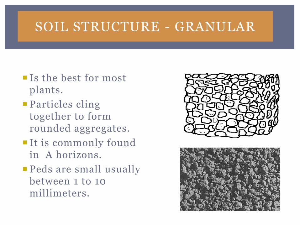
SOIL STRUCTURE - GRANULAR
Is the best for most plants.
Particles cling together to form rounded aggregates.
It is commonly found in A horizons.
Peds are small usually between 1 to 10 millimeters.
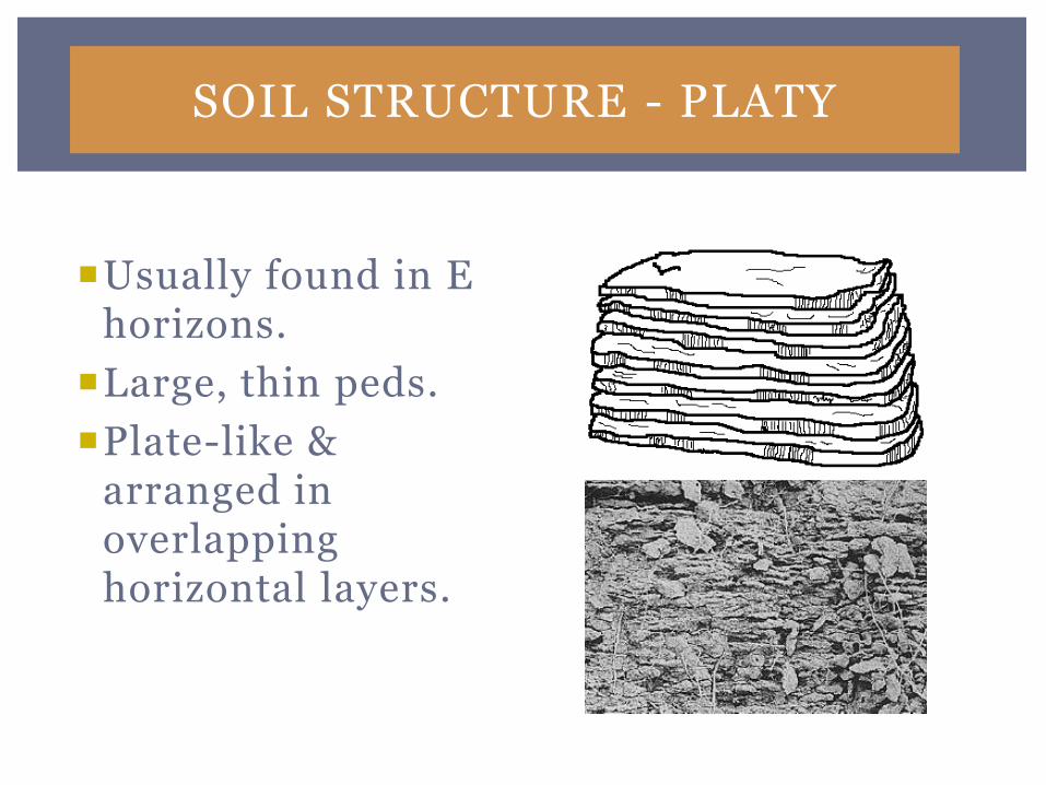
SOIL STRUCTURE - PLATY
Usually found in E horizons.
Large, thin peds.
Plate-like & arranged in overlapping horizontal layers.
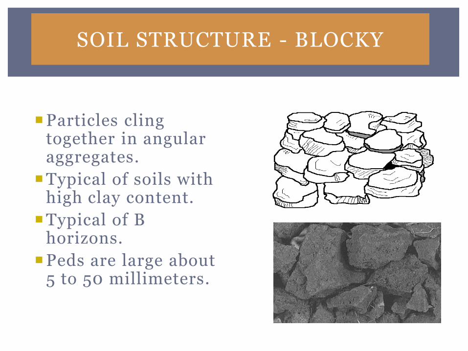
SOIL STRUCTURE - BLOCKY
Particles cling together in angular aggregates.
Typical of soils with high clay content.
Typical of B horizons.
Peds are large about 5 to 50 millimeters.
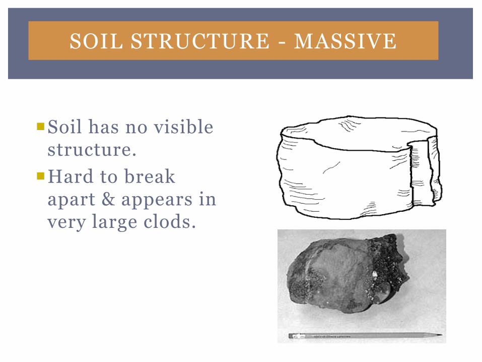
SOIL STRUCTURE - MASSIVE
Soil has no visible structure.
Hard to break apart & appears in very large clods.
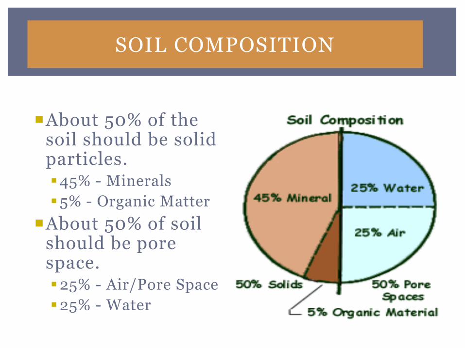
SOIL COMPOSITION
About 50% of the soil should be solid particles.45% - Minerals
5% - Organic Matter
About 50% of soil should be pore space.25% - Air/Pore Space
25% - Water
SOIL PH
pH has the most impact on the availability of nutrients in the soil/media.
pH Scale
Ranges from 0 to 15.
Indicates the level of acidity or alkalinity.
7 is considered neutral.
Everything greater than 7 is considered alkaline (basic).
Everything less than 7 is considered acidic.
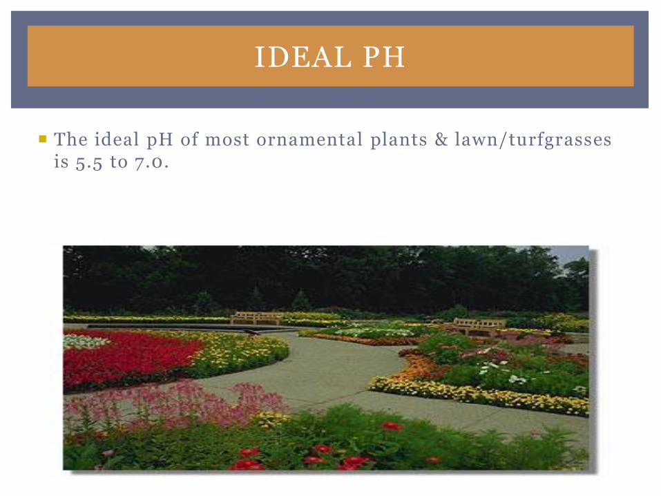
IDEAL PH
The ideal pH of most ornamental plants & lawn/turfgrasses is 5.5 to 7.0.
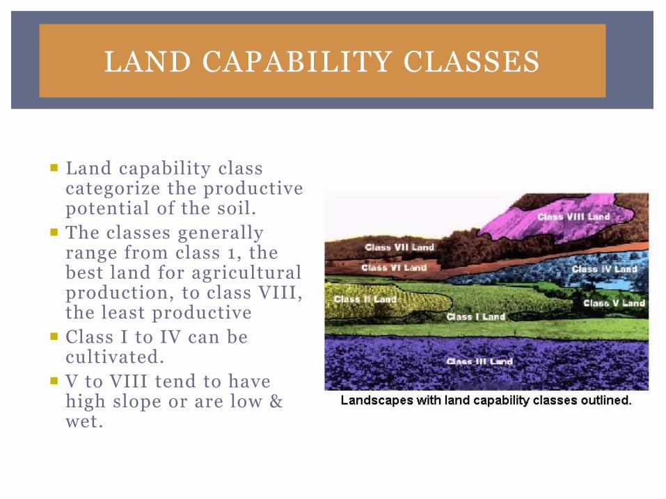
LAND CAPABILITY CLASSES
Land capability class categorize the productive potential of the soil.
The classes generally range from class 1, the best land for agricultural production, to class VIII, the least productive
Class I to IV can be cultivated.
V to VIII tend to have high slope or are low & wet.
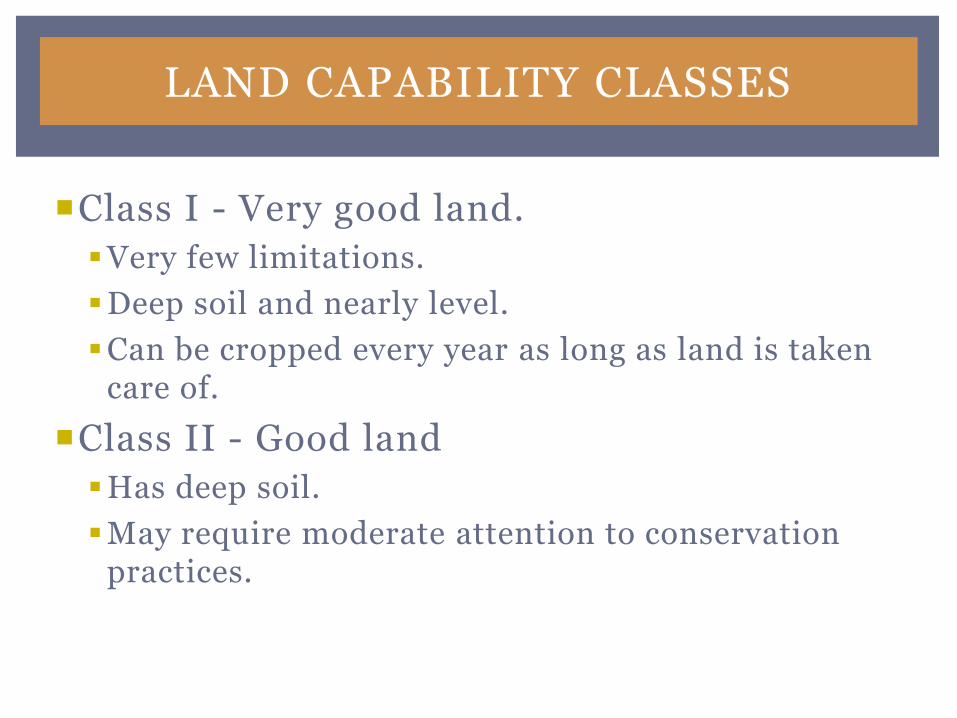
LAND CAPABILITY CLASSES
Class I - Very good land.
Very few limitations.
Deep soil and nearly level.
Can be cropped every year as long as land is taken care of.
Class II - Good land
Has deep soil.
May require moderate attention to conservation practices.
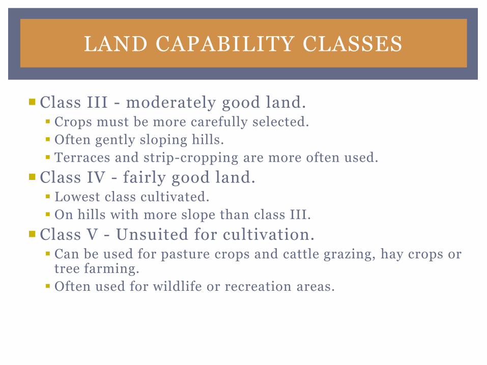
LAND CAPABILITY CLASSES
Class III - moderately good land. Crops must be more carefully selected.
Often gently sloping hills.
Terraces and strip-cropping are more often used.
Class IV - fairly good land. Lowest class cultivated.
On hills with more slope than class III.
Class V - Unsuited for cultivation. Can be used for pasture crops and cattle grazing, hay crops or
tree farming.
Often used for wildlife or recreation areas.
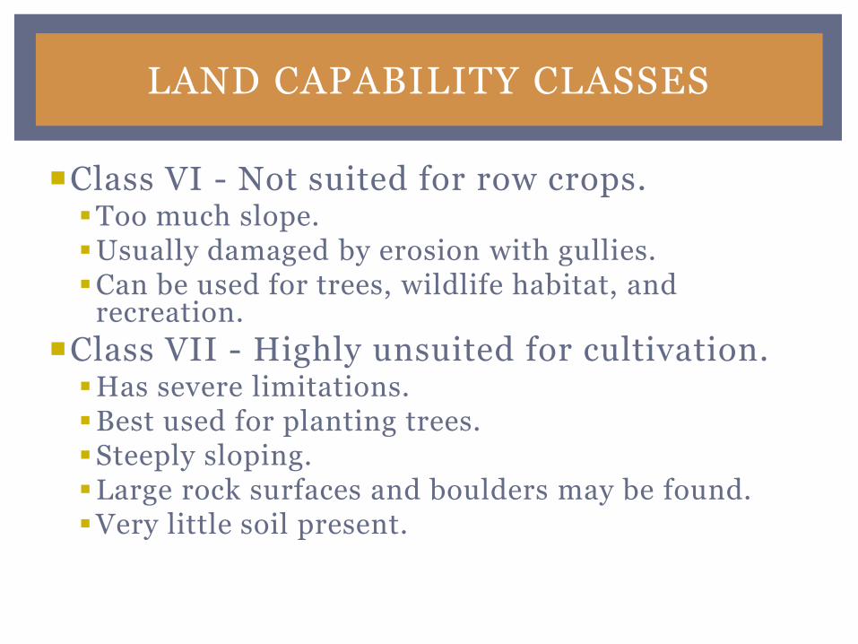
LAND CAPABILITY CLASSES
Class VI - Not suited for row crops.Too much slope.Usually damaged by erosion with gullies.Can be used for trees, wildlife habitat, and
recreation.
Class VII - Highly unsuited for cultivation.Has severe limitations.Best used for planting trees.Steeply sloping.Large rock surfaces and boulders may be found.Very little soil present.
LAND CAPABILITY CLASSES
Class VIII – Cannot be use for commercial plants.
Cannot be used for row crops or other crops.
Often lowland covered with water.
Soil maybe wet or high in clay.
Best suited for wildlife & recreation.
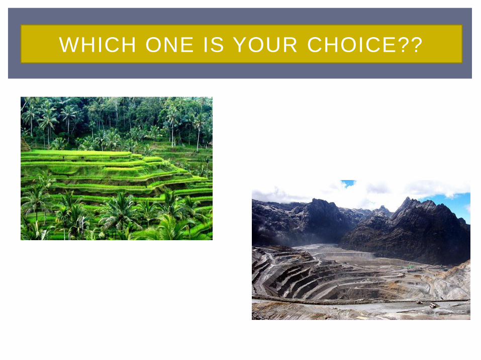
WHICH ONE IS YOUR CHOICE??