sketch masterplan
DESCRIPTION
sketch Masterplan of Deptford CreekTRANSCRIPT

Context
River Thames
DEPTFORD
GREENWICH
BLACKHEATH
LEWISHAM BROCKLEY
HITHER
GREEN
Deptford Creek
River
Racensbourne
River Quaggy
Kyd Brook
Cutty Sark
North Greenwich
Isle of Dogs
Lewisham
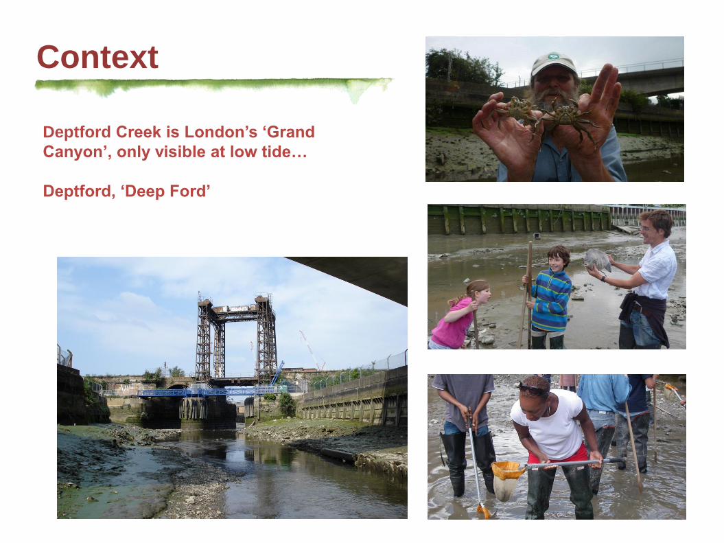
Context
Deptford Creek is London’s ‘Grand
Canyon’, only visible at low tide…
Deptford, ‘Deep Ford’

Phoenix Gas Works
Shipbuilding Yard
Engine Works
Gas Works
Pumping Station
General Steam
Navigation Works
Soap Works
Manure Works
Pitch Tar Varnish Works
Surrey Brach Gas Works
Chemical Works
History
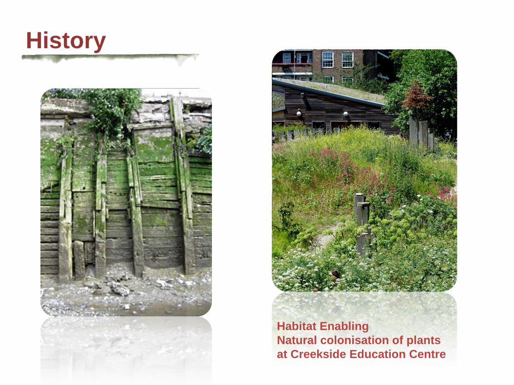
History
Habitat Enabling
Natural colonisation of plants
at Creekside Education Centre

Charrette’s Proposal
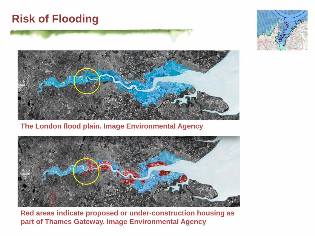
Risk of Flooding
The London flood plain. Image Environmental Agency
Red areas indicate proposed or under-construction housing as
part of Thames Gateway. Image Environmental Agency

River Profile
Prehistorical overlaid on
current river profile
17 Century overlaid on
current river profile
Proposed river profile
Marshy delta Island
Concrete/Timber Bank
Main transport route
Canals/Docks/Osier
island
Marshy island /
Terraced bank
Natural infiltration

Land Use
Exiting Developer's Proposal Assessment Mitigation

Circulation
Exiting Mitigation
Creek Road
A2
Deptford Church Street
Greenwich
High Road
Deptford
Church Street Ha’Penny
Hatch Foot
Bridge
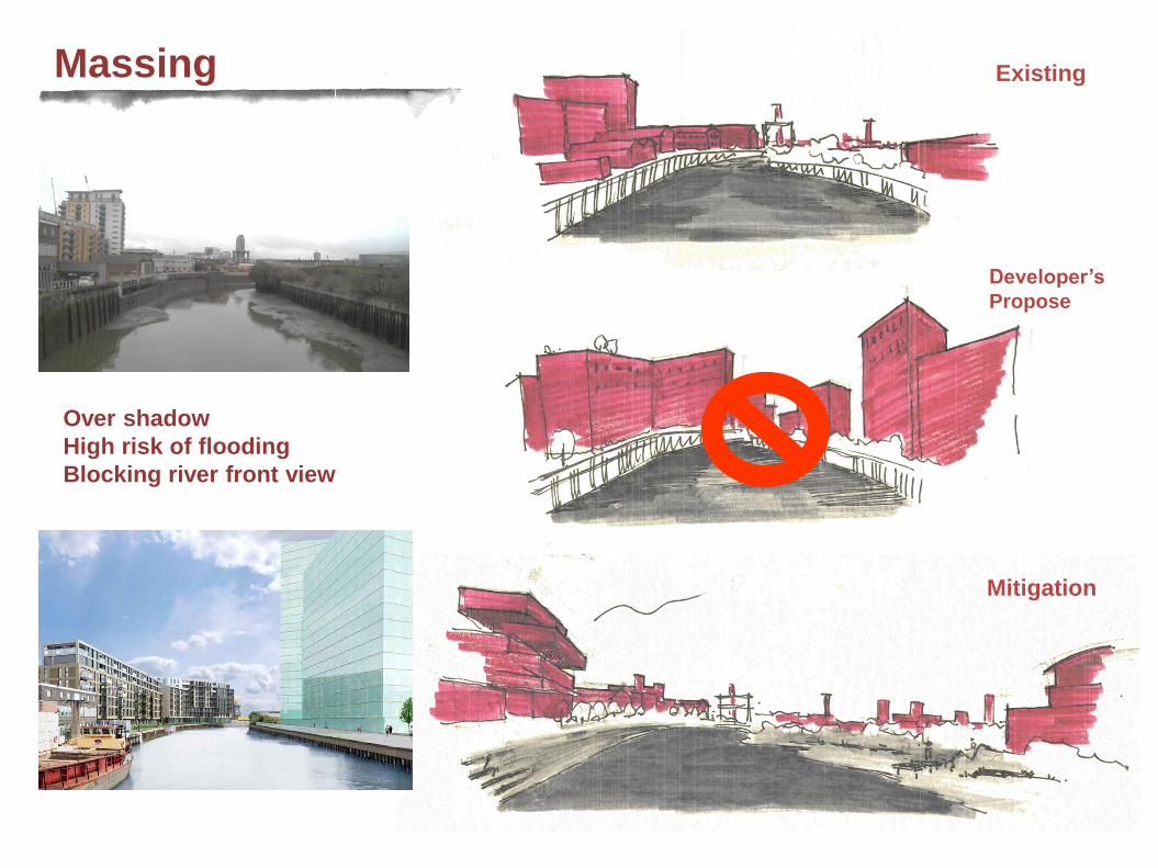
Massing
Existing
Developer’s
Propose
Mitigation
Over shadow
High risk of flooding
Blocking river front view

View

Exiting Developer's Proposal Assessment Mitigation
Ecology

Draft Master Plan?

After
Looking towards
Isle of Dogs
Mushy island with
floating houses

Before
After
Thames Water
Sewage Pumping
Station converted
to Ecological Park
To Fairview
Artist Quarter


Deptford Creek
Thank you!
The Thin Green Line
The New Cohabitation of Nature and City