road safety basics - nysmpos.org safety assessment process.pdf · road safety assessment process...
TRANSCRIPT

Road Safety Assessment Process for NYSMPOs
Presenters: Frank L. Dolan, BergmannBrian Malone, SynecticsGreg Junnor, Synectics
Presented at the NYSMPO Conference June 12, 2008,,

Purpose of the presentation
� To report purpose of project � Progress to date� To present safety assessment guidelines� To present safety assessment field tests to
date� To answer your questions

Progress to date
� Draft Assessment Guidelines Completed
� Comments received and under review
� 2 field tests completed
� 1 field test scheduled in New York City next week

Safety Assessment Guidelines
� Purpose of Guidelines:
� To present the SA process step-by-step so that the reader gets an idea of the SA process as a whole.
� Serve as a reference tool for MPO’s and Local Officials in managing and/or conducting SAs

5
What is a Safety Assessment?
An SA is aformal safety performance
examinationof an existing or future
transportation facility, road, intersection, or development
by a non biased multidisciplinary team.“Low Cost Tool to Improve Safety”
Conducting an SA
The SA Team considers the safety of all users, qualitatively estimates and reports on safety issues, and identifies opportunities for safety improvement

Attributes� formal: procedures and
documentation
� safety performance: focus confined to user safety
� independent, non biased:
Persons who can objectively review the area
� assessment team: general experience and specialists ( if available)–multidisciplinary

Key Elements
� Team size: should we suggest three for local roads/simple projects, and four for other projects?
� Independence of SA team: specific vs. broad/functional definition: “independent if the members do not have any conflict of interest which may affect Assessment findings and recommendations”.

Safety Assessments Stages� Stage ER: SAs of existing roads (the road is
open to traffic)� Stage PL: Planning stage SAs� Stage PD: Preliminary design SAs (plans
30-40% complete).� Stage DD: Detailed design SAs (plans 60-
80% complete)� Stage LD: SAs of land use development
projects� Stage PO: Pre-opening SAs (the
construction of the design is practically completed)
� Construction Phase
Roles and Responsibilities in the Safety Assessment Process
� The SA defines the project, participants, roles and responsibilities
� The roles and responsibilities are defined for the Assessment team members. What is expected and how to do it.

SA..…
� Considers the safety of all users
� Examines interaction between project elements and users; identifies risks
� Suggests mitigating measures

An SA is NOT….
� …a standards check� May identify design or
operational issues, but not checking design compliance
� ….an opportunity to re-visit or re-design the project� Suggests improvements,
provides illustrative solutions
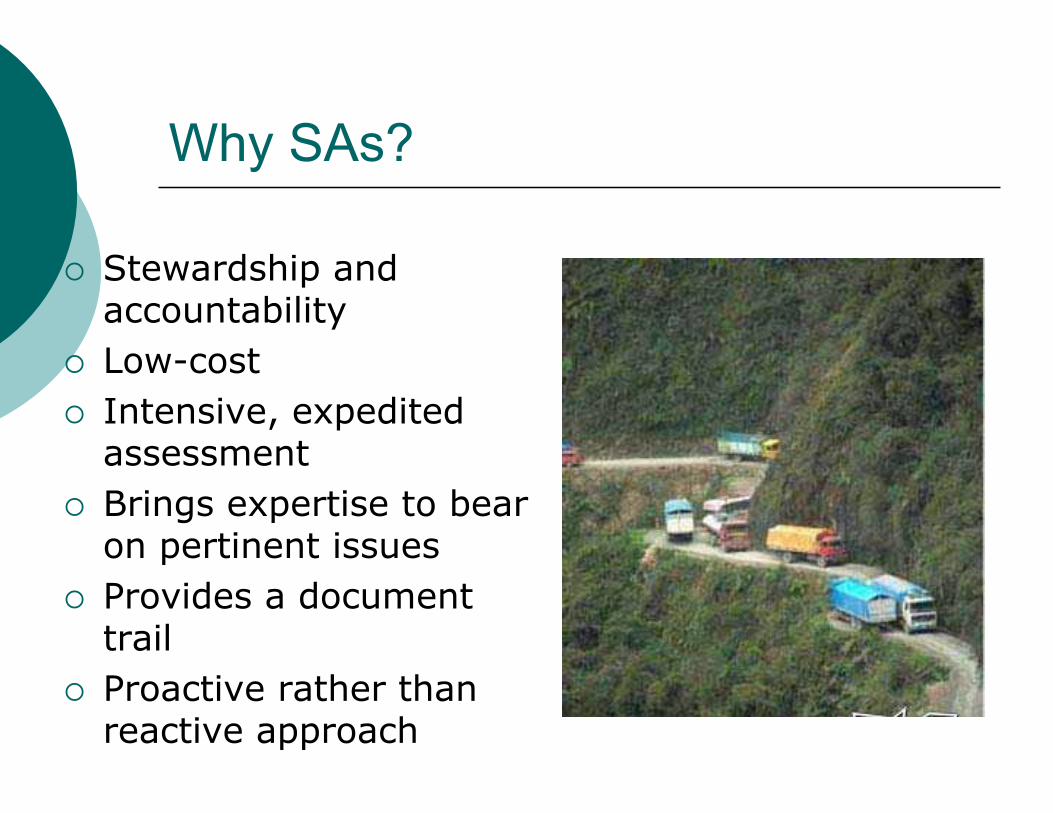
Why SAs?
� Stewardship and accountability
� Low-cost� Intensive, expedited
assessment� Brings expertise to bear
on pertinent issues � Provides a document
trail� Proactive rather than
reactive approach
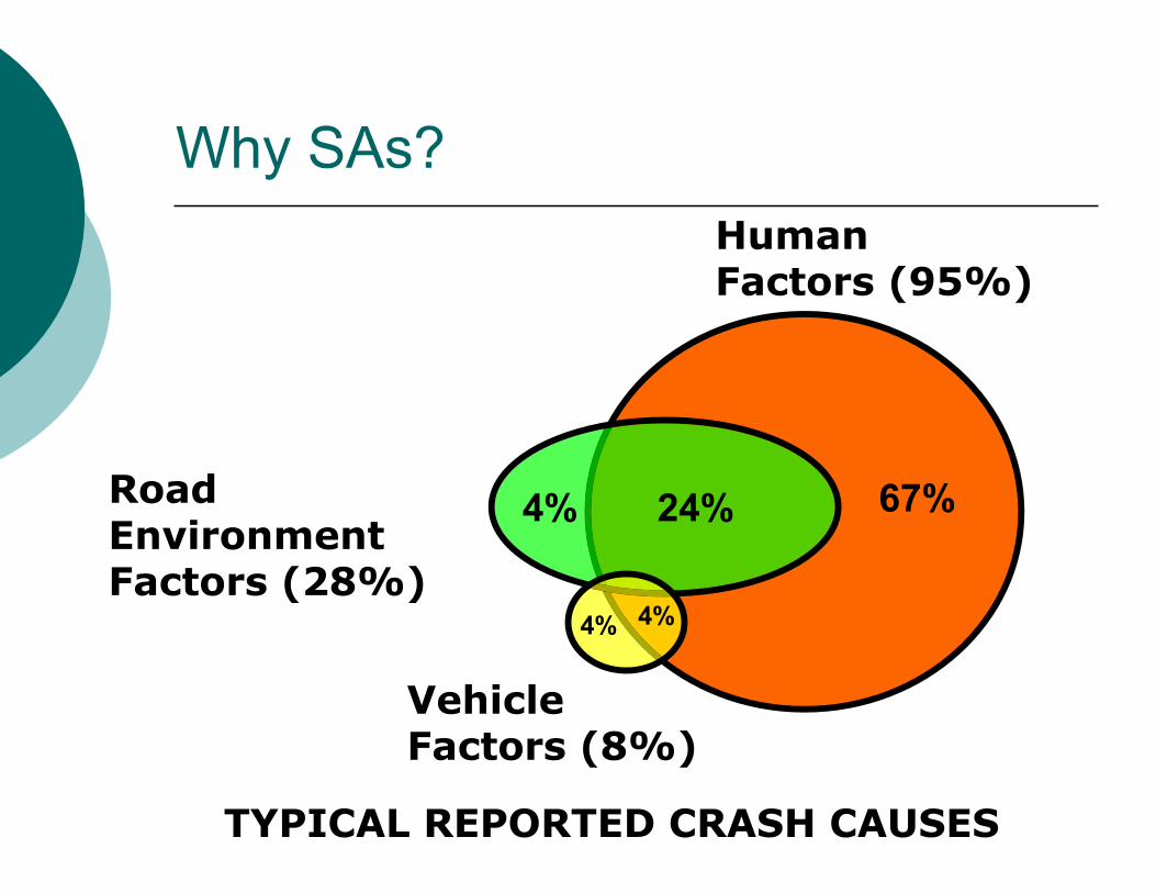
RoadEnvironmentFactors (28%)
VehicleFactors (8%)
HumanFactors (95%)
4%
24% 67%4%
4%
TYPICAL REPORTED CRASH CAUSES
Why SAs?
Why SAs?
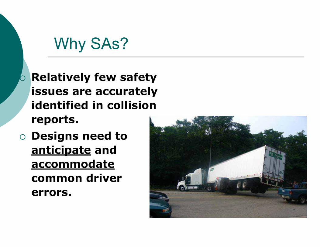
� Relatively few safety issues are accurately identified in collision reports.
� Designs need to anticipate andaccommodatecommon driver errors.

Why SAs?
There are many competing interests at play in transportation projects:� cost� right of way� environment� topographic and geotechnical conditions� socio-economic issues� capacity / efficiency� politics� safety
Why SAs?
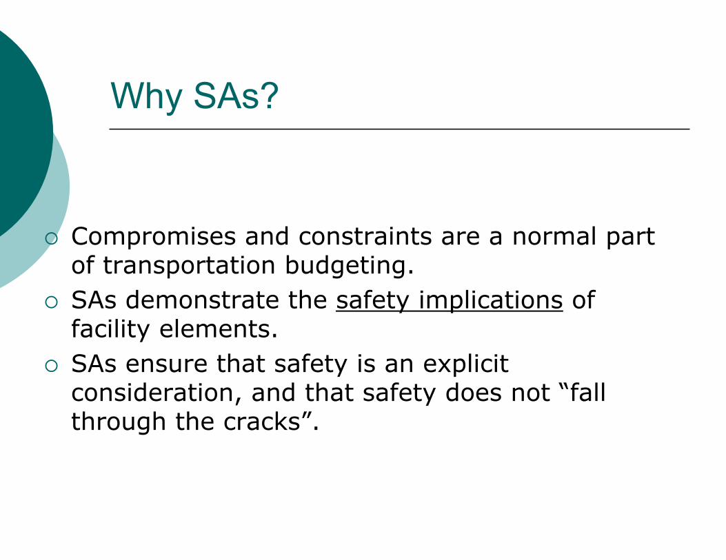
� Compromises and constraints are a normal part of transportation budgeting.
� SAs demonstrate the safety implications offacility elements.
� SAs ensure that safety is an explicit consideration, and that safety does not “fall through the cracks”.

The SA Difference
� reactive� vehicle-centric� in-house team� field review?� standards
compliance
� proactive� independent team� field reviews� comprehensive, with
human factors
TraditionalOperational
Safety Review
Safety Assessment

Conducting an SA
Step 1: Identify Project or Existing Location to be Assessed
Step 2: Select an SA Team Step 3: Conduct a Pre-assessment Meeting to
Review Project Information and DrawingsStep 4: Conduct Review of Project Data and
Field Review
Conducting an SA
Step 5: Conduct Assessment Analysis and Prepare Report of Findings/Suggestions
Step 6: Present Assessment Findings to Project Owner/Design Team
Step 7: Review SA Report and Prepare Formal Response
Step 8: Incorporate SA Suggestions

Identify Candidate Projects
� High-collision sites (network screening)
� High-profile (political or public interest)
� Unique, high-risk, high exposure projects
� Sites at which traffic characteristics have changed over time

Selection of Locations on Existing Roads for SAs
� Proposed Location Selection Matrix
case by case decision always
Locations selected for 1R, 2R, 3R projects 1R, 2R, 3R annual programs �
High-crash intersectionsComparizon of safety of the entity with thebaseline.
Subsequent selection of entities from the top candidate list*.
�
High-crash road sectionsComparizon of safety of the entity with the baseline.
Subsequent selection of entities from the top candidate list*.
�
Locations identified from other sources
"Qualitative" list by local jurisdictions compiled based on local knowledge and observations, public complaints/concerns, police concerns, anecdotal
evidence, traffic conflict studies etc**.
�
* different methods to define these measures and derive their estimates are available. Usually the Guidelines do not contain the overview oif such methods. [The need for inclusion of such overview to be discussed]The number of locations from this top list should be determined by MPO based on the budget available each yearThe synthesis could appended to the Guidelines [To be discussed]** SA Program coordinator should define a process to solicit this input from local jurisdictions on a regular basis
Locations on existing road network How determined
When conducted

SA Team
� Independent-Non Biased� Experienced� Multi-disciplinary
� SA Process & Transportation Safety
� Design� Construction Mgmt� Operations & Mtce.� First Responders &
Enforcement� Human Factors� Users

Requirements to a SA Team
Core Qualifications: Who should be on the team? Typical Team but not absolute� Safety Specialist , Traffic Operations Practitioner,
Road Designer, Local Contact Person, Police official
Additional qualifications� Will be defined for each stage by SA facilitator
Minimum Team size- 3
Independence of Safety Assessment Team- Non Biased and open to suggestions and comments

Pre-Assessment Meeting/Office Review
� Drawings� Background reports� Design criteria� Designer / operator /
owner briefing� Collision history� Traffic characteristics� Photographs

Field Review
� Consider� All users� Needs, capabilities,
limitations� Likely behavior
� Use prompts to assist review
� Take notes and photos
� Team cooperation / interaction

Prompt ListsA tool to assist: Use as a guideNot a “check” list Keep the focus on safety!
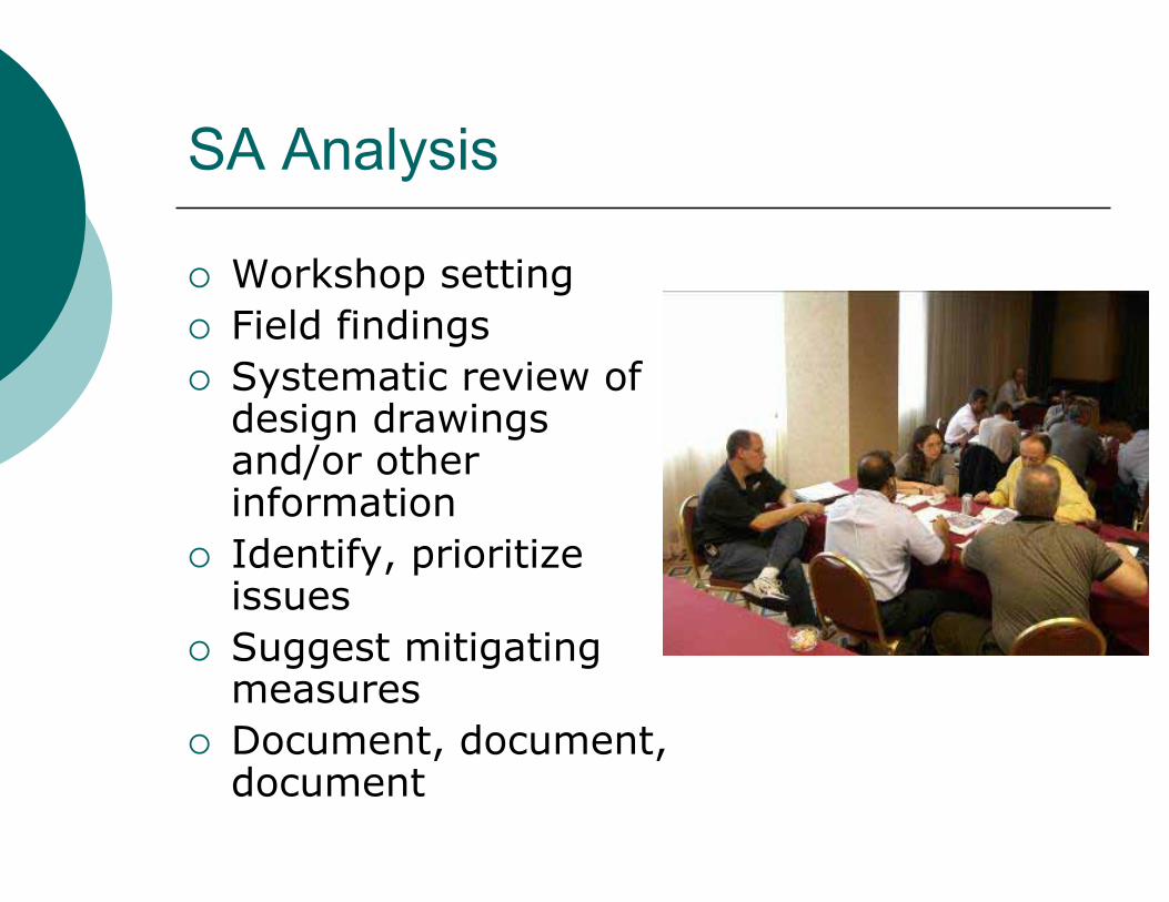
SA Analysis
� Workshop setting� Field findings� Systematic review of
design drawings and/or other information
� Identify, prioritize issues
� Suggest mitigating measures
� Document, document, document

Potential Crashes
� Reduce Crash Frequency
� Reduce Crash Severity
� Expediteincidentresolution
� No collision history ?� Consider risk estimation (qualitative)
� Exposure – opportunity to occur� Probability - likelihood of occurring� Consequence – outcome of occurrence

Presentation of Findings
� SA team, design or operations team, owner
� Discuss preliminary findings and possible solutions
� Use results to prepare SA report
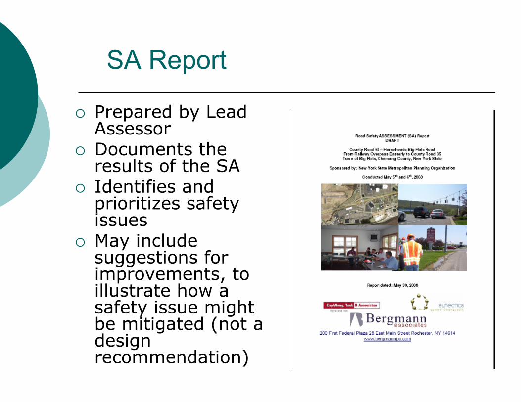
SA Report
� Prepared by Lead Assessor
� Documents the results of the SA
� Identifies and prioritizes safety issues
� May include suggestions for improvements, to illustrate how a safety issue might be mitigated (not a designrecommendation)
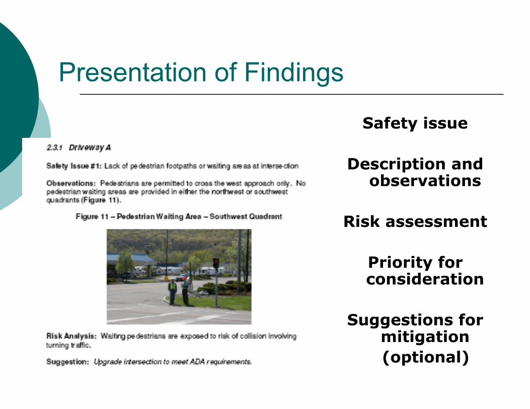
Presentation of Findings
Safety issue
Description and observations
Risk assessment
Priority for consideration
Suggestions for mitigation(optional)

SA Response
� Prepared by the owner � Documented in project file� Respond to assessment issue
� Action will (or will not) be taken � Brief explanation
� Implementation
Acting on Findings of a Safety Assessment Report
� Acting on SA report is critical� The Guidelines will outline specific
procedures for acting on a SA report and provide standardized Forms e.g.:� Review of SA report should be conducted within
30 days from the receipt.� Decisions made, rationale, and actions to be
taken should be properly documented using a special form (Form A) appended to a Response Report
� After the SA suggestions are implemented, the implementations are documented using Form B.
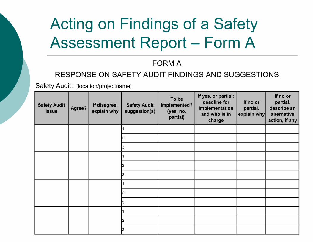
Acting on Findings of a Safety Assessment Report – Form A
Safety Audit Issue Agree? If disagree,
explain whySafety Audit
suggestion(s)
To be implemented?
(yes, no, partial)
If yes, or partial: deadline for
implementation and who is in
charge
If no or partial,
explain why
If no or partial,
describe an alternative
action, if any
1
2
3
1
2
3
1
2
3
1
2
3
RESPONSE ON SAFETY AUDIT FINDINGS AND SUGGESTIONSFORM A
Safety Audit: [location/projectname]

Acting on Findings of a Safety Assessment Report – Form B
Safety Audit suggestion
Disposition per Form A Implemented? If no or partial,
explain whyIf no or partial, describe an alternative action taken, if
any
FORM B
IMPLEMENTATION OF SAFETY AUDIT SUGGESTIONS
Safety Audit: [location/projectname]
Evaluation of the Effectiveness of Implemented SA Suggestions
� Quantitative evaluation of the implemented SA program is important
� Jurisdictions are only rarely conducting this activity in a systematic manner.� Disparity of capabilities to conduct this task among
jurisdictions:� availability of adequate collision data,� qualified staff, tools, � funding.
� The validity of the methodology to conduct such studies is also a question.
� SA Project Coordinator should initiate and manage ad-hoc SA evaluation studies
Monitoring and Promotion of the Safety Assessment Process
� It is important that SA process is regularly reviewed.
� It could be a learning opportunity and greatly aid in refining future SA.� It is proposed that SA Program coordinator is put
in charge of this activity:� Conducts a review of each SA on completion � Conducts review of SA process as a whole on a
regular basis (e.g., annually).
� To assist in SA reviews we propose to introduce a Form C (a follow–up SA Team Survey) appended to the Guidelines
Legal Considerations
� Always an issue
� Better off with a program than without one
� A well documented and consistent program will always help defend against legal action
Safety Assessment Prompt Lists
� There is no one “ultimate” or “ideal” prompt list
� We recommend that:� Guidelines do not require the use of specific prompt
lists� refer the user to the FHWA RSA prompt lists and to
the FHWA Pedestrian RSA prompt lists

SA Context - Safety in Transport
� Purpose - safe movement of people and goods
� Mobility = risk (of collision)� Collisions and severity outcomes primary
measure of:� travel risk� facility safety performance
� Risk reduction while providing acceptable levels of mobility (should be) a primary goal of transportation authorities

Safety Goals� Minimize risk
� prevent crashes from occurring, and� mitigate their severity, when they occur.
� Create and sustain an environment for users that is � “caring” (provides information supportive of
appropriate decisions and actions), and � “forgiving” (recognizes and anticipates for the
inevitable errors that users will make – and mitigates the severity of their outcomes)
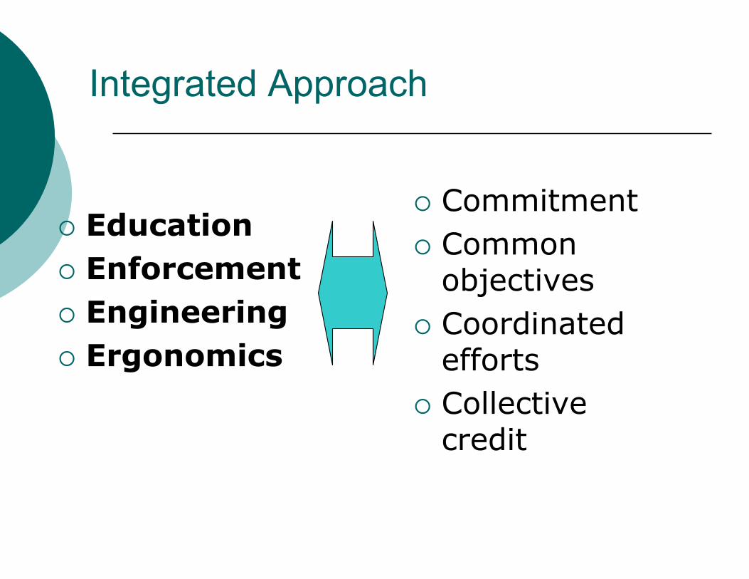
Integrated Approach
� Education� Enforcement� Engineering� Ergonomics
� Commitment� Common
objectives� Coordinated
efforts� Collective
credit
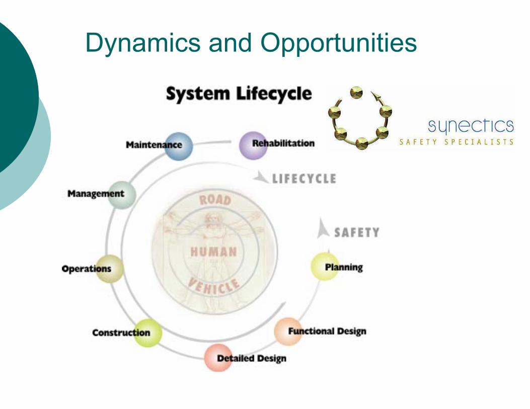
Dynamics and Opportunities

Safety Management
� Setting goals and objectives
� Obtainingstakeholder “buy-in” and participation
� Measuring safety performance
� Benchmarkingactual performance againstexpectations
� Identifyingopportunities for improvement
� Implementing a comprehensive set of countermeasures
� Monitoringoutcomes
� Evidence-basedrevisions to policies, standards and practices
Risk in Road Use: What is “Safe”?
� There are no safe facilities in New York State
� “Safe” is the total absence of (collision) risk
� There are no unsafe facilities in New York State
� “Unsafe” makes collision involvement a certainty
� Accordingly, facilities may be relatively “safer”(lower risk) or “less-safe” (higher risk) than one-another, but are neither “safe” nor “unsafe”.
Measuring Risk
� Risk is composed of three elements:� Exposure (to hazards)� Likelihood (of a collision occurring)� Consequence (severity outcomes)
� Risk may be examined in hindsight (historical collision experience)
� Future risk may also be predicted (safety performance functions)

What is Network Screening?
� A systematic review the entire roadway network under the jurisdiction of a particular agency
� Identifying sites with potential for safetyimprovement
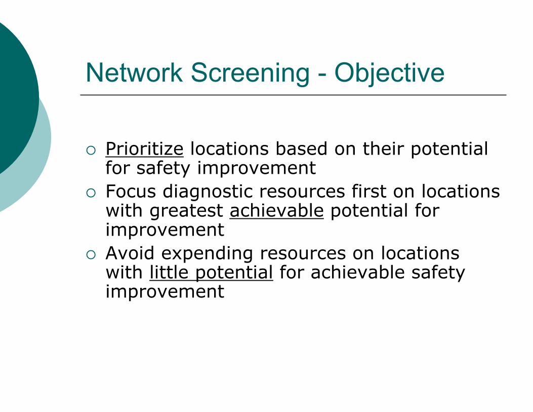
Network Screening - Objective
� Prioritize locations based on their potential for safety improvement
� Focus diagnostic resources first on locations with greatest achievable potential for improvement
� Avoid expending resources on locations with little potential for achievable safety improvement
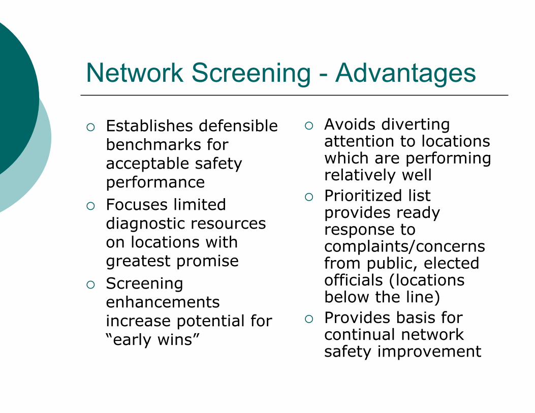
Network Screening - Advantages
� Establishes defensible benchmarks for acceptable safety performance
� Focuses limited diagnostic resources on locations with greatest promise
� Screeningenhancementsincrease potential for “early wins”
� Avoids diverting attention to locations which are performing relatively well
� Prioritized list provides ready response to complaints/concernsfrom public, elected officials (locations below the line)
� Provides basis for continual network safety improvement

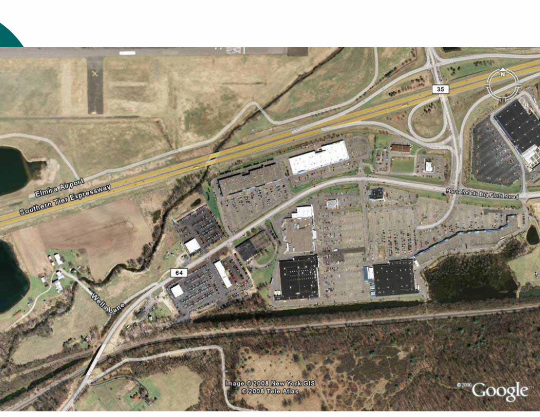
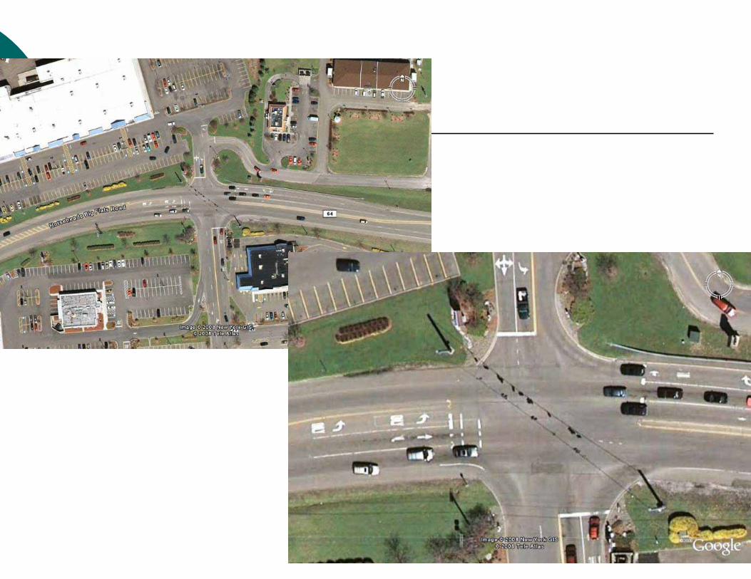
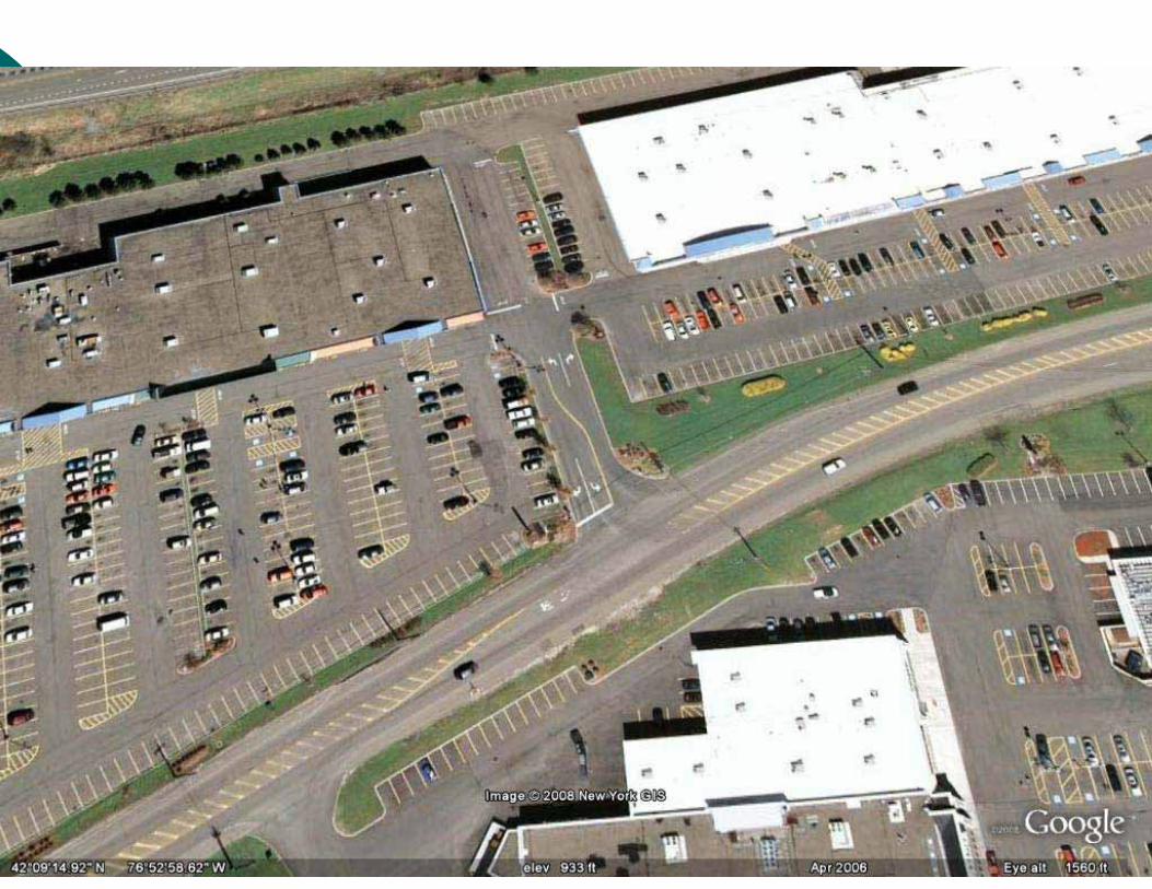
Case Study #1
County Road 64Horseheads Big Flats RoadTown of Big Flats, Chemung County


CR 64
� Two-lane arterial roadway� Rural cross-section � Posted speed limit of 45 miles per hour� Emerging as Regional shopping destination� AADT approaching 20,000� 100+ collisions in past 3 years� Under jurisdiction of Chemung County with
NYSDOT responsible for segments located within the functional areas of interchanges with I-86.

Why an SA?� Changes:
� Adjacent land development, roadway function� Traffic volumes, characteristics, and travel patterns� Development, new points of access
� Concerns:� Perception of a safety problem� Review of crash records
� Observations:� From the New York State Police regarding violations,
conflicts, and collisions� Opportunities:
� Potential for safety improvement� Response to increased traffic volumes, access, and
capacity requirements

Team
� Jay Schissell, Mike Perry, Elmira Chemung TC� Dan Connors, New York State DOT (Traffic)� Vince Corona, New York State Police� Larry Wagner, Town of Big Flats� Andy Avery, Shawn Crater, Chemung County� Rick Bennett, Frank Dolan, Bergmann� Greg Junnor, Synectics

Effort
� Pre-assessment exchange of information� ½-day training� 1-day office and field review, draft
assessment report (RSA software)� 1-day produce draft report� Team review� Final report
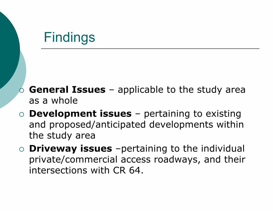
Findings
� General Issues – applicable to the study area as a whole
� Development issues – pertaining to existing and proposed/anticipated developments within the study area
� Driveway issues –pertaining to the individual private/commercial access roadways, and their intersections with CR 64.

General Issues
� Safety Concern:� Continued application of rural arterial standards
given changing road function and traffic characteristics
� Treatment of capacity and access needs driven by new developments on a case-by-case basis (lack of uniformity, consistency in road message)
� Vulnerable users
� Suggestion:� Longer-term corridor “plan” needed


Specific Suggestions� Reconsider classification, design standards, access
management policies for corridor� Provide an environment consistent with sub-urban
commercial operations, suited to vulnerable road users
� Consider a three or five-lane cross-section � Consider access consolidation, provision of dedicated
turn lanes, raised islands, physical channelization, turn prohibition
� Retrofit a consistent cross-section and impose access management in areas developed/under development,
� Apply same to all future developments � Re-evaluate the current 45 MPH speed limit.

Access Issues
� Safety Concerns:� Dual left turns on permissive phase� Angle collisions at STOP-controlled driveway
� Suggestions:� Capacity assessment, traffic control revisions� Access consolidation, traffic controls

Development Issues
� Safety Concern:� Access operations� Site Layout
� Suggestions:� Access management� Traffic controls� Site plan approvals


Case Study #2
Washington County Road 12 at Hatch Hill Road (South Junction)Town of Granville, Washington County
CR 12
� Two-lane, hard-surfaced, collector roadway � Rural cross-section� AADT 919� Statutory speed limit of 55 miles per hour.� Adjacent land uses generally rural
residential/agricultural.� Approximately 1.5 miles north of SR 22, CR
12 intersects with Hatch Hill Road (South Junction)
� Viewed from the south, the two roadways form a “Y” intersection


Hatch Hill Road
� Two-lane, hard-surfaced, minor collector roadway
� Rural cross-section � AADT 313� Posted speed limit of 45 miles per hour � Hatch Hill Road is under the jurisdiction of
the Town of Granville.� The Hatch Hill Road approach is controlled
by a STOP sign.


Why an SA?
� High collision frequency (adjacent road sections and intersection) – 45 in 11 years
� Intersection geometry� Traffic control device compliance (STOP
control)

Team
� Aaron Frankenfeld, Kristina Hong,Adirondack Glens Falls Transportation Council
� Richard Doyle, Michael Breault, ScotTracy, Washington County Department of Public Works
� Mike Croce, Bergmann� Greg Junnor, Synectics
Findings� 12 vehicle versus animal (deer, raccoon)
collisions, with the deer incidents primarily located on CR 12 north approach;
� The CR 12 north approach also associated with single vehicle loss of control collisions (total of 7), speculated to be occurring in the reverse curve, where roadbed stability and localized settlement is an ongoing maintenance issue;
� Several intersection and intersection-related collisions make reference to wet pavement and loose sand/gravel on the roadway surface; and
� Collisions on Hatch Hill Road make frequent reference to slush, snow or ice on the road surface, leading to single vehicle loss of control.
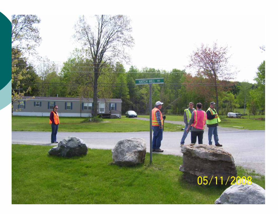
Issues - Intersection
� Safety Concerns:� Visibility of STOP control, Tee intersection sign� Skewed Stopping Position� Lack of Centre Line, Stop Bar� Drainage� Roadside hazards (boulders)� Right turn slip movement –speed� Crossing Roadway identification
Suggestions -Intersection
� Suggestions:� STOP ahead sign� Larger double arrow sign� Centre line and Stop Bar (perpendicular stopping
position)� Restore cross-section and super-elevation � Tighten right turn radius to reduce speeds� Move/enlarge street name sign
Issues and Suggestions – Hatch Hill Road
� Safety Concerns:� Differing (from CR 12) winter maintenance
standards� Posted speed limit
� Suggestions� Tighten right turn radius (to reduce speeds)� Confirm and properly post speed limit

Issues – CR 12
� Safety Issues:� Super-elevation in horizontal curve� Positive guidance (through road, curve)� Intersection and curve warning signs� Roadbed settlement� Roadside design� Deer tracks
Suggestions – CR 12
� Suggestions:� Restore super-elevation and cross-section within
intersection� Continue dashed markings through intersection,
combine curve warning and intersection signs, delineate gore
� Padding to address settlement (short-term), correct erosion (longer-term)
� Ditch flattening, shoulder grading, pole relocation
Suggestions – CR 12
� Suggestions:� Warrant for Deer Crossing sign� ROW fencing to “channel” crossing activity� ……or

An “Out of the Box” Solution

Questions?Discussion?