rehabilitating the lake sturgeon in lakes erie and …€¦ · rehabilitating the lake sturgeon in...
TRANSCRIPT
Rehabilitating the Lake Sturgeon in Lakes Erie and Huron through COA
Rich Drouin and Andy McKeeMinistry of Natural Resources
2010 - A.D. Latornell Conservation SymposiumBiodiversity: Connecting People, Land and Water
2
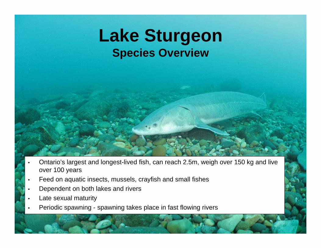
Lake SturgeonSpecies Overview
• Ontario’s largest and longest-lived fish, can reach 2.5m, weigh over 150 kg and live over 100 years
• Feed on aquatic insects, mussels, crayfish and small fishes• Dependent on both lakes and rivers• Late sexual maturity• Periodic spawning - spawning takes place in fast flowing rivers
3
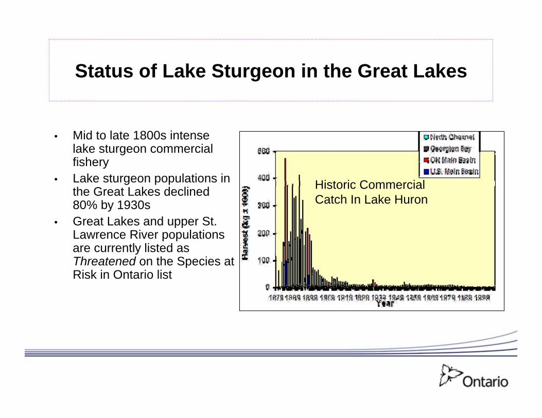
Status of Lake Sturgeon in the Great Lakes
• Mid to late 1800s intense lake sturgeon commercial fishery
• Lake sturgeon populations in the Great Lakes declined 80% by 1930s
• Great Lakes and upper St. Lawrence River populations are currently listed as Threatened on the Species at Risk in Ontario list
Historic CommercialCatch In Lake Huron
4
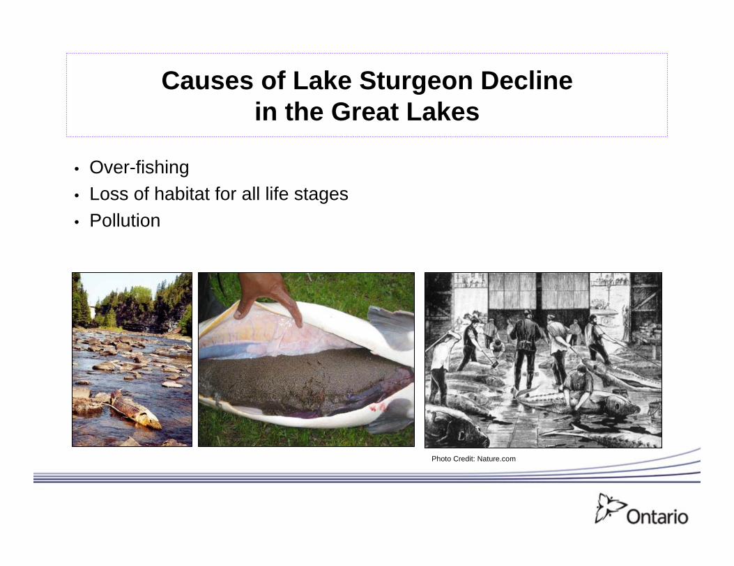
Causes of Lake Sturgeon Decline in the Great Lakes
• Over-fishing• Loss of habitat for all life stages• Pollution
Photo Credit: Nature.com
5
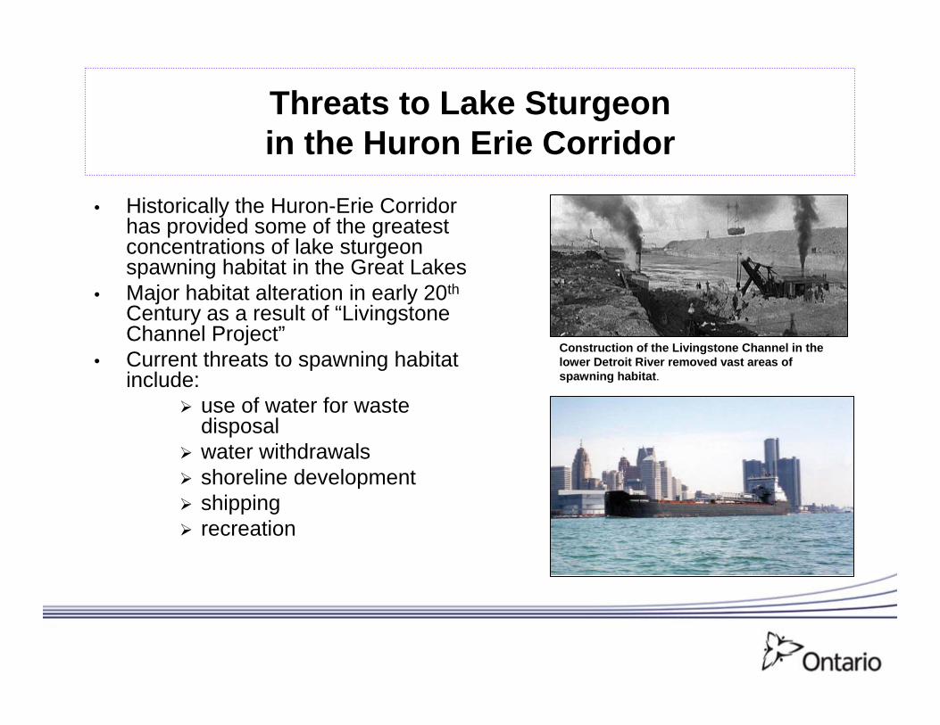
Threats to Lake Sturgeon in the Huron Erie Corridor
• Historically the Huron-Erie Corridor has provided some of the greatest concentrations of lake sturgeon spawning habitat in the Great Lakes
• Major habitat alteration in early 20th
Century as a result of “Livingstone Channel Project”
• Current threats to spawning habitat include:
use of water for waste disposalwater withdrawalsshoreline developmentshippingrecreation
Construction of the Livingstone Channel in the lower Detroit River removed vast areas of spawning habitat.
6
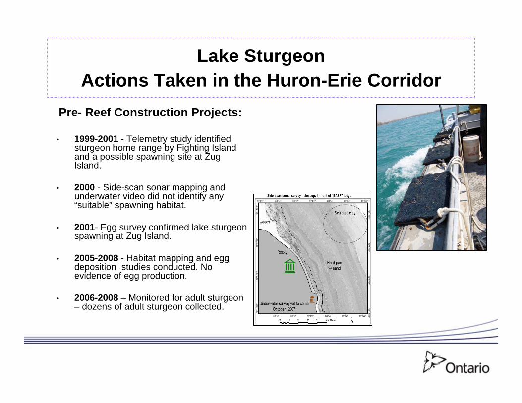
Lake SturgeonActions Taken in the Huron-Erie Corridor
Pre- Reef Construction Projects:
• 1999-2001 - Telemetry study identified sturgeon home range by Fighting Island and a possible spawning site at Zug Island.
• 2000 - Side-scan sonar mapping and underwater video did not identify any “suitable” spawning habitat.
• 2001- Egg survey confirmed lake sturgeon spawning at Zug Island.
• 2005-2008 - Habitat mapping and egg deposition studies conducted. No evidence of egg production.
• 2006-2008 – Monitored for adult sturgeon – dozens of adult sturgeon collected.
7
Lake SturgeonActions Taken in Huron-Erie Corridor
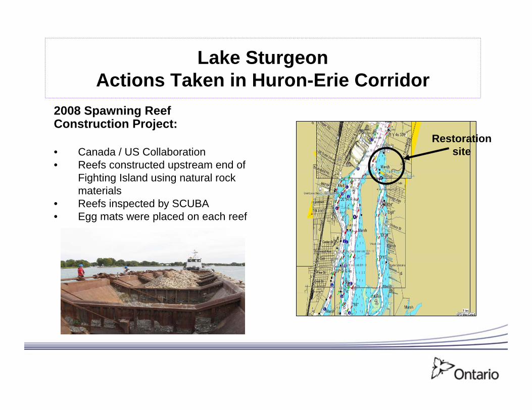
Restoration site
2008 Spawning Reef Construction Project:
• Canada / US Collaboration • Reefs constructed upstream end of
Fighting Island using natural rock materials
• Reefs inspected by SCUBA• Egg mats were placed on each reef
8
Lake SturgeonActions Taken in Huron-Erie Corridor
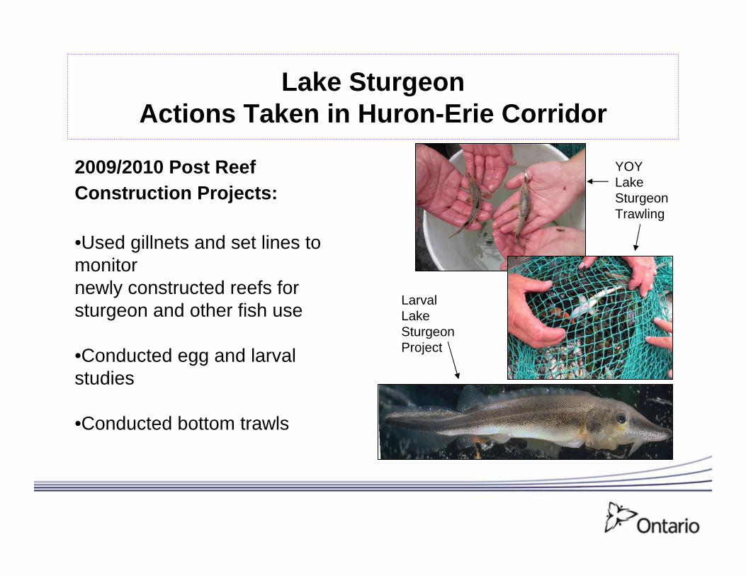
2009/2010 Post Reef Construction Projects:
•Used gillnets and set lines to monitornewly constructed reefs for sturgeon and other fish use
•Conducted egg and larval studies
•Conducted bottom trawls
YOY Lake Sturgeon Trawling
Larval Lake Sturgeon Project
9
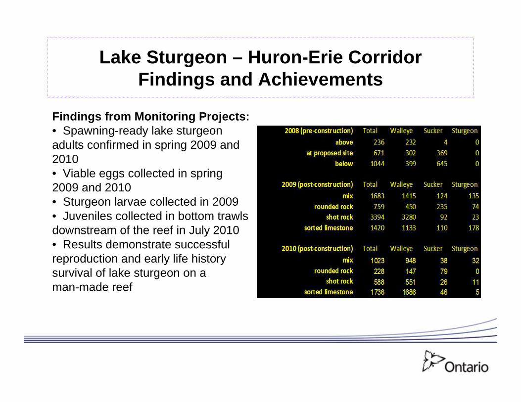
Lake Sturgeon – Huron-Erie Corridor Findings and Achievements
Findings from Monitoring Projects:• Spawning-ready lake sturgeon adults confirmed in spring 2009 and 2010• Viable eggs collected in spring 2009 and 2010• Sturgeon larvae collected in 2009• Juveniles collected in bottom trawls downstream of the reef in July 2010• Results demonstrate successful reproduction and early life history survival of lake sturgeon on a man-made reef
10
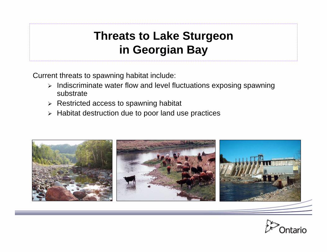
Threats to Lake Sturgeon in Georgian Bay
Current threats to spawning habitat include:Indiscriminate water flow and level fluctuations exposing spawning substrate Restricted access to spawning habitatHabitat destruction due to poor land use practices
11
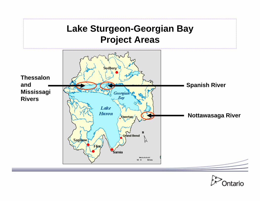
Lake Sturgeon-Georgian BayProject Areas
Thessalon and MississagiRivers
Spanish River
Nottawasaga River
12
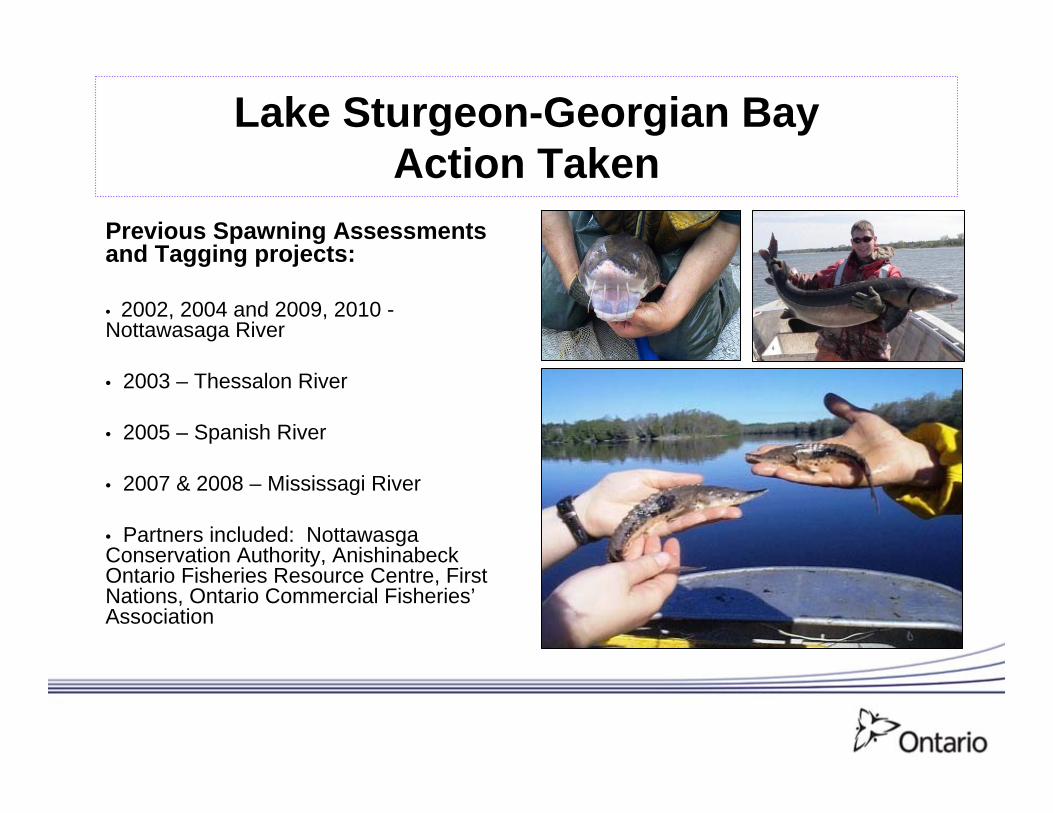
Lake Sturgeon-Georgian BayAction Taken
Previous Spawning Assessments and Tagging projects:
• 2002, 2004 and 2009, 2010 -Nottawasaga River
• 2003 – Thessalon River
• 2005 – Spanish River
• 2007 & 2008 – Mississagi River
• Partners included: Nottawasga Conservation Authority, Anishinabeck Ontario Fisheries Resource Centre, First Nations, Ontario Commercial Fisheries’Association
13
Lake Sturgeon-Georgian BayActions Taken
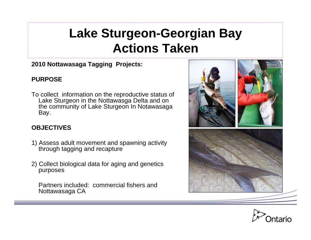
2010 Nottawasaga Tagging Projects:
PURPOSE
To collect information on the reproductive status of Lake Sturgeon in the Nottawasga Delta and on the community of Lake Sturgeon In Notawasaga Bay.
OBJECTIVES
1) Assess adult movement and spawning activity through tagging and recapture
2) Collect biological data for aging and genetics purposes
Partners included: commercial fishers and Nottawasaga CA

14
Lake Sturgeon-Georgian BayProject Findings and Achievements
•60 fishing efforts completed in Nottawasga River delta mid April to mid May 2010•8 fishing efforts were completed by commercial fishers in Notawasga Bay from mid April to mid June•286 captured sturgeon were tagged with PIT and streamer tags and released (129 in the river, 157 in the bay)•Biological information collected included: total length, fork length, dressed length, girth, lamprey marks, round weight, gonad condition•River mouth net sets more productive than in the river
Sturgeon caught/net/day
Nottawasaga River Delta
15
Lake Sturgeon-Georgian BayProject Findings and Achievements
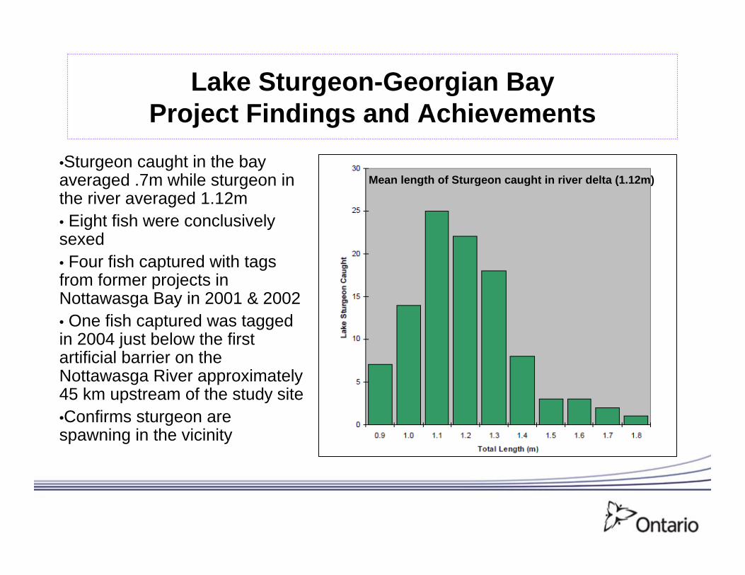
•Sturgeon caught in the bay averaged .7m while sturgeon in the river averaged 1.12m• Eight fish were conclusively sexed• Four fish captured with tags from former projects in Nottawasga Bay in 2001 & 2002• One fish captured was tagged in 2004 just below the first artificial barrier on the Nottawasga River approximately 45 km upstream of the study site•Confirms sturgeon are spawning in the vicinity
Mean length of Sturgeon caught in river delta (1.12m)
16
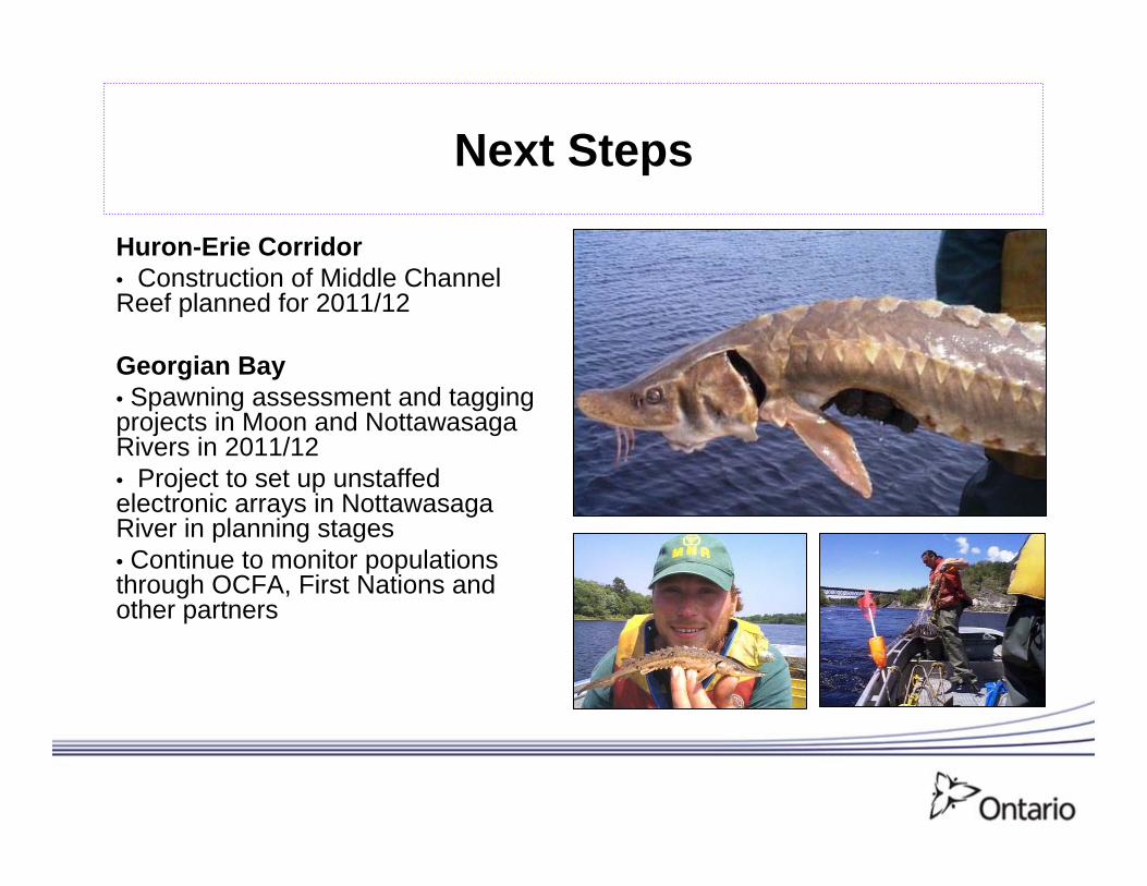
Next Steps
Huron-Erie Corridor• Construction of Middle Channel Reef planned for 2011/12
Georgian Bay• Spawning assessment and tagging projects in Moon and Nottawasaga Rivers in 2011/12• Project to set up unstaffed electronic arrays in Nottawasaga River in planning stages• Continue to monitor populations through OCFA, First Nations and other partners