adapting to climate change - american planning...
TRANSCRIPT
Adapting to Climate Change California Resources for Local Governments
Adrienne I. Greve Assistant Professor, City & Regional Planning
Cal Poly - San Luis Obispo
Dep
artm
ent
of
Wat
er R
eso
urc
es
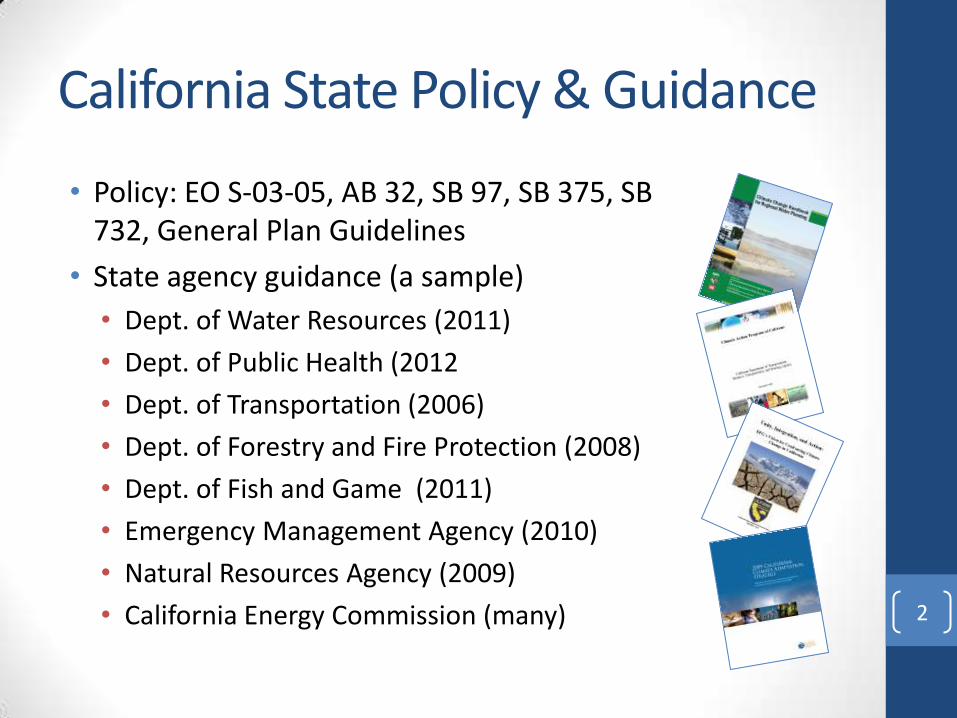
California State Policy & Guidance
• Policy: EO S‐03‐05, AB 32, SB 97, SB 375, SB 732, General Plan Guidelines
• State agency guidance (a sample)
• Dept. of Water Resources (2011)
• Dept. of Public Health (2012
• Dept. of Transportation (2006)
• Dept. of Forestry and Fire Protection (2008)
• Dept. of Fish and Game (2011)
• Emergency Management Agency (2010)
• Natural Resources Agency (2009)
• California Energy Commission (many)
2
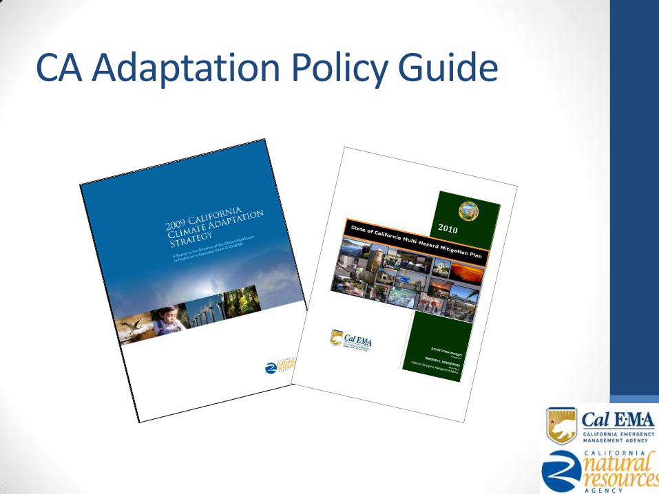
CA Adaptation Policy Guide
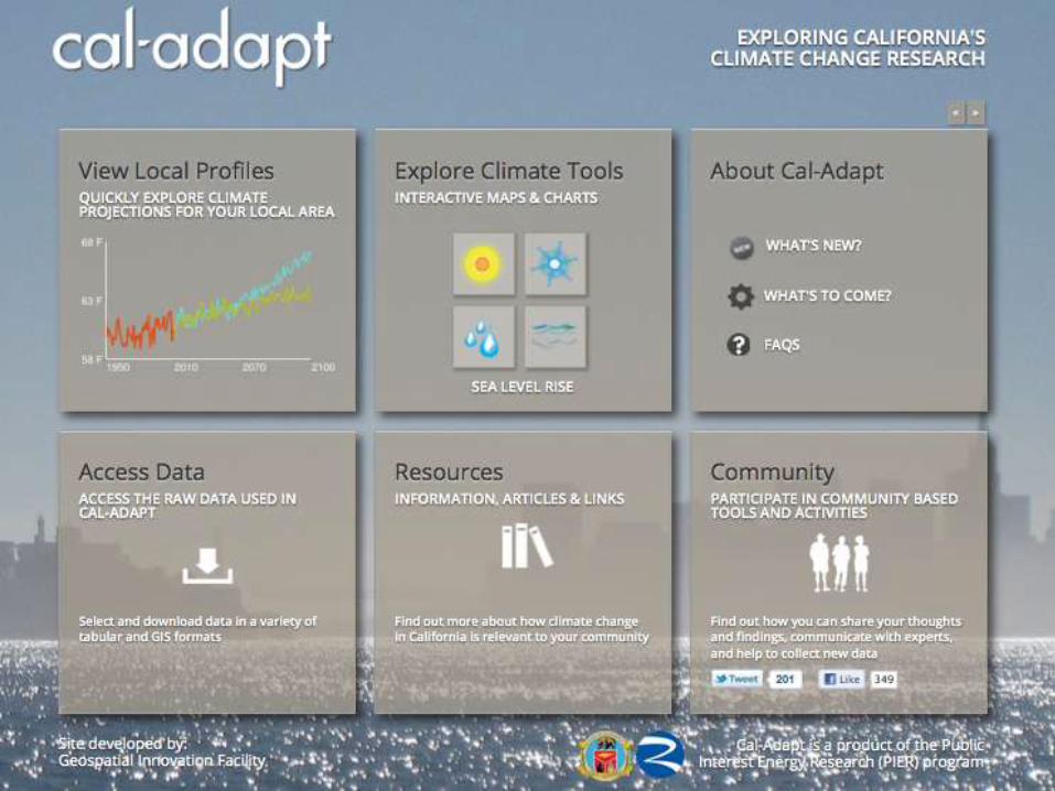
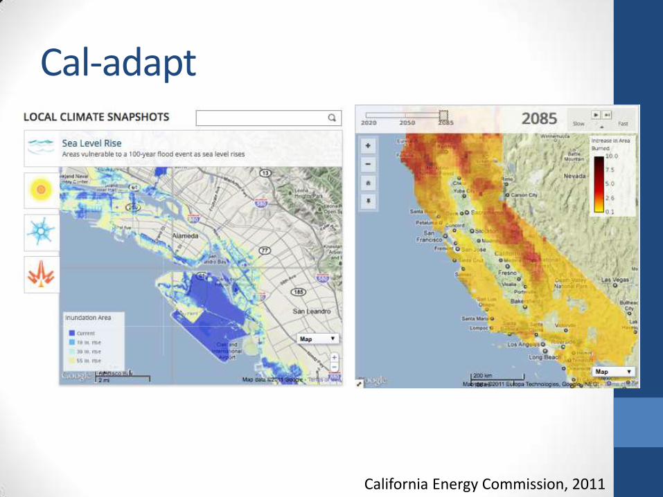
Cal-adapt
California Energy Commission, 2011
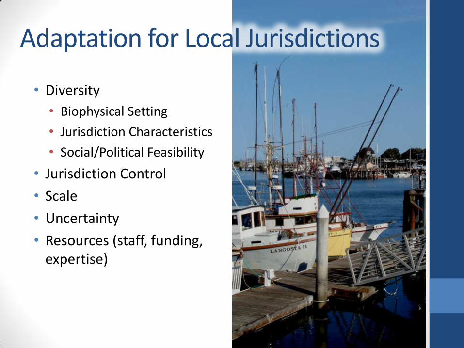
• Diversity
• Biophysical Setting
• Jurisdiction Characteristics
• Social/Political Feasibility
• Jurisdiction Control
• Scale
• Uncertainty
• Resources (staff, funding, expertise)
Adaptation for Local Jurisdictions

State of Practice
• Local government
• Regional planning entities
• State agencies and organizations
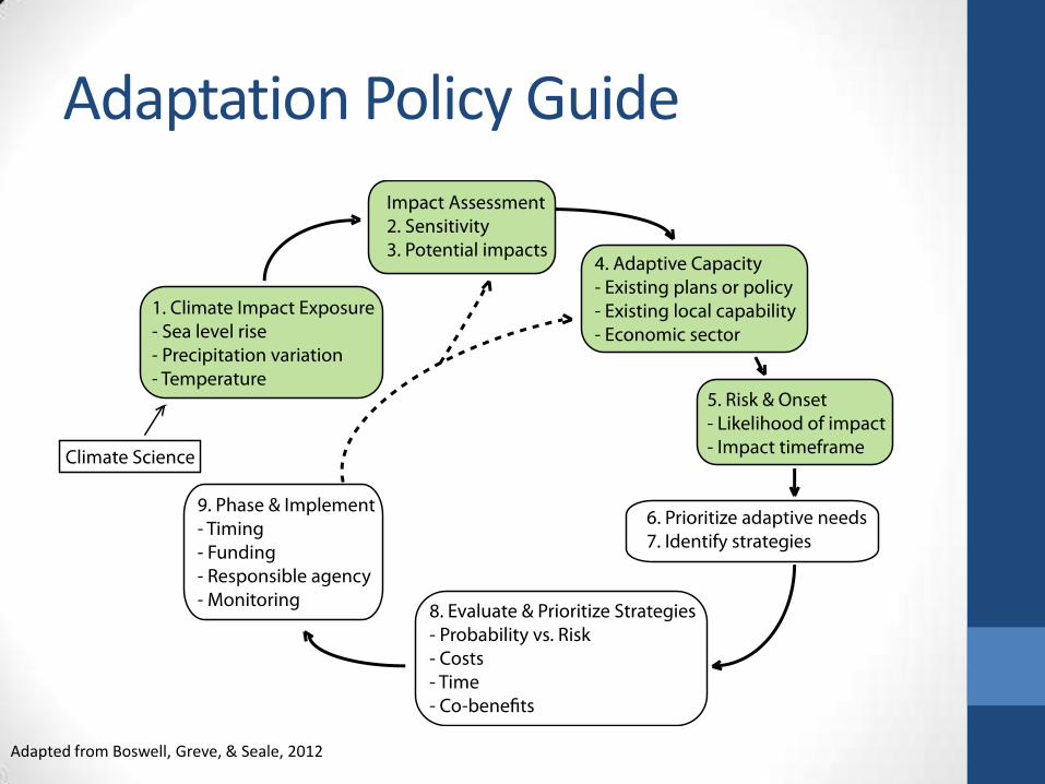
Adaptation Policy Guide
Adapted from Boswell, Greve, & Seale, 2012
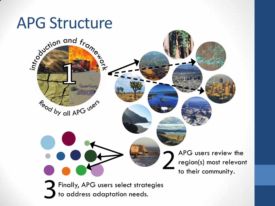
APG Structure
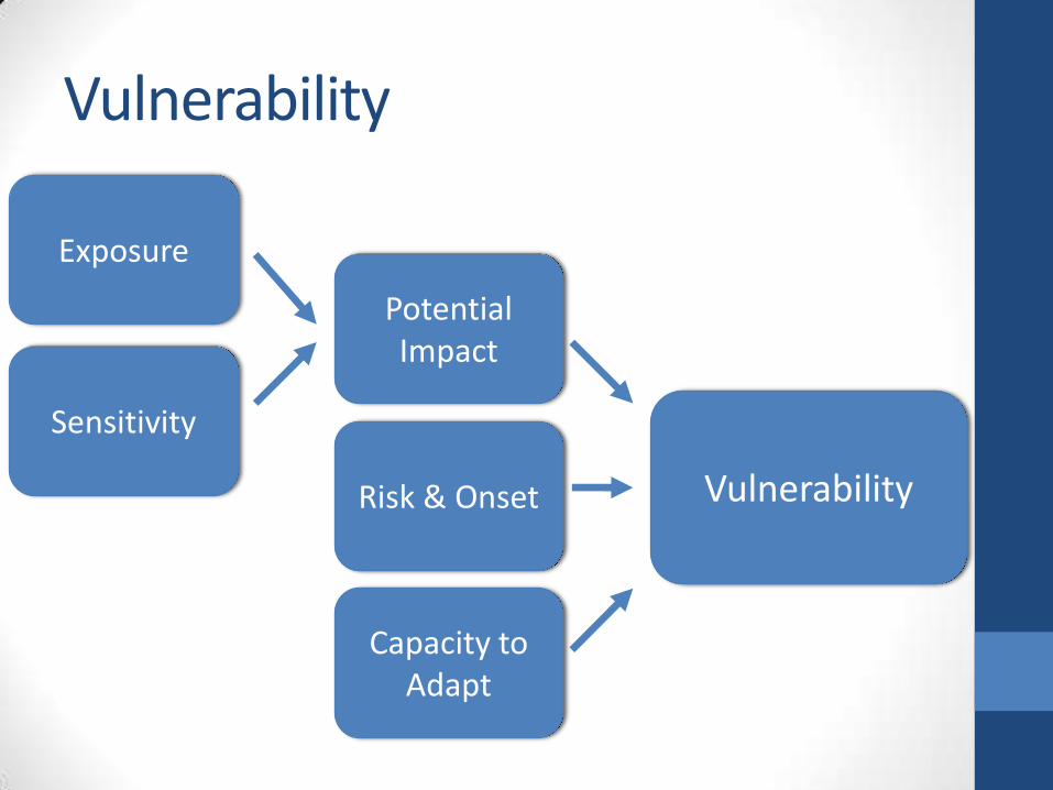
Vulnerability
Vulnerability
Capacity to Adapt
Risk & Onset
Potential Impact
Exposure
Sensitivity
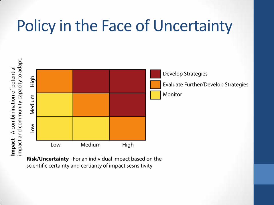
Policy in the Face of Uncertainty
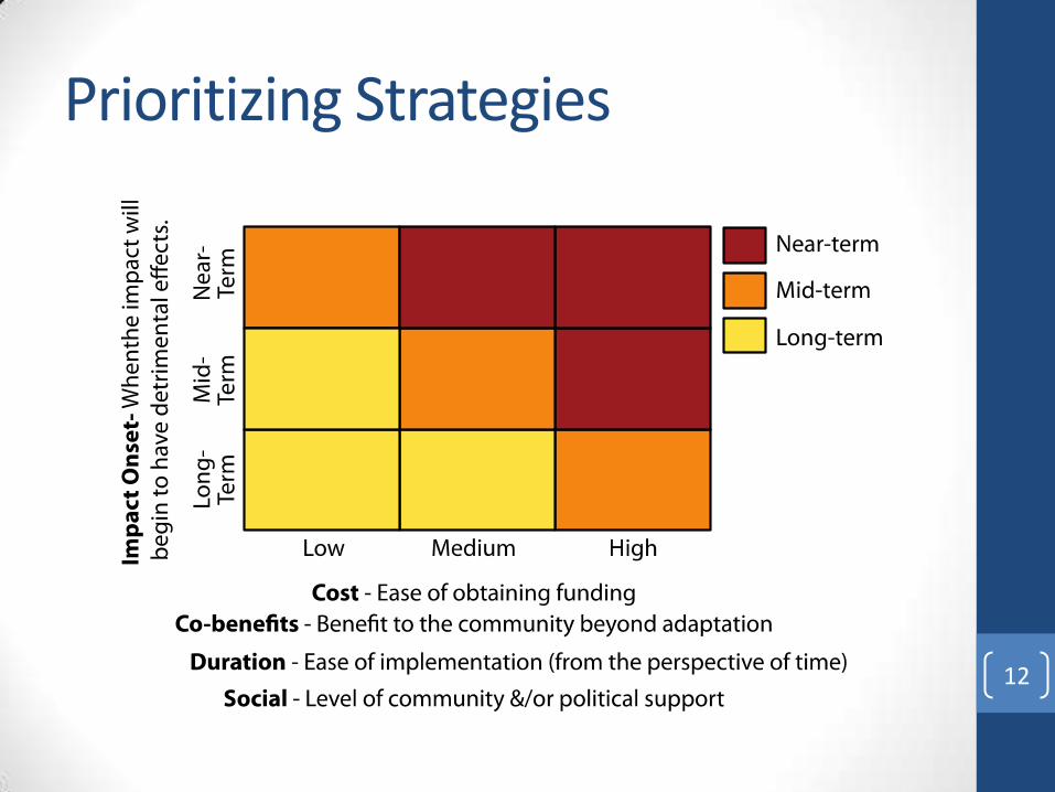
Prioritizing Strategies
12

We want to hear from you!!!
Public Review Draft
California Climate Change
ADAPTATION POLICY GUIDE
http://resources.ca.gov/climate_adaptation/local_government/
Thank You!
Contact:
Adrienne I. Greve
City & Regional Planning Department
California Polytechnic State University, San Luis Obispo
Researc
h L
ead
: T
he U
niv
ers
ity o
f N
ort
h C
aro
lin
a a
t C
hap
el H
ill
Ed
ucatio
n L
ead
: Jackso
n S
tate
Un
ivers
ity, M
issis
sip
pi
A U.S. Department of Homeland Security Center of Excellence
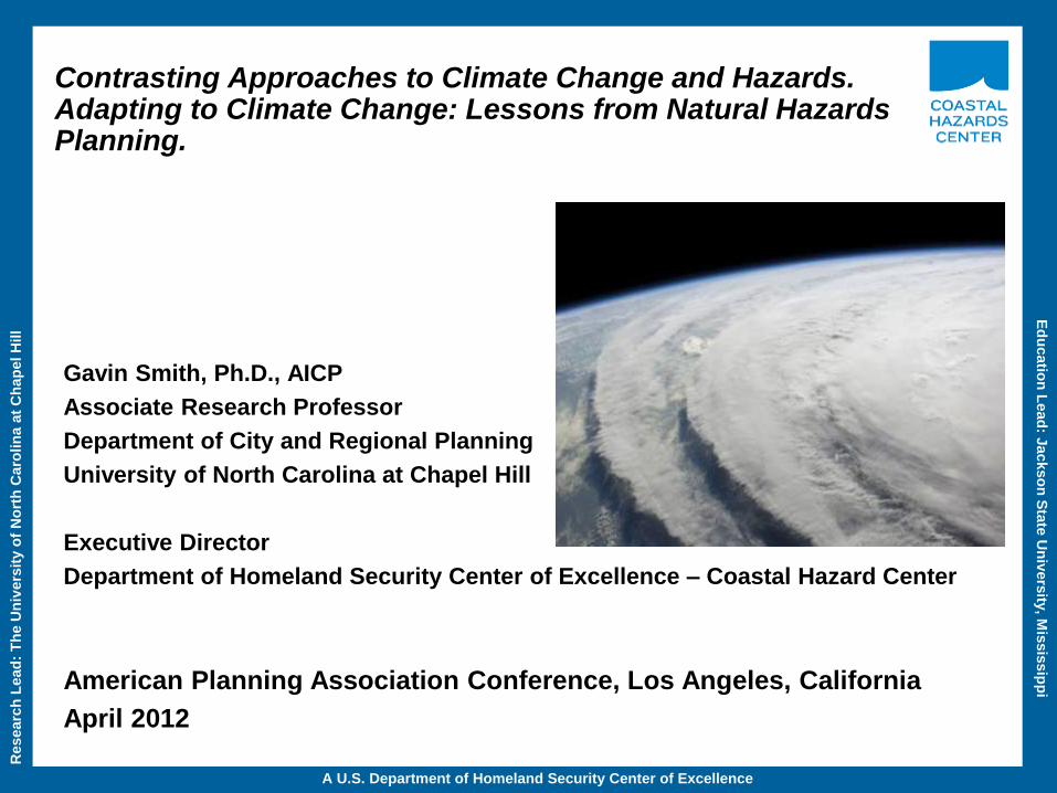
Contrasting Approaches to Climate Change and Hazards. Adapting to Climate Change: Lessons from Natural Hazards Planning.
Gavin Smith, Ph.D., AICP
Associate Research Professor
Department of City and Regional Planning
University of North Carolina at Chapel Hill
Executive Director
Department of Homeland Security Center of Excellence – Coastal Hazard Center
American Planning Association Conference, Los Angeles, California
April 2012
Researc
h L
ead
: T
he U
niv
ers
ity o
f N
ort
h C
aro
lin
a a
t C
hap
el H
ill
Ed
ucatio
n L
ead
: Jackso
n S
tate
Un
ivers
ity, M
issis
sip
pi
A U.S. Department of Homeland Security Center of Excellence
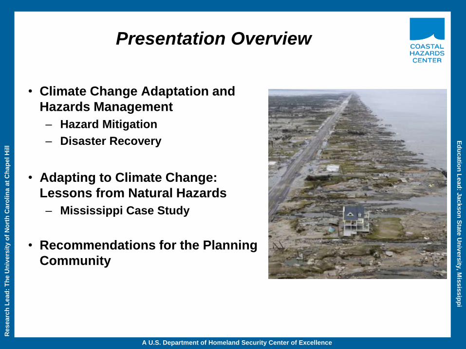
Presentation Overview
• Climate Change Adaptation and
Hazards Management
– Hazard Mitigation
– Disaster Recovery
• Adapting to Climate Change:
Lessons from Natural Hazards
– Mississippi Case Study
• Recommendations for the Planning
Community
Researc
h L
ead
: T
he U
niv
ers
ity o
f N
ort
h C
aro
lin
a a
t C
hap
el H
ill
Ed
ucatio
n L
ead
: Jackso
n S
tate
Un
ivers
ity, M
issis
sip
pi
A U.S. Department of Homeland Security Center of Excellence
Adapting to Climate Change: Lessons from Natural Hazards (Glavovic and Smith 2012, Springer)
• Introduction
• Climate Change Adaptation: Theory and Practice – Synthesis of scholarship and experience
• The Nature of Disasters and the Role of Natural Hazards in Building Resilient
Communities – Climate change adaptation and risk reduction in highland Peru (Anthony Oliver-Smith)
– Castles on sand: the shifting sources of flood risk and the implications for flood governance (Iain White)
– Planning for resilient coastal communities: the emerging practice and future directions (Tim Beatley)
– Resilience and Adaptation: the emergence of local action in California, USA (Bill Simbieda)
– Rising to the challenge: planning for adaptation in the age of climate change (Phil Berke)
• Case Studies: Lessons from Natural Hazards – Applying Hurricane Recovery Lessons in the U.S. to Climate Change Adaptation: Hurricanes Fran and
Floyd in North Carolina, USA (Gavin Smith)
– The Manawatu floods in New Zealand: Integrating flood risk reduction and climate change adaptation
(Bruce Glavovic)
– Drought and Bushfires in Australia (Karyn Bosomworth, John Handmer and Steven Dovers)
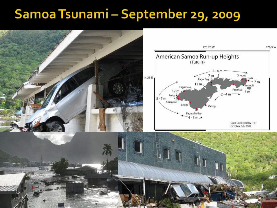
– Natural coastal hazards planning: the 2009 tsunami and lessons for climate change adaptation in Samoa
(Michelle Daly)
– Disaster Recovery in Coastal Mississippi (USA): Lesson Drawing from Hurricanes Camille and Katrina
(Gavin Smith)
– New Orleans and Hurricane Katrina (Bruce Glavovic)
• Conclusions: Taking Action to Address Climate Change Adaptation
Researc
h L
ead
: T
he U
niv
ers
ity o
f N
ort
h C
aro
lin
a a
t C
hap
el H
ill
Ed
ucatio
n L
ead
: Jackso
n S
tate
Un
ivers
ity, M
issis
sip
pi
A U.S. Department of Homeland Security Center of Excellence
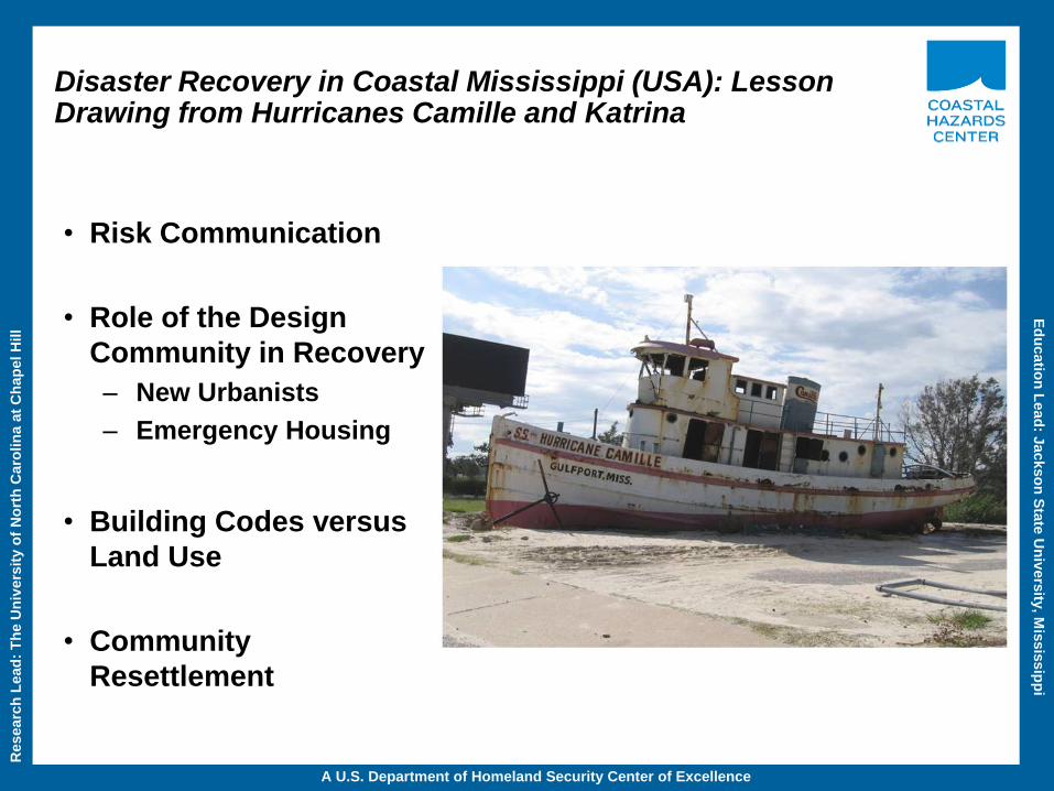
Disaster Recovery in Coastal Mississippi (USA): Lesson Drawing from Hurricanes Camille and Katrina
• Risk Communication
• Role of the Design
Community in Recovery
– New Urbanists
– Emergency Housing
• Building Codes versus
Land Use
• Community
Resettlement
Researc
h L
ead
: T
he U
niv
ers
ity o
f N
ort
h C
aro
lin
a a
t C
hap
el H
ill
Ed
ucatio
n L
ead
: Jackso
n S
tate
Un
ivers
ity, M
issis
sip
pi
A U.S. Department of Homeland Security Center of Excellence
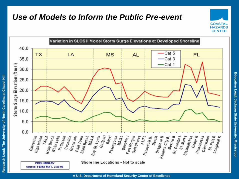
Use of Models to Inform the Public Pre-event
Researc
h L
ead
: T
he U
niv
ers
ity o
f N
ort
h C
aro
lin
a a
t C
hap
el H
ill
Ed
ucatio
n L
ead
: Jackso
n S
tate
Un
ivers
ity, M
issis
sip
pi
A U.S. Department of Homeland Security Center of Excellence
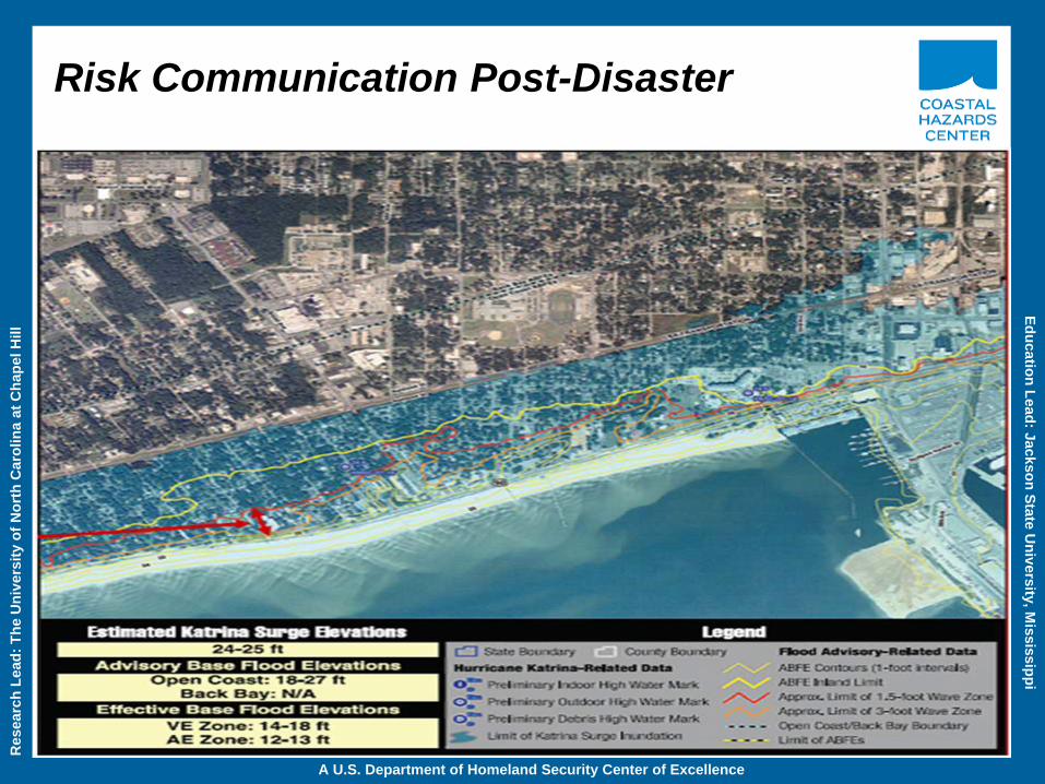
Risk Communication Post-Disaster

Researc
h L
ead
: T
he U
niv
ers
ity o
f N
ort
h C
aro
lin
a a
t C
hap
el H
ill
Ed
ucatio
n L
ead
: Jackso
n S
tate
Un
ivers
ity, M
issis
sip
pi
A U.S. Department of Homeland Security Center of Excellence
Role of the Design Community in Recovery: Mississippi Renewal Forum
Researc
h L
ead
: T
he U
niv
ers
ity o
f N
ort
h C
aro
lin
a a
t C
hap
el H
ill
Ed
ucatio
n L
ead
: Jackso
n S
tate
Un
ivers
ity, M
issis
sip
pi
A U.S. Department of Homeland Security Center of Excellence
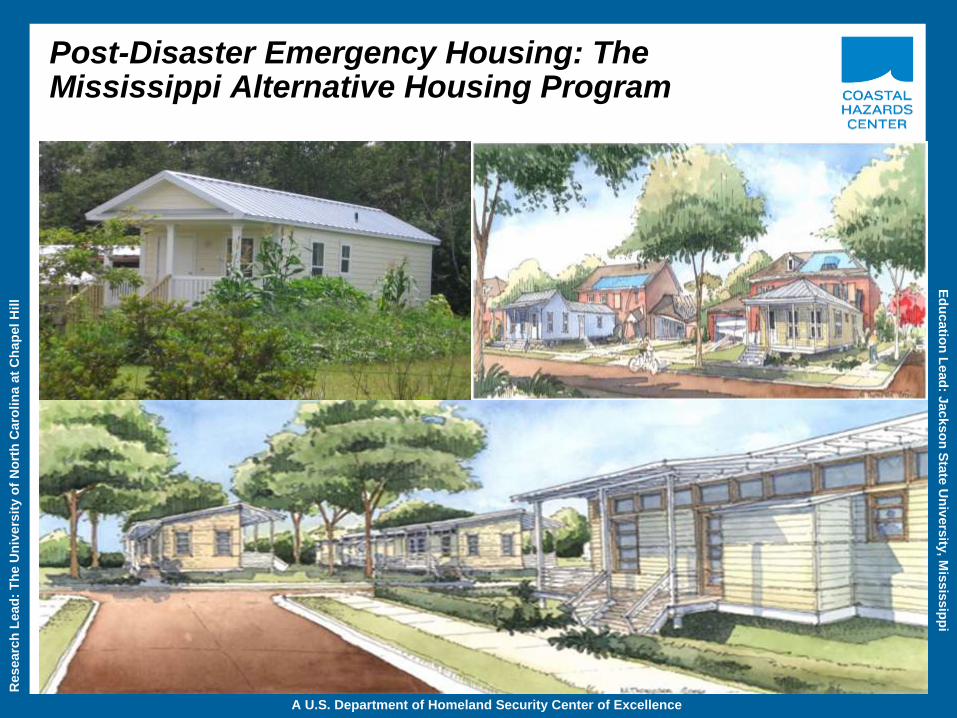
Post-Disaster Emergency Housing: The Mississippi Alternative Housing Program
Researc
h L
ead
: T
he U
niv
ers
ity o
f N
ort
h C
aro
lin
a a
t C
hap
el H
ill
Ed
ucatio
n L
ead
: Jackso
n S
tate
Un
ivers
ity, M
issis
sip
pi
A U.S. Department of Homeland Security Center of Excellence
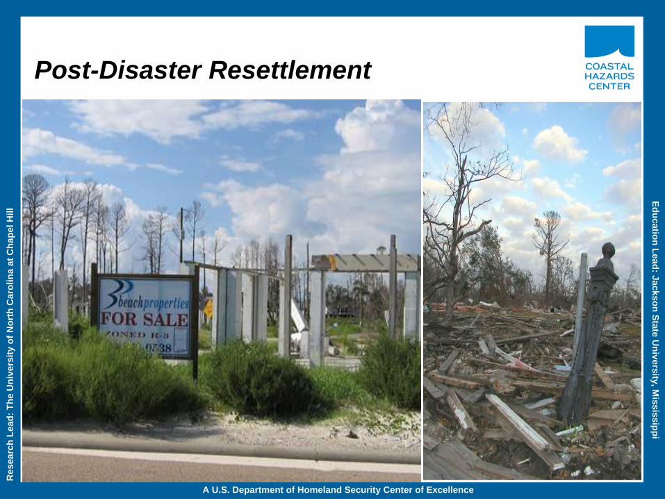
Post-Disaster Resettlement
Researc
h L
ead
: T
he U
niv
ers
ity o
f N
ort
h C
aro
lin
a a
t C
hap
el H
ill
Ed
ucatio
n L
ead
: Jackso
n S
tate
Un
ivers
ity, M
issis
sip
pi
A U.S. Department of Homeland Security Center of Excellence
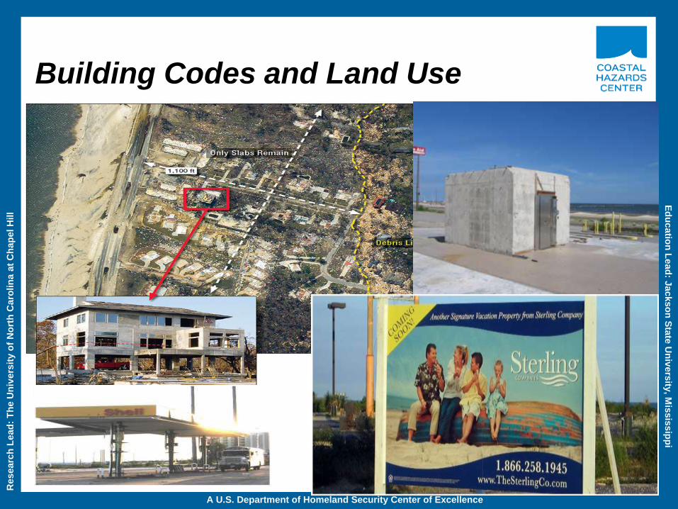
Building Codes and Land Use

Researc
h L
ead
: T
he U
niv
ers
ity o
f N
ort
h C
aro
lin
a a
t C
hap
el H
ill
Ed
ucatio
n L
ead
: Jackso
n S
tate
Un
ivers
ity, M
issis
sip
pi
A U.S. Department of Homeland Security Center of Excellence
Hazards Management Lessons in Mississippi
• The Remapping of Mississippi’s Coastal Floodplains: Implications
for Risk Communications, Hazard Mitigation, Disaster Recovery, and Adaptation.
• Secondary policy impacts, migration of coastal residents, and the construction of
new inland communities.
• The role of the design community in disaster recovery, hazard mitigation, and
climate change adaptation.
• The adoption of new building codes and flood ordinances is not enough; these
techniques should be coupled with land use measures.
• The Widespread use of Post-Disaster Temporary and Transitional Housing (new
approach not adopted by FEMA).
• Creating and Sustaining a State Disaster Recovery Organization Committed to
Hazards Management and Related Elements of Climate Change Adaptation.
Researc
h L
ead
: T
he U
niv
ers
ity o
f N
ort
h C
aro
lin
a a
t C
hap
el H
ill
Ed
ucatio
n L
ead
: Jackso
n S
tate
Un
ivers
ity, M
issis
sip
pi
A U.S. Department of Homeland Security Center of Excellence
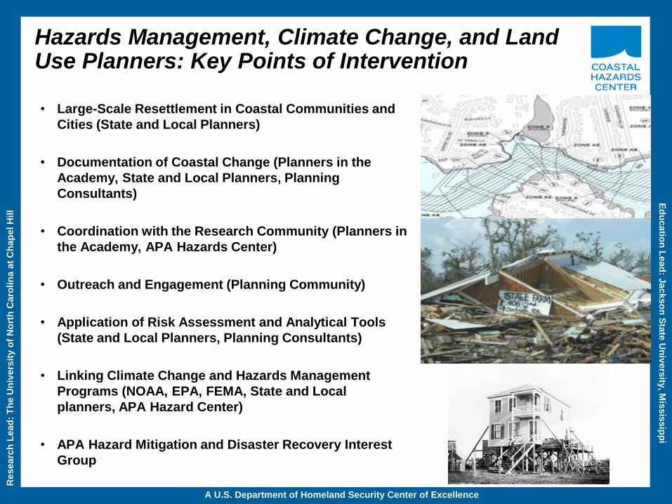
Hazards Management, Climate Change, and Land Use Planners: Key Points of Intervention
• Large-Scale Resettlement in Coastal Communities and
Cities (State and Local Planners)
• Documentation of Coastal Change (Planners in the
Academy, State and Local Planners, Planning
Consultants)
• Coordination with the Research Community (Planners in
the Academy, APA Hazards Center)
• Outreach and Engagement (Planning Community)
• Application of Risk Assessment and Analytical Tools
(State and Local Planners, Planning Consultants)
• Linking Climate Change and Hazards Management
Programs (NOAA, EPA, FEMA, State and Local
planners, APA Hazard Center)
• APA Hazard Mitigation and Disaster Recovery Interest
Group
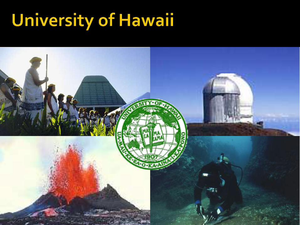
Karl Kim, Ph.D. Professor of Urban & Regional Planning
Director, Disaster Management and Humanitarian Assistance Program University of Hawaii
2012 National Planning Conference • Los Angeles • 15 April
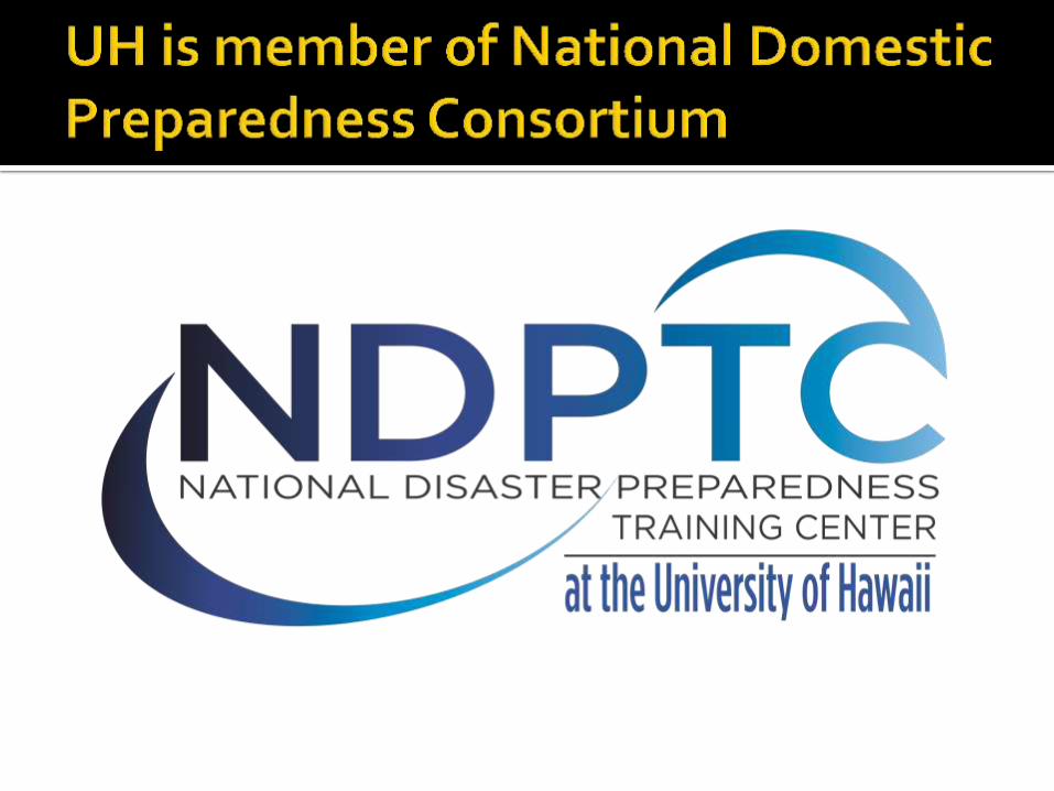
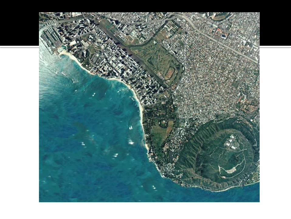
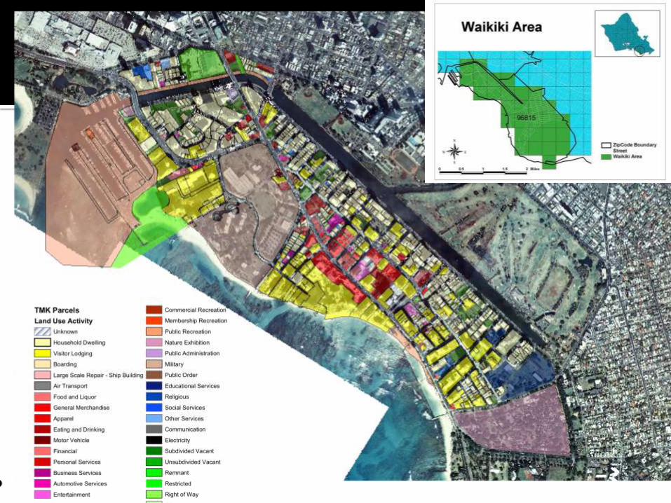
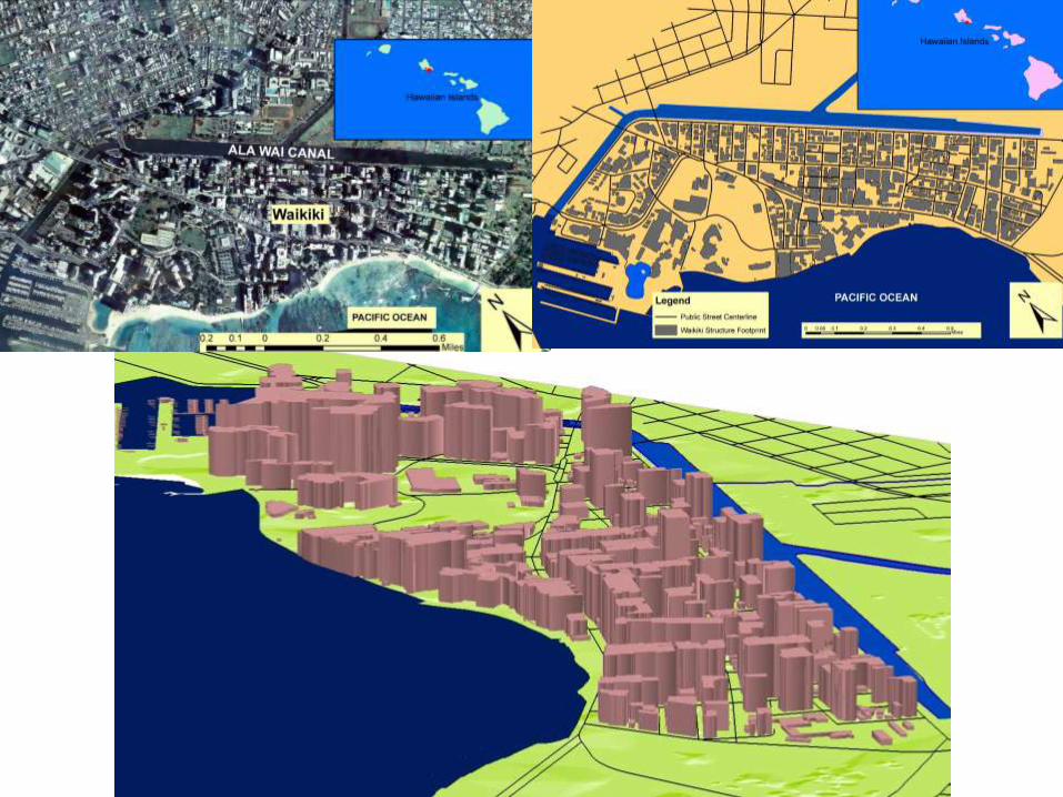
Background on NDPTC Climate Change and Planning Research Hawaii, Pacific Islands, Asia-Pacific Region Mainstreaming Adaptation
Climate into Codes
The Lure of the Local
Living with Water
New models for collaboration
3 3
3
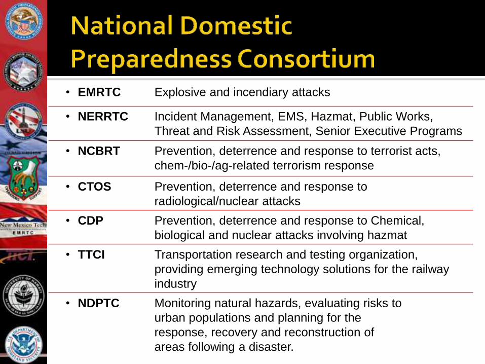
• EMRTC Explosive and incendiary attacks
• NERRTC Incident Management, EMS, Hazmat, Public Works,
Threat and Risk Assessment, Senior Executive Programs
• NCBRT Prevention, deterrence and response to terrorist acts,
chem-/bio-/ag-related terrorism response
• CTOS Prevention, deterrence and response to
radiological/nuclear attacks
• CDP Prevention, deterrence and response to Chemical,
biological and nuclear attacks involving hazmat
• TTCI Transportation research and testing organization,
providing emerging technology solutions for the railway
industry
• NDPTC Monitoring natural hazards, evaluating risks to
urban populations and planning for the
response, recovery and reconstruction of
areas following a disaster.
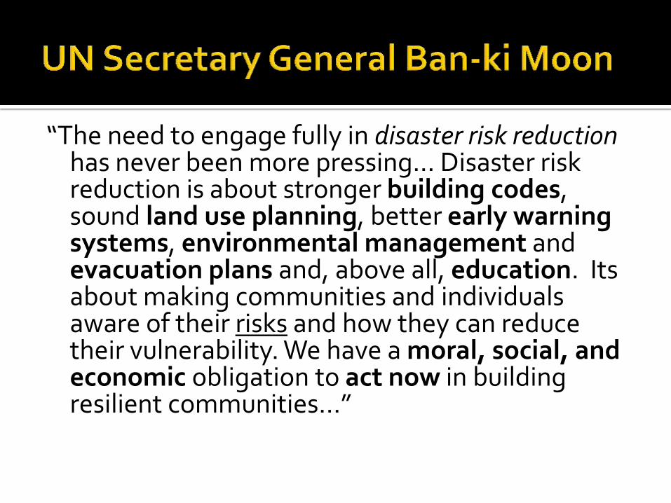
“The need to engage fully in disaster risk reduction has never been more pressing… Disaster risk reduction is about stronger building codes, sound land use planning, better early warning systems, environmental management and evacuation plans and, above all, education. Its about making communities and individuals aware of their risks and how they can reduce their vulnerability. We have a moral, social, and economic obligation to act now in building resilient communities…”

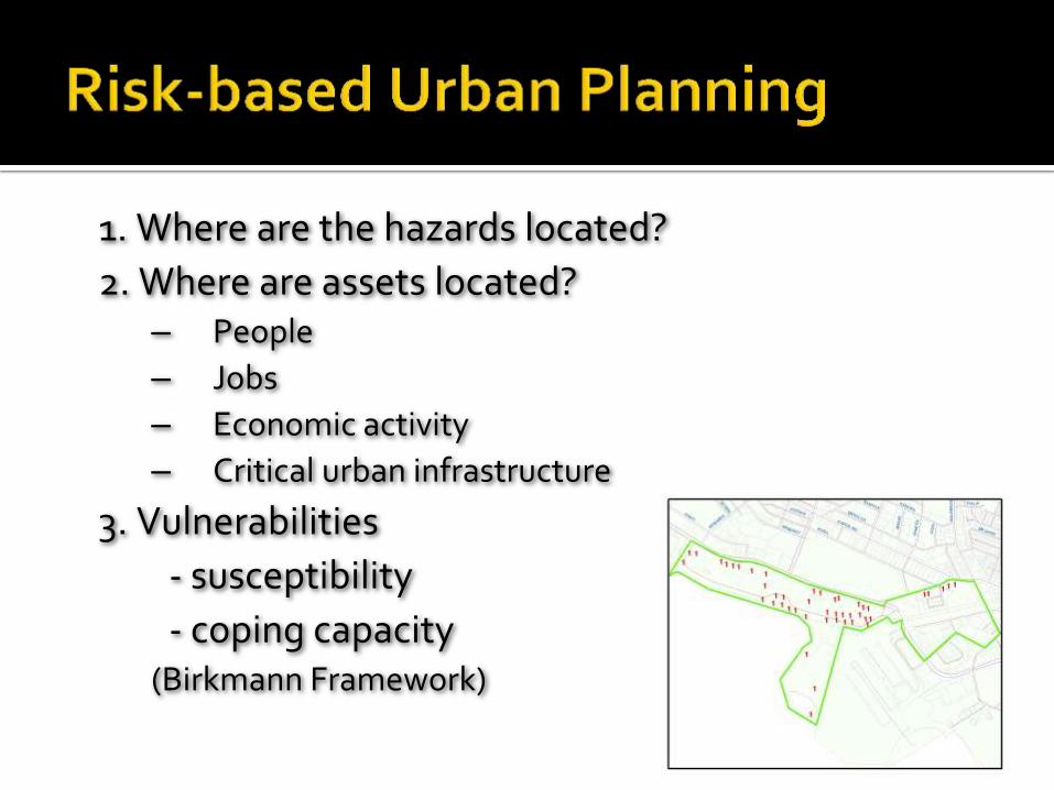
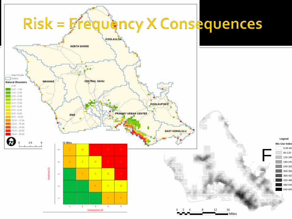
1. Where are the hazards located?
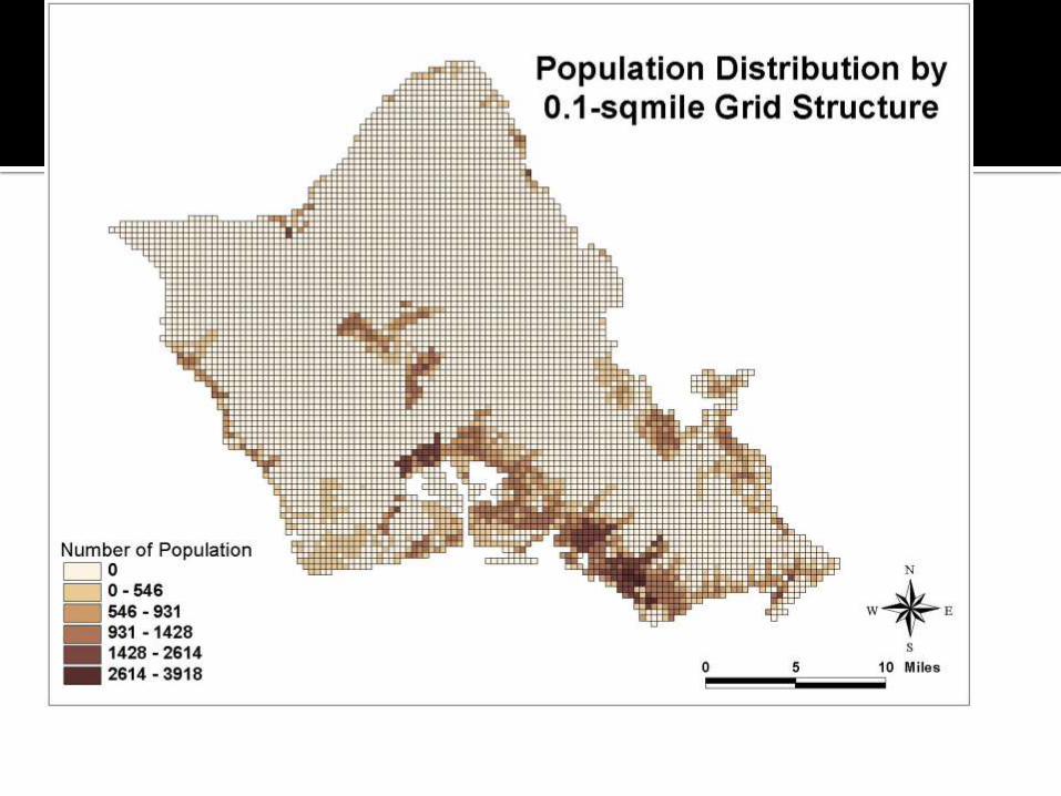
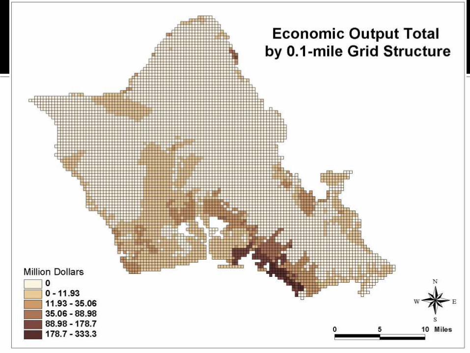
2. Where are assets located? – People
– Jobs
– Economic activity
– Critical urban infrastructure
3. Vulnerabilities
- susceptibility
- coping capacity (Birkmann Framework)

Tsunami Coastal Resilience Coastal Flooding Hurricanes/Cyclones Volcanoes Social Media Rapid Damage Assessment Senior Caregivers Security Professionals Community Leaders Disaster Recovery
ndptc.hawaii.edu
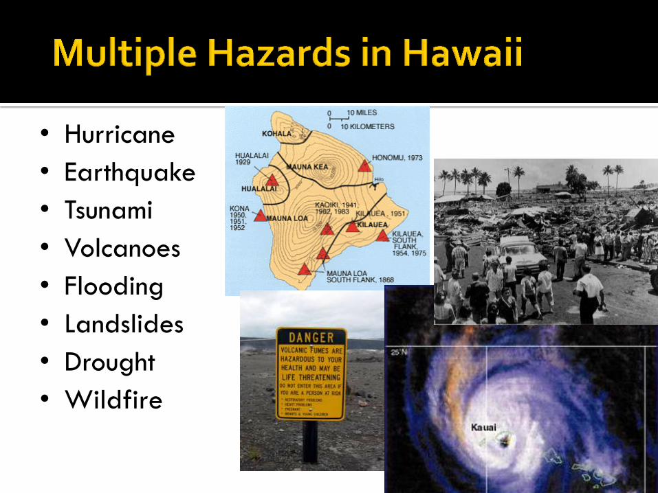
• Hurricane
• Earthquake
• Tsunami
• Volcanoes
• Flooding
• Landslides
• Drought
• Wildfire

Hurricanes Storm Surge
Flash Flooding
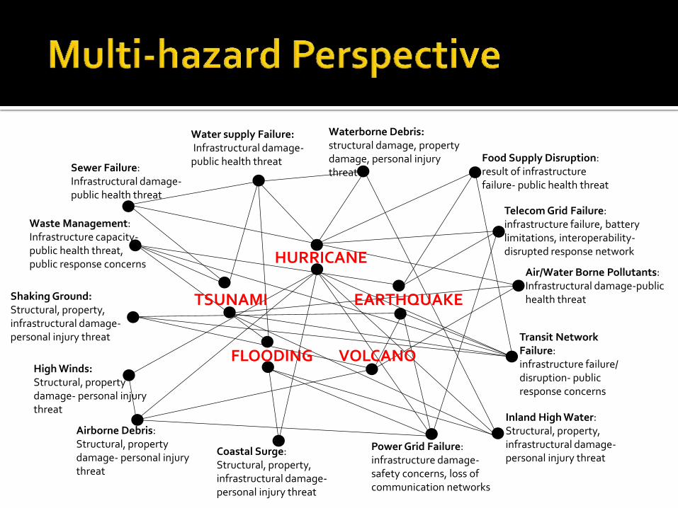
Sewer Failure: Infrastructural damage-public health threat
Water supply Failure: Infrastructural damage- public health threat
Waterborne Debris: structural damage, property damage, personal injury threat
Waste Management: Infrastructure capacity- public health threat, public response concerns
Food Supply Disruption: result of infrastructure failure- public health threat
Transit Network Failure: infrastructure failure/ disruption- public response concerns
Telecom Grid Failure: infrastructure failure, battery limitations, interoperability- disrupted response network
Shaking Ground: Structural, property, infrastructural damage- personal injury threat
Air/Water Borne Pollutants: Infrastructural damage-public health threat
Power Grid Failure: infrastructure damage- safety concerns, loss of communication networks
Inland High Water: Structural, property, infrastructural damage- personal injury threat
Coastal Surge: Structural, property, infrastructural damage- personal injury threat
Airborne Debris: Structural, property damage- personal injury threat
High Winds: Structural, property damage- personal injury threat
VOLCANO FLOODING
HURRICANE
TSUNAMI EARTHQUAKE
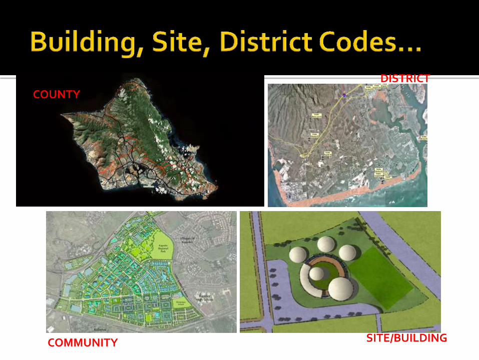
DISTRICT
COUNTY
COMMUNITY SITE/BUILDING

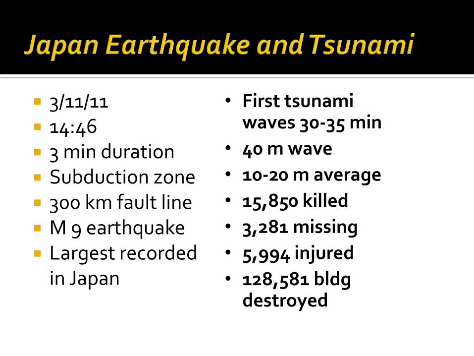
3/11/11 14:46 3 min duration Subduction zone 300 km fault line M 9 earthquake Largest recorded
in Japan
• First tsunami waves 30-35 min
• 40 m wave
• 10-20 m average
• 15,850 killed
• 3,281 missing
• 5,994 injured
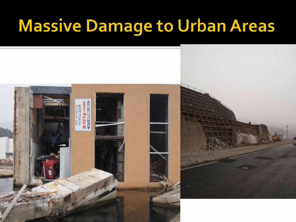
• 128,581 bldg destroyed
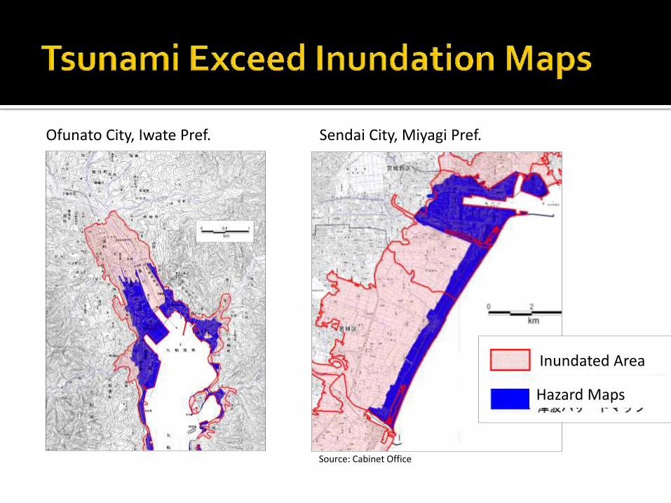
Ofunato City, Iwate Pref. Sendai City, Miyagi Pref.
Inundated Area
Hazard Maps
Source: Cabinet Office
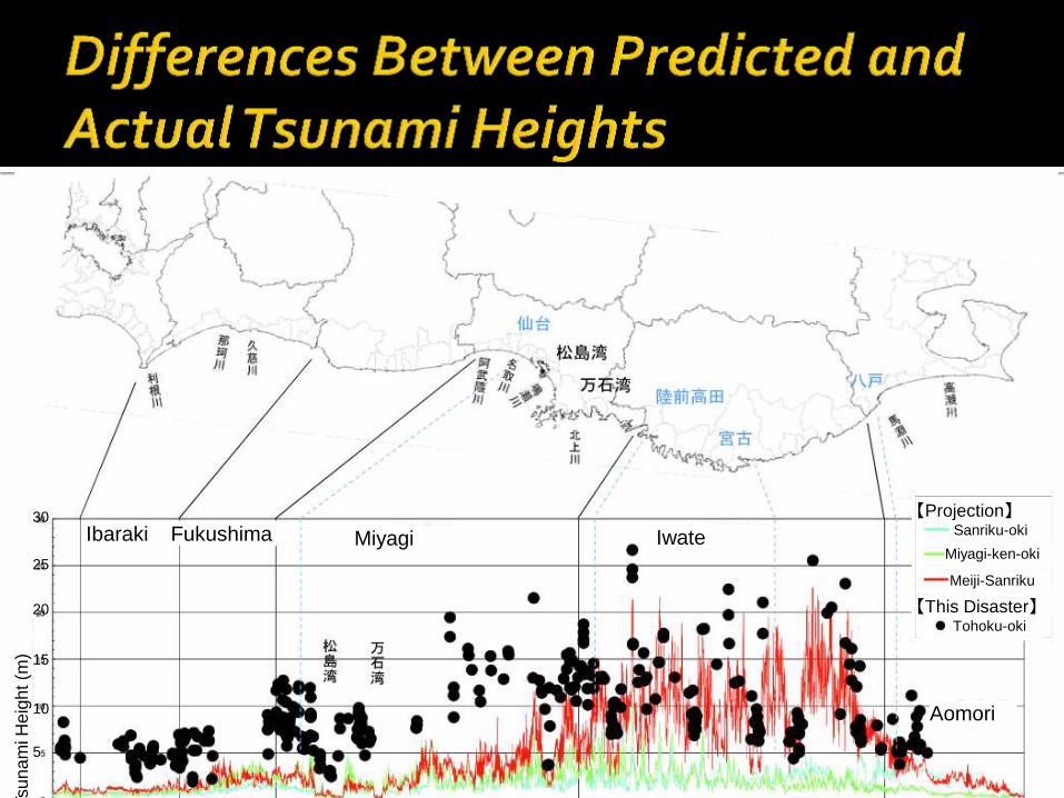
23
Ibaraki Fukushima Miyagi Iwate
【Projection】 Sanriku-oki
Miyagi-ken-oki
Meiji-Sanriku
【This Disaster】 Tohoku-oki
Aomori
Tsu
na
mi H
eig
ht (m
)
30
25
20
15
10
5
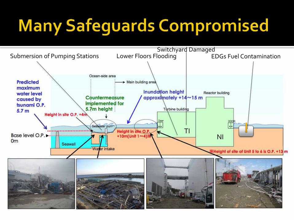
Submersion of Pumping Stations Lower Floors Flooding EDGs Fuel Contamination
NI TI
Switchyard Damaged
Tsunami Impact on Fukushima Nuclear Power Plant
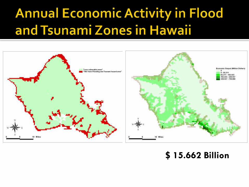
$ 15.662 Billion
F
Legend
Mix Use Index
0.05-60
60-120
120-180
180-240
240-300
300-360
360-420
420-480
480-540
540-600
0 4 8 12 162
Miles


Negative Binomial (NB)
Pr(Yi = yi ; , d) = (yi + d – 1)!yi ! + ( d – 1)!
yi
(1 + )yi + k
; yi = 0, 1, 2...
Expected number of casualties/losses, Yi, occurring at grid i with a set of q predictor variables, Xi1, to Xiq:
Function (Yi) = 0 + 1 Xi1 + 2 Xi2 + … + q Xiq
Probability that a grid defined by a known set of predictor variables, Xi1, Xi2, ..., Xiq, experiences Yi = yi losses:
1, 2 ..., q for the negative binomial regression estimated using GLM in SAS
32

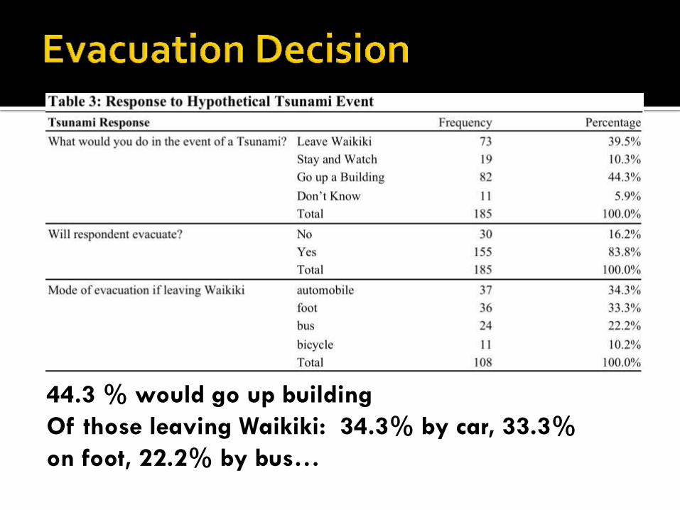
44.3 % would go up building
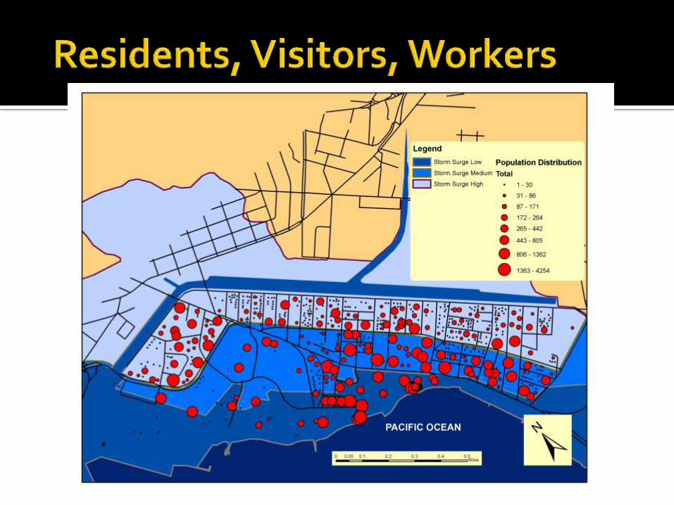
Of those leaving Waikiki: 34.3% by car, 33.3%
on foot, 22.2% by bus…
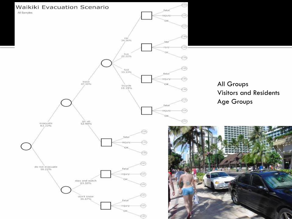
All Groups
Visitors and Residents
Age Groups
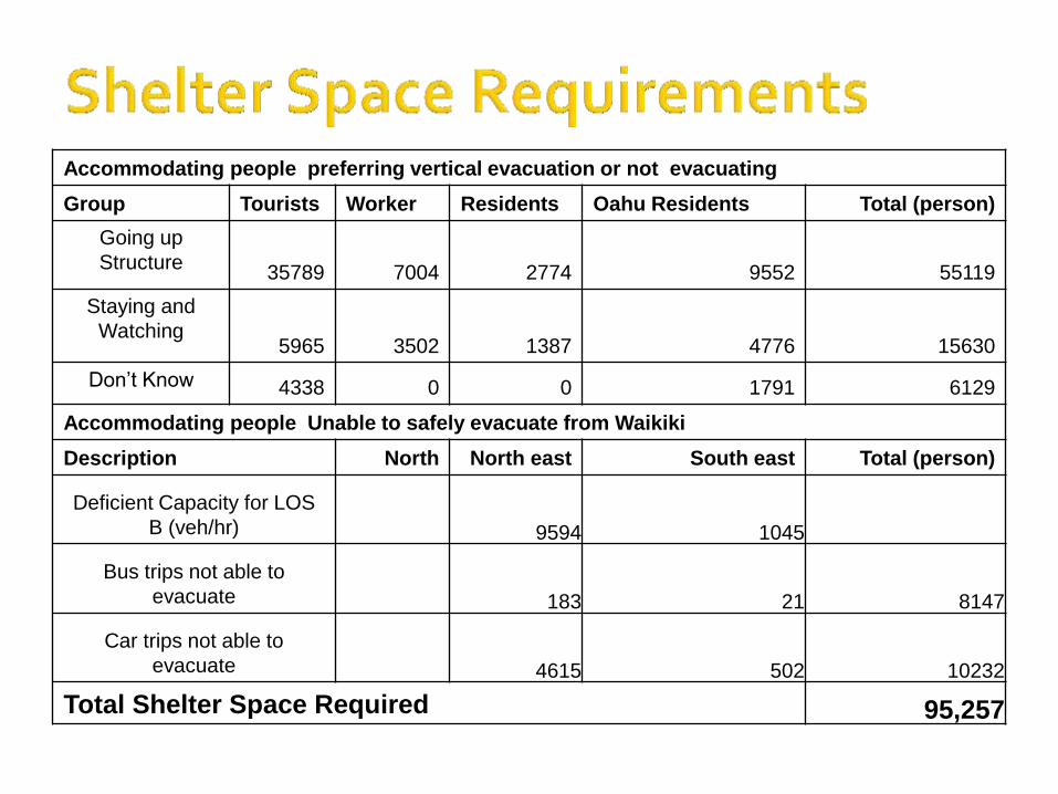
Accommodating people preferring vertical evacuation or not evacuating
Group Tourists Worker Residents Oahu Residents Total (person)
Going up
Structure 35789 7004 2774 9552 55119
Staying and
Watching 5965 3502 1387 4776 15630
Don’t Know 4338 0 0 1791 6129
Accommodating people Unable to safely evacuate from Waikiki
Description North North east South east Total (person)
Deficient Capacity for LOS
B (veh/hr) 9594 1045
Bus trips not able to
evacuate 183 21 8147
Car trips not able to
evacuate 4615 502 10232
Total Shelter Space Required 95,257

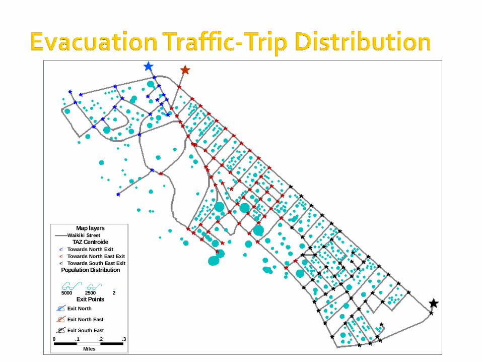
0 .1 .2 .3
Miles
Map layersWaikiki Street
TAZ Centroide Towards North Exit
Towards North East Exit
Towards South East Exit
Exit North
Exit North East
Exit South East
Population Distribution
5000 2500 2
Exit Points
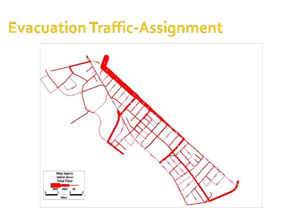
0 .1 .2 .3
Miles
Map layersWaikiki Street
Total Flow
5000 2500 50

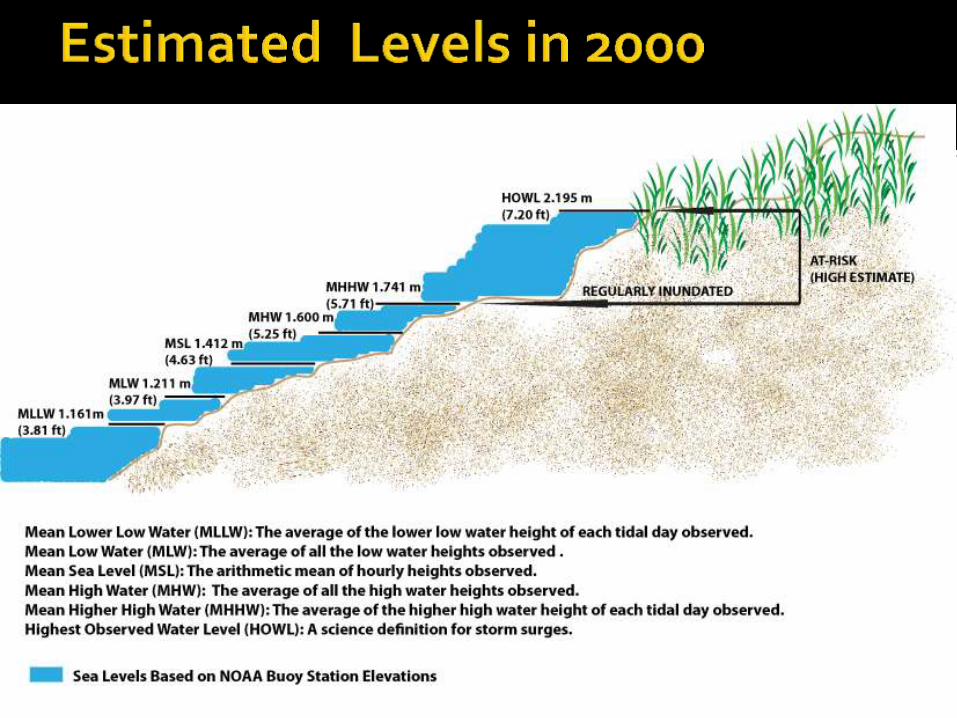
2000 2025 2050 2075 2100
Regularly
inundated (Low)
Below MHHW
(El. < +32.9 cm)
MHHW to
MHHW + 6cm
MHHW to
MHHW + 13cm
MHHW to
MHHW + 21cm
MHHW to
MHHW + 30cm
(El. +32.9 cm to
+38.9 cm)
(El. +32.9 cm to +45.9
cm)
(El. +32.9 cm to
+53.9 cm)
(El. +32.9 cm to +62.9
cm)
Regularly
inundated (High)
Below MHHW
(El. < +32.9 cm)
MHHW to
MHHW + 6.5cm
MHHW to
MHHW + 17.5cm
MHHW to
MHHW + 31cm
MHHW to
MHHW + 48.5cm
(El. +32.9 cm to
+39.4 cm)
(El. +32.9 cm to +50.4
cm)
(El. +32.9 cm to
+63.9 cm)
(El. +32.9 cm to +81.4
cm)
At-risk (Low)
MHHW to HOWL
(El. +32.9 cm to
+78.3 cm
MHHW + 6cm to
HOWL + 6cm
MHHW + 13cm to
HOWL + 13cm
MHHW + 21cm to
HOWL + 21cm
MHHW + 30cm to
HOWL + 30cm
(El. +38.9 cm to
+84.3 cm)
(El. +45.9 cm to +91.3
cm)
(El. +53.9 cm to
+99.3 cm)
(El. +62.9 cm to
+108.3 cm)
At-risk (High)
MHHW to HOWL
(El. +32.9 cm to
+78.3 cm
MHHW + 6.5cm to
HOWL + 6.5cm
MHHW + 17.5cm to
HOWL + 17.5cm
MHHW + 31cm to
HOWL + 31cm
MHHW + 48.5cm to
HOWL + 48.5cm
(El. +39.4 cm to
+84.8 cm)
(El. +50.4 cm to +95.8
cm)
(El. +63.9 cm to
+109.3 cm)
(El. +81.4 cm to
+126.8 cm)
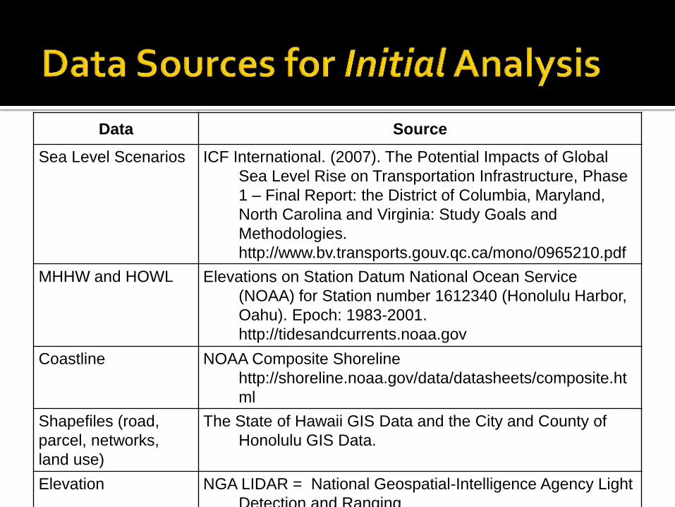
Data Source
Sea Level Scenarios ICF International. (2007). The Potential Impacts of Global
Sea Level Rise on Transportation Infrastructure, Phase
1 – Final Report: the District of Columbia, Maryland,
North Carolina and Virginia: Study Goals and
Methodologies.
http://www.bv.transports.gouv.qc.ca/mono/0965210.pdf
MHHW and HOWL Elevations on Station Datum National Ocean Service
(NOAA) for Station number 1612340 (Honolulu Harbor,
Oahu). Epoch: 1983-2001.
http://tidesandcurrents.noaa.gov
Coastline NOAA Composite Shoreline
http://shoreline.noaa.gov/data/datasheets/composite.ht
ml
Shapefiles (road,
parcel, networks,
land use)
The State of Hawaii GIS Data and the City and County of
Honolulu GIS Data.
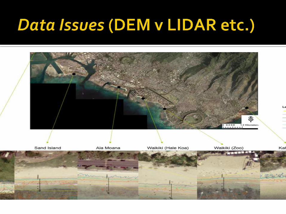
Elevation NGA LIDAR = National Geospatial-Intelligence Agency Light
Detection and Ranging
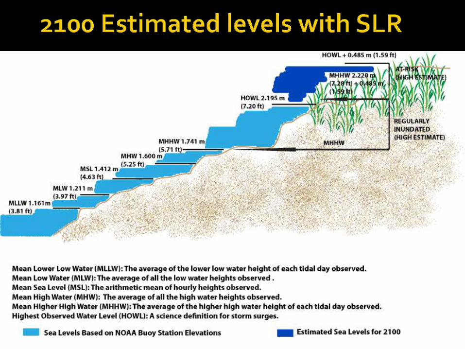

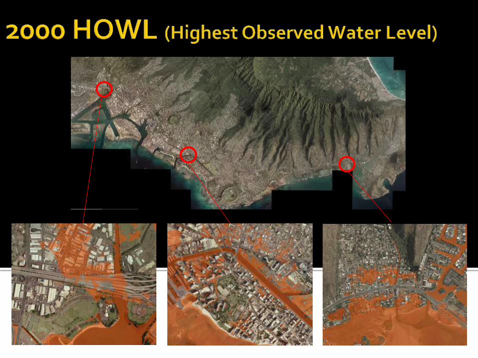
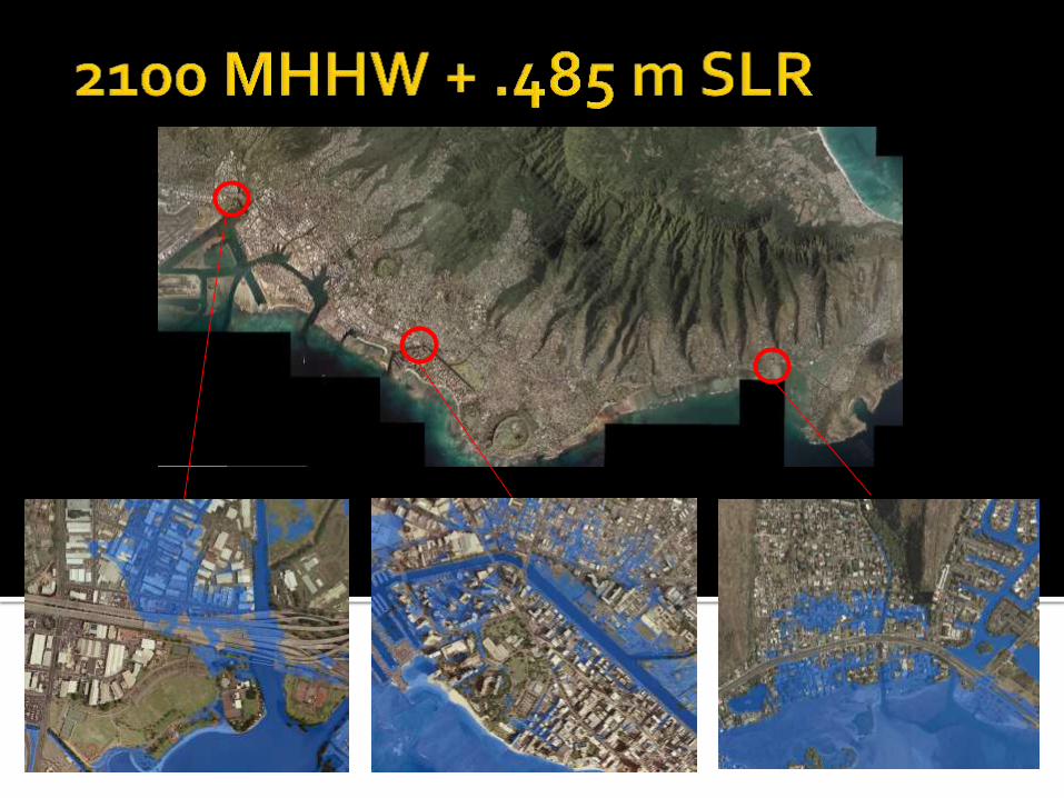

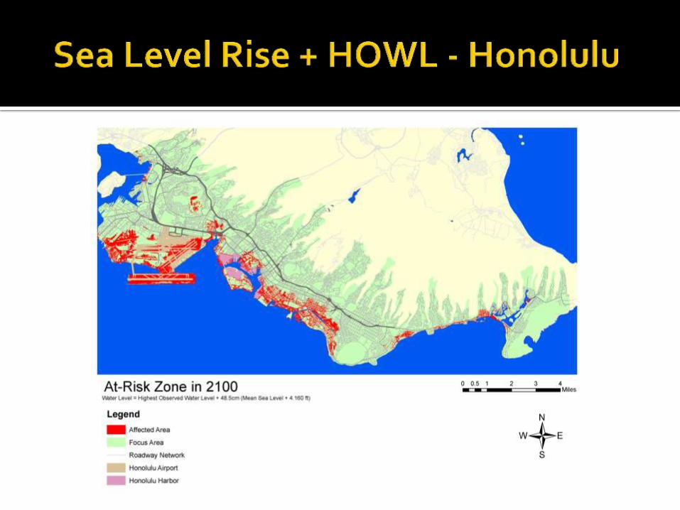
At Risk – High Estimate (2100) based on HOWL + 0.485m
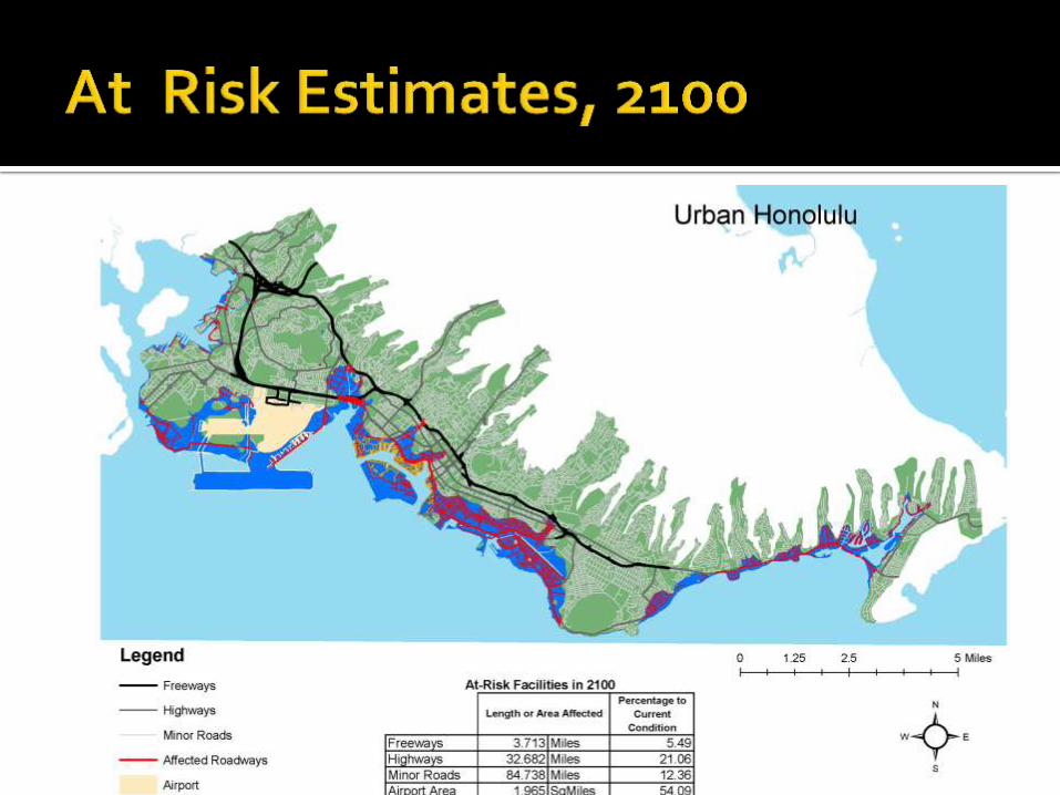
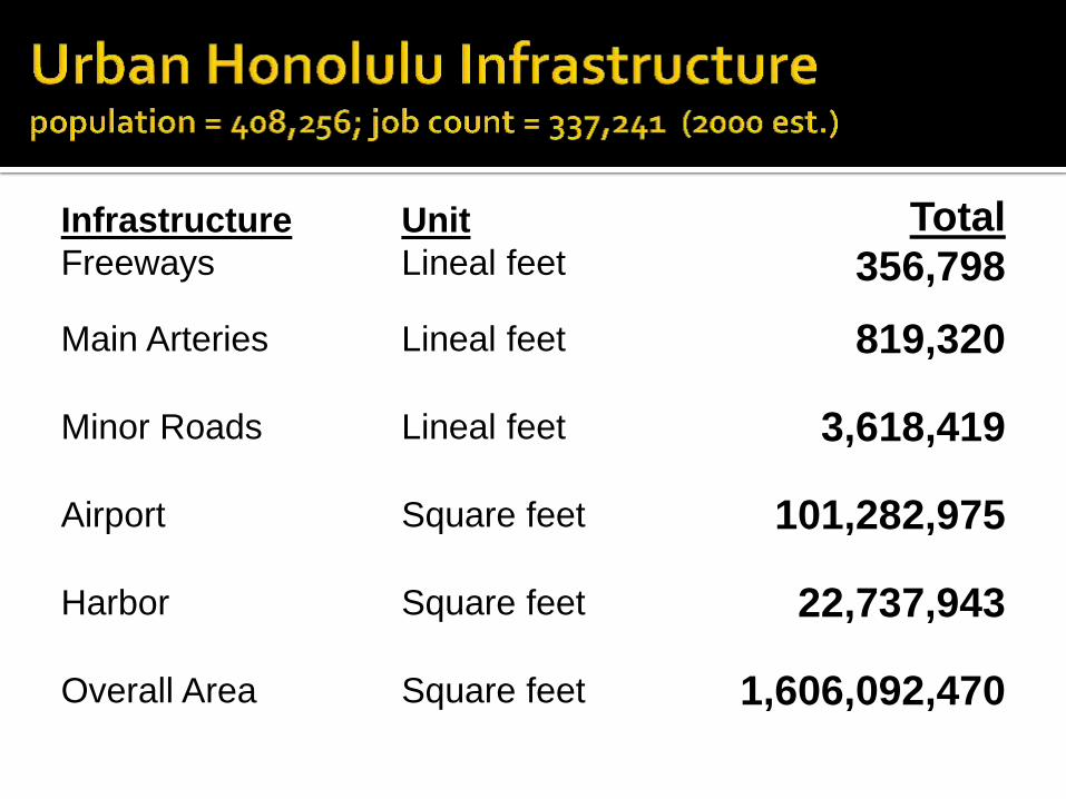
Infrastructure
Freeways
Unit
Lineal feet
Total
356,798
Main Arteries Lineal feet 819,320
Minor Roads Lineal feet 3,618,419
Airport Square feet 101,282,975
Harbor Square feet 22,737,943
Overall Area Square feet 1,606,092,470
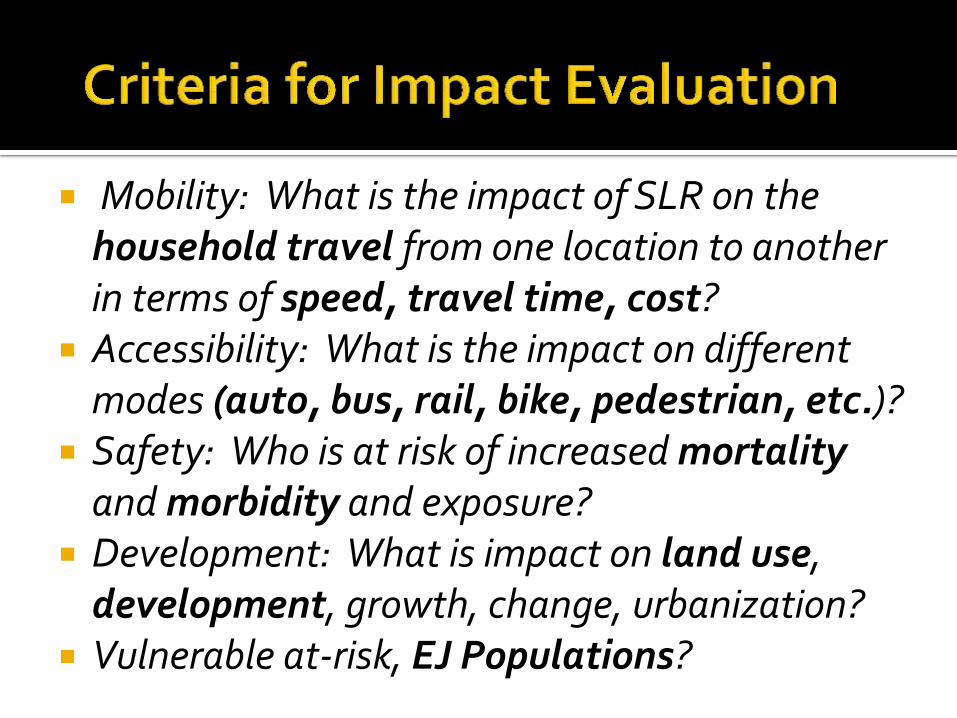
Mobility: What is the impact of SLR on the household travel from one location to another in terms of speed, travel time, cost?
Accessibility: What is the impact on different modes (auto, bus, rail, bike, pedestrian, etc.)?
Safety: Who is at risk of increased mortality and morbidity and exposure?
Development: What is impact on land use, development, growth, change, urbanization?
Vulnerable at-risk, EJ Populations?
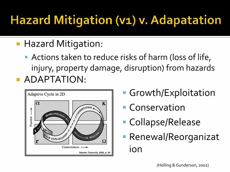
Hazard Mitigation:
Actions taken to reduce risks of harm (loss of life, injury, property damage, disruption) from hazards
ADAPTATION:
Growth/Exploitation
Conservation
Collapse/Release
Renewal/Reorganization
(Holling & Gunderson, 2002)
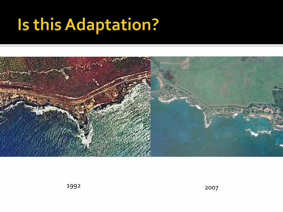
1992 2007
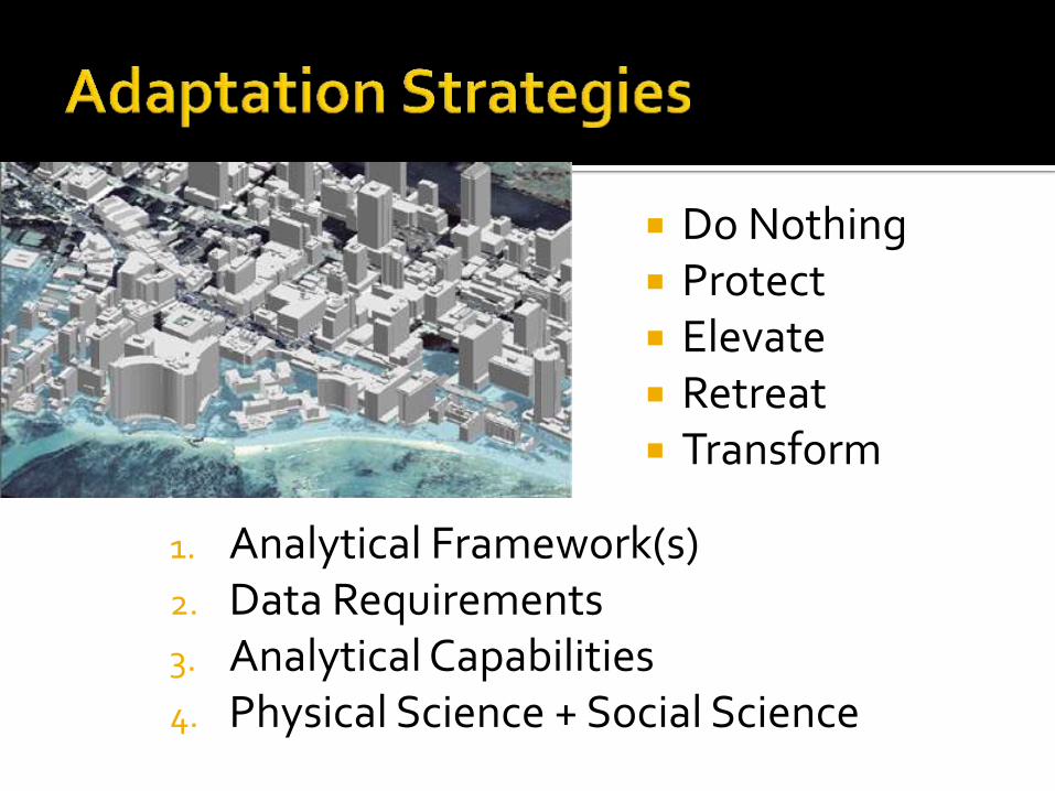
Do Nothing Protect Elevate Retreat Transform
1. Analytical Framework(s) 2. Data Requirements 3. Analytical Capabilities 4. Physical Science + Social Science
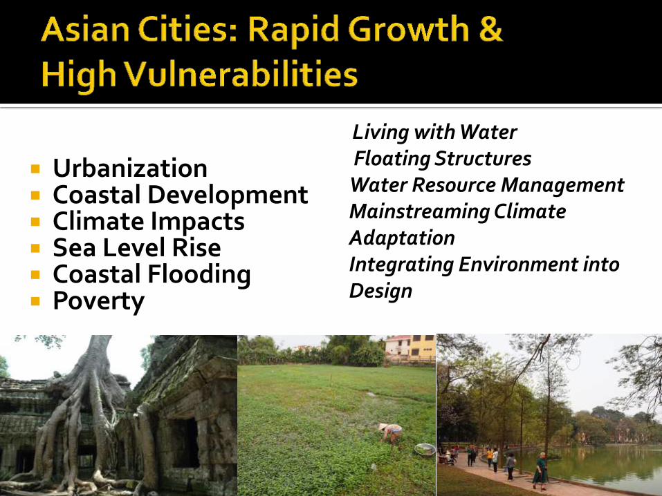
Urbanization Coastal Development Climate Impacts Sea Level Rise Coastal Flooding Poverty
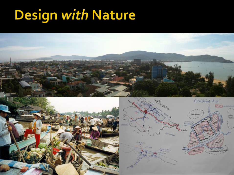
Living with Water Floating Structures Water Resource Management Mainstreaming Climate Adaptation Integrating Environment into Design
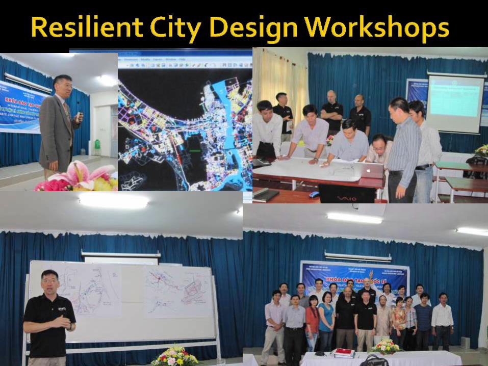

Partner with ICLEI-Korea and others Community Resilience Training Initiative Coastal Hazards, Sea Level Rise, Adaptation Flood Risk Reduction University-Government-Community Training,
Exercises, Drills focus on resilient sustainable cities.

Lure of the Local Go to threats/risks/hazards Coding (Building, Land Use, etc.) Data integration for risk reduction Transport/Land Use/Development Critical Infrastructure Data Rich Environment Interactions between transport
facilities, land use, development, especially in coastal area
COLLABORATION for ADAPTATION
Science + Social Science = PLANNING DANCE of Black Dragon + Phoenix
Prof. Karl Kim, Executive Director National Disaster Preparedness Training Center
University of Hawaii Department of Urban & Regional Planning
828 Fort Street Mall • Suite 320 Honolulu, Hawaii 96822
Tel: 808 956-0600 Email: [email protected]
Website: ndptc.hawaii.edu