qgis: application of a free-license geographic information ... · qgis: application of a...
TRANSCRIPT
QGIS: Application of a free-license Geographic Information System in the GIZ
EbA project in Viet Nam
Dr. Harald Kirsch (CIM)Adviser for Spatial Planning, Ha Tinh Dept. of Natural Resources and Environment
1
Project: “Strategic mainstreaming of ecosystem-based adaptation (EbA) in Vietnam
Table of Content
1. Introduction and Background
2. Features and advantages of QGIS
3. GIS in the capacity development component of the GIZ EbA project
4. Outlook and conclusion
2
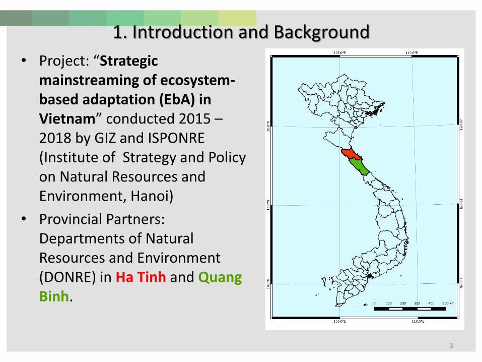
1. Introduction and Background
• Project: “Strategic mainstreaming of ecosystem-based adaptation (EbA) in Vietnam” conducted 2015 –2018 by GIZ and ISPONRE (Institute of Strategy and Policy on Natural Resources and Environment, Hanoi)
• Provincial Partners: Departments of Natural Resources and Environment (DONRE) in Ha Tinh and Quang Binh.
3
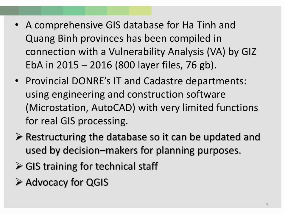
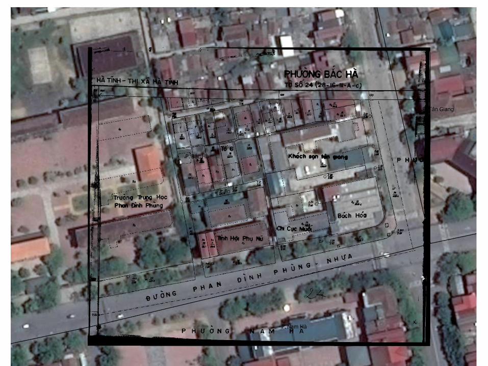
• A comprehensive GIS database for Ha Tinh and Quang Binh provinces has been compiled in connection with a Vulnerability Analysis (VA) by GIZ EbA in 2015 – 2016 (800 layer files, 76 gb).
• Provincial DONRE’s IT and Cadastre departments: using engineering and construction software (Microstation, AutoCAD) with very limited functions for real GIS processing.
➢ Restructuring the database so it can be updated and used by decision–makers for planning purposes.
➢GIS training for technical staff
➢Advocacy for QGIS
4
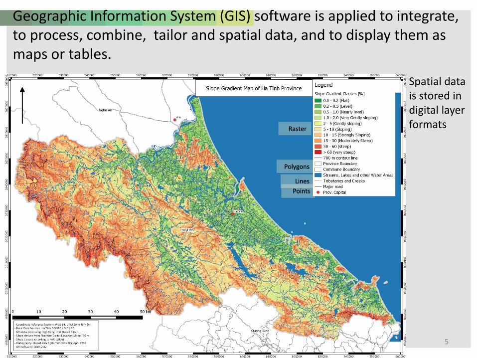
Geographic Information System (GIS) software is applied to integrate, to process, combine, tailor and spatial data, and to display them as maps or tables.
• Spatial data is stored in digital layer formats
5
Points
Lines
Polygons
Raster
6
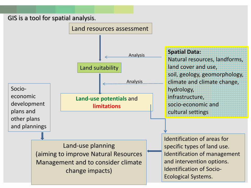
Land-use planning (aiming to improve Natural Resources Management and to consider climate
change impacts)
Land resources assessment
Spatial Data:Natural resources, landforms, land cover and use, soil, geology, geomorphology,climate and climate change,hydrology,infrastructure, socio-economic and cultural settings
Land suitability
Land-use potentials and limitations
Identification of areas for specific types of land use. Identification of management and intervention options.Identification of Socio-Ecological Systems.
Socio-economic development plans and other plans and plannings
Analysis
Analysis
GIS is a tool for spatial analysis.
7
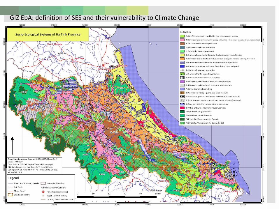
GIZ EbA: definition of SES and their vulnerability to Climate Change
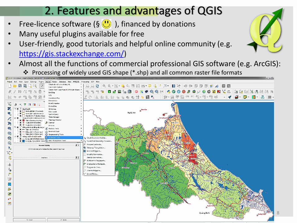
2. Features and advantages of QGIS• Free-licence software (§ ), financed by donations• Many useful plugins available for free• User-friendly, good tutorials and helpful online community (e.g.
https://gis.stackexchange.com/)• Almost all the functions of commercial professional GIS software (e.g. ArcGIS):
❖ Processing of widely used GIS shape (*.shp) and all common raster file formats
8
9
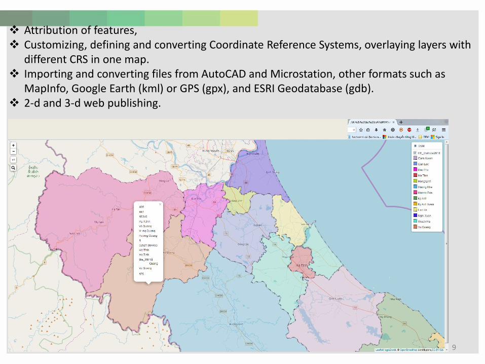
❖ Attribution of features, ❖ Customizing, defining and converting Coordinate Reference Systems, overlaying layers with
different CRS in one map.❖ Importing and converting files from AutoCAD and Microstation, other formats such as
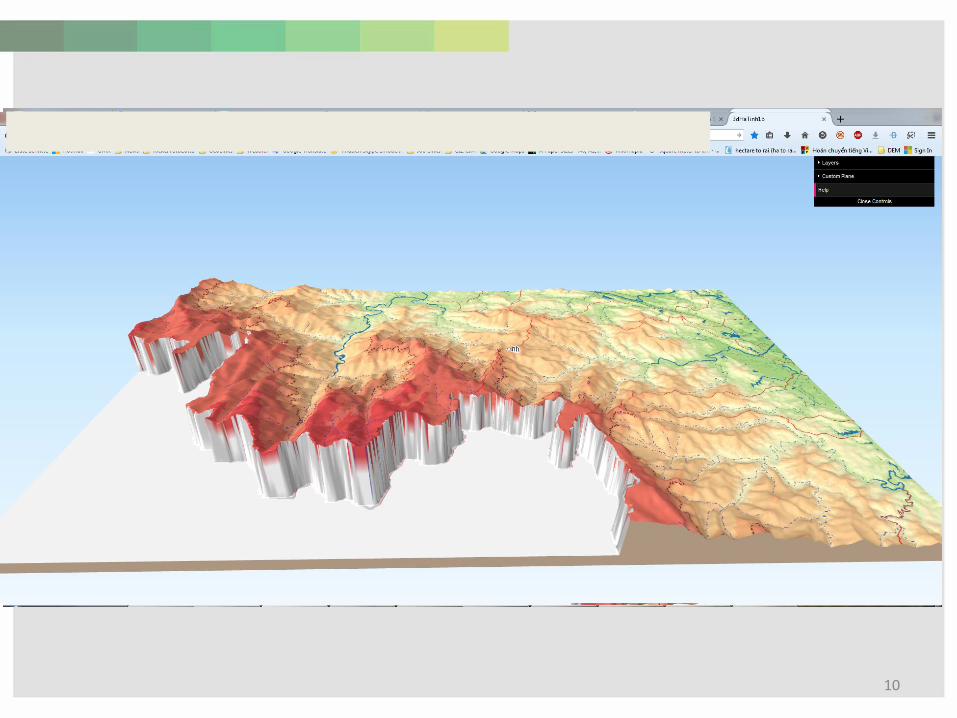
MapInfo, Google Earth (kml) or GPS (gpx), and ESRI Geodatabase (gdb).❖ 2-d and 3-d web publishing.
10

11
❖ “Open Layers” and “Quick MapServices” plugins: High resolution satellite images can be uploaded as background images to verify, correct, and edit the content of processed GIS files
❖ Layer export options to other file formats and print composer map export as jpg and pdf
12
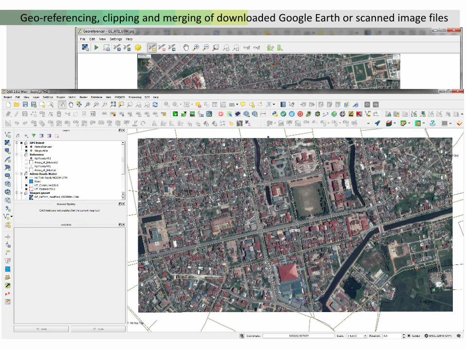
Geo-referencing, clipping and merging of downloaded Google Earth or scanned image files
13
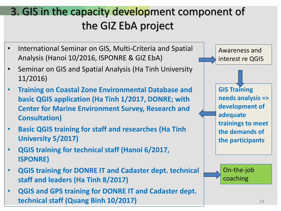
3. GIS in the capacity development component of the GIZ EbA project
• International Seminar on GIS, Multi-Criteria and Spatial Analysis (Hanoi 10/2016, ISPONRE & GIZ EbA)
• Seminar on GIS and Spatial Analysis (Ha Tinh University 11/2016)
• Training on Coastal Zone Environmental Database and basic QGIS application (Ha Tinh 1/2017, DONRE; with Center for Marine Environment Survey, Research and Consultation)
• Basic QGIS training for staff and researches (Ha Tinh University 5/2017)
• QGIS training for technical staff (Hanoi 6/2017, ISPONRE)
• QGIS training for DONRE IT and Cadaster dept. technical staff and leaders (Ha Tinh 8/2017)
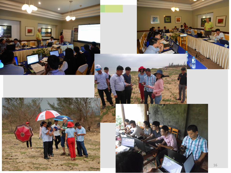
• QGIS and GPS training for DONRE IT and Cadaster dept. technical staff (Quang Binh 10/2017) 14
GIS Training needs analysis => development of adequate trainings to meet the demands of the participants
Awareness and interest re QGIS
On-the-job coaching
15
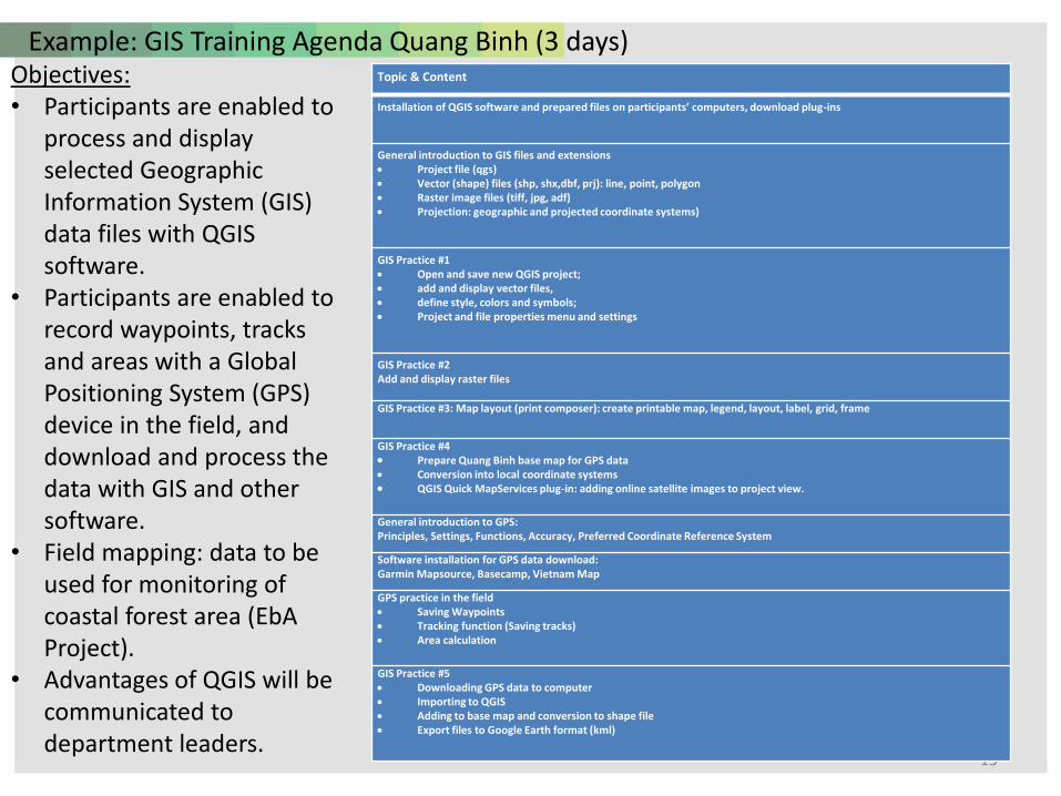
Example: GIS Training Agenda Quang Binh (3 days)Objectives: • Participants are enabled to
process and display selected Geographic Information System (GIS) data files with QGIS software.
• Participants are enabled to record waypoints, tracks and areas with a Global Positioning System (GPS) device in the field, and download and process the data with GIS and other software.
• Field mapping: data to be used for monitoring of coastal forest area (EbA Project).
• Advantages of QGIS will be communicated to department leaders.
Topic & Content
Installation of QGIS software and prepared files on participants’ computers, download plug-ins
General introduction to GIS files and extensions • Project file (qgs)• Vector (shape) files (shp, shx,dbf, prj): line, point, polygon• Raster image files (tiff, jpg, adf) • Projection: geographic and projected coordinate systems)
GIS Practice #1• Open and save new QGIS project;• add and display vector files,• define style, colors and symbols;• Project and file properties menu and settings
GIS Practice #2Add and display raster files
GIS Practice #3: Map layout (print composer): create printable map, legend, layout, label, grid, frame
GIS Practice #4• Prepare Quang Binh base map for GPS data• Conversion into local coordinate systems• QGIS Quick MapServices plug-in: adding online satellite images to project view.
General introduction to GPS:Principles, Settings, Functions, Accuracy, Preferred Coordinate Reference System
Software installation for GPS data download:Garmin Mapsource, Basecamp, Vietnam Map
GPS practice in the field• Saving Waypoints• Tracking function (Saving tracks)• Area calculation
GIS Practice #5• Downloading GPS data to computer• Importing to QGIS• Adding to base map and conversion to shape file• Export files to Google Earth format (kml)
16
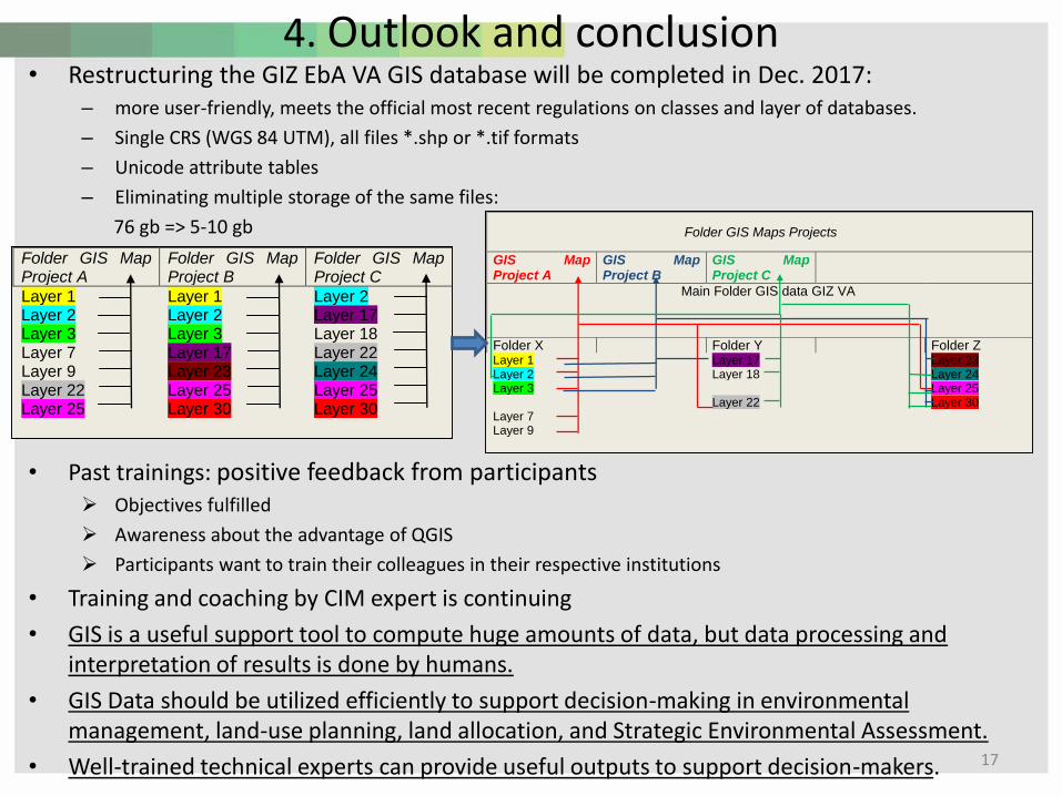
4. Outlook and conclusion• Restructuring the GIZ EbA VA GIS database will be completed in Dec. 2017:
– more user-friendly, meets the official most recent regulations on classes and layer of databases.
– Single CRS (WGS 84 UTM), all files *.shp or *.tif formats
– Unicode attribute tables
– Eliminating multiple storage of the same files:
76 gb => 5-10 gb
• Past trainings: positive feedback from participants➢ Objectives fulfilled
➢ Awareness about the advantage of QGIS
➢ Participants want to train their colleagues in their respective institutions
• Training and coaching by CIM expert is continuing
• GIS is a useful support tool to compute huge amounts of data, but data processing and interpretation of results is done by humans.
• GIS Data should be utilized efficiently to support decision-making in environmental management, land-use planning, land allocation, and Strategic Environmental Assessment.
• Well-trained technical experts can provide useful outputs to support decision-makers. 17
Folder GIS Map Project A
Folder GIS Map Project B
Folder GIS Map Project C
Layer 1 Layer 1 Layer 2 Layer 2 Layer 2 Layer 17 Layer 3 Layer 3 Layer 18 Layer 7 Layer 17 Layer 22 Layer 9 Layer 23 Layer 24 Layer 22 Layer 25 Layer 25 Layer 25 Layer 30 Layer 30
Folder GIS Maps Projects
GIS Map Project A
GIS Map Project B
GIS Map Project C
Main Folder GIS data GIZ VA
Folder X Folder Y Folder Z Layer 1 Layer 17 Layer 23 Layer 2 Layer 18 Layer 24 Layer 3 Layer 25 Layer 22 Layer 30 Layer 7 Layer 9