progress 2006–2007 - reefplan.qld.gov.au · will have made changes that improve their ... a water...
TRANSCRIPT
33
The Rural Water Use Efficiency (RWUE)
initiative is a partnership between the
Queensland Government through NRW
and the major industry groups involved
in irrigation in Queensland.
The initiative is now in its third stage,
representing a total investment in excess
of $50 million since 1999. The Queensland
Government provided $2.58 million over
2005–06 and 2006–07 for RWUE 3 and
has built on this commitment to the initiative
with additional funding of $4 million
($1.25 million in 2006–07) under the
Blueprint for the Bush programme.
This funding will allow RWUE 3 to be
extended for a further two years to
June 2009.
The RWUE initiative enables rural
industries to assist and encourage their
growers to achieve better on-farm water
management, and reduce their off-farm
impacts, particularly through efficient
irrigation and management of nutrients.
Under RWUE 3, grant agreements
have been established and are being
implemented with seven partner industries.
These are CANEGROWERS, the
Queensland Dairyfarmers’ Organisation,
Cotton Australia, Growcom, Queensland
Turf Producers Association, Flower
Association of Queensland and Nursery
and Garden Industry Queensland.
The programme is heavily committed to
supporting the implementation of Farm
Management Systems (FMS)
Progress 2006–2007 Identifying and removing barriers to the uptake of sustainable management practices
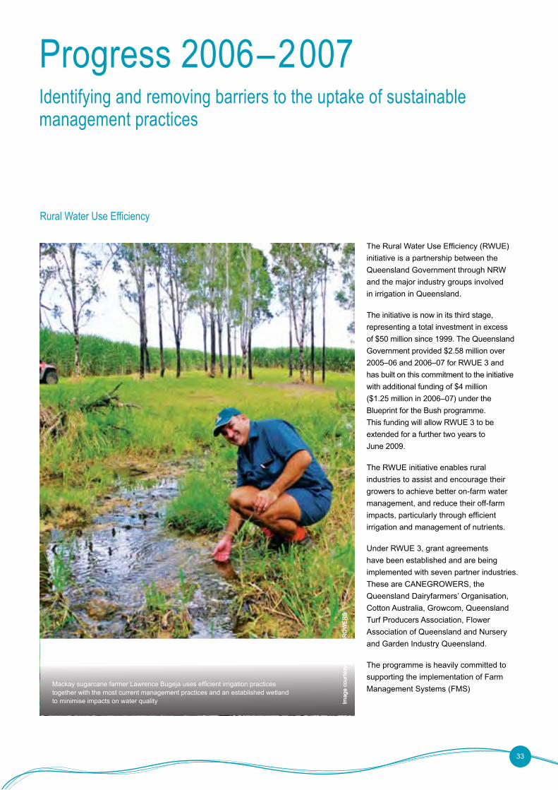
Rural Water Use Efficiency
Mackay sugarcane farmer Lawrence Bugeja uses efficient irrigation practices together with the most current management practices and an established wetland to minimise impacts on water quality Im
age
cour
tesy
of C
AN
EG
RO
WE
RS
Imag
e co
urte
sy o
f CA
NE
GR
OW
ER
S
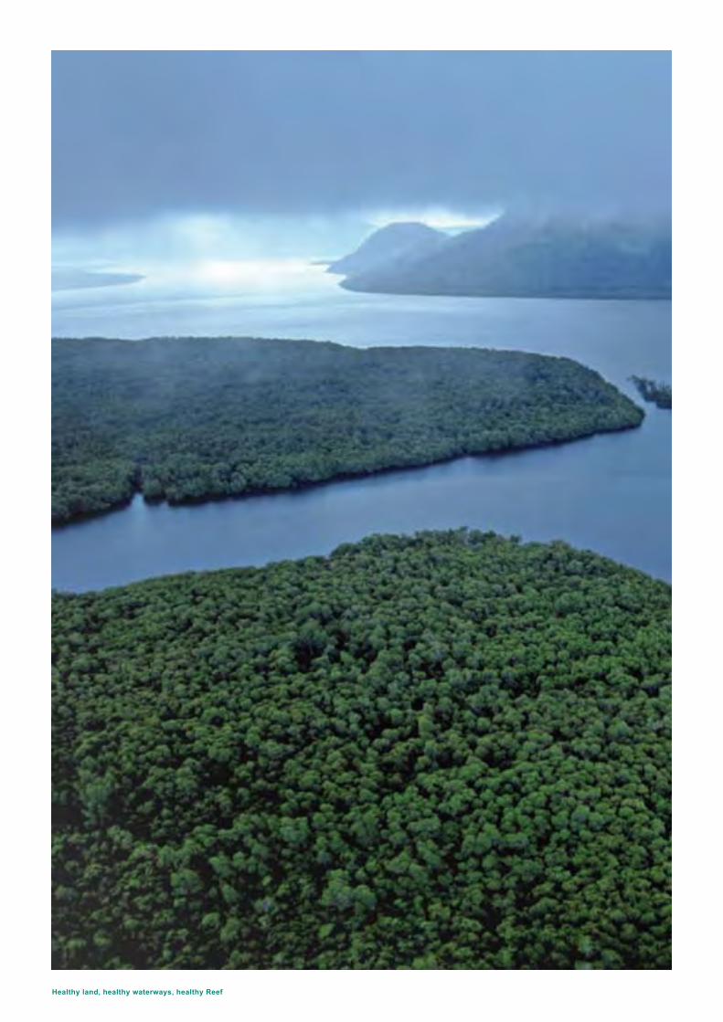
Healthy land, healthy waterways, healthy Reef
(see page 31). Agreements with industry
partners target the development and
implementation of FMS that will assist in
on-ground actions at the property level.
Each industry group will run the initiative
through their respective industry-based
programmes, for example:
• the sugar industry will mainly use an
incentive programme to concentrate
on improving irrigation and water
use efficiency, and achieving better
environmental outcomes
• the cotton industry will focus on education
and training and further promotion of
FMS, encompassing catchment and
environmental management
• the horticulture industry will focus on
irrigation system assessments and
minimising nutrient losses from farms.
It will address water use in packing
sheds and soil management and will
promote FMS.
By the end of the programme, water savings
of at least 10 per cent are expected to have
been achieved and up to 50 per cent of
those irrigators involved in the programme
will have made changes that improve their
on-farm water use efficiency and address
priority NRM issues.
The RWUE initiative contributes to Reef
Plan objectives through:
• promoting the adoption of sustainable land and water management practices
• implementing education and extension programmes to increase voluntary uptake of sustainable practices
• supporting industry-led development
of BMP.
This activity supports Actions A4, B1
and C1.
34
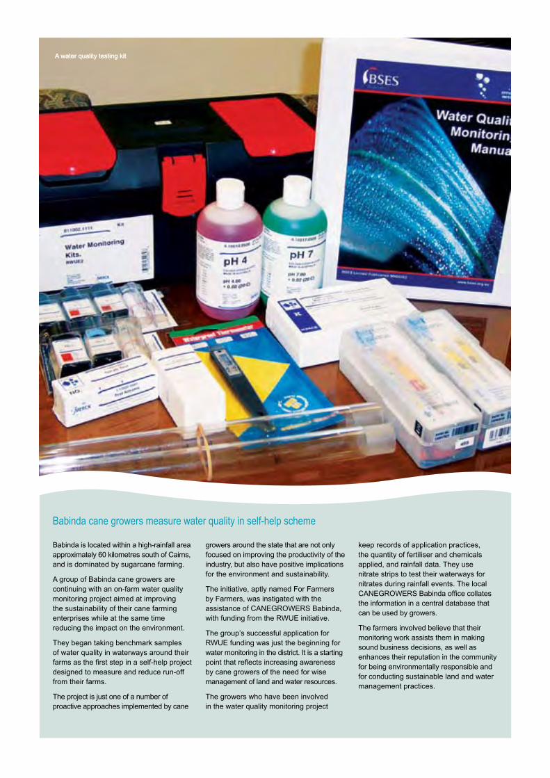
A water quality testing kitA water quality testing kit
Babinda is located within a high-rainfall area approximately 60 kilometres south of Cairns, and is dominated by sugarcane farming.
A group of Babinda cane growers are continuing with an on-farm water quality monitoring project aimed at improving the sustainability of their cane farming enterprises while at the same time reducing the impact on the environment.
They began taking benchmark samples of water quality in waterways around their farms as the first step in a self-help project designed to measure and reduce run-off from their farms.
The project is just one of a number of proactive approaches implemented by cane
growers around the state that are not only focused on improving the productivity of the industry, but also have positive implications for the environment and sustainability.
The initiative, aptly named For Farmers by Farmers, was instigated with the assistance of CANEGROWERS Babinda, with funding from the RWUE initiative.
The group’s successful application for RWUE funding was just the beginning for water monitoring in the district. It is a starting point that reflects increasing awareness by cane growers of the need for wise management of land and water resources.
The growers who have been involved in the water quality monitoring project
keep records of application practices, the quantity of fertiliser and chemicals applied, and rainfall data. They use nitrate strips to test their waterways for nitrates during rainfall events. The local CANEGROWERS Babinda office collates the information in a central database that can be used by growers.
The farmers involved believe that their monitoring work assists them in making sound business decisions, as well as enhances their reputation in the community for being environmentally responsible and for conducting sustainable land and water management practices.
Babinda cane growers measure water quality in self-help scheme
Healthy land, healthy waterways, healthy Reef
In recent years, there has been much progress on the trialling and proving of individual activities for more sustainable agricultural production and the protection of natural environment systems. To maximise the benefits of this work, these individual components were integrated into a complete package: a Sustainable Landscapes Programme (SLP).
SLP in the Mackay/Whitsunday region targets the highest priority NRM issues in both agricultural production and natural environment systems, particularly as they apply to cane farming, grazing, horticulture, management of native vegetation and environmental weeds.
Through the provision of incentive-based activities, SLP has accelerated the adoption of the BMP by land managers across the region. In this way, SLP continues to improve the efficiency, momentum and community involvement in improving NRM in the Mackay/Whitsunday region.
The high priority NRM issues targeted by SLP were identified in the regional planning process. The Programme is designed to link with other work that is contributing to the understanding of the region: the Integrated Monitoring Programme; the Water Quality Improvement Plan (refer to page 20); and Reef Plan. SLP is improving the underlying resource condition of the region, creating measurable and lasting change both within the paddock and in downstream ecosystems.
Projects involved in SLP have been used to demonstrate the BMP by land managers – at a paddock, farm, catchment and landscape scale – to other land managers, politicians, government agencies, non-government organisations, councils and the community at large.
The programme has provided strategic links between research into practical application of, and innovation within, the most sustainable practices of productive agricultural enterprises and the skills and knowledge of land managers have been raised through the numerous workshops run by SLP.
All the major stakeholders with an interest in practical on-ground works were engaged in the development of SLP, and the programme has been monitored and evaluated to test its effect on the underlying resource condition (soil, water and vegetation), and encourages adoption of the most sustainable practices by individual landholders.
SLP has undergone a process of continuous review and evaluation by the stakeholder members involved in the development, as well as formal review by the Technical Assessment Panel of the Mackay Whitsunday Natural Resource Management Group (MWNRM). This review process ensured that the stakeholder members were fully engaged and committed to the development and implementation of an on-ground works
programme that meets the needs of their clients.
A review and evaluation was undertaken by Central Queensland University during the 2006–07 year. The evaluation demonstrated that participants were happy with process, reporting and money offered, although some reported they would have undertaken the work without financial incentives.
Recently, formal contracts have been signed with Growcom for the provision of database services and the development of an incentives programme for the adoption of horticulture BMP. Partnerships have been developed with Mackay City Council to address stormwater run-off and Sarina City Council to deliver the coastal management guidelines for the Sarina beaches. Cross-regional contracts have also been signed between Burdekin Dry Tropics NRM and MWNRM to deliver SLP in the Broken, Bogie and Upper Bowen regions of the Burdekin catchment.
To date, SLP has distributed about $3.3 million dollars. This constitutes only up to 40 per cent of the costs of the activities; the remaining 60 plus per cent has been contributed by the land manager for on-ground works. Nevertheless, more funding is required to get the maximum efficiency from the programme.
SLP contributes to Reef Plan Action A4, and C1.
Sustainable Landscapes Programme
36
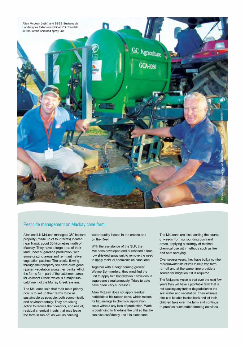
Pesticide management on Mackay cane farm
Allan and Liz McLean manage a 380 hectare property (made up of four farms) located near Narpi, about 35 kilometres north of Mackay. They have a large area of their land under sugarcane production, with some grazing areas and remnant native vegetation patches. The creeks flowing through their property still have quite good riparian vegetation along their banks. All of the farms form part of the catchment area for Jolimont Creek, which is a major sub-catchment of the Murray Creek system.
The McLeans said that their main priority now is to set up their farms to be as sustainable as possible, both economically and environmentally. They are taking action to reduce their need for, and use of, residual chemical inputs that may leave the farm in run-off, as well as causing
water quality issues in the creeks and on the Reef.
With the assistance of the SLP, the McLeans developed and purchased a four-row shielded spray unit to remove the need to apply residual chemicals on cane land.
Together with a neighbouring grower, Wayne Sommerfeld, they modified the unit to apply two knockdown herbicides in sugarcane simultaneously. Trials to date have been very successful.
Allan McLean does not apply residual herbicide to his ratoon cane, which makes for big savings in chemical application costs without any loss of production. Work is continuing to fine-tune the unit so that he can also confidently use it in plant cane.
The McLeans are also tackling the source of weeds from surrounding bushland areas, applying a strategy of minimal chemical use with methods such as fire and spot spraying.
Over several years, they have built a number of stormwater structures to help trap farm run-off and at the same time provide a source for irrigation if it is required.
The McLeans’ vision is that over the next few years they will have a profitable farm that is not causing any further degradation to the soil, water and vegetation. Their ultimate aim is to be able to step back and let their children take over the farm and continue to practice sustainable farming activities.
Allan McLean (right) and BSES Sustainable Landscapes Extension Officer Phil Trendell in front of the shielded spray unit
Imag
e co
urte
sy o
f the
Mac
kay-
Whi
tsun
day
Nat
ural
Res
ourc
e M
anag
emen
t bod
y
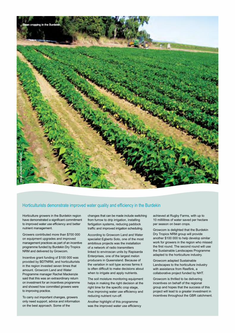
Horticulturists demonstrate improved water quality and efficiency in the Burdekin
Horticulture growers in the Burdekin region have demonstrated a significant commitment to improved water use efficiency and better nutrient management.
Growers contributed more than $700 000 on equipment upgrades and improved management practices as part of an incentive programme funded by Burdekin Dry Tropics NRM and delivered by Growcom.
Incentive grant funding of $100 000 was provided by BDTNRM, and horticulturists in the region invested seven times that amount. Growcom Land and Water Programme manager Rachel Mackenzie said that this was an extraordinary return on investment for an incentives programme and showed how committed growers were to improving practice.
To carry out important changes, growers only need support, advice and information on the best approach. Some of the
changes that can be made include switching from furrow to drip irrigation, installing fertigation systems, reducing paddock traffic and improved irrigation scheduling.
According to Growcom Land and Water specialist Egberto Soto, one of the most ambitious projects was the installation of a network of radio transmitters linked to enviroscan units by Rapisarda Enterprises, one of the largest melon producers in Queensland. Because of the variation in soil type across farms it is often difficult to make decisions about when to irrigate and apply nutrients.
The soil moisture monitoring equipment helps in making the right decision at the right time for the specific crop stage, thus improving water use efficiency and reducing nutrient run-off.
Another highlight of this programme was the improved water use efficiency
achieved at Rugby Farms, with up to 10 millilitres of water saved per hectare per season on bean crops.
Growcom is delighted that the Burdekin Dry Tropics NRM group will provide another $100 000 to help develop similar work for growers in the region who missed the first round. The second round will use the Sustainable Landscapes Programme adapted to the horticulture industry.
Growcom adapted Sustainable Landscapes to the horticulture industry with assistance from Reeflink, a collaborative project funded by NHT.
Growcom is thrilled to be delivering incentives on behalf of the regional group and hopes that the success of this project will lead to a greater investment in incentives throughout the GBR catchment.
Bean cropping in the BurdekinBean cropping in the BurdekinBean cropping in the Burdekin
Imag
e co
urte
sy o
f Gro
wco
mIm
age
cour
tesy
of G
row
com
The Fitzroy Basin Association’s (FBA) delivery through Neighbourhood Catchments supports small groups of neighbouring landholders in priority catchments in Central Queensland to work together to address local NRM issues. This approach enables the integration of production and resource management issues at both the property scale and the catchment scale. The programme is helping more landholders in the Fitzroy Basin turn their ideas into on-ground changes in management practices.
Neighbourhood Catchments is funded under Australian and Queensland Government programmes, including the NAP and NHT. Activities approved under Neighbourhood Catchments may receive funding of up to 50 per cent of the total cost. Property owners contribute at least 50 per cent of their own time and money to see improvements realised.
Staff from both FBA and its five sub-regional groups work closely with landholders to foster involvement in Neighbourhood Catchments through workshops, field days and technical support. Landholders implement infrastructure improvements and practice change at the property scale.
Table 2 shows outcomes achieved under Neighbourhood Catchments in the 2006–07 year.
Based on activity in the 2005–06 year, the FBA is helping reduce annual average sediment loads delivered to waterways by an estimated 75 000 tonnes. If investment is continued at current levels over ten years, the cumulative reduction in sediment is predicted to be 4.1 million tonnes. In the 2006–07 year, landholders worked with FBA to implement more projects than in previous years, therefore this target is well within sight.
To date, managers of 19 per cent of the region have been assisted under Neighbourhood Catchments.
The Programme is delivering improved ground cover and riverbank stability by helping landholders to manage access of stock to sensitive areas. This reduces sediment and nutrients from entering waterways and improves water quality.
In order to realise the water quality target, FBA plans to continue Neighbourhood Catchments on-ground works for at least seven more years, depending on available funding and other initiatives. FBA continues to invest in research to enable activities to be directed to areas at the highest risk of soil erosion.
Neighbourhood Catchments support Reef Plan Action A3, C1 and H1.
Neighbourhood Catchments
Table 2 Outcomes achieved under Neighbourhood Catchments in the 2006–07 year
Outcome 2006–07 year
Managing to grazing land type 36 575 ha
Improved cropping land management 35 424 ha
Strategic weed control 11 653 ha
Riparian areas protected 601 ha
Length of waterways protected 288.5 km
Wetland areas protected 601 ha
Coastal areas protected 1637 ha
Removing barriers
39
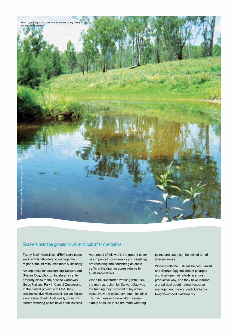
Graziers manage ground cover and look after riverbanks
Fitzroy Basin Association (FBA) coordinates
work with landholders to manage the
region’s natural resources more sustainably.
Among these landowners are Stewart and
Sheree Ogg, who run Ingelara, a cattle
property close to the pristine Carnavon
Gorge National Park in Central Queensland.
In their latest project with FBA, they
constructed five kilometres of riparian fences
along Oaky Creek. Additionally, three off-
stream watering points have been installed.
As a result of this work, the ground cover
has improved considerably and seedlings
are recruiting and flourishing as cattle
traffic in the riparian zones returns to
sustainable levels.
When he first started working with FBA,
the main attraction for Stewart Ogg was
the funding they provided to lay water
pipes. Now the pipes have been installed
it is much easier to look after grasses,
simply because there are more watering
points and cattle can be locked out of
riparian zones.
Working with the FBA has helped Stewart
and Sheree Ogg implement changes
and fine-tune their efforts in a most
productive way, and they have learned
a great deal about natural resource
management through participating in
Neighbourhood Catchments.
Pho
to c
ourt
esy
of th
e F
itzro
y B
asin
Ass
ocia
tion
Good riparian ground cover is now evident along Oakey Creek as a result of fencing
41
Progress 2006–2007 Protecting and conserving wetlands and riverbanks
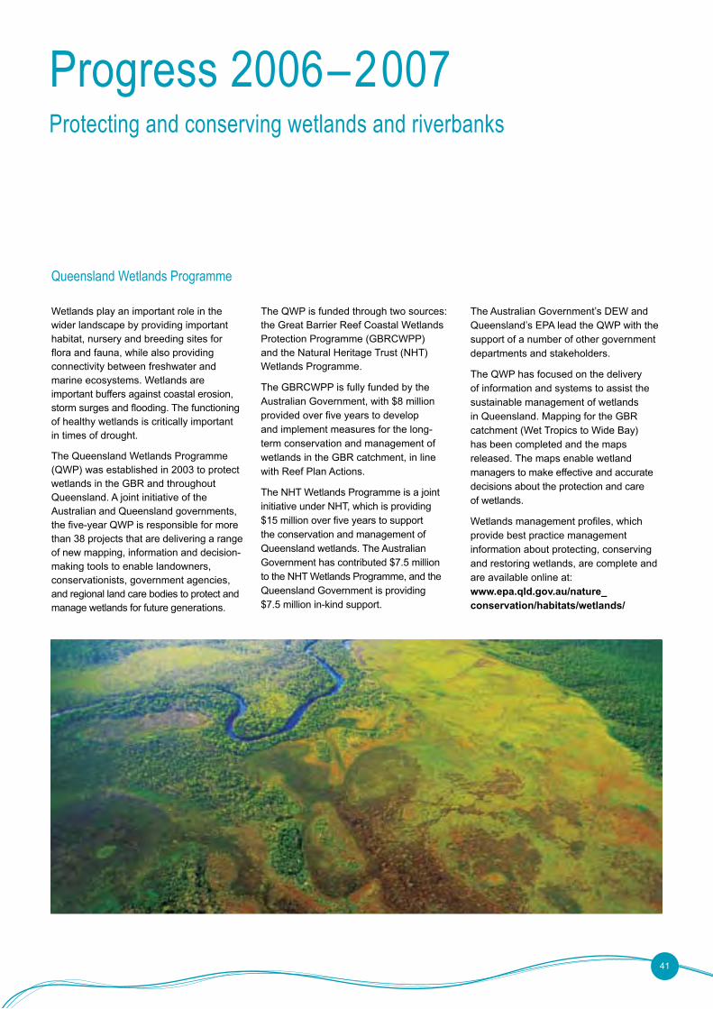
Wetlands play an important role in the wider landscape by providing important habitat, nursery and breeding sites for flora and fauna, while also providing connectivity between freshwater and marine ecosystems. Wetlands are important buffers against coastal erosion, storm surges and flooding. The functioning of healthy wetlands is critically important in times of drought.
The Queensland Wetlands Programme (QWP) was established in 2003 to protect wetlands in the GBR and throughout Queensland. A joint initiative of the Australian and Queensland governments, the five-year QWP is responsible for more than 38 projects that are delivering a range of new mapping, information and decision-making tools to enable landowners, conservationists, government agencies, and regional land care bodies to protect and manage wetlands for future generations.
The QWP is funded through two sources: the Great Barrier Reef Coastal Wetlands Protection Programme (GBRCWPP) and the Natural Heritage Trust (NHT) Wetlands Programme.
The GBRCWPP is fully funded by the Australian Government, with $8 million provided over five years to develop and implement measures for the long-term conservation and management of wetlands in the GBR catchment, in line with Reef Plan Actions.
The NHT Wetlands Programme is a joint initiative under NHT, which is providing $15 million over five years to support the conservation and management of Queensland wetlands. The Australian Government has contributed $7.5 million to the NHT Wetlands Programme, and the Queensland Government is providing $7.5 million in-kind support.
The Australian Government’s DEW and Queensland’s EPA lead the QWP with the support of a number of other government departments and stakeholders.
The QWP has focused on the delivery of information and systems to assist the sustainable management of wetlands in Queensland. Mapping for the GBR catchment (Wet Tropics to Wide Bay) has been completed and the maps released. The maps enable wetland managers to make effective and accurate decisions about the protection and care of wetlands.
Wetlands management profiles, which provide best practice management information about protecting, conserving and restoring wetlands, are complete and are available online at: www.epa.qld.gov.au/nature_conservation/habitats/wetlands/
Queensland Wetlands Programme
Healthy land, healthy waterways, healthy Reef
The QWP is also on the way to making wetland science and research accessible to wetland managers, enabling them to make decisions based on the most up-to-date information available. The provision of comprehensive guidelines and information support tools will guide decision makers, and monitoring will assess the success of specific management practices. A Wetland Decision Support System tool has been run for the GBR catchments, resulting in the identification of wetlands that will receive further investments, for example through Wetlands Plans.
A range of education and communication products have been developed under the QWP, including 11 interactive kiosks located throughout the GBR catchment, a wetlands exhibit at the ReefHQ Aquarium in Townsville, a wetland interactive programme delivered through DVD and online, and two school-based curriculum units. These activities have helped build community understanding of the values and importance of wetlands.
In addition, a $2 million pilot programme has resulted in more than 20 on-ground wetland rehabilitation and/or management projects. A module to integrate wetlands management into grazing activities has been developed through the Grazing Land
Management System (see page 29).
The QWP is also supporting projects to develop and implement new planning and development assessment arrangements to protect wetlands. This approach is consistent with the commitments under both NHT and Reef Plan.
The outcomes of the QWP are directly linked to both objectives of Reef Plan: reduce the load of pollutants from diffuse sources in the water entering the Reef, and rehabilitate and conserve areas of the Reef catchment that have a role in removing waterborne pollutants.
The QWP is reported against Reef Plan Action F2. Outputs of the QWP also contribute to a wide range of other Reef Plan Actions:
• the wetland module of the Grazing Land Management Programme and Farm Management System (refer to page 31) contributes to Actions A3, A4 and B1
• the wetland rehabilitation guideline contributes to Actions A6 and H5
• wetland conservation agreements contribute to Actions B5 and C6
• development of Public Reserve Management Plans for local government contributes to Action B5
• education and extension activities, such as GBRMPA’s education and extension materials, the educational booth, display in Reef HQ and material in the school curriculum, contribute to Actions B1 and B4
• extension and partnerships with landholders, catchment groups and NRM bodies contributes to Actions B1 and B5
• integration of science and research online through WetlandInfo contributes to Action B2
• mapping Traditional Owner values of wetlands contributes to Actions B3 and G2
• wetland mapping contributes to Actions D3, G6 and H3
• support for review of legislation contributes to Action D7
• the process to monitor wetlands contributes to Actions F1 and F3
• the Inventory Database of Wetland Information contributes to Action H3
• the Decision Support System contributes to Actions H3 and H5.
42
Monitoring for Pesticides
Wisi. Riliqua mcommolore tet etue del ulla core doloboreet nulput lore do odio ea faccum dolor si.
Equam digna consequat augue consequis augue modiat.
Magna alit lorpero diat, consed dolobor adiamet, commodiam quisl inis dolortie facip ese dit, quiscil ut dolortisl iuscilla facilis alit nonsent la faccum doluptat, con vulla commolutat.
Facipissi bla aut veliqui ciliquisit nonsed dunt at, quat.
At. Ut pratum iriliquissit lore mod et,
velit lobore eugue delit nim dunt et, quate enit wis do core dipsum alit augiat.
To od dolor augait, sit adigna facilit praese el dunt ad diam dolor ilit ut nullum venim deliquatet, sed modiat in vel dolobor incipiscilis nonsequam nonse faci tion henis atissi.
Duipsum sandigna feugue modigna feui tisit ea facidunt veliquatie tion vel ea core velissequat. Ut wis nim zzriure tat volut wis nim vel dolobor aut vendre dolore dolendre magnit utat lutetum nonumsan volum veliquat, conullaorem
delendre el dolobore con volor irilis amet, quatie elestrud molum vel irit nim volorero odolobor ipsum dolent eugait ing ea augiat. Duisim dolore mod tissit accum iure dolorperiure ercillutatio ese velesed essequi ea aci el et, quam quat lortie tatet wisis deliquat, susci eugiamcorem iriliquisisl dolorem quatuerci tet erat wismodo leniamc ommolumsan velesto et ea faciliq uatisim non ulla feugiat praessectem zzriurerosto elisi.
Oborpero con ut nonsequi eu facillaore dit, se tat. Uptatis nullaorer se con ero dolore do
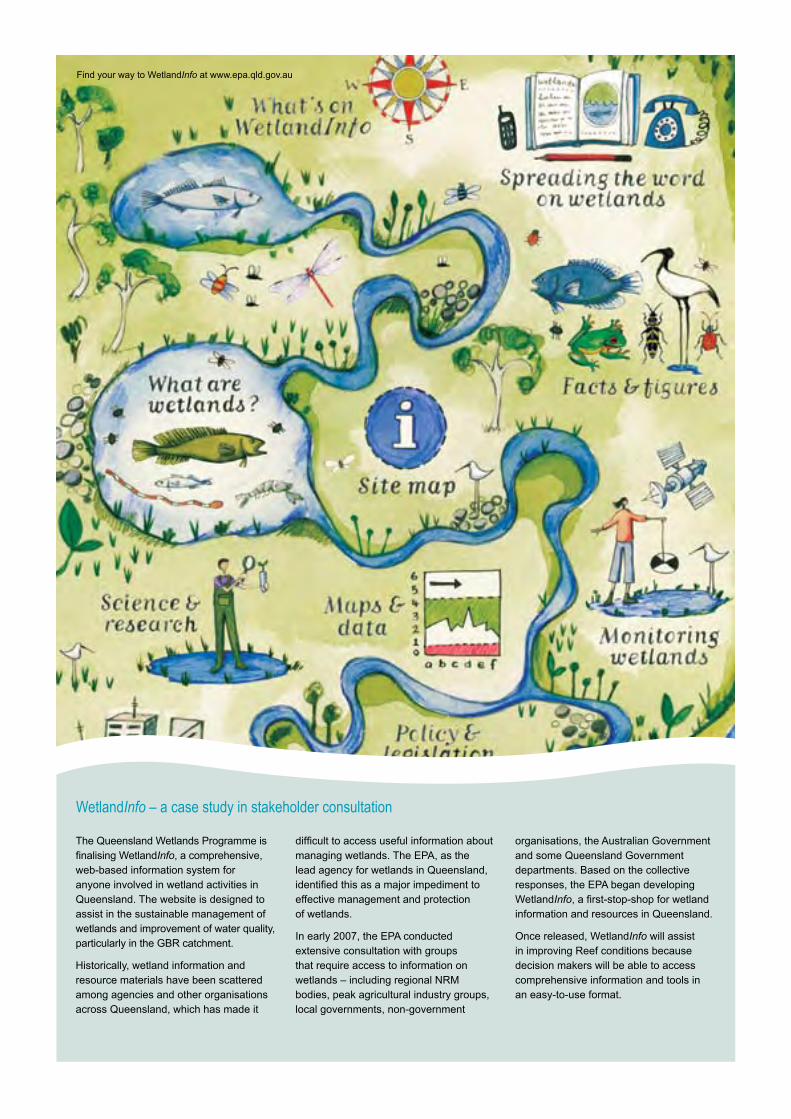
WetlandInfo – a case study in stakeholder consultation
The Queensland Wetlands Programme is finalising WetlandInfo, a comprehensive, web-based information system for anyone involved in wetland activities in Queensland. The website is designed to assist in the sustainable management of wetlands and improvement of water quality, particularly in the GBR catchment.
Historically, wetland information and resource materials have been scattered among agencies and other organisations across Queensland, which has made it
difficult to access useful information about managing wetlands. The EPA, as the lead agency for wetlands in Queensland, identified this as a major impediment to effective management and protection of wetlands.
In early 2007, the EPA conducted extensive consultation with groups that require access to information on wetlands – including regional NRM bodies, peak agricultural industry groups, local governments, non-government
organisations, the Australian Government and some Queensland Government departments. Based on the collective responses, the EPA began developing WetlandInfo, a first-stop-shop for wetland information and resources in Queensland.
Once released, WetlandInfo will assist in improving Reef conditions because decision makers will be able to access comprehensive information and tools in an easy-to-use format.
Find your way to WetlandInfo at www.epa.qld.gov.au
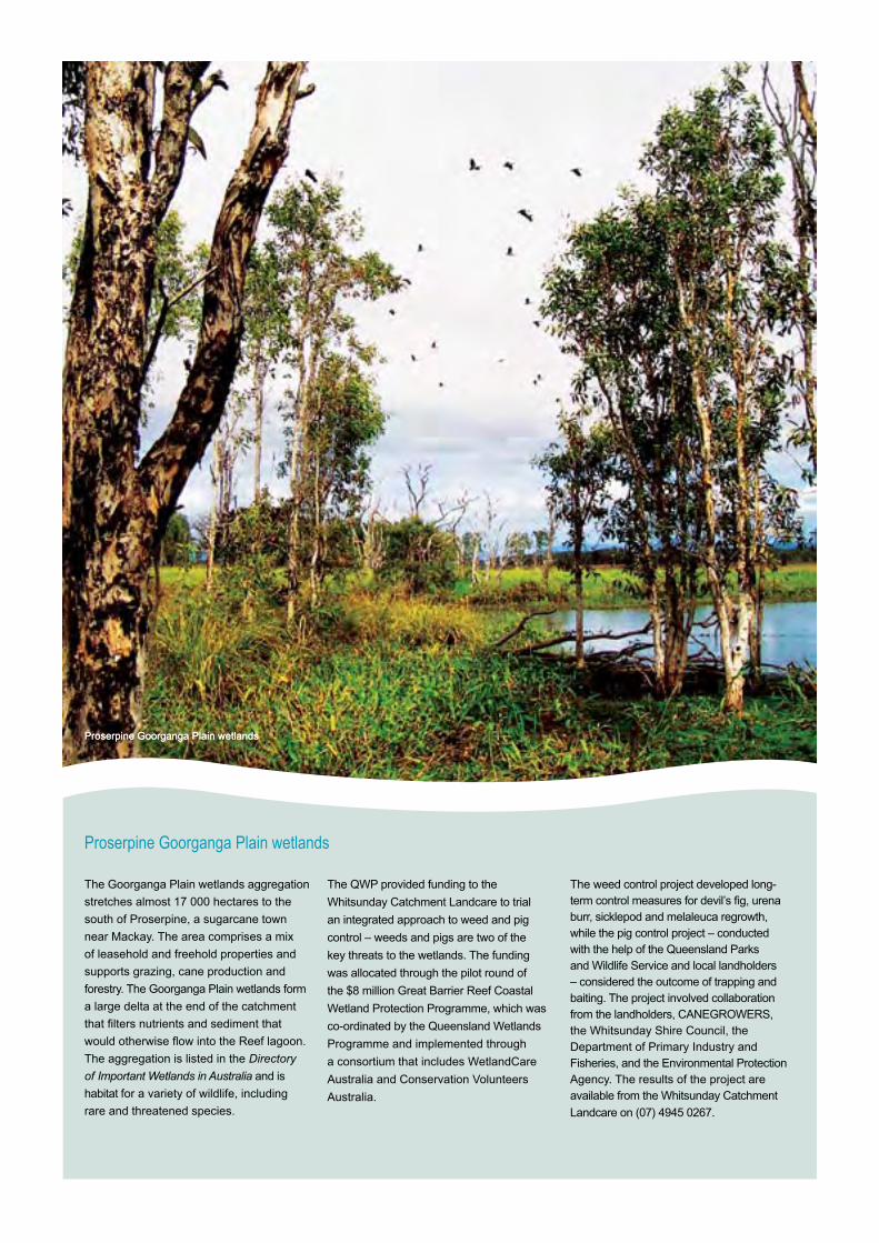
The Goorganga Plain wetlands aggregation
stretches almost 17 000 hectares to the
south of Proserpine, a sugarcane town
near Mackay. The area comprises a mix
of leasehold and freehold properties and
supports grazing, cane production and
forestry. The Goorganga Plain wetlands form
a large delta at the end of the catchment
that filters nutrients and sediment that
would otherwise flow into the Reef lagoon.
The aggregation is listed in the Directory
of Important Wetlands in Australia and is
habitat for a variety of wildlife, including
rare and threatened species.
The QWP provided funding to the
Whitsunday Catchment Landcare to trial
an integrated approach to weed and pig
control – weeds and pigs are two of the
key threats to the wetlands. The funding
was allocated through the pilot round of
the $8 million Great Barrier Reef Coastal
Wetland Protection Programme, which was
co-ordinated by the Queensland Wetlands
Programme and implemented through
a consortium that includes WetlandCare
Australia and Conservation Volunteers
Australia.
The weed control project developed long-term control measures for devil’s fig, urena burr, sicklepod and melaleuca regrowth, while the pig control project – conducted with the help of the Queensland Parks and Wildlife Service and local landholders – considered the outcome of trapping and baiting. The project involved collaboration from the landholders, CANEGROWERS, the Whitsunday Shire Council, the Department of Primary Industry and Fisheries, and the Environmental Protection Agency. The results of the project are available from the Whitsunday Catchment
Landcare on (07) 4945 0267.
Proserpine Goorganga Plain wetlands
Proserpine Goorganga Plain wetlandsProserpine Goorganga Plain wetlands
Riverbank restoration
Protecting wetlands and riverbanks
45
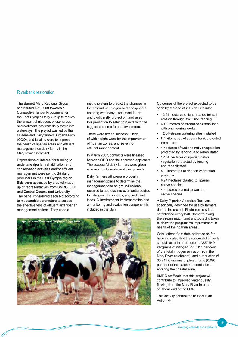
The Burnett Mary Regional Group contributed $250 000 towards a Competitive Tender Programme for the East Gympie Dairy Group to reduce the amount of nitrogen, phosphorous and sediment loss from dairy farms into waterways. The project was led by the Queensland Dairyfarmers’ Organisation (QDO), and its aims were to improve the health of riparian areas and effluent management on dairy farms in the Mary River catchment.
Expressions of interest for funding to undertake riparian rehabilitation and conservation activities and/or effluent management were sent to 28 dairy producers in the East Gympie region. Bids were assessed by a panel made up of representatives from BMRG, QDO, and Central Queensland University. The panel considered each bid according to measurable parameters to assess the effectiveness of effluent and riparian management actions. They used a
metric system to predict the changes in the amount of nitrogen and phosphorus entering waterways, sediment loads, and biodiversity protection, and used this prediction to select projects with the biggest outcome for the investment.
There were fifteen successful bids, of which eight were for the improvement of riparian zones, and seven for effluent management.
In March 2007, contracts were finalised between QDO and the approved applicants. The successful dairy farmers were given nine months to implement their projects.
Dairy farmers will prepare property management plans to determine the management and on-ground actions required to address improvements required for nitrogen, phosphorus, and sediment loads. A timeframe for implementation and a monitoring and evaluation component is included in the plan.
Outcomes of the project expected to be seen by the end of 2007 will include:
• 12.54 hectares of land treated for soil erosion through exclusion fencing
• 6000 metres of stream bank stabilised with engineering works
• 12 off-stream watering sites installed
• 8.1 kilometres of stream bank protected from stock
• 4 hectares of wetland native vegetation protected by fencing, and rehabilitated
• 12.54 hectares of riparian native vegetation protected by fencing and rehabilitated
• 8.1 kilometres of riparian vegetation protected
• 6.94 hectares planted to riparian native species
• 4 hectares planted to wetland native species.
A Dairy Riparian Appraisal Tool was specifically designed for use by farmers during the project. Photo points will be established every half kilometre along the stream reach, and photographs taken to show the progressive improvement in health of the riparian areas.
Calculations from data collected so far have indicated that the successful projects should result in a reduction of 227 549 kilograms of nitrogen (or 0.111 per cent of the total nitrogen emission from the Mary River catchment), and a reduction of 35 211 kilograms of phosphorus (0.097 per cent of the catchment emissions) entering the coastal zone.
BMRG staff said that this project will contribute to improved water quality flowing from the Mary River into the southern end of the GBR.
This activity contributes to Reef Plan Action H4.
Image courtesy of Queensland Dairyfarmers’ OrganisationImage courtesy of Queensland Dairyfarmers’ Organisation
Healthy land, healthy waterways, healthy Reef
Progress 2006–2007 Maintaining the connection between science and policy
Nutrient Management Zones
Action D8 of the Reef Plan requires the identification of Nutrient Management Zones (NMZs) to provide a focus for extension services, property resource management planning and NRM funding to improve land management practices and reduce nutrient export. The Action also requires the investigation of further land use planning and regulatory, market and voluntary mechanisms that could be applied in these zones.
In March 2007, the Australian and Queensland Governments released two documents relating to NMZs: a Technical Report identifying the NMZs, and a Policy Discussion Paper exploring policy options to apply within these NMZs.
Identifying NMZs
The Australian Government Department of Environment and Water Resources (DEW) and the Great Barrier Reef Marine Park Authority (GBRMPA) led the process of identifying the location of NMZs within the Reef catchments.
The peer reviewed paper, Nutrient Management Zones in the Great Barrier Reef Catchment: A Decision System for Zone Selection (the Technical Report), identified ten regions of significant fertiliser use within the GBR catchment.
The criteria for identifying NMZs were initially developed by the Australian Centre for Tropical Freshwater Research (ACTFR) (which was commissioned
by DEW and GBRMPA). The decision system and criteria developed by ACTFR was then ‘workshopped’ by a panel of experts and released for comment from agricultural industry representatives and scientific experts. In September 2006, the framework for identifying NMZs was also subject to an independent technical review. Feedback from each of these stages was incorporated prior to the finalisation of the Technical Report.
Based on this expert opinion, five criteria were applied to the ten regions of significant fertiliser use. Criteria were:
• fertilised land use
• potential for nitrogen and phosphorus loss
• likelihood that the nutrients would reach the coast
• extent of transport of nutrients within the GBR lagoon
• number and proximity to the coast of coral reefs within the influence area of the discharge.
The three NMZs of highest priority were identified as the Wet Tropics, Mackay/Whitsunday, and Burdekin coastal catchments.
Policy options
The Queensland Government Department of Primary Industries and Fisheries (DPI&F) was responsible for the
development of the Policy Discussion Paper and consultation with stakeholders.
The Discussion Paper investigated a range of options that could be applied in NMZs to optimise nutrient use (including fertiliser and mill mud) to meet crop needs, while minimising the risk of off-site movement to the GBR. The development of the Discussion Paper included extensive consultation with industry bodies, particularly those representing the intensive industries such as CANEGROWERS, Growcom, and Queensland Dairyfarmers’ Organisation.
Because of the diverse nature of agricultural industries within the GBR catchment, the policy proposed was based on an industry-specific approach, with sugarcane and horticulture identified as priority industries.
A phased approach was also proposed, with an emphasis on industry-led voluntary approaches; however, the Discussion Paper also acknowledged that should significant improvement in nutrient management not occur within an acceptable timeframe, more stringent approaches may need to be considered by government.
DPI&F will continue to refine the policy approaches identified in the Discussion Paper following the results of the public consultation period.
This activity supports Reef Plan Action D8.
46
Monitoring for Pesticides
Wisi. Riliqua mcommolore tet etue del ulla core doloboreet nulput lore do odio ea faccum dolor si.
Equam digna consequat augue consequis augue modiat.
Magna alit lorpero diat, consed dolobor adiamet, commodiam quisl inis dolortie facip ese dit, quiscil ut dolortisl iuscilla facilis alit nonsent la faccum doluptat, con vulla commolutat.
Facipissi bla aut veliqui ciliquisit nonsed dunt at, quat.
At. Ut pratum iriliquissit lore mod et,
velit lobore eugue delit nim dunt et, quate enit wis do core dipsum alit augiat.
To od dolor augait, sit adigna facilit praese el dunt ad diam dolor ilit ut nullum venim deliquatet, sed modiat in vel dolobor incipiscilis nonsequam nonse faci tion henis atissi.
Duipsum sandigna feugue modigna feui tisit ea facidunt veliquatie tion vel ea core velissequat. Ut wis nim zzriure tat volut wis nim vel dolobor aut vendre dolore dolendre magnit utat lutetum nonumsan volum veliquat, conullaorem
delendre el dolobore con volor irilis amet, quatie elestrud molum vel irit nim volorero odolobor ipsum dolent eugait ing ea augiat. Duisim dolore mod tissit accum iure dolorperiure ercillutatio ese velesed essequi ea aci el et, quam quat lortie tatet wisis deliquat, susci eugiamcorem iriliquisisl dolorem quatuerci tet erat wismodo leniamc ommolumsan velesto et ea faciliq uatisim non ulla feugiat praessectem zzriurerosto elisi.
Oborpero con ut nonsequi eu facillaore dit, se tat. Uptatis nullaorer se con ero dolore do
The NMZ Discussion Paper was launched for public consultation by the Minister for Primary Industries and Fisheries Tim Mulherin MP on 19 March 2007. Copies of the Technical Report and the Discussion Paper were sent to approximately 60 interest groups and made available on the Reef Plan website.
Over the two-month consultation phase, meetings were held with a broad range of groups and individuals in areas identified as high priority NMZs: the Wet Tropics, Burdekin, and Mackay/Whitsunday regions.
As part of this process, policy officers from DPI&F in Brisbane met with a broad range of sugarcane industry representatives in Mackay. Coordinated by DPI&F FutureCane staff, the meeting included individual sugarcane growers and sugarcane industry representatives in the Mackay region, including the Mackay Area Productivity Services, Mackay Mill Board, BSES, and MWNRM. Each group presented their work on improving nutrient management, with the presentation on NMZs sparking strong interest.
A second meeting took place the following day with approximately 20 growers from the region interested in NMZs and the implications they would have for their businesses. The group discussed the
issues raised by the NMZ presentation, particularly voluntary management and government regulation. Generally, growers agreed that looking after local waterways that flow to the GBR was important, and that new farming systems are the most efficient way to keep nutrients, sediments, and pesticides on the farm.
In the main, growers supported the voluntary self-managed approach recommended in the Discussion Paper. However, they also acknowledged that those in the industry not implementing Six Easy Steps or other good nutrient practices might be targeted by the government in the future.
The meeting was followed by a bus trip, which took place with a further 45 farmers from the region. Several farm trial sites were visited, enabling farmers to see first hand how to implement farming efficiencies on their own sugarcane farms.
Other groups consulted during the two-month consultation phase included:
• peak industry bodies, including QFF, Cotton Australia, Growcom, and AgForce
• reference groups for tropical fruit tree industries, including rambutan,
lychee, and paw paw growers, and the Australian Banana Growers Council
• the Lower Burdekin Sugar Working Group and Kalamia Canegrowers in the Burdekin
• the Burdekin WQIP Steering Committee
• the FNQNRM (Terrain NRM) Board Industry Advisory Group
• the Tully WQIP Steering Committee
• the Reef Water Quality Partnership Working Group and Regional Implementation Group
• conservation groups, including WWF and the Queensland Conservation Council.
Consultation closed on 11 May 2007, with 29 detailed submissions received via the online feedback form and in hard copy. The majority of submissions accepted the selection of the three priority NMZs and supported the proposed policy of an industry-specific phased approach, with emphasis on industry-led voluntary approaches.
Feedback also supported the alignment of NMZ and WQIP management targets, to avoid duplication. Work to align and progress these processes will continue into the 2007–08 year.
Discussion paper consultation
Machinery such as this modified planter allows for improved farming practices such as dual rows, which reduce farm traffic and protect soil from compactionMachinery such as this modified planter allows for improved farming practices such as dual rows, which reduce farm traffic and protect soil from compaction
Imag
e co
urte
sy o
f the
Gre
at B
arrie
r R
eef M
arin
e P
ark
Aut
horit
y
Next steps
In order to maintain Reef Plan in a contemporary framework, the key focus over the next 12 months will be to revitalise and update the Plan in line with the recommendations contained in the 2005 Evaluation Report, the feedback from stakeholders and the priorities of government.
A comprehensive and detailed communication strategy will be implemented to report the many positive outcomes already achieved from Reef Plan activities and more effective engagement with non-government stakeholders and the wider community will be pursued to improve public confidence in the implementation of Reef Plan.
The second evaluation report to the Prime Minister and Premier of Queensland, which is scheduled for 2010, is required
to detail whether the objectives, strategies and actions in the revised Plan have been adequate in achieving sufficient progress towards the goal of halting and reversing the decline in water quality entering the Reef and will propose future actions beyond the life of the plan, which is due to end in 2013.
Looking forward to this evaluation, it has been recognised that substantial work will be required to define the agreed criteria for measuring progress and success at that time. In particular, there is a clear need to define appropriate measures for the goal and objectives.
A significant challenge for the achievement of Reef Plan outcomes remains the delivery of pragmatic management options for landholders, and others, within a coordinated
and supportive policy framework based on best available scientific information. For example, the veracity of the various Reef Plan actions and activities will need to be established in the context of climate change.
The ten-year Reef Plan was initiated in 2003 and throughout its development phase has provided some credible achievements. The challenge for the next phase is to ensure that the actions and activities attributable to the Plan continue to deliver appropriate outcomes and that the water quality entering the reef is a positive influence on overall health of the reef and its waters, thereby achieving the goal of Reef Plan.
49
Healthy land, healthy waterways, healthy Reef
ACTFR Australian Centre for Tropical Freshwater Research
AIMS Australian Institute of Marine Science
BDTNRM Burdekin Dry Tropics Natural Resource Management Group
BMP Best Management Practices
BMRG Burnett Mary Regional Group for Natural Resource Management
BSES Bureau of Sugar Experiment Stations
CANEGROWERS Peak representative body for Australian sugarcane growers
CCI Coastal Catchments Initiative
CSFP Cardwell Shire Floodplain Programme
CSIRO Commonwealth Scientific and Industrial Research Organisation
DAFF Department of Agriculture, Fisheries and Forestry
DEW Department of the Environment and Water Resources
DPC Department of the Premier and Cabinet
DPI&F Department of Primary Industries and Fisheries
EMS Environmental Management Systems
EPA Environmental Protection Agency
EPS Environmental Partnership Scheme
FBA Fitzroy Basin Association
FMS Farm Management Systems
FNQNRM/ Far North Queensland Natural Resource Management Group (Note that FNQNRM changed its name to Terrain NRM on 30 June 2007)
FutureCane DPI&F-led sugarcane industry assistance initiative
GBR Great Barrier Reef
GBRCWPP Great Barrier Reef Coastal Wetlands Protection Programme
GBRMPA Great Barrier Reef Marine Park Authority
GLM Grazing Land Management
Growcom Queensland horticulture industry advocate
MMP Marine Monitoring Programme
MoU Memorandum of Understanding
MTSRF Marine and Tropical Science Research Facility
MWNRM Mackay Whitsunday Natural Resource Management Group
NAP National Action Plan for Salinity and Water Quality
NHT Natural Heritage Trust
NMZ Nutrient Management Zone
NRM Natural Resource Management
NRW Department of Natural Resources and Water
PDS Producer Demonstration Site
QDO Queensland Dairyfarmers’ Organisation
QFF Queensland Farmers’ Federation
R2R Research to Reality project
RIG Regional Implementation Group
RWQP Reef Water Quality Partnership
RWUE Rural Water Use Efficiency initiative
SAP Scientific Advisory Panel
SIP State-level Investment Projects
SLP Sustainable Landscapes Programme
UQ University of Queensland
WQIP Water Quality Improvement Plan
Glossary
Terrain NRM
51