pre-phase report on site selection
TRANSCRIPT
PAC – Pre-phase report on Site Selection
Page 1
PARTNERSHIP AFRICA CANADA
Tracking, certifying and Exporting
Artisanal Gold from Eastern DRC
Pre-phase Report on Site Selection
PAC – Pre-phase report on Site Selection
Page 2
Executive Summary:
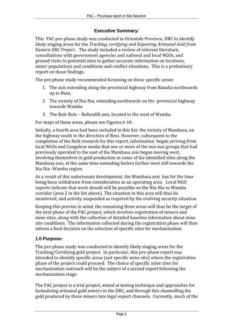
This PAC pre-phase study was conducted in Orientale Province, DRC to identify likely staging areas for the Tracking, certifying and Exporting Artisanal Gold from Eastern DRC Project . The study included a review of relevant literature, consultations with government agencies and national and local NGOs, and ground visits to potential sites to gather accurate information on locations, miner populations and conditions and conflict situations. This is a preliminary report on those findings.
The pre-phase study recommended focussing on three specific areas:
1. The axis extending along the provincial highway from Banalia northwards up to Buta.
2. The vicinity of Nia-Nia, extending northwards on the provincial highway towards Wamba
3. The Bole Bole – Bafwadili axis, located to the west of Wamba
For maps of these areas, please see Figures 6-10.
Initially, a fourth area had been included in this list: the vicinity of Mambasa, on the highway south in the direction of Beni. However, subsequent to the completion of the field research for this report, information began arriving from local NGOs and Congolese media that one or more of the mai mai groups that had previously operated to the east of the Mambasa axis began moving west, involving themselves in gold production in some of the identified sites along the Mambasa axis, at the same time extending feelers further west still towards the Nia Nia -Wamba region.
As a result of this unfortunate development, the Mambasa axis has for the time being been withdrawn from consideration as an operating area. Local NGO reports indicate that work should still be possible on the Nia-Nia to Wamba corridor (area 2 in the list above). The situation in this area will thus be monitored, and activity suspended as required by the evolving security situation.
Keeping this proviso in mind, the remaining three areas will thus be the target of the next phase of the PAC project, which involves registration of miners and mine sites, along with the collection of detailed baseline information about mine site conditions. The information collected during the registration phase will then inform a final decision on the selection of specific sites for mechanisation.
1.0 Purpose:
The pre-phase study was conducted to identify likely staging areas for the Tracking/Certifying gold project. In particular, this pre-phase report was intended to identify specific areas (not specific mine site) where the registration phase of the project could proceed. The choice of specific mine sites for mechanisation outreach will be the subject of a second report following the mechanization stage. The PAC project is a trial project, aimed at testing technique and approaches for formalizing artisanal gold miners in the DRC, and through this channelling the gold produced by these miners into legal export channels. Currently, much of the
PAC – Pre-phase report on Site Selection
Page 3
DRC’s gold production exits the country illegally, thus evading government export royalties. The core idea of the project is that artisanal miners will accept the costs associated with formalization and legalisation, provided these costs are kept within quite constrained limits, and provided clear and obvious benefits arrive as a result of formalisation. For this project, the major added cost associated with formalisation will be the DRC mineral royalty on gold, currently set at 2% of export value. In return for paying this 2% royalty, the project plans on offering miners two main benefits: formalisation, in the form of miner registration and issuance of a government-sanctioned artisanal miners ID card (carte d’exploitant artisanal); and technical outreach assistance (semi-mechanisation assistance) designed to help diggers increase their currently low yields. The project is being by directed PAC, with funding from the PPA, technical assistance of DDI, and the support and participation of DRC government and civil society. Full details of this project can be found in the project outline, Tracking, certifying and Exporting Artisanal Gold from Eastern DRC, available on the PAC website (www.pacweb.org)
2.0 Procedure
The process began with a review of existing documents and literature, most usefully including the DRC Mining Cadastre on-line database (www.cami.cd), which shows which areas in Orientale are subject to exploitation and exploration concessions.
PAC then undertook on-the-ground consultations, beginning with senior DRC government personnel in Kinshasa. Those consulted included the Minister of Mines, the Director of SAESSCAM, and the newly-elected Governor of Orientale Province.
In-country consultations continued consultation in Kisangani, where a day long workshop was held on the project, with the participation of local government, industry, and civil society. PAC was joined in this effort by representatives of CENADEP, OCEAN and DDI. Discussions were also undertaken with provincial level government officials, including the Minister of Environment, the Minister of Mines, and the provincial heads of SAESSCAM and the Division de Mines.
The combination of map and literature research and in-country consultations gave a certain direction to the research, indicating certain promising areas worthy of further investigation.
An independent consultant, with experience researching the gold sector for other international organizations, was hired to conduct an on-the-ground investigation into conditions on the ground at a score of mine sites in several of the most promising areas. The researcher was guided and oriented by the needs
PAC – Pre-phase report on Site Selection
Page 4
of the project, and in particular the desired criteria for site locations, details of which are given in the section below.
The results of this investigation are available as a full separate report. This pre-phase report analyzes and incorporated these findings with other information, all of which together inform the preliminary conclusions concerning site locations given below.
3.0 Site Locations - Desired Criteria
For reasons discussed in some detail in the PAC report, Tracking, certifying and Exporting Artisanal Gold from Eastern DRC, the project opted to locate somewhere in Orientale Province, DRC. (briefly, Orientale has significant levels of gold production, close proximity to Uganda —and significant levels of smuggling—, but no active armed conflict, making it an excellent location to try out approaches and techniques for formalizing artisanal gold miners.) At 503,239 km2,, Orientale is only slightly smaller than France. The challenge thus lay in narrowing down where within Orientale the pilot mine sites might be located. A series of criteria were developed, against which candidate sites or regions could be evaluated. These criteria include:
1. Reasonable population of diggers 2. Reasonably significant production of gold 3. Reasonable access to site/area 4. Stable or reasonably stable organisation of diggers on site (cooperative,
PDG structure, other) 5. Manageable levels of conflict with overlying mineral claims 6. Security situation (no conflict or manageable level of conflict) 7. Proximity to local population centres, where government agencies and
NGOs are located (from which registration team members can be drawn)
4.0 Results
The selection of sites followed a step by step, logical process, narrowing down the range of potential sites from the whole of Orientale province to a much more manageable set of a three areas located on the highway axis from Isiro to Nia-Nia to Mambasa. This section will explain this step by step process.
4.1 Setting: Orientale Province
As noted above, the project opted to focus on Orientale, a mineral-rich province of over 500,000 square kilometres located in the DRC’s northeast. Shared borders with South Sudan and particularly Uganda renders Orientale particularly vulnerable to smuggling.

PAC – Pre-phase report on Site Selection
Page 5
4.2 Areas of Gold Production
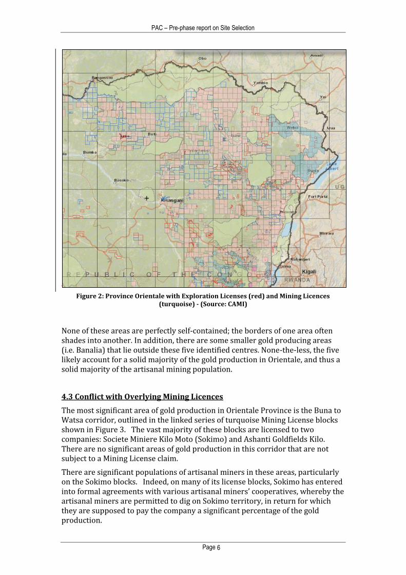
Discussions with DRC government officials, miners, and consultation of the DRC Cadastre Minier licensing map reveals that Orientale Province has some five main centres of gold production. The mineral claim blocks shown in the map in Figure 2, drawn from CAMI’s on-line database, shows these areas as concentrations of mineral claims (red blocks are research licenses, turquoise blocks are mining licenses).
These areas are, from east to west:
the Bunia to Watsa corridor (solid turquoise on Figure 2)
Mambasa to Beni corridor
Nia-Nia – Wamba - Isiro
Bafwasende-Opienge
The Banalia to Buta Corridor
Figure 1: DRC Provinces (Orientale is top right)
PAC – Pre-phase report on Site Selection
Page 6
Figure 2: Province Orientale with Exploration Licenses (red) and Mining Licences (turquoise) - (Source: CAMI)
None of these areas are perfectly self-contained; the borders of one area often shades into another. In addition, there are some smaller gold producing areas (i.e. Banalia) that lie outside these five identified centres. None-the-less, the five likely account for a solid majority of the gold production in Orientale, and thus a solid majority of the artisanal mining population.
4.3 Conflict with Overlying Mining Licences
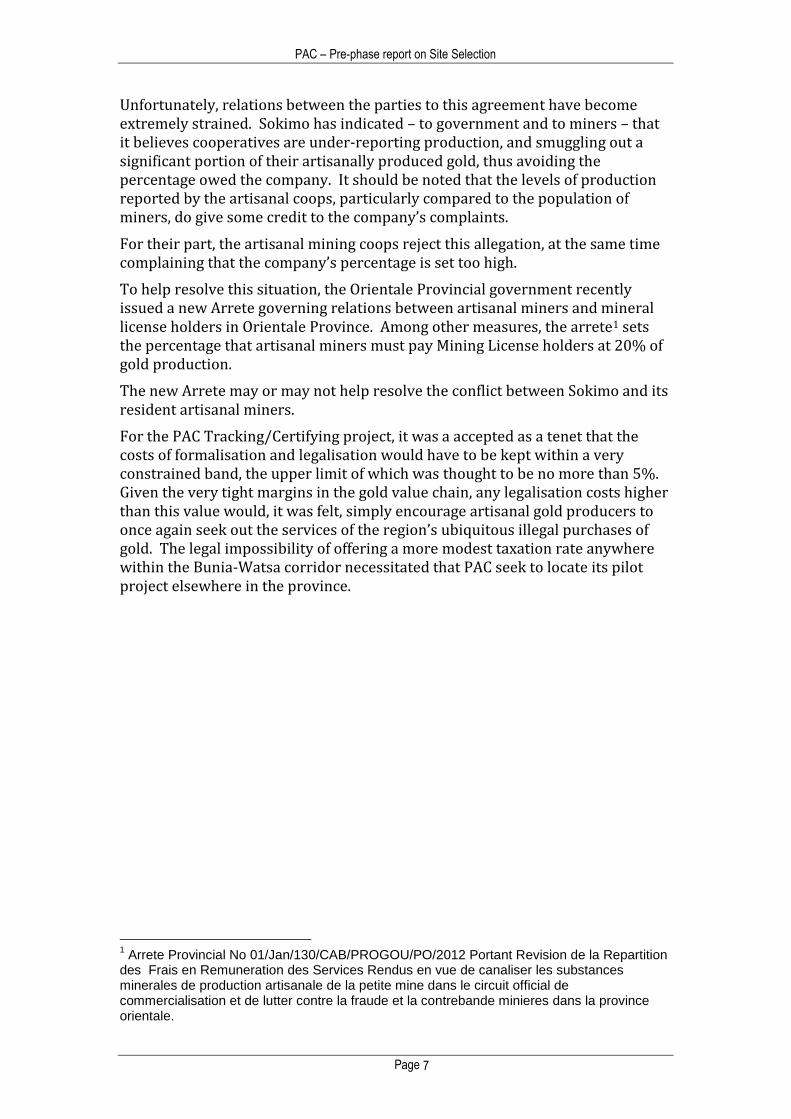
The most significant area of gold production in Orientale Province is the Buna to Watsa corridor, outlined in the linked series of turquoise Mining License blocks shown in Figure 3. The vast majority of these blocks are licensed to two companies: Societe Miniere Kilo Moto (Sokimo) and Ashanti Goldfields Kilo. There are no significant areas of gold production in this corridor that are not subject to a Mining License claim.
There are significant populations of artisanal miners in these areas, particularly on the Sokimo blocks. Indeed, on many of its license blocks, Sokimo has entered into formal agreements with various artisanal miners’ cooperatives, whereby the artisanal miners are permitted to dig on Sokimo territory, in return for which they are supposed to pay the company a significant percentage of the gold production.
PAC – Pre-phase report on Site Selection
Page 7
Unfortunately, relations between the parties to this agreement have become extremely strained. Sokimo has indicated – to government and to miners – that it believes cooperatives are under-reporting production, and smuggling out a significant portion of their artisanally produced gold, thus avoiding the percentage owed the company. It should be noted that the levels of production reported by the artisanal coops, particularly compared to the population of miners, do give some credit to the company’s complaints.
For their part, the artisanal mining coops reject this allegation, at the same time complaining that the company’s percentage is set too high.
To help resolve this situation, the Orientale Provincial government recently issued a new Arrete governing relations between artisanal miners and mineral license holders in Orientale Province. Among other measures, the arrete1 sets the percentage that artisanal miners must pay Mining License holders at 20% of gold production.
The new Arrete may or may not help resolve the conflict between Sokimo and its resident artisanal miners.
For the PAC Tracking/Certifying project, it was a accepted as a tenet that the costs of formalisation and legalisation would have to be kept within a very constrained band, the upper limit of which was thought to be no more than 5%. Given the very tight margins in the gold value chain, any legalisation costs higher than this value would, it was felt, simply encourage artisanal gold producers to once again seek out the services of the region’s ubiquitous illegal purchases of gold. The legal impossibility of offering a more modest taxation rate anywhere within the Bunia-Watsa corridor necessitated that PAC seek to locate its pilot project elsewhere in the province.
1 Arrete Provincial No 01/Jan/130/CAB/PROGOU/PO/2012 Portant Revision de la Repartition
des Frais en Remuneration des Services Rendus en vue de canaliser les substances minerales de production artisanale de la petite mine dans le circuit official de commercialisation et de lutter contre la fraude et la contrebande minieres dans la province orientale.
PAC – Pre-phase report on Site Selection
Page 8
In a sense this is no bad thing. It is clear that the DRC has a serious challenge in controlling and legalizing its artisanal gold miners; what the most promising solution may be is much less obvious. Numerous approaches should be thus tried, in order to hit upon a successful formula. The Kilo Moto gold concession are in effect one such experiment – an Mining License holder offers access to artisanal cooperatives, in return for a hefty percentage of production. While the model is currently experiencing difficulties, it may in the end prove successful.
The PAC Tracking/Certifying project offers a different formalisation model – legalisation in return for registration and technical assistance. Were PAC to locate its pilot project in the Kilo Moto Concession, it would in effect be superimposing two experiments one on top of the other, distorting the results of both. Better then to locate the PAC pilot in other part of Orientale, where cleaner experimental conditions prevail.
4.4 Accessibility
PAC – Pre-phase report on Site Selection
Page 9
Accessibility by road was another key criterion for potential pilot sites. In the registration phase of the project, registration teams will need to visit the mine sites on multiple occasions over the course of days or weeks.
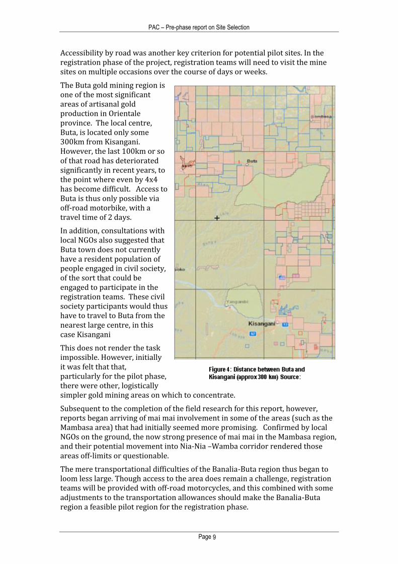
The Buta gold mining region is one of the most significant areas of artisanal gold production in Orientale province. The local centre, Buta, is located only some 300km from Kisangani. However, the last 100km or so of that road has deteriorated significantly in recent years, to the point where even by 4x4 has become difficult. Access to Buta is thus only possible via off-road motorbike, with a travel time of 2 days.
In addition, consultations with local NGOs also suggested that Buta town does not currently have a resident population of people engaged in civil society, of the sort that could be engaged to participate in the registration teams. These civil society participants would thus have to travel to Buta from the nearest large centre, in this case Kisangani
This does not render the task impossible. However, initially it was felt that that, particularly for the pilot phase, there were other, logistically simpler gold mining areas on which to concentrate.
Subsequent to the completion of the field research for this report, however, reports began arriving of mai mai involvement in some of the areas (such as the Mambasa area) that had initially seemed more promising. Confirmed by local NGOs on the ground, the now strong presence of mai mai in the Mambasa region, and their potential movement into Nia-Nia –Wamba corridor rendered those areas off-limits or questionable.
The mere transportational difficulties of the Banalia-Buta region thus began to loom less large. Though access to the area does remain a challenge, registration teams will be provided with off-road motorcycles, and this combined with some adjustments to the transportation allowances should make the Banalia-Buta region a feasible pilot region for the registration phase.
PAC – Pre-phase report on Site Selection
Page 10
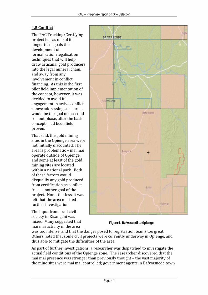
4.5 Conflict
The PAC Tracking/Certifying project has as one of its longer term goals the development of formalisation/legalisation techniques that will help draw artisanal gold producers into the legal mineral chain, and away from any involvement in conflict financing. As this is the first pilot field implementation of the concept, however, it was decided to avoid full engagement in active conflict zones; addressing such areas would be the goal of a second roll out phase, after the basic concepts had been field proven.
That said, the gold mining sites in the Opienge area were not initially discounted. The area is problematic – mai mai operate outside of Opienge, and some at least of the gold mining sites are located within a national park. Both of these factors would disqualify any gold produced from certification as conflict free – another goal of the project. None-the-less, it was felt that the area merited further investigation.
The input from local civil society in Kisangani was mixed. Many suggested that mai mai activity in the area was too intense, and that the danger posed to registration teams too great. Others noted that some civil projects were currently underway in Opienge, and thus able to mitigate the difficulties of the area.
As part of further investigations, a researcher was dispatched to investigate the actual field conditions of the Opienge zone. The researcher discovered that the mai mai presence was stronger than previously thought – the vast majority of the mine sites were mai mai controlled; government agents in Bafwasnede town
PAC – Pre-phase report on Site Selection
Page 11
indicated that they had ceased efforts to regulate or supervise the sites. According to the researcher, one local miner leaders (PDG) who had refused to cooperate with the mai mai group had been taken and held prisoner over the course of several days.
Given this situation, it was decided to leave the Opeinge sites out of the pilot phase of the project.
Additionally, subsequent to the completion of the field research for this report, reports began arriving from local NGOs and Congolese media that one or more of the mai mai groups that had previously operated to the east of the Mambasa axis began moving west, involving themselves in gold production in some of the identified sites along the Mambasa axis, at the same time extending feelers further west still towards the Nia Nia -Wamba region.
As a result of this unfortunate development, the Mambasa axis, which had been identified as a promising area in the field research phase of this report, has for the time being been withdrawn from consideration as an operating area.
4.6 Field Investigations
The remaining areas of significant artisanal gold production in Orientale thus lay on a pair of axes, one stretching from Bafwasende centre through Nia-nia and Wamba up to Isiro, with the second running from Mambasa down the Beni road to the border with North Kivu. At the time this field research was conducted, consultations with local officials and NGOs indicated that these areas lay outside significant conflict zones, on recently rehabilitative dirt or gravel roads, reasonably close to local administrative centres (Isiro, Bafwasendi) and within a manageable distance of the likely project headquarters in Kisangani.
(After the field research phase was completed, mai mai groups moved into some of the sites on the Mambasi-Beni axis, rendering this area out of bounds for the purpsoses of this project).
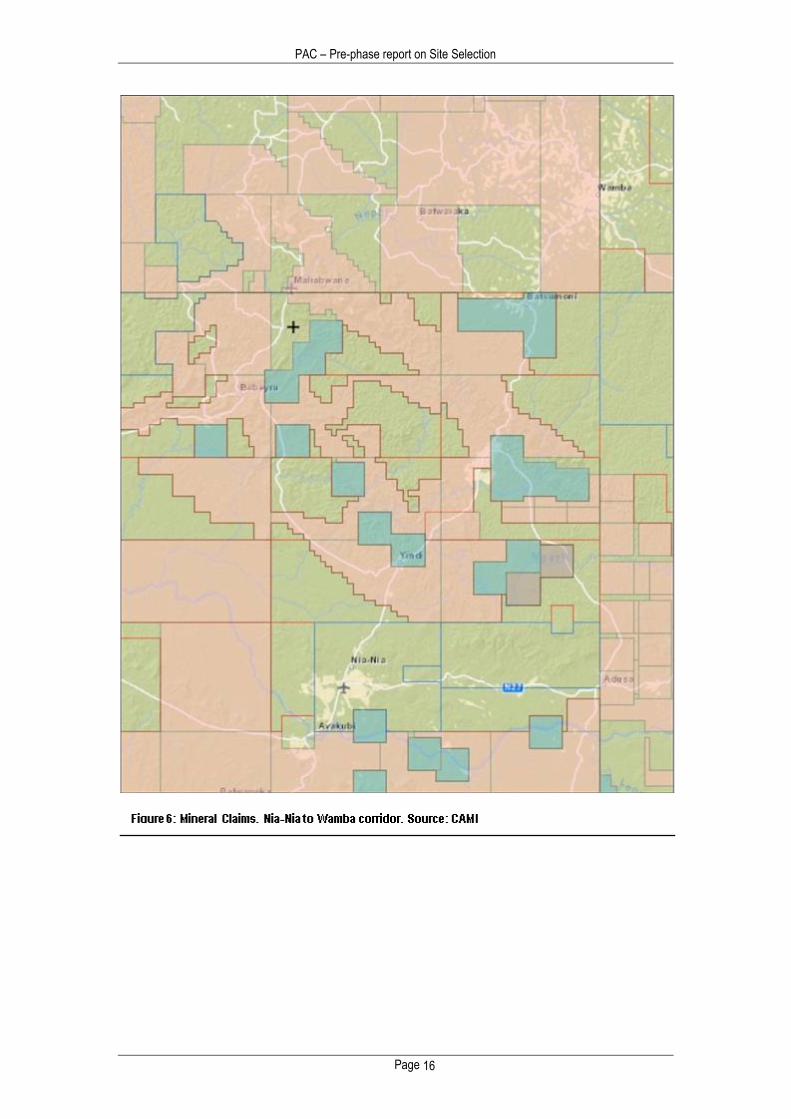
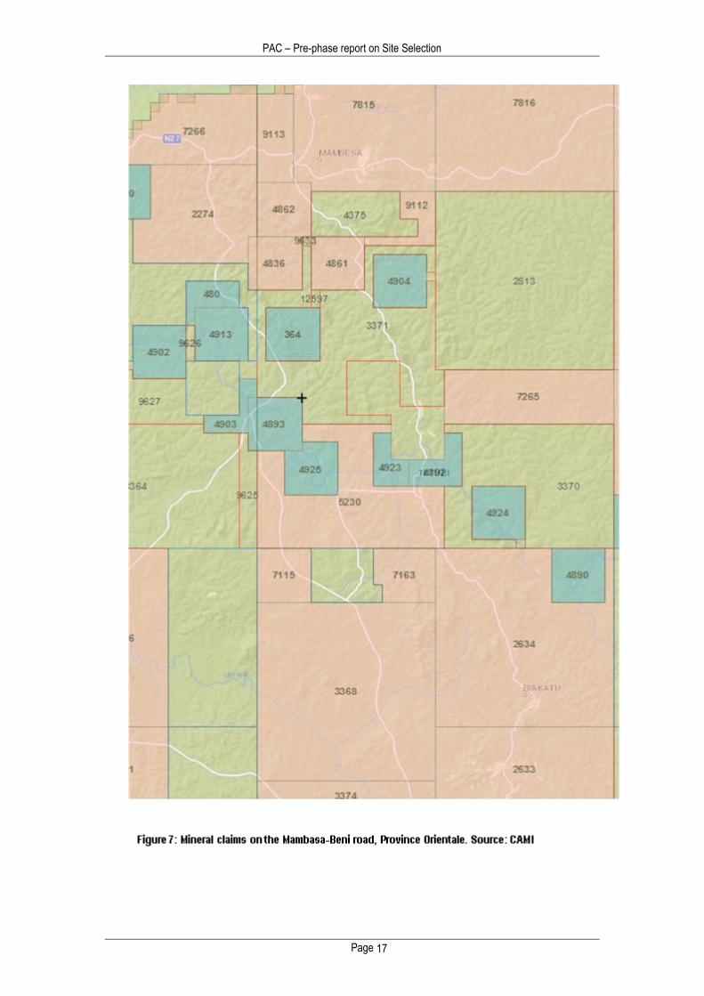
Consultations with the CAMI mining claims map revealed that – though there were Mining Licenses (exploitation licenses) in these areas, the vast majority of territory was subject only to Exploration Licenses; some areas were not subject to any mineral claims whatsoever. (See Figures 6 and 7 for CAMI claim maps for Wamba and Mambasa). Consultations with local artisanal miners and government officials indicated there was substantial gold production in these areas, and substantial concentrations of artisanal miners.
A researcher was dispatched to visit these areas, with a brief to visits at least 20 mine sites, verify numbers of miners and gold production, collect preliminary baseline data (on topics such as miner organisation, technology, use of mercury, gold prices, and other issues). This mission was carried out over a 20 day period from December, 2012 to January, 2013.
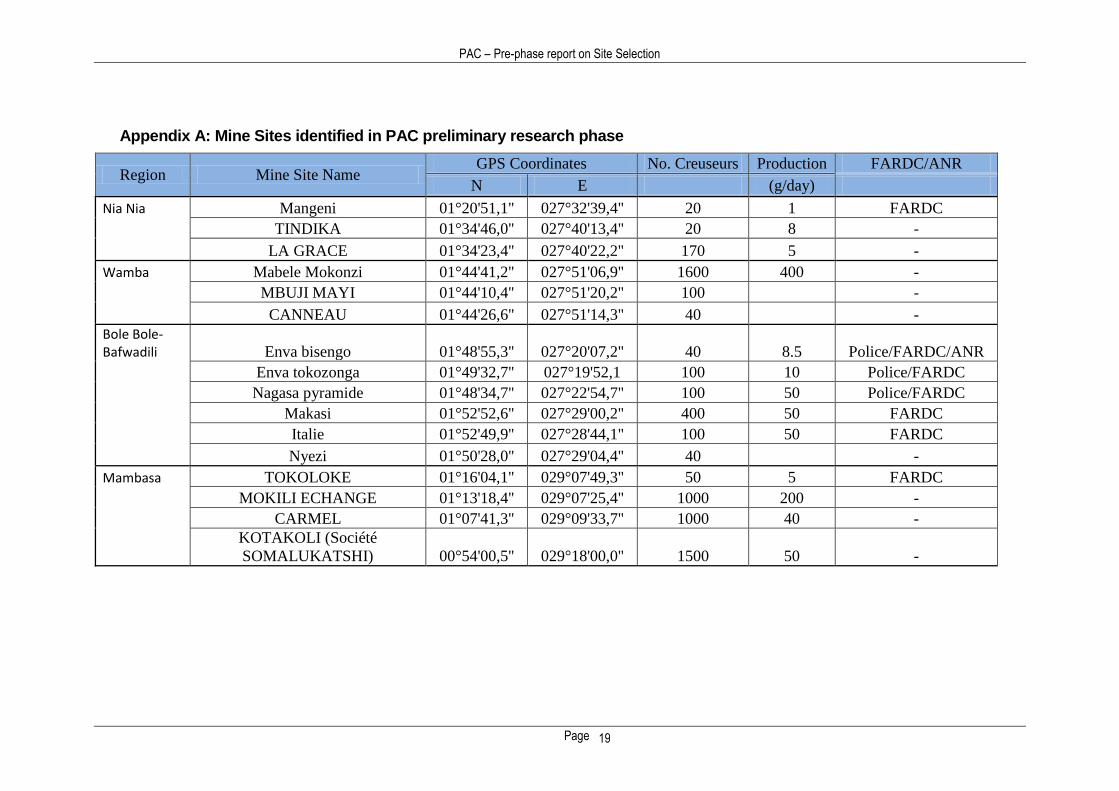
Table 1 shows the sites identified by this mission, together with a selected sub-set of the baseline data, including location, number of miners, and the potentially illegal presence of FARDC or other government organs.
PAC – Pre-phase report on Site Selection
Page 12
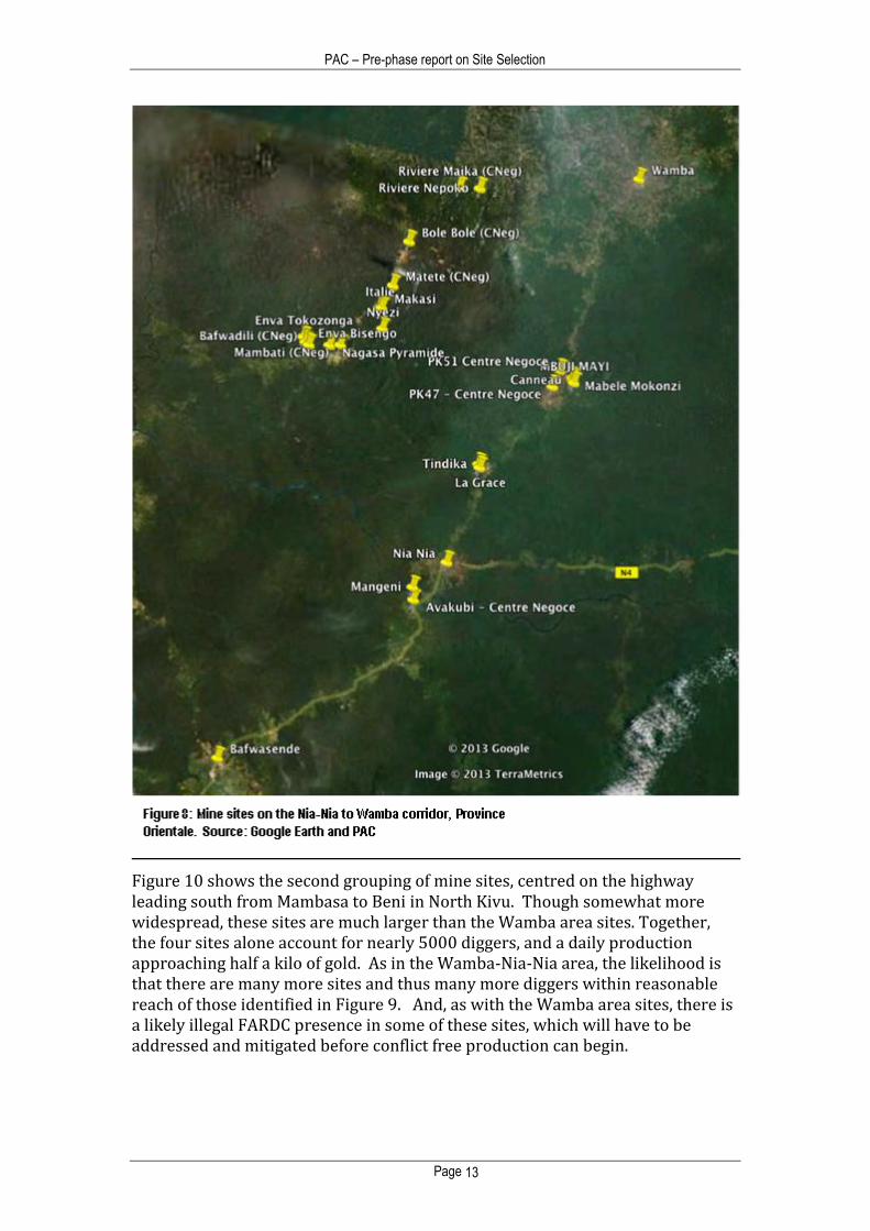
The results were extremely promising. Though obviously limited by time and methods of transportation, the PAC researcher was able to visit and map mine sites that, together, accounted for over 6000 diggers and a production of close to 800 grams of gold per day. The sites are shown mapped on Figures 8-10.
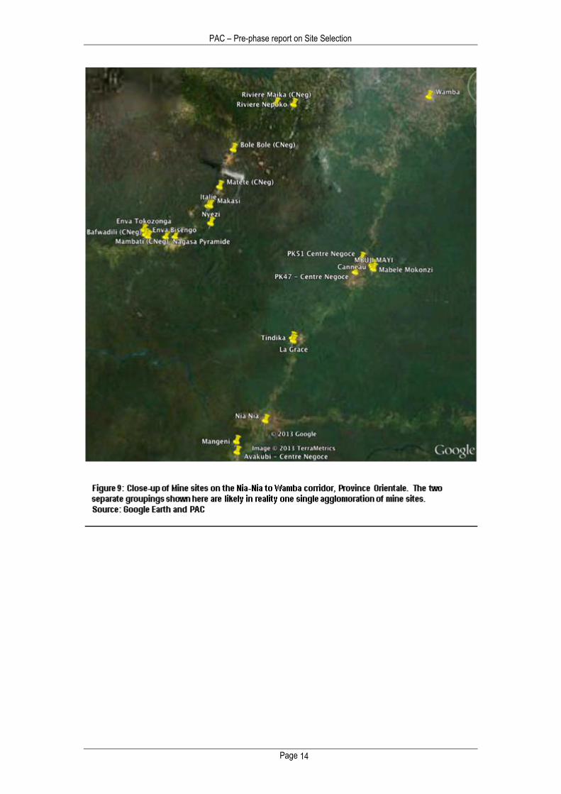
Figure 8 shows the entire Nia-Nia to Wamba axis. Figure 9 shows the same area, in closer detail. The findings show two separate agglomerations of mine sites, clustered on two parallel roadways to the north of Nia -Nia. The first cluster is grouped on the Isiro highway, and centres roughly on the PK 51 Centre de Negoce, located about halfway between Nia-Nia and Wamba; the other cluster is grouped on the Bole-Bole Centre de Negoce some 50 km to the west.
The PAC researcher was necessarily limited to sites within a reasonable hiking distance of the highway. However, discussions with local diggers indicated many more sites in areas 4-8 hours hike from the nearest roadway. In all likelihood, the two clusters in Figure 8 are actually one larger agglomeration of mines sites, with a creusuer population approaching 10,000 people.
Encouragingly, on site research showed little active conflict with overlying formal mineral claims. The presence of Congolese army (FARDC) units in mine sites was somewhat more disturbing, and will of course have to be addressed in the mechanization stage of the project.
PAC – Pre-phase report on Site Selection
Page 13
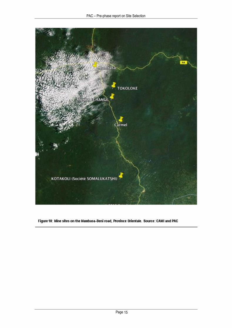
Figure 10 shows the second grouping of mine sites, centred on the highway leading south from Mambasa to Beni in North Kivu. Though somewhat more widespread, these sites are much larger than the Wamba area sites. Together, the four sites alone account for nearly 5000 diggers, and a daily production approaching half a kilo of gold. As in the Wamba-Nia-Nia area, the likelihood is that there are many more sites and thus many more diggers within reasonable reach of those identified in Figure 9. And, as with the Wamba area sites, there is a likely illegal FARDC presence in some of these sites, which will have to be addressed and mitigated before conflict free production can begin.
PAC – Pre-phase report on Site Selection
Page 14
PAC – Pre-phase report on Site Selection
Page 15
PAC – Pre-phase report on Site Selection
Page 16
PAC – Pre-phase report on Site Selection
Page 17
PAC – Pre-phase report on Site Selection
Page 18
5.0 Conclusions
The PAC Tracking/Certifying project takes a phased approach, with evaluations after each phase to take stock of lessons learned and determine the feasibility of proceeding to the following phase. In the pre-project research phase, it was critical to determine whether the project approach by PAC – registration and formalisation followed by technical assistance and outreach – was compatible with conditions on the ground in Province Orientale. In short, was there a place in Orientale were the PAC pilot project could be tested.
To answer this question, a set of objective criteria for site selection were developed (see Section 3). Information was then gathered via literature reviews, in country consultation and on the ground research. The information thus gathered was then compared to the site selection criteria.
It is important to recall that the purpose of this pre-phase report is to identify specific areas (not specific mine site) where the registration phase of the project can proceed. The choice of specific mine sites for mechanisation outreach will be the subject of a second report following the mechanization stage.
As a result of the information gathered during this pre-phase research, the following areas were identified as being suitable:
1. The axis extending along the provincial highway from Banalia northwards up to Buta.
2. The vicinity of Nia-Nia, extending northwards on the provincial highway towards Wamba
3. The Bole Bole – Bafwadili axis, located to the west of Wamba
Maps of these areas are given in Figures 6-10. GPS coordinates of many of the specific mine sites in these areas are given in Appendix 1.
The above three areas should be the target of the next phase of the PAC Tracking/Certifying project, which involves registration of miners and mine sites, along with the collection of detailed baseline information about mine site conditions. The information collected during the registration phase will then inform a final decision on the selection of specific sites for mechanisation.
PAC – Pre-phase report on Site Selection
Page 19
Appendix A: Mine Sites identified in PAC preliminary research phase
Region Mine Site Name GPS Coordinates No. Creuseurs Production FARDC/ANR
N E (g/day)
Nia Nia Mangeni 01°20'51,1'' 027°32'39,4'' 20 1 FARDC
TINDIKA 01°34'46,0'' 027°40'13,4'' 20 8 -
LA GRACE 01°34'23,4'' 027°40'22,2'' 170 5 -
Wamba Mabele Mokonzi 01°44'41,2'' 027°51'06,9'' 1600 400 -
MBUJI MAYI 01°44'10,4'' 027°51'20,2'' 100 -
CANNEAU 01°44'26,6'' 027°51'14,3'' 40 -
Bole Bole-Bafwadili Enva bisengo 01°48'55,3'' 027°20'07,2'' 40 8.5 Police/FARDC/ANR
Enva tokozonga 01°49'32,7'' 027°19'52,1 100 10 Police/FARDC
Nagasa pyramide 01°48'34,7'' 027°22'54,7'' 100 50 Police/FARDC
Makasi 01°52'52,6'' 027°29'00,2'' 400 50 FARDC
Italie 01°52'49,9'' 027°28'44,1'' 100 50 FARDC
Nyezi 01°50'28,0'' 027°29'04,4'' 40 -
Mambasa TOKOLOKE 01°16'04,1'' 029°07'49,3'' 50 5 FARDC
MOKILI ECHANGE 01°13'18,4'' 029°07'25,4'' 1000 200 -
CARMEL 01°07'41,3'' 029°09'33,7'' 1000 40 -
KOTAKOLI (Société
SOMALUKATSHI) 00°54'00,5'' 029°18'00,0'' 1500 50 -
PAC – Pre-phase report on Site Selection
Page 20
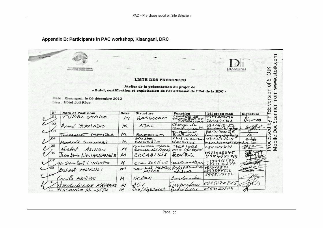
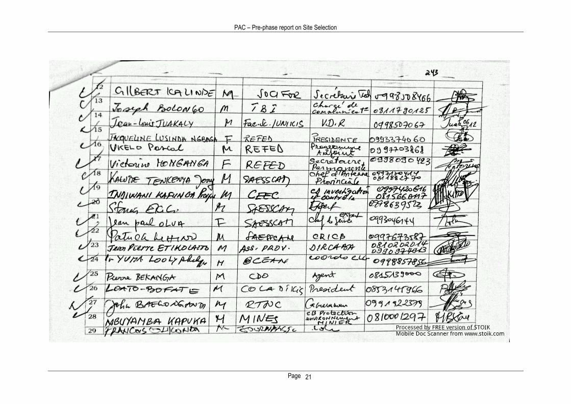
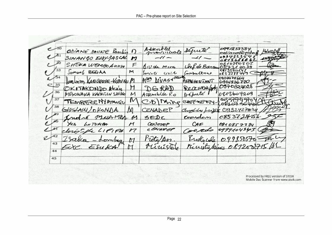
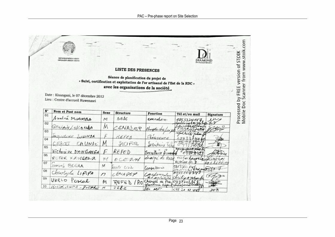
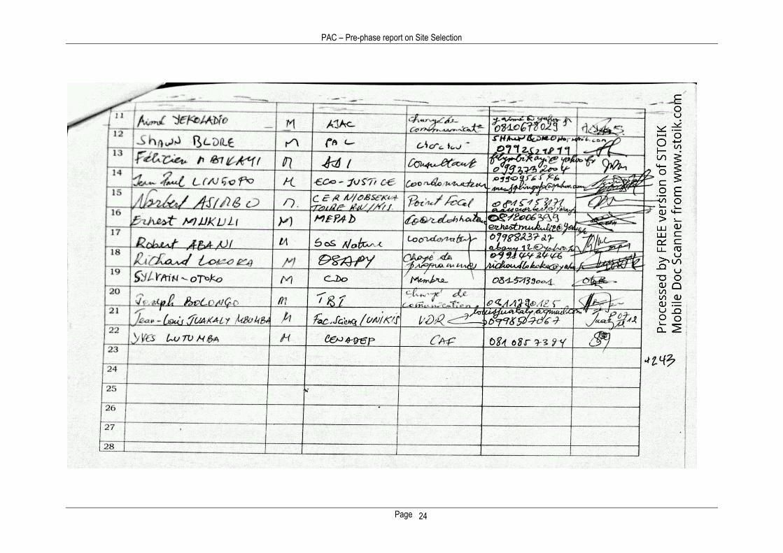
Appendix B: Participants in PAC workshop, Kisangani, DRC
PAC – Pre-phase report on Site Selection
Page 21
PAC – Pre-phase report on Site Selection
Page 22
PAC – Pre-phase report on Site Selection
Page 23
PAC – Pre-phase report on Site Selection
Page 24