penang hills watch report 20173 penang hills watch report 2017 1.0 introduction the penang hills...
TRANSCRIPT
1
Penang Hills Watch Report 2017
15th September 2017
Prepared by
2
Contents
1.0 Introduction ............................................................................................................................... 3
2.0 Follow up on MBPP responses to the 12 cases of the second report ........................................ 5
3.0 Records of public observations ................................................................................................. 7
3.1 Zone 1: Northern Part of Penang Island ................................................................................ 8
3.2 Zone 2: Middle Part of Penang Island ................................................................................. 12
3.3 Zone 3: Southern Part of Penang Island .............................................................................. 13
3.4 Zone 4: Seberang Perai ....................................................................................................... 15
4.0 Follow up ................................................................................................................................ 17
3
Penang Hills Watch Report 2017
1.0 Introduction
The Penang Hills Watch (PHW) was publicly launched by the Penang Forum (PF) on 31 October
2016, with an invitation to the public to contribute on-the-ground observations on hill clearing
activities. Thus far, we have received 70 cases* of land clearing and construction activities on
the island from the general public, which we have documented, mapped and displayed online
through the PHW portal https://hillclearinginpenang.ushahidi.io/views/map.
A week before the launch, PF members requested and had a meeting with a number of
government agencies including Majlis Bandaraya Pulau Pinang (MBPP), Jabatan Perhutanan
Negeri Pulau Pinang (JPNPP), Jabatan Ukur dan Pemetaan Malaysia (JUPEM) and Jabatan
Perancang Bandar Dan Desa Pulau Pinang (JPBDPP) when we explained the purpose of the
PHW project and demonstrated the online application.
We emphasized that the observations made in the field need to be checked against official
records to determine if the clearing activities have official approval or, if otherwise, whether
these activities need to be checked out and acted upon by the relevant government authorities.
We therefore suggested close cooperation with MBPP and other relevant government
departments for mutual exchange of information, and our suggestion was well received at the
meeting.
This report constitutes our third compilation of observations since the launch at the end of
October 2016. In this third report, we seek clarification for a further 18 reports which are the
observations made between April and September 2017 as well as follow ups to cases reported in
the second report. In this report, we have also received 4 reports of clearing activities in
Seberang Perai, which would come under the jurisdiction of MPSP. Therefore, we seek the
goodwill and the cooperation of MPSP in investigating and exchanging information pertaining
these cases as well.
*59 of the 70 cases have been referred to MBPP and State Government while 11 have been
independently verified by the Penang State Government prior to our reports.
4
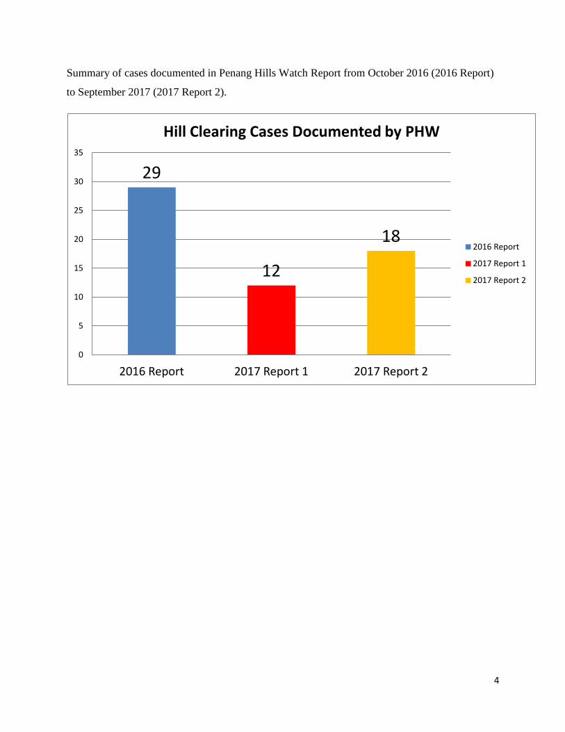
Summary of cases documented in Penang Hills Watch Report from October 2016 (2016 Report)
to September 2017 (2017 Report 2).
29
12
18
0
5
10
15
20
25
30
35
2016 Report 2017 Report 1 2017 Report 2
Hill Clearing Cases Documented by PHW
2016 Report
2017 Report 1
2017 Report 2
5
2.0 Follow up on MBPP responses to the 12 cases of the second report
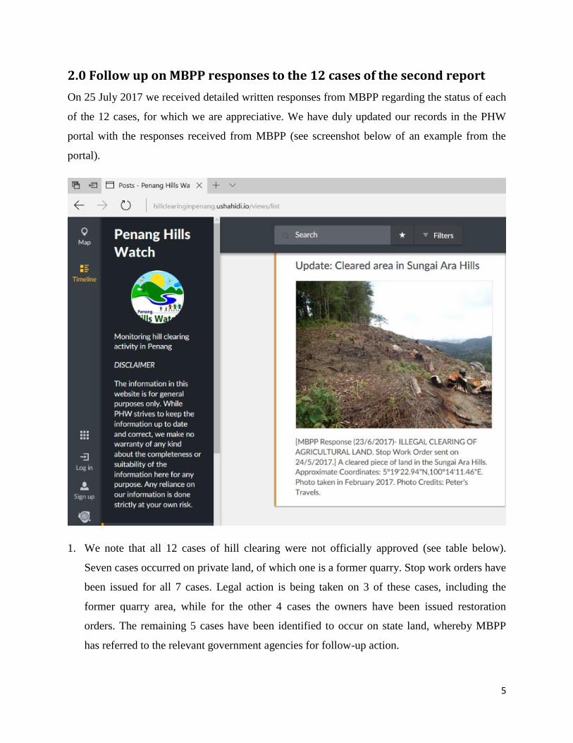
On 25 July 2017 we received detailed written responses from MBPP regarding the status of each
of the 12 cases, for which we are appreciative. We have duly updated our records in the PHW
portal with the responses received from MBPP (see screenshot below of an example from the
portal).
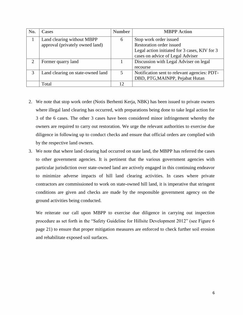
1. We note that all 12 cases of hill clearing were not officially approved (see table below).
Seven cases occurred on private land, of which one is a former quarry. Stop work orders have
been issued for all 7 cases. Legal action is being taken on 3 of these cases, including the
former quarry area, while for the other 4 cases the owners have been issued restoration
orders. The remaining 5 cases have been identified to occur on state land, whereby MBPP
has referred to the relevant government agencies for follow-up action.
6
No. Cases Number MBPP Action
1 Land clearing without MBPP
approval (privately owned land)
6 Stop work order issued
Restoration order issued
Legal action initiated for 3 cases, KIV for 3
cases on advice of Legal Adviser
2 Former quarry land 1 Discussion with Legal Adviser on legal
recourse
3 Land clearing on state-owned land 5 Notification sent to relevant agencies: PDT-
DBD, PTG,MAINPP, Pejabat Hutan
Total 12
2. We note that stop work order (Notis Berhenti Kerja, NBK) has been issued to private owners
where illegal land clearing has occurred, with preparations being done to take legal action for
3 of the 6 cases. The other 3 cases have been considered minor infringement whereby the
owners are required to carry out restoration. We urge the relevant authorities to exercise due
diligence in following up to conduct checks and ensure that official orders are complied with
by the respective land owners.
3. We note that where land clearing had occurred on state land, the MBPP has referred the cases
to other government agencies. It is pertinent that the various government agencies with
particular jurisdiction over state-owned land are actively engaged in this continuing endeavor
to minimize adverse impacts of hill land clearing activities. In cases where private
contractors are commissioned to work on state-owned hill land, it is imperative that stringent
conditions are given and checks are made by the responsible government agency on the
ground activities being conducted.
We reiterate our call upon MBPP to exercise due diligence in carrying out inspection
procedure as set forth in the “Safety Guideline for Hillsite Development 2012” (see Figure 6
page 21) to ensure that proper mitigation measures are enforced to check further soil erosion
and rehabilitate exposed soil surfaces.
7
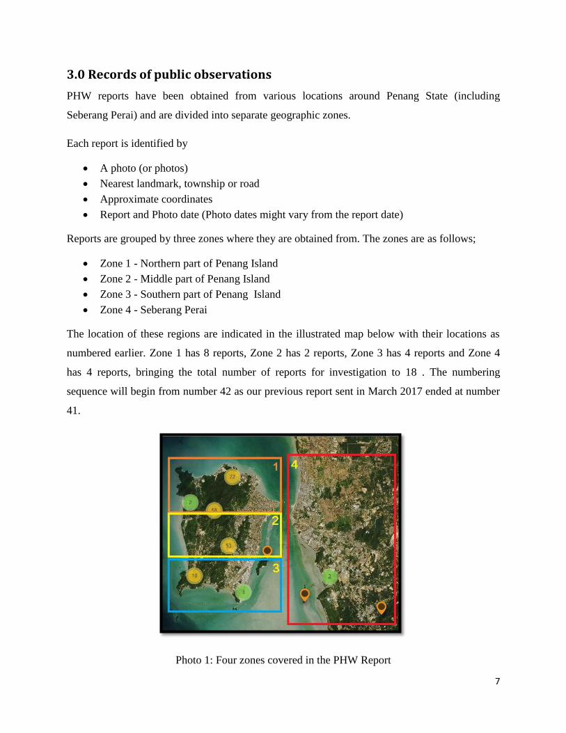
3.0 Records of public observations
PHW reports have been obtained from various locations around Penang State (including
Seberang Perai) and are divided into separate geographic zones.
Each report is identified by
A photo (or photos)
Nearest landmark, township or road
Approximate coordinates
Report and Photo date (Photo dates might vary from the report date)
Reports are grouped by three zones where they are obtained from. The zones are as follows;
Zone 1 - Northern part of Penang Island
Zone 2 - Middle part of Penang Island
Zone 3 - Southern part of Penang Island
Zone 4 - Seberang Perai
The location of these regions are indicated in the illustrated map below with their locations as
numbered earlier. Zone 1 has 8 reports, Zone 2 has 2 reports, Zone 3 has 4 reports and Zone 4
has 4 reports, bringing the total number of reports for investigation to 18 . The numbering
sequence will begin from number 42 as our previous report sent in March 2017 ended at number
41.
Photo 1: Four zones covered in the PHW Report
8
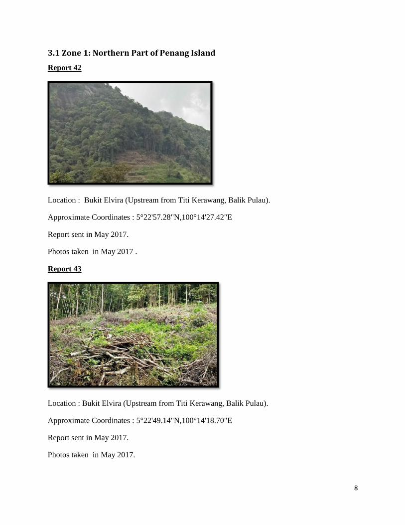
3.1 Zone 1: Northern Part of Penang Island
Report 42
Location : Bukit Elvira (Upstream from Titi Kerawang, Balik Pulau).
Approximate Coordinates : 5°22'57.28"N,100°14'27.42"E
Report sent in May 2017.
Photos taken in May 2017 .
Report 43
Location : Bukit Elvira (Upstream from Titi Kerawang, Balik Pulau).
Approximate Coordinates : 5°22'49.14"N,100°14'18.70"E
Report sent in May 2017.
Photos taken in May 2017.
9
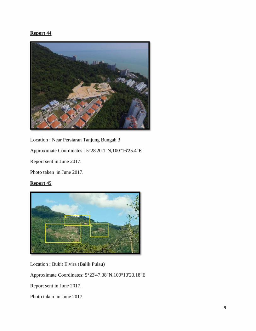
Report 44
Location : Near Persiaran Tanjung Bungah 3
Approximate Coordinates : 5°28'20.1"N,100°16'25.4"E
Report sent in June 2017.
Photo taken in June 2017.
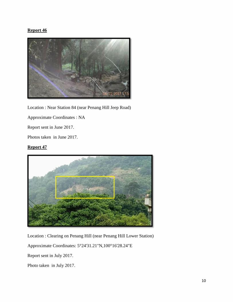
Report 45
Location : Bukit Elvira (Balik Pulau)
Approximate Coordinates: 5°23'47.38"N,100°13'23.18"E
Report sent in June 2017.
Photo taken in June 2017.
10
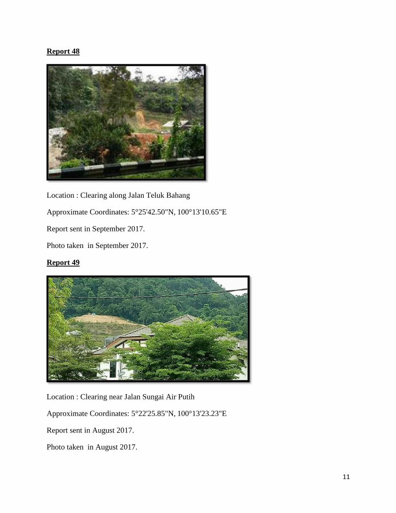
Report 46
Location : Near Station 84 (near Penang Hill Jeep Road)
Approximate Coordinates : NA
Report sent in June 2017.
Photos taken in June 2017.
Report 47
Location : Clearing on Penang Hill (near Penang Hill Lower Station)
Approximate Coordinates: 5°24'31.21"N,100°16'28.24"E
Report sent in July 2017.
Photo taken in July 2017.
11
Report 48
Location : Clearing along Jalan Teluk Bahang
Approximate Coordinates: 5°25'42.50"N, 100°13'10.65"E
Report sent in September 2017.
Photo taken in September 2017.
Report 49
Location : Clearing near Jalan Sungai Air Putih
Approximate Coordinates: 5°22'25.85"N, 100°13'23.23"E
Report sent in August 2017.
Photo taken in August 2017.
12
3.2 Zone 2: Middle Part of Penang Island
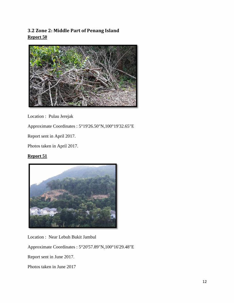
Report 50
Location : Pulau Jerejak
Approximate Coordinates : 5°19'26.50"N,100°19'32.65"E
Report sent in April 2017.
Photos taken in April 2017.
Report 51
Location : Near Lebuh Bukit Jambul
Approximate Coordinates : 5°20'57.89"N,100°16'29.48"E
Report sent in June 2017.
Photos taken in June 2017
13
3.3 Zone 3: Southern Part of Penang Island
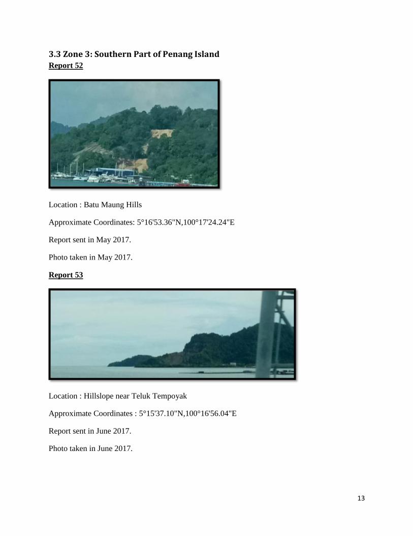
Report 52
Location : Batu Maung Hills
Approximate Coordinates: 5°16'53.36"N,100°17'24.24"E
Report sent in May 2017.
Photo taken in May 2017.
Report 53
Location : Hillslope near Teluk Tempoyak
Approximate Coordinates : 5°15'37.10"N,100°16'56.04"E
Report sent in June 2017.
Photo taken in June 2017.
14
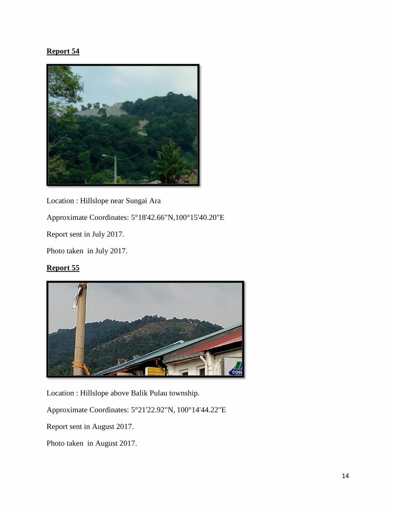
Report 54
Location : Hillslope near Sungai Ara
Approximate Coordinates: 5°18'42.66"N,100°15'40.20"E
Report sent in July 2017.
Photo taken in July 2017.
Report 55
Location : Hillslope above Balik Pulau township.
Approximate Coordinates: 5°21'22.92"N, 100°14'44.22"E
Report sent in August 2017.
Photo taken in August 2017.
15
3.4 Zone 4: Seberang Perai
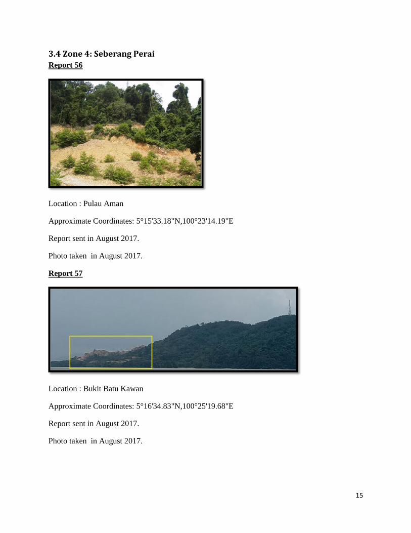
Report 56
Location : Pulau Aman
Approximate Coordinates: 5°15'33.18"N,100°23'14.19"E
Report sent in August 2017.
Photo taken in August 2017.
Report 57
Location : Bukit Batu Kawan
Approximate Coordinates: 5°16'34.83"N,100°25'19.68"E
Report sent in August 2017.
Photo taken in August 2017.
16
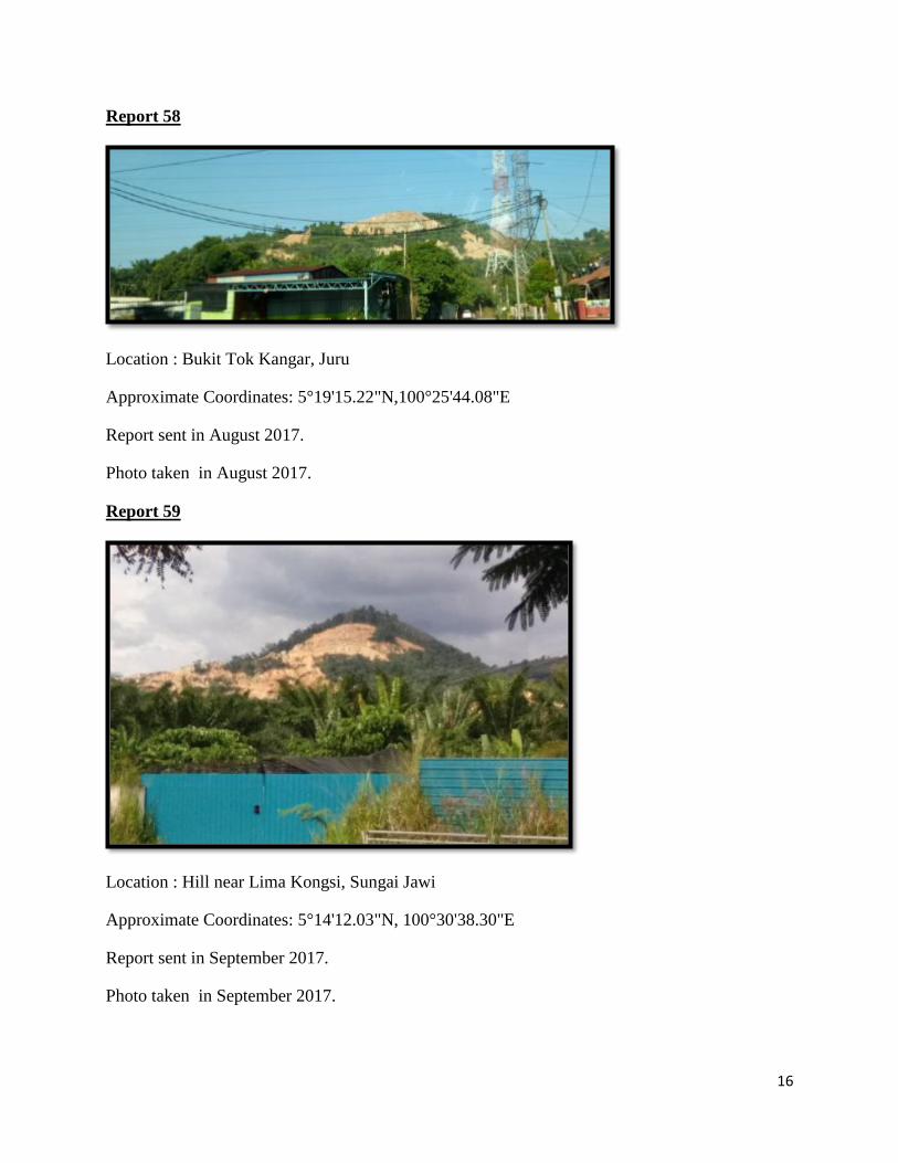
Report 58
Location : Bukit Tok Kangar, Juru
Approximate Coordinates: 5°19'15.22"N,100°25'44.08"E
Report sent in August 2017.
Photo taken in August 2017.
Report 59
Location : Hill near Lima Kongsi, Sungai Jawi
Approximate Coordinates: 5°14'12.03"N, 100°30'38.30"E
Report sent in September 2017.
Photo taken in September 2017.
17
4.0 Follow up
We seek MBPP and MPSP’s assistance to look through the above observed reports and
comment:
1. If the land clearing activity is legally sanctioned;
2. The purpose of the land clearing activity;
3. The land use status of the affected site;
4. If the activity is legal, the highest elevation from sea level in the activity site, and
5. If any action needs to be taken on the part of the Council or other government
departments.
We appreciate that YB Chow Kon Yeow, State Executive Councillor for Local Government,
Traffic Management and Environment, in chairing the meeting with Penang Forum members on
04 May 2017 specifically to discuss the second PHW report, stated his willingness to continue
holding such dialog sessions as subsequent reports are submitted. We sincerely hope that in
future meetings there would be wider representation of the relevant agencies where reported
cases fall within their jurisdiction.
We look forward to your continued assistance and attention to these new cases highlighted in this
third report and hope to receive your written answer in regards to it.
Thank you.
Penang Forum Steering Committee
15 September 2017