pakistan 29 october 5 november, 2012 - iucncmsdata.iucn.org/downloads/pk_wwd2016_igf.pdf ·...
TRANSCRIPT

Ramsar Advisory Mission Pakistan
29 October – 5 November, 2012

What are wetlands?
Wetlands are areas of marsh, fen,
peatland or water, whether natural or
artificial, permanent or temporary,
with water that is static or flowing,
fresh, brackish or salt, including
areas of marine water the depth of
which at low tide does not exceed
six metres.
Human-made wetlands:
Rice fields, fish ponds, reservoirs,
ditches and canals.
Inland Wetlands
Glaciers, lakes, marshes, rivers,
streams, aquifers.
Coastal Wetlands
Mangroves, tidal flats, sea grass
beds, coral reefs.
© Ms. Ikram Qasim
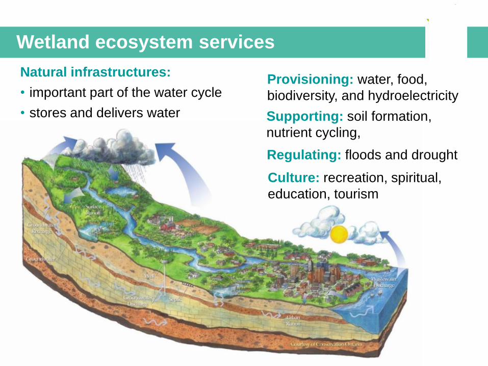
Wetland ecosystem services
Provisioning: water, food,
biodiversity, and hydroelectricity
Regulating: floods and drought
Supporting: soil formation,
nutrient cycling,
Culture: recreation, spiritual,
education, tourism
Natural infrastructures:
• important part of the water cycle
• stores and delivers water
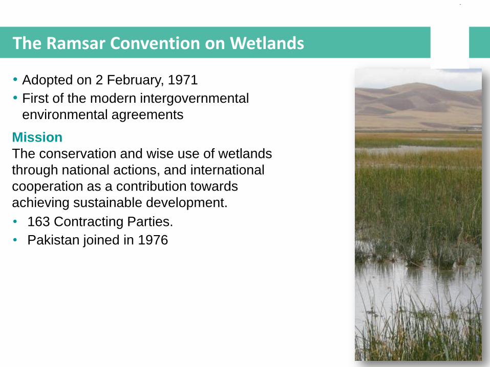
The Ramsar Convention on Wetlands
Mission
The conservation and wise use of wetlands
through national actions, and international
cooperation as a contribution towards
achieving sustainable development.
• Adopted on 2 February, 1971
• First of the modern intergovernmental
environmental agreements
• 163 Contracting Parties.
• Pakistan joined in 1976
1. “Wise use” of wetland
This is at the heart of the Convention, the
sustainable use of wetlands and their resources for
the benefit of humankind.
The 3 implementation “pillars” of the Convention
© Ms. Ikram Qasim
© Dr. M. Fouda
© Ms. Ikram Qasim
© Ms. M. Kodami
2. Designation of Wetlands of international
Importance
Designation of priority wetlands as Wetlands of
International Importance (Ramsar Sites), and to
ensure their conservation and wise use.
3. International cooperation
International cooperation for shared wetlands and
their resources, e.g. water, migratory species.
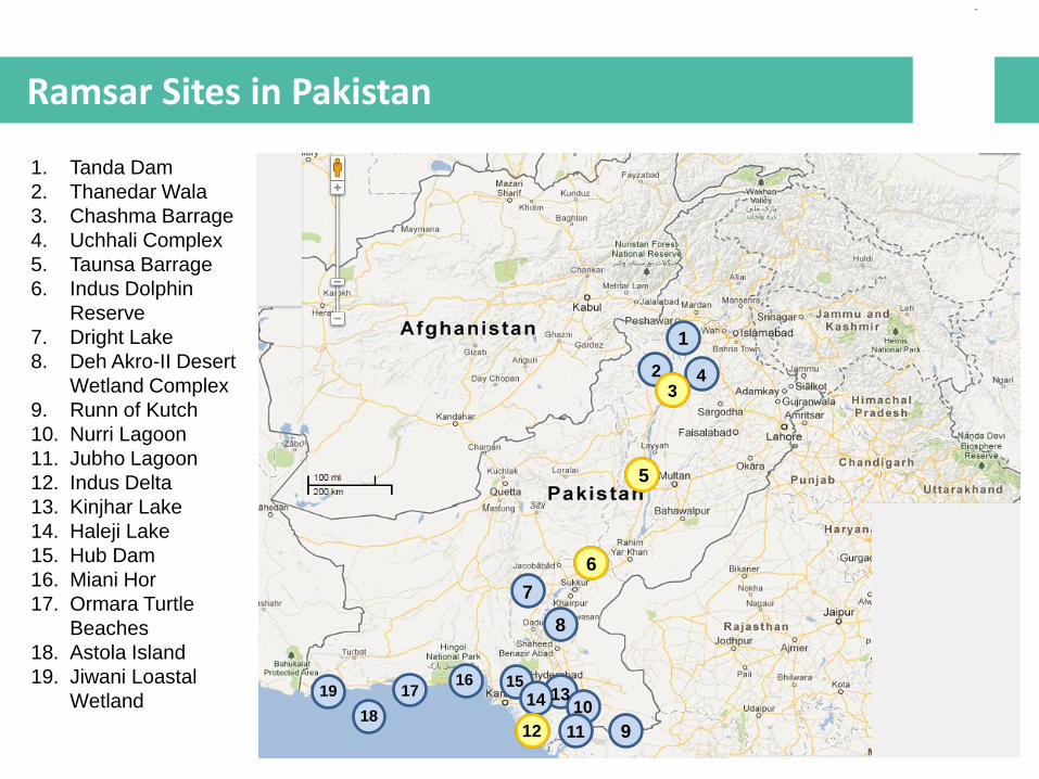
1. Tanda Dam
2. Thanedar Wala
3. Chashma Barrage
4. Uchhali Complex
5. Taunsa Barrage
6. Indus Dolphin
Reserve
7. Dright Lake
8. Deh Akro-II Desert
Wetland Complex
9. Runn of Kutch
10. Nurri Lagoon
11. Jubho Lagoon
12. Indus Delta
13. Kinjhar Lake
14. Haleji Lake
15. Hub Dam
16. Miani Hor
17. Ormara Turtle
Beaches
18. Astola Island
19. Jiwani Loastal
Wetland
Ramsar Sites in Pakistan
15
5
1
12
2 3
4
6
7
8
9
17
18
19 10
11
13 14
16
3
5
6
12
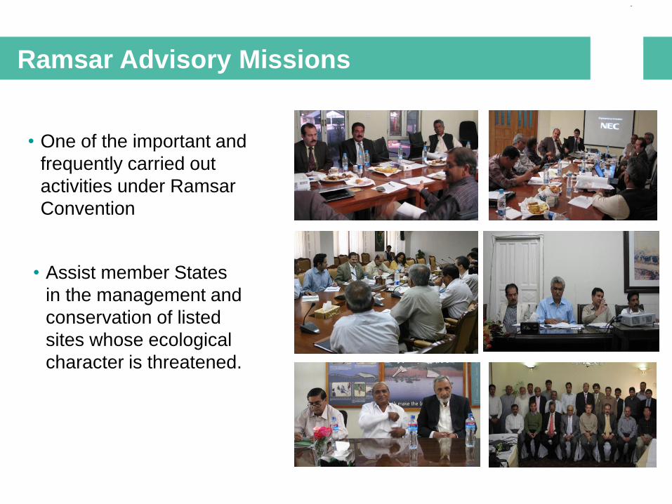
Ramsar Advisory Missions
• One of the important and
frequently carried out
activities under Ramsar
Convention
© Ms. Ikram Qasim
• Assist member States
in the management and
conservation of listed
sites whose ecological
character is threatened.

Itinerary of the RAM Team to Pakistan
29 October - Islamabad
Ministry of Climate Change, Federal Flood
Commission, National Disaster Management
Authority, Pakistan Meteorological Authority
30 October - Lahore
Water and Power Development Authority, Punjab
Provincial Disaster Management Authority
31 October – Lahore
Provincial Wildlife, Forest and Fisheries Department,
Irrigation Department
1 November – Lal Suhanra National Park
2 November – Indus Dolphin Reserve Ramsar Site
(Guddu Barrage) Sindh Wildlife Department
3 November – Indus Dolphin Reserve Ramsar Site
(Sukkur Barrage) Sindh Wildlife Department, Irrigation
Department
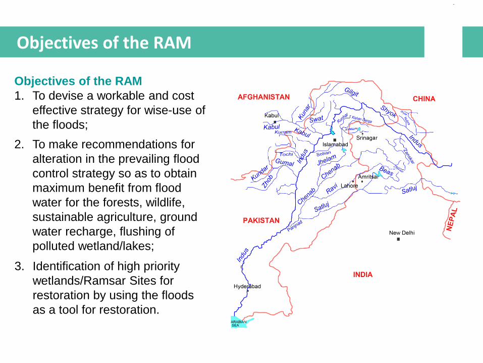
Objectives of the RAM
Objectives of the RAM
1. To devise a workable and cost
effective strategy for wise-use of
the floods;
2. To make recommendations for
alteration in the prevailing flood
control strategy so as to obtain
maximum benefit from flood
water for the forests, wildlife,
sustainable agriculture, ground
water recharge, flushing of
polluted wetland/lakes;
3. Identification of high priority
wetlands/Ramsar Sites for
restoration by using the floods
as a tool for restoration.
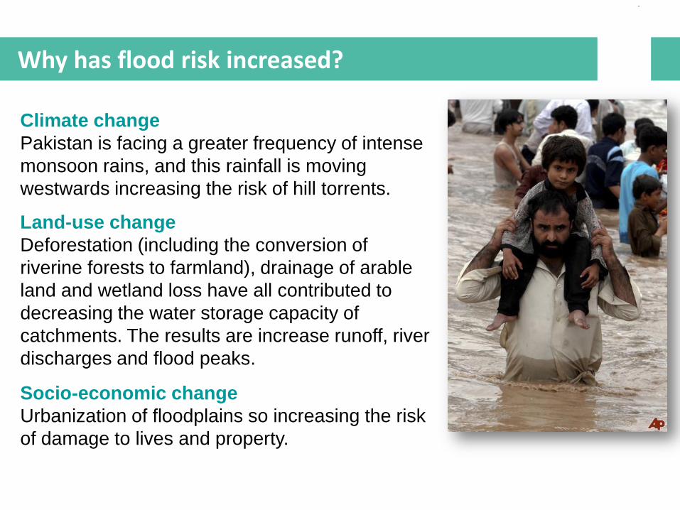
Why has flood risk increased?
Climate change
Pakistan is facing a greater frequency of intense
monsoon rains, and this rainfall is moving
westwards increasing the risk of hill torrents.
Land-use change
Deforestation (including the conversion of
riverine forests to farmland), drainage of arable
land and wetland loss have all contributed to
decreasing the water storage capacity of
catchments. The results are increase runoff, river
discharges and flood peaks.
Socio-economic change
Urbanization of floodplains so increasing the risk
of damage to lives and property.
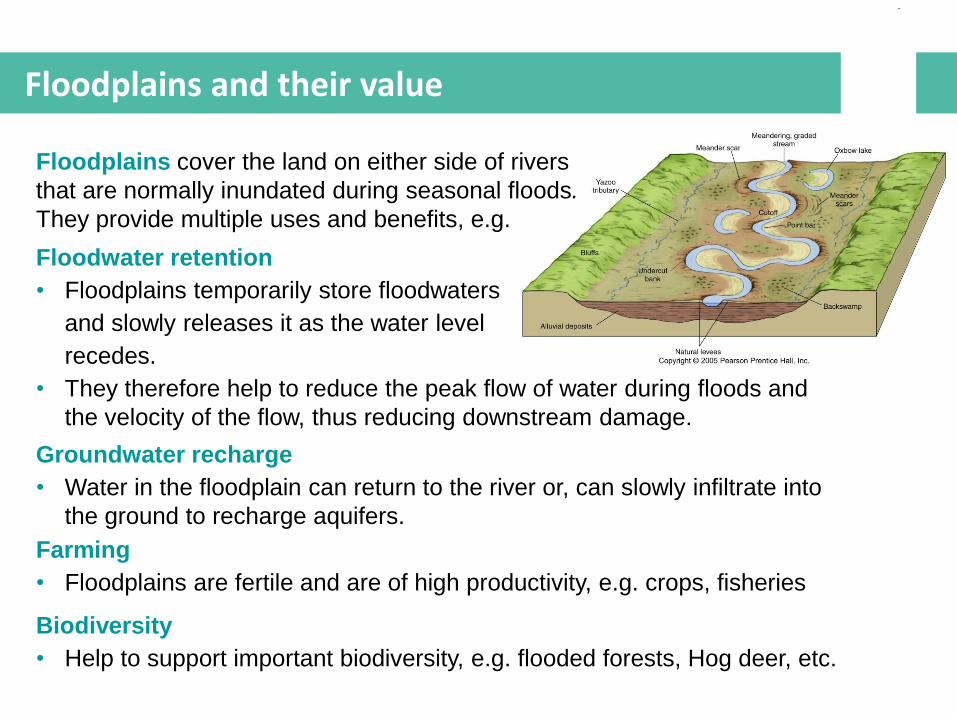
Floodplains and their value
Groundwater recharge
• Water in the floodplain can return to the river or, can slowly infiltrate into
the ground to recharge aquifers.
Floodwater retention
• Floodplains temporarily store floodwaters
and slowly releases it as the water level
recedes.
• They therefore help to reduce the peak flow of water during floods and
the velocity of the flow, thus reducing downstream damage.
Floodplains cover the land on either side of rivers
that are normally inundated during seasonal floods.
They provide multiple uses and benefits, e.g.
Farming
• Floodplains are fertile and are of high productivity, e.g. crops, fisheries
Biodiversity
• Help to support important biodiversity, e.g. flooded forests, Hog deer, etc.

Natural flood management
Natural floodplain management
There are many techniques for doing this and most aims to
enlarge the floodplain area and its storage capacity, such as by:
• Constructing flood bypasses, including new floodplains;
• Removal/ lowering of minor embankments;
• Setting-back of embankments;
• (Re)construction of meanders and flowing side channels;
• Removal of flow restrictions.
The best way however, is to protect the existing natural
rivers and floodplain systems!
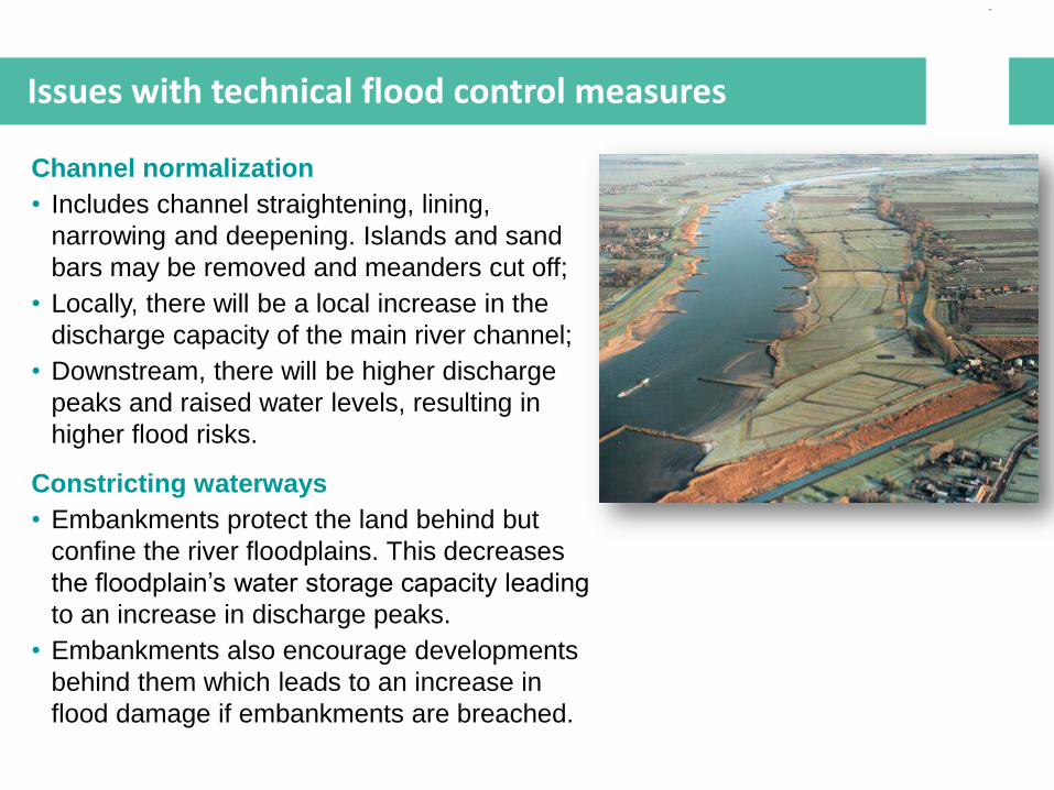
Issues with technical flood control measures
Channel normalization
• Includes channel straightening, lining,
narrowing and deepening. Islands and sand
bars may be removed and meanders cut off;
• Locally, there will be a local increase in the
discharge capacity of the main river channel;
• Downstream, there will be higher discharge
peaks and raised water levels, resulting in
higher flood risks.
Constricting waterways
• Embankments protect the land behind but
confine the river floodplains. This decreases
the floodplain’s water storage capacity leading
to an increase in discharge peaks.
• Embankments also encourage developments
behind them which leads to an increase in
flood damage if embankments are breached.
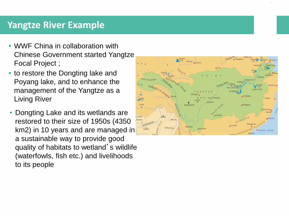
Yangtze River Example
• WWF China in collaboration with
Chinese Government started Yangtze
Focal Project ;
• to restore the Dongting lake and
Poyang lake, and to enhance the
management of the Yangtze as a
Living River
• Dongting Lake and its wetlands are
restored to their size of 1950s (4350
km2) in 10 years and are managed in
a sustainable way to provide good
quality of habitats to wetland’s wildlife
(waterfowls, fish etc.) and livelihoods
to its people
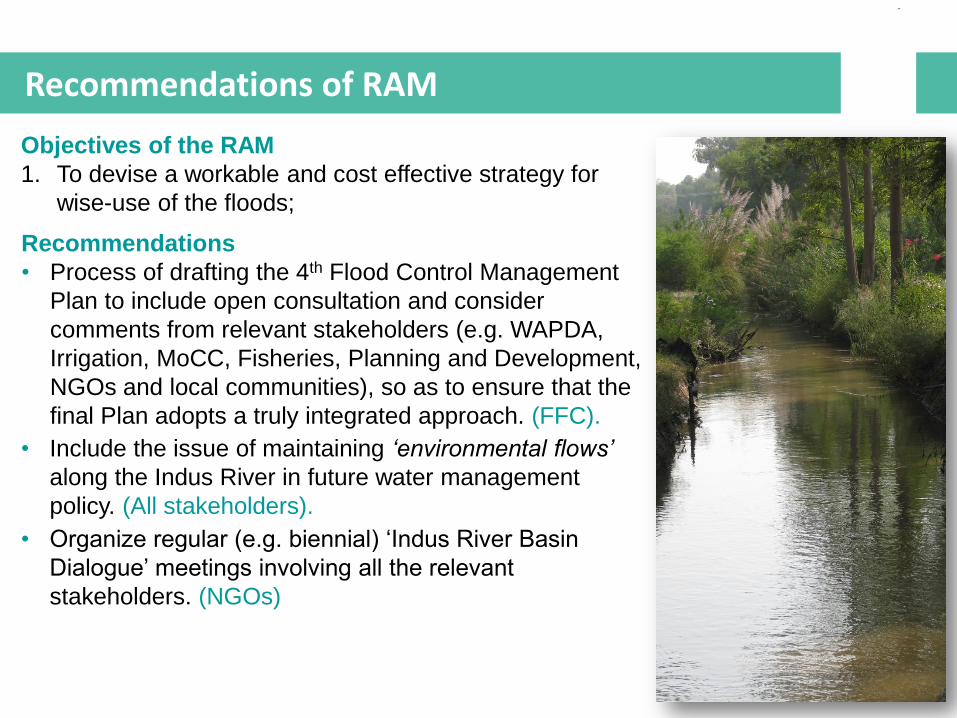
Recommendations of RAM
Objectives of the RAM
1. To devise a workable and cost effective strategy for
wise-use of the floods;
Recommendations
• Process of drafting the 4th Flood Control Management
Plan to include open consultation and consider
comments from relevant stakeholders (e.g. WAPDA,
Irrigation, MoCC, Fisheries, Planning and Development,
NGOs and local communities), so as to ensure that the
final Plan adopts a truly integrated approach. (FFC).
• Include the issue of maintaining ‘environmental flows’
along the Indus River in future water management
policy. (All stakeholders).
• Organize regular (e.g. biennial) ‘Indus River Basin
Dialogue’ meetings involving all the relevant
stakeholders. (NGOs)
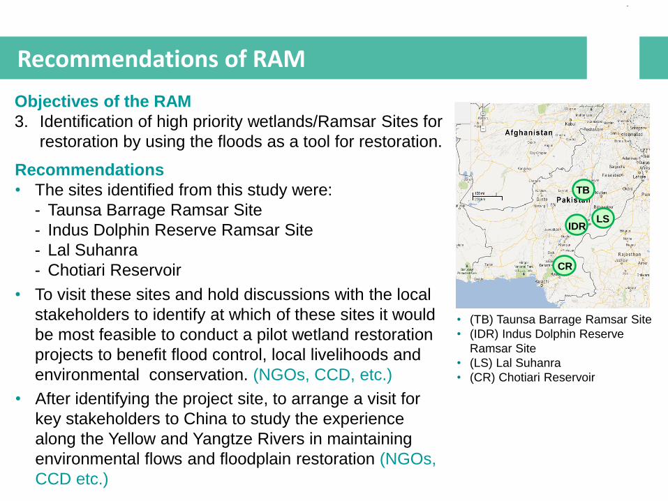
Recommendations of RAM
Objectives of the RAM
3. Identification of high priority wetlands/Ramsar Sites for
restoration by using the floods as a tool for restoration.
TB
IDR
• (TB) Taunsa Barrage Ramsar Site
• (IDR) Indus Dolphin Reserve
Ramsar Site
• (LS) Lal Suhanra
• (CR) Chotiari Reservoir
LS
CR
Recommendations
• The sites identified from this study were:
- Taunsa Barrage Ramsar Site
- Indus Dolphin Reserve Ramsar Site
- Lal Suhanra
- Chotiari Reservoir
• To visit these sites and hold discussions with the local
stakeholders to identify at which of these sites it would
be most feasible to conduct a pilot wetland restoration
projects to benefit flood control, local livelihoods and
environmental conservation. (NGOs, CCD, etc.)
• After identifying the project site, to arrange a visit for
key stakeholders to China to study the experience
along the Yellow and Yangtze Rivers in maintaining
environmental flows and floodplain restoration (NGOs,
CCD etc.)
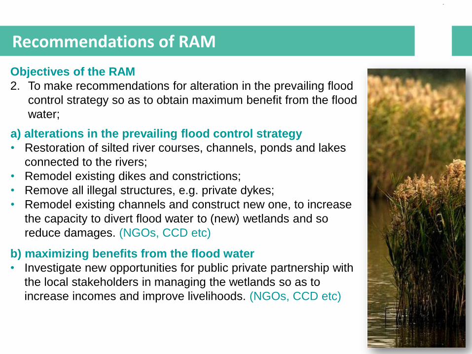
Recommendations of RAM
Objectives of the RAM
2. To make recommendations for alteration in the prevailing flood
control strategy so as to obtain maximum benefit from the flood
water;
a) alterations in the prevailing flood control strategy
• Restoration of silted river courses, channels, ponds and lakes
connected to the rivers;
• Remodel existing dikes and constrictions;
• Remove all illegal structures, e.g. private dykes;
• Remodel existing channels and construct new one, to increase
the capacity to divert flood water to (new) wetlands and so
reduce damages. (NGOs, CCD etc)
b) maximizing benefits from the flood water
• Investigate new opportunities for public private partnership with
the local stakeholders in managing the wetlands so as to
increase incomes and improve livelihoods. (NGOs, CCD etc)
Thank You