office of coast survey hydrographic surveys...
TRANSCRIPT

Office of Coast Survey
Hydrographic Surveys Division’s
USS MONITOR
March 2006
2
Table of Contents
Page(s)
Introduction 3
Explanation 3
Database Structure 4
Inquiries 7
Figure 1 4
Figure 2 8
Figure 3 10
Appendix 1 11
Appendix 2 12
Appendix 3 13
Appendix 4 15
Appendix 5 24
Disclaimer 28

INTRODUCTION This manual has been compiled to provide users of the Automated Wreck and Obstruction Information System (AWOIS) with instructions for obtaining and interpreting data from the system. Background is also available which explains the use of the system as a basic research tool.
EXPLANATION
Background
In 1981, the National Ocean Service (NOS) implemented the Automated Wreck and Obstruction Information System (AWOIS) to assist in planning hydrographic survey operations and to catalog and store a substantial volume of reported wrecks and obstructions that are considered navigational hazards within U.S. coastal waters. Today, over 10,000 reports have been received, which include unverified accounts of vessel casualties, as well as chronological history. As part of the hydrographic survey planning process, these records are reviewed and those wrecks or obstructions which require additional field investigation are assigned to specific field units. The results of these investigations eventually become part of the AWOIS file so that a permanent record of a wreck or obstruction is always available.
Besides functioning as a survey planning tool, AWOIS is of potential value to various users
outside of NOS. The historical record of selected wrecks, the accessibility of information in a sorted format, and its reasonable cost make AWOIS an important information source for marine archaeologists and historians, fishermen, divers, salvage operators, and others in the marine community. Interested individuals are encouraged to use the system as a supplement to other sources of information. However, AWOIS has limitations that should be considered by potential users. Most notably, it is not a comprehensive record of wrecks in any particular area. Historical research is constantly being conducted to improve the quality of the file, but it will never completely address every known or reported wreck. The emphasis is constantly placed on wrecks which may be a hazard to navigation. Purpose of User’s Guide The purpose of this guide is an aid to decipher the Automated Wreck and Obstruction Information System (AWOIS) information within a MS Access 2000 database. As Access 2000 is the current version of the master AWOIS database, previous versions of Access (such as version 7) will not function.
3

4
Figure 1: Sample of Form in MS Access:
DATABASE STRUCTURE
Fields of the AWOIS table: The fields are listed below and are grouped by themes as reflected inrectangular groupings on the standard MS Access AWOIS form. SEE FIGURE 1.
1. Identifier Fields:
RECRD: Unique 5-digit AWOIS number. AWOIS numbers are assigned by the Hydrographic SurveysDivision, Operations Branch.
VESSLTERMS: A vessel name or the terms UNKNOWN, OBSTRUCTION, and SOUNDING.
CHART: The chart number entered here is that of either an NOS chart or a Defense Mapping Agencychart and is the largest scale chart on which the wreck, obstruction, or sounding is located.
5
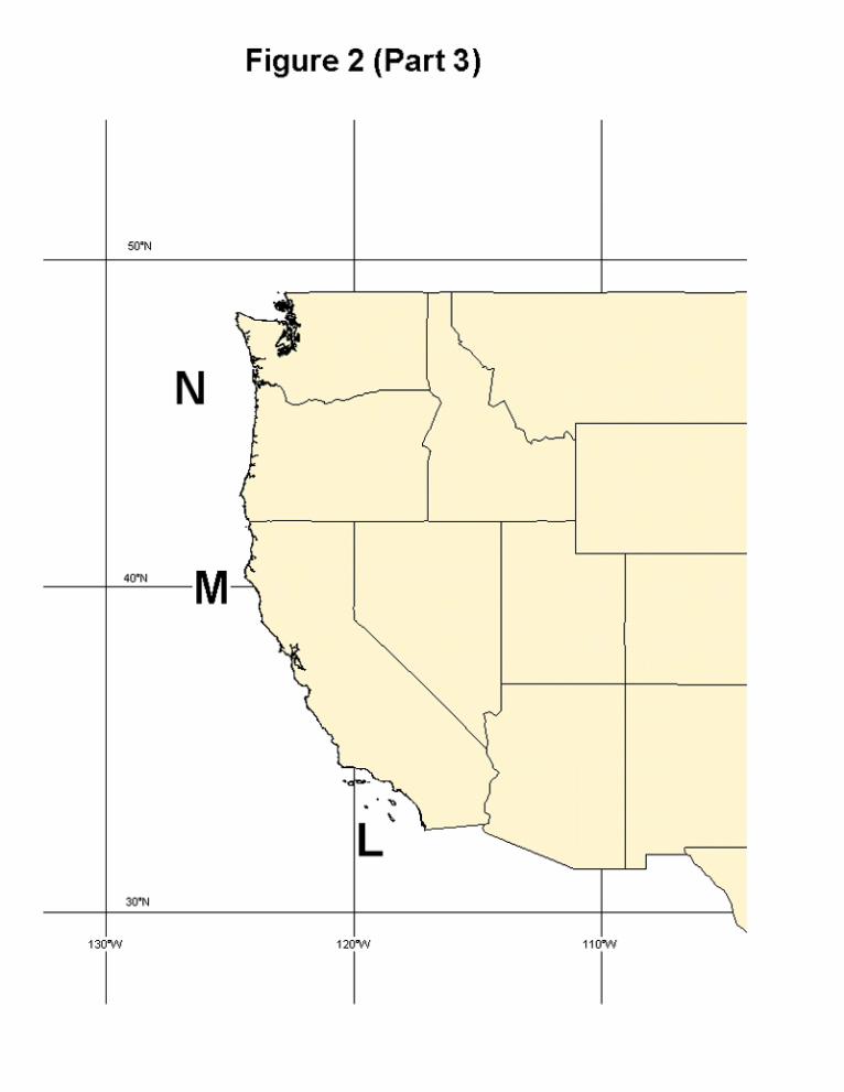
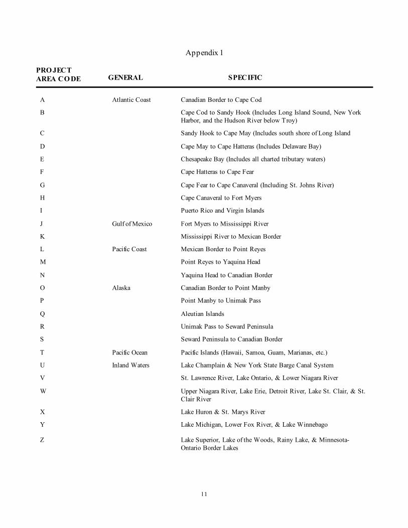
AREA: A single capital letter designating a particular geographic zone will appear in this field. These letters areused to assign project numbers (e.g. OPR-B118-MI-85) See figure1 and 2 (part 1 & 2).
CARTOCODE: This 3-digit cartographic code with leading zero identifies the characteristic of the item. Alist of the carto codes used in AWOIS is contained in appendix 2.
SNDINGCODE: This is essentially a cartographic code (appendix 2) which indicates the units; i.e., feet,fathoms, or meters in which the least depth over the feature has been determined.
DEPTH: Actual least depth or wire drag cleared depth over a feature that has been determined byhydrographic or wire drag survey methods. This depth will not be a reported or unverified depth. Thesedepths originate primarily from National Ocean Service (NOS) hydrographic surveys.
2. Geographic Position Fields: The geographic position represents the most accurate position availablefound in documents at NOS. Other positions in the History memo field are for reference purposes only and willhave generally been superseded by the Header Record position. Users should be aware that the AWOISposition may not agree with a charted position for a similar feature. Most of these differences are minor anddue to the fact that the paper chart cannot always show a location as accurately as a digital list. Other moresignificant differences are generally due to a time lag in updating either the chart or AWOIS..
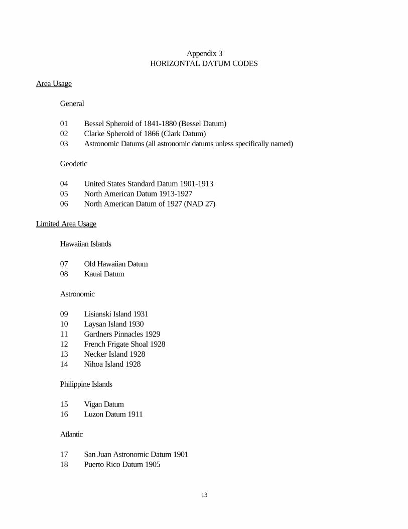
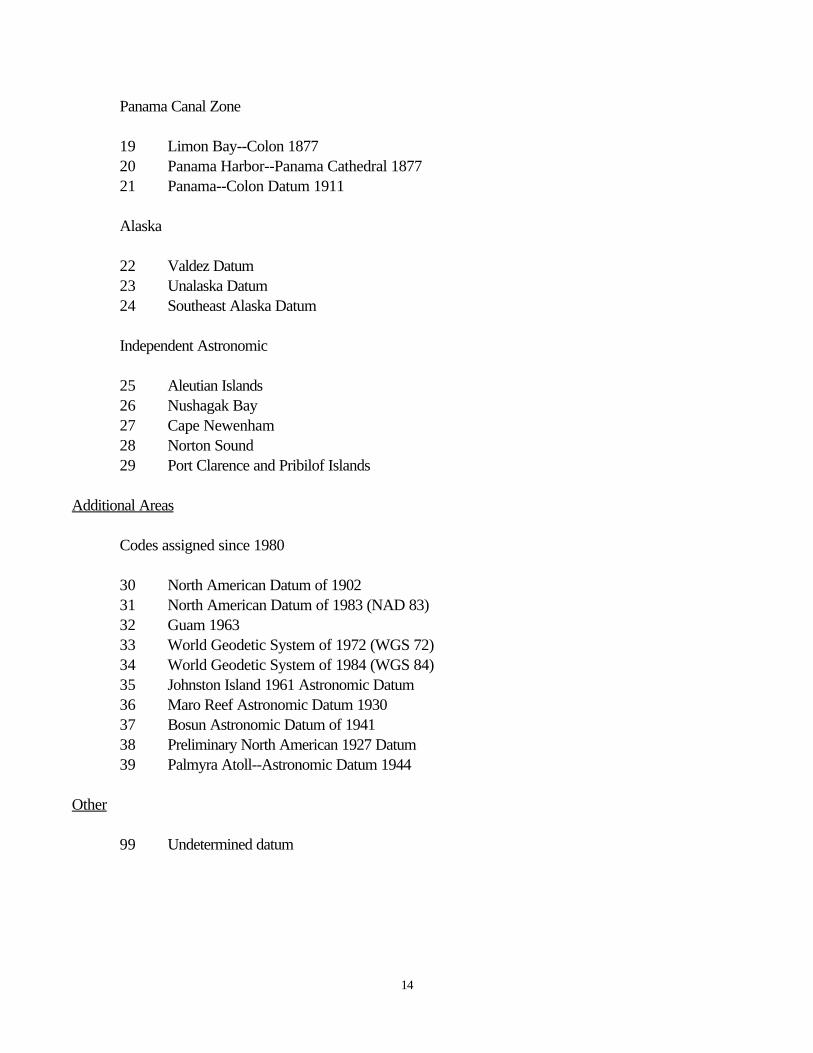
NATIVDATUM: This two-digit code refers to a specific horizontal datum (See appendix 3). The code willreference the original datum for source of the best known position of the item.
LAT83 and LONG83: This is the best available geographic position and reference position for the AWOISitem. It will always be in the NAD 83 datum. As with the NATIVDATUM fields, the position is to beentered into the fields with a space delimiter between degrees, minutes, and seconds with provision forrecording tenths and hundredths of seconds. Place a leading zero in the longitude degree block for east coast,gulf coast, and Great Lakes positions. This is particularly important here as the "Update GP" function (seebelow) will not function properly with only two numbers entered for longitude degrees.
LATDEC: and LONGDEC: Decimal degrees created from the LAT83 and LONG83 fields.. This featureallows the AWOIS item to be plotted directly into GIS systems such as MapInfo, however a leading minus ("-") sign must be generated for the longitude column with the GIS. In MapInfo, add the leading "-" while usingthe "create points" feature.
GPQUALITY: Contains a drop down selection list for the relative position quality of the position shown in thefields LAT83 and LONG83. The position quality is to be categorized as follows:
High: A high quality position originating from a survey source or whenever there is a high level of confidencethat the wreck or obstruction may be relocated without unreasonable difficulty. Although most positions in thiscategory originate with NOS surveys, other sources may qualify. In evaluating these other positions, it isessential that the originating authority have the capability to do high quality work. Authorities such as the U.S.Army Corps of Engineers and private surveyors are selected examples. It is also important that the position be
6
appropriately reported. Survey field sheets or written documentation that clearly states that the position is ofgood quality should be available. As a general rule, it has been found that positions expressed without partialseconds may be classified with a lower quality accuracy code.
Med: A probable high quality position such as that originating with a survey but lacking supportingdocumentation or a lower quality survey position obtained by such means as see-field-sheet techniques. Positions originating from non-agency sources may also be in this category if the location is tightly controlled byadjacent features such as pier lines or fixed aids to navigation. A report that the wreck or obstruction has beenactually located by the Coast Guard or Corps of Engineers will usually qualify a position for this category. Insome cases, the item may be charted with an approximate position (PA) notation.
Low: A position of questionable or unverified quality. Most reports from Local Notice to Mariners and privateobservers are of this type. If the reported position is expressed as a GP or range and bearing from anidentifiable fixed feature and is near shore relative to the position fixing method, it will probably be included inthis category. If the position fixing method is unknown, it is assumed to be visual. The nautical chart shouldindicate an approximate position (PA) for this item.
Poor: A position of doubtful quality usually referenced to some general shoreline feature or portion of shoreline. The nautical chart may indicate an approximate position (PA) or a position doubtful (PD) for this item.
GPSOURCE: Contains a drop down selection list indicating the method in which the position was derivedfrom the source document. The two selections available are as follows:
Scaled: Scaled from a hard copy or from a digital (vector / raster) image.
Direct: Transcribed directly as reported in the source document.
3. History Field: This memo field contains information which is a byproduct of the NOS nautical chart revision system. Some ofthe entries in this category (e.g., USPS chart letters or USCG LMN's) are unverified and may be unreliable. Codes used here are restricted to document file numbers and designator. Common codes include hydrographicsurvey registry numbers (e.g., H-9872/79), shoreline manuscript registry numbers (e.g., TP-00278), andmiscellaneous document numbers (e.g., CL980/76 and BP100234). The format for entry may be seen on theexample shown on the cover page or on figure 1.
4. Reference Field:
This memo field will contain the code of various publications that describes the AWOIS item (see appendix 4for a list of references). Copyright information will be not be included in database subsets or printoutssent to the general public.
7
5. Miscellaneous Fields:
YEARSUNK: If known, enter the year in which the vessel was sunk.
SYSTEMNUM: An internal system number to the database, not generally a concern to the database user.
INQUIRIES
For questions concerning the AWOIS database e-mail: [email protected]


11
Appendix 1
PRO JECTAREA CO DE GENERAL SPECIFIC
A Atlantic Coast Canadian Border to Cape Cod
B Cape Cod to Sandy Hook (Includes Long Island Sound, New YorkHarbor, and the Hudson River below Troy)
C Sandy Hook to Cape May (Includes south shore of Long Island
D Cape May to Cape Hatteras (Includes Delaware Bay)
E Chesapeake Bay (Includes all charted tributary waters)
F Cape Hatteras to Cape Fear
G Cape Fear to Cape Canaveral (Including St. Johns River)
H Cape Canaveral to Fort Myers
I Puerto Rico and Virgin Islands
J Gulf of Mexico Fort Myers to Mississippi River
K Mississippi River to Mexican Border
L Pacific Coast Mexican Border to Point Reyes
M Point Reyes to Yaquina Head
N Yaquina Head to Canadian Border
O Alaska Canadian Border to Point Manby
P Point Manby to Unimak Pass
Q Aleutian Islands
R Unimak Pass to Seward Peninsula
S Seward Peninsula to Canadian Border
T Pacific Ocean Pacific Islands (Hawaii, Samoa, Guam, Marianas, etc.)
U Inland Waters Lake Champlain & New York State Barge Canal System
V St. Lawrence River, Lake Ontario, & Lower Niagara River
W Upper Niagara River, Lake Erie, Detroit River, Lake St. Clair, & St.Clair River
X Lake Huron & St. Marys River
Y Lake Michigan, Lower Fox River, & Lake Winnebago
Z Lake Superior, Lake of the Woods, Rainy Lake, & Minnesota-Ontario Border Lakes

1
Appendix 2 AWOIS CART0 CODES
CODE SYMBOL DESCRIPTION
Wrecks
098
100
A
.:+.. .
Visible
Submerged, dangerous to surface navigation
102 & Submerged, nondangerous
085
284
067
094
104
127
130
711
370
372
0
0
. . . : :
*
+
u
U
Obstructions
Visible at high water
Covers/uncovers (awash)
Submerged
Rocks
Awash
Covered at low water
Soundinas
Feet and tenths
Fathoms and tenths
Meters and tenths
Wire-drag clearance, feet
Wire-drag clearance, fathoms
13
Appendix 3HORIZONTAL DATUM CODES
Area Usage
General
01 Bessel Spheroid of 1841-1880 (Bessel Datum)02 Clarke Spheroid of 1866 (Clark Datum)03 Astronomic Datums (all astronomic datums unless specifically named)
Geodetic
04 United States Standard Datum 1901-191305 North American Datum 1913-192706 North American Datum of 1927 (NAD 27)
Limited Area Usage
Hawaiian Islands
07 Old Hawaiian Datum08 Kauai Datum
Astronomic
09 Lisianski Island 193110 Laysan Island 193011 Gardners Pinnacles 192912 French Frigate Shoal 192813 Necker Island 192814 Nihoa Island 1928
Philippine Islands
15 Vigan Datum16 Luzon Datum 1911
Atlantic
17 San Juan Astronomic Datum 190118 Puerto Rico Datum 1905
14
Panama Canal Zone
19 Limon Bay--Colon 187720 Panama Harbor--Panama Cathedral 187721 Panama--Colon Datum 1911
Alaska
22 Valdez Datum23 Unalaska Datum24 Southeast Alaska Datum
Independent Astronomic
25 Aleutian Islands26 Nushagak Bay27 Cape Newenham28 Norton Sound29 Port Clarence and Pribilof Islands
Additional Areas
Codes assigned since 1980
30 North American Datum of 190231 North American Datum of 1983 (NAD 83)32 Guam 196333 World Geodetic System of 1972 (WGS 72)34 World Geodetic System of 1984 (WGS 84)35 Johnston Island 1961 Astronomic Datum36 Maro Reef Astronomic Datum 193037 Bosun Astronomic Datum of 194138 Preliminary North American 1927 Datum39 Palmyra Atoll--Astronomic Datum 1944
Other
99 Undetermined datum
15
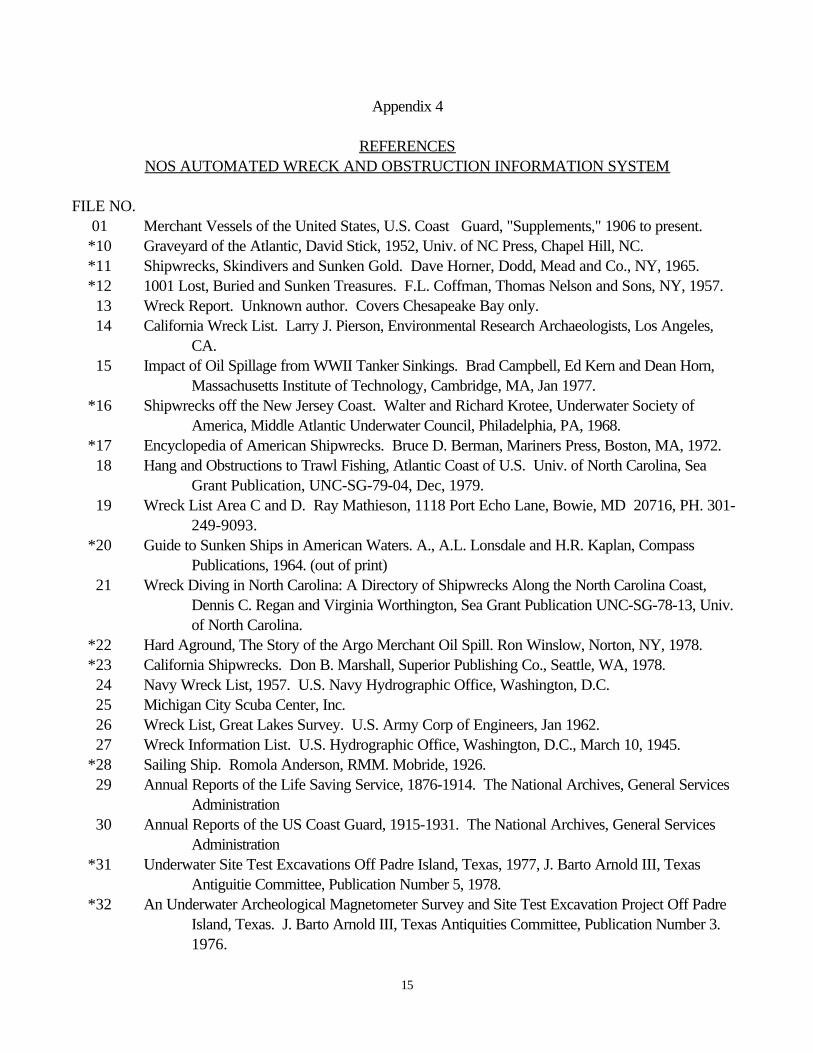
Appendix 4
REFERENCESNOS AUTOMATED WRECK AND OBSTRUCTION INFORMATION SYSTEM
FILE NO. 01 Merchant Vessels of the United States, U.S. Coast Guard, "Supplements," 1906 to present. *10 Graveyard of the Atlantic, David Stick, 1952, Univ. of NC Press, Chapel Hill, NC. *11 Shipwrecks, Skindivers and Sunken Gold. Dave Horner, Dodd, Mead and Co., NY, 1965. *12 1001 Lost, Buried and Sunken Treasures. F.L. Coffman, Thomas Nelson and Sons, NY, 1957.
13 Wreck Report. Unknown author. Covers Chesapeake Bay only.14 California Wreck List. Larry J. Pierson, Environmental Research Archaeologists, Los Angeles,
CA.15 Impact of Oil Spillage from WWII Tanker Sinkings. Brad Campbell, Ed Kern and Dean Horn,
Massachusetts Institute of Technology, Cambridge, MA, Jan 1977. *16 Shipwrecks off the New Jersey Coast. Walter and Richard Krotee, Underwater Society of
America, Middle Atlantic Underwater Council, Philadelphia, PA, 1968. *17 Encyclopedia of American Shipwrecks. Bruce D. Berman, Mariners Press, Boston, MA, 1972.
18 Hang and Obstructions to Trawl Fishing, Atlantic Coast of U.S. Univ. of North Carolina, SeaGrant Publication, UNC-SG-79-04, Dec, 1979.
19 Wreck List Area C and D. Ray Mathieson, 1118 Port Echo Lane, Bowie, MD 20716, PH. 301-249-9093.
*20 Guide to Sunken Ships in American Waters. A., A.L. Lonsdale and H.R. Kaplan, CompassPublications, 1964. (out of print)
21 Wreck Diving in North Carolina: A Directory of Shipwrecks Along the North Carolina Coast,Dennis C. Regan and Virginia Worthington, Sea Grant Publication UNC-SG-78-13, Univ.of North Carolina.
*22 Hard Aground, The Story of the Argo Merchant Oil Spill. Ron Winslow, Norton, NY, 1978. *23 California Shipwrecks. Don B. Marshall, Superior Publishing Co., Seattle, WA, 1978.
24 Navy Wreck List, 1957. U.S. Navy Hydrographic Office, Washington, D.C.25 Michigan City Scuba Center, Inc.26 Wreck List, Great Lakes Survey. U.S. Army Corp of Engineers, Jan 1962.27 Wreck Information List. U.S. Hydrographic Office, Washington, D.C., March 10, 1945.
*28 Sailing Ship. Romola Anderson, RMM. Mobride, 1926.29 Annual Reports of the Life Saving Service, 1876-1914. The National Archives, General Services
Administration30 Annual Reports of the US Coast Guard, 1915-1931. The National Archives, General Services
Administration *31 Underwater Site Test Excavations Off Padre Island, Texas, 1977, J. Barto Arnold III, Texas
Antiguitie Committee, Publication Number 5, 1978. *32 An Underwater Archeological Magnetometer Survey and Site Test Excavation Project Off Padre
Island, Texas. J. Barto Arnold III, Texas Antiquities Committee, Publication Number 3.1976.

16
*33 Down To The Sea In Ships. Irwin Anthony, Penn Publishing Co., Philadelphia, PA, 1925. *34 Atlas of Treasure Maps. F.L. Coffman, Thomas Nelson and Sons, NY, 1957.
35 National Archeology of Padre Island, The. J. Barto Arnold III, Texas Antiquities Committee,Publication Number 7. 1978. LC No. HF392 P14 A74. National Archives and RecordsService, GSA. Civil Archives Division, Legislative, Judicial and Fiscal Branch, Washington, D.C. 20408. Records of Shipwrecks 1875- 1940; Will make limitedsearches if name, date, and place provided. National Archives and Records Service,Reference Report: Information about records and printed sources containing data aboutshipwrecks, covers annual reports of the U.S. Coast Guard; the Lytle List; US MerchantMarine; Wreck Report of the Great Lakes 1886-1891; wreck info of New England, middle Atlantic coast Florida and Pacific areas; and casualty reports for various years.
36 Fort Jefferson National Monument, Florida: Shipwreck Study--The Dry Tortugas. Washington,Eastern Service Center, Office of History and Historic Architecture, 1971.
*37 Art of Shipwreck Research, The. Bruce D. Berman, Mariners Press, Boston, MA, 1976. *38 Great Gales and Dire Disasters. E.R. Snow, Yankee Publishing Co., Boston, MA. *39 Diving for Pleasure and Treasure. Clay Blair, World Publishing Co., 2231 W. 110th St.,
Cleveland, OH 44102, 1960. *40 Illustrated Encyclopedia of Ships, Boats, Etc. Graham Blackburn, LC No. HVM 25B5., 1978. *41 Shipwrecks of the Lakes. Captain D. T. Bowen, Freshwater Press, Cleveland, OH, 1952. *42 Memories of The Lakes. Captain D. T. Bowen, Daytona Beach, FL, 1946. *43 Lore Of The Lakes. Captain D. T. Bowen. *44 Great Stories of The Great Lakes. Dwight Boyer, Dodd, Mead and Co., NY, 1966. *45 Strange Adventures of The Great Lakes. Dwight Boyer, Dodd, Mead, NY, 1974. *46 Blockade Running During the Civil War. Frances B.C. Bradlee, The Essex Institute, Salem, MA,
1925. *47 Marine Salvage Operations. Edward M. Brady, 1960.
48 Buffalo and Erie County Historical Society, Nottingham Court, Buffalo, NY 14216. *49 Sinkings, Salvages and Shipwrecks. Robert Forrest Burgess, American Heritage Press, LC No.
G525 B868, 1970.50 Japanese Naval and Merchant Losses During WWII by All Causes (NAVEXOSP-468).51 U.S. Losses - Director, Fleet Operations52 COMNAVPAC53 COMNAVFE54 DETROIT Historical Museum, The. 5401 Woodward Avenue, Detroit, MI 48202.55 Lloyds56 Imperial Japanese Navy in WWII, The.57 U.S. Navy at War, 1941-194558 German, Japanese, and Italian Submarine Losses in WWII59 Swedish Merchant Losses, 1914-192060 American Ship Casualties of WWI61 Tenth Fleet Records (OP-374)62 Naval Losses of All Nations, 9/03/39--8/15/4563 Italian Naval and Merchant Losses, WWII
17
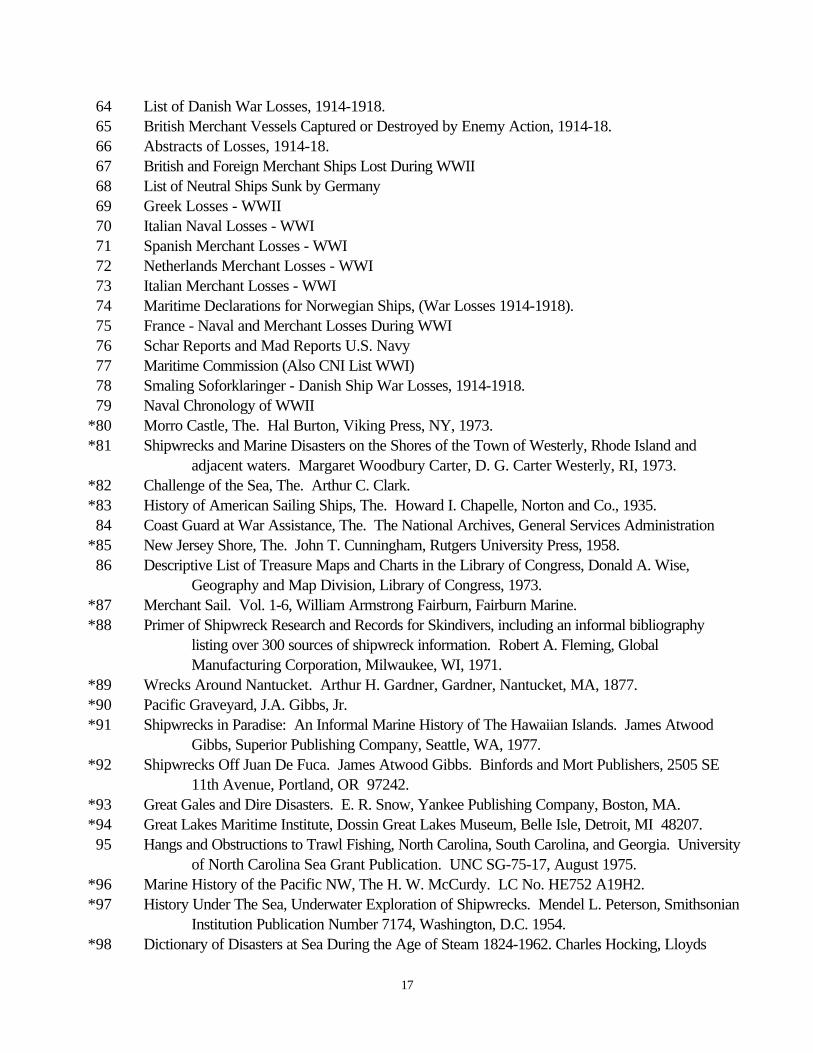
64 List of Danish War Losses, 1914-1918.65 British Merchant Vessels Captured or Destroyed by Enemy Action, 1914-18.
66 Abstracts of Losses, 1914-18.67 British and Foreign Merchant Ships Lost During WWII68 List of Neutral Ships Sunk by Germany69 Greek Losses - WWII70 Italian Naval Losses - WWI71 Spanish Merchant Losses - WWI72 Netherlands Merchant Losses - WWI73 Italian Merchant Losses - WWI74 Maritime Declarations for Norwegian Ships, (War Losses 1914-1918).75 France - Naval and Merchant Losses During WWI76 Schar Reports and Mad Reports U.S. Navy77 Maritime Commission (Also CNI List WWI)78 Smaling Soforklaringer - Danish Ship War Losses, 1914-1918.79 Naval Chronology of WWII
*80 Morro Castle, The. Hal Burton, Viking Press, NY, 1973. *81 Shipwrecks and Marine Disasters on the Shores of the Town of Westerly, Rhode Island and
adjacent waters. Margaret Woodbury Carter, D. G. Carter Westerly, RI, 1973. *82 Challenge of the Sea, The. Arthur C. Clark. *83 History of American Sailing Ships, The. Howard I. Chapelle, Norton and Co., 1935.
84 Coast Guard at War Assistance, The. The National Archives, General Services Administration *85 New Jersey Shore, The. John T. Cunningham, Rutgers University Press, 1958.
86 Descriptive List of Treasure Maps and Charts in the Library of Congress, Donald A. Wise,Geography and Map Division, Library of Congress, 1973.
*87 Merchant Sail. Vol. 1-6, William Armstrong Fairburn, Fairburn Marine. *88 Primer of Shipwreck Research and Records for Skindivers, including an informal bibliography
listing over 300 sources of shipwreck information. Robert A. Fleming, GlobalManufacturing Corporation, Milwaukee, WI, 1971.
*89 Wrecks Around Nantucket. Arthur H. Gardner, Gardner, Nantucket, MA, 1877. *90 Pacific Graveyard, J.A. Gibbs, Jr. *91 Shipwrecks in Paradise: An Informal Marine History of The Hawaiian Islands. James Atwood
Gibbs, Superior Publishing Company, Seattle, WA, 1977. *92 Shipwrecks Off Juan De Fuca. James Atwood Gibbs. Binfords and Mort Publishers, 2505 SE
11th Avenue, Portland, OR 97242. *93 Great Gales and Dire Disasters. E. R. Snow, Yankee Publishing Company, Boston, MA. *94 Great Lakes Maritime Institute, Dossin Great Lakes Museum, Belle Isle, Detroit, MI 48207.
95 Hangs and Obstructions to Trawl Fishing, North Carolina, South Carolina, and Georgia. Universityof North Carolina Sea Grant Publication. UNC SG-75-17, August 1975.
*96 Marine History of the Pacific NW, The H. W. McCurdy. LC No. HE752 A19H2. *97 History Under The Sea, Underwater Exploration of Shipwrecks. Mendel L. Peterson, Smithsonian
Institution Publication Number 7174, Washington, D.C. 1954. *98 Dictionary of Disasters at Sea During the Age of Steam 1824-1962. Charles Hocking, Lloyds
18
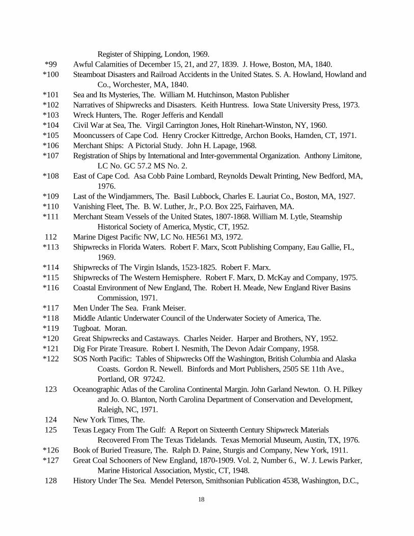
Register of Shipping, London, 1969. *99 Awful Calamities of December 15, 21, and 27, 1839. J. Howe, Boston, MA, 1840. *100 Steamboat Disasters and Railroad Accidents in the United States. S. A. Howland, Howland and
Co., Worchester, MA, 1840. *101 Sea and Its Mysteries, The. William M. Hutchinson, Maston Publisher *102 Narratives of Shipwrecks and Disasters. Keith Huntress. Iowa State University Press, 1973. *103 Wreck Hunters, The. Roger Jefferis and Kendall *104 Civil War at Sea, The. Virgil Carrington Jones, Holt Rinehart-Winston, NY, 1960. *105 Mooncussers of Cape Cod. Henry Crocker Kittredge, Archon Books, Hamden, CT, 1971. *106 Merchant Ships: A Pictorial Study. John H. Lapage, 1968. *107 Registration of Ships by International and Inter-governmental Organization. Anthony Limitone,
LC No. GC 57.2 MS No. 2. *108 East of Cape Cod. Asa Cobb Paine Lombard, Reynolds Dewalt Printing, New Bedford, MA,
1976. *109 Last of the Windjammers, The. Basil Lubbock, Charles E. Lauriat Co., Boston, MA, 1927. *110 Vanishing Fleet, The. B. W. Luther, Jr., P.O. Box 225, Fairhaven, MA. *111 Merchant Steam Vessels of the United States, 1807-1868. William M. Lytle, Steamship
Historical Society of America, Mystic, CT, 1952. 112 Marine Digest Pacific NW, LC No. HE561 M3, 1972. *113 Shipwrecks in Florida Waters. Robert F. Marx, Scott Publishing Company, Eau Gallie, FL,
1969. *114 Shipwrecks of The Virgin Islands, 1523-1825. Robert F. Marx. *115 Shipwrecks of The Western Hemisphere. Robert F. Marx, D. McKay and Company, 1975. *116 Coastal Environment of New England, The. Robert H. Meade, New England River Basins
Commission, 1971. *117 Men Under The Sea. Frank Meiser. *118 Middle Atlantic Underwater Council of the Underwater Society of America, The. *119 Tugboat. Moran. *120 Great Shipwrecks and Castaways. Charles Neider. Harper and Brothers, NY, 1952. *121 Dig For Pirate Treasure. Robert I. Nesmith, The Devon Adair Company, 1958. *122 SOS North Pacific: Tables of Shipwrecks Off the Washington, British Columbia and Alaska
Coasts. Gordon R. Newell. Binfords and Mort Publishers, 2505 SE 11th Ave.,Portland, OR 97242.
123 Oceanographic Atlas of the Carolina Continental Margin. John Garland Newton. O. H. Pilkeyand Jo. O. Blanton, North Carolina Department of Conservation and Development,Raleigh, NC, 1971.
124 New York Times, The. 125 Texas Legacy From The Gulf: A Report on Sixteenth Century Shipwreck Materials
Recovered From The Texas Tidelands. Texas Memorial Museum, Austin, TX, 1976. *126 Book of Buried Treasure, The. Ralph D. Paine, Sturgis and Company, New York, 1911. *127 Great Coal Schooners of New England, 1870-1909. Vol. 2, Number 6., W. J. Lewis Parker,
Marine Historical Association, Mystic, CT, 1948. 128 History Under The Sea. Mendel Peterson, Smithsonian Publication 4538, Washington, D.C.,
19
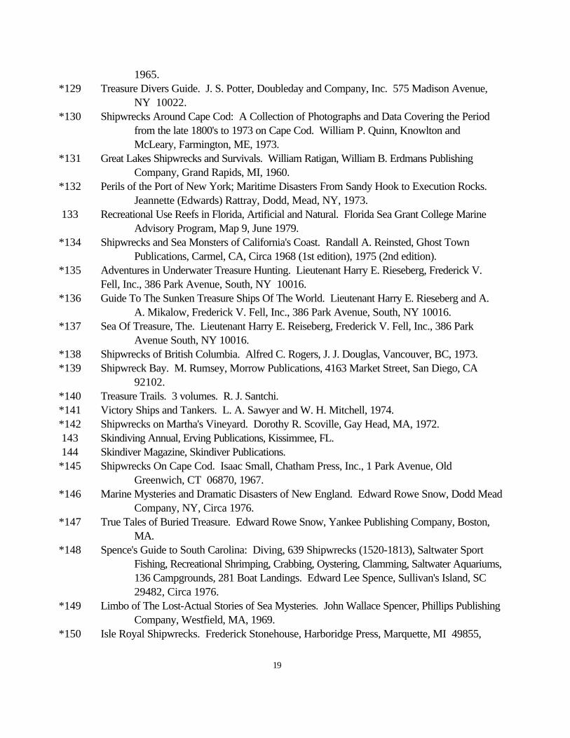
1965. *129 Treasure Divers Guide. J. S. Potter, Doubleday and Company, Inc. 575 Madison Avenue,
NY 10022. *130 Shipwrecks Around Cape Cod: A Collection of Photographs and Data Covering the Period
from the late 1800's to 1973 on Cape Cod. William P. Quinn, Knowlton andMcLeary, Farmington, ME, 1973.
*131 Great Lakes Shipwrecks and Survivals. William Ratigan, William B. Erdmans PublishingCompany, Grand Rapids, MI, 1960.
*132 Perils of the Port of New York; Maritime Disasters From Sandy Hook to Execution Rocks. Jeannette (Edwards) Rattray, Dodd, Mead, NY, 1973.
133 Recreational Use Reefs in Florida, Artificial and Natural. Florida Sea Grant College MarineAdvisory Program, Map 9, June 1979.
*134 Shipwrecks and Sea Monsters of California's Coast. Randall A. Reinsted, Ghost TownPublications, Carmel, CA, Circa 1968 (1st edition), 1975 (2nd edition).
*135 Adventures in Underwater Treasure Hunting. Lieutenant Harry E. Rieseberg, Frederick V.Fell, Inc., 386 Park Avenue, South, NY 10016.
*136 Guide To The Sunken Treasure Ships Of The World. Lieutenant Harry E. Rieseberg and A.A. Mikalow, Frederick V. Fell, Inc., 386 Park Avenue, South, NY 10016.
*137 Sea Of Treasure, The. Lieutenant Harry E. Reiseberg, Frederick V. Fell, Inc., 386 ParkAvenue South, NY 10016.
*138 Shipwrecks of British Columbia. Alfred C. Rogers, J. J. Douglas, Vancouver, BC, 1973. *139 Shipwreck Bay. M. Rumsey, Morrow Publications, 4163 Market Street, San Diego, CA
92102. *140 Treasure Trails. 3 volumes. R. J. Santchi. *141 Victory Ships and Tankers. L. A. Sawyer and W. H. Mitchell, 1974. *142 Shipwrecks on Martha's Vineyard. Dorothy R. Scoville, Gay Head, MA, 1972. 143 Skindiving Annual, Erving Publications, Kissimmee, FL. 144 Skindiver Magazine, Skindiver Publications. *145 Shipwrecks On Cape Cod. Isaac Small, Chatham Press, Inc., 1 Park Avenue, Old
Greenwich, CT 06870, 1967. *146 Marine Mysteries and Dramatic Disasters of New England. Edward Rowe Snow, Dodd Mead
Company, NY, Circa 1976. *147 True Tales of Buried Treasure. Edward Rowe Snow, Yankee Publishing Company, Boston,
MA. *148 Spence's Guide to South Carolina: Diving, 639 Shipwrecks (1520-1813), Saltwater Sport
Fishing, Recreational Shrimping, Crabbing, Oystering, Clamming, Saltwater Aquariums,136 Campgrounds, 281 Boat Landings. Edward Lee Spence, Sullivan's Island, SC29482, Circa 1976.
*149 Limbo of The Lost-Actual Stories of Sea Mysteries. John Wallace Spencer, Phillips PublishingCompany, Westfield, MA, 1969.
*150 Isle Royal Shipwrecks. Frederick Stonehouse, Harboridge Press, Marquette, MI 49855,
20
1974. 151 Burton Historical Collection, The. Detroit Public Library, 5201 Woodward Avenue, Detroit,
MI 48202. *153 Interesting and Authentic Narratives Of The Most Remarkable Shipwrecks, Fires, Famines,
Calamities, Providential Deliverence and Lamentable Disasters on The Seas in MostParts of The World. R. Thomas and A. M. Thomas, Books for Libraries Press,Freeport, NY, 1970.
*154 Shipwreck and Archeology. P. Throckmorton, The Atlantic Press, Little Brown andCompany, 34 Beacon Street, Boston, MA 02106.
155 Principal Marine Disasters, 1831-1932. U.S. Coast Guard, Public Information Division,Washington, D.C.
156 U.S. Merchant Ship Losses December 7, 1942 Through August 14, 1945. U.S. Coast Guard,Public Information Division, Washington, D.C.
157 Wreck Chart of The North Atlantic Coast of America. U.S. Hydrographic Office, Bureau ofNavigation, Washington, D.C.
158 U.S. Life Saving Service Annual Reports, Washington, D.C., Government Printing Office,1872-1914.
159 U.S. Merchant Marine, 1789-1963, The. U.S. Naval Institute Proceedings. 160 U.S. Navy Diving Manual 161 U.S. Revenue Cutter Service Annual Reports, 1912-13. Washington, D.C., Government
Printing Office. 162 U.S. Steamboat Inspection Service Annual Reports, 1871- 1934. Washington, D.C.,
Government Printing Office. 163 Wreck and Casualty Chart of the Great Lakes. U.S. Weather Bureau, Department of
Agriculture, Washington, D.C., 1895. 164 Wreck Chart Of The Great Lakes. U.S. Weather Bureau, Department of Agriculture,
Washington, D.C., 1886-1891. *165 Pirate Treasure. H. T. Wilkens. 166 U.S. Coast Guard In WWII, The. M. F. Willoughby, U.S. Naval Institute, Annapolis, MD,
1957. *167 Lake Michigan Shipwrecks, Map Of (2 parts). Midwest Explorers League, Paul W.
Ackerman, 3641 N. Marshfield Avenue, Chicago, IL 60613. *168 Lake Superior Dive Chart. Midwest Explorers League. Paul W. Ackerman, 3641 N.
Marshfield Avenue, Chicago, IL 60613. *169 Great Ship Disasters. Adolf A. Hoehling, Cowles Book Company, NY, 1971. *170 Shipwrecks Of The Pacific Coast. J.A. Gibbs, Jr. A complete account of all wrecks, 50 tons
and over. *171 Secrets Of The North Atlantic Islands. Edward Rowe Snow, Yankee Publishing Company,
Boston, MA. *172 Pirates and Buccaneers Of The North Atlantic Coast. Edward Rowe Snow, Yankee
Publishing Company, Boston, MA.
21
*174 Unharvested Sea, The. P. Throckmorton, The Atlantic Press. Little Brown and Company, 34Beacon Street, Boston, MA. 02106.
*175 Panorama Of Treasure Hunting. H. T. Wilkens. *176 Modern Treasure Hunter, A. H. T. Wilkens. 177 Navy Wreck List, 1954. U.S. Navy Hydrographic Office, Washington, D.C. 178 Wreck List, Private. Anthony J Vraim, 66 Southstate Road, P.O. Box 93, Upper Darby, PA
19082, PH. 21449- 7770. 179 Navy Wreck List, DMAHTC, Washington, D.C., 1975. 180 Dictionary of American Naval Fighting Ships, Naval History Division, Department of The
Navy, Washington, D.C. 181 Thunder Bay Shipwreck Survey Report, The. Thomas D. Warner and Dr. Donald F. Holecek,
Michigan State University. *182 Primer of Shipwreck Research and Records For Skin Divers, A. Robert M. Fleming, Global
Manufacturing Corporation. 183 Bottom Obstructions In The Southwestern North Atlantic, Gulf of Mexico and Caribbean Sea.
G. Michael Russel, Abraham J. Barrett, L. Steve Sarbeck and John H. Wordlaw,NOAA Technical Report NMFS SSRF-715, Superintendent of Documents,Government Printing Office, Washington, D.C., 1977.
184 Bottom Fishing Obstructions, Texas, Louisiana and Gulf. G. L. Graham, Texas A&MUniversity. Sea Grant Publication TAMU-SG-76-506, Updated Version TAMU-SG81-501, November 1980.
185 Archeological Survey, An Evaluation Of The Proposed Offshore Disposal Site For TheNorfolk Harbor and Channels, Steadfast Marine Inc., 6269 Leesburg Pike, FallsChurch, VA 22044.
186 Wreck List, NUMA, Inc. *187 Scuba Northeast. Robert G. Bachand. Rowe Publications, 3906 N. 69th St., Milwaukee, WI
53216, 1982. 188 Navy Wreck List, DMAHTC, Washington, D.C., 1982. 189 California Place Names. Erwin G. Guddle, University of California Press, Berkeley, 1960. *190 Shipwrecks On The Chesapeake, Maritime Disasters On Chesapeake Bay and Its Tributaries,
1608-1978. Donald G. Shomette Cornell Maritime Press, P.O. Box 456, Centreville,MD 21617, (301)758-1075.
*191 Wrecks and Rescues Of The Great Lakes, James P. Barry 1981. 192 British Wreck File. *193 Miscellaneous information from sources requesting copyright status. *194 Yachtsman's Guide to The Bahamas (Edition No. 31, 1981) 195 Miscellaneous information (e.g., Loran-C rates) from non-copyrighted sources. 196 The Historical Maritime Group of New England, P.O. Box 351, Cataumet, MA 02534. *197 Shipwrecks of South Carolina and Georgia (Volume I and II), E. Lee Spence, Sea Research
Society, P.O. Drawer V, Sullivan's Island, SC 29482, 1984. *198 Axis Submarine Successes 1939-1945. Jurgen Rohwer, U.S. Naval Institute, Annapolis, MD,
22
1983. *199 Shipwrecks--Diving the Graveyard of the Atlantic, Roderick M. Farb, Menasha Ridge Press,
Hilleborough, NC, 1985. 200 Wreck List, Carroll Scuba, Ed Suarez, Jr. 2027 Suffolk Road, Suite 4, Finksburg, MD
21048. Phone 301-965 6432 (W) or 301-381-6799 (H). 201 Wreck List, Jim Cummings, 200 Kane Court, Joppa, MD 21085, 1983. 202 AWOIS Research Report, Aransas Pass, TX. Prepared by LCDR David Peterson, NOAA,
during OPR-K120-WH-85, October-December 1985, Martin R. Mulhern,Commanding Officer (Ref: Survey H-10205/85).
*203 Shipwrecks of New Jersey. Gary Gentile, Sea Sports Publications, Box 647, Belden Station,Norwalk, CT 06852, 1988.
204 Sourcebook of Alaskan Shipwrecks: 1786-1932, compiled by Dale Stirling, Heritage NorthPublications in History No. 1, May 1984 (Revised May 1988).
*205 Fishing Connecticut Waters. Tim Coleman, Two Denison Avenue, Mystic, CT 06355, 1988. 206 Fisherman, The., The New England Edition, Two Denison Avenue, P.O. Box 211, Mystic, CT
06355. 207 Wreck List. Terry Helmers, Volunteer Diver for Biscayne National Park, FL, 5788 SW 54
Terrace, Miami, FL 33155. *208 In Search of Shipwrecks. Jim Jenney, A. S. Barnes and Company, Inc., Cranbury, NJ 08512,
1980. *209 A Guide to Shipwreck Sites Along the Oregon Coast Via US 101. R.E. Wells and Victor C.
West, Wells and West Publishers, 1166 Winsor, North Bend, OR 97459, 1984. *210 Fishable Wrecks and Rockpiles. Tim Coleman and Charley Soares, MT Publications, Two
Denison Avenue, Mystic, CT 06355, 1989. *211 Unfinished Voyages, A Chronology of Shipwrecks Maritime, Diasters in the Northeast United
States from 1606 to 1956. John Perry Fish, Lower Cape Publishing, Orleans, MA 02653, 1989.
*212 Track of the Gray Wolf, 1942-1945. Gary Gentile, AVON BOOKS, 105 Madison Avenue,New York, NY 10016, 1989.
*213 Wreck Valley and Wreck Valley Loran - C Coordinate List. Aqua Explorers, Inc., 22 MaidenLane, Lynbrook, NY 11563, 1986.
214 Fisherman, The., Long Island, Metropolitan Edition, 14 Ramsey Road, Shirley, NY 11967. 215 National Fisherman, The., Journal Publications, 120 Tillson Avenue, Suite 201, P.O. Box 908,
Rockland, ME 04841. *216 Shipwrecks of Delaware and Maryland. Gary Gentile, Gary Gentile Productions, P.O. Box
57137, Philadelphia, PA 19111, 1990. 217 Master Hang Log, The. Van Strickler, 1304 White Marlin Lane, Virginia Beach, VA 23464,
1992. 218 "Hangs" and Bottom Obstructions of the Mississippi/ Alabama Gulf. G.L. Grahm, D. Veal, and B.
Hosking. Mississippi-Alabama Sea Grant Consortium, Sea Grant Publication TAMU-SG-83-505, June 1983.

23
*219 Shipwrecks Around New England, William P. Quinn, 1979, The Lower Cape Publishing Co., P.O.Box 901, Orleans, MA, 02653, 1979.
*220 Notebook on Shipwrecks Maryland Delaware Coast, H. Richard Moale, Family LinePublications, Rear 63 East Main Street, Westminster, MD 21157, 1990.
*221 Salvage From the Sea, Gerald Forsberg, Routledge & Kegan Paul, London and Henley, 1977. *222 Explore Wisconsin's Shipwrecks, Kimm Stabelfeldt, Rowe Publications, 3906 N. 69th Street,
Milwaukee, WI 53216, 1981. 223 Report of Wrecks Surveyed by USCG GENTIAN in Fifth Naval District, 1944. *224 Shipwrecks of Broward County, James Dean and Steven Danforth Singer, 1984. 225 USN Gulf Coast Strategic Homeporting, Underwater Archaeological Investigations Gulf
of Mexico and Pensacola Bay, Florida, 1987. 226 Survey of Fishing Vessels Operating at Ocean and Great Lakes Ports of the United States. War Department, 1941. 227 Wreck List, Defense Mapping Agency, Washington, D.C., 1986. *228 Shipwrecks! for State of Washington, Kent Barnard, Argonaut Resources, INC., P.O. Box 743, Mukilteo, WA 98275, 1993. 229 Shipwrecks of the Alaskan Shelf and Shore, Evert E. Tornfelt and Michael Burwell, U.S. Department of the Interior, Minerals Management Service, Alaska OCS Region, Anchorage, Alaska, 1992.
*Indicates documents that are known to be copyrighted and may generally be found in a library.
****Indicates that the document is not indexed in the Description category. These documents aregenerally newspaper articles, short correspondences, telephone conversations, copies from otherpublications, and other information.
24
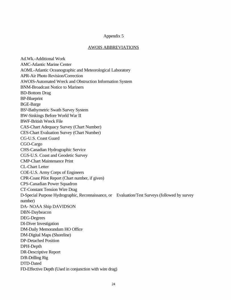
Appendix 5
AWOIS ABBREVIATIONS
Ad.Wk.-Additional WorkAMC-Atlantic Marine CenterAOML-Atlantic Oceanographic and Meteorological LaboratoryAPR-Air Photo Revision/CorrectionAWOIS-Automated Wreck and Obstruction Information SystemBNM-Broadcast Notice to MarinersBD-Bottom DragBP-BlueprintBGE-BargeBS³-Bathymetric Swath Survey SystemBW-Sinkings Before World War IIBWF-British Wreck FileCAS-Chart Adequacy Survey (Chart Number)CES-Chart Evaluation Survey (Chart Number)CG-U.S. Coast GuardCGO-CargoCHS-Canadian Hydrographic ServiceCGS-U.S. Coast and Geodetic SurveyCMP-Chart Maintenance PrintCL-Chart LetterCOE-U.S. Army Corps of EngineersCPR-Coast Pilot Report (Chart number, if given)CPS-Canadian Power SquadronCT-Constant Tension Wire DragD-Special Purpose Hydrographic, Reconnaissance, or Evaluation/Test Surveys (followed by surveynumber)DA- NOAA Ship DAVIDSONDBN-DaybeaconDEG-DegreesDI-Diver InvestigationDM-Daily Memorandum HO OfficeDM-Digital Maps (Shoreline)DP-Detached PositionDPH-DepthDR-Descriptive ReportD/R-Drilling RigDTD-DatedFD-Effective Depth (Used in conjunction with wire drag)
25
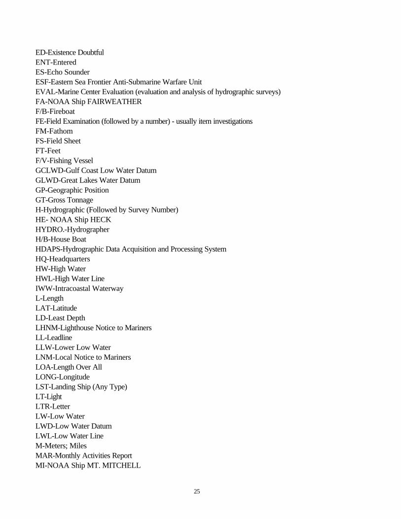
ED-Existence DoubtfulENT-EnteredES-Echo SounderESF-Eastern Sea Frontier Anti-Submarine Warfare UnitEVAL-Marine Center Evaluation (evaluation and analysis of hydrographic surveys)FA-NOAA Ship FAIRWEATHERF/B-FireboatFE-Field Examination (followed by a number) - usually item investigationsFM-FathomFS-Field SheetFT-FeetF/V-Fishing VesselGCLWD-Gulf Coast Low Water DatumGLWD-Great Lakes Water DatumGP-Geographic PositionGT-Gross TonnageH-Hydrographic (Followed by Survey Number)HE- NOAA Ship HECKHYDRO.-HydrographerH/B-House BoatHDAPS-Hydrographic Data Acquisition and Processing SystemHQ-HeadquartersHW-High WaterHWL-High Water LineIWW-Intracoastal WaterwayL-LengthLAT-LatitudeLD-Least DepthLHNM-Lighthouse Notice to MarinersLL-LeadlineLLW-Lower Low WaterLNM-Local Notice to MarinersLOA-Length Over AllLONG-LongitudeLST-Landing Ship (Any Type)LT-LightLTR-LetterLW-Low WaterLWD-Low Water DatumLWL-Low Water LineM-Meters; MilesMAR-Monthly Activities ReportMI-NOAA Ship MT. MITCHELL

26
MIN-Minutes or MinimumMHW-Mean High Water DatumMLW-Mean Low Water DatumMLLW-Mean Lower Low Water DatumM/V-Motor VesselNAD-North American Datum (followed by year)NANCI-New Aeronautical and Nautical Charting InformationNAS-Navigable Area SurveyNAVOCEANO-U.S. Naval Oceanographic OfficeND-HQ-Naval District HeadquartersNM-HO/DMAHC Notice to Mariners; Nautical MilesNMFS-National Marine Fisheries ServiceNMR-Restricted Notice to Mariners, Hydrographic OfficeNORDA-U.S. Naval Ocean Research and Development ActivityNOS-National Ocean ServiceNT-Net TonnageNTH-Notes to HydrographerOBSTR-ObstructionO/B-OutboardOCGR-Old Coast Guard RecordsOPR-Operation (Followed by Project No.)OTEC-Ocean Thermal Energy ConversionPA-Position ApproximateP/C-Pleasure CraftPD-Position DoubtfulPE-NOAA Ship PeircePIDC-Pleasure Island Dive Center (Gulf Shores, AL)PMC-Pacific Marine CenterPMEL-Pacific Marine Environmental LaboratoryPR-Preprocessing ReportPROJ-ProjectPSR-Presurvey Review(Followed by Project No.)QC-Quality Control InspectionRA-NOAA Ship RAINIERRCNWL-Royal Canadian Navy Wreck ListRECON-ReconnaissanceREG NO-Registry Number of SurveyREP-Report or ReportedRS-Revisory Survey (followed by year)R/V-Research VesselREV-Review; Reviewed; Revised; RevisionRU-NOAA Ship RUDES-Special Project (followed by Project Number)
27
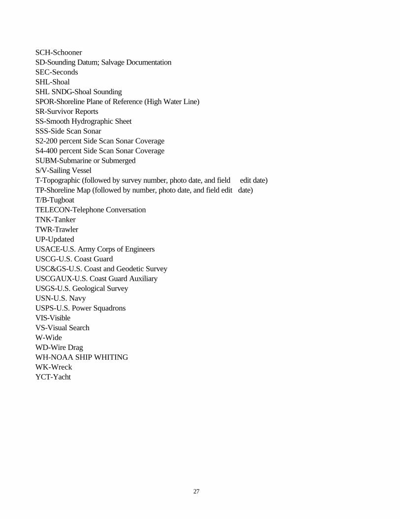
SCH-SchoonerSD-Sounding Datum; Salvage DocumentationSEC-SecondsSHL-ShoalSHL SNDG-Shoal SoundingSPOR-Shoreline Plane of Reference (High Water Line)SR-Survivor ReportsSS-Smooth Hydrographic SheetSSS-Side Scan SonarS2-200 percent Side Scan Sonar CoverageS4-400 percent Side Scan Sonar CoverageSUBM-Submarine or SubmergedS/V-Sailing VesselT-Topographic (followed by survey number, photo date, and field edit date)TP-Shoreline Map (followed by number, photo date, and field edit date)T/B-TugboatTELECON-Telephone ConversationTNK-TankerTWR-TrawlerUP-UpdatedUSACE-U.S. Army Corps of EngineersUSCG-U.S. Coast GuardUSC&GS-U.S. Coast and Geodetic SurveyUSCGAUX-U.S. Coast Guard AuxiliaryUSGS-U.S. Geological SurveyUSN-U.S. NavyUSPS-U.S. Power SquadronsVIS-VisibleVS-Visual SearchW-WideWD-Wire DragWH-NOAA SHIP WHITINGWK-WreckYCT-Yacht
28
Release of National Ocean Service (NOS)Automated Wreck and Obstruction System (AWOIS) Data
DISCLAIMER
The software used to enter, store, and retrieve data from the AWOIS was developed and implementedfor use by NOS under controlled conditions of software maintenance, input data quality, processingconfigurations, and output data utilization. NOS makes no warranties, expressed or implied, concerning theaccuracy, completeness, reliability, or suitability for any particular purpose of the data contained in orgenerated by the AWOIS computer program or furnished in connection therewith. Any use of the associateddata contained in AWOIS must have the sources correctly cited, wherever appropriate. Furthermore, NOSassumes no liability associated with the use of such data and assumes no responsibility to maintain and updatethe data in any manner or means after it is released to the user. Any exceptions to these conditions of releasemust be formally established through negotiated agreements with NOS.
Because the software and associated data were developed, researched, and compiled with U.S.Government funding, no proprietary rights may be attached to them for purposes of sale to the U.S.Government as part of any procurement of ADP products or services.