oases settlements in oman - edition-et.de · al buhsaid dynasty that still reigns today. in the...
TRANSCRIPT
Oases Settlements in Oman

editionesefeld& traub
Humboldtstrasse 6
70178 Stuttgart
Germany
T +49.711.256.81.33
F +49.711.257.21.25
www.edition-et.de
Copyright:
edition esefeld & traub
All rights reserved
Layout:
Johannes Traub
Dr. Manal El-Shahat
Translation:
Dr. Samir Anwar
Samia Mousa
Print:
REMAprint, Vienna
ISBN 978-3-9809887-3-5
1st edition 2008
Oases Settlements in Oman
Edited by Anette Gangler
11
Introduction
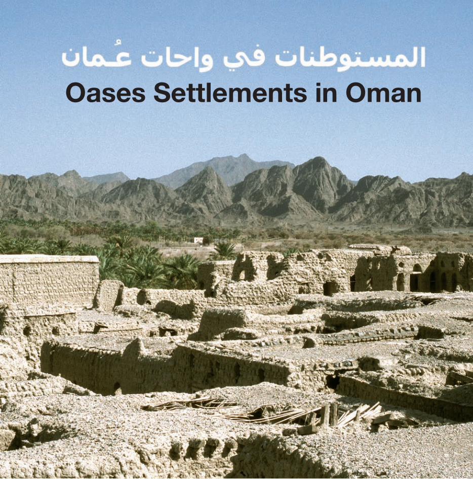
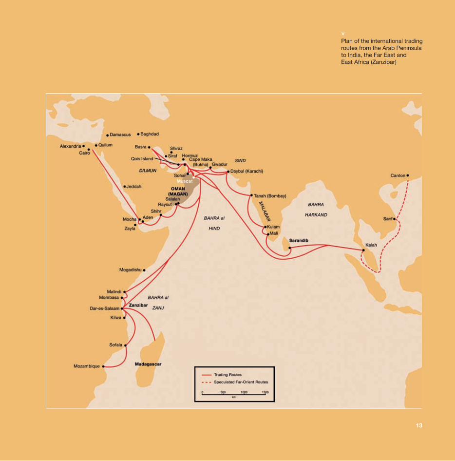
The Sultanate of Oman occupies most of the southeastern area of the Arab Peninsula and was first mentioned in cuneiform writings as »Magan, the Land of Copper« in the third millennium B.C. As a result of its geo-political location, this region has repeatedly played a significant role in international trade relations throughout the course of history. Seafaring, fishing, cattle breeding and agriculture formed the basis of this civilization’s existence until oil and gas fields were discovered.
Nature determined a tri-partition of the country into the north, a desert area south of it and the south. The north is the heart of the country. It is divided into a coastal zone of differing width, a mountainous area and an arid interior.Northern Oman is characterized by the highest elevation on the Arab Peninsula, i.e. the mountain range Jabal Akhdar, reaching a height of nearly 3,000 meters. The designation »Jabal Akhdar«, i.e. the »green mountain«, is attributed to the abundance of water that is available in this region and that has rendered possible the development of a complex irrigation system and the oasis-based culture thus evolving. Countless fortresses and settlements bear witness to a history of settlement activity going back as far as the third millennium B.C. For a long time, Oman was subjected to Perso-Iranian influence and its coastline was thus of significance to Persian maritime trade. As a result of its strategically favorable location, power interests also extended to inner Omani regions in the first millennium B.C. Being protected by the mountains, settlements evolved on the southeastern flank of the Jabel Akhdar that were taken over by Arabian tribes
from Yemen in pre-Islamic times. These settlements enjoyed an economic boom throughout the course of the Arabian conquest in the 6th and 7th centuries A.D. Not only the ports, but also the inner Omani towns began to gain significance. Historical centers such as Nizwa formed the political, cultural, religious and economic focal point of the country for centuries. Being once again subjected to a stronger influence of Persian power, coastal towns developed into significant trading centers in the 13th century. Upon the discovery of the ocean route to India via Vasco da Gama in the 16th century, the Portuguese occupied the eastern coast of Africa and the Omani ports. Inner Omani tribes cried out for the need to resist Portugal as a colonial power and, in 1650 during the reign of the Ya’arubah dynasty, the complete expulsion of the Portuguese was accompanied by Omani expansion to eastern Africa (Zanzibar). Flourishing maritime trade gave rise to new prosperity that also extended to inner Omani regions. The Ya’arubah imams promoted agriculture by investing in the construction of new »aflaj« (water canals), planting numerous date palms and extending defensive structures.Internal struggles for power led to the end of the Ya’arubah dynasty, thus paving the way for accession to power by theAl Buhsaid dynasty that still reigns today. In the middle of the 18th century, Muscat became the capital of Oman and Omani trade policy reached its peak. It was not until the end of the 19th century that Omani territories in parts of eastern Africa had to be relinquished in the face of the growing influence of the colonial powers. In the 70s, Oman was caught up in the oil boom and, within but a brief period, cultural, social and economic changes took place and a modern development began.
12
13
Plan of the international tradingroutes from the Arab Peninsula to India, the Far East and East Africa (Zanzibar)
<
22
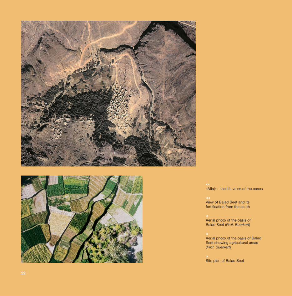
<<»Aflaj« – the life veins of the oases
<<View of Balad Seet and its fortification from the south
<Aerial photo of the oasis of Balad Seet (Prof. Buerkert)
<Aerial photo of the oasis of BaladSeet showing agricultural areas(Prof. Buerkert)
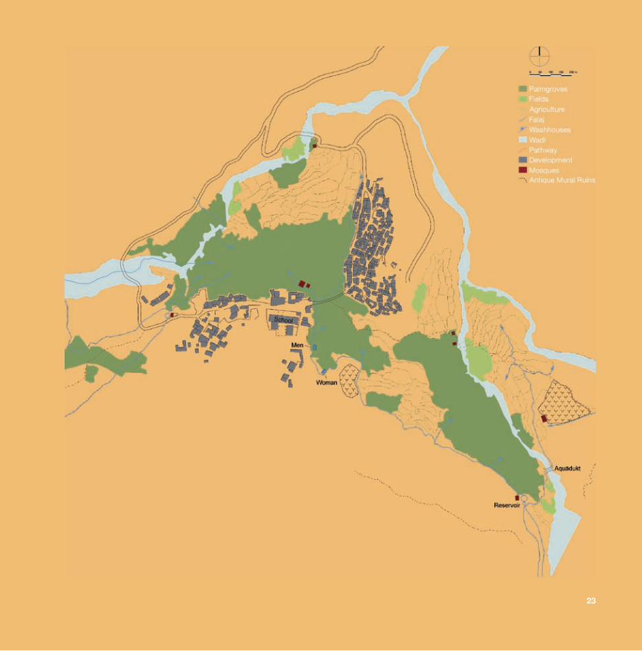
>Site plan of Balad Seet
23
34
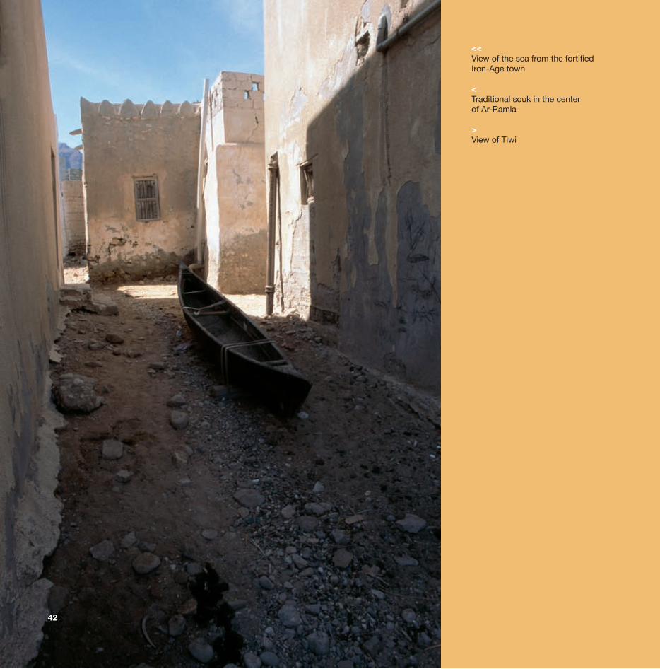
<<View of the sea from the fortifiedIron-Age town
<Traditional souk in the center of Ar-Ramla
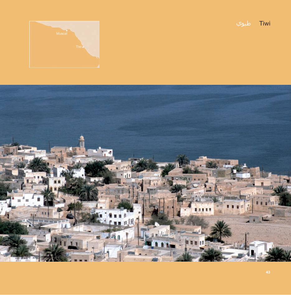
>View of Tiwi
42
34
43
Tiwi
44
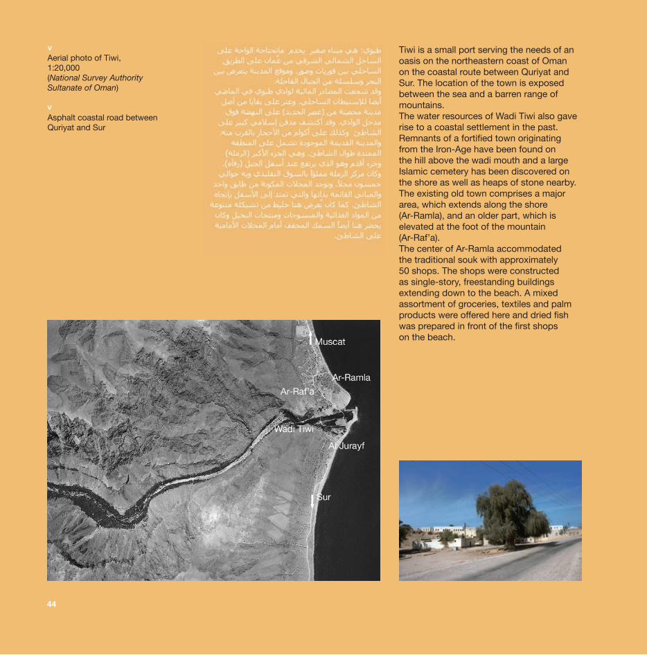
Tiwi is a small port serving the needs of an oasis on the northeastern coast of Oman on the coastal route between Quriyat and Sur. The location of the town is exposed between the sea and a barren range of mountains.The water resources of Wadi Tiwi also gave rise to a coastal settlement in the past. Remnants of a fortified town originating from the Iron-Age have been found on the hill above the wadi mouth and a largeIslamic cemetery has been discovered on the shore as well as heaps of stone nearby. The existing old town comprises a major area, which extends along the shore (Ar-Ramla), and an older part, which is elevated at the foot of the mountain (Ar-Raf’a). The center of Ar-Ramla accommodated the traditional souk with approximately 50 shops. The shops were constructed as single-story, freestanding buildings extending down to the beach. A mixed assortment of groceries, textiles and palm products were offered here and dried fish was prepared in front of the first shops on the beach.
Aerial photo of Tiwi, 1:20,000(National Survey Authority Sultanate of Oman)
Asphalt coastal road between Quriyat and Sur
<<
45
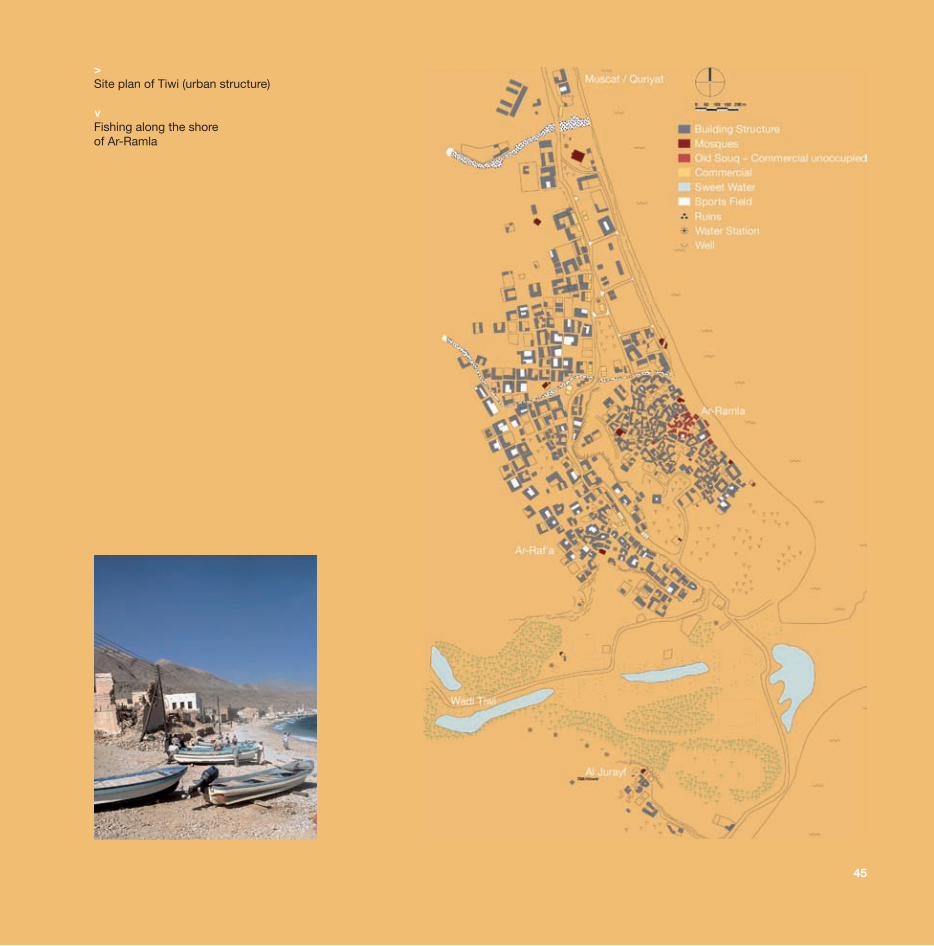
>Site plan of Tiwi (urban structure)
Fishing along the shoreof Ar-Ramla
<
54
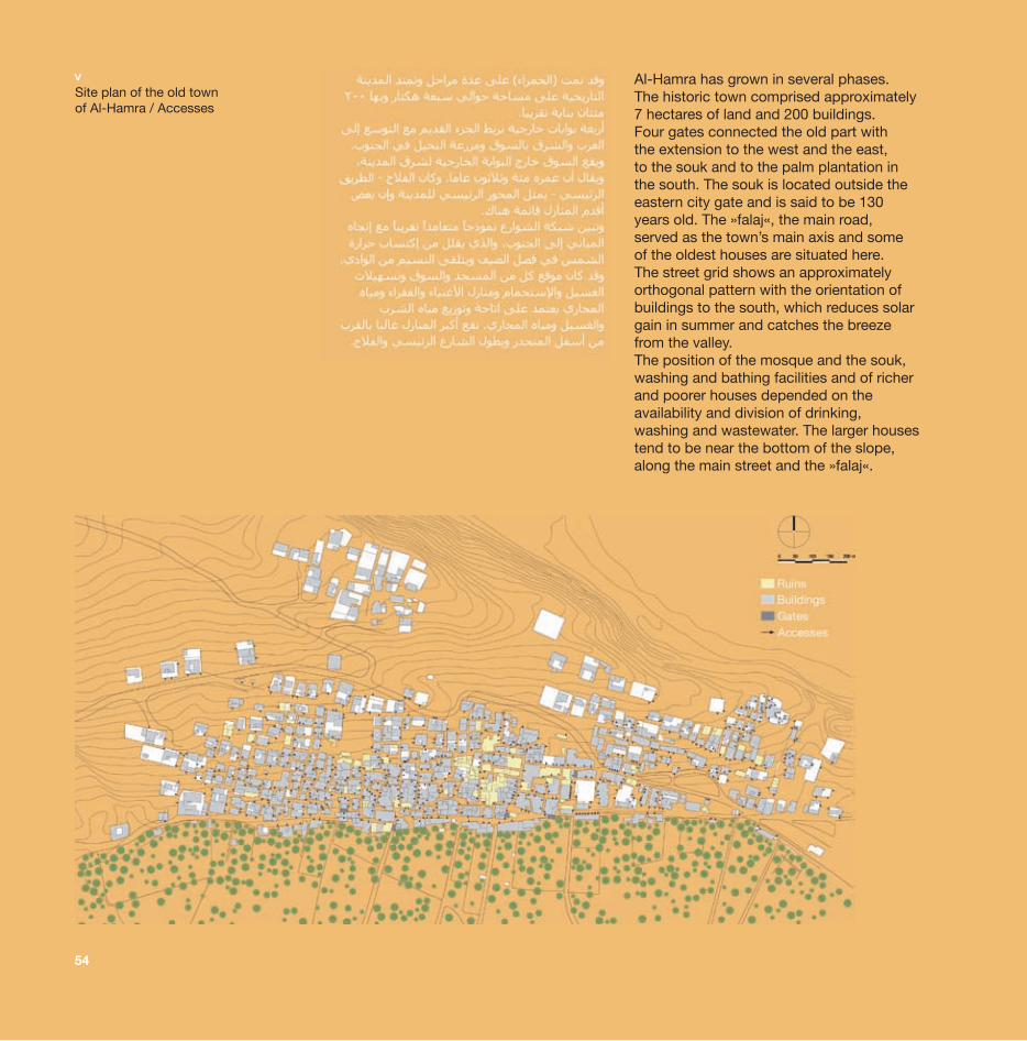
Al-Hamra has grown in several phases. The historic town comprised approximately 7 hectares of land and 200 buildings. Four gates connected the old part with the extension to the west and the east, to the souk and to the palm plantation in the south. The souk is located outside the eastern city gate and is said to be 130 years old. The »falaj«, the main road, served as the town’s main axis and some of the oldest houses are situated here. The street grid shows an approximately orthogonal pattern with the orientation of buildings to the south, which reduces solar gain in summer and catches the breeze from the valley.The position of the mosque and the souk, washing and bathing facilities and of richer and poorer houses depended on the availability and division of drinking, washing and wastewater. The larger housestend to be near the bottom of the slope, along the main street and the »falaj«.
Site plan of the old town of Al-Hamra / Accesses
<
55
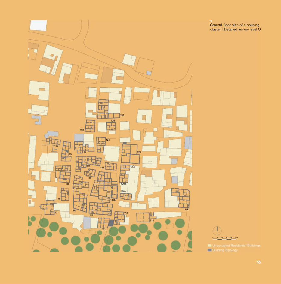
<Ground-floor plan of a housing cluster / Detailed survey level O
56
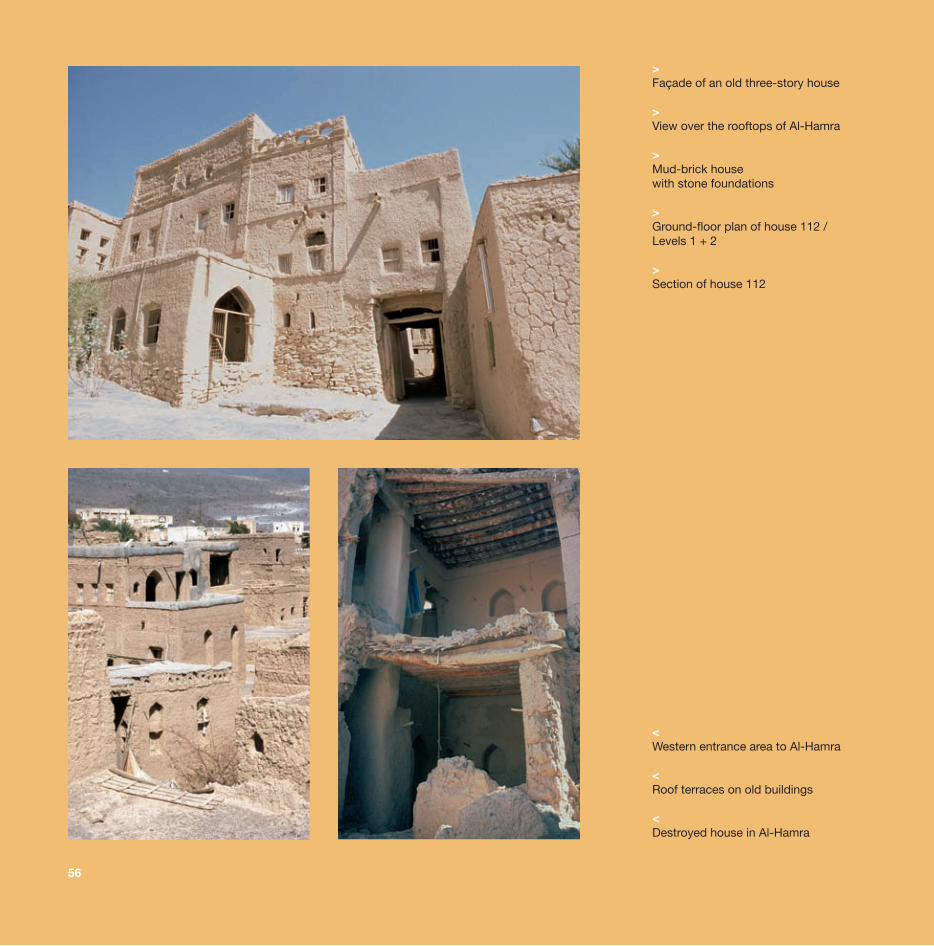
>Façade of an old three-story house
>View over the rooftops of Al-Hamra
>Mud-brick house with stone foundations
>Ground-floor plan of house 112 /Levels 1 + 2
>Section of house 112
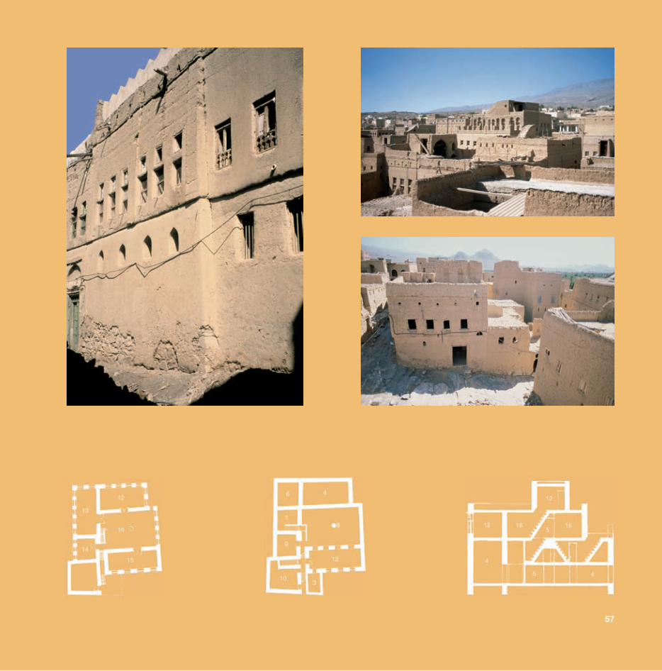
<Western entrance area to Al-Hamra
<Roof terraces on old buildings
<Destroyed house in Al-Hamra
57
58
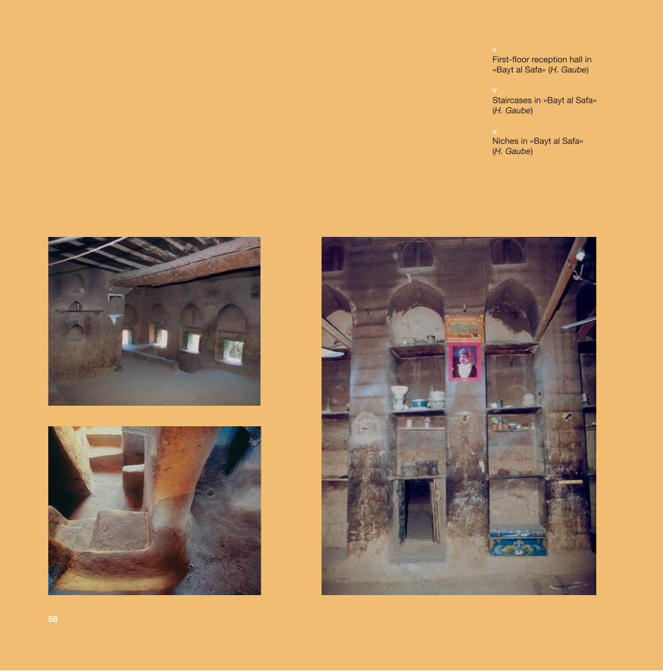
First-floor reception hall in »Bayt al Safa« (H. Gaube)
Staircases in »Bayt al Safa«(H. Gaube)
Niches in »Bayt al Safa« (H. Gaube)
<<
<
77
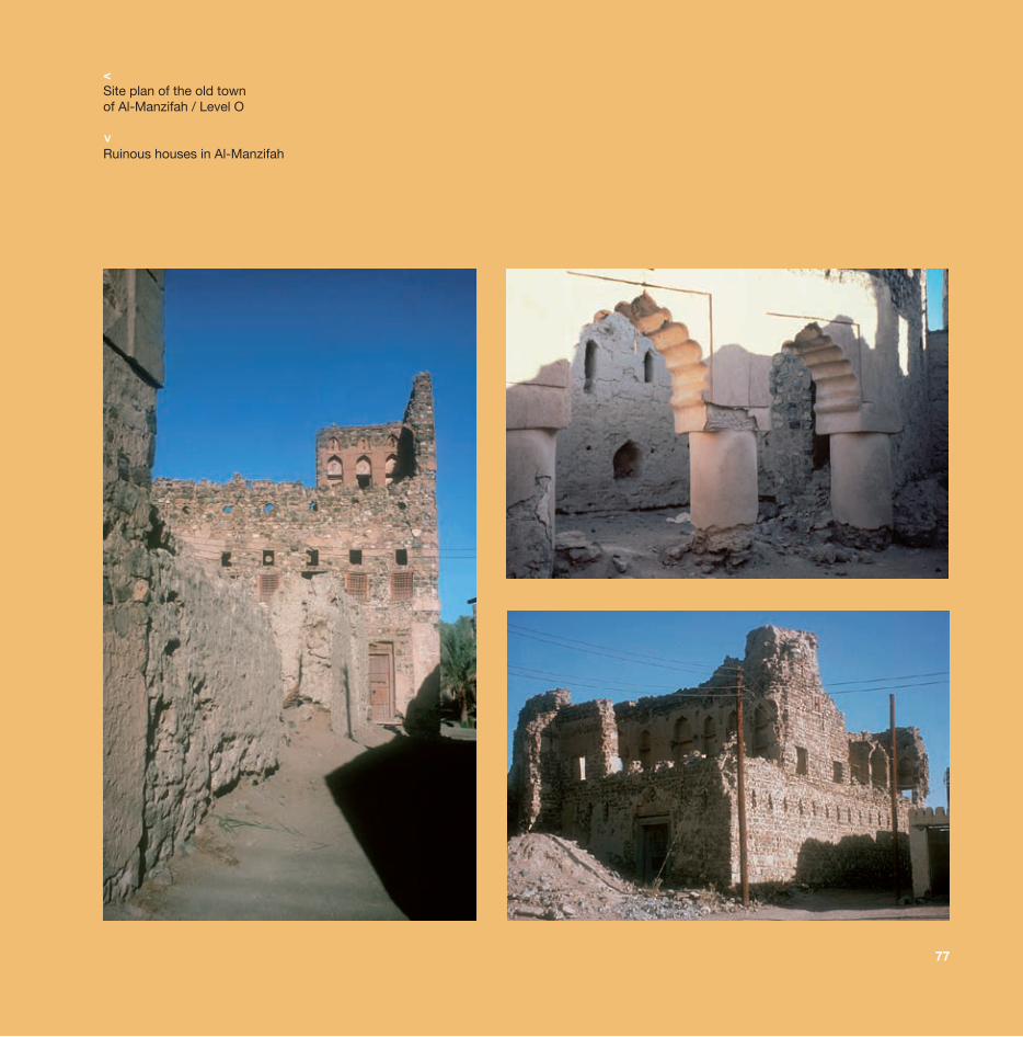
<Site plan of the old town of Al-Manzifah / Level O
Ruinous houses in Al-Manzifah
<
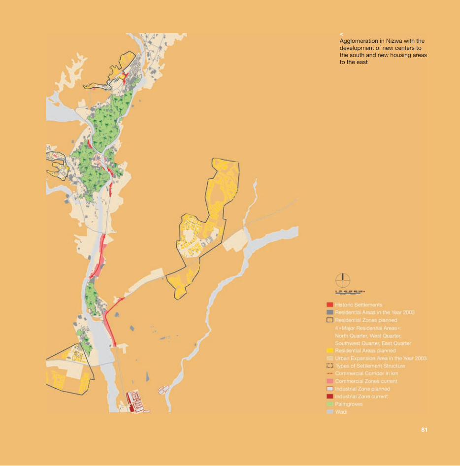
<Agglomeration in Nizwa with thedevelopment of new centers to the south and new housing areasto the east
81
84
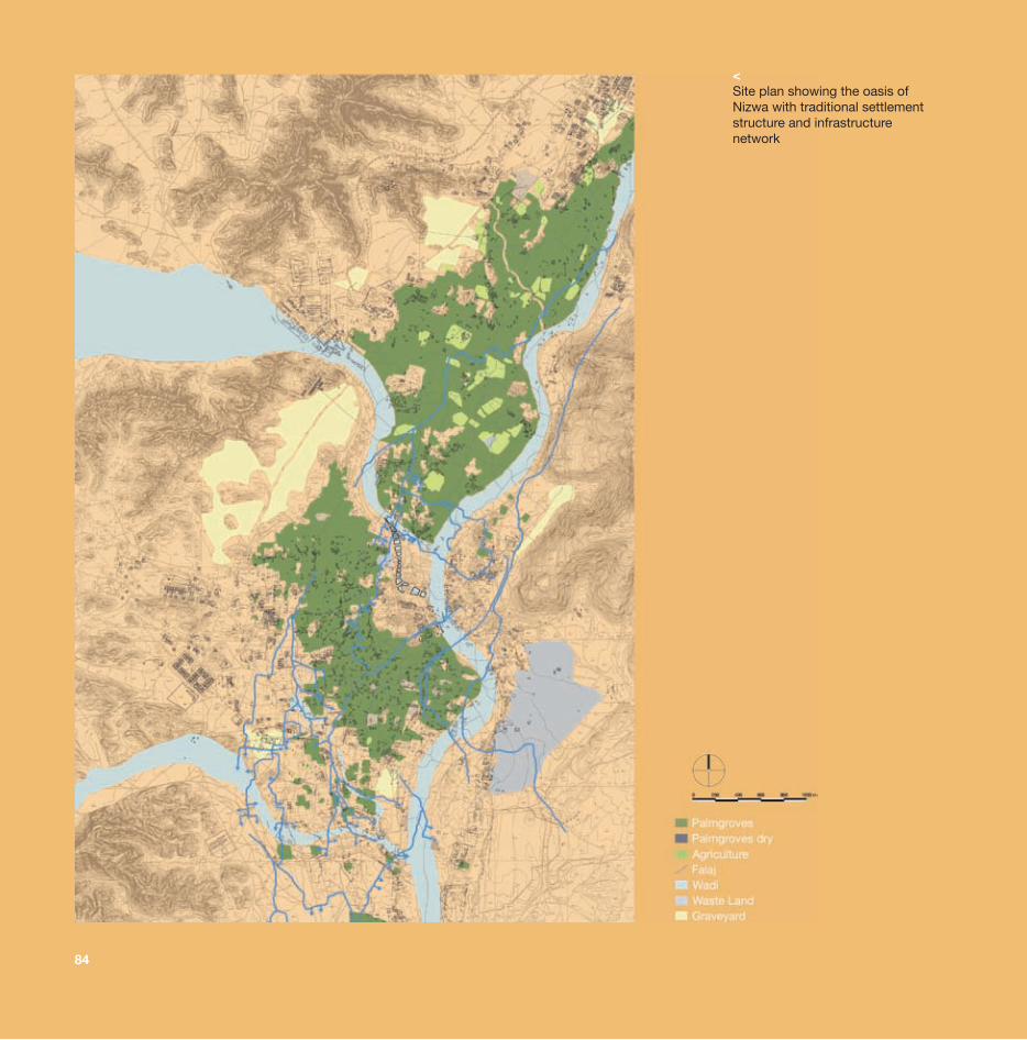
<Site plan showing the oasis of Nizwa with traditional settlementstructure and infrastructure network
85
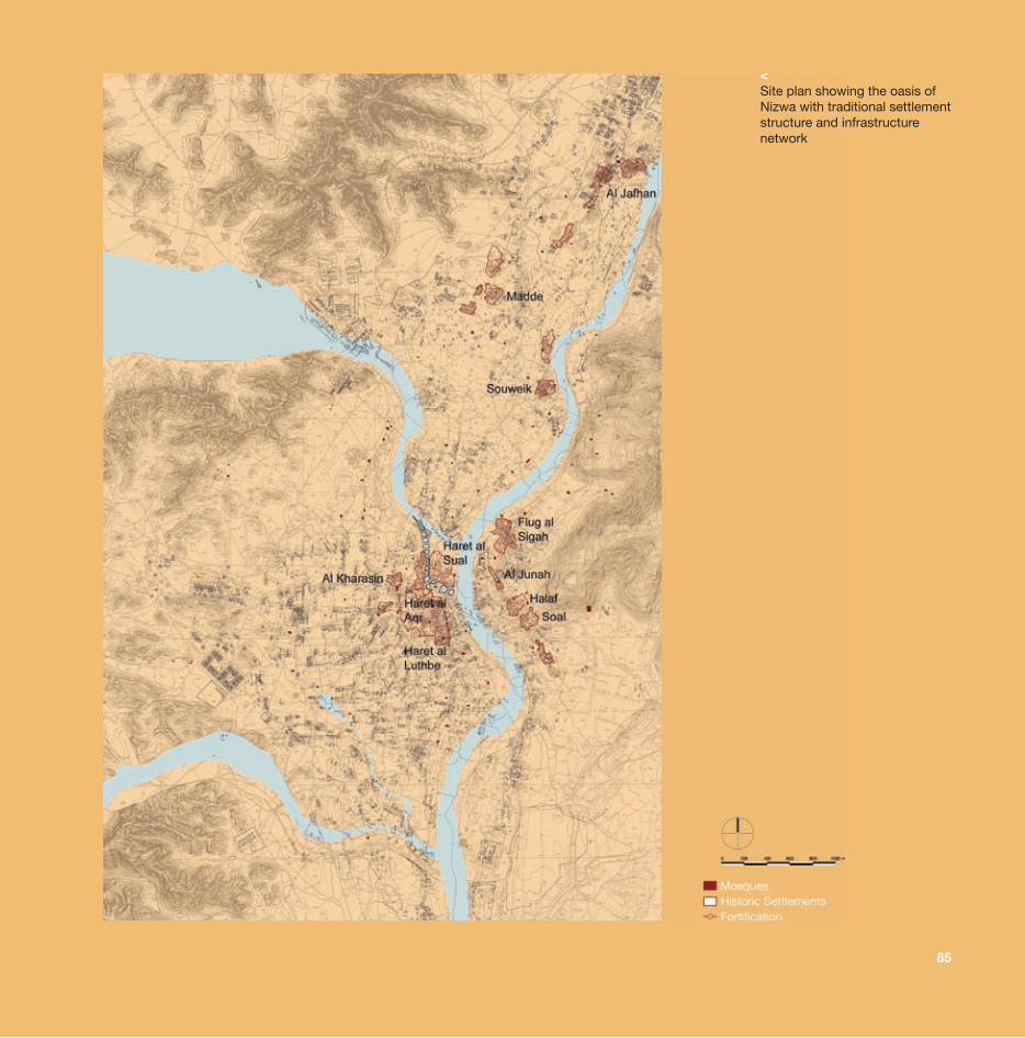
<Site plan showing the oasis of Nizwa with traditional settlementstructure and infrastructure network
88
89
<
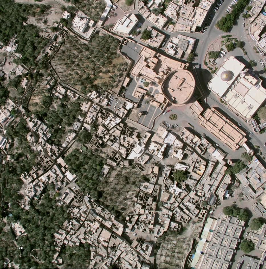
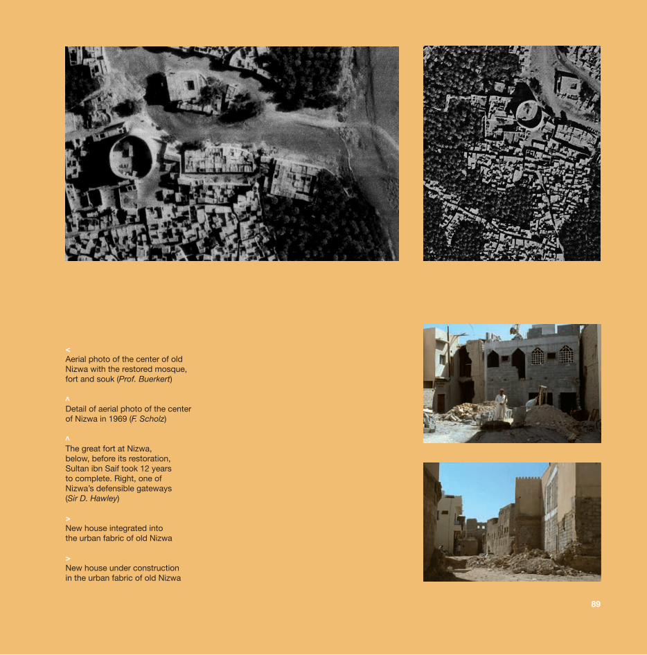
<Aerial photo of the center of old Nizwa with the restored mosque,fort and souk (Prof. Buerkert)
Detail of aerial photo of the center of Nizwa in 1969 (F. Scholz)
The great fort at Nizwa, below, before its restoration, Sultan ibn Saif took 12 years to complete. Right, one of Nizwa’s defensible gateways (Sir D. Hawley)
>New house integrated into the urban fabric of old Nizwa
>New house under construction in the urban fabric of old Nizwa
<
96
>»Omani villas«
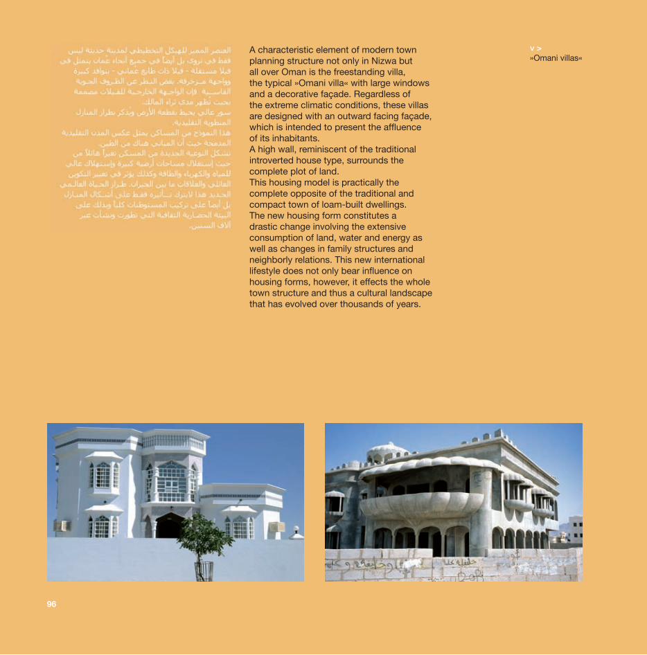
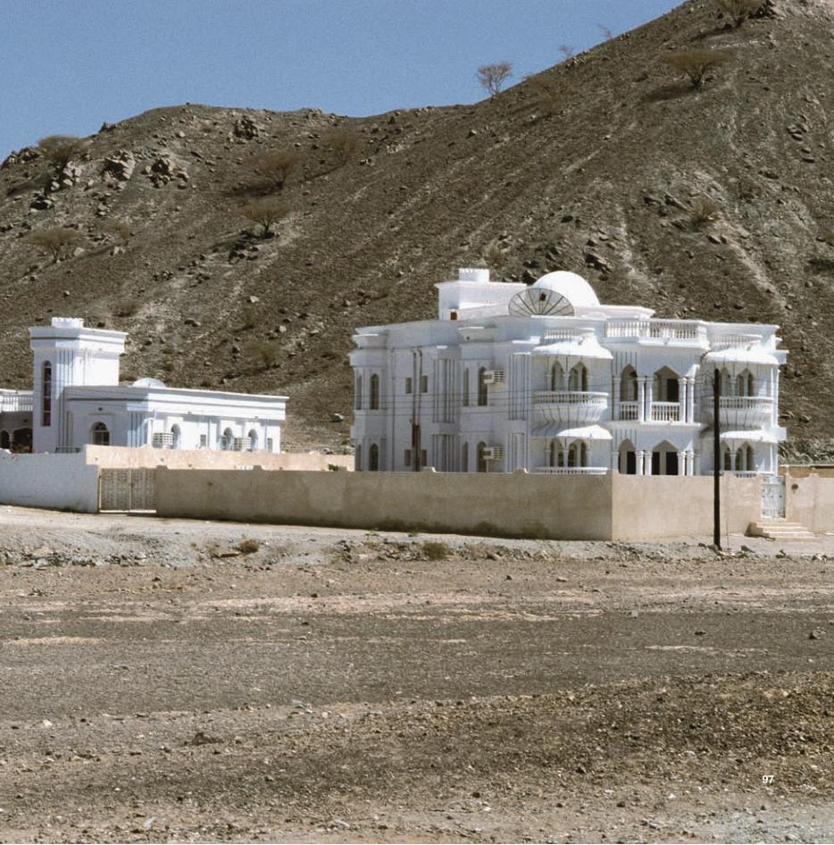
<A characteristic element of modern town planning structure not only in Nizwa but all over Oman is the freestanding villa, the typical »Omani villa« with large windows and a decorative façade. Regardless of the extreme climatic conditions, these villas are designed with an outward facing façade, which is intended to present the affluence of its inhabitants. A high wall, reminiscent of the traditional introverted house type, surrounds the complete plot of land. This housing model is practically the complete opposite of the traditional and compact town of loam-built dwellings. The new housing form constitutes a drastic change involving the extensive consumption of land, water and energy as well as changes in family structures and neighborly relations. This new international lifestyle does not only bear influence on housing forms, however, it effects the whole town structure and thus a cultural landscape that has evolved over thousands of years.
97
98
Transformation Processes
In the arid climate zones of the earth, phenomena such as desertification, climate change, globalization, population explosion, the scarcity of natural resources and their political exploitation threaten the sensitive ecological, social, economic and sometimes the political equilibrium of the settlement areas in these regions. There is a growing awareness of the need to protect basic natural resources and the necessity to develop strategies for sustainable development has become particularly apparent with regard to large metropolises.
Due to climate and water resources, traditional oasis settlements were adapted to the extreme environment and created a kind of sustainable development, which was necessary for survival and from which we can learn some principles of sustainable development for the future. Traditional settlement patterns and forms of architecture in northern Oman have been shaped by topography, climatic preconditions and the natural resources of specific areas. In addition, the geographical and historical contexts, which determine the function of individual places, have played and continue to play an important role in determining the settlement pattern and architecture of individual settlements. This diversity will be lost however, since, regardless of location or size, all oasis settlements are caught up in a rapid transformation process.
In terms of urban development, the capital Muscat is a model reflecting the transformation evident throughout Oman, particularly with regard to large towns such as Nizwa and Ibra. Small, remote oases also reproduce the
99
same settlement and building pattern taking place in the »capital area« however, albeit on a smaller scale. Residential quarters are no longer organized in keeping with environmental, climatic, social and cultural aspects; they are determined by a global lifestyle – independent of the past and cultural aspects. Characterized by villas on spacious plots, these new settlement areas represent exactly the opposite of the compactly arranged loam-built traditional town. The freestanding Omani villa has a representative outward facing façade and a high surrounding wall ensures that the plot of land and dwelling are out of view for any passers-by. This also means a completely different form of social contacts, which were necessarily and naturally much closer in the traditional residential dwellings.
New settlement patterns and architectural styles evolve and are, in turn, adopted in the old settlement centers that are in a state of dilapidation with their often magnificent loam-built houses. Anonymous building activity involving small structural units in parts of the traditional town centers is giving rise to locally produced »everyday architecture« that is also developing on the respective urban outskirts and on the edge of the green oasis. These new buildings are working their way into the palm gardens with increasing intensity thus rendering these gardens potential building land and turning them into a sort of »residential estate«. Whilst regional and infrastructural accessibility is becoming increasingly important, the traditional date palm oasis is losing its economic significance. Large and officially planned development areas with spacious plots for villas and new landscaped gardens are mostly situated a few kilometers away from the old oasis.
100
These new development areas are usually only a few years old. In terms of their generous dimensions however, they would be able to accommodate the complete population of the oases in question. Throughout the course of the last 20 years, the required settlement area has often increased tenfold, whereas the population has grown threefold. This has resulted in a strong increase in road traffic and high water consumption. However, these areas are no longer irrigated by way of the traditional »falaj«; they are supplied with water using deep wells and pumps and have brought about a considerable reduction in the water table.
On the whole, the oases, which formerly merely consisted of a compact loam-built town and palm gardens, have been transformed into extensive settlement rings that are encircling the green oasis with increasing density and distancing themselves from the old centre. This process is also being accelerated by new traffic axes, new administrative structures and the development of new commercial centers. An architectural style has thus evolved that has banished poverty and backwardness from the towns but is practically devoid of local roots and is neither urban nor rural.
Traditional building skills are increasingly falling into oblivion, whilst, as a result of their large spatial requirements, increased water and energy consumption and extensive traffic developments, new building methods not only give rise to changes in settlement patterns but also alter the complete structure of urban planning. The historical centers, which were clearly separated from agricultural areas by way of fortifications, are in a state of dilapidation. Traditional forms of agriculture are being abandoned and a cultural climate that has survived throughout centuries is being lost. Water and the palm are degraded thereby
101
to symbols, and the real past is difficult to understand as the cultural achievement of earlier generations, as an expression of pride in the past, as an irreplaceable and exalted good of a society and its roots.
The destruction of traditional oases would be an enormous loss of important parts of cultural heritage. No simple rules for the preservation and development of old settlements can be adopted however, since manifold influences affect oases of differing magnitude and significance. Despite undergoing many new parallel developments and changes, each town possesses its own characteristics and specific natural surroundings that must be taken into consideration when new plans are made.
Consciousness of the destruction of traditional oases and thus of the loss of an important part of cultural heritage is evident and plays an integral part in protecting and upgrading complex urban structures and the characteristic landscape. Traditional settlement patterns, old pathways and the historical landscape create living space and thus a specific identity. Oasis landscapes seem to be paradisiacal gifts, in which mankind has been developing and proving his ingenuity and cultural capacity for hundreds of years. These acquired characteristics are also the prerequisites for life in the future thus rendering the care and preservation of cultural roots and the conservation of cultural heritage the basis for the confident development of modern Omani society. Creating the balance between the past and the future thus enabling this unique cultural landscape to regain its significance and serve its inhabitants to their advantage.

editionesefeld& traub
ISBN 978-3-9809887-3-5