nasa’s airborne visible/infrared imaging spectrometer...
TRANSCRIPT
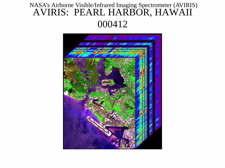
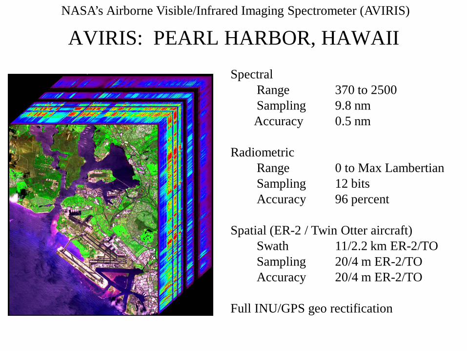
NASA’s Airborne Visible/Infrared Imaging Spectrometer (AVIRIS)AVIRIS: PEARL HARBOR, HAWAII
000412
NASA’s Airborne Visible/Infrared Imaging Spectrometer (AVIRIS)
NASA’s Airborne Visible/Infrared Imaging
Spectrometer (AVIRIS)
LCLUC Update
Robert O. Green(Tom Chrien, presenting)Jet Propulsion Laboratory
NASA’s Airborne Visible/Infrared Imaging Spectrometer (AVIRIS)
Overview
• Objective & Approach
• Instrument
• Science
• Obtaining AVIRIS data
NASA’s Airborne Visible/Infrared Imaging Spectrometer (AVIRIS)
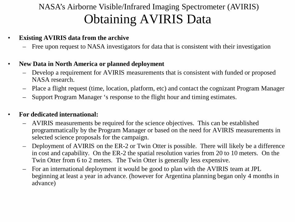
Obtaining AVIRIS Data• Existing AVIRIS data from the archive
– Free upon request to NASA investigators for data that is consistent with their investigation
• New Data in North America or planned deployment– Develop a requirement for AVIRIS measurements that is consistent with funded or proposed
NASA research.– Place a flight request (time, location, platform, etc) and contact the cognizant Program Manager– Support Program Manager ‘s response to the flight hour and timing estimates.
• For dedicated international:– AVIRIS measurements be required for the science objectives. This can be established
programmatically by the Program Manager or based on the need for AVIRIS measurements in selected science proposals for the campaign.
– Deployment of AVIRIS on the ER-2 or Twin Otter is possible. There will likely be a difference in cost and capability. On the ER-2 the spatial resolution varies from 20 to 10 meters. On the Twin Otter from 6 to 2 meters. The Twin Otter is generally less expensive.
– For an international deployment it would be good to plan with the AVIRIS team at JPL beginning at least a year in advance. (however for Argentina planning began only 4 months in advance)
NASA’s Airborne Visible/Infrared Imaging Spectrometer (AVIRIS)
AVIRIS Task Objectives
• Support NASA Code Y by measuring and delivering AVIRIS data sets to designated investigators
• Ensuring AVIRIS is a unique advanced technology imaging spectrometer for NASA Code Y science
NASA’s Airborne Visible/Infrared Imaging Spectrometer (AVIRIS)
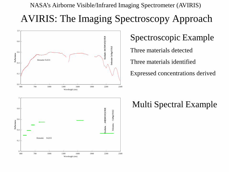
AVIRIS: The Imaging Spectroscopy Approach
0.0
0.2
0.4
0.6
0.8
1.0
400 700 1000 1300 1600 1900 2200 2500Wavelength (nm)
Hematite Fe2O3
0
0.2
0.4
0.6
0.8
1
400 700 1000 1300 1600 1900 2200 2500Wavelength (nm)
Hematite Fe2O3
Spectroscopic ExampleThree materials detected
Three materials identified
Expressed concentrations derived
Multi Spectral Example
NASA’s Airborne Visible/Infrared Imaging Spectrometer (AVIRIS)
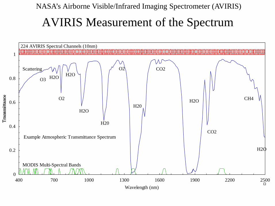
AVIRIS Measurement of the Spectrum
0
0.2
0.4
0.6
0.8
1
400 700 1000 1300 1600 1900 2200 2500Wavelength (nm)
MODIS Multi-Spectral Bands
224 AVIRIS Spectral Channels (10nm)
Example Atmospheric Transmittance Spectrum
O2
H2O
O3
Scattering
H20
H20
CO2
H2O
CO2
H2O
CH4
O2H2OH2O
NASA’s Airborne Visible/Infrared Imaging Spectrometer (AVIRIS)
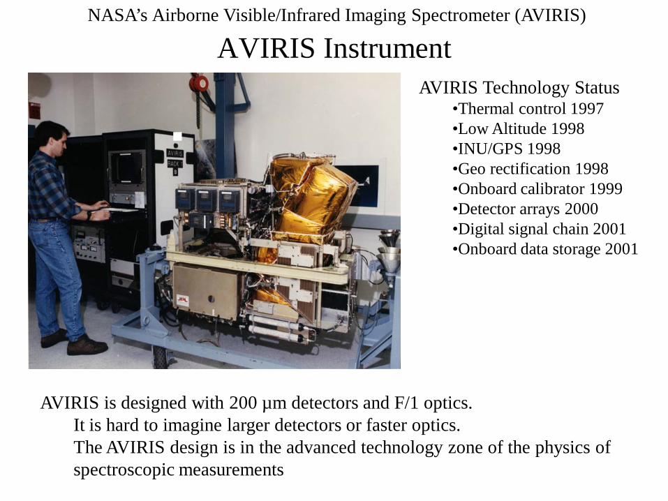
AVIRIS Instrument
AVIRIS is designed with 200 µm detectors and F/1 optics.It is hard to imagine larger detectors or faster optics.The AVIRIS design is in the advanced technology zone of the physics of spectroscopic measurements
AVIRIS Technology Status•Thermal control 1997•Low Altitude 1998 •INU/GPS 1998•Geo rectification 1998•Onboard calibrator 1999•Detector arrays 2000•Digital signal chain 2001•Onboard data storage 2001
NASA’s Airborne Visible/Infrared Imaging Spectrometer (AVIRIS)
AVIRIS: PEARL HARBOR, HAWAIISpectral
Range 370 to 2500 Sampling 9.8 nmAccuracy 0.5 nm
RadiometricRange 0 to Max LambertianSampling 12 bitsAccuracy 96 percent
Spatial (ER-2 / Twin Otter aircraft)Swath 11/2.2 km ER-2/TOSampling 20/4 m ER-2/TOAccuracy 20/4 m ER-2/TO
Full INU/GPS geo rectification
NASA’s Airborne Visible/Infrared Imaging Spectrometer (AVIRIS)
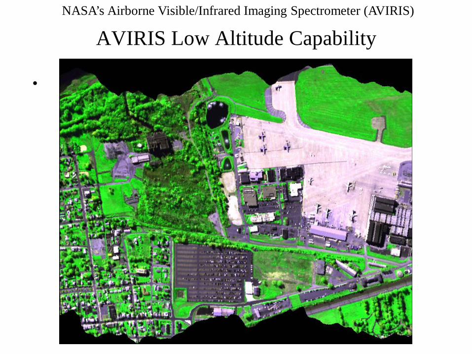
AVIRIS Low Altitude Capability
•
NASA’s Airborne Visible/Infrared Imaging Spectrometer (AVIRIS)
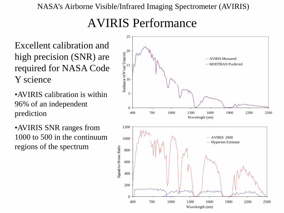
AVIRIS Performance
0
5
10
15
20
25
400 700 1000 1300 1600 1900 2200 2500Wavelength (nm)
AVIRIS MeasuredMODTRAN Predicted
0
200
400
600
800
1000
1200
400 700 1000 1300 1600 1900 2200 2500Wavelength (nm)
AVIRIS 2000Hyperion Estimate
Excellent calibration and high precision (SNR) are required for NASA Code Y science•AVIRIS calibration is within 96% of an independent prediction
•AVIRIS SNR ranges from 1000 to 500 in the continuum regions of the spectrum
NASA’s Airborne Visible/Infrared Imaging Spectrometer (AVIRIS)
AVIRIS Science
• AVIRIS data sets are used to pose and answer questions wherever a spectral signature or correlated spectral signature of interest exist in the 400 to 2500 nm spectral range
• With AVIRIS a full spectral signature is available for identification and quantification
• With AVIRIS there are generally more measurements than unknowns for a give objective. This leads to well constrained remote sensing solutions
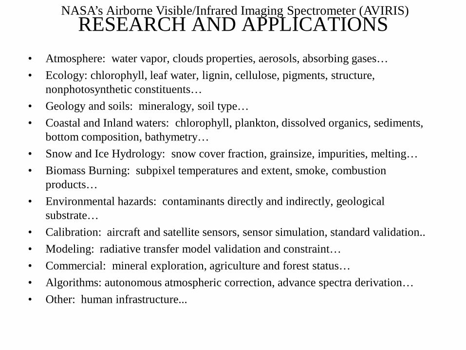
NASA’s Airborne Visible/Infrared Imaging Spectrometer (AVIRIS)RESEARCH AND APPLICATIONS
• Atmosphere: water vapor, clouds properties, aerosols, absorbing gases…• Ecology: chlorophyll, leaf water, lignin, cellulose, pigments, structure,
nonphotosynthetic constituents…• Geology and soils: mineralogy, soil type…• Coastal and Inland waters: chlorophyll, plankton, dissolved organics, sediments,
bottom composition, bathymetry…• Snow and Ice Hydrology: snow cover fraction, grainsize, impurities, melting…• Biomass Burning: subpixel temperatures and extent, smoke, combustion
products…• Environmental hazards: contaminants directly and indirectly, geological
substrate…• Calibration: aircraft and satellite sensors, sensor simulation, standard validation..• Modeling: radiative transfer model validation and constraint…• Commercial: mineral exploration, agriculture and forest status…• Algorithms: autonomous atmospheric correction, advance spectra derivation…• Other: human infrastructure...
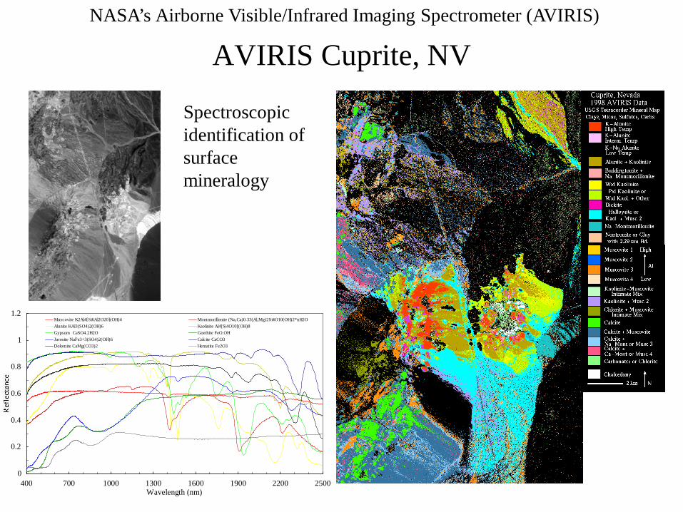
NASA’s Airborne Visible/Infrared Imaging Spectrometer (AVIRIS)
AVIRIS Cuprite, NV
0
0.2
0.4
0.6
0.8
1
1.2
400 700 1000 1300 1600 1900 2200 2500Wavelength (nm)
Muscovite K2Al4[Si6Al2O20](OH)4 Montmorillonite (Na,Ca)0.33(Al,Mg)2Si4O10(OH)2*nH2OAlunite KAl3(SO4)2(OH)6 Kaolinite Al4[Si4O10[(OH)8Gypsum CaSO4.2H2O Goethite FeO.OHJarosite NaFe3+3(SO4)2(OH)6 Calcite CaCO3Dolomite CaMg(CO3)2 Hematite Fe2O3
Spectroscopic identification of surface mineralogy
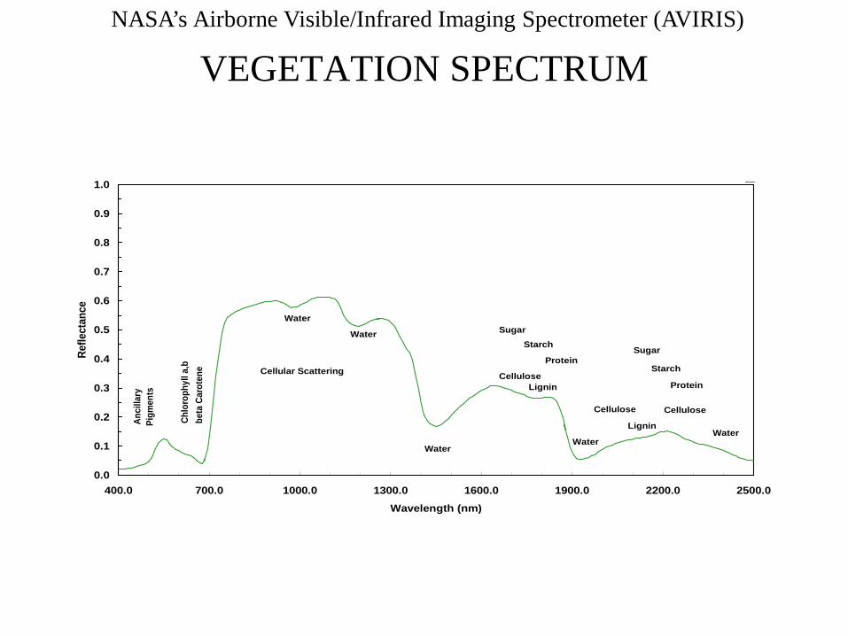
NASA’s Airborne Visible/Infrared Imaging Spectrometer (AVIRIS)
VEGETATION SPECTRUM
0.0
0.1
0.2
0.3
0.4
0.5
0.6
0.7
0.8
0.9
1.0
400.0 700.0 1000.0 1300.0 1600.0 1900.0 2200.0 2500.0
Wavelength (nm)
Refle
ctan
ce
Chlo
roph
yll a
,bbe
ta C
arot
ene
Anci
llary
Pi
gmen
ts
Cellular Scattering
Water
Water
WaterWater
Water
CelluloseLignin
Sugar
Cellulose
Starch
Lignin
Cellulose
ProteinSugar
Starch
Protein
NASA’s Airborne Visible/Infrared Imaging Spectrometer (AVIRIS)
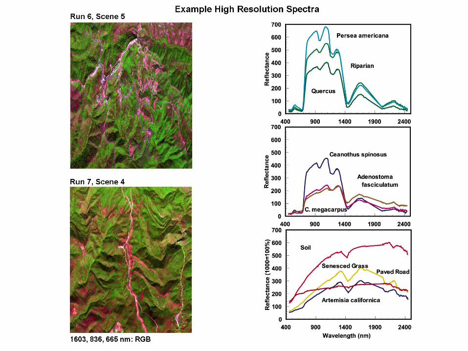
NASA’s Airborne Visible/Infrared Imaging Spectrometer (AVIRIS)
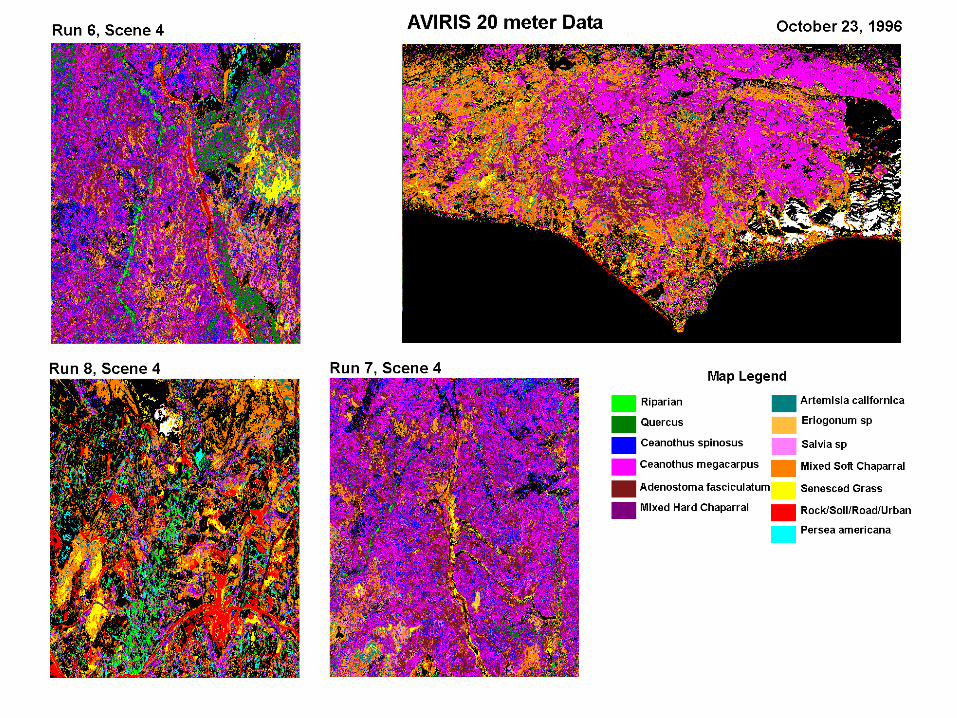
NASA’s Airborne Visible/Infrared Imaging Spectrometer (AVIRIS)
NASA’s Airborne Visible/Infrared Imaging Spectrometer (AVIRIS)
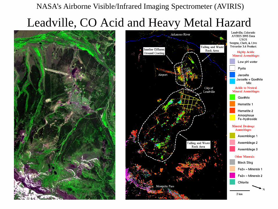
Leadville, CO Acid and Heavy Metal Hazard
NASA’s Airborne Visible/Infrared Imaging Spectrometer (AVIRIS)
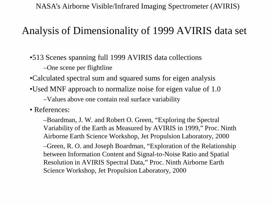
Analysis of Dimensionality of 1999 AVIRIS data set
•513 Scenes spanning full 1999 AVIRIS data collections–One scene per flightline
•Calculated spectral sum and squared sums for eigen analysis•Used MNF approach to normalize noise for eigen value of 1.0
–Values above one contain real surface variability• References:
–Boardman, J. W. and Robert O. Green, “Exploring the Spectral Variability of the Earth as Measured by AVIRIS in 1999,” Proc. Ninth Airborne Earth Science Workshop, Jet Propulsion Laboratory, 2000–Green, R. O. and Joseph Boardman, “Exploration of the Relationship between Information Content and Signal-to-Noise Ratio and Spatial Resolution in AVIRIS Spectral Data,” Proc. Ninth Airborne Earth Science Workshop, Jet Propulsion Laboratory, 2000
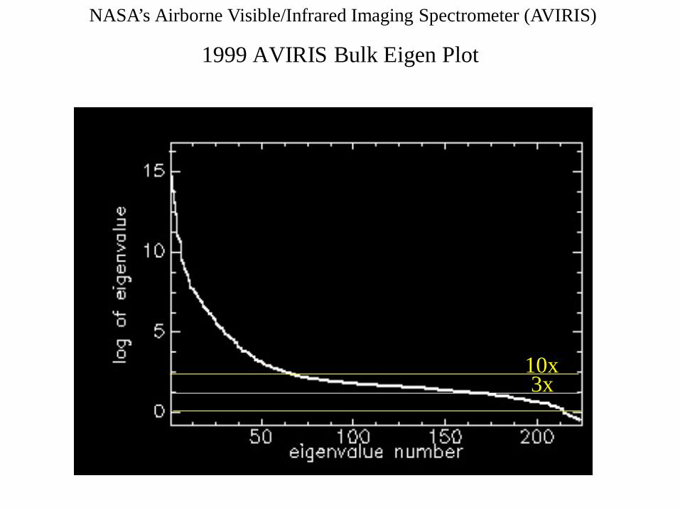
NASA’s Airborne Visible/Infrared Imaging Spectrometer (AVIRIS)
1999 AVIRIS Bulk Eigen Plot
10x3x
NASA’s Airborne Visible/Infrared Imaging Spectrometer (AVIRIS)
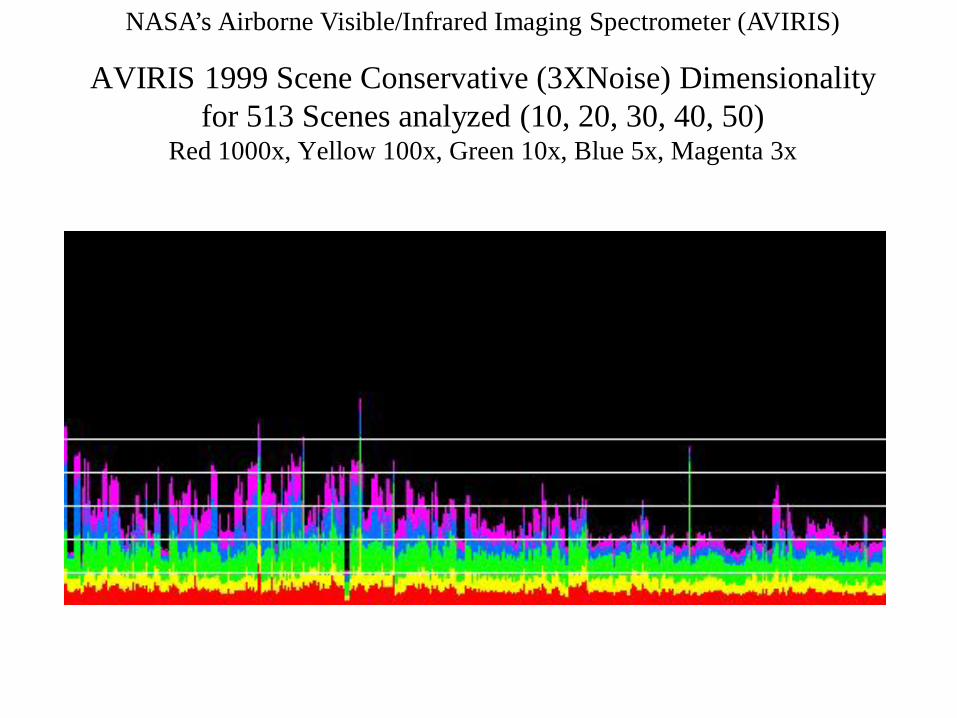
AVIRIS 1999 Scene Conservative (3XNoise) Dimensionalityfor 513 Scenes analyzed (10, 20, 30, 40, 50)
Red 1000x, Yellow 100x, Green 10x, Blue 5x, Magenta 3x
NASA’s Airborne Visible/Infrared Imaging Spectrometer (AVIRIS)
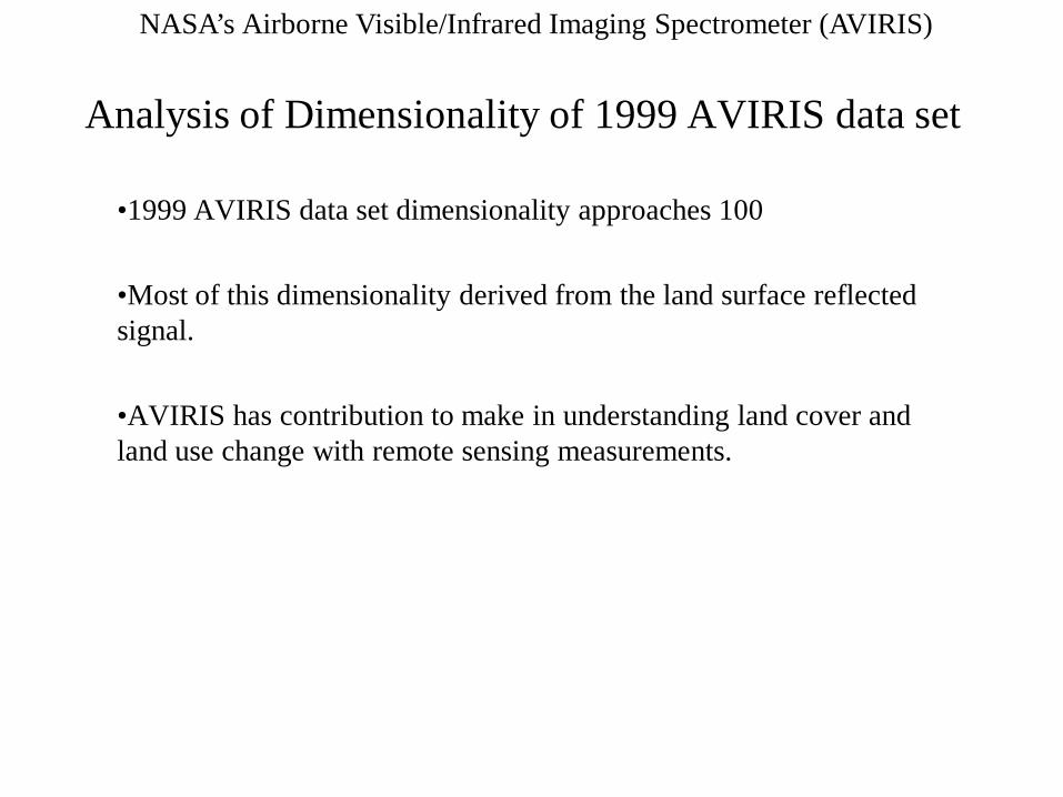
Analysis of Dimensionality of 1999 AVIRIS data set
•1999 AVIRIS data set dimensionality approaches 100
•Most of this dimensionality derived from the land surface reflected signal.
•AVIRIS has contribution to make in understanding land cover and land use change with remote sensing measurements.
NASA’s Airborne Visible/Infrared Imaging Spectrometer (AVIRIS)
AVIRIS Literature
• A citation search for “AVIRIS” in titles and abstract shows 231 refereed journal articles currently published.
• The AVIRIS workshops contain over 473 papers. These are available on-line at the AVIRIS web site.
• There are many additional AVIRIS papers in SPIE, IGARSS, ERIM and other conference proceedings
221m
NASA’s Airborne Visible/Infrared Imaging Spectrometer (AVIRIS)
AVIRIS Contributions
• AVIRIS and Imaging spectroscopy are providing the basis for a step forward in Earth remote sensing in the solar reflected spectrum
– Based in the physics and chemistry of spectroscopy
– Based in the general problem of unknowns and measurements
– Based in the advance of optical, detector, dispersion and computer technology
NASA’s Airborne Visible/Infrared Imaging Spectrometer (AVIRIS)
Information
• http://aviris.jpl.nasa.gov
• All AVIRIS Workshop Proceedings On-line at website
• AVIRIS Workshop March 5 to 8, 2002
NASA’s Airborne Visible/Infrared Imaging Spectrometer (AVIRIS)
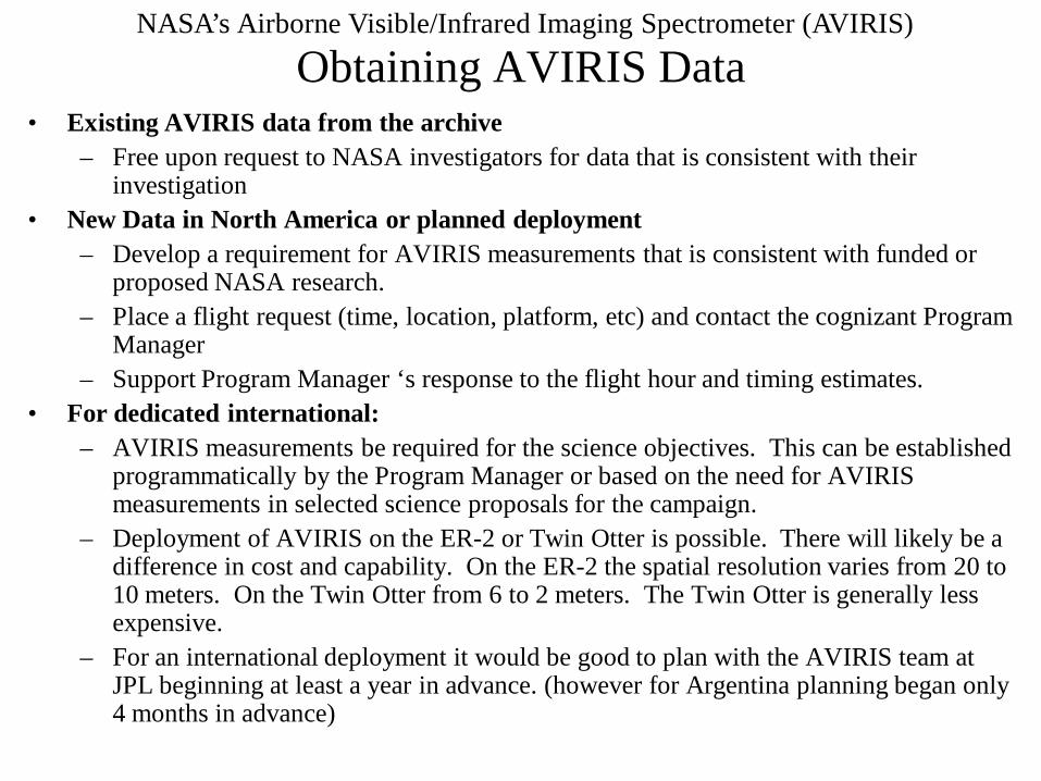
Obtaining AVIRIS Data• Existing AVIRIS data from the archive
– Free upon request to NASA investigators for data that is consistent with their investigation
• New Data in North America or planned deployment– Develop a requirement for AVIRIS measurements that is consistent with funded or
proposed NASA research.– Place a flight request (time, location, platform, etc) and contact the cognizant Program
Manager– Support Program Manager ‘s response to the flight hour and timing estimates.
• For dedicated international:– AVIRIS measurements be required for the science objectives. This can be established
programmatically by the Program Manager or based on the need for AVIRIS measurements in selected science proposals for the campaign.
– Deployment of AVIRIS on the ER-2 or Twin Otter is possible. There will likely be a difference in cost and capability. On the ER-2 the spatial resolution varies from 20 to 10 meters. On the Twin Otter from 6 to 2 meters. The Twin Otter is generally less expensive.
– For an international deployment it would be good to plan with the AVIRIS team at JPL beginning at least a year in advance. (however for Argentina planning began only 4 months in advance)
NASA’s Airborne Visible/Infrared Imaging Spectrometer (AVIRIS)
AVIRIS Information • AVIRIS website: http://aviris.jpl.nasa.gov
• All workshop proceeding published in PDF for on the website.
• > 5 terabytes of existing data spanning a range of land cover types available free upon request to LCLUC investigators
• You may request acquisition of AVIRIS that supports NASA LCLUC science research
• Contact email: [email protected]