mars exploration rover fact sheet
TRANSCRIPT
In April 2004, two mobile robots named Spiritand Opportunity successfully completed their primarythree-month missions on opposite sides of Mars andwent into bonus overtime work. These twin vehiclesof NASA’s Mars Exploration Rover project continuedtheir pursuit ofgeological cluesabout whetherparts of Mars for-merly had envi-ronments wetenough to be hos-pitable to life.
Opportunityhit the jackpotearly. It landedclose to a thinoutcrop of rocks.Within twomonths, its versa-tile science instru-ments found evi-dence in thoserocks that a bodyof salty waterdeep enough tosplash in onceflowed gentlyover the area.Preliminary inter-pretations point to a past environment that could havebeen hospitable to life and also could have preservedfossil evidence of it, though these rovers are notequipped to detect life or to be fossil hunters.
As Opportunity’s primary mission ran out and anextended mission began, the rover was headed forthicker layers of exposed bedrock that might bear evi-dence about how long or how often water covered theregion.
Spirit, duringits primary mis-sion, explored aplain strewn withvolcanic rocksand pocked withimpact craters. Itfound indicationsthat smallamounts of watermay have gotteninto cracks in therocks and mayalso have affect-ed some of therocks’ surfaces.This did not indi-cate a particularlyfavorable pastenvironment forlife.
Spirit’sextended missionbegan with therover starting a
long trek toward a range of hills on the horizon whoserocks might have come from an earlier and wetter eraof the region’s past.
Mars Exploration Rover
NASA FactsNational Aeronautics andSpace Administration
Jet Propulsion LaboratoryCalifornia Institute of TechnologyPasadena, CA 91109
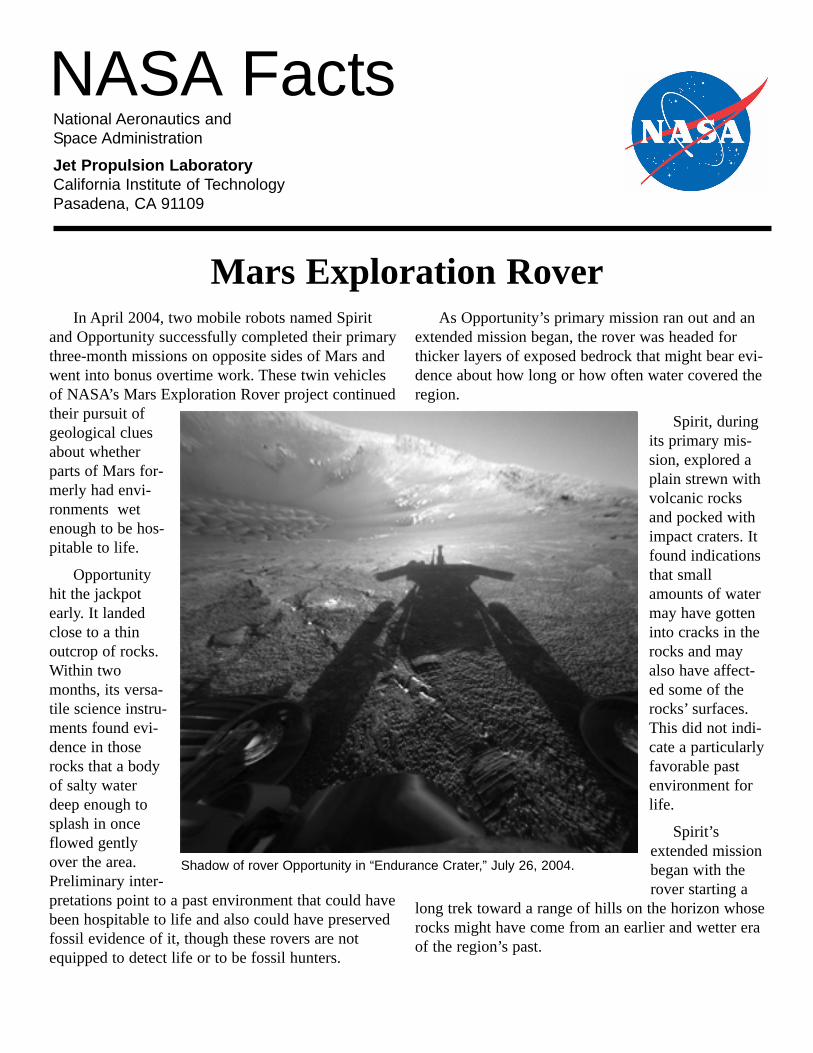
Shadow of rover Opportunity in “Endurance Crater,” July 26, 2004.
Second Extension as Adventure Continues
In late September 2004, NASA approved a secondextension of the rovers’ missions. The solar-poweredmachines were still in good health, though beginningto show signs of aging. They had come through theworst days of the martian year from a solar-energystandpoint. Also, they had resumed full operationsafter about two weeks of not driving in mid-September while communications were unreliablebecause Mars was passing nearly behind the Sun.
Spirit had driven 3.6 kilometers (2.25 miles), sixtimes the goal set in advance as a criterion for a suc-cessful mission. It was climbing hills where its exam-inations of exposed bedrock found more extensivealteration by water than what the rover had seen inrocks on the younger plain. During the long trek,Spirit’s right front wheel developed excessive friction.Controllers found a way to press on with the explo-ration by sometimes driving the rover in reverse withthe balky wheel dragging.
Opportunity had driven about 1.6 kilometers (1mile). It was studying rocks and soils inside a craterabout 130 meters (142 yards) wide and 22 meters (24
yards) deep. The rover entered this crater in June aftercareful analysis of its ability to climb back out.Inside, Opportunity examined layer upon layer ofbedrock with characteristics similar to those of theoutcrop inside the smaller crater where it landed. Thisindicated a much longer duration for the watery por-tion of the region’s ancient past. The rover also foundsome features unlike any it had seen before, evidenceof changes in the environment over time.
Whether the rovers’ unpredictable life spanswould extend only a few more days or several moremonths, they had already racked up successes beyondthe high expectations set for them when the MarsExploration Rover project began.
Favorable Time to Build on Experience
Mars came closer to Earth in August 2003 than ithad in thousands of years. NASA decided in the sum-mer of 2000 to take advantage of this favorable plane-tary geometry to send two rovers to Mars.
The design began with some basics fromSojourner, the rover on NASA’s 1997 Mars Pathfindermission. Some of the carried-over design elements are
2
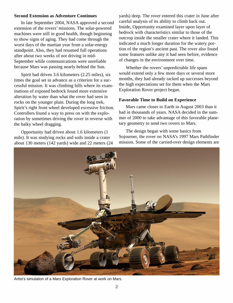
Artist’s simulation of a Mars Exploration Rover at work on Mars.
six wheels and a rocker-bogie suspension for drivingover rough terrain, a shell of airbags for cushioningthe landing, solar panels and rechargeable batteriesfor power, and radioisotope heater units for protectingbatteries through extremely cold martian nights.However, at 174 kilograms (384 pounds), each MarsExploration Rover is more than 17 times as heavy asPathfinder. It is also more than more than twice aslong (at 1.6 meters or 5.2 feet) and tall (1.5 meters or4.9 feet). Pathfinder’s lander, not the Sojourner rover,housed that mission’s main communications, cameraand computer functions. The Mars ExplorationRovers carry equipment for those functions onboard.Their landers enfolded them in flight and performedcrucial roles on arrival, but after Spirit andOpportunity rolled off their unfolded landers ontomartian soil, the landers’ jobs was finished.
NASA’s Jet Propulsion Laboratory, Pasadena,Calif., designed and built the two new rovers plus thelander and the cruise stage for each. The cruise stageprovided capabilities needed during the journey fromEarth to Mars. In early 2003, the hardware arrived atNASA’s Kennedy Space Station in Florida for finalassembly, testing and integration with Boeing Delta IIlaunch vehicles.
While the twin spacecraft were being built, scien-tists and engineers winnowed a list of 155 candidatelanding sites to a final pair best suited to the mis-sions’ goals and safety. More than 100 Mars expertsparticipated in evaluating the sites. They made heavyuse of images and other data from NASA’s MarsGlobal Surveyor and Mars Odyssey orbiters.
The rover project’s science goal has been to assessthe history of environmental conditions at sites thatmay once have been wet and favorable to life. Eachof the two selected landing sites showed evidencedetectable from orbit that it may have once been wet.For Spirit, NASA chose Gusev Crater, a Connecticut-size basin that appears to have once held a lake, judg-ing from the shapes of the landscape. A wide channel,now dry, runs downhill for hundreds of kilometers ormiles to the crater and appears to have been carved bywater flowing into the crater. For Opportunity, NASAchose part of a broad plain named Meridiani Planumbased on a different type of evidence for a possiblywatery past. A mineral-mapping instrument on MarsGlobal Surveyor had identified there an Oklahoma-
size exposure of gray hematite, a mineral that usuallyforms in the presence of liquid water.
Getting to Mars
Both rovers were launched from Cape CanaveralAir Force Station on central Florida’s Space Coast.Spirit ascended in daylight on June 10, 2003.Opportunity followed with a nighttime launch on July7 after several days of delays for repairing cork insu-lation.
During the cruise to Mars, Spirit made four trajec-tory correction maneuvers. Opportunity performedthree. The two spacecraft survived blasts of high-energy particles from some of the most intense solarflares on record. To prevent possible problems fromthe flares’ effects on computer memory, mission con-trollers commanded rebooting of the rovers’ comput-ers, a capability originally planned for use on Marsbut not during the cruise.
Each rover made the trip tightly tucked inside itsfolded-up lander, which was encased in a protectiveaeroshell and attached to a disc-shaped cruise stageabout 2.6 meters (8.5 feet) in diameter. The cruisestage was jettisoned about 15 minutes before thespacecraft reached the top of Mars’ atmosphere.
With the heat-shield portion of the aeroshellpointed forward, the spacecraft slammed into theatmosphere at about 5.4 kilometers per second(12,000 miles per hour). Atmospheric friction in thenext four minutes cut that speed by 90 percent, then aparachute fastened to the backshell portion of theaeroshell opened about two minutes before landing.About 20 seconds later, the spacecraft jettisoned theheat shield. The lander descended on a bridle thatunspooled from the backshell. A downward-pointingcamera on the lander took three pictures during thefinal half-minute of the flight. An onboard computerinstantly analyzed the pictures to estimate horizontalmotion. In the final eight seconds before impact, gasgenerators inflated the lander’s airbags, retro rocketson the backshell fired to halt descent speed, and trans-verse rockets fired (on Spirit’s lander) to reduce hori-zontal speed. The bridle was cut to release the landerfrom the backshell and parachute. Then the airbag-encased lander dropped in free fall.
Spirit landed on Jan. 4, Universal Time (at 8:35p.m. Jan. 3, Pacific Standard Time). It bounced
3
about 8.4 meters (27.6 feet) high. After 27 morebounces and then rolling, it came to a stop about 250to 300 meters (270 to 330 yards) from its first impact.Spirit had journeyed 487 million kilometers (303 mil-lion miles). JPL navigators and engineers successfullyput it only about 10 kilometers (6 miles) from thecenter of its target area. Coordinates of Spirit’s land-ing site are 14.57 degrees south latitude and 175.47degrees east longitude.
Opportunity landed on Jan. 25, Universal Time (at9:05 p.m. Jan. 24, Pacific Standard Time). It traveledabout 200 meters (220 yards) while bouncing 26times and rolling after the impact, with a 90-degreeturn northward during that period. It came to restinside a small crater. One scientist called the landingan “interplanetary hole in one.” Opportunity hadflown 456 million kilometers (283 million miles)from Earth and landed only about 25 kilometers (16miles) from the center of the target area. The landing-
site crater, later informally named “Eagle Crater,” isabout 22 meters (72 feet) in diameter, 3 meters (10feet) deep. Its coordinates are 1.95 degrees south,354.47 degrees east.
Science Instruments: A Geology Toolkit
Like a human field geologist, each MarsExploration Rover has the capabilities to scout its sur-roundings for interesting rocks and soils, to move tothose targets and to examine their composition andstructure.
Spirit and Opportunity have identical suites offive scientific instruments: a panoramic camera pro-vided by JPL; a miniature thermal emission spectrom-eter from Arizona State University, Tempe; aMoessbauer spectrometer from the JohannesGutenberg University, Mainz, Germany; an alpha par-ticle X-ray spectrometer from Max Planck Institutefor Chemistry, also in Mainz, Germany; and a micro-
4
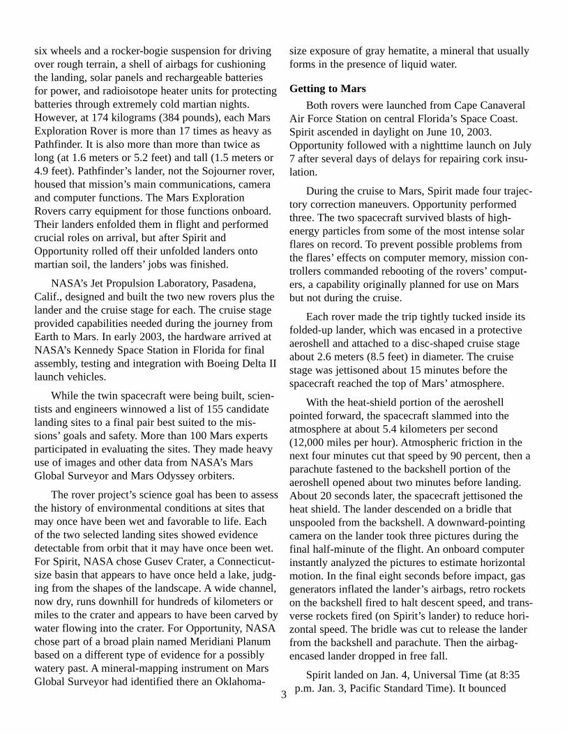
Spirit’s landing site on a plain inside Gusev Crater, viewed with the rover’s panoramic camera before leaving the lander.
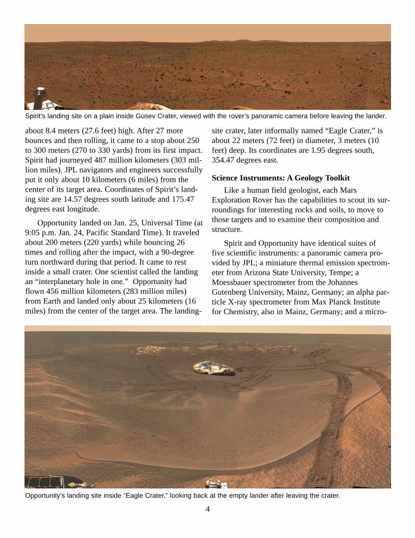
Opportunity’s landing site inside “Eagle Crater,” looking back at the empty lander after leaving the crater.
scopic imager from JPL. These are augmented by arock abrasion tool from Honeybee Robotics, NewYork, N.Y., for removing the weathered surfaces ofrocks to expose fresh interiors for examination. Thepayload also includes magnetic targets provided byNiels Bohr Institute in Copenhagen, Denmark, tocatch samples of martian dust for examination. Thespectrometers, microscopic imager and abrasion toolshare a turret at the end of a robotic arm provided byAlliance Spacesystems Inc., Pasadena, Calif.
� Panoramic Camera — Providing thegeologic context: This high-resolution stereo camerareveals the surrounding terrain at each new locationthat the rover reaches. Its two eyes sit 30 centimeters(12 inches) apart, atop a mast about 1.5 meters (5feet) above the ground. The instrument carries 14 dif-ferent types of filters, allowing not only full-colorimages but also spectral analysis of minerals and theatmosphere. Its images are used to help select rockand soil targets for more intensive study and to picknew regions for the rover to explore.
� Miniature Thermal Emission Spectrometer— Identifying minerals at the site: This instrumentviews the surrounding scene in infrared wavelengths,determining types and amounts of many differentkinds of minerals. A particular goal is to search fordistinctive minerals that are formed by the action ofwater. The spectrometer scans to build up an image.Data from it and from the panoramic camera are usedin choosing science targets and new areas to explore.Scientists also use it in studies of Mars’ atmosphere.
� Moessbauer Spectrometer — Identifyingiron-bearing minerals: Mounted on the rover arm,this instrument is placed against rock and soil targets.It identifies minerals that contain iron, which helpsscientists evaluate what role water played in the for-mation of the targets and discern the extent to whichrocks have been weathered. The instrument uses twocobalt-57 sources, each about the size of a pencileraser, in calibrating its measurements. It is a minia-turized version of spectrometers used by geologists tostudy rocks and soils on Earth.
� Alpha Particle X-Ray Spectrometer —Determining the composition of rocks: Animproved version of an instrument used by theSojourner rover, this spectrometer is also similar toinstruments used in geology labs on Earth. It uses
small amounts of curium-244 in measuring the con-centrations of most major elements in rocks and soil.Learning the elemental ingredients in rocks and soilshelps scientists understand the samples’ origins andhow they have been altered over time.
� Microscopic Imager — Looking at fine-scalefeatures: The fine-scale appearance of rocks and soilscan provide essential clues to how those rocks andsoils were formed. For instance, the size and angulari-ty of grains in water-lain sediments can reveal howthey were transported and deposited. This imager pro-vides the close-up data needed for such studies.
� Supplemental Instruments — Engineeringtools aid science: Each rover also has other toolsthat, while primarily designed for engineering use inthe operation of the rover, can also provide geologicalinformation. The navigation camera is a wider-anglestereo instrument on the same mast as the panoramiccamera. Hazard-avoidance cameras ride low on thefront and rear of the rover in stereo pairs to producethree-dimensional information about the nearby ter-rain. The front pair provides information to aid posi-tioning of the tools mounted on the rover’s arm.Rover wheels, in addition to allowing mobility, areused to dig shallow trenches to evaluate soil proper-ties.
5
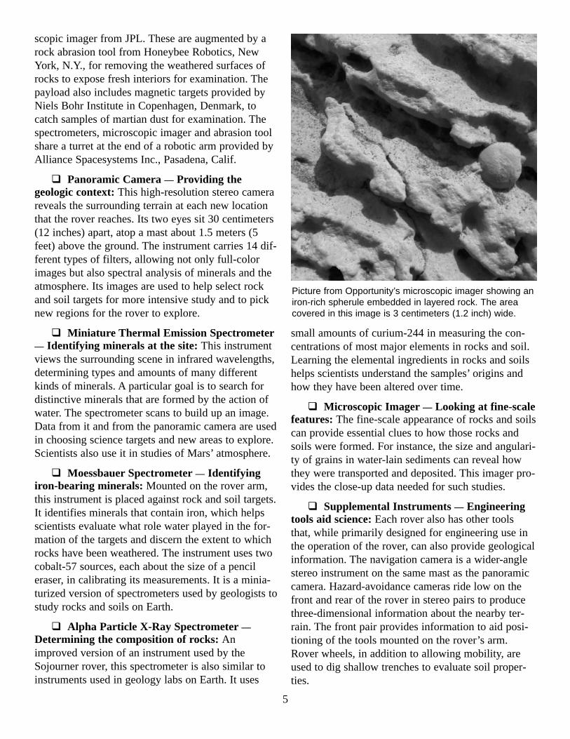
Picture from Opportunity’s microscopic imager showing aniron-rich spherule embedded in layered rock. The areacovered in this image is 3 centimeters (1.2 inch) wide.
Names of Rovers and Features
The names of the rovers, Spirit and Opportunity,were selected in a student essay contest that drewnearly 10,000 entries.
After the spacecraft reached Mars, NASA dedicat-ed the landers as memorials to astronauts who per-ished in space shuttle accidents. Spirit’s landerbecame Columbia Memorial Station. Opportunity’sbecame Challenger Memorial Station.
A committee of the International AstronomicalUnion designates official place names on Mars, suchas the names Gusev Crater and Meridiani Planum.NASA and members of the rover science team haveput unofficial names on many natural features seen bythe rovers.
A range of hills that Spirit saw on the easternhorizon from the rover’s landing site is unofficiallycalled the “Columbia Hills,” with seven individualhilltops named for members of the Space ShuttleColumbia’s last crew: Anderson, Brown, Chawla,Clark, Husband, McCool and Ramon. Spirit drovemore than three kilometers (about two miles) to reachthose hills and begin climbing them.
As in earlier Mars surface missions — Viking andPathfinder — scientists assign informal names tosmaller features, such as rocks and patches of soil in
order to avoid confusion when talking about plansand results related to those features. The named fea-tures range from stadium-size craters to coin-sizespectrometer targets on rocks.
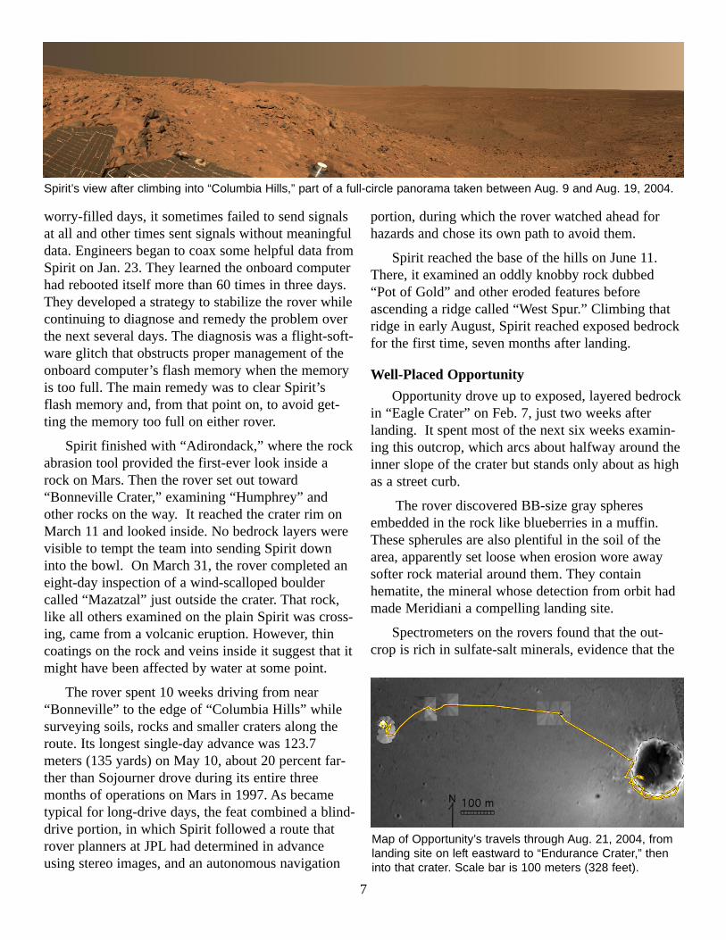
Persistent Spirit
Spirit’s first photos looking around its landing siterevealed a rock-strewn plain. A few shallow, dustyhollows lay nearby and a few hills and crater rimsinterrupted the flat horizon. Even before the rover hadrolled off its lander platform, scientists chose“Bonneville Crater,” about 300 meters (328 yards) tothe northeast, as a destination that might offer accessto underlying rock layers. They eyed the ColumbiaHills, about 2.6 kilometers (1.6 miles) to the south-east, as a tempting but probably unreachable goal forlater.
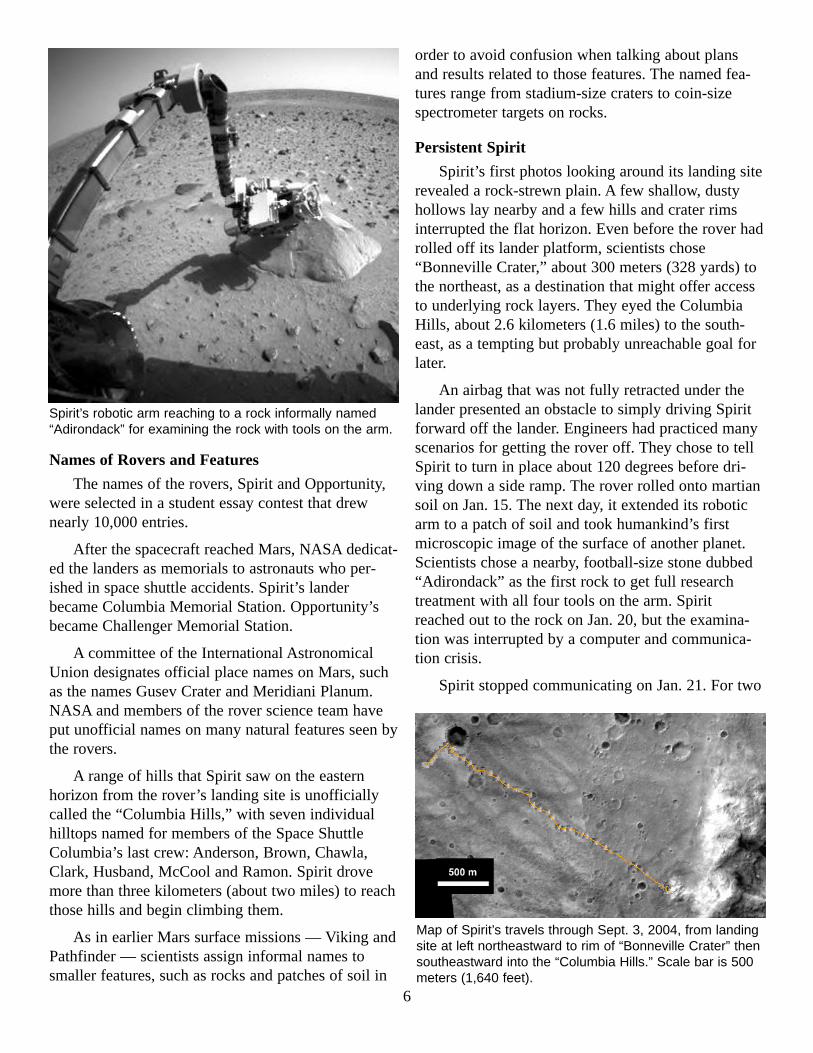
An airbag that was not fully retracted under thelander presented an obstacle to simply driving Spiritforward off the lander. Engineers had practiced manyscenarios for getting the rover off. They chose to tellSpirit to turn in place about 120 degrees before dri-ving down a side ramp. The rover rolled onto martiansoil on Jan. 15. The next day, it extended its roboticarm to a patch of soil and took humankind’s firstmicroscopic image of the surface of another planet.Scientists chose a nearby, football-size stone dubbed“Adirondack” as the first rock to get full researchtreatment with all four tools on the arm. Spiritreached out to the rock on Jan. 20, but the examina-tion was interrupted by a computer and communica-tion crisis.
Spirit stopped communicating on Jan. 21. For two
6
Spirit’s robotic arm reaching to a rock informally named“Adirondack” for examining the rock with tools on the arm.
Map of Spirit’s travels through Sept. 3, 2004, from landingsite at left northeastward to rim of “Bonneville Crater” thensoutheastward into the “Columbia Hills.” Scale bar is 500meters (1,640 feet).
worry-filled days, it sometimes failed to send signalsat all and other times sent signals without meaningfuldata. Engineers began to coax some helpful data fromSpirit on Jan. 23. They learned the onboard computerhad rebooted itself more than 60 times in three days.They developed a strategy to stabilize the rover whilecontinuing to diagnose and remedy the problem overthe next several days. The diagnosis was a flight-soft-ware glitch that obstructs proper management of theonboard computer’s flash memory when the memoryis too full. The main remedy was to clear Spirit’sflash memory and, from that point on, to avoid get-ting the memory too full on either rover.
Spirit finished with “Adirondack,” where the rockabrasion tool provided the first-ever look inside arock on Mars. Then the rover set out toward“Bonneville Crater,” examining “Humphrey” andother rocks on the way. It reached the crater rim onMarch 11 and looked inside. No bedrock layers werevisible to tempt the team into sending Spirit downinto the bowl. On March 31, the rover completed aneight-day inspection of a wind-scalloped bouldercalled “Mazatzal” just outside the crater. That rock,like all others examined on the plain Spirit was cross-ing, came from a volcanic eruption. However, thincoatings on the rock and veins inside it suggest that itmight have been affected by water at some point.
The rover spent 10 weeks driving from near“Bonneville” to the edge of “Columbia Hills” whilesurveying soils, rocks and smaller craters along theroute. Its longest single-day advance was 123.7meters (135 yards) on May 10, about 20 percent far-ther than Sojourner drove during its entire threemonths of operations on Mars in 1997. As becametypical for long-drive days, the feat combined a blind-drive portion, in which Spirit followed a route thatrover planners at JPL had determined in advanceusing stereo images, and an autonomous navigation
portion, during which the rover watched ahead forhazards and chose its own path to avoid them.
Spirit reached the base of the hills on June 11.There, it examined an oddly knobby rock dubbed“Pot of Gold” and other eroded features beforeascending a ridge called “West Spur.” Climbing thatridge in early August, Spirit reached exposed bedrockfor the first time, seven months after landing.
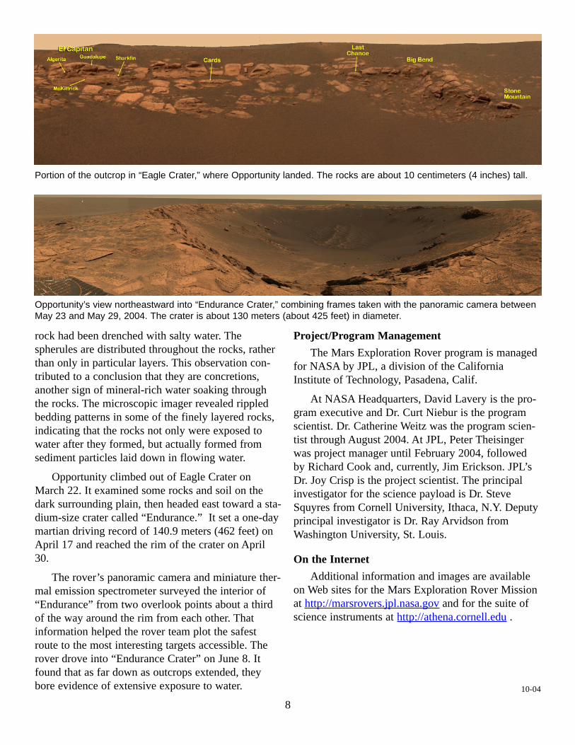
Well-Placed Opportunity
Opportunity drove up to exposed, layered bedrockin “Eagle Crater” on Feb. 7, just two weeks afterlanding. It spent most of the next six weeks examin-ing this outcrop, which arcs about halfway around theinner slope of the crater but stands only about as highas a street curb.
The rover discovered BB-size gray spheresembedded in the rock like blueberries in a muffin.These spherules are also plentiful in the soil of thearea, apparently set loose when erosion wore awaysofter rock material around them. They containhematite, the mineral whose detection from orbit hadmade Meridiani a compelling landing site.
Spectrometers on the rovers found that the out-crop is rich in sulfate-salt minerals, evidence that the
7
Spirit’s view after climbing into “Columbia Hills,” part of a full-circle panorama taken between Aug. 9 and Aug. 19, 2004.
Map of Opportunity’s travels through Aug. 21, 2004, fromlanding site on left eastward to “Endurance Crater,” theninto that crater. Scale bar is 100 meters (328 feet).
rock had been drenched with salty water. Thespherules are distributed throughout the rocks, ratherthan only in particular layers. This observation con-tributed to a conclusion that they are concretions,another sign of mineral-rich water soaking throughthe rocks. The microscopic imager revealed rippledbedding patterns in some of the finely layered rocks,indicating that the rocks not only were exposed towater after they formed, but actually formed fromsediment particles laid down in flowing water.
Opportunity climbed out of Eagle Crater onMarch 22. It examined some rocks and soil on thedark surrounding plain, then headed east toward a sta-dium-size crater called “Endurance.” It set a one-daymartian driving record of 140.9 meters (462 feet) onApril 17 and reached the rim of the crater on April30.
The rover’s panoramic camera and miniature ther-mal emission spectrometer surveyed the interior of“Endurance” from two overlook points about a thirdof the way around the rim from each other. Thatinformation helped the rover team plot the safestroute to the most interesting targets accessible. Therover drove into “Endurance Crater” on June 8. Itfound that as far down as outcrops extended, theybore evidence of extensive exposure to water.
Project/Program Management
The Mars Exploration Rover program is managedfor NASA by JPL, a division of the CaliforniaInstitute of Technology, Pasadena, Calif.
At NASA Headquarters, David Lavery is the pro-gram executive and Dr. Curt Niebur is the programscientist. Dr. Catherine Weitz was the program scien-tist through August 2004. At JPL, Peter Theisingerwas project manager until February 2004, followedby Richard Cook and, currently, Jim Erickson. JPL’sDr. Joy Crisp is the project scientist. The principalinvestigator for the science payload is Dr. SteveSquyres from Cornell University, Ithaca, N.Y. Deputyprincipal investigator is Dr. Ray Arvidson fromWashington University, St. Louis.
On the Internet
Additional information and images are availableon Web sites for the Mars Exploration Rover Missionat http://marsrovers.jpl.nasa.gov and for the suite ofscience instruments at http://athena.cornell.edu .
10-04
8
Portion of the outcrop in “Eagle Crater,” where Opportunity landed. The rocks are about 10 centimeters (4 inches) tall.
Opportunity’s view northeastward into “Endurance Crater,” combining frames taken with the panoramic camera betweenMay 23 and May 29, 2004. The crater is about 130 meters (about 425 feet) in diameter.