map portals and geoarchiving: new opportunities in geospatial information services steve morris head...
TRANSCRIPT
Map Portals and Geoarchiving: New Opportunities in Geospatial Information Services Steve MorrisHead of Digital Library InitiativesNCSU Libraries
GIS Technology: Sustaining the Future
& Understanding the Past Case Western Reserve UniversityOctober 13, 2005
Note: Percentages based on the actual number of respondents to each question 2
Overview
Brief overview of library roles in digital geographic information servicesGeospatial web services: opportunities and challenges for librariesLong-term preservation of digital geospatial data
Note: Percentages based on the actual number of respondents to each question 3
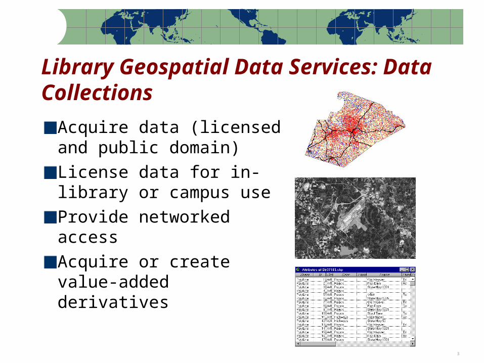
Library Geospatial Data Services: Data Collections
Acquire data (licensed and public domain)License data for in-library or campus useProvide networked accessAcquire or create value-added derivatives
Note: Percentages based on the actual number of respondents to each question 4
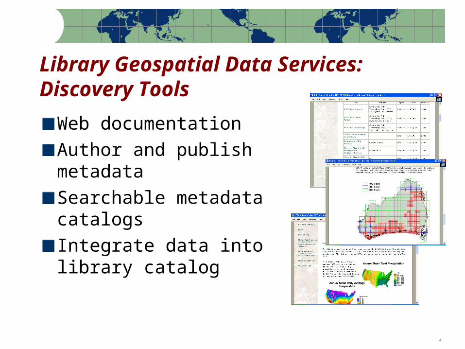
Library Geospatial Data Services: Discovery Tools
Web documentationAuthor and publish metadataSearchable metadata catalogsIntegrate data into library catalog
Note: Percentages based on the actual number of respondents to each question 5
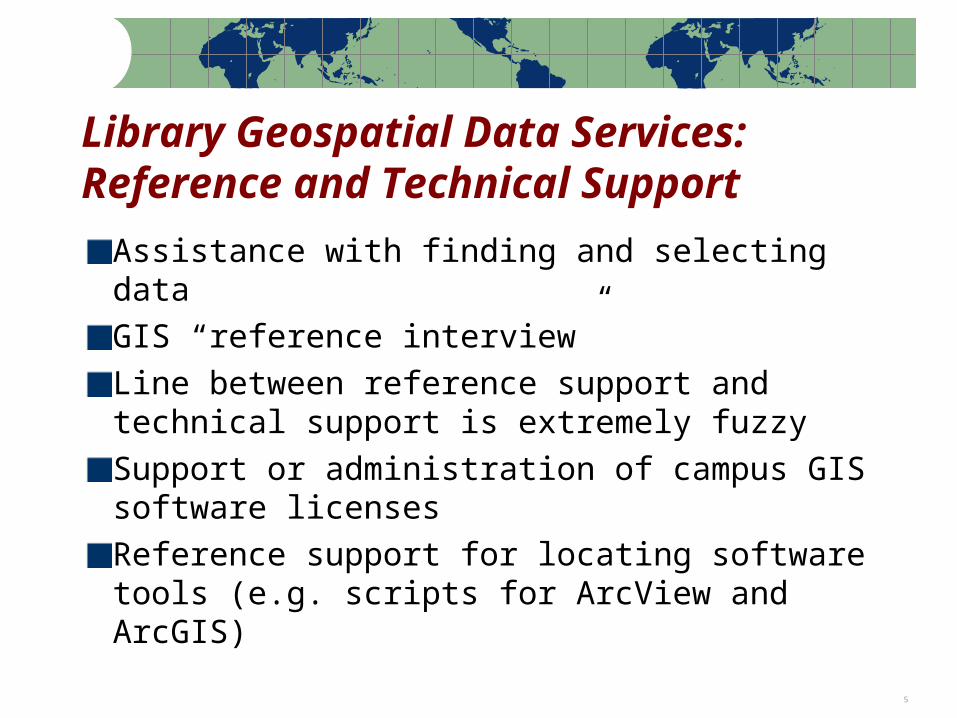
Library Geospatial Data Services: Reference and Technical Support
Assistance with finding and selecting dataGIS “reference interview”Line between reference support and technical support is extremely fuzzySupport or administration of campus GIS software licensesReference support for locating software tools (e.g. scripts for ArcView and ArcGIS)
Note: Percentages based on the actual number of respondents to each question 6
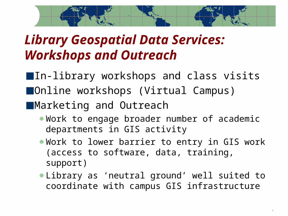
Library Geospatial Data Services: Workshops and Outreach
In-library workshops and class visitsOnline workshops (Virtual Campus)Marketing and Outreach
Work to engage broader number of academic departments in GIS activityWork to lower barrier to entry in GIS work (access to software, data, training, support)Library as ‘neutral ground’ well suited to coordinate with campus GIS infrastructure
Note: Percentages based on the actual number of respondents to each question 7
MapCollections
DataCollections
MapServers
MapPortals
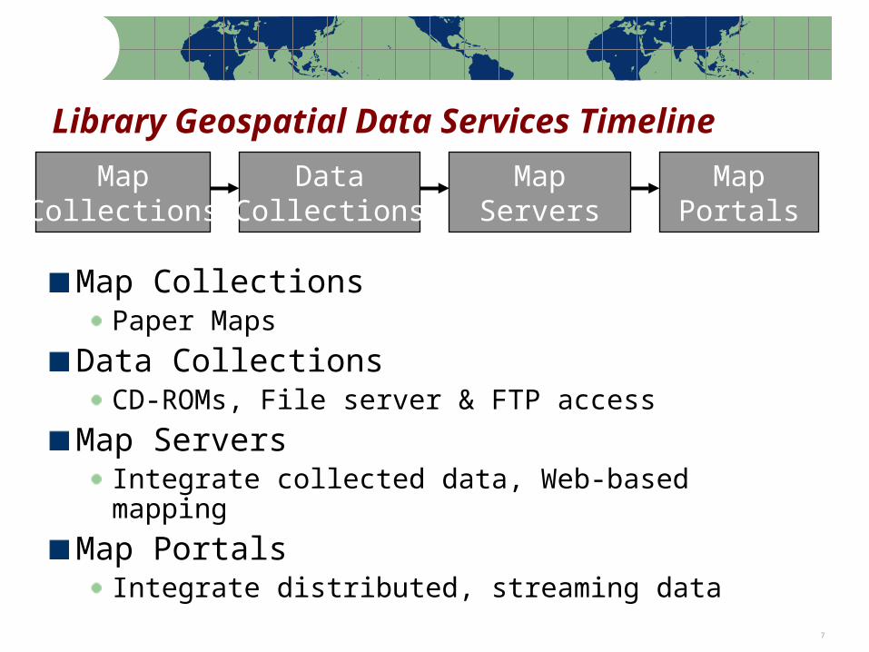
Library Geospatial Data Services Timeline
Map CollectionsPaper Maps
Data CollectionsCD-ROMs, File server & FTP access
Map ServersIntegrate collected data, Web-based mapping
Map PortalsIntegrate distributed, streaming data
Note: Percentages based on the actual number of respondents to each question 8
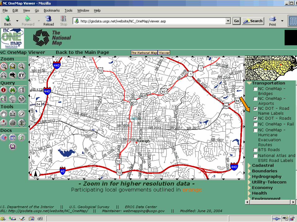
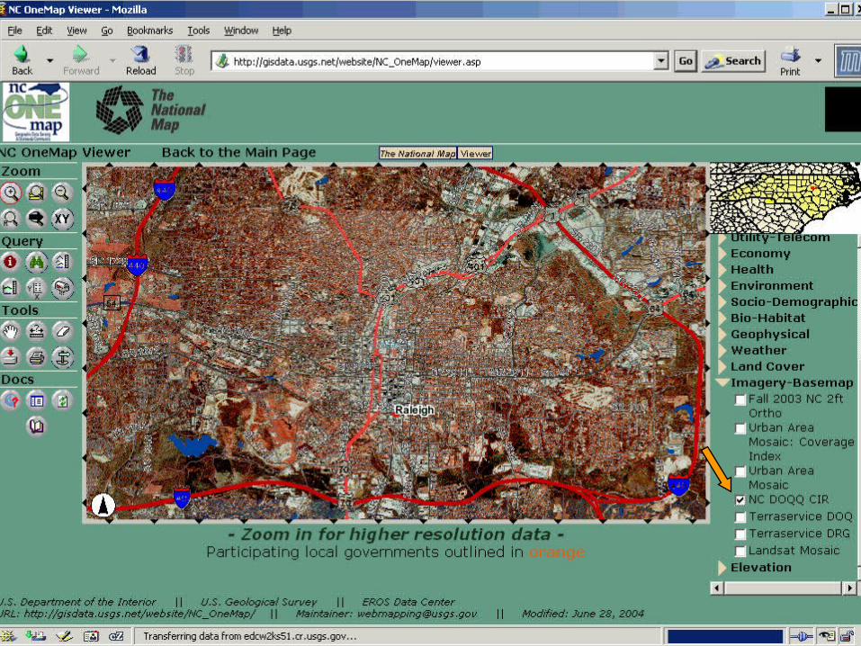
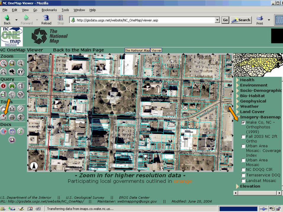
NC Local Government Map Services
#
#
#
##
#
##
#
#
#
#
#
#
#
#
#
#
# #
#
#
#
#
#
#
#
#
##
#
County Map Services# City Map Services
Note: Percentages based on the actual number of respondents to each question 9
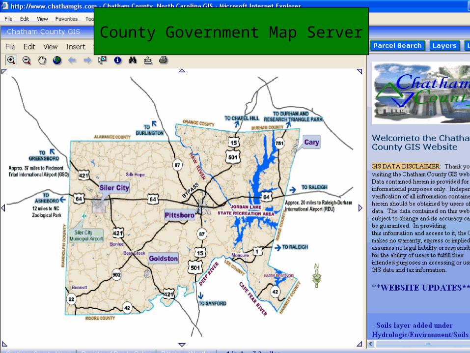
County Government Map Server
Note: Percentages based on the actual number of respondents to each question 10
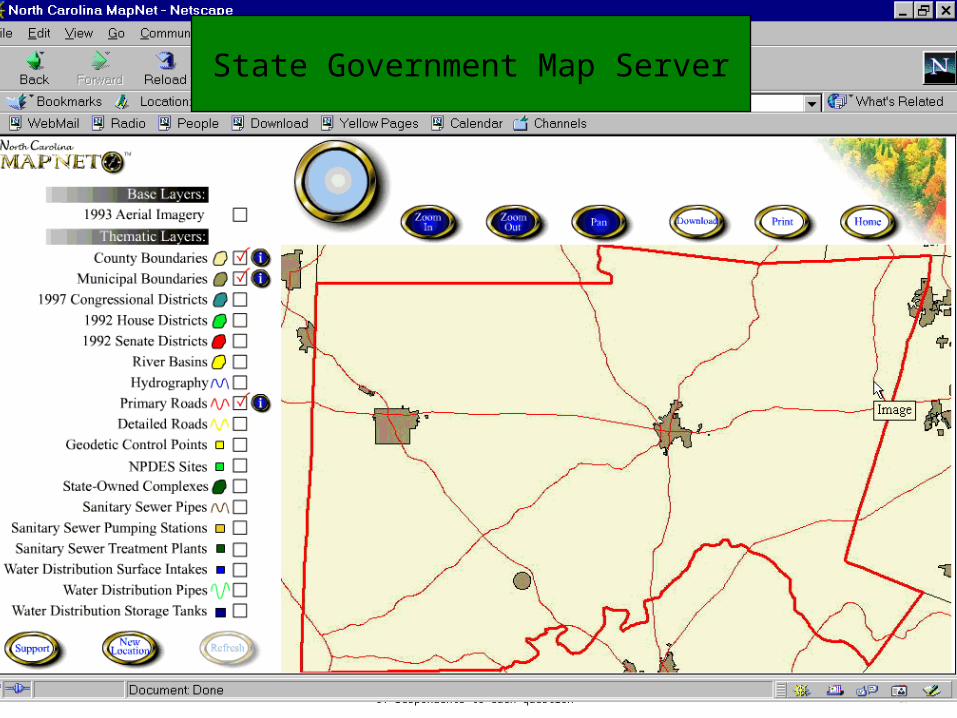
State Government Map Server

Note: Percentages based on the actual number of respondents to each question 11
Federal Government Map Server
Note: Percentages based on the actual number of respondents to each question 12
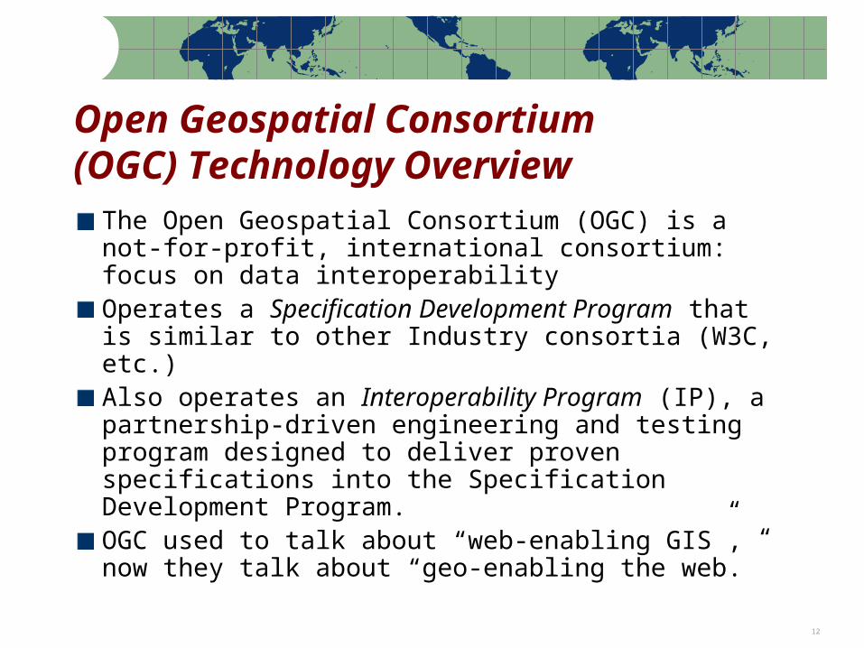
Open Geospatial Consortium(OGC) Technology Overview
The Open Geospatial Consortium (OGC) is a not-for-profit, international consortium: focus on data interoperabilityOperates a Specification Development Program that is similar to other Industry consortia (W3C, etc.)Also operates an Interoperability Program (IP), a partnership-driven engineering and testing program designed to deliver proven specifications into the Specification Development Program.OGC used to talk about “web-enabling GIS”, now they talk about “geo-enabling the web.”
Note: Percentages based on the actual number of respondents to each question 13
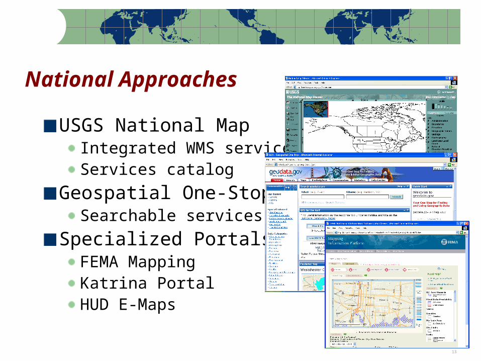
National Approaches
USGS National MapIntegrated WMS servicesServices catalog
Geospatial One-StopSearchable services
Specialized PortalsFEMA MappingKatrina PortalHUD E-Maps
Note: Percentages based on the actual number of respondents to each question 14
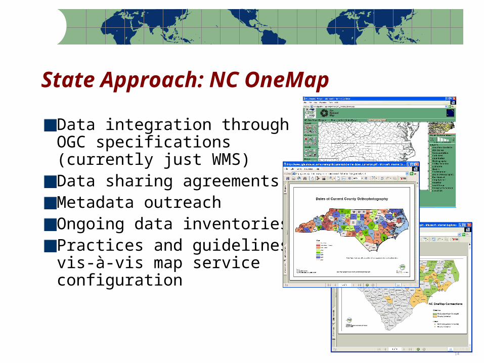
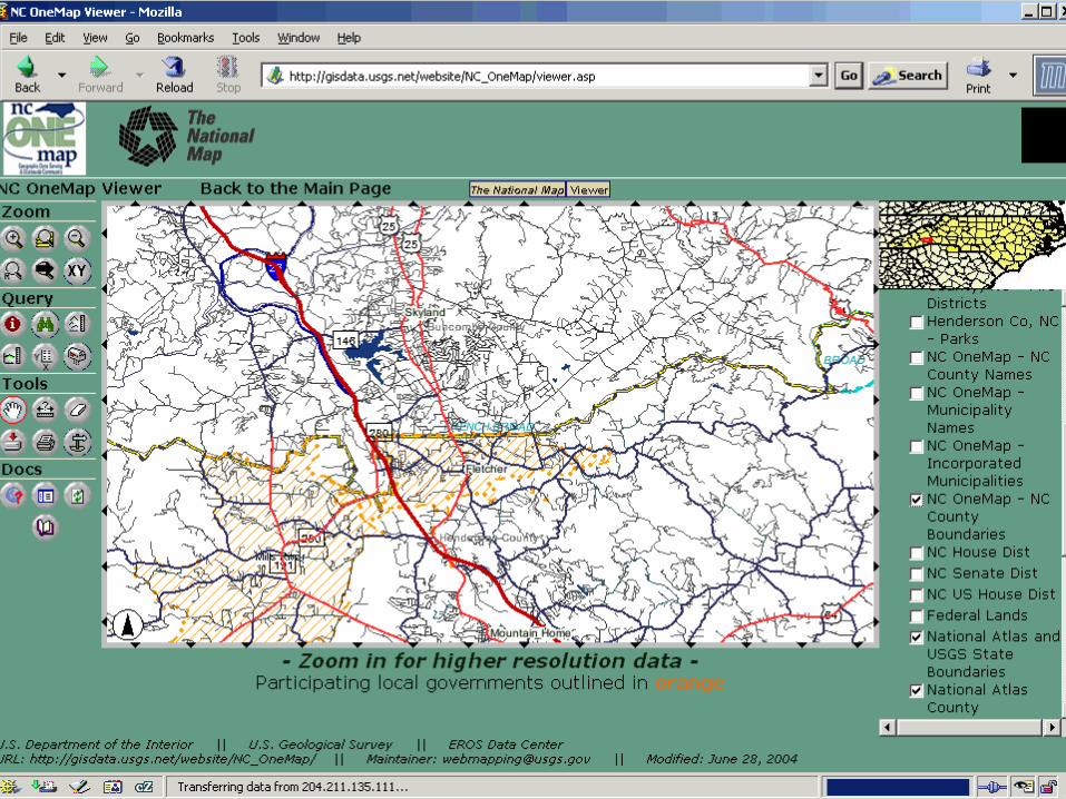
State Approach: NC OneMap
Data integration through OGC specifications (currently just WMS)Data sharing agreementsMetadata outreachOngoing data inventoriesPractices and guidelines vis-à-vis map service configuration
Note: Percentages based on the actual number of respondents to each question 15
Note: Percentages based on the actual number of respondents to each question 16
Note: Percentages based on the actual number of respondents to each question 17
Note: Percentages based on the actual number of respondents to each question 18

Note: Percentages based on the actual number of respondents to each question 19
Note: Percentages based on the actual number of respondents to each question 20
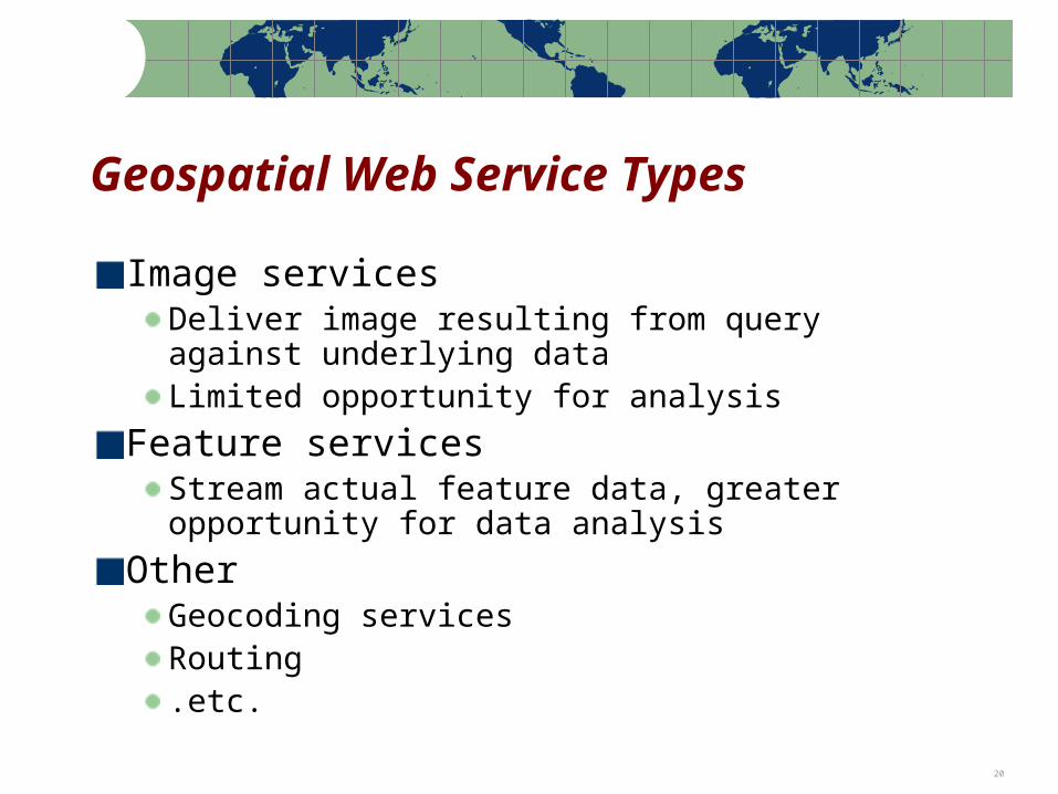
Geospatial Web Service Types
Image servicesDeliver image resulting from query against underlying dataLimited opportunity for analysis
Feature servicesStream actual feature data, greater opportunity for data analysis
OtherGeocoding servicesRouting.etc.
Note: Percentages based on the actual number of respondents to each question 21
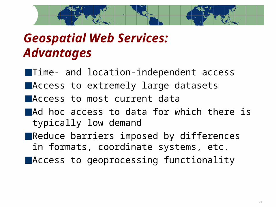
Geospatial Web Services:Advantages
Time- and location-independent accessAccess to extremely large datasetsAccess to most current dataAd hoc access to data for which there is typically low demandReduce barriers imposed by differences in formats, coordinate systems, etc.Access to geoprocessing functionality
Note: Percentages based on the actual number of respondents to each question 22
Note: Percentages based on the actual number of respondents to each question 23
Note: Percentages based on the actual number of respondents to each question 24
Note: Percentages based on the actual number of respondents to each question 25
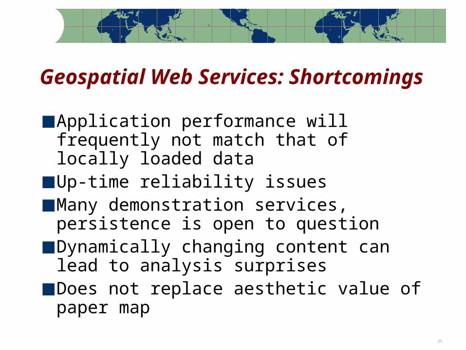
Geospatial Web Services: Shortcomings
Application performance will frequently not match that of locally loaded dataUp-time reliability issuesMany demonstration services, persistence is open to questionDynamically changing content can lead to analysis surprisesDoes not replace aesthetic value of paper map
Note: Percentages based on the actual number of respondents to each question 26
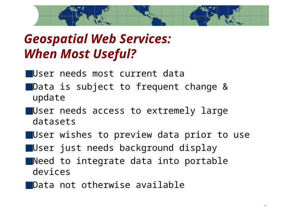
Geospatial Web Services:When Most Useful?
User needs most current dataData is subject to frequent change & updateUser needs access to extremely large datasetsUser wishes to preview data prior to useUser just needs background displayNeed to integrate data into portable devicesData not otherwise available
Note: Percentages based on the actual number of respondents to each question 27
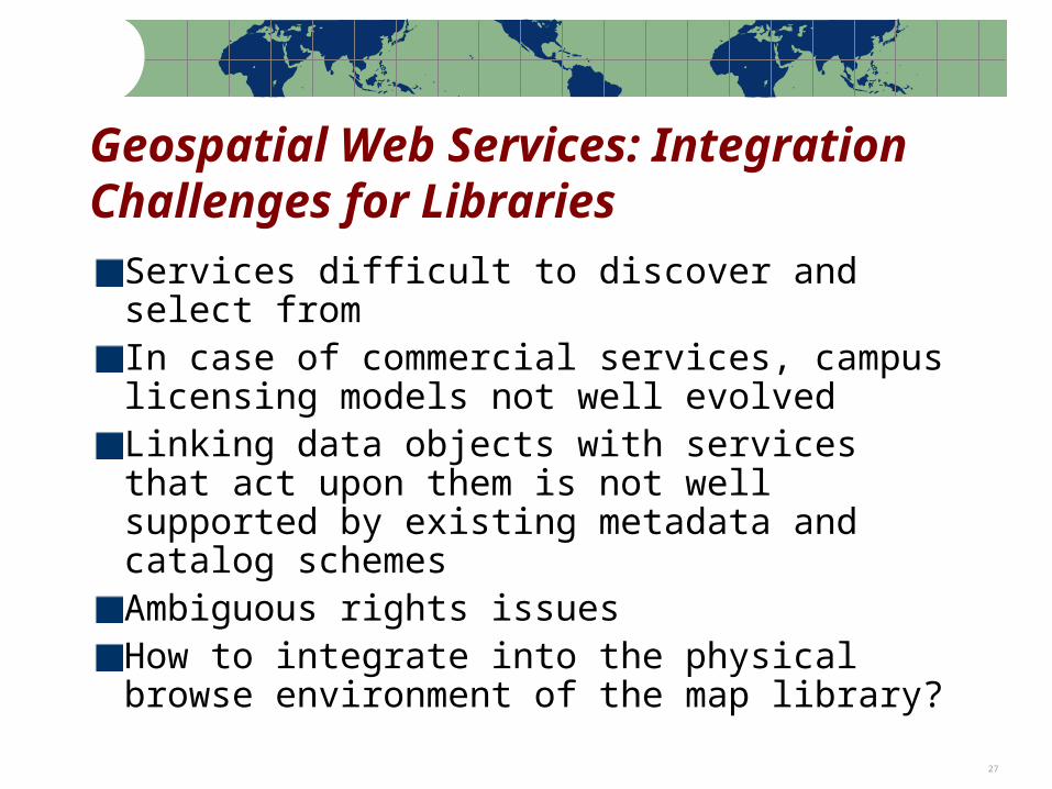
Geospatial Web Services: Integration Challenges for Libraries
Services difficult to discover and select fromIn case of commercial services, campus licensing models not well evolvedLinking data objects with services that act upon them is not well supported by existing metadata and catalog schemesAmbiguous rights issuesHow to integrate into the physical browse environment of the map library?
Note: Percentages based on the actual number of respondents to each question 28
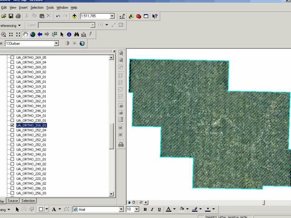
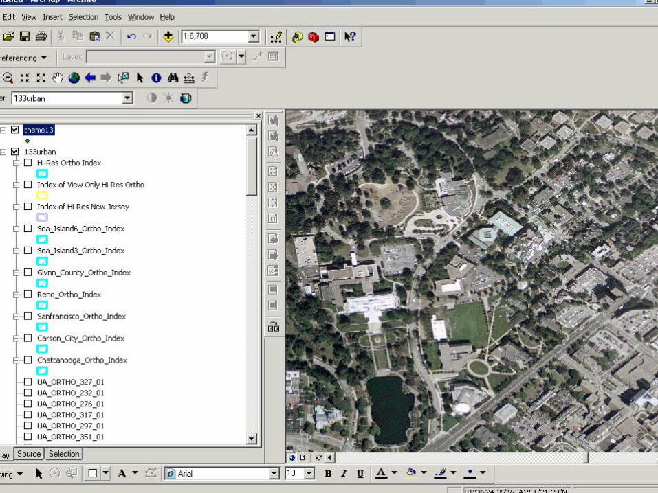
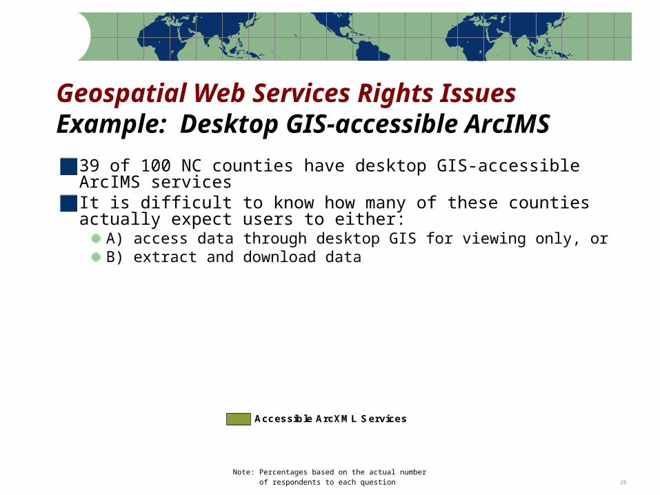
Accessible ArcXML Services
Geospatial Web Services Rights IssuesExample: Desktop GIS-accessible ArcIMS39 of 100 NC counties have desktop GIS-accessible
ArcIMS servicesIt is difficult to know how many of these counties actually expect users to either:
A) access data through desktop GIS for viewing only, orB) extract and download data
Note: Percentages based on the actual number of respondents to each question 29
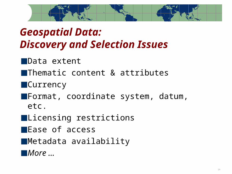
Geospatial Data:Discovery and Selection Issues
Data extentThematic content & attributesCurrencyFormat, coordinate system, datum, etc.Licensing restrictionsEase of accessMetadata availabilityMore …
Note: Percentages based on the actual number of respondents to each question 30
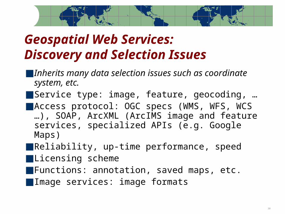
Geospatial Web Services:Discovery and Selection Issues
Inherits many data selection issues such as coordinate system, etc.Service type: image, feature, geocoding, …Access protocol: OGC specs (WMS, WFS, WCS …), SOAP, ArcXML (ArcIMS image and feature services, specialized APIs (e.g. Google Maps)Reliability, up-time performance, speedLicensing schemeFunctions: annotation, saved maps, etc.Image services: image formats
Note: Percentages based on the actual number of respondents to each question 31
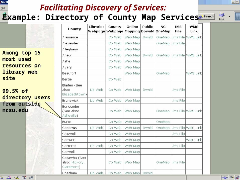
Facilitating Discovery of Services:Example: Directory of County Map Services
Among top 15 most used resources on library web site
99.5% of directory users from outside ncsu.edu
Note: Percentages based on the actual number of respondents to each question 32
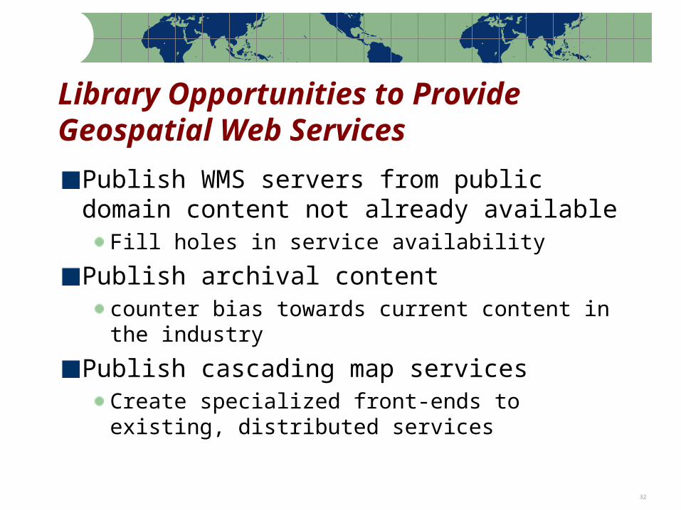
Library Opportunities to Provide Geospatial Web Services
Publish WMS servers from public domain content not already available
Fill holes in service availability
Publish archival contentcounter bias towards current content in the industry
Publish cascading map servicesCreate specialized front-ends to existing, distributed services
Note: Percentages based on the actual number of respondents to each question 33
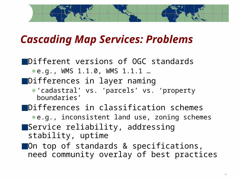
Cascading Map Services: Problems
Different versions of OGC standardse.g., WMS 1.1.0, WMS 1.1.1 …
Differences in layer naming‘cadastral’ vs. ‘parcels’ vs. ‘property boundaries’
Differences in classification schemese.g., inconsistent land use, zoning schemes
Service reliability, addressing stability, uptimeOn top of standards & specifications, need community overlay of best practices
Note: Percentages based on the actual number of respondents to each question 34
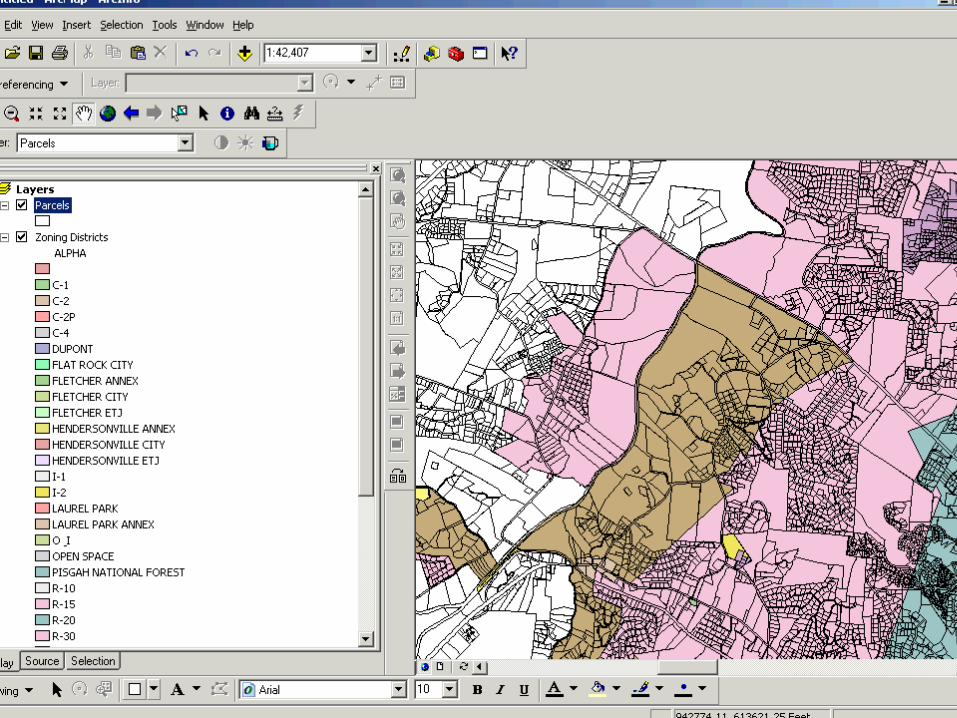
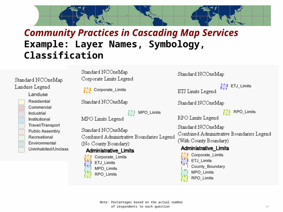
Community Practices in Cascading Map ServicesExample: Layer Names, Symbology, Classification
Note: Percentages based on the actual number of respondents to each question 35
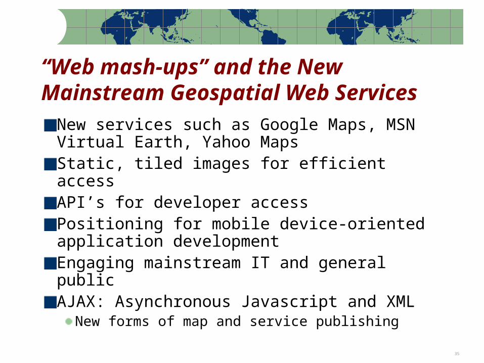
“Web mash-ups” and the New Mainstream Geospatial Web Services
New services such as Google Maps, MSN Virtual Earth, Yahoo MapsStatic, tiled images for efficient accessAPI’s for developer accessPositioning for mobile device-oriented application developmentEngaging mainstream IT and general publicAJAX: Asynchronous Javascript and XML
New forms of map and service publishing

Note: Percentages based on the actual number of respondents to each question 36
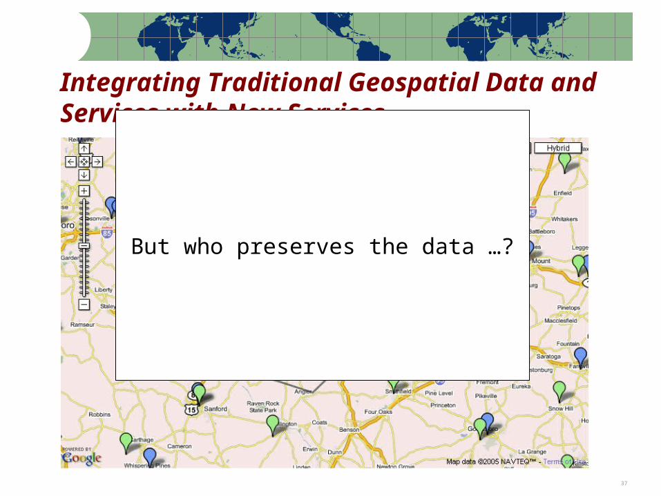
Integrating Traditional Geospatial Data and Services with New Services
Note: Percentages based on the actual number of respondents to each question 37
Integrating Traditional Geospatial Data and Services with New Services
But who preserves the data …?
Note: Percentages based on the actual number of respondents to each question 38
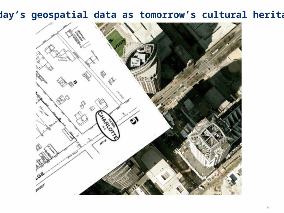
Today’s geospatial data as tomorrow’s cultural heritage
Note: Percentages based on the actual number of respondents to each question 39
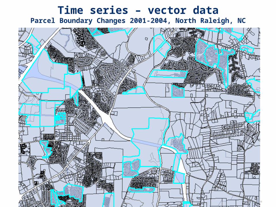
Time series – vector dataParcel Boundary Changes 2001-2004, North Raleigh, NC
Note: Percentages based on the actual number of respondents to each question 40
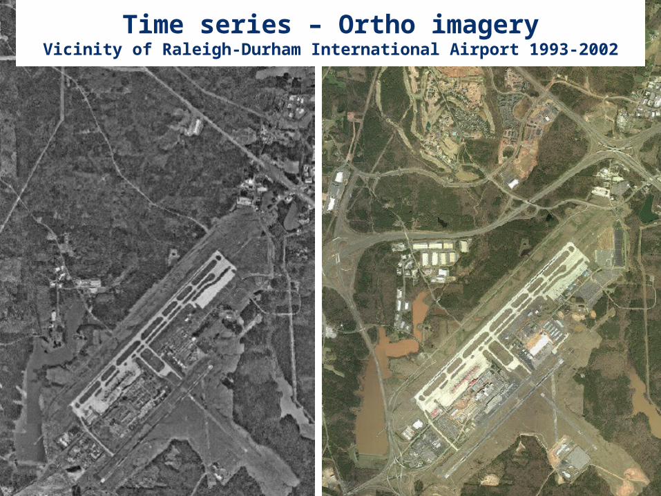
Time series – Ortho imageryVicinity of Raleigh-Durham International Airport 1993-2002
Note: Percentages based on the actual number of respondents to each question 41
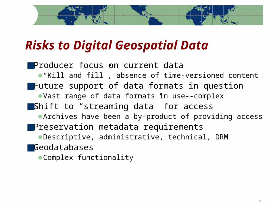
Risks to Digital Geospatial Data
Producer focus on current data“Kill and fill”, absence of time-versioned content
Future support of data formats in questionVast range of data formats in use--complex
Shift to “streaming data” for accessArchives have been a by-product of providing access
Preservation metadata requirementsDescriptive, administrative, technical, DRM
GeodatabasesComplex functionality
Note: Percentages based on the actual number of respondents to each question 42
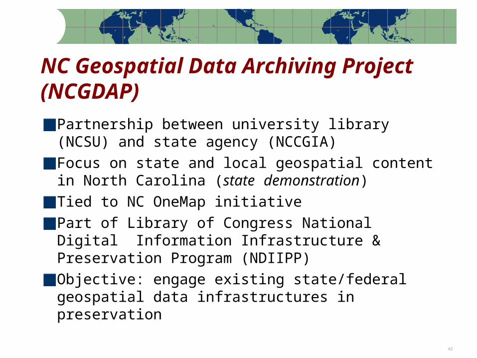
NC Geospatial Data Archiving Project (NCGDAP)
Partnership between university library (NCSU) and state agency (NCCGIA)Focus on state and local geospatial content in North Carolina (state demonstration)Tied to NC OneMap initiativePart of Library of Congress National Digital Information Infrastructure & Preservation Program (NDIIPP)Objective: engage existing state/federal geospatial data infrastructures in preservation
Note: Percentages based on the actual number of respondents to each question 43
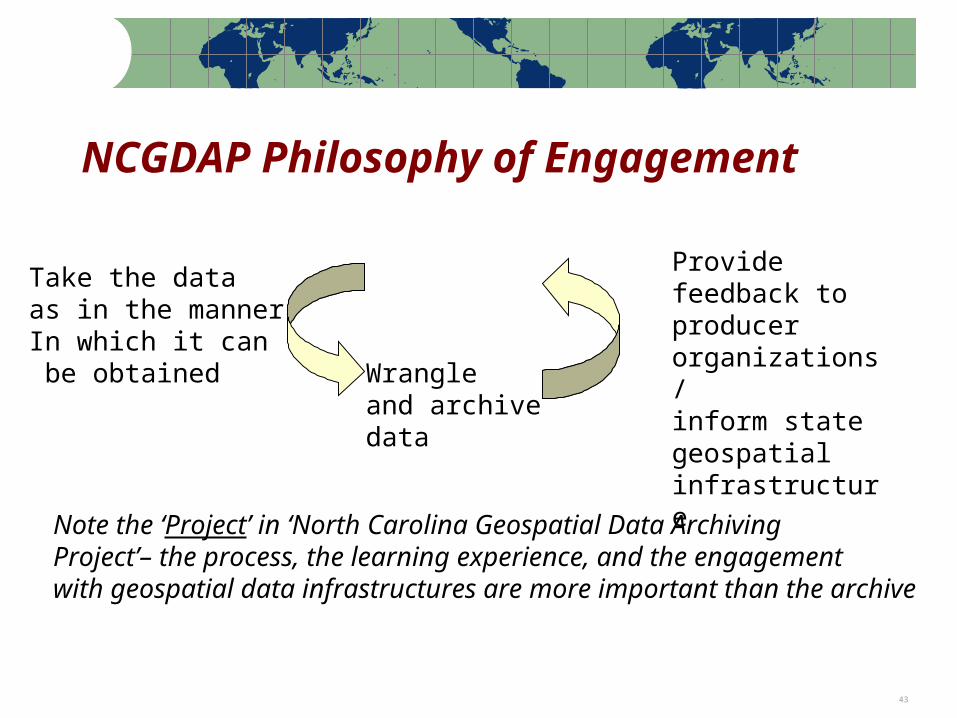
NCGDAP Philosophy of Engagement
Take the dataas in the mannerIn which it can be obtained
Provide feedback to producer organizations/inform state geospatial infrastructure
Wrangleand archivedata
Note the ‘Project’ in ‘North Carolina Geospatial Data ArchivingProject’– the process, the learning experience, and the engagementwith geospatial data infrastructures are more important than the archive
Note: Percentages based on the actual number of respondents to each question 44
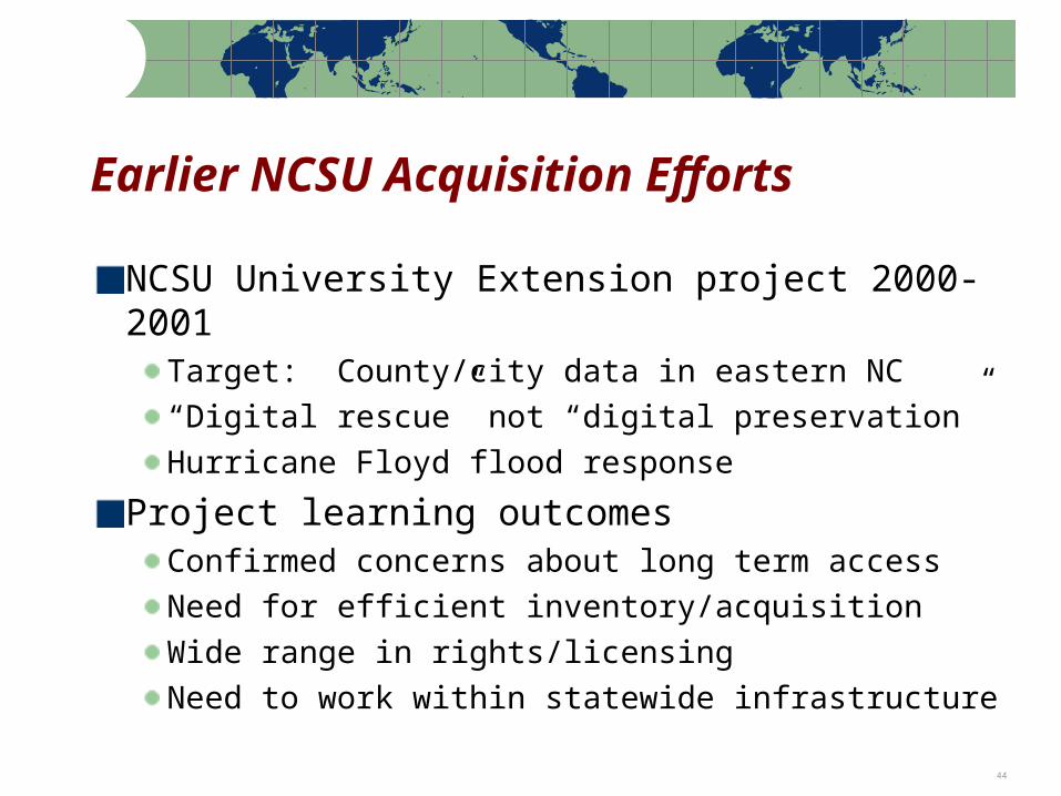
Earlier NCSU Acquisition Efforts
NCSU University Extension project 2000-2001
Target: County/city data in eastern NC“Digital rescue” not “digital preservation”Hurricane Floyd flood response
Project learning outcomesConfirmed concerns about long term accessNeed for efficient inventory/acquisitionWide range in rights/licensingNeed to work within statewide infrastructure
Note: Percentages based on the actual number of respondents to each question 45
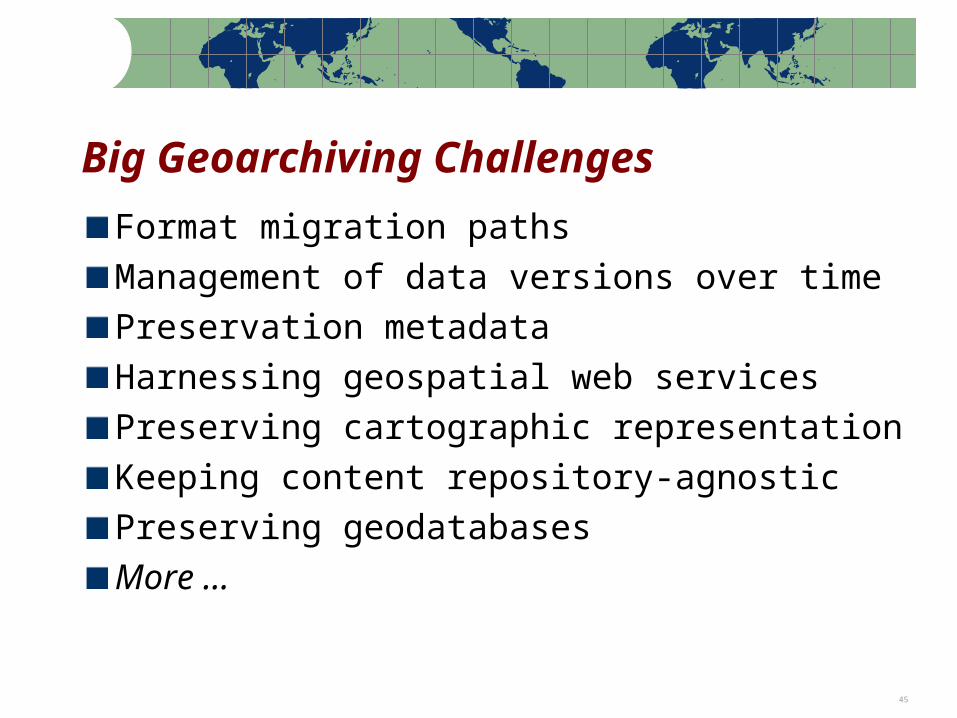
Big Geoarchiving Challenges
Format migration paths
Management of data versions over time
Preservation metadata
Harnessing geospatial web services
Preserving cartographic representation
Keeping content repository-agnostic
Preserving geodatabases
More …
Note: Percentages based on the actual number of respondents to each question 46
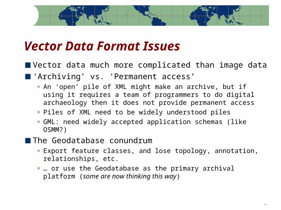
Vector Data Format Issues
Vector data much more complicated than image data
‘Archiving’ vs. ‘Permanent access’An ‘open’ pile of XML might make an archive, but if using it requires a team of programmers to do digital archaeology then it does not provide permanent access
Piles of XML need to be widely understood piles
GML: need widely accepted application schemas (like OSMM?)
The Geodatabase conundrumExport feature classes, and lose topology, annotation, relationships, etc.
… or use the Geodatabase as the primary archival platform (some are now thinking this way)
Note: Percentages based on the actual number of respondents to each question 47
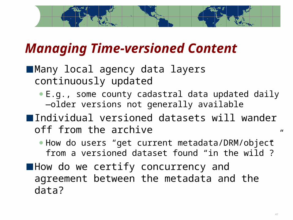
Managing Time-versioned Content
Many local agency data layers continuously updated
E.g., some county cadastral data updated daily—older versions not generally available
Individual versioned datasets will wander off from the archive
How do users “get current metadata/DRM/object” from a versioned dataset found “in the wild”?
How do we certify concurrency and agreement between the metadata and the data?
Note: Percentages based on the actual number of respondents to each question 48
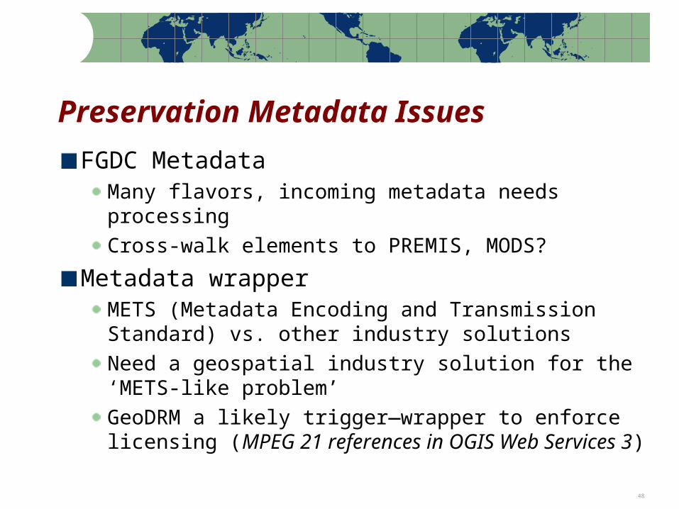
Preservation Metadata Issues
FGDC MetadataMany flavors, incoming metadata needs processing
Cross-walk elements to PREMIS, MODS?
Metadata wrapperMETS (Metadata Encoding and Transmission Standard) vs. other industry solutions
Need a geospatial industry solution for the ‘METS-like problem’
GeoDRM a likely trigger—wrapper to enforce licensing (MPEG 21 references in OGIS Web Services 3)
Note: Percentages based on the actual number of respondents to each question 49
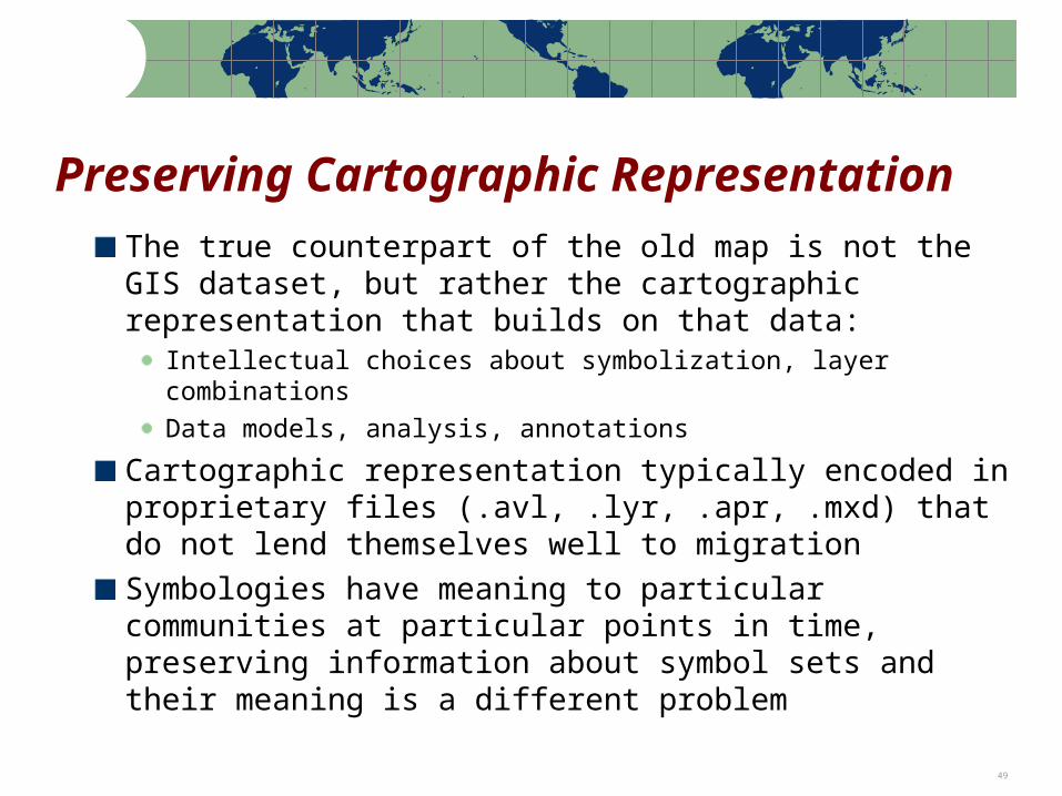
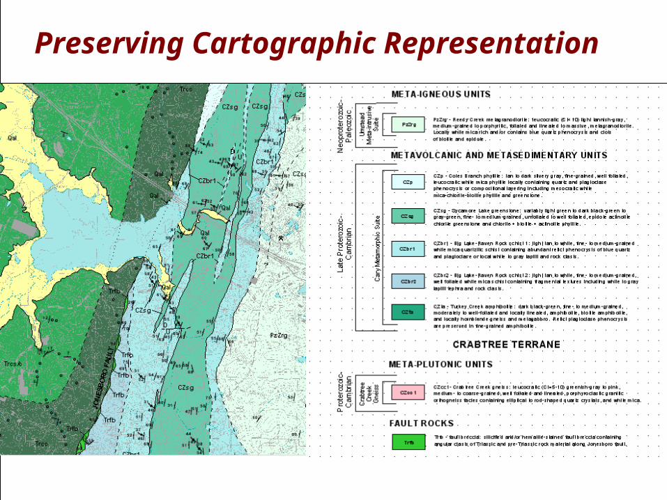
Preserving Cartographic Representation
The true counterpart of the old map is not the GIS dataset, but rather the cartographic representation that builds on that data:
Intellectual choices about symbolization, layer combinations
Data models, analysis, annotations
Cartographic representation typically encoded in proprietary files (.avl, .lyr, .apr, .mxd) that do not lend themselves well to migration
Symbologies have meaning to particular communities at particular points in time, preserving information about symbol sets and their meaning is a different problem
Note: Percentages based on the actual number of respondents to each question 50
Preserving Cartographic Representation
Note: Percentages based on the actual number of respondents to each question 51
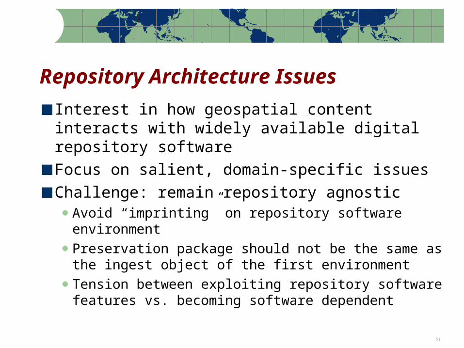
Interest in how geospatial content interacts with widely available digital repository software
Focus on salient, domain-specific issues
Challenge: remain repository agnosticAvoid “imprinting” on repository software environment
Preservation package should not be the same as the ingest object of the first environment
Tension between exploiting repository software features vs. becoming software dependent
Repository Architecture Issues
Note: Percentages based on the actual number of respondents to each question 52
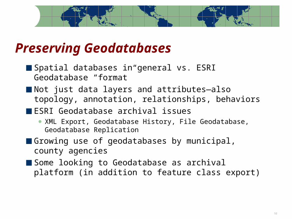
Preserving Geodatabases
Spatial databases in general vs. ESRI Geodatabase “format”
Not just data layers and attributes—also topology, annotation, relationships, behaviors
ESRI Geodatabase archival issuesXML Export, Geodatabase History, File Geodatabase, Geodatabase Replication
Growing use of geodatabases by municipal, county agencies
Some looking to Geodatabase as archival platform (in addition to feature class export)
Note: Percentages based on the actual number of respondents to each question 53
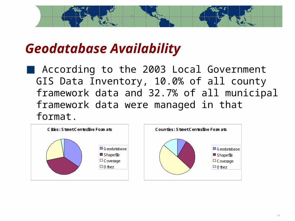
Geodatabase Availability
According to the 2003 Local Government GIS Data Inventory, 10.0% of all county framework data and 32.7% of all municipal framework data were managed in that format.
Cities: Street Centerline Formats
Geodatabase
Shapefile
Coverage
Other
Counties: Street Centerline Formats
Geodatabase
Shapefile
Coverage
Other
Note: Percentages based on the actual number of respondents to each question 54
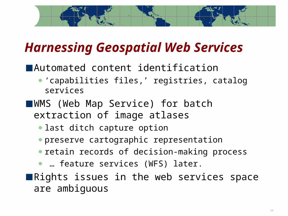
Harnessing Geospatial Web Services
Automated content identification ‘capabilities files,’ registries, catalog services
WMS (Web Map Service) for batch extraction of image atlases
last ditch capture option
preserve cartographic representation
retain records of decision-making process
… feature services (WFS) later.
Rights issues in the web services space are ambiguous
Note: Percentages based on the actual number of respondents to each question 55
Questions?
Contact:
Steve MorrisHead, Digital Library InitiativesNCSU [email protected]