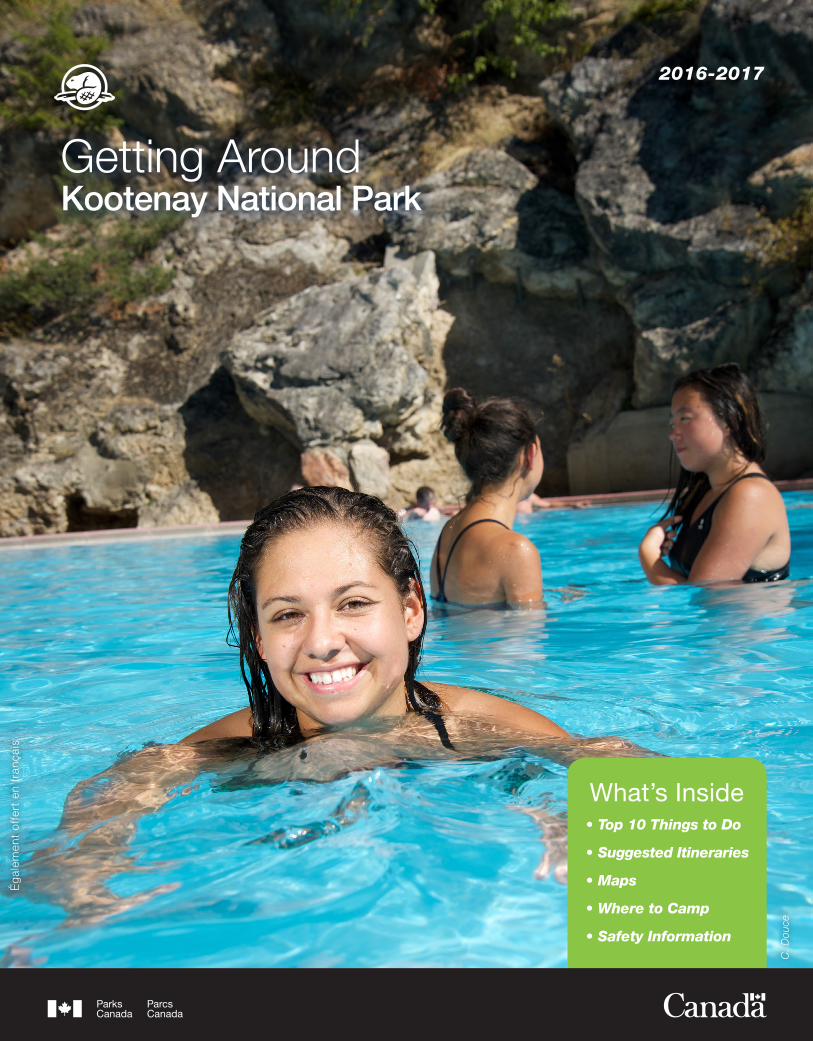
kootenay national park
DESCRIPTION
Everything you need to know about Kootenay National Park. Located in the Kootenay Rockies region of British Columbia, Canada.TRANSCRIPT
•Top10ThingstoDo
•SuggestedItineraries
•Maps
•WheretoCamp
•SafetyInformation
What’s InsideP.
Ziz
ka
Getting AroundKootenay National Park
2016-2017
Ég
alem
ent
off
ert
en f
ranç
ais
•Top10ThingstoDo
•SuggestedItineraries
•Maps
•WheretoCamp
•SafetyInformation
What’s InsideC
. Dou
ce
2
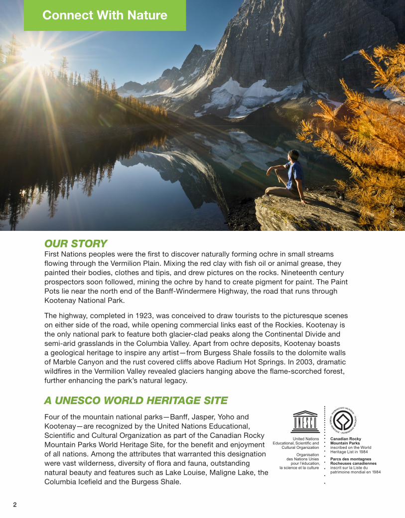
Connect With Nature
OURSTORYFirst Nations peoples were the first to discover naturally forming ochre in small streams flowing through the Vermilion Plain. Mixing the red clay with fish oil or animal grease, they painted their bodies, clothes and tipis, and drew pictures on the rocks. Nineteenth century prospectors soon followed, mining the ochre by hand to create pigment for paint. The Paint Pots lie near the north end of the Banff-Windermere Highway, the road that runs through Kootenay National Park.
The highway, completed in 1923, was conceived to draw tourists to the picturesque scenes on either side of the road, while opening commercial links east of the Rockies. Kootenay is the only national park to feature both glacier-clad peaks along the Continental Divide and semi-arid grasslands in the Columbia Valley. Apart from ochre deposits, Kootenay boasts a geological heritage to inspire any artist—from Burgess Shale fossils to the dolomite walls of Marble Canyon and the rust covered cliffs above Radium Hot Springs. In 2003, dramatic wildfires in the Vermilion Valley revealed glaciers hanging above the flame-scorched forest, further enhancing the park’s natural legacy.
AUNESCOWORLDHERITAGESITEFour of the mountain national parks—Banff, Jasper, Yoho and Kootenay—are recognized by the United Nations Educational, Scientific and Cultural Organization as part of the Canadian Rocky Mountain Parks World Heritage Site, for the benefit and enjoyment of all nations. Among the attributes that warranted this designation were vast wilderness, diversity of flora and fauna, outstanding natural beauty and features such as Lake Louise, Maligne Lake, the Columbia Icefield and the Burgess Shale.
P. Z
izka
C. D
ouce
3
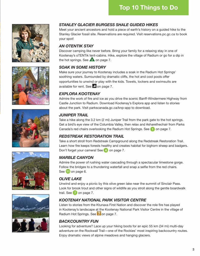
STANLEY GLACIER BURGESS SHALE GUIDED HIKES Meet your ancient ancestors and hold a piece of earth’s history on a guided hike to the Stanley Glacier fossil site. Reservations are required. Visit reservations.pc.gc.ca to book your spot!
AN OTENTIK STAYDiscover camping like never before. Bring your family for a relaxing stay in one of Kootenay’s oTENTik tent-cabins. Hike, explore the village of Radium or go for a dip in the hot springs. See on page 7.
SOAK IN SOME HISTORYMake sure your journey to Kootenay includes a soak in the Radium Hot Springs’ soothing waters. Surrounded by dramatic cliffs, the hot and cool pools offer
opportunities to unwind or play with the kids. Towels, lockers and swimsuits are
available for rent. See on page 7.
EXPLORA KOOTENAYAdmire the work of fire and ice as you drive the scenic Banff-Windermere Highway from Castle Junction to Radium. Download Kootenay’s Explora app and listen to stories about the park. Visit parkscanada.gc.ca/knp-app to download.
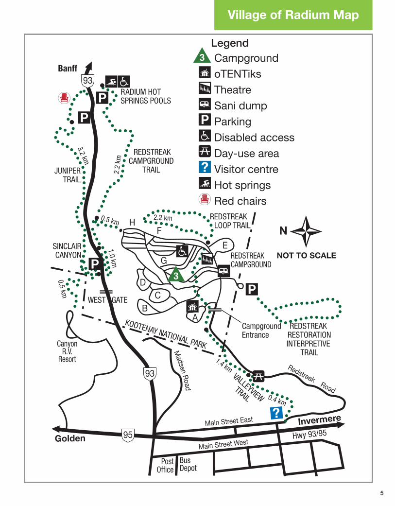
JUNIPER TRAIL Take a hike along the 3.2 km (2 mi) Juniper Trail from the park gate to the hot springs. Get a bird’s eye view of the Columbia Valley, then relax and #sharethechair from Parks Canada’s red chairs overlooking the Radium Hot Springs. See on page 7.
REDSTREAK RESTORATION TRAIL Take a short stroll from Redstreak Campground along the Redstreak Restoration Trail. Learn how fire keeps forests healthy and creates habitat for bighorn sheep and badgers. Don’t forget your camera! See on page 7.
MARBLE CANYONAdmire the power of rushing water cascading through a spectacular limestone gorge. Follow the bridges to a thundering waterfall and snap a selfie from the red chairs. See on page 6.
OLIVE LAKE Unwind and enjoy a picnic by this olive green lake near the summit of Sinclair Pass. Look for brook trout and other signs of wildlife as you stroll along the gentle boardwalk trail. See on page 7.
KOOTENAY NATIONAL PARK VISITOR CENTRE Listen to stories from the Ktunaxa First Nation and discover the role fire has played in Kootenay’s landscape at the Kootenay National Park Visitor Centre in the village of Radium Hot Springs. See on page 7.
BACKCOUNTRY FUN Looking for adventure? Lace up your hiking boots for an epic 55 km (34 mi) multi-day adventure on the Rockwall Trail—one of the Rockies’ most inspiring backcountry routes. Enjoy dramatic views of alpine meadows and hanging glaciers.
Top 10 Things to Do
P. Z
izka
O. R
obin
son
S. M
orga
nM
. Oliv
er
3
1
4
7
11
4
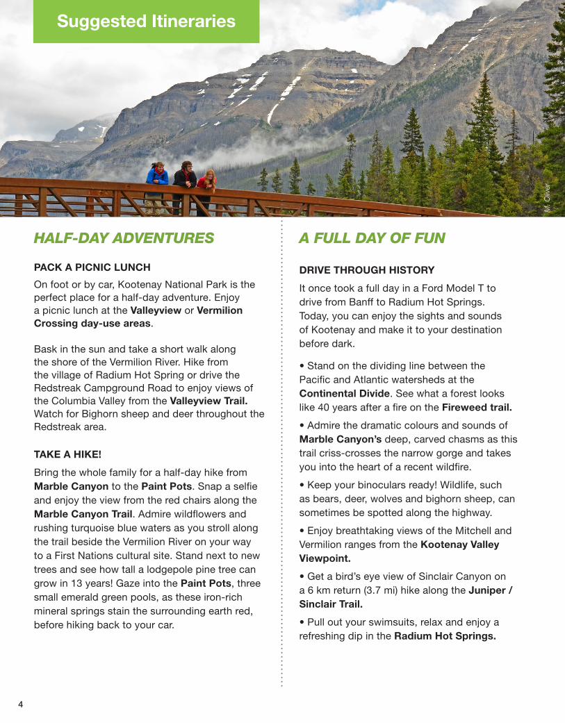
Suggested Itineraries
HALF-DAYADVENTURES
PACK A PICNIC LUNCH
On foot or by car, Kootenay National Park is the perfect place for a half-day adventure. Enjoy a picnic lunch at the Valleyview or Vermilion Crossing day-use areas.
Bask in the sun and take a short walk along the shore of the Vermilion River. Hike from the village of Radium Hot Spring or drive the Redstreak Campground Road to enjoy views of the Columbia Valley from the Valleyview Trail. Watch for Bighorn sheep and deer throughout the Redstreak area.
TAKE A HIKE!
Bring the whole family for a half-day hike from Marble Canyon to the Paint Pots. Snap a selfie and enjoy the view from the red chairs along the Marble Canyon Trail. Admire wildflowers and rushing turquoise blue waters as you stroll along the trail beside the Vermilion River on your way to a First Nations cultural site. Stand next to new trees and see how tall a lodgepole pine tree can grow in 13 years! Gaze into the Paint Pots, three small emerald green pools, as these iron-rich mineral springs stain the surrounding earth red, before hiking back to your car.
AFULLDAYOFFUN
DRIVE THROUGH HISTORY
It once took a full day in a Ford Model T to drive from Banff to Radium Hot Springs. Today, you can enjoy the sights and sounds of Kootenay and make it to your destination before dark.
• Stand on the dividing line between the Pacific and Atlantic watersheds at the Continental Divide. See what a forest looks like 40 years after a fire on the Fireweed trail.
• Admire the dramatic colours and sounds of Marble Canyon’s deep, carved chasms as this trail criss-crosses the narrow gorge and takes you into the heart of a recent wildfire.
• Keep your binoculars ready! Wildlife, such as bears, deer, wolves and bighorn sheep, can sometimes be spotted along the highway.
• Enjoy breathtaking views of the Mitchell and Vermilion ranges from the Kootenay Valley Viewpoint.
• Get a bird’s eye view of Sinclair Canyon on a 6 km return (3.7 mi) hike along the Juniper /Sinclair Trail.
• Pull out your swimsuits, relax and enjoy a refreshing dip in the Radium Hot Springs.
M. O
liver
Redstreak Road
Madsen R
oad
Main Street West
Main Street East
HF
E
G
DC
BA
Golden
Banff
Invermere
NOT TO SCALESINCLAIRCANYON
R ADIUM HOTSPRINGS POOLS
REDSTREAK LOOP TRAIL
REDSTREAK RESTORATIONINTERPRETIVE
TRAIL
REDSTREAKCAMPGROUND
TRAILJUNIPERTRAIL
VALLEYVIEWTRAIL
Campground Entrance
WEST GATE
KOOTENAY NATIONAL PARK
PostOffice
Bus Depot
Hwy 93/95
3.2 km
2.2
km
0.5 km
0.5 km
1.0 km
2.2 km
1.4 km
0.4 km
REDSTREAK CAMPGROUND
CanyonR.V.
Resort
?
3
95
93
93
3 CampgroundoTENTiksTheatreSani dumpParking Disabled accessDay-use areaVisitor centreHot springs Red chairs
Legend
Village of Radium Map
5
10.5
4.2
4.0
8.9
3.4
10.1
2.7
8.8
9.8
8.4
6.4
10.5
12.8
4.3
7.0
9.0
5.02.6
6.5
2.7
4.8
2.3
10.0
4.1 7.
1
9.7
7.0
3.8
2.7
2.3
7.1
8.1
Toku
mm Creek
Misko Ck
Hel
met
Ck
Ochre Ck
Stanl
ey C
reek
Haffner
Creek
Verdan
t Cre
ek
Vere
ndry
e Cre
ek
Sim
pson
Riv
er
Surp
rise
Creek
Tum
blin
g Ck
Verm
ilion
River
River
Dolly
Vard
en C
k
KOOTENAY RIVE
R
Wardle Creek
Sin
clai
r
Floe
Lak
e
Kau
fman
nLa
ke
Boo
m L
ake
Was
hmaw
apta
Ice�
eld
Floe Cree
kSer
ac C
reek
S
had
owLa
ke
Egy
pt
Lake
Talc
Lak
e
Roc
k La
ke
Dae
r Cre
ek
LostCreek
Dog
La
ke
Pitts
Redstreak CreekCre
ek
Kimpton C
reek
Cob
b
Lak
e
Oliv
eLa
ke
Otterta
il
Riv
er
Hawk Cre
ek
Numa Creek
Whitetail Ck
Cre
ek
Meado
w C
k
Nix
on C
reek
John McKay Creek
Sw
ede
Cre
ek
Silt Creek
Sinclai
r Cre
ek
Verm
ilion
East Kootenay Trai
l
95
93
1A
93
93
M
tH
arki
n29
80 m
M
tD
aer
Mt
Sel
kirk
Mt
Kin
der
sley
Mt
C
rook
Lux
or P
ass
Mt
Alle
n
Mt
Oke
Qua
dra
Mt
Chi
mne
yP
eak
Mt
Why
mp
er28
45 m
Boo
mM
t
Mar
ble
Can
yon
Mt
Gra
y
Mt
Dry
sdal
e
Hel
met Mt
Sha
rpM
tGoo
dsi
r P
ass
Ott
erta
il P
ass
Mis
ko P
ass
Roc
kwal
l P
ass
Hon
eym
oon
Pas
s
Wol
verin
e
Pas
s
Sto
rmM
t30
95 m M
tB
all
Mt
Haf
fner
Isab
elle
Pea
k
Verm
ilion
Pea
k26
36 m
Lim
esto
ne
Pea
k
Sta
nley
Pea
k31
55 m
Fost
er
Pea
k32
04 m
Num
a P
ass
Num
aM
t
Hai
duk
Pea
k
The
Mon
arch
Hea
lyP
ass
Cas
tleJu
nctio
n
Bal
lP
ass
Hawk R
idge
Verm
ilio
n
Cro
ssin
g
To B
anff
To Invermere
To Golden
To
Lak
e Lo
uise
Ko
ote
nay
Cro
ssin
g
Cro
ok’s
Mea
dow
(by
rese
rvat
ion
only
)
Mt
Sha
nks
Sp
arM
t
Mt
War
dle
2810
m
Mt
Vere
ndry
e
Sp
litP
eak
Red
stre
akM
t21
18 m
Mt
Ber
land
Rad
ium
Ho
t S
pri
ngs
808
m
Mt
Sin
clai
r
McL
eod
Mea
dow
s
Kinders
leyPas
s
Settlers Road
Redearth P
ass
Gorge Trail
Dol
ly V
arde
nTr
ail
West
Trai
l
Hector
Ko
otenay
1
1
1.2
Red
eart
h
Creek Trail
95
1.0
BA
NFF
NAT
ION
AL
PAR
K
MO
UN
T A
SS
INIB
OIN
EP
RO
VIN
CIA
L PA
RK
YO
HO
N
ATIO
NA
L PA
RK
5.1
7.2
7.9
6.8
2.4
10.5
5.3
8.7
8.72.8
3.2
3.3
5.9 6.6
9.0
Koot
enay
Va
lley
View
poin
t
3
1
2.0
4618
KOO
TEN
AYN
ATIO
NAL
PAR
K
Par
k C
abin
Vis
itor
Cen
tre
Fron
tcou
ntry
Cam
pgr
ound
Bac
kcou
ntry
Cam
pgr
ound
Gro
up C
amp
grou
nd
Rad
ium
Hot
Sp
rings
Poo
ls
Red
Cha
irs
Hik
ing
Trai
l
Cyc
ling
Per
mitt
ed
Hig
hway
Gra
vel R
oad
s
Par
k B
ound
ary
Lege
nd
1
2 35
8
9
7
15
10
13
12
22
21
14
16
This
is n
ot a
top
ogra
phi
cal m
ap a
nd is
not
sui
tab
le fo
r ro
ute-
�nd
ing.
Trai
l inf
orm
atio
n is
ava
ilab
le o
n th
e fo
llow
ing
pag
e.N
ote:
Dis
tanc
es o
n m
ap a
re in
dic
ated
in k
ilom
etre
s.
Juni
per
/ S
incl
air
Can
yon
Red
stre
ak C
amp
grou
nd
Red
stre
ak L
oop
Red
stre
ak R
esto
ratio
n
Val
leyv
iew
Red
stre
ak C
reek
Oliv
e La
ke
Cob
b L
ake
Dog
Lak
e
Pai
nt P
ots
Mar
ble
Can
yon
Pai
nt P
ots
to M
arb
le C
anyo
n
Fire
wee
d L
oop
s
Sta
nley
Gla
cier
1 2 3 4 5 6 7 1298 10 11 13 14
15 16 17 21 23 24 25 26 2722
Kim
pto
n C
reek
Sim
pso
n R
iver
Pro
spec
tor’
s V
alle
y
Kin
der
sley
/ S
incl
air
Loop
Haw
k C
reek
& B
all P
ass
Floe
Lak
e
Hel
met
/ O
chre
Jun
ctio
n
Num
a C
reek
Tum
blin
g C
reek
Hel
met
Cre
ek &
Fal
ls
Tum
blin
g /
Hel
met
/ O
chre
Roc
kwal
l
Hon
eym
oon
Pas
s /
Ver
dan
t
Hiki
ng T
rails
Easy
M
oder
ate
Di
fficu
lt
2018 19
20
19
23
24
25
26
27
17
11
1 4
Rad
ium
Ho
t S
pri
ngs
Are
a Tr
ails
Rad
ium
Hot
Sp
rings
Poo
ls
Red
stre
akC
amp
grou
nd
4
1
2
3
5
93
95
9395
3
4
2
6
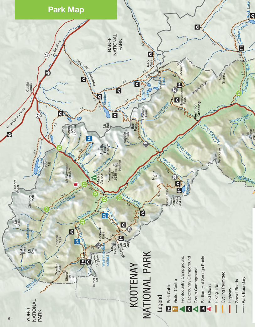
Park Map
10.5
4.2
4.0
8.9
3.4
10.1
2.7
8.8
9.8
8.4
6.4
10.5
12.8
4.3
7.0
9.0
5.02.6
6.5
2.7
4.8
2.3
10.0
4.1 7.
1
9.7
7.0
3.8
2.7
2.3
7.1
8.1
Toku
mm Creek
Misko Ck
Hel
met
Ck
Ochre Ck
Stanl
ey C
reek
Haffner
Creek
Verdan
t Cre
ek
Vere
ndry
e Cre
ek
Sim
pson
Riv
er
Surp
rise
Creek
Tum
blin
g Ck
Verm
ilion
River
River
Dolly
Vard
en C
k
KOOTENAY RIVE
R
Wardle Creek
Sin
clai
r
Floe
Lak
e
Kau
fman
nLa
ke
Boo
m L
ake
Was
hmaw
apta
Ice�
eld
Floe Cree
kSer
ac C
reek
S
had
owLa
ke
Egy
pt
Lake
Talc
Lak
e
Roc
k La
ke
Dae
r Cre
ek
LostCreek
Dog
La
ke
Pitts
Redstreak CreekCre
ek
Kimpton C
reek
Cob
b
Lak
e
Oliv
eLa
ke
Otterta
il
Riv
er
Hawk Cre
ek
Numa Creek
Whitetail Ck
Cre
ek
Meado
w C
k
Nix
on C
reek
John McKay Creek
Sw
ede
Cre
ek
Silt Creek
Sinclai
r Cre
ek
Verm
ilion
East Kootenay Trai
l
95
93
1A
93
93
M
tH
arki
n29
80 m
M
tD
aer
Mt
Sel
kirk
Mt
Kin
der
sley
Mt
C
rook
Lux
or P
ass
Mt
Alle
n
Mt
Oke
Qua
dra
Mt
Chi
mne
yP
eak
Mt
Why
mp
er28
45 m
Boo
mM
t
Mar
ble
Can
yon
Mt
Gra
y
Mt
Dry
sdal
e
Hel
met Mt
Sha
rpM
tGoo
dsi
r P
ass
Ott
erta
il P
ass
Mis
ko P
ass
Roc
kwal
l P
ass
Hon
eym
oon
Pas
s
Wol
verin
e
Pas
s
Sto
rmM
t30
95 m M
tB
all
Mt
Haf
fner
Isab
elle
Pea
k
Verm
ilion
Pea
k26
36 m
Lim
esto
ne
Pea
k
Sta
nley
Pea
k31
55 m
Fost
er
Pea
k32
04 m
Num
a P
ass
Num
aM
t
Hai
duk
Pea
k
The
Mon
arch
Hea
lyP
ass
Cas
tleJu
nctio
n
Bal
lP
ass
Hawk R
idge
Verm
ilio
n
Cro
ssin
g
To B
anff
To Invermere
To Golden
To
Lak
e Lo
uise
Ko
ote
nay
Cro
ssin
g
Cro
ok’s
Mea
dow
(by
rese
rvat
ion
only
)
Mt
Sha
nks
Sp
arM
t
Mt
War
dle
2810
m
Mt
Vere
ndry
e
Sp
litP
eak
Red
stre
akM
t21
18 m
Mt
Ber
land
Rad
ium
Ho
t S
pri
ngs
808
m
Mt
Sin
clai
r
McL
eod
Mea
dow
s
Kinders
leyPas
s
Settlers Road
Redearth P
ass
Gorge Trail
Dol
ly V
arde
nTr
ail
West
Trai
l
Hector
Ko
otenay
1
1
1.2
Red
eart
h
Creek Trail
95
1.0
BA
NFF
NAT
ION
AL
PAR
K
MO
UN
T A
SS
INIB
OIN
EP
RO
VIN
CIA
L PA
RK
YO
HO
N
ATIO
NA
L PA
RK
5.1
7.2
7.9
6.8
2.4
10.5
5.3
8.7
8.72.8
3.2
3.3
5.9 6.6
9.0
Koot
enay
Va
lley
View
poin
t
3
1
2.0
4618
KOO
TEN
AYN
ATIO
NAL
PAR
K
Par
k C
abin
Vis
itor
Cen
tre
Fron
tcou
ntry
Cam
pgr
ound
Bac
kcou
ntry
Cam
pgr
ound
Gro
up C
amp
grou
nd
Rad
ium
Hot
Sp
rings
Poo
ls
Red
Cha
irs
Hik
ing
Trai
l
Cyc
ling
Per
mitt
ed
Hig
hway
Gra
vel R
oad
s
Par
k B
ound
ary
Lege
nd
1
2 35
8
9
7
15
10
13
12
22
21
14
16
This
is n
ot a
top
ogra
phi
cal m
ap a
nd is
not
sui
tab
le fo
r ro
ute-
�nd
ing.
Trai
l inf
orm
atio
n is
ava
ilab
le o
n th
e fo
llow
ing
pag
e.N
ote:
Dis
tanc
es o
n m
ap a
re in
dic
ated
in k
ilom
etre
s.
Juni
per
/ S
incl
air
Can
yon
Red
stre
ak C
amp
grou
nd
Red
stre
ak L
oop
Red
stre
ak R
esto
ratio
n
Val
leyv
iew
Red
stre
ak C
reek
Oliv
e La
ke
Cob
b L
ake
Dog
Lak
e
Pai
nt P
ots
Mar
ble
Can
yon
Pai
nt P
ots
to M
arb
le C
anyo
n
Fire
wee
d L
oop
s
Sta
nley
Gla
cier
1 2 3 4 5 6 7 1298 10 11 13 14
15 16 17 21 23 24 25 26 2722
Kim
pto
n C
reek
Sim
pso
n R
iver
Pro
spec
tor’
s V
alle
y
Kin
der
sley
/ S
incl
air
Loop
Haw
k C
reek
& B
all P
ass
Floe
Lak
e
Hel
met
/ O
chre
Jun
ctio
n
Num
a C
reek
Tum
blin
g C
reek
Hel
met
Cre
ek &
Fal
ls
Tum
blin
g /
Hel
met
/ O
chre
Roc
kwal
l
Hon
eym
oon
Pas
s /
Ver
dan
t
Hiki
ng T
rails
Easy
M
oder
ate
Di
fficu
lt
2018 19
20
19
23
24
25
26
27
17
11
1 4
Rad
ium
Ho
t S
pri
ngs
Are
a Tr
ails
Rad
ium
Hot
Sp
rings
Poo
ls
Red
stre
akC
amp
grou
nd
4
1
2
3
5
93
95
9395
3
4
2
7
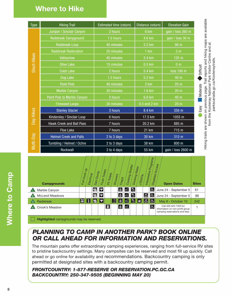
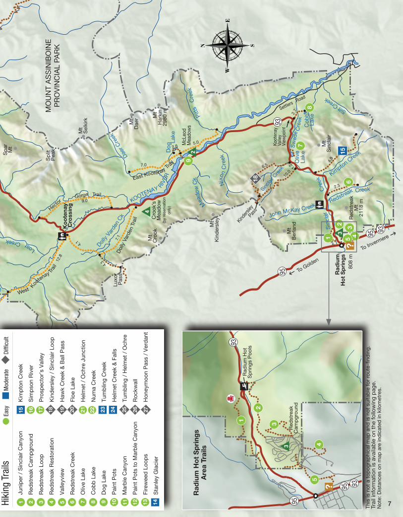
Marble Canyon
McLeod Meadows
Redstreak
Crook’s Meadow
Highlighted campgrounds may be reserved.
Open Dates SitesCampgrounds
June 24 - September 5
Call 403-522-1203 for information on non-pro�t group camping reservations and fees.
May 6 - October 10
June 24 - September 5
1
2
3
4
6
61
88
242
1
Drin
king
Wat
er
Dis
able
d A
cces
s
oTE
NTi
kIn
terp
retiv
e P
rogr
ams
Flus
h To
ilets
Pit
Toile
tsS
how
ers
Full
Hoo
k-up
Ele
ctric
al
Fire
pit
Coo
king
She
lter
San
i Dum
p
8
Hiking Trail Estimated time (return) Distance (return) Elevation Gain
Juniper / Sinclair Canyon 2 hours 6 km gain / loss 260 m
Redstreak Campground 1.5 hours 4.6 km gain / loss 30 m
Redstreak Loop 45 minutes 2.2 km 90 m
Redstreak Restoration 20 minutes 1 km 5 m
Valleyview 45 minutes 2.4 km 125 m
Olive Lake 15 minutes 0.5 km 0 m
Cobb Lake 2 hours 5.4 km loss 190 m
Dog Lake 1.5 hours 5.2 km 40 m
Paint Pots 40 minutes 2 km 25 m
Marble Canyon 30 minutes 1.6 km 20 m
Paint Pots to Marble Canyon 2 hours 6.8 km 40 m
Fireweed Loops 30 minutes 0.5 and 2 km 20 m
Stanley Glacier 3 hours 8.4 km 356 m
Kindersley / Sinclair Loop 6 hours 17.5 km 1055 m
Hawk Creek and Ball Pass 7 hours 20.2 km 885 m
Floe Lake 7 hours 21 km 715 m
Helmet Creek and Falls 2 to 3 days 30 km 310 m
Tumbling / Helmet / Ochre 2 to 3 days 38 km 800 m
Rockwall 3 to 4 days 55 km gain / loss 2600 m
Type
Shor
t Hik
es
Day
Hike
s M
ulti-
Day
Whe
re t
o C
amp
The mountain parks offer extraordinary camping experiences, ranging from full-service RV sites to pristine backcountry settings. Many campsites can be reserved and most fill up quickly. Call ahead or go online for availability and recommendations. Backcountry camping is only permitted at designated sites with a backcountry camping permit.
FRONTCOUNTRY:1-877-RESERVEORRESERVATION.PC.GC.CABACKCOUNTRY:250-347-9505(BEGINNINGMAY20)
PLANNINGTOCAMPINANOTHERPARK?BOOKONLINEORCALLAHEADFORINFORMATIONANDRESERVATIONS.
Where to Hike
Hik
ing
tra
ils a
re s
how
n o
n p
revi
ous
pag
e. T
rail
rep
ort
s an
d h
ikin
g m
aps
are
avai
lab
le
fro
m t
he K
oo
tena
y N
atio
nal P
ark
Vis
itor
Cen
tre
and
at
par
ksca
nad
a.g
c.ca
/Ko
ote
nayt
rails
.

9
Stay Safe and Enjoy
(Insertimagehere)
MOUNTAINSAFETYUnpredictable mountain weather can change road and trail conditions instantly and wildlife can be anywhere, any time. These simple precautions will help ensure you have a safe and enjoyable visit.
• Visit drivebc.ca and 511.alberta to check road conditions prior to heading out. • Obey speed limits and watch for wildlife on the roadside.• Stay on designated roads, trails and other hardened surfaces. • Keep a ‘Bare’ campsite. Visit parkscanada.gc.ca/bare-campsite.• Make noise on the trails and let wildlife know you are coming.• Research and plan overnight trips including potential trail restrictions and
closures, avalanche conditions and mandatory backcountry permits. Visit parkscanada.gc.ca/knp-backcountry and avalanche.pc.gc.ca for safety tips.
• Let someone know your plans. Cell phones are not reliable in the wilderness.• Keep clear of cliffs, ledges and fast moving water.
PARKREGULATIONSFollowingparkregulationswhileenjoyingyournationalparkswillhelpprotectyou,thelandandourwildlife:
• Keep pets on a leash and under control at all times. Please collect and properly discard pet feces.
• Take only photographs. It is illegal to pick flowers, mushrooms, cut down trees, branches, remove cultural artifacts or fossils, or otherwise cause damage to natural objects or living things.
• Be considerate of your neighbours. Liquor consumption is prohibited in public places, day-use areas, and during set periods in campgrounds. Respect quiet hours and liquor bans in campgrounds.
• Stay out of closed areas. Area closures or activity restrictions are implemented when visitors are at risk or when wildlife requires additional protection. Signs indicate the areas impacted.
• Be careful with fire. Fires are permitted only in designated areas with fireboxes or firepits. Extinguish fires completely. Do not use deadwood, bark or branches for fuel. Report wildfires immediately.
• Buy fishing permits. Anglers require a national park fishing permit, available at Parks Canada visitor centres. Provincial licenses are not valid in national parks.
• Going boating? Motors are not allowed on most lakes.
• Motorized off-road travel is not permitted.
THECANADANATIONALPARKSACTPark Wardens are responsible for enforcing park regulations as required by the Canada National Parks Act. To report national park violations, call 24 hours a day, 7 days per week.
1-888-927-3367 (Banff, Yoho, Kootenay and Waterton Lakes)1-877-852-3100 (Jasper, Mount Revelstoke and Glacier) Visit pc.gc.ca/mtnregulations
Violators will be charged, be required to appear in court and could pay fines of up to $25 000.
Par
ks C
anad
aA
. Ath
wal
M. M
acul
loC
. Dou
ceM
. Mac
ullo
10
Mountain Stories
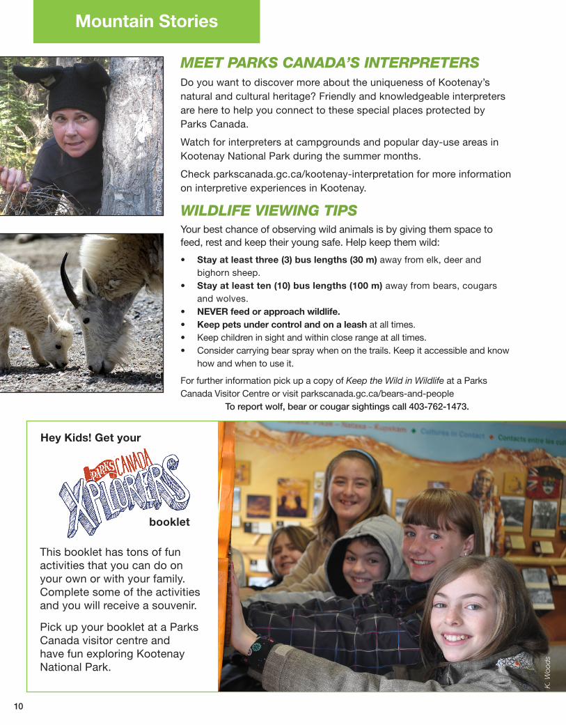
MEETPARKSCANADA’SINTERPRETERSDo you want to discover more about the uniqueness of Kootenay’s natural and cultural heritage? Friendly and knowledgeable interpreters are here to help you connect to these special places protected by Parks Canada.
Watch for interpreters at campgrounds and popular day-use areas in Kootenay National Park during the summer months.
Check parkscanada.gc.ca/kootenay-interpretation for more information on interpretive experiences in Kootenay.
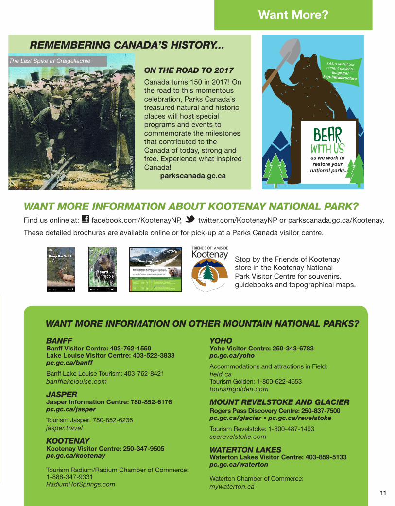
WILDLIFEVIEWINGTIPSYour best chance of observing wild animals is by giving them space to feed, rest and keep their young safe. Help keep them wild:
• Stay at least three (3) bus lengths (30 m) away from elk, deer and bighorn sheep.
• Stay at least ten (10) bus lengths (100 m) away from bears, cougars and wolves.
• NEVER feed or approach wildlife.• Keep pets under control and on a leash at all times. • Keep children in sight and within close range at all times. • Consider carrying bear spray when on the trails. Keep it accessible and know
how and when to use it.
For further information pick up a copy of Keep the Wild in Wildlife at a Parks Canada Visitor Centre or visit parkscanada.gc.ca/bears-and-people
To report wolf, bear or cougar sightings call 403-762-1473.
A. D
ibb
Par
ks C
anad
a
This booklet has tons of fun activities that you can do on your own or with your family. Complete some of the activities and you will receive a souvenir.
Pick up your booklet at a Parks Canada visitor centre and have fun exploring Kootenay National Park.
Hey Kids! Get your
booklet
K. W
ood
s
11
Learn about our current projects:
pc.gc.ca/knp-infrastructure
as we work to restore your
national parks.
BEARWITH US
REMEMBERINGCANADA’SHISTORY...
ONTHEROADTO2017
Canada turns 150 in 2017! On the road to this momentous celebration, Parks Canada’s treasured natural and historic places will host special programs and events to commemorate the milestones that contributed to the Canada of today, strong and free. Experience what inspired Canada!
parkscanada.gc.ca
Par
ks C
anad
a
Want More?
BANFFBanff Visitor Centre: 403-762-1550Lake Louise Visitor Centre: 403-522-3833pc.gc.ca/banff
Banff Lake Louise Tourism: 403-762-8421 banfflakelouise.com
JASPER Jasper Information Centre: 780-852-6176pc.gc.ca/jasper
Tourism Jasper: 780-852-6236jasper.travel
KOOTENAYKootenay Visitor Centre: 250-347-9505pc.gc.ca/kootenay
Tourism Radium/Radium Chamber of Commerce: 1-888-347-9331RadiumHotSprings.com
YOHOYoho Visitor Centre: 250-343-6783pc.gc.ca/yoho
Accommodations and attractions in Field:field.caTourism Golden: 1-800-622-4653tourismgolden.com
MOUNTREVELSTOKEANDGLACIERRogers Pass Discovery Centre: 250-837-7500pc.gc.ca/glacier• pc.gc.ca/revelstoke
Tourism Revelstoke: 1-800-487-1493seerevelstoke.com
WATERTONLAKESWaterton Lakes Visitor Centre: 403-859-5133pc.gc.ca/waterton
Waterton Chamber of Commerce:mywaterton.ca
WANTMOREINFORMATIONABOUTKOOTENAYNATIONALPARK?Find us online at: facebook.com/KootenayNP, twitter.com/KootenayNP or parkscanada.gc.ca/Kootenay.
These detailed brochures are available online or for pick-up at a Parks Canada visitor centre.
WANTMOREINFORMATIONONOTHERMOUNTAINNATIONALPARKS?
K. W
ood
s
Stop by the Friends of Kootenay store in the Kootenay National Park Visitor Centre for souvenirs, guidebooks and topographical maps.
The Last Spike at Craigellachie
!.
!.
!.
!(!(
!(
!(
!(
!(
!(
!(
!(
!(
!(
!(
ì
ì
16
16
YohoNational
Park
KootenayNational
Park
BanffNational
Park
Waterton LakesNational
Park
JasperNational
Park
!93N
!93S
"11
£2
!95
!93
!95
"3
BritishColumbia
Alberta
£2
Mount RevelstokeNational
ParkGlacier
National Park
Banff
Jasper
!22
to FortSt. JamesNational
Historic Site
a
to Vancouver
a
!5
to Vancouver
a
!5
!22
"6
Golden
Invermere
Grande Cache
RadiumHot Springs
Hinton
Field
Canmore
Revelstoke
Lake Louise
Columbia Icefield
Bar U RanchNational Historic Site
Rocky Mountain HouseNational Historic Site
Calgary
Red Deer
Edmonton
0 20 4010 kilometres
0 10 20 miles
Ü
FOREMERGENCIESDIAL911(Police, Fire and Ambulance)
Road reports: Visit 511.alberta.ca or Drivebc.ca
Cell phone coverage is not reliable in all areas of the mountain parks.
Calgary
ColumbiaIcefield
Edmonton
Field (Yoho NP)
Jasper
Lake Louise
RadiumHot Springs
Golden
Revelstoke
Vancouver
Waterton
128
188
423
85
291
58
132
134
282
856
395
316
295
213
419
186
260
262
410
984
266
461
157
103
130
261
207
355
928
582
508
361
481
555
557
705
1279
568
260
27
157
57
197
771
476
233
361
307
455
798
687
130
85
224
794
453
105
253
818
395
148
713
532
565
681 1140
distancechart
Distances are shown in kilometres. To convert distances to miles, multiply by 0.62.
Banff
Calgary
Columbia
Icefie
ld
Edmon
ton
Field
(Yoho
NP)
Jasp
er
Lake
Louis
e
Radium
Hot Sp
rings
Golden
Revelst
oke
Vanc
ouver
©H
er M
ajes
ty t
he Q
ueen
in R
ight
of
Can
ada
Cat
alo
gue
No
: R64
-438
/201
6EIS
BN
: 978
-0-6
60-0
3986
-2