international association of · pdf filea constituent association of the international union...
TRANSCRIPT
A Constituent Association of the International Union of Geodesy and Geophysics
International Associationof Geodesy
2
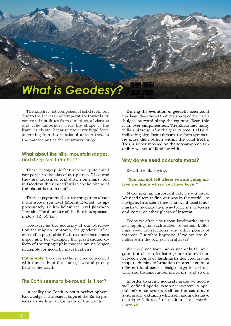
Permanent GPS Station in southern Greenlandpart of the GNET Project (Photo: M. Bevis)
The Earth is not composed of solid rock, butdue to the increase of temperature towards itscentre it is built up from a mixture of viscousand solid materials. Thus the shape of theEarth is oblate, because the centrifugal forcestemming from its rotational motion thruststhe masses out at the equatorial bulge.
What about the hills, mountain ranges,and deep sea trenches?
These ‘topographic features’ are quite smallcompared to the size of our planet. Of coursethey are measured and drawn on maps, butin Geodesy their contribution to the shape ofthe planet is quite small.
These topographic features range from about9 km above sea level (Mount Everest) to ap-proximately 12 km below sea level (MarianaTrench). The diameter of the Earth is approxi-mately 12756 km.
However, as the accuracy of our observa-tion techniques improves, the geodetic influ-ence of topographic features becomes moreimportant. For example, the gravitational ef-fects of the topographic masses are no longernegligible for geodetic investigations.
Put simply: Geodesy is the science concernedwith the study of the shape, size and gravityfield of the Earth.
The Earth seems to be round, is it not?
In reality the Earth is not a perfect sphere.Knowledge of the exact shape of the Earth pro-vides us with accurate maps of the Earth.
During the evolution of geodetic science, ithas been discovered that the shape of the Earth‘bulges’ outward along the equator. Even thisis an over simplification. The Earth has many‘hills and troughs’ in the gravity potential field,indicating significant departures from symmet-ric mass distribution within the solid Earth.This is superimposed on the topographic vari-ability we are all familiar with.
Why do we need accurate maps?
Recall the old saying:
“You can not tell where you are going un-less you know where you have been.”
Maps play an important role in our lives.We need them to find our way in the world – tonavigate. In ancient times mankind used land-marks to navigate their way to friends, to townsand ports, or other places of interest.
Today we often use urban landmarks, suchas shopping malls, churches, prominent build-ings, road intersections, and other points ofinterest. But what happens, if we are not fa-miliar with the town or rural area?
We need accurate maps not only to navi-gate, but also to indicate geometric relationsbetween points or landmarks depicted on themap, to display information on areal extent ofdifferent landuse, to design large infrastruc-ture and transportation problems, and so on.
In order to create accurate maps we need awell-defined spatial reference system. A spa-tial reference system defines the coordinatesystem and datum in which all landmarks havea unique “address” or position (i.e., coordi-nates).
What is Geodesy?

3
Photo: iStockPhoto (dra_schwartz, hidesy,Zhenikeyev)
Detailed knowledge of the Gravitational Fieldof the Earth does improve our lives. It helpsus understanding climate change, sea levelrise, and geological hazards (e.g., earthquakes,volcanoes); and it underpins practically allsatellite applications, as well as precise naviga-tion systems.
Since our planet is composed of differentmaterials, its gravitational field shows localvariations (called “anomalies”). Observing theseanomalies can help us to explore the sub-surface mass distribution of our planet. In thisway, we may look into the interior of the Earth.
What affects the gravitational field?
The gravitational field is affected by manyfactors, including:
mass density variations inside the Earth;
the oceans - the level of oceans changesdue to temperature, ocean currents, etc.Changes in the level of oceans also changethe gravitational field.
the Sun, Moon and other planets - thegravitational effects of the Sun, Moon andthe planets vary according to their posi-tion relative to the Earth.
ice sheets - they compress the Earth'scrust beneath them. Changes in theicecaps (e.g., melting due to ClimateChange) may reduce this compression,and thus affect the gravitational field.
These effects are only examples. Howeverwe can see how complicated our planet is, andcan get a sense of how these components in-teract with one another.
In the previous page we defined Geodesy asthe science of studying the Shape, Size andGravity Field of the Earth. But what is the Grav-ity Field, and why is it important?
Gravity in a nutshell
Gravitation is a force that pulls or attractsall bodies in the universe that have a masstowards each other. Planets remain in theirorbits around the Sun due to this force. Thegravitational force depends on the magnitudesof the masses of the bodies and their separa-tion. In Geodesy we usually distinguish “grav-ity” as gravitation plus centrifugal accelerationdue to the Earth's rotation, because tradition-ally we can measure gravity, not gravitation,at points on the rotating Earth.
Newton's apple
Sir Isaac Newton postulated that the Earth'sgravitation causes such things as the fabledapple to fall, yet it is the same force that keepsplanets in their orbits. For example, he figuredout that the Moon would travel in a straightline without the attraction from the Earthpulling it into a curved orbit.
What is Gravitation?From the Apples to the Satellites
GRACE satellites observing the gravity field ofthe Earth
4(Image courtesy of NASA/JPL)
Why do we need to study the gravita-tional field?
Gravitation affects almost everything in ourlives. From precise clocks to hydroelectricdams, from the tides in the oceans to bloodcirculation.
We study the Earth's gravitational field tolearn more about our planet.
How can the satellites help?
If we want to study the gravitational field glo-bally, terrestrial gravity data have severe limi-tations, mostly because they do not cover thewhole globe with a homogeneous set of mea-surements. Moreover, in some places in theworld, these observations are highly confiden-tial because gravity measurements lead explo-ration geophysicists to oil fields and mineraldeposits, and assist military planners to guidemissiles to their intended targets.
Satellite missions such as CHAMP(CHAllenging Minisatellite Payload), GRACE(Gravity Recovery And Climate Experiment) andGOCE (Gravity Field and Steady-state OceanCirculation Explorer) help us to study the
global gravitational field of the Earth. TheseLow-Earth Orbiters (LEOs) provide geodesistswith a global, homogeneous coverage of gravi-tational measurements.
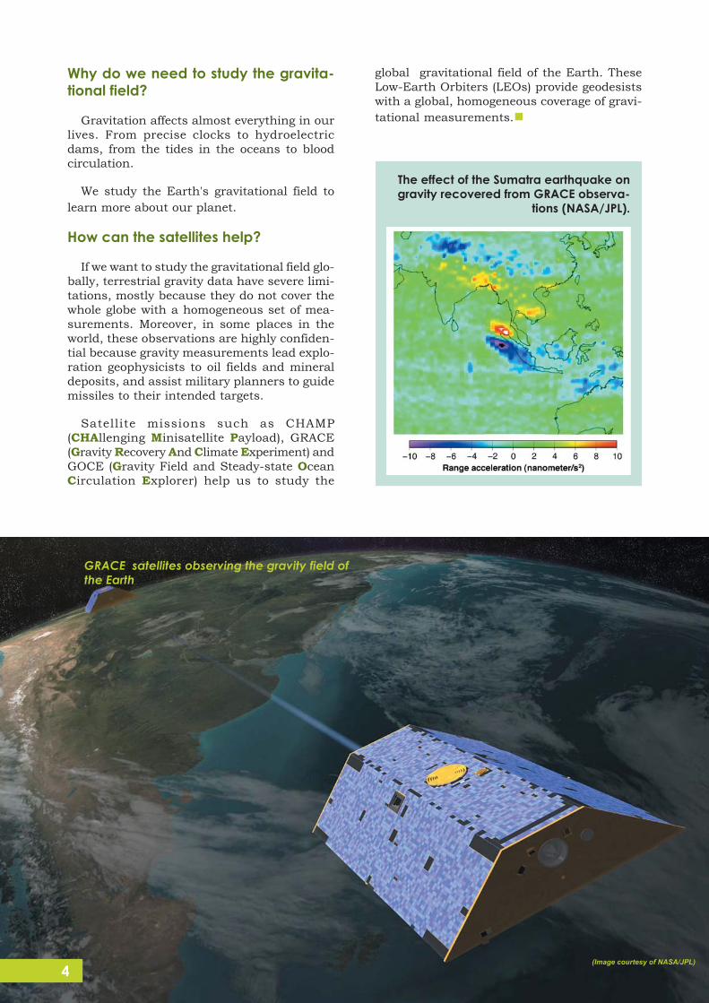
The effect of the Sumatra earthquake ongravity recovered from GRACE observa-
tions (NASA/JPL).

5
The classical definition of Geodesy is thescience concerned with the Shape, Size, andGravity Field of the Earth. Webster’s dictio-nary even defines it as a branch of appliedmathematics!
Geodesy today is much more than that. It isa geoscience that treats the Earth as a com-plex dynamic system, a body consisting ofmany layers, surrounded by atmosphere andoceans. Geodesy is required to model thesystem’s behaviour in space and time so as toprovide the basic framework needed across awide range of Earth sciences. For example, itdoes not make sense to speak of global sealevel rise without referring to the cm-accurate(time-variable) terrestrial reference system, orthe precise global gravity field determined fromsatellite tracking, or the sea surface topogra-phy maps established from a series of al-timeter satellite missions.
The title page of Peter Apian’s famous workIntroductio Geographica, published in 1533,indicates, on the other hand, that Geodesy isa rather old observational science.
The illustration at the top of the page indicatesthat:
1) State-of-the-art measurements and theircorrect mathematical treatment were, andare, of central importance.
2) The same measurement techniques areused for the most demanding as well as“everyday” purposes.
3) Geodetic techniques provide the basis forapplications of crucial importance to man-kind, such as Precise Positioning (from theglobal scale down to the maintenance ofcadastres) and Navigation (illustrated in thefigure by the measurement of “lunar dis-tances”).
4) Geodesy provides the link to Astronomy (in-dicated by the measurement of “lunar dis-tances”, allowing the reconstruction ofUniversal Time (UT) in connection withastronomical almanacs).
The Space Age, and the development of spacegeodetic observation techniques associatedwith it, revolutionized our understanding ofGeodesy. Distance and distance differencemeasurements complemented and, to a certainextent, replaced the measurement of angles,making possible the establishment of truly glo-bal reference systems (geometric and gravita-tional). The progress of Space Geodesy nowmakes possible routine millimetre-level posi-tioning, enabling the detection of crustal move-ment and strain with unprecedented accuracyand high time resolution.
Geodesy continues to provide, with state-of-the-art measurement tools, the scientific basisof Navigation, e.g., by the exploitation of theexisting and planned Global Navigation SatelliteSystems (GNSS), such as GPS, GLONASS,GALILEO and COMPASS. The link to funda-mental Astronomy via the global terrestrial ref-erence system, by monitoring the rotationalmotion of our planet, by space geodetic tech-niques, and by establishing the celestial refer-ence system and UT (reflecting Earth rotation).
Modern Geodesy is experiencing spectacu-lar growth and each year new frontiers of Earthscience knowledge are being explored, such astemporal variations of positions and gravity(land deformations, post-glacial rebound, sealevel rise, etc.). It is a fundamental science,contributing to both everyday mapping andnavigation purposes, and to our understand-ing of our living planet.
Geodesy of Today

6
Photo: iStockPhoto (AB DESIGN)
Traditionally, Geodesy has been viewed asa service science, providing an important util-ity to other geosciences, and supporting manyapplications. In the past, the main ”custom-ers” of Geodesy came from the surveying andmapping profession, while today Geodesyserves all Earth sciences, including the geo-physical, oceanographic, atmospheric, hydro-logical and environmental science communi-ties.
Moreover, Geodesy has served society byproviding reference frames for a wide range ofpractical applications, such as navigation onland, sea and in the air, and from constructionof infrastructure to the determination ofreliable boundaries of real estate properties.Reference frames were, however, national orregional in scope, and they were suited for thedetermination of coordinates relative to a net-work of ground reference points. Thus, deter-mination of precise point coordinates requiredsimultaneous mea-surements at se-veralpoints. Today, GNSSprovides access to pre-cise point coordinatesin a global referenceframe anytime and anywhere on the Earth’ssurface with centimetre-level accuracy.
This technological development has stimu-lated new applications demanding even greateraccuracy and better access to geodetically de-termined positions. On local to regional scales,applications such as land surveying, deforma-tion monitoring of infrasructure, prevention
and mitigation of the impacts of environmentalhazards, and numerous technical applicationsrequire more or less instantaneous access to
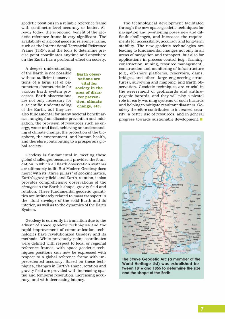
Triangulation tower (“ground referencepoint”) in the Struve Chain, a memberon UNESCO’s World Heritage List
Traditionally Geodesyserved the society byproviding reference
frames ...
Why is Geodesy Fundamental toSociety?
7
geodetic positions in a reliable reference framewith centimetre-level accuracy or better. Al-ready today, the economic benefit of the geo-detic reference frame is very significant. Theavailability of a global geodetic reference frame,such as the International Terrestrial ReferenceFrame (ITRF), and the tools to determine pre-cise point coordinates anytime and anywhereon the Earth has a profound effect on society.
A deeper understandingof the Earth is not possiblewithout sufficient observa-tions of a large set of pa-rameters characteristic forvarious Earth system pro-cesses. Earth observationsare not only necessary fora scientific understandingof the Earth, but they arealso fundamental for many societal benefit ar-eas, ranging from disaster prevention and miti-gation, the provision of resources such as en-ergy, water and food, achieving an understand-ing of climate change, the protection of the bio-sphere, the environment, and human health,and therefore contributing to a prosperous glo-bal society.
Geodesy is fundamental in meeting theseglobal challenges because it provides the foun-dation in which all Earth observation systemsare ultimately built. But Modern Geodesy doesmore: with its „three pillars” of geokinematics,Earth’s gravity field, and Earth rotation, it alsoprovides comprehensive observations of thechanges in the Earth’s shape, gravity field androtation. These fundamental geodetic quanti-ties are intimately related to mass transport inthe fluid envelope of the solid Earth and itsinterior, as well as to the dynamics of the EarthSystem.
Geodesy is currently in transition due to theadvent of space geodetic techniques and therapid improvement of communication tech-nologies have revolutionized Geodesy and itsmethods. While previously point coordinateswere defined with respect to local or regionalreference frames, with space geodetic tech-niques positions can now be expressed withrespect to a global reference frame with un-precedented accuracy. Based on these tech-niques, changes in Earth’s shape, rotation andgravity field are provided with increasing spa-tial and temporal resolution, increasing accu-racy, and with decreasing latency.
The technological development facilitatedthrough the new space geodetic techniques fornavigation and positioning poses new and dif-ficult challenges, and increases the require-ments for accessibility, accuracy and long-termstability. The new geodetic technologies areleading to fundamental changes not only in allareas of navigation and transport, but also forapplications in process control (e.g., farming,construction, mining, resource management),construction and monitoring of infrastructure(e.g., off-shore platforms, reservoirs, dams,bridges, and other large engineering struc-tures), surveying and mapping, and Earth ob-servation. Geodetic techniques are crucial inthe assessment of geohazards and anthro-pogenic hazards, and they will play a pivotalrole in early warning systems of such hazardsand helping to mitigate resultant disasters. Ge-odesy therefore contributes to increased secu-rity, a better use of resources, and in generalprogress towards sustainable development.
Earth obser-vations are
vital forsociety in thearea of disas-ter preven-
tion, climatechange, etc.
The Struve Geodetic Arc (a member of theWorld Heritage List) was established be-tween 1816 and 1855 to determine the sizeand the shape of the Earth.
8
Photo: iStockPhoto (dra_schwartz, hidesy,Zhenikeyev)
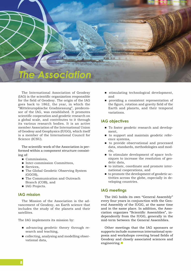
The International Association of Geodesy(IAG) is the scientific organization responsiblefor the field of Geodesy. The origin of the IAGgoes back to 1862, the year, in which the“Mitteleuropäische Gradmessung”, predeces-sor of the IAG, was established. It promotesscientific cooperation and geodetic research ona global scale, and contributes to it throughits various research bodies. It is an activemember Association of the International Unionof Geodesy and Geophysics (IUGG), which itselfis a member of the International Council forScience (ICSU).
The scientific work of the Association is per-formed within a component structure consist-ing of:
Commissions, Inter-commission Committees, Services, The Global Geodetic Observing System(GGOS), The Communication and OutreachBranch (COB), and IAG Projects.
IAG missionThe Mission of the Association is the ad-
vancement of Geodesy, an Earth science thatincludes the study of the planets and theirsatellites.
The IAG implements its mission by:
advancing geodetic theory through re-search and teaching, collecting, analysing and modelling obser-vational data,
stimulating technological development,and providing a consistent representation ofthe figure, rotation and gravity field of theEarth and planets, and their temporalvariations.
IAG objectives To foster geodetic research and develop-ment, to support and maintain geodetic refer-ence systems, to provide observational and processeddata, standards, methodologies and mod-els, to stimulate development of space tech-niques to increase the resolution of geo-detic data, to initiate, coordinate and promote inter-national cooperations, and to promote the development of geodetic ac-tivities across the globe, especially in de-veloping countries.
IAG meetingsThe IAG holds its own “General Assembly”
every four years in conjunction with the Gen-eral Assembly of the IUGG, at the same timeand in the same place. In addition, the Asso-ciation organizes “Scientific Assemblies”, in-dependently from the IUGG, generally in themid-term between the General Assemblies.
Other meetings that the IAG sponsors orsupports include numerous international sym-posia and workshops covering broad fields ofGeodesy and closely associated sciences andengineering.
The Association
9
The Very Large Array radiotelescope (Image courtesy of NRAO/AUI and Laure Wilson Neish)
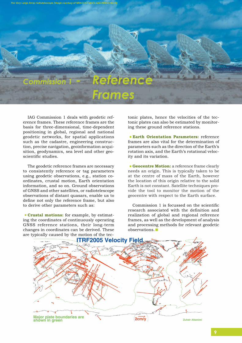
IAG Commission 1 deals with geodetic ref-erence frames. These reference frames are thebasis for three-dimensional, time-dependentpositioning in global, regional and nationalgeodetic networks, for spatial applicationssuch as the cadastre, engineering construc-tion, precise navigation, geoinformation acqui-sition, geodynamics, sea level and other geo-scientific studies.
The geodetic reference frames are necessaryto consistently reference or tag parametersusing geodetic observations, e.g., station co-ordinates, crustal motion, Earth orientationinformation, and so on. Ground observationsof GNSS and other satellites, or radiotelescopeobservations of distant quasars, enable us todefine not only the reference frame, but alsoto derive other parameters such as:
Crustal motions: for example, by estimat-ing the coordinates of continuously operatingGNSS reference stations, their long-termchanges in coordinates can be derived. Theseare typically caused by the motion of the tec-
tonic plates, hence the velocities of the tec-tonic plates can also be estimated by monitor-ing these ground reference stations.
Earth Orientation Parameters: referenceframes are also vital for the determination ofparameters such as the direction of the Earth’srotation axis, and the Earth’s rotational veloc-ity and its variation.
Geocentre Motion: a reference frame clearlyneeds an origin. This is typically taken to beat the centre of mass of the Earth, howeverthe location of this origin relative to the solidEarth is not constant. Satellite techniques pro-vide the tool to monitor the motion of thegeocentre with respect to the Earth surface.
Commission 1 is focussed on the scientificresearch associated with the definition andrealization of global and regional referenceframes, as well as the development of analysisand processing methods for relevant geodeticobservations.
Commission 1 - ReferenceFrames
10
GOCE Satellite (Image courtesy of ESA)
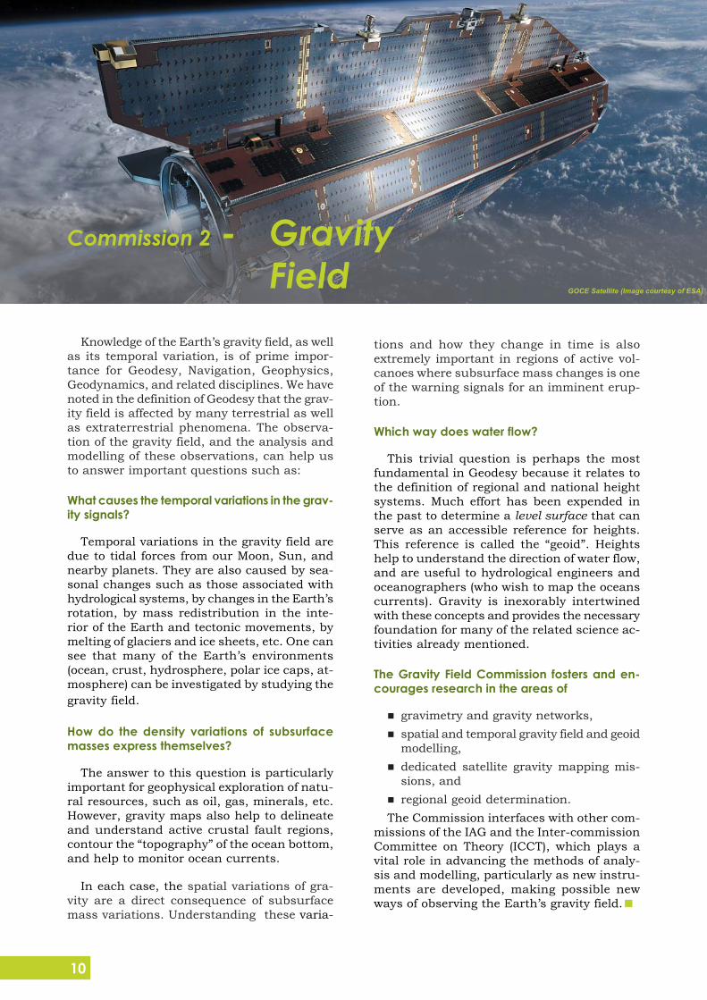
Knowledge of the Earth’s gravity field, as wellas its temporal variation, is of prime impor-tance for Geodesy, Navigation, Geophysics,Geodynamics, and related disciplines. We havenoted in the definition of Geodesy that the grav-ity field is affected by many terrestrial as wellas extraterrestrial phenomena. The observa-tion of the gravity field, and the analysis andmodelling of these observations, can help usto answer important questions such as:
What causes the temporal variations in the grav-ity signals?
Temporal variations in the gravity field aredue to tidal forces from our Moon, Sun, andnearby planets. They are also caused by sea-sonal changes such as those associated withhydrological systems, by changes in the Earth’srotation, by mass redistribution in the inte-rior of the Earth and tectonic movements, bymelting of glaciers and ice sheets, etc. One cansee that many of the Earth’s environments(ocean, crust, hydrosphere, polar ice caps, at-mosphere) can be investigated by studying thegravity field.
How do the density variations of subsurfacemasses express themselves?
The answer to this question is particularlyimportant for geophysical exploration of natu-ral resources, such as oil, gas, minerals, etc.However, gravity maps also help to delineateand understand active crustal fault regions,contour the “topography” of the ocean bottom,and help to monitor ocean currents.
In each case, the spatial variations of gra-vity are a direct consequence of subsurfacemass variations. Understanding these varia-
tions and how they change in time is alsoextremely important in regions of active vol-canoes where subsurface mass changes is oneof the warning signals for an imminent erup-tion.
Which way does water flow?
This trivial question is perhaps the mostfundamental in Geodesy because it relates tothe definition of regional and national heightsystems. Much effort has been expended inthe past to determine a level surface that canserve as an accessible reference for heights.This reference is called the “geoid”. Heightshelp to understand the direction of water flow,and are useful to hydrological engineers andoceanographers (who wish to map the oceanscurrents). Gravity is inexorably intertwinedwith these concepts and provides the necessaryfoundation for many of the related science ac-tivities already mentioned.
The Gravity Field Commission fosters and en-courages research in the areas of
gravimetry and gravity networks,spatial and temporal gravity field and geoidmodelling,dedicated satellite gravity mapping mis-sions, andregional geoid determination.
The Commission interfaces with other com-missions of the IAG and the Inter-commissionCommittee on Theory (ICCT), which plays avital role in advancing the methods of analy-sis and modelling, particularly as new instru-ments are developed, making possible newways of observing the Earth’s gravity field.
Commission 2 - GravityField
11
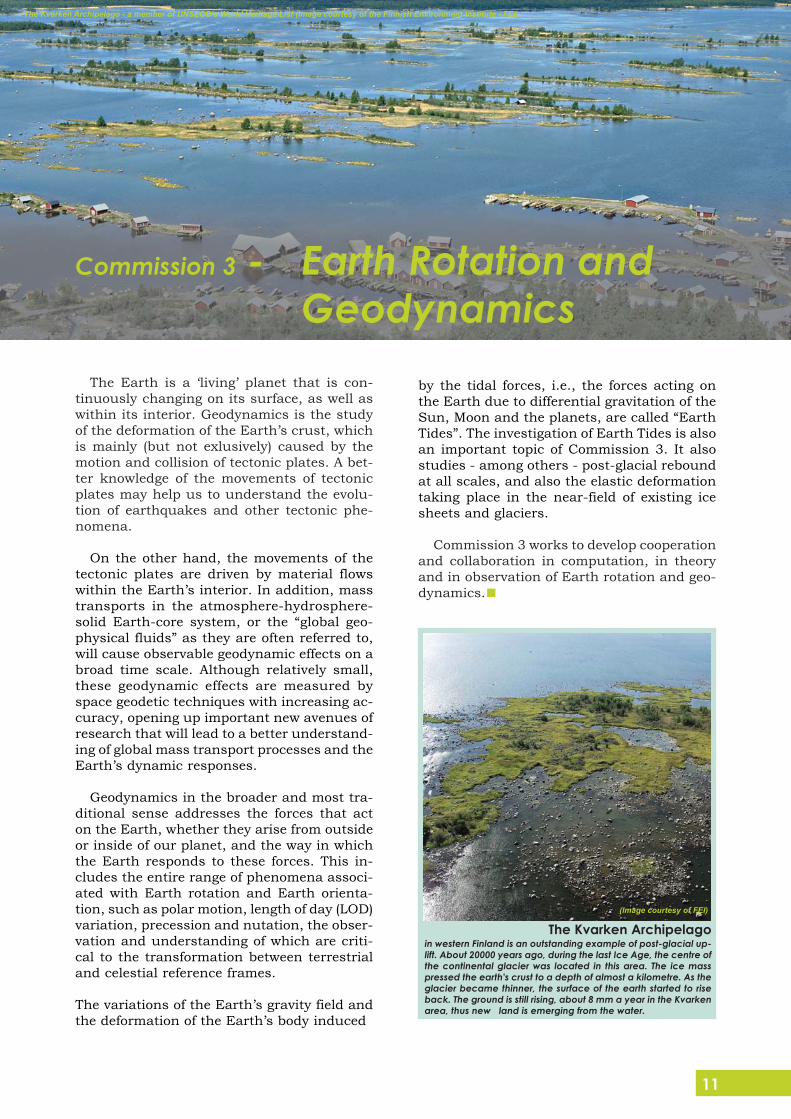
The Kvarken Archipelago - a member of UNSECO’s World Heritage List (Image courtesy of the Finnish Environment Institute - FEI)
The Earth is a ‘living’ planet that is con-tinuously changing on its surface, as well aswithin its interior. Geodynamics is the studyof the deformation of the Earth’s crust, whichis mainly (but not exlusively) caused by themotion and collision of tectonic plates. A bet-ter knowledge of the movements of tectonicplates may help us to understand the evolu-tion of earthquakes and other tectonic phe-nomena.
On the other hand, the movements of thetectonic plates are driven by material flowswithin the Earth’s interior. In addition, masstransports in the atmosphere-hydrosphere-solid Earth-core system, or the “global geo-physical fluids” as they are often referred to,will cause observable geodynamic effects on abroad time scale. Although relatively small,these geodynamic effects are measured byspace geodetic techniques with increasing ac-curacy, opening up important new avenues ofresearch that will lead to a better understand-ing of global mass transport processes and theEarth’s dynamic responses.
Geodynamics in the broader and most tra-ditional sense addresses the forces that acton the Earth, whether they arise from outsideor inside of our planet, and the way in whichthe Earth responds to these forces. This in-cludes the entire range of phenomena associ-ated with Earth rotation and Earth orienta-tion, such as polar motion, length of day (LOD)variation, precession and nutation, the obser-vation and understanding of which are criti-cal to the transformation between terrestrialand celestial reference frames.
The variations of the Earth’s gravity field andthe deformation of the Earth’s body induced
by the tidal forces, i.e., the forces acting onthe Earth due to differential gravitation of theSun, Moon and the planets, are called “EarthTides”. The investigation of Earth Tides is alsoan important topic of Commission 3. It alsostudies - among others - post-glacial reboundat all scales, and also the elastic deformationtaking place in the near-field of existing icesheets and glaciers.
Commission 3 works to develop cooperationand collaboration in computation, in theoryand in observation of Earth rotation and geo-dynamics.
The Kvarken Archipelagoin western Finland is an outstanding example of post-glacial up-lift. About 20000 years ago, during the last Ice Age, the centre ofthe continental glacier was located in this area. The ice masspressed the earth's crust to a depth of almost a kilometre. As theglacier became thinner, the surface of the earth started to riseback. The ground is still rising, about 8 mm a year in the Kvarkenarea, thus new land is emerging from the water.
(Image courtesy of FEI)
Commission 3 - Earth Rotation andGeodynamics
12
(Image courtesy of Charles K. Toth, OSU)
Thus GNSS systems are also used to en-hance the near real-time water vapour esti-mation, which is useful for weather forecast-ing.
Recent advances in tomographic modelling andthe availability of spaceborne GPS observationshas also made possible 3-D profiling of elec-tron density and atmospheric refractivity. Withplans for a significant increase in the numberof GNSS satellites in the next decade, it is clearthat GNSS atmospheric sounding will becomea valuable atmospheric remote sensing tool.
Commission 4 also promotes research intothe development of a number of geodetic toolsthat have practical applications to engineer-
ing and mapping. Hencethere are many joint con-ferences with sisterorganizations such as theFIG (International Fede-ration of Surveyors) andISPRS (International So-ciety of Photogrammetryand Remote Sensing).
There are networks ofpermanent GPS stationsestablished locally, re-gionally and globally toperform not only geodeticresearch, but also to sup-port surveying, engineer-ing, precise navigation,and data acquisition forGeographic InformationSystems (GISs).
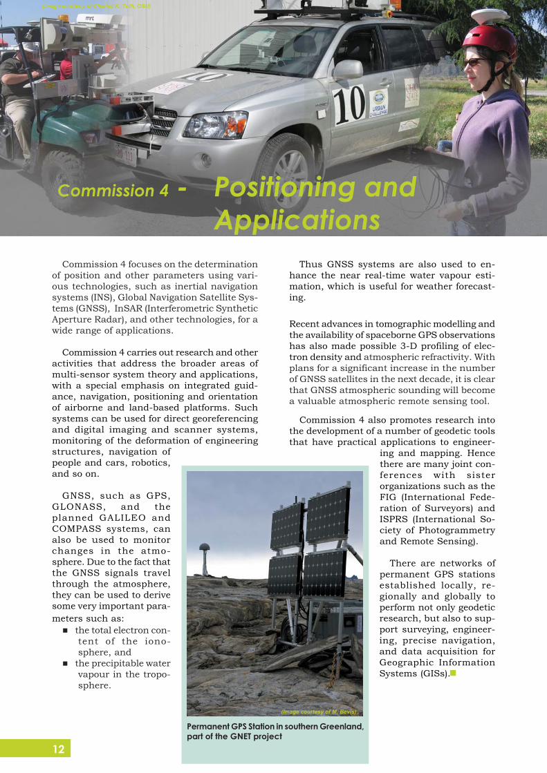
Commission 4 focuses on the determinationof position and other parameters using vari-ous technologies, such as inertial navigationsystems (INS), Global Navigation Satellite Sys-tems (GNSS), InSAR (Interferometric SyntheticAperture Radar), and other technologies, for awide range of applications.
Commission 4 carries out research and otheractivities that address the broader areas ofmulti-sensor system theory and applications,with a special emphasis on integrated guid-ance, navigation, positioning and orientationof airborne and land-based platforms. Suchsystems can be used for direct georeferencingand digital imaging and scanner systems,monitoring of the deformation of engineeringstructures, navigation ofpeople and cars, robotics,and so on.
GNSS, such as GPS,GLONASS, and theplanned GALILEO andCOMPASS systems, canalso be used to monitorchanges in the atmo-sphere. Due to the fact thatthe GNSS signals travelthrough the atmosphere,they can be used to derivesome very important para-meters such as:
the total electron con-tent of the iono-sphere, and
the precipitable watervapour in the tropo-sphere.
Permanent GPS Station in southern Greenland,part of the GNET project
(Image courtesy of M. Bevis)
Commission 4 - Positioning andApplications
13
Photo: iStockPhoto (Georgo, catherine_jones)
The Inter-commission Committee on Theory(ICCT) was established to interact with otherIAG entities. Recognizing that geodetic observ-ing systems have advanced to such an extentthat geodetic measurements (i) are now of un-precedented accuracy and quality, can readilycover a region of any scale up to tens of thou-sands of kilometres, yield non-conventionaldata types, and can be provided continuously;and (ii) consequently, demand advanced math-ematical modelling in order to obtain the maxi-mum benefit of such technological advance,the ICCT
strongly encourages frontier mathemati-cal and physical research, directly motivatedby geodetic need/practice, as a contributionto science/engineering in general and thefoundations of Geodesy in particular;
provides the channel of communicationamongst the different IAG entities of commis-sions/services/projects with respect to thetheory and methodology, and directly cooper-ates with and supports these entities in thetopic-oriented work;
helps the IAG in articulating mathemati-cal and physical challenges of Geodesy as asubject of science. The ICCT strives to attractand serve as home to mathematicallymotivated/oriented geodesists and to appliedmathematicians; and
encourages closer research ties with andgets directly involved in relevant areas of theEarth sciences.
The IAG Publications include:the Journal of Geodesy;the Geodesist’s Handbook;the IAG Newsletter;the “Travaux de l’Association
Internationale de Géodésie”;the IAG Special Publications; andthe IAG Symposia series.
The Journal of Geodesy is an internationaljournal concerned with the study of scientificproblems of Geodesy and related interdiscipli-nary sciences. Peer-reviewed papers are pub-lished on theoretical or modelling studies, andon results of experiments and interpretations.
Every four years after a General Assembly,the IAG publishes The Geodesist’s Handbook.This Handbook provides information on the As-sociation, including the reports of the Presi-dent and Secretary General, the resolutions,and the Association structure.
The IAG Newsletter is published monthlyelectronically. A reduced version is also regu-larly published in the Journal of Geodesy. Theoriginal Newsletters are available at the IAGwebsite: http://www.iag-aig.org.
After each General and Scientific Assembly,a collection of the reports by the Associationcomponents is published in the “Travaux del’Association Internationale de Géodésie” elec-tronically.
Proceedings of IAG symposia are typically pub-lished in the IAG Symposia Series.
IAG ICCon Theory (ICCT)
IAGPublications
14
Photo: iStockPhoto (hidesy),NRAO/AUI and Laure Wilson
Neish
BGI (Bureau Gravimetrique Interna-tional)URL: http://bgi.cnes.fr
The main task of the BGI is to collect, on aworldwide basis, all existing gravity measure-ments and pertinent information about thegravity field of the Earth, to compile them andstore them in a computerized database, andto redistribute them on request to scientificusers.
BIPM (Bureau International de Poidset Measures) -Section Time, Fre-quency and GravimetryURL: http://www.bipm.org/en/scientific/tfg/
The Bureau International des Poids etMesures (BIPM) is responsible for the mainte-nance of the International Atomic Time (TAI)scale and of the Coordinated Universal Time(UTC) scale. The BIPM ensures that TAI andUTC are available in the standards laborato-ries around the world, and is responsible forthe worldwide coordination of time compari-sons.
IAS (International Altimetry Service)URL:http://ias.dgfi.badw.de
The IAS provides a point of contact for gen-eral information on satellite altimetry and itsapplications; promotes satellite altimetry as acore element of Global Geodetic Observing Sys-tem; and helps users to compile and analysedata.
IBS (IAG Bibliographic Service)URL:http://www.bkg.bund.de
The service maintains a literature database forgeodesy, photogrammetry and cartography(GEOPHOKA), which is housed at the Germanfederal agency BKG (Bundesamt fürKartografie und Geodäsie).
ICET (International Centre for EarthTides)URL: http://www.astro.oma.be/ICET
The ICET collects all available measurementson Earth Tides. It evaluates these data in orderto reduce the very large amount ofmeasurements to a limited number of param-eters which contain all required geophysicalinformation, and compares the data from dif-ferent instruments and different stations dis-tributed all over the world.
ICGEM (International Center for Glo-bal Gravity Field Models)URL: http://icgem.gfz-potsdam.de/ICGEM
The ICGEM collects all existing gravity fieldmodels and provides on-line interfaces todownload and visualize these models, and tocalculate functionals (e.g., geoid heights orgravity anomalies) from these models on user-defined geographic grids.
IDEMS (International Digital Eleva-tion Model Service)URL: http://www.cse.dmu.ac.uk/EAPRS/iag
The IDEMS collects and validates digital rep-resentations of the global topography (DigitalElevation Models-DEMs). IDEMS places a par-ticular emphasis on water representation inDEMs.
The IAG is the home of a number of scientificservices whose goals are to provide the usercommunity with various geodetic productsand/or information and to foster internationalcooperation.
IAG Services
15
IDS (International DORIS Service)URL: http://ids.cls.fr
The primary objective of the IDS is to oper-ate a service to provide Doppler Orbitographyand Radiopositioning Integrated by Satellite(DORIS) data and data products, useful to awide range of scientific and practical applica-tions.
IERS (International Earth Rotationand Reference Systems Service)URL: http://www.iers.org
The primary objectives of the IERS are toserve the astronomical, geodetic and geophysi-cal communities by providing the following: a)The International Celestial Reference System(ICRS) and its realization, the InternationalCelestial Reference Frame (ICRF); b) The In-ternational Terrestrial Reference System (ITRS)and its realization, the International TerrestrialReference Frame (ITRF); c) Earth orientationparameters required to study Earth orienta-tion variations and to transform between theICRF and the ITRF; d) Geophysical data tointerpret time/space variations in the ICRF,ITRF or Earth orientation parameters, andmodel such variations; e) Standards, constantsand models, and encouraging international ad-herence to its conventions.
IGeS (International Geoid Service)URL: http://www.iges.polimi.it
The main task of the IGeS are to collect soft-ware and data referring to the geoid, validatethem and disseminate them upon requestamong the scientific community. IGeS is alsoorganizing regularly the “International Schoolon the Determination and Use of the Geoid”.
IGFS (International Gravity Field Ser-vice)URL: http://www.igfs.net
IGFS is a unified service which is respon-sible for gravity data collection, validation,archiving and dissemination, as well as soft-ware collection, evaluation, dissemination forthe purpose of determining, with various de-grees of accuracy and resolution, the Earth’ssurface and gravity potential, or any of itsfunctionals. The temporal variations of thegravity field are also studied. It integrates theBGI, ICET, ICGEM, IDEMS, IGeS and IAS.
IGS (International GNSS Service)URL: http://www.igs.org
The Global Positioning System (GPS) is anextremely versatile technology that enablesprecise ground and space-based positioning,timing and navigation anywhere in the world.
The use of GPS, and GNSS in general, par-ticularly for Earth sciences applications, stemslargely from activities of the InternationalGNSS Service (IGS). More than 200 organiza-tions in 80 countries contribute daily to theIGS, which is dependent upon a cooperativeglobal tracking network of over 350 GNSS sta-tions.
IGS provides various important data andproducts to many users.
ILRS (International Laser RangingService)URL: http://ilrs.gsfc.nasa.gov
The ILRS collects, merges, analyzes and dis-tributes Satellite Laser Ranging (SLR) and Lu-nar Laser Ranging (LLR) observation data setsof sufficient accuracy to satisfy a wide rangeof applications. The basic observable is theprecise time-of-flight of a laser pulse to andfrom retroreflectors on a satellite (in the caseof SLR), and on the Moon (in the case of LLR).
IVS (International VLBI Service forGeodesy and Astrometry)URL: http://ivscc.gsfc.nasa.gov
The IVS coordinates Very Long Baseline In-terferometry (VLBI) observing programs, setsperformance standards for VLBI stations, de-velops conventions for VLBI data formats anddata products, issues recommendations forVLBI data analysis software, sets standardsfor VLBI analysis documentation, and insti-tutes appropriate VLBI product delivery meth-ods to ensure suitable product quality andtimeliness.
PSMSL (Permanent Service for MeanSea Level)URL: http://www.pol.ac.uk/psmsl
The PSMSL is responsible for the collection,publication, analysis and interpretation of sealevel data from the global network of tidegauges. These data are used for a wide rangeof scientific uses, including the long-term sealevel change assessments of the Intergovern-mental Panel on Climate Change (IPCC). ThePSMSL also manages the delayed-mode activ-ity of the Global Sea Level Observing System(GLOSS).

16
Photo: iStockPhot(switas, jdavidlong
Mike GR, carterdayn
The GlobalGeodetic ObservingSystem (GGOS)was established bythe IAG in July2003 as a project.In April 2004 theIAG, representedby GGOS, becamea participatingorganization of the
Group on Earth Observations (GEO). In May2006 GGOS was accepted as a member of theIntegrated Global Observation StrategyPartnership (IGOS-P) and in July 2007 at theIUGG General Assembly GGOS became an of-ficial component of the IAG, i.e., the GlobalGeodetic Observing System of the IAG.
GGOS provides observations of the threefundamental geodetic observables and theirvariations, that is, the Earth’s shape, theEarth’s gravity field, and the Earth’s rotationalmotion.
GGOS integrates different geodetic tech-niques, different models and different ap-proaches in order to ensure a long-term, pre-cise monitoring of the geodetic observables inagreement with the Integrated Global Observ-ing Strategy (IGOS). GGOS provides the ob-servational basis to maintain a stable, accu-rate and global reference frame, and in thisfunction is crucial for all Earth observation andmany practical applications.
GGOS contributes to the Global Earth Observ-ing System of Systems (GEOSS) not only withthe accurate reference frame required for manycomponents of GEOSS but also with observa-tions related to the global hydrological cycle,the dynamics of the atmosphere and theoceans, and geohazards. GGOS acts as theinterface between the geodetic services andexternal agencies such as GEOSS and UnitedNations bodies. A major goal is to ensure theinteroperability of the IAG services andGEOSS.
GGOS is built on the IAG Services (IGS, IVS,ILRS, IDS, IERS, IGFS, etc.) and the productsthey derive on an operational basis for Earthmonitoring making use of a large variety ofspace- and ground-based geodetic techniques,such as VLBI, SLR/LLR, GNSS, DORIS, altim-etry, interferometric Synthetic Aperture Radar(InSAR) and gravity satellite missions (CHAMP,GRACE, GOCE), gravimetry, and so on.
All of these observation techniques are con-sidered integral parts of GGOS, allowing themonitoring of the Earth’s shape and deforma-tion (including water surface), the Earth’s ori-entation and rotation and the Earth’s gravityfield and its temporal variations. The observedquantities give direct evidence of many globalprocesses that have a crucial impact on hu-man society such as earthquakes, volcanism,floods, sea level change, climate change, waterredistribution, mass balance of the polar icesheets, post-glacial rebound, etc.
The Global Geodetic ObservingSystem (GGOS)

17
The Mission of GGOS
The mission of GGOS is to promote the ap-plication of geodetic Earth observation meth-ods to the solution of Earth science problems.GGOS accomplishes its mission: a) by defin-ing the geodetic infrastructure that is neededto meet scientific and societal requirements;b) by advocating the establishment and main-tenance of this geodetic infrastructure; c) bycoordinating interaction between the IAG Ser-vices, Commissions or other geodetic entities;d) by improving accessibility to geodetic obser-vations and products; and e) by educating thescientific community about the benefits of geo-detic research and the public about the rolethat Geodesy plays in society.
GGOS provides the basis on which futureadvances in geosciences can be built. By con-sidering the Earth system as a whole (includ-ing the geosphere, hydrosphere, cryosphere,atmosphere and biosphere), monitoring Earthsystem components and their interactions bygeodetic techniques and studying them fromthe geodetic point of view, the geodeticcommunity provides the global geo-sciences community with a pow-erful tool consisting mainly ofhigh quality services, stan-dards and references, theo-retical and observationinnovations.
GGOS and its re-lated research andServices’ prod-ucts will add-
For more information, please visit the GGOSwebsite:
http://www.ggos.org
ress the relevant science issues related to ge-odesy and geodynamics in the 21st century,but also issues relevant to society (global riskmanagement, geohazards, natural resources,climate change, severe storm forecasting, sea-level estimations and ocean forecasting, spaceweather, and others). It is an ambitious pro-gram of a dimension that goes beyond IAG, re-quiring a strong cooperation within the geo-detic, geodynamic and geophysical communi-ties, and externally, to related endeavours andcommunities.
18
Photo: iStockPhoto (sweetym
International Union of Geodesyand Geophysics (IUGG)(www.iugg.org)
International Association ofCryospheric Sciences (IACS)(www.cryosphericsciences.org)
Int. Association of Geomag-netism and Aeronomy (IAGA)(www.iugg.org/IAGA)
International Association of Hy-drological Sciences (IAHS)(www.iahs.info)
International Association of Me-teorology and AtmosphericSciences (IAMAS)(www.iamas.org)
International Association for thePhysical Sciences of theOceans (IAPSO)(iapso.iugg.org)
International Association ofSeismology and Physics of theEarth’s Interior (IASPEI)(www.iaspei.org)
International Association of Vol-canology and Chemistry of theEarth’s Interior (IAVCEI)(www.iavcei.org)
International AstronomicalUnion (IAU)(www.iau.org)
International Union of GeologicalSciences (IUGS)(www.iugs.org)
International Federation of Sur-veyors (FIG)(www.fig.net)
Int. Society for Photogrammetryand Remote Sensing (ISPRS) (www.isprs.org)
International Cartographic Asso-ciation (ICA)(cartography.tuwien.ac.at/ica)
International Society of Mine Sur-veying (ISM)(www.ism.bw-art.de)
International Hydrographic Or-ganization (IHO)(www.iho-ohi.net)
American Geophysical Union(www.agu.org)
European Geosciences Union( w w w . c o p e r n i c u s . o r g / E G U /EGU.html)
Global Spatial Data Infra-structure Association (GSDI)(www.gsdi.org)
Federation of Astronomical andGeophysical Data AnalysisServices (FAGS)(www.icsu-fags.org)
The U.S. Institute of Navigation(www.ion.org)
The IUGG comprises of the following sevensemi-autonomous Associations beside IAG:
Links to other organizations:
Links
19
Photo: iStockPhoto (AndrewJohnson, andipantz)
The membership of the IAG comprises coun-tries and individuals. Any member country ofthe IUGG is regarded as a National Member ofthe IAG and may, through its adhering body,appoint a National Delegate to the Association.National Delegates represent their countriesin IAG Council Meetings and act as correspon-dents for their countries in the period betweenGeneral Assemblies. Individual scientists maybecome Members and Fellows of the IAG. TheIAG Executive Committee, upon the recom-mendation of the Secretary General, acceptsindividuals as Members. Applications for in-dividual membership are made to the Bureau.
Benefits of individual membership includesubstantial reduction on the individual sub-scription rate to the Journal of Geodesy, theright to participate in the IAG election processboth as a nominator and a nominee, and areduction of the registration fee for many IAGmeetings. The individual members also receivethe monthly IAG Newsletter.
IAG Members have access to the Members’Area of the IAG website, where they can browseamong the contact data of other internationalscientists. The Members’ Area contains elec-tronic materials related to the latest achieve-ments of Geodesy.
IAG Members are entitled to use the privatebillboard service of the IAG website to exchangetheir views about issues related to Geodesy.
Finally individual IAG Members contributewith their membership fee especially to thesupport of young scientists with travel grants,awards for outstanding works, etc.
Past Officers of the Association are eligibleto become Fellows and are invited to becomesuch. The IAG Executive Committee makesthese appointments.
The Communication and Outreach Branch(COB) provides the IAG with communication,educational/public information and outreachlinks to the membership, to other scientificassociations and to the world as a whole.
The responsibilities of the COB include pro-motion of the IAG (at meetings and confer-ences), membership development, mainte-nance of the IAG website, publications (news-letters), and creation of a resource base foreducators, developing countries and our glo-bal community.
The COB maintains the official IAG website,where one can find all the latest news aboutIAG and Geodesy in general.
For further information please browse theIAG website, or contact us on the following e-mail address:
URL: http://www.iag-aig.org
E-mail: [email protected]
Acknowledgements: This brochure has been prepared,under the supervision of the IAG Executive Committee, inarrangement of the IAG Communication and OutreachBranch (COB). Contributions to this brochure came frommany sources, especially the IAG entities (Commissions,GGOS, Services) Chairs and the new IAG Statutes and By-laws, supplemented by valuable suggestions from the IAGCentral Bureau, the COB Steering Committee (SC) serv-ing in 2003-2007 and a number of individual scientists. Afirst draft text, synthesizing the original input material wasprepared by József Ádám (COB President), Szabolcs Rózsa(COB Secretary) and Markku Poutanen (COB SC Mem-ber). Revisions and additional material were provided byRiccardo Barzaghi, Gerhard Beutler, René Forsberg,Helmut Hornik, Chris Jekeli, Ron Noomen, Chris Rizos,Fernando Sansó, Michael G. Sideris and C. ChristianTscherning. The contribution of Szabolcs Rózsa to its de-sign and for the editing is particularly acknowledged.
Membership IAG COB
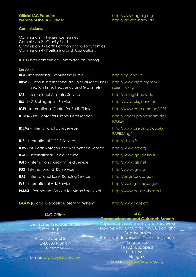
Official IAG Website: http://www.iag-aig.orgWebsite of the IAG Office: http://iag.dgfi.badw.de
Commissions:
Commission 1 - Reference FramesCommission 2 - Gravity FieldCommission 3 - Earth Rotation and GeodynamicsCommission 4 - Positioning and Applications
ICCT (Inter-commission Committee on Theory)
Services:BGI - International Gravimetric Bureau http://bgi.cnes.fr
BIPM - Bureaus International de Poids at Measures - http://www.bipm.org/en/ Section Time, Frequency and Gravimetry scientific/tfg
IAS - International Altimetry Service http://ias.dgfi.badw.de
IBS - IAG Bibliographic Service http://www.bkg.bund.de
ICET - International Centre for Earth Tides http://www.astro.oma.be/ICET
ICGEM - Int.Center for Global Earth Models http://icgem.gfz/potsdam.de/ICGEM
IDEMS - International DEM Service http://www.cse.dmu.acu.uk/EAPRS/iag/
IDS - International DORIS Service http://ids.cls.fr
IERS - Int. Earth Rotation and Ref. Systems Service http://www.iers.org
IGeS - International Geoid Service http://www.iges.polimi.it
IGFS - International Gravity Field Service http://www.igfs.net
IGS - International GNSS Service http://www.igs.org
ILRS - International Laser Ranging Service http://ilrs.gsfc.nasa.gov
IVS - International VLBI Service http://ivscc.gsfc.nasa.gov
PSMSL - Permanent Service for Mean Sea Level http://www.pol.ac.uk/psmsl
GGOS (Global Geodetic Observing System) http://www.ggos.org
IAG Office
Deutsches GeodaetischesForschungsinstitut
(DGFI)Alfons Goppel Str. 11.
D-80539 MunichGermany
E-mail: [email protected]
IAGCommunication and Outreach BranchDepartment of Geodesy and Surveying
HAS-BME Res. Group for Phys. Geod. andGeodynamics
Budapest University of Technology andEconomics
H-1521 BudapestP.O. Box. 91
HungaryE-mail: [email protected]