index to executive committee minutes #6/06 friday, … · index to executive committee minutes...
TRANSCRIPT
INDEX TO
EXECUTIVE COMMITTEE MINUTES #6/06
Friday, August 11, 2006
MINUTESMinutes of Meeting #5/06, held on July 7, 2006 511
ONTARIO REGULATION 166/06830460 Ontario Limited 552, 5531281216 Ontario Inc. 550Barbieri, Guido and Gina 559Barker Business Park (Phase II) Limited 572Block 11 Landowners Group 537Block 11 Properties Inc. 539Boyan, Mark and Tiana 530Brampton, City of 512, 514Bratty, Christopher 558Centorame, Elena and Dante 579Czumak, Peter and Hedyeh 579Dabrus, Richard 566Dedomenico, Fabian 579Donenfield, Halee 564Enbridge Gas Distribution 515, 565, 569Etobicoke Yacht Club 525Giovannone, Tiziana 573Goodeve, Tom 542Goodman, Leslie and Stafford 587Griggs, Susan 528Hampstock Developments Inc. 570Legge, Brian 562MacLeod, Peter 516Manji, Karima 560Manufacturers Life Insurance Company, The 535McDonald, William H. 548Medallion Developments Ltd. 541Mesiano, Domenic and Nina 578Miraliakbari, Narges 531, 532Mississauga, City of 518Ng, Simon and Mary 574
Panattoni Development Company 582Paquette, Ron 578Powers, Maria 561Regional Municipality of Peel 580, 584, 585, 588, 590Regional Municipality of York 591Reynolds, Richard and Barbara 527Ridgecore Developers Inc. 55Romano, Jim and Olga 579Romashkina, Galina and Anatoly Germatenko 526Sansalone, John and Marion 544Seneca College of Applied Arts and Technology 545Singh, Ronald 578Smalley, Kathleen 547Starserra Homes (Humber River) Limited 556Toronto, City of 522, 524, 533, 558Turgeman, Mustafa 577Turko, Daniel 578Uxbridge, Town of 580Vacca, Anna Maria and Robert Vacca 521Vaughan, City of 568Wharf Street Marina Ltd. 520Whitchurch-Stouffville, Town of 575Zentil, Garry 563
AWARD OF CONTRACT RSD06-15Restoration of the Roblin's Mill Water Flume at Black Creek Pioneer Village, City of Toronto 593
NEW BUSINESSBob Hunter Park 594
511
MEETING OF THE EXECUTIVE COMMITTEE #6/06August 11, 2006
The Executive Committee Meeting #6/06, was held in the South Theatre, Black Creek Pioneer Village, on Friday, August 11, 2006. The Chair Dick O'Brien, called the meeting to order at 10:05 a.m..
PRESENTMaria Augimeri MemberDavid Barrow MemberFrank Dale MemberMichael Di Biase MemberRob Ford MemberDick O'Brien ChairGerri Lynn O'Connor Vice ChairDave Ryan Member
ABSENTSuzan Hall Member
RES.#B91/06 - MINUTES
Moved by: Frank DaleSeconded by: Rob Ford
THAT the Minutes of Meeting #5/06, held on July 7, 2006, be approved.CARRIED
_________________________________________
SECTION II - ITEMS FOR EXECUTIVE ACTION
RES.#B92/06 - APPLICATIONS FOR PERMITS PURSUANT TO ONTARIO REGULATION 166/06Development, Interference with Wetlands and Alterations to Shorelines and Watercourses. Pursuant to Ontario Regulation 166/06, written permission from the Authority is required for:
a) straightening, changing, diverting or interfering in any way with the existing channel of a river, creek, stream or watercourse, or for changing or interfering in any way with a wetland;
512
b) development, if in the opinion of the authority, the control of flooding, erosion, dynamic beaches or pollution or the conservation of land may be affected by the development.
A permit may be refused through a Hearing Process, if in the opinion of the Authority, the control of flooding, erosion, dynamic beaches, pollution or the conservation of land is affected.
Moved by: Gerri Lynn O'ConnorSeconded by: Dave Ryan
THAT permits be granted in accordance with Ontario Regulation 166/06 for the applications (7.1.1 - 7.1.26, inclusive) which are listed below.
CARRIED
RES.#B93/06 - APPLICATIONS FOR PERMITS PURSUANT TO ONTARIO REGULATION 166/06
Moved by: Frank DaleSeconded by: Rob Ford
THAT permits be granted in accordance with Ontario Regulation 166/06 for the applications (7.1.59 - 7.1.66, inclusive) which are listed below.
CARRIEDCITY OF BRAMPTON
7.1.1 CITY OF BRAMPTONTo site grade, temporarily or permanently place, dump or remove any material, originating on the site or elsewhere and alter a watercourse at the Calvert Park pedestrian bridge over Etobicoke Creek, in the City of Brampton, Etobicoke Creek Watershed as located on the property owned by the City of Brampton.
The purpose is to site grade, permanently place and remove fill (riverstones, asphalt, gabions, bridge abutments) and temporarily alter a watercourse (cofferdam) to facilitate the replacement of the Calvert Park pedestrian bridge, over Etobicoke Creek, in the City of Brampton.
The permit will be issued for the period of August 11, 2006 to August 10, 2008 in accordance with the following documents and plans which form part of this permit:
Letter of Undertaking to provide minor revisions to engineering drawings to the satisfaction of TRCA staff; dated July 25, 2006; received July 25, 2006; prepared by the City of Brampton.
RATIONALEThe application was reviewed by staff on the basis of the following information:
513
Proposal:The proposal consists of removing an existing pedestrian bridge (11 metre span) and replacing it with a new pedestrian bridge (20 metre span) in Calvert Park, over the Etobicoke Creek. The new abutments will be approximately 4 metres further back from the creek on both sides. The existing concrete headwalls will be removed and replaced with riverstone (200 to 300mm) under the bridge, adjacent to the watercourse, for bank protection. The existing gabions will be removed and new wingwalls constructed. Asphalt will be used to connect the new bridge to the existing trail system.
Control of Flooding:TRCA engineering staff has reviewed the proposal and determined that the proposed works will have no impact to the control of flooding.
Pollution:Standard erosion control measures (cofferdam, silt fencing, splash pad) will be implemented for the duration of construction, and until the site is restored, in order to prevent construction generated sediment from entering the watercourse.
Dynamic Beaches:Not applicable
Erosion:There will be no geotechnical/slope stability issues associated with the proposal.
Conservation of Land:With erosion and sedimentation plans in effect, the potential for a Harmful, Alteration, Disruption or Destruction (HADD) of fish habitat will be mitigated and a Letter of Advice will be written by TRCA staff on behalf of the Department of Fisheries and Oceans (DFO). This application is subject to the Ministry of Natural Resources (MNR) warmwater fisheries timing window however, TRCA is revising the timing window, due to the flooding sensitivities in Etobicoke Creek, to account for the spring freshet. Any instream works must be completed between July 1 and February 28.
PlantingsAll disturbed areas will be restored with native/non-invasive species. A net ecological gain (48 saplings) will be achieved for this site.
Policy Guidelines:This proposal complies with Section 4.3 - Infrastructure and Servicing of the Authority's Valley and Stream Corridor Management Program.
CFN: 37858 - Application #: 299/06/BRAMReport Prepared by: Sharon Lingertat, extension 5717For information contact : Suzanne Bevan, extension 5374Date: July 27, 2006
514
7.1.2 CITY OF BRAMPTONTo site grade, temporarily or permanently place, dump or remove any material, originating on the site or elsewhere and alter a watercourse at Archdekin Park pedestrian bridge over Etobicoke Creek, in the City of Brampton, Etobicoke Creek Watershed, as located on property owned by TRCA but under management agreement with the City of Brampton's Parks Department.
The purpose is to site grade, permanently place and remove fill (fieldstones, gabions) and temporarily alter a watercourse (jersey barriers) to facilitate the rehabilitation of Archdekin Park pedestrian bridge, over Etobicoke Creek, in the City of Brampton.
The permit will be issued for the period of August 11, 2006 to August 10, 2008.
Letter of Undertaking to provide minor revisions to engineering drawings to the satisfaction of TRCA staff; dated July 25, 2006; received July 25, 2006; prepared by the City of Brampton.
RATIONALEThe application was reviewed by staff on the basis of the following information:
Proposal:The proposal consists of rehabilitating the existing pedestrian bridge structure by repairing and replacing the existing concrete wingwalls and replacing the gabion on the northeast corner of the bridge with fieldstones. Fieldstones will also be placed at the southwest corner of the bridge to protect against further bank erosion. The spalling and exposed rebar under the deck will be repaired. The deck drains will be blocked during construction. Repairs to the bridge will adhere to the designated structures restoration procedures pursuant to the Heritage Act.
Control of Flooding:TRCA engineering staff has reviewed the proposal and determined that the proposed works will have no impact to the control of flooding.
Pollution:Standard erosion control measures (jersey barriers, silt fencing, splash pad) will be implemented for the duration of construction, and until the site is restored, in order to prevent construction generated sediment from entering the watercourse.
During construction the contractor will provide temporary scaffolding suspended from the deck with plastic sheeting to collect debris. The temporary scaffolding will be removed every day after work is completed.
Dynamic Beaches:Not applicable
Erosion:There will be no geotechnical/slope stability issues associated with the proposal.
515
Conservation of Land:With erosion and sedimentation plans in effect, the potential for a Harmful, Alteration, Disruption or Destruction (HADD) of fish habitat will be mitigated and a Letter of Advice will be written by TRCA staff on behalf of the Department of Fisheries and Oceans (DFO). This application is subject to the Ministry of Natural Resources (MNR) warmwater fisheries timing window however, TRCA is revising the timing window, due to the flooding sensitivities in Etobicoke Creek, to account for the spring freshet. Any instream works must be completed between July 1 and February 28.
PlantingsAll disturbed areas will be restored with native/non-invasive species (live stakes and shrubs) following construction. A net ecological gain will be achieved for this site.
Policy Guidelines:This proposal complies with Section 4.3 - Infrastructure and Servicing of the Authority's Valley and Stream Corridor Management Program.
CFN: 37857 - Application #: 300/06/BRAMReport Prepared by: Sharon Lingertat, extension 5717For information contact : Suzanne Bevan, extension 5374Date: July 27, 2006
7.1.3 ENBRIDGE GAS DISTRIBUTION INC .To site grade, temporarily or permanently place, dump or remove any material originating on the site or elsewhere on the south side of Father Tobin Road, in the City of Brampton, Humber River Watershed as located on the property owned by Enbridge Gas Distribution Incorporated.
The purpose is to undertake works within a TRCA Regulated Area of the Humber River Watershed in order to facilitate the installation of an underground utility conduit above an existing culvert via open cut.
The permit will be issued for the period of August 11, 2006 to August 10, 2008 in accordance with the following documents and plans which form part of this permit:
Construction Plan, Page 15 of 16, prepared by T. Strezos, Enbridge Gas Distribution Inc ., dated June 21, 2006, stamped received by TRCA Planning and Development staff July 5, 2006.
RATIONALEThe application was reviewed by staff on the basis of the following information:
Proposal:The purpose of this application is to undertake works within a TRCA Regulated Area of the Humber River Watershed in order to facilitate the installation of an underground utility conduit. The proposed utility conduit will be placed approximately 1.0 metres above the existing culvert via an open cut method. This proposal does not involve any in-water works.
516
Control of Flooding:No excavated material will be stockpiled within the Regional Storm Floodplain and no grades will be altered as a result of this proposal. As such, no impacts to the storage and/or conveyance of flood waters are anticipated.
Pollution:Appropriate sediment controls (i.e., silt fence) will be installed and maintained throughout all phases of construction to impede the overland migration of construction generated sediment.
Dynamic Beaches:Not applicable
Erosion:There are no geotechnical and/or slope stability concerns associated with this project.
Conservation of Land:There are no in-water works associated with this proposal. As such, there are no fisheries related concerns. No significant vegetation will be removed as a result of construction.
PlantingsAll disturbed areas will be restored using a TRCA approved seed mix. The seed mix composition will be composed of native and non-invasive species.
Policy Guidelines:This project is in conformity with Section 4.3 - Infrastructure and Servicing - of the Authority's Valley and Stream Corridor Management Program (VSCMP).
CFN: 37975 - Application #: 392/06/BRAMReport Prepared by: Adam Miller, extension 5244For information contact : Adam Miller, extension 5244Date: August 2, 2006
7.1.4 PETER MACLEODTo construct, reconstruct and erect or place a building or structure on 24 Valleyside Trail, in the City of Brampton, Humber River Watershed as located on the property owned by Peter MacLeod.
The purpose is to construct within a TRCA Regulated Area of the Humber River Watershed in order to facilitate the construction of an inground swimming pool and ancillary deck structure.
The permit will be issued for the period of August 11, 2006 to August 10, 2008 in accordance with the following documents and plans which form part of this permit:
Site Plan, prepared by Outdoor Lifestyles , dated June 24, 2006, redline revised by TRCA Planning and Development staff August 1, 2006, stamped received by TRCA Planning and Development staff July 10, 2006;

517
Landscape Plan, prepared by P. MacLeod, dated July 28, 2006, stamped received by TRCA Planning and Development staff July 28, 2006;Plant Species List, prepared by P. MacLeod, dated July 28, 2006, stamped received by TRCA Planning and Development staff July 28, 2006.
RATIONALEThe application was reviewed by staff on the basis of the following information:
Proposal:The purpose of this proposal is to construct within a TRCA Regulated Area of the Humber River Watershed in order to facilitate the construction of an inground swimming pool and ancillary deck structure at the rear of an existing residential dwelling at 24 Valleyside Trail, in the City of Brampton. The rear of the subject property is located adjacent to a valley feature of the Humber River Watershed. Given the location in which the works are proposed, the proposed development setback is sufficient. However, extensive native and non-invasive plantings are proposed along the rear property line to improve the ecological form and function of the area. The area to which this application applies is currently a manicured lawn. As such, the proposed works will not necessitate the removal of any significant vegetation. The subject property is located entirely outside of the Regional Storm Floodplain.
Control of Flooding:The proposed works are located outside of the Regional Storm Floodplain. As such, no impacts to the storage and/or conveyance of flood waters are anticipated.
Pollution:Appropriate erosion and sediment controls (i.e., silt fence) have been proposed with this application, and will be maintained throughout all phases of construction.
Dynamic Beaches:Not applicable
Erosion:There are no geotechnical and/or slope stability concerns associated with this project.
Conservation of Land:No significant vegetation will be removed as a result of construction.
PlantingsExtensive native, non-invasive plantings are proposed along the rear property line, adjacent to the valley feature. All disturbed areas outside of those on which development is proposed will be restored using a TRCA approved seed mix.
Policy Guidelines:This proposal is in conformity with Section 4.2.2 (E) - Property Improvements and Ancillary Structures - of the Authority's Valley and Stream Corridor Management Program (VSCMP).
518
CFN: 37926 - Application #: 348/06/BRAMReport Prepared by: Adam Miller, extension 5244For information contact : Adam Miller, extension 5244Date: August 1, 2006
CITY OF MISSISSAUGA
7.1.5 CITY OF MISSISSAUGATo alter a watercourse at Wildwood Park (south of Derry Road East and west of Goreway Drive), in the City of Mississauga, Mimico Creek Watershed as located on the property owned by City of Mississauga.
The purpose is to alter a watercourse of the Mimico Creek Watershed within a TRCA Regulated Area in order to facilitate the removal of debris, including fallen trees from a section of Mimico Creek at Wildwood Park, in the City of Mississauga.
The permit will be issued for the period of August 11, 2006 to August 10, 2008 in accordance with the following documents and plans which form part of this permit:
Location Plan, Figure 1, prepared by J. Blair, City of Mississauga, dated July 13, 2006, stamped received by TRCA Planning and Development staff July 13, 2006;Proposed Access Route Plan , Figure 2, prepared by J. Blair, City of Mississauga, dated July 13, 2006, stamped received by TRCA Planning and Development staff July 13, 2006;Aerial Image Plan, Figure 3, prepared by J. Blair, City of Mississauga, dated July 13, 2006, stamped received by TRCA Planning and Development staff July 13, 2006;Floodline Plan, Figure 4, prepared by J. Blair, City of Mississauga, dated July 13, 2006, stamped received by TRCA Planning and Development staff July 13, 2006;Tree Species Inventory , Figure 5, prepared by J. Blair, City of Mississauga, dated July 13, 2006, stamped received by TRCA Planning and Development staff July 13, 2006.
RATIONALEThe application was reviewed by staff on the basis of the following information:
Proposal:The purpose of this application is to alter a watercourse of the Mimico Creek Watershed within a TRCA Regulated Area in order to facilitate the removal of debris, including fallen trees from a section of Mimico Creek at Wildwood Park, located on the east side of Professional Court, south of Derry Road East, in the City of Mississauga. A portion of the outer bank of Mimico Creek has recently collapsed, and several trees have fallen into the creek. As a result, the creek has become blocked and water flows are now being diverted toward the outer portion of the bank, exacerbating the rate of erosion. On this basis, the fallen debris and trees will be removed to reduce the rate of erosion. Considering the nature of this application and the implications to the surrounding properties and infrastructure, an emergency works approval has been issued.
519
The emergency works protocol stipulates that such works are typically temporary in nature and designed to remediate the emergency situation. Generally, a long-term solution is required. In this regard, it is anticipated that a realignment of this reach of the Mimico Creek will be necessary to stabilize the existing bank. As the bank at risk is in very close proximity to private lands, it is unlikely that sufficient public lands are available to create a stable slope, although further studies are required.
Control of Flooding:Although the works will occur within the Regional Storm Floodplain, the works will provide an increase in hydraulic capacity and are anticipated to improve the control of flooding for this reach of the Mimico Creek Watershed.
Pollution:Appropriate sediment controls (i.e., silt fence) have been proposed with this project, and will be maintained throughout all phases of construction.
Dynamic Beaches:Not applicable
Erosion:The proposed works will reduce the rate of erosion of the bank at risk. A long-term solution that will stabilize the existing bank conditions will be forthcoming through a future TRCA permit application.
Conservation of Land:Although the proposed works will necessitate the removal of existing vegetation, through a long-term project to stabilize the bank at risk, extensive native and non-invasive plantings are proposed to achieve an ecological 'net gain'.
PlantingsThese details will be reflected in the future TRCA permit application that is to be submitted for the long-term stabilization project.
Policy Guidelines:This proposal is in conformity with Section 4.4.2 (F) - Opportunities for Regeneration and Section 4.4.2 (H) - Existing Resource-based Uses - of the Authority's Valley and Stream Corridor Management Program (VSCMP).
CFN: 37960 - Application #: 372/06/MISSReport Prepared by: Adam Miller, extension 5244For information contact : Adam Miller, extension 5244Date: August 1, 2006
520
CITY OF PICKERING
7.1.6 WHARF STREET MARINA LTD.To site grade, temporarily or permanently place, dump or remove any material, originating on the site or elsewhere and alter a shoreline on Lot 8, 9, 10, 21, 22, 23, 24, 25, Plan M-89, (1289 Wharf Street), in the City of Pickering, Frenchman's Bay Watershed as located on the property owned by Wharf Street Marina Ltd..
The purpose is to develop and alter a shoreline within a Regulated Area to facilitate the construction of new seawall and a new restaurant on the west side of Frenchman's Bay.
The permit will be issued for the period of August 11, 2006 to August 10, 2008 in accordance with the following documents and plans which form part of this permit:
Drawing No. 01, Site Plan and Sections, prepared by Shoreplan Engineering Limited , revised July 7, 2006, received July 11, 2006;Drawing No. SS-1, Site Grading and Servicing , prepared by Land-Pro Engineering Consultants Inc., revised July 18, 2006, received July 24, 2006;Drawing Nos. OPSD - 219.260 and 219.261, Turbidity Curtain, received July 24, 2006.
RATIONALEThe application was reviewed by staff on the basis of the following information:
Proposal:The proposal is to construct a new restaurant and boat slip on the site of an existing marina use located on the south side of Wharf Street, adjacent to the east shore of Frenchman's Bay in the City of Pickering. The development proposal includes a single storey restaurant, associated surface parking, a boat haul-out slip and armourstone and rip-rap sea walls and steel sheetpile sea walls. The restaurant replaces an existing shed, the boat haul-out slip replaces an existing dock and the sea walls replace existing retaining walls.
Control of Flooding:The proposed sea walls will be elevated to above the mean high water line and the grades will match the retaining sea walls for the Marshall Homes condominium development to the south. As such the proposed development is protected from flooding. There will be no impact on the storage or conveyance of flood waters.
Pollution:A temporary silt curtain will be installed to keep construction debris from migrating into the Bay. The stormwater management system is designed to ensure Level 1 (Enhanced) water quality through a combination of oil-grit separator treatment and clean roof water discharge directly to the Bay.
Dynamic Beaches:Not applicable.
521
Erosion:The site is adjacent to the Frenchman's Bay waterfront and therefore stream erosion is not of concern.
Conservation of Land:The proposed sea walls will fill in a small portion of the lake bottom adjacent to the existing sea wall, but this filling will be mitigated by the addition of greater open-water area for the new boat haul-out slip. The proposal will not result in a Harmful Alteration, Disruption or Destruction of Fish Habitat and a Letter of Advice will be issued on behalf of Fisheries and Oceans Canada.
PlantingsThe subject property is entirely urbanized and new plantings are not required.
Policy Guidelines:The proposal complies with Section 4.2.2 - Development and Redevelopment/Intensification within Non-established Communities - of the Authority's Valley and Stream Corridor Management Program.
CFN: 37786 - Application #: 264/06/PICKReport Prepared by: Steve Heuchert, extension 5311For information contact : Steve Heuchert, extension 5311Date: July 25, 2006
CITY OF TORONTO (ETOBICOKE YORK COMMUNITY COUNCIL AREA )
7.1.7 ANNA MARIA VACCA & ROBERT VACCATo construct, reconstruct, erect or place a building or structure and site grade on Lot 13, Plan 905, (299 Maple Leaf Drive), in the City of Toronto (Etobicoke York Community Council Area), Humber River Watershed as located on the property owned by Anna Maria Vacca & Robert Vacca.
The purpose is to develop within a Fill Regulated Area of the Humber River to facilitate the construction of a two storey dwelling. The existing dwelling will be demolished.
The permit will be issued for the period of August 11, 2006 to August 10, 2008 in accordance with the following documents and plans which form part of this permit:
Drawing No. A-1, Site Plan, prepared by BICORP, dated April 2006, received July 19, 2006.
RATIONALEThe application was reviewed by staff on the basis of the following information:

522
Proposal:The proposal is to develop within a Regulated Area of the Humber River to facilitate the construction of a two storey dwelling. The existing dwelling will be demolished. The subject property is located west of Keele Street and north of Lawrence Avenue West in North York within the City of Toronto.
Control of Flooding:The proposed works are not located within the Regional Storm Floodplain and therefore will not affect the storage or conveyance of flood waters.
Pollution:Sediment fencing is not necessary as the proposed works are removed from significant natural features.
Dynamic Beaches:Not applicable.
Erosion:Not applicable.
Conservation of Land:There are no geotechnical issues associated with this project. There will be no impact on significant natural features or riparian vegetation.
PlantingsPlantings are not required as part of this application.
Policy Guidelines:This project complies with Section 4.2.2 D - Replacement Structures - of this Authority's Valley and Stream Corridor Management Program
CFN: 37964 - Application #: 377/06/TORReport Prepared by: Louise Monaghan, extension For information contact : Steve Heuchert, extension 5311Date: August 1, 2006
7.1.8 CITY OF TORONTO - ETOBICOKE-YORK DISTRICTTo site grade, temporarily or permanently place, dump or remove any material originating on the site or elsewhere from the end of Caulfield Road to the existing bikeway, west of the Humber River, in the City of Toronto (Etobicoke York Community Council Area), Humber River Watershed as located on the property owned by City of Toronto.
The purpose is to regrade and permanently place material to construct a multi-use recreational trail.
523
The permit will be issued for the period of August 11, 2006 to August 10, 2008 in accordance with the following documents and plans which form part of this permit:
Letter of Undertaking to provide minor revisions to engineering drawings and restoration plans; dated July 28, 2006; received July 31, 2006; prepared by the City of Toronto .
RATIONALEThe application was reviewed by staff on the basis of the following information:
Proposal:The proposal consists of the construction of a 3.5m asphalt paved bikeway to provide access between Caulfield Road and the existing bikeway west of the Humber River. Check dams and swales will be constructed to maintain drainage and improve water quality entering the watercourse. The construction will take place within an existing easement on TRCA property.
Control of Flooding:There will be no significant impacts to flooding from the proposed works.
Pollution:Standard erosion control measures will be implemented to ensure that sediment will not enter the watercourse.
Dynamic Beaches:Not applicable.
Erosion:There are no slope stability concerns with the proposed works.
Conservation of Land:The proposed bikeway will be constructed on top of an existing natural pathway. There will be no impacts to significant aquatic or terrestrial habitat from the proposed works.
PlantingsAll disturbed areas will be stabilized and restored with native species upon completion of the works. Additional planting will take place in accordance with the restoration plan for permit C-04344, issued in 2004, for the construction of the sanitary sewer in the existing easement.
Policy Guidelines:The proposal complies with Section 4.3, Infrastructure and Servicing, of the Authority's Valley and Stream Corridor Management Program.
CFN: 37945 - Application #: 359/06/TORReport Prepared by: Alex Blasko, extension 5714For information contact : Laura James, extension 5723Date: August 1, 2006
7.1.9 CITY OF TORONTO - ETOBICOKE-YORK DISTRICT
524
To site grade, temporarily or permanently place, dump or remove any material originating on the site or elsewhere on Stevenson Road from Garfella Drive to Kipling Avenue, in the City of Toronto (Etobicoke York Community Council Area), Humber River Watershed as located on the property owned by City of Toronto.
The purpose is to regrade and permanently place material (reconstructed road, sidewalk, curb and gutter; watermain) to construct an urban road cross section and replace a watermain.
The permit will be issued for the period of August 11, 2006 to August 10, 2008 in accordance with the following documents and plans which form part of this permit:
Letter of Undertaking to provide minor revisions to engineering drawings and restoration plans; dated July 28, 2006; received July 31, 2006; prepared by the City of Toronto .
RATIONALEThe application was reviewed by staff on the basis of the following information:
Proposal:The proposal consists of the reconstruction of Stevenson Road between Garfella Drive and Kipling Avenue to create an urban cross-section, including curb, gutter and sidewalk. The existing road will be lowered approximately 300mm to provide for a raised sidewalk that will drain to the streetline. The sidewalk will match the existing road crown. Oil-grit separators will be installed to the existing storm sewer outfalls to Albion Creek to improve stormwater quality treatment.
In addition, the existing 200mm watermain will be replaced within the north and east side boulevards by open cut, with a crossing under the culvert at Albion Creek by directional drilling.
Control of Flooding:There will be no impact on flooding as a result of the proposed works.
Pollution:Standard erosion control measures will be implemented to ensure that sediment will not enter the watercourse.
Dynamic Beaches:Not applicable.
Erosion:There are no slope stability concerns with the proposed works.
525
Conservation of Land:The crossing of Albion Creek will take place by directional drilling under the existing culvert. There will be no impacts to significant aquatic or terrestrial habitat from the proposed works.
PlantingsAll disturbed areas will be stabilized and restored with sod upon completion of the works.
Policy Guidelines:The proposal complies with Section 4.3, Infrastructure and Servicing, of the Authority's Valley and Stream Corridor Management Program.
CFN: 37946 - Application #: 360/06/TORReport Prepared by: Alex Blasko, extension 5714For information contact : Laura James, extension 5723Date: August 1, 2006
7.1.10 ETOBICOKE YACHT CLUBTo construct, reconstruct, erect or place a building or structure and alter a watercourse on, (300 Humber Bay Park Road West), in the City of Toronto (Etobicoke York Community Council Area), Mimico Creek Watershed as located on the property owned by Etobicoke Yacht Club.
The purpose is to develop within a Fill Regulated Area of the Mimico Creek to facilitate the replacement of two existing floating docks at the Etobicoke Yacht Club.
The permit will be issued for the period of August 11, 2006 to August 10, 2008 in accordance with the following documents and plans which form part of this permit:
E and F Dock Replacement , General Arrangement and Typical Section Plan , submitted by the applicant on June 27, 2006.
RATIONALEThe application was reviewed by staff on the basis of the following information:
Proposal:The proposal is to develop within a Regulated Area of the Mimico Creek to facilitate the replacement of two existing floating docks at the Etobicoke Yacht Club. The subject property is located west of Park Lawn Road and south of Lake Shore Boulevard West. The new floating docks will be located within the same footprint as the existing docks.
Control of Flooding:The proposed works will not affect the storage or conveyance of flood waters.
Pollution:Sediment controls will be installed and the work area will be isolated to ensure all works are contained within the area.
526
Dynamic Beaches:Not applicable
Erosion:There are no erosion issues associated with this project.
Conservation of Land:There are no geo-technical issues associated with this project. There will be no impact on riparian vegetation or significant natural features. The proposed works will take place within the fisheries timing window between July 1 to March 31.
PlantingsPlantings are not required as part of this application.
Policy Guidelines:The proposal complies with Section 4.1.2 -New Resource-Based Uses - of the Authority's Valley and Stream Corridor Management Program.
CFN: 37984 - Application #: 383/06/TORReport Prepared by: Annemarie Sanchez, extension 5284For information contact : Steve Heuchert, extension 5311Date: August 1, 2006
7.1.11 GALINA ROMASHKINA & ANATOLY GERMATENKOTo construct, reconstruct, erect or place a building or structure and site grade on Part Lot 12, 13, Plan 3729, (38 Grenview Boulevard South), in the City of Toronto (Etobicoke York Community Council Area), Humber River Watershed as located on the property owned by Galina Romashkina & Anatoly Germatenko.
The purpose is to develop within a Regulated Area of the Humber River to facilitate the construction of a new dwelling. The existing dwelling will be demolished.
The permit will be issued for the period of August 11, 2006 to August 10, 2008 in accordance with the following documents and plans which form part of this permit:
Site Plan submitted by the applicant on July 26, 2006.
RATIONALEThe application was reviewed by staff on the basis of the following information:
Proposal:The proposal is to develop within a Regulated Area of the Humber River to facilitate the construction of a new dwelling. The existing dwelling will be demolished. The subject property is located east of Royal York and south of Bloor Street West in Etobicoke York within the City of Toronto.
527
Control of Flooding:The proposal is not located within a Regional Storm Floodplain and therefore will not impact the storage or conveyance of flood waters.
Pollution:Sediment fencing is not required as the proposed works are removed from significant natural features.
Dynamic Beaches:Not applicable
Erosion:Not applicable.
Conservation of Land:There are no geo-technical issues associated with this project. There will be no impact on significant natural features, riparian vegetation or fisheries.
PlantingsPlantings are not required as part of this application.
Policy Guidelines:The proposal is consistent with Section 4.2.2 D - Replacement Structures - of this Authority's Valley and Stream Corridor Management Program.
CFN: 37988 - Application #: 394/06/TORReport Prepared by: Annemarie Sanchez, extension 5284For information contact : Steve Heuchert, extension 5311Date: August 1, 2006
7.1.12 RICHARD & BARBARA REYNOLDSTo construct, reconstruct and erect or place a building or structure on Part Lot 29, Plan 3763, (1 Norwich Place), in the City of Toronto (Etobicoke York Community Council Area), Humber River Watershed as located on the property owned by Richard & Barbara Reynolds.
The purpose is to develop and construct within a Regional Storm Floodplain of the Humber River to facilitate the construction of an inground pool at the rear of the existing dwelling.
The permit will be issued for the period of August 11, 2006 to August 10, 2008 in accordance with the following documents and plans which form part of this permit:
Site Plan submitted by the applicant on July 24, 2006.
RATIONALEThe application was reviewed by staff on the basis of the following information:
528
Proposal:The proposal is to develop and construct within a Regional Storm Floodplain of the Humber River to facilitate the construction of an inground pool at the rear of the existing dwelling. The subject property is located east of Islington Avenue and north of Albion Road in Etobicoke York, within the City of Toronto.
Control of Flooding:The proposed works are located within the Regional Storm Floodplain, however, the works will not have a significant impact on the storage or conveyance of flood waters.
Pollution:Sediment controls are not necessary as the proposed works are sufficiently setback from significant natural features.
Dynamic Beaches:Not applicable.
Erosion:Not applicable.
Conservation of Land:There are no geo-technical issues associated with this project. There will be no impact on fisheries, riparian vegetation or significant natural features.
PlantingsPlantings are not required as part of this application.
Policy Guidelines:The proposal is consistent with Section 4.2.2.E - Property Improvements and Ancillary Structures - of the Authority's Valley and Stream Corridor Management Program.
CFN: 37993 - Application #: 399/06/TORReport Prepared by: Annemarie Sanchez, extension 5284For information contact : Steve Heuchert, extension 5311Date: August 1, 2006
7.1.13 SUSAN GRIGGSTo construct, reconstruct and erect or place a building or structure on Part Lot 37, Lot 52, 53, Plan 3011, (14 Ellis Gardens), in the City of Toronto (Etobicoke York Community Council Area), Humber River Watershed as located on the property owned by Susan Griggs.
The purpose is to develop within a Regulated Area of the Humber River to facilitate the construction of a new two storey dwelling. The existing dwelling will be demolished.
529
The permit will be issued for the period of August 11, 2006 to August 10, 2008 in accordance with the following documents and plans which form part of this permit:
Drawing No. A-1, Site Plan prepared by D 'Arcy Dunal Architect , dated July 27, 2005, received on June 2, 2006.
RATIONALEThe application was reviewed by staff on the basis of the following information:
Proposal:The proposal is to develop within a Regulated Area of the Humber River to facilitate the construction of a new two storey dwelling. The existing dwelling will be demolished. The subject property is located west of Ellis Avenue and north of The Queensway.
Control of Flooding:The proposal is not located within a Regional Storm Floodplain and therefore will not impact the storage or conveyance of flood waters.
Pollution:Sediment controls are not necessary as the proposed works are removed from significant natural features.
Dynamic Beaches:Not applicable
Erosion:Not applicable.
Conservation of Land:There are no geo-technical issues associated with this project. There will be no impact on significant natural features, riparian vegetation or fisheries.
PlantingsPlantings are not required as part of this application.
Policy Guidelines:The proposal is consistent with Section 4.2.2.D - Replacement Structures - of the Authority's Valley and Stream Corridor Management Program.
CFN: 37924 - Application #: 345/06/TORReport Prepared by: Annemarie Sanchez, extension 5284For information contact : Steve Heuchert, extension 5311Date: August 1, 2006
530
CITY OF TORONTO (NORTH YORK COMMUNITY COUNCIL AREA )
7.1.14 MARK AND TIANA BOYMANTo construct, reconstruct and erect or place a building or structure on Lot 29, 30, Plan 3464, (22 Knightswood Road), in the City of Toronto (North York Community Council Area), Don River Watershed as located on the property owned by Mark and Tiana Boyman.
The purpose is to develop and construct within a Regional Storm Floodplain of the Don River to facilitate the construction of an addition at the rear of the existing dwelling.
The permit will be issued for the period of August 11, 2006 to August 10, 2008 in accordance with the following documents and plans which form part of this permit:
Site Plan; Drawing No. A2, Basement Floor Plan; Drawing No. A3, Ground Floor Plan; Drawing No. A4, Second Floor Plan, prepared by Richard Wengle Architect , dated June 29, 2006, received on July 4, 2006.
RATIONALEThe application was reviewed by staff on the basis of the following information:
Proposal:The proposal is to develop and construct within a Regional Storm Floodplain of the Don River to facilitate the construction of an addition at the rear of the existing dwelling. The site is located within the Hoggs Hollow Special Policy Area (SPA). The subject property is located east of Yonge Street and south of York Mills Road in North York, within the City of Toronto.
Control of Flooding:The entire property is located within the Regional Storm Floodplain of the Don River and within the Hoggs Hollow Special Policy Area. The new addition will be floodproofed to be above the 350 Year flood level.
Pollution:Sediment fencing is not required as the proposed works are removed from significant natural features.
Dynamic Beaches:Not applicable
Erosion:Not applicable.
Conservation of Land:There are no geo-technical issues associated with this project. There will be no impact on significant natural features, riparian vegetation or fisheries.

531
PlantingsNative and non-invasive species will be planted.
Policy Guidelines:The proposal is consistent with Section 4.2.1 - Development and Redevelopment within Designated Two Zone Areas or Special Policy Areas - of the Authority's Valley and Stream Corridor Management Program.
CFN: 37997 - Application #: 403/06/TORReport Prepared by: Annemarie Sanchez, extension 5284For information contact : Steve Heuchert, extension 5311Date: August 1, 2006
7.1.15 NARGES MIRALIAKBARITo construct, reconstruct, erect or place a building or structure, site grade and development on, (37 Wentworth Avenue), in the City of Toronto (North York Community Council Area), Don River Watershed as located on the property owned by Narges Miraliakbari.
The purpose is to develop within a Regulated Area of the Don River to facilitate the construction of a new dwelling. The existing dwelling will be demolished.
The permit will be issued for the period of August 11, 2006 to August 10, 2008 in accordance with the following documents and plans which form part of this permit:
Site Plan prepared by Rowan - Stanciu Limited, dated June 30, 2006, received on June 30, 2006.
RATIONALEThe application was reviewed by staff on the basis of the following information:
Proposal:The proposal is to develop within a Regulated Area of the Don River to facilitate the construction of a new dwelling. The existing dwelling will be demolished. The subject property is located west of Senlac Road and north of Sheppard Avenue in North York, within the City of Toronto. This application was subject to a Consent Application which involved the approval of a severance of the existing lot into two residential lots.
Control of Flooding:The proposal is not located within a Regional Storm Floodplain and therefore will not impact the storage or conveyance of flood waters.
Pollution:A sediment control fence will be installed to prevent construction debris from entering the adjacent ravine.
532
Dynamic Beaches:Not applicable
Erosion:There are no erosion issues associated with this project.
Conservation of Land:The proposed dwelling is sufficiently setback from the top of bank and the applicant has submitted a letter from a geo-technical engineer which states that there are no slope stability issues associated with the project. There will be no impact on significant natural features, riparian vegetation or fisheries. A large portion of the valley lands located at the rear of the property will be transferred to TRCA ownership as part of the Consent Application.
PlantingsNative and non-invasive species will be planted.
Policy Guidelines:The proposal is consistent with Section 4.2.2D - Replacement Structures and Section 4.2.2.G - Infilling - of the Authority's Valley and Stream Corridor Management Program.
CFN: 37923 - Application #: 346/06/TORReport Prepared by: Annemarie Sanchez, extension 5284For information contact : Steve Heuchert, extension 5311Date: August 2, 2006
7.1.16 NARGES MIRALIAKBARITo construct, reconstruct, erect or place a building or structure and site grade on Part Lot 10, Plan 2069, (37 Wentworth Avenue), in the City of Toronto (North York Community Council Area), Don River Watershed as located on the property owned by Narges Miraliakbari.
The purpose is to develop within a Regulated Area of the Don River to facilitate the construction of a new dwelling. The existing dwelling will be demolished.
The permit will be issued for the period of August 11, 2006 to August 10, 2008 in accordance with the following documents and plans which form part of this permit:
Site Plan, prepared by Rowan Stanciu Ltd ., dated June 30, 2006, received on July 20, 2006.
RATIONALEThe application was reviewed by staff on the basis of the following information:

533
Proposal:The proposal is to develop within a Regulated Area of the Don River to facilitate the construction of a new dwelling. The existing dwelling will be demolished. The subject property is located west of Senlac Road and north of Sheppard Avenue in North York, within the City of Toronto. This application was subject to a Consent Application which involved the approval of a severance of the existing lot into two residential lots.
Control of Flooding:The proposal is not located within a Regional Storm Floodplain and therefore will not impact the storage or conveyance of flood waters.
Pollution:A sediment control fence will be installed to prevent construction debris from entering the adjacent ravine.
Dynamic Beaches:Not applicable
Erosion:There are no erosion issues associated with this project.
Conservation of Land:The proposed dwelling is sufficiently setback from the top of bank and the applicant has submitted a letter from a geo-technical engineer which states that there are no slope stability issues associated with the project. There will be no impact on significant natural features, riparian vegetation or fisheries. A large portion of the valley lands located the rear of the property will be transferred to TRCA ownership as part of the consent application.
PlantingsNative and non-invasive species will be planted.
Policy Guidelines:The proposal is consistent with Section 4.2.2D - Replacement Structures and Section 4.2.2.G - Infilling - of the Authority's Valley and Stream Corridor Management Program.
CFN: 37969 - Application #: 379/06/TORReport Prepared by: Annemarie Sanchez, extension 5284For information contact : Steve Heuchert, extension 5311Date: August 1, 2006
CITY OF TORONTO (SCARBOROUGH COMMUNITY COUNCIL AREA )
7.1.17 CITY OF TORONTOTo site grade, temporarily or permanently place, dump or remove any material, originating on the site or elsewhere and alter a watercourse on, (south of Ellesmere Avenue, west of Morningside Avenue), in the City of Toronto (Scarborough Community Council Area), Highland Creek Watershed as located on the property owned by City of Toronto.
534
The purpose is to Ratify the TRCA staff Authorization for Emergency Works under Ontario Regulation 166/06 for Emergency Protection of Two Sections of Exposed Trunk Sewer Crossings in the East Highland Creek between South of Ellesmere Road and North of Morningside Park (Between MH#8&9 and MH#9&10), dated July 14, 2006 and issued to Cliff Chu, Manager of Linear Infrastructure at the City of Toronto.
The permit will be issued for the period of August 11, 2006 to August 10, 2008 in accordance with the following documents and plans which form part of this permit:
Plans prepared by Aquifor Beech Limited and issued by City of Toronto Technical Services, City Drawing Number 1252-2005-21, Sheets 1, 2, 3, 4, 5, 6, 7, 8, dated revised June 13, 2006, and received June 16, 2006.
RATIONALEThe application was reviewed by staff on the basis of the following information:
Proposal:City of Toronto declared as an emergency the exposure of two sections of exposed sanitary sewers in the East Highland Creek between manholes 8 & 9 and manholes 9 & 10. TRCA staff reviewed the project under the Emergency Works Protocol for the City of Toronto (July 30, 2003) that has been established with TRCA, the Ministry of Natural Resources and Fisheries and Oceans Canada. TRCA staff were satisfied that the scope of works constitute an emergency as defined by the protocol as there was an immediate threat of injury to persons, loss of life, or loss of property, (Lakes and Rivers Improvement Act - Section 14(11) and Conservation Authorities Act). In a letter dated July 14, 2006, the City was authorized to immediately begin the emergency works.
This project is considered temporary in nature. An environmental assessment is underway for Valley Segment 8, which includes this section of the East Highland Creek (Stage 1, Phase 1). Once complete, the City will apply for all necessary permit approvals. Pending the outcome of the environmental assessment, the works associated with this permit may require modification in the future.
Control of Flooding:There will be no impact to flooding through the horizontal and vertical realignment of approximately 400 metres of East Highland Creek within Morningside Park, the construction and removal of a temporary access road, including a culvert crossing the creek, or the construction and removal of a temporary diversion channel to manage the low flows in East Highland Creek. The site managers be notified of flood messages through the TRCA voice broadcast system for the duration of the project in an effort to ensure that crews and equipment are removed from the channel area in the event of a storm. TRCA archaeological and monitoring staff will be given 48 hour notification to with respect to construction activities in the flood plain and fish removal.

535
Pollution:The works will be completed solely within the dry, with no impact on the diverted watercourse. Any sediment or deleterious material will be contained within the dry cell. No in-stream barriers will be required at this stage.
Dynamic Beaches:Not applicable
Erosion:Valley land protection works at the toe of slope along sections of the flood plain, tree protection, sediment controls and restoration planting are to be implemented.
Conservation of Land:All disturbed areas will be restored with native/non-invasive species following construction. The in stream works will constitute a harmful alteration, disruption or destruction (HADD) of fish habitat and will require an authorization from the Fisheries and Oceans Canada has issued an emergency authorization for this project. Staff are therefore able to issue the Ontario Regulation 166/06 permit.
PlantingsAll disturbed areas will be restored with native/non-invasive species following construction.
Policy Guidelines:The proposal complies with Section 4.3 - Infrastructure and Servicing of the Authority's Valley and Stream Corridor Management Program.
CFN: 37916 - Application #: 341/06/TORReport Prepared by: Beth Williston, extension 5217For information contact : Beth Williston, extension 5217Date: August 1, 2006
7.1.18 THE MANUFACTURERS LIFE INSURANCE COMPANYTo construct, reconstruct, erect or place a building or structure and site grade on Lot 14, 15, 16, 17, 18, 19, 20, Concession 4, 5, (South side of Finch Avenue East, west of Morningside Tributary), in the City of Toronto (Scarborough Community Council Area), Rouge River Watershed as located on the property owned by The Manufacturers Life Insurance Company.
The purpose is to construct a stormwater outfall adjacent to the Morningside Tributary on the south side of Steeles Avenue East.
The permit will be issued for the period of August 11, 2006 to August 10, 2008 in accordance with the following documents and plans which form part of this permit:
Letter of Undertaking, prepared by Sernas, dated July 5, 2006.
536
RATIONALEThe application was reviewed by staff on the basis of the following information:
Proposal:The proposal is to install a stormwater outfall adjacent to Morningside Tributary on the south side of Steeles Avenue East on land owned by The Manufacturers Life Insurance Company. The outfall will be connected to a stormwater management pipe to be located along the south side of the Steeles Avenue East right-of-way. This pipe ultimately drains a new stormwater management pond to serve the Tapscott Industrial area west of Tapscott Road. The stormwater management program and the detailed design of the pond and infrastructure for the first phase of the Tapscott Industrial Area located west of Tapscott Road has been approved by TRCA staff through the review of a Master Environmental Servicing Plan and detailed drawings. The permit approval is conditional upon review and approval of some minor design details and a Letter of Advice will be issued on behalf of Fisheries and Oceans Canada.
Control of Flooding:The outfall is located above the regional storm floodplain elevation and flows from the outfall are controlled by the stormwater management pond. Therefore, there will be no impact on the storage or conveyance of floodwaters.
Pollution:Temporary sediment control fencing will be installed during construction to prevent sediment from entering the watercourse. Temperature calculations have been provided to ensure that the temperature of the outfall discharge will not impact the coldwater fishery in the Morningside Tributary.
Dynamic Beaches:Not applicable.
Erosion:A flow spreader will be installed at the mouth of the outfall to dissipate flows to the watercourse. The stormwater management pond from which the outfall discharges is designed to limit flows to that which will not exacerbate downstream erosion.
Conservation of Land:The outfall will be located in a relatively disturbed portion of the slope adjacent to Steeles Avenue East. Minor tree and shrub removal is proposed.
PlantingsNative trees, shrubs and seed mix will be planted around the proposed headwall.
Policy Guidelines:The proposal complies with Section 4.3 - Infrastructure and Servicing - of the Authority's Valley and Stream Corridor Management Program.
537
CFN: 37559 - Application #: 129/06/TORReport Prepared by: Steve Heuchert, extension 5311For information contact : Steve Heuchert, extension 5311Date: July 24, 2006
CITY OF VAUGHAN
7.1.19 BLOCK 11 LANDOWNERS GROUPTo site grade, temporarily or permanently place, dump or remove any material, originating on the site or elsewhere and alter a watercourse on Lot 2, Concession 18, north of Rutherford Road, west of Bathurst Street, in the City of Vaughan, Don River Watershed as located on the property owned by Block 11 Landowners Group.
The purpose is to conduct site grading, permit the temporary/permanent placement, dumping and/or removal of material within a Regulated Area of the Don River and interfere with a watercourse, in order to implement restoration works relating to a stream realignment, fish habitat enhancements and combined riparian plantings in Planning Block 11, in the City of Vaughan.
The permit will be issued for the period of August 11, 2006 to August 10, 2008 in accordance with the following documents and plans which form part of this permit:
Plan and Profile for Restoration Site 2, Drawing No. 1, prepared by Dillon Consulting , Revision No. 2 (revised June 21, 2006), received July 14, 2006;Revegetation Plan for Restoration Site 2, Drawing No. 2, prepared by Dillon Consulting , Revision No. 2 (revised June 21, 2006), received July 14, 2006;Sections/Sediment and Erosion Control Plan for Restoration Site 2, Drawing No. 3, prepared by Dillon Consulting , Revision No. 2 (revised June 21, 2006), received July 14, 2006.
RATIONALEThe application was reviewed by staff on the basis of the following information:
Proposal:The proposal is to conduct site grading, temporary/permanently place, dump and/or remove material within a Regulated Area of the Don River and to interfere with a watercourse, in order to conduct restoration works involving the realignment of an existing watercourse and fish habitat enhancements. The subject site is located west of Bathurst Street, south of Major Mackenzie Drive, within Draft Approved Plan of Subdivision 19T-95044 (Humbold Properties Ltd.).
538
The proposed restoration work site was previously identified as one of four ecological restoration areas in the Master Environmental Service Plan (MESP) for Block 11, within the City of Vaughan. The subject work area is commonly referred to as Restoration Site # 2. Previously, Authority staff issued permits for Restoration Sites # 3 & 4 (Permit No. C-06163 & C-06164), located within Draft Approved Plan of Subdivision 19T-95066 (Nine-Ten West Limited). Block 11 is bounded by Major Mackenzie to the north, Rutherford Road to the south, Dufferin Street to the west and Bathurst Street to the east.
Restoration Site # 2 is located adjacent to the former Montessori School site and is also within the east branch of the East Don River. Currently, there is an existing on-line farm pond in the work area. The east tributary of the East Don River feeds into this on-line pond and discharges flows back into the tributary, which leads south. The site has been identified as a prime area for restoration, including the removal of the on-line farm pond and the construction of a new natural channel, which will include enhanced wetland habitat and extensive riparian plantings. The transfer of flows into a naturalized channel will follow the historical 'natural' channel of this branch of the East Don River. By taking the pond off-line and connecting it to the historical channel, fish passage barriers will be removed.
The above permit application was submitted and reviewed under Ontario Regulation 158 (Fill, Construction and Alteration to Waterways). Furthermore, the proposed works were also reviewed to ensure consistency with Ontario Regulation 166/06, which came into effect on May 8, 2006. It is noted that the issuance of the permit for the works will be provided under O.Reg. 166/06.
Control of Flooding:Authority staff has reviewed the technical drawings to ensure that the proposed natural channel will safely convey storm flows. As such, the storage and conveyance of flood waters is not expected to be impacted.
Pollution:Sediment and erosion control measures will be erected prior to the initiation of works on the subject site. These measures will be maintained for the duration of the project, to ensure sediment does not enter the East Don River.
Dynamic Beaches:Not applicable
Erosion:Erosion on the work site will be minimized through the application of the aforementioned sediment and erosion control measures. This includes outside meander bend protection for the new channel. Authority technical staff has review submitted drawings to ensure that the new channel meets up-to-date fluvial geomorphological principles.
Conservation of Land:There are no geotechnical/slope stability issues associated with the proposed works. Given that the proposed works potentially involves the Harmful Alteration, Disruption or Destruction (HADD) of fish habitat, formal authorization from Fisheries and Oceans Canada (DFO) will be required. At this time, staff at DFO are currently conducting a review of the project.
539
PlantingsAn extensive planting plan has been submitted for the subject application and will include comprehensive plantings of native, non-invasive species.
Policy Guidelines:This proposal complies with Section 4.2.2 (F) - Opportunities for Regeneration, of the Authority's Valley and Stream Corridor Management Program.
CFN: 36616 - Application #: 205/05/VAUGReport Prepared by: Kevin Huang, extension 5307For information contact : Kevin Huang, extension 5307Date: August 2, 2006
7.1.20 BLOCK 11 PROPERTIES INC.To conduct site grading, temporarily or permanently place, dump or remove any material, originating on the site or elsewhere, alter a watercourse and develop on Lot 18, Concession 2, at Major Mackenzie Drive & Thomas Cook Avenue, in the City of Vaughan, Don River Watershed as located on the property owned by Block 11 Properties Inc.
The purpose is to develop, conduct site grading, permit the temporary/permanent placement, dumping and/or removal of material within a Regulated Area of the East Don River and interfere with a watercourse, in order to facilitate the development of a siltation control pond and outfall, which will contribute to the development of Planning Block 11, in the City of Vaughan.
The permit will be issued for the period of August 11, 2006 to August 10, 2008 in accordance with the following documents and plans which form part of this permit:
Letter of Undertaking, denoting that all outstanding TRCA concerns will be satisfactorily addressed prior to the release of the permit , prepared by Schaeffers Consulting Engineers , dated June 28, 2006, received June 28, 2006.
RATIONALEThe application was reviewed by staff on the basis of the following information:
Proposal:The proposal is to develop, conduct site grading and permit the placement and removal of material within a Regulated Area of the East Don River and interfere with a watercourse, in order to facilitate the development of a siltation control pond and outfall, which will contribute to the development of Planning Block 11, in the City of Vaughan. The proposed siltation control pond is located within a proposed community park block, north of Valley Vista Drive and east of Thomas Cook Avenue (south of Major Mackenzie Drive and east of Dufferin Street). The proposed pond and community park block are located on lands owned by Senang Investments Ltd. A formal draft plan of subdivision or development proposal has not been received for the subject lands. However, it is noted that the lands are proposed to be developed as part of the Block 11 Master Environmental Servicing Plan (MESP).

540
Previously, a proposal for a similar siltation control pond for a proposed school block, across the street (Thomas Cook Avenue) from the subject works was conditionally approved by the Executive Committee in July 2006 (CFN 37871; 317/06/VAUG).
Planning Block 11 is bounded by Major Mackenzie Drive to the north, Bathurst Street to the east, Dufferin Street to the west and Rutherford Road to the south. Top soil stripping/grading approvals were previously received for Planning Block 11 (O.Reg. 158 Permit No. C-04301). The proposed siltation control pond will receive stormwater flows from the proposed community park, which is approximately 9.53 ha in size. This will allow for the removal of sediment from these flows before they are discharged into the east tributary of the East Don River.
Control of Flooding:The proposed works are located outside of the Regional Storm Flood Plain and as such, the storage and conveyance of flood waters will not be impacted.
Pollution:Erosion and sediment control measures including sediment fencing will be erected prior to the initiation of works and maintained for the duration of construction on the site.
Dynamic Beaches:Not applicable.
Erosion:The proposed siltation control pond is located well away from the previously delineated limits of the valley corridor and will not encroach into the natural valley system. An outfall will be created at the bottom of the valley slope and discharge stormwater flows into the watercourse. Rock check dams will be implemented along with the aforementioned erosion and sediment controls to ensure that erosion and sedimentation of the valley slope is minimized.
Conservation of Land:There are no geotechnical/slope stability issues associated with the proposed works as the subject works are located away from the valley corridor. Furthermore, no in-water works are proposed as part of the subject application. However, a Letter of Advice will be issued on behalf of Fisheries and Oceans Canada (DFO) for the flow of treated stormwater into the watercourse. No other significant natural features will be impacted by the proposed works.
PlantingsNo vegetation is to be removed as part of the works. The sediment control facility is temporary in nature and will be removed as the community park is developed. Therefore, the work site will be restored and regraded to pre-construction conditions.
Policy Guidelines:This proposal complies with Section 4.3 - Infrastructure and Servicing, of the Authority's Valley and Stream Corridor Management Program.
541
CFN: 37909 - Application #: 340/06/VAUGReport Prepared by: Kevin Huang, extension 5307For information contact : Kevin Huang, extension 5307Date: August 2, 2006
TOWN OF AJAX
7.1.21 MEDALLION DEVELOPMENTS LTD.To site grade, temporarily or permanently place, dump or remove any material and originating on the site or elsewhere on Lot 3, 4, Concession 3, (Rossland Road East and Audley Road), in the Town of Ajax, Carruthers Creek Watershed as located on the property owned by Medallion Developments Ltd..
The purpose is to grade and place fill within the Regulated Area of the Carruthers Creek Watershed to facilitate grading activities for development of phase IV within an Draft Plan of Subdivision in the Town of Ajax.
The permit will be issued for the period of August 11, 2006 to August 10, 2008 in accordance with the following documents and plans which form part of this permit:
Drawing No. ER-101, Temporary Erosion & Sedimentation Control Plan and Details , prepared by Sernas Associates , dated November 2005 and received April 18, 2006;Drawing No. L-101, Lot Grading Plan, prepared by Sernas Associates , dated November 2005 and received April 18, 2006;Drawing No. L-102, Lot Grading Plan, prepared by Sernas Associates , dated November 2005 and received April 18, 2006;Drawing No. G-102B, Storm Drainage Areas Plan , prepared by Sernas Associates , dated November 2005 and received April 18, 2006;Drawing No. G-102, General Plan, prepared by Sernas Associates , dated November 2005 and received April 18, 2006;Drawing No. 02-216, 02-216MP04, prepared by KRCMAR, dated January 9, 2006 and received April 18, 2006.
RATIONALEThe application was reviewed by staff on the basis of the following information:
Proposal:The proposal is to grade and place fill within a Regulated Area of the Carruthers Creek Watershed to facilitate the approval of grading activities for Phase IV within a related Draft Plan of Subdivision, in the Town of Ajax. A portion of Phase IV is located within the TRCA's jurisdiction. Phases I through III, located within the TRCA's jurisdiction were cleared at an earlier date.
Control of Flooding:The proposed works will not affect the storage and conveyance of flood waters as the grading activities are not proposed in the Regional Storm Flood Plain.

542
Pollution:Sediment control fencing will be constructed along the dripline of the valley vegetation to prevent construction-generated sediment from entering into the Provincially Significant Wetland.
Dynamic Beaches:Not applicable
Erosion:Not applicable
Conservation of Land:There are no geotechnical/slope stability issues associated with the proposed works, as there is no slope on the property. The works are isolated from the Provincially Significant Wetland.
PlantingsThe project will not affect any significant natural features and therefore, a planting plan is not required.
Policy Guidelines:This proposal is consistent with Section 4.1.1(C) - New Urban Development - of the Authority's Valley and Stream Corridor Management Program.
CFN: 37634 - Application #: 166/06/AJAXReport Prepared by: Susan Robertson, extension 5370For information contact : Steve Heuchert, extension 5311Date: August 1, 2006
7.1.22 TOM GOODEVETo construct, reconstruct, erect or place a building or structure, site grade, temporarily or permanently place, dump or remove any material and originating on the site or elsewhere on Part Lot 14, Concession 1, Plan 40R-11435, (117 Church Street South), in the Town of Ajax, Duffins Creek Watershed as located on the property owned by Tom Goodeve.
The purpose is to develop, site grade and construct an addition to an existing residence located within the Regulated Area and the Regional Storm Floodplain of the Duffins Creek Watershed.
The permit will be issued for the period of August 11, 2006 to August 10, 2008 in accordance with the following documents and plans which form part of this permit:
Drawing No. 103, Elevations, prepared by Hull Drafting and Development , dated May 2006 and revised July 25, 2005, received July 26, 2006;Drawing No. 2 of 3, Ground Floor, Basement Floor, Notes, prepared by Hull Drafting and Development, dated May 2006 and revised July 25, 2005, received July 26, 2006;

543
Drawing No. 3 of 3, Second Floor/ Deck Plan, Cross Sections, Site Plan, prepared by Hull Drafting and Development , dated May 2006 and revised July 25, 2005, received July 26, 2006.
RATIONALEThe application was reviewed by staff on the basis of the following information:
Proposal:The proposal is to develop within a Regulated Area and to construct in the Regional Storm Flood Plain of the Duffins Creek Watershed to facilitate the development of a 523 square foot addition to an existing residence. The subject property, which is located on the flood fringe of the Duffins Creek Watershed, is not located within a Special Policy Area.
Control of Flooding:The proposed works will not affect the storage and conveyance of flood waters. The addition will be floodproofed to the Regional Storm Flood elevation and is less than 50% of the total area of the existing residence. All excess fill material will be removed from the site.
Pollution:The subject property is removed from the watercourse and therefore sediment control fencing is not required.
Dynamic Beaches:Not applicable
Erosion:There are no geotechnical/slope stability issues associated with the proposed works, as there is no slope on the property.
Conservation of Land:The project will not affect any significant natural features.
PlantingsA planting plan is not required.
Policy Guidelines:This proposal is consistent with Section 4.2.2(C) - Minor Additions - of the Authority's Valley and Stream Corridor Management Program.
CFN: 37867 - Application #: 313/06/AJAXReport Prepared by: Susan Robertson, extension 5370For information contact : Steve Heuchert, extension 5311Date: August 1, 2006

544
TOWN OF CALEDON
7.1.23 JOHN AND MARION SANSALONETo construct, reconstruct and erect or place a building or structure on Lot 94, Plan M31, (71 Matson Drive), in the Town of Caledon, Humber River Watershed as located on the property owned by John and Marion Sansalone.
The purpose is to construct within a TRCA Regulated Area of the Humber River Watershed in order to facilitate the construction of one-storey, 20.45 sq. m. solarium addition to the rear of an existing residential dwelling without extending the setback of the dwelling.
The permit will be issued for the period of August 11, 2006 to August 10, 2008 in accordance with the following documents and plans which form part of this permit:
Subfloor and Foundations Plan , prepared by J.L. Four Seasons Sunrooms, dated June 23, 2006, stamped received by TRCA Planning and Development staff July 10, 2006; Proposed Addition Site Plan , prepared by J.L. Four Seasons Sunrooms, dated June 23, 2006, stamped received by TRCA Planning and Development staff July 10, 2006;Proposed Solarium Elevation Views , prepared by J.L. Four Seasons Sunrooms, dated June 23, 2006, stamped received by TRCA Planning and Development staff July 10, 2006; Lot Survey, prepared by Anton Kikas Limited , dated July 10, 2006, stamped received by TRCA Planning and Development staff July 10, 2006.
RATIONALEThe application was reviewed by staff on the basis of the following information:
Proposal:The purpose of this proposal is to construct within a TRCA Regulated Area of the Humber River Watershed in order to facilitate the construction of a one-storey, 20.45 sq. m. solarium addition to the rear of an existing residential dwelling at 71 Matson Drive, in the Town of Caledon. The proposed works are sufficiently setback and are consistent with existing development setbacks. The rear of the subject property is within a wetland feature. The proposed development setback is sufficient from this wetland feature. The area to which this application applies is currently a manicured lawn. As such, the proposed works will not necessitate the removal of any significant vegetation. Excavation and grading is not necessary. The subject property is located entirely outside of the Regional Storm Floodplain.
Control of Flooding:The proposed works are located outside of the Regional Storm Floodplain. As such, no impacts to the storage and/or conveyance of flood waters are anticipated.
Pollution:Excavation and grading is not necessary. As such, sedimentation of the nearby wetland is not anticipated.

545
Dynamic Beaches:Not applicable
Erosion:There are no geotechnical and/or slope stability concerns associated with this proposal.
Conservation of Land:No significant vegetation will be removed as a result of construction related to this proposal.
PlantingsCompensatory planting is not required.
Policy Guidelines:This proposal is in conformity with Section 4.2.2 (C)-Minor Additions - of the Authority's Valley and Stream Corridor Management Program (VSCMP)
CFN: 37981 - Application #: 386/06/CALReport Prepared by: Jason Wagler, extension For information contact : Quentin Hanchard, extension 5324Date: August 1, 2006
TOWN OF MARKHAM
7.1.24 SENECA COLLEGE OF APPLIED ARTS & TECHNOLOGYTo construct, reconstruct, erect or place a building or structure, temporarily or permanently place, dump or remove any material and originating on the site or elsewhere on Lot 9, Plan M2029, (10 Allstate Parkway), in the Town of Markham, Rouge River Watershed as located on the property owned by Seneca College of Applied Arts & Technology.
The purpose is to develop, site grade and construct a concrete pad to facilitate the construction of a passenger waiting and loading area for the York Region Transit (YRT) within the Regulated Area and the Regional Storm Floodplain of the Rouge River Watershed.
The permit will be issued for the period of August 11, 2006 to August 10, 2008 in accordance with the following documents and plans which form part of this permit:
Drawing No. C-100E, titled Parking Lot Reconfiguration , prepared by IBI Group, dated May 4, 2005 and received July 26, 2006, Red-line Revised to include Sediment and Erosion Control fencing and to exclude all other design detail except the proposed pre -cast concrete pad that will serve as a York Region Transit (YRT) bus service passenger waiting and loading area.
RATIONALEThe application was reviewed by staff on the basis of the following information:
546
Proposal:The proposal is to develop within a Regulated Area and to construct in the Regional Storm Flood Plain of the Rouge River Watershed to facilitate the development of a concrete pad which will be used for a passenger waiting and loading area for the York Region Transit (YRT). The subject property, which is located on the flood fringe of the Rouge River Watershed, is not located within a Special Policy Area. Therefore, in accordance with the Authority's Valley and Stream Corridor Management Program policies, Minor Additions, which do not exceed 50% of the total area of the existing building are permitted, subject to the applicant floodproofing to the level of the Regulatory Flood and adhering to Provincial Floodproofing Guidelines. The current proposal satisfies the technical requirements, as the concrete pad does not constitute an increase greater than 50% of the total area of the existing facility and does not impede the conveyance and storage of flood waters. All excess fill material will be removed from the site.
Control of Flooding:TRCA staff are satisfied that the proposed works will not affect the storage and conveyance of flood waters as proposed concrete pad is floodproofed to the level of the Regional Storm Flood Plain elevation. There will be no in-water works associated with this project.
Pollution:Standard erosion control measures will be implemented to isolate the area of works and to ensure that the construction-generated sediment does not enter into the Rouge River Watershed.
Dynamic Beaches:Not applicable
Erosion:Not applicable
Conservation of Land:There are no geotechnical/slope stability issues associated with the proposed works, as there is no slope on the property. Sediment and erosion control fencing will be constructed along the lot line to prevent construction-generated sediment from entering into the valley and stream corridor.
PlantingsThe project will not affect any significant natural features therefore, no planting plan is required
Policy Guidelines:This proposal is consistent with Section 4.2.2(C) - Minor Additions - of the Authority's Valley and Stream Corridor Management Program.
CFN: 37994 - Application #: 400/06/MARKReport Prepared by: Susan Robertson, extension 5370For information contact : Quentin Hanchard, extension 5324Date: August 1, 2006
547
TOWNSHIP OF ADJALA-TOSORONTIO
7.1.25 KATHERINE SMALLEYTo construct, reconstruct and erect or place a building or structure on East Half Lot 1, Plan 51M-298, (10082 Highway 9), in the Township of Adjala-Tosorontio, Humber River Watershed as located on the property owned by Katherine Smalley.
The purpose is to demolish an existing guest house and construct a new guest house accessory to the existing residential dwelling at 10082 Highway 9, in the Township of Adjala-Tosorontio.
The permit will be issued for the period of August 11, 2006 to August 10, 2008 in accordance with the following documents and plans which form part of this permit:
Front & Left Elevations, Sheet No. 1 of 11, prepared by Home Building Centre , dated July 4, 2006, stamped received by TRCA Planning and Development staff July 4, 2006;Rear & Right Elevations, Sheet No. 2 of 11, prepared by Home Building Centre , dated July 4, 2006, stamped received by TRCA Planning and Development staff July 4, 2006;Foundation Plan, Sheet No. 3 of 11, prepared by Home Building Centre , dated July 4, 2006, stamped received by TRCA Planning and Development staff July 4, 2006;Main Floor Plan, Sheet No. 4 of 11, prepared by Home Building Centre , dated July 4, 2006, stamped received by TRCA Planning and Development staff July 4, 2006;Floor Plan, Sheet No. 5 of 11, prepared by Home Building Centre , dated July 4, 2006, stamped received by TRCA Planning and Development staff July 4, 2006;Upper Floor Joist Layout , Sheet No. 6 of 11, prepared by Home Building Centre , dated July 4, 2006, stamped received by TRCA Planning and Development staff July 4, 2006;Upper Floor Plan, Sheet No. 7 of 11, prepared by Home Building Centre , dated July 4, 2006, stamped received by TRCA Planning and Development staff July 4, 2006;Cross Section A-A, Sheet No. 8 of 11, prepared by Home Building Centre , dated July 4, 2006, stamped received by TRCA Planning and Development staff July 4, 2006;Cross Section B-B, Sheet No. 9 of 11, prepared by Home Building Centre , dated July 4, 2006, stamped received by TRCA Planning and Development staff July 4, 2006;Stair Section, Sheet No. 10 of 11, prepared by Home Building Centre , dated July 4, 2006, stamped received by TRCA Planning and Development staff July 4, 2006;Standard Details, Sheet No. 11 of 11, prepared by Home Building Centre , dated July 4, 2006, stamped received by TRCA Planning and Development staff July 4, 2006.
RATIONALEThe application was reviewed by staff on the basis of the following information:

548
Proposal:This proposal involves the demolition of an existing guest house and the reconstruction of a new 74.32 square metre (800 sq. ft.) guest house accessory to an existing residential dwelling at 10082 Highway 9, in the Township of Adjala-Tosorontio. The proposed works will be constructed on the footprint of the existing guest house, which is located in a low-lying area within the valley corridor. Please note that a significant portion of the subject property is vegetated, however, the surrounding area to which this application applies is currently a manicured lawn.
Control of Flooding:The proposed works are located outside of the Regional Floodplain. As such, no impacts to the storage and/or conveyance of flood waters are anticipated.
Pollution:Appropriate erosion and sediment controls (i.e., silt fence) have been proposed with this application, and will be maintained throughout all phases of construction.
Dynamic Beaches:Not applicable
Erosion:TRCA staff has confirmed that there are no geotechnical and/or slope stability concerns associated with this application.
Conservation of Land:No significant vegetation will be removed as a result of this project.
PlantingsCompensatory planting is not required. All disturbed areas outside of those on which development is proposed will be restored using a TRCA approved seed mix.
Policy Guidelines:This proposal is consistent with Section 4.2.2 (D) - Replacement Structures - of the Authority's Valley and Stream Corridor Management Program (VSCMP).
CFN: 37902 - Application #: 336/06/ADJReport Prepared by: Adam Miller, extension 5244For information contact : Quentin Hanchard, extension 5324Date: August 1, 2006
TOWNSHIP OF KING
7.1.26 WILLIAM H. MCDONALDTo construct, reconstruct and erect or place a building or structure on Lot 15, Concession 9 Lot 15, Plan 65R-11072, (6655 16th Sideroad), in the Township of King, Humber River Watershed as located on the property owned by William H. McDonald.
549
The purpose is to construct a shed within a Regulated Area of the Humber River Watershed at 6655 16th Sideroad in the Township of King.
The permit will be issued for the period of August 11, 2006 to August 10, 2008 in accordance with the following documents and plans which form part of this permit:
Sketch illustrating the shed at 6655 16th Sideroad, in the Township of King, received by the TRCA on July 13, 2006, redline revised to indicate sediment control fencing and the removal of excess fill material .
RATIONALEThe application was reviewed by staff on the basis of the following information:
Proposal:The subject property is located within a Regulated Area. The application was reviewed under Ontario Regulation 166/06 (Development, Interference with Wetlands and Alterations to Shorelines and Watercourses Regulation). The works involve excavating and placing fill to facilitate the construction of a (9.14 metre x 15.85 metre) shed within a clearing, adjacent to an existing shed. The subject property is regulated because it is adjacent to a watercourse and wetland. The shed is approximately 35 metres from a watercourse located on an abutting property. The location of the shed is 34 metres from the wetland boundary (or the Open Space and Conservation zone).There are no geotechnical/slope stability issues associated with the development. The development will not be located within the Regional Storm Flood Plain, and no significant natural features will be affected by the project.
Control of Flooding:The development will not be located within the Regional Storm Flood Plain. As such, there will be no impact on the storage or conveyance of flood waters.
Pollution:Sediment control fencing will be installed and maintained during construction to prevent sediment from entering the adjacent valley system.
Dynamic Beaches:Not applicable.
Erosion:There are no geotechnical/slope stability issues associated with the development.
Conservation of Land:As the watercourse will not be impacted by the proposal, no fisheries concerns will result. There are no other significant natural features on, or adjacent to, the site that may be negatively impacted by the project.
550
PlantingsThe proposed works will not affect any significant natural features. All disturbed areas will be restored to existing conditions upon completion of the project.
Policy Guidelines:The proposal is consistent with Section 4.2.2 E) - Property Improvements and Ancillary Structures - of the Authority's Valley and Stream Corridor Management Program.
CFN: 37990 - Application #: 397/06/KINGReport Prepared by: Suzie Losiak, extension 5724For information contact : Coreena Smith, extension 5269Date: August 2, 2006
THE FOLLOWING PERMIT APPLICATIONS WERE ERRATA ITEMS :
RES.#B94/06 - APPLICATIONS FOR PERMITS PURSUANT TO ONTARIO REGULATION 166/06 - ERRATA APPLICATIONS
Moved by: Gerri Lynn O'ConnorSeconded by: Dave Ryan
THAT permits be granted in accordance with Ontario Regulation 166/06 for applications (7.1.27 - 7.1.48, with the exception of 7.1.32 - Christopher Bratty, 7.1.36 - Maria Powers and 7.1.46 - Tiziana Giovannone, which were withdrawn), that had been scheduled on the agenda as errata items for which all the required information was received and finalized as listed below.
CARRIEDCITY OF BRAMPTON
7.1.27 1281216 ONTARIO INC.To construct, reconstruct, erect or place a building or structure, site grade, temporarily or permanently place, dump or remove any material, originating on the site or elsewhere and alter a watercourse on Lot 12, Concession 7 NDS, in the City of Brampton, Humber River Watershed as located on the property owned by 1281216 Ontario Inc..
The purpose is to undertake works within a regulated area to facilitate the construction of a residential subdivision and associated infrastructure.
The permit will be issued for the period of August 11, 2006 to August 10, 2008.
Letter of Undertaking provided by Rodolfo Santos , P.Eng, of Candevcon Limited, dated July 17, 2006, to address all outstanding engineering and ecology related issues .
RATIONALEThe application was reviewed by staff on the basis of the following information:
551
Proposal:The purpose of this proposal is to undertake works within a regulated area to facilitate the construction of a residential subdivision and associated infrastructure on the westside of Goreway Drive, north of Castlemore Road, in the City of Brampton. The works proposed with this application include minor tableland grading, the construction of an outfall, and landscaping enhancement plantings throughout the valley corridor. It has been determined that the proposed valleyland enhancements will provide for an ecological net gain by improving the form and functions of the system. In addition, the works being considered with this application do not require Fisheries and Oceans Canada (DFO) authorization. As such, a letter of advice (LOA) on behalf of DFO will be issued with this permit.
Control of Flooding:The proposed works are located entirely outside of the Regulatory Floodplain. In this regard, no adverse impacts on the storage and/or conveyance of flood waters are anticipated.
Pollution:Appropriate sediment and erosion control measures are to be installed and maintained during all phases of construction.
Dynamic Beaches:Not applicable
Erosion:TRCA technical staff has confirmed that there are no outstanding slope stability and/or erosion related concerns with this application. However, please note that to reduce the potential for erosion and increase slope stability along this reach of the valley corridor enhancement plantings have been proposed with this application.
Conservation of Land:TRCA staff has determined that the works associated with this phase of the development will not constitute a Harmful Alteration, Disruption or Destruction (HADD) of fish habitat. Therefore, a LOA on behalf of DFO will be issued with this permit. As noted above, this application includes a compensation plan which provides for a significant amount of valleyland enhancement plantings. In this regard, it has been determined that a net ecological gain will be achieved through the implementation of this plan by increasing the biodiversity and habitat potential of the area.
PlantingsAll proposed plantings are to be native and non-invasive species. In addition, all landscaping works will be in accordance with TRCA's Seed Mix and Post-Construction Restoration Guidelines.
Policy Guidelines:This proposal is in conformity with Section 4.1 - New Urban Development and 4.3 - Infrastructure and Servicing of the Authority's Valley and Stream Corridor Management Program (VSCMP).
552
CFN: 37482 - Application #: 094/06/BRAMReport Prepared by: Joshua Campbell, extension 5386For information contact : Joshua Campbell, extension 5386Date: August 1, 2006
7.1.28 830460 ONTARIO LIMITEDTo construct, reconstruct, erect or place a building or structure, site grade, temporarily or permanently place, dump or remove any material, originating on the site or elsewhere and alter a watercourse on Lot 6, 7, Concession 9 NDS, in the City of Brampton, Humber River Watershed as located on the property owned by 830460 Ontario Limited.
The purpose is to undertake works within a regulated area to remove a dam structure and upgrade existing stream crossing infrastructure to facilitate the reconfiguration of an existing golf course.
The permit will be issued for the period of August 11, 2006 to August 10, 2008.
Letter of Undertaking prepared by Rodolfo Santos , P.Eng, of Candevcon Limited, dated August 9, 2006, to address all outstanding engineering and ecology related issues .
RATIONALEThe application was reviewed by staff on the basis of the following information:
Proposal:The purpose of this proposal is to undertake works within a regulated area to remove and existing dam structure and upgrade existing stream crossings to facilitate the reconfiguration of an existing golf course located on McVean Drive south of Queen Street, in the City of Brampton. TRCA staff have determined that the proposed works will improve the existing aquatic habitat potential of the area and reduce the potential for slope instability and erosion by removing existing stream barriers and enhancing the morphology of the stream. Please note that this application is associated with a permit (permit application #426/05/Bram) to complete some minor valleyland grading on these lands also being considered by the Executive. As the works proposed with this application are considered to be in-water works, authorization from Fisheries and Oceans Canada (DFO) is required. As such, this permit will not be issued until such time that the DFO authorization is received.
Control of Flooding:TRCA Water Resources staff has confirmed that there will be no adverse impacts on the storage and/or conveyance of flood waters as a result of these works.
Pollution:Appropriate sediment and erosion control measures are to be installed and maintained during all phases of construction.
553
Dynamic Beaches:Not applicable
Erosion:TRCA technical staff has confirmed that there are no outstanding slope stability and/or erosion related concerns with this application. However, please note that the proposed realignment and renaturalization of the stream channel is designed to enhance the long term sustainability of this system. In this regard, improvements such as upgrading and/or removal of existing infrastructure, enhancements to the morphology of the stream, and planting of the riparian zone will occur.
Conservation of Land:TRCA staff has determined that the works associated with this phase of the development will constitute a Harmful Alteration, Disruption or Destruction (HADD) of fish habitat. As such, this permit will not be issued until such time that DFO authorization is received. In addition, this application proposes a significant amount of stream restoration through a valleyland enhancement and planting plan. In this regard, it has been determined that a net ecological gain will be achieved through the implementation of this plan.
PlantingsAll proposed plantings are to be native and non-invasive species. In addition, all landscaping works will be in accordance with TRCA's Seed Mix and Post-Construction Restoration Guidelines.
Policy Guidelines:This proposal is in conformity with Section 4.1 - New Urban Development and 4.3 - Infrastructure and Servicing of the Authority's Valley and Stream Corridor Management Program (VSCMP).
CFN: 36998 - Application #: 425/05/BRAMReport Prepared by: Joshua Campbell, extension 5386For information contact : Joshua Campbell, extension 5386Date: August 1, 2006
7.1.29 830460 ONTARIO LIMITEDTo construct, reconstruct, erect or place a building or structure, site grade, temporarily or permanently place, dump or remove any material originating on the site or elsewhere on Lot 6, 7, Concession 9 NDS, in the City of Brampton, Humber River Watershed as located on the property owned by 830460 Ontario Limited.
The purpose is to undertake works within a regulated area to facilitate the reconfiguration of an existing golf course.
The permit will be issued for the period of August 11, 2006 to August 10, 2008.
554
Letter of Undertaking prepared by Rodolfo Santos , P.Eng, of Candevcon Limited, dated August 9, 2006, to address all outstanding engineering and ecology related issues .
RATIONALEThe application was reviewed by staff on the basis of the following information:
Proposal:The purpose of this proposal is to undertake works within a regulated area to facilitate the reconfiguration of an existing golf course located on McVean Drive south of Queen Street, in the City of Brampton. All works proposed with this phase of the development are located within the valley corridor, but are outside of the riparian area of the watercourse. In this regard, the works being considered with this application are minor valleyland grading and restoration plantings which do not require Fisheries and Oceans Canada (DFO) authorization. As such, a letter of advice (LOA) on behalf of DFO will be issued with this permit. Please note that all in-water works associated with this development are being considered under separate permit (permit application 425/05/Bram). In addition, it has been determined that a net ecological gain will be achieved through the implementation of this plan through the proposed valleyland restoration plan.
Control of Flooding:TRCA Water Resources staff has confirmed that there will be no adverse impacts on the storage and/or conveyance of flood waters as a result of these works.
Pollution:Appropriate sediment and erosion control measures are to be installed and maintained during all phases of construction.
Dynamic Beaches:Not applicable
Erosion:TRCA technical staff has confirmed that there are no slope stability and/or erosion related concerns with this application.
Conservation of Land:TRCA staff has determined that the works associated with this phase of the development will not constitute a Harmful Alteration, Disruption or Destruction (HADD) of fish habitat. Therefore, a LOA will be issued on behalf of DFO. This application also proposes a significant amount of restoration through a valleyland enhancement and planting plan. In this regard, it has been determined that a net ecological gain will be achieved through the implementation of this plan.
PlantingsAll proposed plantings are to be native and non-invasive species. In addition, all landscaping works will be in accordance with TRCA's Seed Mix and Post-Construction Restoration Guidelines.
555
Policy Guidelines:This proposal is in conformity with Section 4.1 - New Urban Development and 4.3 - Infrastructure and Servicing of the Authority's Valley and Stream Corridor Management Program (VSCMP).
CFN: 37004 - Application #: 426/05/BRAMReport Prepared by: Joshua Campbell, extension 5386For information contact : Joshua Campbell, extension 5386Date: August 1, 2006
7.1.30 RIDGECORE DEVELOPERS INC.To construct, reconstruct, erect or place a building or structure, site grade, temporarily or permanently place, dump or remove any material originating on the site or elsewhere on Lot 14, Concession 7, (10766 Goreway Drive), in the City of Brampton, Humber River Watershed as located on the property owned by Ridgecore Developers Inc..
The purpose is to undertake works within a regulated area to facilitate the construction of a residential subdivision.
The permit will be issued for the period of August 11, 2006 to August 10, 2008.
Letter of Undertaking prepared by David Leighton , C.E.T, of Urbantech, dated August 9, 2006, to address all outstanding engineering and ecology related issues .
RATIONALEThe application was reviewed by staff on the basis of the following information:
Proposal:The purpose of this proposal is to undertake works within a regulated area to facilitate the construction of a residential subdivision located on the westside of Goreway Drive, south of Tortoise Court, in the City of Brampton. Please note that there are two phases of construction associated with this subdivision - phase one includes the tableland grading/preservicing works and phase two includes the construction of a culvert crossing and realignment of an existing watercourse. The works proposed with this application include tableland grading and preservicing works only.
Control of Flooding:The proposed works are located entirely outside of the Regulatory Floodplain. In this regard, no adverse impacts on the storage and/or conveyance of flood waters are anticipated.
Pollution:Appropriate sediment and erosion control measures are to be installed and maintained during all phases of construction.
Dynamic Beaches:Not applicable

556
Erosion:TRCA technical staff has confirmed that there are no slope stability and/or erosion related concerns with this application.
Conservation of Land:No significant vegetation is to be removed as a result of the proposed works.
PlantingsAll proposed restorative seeding are to be native and non-invasive species. In addition, all landscaping will be in accordance with TRCA's Seed Mix and Post-Construction Restoration Guidelines.
Policy Guidelines:This proposal is in conformity with Section 4.1 - New Urban Development and 4.3 - Infrastructure and Servicing of the Authority's Valley and Stream Corridor Management Program (VSCMP).
CFN: 37927 - Application #: 349/06/BRAMReport Prepared by: Joshua Campbell, extension 5386For information contact : Joshua Campbell, extension 5386Date: August 1, 2006
7.1.31 STARSERRA HOMES (HUMBER RIVER) LIMITEDTo construct, reconstruct, erect or place a building or structure, site grade, temporarily or permanently place, dump or remove any material originating on the site or elsewhere on Part Lot 8, Concession 9, in the City of Brampton, Humber River Watershed as located on the property owned by Starserra Homes (Humber River) Limited.
The purpose is to undertake works within a regulated area to facilitate the construction of a residential subdivision.
The permit will be issued for the period of August 11, 2006 to August 10, 2008.
Letter of Undertaking prepared by Bill Butler , P.Eng, of KMK Consultants Limited , dated August 2, 2006, to address all outstanding engineering and ecology related issues .
RATIONALEThe application was reviewed by staff on the basis of the following information:
557
Proposal:The purpose of this proposal is to undertake works within a regulated area to facilitate the construction of a residential subdivision located on the westside of The Gore Road, south of Castlemore Road, in the City of Brampton. The works proposed with this application include minor tableland grading, in addition to landscaping enhancement plantings along the valley corridor as required by the master plan for this area (Bram East Area G planning area).
Control of Flooding:The proposed works are located entirely outside of the Regulatory Floodplain. In this regard, no adverse impacts on the storage and/or conveyance of flood waters are anticipated.
Pollution:Appropriate sediment and erosion control measures are to be installed and maintained during all phases of construction.
Dynamic Beaches:Not applicable
Erosion:TRCA technical staff has confirmed that there are no slope stability and/or erosion related concerns with this application.
Conservation of Land:As noted above, this application includes a compensation plan which provides for valleyland enhancement plantings. In this regard, it has been determined that a net ecological gain will be achieved through the implementation of this plan by increasing the biodiversity and habitat potential of the area.
PlantingsAll proposed plantings are to be native and non-invasive species. In addition, all landscaping works will be in accordance with TRCA's Seed Mix and Post-Construction Restoration Guidelines.
Policy Guidelines:This proposal is in conformity with Section 4.1 - New Urban Development and 4.3 - Infrastructure and Servicing of the Authority's Valley and Stream Corridor Management Program (VSCMP).
CFN: 37928 - Application #: 350/06/BRAMReport Prepared by: Joshua Campbell, extension 5386For information contact : Joshua Campbell, extension 5386Date: August 1, 2006
558
CITY OF TORONTO (ETOBICOKE YORK COMMUNITY COUNCIL AREA )
7.1.32 CHRISTOPHER BRATTYTo construct, reconstruct and erect or place a building or structure on Lot D, Plan 4059, (61 Valecrest Drive), in the City of Toronto (Etobicoke York Community Council Area), Humber River Watershed as located on the property owned by Christopher Bratty.
Withdrawn
7.1.33 CITY OF TORONTO - PARKS FORESTRY AND RECREATION DIVISIONTo construct, reconstruct and erect or place a building or structure in West Deane Park, in the City of Toronto (Etobicoke York Community Council Area), Mimico Creek Watershed as located on the property owned by City of Toronto.
The purpose is to construct within a Regional Storm Floodplain of Mimico Creek to facilitate the replacement of the existing pedestrian bridge located at West Deane Park.
The permit will be issued for the period of August 11, 2006 to August 10, 2008.
Sheet 1, General Plan; Sheet 2, Ex. Site Plan/Demolition Plan, Materials Site Storage Plan , Sediment Control Plan; Sheet 3, Pile Details; Sheet 4, Abutments and Wingwalls ; Sheet 5, Bridge Details; Sheet 6, Pathway Road Details; Drawing No. 7, OPSD Standards, prepared by Peter T. Mitches and Associates Ltd ., received on May 30, 2006.
RATIONALEThe application was reviewed by staff on the basis of the following information:
Proposal:The proposal is to construct within a Regional Storm Floodplain of the Mimico Creek to facilitate the construction of a new pedestrian bridge located at West Deane Park. The existing bridge will be demolished. The proposed construction is part of the overall maintenance of bridge structures within the park. The subject property is located east of Highway 427 and north of Rathburn Road, in Etobicoke York, within the City of Toronto. All works are sufficiently setback from significant natural features and no in water works are required.
Control of Flooding:The bridge is located within the Regional Storm Floodplain, however, the works proposed will not affect the existing hydraulic opening. As such, no significant impacts to the storage and conveyance of stream flows are anticipated as a result of this project.
Pollution:Sediment and erosion control measures will be installed and maintained during construction to ensure that no debris enters the watercourse.

559
Dynamic Beaches:Not applicable.
Erosion:Not applicable.
Conservation of Land:There are no geo-technical issues associated with this project. There will be no impact on significant natural features, riparian vegetation or fisheries.
PlantingsNative and non-invasive species will be planted. All disturbed areas will be restored upon the completion of the project.
Policy Guidelines:The works are consistent with Section 4.3 - Infrastructure and Servicing - of the Authority's Valley and Stream Corridor Management Program.
CFN: 37642 - Application #: 175/06/TORReport Prepared by: Annemarie Sanchez, extension 5284For information contact : Steve Heuchert, extension 5311Date: August 1, 2006
7.1.34 GUIDO & GINA BARBIERITo construct, reconstruct and erect or place a building or structure on, (36 Amaron Avenue), in the City of Toronto (Etobicoke York Community Council Area), Humber River Watershed as located on the property owned by Guido & Gina Barbieri.
The purpose is to develop and construct within a Regional Storm Floodplain of the Humber River to facilitate the construction of a garage at the rear of the existing dwelling.
The permit will be issued for the period of August 11, 2006 to August 10, 2008.
Site Plan, submitted by the applicant on July 17, 2006.
RATIONALEThe application was reviewed by staff on the basis of the following information:
Proposal:The proposal is to develop and construct within a Regional Storm Floodplain of the Humber River to facilitate the construction of a garage at the rear of the existing dwelling. The subject property is located east of Kipling Avenue and south of Finch Avenue in Etobicoke York, within the City of Toronto.
560
Control of Flooding:The proposed works are located within the Regional Storm Floodplain, however, the works will not have a significant impact on the storage or conveyance of flood waters. The structure is a non-habitable space.
Pollution:A sediment control fence will be installed and maintained during construction to ensure that no debris enters into the adjacent valley system.
Dynamic Beaches:Not applicable
Erosion:Not applicable.
Conservation of Land:There are no geo-technical issues associated with this project. There will be no impact on fisheries, riparian vegetation or significant natural features.
PlantingsPlantings are not required as part of this application.
Policy Guidelines:The proposal is consistent with Section 4.2.2.E - Property Improvements and Ancillary Structures - of the Authority's Valley and Stream Corridor Management Program.
CFN: 37978 - Application #: 390/06/TORReport Prepared by: Annemarie Sanchez, extension 5284For information contact : Steve Heuchert, extension 5311Date: August 1, 2006
7.1.35 KARIMA MANJITo construct, reconstruct and erect or place a building or structure on Part Lot 27, Block C, Plan M-1303, (88A Edenbridge Drive), in the City of Toronto (Etobicoke York Community Council Area), Humber River Watershed as located on the property owned by Karima Manji.
The purpose is to construct within a Regulated Area of the Humber River to facilitate the construction of a new two storey dwelling. The existing dwelling will be demolished.
The permit will be issued for the period of August 11, 2006 to August 10, 2008.
Drawing No. SP, Site Plan; prepared by David W. Small Designs, dated April 2006, received May 15, 2006.
RATIONALEThe application was reviewed by staff on the basis of the following information:
561
Proposal:The proposal is to construct within a Regulated Area of the Humber River to facilitate the construction of a new two storey dwelling. The existing dwelling will be demolished. The subject property is located west of Scarlett Road and south of Eglinton Avenue in Etobicoke York, within the City of Toronto. The new dwelling will be slightly larger than the existing dwelling. All works are sufficiently setback from the top of bank.
Control of Flooding:The proposal is not located within a Regional Storm Floodplain and therefore will not impact the storage or conveyance of flood waters.
Pollution:A sediment control fence will be installed to prevent construction debris from entering the adjacent ravine.
Dynamic Beaches:Not applicable.
Erosion:Not applicable.
Conservation of Land:There are no geo-technical issues associated with this project. There will be no impact on fisheries, riparian vegetation or significant natural features.
PlantingsNative and non-invasive species will be planted.
Policy Guidelines:The proposal is consistent with Section 4.2.2.D -Replacement Structures - of the Authority's Valley and Stream Corridor Management Program.
CFN: 37708 - Application #: 214/06/TORReport Prepared by: Annemarie Sanchez, extension 5284For information contact : Steve Heuchert, extension 5311Date: August 1, 2006
7.1.36 MARIA POWERSTo construct, reconstruct, erect or place a building or structure and site grade on Part Lot 260, Plan 1582, (85 Baby Point Crescent), in the City of Toronto (Etobicoke York Community Council Area), Humber River Watershed as located on the property owned by Maria Powers.
Withdrawn
562
CITY OF TORONTO (NORTH YORK COMMUNITY COUNCIL AREA )
7.1.37 BRIAN LEGGETo construct, reconstruct and erect or place a building or structure on Part Lot 10, Concession 1 EYS, (34 Old Yonge Street), in the City of Toronto (North York Community Council Area), Don River Watershed as located on the property owned by Brian legge.
The purpose is to develop within a Regulated Area of the Don River to facilitate the construction of a two storey dwelling. The existing dwelling will be demolished.
The permit will be issued for the period of August 11, 2006 to August 10, 2008.
Drawing No. A0, Site Plan, prepared by Taylor Hannah Architects Inc ., revised on January 23, 2006, received on August 1, 2006;Drawing No. L4, Grading and Drainage, prepared by Allweather Landscape Ltd ., received on August 1, 2006.
RATIONALEThe application was reviewed by staff on the basis of the following information:
Proposal:The proposal is to develop within a Regulated Area of the Don River to facilitate the construction of a two storey dwelling. The existing dwelling will be demolished. The subject property is located east of Yonge Street and south of York Mills Road in North York, within the City of Toronto.
Control of Flooding:The proposal is not located within a Regional Storm Floodplain and therefore will not impact the storage or conveyance of flood waters.
Pollution:A sediment control fence will be installed to prevent construction debris from entering the adjacent ravine.
Dynamic Beaches:Not applicable
Erosion:Not applicable.
Conservation of Land:The new dwelling will be sufficiently setback from the top of bank. TRCA staff have reviewed the geo-technical report submitted by the applicant and are satisfied that there are no geo-technical issues associated with the project. There will be no impact on significant natural features, riparian vegetation or fisheries.

563
PlantingsNative and non-invasive species will be planted.
Policy Guidelines:The proposal is consistent with Section 4.2.2D - Replacement Structures of this Authority's Valley and Stream Corridor Management Program.
CFN: 37996 - Application #: 402/06/TORReport Prepared by: Annemarie Sanchez, extension 5284For information contact : Steve Heuchert, extension 5311Date: August 2, 2006
7.1.38 GARRY ZENTILTo construct, reconstruct and erect or place a building or structure on Lot 2, Plan 2469, (1 St. Margaret's Drive), in the City of Toronto (North York Community Council Area), Don River Watershed as located on the property owned by Garry Zentil.
The purpose is to develop within a Regional Storm Floodplain of the Don River to facilitate the construction of a new one storey free-standing cabana within the Hoggs Hollow Special Policy Area (SPA).
The permit will be issued for the period of August 11, 2006 to August 10, 2008.
Drawing A1, Site Plan, prepared by Wes Surdyka Architect Inc ., dated June 14, 2006, received August 8, 2006.
RATIONALEThe application was reviewed by staff on the basis of the following information:
Proposal:The proposal is to develop within the Regional Storm Floodplain of the Don River to facilitate the construction of a cabana at the rear of the dwelling. The subject property is within the Hoggs Hollow Special Policy Area (SPA), located south of York Mills Road and east of Yonge Street in North York within the City of Toronto.
Control of Flooding:The proposed cabana will be floodproofed to be above the 350 year storm elevation. The applicant will be submitting a letter from a structural engineer stating the proposed cabana can withstand depths and velocities expected under the Regional Storm.
Pollution:Sediment fencing is not necessary as the proposed works are removed from significant natural features.
564
Dynamic Beaches:Not applicable.
Erosion:Not applicable.
Conservation of Land:There are no geotechnical issues associated with this project. There will be no impact on significant natural features or riparian vegetation.
PlantingsPlantings are not required as part of this application.
Policy Guidelines:The proposal is consistent with Section 4.2.1 B) Development Guidelines for Development/Redevelopment within Designated Two Zone Areas or Special Policy Areas - of the Authority's Valley and Stream Corridor Management Program
CFN: 37982 - Application #: 384/06/TORReport Prepared by: Louise Monaghan, extension For information contact : Steve Heuchert, extension 5311Date: August 1, 2006
7.1.39 HALEE DONENFELDTo construct, reconstruct, erect or place a building or structure and site grade on Lot 9, 10, Plan 3720, (76 Arjay Crescent), in the City of Toronto (North York Community Council Area), Don River Watershed as located on the property owned by Halee Donenfeld.
The purpose is to develop within a Regulated Area of the Don River, to facilitate the construction of a new dwelling and swimming pool. The existing dwelling will be demolished.
The permit will be issued for the period of August 11, 2006 to August 10, 2008.
Drawing No. A-1, Site Plan; Drawing No. A-2, Basement Plan; Drawing No. A-3, Ground Floor Plan; Drawing No. A-5 and A-6, Elevation Plans, prepared by M-Arch Design Group Inc., dated April 2006, received on July 17, 2006.
RATIONALEThe application was reviewed by staff on the basis of the following information:
Proposal:The proposal is to develop within a Regulated Area of the Don River to facilitate the construction of a new two storey dwelling and swimming pool. The existing dwelling will be demolished. The subject property is located west of Bayview Avenue and south of York Mills Road. The new dwelling is located sufficiently away from the top of bank.

565
Control of Flooding:The proposed works are not located within the Regional Storm Floodplain and therefore will not affect the storage or conveyance of flood waters.
Pollution:A sediment control fence will be installed and maintained during construction to ensure that no debris enters into the adjacent valley system.
Dynamic Beaches:Not applicable.
Erosion:Not applicable.
Conservation of Land:There are no geo-technical issues associated with this project. There will be no impact on significant natural features, riparian vegetation or fisheries.
PlantingsNative and non-invasive species will be planted.
Policy Guidelines:This project complies with Section 4.2.2 D - Replacement Structures of this Authority's Valley and Stream Corridor Management Program.
CFN: 37986 - Application #: 381/06/TORReport Prepared by: Annemarie Sanchez, extension 5284For information contact : Steve Heuchert, extension 5311Date: August 1, 2006
CITY OF TORONTO (SCARBOROUGH COMMUNITY COUNCIL AREA )
7.1.40 ENBRIDGE GAS DISTRIBUTION INC .To construct, reconstruct, erect or place a building or structure and site grade on, (Steeles Avenue East between Eastvale Drive and Staines Road), in the City of Toronto (Scarborough Community Council Area), Rouge River Watershed as located on the property owned by Enbridge Gas Distribution Inc..
The purpose is to develop and construct within a Regional Storm Floodplain of the Rouge River to facilitate the installation of a new gas pipeline crossing Morningside Creek and one tributary on the south side of Steeles Avenue East. The directional drilling method will be used.
The permit will be issued for the period of August 11, 2006 to August 10, 2008.
Site Plan and Construction Drawings , prepared by Enbridge, received on April 24, 2006.
566
RATIONALEThe application was reviewed by staff on the basis of the following information:
Proposal:The proposal is to develop and construct within the Regional Storm Floodplain of the Rouge River to facilitate the installation of a new gas pipeline crossing Morningside Creek and one tributary on the south side of Steeles Avenue East. The directional drilling method will be used. No in water works are required.
Control of Flooding:The proposal is not located within a Regional Storm Floodplain and therefore will not impact the storage or conveyance of flood waters.
Pollution:Sediment and erosion control measures will be installed and maintained during construction to ensure that no debris enters the watercourse.
Dynamic Beaches:Not applicable.
Erosion:Not applicable.
Conservation of Land:There are no geo-technical issues associated with this project. There will be no impact on significant natural features, riparian vegetation or fisheries.
PlantingsAll disturbed areas will be restored with native species upon completion of the project.
Policy Guidelines:The works are consistent with Section 4.3 - Infrastructure and Servicing - of the Authority's Valley and Stream Corridor Management Program.
CFN: 37681 - Application #: 194/06/TORReport Prepared by: Annemarie Sanchez, extension 5284For information contact : Steve Heuchert, extension 5311Date: August 1, 2006
CITY OF TORONTO (TORONTO AND EAST YORK COMMUNITY COUNCIL AREA )
7.1.41 RICHARD DABRUSTo construct, reconstruct, erect or place a building or structure and site grade on Lot 12, Plan 2191, (36 Chester Hill Road), in the City of Toronto (Toronto and East York Community Council Area), Don River Watershed as located on the property owned by Richard Dabrus.
567
The purpose is to develop within a Regulated Area of the Don River to facilitate the construction of a two storey addition at the rear of the existing dwelling.
The permit will be issued for the period of August 11, 2006 to August 10, 2008.
Drawing No. A1, Site Plan, prepared by Wong Gregersen Dabrus Architects , dated October 2005, received July 19, 2006.
RATIONALEThe application was reviewed by staff on the basis of the following information:
Proposal:The proposal is to develop within a Regulated Area of the Don River to facilitate the construction of a two storey addition at the rear of the existing dwelling. The subject property is located east of Broadview Avenue and north of Danforth Avenue in the City of Toronto.
Control of Flooding:The proposed works are not located within the Regional Storm Floodplain and therefore will not affect the storage or conveyance of flood waters.
Pollution:Sediment fencing is not necessary as the proposed works are removed from significant natural features.
Dynamic Beaches:Not applicable.
Erosion:Not applicable.
Conservation of Land:There are no geotechnical issues associated with this project. There will be no impact on significant natural features or riparian vegetation.
PlantingsPlantings are not required as part of this application.
Policy Guidelines:This project complies with Section 4.2.2 C - Minor Additions of this Authority's Valley and Stream Corridor Management Program
CFN: 37995 - Application #: 401/06/TORReport Prepared by: Louise Monaghan, extension For information contact : Steve Heuchert, extension 5311Date: August 1, 2006
568
CITY OF VAUGHAN
7.1.42 CITY OF VAUGHANTo construct, reconstruct, erect or place a building or structure, site grade, temporarily or permanently place, dump or remove any material, originating on the site or elsewhere and alter a watercourse on Waterside Marsh, between Waterside Crescent and Glenside Drive, in the City of Vaughan, Don River Watershed as located on the property owned by City of Vaughan.
The purpose is to replace the existing concrete pedestrian bridge and abutments with a new steel and wood bridge and concrete abutments.
The permit will be issued for the period of August 11, 2006 to August 10, 2008.
Letter of Undertaking indicating that minor revisions will be made to the plans to the satisfaction of the TRCA, prepared by MHBC Planning Limited , dated August 9, 2006.
RATIONALEThe application was reviewed by staff on the basis of the following information:
Proposal:The purpose is to replace the existing concrete pedestrian bridge and abutments with a new steel and wood bridge and concrete abutments. The existing 6-metre-long concrete pedestrian bridge, abutments and wall will be demolished and removed from the site. Excavation will then occur for the new concrete bridge abutments and armourstone walls. The abutments will be set back from the watercourse to accommodate the new 15-metre-long steel and wood bridge. The work area will be regraded and the compacted limestone screenings walkway adjacent to the bridge will be restored and realigned as needed. The area will then be planted with native trees and shrubs. Disturbed areas will be seeded to help stabilize the site. The works will be conducted in the dry by temporarily diverting the watercourse around the work area . Water flow will be restored to the area once the works are complete.
Control of Flooding:TRCA Water Management staff have reviewed the proposal and are satisfied that there will be no impact on the storage or conveyance of flood waters.
Pollution:Sediment and erosion controls will be installed and maintained throughout construction to prevent sediment from entering the watercourse.
Dynamic Beaches:Not applicable.
Erosion:There will be no geotechnical/slope stability issues associated with the proposed development.

569
Conservation of Land:The project does not constitute a Harmful Alteration, Destruction, or Disruption of Fish Habitat and, therefore, an Authorization from Fisheries and Oceans Canada (DFO) is not required. Staff will issue a Letter of Advice to the proponent on behalf of DFO. There are no other significant natural features on, or adjacent to, the site that may be negatively impacted by the project.
PlantingsPlantings of native, non-invasive species will be provided to the satisfaction of TRCA staff.
Policy Guidelines:The proposal is consistent with Section 4.3 - Infrastructure and Servicing - of the Authority's Valley and Stream Corridor Management Program.
CFN: 37952 - Application #: 365/06/VAUGReport Prepared by: Coreena Smith, extension 5269For information contact : Coreena Smith, extension 5269Date: August 2, 2006
7.1.43 ENBRIDGE GAS DISTRIBUTION INC .To site grade, temporarily or permanently place, dump or remove any material and originating on the site or elsewhere on, Valley Vista Drive, Street 39 and Marc Santi Boulevard, in the City of Vaughan, Don River Watershed as located on the property owned by Enbridge Gas Distribution Inc.
The purpose is to undertake works within a TRCA Regulated Area of the Don River Watershed in order to facilitate the installation of a gas pipeline. The pipe will be installed either over the culvert via open cut or below the watercourse via directional drill.
The permit will be issued for the period of August 11, 2006 to August 10, 2008 in accordance with the following documents and plans which form part of this permit:
Letter of Undertaking that minor revisions will be made to the plans to the satisfaction of the TRCA, prepared by Enbridge Gas Distribution Inc ., dated August 9, 2006.
RATIONALEThe application was reviewed by staff on the basis of the following information:
Proposal:The purpose of this application is to undertake works within a TRCA Regulated Area of the Don River Watershed in order to facilitate the installation of an underground utility conduit. The gas pipeline is crossing the East Don River and tributary 5 times in the new subdivision between Rutherford Road and Major Mackenzie Drive just west of Bathurst Street, 2 crossings will be installed approximately 1.0 metre above the existing culverts on Valley Vista Drive, 1 crossing will be installed approximately 1 metre above the culvert on Street 39 and 2 crossings will be installed under the watercourses on Marc Santi Boulevard via directional drill.
570
Control of Flooding:No excavated material will be stockpiled within the Regional Storm Floodplain and no grades will be altered as a result of this proposal. As such, no impacts to the storage and/or conveyance of flood waters are anticipated.
Pollution:Appropriate sediment controls (i.e., silt fence) will be installed and maintained throughout all phases of construction to impede the overland migration of construction generated sediment.
Dynamic Beaches:Not applicable.
Erosion:There are no geotechnical and/or slope stability concerns associated with this project.
Conservation of Land:As the watercourse will not be impacted by the proposal, no fisheries concerns will result. There are no other significant natural features on, or adjacent to, the site that may be negatively impacted by the project.
PlantingsThe proposed works will not affect any significant natural features. All disturbed areas will be restored to existing conditions upon completion of the project.
Policy Guidelines:The proposal is consistent with Section 4.2.2 E) - Property Improvements and Ancillary Structures - of the Authority's Valley and Stream Corridor Management Program.
CFN: 37899 - Application #: 337/06/VAUGReport Prepared by: Suzie Losiak, extension 5724For information contact : Coreena Smith, extension 5269Date: August 2, 2006
TOWN OF AJAX
7.1.44 HAMPTSTOCK DEVELOPMENTS INC.To construct, reconstruct, erect or place a building or structure and alter a watercourse on Part Lot 3, 4, 5, Concession 3, (Taunton Road and Audley Road), in the Town of Ajax, Carruthers Creek Watershed as located on the property owned by Hamptstock Developments Inc..
The purpose is to construct on lands susceptible to flooding during a Regional Storm and to alter a watercourse in order to establish two new road crossings of a tributary of the Carruthers Creek.
The permit will be issued for the period of August 11, 2006 to August 10, 2008.
571
Letter of Undertaking dated April 27, 2006, from Geof Nicholson C.E.T., committing to revise plans in accordance with TRCA staff direction .
RATIONALEThe application was reviewed by staff on the basis of the following information:
Proposal:This proposal involves construction on lands susceptible to flooding during a Regional Storm and the alteration of a watercourse in order to establish two road crossings of a tributary of the Carruthers Creek. The proposed works form part of a larger residential development known as Hamptstock. The proposed road crossings are located in the northeastern portion of the Town of Ajax east of Audley Road and South of Taunton Road on a small intermittent watercourse which forms a tributary to the Carruthers Creek. Each of the crossings are for minor residential streets leading to cul-de-sacs. The bridge structures are to be constructed from precast concrete sections with an opening size of approximately 7 metres wide. The crossing structures are to have open bottoms in order to minimize disturbance to the watercourse.
Control of Flooding:TRCA engineering staff have reviewed the proposal and have determined that the proposed crossings are appropriately designed to convey the Regional Storm Flood flows.
Pollution:Sediment and erosion control measures will be in place for the duration of construction in order to prevent construction generated sediment from entering the watercourse.
Dynamic Beaches:Not applicable
Erosion:There are no slope or geotechnical concerns associated with the proposed works.
Conservation of Land:There are no significant natural heritage features at the location of the two crossings. TRCA ecology staff have determined that a Harmful Alteration, Disruption or Destruction of fish habitat will not result from the project. A letter of advice will be issued on behalf of the Department of Fisheries and Oceans Canada for the project. The proposed works are subject to the Ministry of Natural Resources cold water fisheries timing window which requires that any instream works associated with the proposal be completed between June 15 to September 15 of any given year.
PlantingsThe road embankments are to be stabilized and planted with a planting plan which will form part of this permit.
Policy Guidelines:This proposal is consistent with Section 4.3 - Infrastructure and Servicing- of TRCA's Valley and Stream Corridor Management Program.

572
CFN: 37702 - Application #: 209/06/AJAXReport Prepared by: Chris Jones, extension 5718For information contact : Chris Jones, extension 5718Date: August 1, 2006
TOWN OF RICHMOND HILL
7.1.45 BARKER BUSINESS PARK (PHASE II) LIMITEDTo construct, reconstruct, erect or place a building or structure, temporarily or permanently place, dump or remove any material, originating on the site or elsewhere and alter a watercourse on Lot 22, Concession 3, (Major MacKenzie Drive and Leslie Street), in the Town of Richmond Hill, Rouge River Watershed as located on the property owned by Barker Business Park (Phase II) Limited.
The purpose is to alter a watercourse, and place fill and construct within a Regulated area to facilitate the construction of a stormwater management outfall.
The permit will be issued for the period of August 11, 2006 to August 10, 2008.
Letter of Undertaking provided by Dave Ashfield , P.Eng. of the Public Infrastructure Group , dated August 1, 2006, to address all outstanding engineering and ecology related issues .
RATIONALEThe application was reviewed by staff on the basis of the following information:
Proposal:This project involves the construction of a stormwater management outfall, with associated outfall channel works. The proposed outfall is located adjacent to the Rouge River, north of Major Mackenzie Drive, east of Leslie Street, in the Town of Richmond Hill.This outfall will form one component of the overall stormwater servicing which is proposed for the larger OPA 120 lands. The proposed outfall will service an adjacent future industrial plan of subdivision.
The location for the proposed outfall has been identified in the recently completed Master Environmental Servicing Plan for the area, which is presently being reviewed by TRCA staff. The applicant is seeking to proceed with construction of the outfall at this time, to allow in-water works, and works adjacent to the Rouge River to be completed within the Cold Water Fishery Timing Window. The proposed outfall will be associated with a future stormwater management pond, which will be reviewed under a separate, future permit application. Additional servicing works within the OPA 120 lands will similarly be reviewed, and brought forward under separate permit applications.
Control of Flooding:The proposed works are partially located within the Regulatory Floodplain, however, no adverse impacts on the storage and/or conveyance of flood waters are anticipated.
573
Pollution:Appropriate sediment and erosion control measures are to be installed and maintained during all phases of construction.
Dynamic Beaches:Not applicable
Erosion:based upon the erosion control slope restoration measures to be implemented with the outfall, TRCA staff are satisfied that there are no slope stability and/or erosion related concerns with this application.
Conservation of Land:As noted above, this application includes a compensation plan which provides for valleyland enhancement plantings. In this regard, it has been determined that a net ecological gain will be achieved through the implementation of this plan by increasing the biodiversity and habitat potential of the area.
PlantingsA comprehensive planting and enhancement plan is to be implemented through the larger valleyland works, to be considered under a separate future permit.
Policy Guidelines:This proposal is consistent with Section 4.3 - Infrastructure and Servicing of the Authority's Valley and Stream Corridor Management Program (VSCMP).
CFN: 37950 - Application #: 363/06/RHReport Prepared by: Quentin Hanchard, extension 5324For information contact : Quentin Hanchard, extension 5324Date: August 1, 2006
7.1.46 TIZIANA GIOVANNONETo construct, reconstruct, erect or place a building or structure and interfere with a wetland on Part Lot 98, 99, Plan 202, PART 2, 65R-1618, (26 Schomberg Road), in the Town of Richmond Hill, Humber River Watershed as located on the property owned by Tiziana Giovannone.
Withdrawn

574
TOWN OF WHITCHURCH-STOUFFVILLE
7.1.47 SIMON AND MARY NGTo site grade, temporarily or permanently place, dump or remove any material, originating on the site or elsewhere and alter a watercourse on Part Lot 7, Concession 6; Lot 5, Plan M-1614, (4 Shalom Street), in the Town of Whitchurch-Stouffville, Rouge River Watershed as located on the property owned by Simon and Mary Ng.
The purpose is to restore and enhance an existing on-line pond through the removal of sediment and the provision of additional habitat areas through grading and planting.
The permit will be issued for the period of August 11, 2006 to August 10, 2008.
Drawing No. L1, Grading Plan, 4 Shalom Street, Whitchurch-Stouffville, prepared by Harrington and Hoyle Ltd ., plotted July 28, 2006, received by the TRCA on July 31, 2006; Drawing No. L2, Planting Plan and Details , 4 Shalom Street, Whitchurch-Stouffville, prepared by Harrington and Hoyle Ltd ., plotted July 28, 2006, received by the TRCA on July 31, 2006.
RATIONALEThe application was reviewed by staff on the basis of the following information:
Proposal:The purpose is to restore and enhance an existing on-line pond through the removal of sediment and the provision of additional habitat areas through grading and planting. The works involve the temporary diversion of the creek around the pond through the construction of a coffer dam at the north of the pond at the creek outlet. The flows will be diverted to the existing overflow outlet structure at the south end of the pond. The pond will then be dewatered by pumping the water into the coffer dam, which will pass through the diversion and connect to the overflow outlet at the south end of the pond. A fish and amphibian rescue plan will be implemented during the dewatering process. The existing pond will then be dredged to remove the accumulated sediment. The pond and the immediate area around the pond will be graded to create two wetland cells, a larger pond cell, an island and shoreline habitat. Once the works are complete, flows will be restored to the pond. The area will then be planted with native trees, shrubs and aquatic plants. Disturbed areas will be seeded to help stabilize the site.
The current application was submitted and reviewed under Ontario Regulation 158 (Fill, Construction and Alteration to Waterways Regulation). The application was also reviewed to ensure consistency with Ontario Regulation 166/06 (Development, Interference with Wetlands and Alterations to Shorelines and Watercourses Regulation), which came into effect May 8, 2006 and replaced Ontario Regulation 158.
Control of Flooding:TRCA Water Management staff have reviewed the proposal and are satisfied that there will be no impact on the storage or conveyance of flood waters.

575
Pollution:Sediment and erosion controls will be installed and maintained throughout construction to prevent sediment from entering the watercourse.
Dynamic Beaches:Not applicable.
Erosion:There will be no geotechnical/slope stability issues associated with the proposed development.
Conservation of Land:The project does not constitute a Harmful Alteration, Destruction, or Disruption of Fish Habitat and, therefore, an Authorization from Fisheries and Oceans Canada (DFO) is not required. Staff will issue a Letter of Advice to the proponent on behalf of DFO. There are no other significant natural features on, or adjacent to, the site that may be negatively impacted by the project.
PlantingsPlantings of native, non-invasive species will be provided to the satisfaction of TRCA staff.
Policy Guidelines:The proposal is consistent with Section 4.2.2 F) - Opportunities for Regeneration - of the Authority's Valley and Stream Corridor Management Program.
CFN: 36794 - Application #: 306/05/WSReport Prepared by: Coreena Smith, extension 5269For information contact : Coreena Smith, extension 5269Date: August 1, 2006
7.1.48 TOWN OF WHITCHURCH-STOUFFVILLETo construct, reconstruct, erect or place a building or structure (Doner Street and southwest of Doner Street) and alter a watercourse (Berczy Creek), in the Town of Whitchurch-Stouffville, Rouge River Watershed as located on the property owned by Town of Whitchurch-Stouffville.
The purpose is to alter a watercourse (construct a storm sewer alignment, outfall location, and grass swale), construct in a flood plain (reconstruct Doner Street, construct a storm sewer alignment, outfall location, and grass swale), in the Town of Whitchurch-Stouffville, Rouge River Watershed as located on the property owned by Town of Whitchurch-Stouffville.
The permit will be issued for the period of August 11, 2006 to August 10, 2008.
Drawing No. 1 of 11 - Town of Whitchurch-Stouffville; Doner Street Removals Sta . 1+000 to Sta. 1+220; prepared by Giffels Associates Limited ; dated July 2006; stamped by Engineer July 12/06; received July 18, 2006;

576
Drawing No. 3 of 11 - Town of Whitchurch-Stouffville; Doner Street New Construction Sta . 1+000 to Sta. 1+060, Sta. 1+200 to Sta. 1+238.953; prepared by Giffels Associates Limited; dated July 2006; stamped by Engineer July 12/06; received July 18, 2006;Drawing No. 7 of 11 - Town of Whitchurch-Stouffville; Storm Sewer Easement New Construction; Sta. 0+117.3 to Sta. 0+258.13; prepared by Giffels Associates Limited ; dated July 2006; revised August 4/06; stamped by Engineer August 4/06; received August 8, 2006;Drawing No. 8 of 11 - Town of Whitchurch-Stouffville; Doner Street Road Cross Section Sta. 1+010 to Sta. 1+090; prepared by Giffels Associates Limited ; dated July 2006; stamped by Engineer July 12/06; received July 18, 2006;Drawing No. 11 of 11 - Town of Whitchurch-Stouffville; Typical Section and Details ; prepared by Giffels Associates Limited ; dated July 2006; revised August 4/06; stamped by Engineer August 4/06; received August 8, 2006.
RATIONALEThe application was reviewed by staff on the basis of the following information:
Proposal:The proposal is to reconstruct Doner Street including repavement with asphalt, and upgrading of the storm drainage system between Doner Street and Berczy Creek. A storm sewer will be constructed (by open trench method) within an easement extending south from Doner Street for approximately 59 metres, then west along another easement for approximately 80 metres ultimately outfalling into an approximately 52 metre long flat bottom grass swale which will terminate at a minimum of 1 metre from the watercourse. A headwall will also be constructed at the storm sewer outfall.
The application was submitted and reviewed under Ontario Regulation 158, (Fill, Construction and Alteration to Waterways Regulation). The application was also reviewed to ensure consistency with Ontario Regulation 166/06 (Development, Interference with Wetlands and Alterations to Shorelines and Watercourses), which came into effect May 8, 2006 and replaced Ontario Regulation 158.
Control of Flooding:TRCA engineering staff has reviewed the proposed works and determined that the structures are appropriately designed so that no impact to the control of flooding will result.
Pollution:Standard erosion control measures (silt fence) will be implemented for the duration of construction and until the site is restored in order to prevent construction generated sediment from entering the watercourse.
Dynamic Beaches:Not applicable.
Erosion:The headwall will be designed and constructed to ensure that there are no slope stability concerns.

577
Conservation of Land:With erosion and sedimentation plans in effect, the potential for a harmful alteration, disruption or destruction (HADD) of fish habitat will be mitigated and a Letter of Advice will be written by TRCA staff on behalf of Fisheries and Oceans Canada (DFO).
PlantingsAll disturbed areas will be restored with native/non-invasive species following construction.
Policy Guidelines:The proposal complies with Section 4.3 - Infrastructure and Servicing of the Authority's Valley and Stream Corridor Management Program.
CFN: 37395 - Application #: 064/06/WSReport Prepared by: Chris Barber, extension 5715For information contact : Beth Williston, extension 5217Date: August 1, 2006
PERMIT APPLICATIONS 7.1.49 - 7.1.58 ARE MINOR WORKS ITEMS:
RES.#B95/06 - MINOR WORKS PERMITS PURSUANT TO ONTARIO REGULATION 166/06
Moved by: Maria AugimeriSeconded by: David Barrow
THAT minor works permits granted by Toronto and Region Conservation Authority staff in accordance with Ontario Regulation 166/06, for items (7.1.49 - 7.1.58, inclusive), which are listed below, be received.
CARRIEDCITY OF BRAMPTON
7.1.49 MUSTAFA TURGEMANTo develop on Lot 8, Concession 8 Lot 74, Plan 43M-1629, (20 Valleyside Trail), in the City of Brampton, Humber River Watershed as located on the property owned by Mustafa Turgeman.
CFN: 37853 - Application #: 304/06/BRAMReport Prepared by: Adam Miller, extension 5244For information contact : Quentin Hanchard, extension 5324Date: July 6, 2006
578
7.1.50 RONALD SINGHTo develop on Part Lot 7, Concession 10 (40 Goreridge Crescent), in the City of Brampton, Humber River Watershed as located on the property owned by Ronald Singh.
CFN: 37934 - Application #: 354/06/BRAMReport Prepared by: Adam Miller, extension 5244For information contact : Quentin Hanchard, extension 5324Date: July 27, 2006
CITY OF TORONTO (ETOBICOKE COMMUNITY COUNCIL AREA )
7.1.51 DOMENIC AND NINA MESIANOTo develop on Lot 4, Plan 4074, (61 Leggett Avenue), in the City of Toronto (Etobicoke York Community Council Area), Humber River Watershed as located on the property owned by Domenic and Nina Mesiano.
CFN: 37750 - Application #: 248/06/TORReport Prepared by: Annemarie Sanchez, extension 5284For information contact : Steve Heuchert, extension 5311Date: July 12, 2006
CITY OF TORONTO (SCARBOROUGH COMMUNITY COUNCIL AREA )
7.1.52 RON PAQUETTETo develop on Lot 116, Part Lot 115, 117, Plan 2235, (123 Sylvan Avenue), in the City of Toronto (Scarborough Community Council Area), Waterfront Watershed as located on the property owned by Ron Paquette.
CFN: 37714 - Application #: 217/06/TORReport Prepared by: Annemarie Sanchez, extension 5284For information contact : Steve Heuchert, extension 5311Date: July 12, 2006
CITY OF TORONTO (TORONTO AND EAST YORK COMMUNITY COUNCIL AREA )
7.1.53 DANIEL TURKOTo develop on Part Lot 38, Plan 528, (70 Roxborough Drive), in the City of Toronto (Toronto and East York Community Council Area), Don River Watershed as located on the property owned by Daniel Turko.
CFN: 37729 - Application #: 229/06/TORReport Prepared by: Annemarie Sanchez, extension 5284For information contact : Steve Heuchert, extension 5311Date: July 14, 2006

579
7.1.54 PETER AND HEDYEH CZUMAKTo develop on Part Lot 108, 109, Plan 2398, (59 Douglas Crescent), in the City of Toronto (Toronto and East York Community Council Area), Don River Watershed as located on the property owned by Peter and Hedyeh Czumak.
CFN: 37780 - Application #: 261/06/TORReport Prepared by: Annemarie Sanchez, extension 5284For information contact : Steve Heuchert, extension 5311Date: June 5, 2006
CITY OF VAUGHAN
7.1.55 ELENA AND DANTE CENTORAMETo construct, reconstruct and erect or place a building or structure on Lot 4, Plan 65M-3750, (86 Julia Valentina Avenue), in the City of Vaughan, Humber River Watershed as located on the property owned by Elena and Dante Centorame.
CFN: 37968 - Application #: 374/06/VAUGReport Prepared by: Suzie Losiak, extension 5724For information contact : Coreena Smith, extension 5269Date: August 1, 2006
7.1.56 FABIAN DEDOMENICOTo develop on Lot 21, Plan M-1672, (25 Nesver Court), in the City of Vaughan, Humber River Watershed as located on the property owned by Fabian DeDomenico.
CFN: 37478 - Application #: 092/06/VAUGReport Prepared by: Coreena Smith, extension 5269For information contact : Coreena Smith, extension 5269Date: July 10, 2006
TOWN OF CALEDON
7.1.57 JIM AND OLGA ROMANOTo develop Lot 4, Plan 973, (4 Farmers Lane), in the Town of Caledon, Humber River Watershed as located on the property owned by Jim and Olga Romano.
CFN: 37878 - Application #: 323/06/CALReport Prepared by: Adam Miller, extension 5244For information contact : Quentin Hanchard, extension 5324Date: July 7, 2006
580
TOWNSHIP OF UXBRIDGE
7.1.58 TOWN OF UXBRIDGETo temporarily or permanently place, dump or remove any material and originating on the site or elsewhere (Concession 4, north of Webb Road), in the Township of Uxbridge, Duffins Creek Watershed as located on the property owned by Town of Uxbridge.
CFN: 37929 - Application #: 351/06/UXBReport Prepared by: Steve Heuchert, extension 5311For information contact : Steve Heuchert, extension 5311Date: July 24, 2006
CITY OF BRAMPTON
7.1.59 REGIONAL MUNICIPALITY OF PEELTo construct, reconstruct, erect or place a building or structure, site grade, temporarily or permanently place, dump or remove any material, originating on the site or elsewhere and alter a watercourse on Airport Road, in the City of Brampton, Humber River Watershed as located on the property owned by Regional Municipality of Peel.
The purpose is to is to construct and alter a watercourse within a Regulated Area of the Humber River Watershed in order to facilitate the construction of a bridge replacement and installation of a sanitary sewer, storm sewer and watermains for the widening of Airport Road, north of Countryside, in the City of Brampton.
The permit will be issued for the period of August 11, 2006 to August 10, 2008 in accordance with the following documents and plans which form part of this permit:
Letter of Undertaking to provide minor revisions to engineering drawings and planting plans to the satisfaction of TRCA staff ; dated July 19, 2006; received July 19, 2006; prepared by the Regional Municipality of Peel .
RATIONALEThe application was reviewed by staff on the basis of the following information:
Proposal:The proposal consists of a two phased replacement of an existing culvert structure with a bridge structure. The first phase of the project involved the construction of 10 m of the west half of the bridge structure and sanitary and storm sewers to the north and south sides of the watercourse which required no in-water works. Phase one was reviewed under CFN 37153 and approved at the July 9, 2006 Executive Committee meeting.
581
This permit application is for the second phase of this project which includes the in-water works and involves the construction of 23 m of the remainder of the bridge structure, removal of the existing 28 m (length), 11 m (height) by 6 m (width) open footed arch culvert, the open cut installation of the 300 mm PVC and 1050 mm CPP watermains and natural channel restoration of the watercourse in the immediate area. The project was reviewed by TRCA staff during the Environmental Assessment process and conforms to TRCA requirements.
Control of Flooding:TRCA engineering staff has reviewed the associated hydraulic modeling and determined that the proposed crossing structure is appropriately designed so that no impact to the control of flooding will result.
Pollution:Standard erosion control measures (heavy duty silt fencing, rock check dams) will be implemented for the duration of construction and until the site is restored in order to prevent construction generated sediment from entering the watercourse.
Dynamic Beaches:Not applicable.
Erosion:There are no geotechnical/slope stability issues associated with this proposal.
Conservation of Land:With erosion and sedimentation plans in effect, the potential for a harmful alteration, disruption or destruction (HADD) of fish habitat will be mitigated and a Letter of Advice will be written by TRCA staff on behalf of the Fisheries and Oceans Canada (DFO).
PlantingsAll disturbed areas will be restored to existing conditions or better with native/non-invasive species following construction of this project.
Policy Guidelines:The proposal complies with Section 4.3 - Infrastructure and Servicing of the Authority's Valley and Stream Corridor Management Program.
CFN: 37967 - Application #: 375/06/BRAMReport Prepared by: Suzanne Bevan, extension 5374For information contact : Beth Williston, extension 5217Date: August 9, 2006
582
CITY OF MISSISSAUGA
7.1.60 PANATTONI DEVELOPMENT COMPANYTo construct, reconstruct, erect or place a building or structure, site grade and alter a watercourse at 7311 Kimbel Street, in the City of Mississauga, Mimico Creek Watershed as located on the property owned by Panattoni Development Company.
The purpose is to undertake works within a Regulated Area of the Mimico Creek Watershed in order to facilitate the partial demolition of an existing industrial building, the interior renovation of the remaining building, site grading and the installation of new storm servicing and outfall structures.
The permit will be issued for the period of August 11, 2006 to August 10, 2008 in accordance with the following documents and plans which form part of this permit:
Letter of Undertaking, prepared by D. Ashfield, The Municipal Infrastructure Group , dated August 4, 2006, to address outstanding TRCA Engineering issues .
RATIONALEThe application was reviewed by staff on the basis of the following information:
Proposal:The purpose of this proposal is to undertake works within a Regulated Area of the Mimico Creek Watershed in order to facilitate the partial demolition of an existing industrial building, the interior renovation of the remaining structure, site grading and the installation of new storm servicing and storm outfall structures at 7311 Kimbel Street, in the City of Mississauga. The rear of the subject property is located adjacent to a stream corridor of Mimico Creek. The site is currently occupied by a 14,586 square metre (157,000 sq. ft.) industrial building and parking lot. The proposed works involve the demolition of the rear portion of the existing industrial building. The demolition work will result in a reduced 10,126 square metre (109,000 sq. ft.) industrial building. The remaining structure is to be renovated to accommodate a recent change in ownership and future industrial use.
As a result of the building reduction, the existing parking lot is proposed to be expanded. Although the proposed parking lot expansion is located outside of the Regional Floodplain, TRCA's floodplain estimation data indicates that a portion of the existing parking lot may be inundated by flood waters during the Regional Storm event. TRCA Engineering staff have reviewed the flood information for this area, and have confirmed that safe access and egress from the site can be maintained with this development. As the applicant is not proposing to change the existing parking lot which may be subject to flood flows during the Regional Storm event, the applicant has committed to ensure that safe access is maintained, and opportunities will be explored for reducing any existing flooding within the parking lot.

583
Currently, storm drainage from this site flows untreated to the adjacent tributary of Mimico Creek. As a component of this project, additional storm water quality control measures will be implemented for as much of the site as possible, to improve the current condition. Two stormwater outfalls, including an existing headwall structure at the northwest portion of the site will be utilized to convey stormwater. An additional storm sewer and outfall will be installed at the northeast portion of the site and will be constructed in accordance with TRCA's technical guidelines.
Control of Flooding:The proposed demolition, renovation works and parking lot expansion are all located outside of the Regional Floodplain. The proposed storm sewer outlets are located within the Regional Floodplain. A portion of the existing parking lot may also be located within the Regional Storm Floodplain. Opportunities for removing the existing parking lot from the floodplain will be explored and where possible implemented, while safe access to and from the site during a Regional Storm event will be maintained. As such, TRCA Water Resources staff are satisfied that the proposed works will not adversely impact the storage and/or conveyance of flood waters, and may improve the existing flood risk.
Pollution:Appropriate erosion and sediment control measures have been proposed with this application, and will be maintained throughout all phases of construction.
Dynamic Beaches:Not applicable
Erosion:There are no geotechnical and/or slope stability concerns associated with this proposal.
Conservation of Land:TRCA staff has reviewed the potential for fisheries impacts from the proposed works and has determined these works do not constitute a non-mitigatable Harmful Alteration, Disruption or Destruction (HADD) of fish habitat. Therefore, a Letter of Advice (LOA) will be issued on behalf of Fisheries and Oceans Canada (DFO). No significant vegetation will be removed as a result of this proposal.
PlantingsNo significant vegetation will be removed. However, re-naturalization efforts are currently being discussed with the proponent and will be reflected in the approved drawings, prior to issuance of this permit.
Policy Guidelines:This proposal is in conformity with Section 4.2.2 (E) - Property Improvements and Ancillary Structures and Section 4.3 - Infrastructure and Servicing of the Authority's Valley and Stream Corridor Management Program (VSCMP).
584
CFN: 38008 - Application #: 407/06/MISSReport Prepared by: Adam Miller, extension 5244For information contact : Quentin Hanchard, extension 5324Date: August 9, 2006
7.1.61 REGION OF PEELTo construct, reconstruct, erect or place a building or structure, site grade, temporarily or permanently place, dump or remove any material, originating on the site or elsewhere, alter a watercourse and development in the City of Mississauga, Etobicoke Creek Watershed as located on the property owned by Region of Peel.
The purpose is to is to construct and alter a watercourse within a Regulated Area of the Etobicoke Creek Watershed in order to facilitate the construction of a feedermain at the City of Mississauga city limit, east of Kennedy Road, in the City of Mississauga.
The permit will be issued for the period of August 11, 2006 to August 10, 2008 in accordance with the following documents and plans which form part of this permit:
Letter of Undertaking to provide minor revisions to engineering drawings and restoration plans to the satisfaction of TRCA staff ; dated August 9, 2006; received August 9, 2006; prepared by the Region of Peel .
RATIONALEThe application was reviewed by staff on the basis of the following information:
Proposal:The proposal involves the construction of the Beckett Sproule Feedermain. The 2100 mm dia. feedermain is proposed to be constructed from approximately the north east corner of Kennedy Road and Britannia Road to the City of Mississauga city limit, east of Kennedy Road. The project has been divided into 4 permit applications under central file numbers, CFN 37252 (Crossing #1), CFN 37949 (Crossing #5), CFN 37956 (Crossing #3) and CFN 37957 (Crossing #4).
This permit application involves Crossing #5 located at the City of Mississauga city limit, east of Kennedy Road. Crossing #5 is located at a concrete and stone lined channel serving the Kennedy Road/Highway 407 drainage system and will be installed by open cut at this location. The project was reviewed by TRCA staff during the Environmental Assessment process and conforms to TRCA requirements.
Control of Flooding:Fill placement will be minimized within the Regional Storm Flood Plain with this infrastructure project and staff has no concerns with loss of storage or conveyance.
585
Pollution:Standard erosion control measures (heavy duty silt fencing, coffer dams) will be implemented for the duration of construction and until the site is restored in order to prevent construction generated sediment from entering the watercourse.
Dynamic Beaches:Not applicable
Erosion:There are no geotechnical/slope stability issues associated with this proposal.
Conservation of Land:With erosion and sedimentation plans in effect, the potential for a Harmful Alteration, Disruption or Destruction (HADD) of fish habitat will be mitigated and a Letter of Advice will be written by TRCA staff on behalf of the Fisheries and Oceans Canada (DFO).
PlantingsAll disturbed areas will be restored to existing conditions or better with native/non-invasive species following construction of this project.
Policy Guidelines:The proposal complies with Section 4.3 - Infrastructure and Servicing of the Authority's Valley and Stream Corridor Management Program.
CFN: 37949 - Application #: 342/06/MISSReport Prepared by: Suzanne Bevan, extension 5374For information contact : Beth Williston, extension 5217Date: August 9, 2006
7.1.62 REGIONAL MUNICIPALITY OF PEELTo construct, reconstruct, erect or place a building or structure, site grade, temporarily or permanently place, dump or remove any material, originating on the site or elsewhere and alter a watercourse in the City of Mississauga, Etobicoke Creek Watershed as located on the property owned by Regional Municipality of Peel.
The purpose is to is to construct and alter a watercourse within a Regulated Area of the Etobicoke Creek Watershed in order to facilitate the construction of a feedermain north of Britannia Road, east of Kennedy Road, in the City of Mississauga.
The permit will be issued for the period of August 11, 2006 to August 10, 2008 in accordance with the following documents and plans which form part of this permit:
Letter of Undertaking to provide minor revisions to engineering drawings and restoration plans to the satisfaction of TRCA staff ; dated August 9, 2006; received August 9, 2006; prepared by the Region of Peel .
586
RATIONALEThe application was reviewed by staff on the basis of the following information:
Proposal:The proposal involves the construction of the Beckett Sproule Feedermain. The 2100 mm dia. feedermain is proposed to be constructed from approximately the north east corner of Kennedy Road and Britannia Road to the City of Mississauga city limit, east of Kennedy Road. The project has been divided into 4 permit applications under central file numbers, CFN 37252 (Crossing #1), CFN 37949 (Crossing #5), CFN 37956 (Crossing #3) and CFN 37957 (Crossing #4).
This permit application involves Crossing #1 located in the north east corner of Kennedy Road and Britannia Road. Crossing #1 is located downstream (east) of twin 1800 mm diameter corrugated steel pipes forming part of the inlet structure to the City of Mississauga stormwater management pond #4 and will be installed by open cut at this location. The project was reviewed by TRCA staff during the Environmental Assessment process and conforms to TRCA requirements.
Control of Flooding:The proposal is not located within a Regional Storm Floodplain and therefore will not impact the storage or conveyance of flood waters.
Pollution:Standard erosion control measures (heavy duty silt fencing, coffer dams) will be implemented for the duration of construction and until the site is restored in order to prevent construction generated sediment from entering the watercourse.
Dynamic Beaches:Not applicable
Erosion:There are no geotechnical/slope stability issues associated with this proposal.
Conservation of Land:With erosion and sedimentation plans in effect, the potential for a Harmful Alteration, Disruption or Destruction (HADD) of fish habitat will be mitigated and a Letter of Advice will be written by TRCA staff on behalf of the Fisheries and Oceans Canada (DFO).
PlantingsAll disturbed areas will be restored to existing conditions or better with native/non-invasive species following construction of this project.
Policy Guidelines:The proposal complies with Section 4.3 - Infrastructure and Servicing of the Authority's Valley and Stream Corridor Management Program.
587
CFN: 37252 - Application #: 003/06/MISSReport Prepared by: Suzanne Bevan, extension 5374For information contact : Beth Williston, extension 5217Date: August 9, 2006
CITY OF PICKERING
7.1.63 LESLIE AND STAFFORD GOODMANTo construct, reconstruct, erect or place a building or structure on Lot 114, Plan M-1037, (1811 Storrington Street), in the City of Pickering, Duffins Creek Watershed as located on the property owned by Leslie and Stafford Goodman.
The purpose is to develop within a Regulated Area and construct in the Flood Plain of the Duffins Creek Watershed to facilitate the placement of an above-ground pool in the rear yard of an existing residence.
The permit will be issued for the period of August 11, 2006 to August 10, 2008 in accordance with the following documents and plans which form part of this permit:
Drawing, prepared by Landowner , detailing placement of an above -ground pool (24 feet deep and 15 feet wide) located within the rear yard , adjacent to the existing residence , received August 4, 2006, Red-line Revised to include Sediment Control fencing .
RATIONALEThe application was reviewed by staff on the basis of the following information:
Proposal:The proposal is to develop within a Regulated Area and to construct in the Regional Storm Flood Plain of the Duffins Creek Watershed to facilitate the construction of an above-ground pool within the rear yard of an existing residence. The subject property backs onto Pine Creek, and lies within the Regional Storm Flood Plain associated with this watercourse. The property is located within an existing plan of subdivision and is surrounded by existing residential development. The proposed above-ground pool will be constructed immediately adjacent to the existing residence, thereby maximizing the distance from the stream corridor. No other works are associated with the proposed above-ground pool, such as a retaining wall or deck.
Control of Flooding:TRCA engineering staff have analyzed the flood plain modeling as it relates to this property and determined that the location of the proposed above-ground pool is located outside the limit of the hydraulic floodway (100 Year Flood). Therefore, staff are satisfied that the proposed works will not affect the storage and conveyance of flood waters.
Pollution:A sediment control measures will be installed to prevent construction debris from entering the adjacent stream corridor.
588
Dynamic Beaches:Not applicable
Erosion:There are no geotechnical issues associated with this project.
Conservation of Land:There will be no impact on significant natural features or riparian vegetation.
PlantingsNot applicable
Policy Guidelines:This proposal is consistent with Section 4.2.2 (E) - Property Improvements and Ancillary Structures - of the Authority's Valley and Stream Corridor Management Program.
CFN: 38006 - Application #: 405/06/PICKReport Prepared by: Susan Robertson, extension 5370For information contact : Steve Heuchert, extension 5311Date: August 8, 2006
CITY OF MISSISSAUGA
8.1.64 REGION OF PEELTo construct, reconstruct, erect or place a building or structure, site grade, temporarily or permanently place, dump or remove any material, originating on the site or elsewhere and alter a watercourse in the City of Mississauga, Etobicoke Creek Watershed as located on the property owned by Region of Peel.
The purpose is to is to construct and alter a watercourse within a Regulated Area of the Etobicoke Creek Watershed in order to facilitate the construction of a feedermain north of Britannia Road, east of Kennedy Road, in the City of Mississauga.
The permit will be issued for the period of August 11, 2006 to August 10, 2008 in accordance with the following documents and plans which form part of this permit:
Letter of Undertaking to provide minor revisions to engineering drawings and restoration plans to the satisfaction of TRCA staff ; dated August 9, 2006; received August 9, 2006; prepared by the Region of Peel .
RATIONALEThe application was reviewed by staff on the basis of the following information:
589
Proposal:The proposal involves the construction of the Beckett Sproule Feedermain. The 2100 mm dia. feedermain is proposed to be constructed from approximately the north east corner of Kennedy Road and Britannia Road to the City of Mississauga city limit, east of Kennedy Road. The project has been divided into 4 permit applications under central file numbers, CFN 37252 (Crossing #1), CFN 37949 (Crossing #5), CFN 37956 (Crossing #3) and CFN 37957 (Crossing #4).
This permit application involves Crossing #3 located downstream (east) of a cast in place concrete channel structure serving as an inlet for City of Mississagua storm water management pond #2 and will be installed by open cut at this location. The project was reviewed by TRCA staff during the Environmental Assessment process and conforms to TRCA requirements.
Control of Flooding:Fill placement will be minimized within the Regional Storm Flood Plain with this infrastructure project and staff has no concerns with loss of storage or conveyance.
Pollution:Standard erosion control measures (heavy duty silt fencing, coffer dams) will be implemented for the duration of construction and until the site is restored in order to prevent construction generated sediment from entering the watercourse.
Dynamic Beaches:Not applicable
Erosion:There are no geotechnical/slope stability issues associated with this proposal.
Conservation of Land:With erosion and sedimentation plans in effect, the potential for a Harmful Alteration, Disruption or Destruction (HADD) of fish habitat will be mitigated and a Letter of Advice will be written by TRCA staff on behalf of the Fisheries and Oceans Canada (DFO).
PlantingsAll disturbed areas will be restored to existing conditions or better with native/non-invasive species following construction of this project.
Policy Guidelines:The proposal complies with Section 4.3 - Infrastructure and Servicing of the Authority's Valley and Stream Corridor Management Program.
CFN: 37956 - Application #: 368/06/MISSReport Prepared by: Suzanne Bevan, extension 5374For information contact : Beth Williston, extension 5217Date: August 9, 2006
590
7.1.65 REGION OF PEELTo construct, reconstruct, erect or place a building or structure, site grade, temporarily or permanently place, dump or remove any material, originating on the site or elsewhere and alter a watercourse in the City of Mississauga, Etobicoke Creek Watershed as located on the property owned by Region of Peel.
The purpose is to is to construct and alter a watercourse within a Regulated Area of the Etobicoke Creek Watershed in order to facilitate the construction of a feedermain south of Derry Road East, east of Kennedy Road, in the City of Mississauga.
The permit will be issued for the period of August 11, 2006 to August 10, 2008 in accordance with the following documents and plans which form part of this permit:
Letter of Undertaking to provide minor revisions to engineering drawings and restoration plans to the satisfaction of TRCA staff ; dated August 9, 2006; received August 9, 2006; prepared by the Region of Peel .
RATIONALEThe application was reviewed by staff on the basis of the following information:
Proposal:The proposal involves the construction of the Beckett Sproule Feedermain. The 2100 mm dia. feedermain is proposed to be constructed from approximately the north east corner of Kennedy Road and Britannia Road to the City of Mississauga city limit, east of Kennedy Road. The project has been divided into 4 permit applications under central file numbers, CFN 37252 (Crossing #1), CFN 37949 (Crossing #5), CFN 37956 (Crossing #3) and CFN 37957 (Crossing #4).
This permit application involves Crossing #4 located approximately 350 m south of Derry Road East, just west of Highway 407. Crossing #4 is located at the outlet for City of Mississauga stormwater management facility No. 5101 and will be installed by open cut at this location. The project was reviewed by TRCA staff during the Environmental Assessment process and conforms to TRCA requirements.
Control of Flooding:Fill placement will be minimized within the Regional Storm Floodplain with this infrastructure project and staff has no concerns with loss of storage or conveyance.
Pollution:Standard erosion control measures (heavy duty silt fencing, coffer dams) will be implemented for the duration of construction and until the site is restored in order to prevent construction generated sediment from entering the watercourse.
Dynamic Beaches:Not applicable

591
Erosion:There are no geotechnical/slope stability issues associated with this proposal.
Conservation of Land:With erosion and sedimentation plans in effect, the potential for a Harmful Alteration, Disruption or Destruction (HADD) of fish habitat will be mitigated and a Letter of Advice will be written by TRCA staff on behalf of the Fisheries and Oceans Canada (DFO).
PlantingsAll disturbed areas will be restored to existing conditions or better with native/non-invasive species following construction of this project.
Policy Guidelines:The proposal complies with Section 4.3 - Infrastructure and Servicing of the Authority's Valley and Stream Corridor Management Program.
CFN: 37957 - Application #: 369/06/MISSReport Prepared by: Suzanne Bevan, extension 5374For information contact : Beth Williston, extension 5217Date: August 9, 2006
TOWN OF WHITCHURCH-STOUFFVILLE
7.1.66 REGIONAL MUNICIPALITY OF YORKTo reconstruct a structure on McCowan Road, 1478 metres north of Stouffville Road, in the Town of Whitchurch-Stouffville, Rouge River Watershed as located on the property owned by the Regional Municipality of York.
The purpose is to restore a culvert section on McCowan Road as part of the road resurfacing project in the Town of Whitchurch-Stouffville.
The permit will be issued for the period of August 11, 2006 to August 10, 2008 in accordance with the following documents and plans which form part of this permit:
Letter of undertaking to provide revised construction drawings ; dated August 9, 2006; received August 9, 2006; prepared by the Regional Municipality of York
RATIONALEThe application was reviewed by staff on the basis of the following information:
Proposal:The proposal consists of the restoration of a section of culvert on McCowan Road 1478 metres north of Stouffville Road in the Town of Whitchurch Stouffville. The culvert provides drainage from the west side of the road to the watercourse that runs adjacent to the east side of the road.
592
Granular material from the road bed breached the culvert during road resurfacing activities when the existing asphalt was stripped. Upon inspection, it was found that larger sections of pipe had been added previously to the inlet and outlet ends of the original pipe to extend the culvert. When the asphalt was removed, material shifted through the space remaining between the improperly sized culvert ends.
The culvert will be flushed of debris, and a slip liner will be inserted through the entire length and grouted to the existing culvert to provide a seamless passage. Once the culvert is stabilized, the originally planned resurfacing will continue.
Control of Flooding:There will be no significant impacts to flooding from the proposed works.
Pollution:Standard erosion control measures will be implemented to ensure that sediment will not enter the watercourse.
Dynamic Beaches:Not applicable.
Erosion:There are no slope stability or geotechnical concerns with the proposed works.
Conservation of Land:There will be no impacts to significant aquatic or terrestrial habitat from the proposed works.
PlantingsAny disturbed areas will be stabilized and restored with native species.
Policy Guidelines:The proposal complies with Section 4.3, Infrastructure and Servicing, of the Authority's Valley and Stream Corridor Management Program.
The location of the proposed culvert works is within the Oak Ridges Moraine (ORM) and Greenbelt. This project has been reviewed for the tests and best management practices described in section 41(5)(a to e) of the Oak Ridges Moraine Conservation Plan.
CFN: 38018 - Application #: 413/06/WSReport Prepared by: Alex Blasko, extension 5714For information contact : Alex Blasko, extension 5714Date: August 9, 2006
_________________________________________
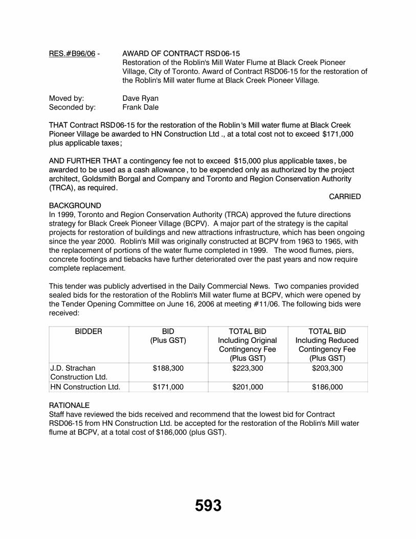
593
RES.#B96/06 - AWARD OF CONTRACT RSD06-15Restoration of the Roblin's Mill Water Flume at Black Creek Pioneer Village, City of Toronto. Award of Contract RSD06-15 for the restoration of the Roblin's Mill water flume at Black Creek Pioneer Village.
Moved by: Dave RyanSeconded by: Frank Dale
THAT Contract RSD06-15 for the restoration of the Roblin 's Mill water flume at Black Creek Pioneer Village be awarded to HN Construction Ltd ., at a total cost not to exceed $171,000 plus applicable taxes;
AND FURTHER THAT a contingency fee not to exceed $15,000 plus applicable taxes, be awarded to be used as a cash allowance , to be expended only as authorized by the project architect, Goldsmith Borgal and Company and Toronto and Region Conservation Authority (TRCA), as required.
CARRIEDBACKGROUNDIn 1999, Toronto and Region Conservation Authority (TRCA) approved the future directions strategy for Black Creek Pioneer Village (BCPV). A major part of the strategy is the capital projects for restoration of buildings and new attractions infrastructure, which has been ongoing since the year 2000. Roblin's Mill was originally constructed at BCPV from 1963 to 1965, with the replacement of portions of the water flume completed in 1999. The wood flumes, piers, concrete footings and tiebacks have further deteriorated over the past years and now require complete replacement.
This tender was publicly advertised in the Daily Commercial News. Two companies provided sealed bids for the restoration of the Roblin's Mill water flume at BCPV, which were opened by the Tender Opening Committee on June 16, 2006 at meeting #11/06. The following bids were received:
BIDDER BID(Plus GST)
TOTAL BIDIncluding Original Contingency Fee
(Plus GST)
TOTAL BIDIncluding Reduced Contingency Fee
(Plus GST)J.D. Strachan Construction Ltd.
$188,300 $223,300 $203,300
HN Construction Ltd. $171,000 $201,000 $186,000
RATIONALEStaff have reviewed the bids received and recommend that the lowest bid for Contract RSD06-15 from HN Construction Ltd. be accepted for the restoration of the Roblin's Mill water flume at BCPV, at a total cost of $186,000 (plus GST).
594
Bids received included a contingency fee as a cash allowance of $35,000 only to be expended as authorized by the project architect, Goldsmith Borgal and Company and TRCA, as required. Upon review of the bids received, based on the available project budget and in discussion with the bidders, the project architect and TRCA staff recommend a reduction in the value of the contingency fee by $15,000. Thereby resulting in a corresponding reduction in the bid amounts of $15,000 to match available project funding.
FINANCIAL DETAILSFunding for this project is available under account number 503-25 from the City of Toronto as part of the future directions strategy capital project.
Report prepared by: Mark Preston, 416-392-9722For Information contact : Marty Brent, extension 5403
Mark Preston,416-392-9722Date: July 12, 2006
_________________________________________
NEW BUSINESSRES.#B97/06 - BOB HUNTER PARK
Moved by: David BarrowSeconded by: Frank Dale
IT IS RECOMMENDED THAT the Chief Administative Officer 's update on the pending announcement of the provincial transfer of lands to TRCA for Bob Hunter Park , to be incorporated within the Rouge Park in the Town of Markham , be received.
_________________________________________
TERMINATION
ON MOTION, the meeting terminated at 10:21 a.m., on Friday, August 11, 2006.
Dick O'BrienChair
/ks
Brian DenneySecretary-Treasurer