imagine downtown encore report
TRANSCRIPT
imagine Downtown: eNCORe2009 Update: Envisioning Central Atlanta’s Future
Planning Overview 1
COntext 3
Planning legaCy 5
PrOCess 9
Market POtential 22 CurrentMarketProfile 22 ResidentialMarketPotential 23 OfficeMarketPotential 25 RetailMarketPotential 26
the visiOn 28
the Plan 32 DevelopmentFrameworkPlan 32 TransportationNetworkPlan 34 PublicSpacePlan 36 IllustrativePlan 38 NeighborhoodsandDistricts 40
CentennialHill 42SoNo 43GreenLine 44SouthCBD 45SweetAuburn 46PeachtreeCorridor 47Fairlie-PoplarDistrict 48MemorialDrive/MLKArea 49MariettaStreetArtery 50CentennialOlympicParkArea 51georgia state University 52CastleberryHill 53PeachtreeBottom 54
aChieving the visiOn 55ImplementationPrinciples 55ImplementationStructure 61ImplementationRecommendations 64AchievingLCIGoals 81DevelopmentSummary/25-YrProjections 85Short-TermProgram 86
aCknOwledgeMents 88
aPPendix a:ComprehensiveCorr idor Project L ist 90
T a b l e o f C o n t e n t s
P l a n n i n g O v e r v i e w
The ten years following the 1996Centennial Olympic Games borewitnesstoarenewedspiritofgrowthandadvancementforAtlanta’scitycenter culminating in 2004 withthecreationofaconsolidatedandprogressive vision for the futureentitled Imagine Downtown. Representing the dedication andcreativityofhundredsofDowntownstakeholders and workshopparticipants, and thousands ofonline survey respondents, theImagine Downtown Plan soughtto synthesize numerous previousplanning efforts and plannedprojects with new and creativeideas in previously unplannedareas of Downtown, into a singlecomprehensive vision for thewhole.
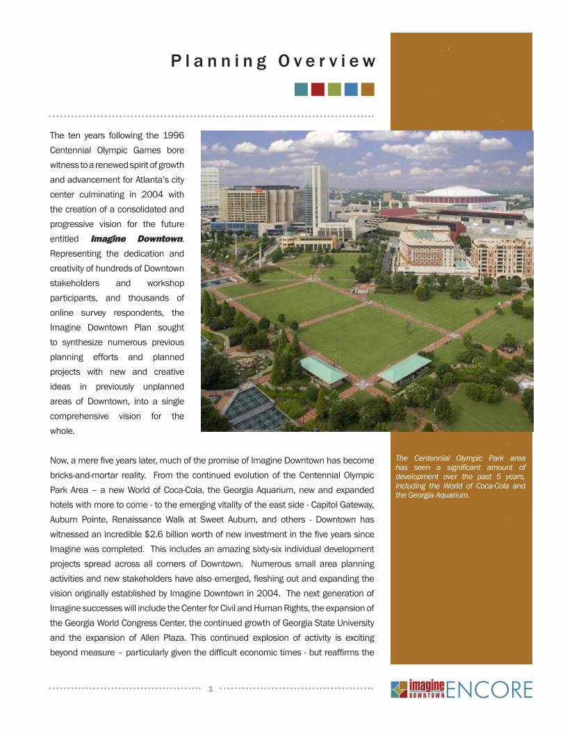
Now,amerefiveyearslater,muchofthepromiseofImagineDowntownhasbecomebricks-and-mortar reality. From thecontinuedevolutionof theCentennialOlympicParkArea–anewWorldofCoca-Cola, theGeorgiaAquarium,newandexpandedhotelswithmoretocome-totheemergingvitalityoftheeastside-CapitolGateway,Auburn Pointe, Renaissance Walk at Sweet Auburn, and others - Downtown haswitnessedanincredible$2.6billionworthofnewinvestmentinthefiveyearssinceImaginewascompleted.Thisincludesanamazingsixty-sixindividualdevelopmentprojects spread across all corners of Downtown. Numerous small area planningactivitiesandnewstakeholdershavealsoemerged,fleshingoutandexpandingthevisionoriginallyestablishedbyImagineDowntownin2004.ThenextgenerationofImaginesuccesseswillincludetheCenterforCivilandHumanRights,theexpansionoftheGeorgiaWorldCongressCenter,thecontinuedgrowthofGeorgiaStateUniversityand the expansion of Allen Plaza. This continued explosion of activity is excitingbeyondmeasure–particularlygiventhedifficulteconomictimes-butreaffirmsthe
The Centennial Olympic Park area has seen a significant amount of development over the past 5 years, including the World of Coca-Cola and the Georgia Aquarium.
1
2
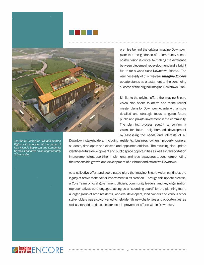
The future Center for Civil and Human Rights will be located at the corner of Ivan Allen Jr. Boulevard and Centennial Olympic Park drive on an approximately 2.5-acre site.
premisebehindtheoriginalImagineDowntownplan:thattheguidanceofacommunity-based,holisticvisioniscriticaltomakingthedifferencebetweenpiecemealredevelopmentandabrightfutureforaworld-classDowntownAtlanta.Theverynecessityofthisfive-yearImagine Encore updatestandsasatestamenttothecontinuingsuccessoftheoriginalImagineDowntownPlan.
Similartotheoriginaleffort,theImagineEncorevision plan seeks to affirm and refine recentmasterplansforDowntownAtlantawithamoredetailed and strategic focus to guide futurepublicandprivateinvestmentinthecommunity.The planning process sought to confirm avision for future neighborhood developmentby assessing the needs and interests of all
Downtown stakeholders, including residents, business owners, property owners,students,developersandelectedandappointedofficials.TheresultingplanupdateidentifiesfuturedevelopmentandpublicspaceopportunitiesaswellastransportationimprovementstosupporttheirimplementationinsuchawaysoastocontinuepromotingtheresponsiblegrowthanddevelopmentofavibrantandattractiveDowntown.
Asacollectiveeffortandcoordinatedplan,theImagineEncorevisioncontinuesthelegacyofactivestakeholderinvolvementinitscreation.Throughthisupdateprocess,aCoreTeamoflocalgovernmentofficials,communityleaders,andkeyorganizationrepresentativeswereengaged,actingasa“sounding-board”fortheplanningteam.Alargergroupofarearesidents,workers,developers,landownersandvariousotherstakeholderswasalsoconvenedtohelpidentifynewchallengesandopportunities,aswellas,tovalidatedirectionsforlocalimprovementeffortswithinDowntown.
3
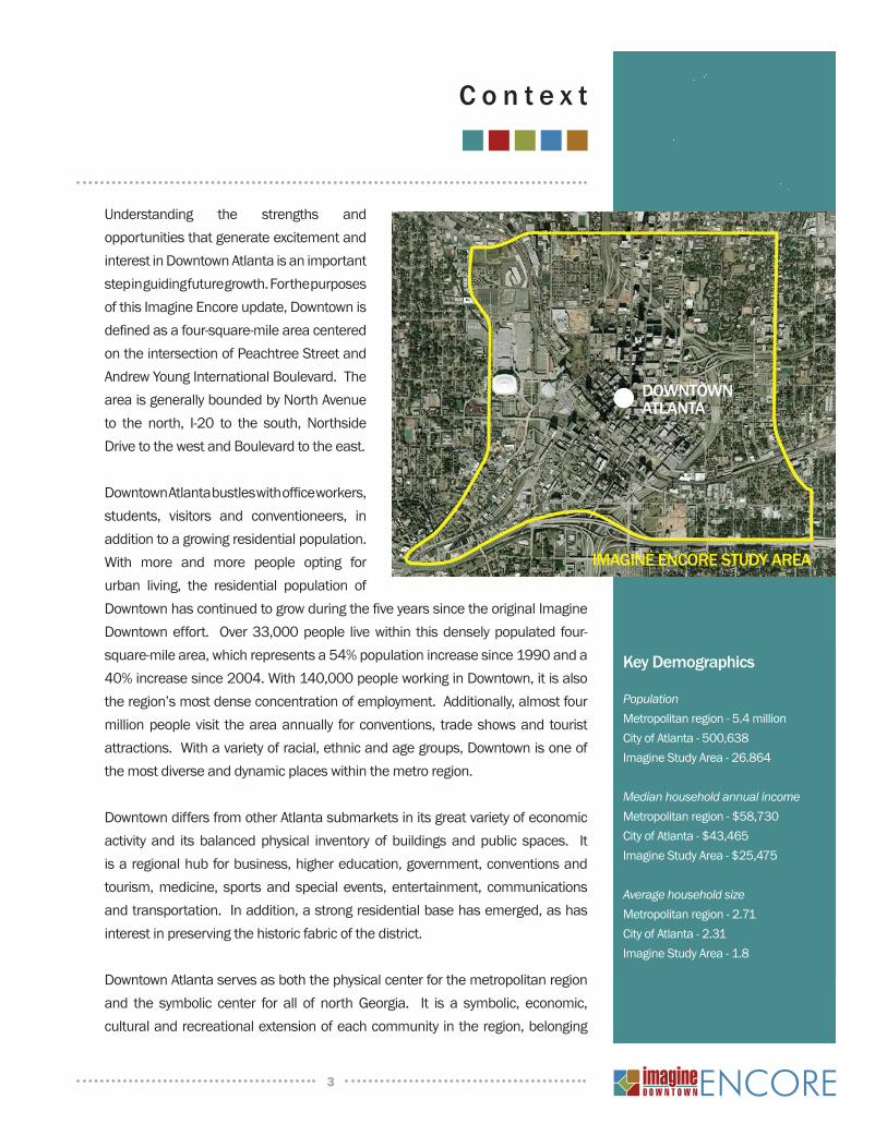
Understanding the strengths and opportunitiesthatgenerateexcitementandinterestinDowntownAtlantaisanimportantstepinguidingfuturegrowth.ForthepurposesofthisImagineEncoreupdate,Downtownisdefinedasafour-square-mileareacenteredontheintersectionofPeachtreeStreetandAndrewYoungInternationalBoulevard.TheareaisgenerallyboundedbyNorthAvenueto the north, I-20 to the south, NorthsideDrivetothewestandBoulevardtotheeast.
DowntownAtlantabustleswithofficeworkers,students, visitors and conventioneers, inadditiontoagrowingresidentialpopulation.With more and more people opting forurban living, the residential population ofDowntownhascontinuedtogrowduringthefiveyearssincetheoriginalImagineDowntowneffort. Over33,000people livewithin thisdenselypopulated four-square-milearea,whichrepresentsa54%populationincreasesince1990anda40%increasesince2004.With140,000peopleworkinginDowntown,itisalsotheregion’smostdenseconcentrationofemployment.Additionally,almostfourmillionpeoplevisit theareaannually forconventions, tradeshowsand touristattractions.Withavarietyofracial,ethnicandagegroups,Downtownisoneofthemostdiverseanddynamicplaceswithinthemetroregion.
DowntowndiffersfromotherAtlantasubmarketsinitsgreatvarietyofeconomicactivityand itsbalancedphysical inventoryofbuildingsandpublic spaces. Itisaregionalhubforbusiness,highereducation,government,conventionsandtourism,medicine, sportsandspecialevents,entertainment, communicationsandtransportation.Inaddition,astrongresidentialbasehasemerged,ashasinterestinpreservingthehistoricfabricofthedistrict.
DowntownAtlantaservesasboththephysicalcenterforthemetropolitanregionand the symbolic center for all of northGeorgia. It is a symbolic, economic,culturalandrecreationalextensionofeachcommunityintheregion,belonging
C o n t e x t
Key Demographics
PopulationMetropolitanregion-5.4millionCityofAtlanta-500,638ImagineStudyArea-26.864
Median household annual incomeMetropolitanregion-$58,730CityofAtlanta-$43,465ImagineStudyArea-$25,475
Average household sizeMetropolitanregion-2.71CityofAtlanta-2.31ImagineStudyArea-1.8
4
toeveryoneregardlessofwheretheyliveorwork.Downtownisnotonlytheregion’slargestcenterfor jobsandofficespace,butalsoitsheartandbrains; itscenterofinfluence,policy,transportationandgovernance.
The growth and success of suburbandevelopment has led many to question theimportance of Downtown. However, the pastfive years have continued to demonstrate thepitfalls of regional sprawl, includingworseningcongestionandcommutingtimes,unsustainablerealestateeconomics,highercostsofprovidingbasic services, and tougher competition fromotherUScitiesforeconomicgrowth.Nowmorethanever, it is critical that thesecommunitiesand neighbors understand how closely theirprosperity is tied to the future of the core ofourcity. Aplanthatpromotestheresponsiblegrowth and development of a vibrant andattractiveDowntown is important to theentireregionbecause:
Astrongcentercityencouragescentralizeddensedevelopmentthatdiscourages•sprawlanddevelopmentofruralland.A healthy Downtown neighborhood offers urban living opportunities for all•citizensInvestmentintheredevelopmentofDowntownprovidesacenterofurbandensity•required to function as a central node for transit destinations and local andregionaltransportationconnectionsApleasantandinvitingcentercitysupportsuniqueusesandactivitiessuchas•conventionfacilities,performingartsandsportvenuesthatservetheregion.AhealthyurbancorepositionstheAtlantaregiontocontinuecapturing its fair•shareofeconomicexpansion.
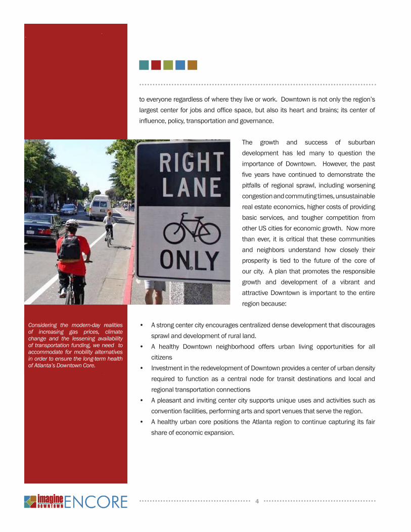
Considering the modern-day realities of increasing gas prices, climate change and the lessening availability of transportation funding, we need to accommodate for mobility alternatives in order to ensure the long-term health of Atlanta’s Downtown Core.
5
In the years preceding the original Imagine Downtown plan, several key effortsestablished area-specific or topic-specific visions for the future. Included amongthesewere:CentralAtlantaActionPlan(CA2P),CentralAtlantaTransportationStudy(CATS),theCityCenterLivableCenterInitiative,theJSA-McGIllLivableCenterInitiative,theDowntownLivabilityCode,theMultimodalPassengerTerminalConcept6DesignReport,andACulturalDistrictforDowntownAtlanta.Intheirownway,eachoftheseplansinformedtheconsolidatedvisionembodiedbytheImagineDowntownPlan.
Asitwasin2004,DowntownAtlantacontinuestobeamodelforthoughtfulplanning.SincethedraftingofImagineseveralnewplanninginitiativeshaveprovidedinputandinsightthatisonceagaininvaluabletoconsideringthefuturegrowthanddevelopmentof Downtown. These recent efforts enrich, modifyandexpandthegroundworkoftheImagineEncorevision.Ofparticularinterestandimportancearethefollowingplansandstudies:
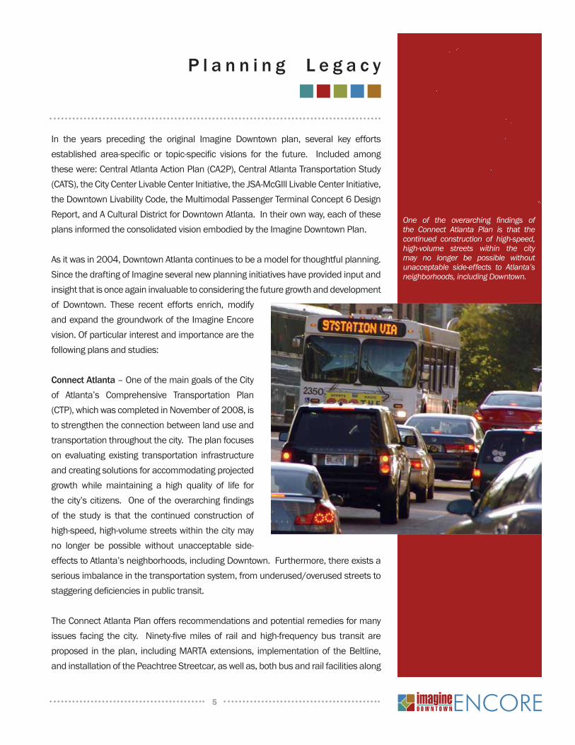
Connect Atlanta –OneofthemaingoalsoftheCityof Atlanta’s Comprehensive Transportation Plan(CTP),whichwascompletedinNovemberof2008,istostrengthentheconnectionbetweenlanduseandtransportationthroughoutthecity.Theplanfocusesonevaluating existing transportation infrastructureandcreatingsolutionsforaccommodatingprojectedgrowth while maintaining a high quality of life forthecity’scitizens. Oneof theoverarchingfindingsof the study is that the continued construction ofhigh-speed,high-volumestreetswithinthecitymayno longer be possible without unacceptable side-effectstoAtlanta’sneighborhoods,includingDowntown.Furthermore,thereexistsaseriousimbalanceinthetransportationsystem,fromunderused/overusedstreetstostaggeringdeficienciesinpublictransit.
TheConnectAtlantaPlanoffersrecommendationsandpotentialremediesformanyissues facing the city. Ninety-fivemiles of rail andhigh-frequencybus transit areproposed in theplan, includingMARTAextensions, implementationof theBeltline,andinstallationofthePeachtreeStreetcar,aswellas,bothbusandrailfacilitiesalong
P l a n n i n g L e g a c y
One of the overarching findings of the Connect Atlanta Plan is that the continued construction of high-speed, high-volume streets within the city may no longer be possible without unacceptable side-effects to Atlanta’s neighborhoods, including Downtown.
6
manymajorcorridors. Twohundredmilesofbike lanesareproposed, linkingkeyactivitycenters.Seventy-threenewstreetsareproposedtobetterconnecttheexistingnetwork,aswellas,twenty-tworoadwideningprojectstoaddmorecapacitytothe
system.Theplanalsoincludesguidelinesfordifferentstreet typologies, which include recommendationsforlocation/designofpedestrianamenitiessuchassidewalks,lighting,landscapingaswellasoutliningspecific regulations for bringing city streets intocompliancewiththeAmericanswithDisabilitiesAct.
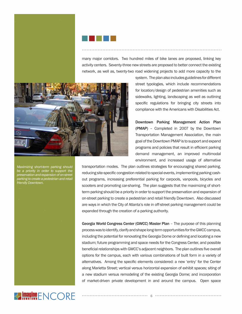
Downtown Parking Management Action Plan (PMAP) – Completed in 2007 by the DowntownTransportationManagementAssociation, themaingoaloftheDowntownPMAPistosupportandexpandprogramsandpoliciesthatresultinefficientparkingdemand management, an improved multimodalenvironment, and increased usage of alternative
transportationmodes.Theplanoutlinesstrategiesforencouragingsharedparking,reducingsite-specificcongestionrelatedtospecialevents,implementingparkingcash-out programs, increasing preferential parking for carpools, vanpools, bicycles andscootersandpromotingcar-sharing.Theplansuggeststhatthemaximizingofshort-termparkingshouldbeapriorityinordertosupportthepreservationandexpansionofon-streetparkingtocreateapedestrianandretailfriendlyDowntown.AlsodiscussedarewaysinwhichtheCityofAtlanta’sroleinoff-streetparkingmanagementcouldbeexpandedthroughthecreationofaparkingauthority.
Georgia World Congress Center (GWCC) Master Plan –Thepurposeofthisplanningprocesswastoidentify,clarifyandshapelong-termopportunitiesfortheGWCCcampus,includingthepotentialforrenovatingtheGeorgiaDomeordefiningandlocatinganewstadium;futureprogrammingandspaceneedsfortheCongressCenter,andpossiblebeneficialrelationshipswithGWCC’sadjacentneighbors.Theplanoutlinesfiveoveralloptionsforthecampus,eachwithvariouscombinationsofbuiltforminavarietyofalternatives.Amongthespecificelementsconsidered:anew‘entry’fortheCenteralongMariettaStreet;verticalversushorizontalexpansionofexhibitspaces;sitingofanewstadiumversusremodelingoftheexistingGeorgiaDome;andincorporationof market-driven private development in and around the campus. Open space
Maximizing short-term parking should be a priority in order to support the preservation and expansion of on-street parking to create a pedestrian and retail friendly Downtown.
7
opportunitieswerealsoidentifiedsuchasanewquadwithinthecenterofthesite,oranewcentralparkextendingtoNorthsideDrive.TheplanalsoaddressedcirculationissuessuchasextensionofInternationalBoulevardwestwardtoNorthsideDrive,busandpedestrianaccessalongMariettaStreetandtheredesigningofMartinLutherKingJr.Drivetoincorporatenewdevelopmentandpotentialgradechanges.
Capitol Hill Greenspace Project Master Plan–TheintentoftheCapitolHillPlanistoimprovepublicspaces,security,connectivityandaccessinandaroundtheStateCapitol grounds. Oneof themajor improvements includes installationof amajorpedestrianbridgeand landscapedmallspanningover I-75/85andaligningwithafuture linearparkbetweenMartinLutherKingJr.DriveandMemorialDrive to theeast.TherealignmentofCapitolAvenueandtheconversionofMitchellStreettoapedestrianmallaremajorelementstothisplan.SignificantpedestrianupgradesarealsoincludedalongMartinLutherKingJr.Drive,MemorialDrive,CentralAvenueandJesseHillJr.Drive.
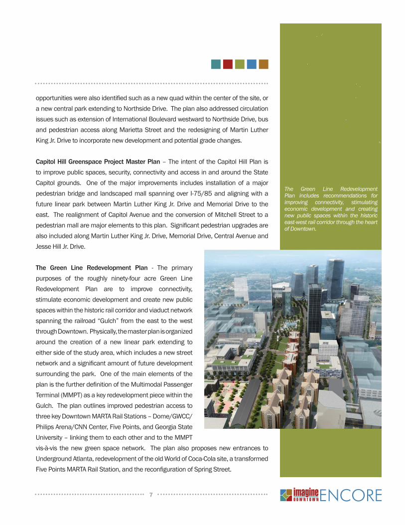
The Green Line Redevelopment Plan - The primarypurposes of the roughly ninety-four acre Green LineRedevelopment Plan are to improve connectivity,stimulateeconomicdevelopmentandcreatenewpublicspaceswithinthehistoricrailcorridorandviaductnetworkspanningtherailroad“Gulch”fromtheeasttothewestthroughDowntown.Physically,themasterplanisorganizedaround the creation of a new linear park extending toeithersideofthestudyarea,whichincludesanewstreetnetworkandasignificantamountoffuturedevelopmentsurroundingthepark.OneofthemainelementsoftheplanisthefurtherdefinitionoftheMultimodalPassengerTerminal(MMPT)asakeyredevelopmentpiecewithintheGulch.TheplanoutlinesimprovedpedestrianaccesstothreekeyDowntownMARTARailStations–Dome/GWCC/PhilipsArena/CNNCenter,FivePoints,andGeorgiaStateUniversity–linkingthemtoeachotherandtotheMMPTvis-à-vis thenewgreenspacenetwork. Theplanalsoproposesnewentrances toUndergroundAtlanta,redevelopmentoftheoldWorldofCoca-Colasite,atransformedFivePointsMARTARailStation,andthereconfigurationofSpringStreet.
The Green Line Redevelopment Plan includes recommendations for improving connectivity, stimulating economic development and creating new public spaces within the historic east-west rail corridor through the heart of Downtown.
8
Peachtree Corridor Vision Plan - Recognizing the Peachtree Corridor as theeconomic and cultural spine of the City, Mayor Shirley Franklin initiated thePeachtreeCorridorTaskforcetodevelopavisionforandstrategicrecommendationsto transform the corridor intoa foremostdestination forAtlanta’s visitorsandresidents.Adiversegroupofindividualsrepresentingconstituenciesalongthecorridor–definedas thenorth/south route fromFt.McPherson toDowntown
and Midtown through to Buckhead -served on the Taskforce. Organizedaround mobility, housing, finance andplanninganddesignissues,theresultingvisionandrecommendationsstriveforadiverse,vibrantboulevardfullof life. Ofthealmost$1.0billionintotalidentifiedcapitalcoststhemostnotableprojectistheconstructionandoperationofmodernstreetcarservicealongPeachtreeStreetandaneast-westroutewithinDowntownbetween Centennial Olympic Park andtheKingHistoricDistrict.
Downtown Neighborhood Plans - Thecommunities that ring the core of thecenter city are critically important tovitality,economichealthandconnectivity
ofDowntownasawhole.BuildingontheoriginalImaginerecommendationstobetterconnectthecoreofthecentercitytosurroundingcommunities,itisnotsurprisingthatsignificantplanningactivityhasoccurredintheseneighborhoodsoverthepastfiveyears.FromtherecentOldFourthWardMasterPlanandtheupdatedButler-AuburnRedevelopmentPlantotheUpperWestsideandVineCityLivable Center Initiatives these neighborhood-driven processes and resultingrecommendationsareintegraltotheImagineEncorevision.
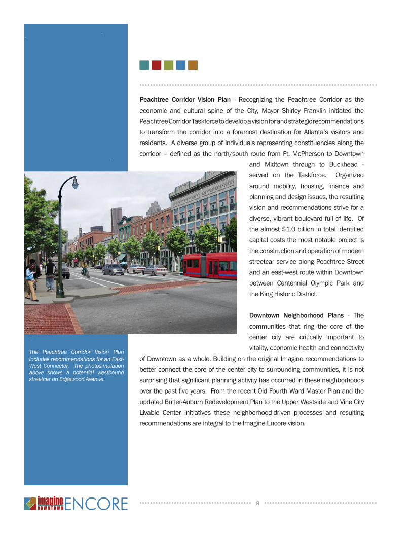
The Peachtree Corridor Vision Plan includes recommendations for an East-West Connector. The photosimulation above shows a potential westbound streetcar on Edgewood Avenue.
9
AhallmarkofImagineEncore-continuedfromtheoriginalplan-hasbeentheabsolutefocusondevelopingacollectivevisionbasedonthewishesanddesiresoftheDowntowncommunity.WhilenotasexhaustiveorlengthyastheoriginalImagineeffort,theImagineEncoreprocessgarneredsupportandinputthroughtheuseofthreedistinctoutreachmechanisms.
stakehOlder interviews
CentralAtlantaProgressstaffandmembersoftheconsultingteamconductednumerous one-on-one interviews with key Downtown stakeholders including:governmentofficials,majorDowntowninstitutions,businessandpropertyowners,serviceprovidersanddevelopers. One-on-oneformatsprovidedtheplanningteamwithacandidassessmentofcurrentissuesaffectingvariousaspects of Downtown including: shortcomingsand/orvalidationoftheexistingImaginevision,challenges for the future and changes in thedevelopmentmarket since 2004. During thefall of 2008 close to twenty interviews wereconducted.
COre teaM dialOgUe
Inadditiontoengagingstakeholdersindividually,a40to50memberCoreTeamwasestablishedtoprovideoversightandconsistencyof reviewofplanningconcepts.TheCoreTeamincludedawidevarietyof representativesforDowntown interests–mostwithpreviousexperience in 2004 Imagine outreach efforts and/or the participation in therecentplanninginitiativesmentionedabove.TheCoreTeammettwiceduringtheImagineUpdateprocesstoprovideguidance, review issuesandopportunities,validateplanningproductsandsign-offontheupdatedvision.
ThefirstCoreTeammeeting (October2008) includedapresentation tobringmembersuptospeedonrecentdevelopmentsandtrendsinDowntownincluding:studies, investment, new housing and commercial development, regulatory
P r o c e s s
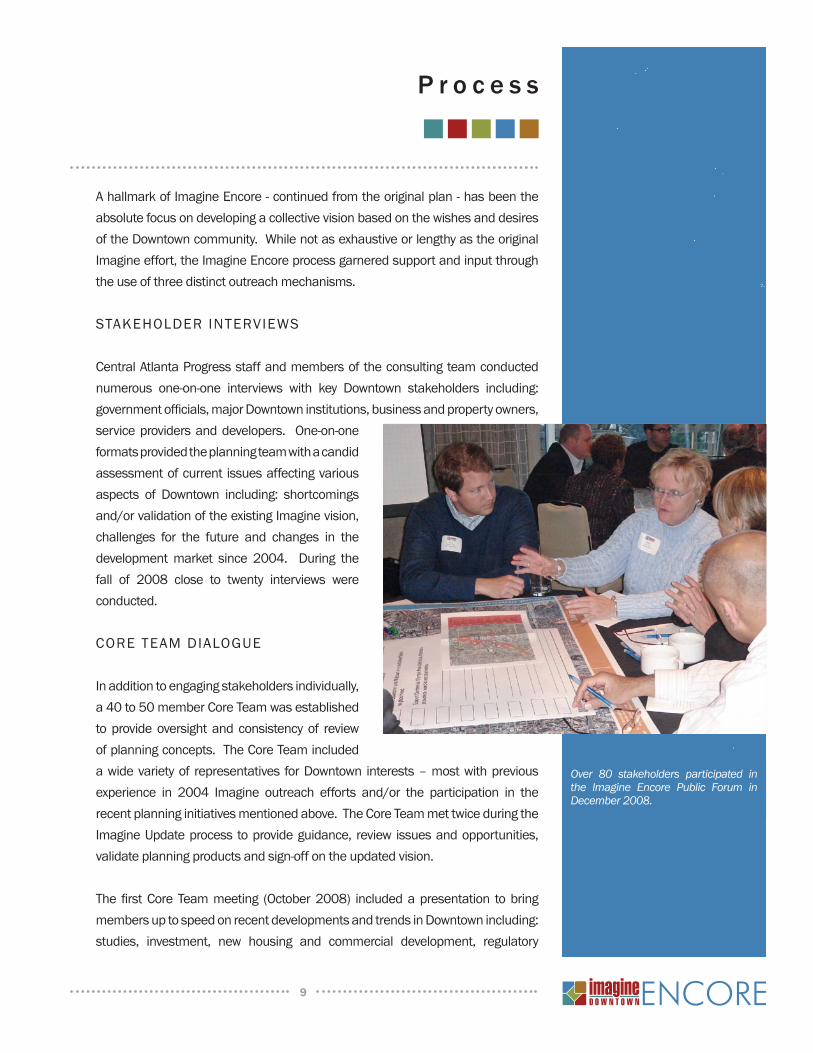
Over 80 stakeholders participated in the Imagine Encore Public Forum in December 2008.
10
conditions,existingphysicalconditionsandcurrentmarketanddemographictrends.Inaddition,CoreTeammemberswereaskedtoweighinonthreestrategicquestions:
• Whatareashavedonewellandneedonlyrefinements?• Whatareasneedmoreprioritizationwhilekeepingtheplanintact?• Whatareasmayneedadifferentapproach,andwhy?
KeydiscussiontopicsduringtheFirstCoreTeammeetingincluded:
• Concernsovermaintenanceofexistinginfrastructureandstreetscapes• QuestionsregardingthestatusofGeorgiaDepartmentofTransportationfunding
commitments• TheneedtolookcloseratfuturedevelopmentaroundtheGarnettMARTARail
station•IdentificationofredevelopmentthemesforrevitalizationoftheSouthCentralBusinessDistrict(CBD)•Adesiretoensurethepreservationandinclusionofaffordablehousingwithintheplan•TheneedtoupdatethecommunityontheGreenLinePlanincludingrecommendationsforFivePointsandtheWallStreetareas.
Ultimately, the answers to the broadquestionsandkeydiscussiontopicsabovewereusedasaframeworktoinformthestructureofanengagingand interactivePublicForumheldinNovember2008.
ThesecondCoreTeammeeting(January2009)wasdesignedtoprovidememberswithasummaryoftheresultsofthePublicForum.Armedwithanunderstandingoftheconsensusdirectionprovidedbythegeneralpublic,theCoreTeamparticipatedinaseriesofhighly-targetedexercisestofinalizethesubstanceoftheImagineUpdateplan.Thethreecategoriesofvalidationwereasfollows:
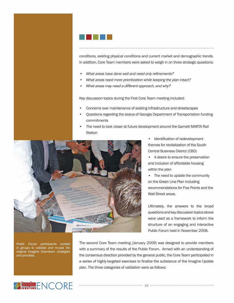
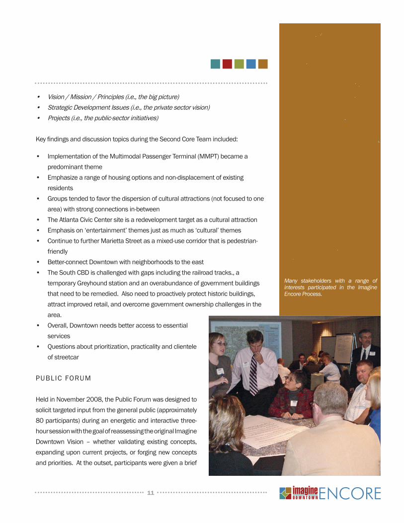
Public Forum participants worked in groups to validate and re-cast the original Imagine Downtown strategies and priorities.
11
• Vision/Mission/Principles(i.e.,thebigpicture)• StrategicDevelopmentIssues(i.e.,theprivatesectorvision)• Projects(i.e.,thepublic-sectorinitiatives)
KeyfindingsanddiscussiontopicsduringtheSecondCoreTeamincluded:
• ImplementationoftheMultimodalPassengerTerminal(MMPT)becameapredominanttheme
• Emphasizearangeofhousingoptionsandnon-displacementofexistingresidents
• Groupstendedtofavorthedispersionofculturalattractions(notfocusedtoonearea)withstrongconnectionsin-between
• TheAtlantaCivicCentersiteisaredevelopmenttargetasaculturalattraction• Emphasison‘entertainment’themesjustasmuchas‘cultural’themes• ContinuetofurtherMariettaStreetasamixed-usecorridorthatispedestrian-
friendly• Better-connectDowntownwithneighborhoodstotheeast• TheSouthCBDischallengedwithgapsincludingtherailroadtracks.,a
temporaryGreyhoundstationandanoverabundanceofgovernmentbuildingsthatneedtoberemedied.Alsoneedtoproactivelyprotecthistoricbuildings,attractimprovedretail,andovercomegovernmentownershipchallengesinthearea.
• Overall,Downtownneedsbetteraccesstoessentialservices
• Questionsaboutprioritization,practicalityandclienteleofstreetcar
PUBLICFORUM
HeldinNovember2008,thePublicForumwasdesignedtosolicittargetedinputfromthegeneralpublic(approximately80participants)duringanenergeticandinteractivethree-hoursessionwiththegoalofreassessingtheoriginalImagineDowntown Vision –whether validating existing concepts,expandinguponcurrentprojects,orforgingnewconceptsandpriorities.Attheoutset,participantsweregivenabrief
Many stakeholders with a range of interests participated in the Imagine Encore Process.
12
30minutepresentationtobringthemuptospeedonthehistoryofImagineDowntownincludingtheoverallvision,existingphysicalconditionsandmarketanddemographictrends.Participantswerethendividedintotenindividually-facilitatedtablesandledthroughaseriesofquick-hittingexercisescoveringthreeprimarytopicareas:
• Growth&Development-desiredlocationsandtypesofnewhousing,retailandrestaurants
• Mobility - priorities and preferred modes for transit, locations and levels ofinvestmentforpedestrianandbikeprojects
• Livability & Attractions - importance and priorities for public spaces, culturalattractions,venues,specialevents
Briefsummariesofconsensusresultsaredescribedbelow:
Vision -TheexistingImagineDowntowneight-pointvisionisstillvalid,thoughadditionsandrefinementsweresuggestedtofocusondistrictswherelessdevelopmentactivityhasoccurred.Aclearpriorityexpressedbythegroupwasthegoalof“connectingallofGeorgiathroughastate-of-the-art multimodal transportation hub”, which participants feltshouldbeacoreelementofthevision.Additionalvisiongoalsincludedeliberate attention to retail recruitment and retention; expandingDowntownculturalattractionsandchoices;andcontinuingtoimproveconnectionsacrosstownandtoadjoiningneighborhoods.
Housing -Ofthespecificlocationsmentioned,DowntownEast,AuburnAvenue,andGeorgiaStateUniversityhadthemostvotes,followedbytheSouthCBD,GarnettStreetareaandSoNo.OtherchoicesincludedFairlie-PoplarandPeachtreeStreet.Overall,40%ofthegroupsagreedthathousingshouldbeapriorityaspartoftheupdatedplan,witha
specificemphasisonarangeofhousingoptions.
Retail -Byfar,thePeachtreeStreetCorridorwastheoverallpriorityintermsofretaillocation,withparticularattentiongiventothesegmentservingthehoteldistrictandalesseremphasistoareaaroundFivePoints.CentennialHillandCentennialOlympicParkalsoscoredwell,asdidareas inDowntownEast;both these locationsmadementionofencouragingspecificretailstreetslikeAuburn,Edgewood,MemorialandSimpson–eithertoanchortheirdistrictsortofollowtheexampleofthesuccessof
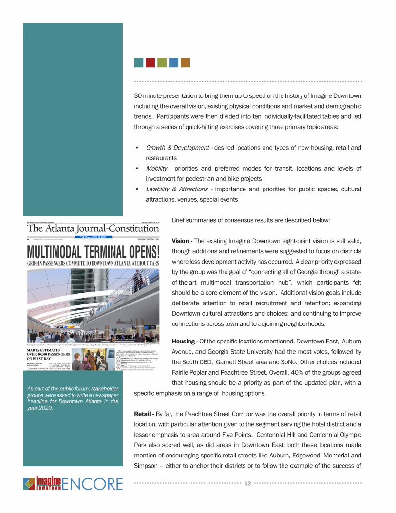
As part of the public forum, stakeholder groups were asked to write a newspaper headline for Downtown Atlanta in the year 2020.
13
theMariettaStreetcorridor.AdditionallocationsmentionedwereFairlie-Poplar,SoNo(northalongtheMidtownborder),andtheSouthCBD.Groupsunanimouslyvoicedtheirpreferenceforsmallerstorefrontsovermoreconsolidatedorlargerretailers.Seventypercent(70%)ofattendeesalsosupportedmorerestaurants,withapreferencetoleavetheircontroltothemarketwithoutprescribedlimitations.
Mobility –Thestrongestconsensusonmobility issues includedsignal timingandimprovingconnectivityandaccess–namely theneed for cross-townconnections;reducing or eliminating the congestion and pedestrian conflicts associated withcommuter buses and coaches; and improving overall pedestrian facilities by acombination of methods including road diets. Parking was considered a minorissuebythegroups,althoughitdidrankhighlyamongprojectpriorities;thevariedresponsessuggestedthatDowntownparkingstrategiesshouldbeongoing,diverseandcomprehensive.
Groupsalsoprioritizedalistoftransportationprojecttypes:
• Priority1:Two-wayconversions• Priority2:Parking(management,on-streetparking)• Priority3:Atiebetweennewstreetsandroaddiets• Priority4:Atiebetweenenhancedinterstateaccessandbettermaintenance
During discussions about modes of future transit, there was almost unanimousconsensus that streetcars including the circulator route and the commuter railincludingtheMMPTarethehighestpriorityforthenexttenyears;butconsiderationforMARTArailandtoalesserextentexpressbusessuggestacombinedstrategyofshort-termimprovementstoMARTAstationsandexpressbusroutingandqueuing,andconsistentadvocacyfortheGriffintoAtlantaandAthenstoAtlantacommuterlinesandthestreetcarcirculator.Groupswerealsoaskedaboutnegativeissuesassociatedwithexistingtransit.Responsesrevolvedaroundfrequency,congestionandpoorimageassociatedwithMARTAandexpressbuses;thefundingandtechnicalunknownsandtouristbiasofthestreetcar;andtheneedforredesignandredevelopmentofMARTArailstations.
When asked about priority areas for pedestrian improvements, groups generallyagreedthatPeachtreewastheprioritypedestriancorridor,followedbyMemorialDriveandAuburnAvenue.Groupsalsorepeatedlymentionedtheneedforbettereast-west
14
connections,withstreetsconnectingthehoteldistricttoCentennialOlympicParkasanotherhigh-priorityitem.Whendiscussingbikeroutes,thehighestprioritywasonethatwouldimprovetheconnectionbetweenFreedomParkandDowntown,especiallytolinktoCentennialOlympicParkandpossiblyovertimetoPiedmontParkaswell.OtherkeybikeroutesincludedPeachtree,Marietta/Decatur,Edgewood,andCapitol.
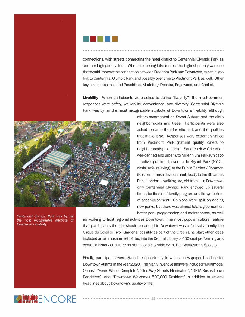
Livability -Whenparticipantswereasked todefine“livability’”, themostcommonresponseswere safety, walkability, convenience, and diversity; Centennial OlympicParkwasby far themost recognizable attribute ofDowntown’s livability, although
otherscommentedonSweetAuburnandthecity’sneighborhoods and trees. Participants were alsoaskedtonametheirfavoriteparkandthequalitiesthatmakeitso.Responseswereextremelyvariedfrom Piedmont Park (natural quality, caters toneighborhoods)toJacksonSquare(NewOrleans–well-definedandurban),toMillenniumPark(Chicago–active,publicart,events), toBryantPark(NYC–oasis,safe,relaxing),tothePublicGarden/Common(Boston–densedevelopment,food),totheSt.JamesPark(London–walkingare,oldtrees).InDowntownonly Centennial Olympic Park showed up severaltimes,foritschild-friendlyprogramanditssymbolismofaccomplishment.Opinionsweresplitonaddingnewparks,buttherewasalmosttotalagreementonbetterparkprogrammingandmaintenance,aswell
asworkingtohostregionalactivitiesDowntown.ThemostpopularculturalfeaturethatparticipantsthoughtshouldbeaddedtoDowntownwasafestivalamenitylikeCirqueduSoleilorTivoliGardens,possiblyaspartoftheGreenLineplan;otherideasincludedanartmuseumretrofittedintotheCentralLibrary,a450-seatperformingartscenter,ahistoryorculturemuseum,oracity-wideeventlikeCharleston’sSpoleto.
Finally, participantswere given the opportunity towrite a newspaper headline forDowntownAtlantaintheyear2020.Thehighlyinventiveanswersincluded“MultimodalOpens”,“FerrisWheelComplete”,“One-WayStreetsEliminated”,“GRTABusesLeavePeachtree”, and “DowntownWelcomes 500,000 Resident” in addition to severalheadlinesaboutDowntown’squalityoflife.
Centennial Olympic Park was by far the nost recognizable attribute of Downtown’s livability.
15
Aswiththeoriginal Imagineeffort, theresultsof thevariousstakeholderoutreachmechanisms–whetherone-on-oneinterviews,throughaCoreTeamorbythegeneralpublic-werethoughtful,honestandattimescritical.However,onceagainImaginestakeholdersexhibitedauniquepenchantforbeingcreativeandhopefulforthefutureofDowntownAtlanta.
reCaPPing iMagine dOwntOwn
Giventhenatureofthisreportasafive-yearupdatetoImagineDowntown,itiscriticaltounderstandthatthevision,prioritiesandprojectscontainedinEncorearenotonlyderivedfromtheoutreachprocessundertakenduring2008and2009,butarealsoareflectionof,andtestamenttotheextensiveprocessoriginallyundertakenin2003and2004.The2003and2004process,anditsresults,isthefundamentalbackboneofthisreportandisdescribedonthepagesthatfollow.
OVeRVieW
Throughout 2004, an extensive and elaborate process was utilized to solicitstakeholderandcommunityinputandparticipation.Theplanwasdevelopeddirectlyfrom information gathered through an online survey, focus area workshops, coreteammeetingsandstakeholderinterviews.ThiscreativeprocessbroughttogetherallelementsoftheDowntowncommunity:residents,businessand property owners, students, developers,andgovernmentandelectedofficials.Aidedbyaconsulting teamofdesignprofessionals, theprocessengaged thecommunityat large,andwhatemergedwasaclearideaofthecharacterofthenewcitycenter.
Online sUrvey
TheImagineDowntownCompasssurvey,whichwasacrucialcomponentoftheinitialvisioningprocess,includedmulti-mediaimagery,avisualcharactersurveyandashort-answerquestion-nairetailoredtoissuesandopportunitiesfacing
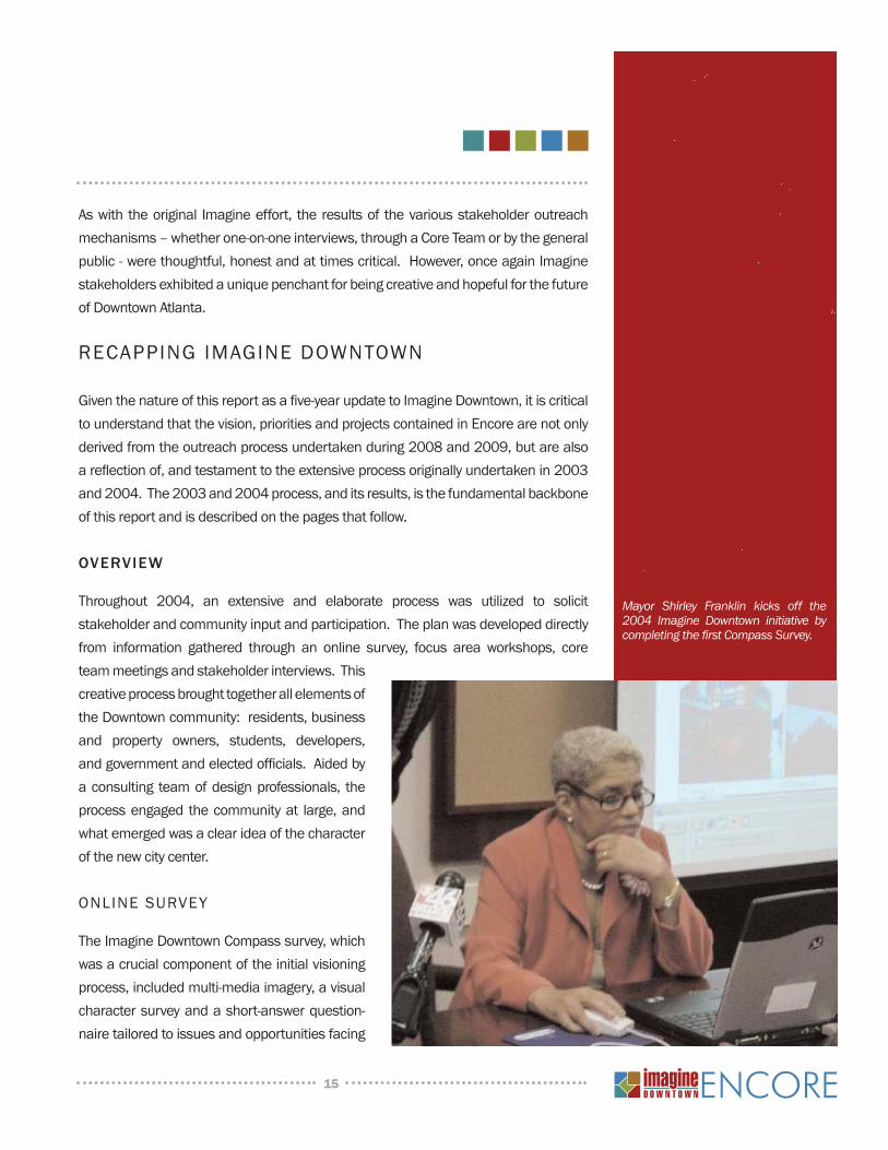
Mayor Shirley Franklin kicks off the 2004 Imagine Downtown initiative by completing the first Compass Survey.
16
Downtown. Administeredonline through theCentralAtlantaProgresswebsite, thesurveycapturedavarietyofDowntownaudiences,butwasalsoaimedatresidentsoftheCityofAtlantaandinterestedpartiesfromthroughouttheregion.Alltold,morethan1,900peopleparticipated,capturingtheirthoughtsandopinionsthroughtwosections;1)KnowledgeoftheDowntownenvironment,usageandbehaviorinthecen-tralcityandopportunitiesforDowntowngrowth;and2)AvisualcharactersurveytoidentifydesiresforDowntowndevelopmentanddesign.AlthoughlargenumbersofDowntownresidentsandworkersresponded,themajorityofparticipantswereactu-allyfromareasofthecityoutsideofDowntown.
The visual character surveys, thoughsubjective, still showed prominentpreferences among respondents as totheirdesiredimageforDowntowngrowthand development. Most categoriesshowedaclearanddefinitepreferenceforonemode,styleorimageoveranyotheralternative, which provided a measureofconsensus indeveloping the Imaginemasterplan.
For low-density residential, rowdevelopmentwasmoststronglypreferred;with traditional mixed a close second.Modernmixedusewaspreferredforhighdensitydevelopmentbya2-to-1margin,aswasinfilldevelopmentforlowdensitycommercial uses. In terms of transit,
althoughmostparticipantsreporteddrivingaprivatevehicle towork (64percent),avastmajority(77percent)suggestedatrolleyorsubwaywasthemostappropriatemodeoftransportintoandwithinthecitycenter.Forstreetcharacter,opinionsweremixedbetweentheMacy’sParade,GeorgetownandSienastylestreetlifeasthemostappropriateforDowntownpublicbyways.TheOlmsteadtraditionoflinear,tree-linedparkswerethemostdesiredtypeofgreenspace,yetCentennialOlympicParkrankedasDowntown’smost-favoredpark.Favoritecityscapesweresplitquiteevenlyamong(indescendingorder)SanFrancisco,NewYork,Chicago,AtlantaandLondon.InAtlanta,
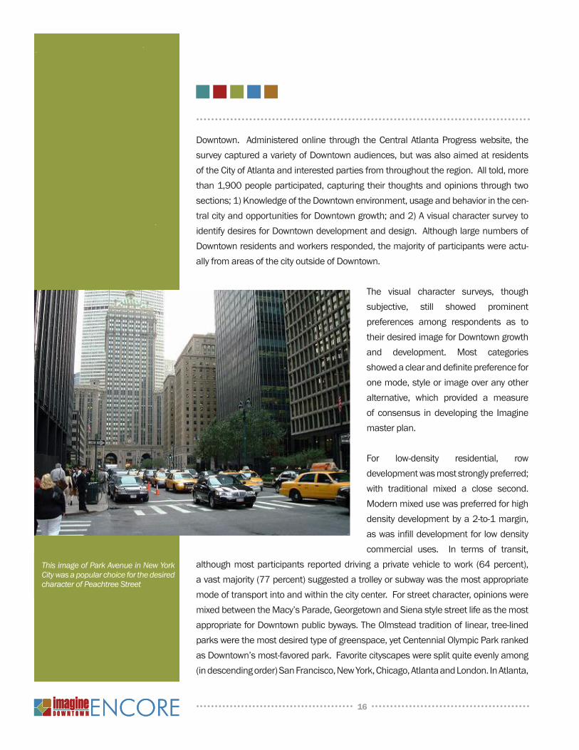
This image of Park Avenue in New York City was a popular choice for the desired character of Peachtree Street
17
theHurtBuildingandBroadStreetweremostclearlythefavoritesforbestbuildingandstreetscape,whilePeachtreewassingledout(byanalmost3-to-1margin)astheofficialgatewaytothecity.
FOCUSAREAS
DowntownAtlantacoversfoursquaremilesofthecentercityandcomprisesmultipleindividual,yetrelated,neighborhoods.InordertobetterunderstandandplanfortheuniquecharacteristicsofeachcommunitythelargerDowntownareawasdividedintoaseriesofsmallerareastofacilitatemoredetailedexamination:
Jones/Simpson/Alexander (JSA)–McGill Corridor
TheJSA-McGillFocusAreaislocatedinthenorthernthirdofDowntownAtlanta.Thestudyareaisapproximatelytwomiles long, extending from Northside Drive on the westalmosttoCentralParkDriveontheeast.Eachendofthecorridorisanchoredbysignificantpublicuses;onthewest,theGeorgiaWorldCongressCenter,andontheeast,theBoisfeuillet Jones Atlanta Civic Center. The area is alsoadjacenttoresidentialneighborhoods–CentennialPlace,Herndon Homes, Vine City and portions of SoNo (Southof North). Formany years, JSA-McGill was identified asthemaineast-westconnectoracrossthenorthernendofDowntown Atlanta. In early 2005, however, the corridorunderwentmajorreconstructionandwasrenamedinhonorofthelateMayorIvanAllenJr.Asof2009,constructionforthiscontinuousfour-lanetwo-wayroad,nowknownasIvanAllenJr.Boulevard,isnearingcompletion.
Eastside/Auburn Avenue
TheEastside/AuburnAvenueFocusAreaislocatedjusteastofthecoreoftheCentralBusinessDistrict.TheAuburnAvenuecorridorisapproximatelyonemilelong,anchoredby a high-density commercial area around Peachtree Street on thewest and theMartinLutherKing,Jr.NationalHistoricSiteontheeast.JohnWesleyDobbsAvenueandEdgewoodAvenueformthenorthernandsouthernboundariesoftheFocusArea.InadditiontotheKingNHSsiteandGradyMemorialHospital,theareaincludesaportionofGeorgiaStateUniversity,thesouthernpartofDowntown’sHotelDistrict,and
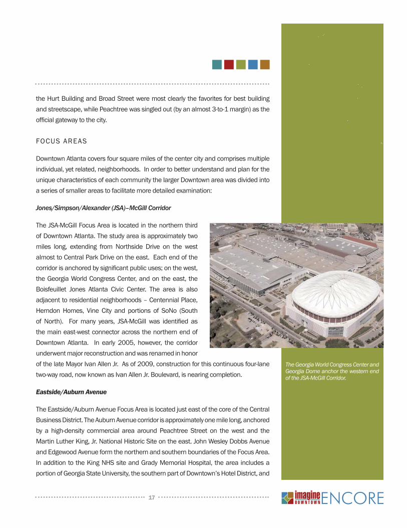
The Georgia World Congress Center and Georgia Dome anchor the western end of the JSA-McGill Corridor.
18
manysmallhistoriccommercialestablishments.TheDowntownConnectorbisectsthecorridorintotwodistrinctsubareas,creatingavisualandpsychologicalbarrier.SweetAuburnisinscribedinalargerneighborhoodcontextunlikesomeoftheotherImagineFocusAreas.WhilemostofthefocusisgiventotheAuburnandEdgewoodAvenuecommercialcorridorsandtheirenvirons,theplanningteamtookintoconsideration
thislargercontexttounderstandthecorridorwithina greater framework and to make the necessarylinkagestootherstudiesandplans.
Peachtree Corridor
The Peachtree Corridor forms the physical andsymbolic backbone of Downtown Atlanta and theFocus Area stretches fromMartin Luther King, Jr.drive on the south to north avenue on the north. The Peachtree Corridor Focus Area includes theDowntownareas thatareperceivedas thecoreoftheCentralBusinessDistrict–thecommercialcenterof theAtlantaRegion. PeachtreeStreetservesasthe primary artery in the corridor, but is joined byDowntown’s network of one-way pair streets that
definetheblocksinthisarea.ThislinearcorridorincludesallpropertieswithinthreeblockseastandwestofPeachtreeStreetitselfandincludesmajorlandmarkssuchastheFivePointsMARTAStation,UndergroundAtlanta,Fairlie-PoplarHistoricDistrict,Woodruff Park, Andrew Young International Boulevard, Peachtree Center, Mayor’sPark,EmoryUniversityHospitalMidtownandseveralmajorDowntownchurchesandhotels.PeachtreeisuniqueinthatitalsooverlapsthreeotherImagineFocusAreas–JSA-McGill,Eastside/Auburn,andSouthCBD.
Terminus
TheTerminusFocusArea is roughly triangular-shapedwithNorthsideDriveas thewesternboundary,MariettaandLuckiestreetsboundingthenortheast,andMartinLutherKing,Jr.DriveandNelsonStreetonthesouth.Muchofthecentralportionoftheareaissurfaceparkingoccupyingtheoldrailroad“Gulch”andthesitesoftheUnionandTerminalStationswhichweredemolishedinthe1970s;anothersignificantportionisgivenovertotheGeorgiaWorldCongressCentercomplex.
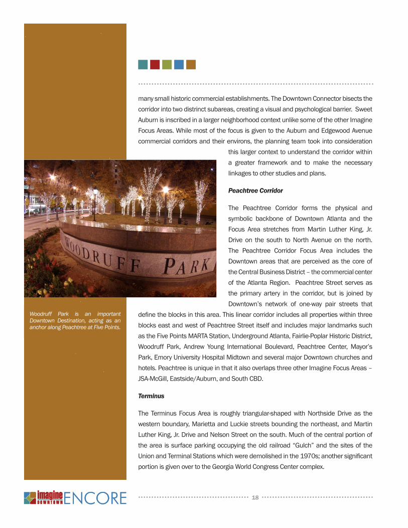
Woodruff Park is an important Downtown Destination, acting as an anchor along Peachtree at Five Points.
19
Terminushaschangedsignificantlyfromitsoldorigins.TheGeorgiaWorldCongressCenterfirstphasewasconstructedinthe1970s,andcompletedanaddition(Building‘C’onNorthsideDrive)in2003.PhilipsArenareplacedtheoldOmniColiseumin2002,andtheOmniHotelexpansiontowerwasopenedforbusinessin2004.CentennialOlympicPark,thelegacyofthe1996Olympics,continuestodrawvisitorsfromalloverthemetroregion,andthenewGeorgiaAquariumandWorldofCoca-Cola,whichbothopenedsincetheoriginal2004planwascompleted,continuetodrawmillionsmorevisitorsperyeartothearea.WiththecontinuedgrowthinCastleberryHillandFairlie-Poplar,and thegrowingsupport for theMultimodalPassengerTerminal, TerminusrepresentsthemostdynamicpieceofDowntownandthefocusareawiththebiggestpotentialforfutureeconomicdevelopmentsuccess.
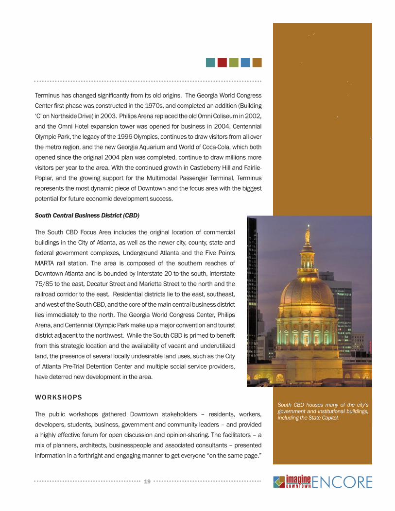
South Central Business District (CBD)
TheSouthCBDFocus Area includes the original location of commercialbuildingsintheCityofAtlanta,aswellasthenewercity,county,stateandfederalgovernmentcomplexes,UndergroundAtlantaand theFivePointsMARTA rail station. The area is composed of the southern reaches ofDowntownAtlantaandisboundedbyInterstate20tothesouth,Interstate75/85totheeast,DecaturStreetandMariettaStreettothenorthandtherailroadcorridortotheeast.Residentialdistrictslietotheeast,southeast,andwestoftheSouthCBD,andthecoreofthemaincentralbusinessdistrictliesimmediatelytothenorth.TheGeorgiaWorldCongressCenter,PhilipsArena,andCentennialOlympicParkmakeupamajorconventionandtouristdistrictadjacenttothenorthwest.WhiletheSouthCBDisprimedtobenefitfromthisstrategiclocationandtheavailabilityofvacantandunderutilizedland,thepresenceofseverallocallyundesirablelanduses,suchastheCityofAtlantaPre-TrialDetentionCenterandmultiplesocialserviceproviders,havedeterrednewdevelopmentinthearea.
WORKsHOPs
The public workshops gathered Downtown stakeholders – residents, workers,developers,students,business,governmentandcommunityleaders–andprovidedahighlyeffectiveforumforopendiscussionandopinion-sharing.Thefacilitators–amixofplanners,architects,businesspeopleandassociatedconsultants–presentedinformationinaforthrightandengagingmannertogeteveryone“onthesamepage.”
South CBD houses many of the city’s government and institutional buildings, including the State Capitol.
20
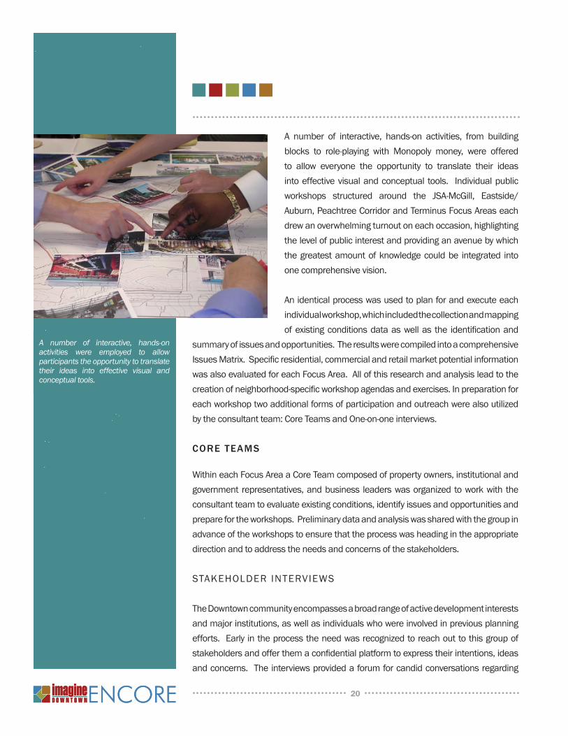
A number of interactive, hands-on activities, from buildingblocks to role-playing with Monopoly money, were offeredto allow everyone the opportunity to translate their ideasintoeffectivevisualandconceptual tools. Individualpublicworkshops structured around the JSA-McGill, Eastside/Auburn,PeachtreeCorridorandTerminusFocusAreaseachdrewanoverwhelmingturnoutoneachoccasion,highlightingthelevelofpublicinterestandprovidinganavenuebywhichthegreatestamountofknowledgecouldbe integrated intoonecomprehensivevision.
Anidenticalprocesswasusedtoplanforandexecuteeachindividualworkshop,whichincludedthecollectionandmappingofexistingconditionsdataaswellas the identificationand
summaryofissuesandopportunities.TheresultswerecompiledintoacomprehensiveIssuesMatrix.Specificresidential,commercialandretailmarketpotentialinformationwasalsoevaluatedforeachFocusArea.Allofthisresearchandanalysisleadtothecreationofneighborhood-specificworkshopagendasandexercises.Inpreparationforeachworkshoptwoadditionalformsofparticipationandoutreachwerealsoutilizedbytheconsultantteam:CoreTeamsandOne-on-oneinterviews.
CORe TeAMs
WithineachFocusAreaaCoreTeamcomposedofpropertyowners,institutionalandgovernmentrepresentatives,andbusiness leaderswasorganizedtoworkwiththeconsultantteamtoevaluateexistingconditions,identifyissuesandopportunitiesandpreparefortheworkshops.Preliminarydataandanalysiswassharedwiththegroupinadvanceoftheworkshopstoensurethattheprocesswasheadingintheappropriatedirectionandtoaddresstheneedsandconcernsofthestakeholders.
stakehOlder interviews
TheDowntowncommunityencompassesabroadrangeofactivedevelopmentinterestsandmajorinstitutions,aswellasindividualswhowereinvolvedinpreviousplanningefforts.Earlyintheprocesstheneedwasrecognizedtoreachouttothisgroupofstakeholdersandofferthemaconfidentialplatformtoexpresstheirintentions,ideasandconcerns.Theinterviewsprovidedaforumforcandidconversationsregarding
A number of interactive, hands-on activities were employed to allow participants the opportunity to translate their ideas into effective visual and conceptual tools.
21
issuesandopportunitiesbeforetheworkshopsweredesignedandplanningconceptsoralternativesproposed.TheissuesemergingfromtheinterviewswereanonymouslygatheredinamatrixthatwassharedwiththeCoreTeamandthathelpedformtheframework for thepublicworkshops.During thecourseof the ImagineDowntownplanningprocessclosetofiftyinterviewswereconducted.
livable Centers initiative
The Atlanta Regional Commission’s (ARC) Livable Centers Initiative (LCI) Programseekstoincreasetheuseofalternativestodrivingalonebydevelopingtransportationprojectsandotherprogramstoimproveaccessibility,expandmixeduses,utilizetransitandsupportfurtherdevelopmentinactivitycenters.TheJSA-McGillFocusAreaportionoftheImagineDowntownplanningprocesswassupportedbyanARCLCIplanninggrant.Additionally,theplanningprocessutilizedfortheJSA-McGillstudyservedasamodelforthesubsequentFocusAreaplanningwork.ByutilizingboththegoalsandobjectivesandtheprocessrequirementsoftheLCIprogram,itisanticipatedthattheentireImagineDowntownplanwillbeadoptedbyARCasanLCIcommunity,makingthewholeofDowntowneligibleforLCIimplementationfunding.
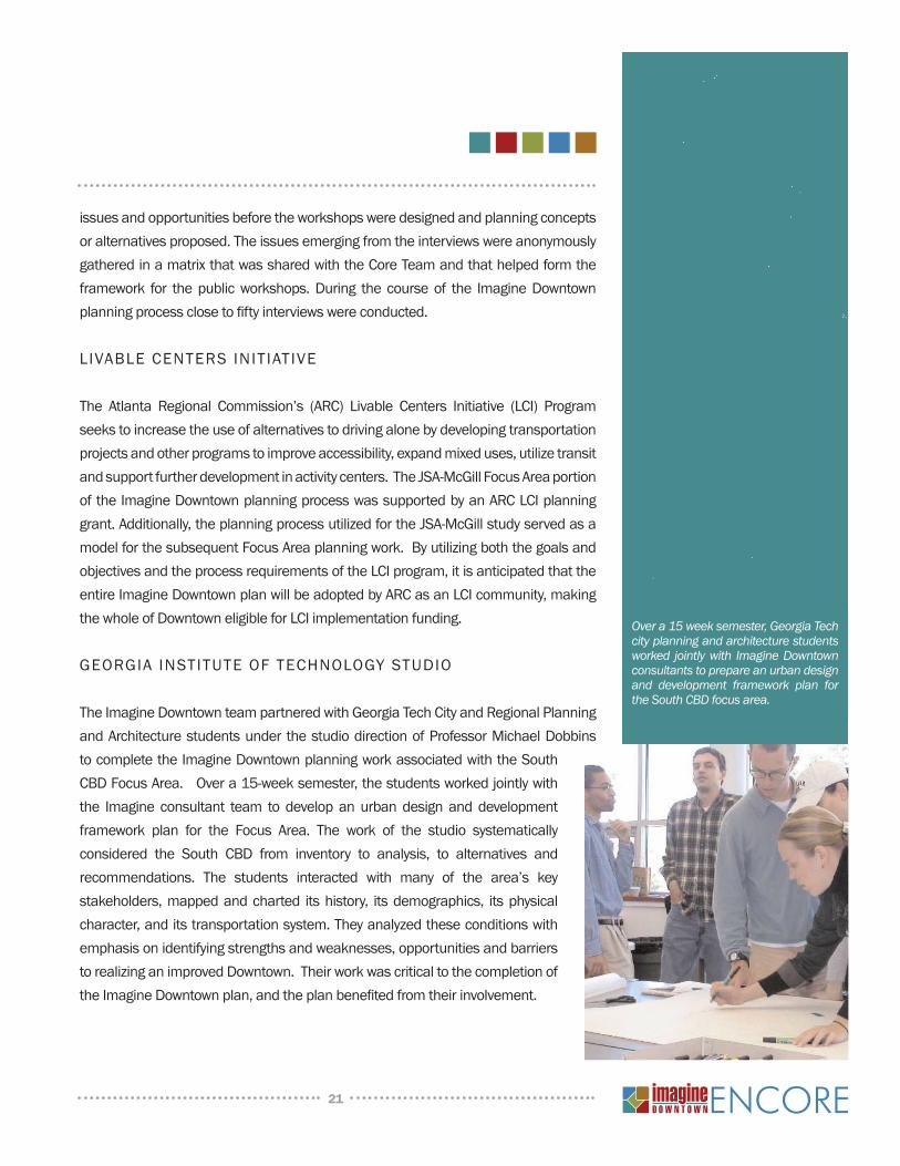
GEORGIA INSTITUTEOFTECHNOLOGYSTUDIO
TheImagineDowntownteampartneredwithGeorgiaTechCityandRegionalPlanningandArchitecturestudentsunderthestudiodirectionofProfessorMichaelDobbinstocompletetheImagineDowntownplanningworkassociatedwiththeSouthCBDFocusArea.Overa15-weeksemester,thestudentsworkedjointlywiththe Imagine consultant team todevelopanurbandesignanddevelopmentframework plan for the Focus Area. The work of the studio systematicallyconsidered the South CBD from inventory to analysis, to alternatives andrecommendations. The students interacted with many of the area’s keystakeholders,mappedandcharted itshistory, itsdemographics, itsphysicalcharacter,anditstransportationsystem.Theyanalyzedtheseconditionswithemphasisonidentifyingstrengthsandweaknesses,opportunitiesandbarrierstorealizinganimprovedDowntown.TheirworkwascriticaltothecompletionoftheImagineDowntownplan,andtheplanbenefitedfromtheirinvolvement.
Over a 15 week semester, Georgia Tech city planning and architecture students worked jointly with Imagine Downtown consultants to prepare an urban design and development framework plan for the South CBD focus area.
22
CURRENTMARKETPROFILE
TheImagineDowntownEncoreplanisgroundedintherealityofthemarketconditionsthat face Downtown Atlanta. As an integral component of the planning process,a review of demographic and economic data was completed to determine thepotentialopportunities thatexist fornewresidential,officeand retaildevelopmentwithinDowntownAtlantaoverthenexttwentyyears.ThecompetitivestrengthsandweaknessesofDowntownasawhole,aswellasthevariousindividualneighborhoods
withinDowntown,wereassessedinlightoflocalandregionaltrends.
The long-term landuse forecastsassume that theDowntownareacontinuestofunctionastheiconiccenter of the Atlanta region and that the Imagineareawillcontinuetobenefitfromthenationalleveltrend of population movement into Sun Belt jobcores. This market analysis was informed by theoriginal ImagineDowntownplan in addition to the‘DowntownAtlantaRetail&OfficeMarketAnalysis’performedbyRCLCOforCentralAtlantaProgressinOctober2007.ThefindingsofthismarketanalysiswereusedtoinformanalysisandrecommendationsduringthesubsequentplanningphasesforImagine
DowntownEncore.
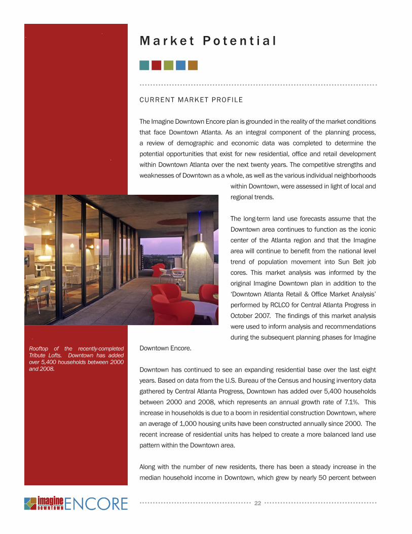
Downtownhascontinuedtoseeanexpanding residentialbaseover the lasteightyears.BasedondatafromtheU.S.BureauoftheCensusandhousinginventorydatagatheredbyCentralAtlantaProgress,Downtownhasaddedover5,400householdsbetween2000and2008,which representsanannual growth rateof7.1%. ThisincreaseinhouseholdsisduetoaboominresidentialconstructionDowntown,whereanaverageof1,000housingunitshavebeenconstructedannuallysince2000.TherecentincreaseofresidentialunitshashelpedtocreateamorebalancedlandusepatternwithintheDowntownarea.
Alongwith thenumberofnewresidents, therehasbeenasteady increase in themedianhouseholdincomeinDowntown,whichgrewbynearly50percentbetween
Rooftop of the recently-completed Tribute Lofts. Downtown has added over 5,400 households between 2000 and 2008.
M a r k e t P o t e n t i a l
23
2000and2008.Thisincreaseisexpectedtocontinue,withprojectionsformedianhousehold incomeanticipatedto jumptoabout$54,000by2013,a17%percentincreaseoverthemedianincomeof$46,000in2008.
Themarketpotential,asdescribedbelow,isreflectiveofcurrenttrendsandconditions.ThedegreetowhichthecurrenteconomicrecessionwillaffectDowntown’sgrowthintheshorttermisyettobeseenandisdifficulttopredict.However,theexpectedlong-termtrendofrenewedinterestinurbanlivingshouldcreatestrongfundamentalsforDowntown’sgrowth.Whilecurrentconditionsmaydampengrowthintheshort-term,itisexpectedthatDowntownwillthriveinthelong-term.
residential Market POtential
Themarketanalysisconcludesthattheresidentialmarketmomentumwillcontinueoverthenextsixyears,addingover5,700rentalorownershiphousingunitsby2015.Incontrasttoconventionalsupplyanddemandanalysis,whichisbasedonsupply-sidedynamicsandbaselinedemographicprojections,theImagineDowntowntargetmarketanalysisdeterminedthedepthandbreadthofDowntown’spotentialmarketderivedfromthehousingpreferencesandsocioeconomiccharacteristicsofhouseholdslikelytoseekhousinginDowntownAtlanta.
ThisanalysisrevealedthatnewhousingunitswithinDowntownarelikelytoattractpotentialrentersandbuyersfromelsewhereintheCityofAtlanta,thebalanceofFultonandDeKalbCounties,othercountiesintheAtlantaRegion,several otherGeorgia counties, surroundingstates and the northeast.
Oneof thekeydriversofhouseholdgrowthin Downtown will be one- and two-personhouseholds.One-andtwo-personhouseholdsgrewby37%and35%respectivelybetween2000and2008,whicharesignificantlyfastergrowth rates than larger household sizesexperienced. Furthermore, Generations X
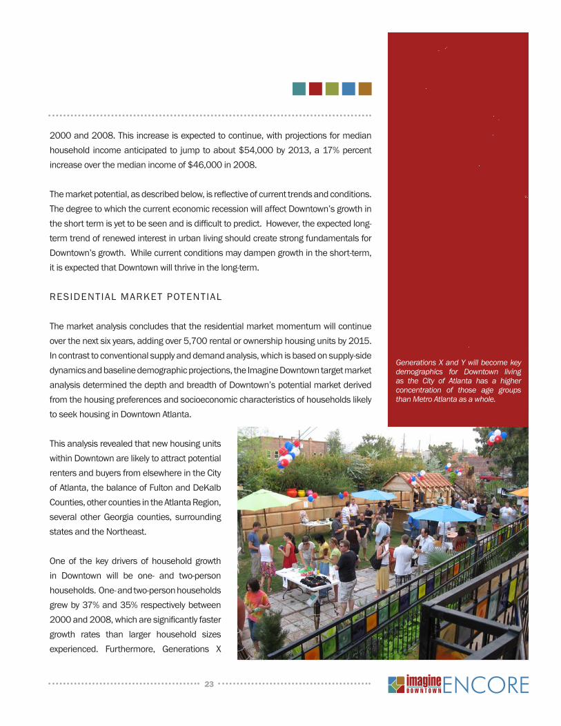
Generations X and Y will become key demographics for Downtown living as the City of Atlanta has a higher concentration of those age groups than Metro Atlanta as a whole.
24
andYwillalsobecomekeydemographicsforDowntownlivingastheCityofAtlantahasahigherconcentrationofthoseagegroupsthanmetroAtlantaasawhole.ThepotentialmarketfornewhousingunitswithinDowntowncouldincludethefullrangeofhousingtypes,fromhigher-densitymultifamilytolower-densitysingle-familydetached.However,givenhighlandcostsandtheneedtoconcentratehigher-densityhousingthatsupportsurbanredevelopmentwithinDowntown,itishighlyrecommendedthatnewconstructionfocusonthehigher-density,multi-familyhousingtypes.
ThetypicalmarketforhousingwithinDowntownAtlantaisatwo-personhousehold,between25and34yearsoldandearning$50,000to$75,000annually.ThiscoupleisreflectiveofthelargestmarketsegmentlikelytoseekhousinginDowntownAtlanta—younger,mostlychildlesssinglesandcouples.IfthepreferenceforDowntownhousingdemonstratedbytheleadingedgeoftheMillennialgeneration—thosepersonsbornbetween1977and1996andthesecond-largestgenerationaftertheBabyBoomers—isrepresentativeoftheentiregeneration,themarketpotentialfromthissegmentislikelytoremainverystrongoverthenextdecade.
Thenextlargestmarketsegmentiscomprisedofolderhouseholds-emptynestersandretirees.Overthenextseveralyears,thismarketsegmentshouldseeitsmarketshareincreaseforDowntownhousingduetoincreasingnumbersofthe“BabyBoom”generation—thelargepopulationcohortbornbetween1946and1964—enteringtheemptynester lifestage.BabyBoomershavebecomeasignificantmarket fornewconstructioninDowntownneighborhoods,particularlywhenthosenewunitsreflecttheirchanginglifestyles.
The third, and smallest, generalmarket segment is family-oriented households—traditionalandnon-traditionalfamilies.Althoughthisisthesmallestmarketsegment,the target familygroups forDowntownhaveapreference forurban living.Mostoftheadults in thesehouseholdswere raised inornearanurbancenterandhaverejectedthesuburbanalternative;mostwillalreadyhavemadeappropriateschoolaccommodations—public,charter,parochialorprivate.
Inconclusion,theresidentialmarketinDowntownispoisedforsubstantialgrowthwithsufficientdemandtosustainit.Keyneighborhoods,sitesandcorridorsareuniquelypositionedtobecomegreaturbanmixed–useneighborhoodsandcaptureasignificantamountofthenewresidentialgrowthwithintheintownmarkets.
25
OFFICEMARKETPOTENTIAL
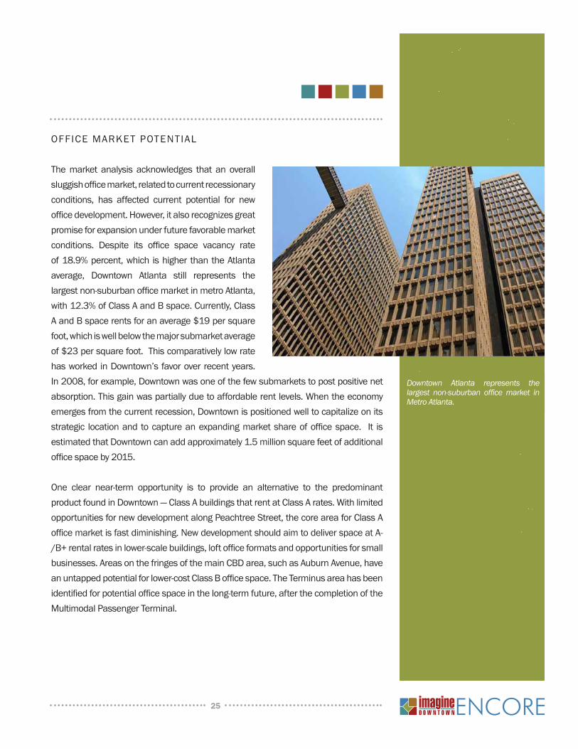
Themarket analysis acknowledges that an overallsluggishofficemarket,relatedtocurrentrecessionaryconditions, has affected current potential for newofficedevelopment.However,italsorecognizesgreatpromiseforexpansionunderfuturefavorablemarketconditions. Despite its office space vacancy rateof18.9%percent,which ishigherthantheAtlantaaverage, Downtown Atlanta still represents thelargestnon-suburbanofficemarketinmetroAtlanta,with12.3%ofClassAandBspace.Currently,ClassAandBspacerentsforanaverage$19persquarefoot,whichiswellbelowthemajorsubmarketaverageof$23persquarefoot.ThiscomparativelylowratehasworkedinDowntown’sfavoroverrecentyears.In2008,forexample,Downtownwasoneofthefewsubmarketstopostpositivenetabsorption.Thisgainwaspartiallyduetoaffordablerentlevels.Whentheeconomyemergesfromthecurrentrecession,Downtownispositionedwelltocapitalizeonitsstrategic locationandtocaptureanexpandingmarketshareofofficespace. It isestimatedthatDowntowncanaddapproximately1.5millionsquarefeetofadditionalofficespaceby2015.
One clear near-term opportunity is to provide an alternative to the predominantproductfoundinDowntown—ClassAbuildingsthatrentatClassArates.WithlimitedopportunitiesfornewdevelopmentalongPeachtreeStreet,thecoreareaforClassAofficemarketisfastdiminishing.NewdevelopmentshouldaimtodeliverspaceatA-/B+rentalratesinlower-scalebuildings,loftofficeformatsandopportunitiesforsmallbusinesses.AreasonthefringesofthemainCBDarea,suchasAuburnAvenue,haveanuntappedpotentialforlower-costClassBofficespace.TheTerminusareahasbeenidentifiedforpotentialofficespaceinthelong-termfuture,afterthecompletionoftheMultimodalPassengerTerminal.
Downtown Atlanta represents the largest non-suburban office market in Metro Atlanta.
26
retail Market POtential
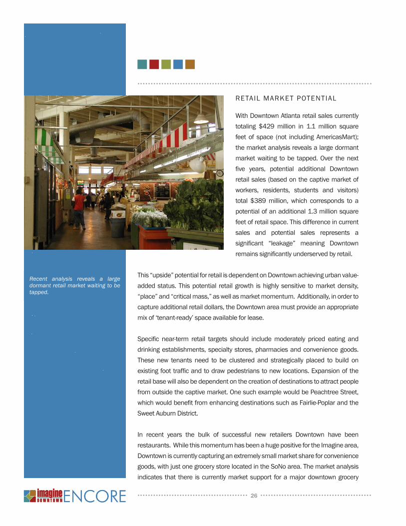
WithDowntownAtlantaretailsalescurrentlytotaling $429million in 1.1 million squarefeet of space (not includingAmericasMart);themarketanalysisrevealsalargedormantmarketwaiting tobe tapped.Over thenextfive years, potential additional Downtownretailsales(basedonthecaptivemarketofworkers, residents, students and visitors)total $389million, which corresponds to apotentialofanadditional1.3millionsquarefeetofretailspace.Thisdifferenceincurrentsales and potential sales represents asignificant “leakage” meaning Downtownremainssignificantlyunderservedbyretail.
This“upside”potentialforretailisdependentonDowntownachievingurbanvalue-addedstatus.Thispotential retailgrowth ishighlysensitive tomarketdensity,“place”and“criticalmass,”aswellasmarketmomentum.Additionally,inordertocaptureadditionalretaildollars,theDowntownareamustprovideanappropriatemixof‘tenant-ready’spaceavailableforlease.
Specific near-term retail targets should includemoderately priced eating anddrinkingestablishments,specialtystores,pharmaciesandconveniencegoods.These new tenants need to be clustered and strategically placed to build onexistingfoottrafficandtodrawpedestrianstonewlocations.Expansionoftheretailbasewillalsobedependentonthecreationofdestinationstoattractpeoplefromoutsidethecaptivemarket.OnesuchexamplewouldbePeachtreeStreet,whichwouldbenefitfromenhancingdestinationssuchasFairlie-PoplarandtheSweetAuburnDistrict.
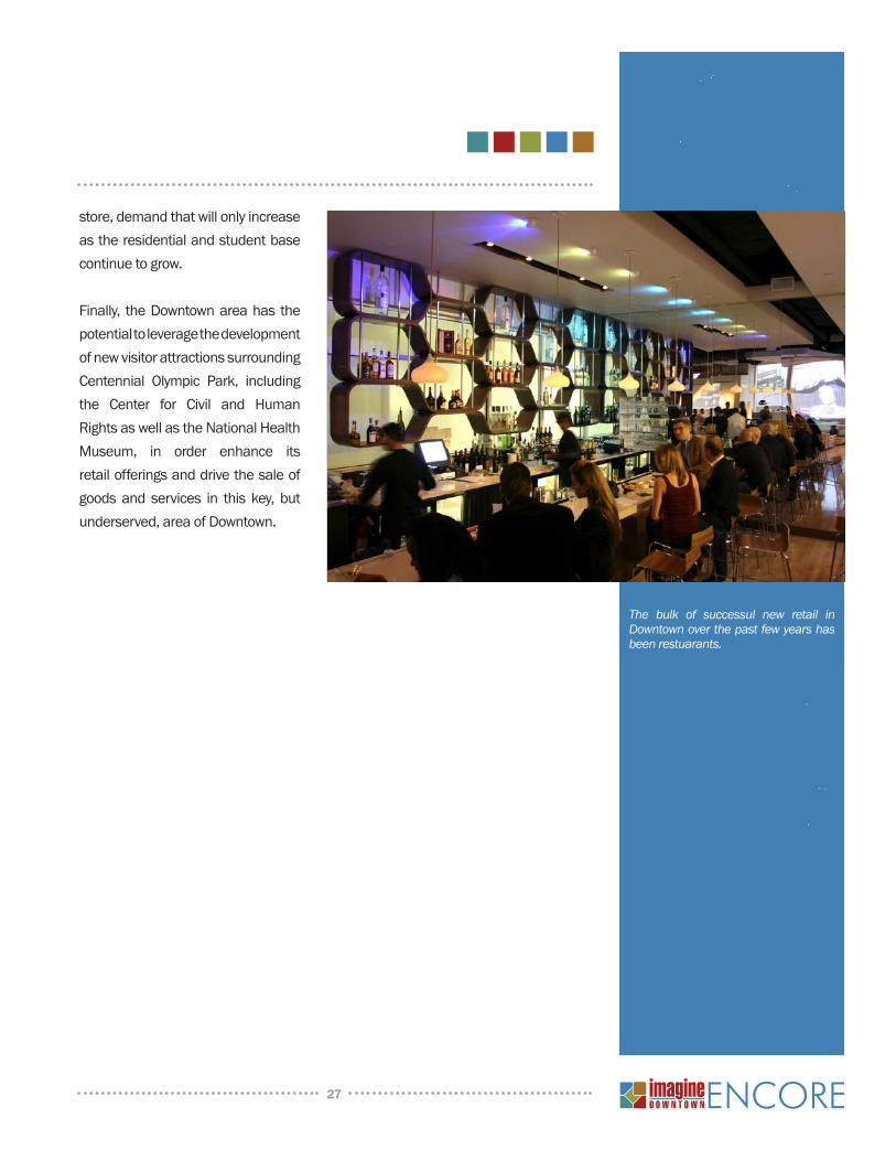
In recent years the bulk of successful new retailers Downtown have beenrestaurants.WhilethismomentumhasbeenahugepositivefortheImaginearea,Downtowniscurrentlycapturinganextremelysmallmarketshareforconveniencegoods,withjustonegrocerystorelocatedintheSoNoarea.Themarketanalysisindicates that there iscurrentlymarketsupport foramajordowntowngrocery
Recent analysis reveals a large dormant retail market waiting to be tapped.
27
store,demandthatwillonlyincreaseastheresidentialandstudentbasecontinuetogrow.
Finally, theDowntownareahas thepotentialtoleveragethedevelopmentofnewvisitorattractionssurroundingCentennial Olympic Park, includingthe Center for Civil and HumanRightsaswellastheNationalHealthMuseum, in order enhance itsretailofferingsanddrivethesaleofgoodsand services in this key, butunderserved,areaofDowntown.
The bulk of successul new retail in Downtown over the past few years has been restuarants.
Atlanta is a global City of international
renown, but with a distinctly Southern
charm; a City of regional scale but
with small-town hospitality; a City with
incredible diversity, but a distinct identity.
Downtown stands on the threshold of
a new age, one of heightened activity
and greater prosperity. During the
initial Imagine Downtown process the
community developed its vision for
the future - a guiding vision for the
growth, development and prosperity of
Downtown. The Imagine Encore process
confi rmed a commitment to that vision
and provided the additional depth and
dimension that emerged from another
fi ve years of Downtown progress.
Downtown community stakeholders are clear about the need to focus on districts
where less development activity has occurred and to rethink Downtown’s relationship
to its adjacent neighborhoods. They also recognize the changing mobility landscape
in the region and the need for Downtown to play a central role in an integrated and
sustainable transportation strategy. The notion of Downtown having an expanded
fi eld is a new paradigm that underlies the fundamental goals of the Imagine Encore,
where Downtown Atlanta is:
• The center of a world-class city that welcomes diversity• A model of progressive growth for the region
• Refl ective of the rich cultural traditions of the South
• The bridge between neighborhoods north, south, east and west
• The location of choice for urban living in the metro area
• Safe and barrier-free for working families and seniors
These six goals raise the bar and provide the rationale for a Downtown vision
summarized by fi ve powerful mandates:
T h e V i s i o n
28
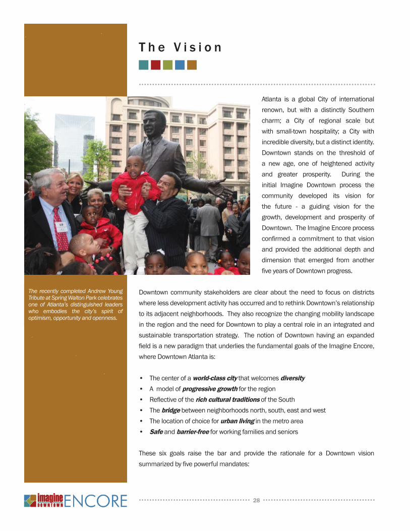
The recently completed Andrew Young Tribute at Spring Walton Park celebrates one of Atlanta’s distinguished leaders who embodies the city’s spirit of optimism, opportunity and openness.
Downtown will lead the way in advancing sustainable mobility choices by connecting the city, the region and all of Georgia through a state-of-the-art, multimodal transportation hub
As a thriving metropolis and regional center, Atlanta has created a roadmap for
becoming a multimodal transportation hub, connecting surrounding cities to what was
the historic center of the City, at the Atlanta Terminus. This site, the meeting point of the
Atlanta railroads, is planned to become a converging point for commuter rail, heavy rail,
intercity and regional bus systems, and local transit. This anticipated activity sets the
stage for a signifi cant amount of high density commercial and residential development
at this transportation crossroad in what is today an expansive, undeveloped railroad
“Gulch.” The multitude of urban design opportunities are detailed further in the Green
Line plan, which envisions the Gulch as a unifi ed and vibrant pedestrian corridor
with a three-dimensional richness that, like Underground Atlanta, is a hallmark of
Downtown.
Downtown will celebrate its identity by elevating the status, appearance, and function of the Peachtree Corridor as Atlanta’s and the Southeast’s premier Main Street
Peachtree Street, already Atlanta’s most
prominent spine, provides a unique experience
as it transforms in scale and character from
Downtown, through Midtown to Buckhead.
Building on this experience, the Peachtree Street
of the future will be a destination unto itself,
connecting distinct districts and showcasing
Atlanta’s economic, cultural and social diversity.
Considerable progress toward this end has
been made over the last several years with the
creation of the Peachtree Corridor Vision and
the establishment of the Peachtree Corridor
Partnership. Through this initiative, the idea of
Peachtree as Atlanta’s Main Street reaches down
to the future biotechnology research campus at
Fort McPherson, and up to the retail centers of
Lenox Mall and Phipps Plaza. Downtown is the
geographic and symbolic center of the expanded
29
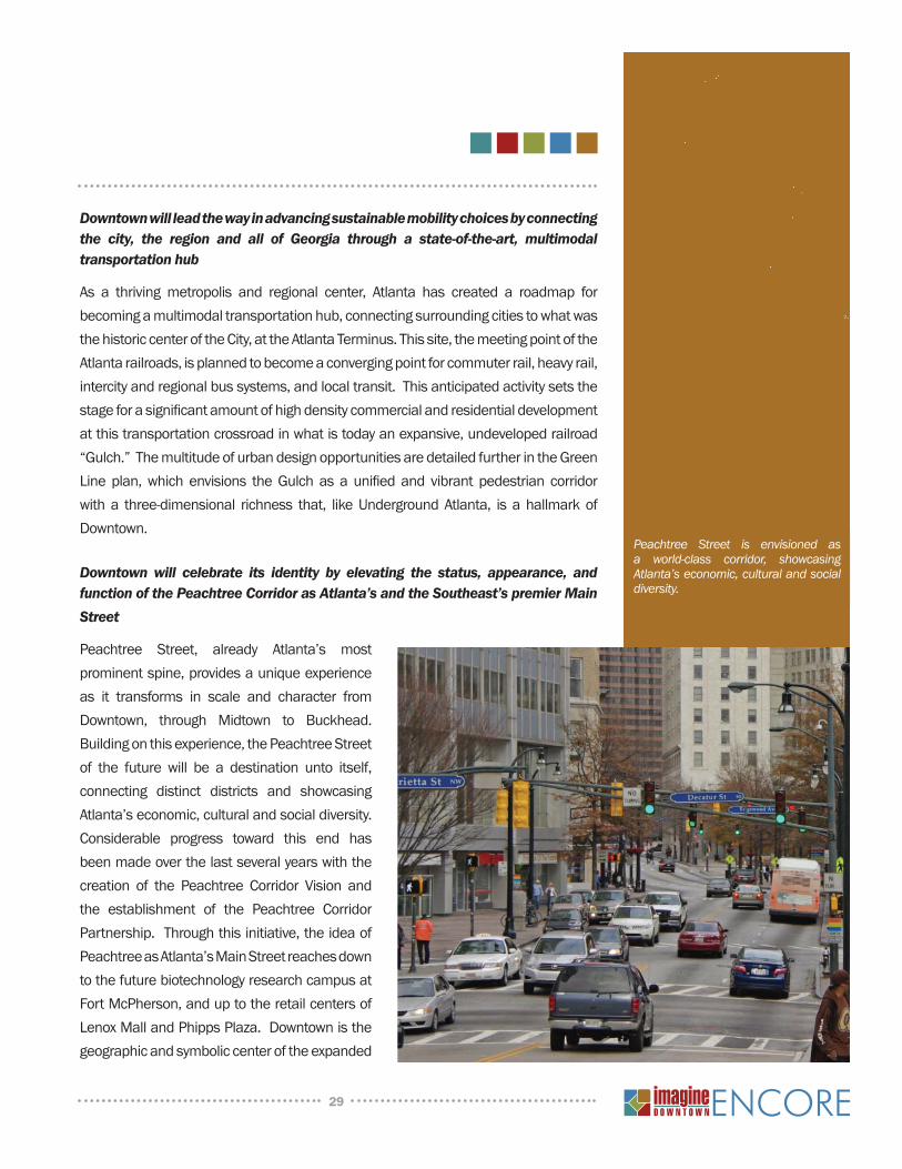
Peachtree Street is envisioned as a world-class corridor, showcasing Atlanta’s economic, cultural and social diversity.
Corridor and the place where east and west meets north and south. Enhancing
the comfort, safety and visual interest of the Peachtree pedestrian experience and
enlivening it with new retail and entertainment venues will add momentum to the
creation and fulfi llment of this linear city.
Downtown will expand urban living options by supporting and encouraging the creation of diverse, affordable, and sustainable neighborhoods and workforce housing throughout its extents
Downtown has seen the rise of the Centennial Hill neighborhood since it
was heralded in the initial Imagine plan as an exciting mixed-use district
anchored by the attraction campus and Ivan Allen Jr. Boulevard. With
new residential construction appearing throughout Downtown, the range
of housing choices and locations has grown considerably so that center
city can now offer quality environments to a full spectrum of potential
residents. Transformation should continue in places like SoNo, the
area south of North Avenue, which is on the path to becoming a thriving
residential district seamlessly integrating Downtown and Midtown. On
the south, plans for a new mixed-use “Railroad District” district linked
directly to the Garnett MARTA Station create an opportunity to live in close
proximity to transit and the local, state and federal government offi ces
lining the Mitchell and Trinity corridors. Other dynamic neighborhoods
are becoming destinations of choice – places like Castleberry Hill,
Downtown East, and Capitol Gateway. Continued emphasis on enhanced
connections, new open spaces, and redevelopment in these and other
neighborhoods will further Downtown’s goal of diversity and richness.
Downtown will be a cultural and entertainment destination rooted in Centennial Olympic Park and colored by the vitality contained in the Auburn, Edgewood, Luckie and Marietta corridors
The prominence of Centennial Olympic Park as Downtown’s cultural and entertainment
center was heightened with the opening of the Georgia Aquarium and World of Coca-
Cola. Development of the Center for Civil and Human Rights at the park’s southeast
corner will crown these efforts by making the district an international destination.
This museum campus sets the stage for other world-class visitor attractions and
entertainment venues to join Atlanta’s premier tourist nexus. Beyond Centennial
Olympic Park, cultural and entertainment corridors with their own unique programs
30
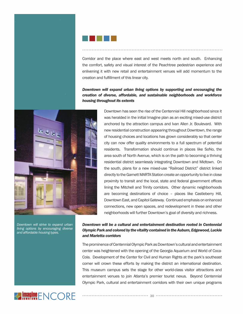
Downtown will strive to expand urban living options by encouraging diverse and affordable housing types.
should grow and extend like a crescent from Georgia Tech to the Beltline, linked
together by a transit circulator system. Potent districts like Sweet Auburn and Luckie
Street will retrace their rich histories as they move toward revitalizing historic storefront
buildings, adding new residential developments and expanding on their legacies. Of
particular importance in Sweet Auburn is the opportunity to capture the district’s Civil
Rights heritage and cultural renaissance as the “Harlem of the South” in venues for
sharing with and educating visitors.
Downtown will approach its physical form with honesty and openness to unconventional beauty, and will seek to overcome design obstacles like the Interstate with creative solutions that build on intrinsic uniqueness and authenticity
Atlanta can take pride in its evolution from frontier railroad town to metropolis, and
the combination of urgency and pragmatism evident in its urban form. Features like
fi ve-point intersections and layered streets are less curiosities than assets that reveal
Downtown’s hidden story, and which hold a beauty not contrived but true to the essence
of the city. When the construction of the Downtown Connector improved transportation
effi ciency and accessibility, it also took its toll on historic communities surrounding the
central business district, breaking street networks and partitioning neighborhoods.
But the Connector is an inextricable part of the city just as the railroads, and may yet
provide a similar drama. As Downtown moves towards multimodal effi ciency, it must
approach the creation of its form by not only re-establishing the historic street grid
and re-connecting neighborhoods, but by appraising and acting on unlikely sources of
inspiration that can turn a bridge into a Folk Art Park, a building into a bridge, and a
street into a building.
31
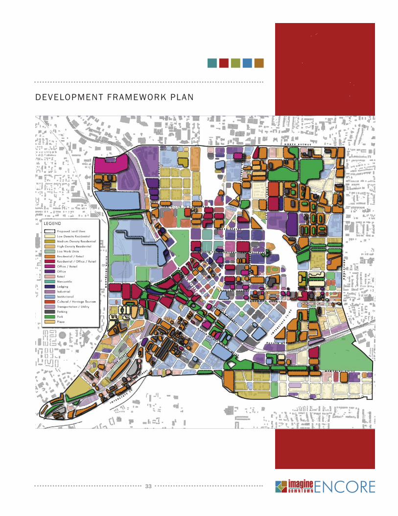
The fi rst building block of the Imagine Encore vision is the Development Framework Plan. This diagrammatic map is intended to illustrate current land uses and anticipated
future land uses for undeveloped and underutilized land within Downtown Atlanta. This
development framework strengthens existing neighborhoods such as Fairlie-Poplar,
Sweet Auburn and Castleberry Hill and creates new neighborhoods at SoNo and the
Railroad District. Land areas outlined in heavy black shadow are future development
parcels, color-keyed to anticipated uses.
As illustrated in the map, Downtown already enjoys a diverse mix of land uses. In
the future, an even greater mix is anticipated and the integration of uses into one
building or one parcel should be encouraged. The majority of future land uses are
shown either as darker red and pink shades, which indicate a mix of uses including
residential, offi ce and retail; or shades of orange, which represent residential uses of
varying intensities. An increase in the number and range of housing opportunities is
highly desirable, activating a 24-hour Downtown environment. Retail is concentrated
on “storefront” streets, i.e. major streets that carry large volumes of pedestrian traffi c.
Some of the principal land use strategies include:
Supporting residential growth at Centennial Hill and encouraging new residential •
neighborhoods in SoNo and the South CBD
Enhancing existing Downtown neighborhoods by focusing on compatible infi ll •
redevelopment on key underutilized properties that currently interrupt continuity
and create barriers for a cohesive, walkable community
Creating transit-oriented development around Downtown’s MARTA rail stations, •
particularly the Five Points, Civic Center and Garnett Street stations
Reweaving the historic fabric of the Fairlie-Poplar, Castleberry Hill, Marietta Street, •
South CBD and Sweet Auburn districts with new compatible in-fi ll development
Continuing the creation of mixed-use, mixed-income communities at Auburn Pointe •
and Capitol Gateway
Expanding on Downtown’s cultural and tourism destinations, particularly surrounding •
Centennial Olympic Park and in the Luckie-Marietta and Sweet Auburn districts
Establishing and supporting fi rst-class community facilities and institutions•
Focusing high-density redevelopment on and around the proposed Multimodal •
Passenger Terminal site and elsewhere along the Green Line
T h e P l a n
32
33
DEVELOPMENT FRAMEWORK PLAN

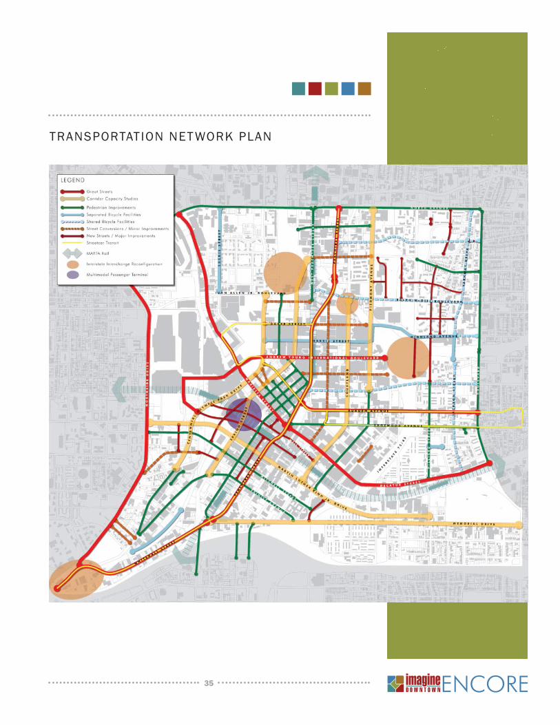
A critical link is the integration of Downtown’s Transportation Network Plan with its
land use goals. The symbols and lines on this diagrammatic map illustrate future
anticipated improvements to the transportation infrastructure of Downtown Atlanta.
An effi cient Downtown transportation system should result in continued commercial
vitality within a livable mixed-use urban neighborhood. The Imagine Encore plan
recommends signifi cant transportation improvements to support the anticipated
arrival of new offi ce towers, tourist venues and residential developments. These
improvement projects have been identifi ed to enhance the transportation network to
serve pedestrians, bicycles, autos, buses and transit users. Ranging from streetscape
improvements and multi-use pathways to new streets and a circulator shuttle, these
projects are intended to encourage and support the redevelopment and revitalization
of Downtown.
Improvements to the vehicular network primarily include either new streets to
reconnect broken links and provide better access both east-west and north-south,
or reworking traffi c fl ow in order to improve access, eliminate confusion and support
new development. Pedestrian improvements are focused on a network of sidewalk
enhancements that will improve the overall walking experience throughout Downtown.
Some of the key projects to be undertaken over the next decade include:
Pursuing the phased implementation of the Multimodal Passenger Terminal •
Expanding transit access and mobility by investing in ‘last mile’ solutions like •
streetcar service
Enhancing the pedestrian environment by ensuring a minimum quality standard •
for each and every sidewalk Downtown and focusing enhanced streetscape
improvements on key corridors
Converting several one-way streets to two-way streets•
Encouraging on-street parking and the more effi cient and shared use of existing •
parking facilities
Pursuing ‘Road Diets’ to convert ineffi cient vehicle right-of-way to pedestrian, bike •
and parking uses
Re-establishing Downtown’s historic small-block street network in areas where it •
has disappeared
Connecting the larger community bicycle network by establishing preferred routes•
Restructuring and reconfi guring interstate interchanges to improve access and fl ow•
Providing for quality maintenance of all transportation infrastructure to ensure its •
on-going operation and longevity
34
35
TRANSPORTATION NET WORK PLAN
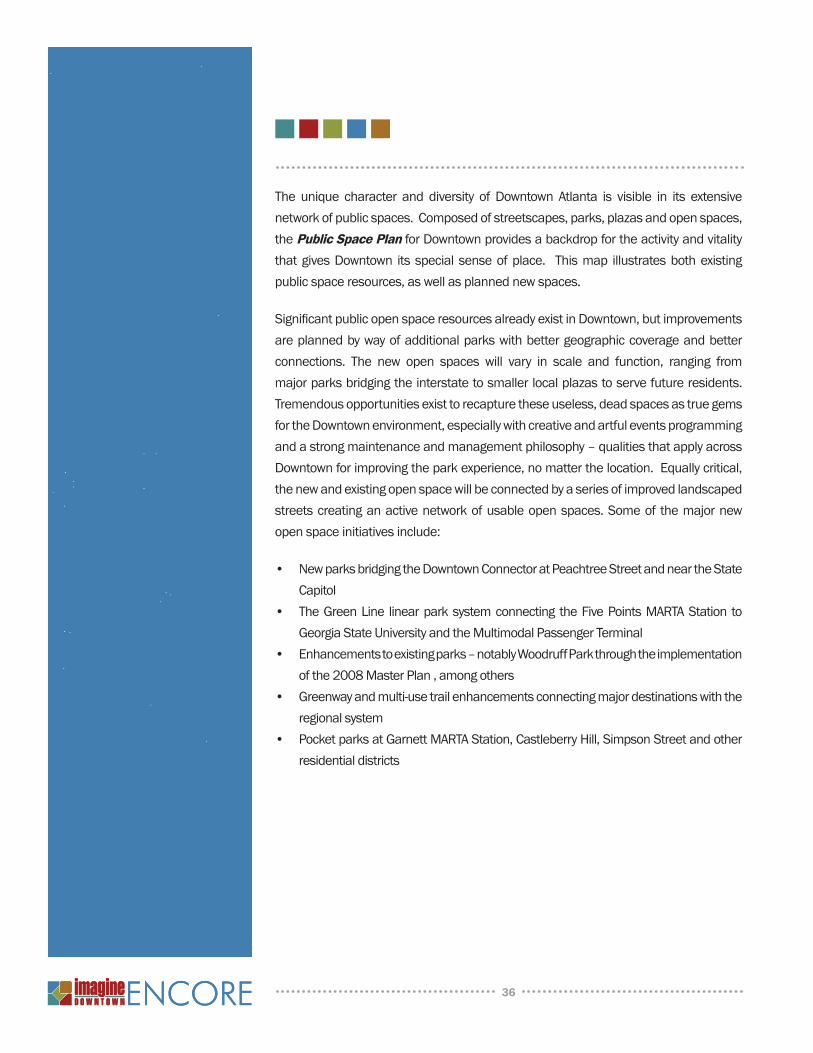
The unique character and diversity of Downtown Atlanta is visible in its extensive
network of public spaces. Composed of streetscapes, parks, plazas and open spaces,
the Public Space Plan for Downtown provides a backdrop for the activity and vitality
that gives Downtown its special sense of place. This map illustrates both existing
public space resources, as well as planned new spaces.
Signifi cant public open space resources already exist in Downtown, but improvements
are planned by way of additional parks with better geographic coverage and better
connections. The new open spaces will vary in scale and function, ranging from
major parks bridging the interstate to smaller local plazas to serve future residents.
Tremendous opportunities exist to recapture these useless, dead spaces as true gems
for the Downtown environment, especially with creative and artful events programming
and a strong maintenance and management philosophy – qualities that apply across
Downtown for improving the park experience, no matter the location. Equally critical,
the new and existing open space will be connected by a series of improved landscaped
streets creating an active network of usable open spaces. Some of the major new
open space initiatives include:
New parks bridging the Downtown Connector at Peachtree Street and near the State •
Capitol
The Green Line linear park system connecting the Five Points MARTA Station to •
Georgia State University and the Multimodal Passenger Terminal
Enhancements to existing parks – notably Woodruff Park through the implementation •
of the 2008 Master Plan , among others
Greenway and multi-use trail enhancements connecting major destinations with the •
regional system
Pocket parks at Garnett MARTA Station, Castleberry Hill, Simpson Street and other •
residential districts
36
37
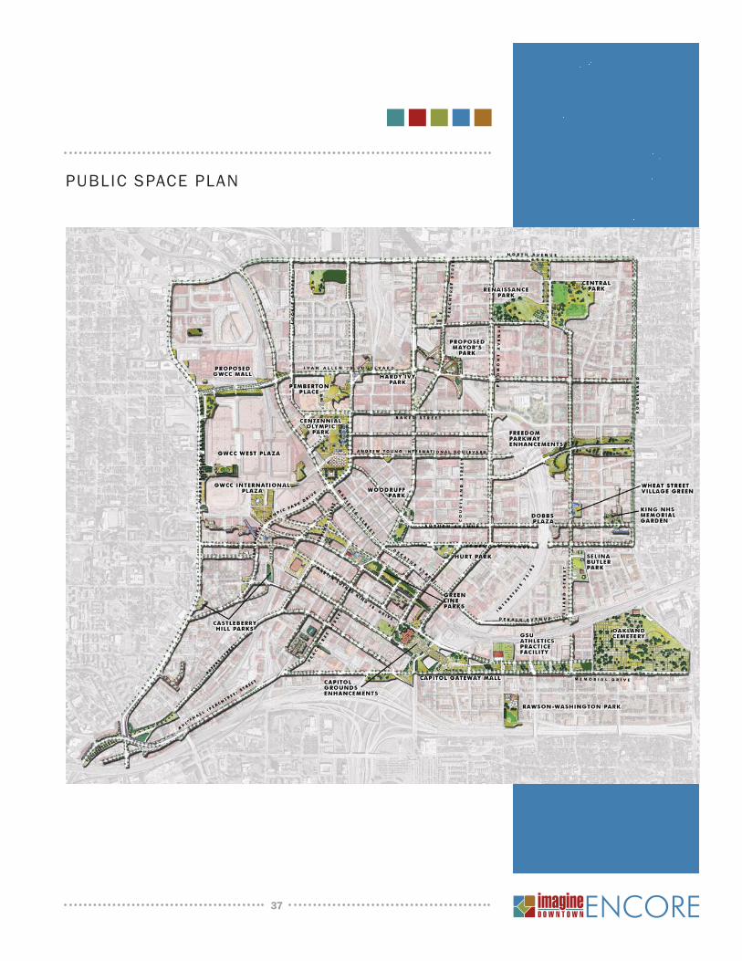
PUBLIC SPACE PLAN

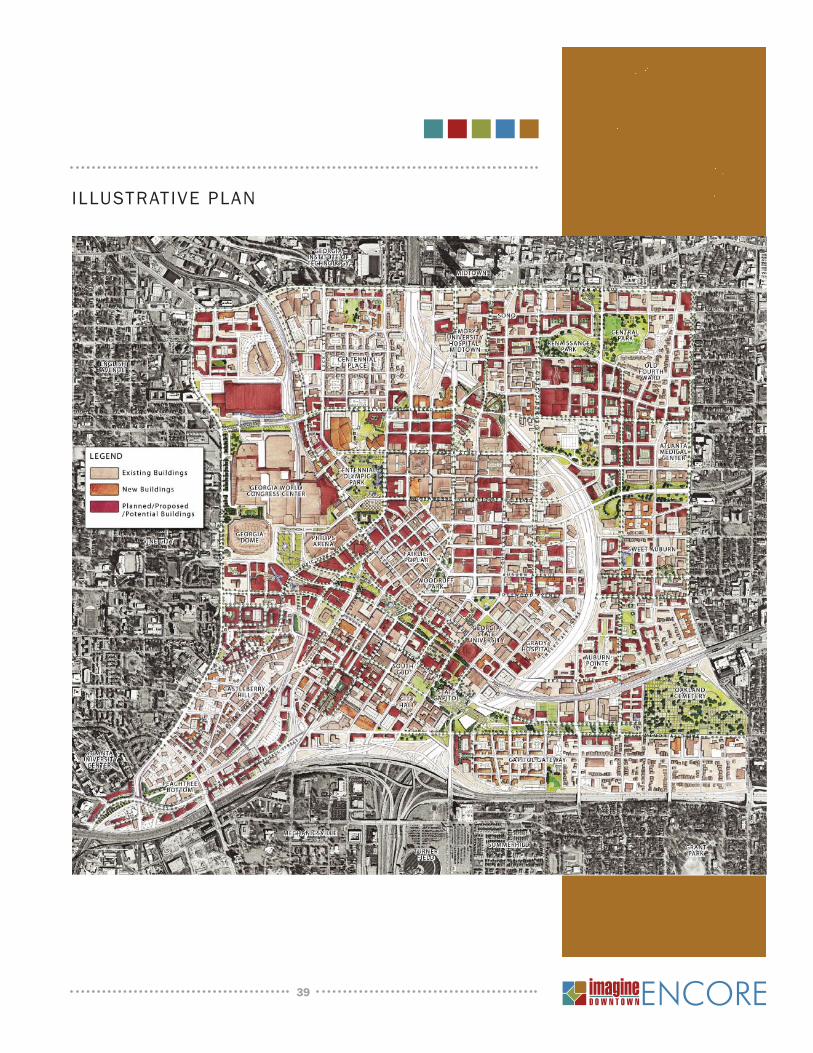
The Illustrative Plan is a convergence of development, transportation and open
space recommendations, unfolding a comprehensive vision for Downtown’s future.
While existing buildings that are not likely to change are shown in beige, projects that
have been completed since the original Imagine Downtown plan in 2004 or are near
completion are shown in orange; while maroon buildings refl ect the aspirations of
creating new vibrant districts while enhancing existing neighborhoods. The maroon
buildings refl ect potential development; ranging from large-scale projects in the
Terminus area to smaller infi ll projects in the Fairlie-Poplar district; developments that
will expand on Downtown’s fabric and add to its current vitality. Inviting plazas and
parks are located at strategic junctions and integrated into potential developments.
And new streetscapes and road enhancements weave seamlessly, linking open
spaces and improving overall connectivity.
The Illustrative Plan incorporates the goals and aspirations established at the beginning
of the Imagine Encore process -- expanding on Downtown’s mixed-use environment,
bridging neighborhoods, improving walkability and revitalizing communities. As Atlanta
solidifi es its position as an international city, its Downtown will become a place to
live, work and play -- known both for its energy and for its district neighborhoods and
districts. The process of creating the overall vision for Downtown involved envisioning
the future of these unique communities as described in the following section.
38
39
ILLUSTRATIVE PLAN
The broad range of land use, circulation and open space projects described previously
create a unique pattern of interconnected but diverse neighborhoods. The vision for
the future is best described neighborhood by neighborhood to better capture the
unique characteristics and opportunities. The Neighborhoods and Districts Map
on the following page captures the framework of neighborhoods that encapsulate
Downtown.
40
41
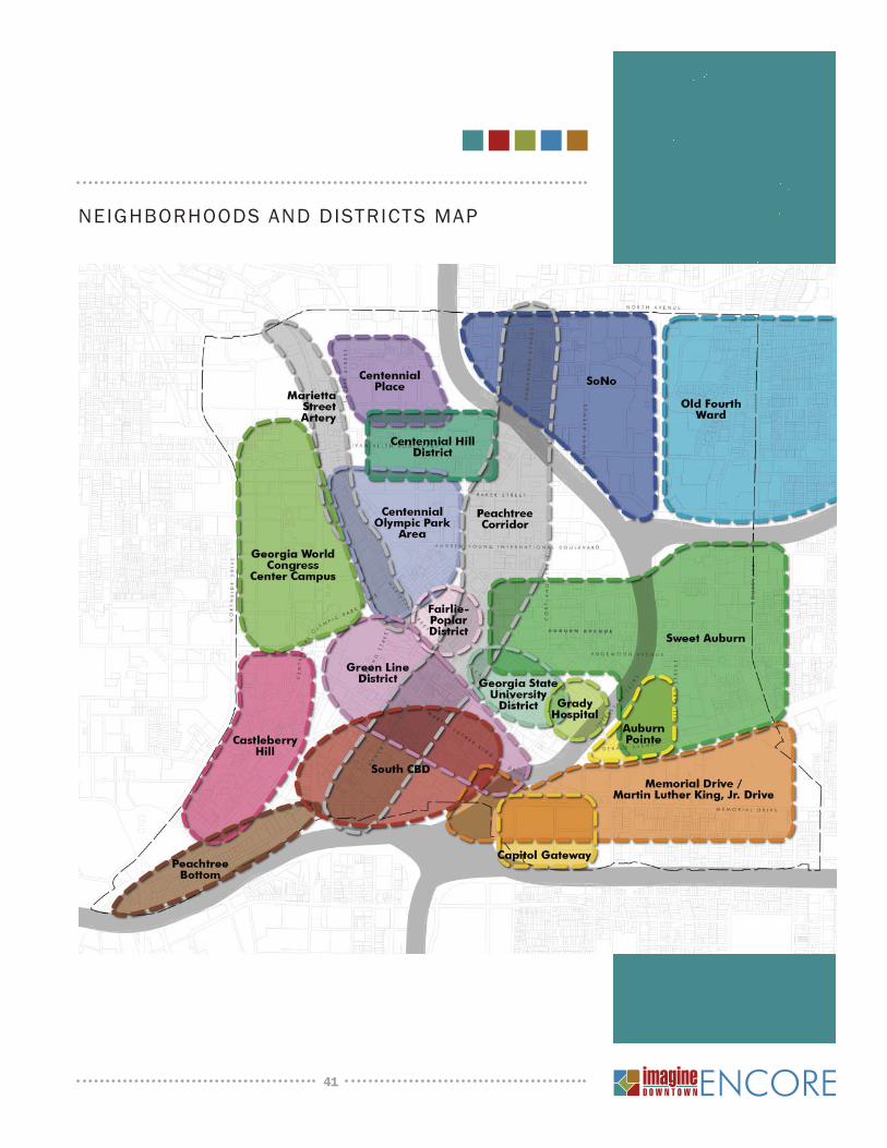
NEIGHBORHOODS AND DISTRICTS MAP
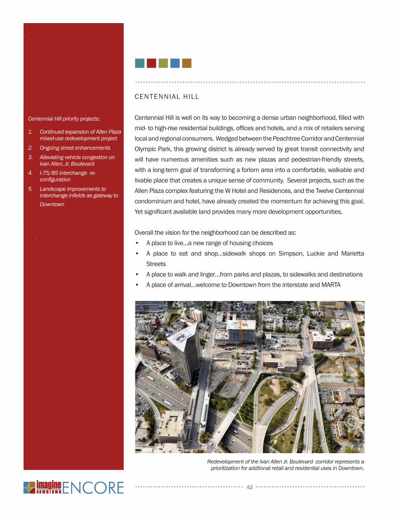
CENTENNIAL HILL
Centennial Hill is well on its way to becoming a dense urban neighborhood, fi lled with
mid- to high-rise residential buildings, offi ces and hotels, and a mix of retailers serving
local and regional consumers. Wedged between the Peachtree Corridor and Centennial
Olympic Park, this growing district is already served by great transit connectivity and
will have numerous amenities such as new plazas and pedestrian-friendly streets,
with a long-term goal of transforming a forlorn area into a comfortable, walkable and
livable place that creates a unique sense of community. Several projects, such as the
Allen Plaza complex featuring the W Hotel and Residences, and the Twelve Centennial
condominium and hotel, have already created the momentum for achieving this goal.
Yet signifi cant available land provides many more development opportunities.
Overall the vision for the neighborhood can be described as:
A place to live…a new range of housing choices•
A place to eat and shop…sidewalk shops on Simpson, Luckie and Marietta •
Streets
A place to walk and linger…from parks and plazas, to sidewalks and destinations•
A place of arrival…welcome to Downtown from the interstate and MARTA•
42
Redevelopment of the Ivan Allen Jr. Boulevard corridor represents a prioritization for addtional retail and residential uses in Downtown.
Centennial Hill priority projects:
Continued expansion of Allen Plaza 1. mixed-use redevelopment projectOngoing street enhancements2. Alleviating vehicle congestion on 3. Ivan Allen, Jr. BoulevardI-75/85 interchange re-4. confi gurationLandscape improvements to 5. interchange infi elds as gateway to Downtown
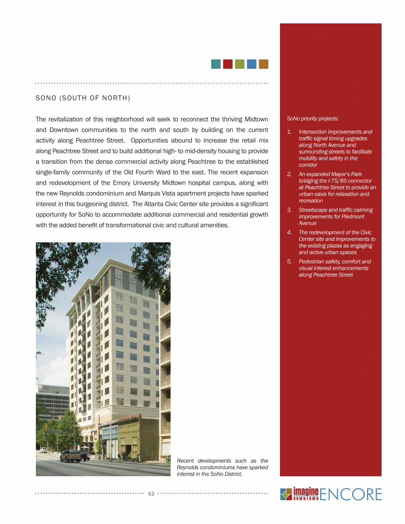
SONO (SOUTH OF NORTH)
The revitalization of this neighborhood will seek to reconnect the thriving Midtown
and Downtown communities to the north and south by building on the current
activity along Peachtree Street. Opportunities abound to increase the retail mix
along Peachtree Street and to build additional high- to mid-density housing to provide
a transition from the dense commercial activity along Peachtree to the established
single-family community of the Old Fourth Ward to the east. The recent expansion
and redevelopment of the Emory University Midtown hospital campus, along with
the new Reynolds condominium and Marquis Vista apartment projects have sparked
interest in this burgeoning district. The Atlanta Civic Center site provides a signifi cant
opportunity for SoNo to accommodate additional commercial and residential growth
with the added benefi t of transformational civic and cultural amenities.
43
Recent developments such as the Reynolds condominiums have sparked interest in the SoNo District.
SoNo priority projects:
Intersection improvements and 1. traffi c signal timing upgrades along North Avenue and surrounding streets to facilitate mobility and safety in the corridorAn expanded Mayor’s Park 2. bridging the I-75/85 connector at Peachtree Street to provide an urban oasis for relaxation and recreationStreetscape and traffi c calming3. improvements for Piedmont Avenue The redevelopment of the 4. Civic Center site and improvements to the existing plazas as engaging and active urban spacesPedestrian safety, comfort and5. visual interest enhancements along Peachtree Street
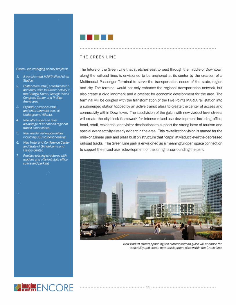
THE GREEN LINE
The future of the Green Line that stretches east to west through the middle of Downtown
along the railroad lines is envisioned to be anchored at its center by the creation of a
Multimodal Passenger Terminal to serve the transportation needs of the state, region
and city. The terminal would not only enhance the regional transportation network, but
also create a civic landmark and a catalyst for economic development for the area. The
terminal will be coupled with the transformation of the Five Points MARTA rail station into
a submerged station topped by an active transit plaza to create the center of access and
connectivity within Downtown. The subdivision of the gulch with new viaduct-level streets
will create the city-block framework for intense mixed-use development including offi ce,
hotel, retail, residential and visitor destinations to support the strong base of tourism and
special event activity already evident in the area. This revitalization vision is named for the
mile-long linear park and plaza built on structure that “caps” at viaduct level the depressed
railroad tracks. The Green Line park is envisioned as a meaningful open space connection
to support the mixed-use redevelopment of the air rights surrounding the park.
44
New viaduct streets spanning the current railroad gulch will enhance the walkability and create new development sites within the Green Line.
Green Line emerging priority projects:
A transformed MARTA Five Points 1. StationFoster more retail, entertainment 2. and hotel uses to further activity in the Georgia Dome, Georgia World Congress Center and Phillips Arena areaExpand / preserve retail3. and entertainment uses at Underground Atlanta.New offi ce space to take 4. advantage of enhanced regional transit connections.New residential opportunities 5. including GSU student housing.New Hotel and Conference Center 6. and State of GA Welcome and History Center.Replace existing structures with7. modern and effi cient state offi ce space and parking.
SOUTH CBD
The South Central Business District (CBD), currently dominated by federal, state and
local government centers, is poised to capitalize on opportunities to increase the
housing options in the area. The future will see existing historic structures converted
for residential uses and new predominantly residential mixed-use projects fi lling
currently vacant land surrounding the Garnett Street MARTA rail station. The existing
walkable, small block structures and remnants of the original commercial buildings
of the city will support the infi ll of commercial buildings to house small offi ces and
retail shops to serve workers and residents alike. The public spaces – parks and
plazas – will be enhanced and connected to provide physical and visual connections
to prominent civic structures. The new residential population will support a 24-hour
active environment and utilize the transit infrastructure already available to this area.
45
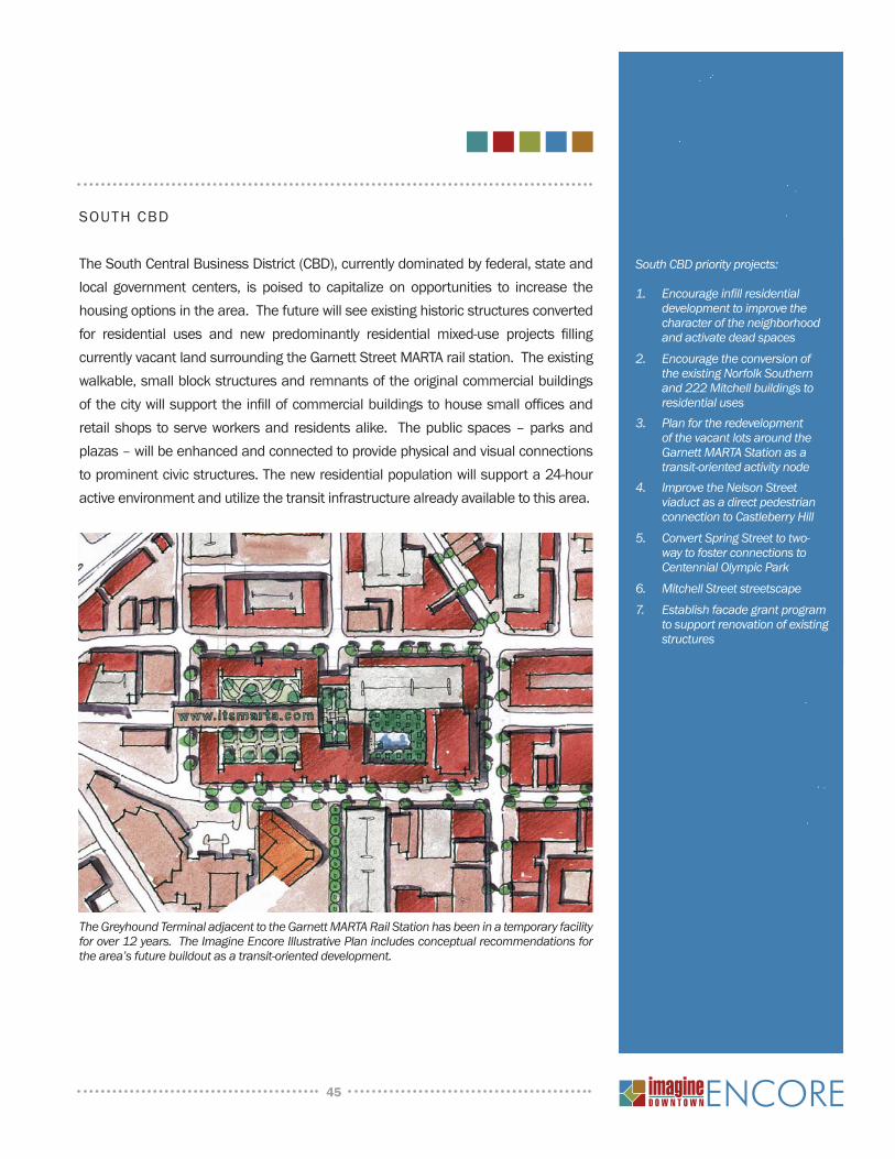
The Greyhound Terminal adjacent to the Garnett MARTA Rail Station has been in a temporary facility for over 12 years. The Imagine Encore Illustrative Plan includes conceptual recommendations for the area’s future buildout as a transit-oriented development.
South CBD priority projects:
Encourage infi ll residential 1. development to improve the character of the neighborhood and activate dead spacesEncourage the conversion of 2. the existing Norfolk Southern and 222 Mitchell buildings to residential usesPlan for the redevelopment 3. of the vacant lots around the Garnett MARTA Station as a transit-oriented activity nodeImprove the Nelson Street 4. viaduct as a direct pedestrian connection to Castleberry HillConvert Spring Street to two-5. way to foster connections to Centennial Olympic ParkMitchell Street streetscape6. Establish facade grant program 7. to support renovation of existing structures
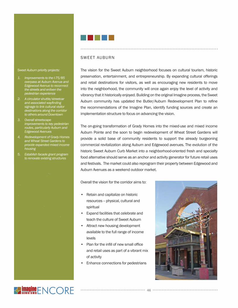
SWEET AUBURN
The vision for the Sweet Auburn neighborhood focuses on cultural tourism, historic
preservation, entertainment, and entrepreneurship. By expanding cultural offerings
and retail destinations for visitors, as well as encouraging new residents to move
into the neighborhood, the community will once again enjoy the level of activity and
vibrancy that it historically enjoyed. Building on the original Imagine process, the Sweet
Auburn community has updated the Butler/Auburn Redevelopment Plan to refi ne
the recommendations of the Imagine Plan, identify funding sources and create an
implementation structure to focus on advancing the vision.
The on-going transformation of Grady Homes into the mixed-use and mixed income
Auburn Pointe and the soon to begin redevelopment of Wheat Street Gardens will
provide a solid base of community residents to support the already burgeoning
commercial revitalization along Auburn and Edgewood avenues. The evolution of the
historic Sweet Auburn Curb Market into a neighborhood-oriented fresh and specialty
food alternative should serve as an anchor and activity generator for future retail uses
and festivals. The market could also reprogram their property between Edgewood and
Auburn Avenues as a weekend outdoor market.
Overall the vision for the corridor aims to:
• Retain and capitalize on historic
resources -- physical, cultural and
spiritual
• Expand facilities that celebrate and
teach the culture of Sweet Auburn
• Attract new housing development
available to the full range of income
levels
• Plan for the infi ll of new small offi ce
and retail uses as part of a vibrant mix
of activity
• Enhance connections for pedestrians
46
Sweet Auburn priority projects:
Improvements to the I-75/85 1. overpass at Auburn Avenue and Edgewood Avenue to reconnect the streets and enliven the pedestrian experienceA circulator shuttle/streetcar 2. and associated wayfi nding signage to link cultural visitor destinations along the corridor to others around Downtown Overall streetscape 3. improvements to key pedestrian routes, particularly Auburn and Edgewood AvenuesRedevelopment of Grady4. Homes and Wheat Street Gardens to provide expanded mixed income housingEstablish facade grant program 5. to renovate existing structures
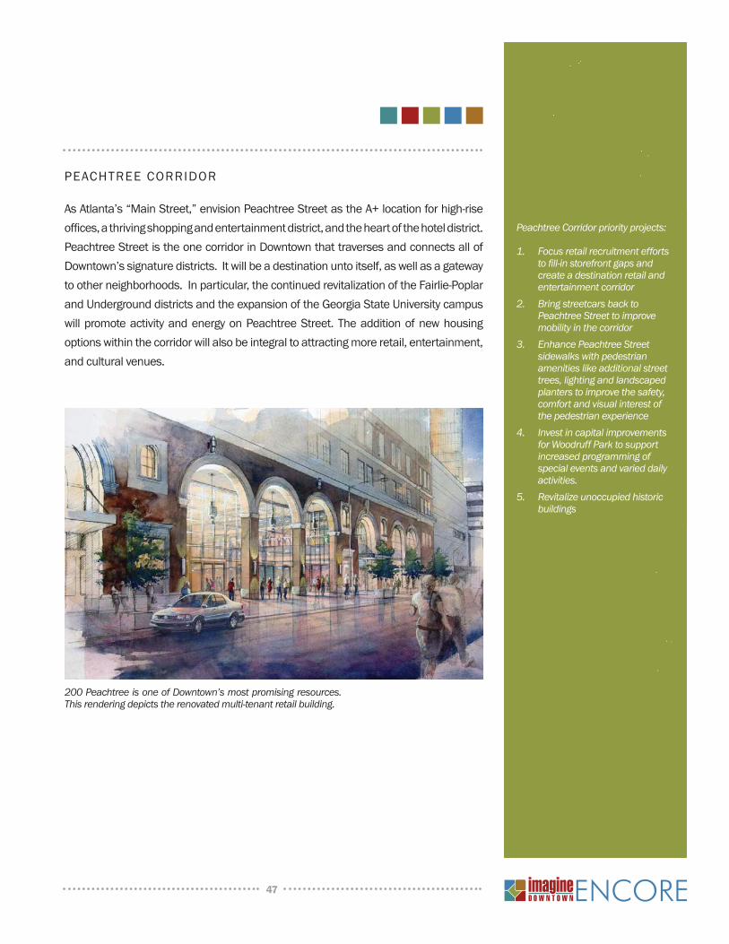
PEACHTREE CORRIDOR
As Atlanta’s “Main Street,” envision Peachtree Street as the A+ location for high-rise
offi ces, a thriving shopping and entertainment district, and the heart of the hotel district.
Peachtree Street is the one corridor in Downtown that traverses and connects all of
Downtown’s signature districts. It will be a destination unto itself, as well as a gateway
to other neighborhoods. In particular, the continued revitalization of the Fairlie-Poplar
and Underground districts and the expansion of the Georgia State University campus
will promote activity and energy on Peachtree Street. The addition of new housing
options within the corridor will also be integral to attracting more retail, entertainment,
and cultural venues.
47
200 Peachtree is one of Downtown’s most promising resources. This rendering depicts the renovated multi-tenant retail building.
Peachtree Corridor priority projects:
Focus retail recruitment efforts 1. to fi ll-in storefront gaps and create a destination retail and entertainment corridorBring streetcars back to 2. Peachtree Street to improve mobility in the corridorEnhance Peachtree Street 3. sidewalks with pedestrian amenities like additional street trees, lighting and landscaped planters to improve the safety, comfort and visual interest of the pedestrian experienceInvest in capital improvements 4. for Woodruff Park to support increased programming of special events and varied daily activities.Revitalize unoccupied historic 5. buildings
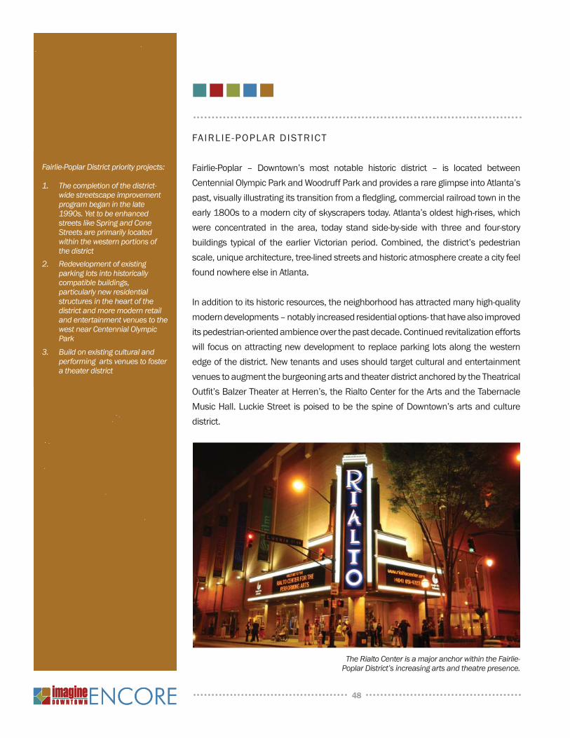
FAIRLIE-POPLAR DISTRICT
Fairlie-Poplar – Downtown’s most notable historic district – is located between
Centennial Olympic Park and Woodruff Park and provides a rare glimpse into Atlanta’s
past, visually illustrating its transition from a fl edgling, commercial railroad town in the
early 1800s to a modern city of skyscrapers today. Atlanta’s oldest high-rises, which
were concentrated in the area, today stand side-by-side with three and four-story
buildings typical of the earlier Victorian period. Combined, the district’s pedestrian
scale, unique architecture, tree-lined streets and historic atmosphere create a city feel
found nowhere else in Atlanta.
In addition to its historic resources, the neighborhood has attracted many high-quality
modern developments – notably increased residential options- that have also improved
its pedestrian-oriented ambience over the past decade. Continued revitalization efforts
will focus on attracting new development to replace parking lots along the western
edge of the district. New tenants and uses should target cultural and entertainment
venues to augment the burgeoning arts and theater district anchored by the Theatrical
Outfi t’s Balzer Theater at Herren’s, the Rialto Center for the Arts and the Tabernacle
Music Hall. Luckie Street is poised to be the spine of Downtown’s arts and culture
district.
48
Fairlie-Poplar District priority projects:
The completion of the district-1. wide streetscape improvement program began in the late 1990s. Yet to be enhanced streets like Spring and Cone Streets are primarily located within the western portions of the district Redevelopment of existing 2. parking lots into historically compatible buildings, particularly new residential structures in the heart of the district and more modern retail and entertainment venues to the west near Centennial Olympic ParkBuild on existing cultural and 3. performing arts venues to foster a theater district
The Rialto Center is a major anchor within the Fairlie-Poplar District’s increasing arts and theatre presence.
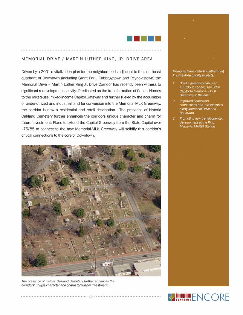
MEMORIAL DRIVE / MARTIN LUTHER KING, JR. DRIVE AREA
Driven by a 2001 revitalization plan for the neighborhoods adjacent to the southeast
quadrant of Downtown (including Grant Park, Cabbagetown and Reynoldstown) the
Memorial Drive – Martin Luther King Jr. Drive Corridor has recently been witness to
signifi cant redevelopment activity. Predicated on the transformation of Capitol Homes
to the mixed-use, mixed-income Capitol Gateway and further fueled by the acquisition
of under-utilized and industrial land for conversion into the Memorial-MLK Greenway,
the corridor is now a residential and retail destination. The presence of historic
Oakland Cemetery further enhances the corridors unique character and charm for
future investment. Plans to extend the Capitol Greenway from the State Capitol over
I-75/85 to connect to the new Memorial-MLK Greenway will solidify this corridor’s
critical connections to the core of Downtown.
49
The presence of historic Oakland Cemetery further enhances the corridors’ unique character and charm for further investment.
Memorial Drive / Martin Luther King, Jr. Drive Area priority projects:
Build a greenway cap over 1. I-75/85 to connect the State Capitol to Memorial - MLK Greenway to the eastImproved pedestrian 2. connections and streetscapes along Memorial Drive and BoulevardPromoting new transit-oriented 3. development at the King Memorial MARTA Station
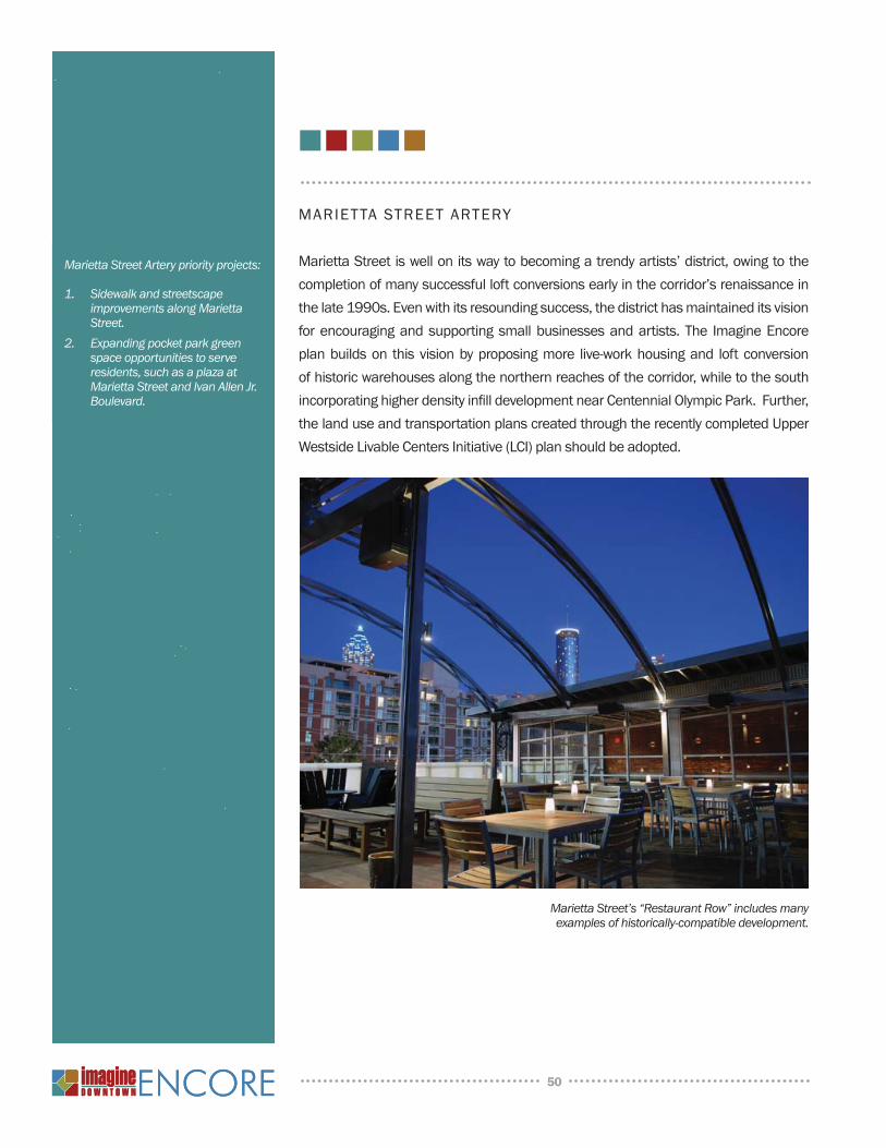
MARIETTA STREET ARTERY
Marietta Street is well on its way to becoming a trendy artists’ district, owing to the
completion of many successful loft conversions early in the corridor’s renaissance in
the late 1990s. Even with its resounding success, the district has maintained its vision
for encouraging and supporting small businesses and artists. The Imagine Encore
plan builds on this vision by proposing more live-work housing and loft conversion
of historic warehouses along the northern reaches of the corridor, while to the south
incorporating higher density infi ll development near Centennial Olympic Park. Further,
the land use and transportation plans created through the recently completed Upper
Westside Livable Centers Initiative (LCI) plan should be adopted.
50
Marietta Street Artery priority projects:
Sidewalk and streetscape 1. improvements along Marietta Street.Expanding pocket park green 2. space opportunities to serve residents, such as a plaza at Marietta Street and Ivan Allen Jr. Boulevard.
Marietta Street’s “Restaurant Row” includes many examples of historically-compatible development.
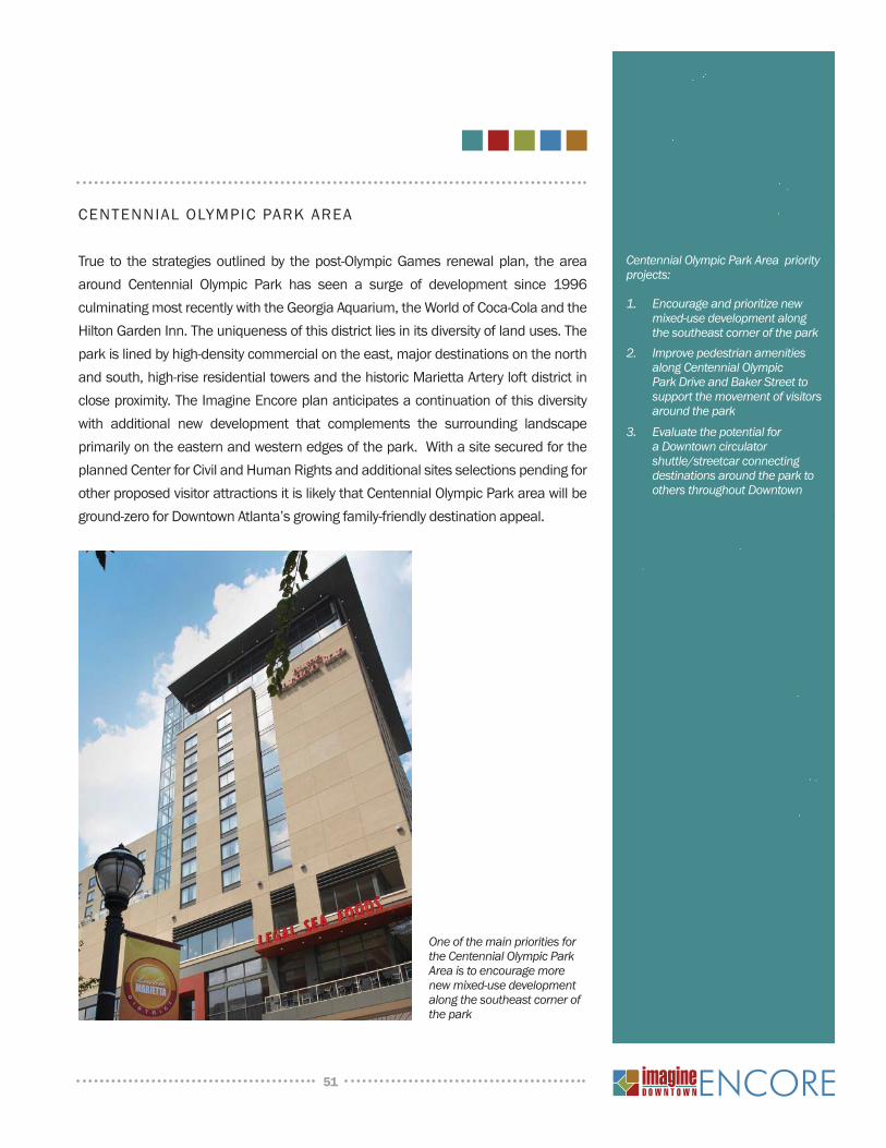
CENTENNIAL OLYMPIC PARK AREA
True to the strategies outlined by the post-Olympic Games renewal plan, the area
around Centennial Olympic Park has seen a surge of development since 1996
culminating most recently with the Georgia Aquarium, the World of Coca-Cola and the
Hilton Garden Inn. The uniqueness of this district lies in its diversity of land uses. The
park is lined by high-density commercial on the east, major destinations on the north
and south, high-rise residential towers and the historic Marietta Artery loft district in
close proximity. The Imagine Encore plan anticipates a continuation of this diversity
with additional new development that complements the surrounding landscape
primarily on the eastern and western edges of the park. With a site secured for the
planned Center for Civil and Human Rights and additional sites selections pending for
other proposed visitor attractions it is likely that Centennial Olympic Park area will be
ground-zero for Downtown Atlanta’s growing family-friendly destination appeal.
51
Centennial Olympic Park Area priority projects:
Encourage and prioritize new 1. mixed-use development along the southeast corner of the parkImprove pedestrian amenities 2. along Centennial Olympic Park Drive and Baker Street to support the movement of visitors around the parkEvaluate the potential for 3. a Downtown circulator shuttle/streetcar connecting destinations around the park to others throughout Downtown
One of the main priorities for the Centennial Olympic Park Area is to encourage more new mixed-use development along the southeast corner of the park
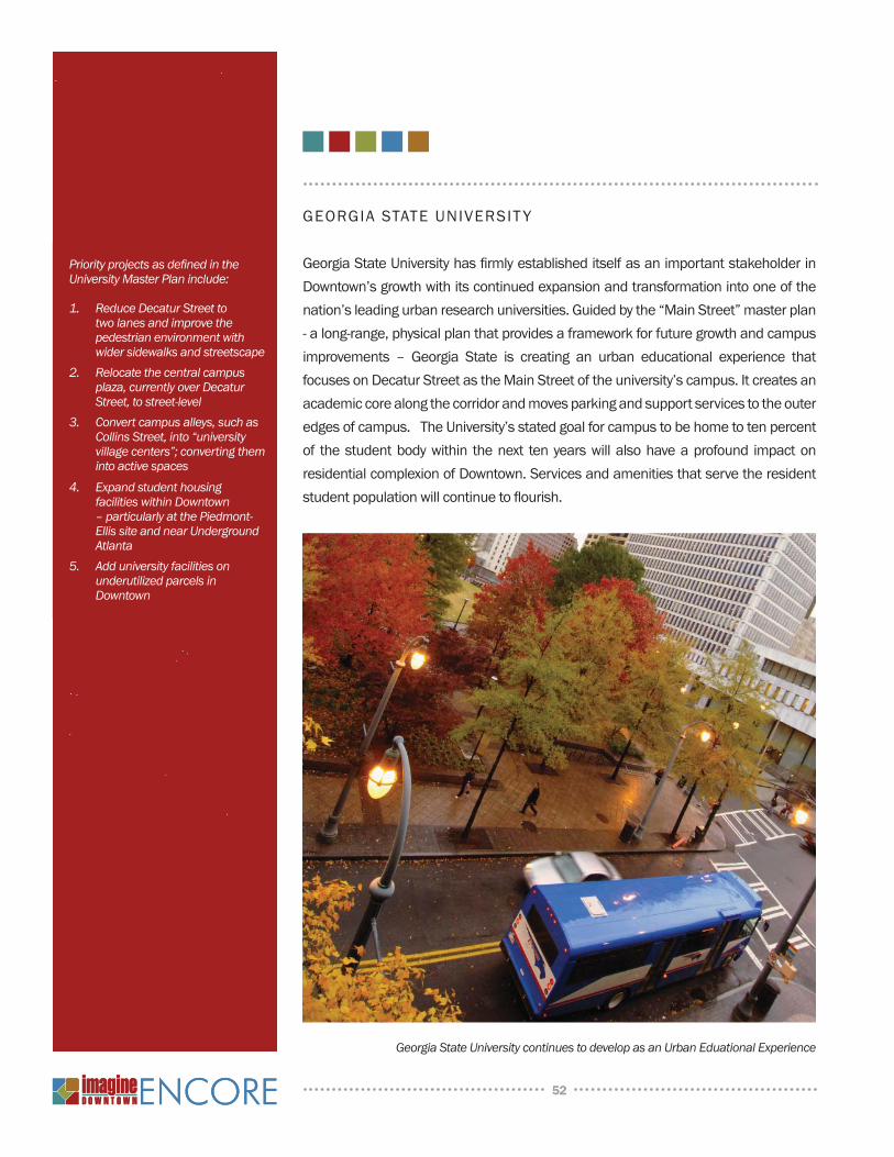
GEORGIA STATE UNIVERSIT Y
Georgia State University has fi rmly established itself as an important stakeholder in
Downtown’s growth with its continued expansion and transformation into one of the
nation’s leading urban research universities. Guided by the “Main Street” master plan
- a long-range, physical plan that provides a framework for future growth and campus
improvements – Georgia State is creating an urban educational experience that
focuses on Decatur Street as the Main Street of the university’s campus. It creates an
academic core along the corridor and moves parking and support services to the outer
edges of campus. The University’s stated goal for campus to be home to ten percent
of the student body within the next ten years will also have a profound impact on
residential complexion of Downtown. Services and amenities that serve the resident
student population will continue to fl ourish.
52
Priority projects as defi ned in the University Master Plan include:
Reduce Decatur Street to 1. two lanes and improve the pedestrian environment with wider sidewalks and streetscapeRelocate the central campus 2. plaza, currently over Decatur Street, to street-levelConvert campus alleys, such as 3. Collins Street, into “university village centers”; converting them into active spacesExpand student housing 4. facilities within Downtown – particularly at the Piedmont-Ellis site and near Underground AtlantaAdd university facilities on 5. underutilized parcels in Downtown
Georgia State University continues to develop as an Urban Eduational Experience
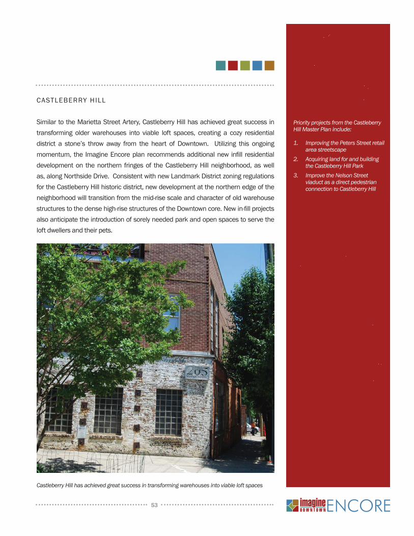
CASTLEBERRY HILL
Similar to the Marietta Street Artery, Castleberry Hill has achieved great success in
transforming older warehouses into viable loft spaces, creating a cozy residential
district a stone’s throw away from the heart of Downtown. Utilizing this ongoing
momentum, the Imagine Encore plan recommends additional new infi ll residential
development on the northern fringes of the Castleberry Hill neighborhood, as well
as, along Northside Drive. Consistent with new Landmark District zoning regulations
for the Castleberry Hill historic district, new development at the northern edge of the
neighborhood will transition from the mid-rise scale and character of old warehouse
structures to the dense high-rise structures of the Downtown core. New in-fi ll projects
also anticipate the introduction of sorely needed park and open spaces to serve the
loft dwellers and their pets.
53
Priority projects from the Castleberry Hill Master Plan include:
Improving the Peters Street retail 1. area streetscapeAcquiring land for and building 2. the Castleberry Hill ParkImprove the Nelson Street 3. viaduct as a direct pedestrian connection to Castleberry Hill
Castleberry Hill has achieved great success in transforming warehouses into viable loft spaces
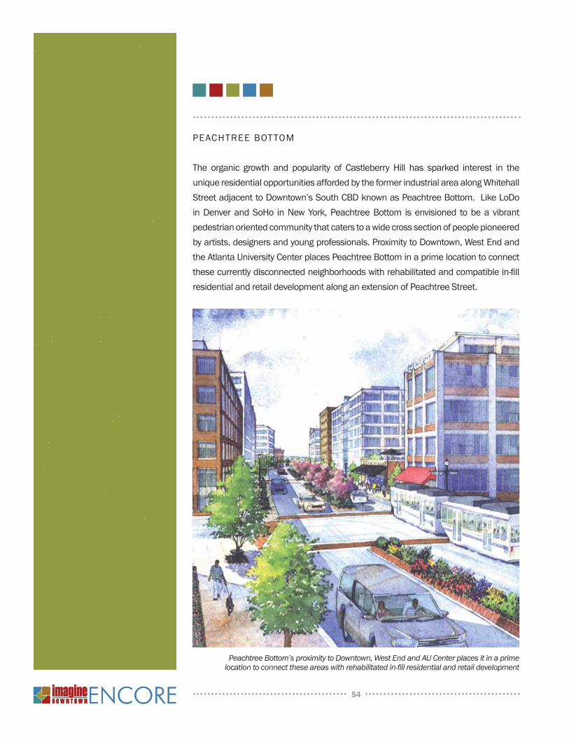
PEACHTREE BOTTOM
The organic growth and popularity of Castleberry Hill has sparked interest in the
unique residential opportunities afforded by the former industrial area along Whitehall
Street adjacent to Downtown’s South CBD known as Peachtree Bottom. Like LoDo
in Denver and SoHo in New York, Peachtree Bottom is envisioned to be a vibrant
pedestrian oriented community that caters to a wide cross section of people pioneered
by artists, designers and young professionals. Proximity to Downtown, West End and
the Atlanta University Center places Peachtree Bottom in a prime location to connect
these currently disconnected neighborhoods with rehabilitated and compatible in-fi ll
residential and retail development along an extension of Peachtree Street.
54
Peachtree Bottom’s proximity to Downtown, West End and AU Center places it in a prime location to connect these areas with rehabilitated in-fi ll residential and retail development
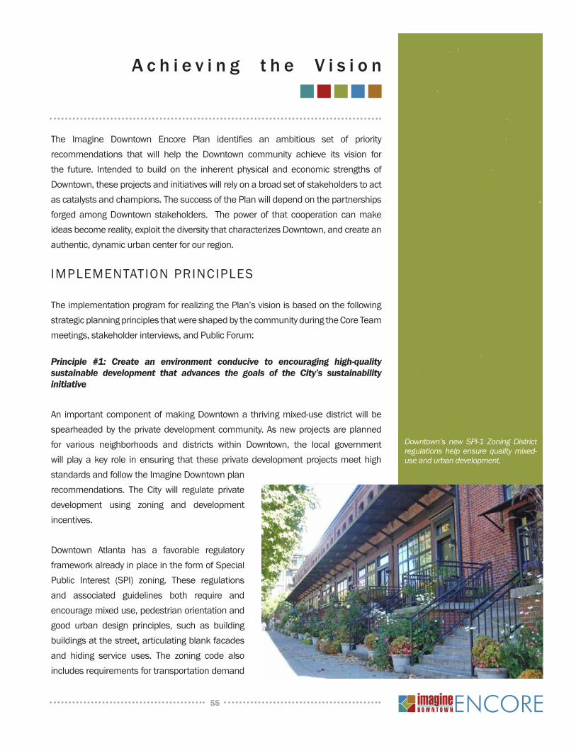
A c h i e v i n g t h e V i s i o n
The Imagine Downtown Encore Plan identifies an ambitious set of priority recommendations that will help the Downtown community achieve its vision for the future. Intended to build on the inherent physical and economic strengths of Downtown, these projects and initiatives will rely on a broad set of stakeholders to act as catalysts and champions. The success of the Plan will depend on the partnerships forged among Downtown stakeholders. The power of that cooperation can make ideas become reality, exploit the diversity that characterizes Downtown, and create an authentic, dynamic urban center for our region.
IMPLEMENTATION PRINCIPLES
The implementation program for realizing the Plan’s vision is based on the following strategic planning principles that were shaped by the community during the Core Team meetings, stakeholder interviews, and Public Forum:
Principle #1: Create an environment conducive to encouraging high-quality sustainable development that advances the goals of the City’s sustainability initiative
An important component of making Downtown a thriving mixed-use district will be spearheaded by the private development community. As new projects are planned for various neighborhoods and districts within Downtown, the local government will play a key role in ensuring that these private development projects meet high standards and follow the Imagine Downtown plan recommendations. The City will regulate private development using zoning and development incentives.
Downtown Atlanta has a favorable regulatory framework already in place in the form of Special Public Interest (SPI) zoning. These regulations and associated guidelines both require and encourage mixed use, pedestrian orientation and good urban design principles, such as building buildings at the street, articulating blank facades and hiding service uses. The zoning code also includes requirements for transportation demand
55
Downtown’s new SPI-1 Zoning District regulations help ensure quality mixed-use and urban development.
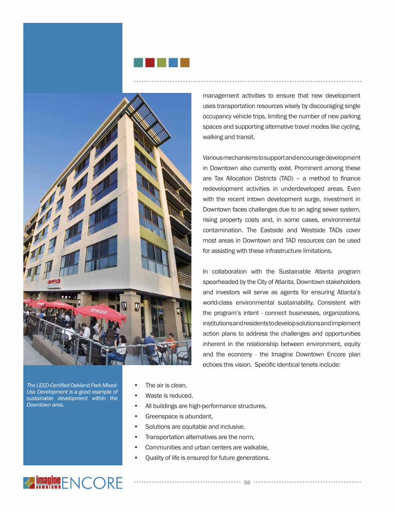
management activities to ensure that new development uses transportation resources wisely by discouraging single occupancy vehicle trips, limiting the number of new parking spaces and supporting alternative travel modes like cycling, walking and transit.
Various mechanisms to support and encourage development in Downtown also currently exist. Prominent among these are Tax Allocation Districts (TAD) – a method to finance redevelopment activities in underdeveloped areas. Even with the recent intown development surge, investment in Downtown faces challenges due to an aging sewer system, rising property costs and, in some cases, environmental contamination. The Eastside and Westside TADs cover most areas in Downtown and TAD resources can be used for assisting with these infrastructure limitations.
In collaboration with the Sustainable Atlanta program spearheaded by the City of Atlanta, Downtown stakeholders and investors will serve as agents for ensuring Atlanta’s world-class environmental sustainability. Consistent with the program’s intent - connect businesses, organizations, institutions and residents to develop solutions and implement action plans to address the challenges and opportunities inherent in the relationship between environment, equity and the economy - the Imagine Downtown Encore plan echoes this vision. Specific identical tenets include:
• The air is clean,• Waste is reduced,• All buildings are high-performance structures,• Greenspace is abundant,• Solutions are equitable and inclusive,• Transportation alternatives are the norm,• Communities and urban centers are walkable,• Quality of life is ensured for future generations.
56
The LEED-Certified Oakland Park Mixed-Use Development is a good example of sustainable development within the Downtown area.
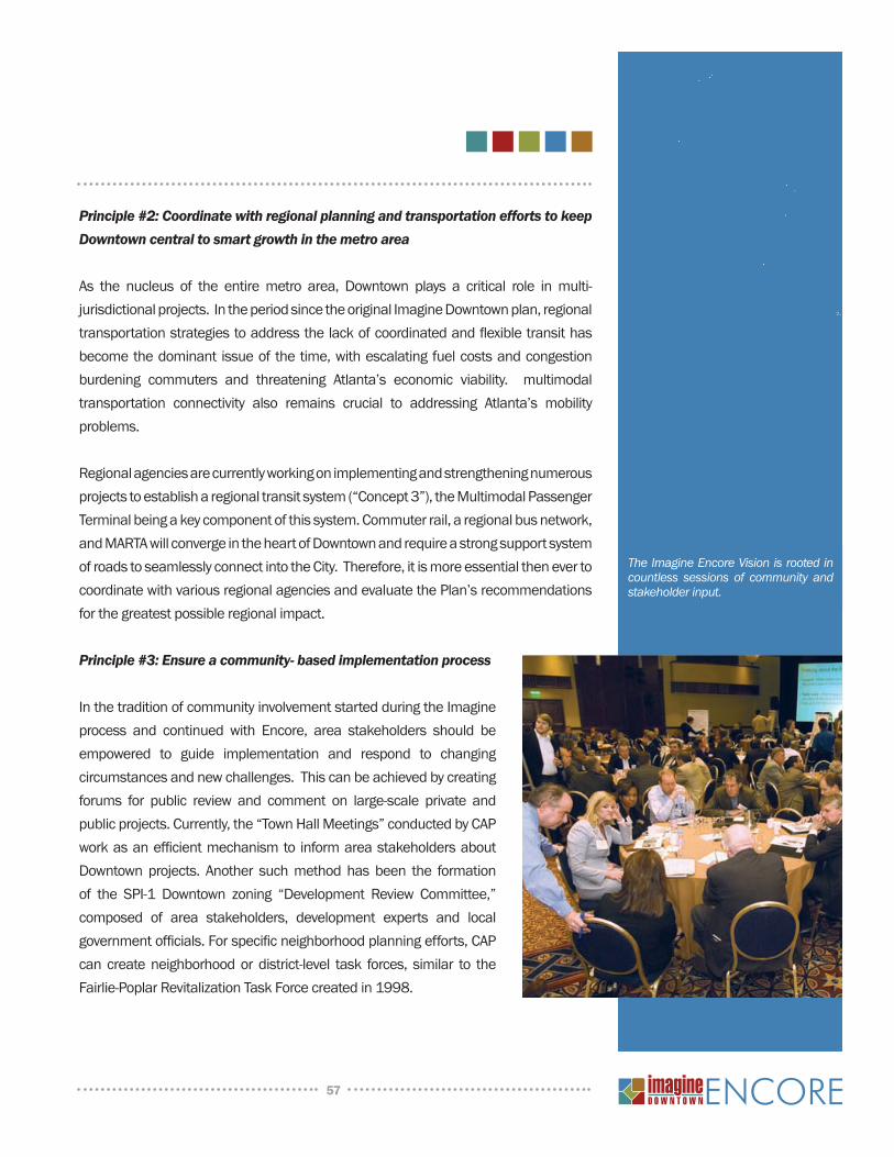
Principle #2: Coordinate with regional planning and transportation efforts to keep Downtown central to smart growth in the metro area
As the nucleus of the entire metro area, Downtown plays a critical role in multi-jurisdictional projects. In the period since the original Imagine Downtown plan, regional transportation strategies to address the lack of coordinated and flexible transit has become the dominant issue of the time, with escalating fuel costs and congestion burdening commuters and threatening Atlanta’s economic viability. multimodal transportation connectivity also remains crucial to addressing Atlanta’s mobility problems.
Regional agencies are currently working on implementing and strengthening numerous projects to establish a regional transit system (“Concept 3”), the Multimodal Passenger Terminal being a key component of this system. Commuter rail, a regional bus network, and MARTA will converge in the heart of Downtown and require a strong support system of roads to seamlessly connect into the City. Therefore, it is more essential then ever to coordinate with various regional agencies and evaluate the Plan’s recommendations for the greatest possible regional impact.
Principle #3: Ensure a community- based implementation process
In the tradition of community involvement started during the Imagine process and continued with Encore, area stakeholders should be empowered to guide implementation and respond to changing circumstances and new challenges. This can be achieved by creating forums for public review and comment on large-scale private and public projects. Currently, the “Town Hall Meetings” conducted by CAP work as an efficient mechanism to inform area stakeholders about Downtown projects. Another such method has been the formation of the SPI-1 Downtown zoning “Development Review Committee,” composed of area stakeholders, development experts and local government officials. For specific neighborhood planning efforts, CAP can create neighborhood or district-level task forces, similar to the Fairlie-Poplar Revitalization Task Force created in 1998.
57
The Imagine Encore Vision is rooted in countless sessions of community and stakeholder input.
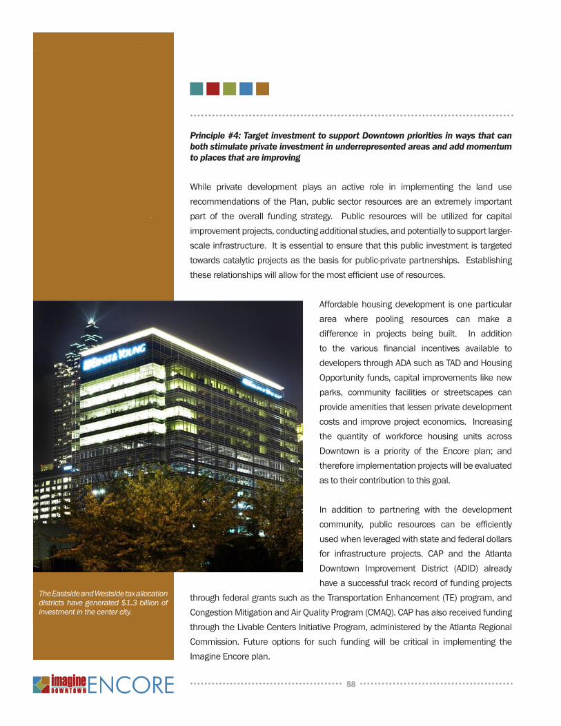
Principle #4: Target investment to support Downtown priorities in ways that can both stimulate private investment in underrepresented areas and add momentum to places that are improving
While private development plays an active role in implementing the land use recommendations of the Plan, public sector resources are an extremely important part of the overall funding strategy. Public resources will be utilized for capital improvement projects, conducting additional studies, and potentially to support larger-scale infrastructure. It is essential to ensure that this public investment is targeted towards catalytic projects as the basis for public-private partnerships. Establishing these relationships will allow for the most efficient use of resources.
Affordable housing development is one particular area where pooling resources can make a difference in projects being built. In addition to the various financial incentives available to developers through ADA such as TAD and Housing Opportunity funds, capital improvements like new parks, community facilities or streetscapes can provide amenities that lessen private development costs and improve project economics. Increasing the quantity of workforce housing units across Downtown is a priority of the Encore plan; and therefore implementation projects will be evaluated as to their contribution to this goal.
In addition to partnering with the development community, public resources can be efficiently used when leveraged with state and federal dollars for infrastructure projects. CAP and the Atlanta Downtown Improvement District (ADID) already have a successful track record of funding projects
through federal grants such as the Transportation Enhancement (TE) program, and Congestion Mitigation and Air Quality Program (CMAQ). CAP has also received funding through the Livable Centers Initiative Program, administered by the Atlanta Regional Commission. Future options for such funding will be critical in implementing the Imagine Encore plan.
58
The Eastside and Westside tax allocation districts have generated $1.3 billion of investment in the center city.

Principle #5: Design infrastructure projects to both improve internal Downtown connections and better link to adjacent neighborhoods and areas.
Great strides have been made in improving Downtown connectivity through projects like Ivan Allen Jr. Boulevard and the upgrading of the pedestrian environment on key corridors.. Perseverance in moving toward a more complete multimodal Downtown is a cornerstone of the Encore plan. Implementation projects that deliver better internal connections and mobility options, particularly in the east-west direction, will be given special consideration in project prioritization.
In the same spirit, the linkages between Downtown and the adjacent neighborhoods and districts will be strengthened to recognize their interdependence and the value they bring to residents, employees and visitors. Regional attractions like Turner Field and projects like the Beltline will play an increasingly vital role in Downtown’s evolution, and need to be included in its mobility framework. Improvements to corridors that achieve this will be treated as high-priority investment targets.
Principle #6: Facilitate the expansion of Downtown’s cultural and entertainment program within the crescent encompassing Centennial Olympic Park, Fairlie-Poplar, Five Points and Sweet Auburn aligned along the Luckie-Marietta and Edgewood-Auburn corridors.
The emergence of the Luckie-Marietta District as a vibrant dining and entertainment district has been one of the hallmarks of the last five years and has come on the heels of the success of the Georgia Aquarium. With the aquarium now expanding, the World of Coca-Cola recently completed, and the Center for Civil and Human Rights moving from concept to reality, this museum campus will further contribute to Centennial Olympic Park’s central position in Downtown’s cultural landscape. And like Marietta, new restaurants on Auburn and Edgewood are gaining in reputation and contributing a measure of distinction for Downtown East.
The “cultural crescent” that traces these corridors and extends southwards to Five Points and the Green Line is the symbolic equivalent to Peachtree Street and will be supported in the future to mature in much the same way. Potential new cultural destinations and entertainment attractions will be encouraged to explore locations
59
Efforts should be made to improve connections between Downtown and adjacent neighborhoods and destinations.
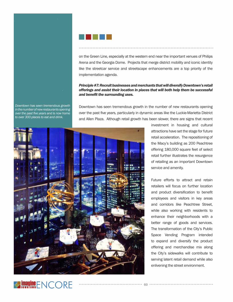
on the Green Line, especially at the western end near the important venues of Philips Arena and the Georgia Dome. Projects that merge district mobility and iconic identity like the streetcar service and streetscape enhancements are a top priority of the implementation agenda.
Principle #7: Recruit businesses and merchants that will diversify Downtown’s retail offerings and assist their location in places that will both help them be successful and benefit the surrounding uses.
Downtown has seen tremendous growth in the number of new restaurants opening over the past five years, particularly in dynamic areas like the Luckie-Marietta District and Allen Plaza. Although retail growth has been slower, there are signs that recent
investment in housing and cultural attractions have set the stage for future retail acceleration. The repositioning of the Macy’s building as 200 Peachtree offering 180,000 square feet of select retail further illustrates the resurgence of retailing as an important Downtown service and amenity.
Future efforts to attract and retain retailers will focus on further location and product diversification to benefit employees and visitors in key areas and corridors like Peachtree Street, while also working with residents to enhance their neighborhoods with a better range of goods and services. The transformation of the City’s Public Space Vending Program intended to expand and diversify the product offering and merchandise mix along the City’s sidewalks will contribute to serving latent retail demand while also enlivening the street environment.
60
Downtown has seen tremendous growth in the number of new restaurants opening over the past five years and is now home to over 300 places to eat and drink.
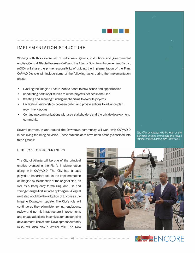
IMPLEMENTATION STRuCTuRE
Working with this diverse set of individuals, groups, institutions and governmental entities, Central Atlanta Progress (CAP) and the Atlanta Downtown Improvement District (ADID) will share the prime responsibility of guiding the implementation of the Plan. CAP/ADID’s role will include some of the following tasks during the implementation phase:
• Evolving the Imagine Encore Plan to adapt to new issues and opportunities• Conducting additional studies to refine projects defined in the Plan• Creating and securing funding mechanisms to execute projects• Facilitating partnerships between public and private entities to advance plan
recommendations• Continuing communications with area stakeholders and the private development
community
Several partners in and around the Downtown community will work with CAP/ADID in achieving the Imagine vision. These stakeholders have been broadly classified into three groups:
PuBLIC SECTOR PARTnERS
The City of Atlanta will be one of the principal entities overseeing the Plan’s implementation along with CAP/ADID. The City has already played an important role in the implementation of Imagine by its adoption of the original plan, as well as subsequently formalizing land use and zoning changes first initiated by Imagine. A logical next step would be the adoption of Encore as the Imagine Downtown update. The City’s role will continue as they administer zoning regulations, review and permit infrastructure improvements and create additional incentives for encouraging development. The Atlanta Development Authority (ADA) will also play a critical role. The new
61
The City of Atlanta will be one of the principal entities overseeing the Plan’s implementation along with CAP/ADID.
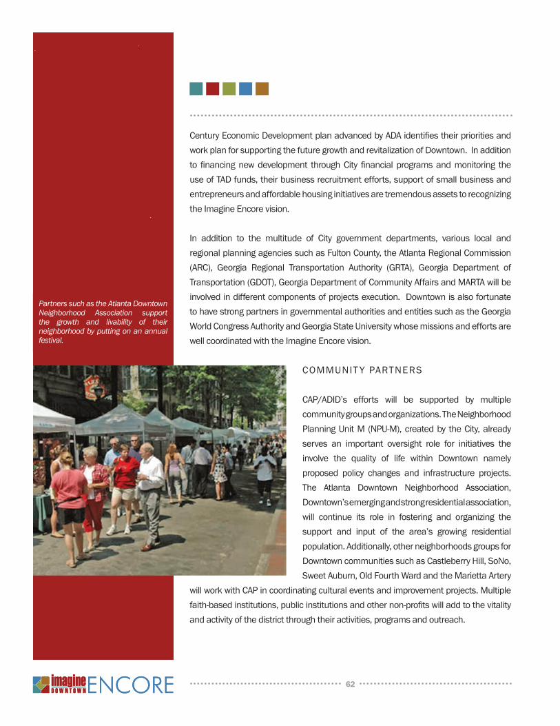
Century Economic Development plan advanced by ADA identifies their priorities and work plan for supporting the future growth and revitalization of Downtown. In addition to financing new development through City financial programs and monitoring the use of TAD funds, their business recruitment efforts, support of small business and entrepreneurs and affordable housing initiatives are tremendous assets to recognizing the Imagine Encore vision.
In addition to the multitude of City government departments, various local and regional planning agencies such as Fulton County, the Atlanta Regional Commission (ARC), Georgia Regional Transportation Authority (GRTA), Georgia Department of Transportation (GDOT), Georgia Department of Community Affairs and MARTA will be involved in different components of projects execution. Downtown is also fortunate to have strong partners in governmental authorities and entities such as the Georgia World Congress Authority and Georgia State university whose missions and efforts are well coordinated with the Imagine Encore vision.
COMMuNIT y PARTNERS
CAP/ADID’s efforts will be supported by multiple community groups and organizations. The neighborhood Planning unit M (nPu-M), created by the City, already serves an important oversight role for initiatives the involve the quality of life within Downtown namely proposed policy changes and infrastructure projects. The Atlanta Downtown neighborhood Association, Downtown’s emerging and strong residential association, will continue its role in fostering and organizing the support and input of the area’s growing residential population. Additionally, other neighborhoods groups for Downtown communities such as Castleberry Hill, Sono, Sweet Auburn, Old Fourth Ward and the Marietta Artery
will work with CAP in coordinating cultural events and improvement projects. Multiple faith-based institutions, public institutions and other non-profits will add to the vitality and activity of the district through their activities, programs and outreach.
62
Partners such as the Atlanta Downtown Neighborhood Association support the growth and livability of their neighborhood by putting on an annual festival.
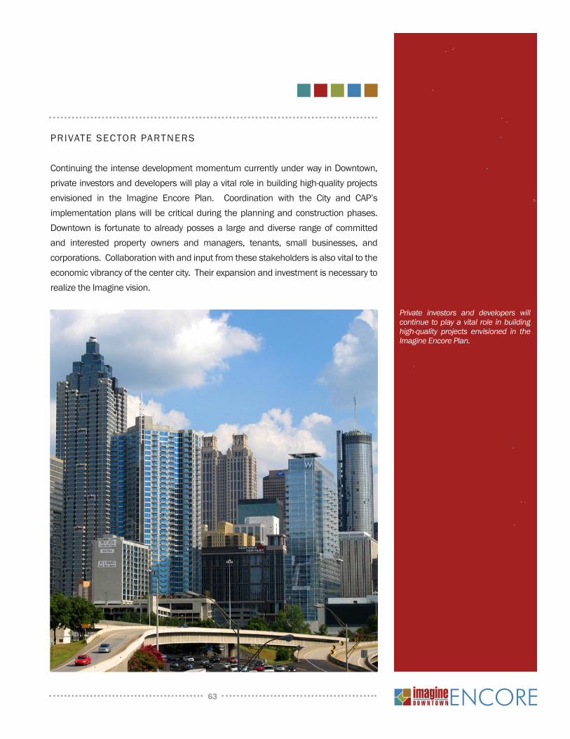
63
PRIvATE SECTOR PARTNERS
Continuing the intense development momentum currently under way in Downtown, private investors and developers will play a vital role in building high-quality projects envisioned in the Imagine Encore Plan. Coordination with the City and CAP’s implementation plans will be critical during the planning and construction phases. Downtown is fortunate to already posses a large and diverse range of committed and interested property owners and managers, tenants, small businesses, and corporations. Collaboration with and input from these stakeholders is also vital to the economic vibrancy of the center city. Their expansion and investment is necessary to realize the Imagine vision.
Private investors and developers will continue to play a vital role in building high-quality projects envisioned in the Imagine Encore Plan.
64
IMPLEMENTATION RECOMMENdATIONS
As Downtown plans for growth and development over the next decade, numerous projects will need to be undertaken to create the appropriate infrastructure, environment and amenities necessary to support this expansion. Many project recommendations were defined conceptually during the first Imagine process and remain relevant and necessary. Additional projects were discussed and scoped during complementary planning efforts completed since Imagine, while other projects have actually been completed or are underway. As development has occurred and priorities have shifted and evolved, additional recommendations have also been identified. Further, initially straightforward projects have become more complicated in some cases by overlapping planning agendas or the need to accomplish multiple goals. As Downtown growth continues to evolve it is critical that projects have a clear framework for evaluation, scope adjustment and funding prioritization.
Every potential recommendation has a role to play in achieving Downtown’s two most important goals – expanding mobility choice through better transit and greater walkability and improving the physical environment to diversify and expand the quality of life for residents, employees and visitors. However, projects are often layered with different program components that must work seamlessly together to generate the most benefit toward these goals. Whether a street, a park, a bridge, or a program, all projects should convey their primary relationship to addressing these fundamental goals regardless of their level of complexity or implementation difficulty.
The project recommendations have been categorized to simplify and illuminate their linkages to Downtown’s goals and vision. Because most projects have multiple components that need to be balanced and integrated, further detailed analysis beyond the scope of the Imagine Encore process must be conducted to evaluate the overall implications of the contemplated programs and to develop more in-depth scopes of work and project cost estimates. A complete and detailed project list is included in the Appendix.
CORRIdORS
Downtown’s streets have served many purposes throughout their history. In the more recent past, streets had evolved into a mechanism to move vehicles and less of a
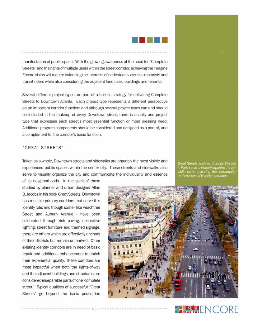
65
manifestation of public space. With the growing awareness of the need for “Complete Streets” and the rights of multiple users within the street corridor, achieving the Imagine Encore vision will require balancing the interests of pedestrians, cyclists, motorists and transit riders while also considering the adjacent land uses, buildings and tenants.
Several different project types are part of a holistic strategy for delivering Complete Streets to Downtown Atlanta. Each project type represents a different perspective on an important corridor function; and although several project types can and should be included in the makeup of every Downtown street, there is usually one project type that expresses each street’s most essential function or most pressing need. Additional program components should be considered and designed as a part of, and a complement to, the corridor’s basic function.
“GREAT STREETS”
Taken as a whole, Downtown streets and sidewalks are arguably the most visible and experienced public spaces within the center city. These streets and sidewalks also serve to visually organize the city and communicate the individuality and essence of its neighborhoods. In the spirit of those studied by planner and urban designer Allan B. Jacobs in his book Great Streets, Downtown has multiple primary corridors that serve this identity role; and though some - like Peachtree Street and Auburn Avenue - have been celebrated through rich paving, decorative lighting, street furniture and themed signage, there are others which are effectively anchors of their districts but remain unmarked. Other existing identity corridors are in need of basic repair and additional enhancement to enrich their experiential quality. These corridors are most impactful when both the rights-of-way and the adjacent buildings and structures are considered inseparable parts of one ‘complete street.’ Typical qualities of successful “Great Streets” go beyond the basic pedestrian
Great Streets such as Champs Elysees in Paris serve to visually organize the city while communicating the individuality and essence of its neighborhoods.
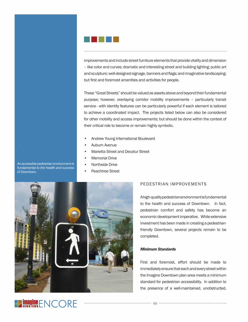
improvements and include street furniture elements that provide vitality and dimension – like color and curves; dramatic and interesting street and building lighting; public art and sculpture; well-designed signage, banners and flags; and imaginative landscaping; but first and foremost amenities and activities for people.
These “Great Streets” should be valued as assets above and beyond their fundamental purpose; however, overlaying corridor mobility improvements – particularly transit service - with identity features can be particularly powerful if each element is tailored to achieve a coordinated impact. The projects listed below can also be considered for other mobility and access improvements; but should be done within the context of their critical role to become or remain highly symbolic.
• Andrew Young International Boulevard• Auburn Avenue• Marietta Street and Decatur Street• Memorial Drive• northside Drive• Peachtree Street
PEdESTRIAN IMPROvEMENTS
A high-quality pedestrian environment is fundamental to the health and success of Downtown. In fact, pedestrian comfort and safety has become an economic development imperative. While extensive investment has been made in creating a pedestrian-friendly Downtown, several projects remain to be completed.
Minimum Standards
First and foremost, effort should be made to immediately ensure that each and every street within the Imagine Downtown plan area meets a minimum standard for pedestrian accessibility. In addition to the presence of a well-maintained, unobstructed,
66
An accessible pedestrian environment is fundamental to the health and success of Downtown.
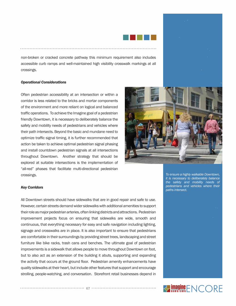
non-broken or cracked concrete pathway this minimum requirement also includes accessible curb ramps and well-maintained high visibility crosswalk markings at all crossings.
Operational Considerations
Often pedestrian accessibility at an intersection or within a corridor is less related to the bricks and mortar components of the environment and more reliant on logical and balanced traffic operations. To achieve the Imagine goal of a pedestrian friendly Downtown, it is necessary to deliberately balance the safety and mobility needs of pedestrians and vehicles where their path intersects. Beyond the basic and mundane need to optimize traffic signal timing, it is further recommended that action be taken to achieve optimal pedestrian signal phasing and install countdown pedestrian signals at all intersections throughout Downtown. Another strategy that should be explored at suitable intersections is the implementation of “all-red” phases that facilitate multi-directional pedestrian crossings.
Key Corridors
All Downtown streets should have sidewalks that are in good repair and safe to use. However, certain streets demand wider sidewalks with additional amenities to support their role as major pedestrian arteries, often linking districts and attractions. Pedestrian improvement projects focus on ensuring that sidewalks are wide, smooth and continuous, that everything necessary for easy and safe navigation including lighting, signage and crosswalks are in place. It is also important to ensure that pedestrians are comfortable in their surroundings by providing street trees, landscaping and street furniture like bike racks, trash cans and benches. The ultimate goal of pedestrian improvements is a sidewalk that allows people to move throughout Downtown on foot, but to also act as an extension of the building it abuts, supporting and expanding the activity that occurs at the ground floor. Pedestrian amenity enhancements have quality sidewalks at their heart, but include other features that support and encourage strolling, people-watching, and conversation. Storefront retail businesses depend in
67
To ensure a highly walkable Downtown, it is necessary to deliberately balance the safety and mobility needs of pedestrians and vehicles where their paths intersect.
part on the destination quality of their pedestrian space for their success; and in many urban neighborhoods sidewalks are a stand-in for the front yard. The corridors identified below have been recommended for pedestrian improvements. As referenced above for “Great Streets”, it is conceivable that other roadway changes are also recommended for these streets that could further contribute to the improved pedestrian environment.
• Boulevard • Capitol Square (including the elimination of vehicular traffic)• Centennial Olympic Park Drive• Edgewood Avenue• Forsyth Street• Hilliard Street• Mitchell Street• north Avenue• Peachtree Center Avenue• Peters Street• Ralph McGill Boulevard• Spring Street• Trinity Avenue• Walker Street• Whitehall Street• All Downtown Interstate underpasses and overpasses – notably Auburn Avenue,
Edgewood Avenue and Peachtree Street
BICYCLE IMPROVEMEnTS
Cycling is growing in popularity as a healthy and economical way to move around a city. not only do today’s streets need to approach bicycles as a serious transportation medium, but facilities for cyclist convenience (bike storage, showers, changing space) should be second nature in planning new development. Recommendations targeting cycling are similar to other projects in that some require substantial investment and design logic unique to the mode, while others are more about increasing corridor flexibility and accommodation.
The future vision for Downtown Atlanta’s street network includes a range of
68
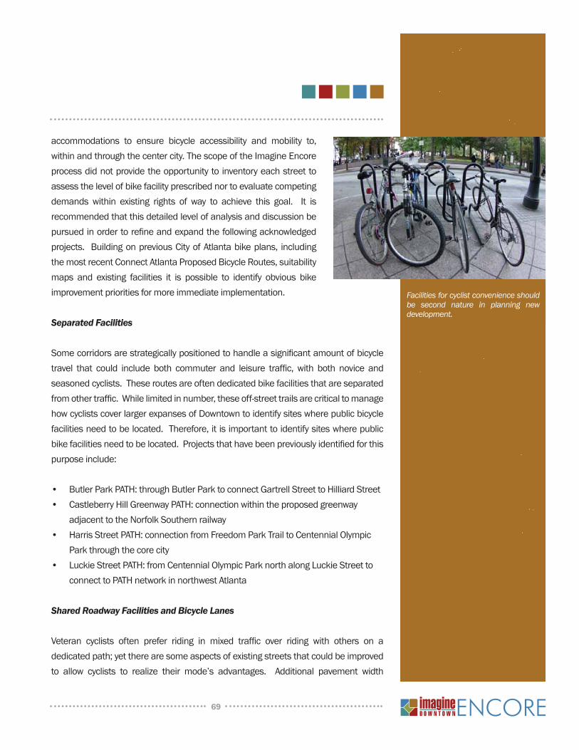
accommodations to ensure bicycle accessibility and mobility to, within and through the center city. The scope of the Imagine Encore process did not provide the opportunity to inventory each street to assess the level of bike facility prescribed nor to evaluate competing demands within existing rights of way to achieve this goal. It is recommended that this detailed level of analysis and discussion be pursued in order to refine and expand the following acknowledged projects. Building on previous City of Atlanta bike plans, including the most recent Connect Atlanta Proposed Bicycle Routes, suitability maps and existing facilities it is possible to identify obvious bike improvement priorities for more immediate implementation.
Separated Facilities
Some corridors are strategically positioned to handle a significant amount of bicycle travel that could include both commuter and leisure traffic, with both novice and seasoned cyclists. These routes are often dedicated bike facilities that are separated from other traffic. While limited in number, these off-street trails are critical to manage how cyclists cover larger expanses of Downtown to identify sites where public bicycle facilities need to be located. Therefore, it is important to identify sites where public bike facilities need to be located. Projects that have been previously identified for this purpose include:
• Butler Park PATH: through Butler Park to connect Gartrell Street to Hilliard Street • Castleberry Hill Greenway PATH: connection within the proposed greenway
adjacent to the norfolk Southern railway• Harris Street PATH: connection from Freedom Park Trail to Centennial Olympic
Park through the core city • Luckie Street PATH: from Centennial Olympic Park north along Luckie Street to
connect to PATH network in northwest Atlanta
Shared Roadway Facilities and Bicycle Lanes
Veteran cyclists often prefer riding in mixed traffic over riding with others on a dedicated path; yet there are some aspects of existing streets that could be improved to allow cyclists to realize their mode’s advantages. Additional pavement width
69
Facilities for cyclist convenience should be second nature in planning new development.
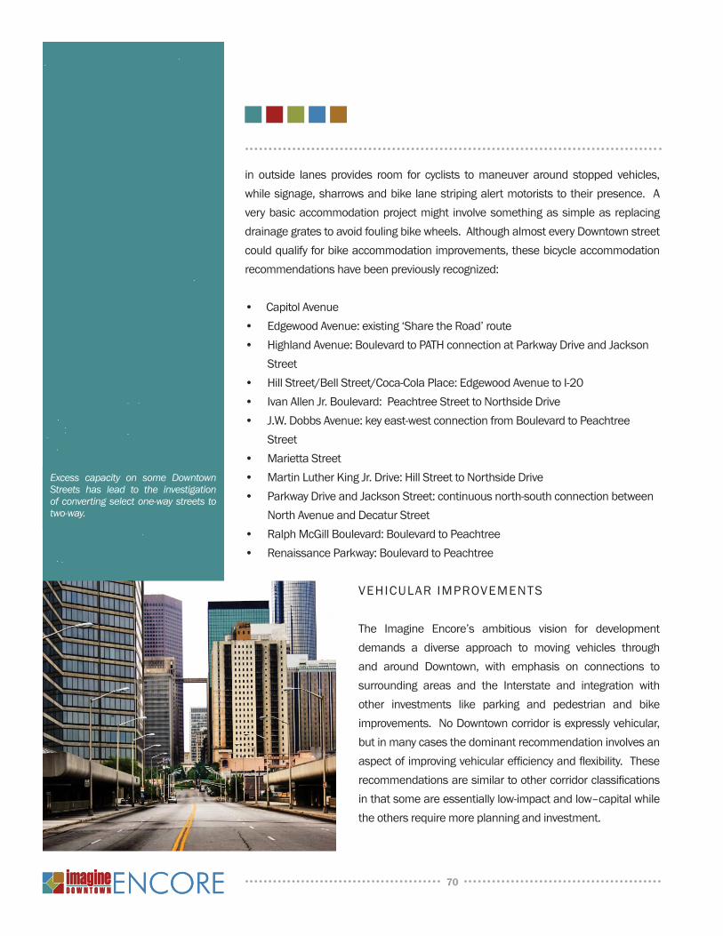
in outside lanes provides room for cyclists to maneuver around stopped vehicles, while signage, sharrows and bike lane striping alert motorists to their presence. A very basic accommodation project might involve something as simple as replacing drainage grates to avoid fouling bike wheels. Although almost every Downtown street could qualify for bike accommodation improvements, these bicycle accommodation recommendations have been previously recognized:
• Capitol Avenue• Edgewood Avenue: existing ‘Share the Road’ route• Highland Avenue: Boulevard to PATH connection at Parkway Drive and Jackson
Street• Hill Street/Bell Street/Coca-Cola Place: Edgewood Avenue to I-20• Ivan Allen Jr. Boulevard: Peachtree Street to northside Drive• J.W. Dobbs Avenue: key east-west connection from Boulevard to Peachtree
Street • Marietta Street• Martin Luther King Jr. Drive: Hill Street to northside Drive• Parkway Drive and Jackson Street: continuous north-south connection between
north Avenue and Decatur Street • Ralph McGill Boulevard: Boulevard to Peachtree• Renaissance Parkway: Boulevard to Peachtree
VEHICuLAR IMPROVEMEnTS
The Imagine Encore’s ambitious vision for development demands a diverse approach to moving vehicles through and around Downtown, with emphasis on connections to surrounding areas and the Interstate and integration with other investments like parking and pedestrian and bike improvements. no Downtown corridor is expressly vehicular, but in many cases the dominant recommendation involves an aspect of improving vehicular efficiency and flexibility. These recommendations are similar to other corridor classifications in that some are essentially low-impact and low–capital while the others require more planning and investment.
70
Excess capacity on some Downtown Streets has lead to the investigation of converting select one-way streets to two-way.

One-Way to Two-Way Conversion
Downtown is fortunate to have dense, interconnected street grids that offer multiple ways to get from point A to point B. Downtown also has a legacy of one-way paired-street routing that restricts the optimum utilization of the grids’ inherent flexibility. network flexibility projects attempt to restore the grid’s power by converting select streets back to two-way traffic, or removing barriers to more effective vehicular connectivity. Several key conversion recommendations include:
• Andrew Young International Boulevard: Carnegie Way to Boulevard• Baker Street: Centennial Olympic Park Drive to Piedmont Avenue• Centennial Olympic Park Drive• Chapel Street: northside Drive to Centennial Olympic Park Drive• Ellis Street: Carnegie Way to Freedom Parkway• Harris Street : Centennial Olympic Park Drive to Piedmont Avenue• Hills Avenue: northside Drive to Peters Street• Luckie Street: Centennial Olympic Park Drive to Peachtree Street• Martin Luther King Jr. Drive: northside Drive to Piedmont Avenue• Mitchell Street: northside Drive to Washington
Street • Peachtree Center Avenue: Peachtree Street to
Decatur Street• Pine Street: West Peachtree Street to Piedmont
Avenue• Spring Street• Trenholm Street: northside Drive to Peters Street• Walton Street• West Peachtree Place: Centennial Olympic Park
Drive to West Peachtree Street
New Roadway Connections and Alignments
Some streets need major modifications like realignment or lane expansions to improve vehicular passage, under the premise of easing the vehicular burden on other streets or accessing new areas for development. In
71
The improvements along Ivan Allen Jr. Boulevard have established the corridor as a primary East-West connection route through Downtown.
some cases these roadway connections are required above grade at viaduct level and require new bridge structures to accommodate them. Still other instances of potential roadway connections are not feasible until the anticipated redevelopment of larger sites and blocks proceeds. These new and expanded facilities are significant efforts, yet essential to preserving the cohesiveness of Downtown’s circulation; and in some cases can be funded by partnerships with private development. notable roadway connection and alignment recommendations include:
• Broad Street: Marietta Street to new upper Wall Street and upper Alabama Street to Martin Luther King Jr. Drive – reopen street to all traffic to coordinate with new streets and access to a transformed MARTA Five Points rail station
• Capitol Avenue: Memorial Drive to Martin Luther King Jr. Drive – realign the street to accommodate the Capitol Gateway Project
• Central Park Place: Baker-Highland Connector over Freedom Parkway - in conjunction with the reconfiguration of the I-75/85 interchange
• Hilliard Street: Highland Avenue to Irwin Street over Freedom Parkway• Hunt Street: Linden Avenue to Pine Street • Jesse Hill Jr. Drive: Armstrong Street to Gilmer Street - remove ‘bus only’
restriction and allow two-way traffic• Mangum Street: Chapel Street to M. L. King Jr. Drive - vehicular connection from
at-grade condition to elevated viaduct• Merritt Avenue: Parkway to Boulevard• nelson Street: bridge between Spring Street and Elliott Street• nutting Street: north Avenue to Linden Avenue• Richard B. Russell Drive Extension: Martin Luther King Jr. Drive to Spring Street /
Marietta Street• upper Alabama Street (East): Central Avenue to Forsyth Street – reopen street to
all traffic• upper Alabama Street (West): Forsyth Street to Centennial Olympic Park Drive
- new viaduct roadway • upper Wall Street (East): Courtland Street to Central Avenue – new viaduct
roadway• upper Wall Street (West): Peachtree Street to Centennial Olympic Park Drive –
new viaduct roadway
72
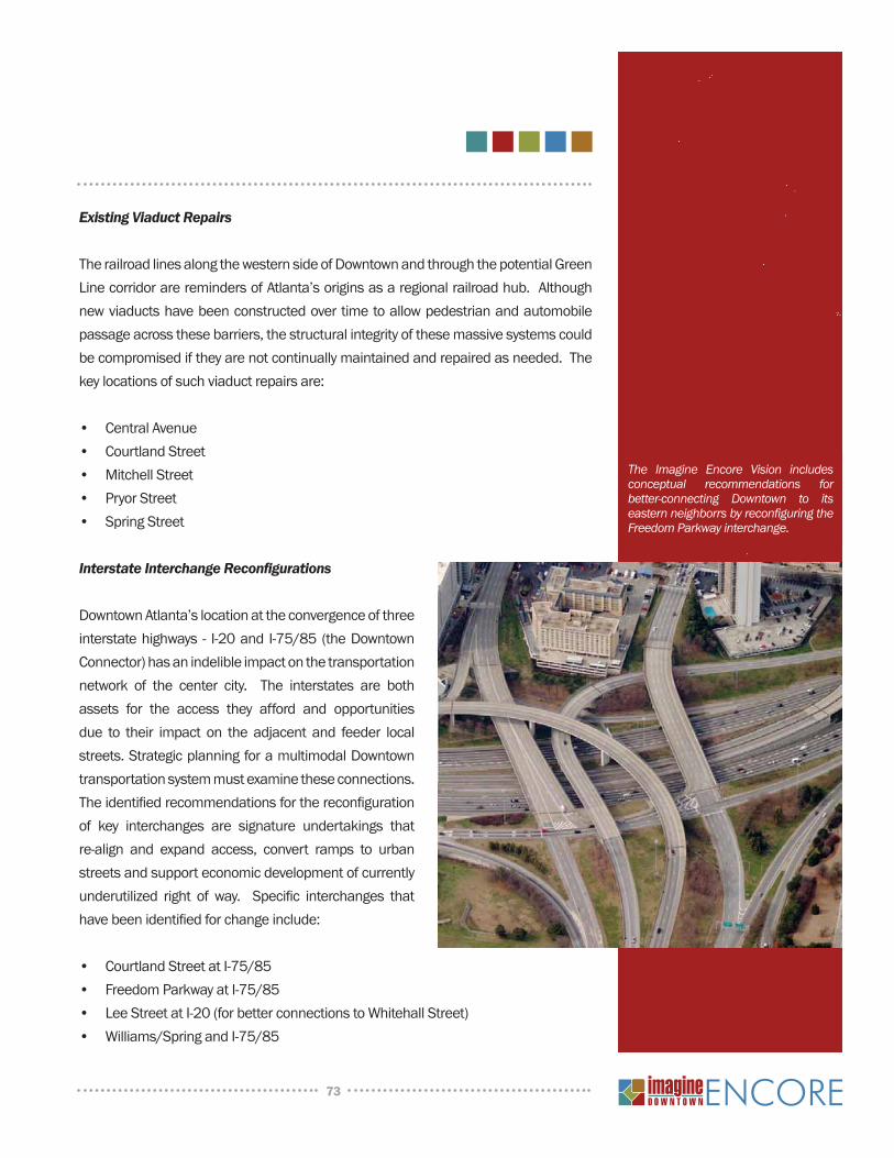
Existing Viaduct Repairs
The railroad lines along the western side of Downtown and through the potential Green Line corridor are reminders of Atlanta’s origins as a regional railroad hub. Although new viaducts have been constructed over time to allow pedestrian and automobile passage across these barriers, the structural integrity of these massive systems could be compromised if they are not continually maintained and repaired as needed. The key locations of such viaduct repairs are:
• Central Avenue• Courtland Street• Mitchell Street• Pryor Street• Spring Street
Interstate Interchange Reconfigurations
Downtown Atlanta’s location at the convergence of three interstate highways - I-20 and I-75/85 (the Downtown Connector) has an indelible impact on the transportation network of the center city. The interstates are both assets for the access they afford and opportunities due to their impact on the adjacent and feeder local streets. Strategic planning for a multimodal Downtown transportation system must examine these connections. The identified recommendations for the reconfiguration of key interchanges are signature undertakings that re-align and expand access, convert ramps to urban streets and support economic development of currently underutilized right of way. Specific interchanges that have been identified for change include:
• Courtland Street at I-75/85• Freedom Parkway at I-75/85• Lee Street at I-20 (for better connections to Whitehall Street)• Williams/Spring and I-75/85
73
The Imagine Encore Vision includes conceptual recommendations for better-connecting Downtown to its eastern neighborrs by reconfiguring the Freedom Parkway interchange.
Traffic Signal Systems
Beyond a well-connected grid of streets an optimized traffic signal system is imperative to the efficient movement of traffic through the network. This sophisticated infrastructure includes the signal display equipment itself, as well as the cabinet and controller equipment; detection and communication devices and the analysis and programming to coordinate the signal timing. Action should be taken to upgrade and improve the entire Downtown system in order to ensure optimization of operations for vehicular and pedestrian signal phasing. In addition to daily system optimization it is also recommended that accommodations be made to support special event traffic.
Corridor Capacity Studies
There are several Downtown streets that have multiple main priorities or, through different planning efforts, have been put in the position of absorbing an unusual or unrealistic number of proposed improvements within a limited cross-section. As a first step toward completing these highly strategic corridors, “capacity” studies should be undertaken to determine each corridor’s existing and anticipated transportation needs and capacities for improvement (predominantly within the existing right of way). understanding of needs and capacity will inform decisions for each corridor’s improvement program: which improvements are most important, and how they will fit into both the right-of-way and the surrounding circulation system. Initial candidates for this level of analysis include Courtland Street, Piedmont Avenue, Centennial Olympic Park Drive, Spring Street, Martin Luther King Jr. Drive and Memorial Drive.
TRANSIT
The Downtown area probably has the most extensive and efficient transit services within the City of Atlanta with north-south and east-west MARTA trains converging at the Five Points Station as well as a healthy network of MARTA bus service. Additionally, regional bus operators including the Georgia Regional Transportation Authority, Cobb Community Transit and Gwinnett County Transit provide extensive commuter service to and from Downtown. To add to this connective network, the Imagine Encore Plan proposes additional transit for short-distance and ‘last mile’ trips within Downtown, serving local residents, employees and tourists. Both a proposed streetcar and circulator shuttle system would serve the busiest areas of Downtown by connecting
74
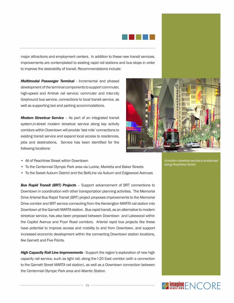
major attractions and employment centers. In addition to these new transit services, improvements are contemplated to existing rapid rail stations and bus stops in order to improve the desirability of transit. Recommendations include:
Multimodal Passenger Terminal - Incremental and phased development of the terminal components to support commuter, high-speed and Amtrak rail service: commuter and inter-city Greyhound bus service, connections to local transit service, as well as supporting taxi and parking accommodations.
Modern Streetcar Service – As part of an integrated transit system,in-street modern streetcar service along key activity corridors within Downtown will provide ‘last mile’ connections to existing transit service and expand local access to residences, jobs and destinations. Service has been identified for the following locations:
• All of Peachtree Street within Downtown• To the Centennial Olympic Park area via Luckie, Marietta and Baker Streets• To the Sweet Auburn District and the BeltLine via Auburn and Edgewood Avenues
Bus Rapid Transit (BRT) Projects – Support advancement of BRT connections to Downtown in coordination with other transportation planning activities. The Memorial Drive Arterial Bus Rapid Transit (BRT) project proposes improvements to the Memorial Drive corridor and BRT service connecting from the Kensington MARTA rail station into Downtown at the Garnett MARTA station. Bus rapid transit, as an alternative to modern streetcar service, has also been proposed between Downtown and Lakewood within the Capitol Avenue and Pryor Road corridors. Arterial rapid bus projects like these have potential to improve access and mobility to and from Downtown, and support increased economic development within the connecting Downtown station locations, like Garnett and Five Points.
High Capacity Rail Line Improvements - Support the region’s exploration of new high capacity rail service, such as light rail, along the I-20 East corridor (with a connection to the Garnett Street MARTA rail station), as well as a Downtown connection between the Centennial Olympic Park area and Atlantic Station.
75
A modern streetcar service is envisioned along Peachtree Street
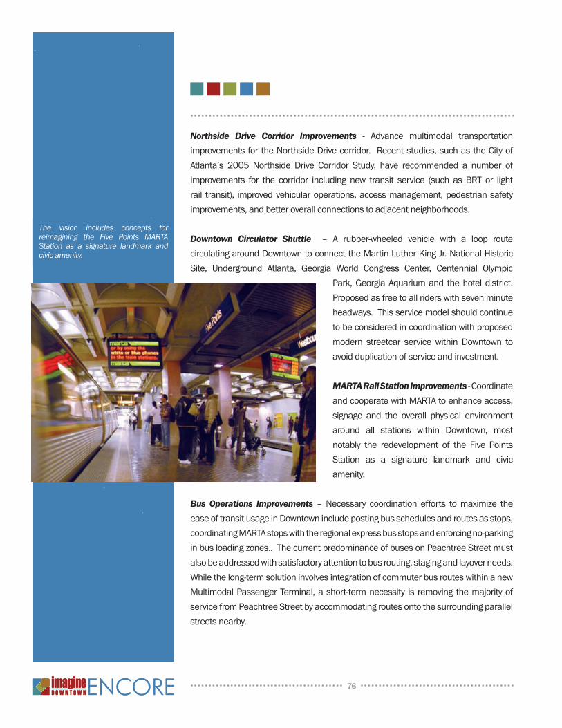
Northside Drive Corridor Improvements - Advance multimodal transportation improvements for the northside Drive corridor. Recent studies, such as the City of Atlanta’s 2005 northside Drive Corridor Study, have recommended a number of improvements for the corridor including new transit service (such as BRT or light rail transit), improved vehicular operations, access management, pedestrian safety improvements, and better overall connections to adjacent neighborhoods.
Downtown Circulator Shuttle – A rubber-wheeled vehicle with a loop route circulating around Downtown to connect the Martin Luther King Jr. national Historic Site, underground Atlanta, Georgia World Congress Center, Centennial Olympic
Park, Georgia Aquarium and the hotel district. Proposed as free to all riders with seven minute headways. This service model should continue to be considered in coordination with proposed modern streetcar service within Downtown to avoid duplication of service and investment.
MARTA Rail Station Improvements - Coordinate and cooperate with MARTA to enhance access, signage and the overall physical environment around all stations within Downtown, most notably the redevelopment of the Five Points Station as a signature landmark and civic amenity.
Bus Operations Improvements – necessary coordination efforts to maximize the ease of transit usage in Downtown include posting bus schedules and routes as stops, coordinating MARTA stops with the regional express bus stops and enforcing no-parking in bus loading zones.. The current predominance of buses on Peachtree Street must also be addressed with satisfactory attention to bus routing, staging and layover needs. While the long-term solution involves integration of commuter bus routes within a new Multimodal Passenger Terminal, a short-term necessity is removing the majority of service from Peachtree Street by accommodating routes onto the surrounding parallel streets nearby.
76
The vision includes concepts for reimagining the Five Points MARTA Station as a signature landmark and civic amenity.
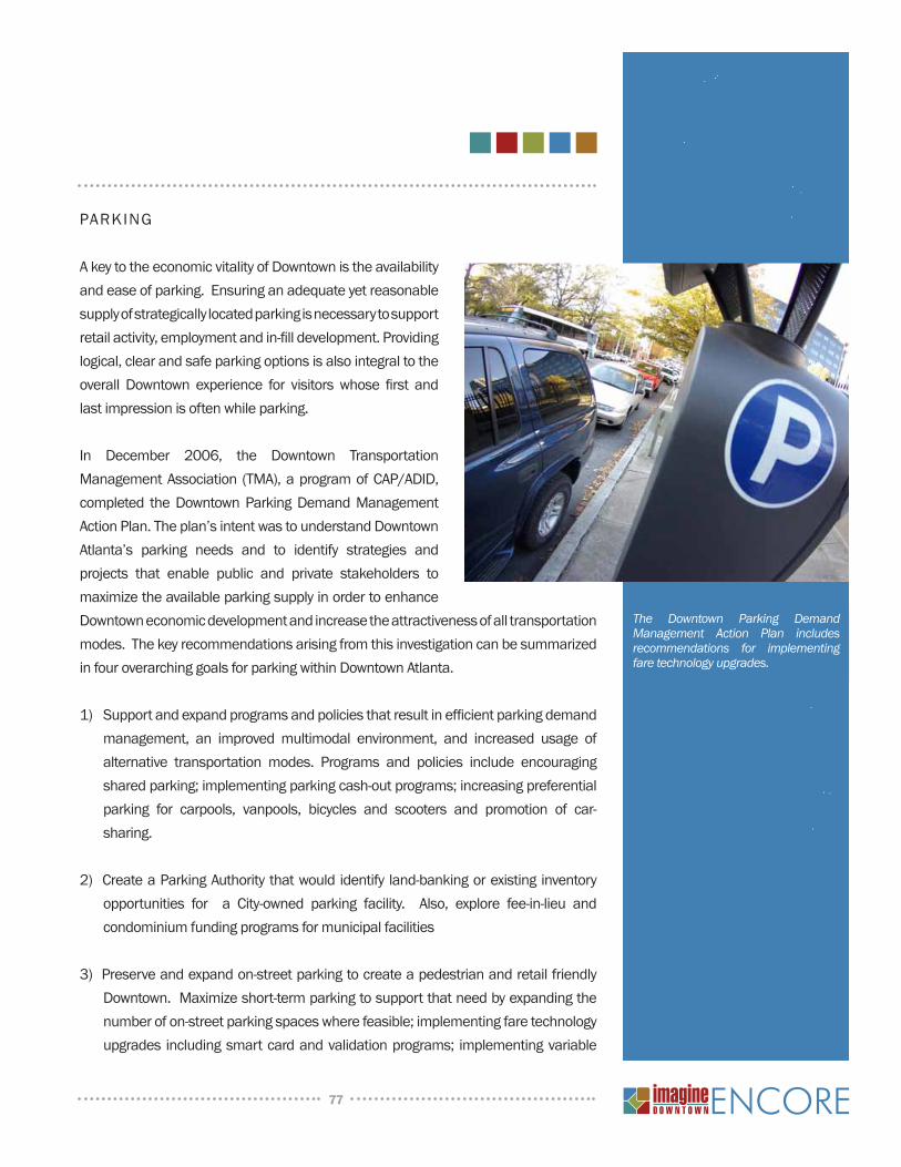
PARKInG
A key to the economic vitality of Downtown is the availability and ease of parking. Ensuring an adequate yet reasonable supply of strategically located parking is necessary to support retail activity, employment and in-fill development. Providing logical, clear and safe parking options is also integral to the overall Downtown experience for visitors whose first and last impression is often while parking.
In December 2006, the Downtown Transportation Management Association (TMA), a program of CAP/ADID, completed the Downtown Parking Demand Management Action Plan. The plan’s intent was to understand Downtown Atlanta’s parking needs and to identify strategies and projects that enable public and private stakeholders to maximize the available parking supply in order to enhance Downtown economic development and increase the attractiveness of all transportation modes. The key recommendations arising from this investigation can be summarized in four overarching goals for parking within Downtown Atlanta.
1) Support and expand programs and policies that result in efficient parking demand management, an improved multimodal environment, and increased usage of alternative transportation modes. Programs and policies include encouraging shared parking; implementing parking cash-out programs; increasing preferential parking for carpools, vanpools, bicycles and scooters and promotion of car-sharing.
2) Create a Parking Authority that would identify land-banking or existing inventory opportunities for a City-owned parking facility. Also, explore fee-in-lieu and condominium funding programs for municipal facilities
3) Preserve and expand on-street parking to create a pedestrian and retail friendly Downtown. Maximize short-term parking to support that need by expanding the number of on-street parking spaces where feasible; implementing fare technology upgrades including smart card and validation programs; implementing variable
77
The Downtown Parking Demand Management Action Plan includes recommendations for implementing fare technology upgrades.
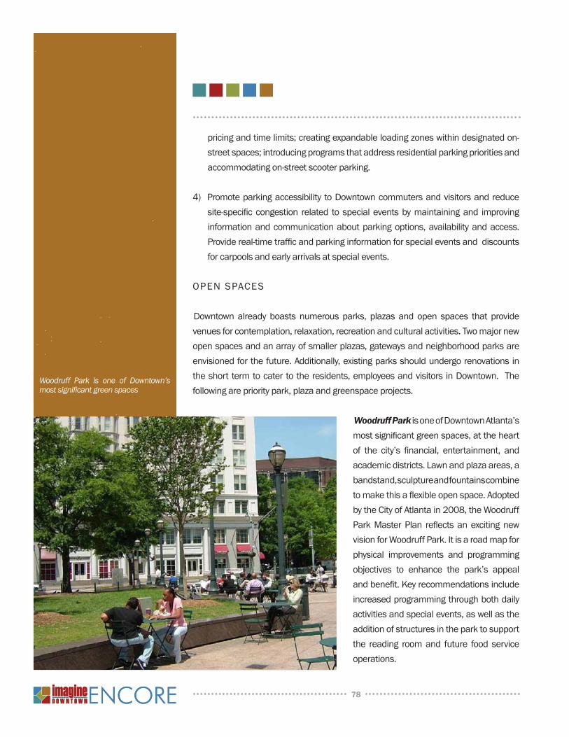
pricing and time limits; creating expandable loading zones within designated on-street spaces; introducing programs that address residential parking priorities and accommodating on-street scooter parking.
4) Promote parking accessibility to Downtown commuters and visitors and reduce site-specific congestion related to special events by maintaining and improving information and communication about parking options, availability and access. Provide real-time traffic and parking information for special events and discounts for carpools and early arrivals at special events.
OPEN SPACES
Downtown already boasts numerous parks, plazas and open spaces that provide venues for contemplation, relaxation, recreation and cultural activities. Two major new open spaces and an array of smaller plazas, gateways and neighborhood parks are envisioned for the future. Additionally, existing parks should undergo renovations in the short term to cater to the residents, employees and visitors in Downtown. The following are priority park, plaza and greenspace projects.
Woodruff Park is one of Downtown Atlanta’s most significant green spaces, at the heart of the city’s financial, entertainment, and academic districts. Lawn and plaza areas, a bandstand, sculpture and fountains combine to make this a flexible open space. Adopted by the City of Atlanta in 2008, the Woodruff Park Master Plan reflects an exciting new vision for Woodruff Park. It is a road map for physical improvements and programming objectives to enhance the park’s appeal and benefit. Key recommendations include increased programming through both daily activities and special events, as well as the addition of structures in the park to support the reading room and future food service operations.
78
Woodruff Park is one of Downtown’s most significant green spaces
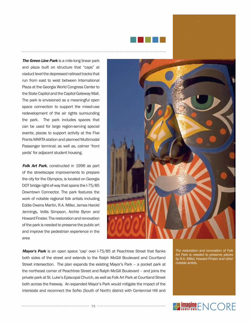
The Green Line Park is a mile-long linear park and plaza built on structure that “caps” at viaduct level the depressed railroad tracks that run from east to west between International Plaza at the Georgia World Congress Center to the State Capitol and the Capitol Gateway Mall. The park is envisioned as a meaningful open space connection to support the mixed-use redevelopment of the air rights surrounding the park. The park includes spaces that can be used for large region-serving special events; plazas to support activity at the Five Points MARTA station and planned Multimodal Passenger terminal; as well as, calmer ‘front yards’ for adjacent student housing.
Folk Art Park, constructed in 1996 as part of the streetscape improvements to prepare the city for the Olympics, is located on Georgia DOT bridge right-of-way that spans the I-75/85 Downtown Connector. The park features the work of notable regional folk artists including Eddie Owens Martin, R.A. Miller, James Harold Jennings, Vollis Simpson, Archie Byron and Howard Finster. The restoration and renovation of the park is needed to preserve the public art and improve the pedestrian experience in the area Mayor’s Park is an open space ‘cap’ over I-75/85 at Peachtree Street that flanks both sides of the street and extends to the Ralph McGill Boulevard and Courtland Street intersection. The plan expands the existing Mayor’s Park – a pocket park at the northeast corner of Peachtree Street and Ralph McGill Boulevard – and joins the private park at St. Luke’s Episcopal Church, as well as Folk Art Park at Courtland Street both across the freeway. An expanded Mayor’s Park would mitigate the impact of the interstate and reconnect the Sono (South of north) district with Centennial Hill and
79
The restoration and renovation of Folk Art Park is needed to preserve pieces by R.A. Miller, Howard Finster and other notable artists.
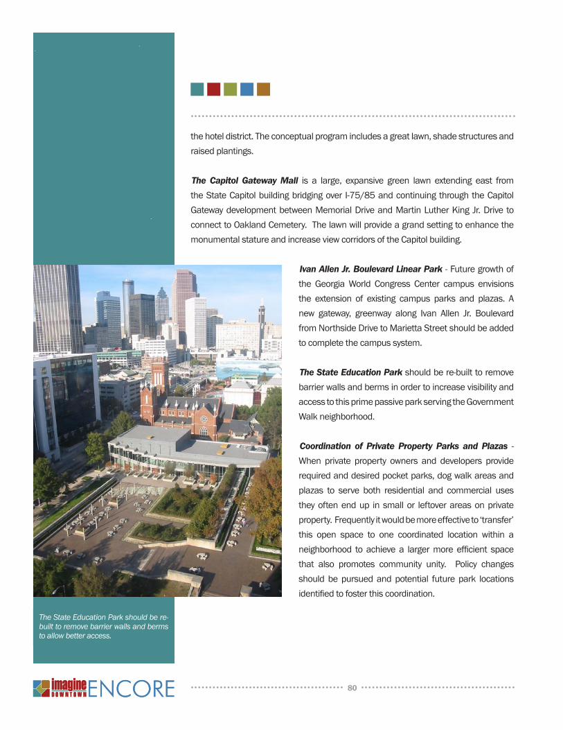
the hotel district. The conceptual program includes a great lawn, shade structures and raised plantings.
The Capitol Gateway Mall is a large, expansive green lawn extending east from the State Capitol building bridging over I-75/85 and continuing through the Capitol Gateway development between Memorial Drive and Martin Luther King Jr. Drive to connect to Oakland Cemetery. The lawn will provide a grand setting to enhance the monumental stature and increase view corridors of the Capitol building.
Ivan Allen Jr. Boulevard Linear Park - Future growth of the Georgia World Congress Center campus envisions the extension of existing campus parks and plazas. A new gateway, greenway along Ivan Allen Jr. Boulevard from northside Drive to Marietta Street should be added to complete the campus system.
The State Education Park should be re-built to remove barrier walls and berms in order to increase visibility and access to this prime passive park serving the Government Walk neighborhood.
Coordination of Private Property Parks and Plazas - When private property owners and developers provide required and desired pocket parks, dog walk areas and plazas to serve both residential and commercial uses they often end up in small or leftover areas on private property. Frequently it would be more effective to ‘transfer’ this open space to one coordinated location within a neighborhood to achieve a larger more efficient space that also promotes community unity. Policy changes should be pursued and potential future park locations identified to foster this coordination.
80
The State Education Park should be re-built to remove barrier walls and berms to allow better access.
ACHIEVInG LIVABLE CEnTERS InITIATIVE GOALS
The LCI Program has identified ten goals that communities must aspire to meet while creating and implementing LCI Plans. The Imagine Encore Plan successfully meets all these goals through recommended policies and projects as described below.
1. Efficiency/feasibility of land uses and mix appropriate for future growth including new and/or revised land use regulations needed to complete the development program
Downtown Atlanta is already a successful thriving mixed-use district, currently witnessing historic residential growth. The Imagine Encore policies encourage a continuation of these trends by promoting a mix of retail, residential, office, institutional facilities and open space throughout the district. The strategic placement of retail and residential uses is punctuated by open space that promotes connectivity within the Downtown area as well as to adjacent neighborhoods. new development is targeted close to transit stations. And the live/work land use for double-frontage sites contributes to future growth by utilizing mixed-use as a solution for difficult sites.
The recently-adopted Special Public Interest (SPI) zoning regulations specifically for Downtown Atlanta promote a more pedestrian friendly, mixed-use environment in Downtown. The ordinance includes supplemental development standards, which will guide the character of the built environment and public realm.
2. Transportation demand reduction measures
The proposed concentration of new development around existing transit stations along with provisions for new pedestrian and transit connections to existing MARTA resources will contribute to reducing transportation demand. Recommended roadway improvements focus primarily on network expansion through new grid connections and one-way to two-way conversions versus widenings to improve the efficiency of the system. In addition to other roadway improvements, the Plan also describes a pedestrian and bicycle network system to encourage more people to walk or cycle for short distance trips.
81
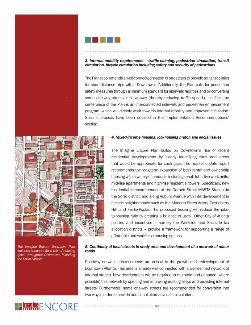
3. Internal mobility requirements – traffic calming, pedestrian circulation, transit circulation, bicycle circulation including safety and security of pedestrians
The Plan recommends a well-connected system of streetcars to provide transit facilities for short-distance trips within Downtown. Additionally, the Plan calls for pedestrian safety measures through a minimum standard for sidewalk facilities and by converting some one-way streets into two-way (thereby reducing traffic speed.). In fact, the centerpiece of the Plan is an interconnected sidewalk and pedestrian enhancement program, which will directly work towards internal mobility and improved circulation. Specific projects have been detailed in the ‘Implementation Recommendations’ section.
4. Mixed-income housing, job/housing match and social issues
The Imagine Encore Plan builds on Downtown’s rise of recent residential developments by clearly identifying sites and areas that would be appropriate for such uses. The market update report recommends the long-term expansion of both rental and ownership housing with a variety of products including rehab lofts, live-work units, mid-rise apartments and high-rise residential towers. Specifically, new residential is recommended at the Garnett Street MARTA Station, in the Sono district, and along Auburn Avenue with infill development in historic neighborhoods such as the Marietta Street Artery, Castleberry Hill, and Fairlie-Poplar. The proposed housing will reduce the jobs-to-housing ratio by creating a balance of uses. Other City of Atlanta policies and incentives – namely the Westside and Eastside tax allocation districts – provide a framework for supporting a range of affordable and workforce housing options.
5. Continuity of local streets in study area and development of a network of minor roads
Roadway network enhancements are critical to the growth and redevelopment of Downtown Atlanta. This area is already well-connected with a well-defined network of internal streets. new development will be required to maintain and enhance (where possible) this network by opening and improving existing alleys and providing internal streets. Furthermore, some one-way streets are recommended for conversion into two-way in order to provide additional alternatives for circulation.
82
The Imagine Encore Illustrative Plan includes concepts for a mix of housing types throughout Downtown, inlcuding the SoNo District.
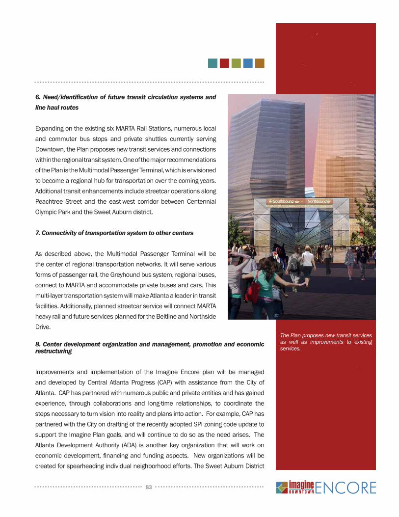
6. Need/identification of future transit circulation systems and line haul routes
Expanding on the existing six MARTA Rail Stations, numerous local and commuter bus stops and private shuttles currently serving Downtown, the Plan proposes new transit services and connections within the regional transit system. One of the major recommendations of the Plan is the Multimodal Passenger Terminal, which is envisioned to become a regional hub for transportation over the coming years. Additional transit enhancements include streetcar operations along Peachtree Street and the east-west corridor between Centennial Olympic Park and the Sweet Auburn district.
7. Connectivity of transportation system to other centers
As described above, the Multimodal Passenger Terminal will be the center of regional transportation networks. It will serve various forms of passenger rail, the Greyhound bus system, regional buses, connect to MARTA and accommodate private buses and cars. This multi-layer transportation system will make Atlanta a leader in transit facilities. Additionally, planned streetcar service will connect MARTA heavy rail and future services planned for the Beltline and northside Drive.
8. Center development organization and management, promotion and economic restructuring
Improvements and implementation of the Imagine Encore plan will be managed and developed by Central Atlanta Progress (CAP) with assistance from the City of Atlanta. CAP has partnered with numerous public and private entities and has gained experience, through collaborations and long-time relationships, to coordinate the steps necessary to turn vision into reality and plans into action. For example, CAP has partnered with the City on drafting of the recently adopted SPI zoning code update to support the Imagine Plan goals, and will continue to do so as the need arises. The Atlanta Development Authority (ADA) is another key organization that will work on economic development, financing and funding aspects. new organizations will be created for spearheading individual neighborhood efforts. The Sweet Auburn District
83
The Plan proposes new transit services as well as improvements to existing services.
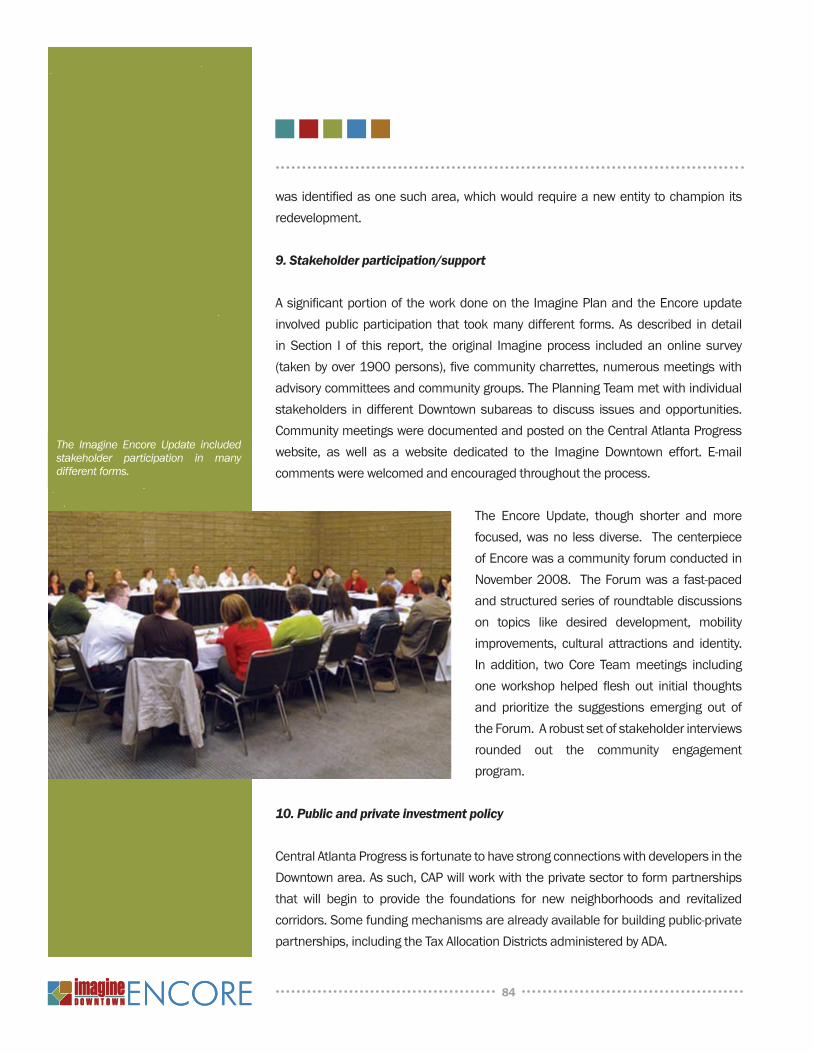
was identified as one such area, which would require a new entity to champion its redevelopment.
9. Stakeholder participation/support
A significant portion of the work done on the Imagine Plan and the Encore update involved public participation that took many different forms. As described in detail in Section I of this report, the original Imagine process included an online survey (taken by over 1900 persons), five community charrettes, numerous meetings with advisory committees and community groups. The Planning Team met with individual stakeholders in different Downtown subareas to discuss issues and opportunities. Community meetings were documented and posted on the Central Atlanta Progress website, as well as a website dedicated to the Imagine Downtown effort. E-mail comments were welcomed and encouraged throughout the process.
The Encore update, though shorter and more focused, was no less diverse. The centerpiece of Encore was a community forum conducted in november 2008. The Forum was a fast-paced and structured series of roundtable discussions on topics like desired development, mobility improvements, cultural attractions and identity. In addition, two Core Team meetings including one workshop helped flesh out initial thoughts and prioritize the suggestions emerging out of the Forum. A robust set of stakeholder interviews rounded out the community engagement program.
10. Public and private investment policy
Central Atlanta Progress is fortunate to have strong connections with developers in the Downtown area. As such, CAP will work with the private sector to form partnerships that will begin to provide the foundations for new neighborhoods and revitalized corridors. Some funding mechanisms are already available for building public-private partnerships, including the Tax Allocation Districts administered by ADA.
84
The Imagine Encore Update included stakeholder participation in many different forms.
DEVELOPMEnT SuMMARY AnD 25-YEAR PROJECTIOnS
The Imagine Downtown Plan’s ambitious program envisions numerous new development projects in Downtown over the next several years. In addition to development projects already either under construction, planned or proposed, the following program includes longer-term development proposed by the Plan.
Estimated new Development (Based on Illustrative Plan):Residential: 18,000 unitsRetail: 1,800,000 SFOffice/Mercantile: 13,750,000 SFHotel: 1,500 roomsCultural/Entertainment: 1,000,000 SFInstitutional Space: 1,900,000 SF
Year Population Households Employment
2008 33,856 14,870 140,000
2010 36,976 16,498 140,1482015 43,675 19,670 151,562
2020 50,594 22,921 163,121
2025 57,382 26,238 175,237
2030 64,954 29,817 186,885
FIVE-YEAR ACTIOn PLAn
The Imagine Encore Plan’s transportation program is a comprehensive wish-list of projects necessary to successfully realize the Imagine vision. But funding and resource limitations create restrictions on the number of projects that can be executed over the next few years. The following Five Year Action Plan is a list of priority projects identified through the plan development process. These projects have been recognized as significant improvements that will be crucial for Downtown over the next five years.
85
ASSuMPTiOnS: Downtown area defined as the 4-square-mile area bounded by north Avenue, Boulevard, i-20 and northside Drive.
2000 Population data source: uS Bureau of Census, 2000 census population and households.
Average Household Size based on neilson Claritas. Population, household, and employment forecast based on neilson Claritas, ARC, and RCLCO forecasts of market absorption potential.
Employment accounts for current downturn and assumes a return to structural demand in the mid-term.
Open Space Projects
CorridorsDescription/Action Cost Status Responsible
PartyFunding Source
Auburn Avenue Enhancements I - Peachtree to I-75/85 $4,500,000 Planned AdId LCI, TE, TAd
Auburn Avenue Enhancements II - I-75/85 to Boulevard $2,720,000 Planned AdId LCI, TE, TAd
Edgewood Avenue Enhancements I - Peachtree to I-75/85 $5,440,000 Planned AdId LCI, TE, TAd
Edgewood Avenue Enhancements II - I-75/85 to Boulevard $2,720,000 Planned AdId LCI, TE, TAd
Decatur Street Streetscape - Peachtree to Piedmont $1,370,000 Funded City/GSu LCI, GSu
Marietta Street Streetscape - Five Points to Park Avenue West $4,375,000 Funded AdId State Bond, ADID
Luckie Street Two-Way Conversion - COP Drive to Peachtree $1,200,000 Planned City LCI, TAd, AdId
Fairlie-Poplar District Streetscape III - Walton and nassau Streets $1,000,000 Funded AdId TE, COA (Q of L)
Simpson / West Peachtree Streetscape - COP Drive to MARTA $2,970,000 Funded AdId LCI, AdId
Harris Street PATH Trail - COP Drive to Piedmont $2,009,300 Planned PATH PATH
Harris Street Two-Way Conversion - COP Drive to Piedmont $2,724,862 Planned City TAd
West Peachtree Place Two-Way Conversion - Entire Length $300,000 Funded ADID/City TAD, Impact Fee
Capitol Avenue Realignment - Memorial to MLK Jr. Drive $2,000,000 Planned State State
Trinty Avenue / Memorial Intersection Realignment $1,500,000 Planned State State
Mitchell Street Restricted Access $500,000 Planned State State
nelson Street Pedestrian Bridge $4,000,000 Planned City LCI, TAd
upper Alabama Extension - Forsyth to COP Drive $32,000,000 Planned City TAd
upper Wall Extension - Peachtree to COP Drive $34,500,000 Planned City TAd
Peachtree Enhancements I - Interstate Bridge to Memorial $6,341,000 Planned AdId LCI, TAd, AdId
Peachtree Enhancements II - north Avenue to Interstate Bridge $4,881,000 Planned AdId, MId LCI, TAd, AdId, MId
Piedmont Enhancements I - Decatur Street to J. W. Dobbs $1,415,000 Funded GSu TE, GSu
Piedmont Enhancements II - J. W. Dobbs to north Avenue $4,500,000 Planned City, ADID LCI, AdId
Memorial Drive Pedestrian Connectivity - Fraser to Connally $2,237,500 Funded AHA LCI, AHA
Mitchell Street Viaduct Replacement $16,154,393 Funded GDOT TIP
Spring Street Viaduct Replacement $19,496,000 Planned GDOT TIP
Courtland Street Viaduct Replacement $16,369,00 Planned GDOT TIP
S h o r t - T e r m P r o g r a m
*See Appendix A for a comprehensive list of longer-term corridor projects*
86
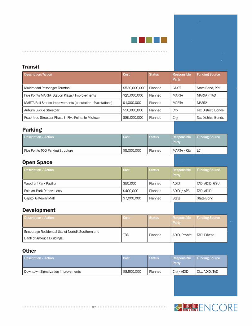
Description/Action Cost Status Responsible Party
Funding Source
Multimodal Passenger Terminal $530,000,000 Planned GDOT State Bond, PPI
Five Points MARTA Station Plaza / Improvements $25,000,000 Planned MARTA MARTA / TAd
MARTA Rail Station Improvements (per station - five stations) $1,000,000 Planned MARTA MARTA
Auburn Luckie Streetcar $50,000,000 Planned City Tax District, Bonds
Peachtree Streetcar Phase I - FIve Points to Midtown $85,000,000 Planned City Tax District, Bonds
Description / Action Cost Status Responsible Party
Funding Source
Five Points TOD Parking Structure $5,000,000 Planned MARTA / City LCI
Description / Action Cost Status Responsible Party
Funding Source
Woodruff Park Pavilion $50,000 Planned AdId TAD, ADID, GSu
Folk Art Park Renovations $400,000 Planned AdId / APAL TAd, AdId
Capitol Gateway Mall $7,000,000 Planned State State Bond
Description / Action Cost Status Responsible Party
Funding Source
Encourage Residential use of norfolk Southern and
Bank of America BuildingsTBD Planned ADID, Private TAD, Private
Description / Action Cost Status Responsible Party
Funding Source
Downtown Signalization Improvements $8,500,000 Planned City / ADID City, ADID, TAD
Transit
Parking
Open Space
Development
Other
87
ATLANTA CIT y COuNCIL
Lisa Borders, President Clair Muller, District 8
Carla Smith, District 1 Felicia Moore, District 9
Kwanza Hall, District 2 C.T. Martin, District 10
Ivory L. Young, Jr, District 3 Jim Maddox, District 11
Cleta Winslow, District 4 Joyce Sheperd, District 12
natalyn Archibong, District 5 Ceasar Mitchell, Post 1 At- Large
Anne Fauver, District 6 Mary norwood, Post 2 At- Large
Howard Shook, District 7 H. Lamar Willis, Post 3 At- Large
2009 ATLAnTA DOWnTOWn IMPROVEMEnT DISTRICT BOARD OF DIRECTORS
Chair: Craig B. Jones, Cousins Properties, Inc.
Henry G. Almquist, Jr., AMC, Inc.
Curley Dossman, Georgia-Pacific Corporation
Alec Fraser, Turner Broadcasting
Joe Hindsley, Hyatt Regency Atlanta
Kwanza Hall, Atlanta City Council
Carl Powell, The Integral Group LLC
David M. Taggart, The Coca-Cola Company
Karen Webster Parks, underground Atlanta Joint Venture
Central Atlanta Progress and the Atlanta Downtown Improvement District recognizes the elected and appointed officials, advisors, and professional and citizen planners who made the Imagine Downtown plan possible. In particular, we thank the City of Atlanta including Mayor Shirley Franklin, the entire Atlanta City Council and City staff.
A c k n o w l e d g e m e n t s
Mr. Kendall Alley, Wachovia Bank n.A.Mr. Hank Almquist, AMC, Inc.Mr. Lars Anderson, Branch Banking & TrustMr. George G. Andrews, Capitol City Bank & Trust
CompanyMr. T. Joshua R. Archer , Balch & Bingham LLPDr. Mark P. Becker, Georgia State universityMr. Thomas D. Bell, Jr. Cousins Properties, IncMr. Robert B. Bentley, AT&TMr. Brad R. Benton, KPMGMr. Harold L. Bevis, Jr., Delta Air Lines, Inc.Mr. James R. Borders, novare Group
Mr. Brad Branch, DeloitteMs. Amanda Brown-Olmstead, A. Brown-Olmstead
Associates, LLCMr. Kevin Cantley, Cooper Carry, Inc.Ms. Xernona Clayton, Trumpet Awards Foundation, Inc.Mr. Dow Dameron, united Parcel ServiceMr. Clark H. Dean, Studley, Inc.Mr. Philip Ellender, Georgia-Pacific CorporationMr. Alec Fraser, Turner Broadcasting SystemMr. Gary Froeba, Omni Hotel at Cnn CenterMr. Michael Garrett, Georgia Power CompanyMs. Renee Glover, Atlanta Housing Authority
2009 CEnTRAl ATlAnTA PROgRESS BOARD OF DiRECTORS
88
A c k n o w l e d g e m e n t s
Mr. Mike Plant, Atlanta BravesMs. Diane L. Prucino, Kilpatrick Stockton LLPMs. Erica Qualls, Atlanta Marriott Marquis HotelMr. John Reyhan, Skanska uSA Building, Inc.Ms. Violet Travis Ricks, Atlanta-Fulton County
Recreation AuthorityMr. Steve Riddell, Troutman Sanders LLPMr. Mark B. Riley, urban Realty PartnersMr. Jerome Russell, Jr. Russell new urban
Development LLCMs. Ingrid Saunders Jones, The Coca-Cola CompanyMs. Alexis Scott, Atlanta Daily WorldDr. Beverly Scott, MARTAMr. Charles W. Seets, Jr., Ernst & Young, LLPMr. John D. Shlesinger, CB Richard EllisMr. E. Kendrick Smith, Jones DayMr. Warren Snipes, Portman Holdings, Inc.Mr. Mason Stephenson, King & SpaldingMr. David Stockert, Post PropertiesMr. R. Scott Taylor, Jr., CARTERMr. Jeffrey L. Warwick, Bank of AmericaMr. Robert R. Williams, Philips Arena/Atlanta Spirit LLCMr. Sam A. Williams, Metro Atlanta Chamber of
CommerceMs. Betty E. Willis, Emory universityMr. Alan M. Wise, The Boston Consulting Group, Inc.Mr. James Young, Citizens Trust BankMr. Michael Young, Grady Health SystemMr. Caldwell Zimmerman, Colliers Spectrum Cauble
Mr. S. Taylor Glover, Turner Enterprises, Inc.Mr. Jay Goldman, BDO Seidman, LLPMr. John T. Grant, Jr., 100 Black Men of Atlanta, Inc.Mr. Dan Graveline, Georgia World Congress CenterMr. Sheffield Hale, American Cancer SocietyMr. John Heagy, HinesMs. Maxine Hicks, Epstein Becker & Green P.C.Mr. William S. Hollett, America’s Capital PartnersMr. Tad Hutcheson, AirTran AirwaysMr. Craig B. Jones, Cousins Properties, Inc.Mr. Mathew C. Jordan, Atlanta Downtown
neighborhood AssociationMr. Phil Kent, Turner Broadcasting SystemMr. Steven Labovitz, McKenna Long & Aldridge LLPMr. Hank Linginfelter, AGL Resources, Inc.Ms. Bari Love, Jackson SpaldingMr. David Marvin, Legacy Property Group, LLCMs. Merry McCleary, AVYVEMs. Peggy McCormick,Atlanta Development AuthorityMr. Richard J. McKay, Atlanta FalconsMr. Dan O’Leary, underground AtlantaMr. Timothy J. Pakenham, Alston & Bird LLPMr. Charles Parker, Atlanta Journal-ConstitutionMr. William Pate, Atlanta Convention & Visitors BureauMr. Lance Patterson, Barry Real Estate CompaniesMr. Gary Peacock, SunTrust Bank, Atlanta RegionMr. Egbert Perry, The Integral GroupMr. Dane C. Peterson, Emory university Hospital
MidtownMs. Alicia A. Philipp, The Community Foundation for
Greater Atlanta
2009 CEnTRAl ATlAnTA PROgRESS BOARD OF DiRECTORS (COnTinuED)
PLAnnInG TEAM
Central Atlanta ProgressA.J. Robinson, PresidentPaul Kelman, Executive Vice PresidentJennifer Ball, Vice President - PlanningAngie Laurie, Vice President - TransportationEllen Mendelsohn - Senior Project Manager
- Economic DevelopmentCarly nassar, Project Manager - Planning
City of Atlanta Bureau of PlanningGarnett Brown, Assistant DirectorJessica Lavandier, Principal Planner
Urban Collage, Inc.Stan Harvey, PrincipalJohn Skach, Senior AssociateMatt Cherry, AssociateStephen Busch, Senior Planner
Rober Charles Lesser & CompanySarah Kirsch, Senior PrincipalJohn Trementozzi, Senior Consultant
Pond & CompanyBrian Bolick, Vice President / PrincipalDaniel Studdard, urban Planner
89