hydrofest 2016 - ths.org.uk · pipelay – shore pull – near shore / offshore operations ......
TRANSCRIPT
The Hydrographic Society in Scotland
Hydrofest 2016
DEVELOPMENT PROJECTS – A CASE
HISTORY
Ian Douglas
Head, Offshore Surveys,
Shell Projects & Technology Europe
GOLDENEYE
PLATFORM
ST. FERGUS
GOLDENEYE FACTS
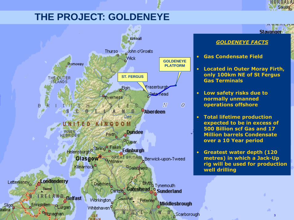
• Gas Condensate Field
• Located in Outer Moray Firth, only 100km NE of St Fergus Gas Terminals
• Low safety risks due to normally unmanned operations offshore
• Total lifetime production expected to be in excess of 500 Billion scf Gas and 17 Million barrels Condensate over a 10 Year period
• Greatest water depth (120 metres) in which a Jack-Up rig will be used for production well drilling
THE PROJECT: GOLDENEYE
Geomatics Foundation
3
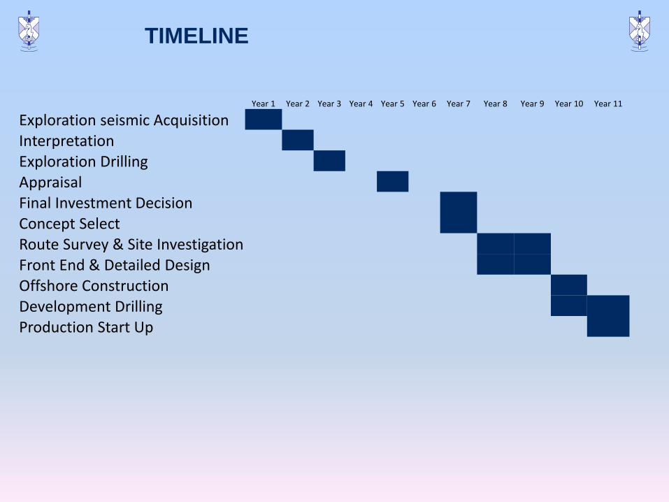
TIMELINE
Year 1 Year 2 Year 3 Year 4 Year 5 Year 6 Year 7 Year 8 Year 9 Year 10 Year 11
Exploration seismic Acquisition
Interpretation
Exploration Drilling
Appraisal
Final Investment Decision
Concept Select
Route Survey & Site Investigation
Front End & Detailed Design
Offshore Construction
Development Drilling
Production Start Up
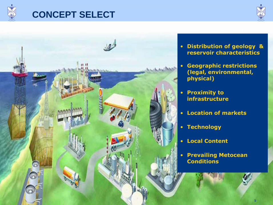
CONCEPT SELECT
5
`
• Distribution of geology & reservoir characteristics
• Geographic restrictions (legal, environmental, physical)
• Proximity to infrastructure
• Location of markets
• Technology
• Local Content
• Prevailing Metocean Conditions
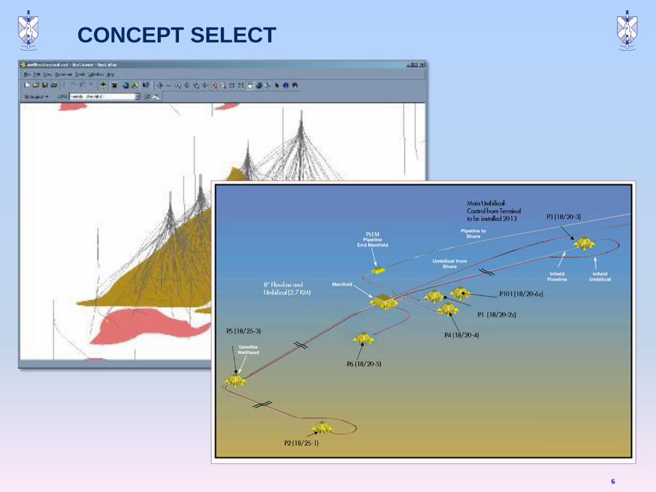
CONCEPT SELECT
6
`
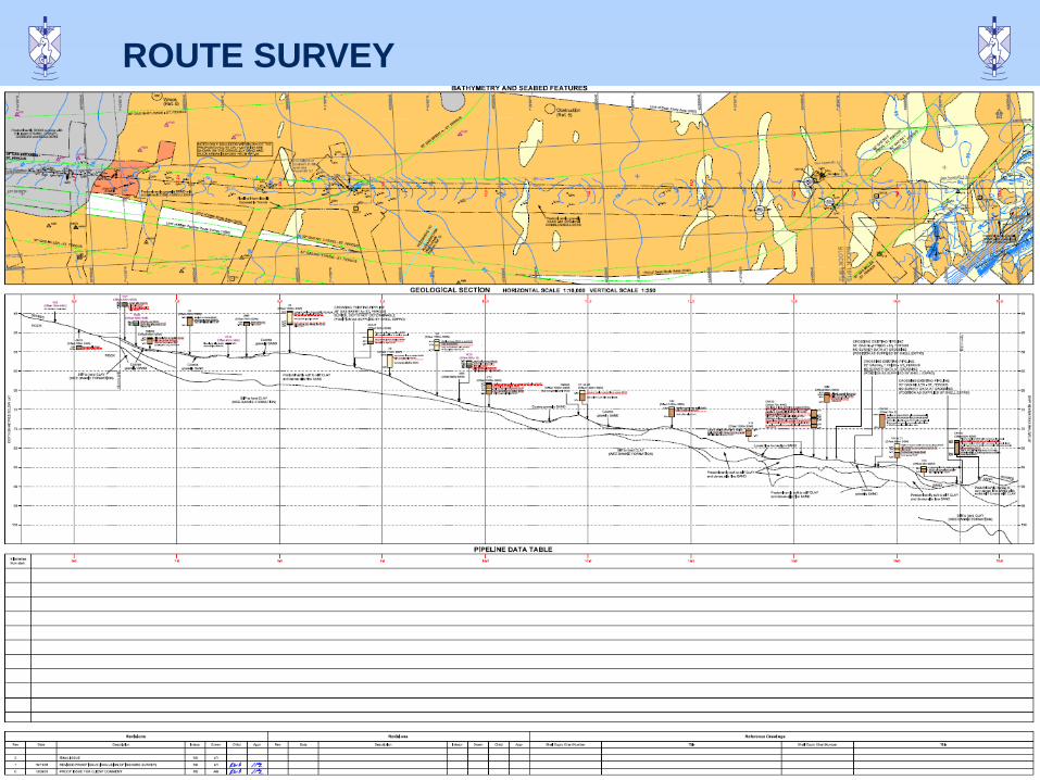
ROUTE SURVEY
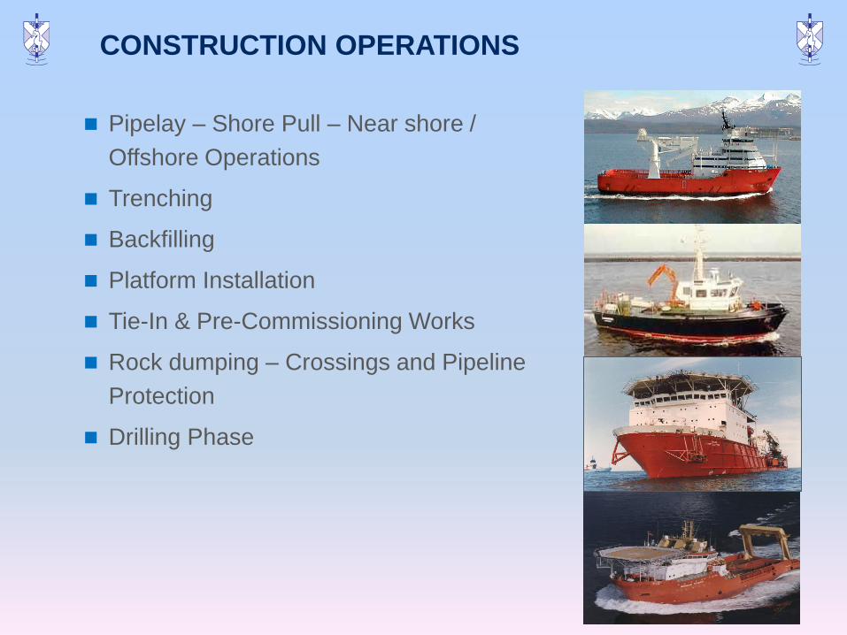
Pipelay – Shore Pull – Near shore /
Offshore Operations
Trenching
Backfilling
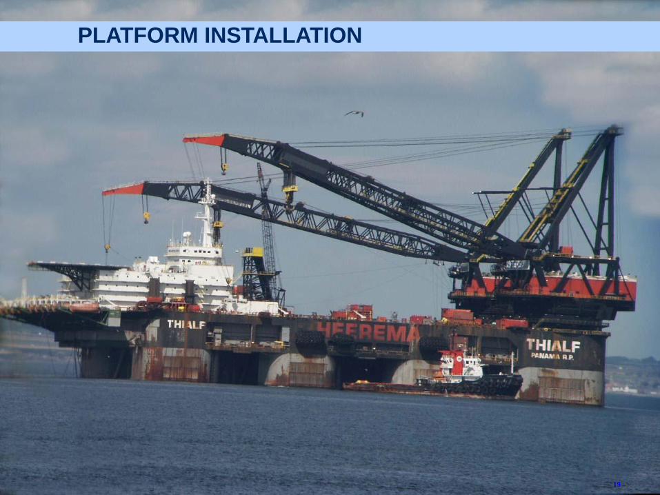
Platform Installation
Tie-In & Pre-Commissioning Works
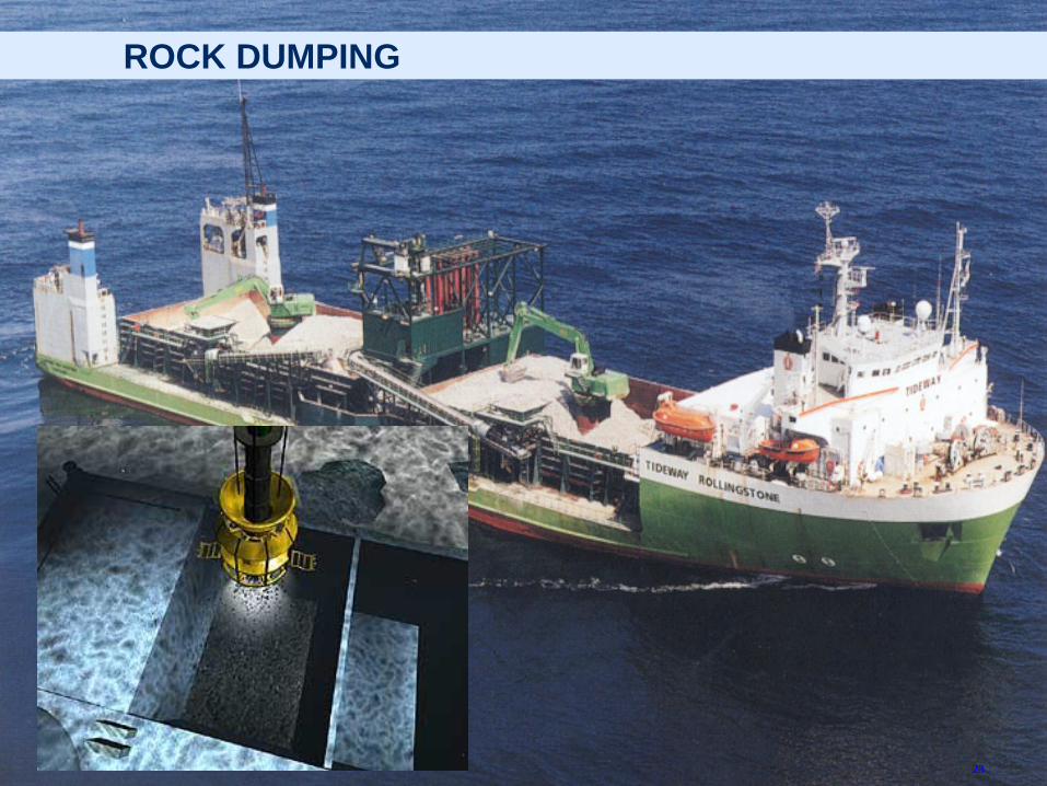
Rock dumping – Crossings and Pipeline
Protection
Drilling Phase
8
CONSTRUCTION OPERATIONS
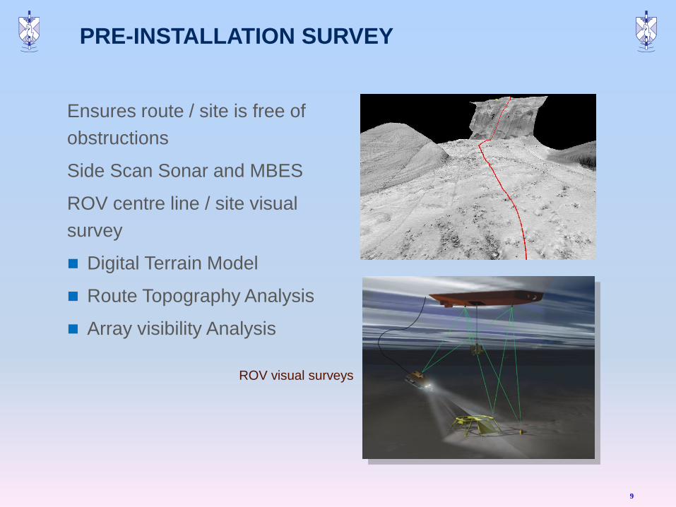
PRE-INSTALLATION SURVEY
Ensures route / site is free of
obstructions
Side Scan Sonar and MBES
ROV centre line / site visual
survey
Digital Terrain Model
Route Topography Analysis
Array visibility Analysis
9
ROV visual surveys
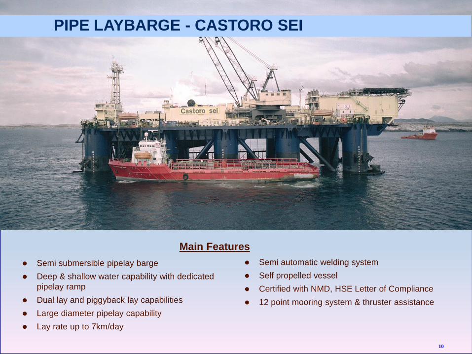
Semi submersible pipelay barge
Deep & shallow water capability with dedicated
pipelay ramp
Dual lay and piggyback lay capabilities
Large diameter pipelay capability
Lay rate up to 7km/day
Semi automatic welding system
Self propelled vessel
Certified with NMD, HSE Letter of Compliance
12 point mooring system & thruster assistance
Main Features
PIPE LAYBARGE - CASTORO SEI
10
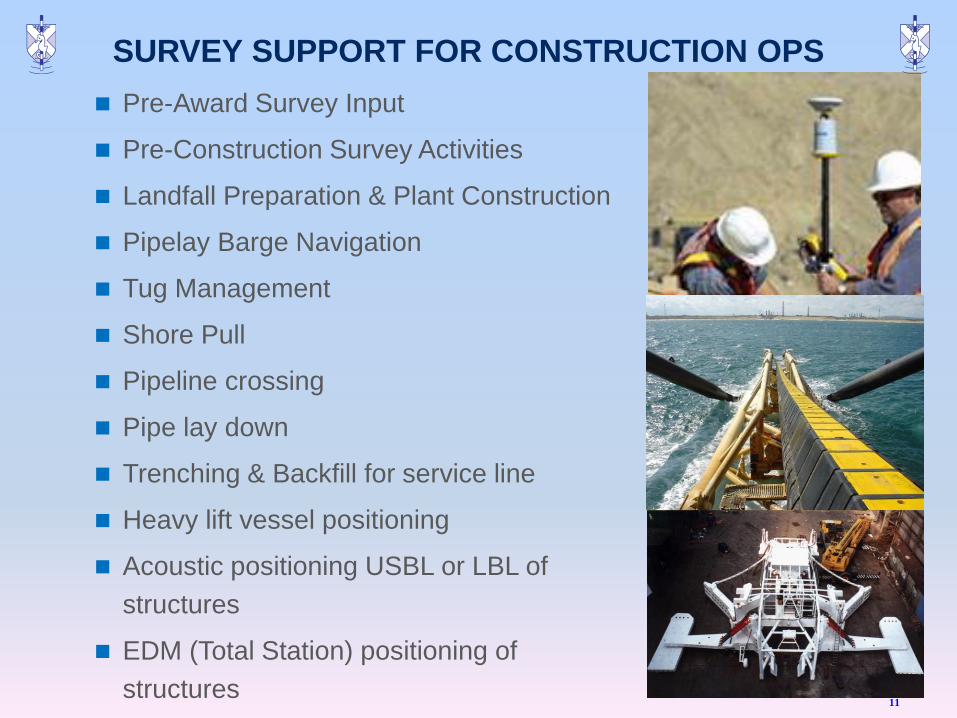
SURVEY SUPPORT FOR CONSTRUCTION OPS
Pre-Award Survey Input
Pre-Construction Survey Activities
Landfall Preparation & Plant Construction
Pipelay Barge Navigation
Tug Management
Shore Pull
Pipeline crossing
Pipe lay down
Trenching & Backfill for service line
Heavy lift vessel positioning
Acoustic positioning USBL or LBL of
structures
EDM (Total Station) positioning of
structures 11
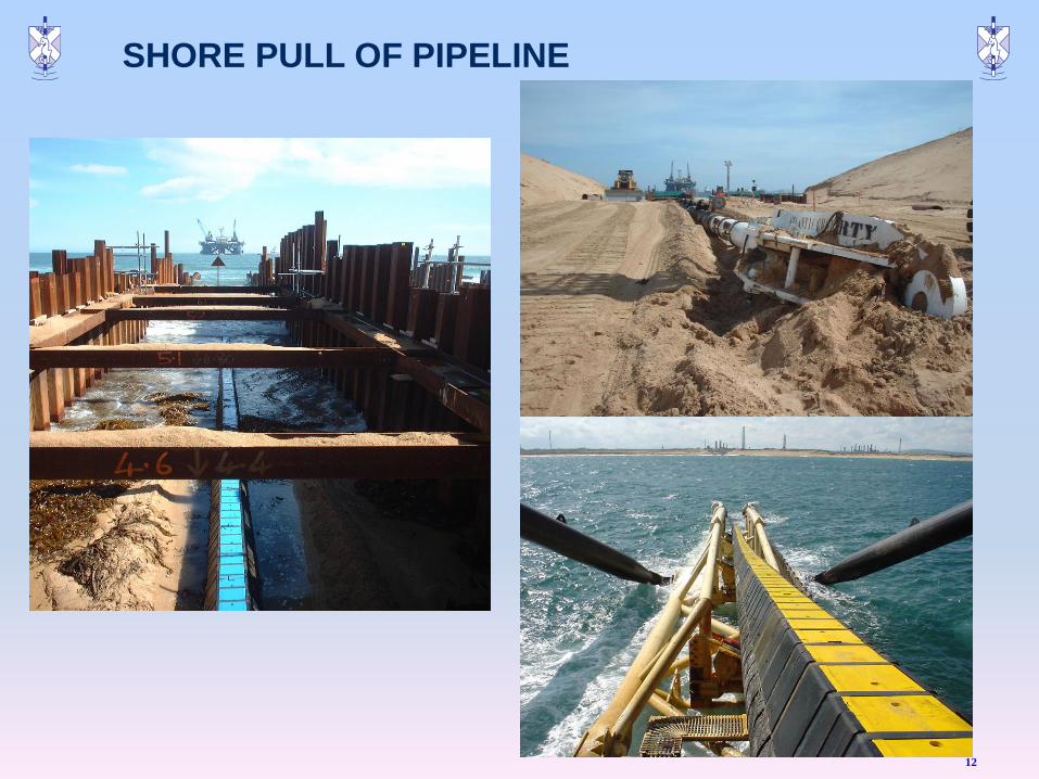
SHORE PULL OF PIPELINE
12
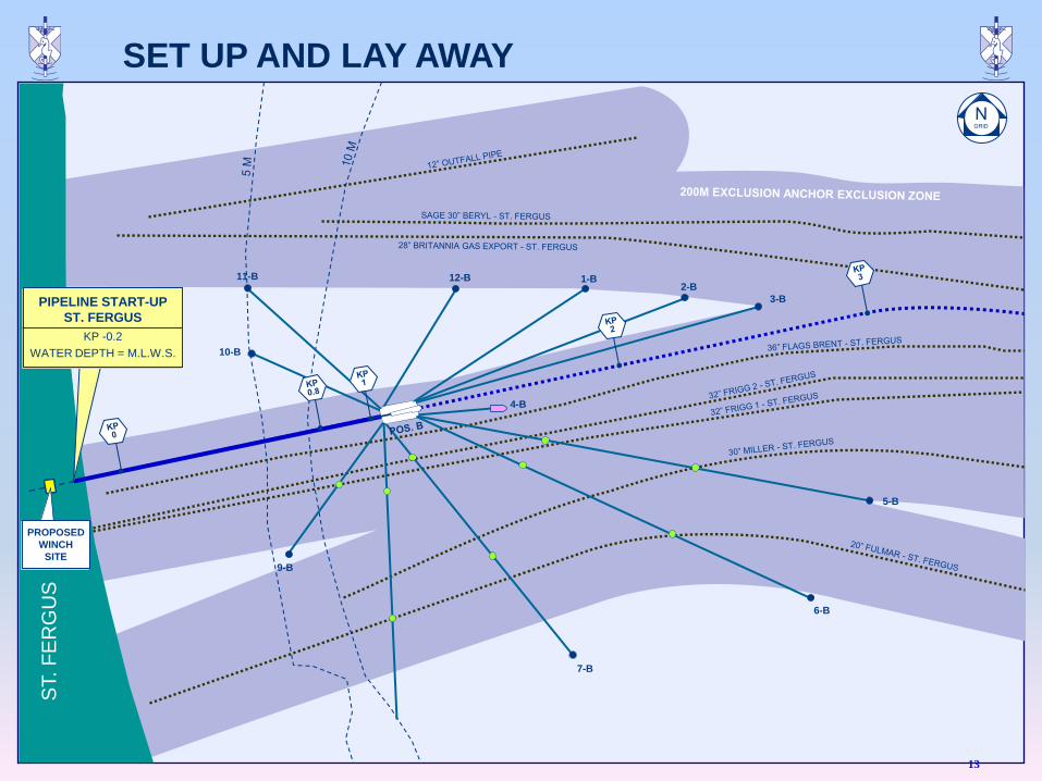
11-B 12-B 1-B 2-B
3-B
5-B
6-B
7-B
9-B
10-B
4-B
PIPELINE START-UP
ST. FERGUS
KP -0.2
WATER DEPTH = M.L.W.S.
ST. F
ER
GU
S
PROPOSED
WINCH
SITE
13
SET UP AND LAY AWAY
ST. F
ER
GU
S
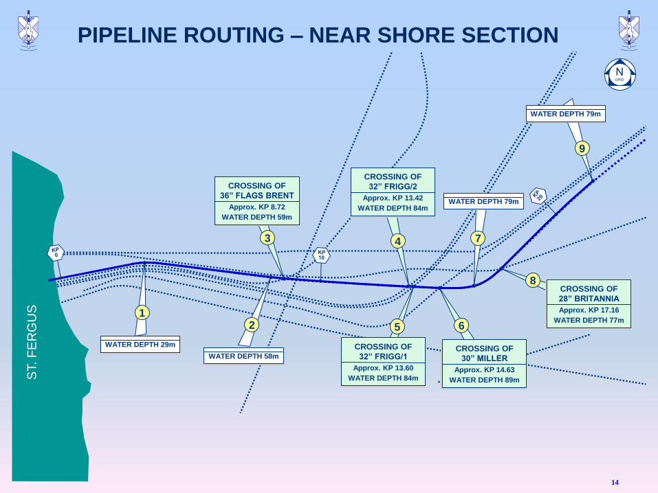
WATER DEPTH 79m
9
CROSSING OF
28” BRITANNIA
Approx. KP 17.16
WATER DEPTH 77m
8
WATER DEPTH 79m
7
CROSSING OF
30” MILLER
Approx. KP 14.63
WATER DEPTH 89m
6
CROSSING OF
32” FRIGG/1
Approx. KP 13.60
WATER DEPTH 84m
5
CROSSING OF
32” FRIGG/2
Approx. KP 13.42
WATER DEPTH 84m
4
CROSSING OF
36” FLAGS BRENT
Approx. KP 8.72
WATER DEPTH 59m
3
WATER DEPTH 58m
2
WATER DEPTH 29m
1
14
PIPELINE ROUTING – NEAR SHORE SECTION
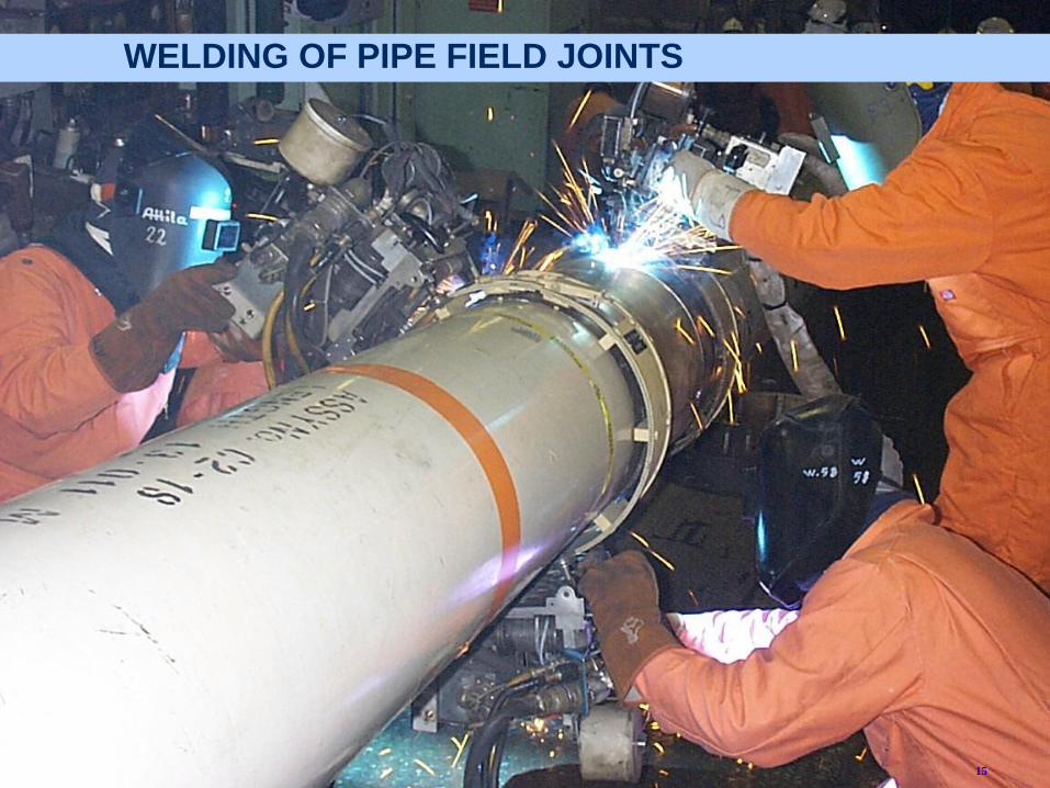
WELDING OF PIPE FIELD JOINTS
15
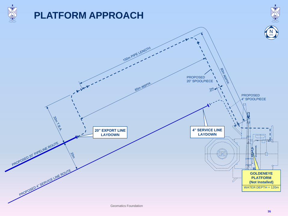
PROPOSED
20” SPOOLPIECE
PROPOSED
4” SPOOLPIECE
4” SERVICE LINE
LAYDOWN 20” EXPORT LINE
LAYDOWN
GOLDENEYE
PLATFORM
(Not Installed)
WATER DEPTH = 120m
Geomatics Foundation
16
PLATFORM APPROACH
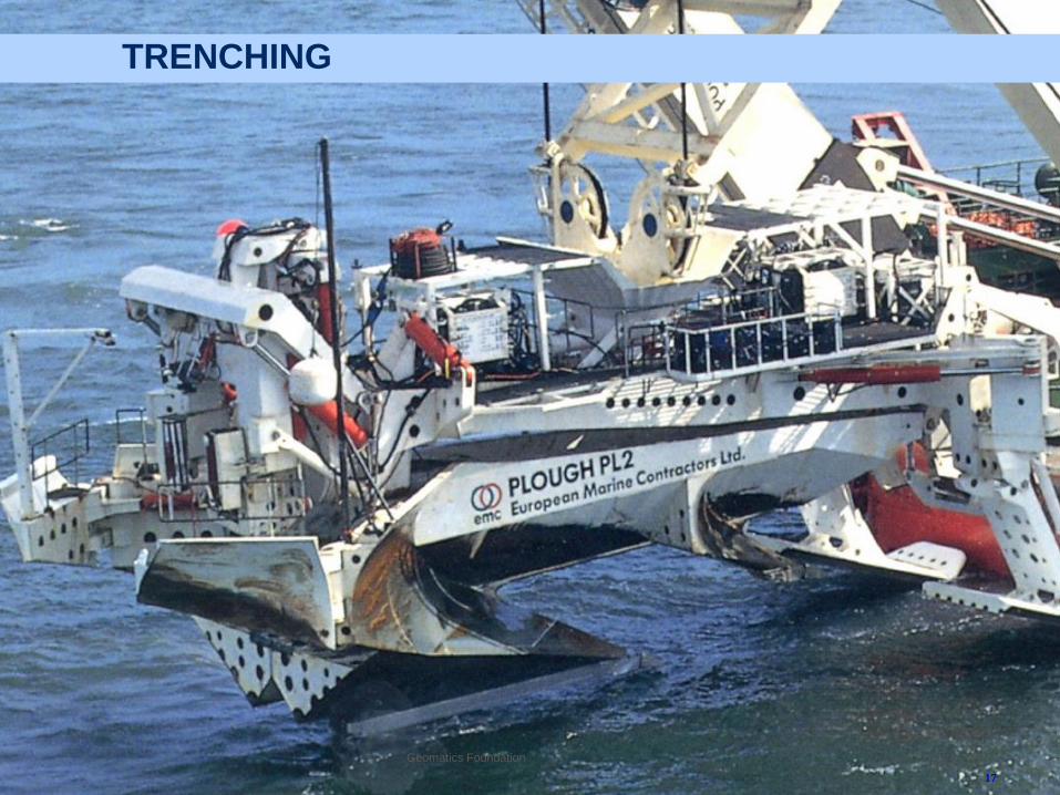
TRENCHING
17
Geomatics Foundation
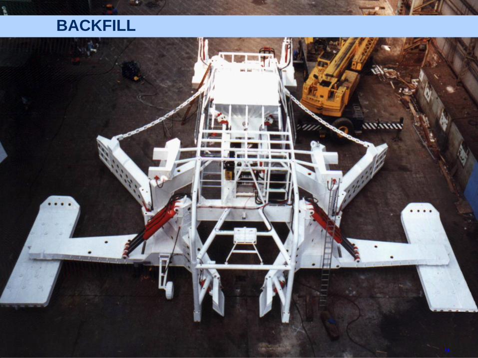
BACKFILL
18
19
PLATFORM INSTALLATION
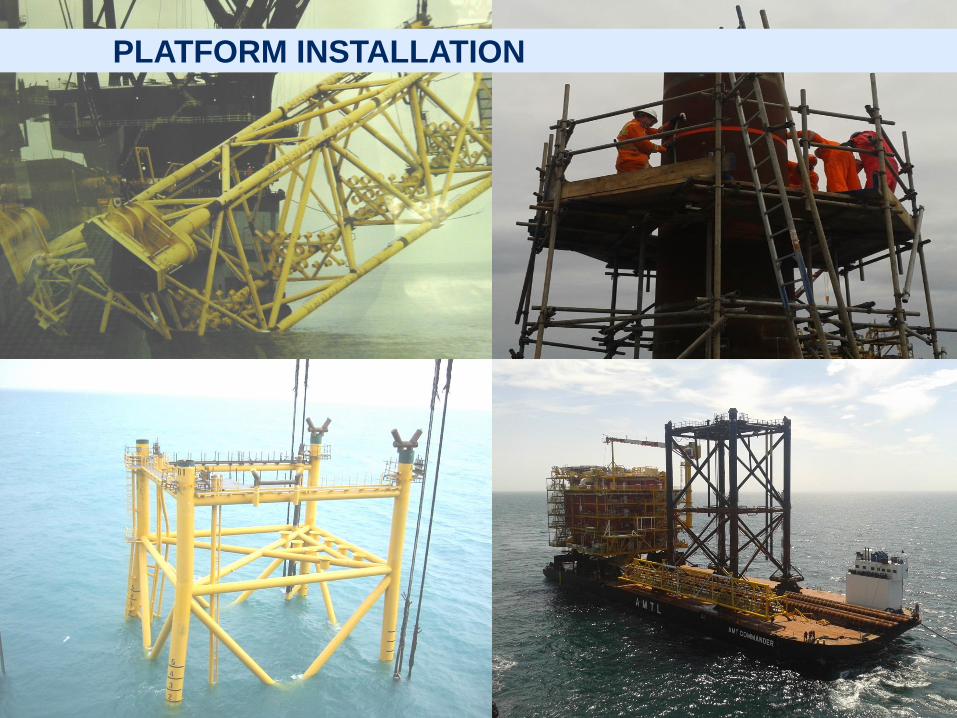
PLATFORM INSTALLATION
20
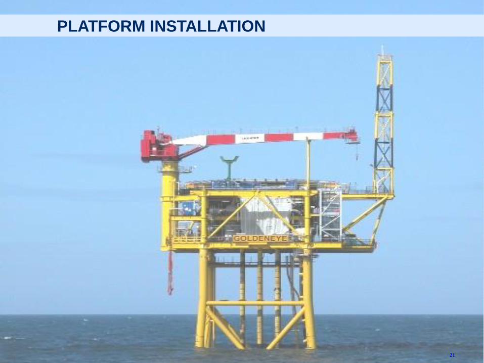
21
PLATFORM INSTALLATION
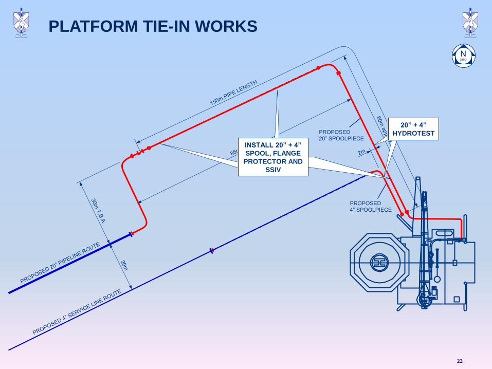
PROPOSED
20” SPOOLPIECE
PROPOSED
4” SPOOLPIECE
INSTALL 20” + 4”
SPOOL, FLANGE
PROTECTOR AND
SSIV
20” + 4”
HYDROTEST
22
PLATFORM TIE-IN WORKS
23
ROCK DUMPING
24
Geomatics Foundation
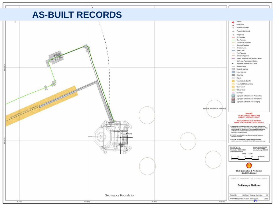
AS-BUILT RECORDS

Q + A
25