how do isotherms behave under different topographic...
TRANSCRIPT
de
pth
/tem
p
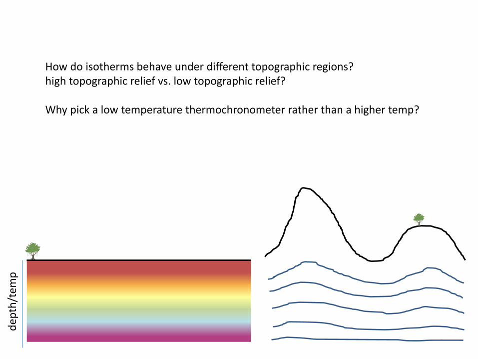
How do isotherms behave under different topographic regions? high topographic relief vs. low topographic relief? Why pick a low temperature thermochronometer rather than a higher temp?
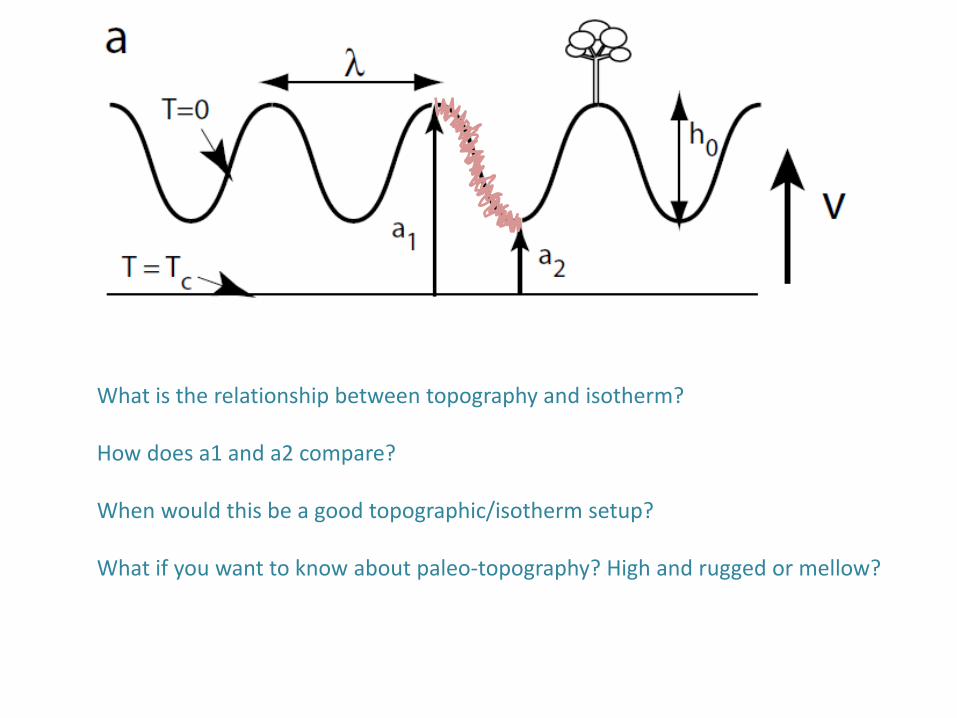
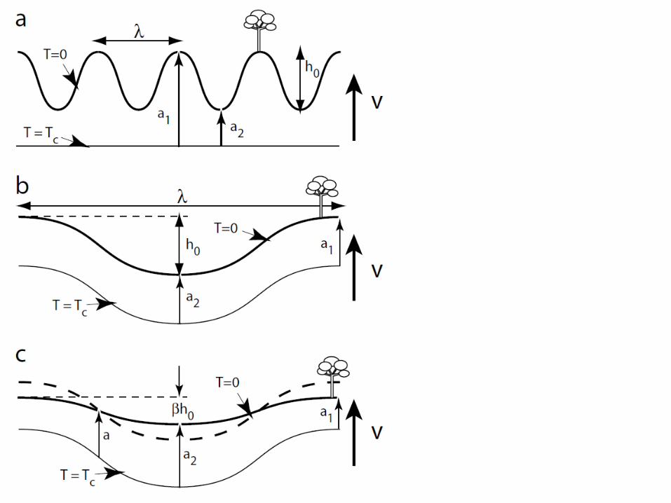
What is the relationship between topography and isotherm? How does a1 and a2 compare? When would this be a good topographic/isotherm setup? What if you want to know about paleo-topography? High and rugged or mellow?
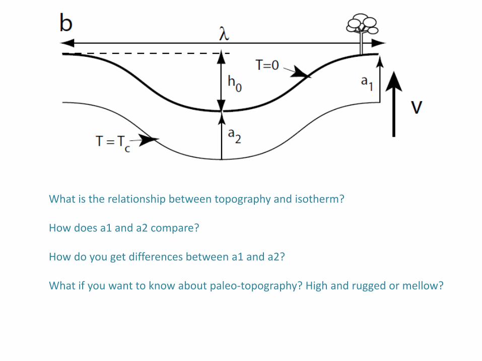
What is the relationship between topography and isotherm? How does a1 and a2 compare? How do you get differences between a1 and a2? What if you want to know about paleo-topography? High and rugged or mellow?
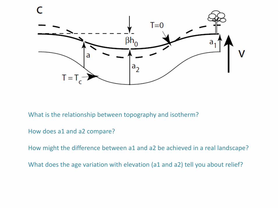
What is the relationship between topography and isotherm? How does a1 and a2 compare? How might the difference between a1 and a2 be achieved in a real landscape? What does the age variation with elevation (a1 and a2) tell you about relief?

To the Math
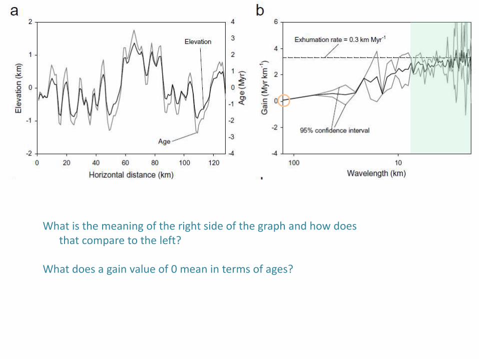
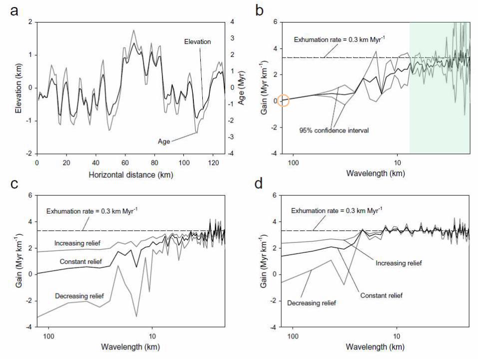
What is the meaning of the right side of the graph and how does that compare to the left? What does a gain value of 0 mean in terms of ages?
a
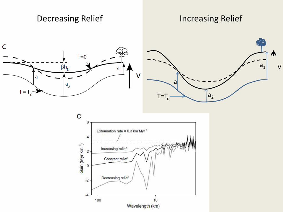
a1
a2 T=Tc
V
Decreasing Relief Increasing Relief
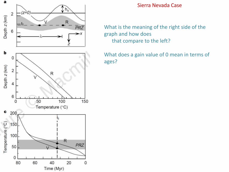
What is the meaning of the right side of the graph and how does that compare to the left? What does a gain value of 0 mean in terms of ages?
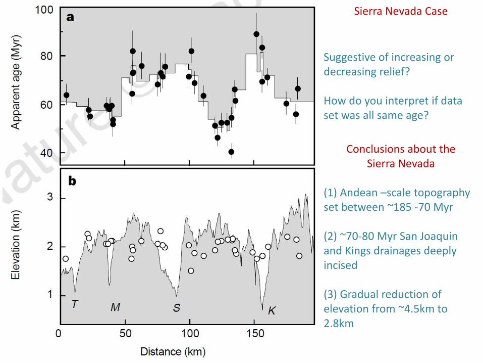
Sierra Nevada Case
Sierra Nevada Case
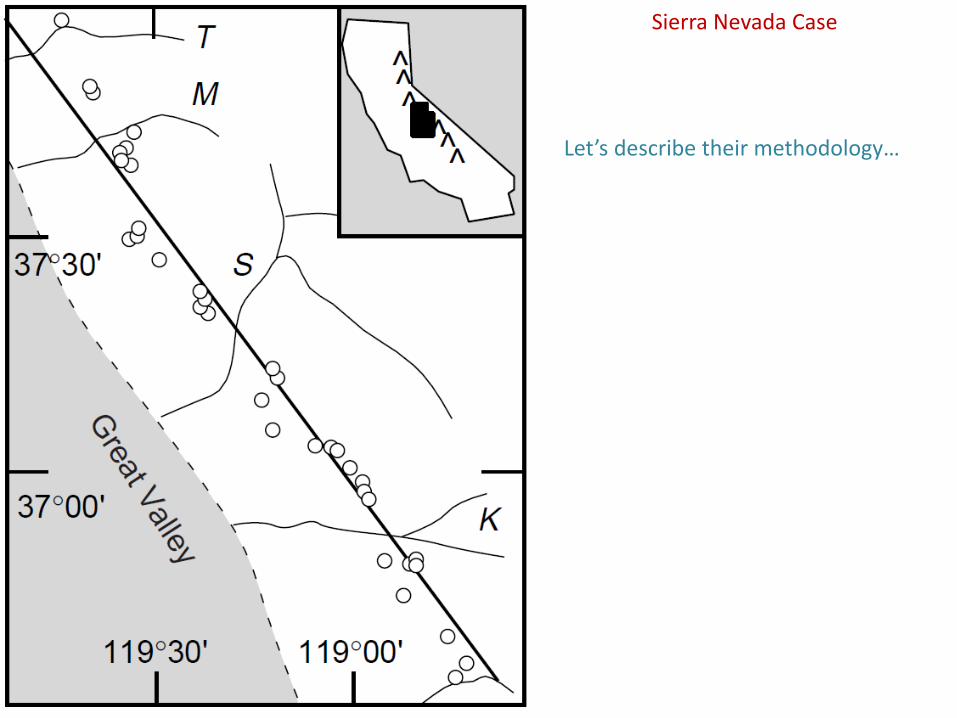
Let’s describe their methodology…
Sierra Nevada Case
Suggestive of increasing or decreasing relief? How do you interpret if data set was all same age?
Conclusions about the Sierra Nevada
(1) Andean –scale topography set between ~185 -70 Myr (2) ~70-80 Myr San Joaquin and Kings drainages deeply incised (3) Gradual reduction of elevation from ~4.5km to 2.8km
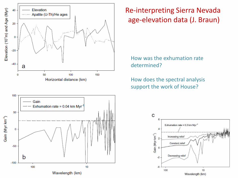
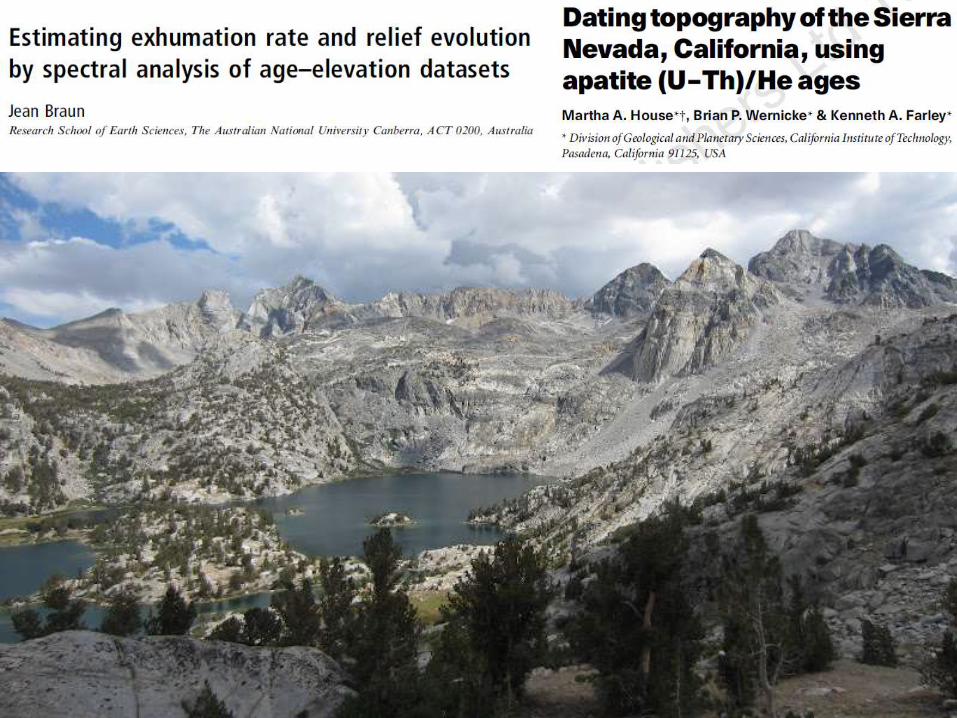
Re-interpreting Sierra Nevada age-elevation data (J. Braun)
How was the exhumation rate determined? How does the spectral analysis support the work of House?
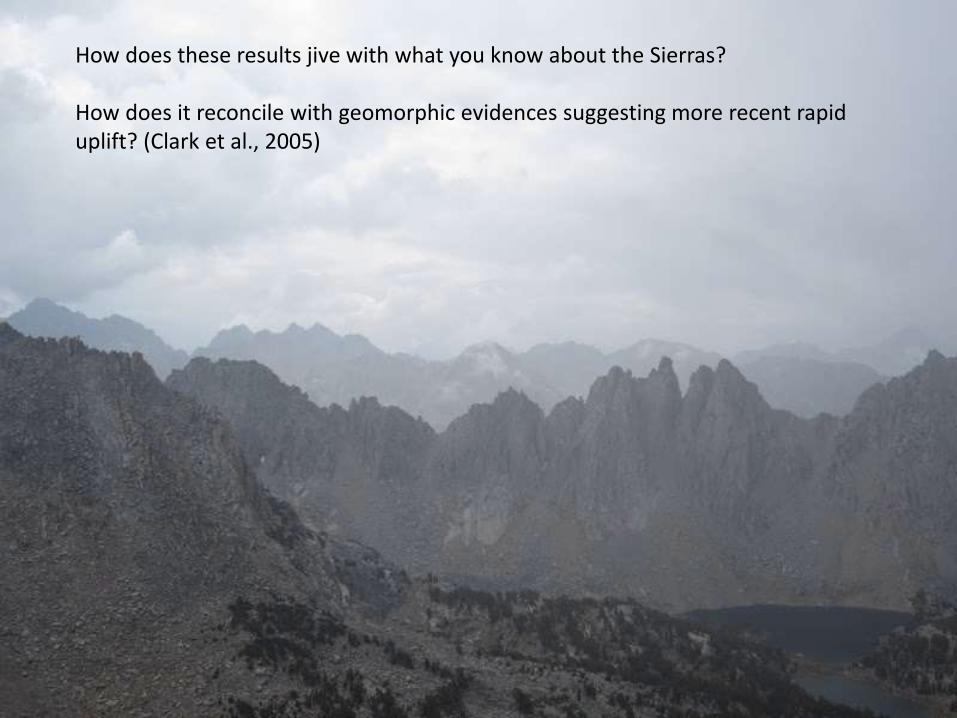
How does these results jive with what you know about the Sierras? How does it reconcile with geomorphic evidences suggesting more recent rapid uplift? (Clark et al., 2005)
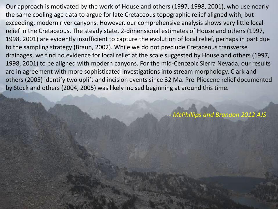
Our approach is motivated by the work of House and others (1997, 1998, 2001), who use nearly the same cooling age data to argue for late Cretaceous topographic relief aligned with, but exceeding, modern river canyons. However, our comprehensive analysis shows very little local relief in the Cretaceous. The steady state, 2-dimensional estimates of House and others (1997, 1998, 2001) are evidently insufficient to capture the evolution of local relief, perhaps in part due to the sampling strategy (Braun, 2002). While we do not preclude Cretaceous transverse drainages, we find no evidence for local relief at the scale suggested by House and others (1997, 1998, 2001) to be aligned with modern canyons. For the mid-Cenozoic Sierra Nevada, our results are in agreement with more sophisticated investigations into stream morphology. Clark and others (2005) identify two uplift and incision events since 32 Ma. Pre-Pliocene relief documented by Stock and others (2004, 2005) was likely incised beginning at around this time.
- McPhillips and Brandon 2012 AJS
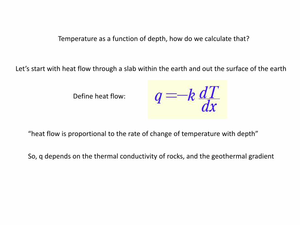
Temperature as a function of depth, how do we calculate that?
Let’s start with heat flow through a slab within the earth and out the surface of the earth
Define heat flow:
“heat flow is proportional to the rate of change of temperature with depth”
So, q depends on the thermal conductivity of rocks, and the geothermal gradient
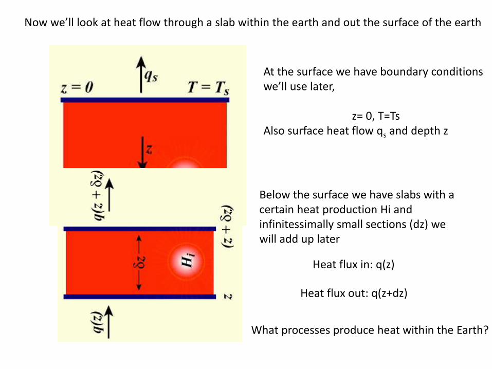
Now we’ll look at heat flow through a slab within the earth and out the surface of the earth
At the surface we have boundary conditions we’ll use later,
z= 0, T=Ts Also surface heat flow qs and depth z
Below the surface we have slabs with a certain heat production Hi and infinitessimally small sections (dz) we will add up later
What processes produce heat within the Earth?
Heat flux in: q(z)
Heat flux out: q(z+dz)
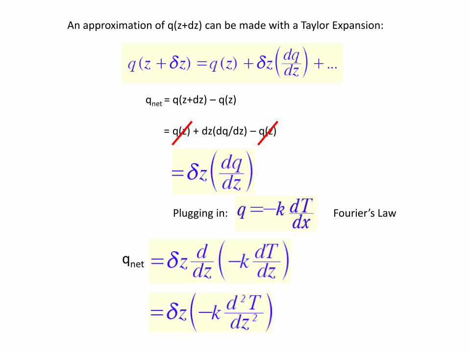
An approximation of q(z+dz) can be made with a Taylor Expansion:
qnet = q(z+dz) – q(z)
= q(z) + dz(dq/dz) – q(z)
Plugging in: Fourier’s Law
qnet
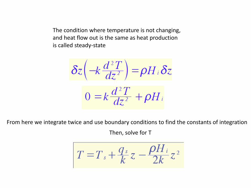
The condition where temperature is not changing, and heat flow out is the same as heat production is called steady-state
From here we integrate twice and use boundary conditions to find the constants of integration
Then, solve for T
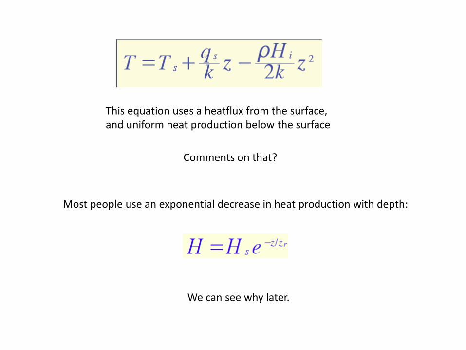
This equation uses a heatflux from the surface, and uniform heat production below the surface
Comments on that?
Most people use an exponential decrease in heat production with depth:
We can see why later.
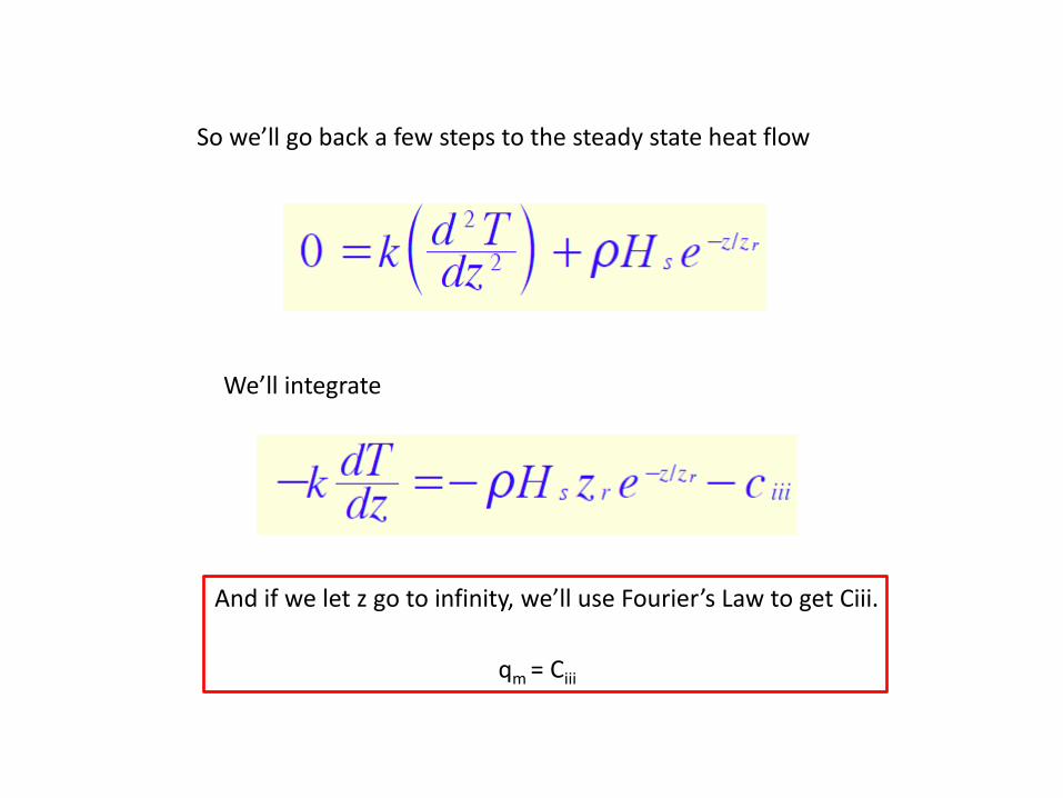
So we’ll go back a few steps to the steady state heat flow
We’ll integrate
And if we let z go to infinity, we’ll use Fourier’s Law to get Ciii.
qm = Ciii
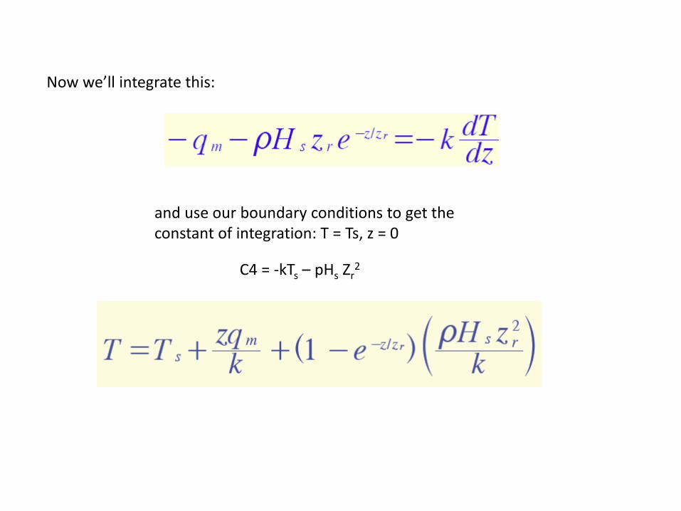
Now we’ll integrate this:
and use our boundary conditions to get the constant of integration: T = Ts, z = 0
C4 = -kTs – pHs Zr2
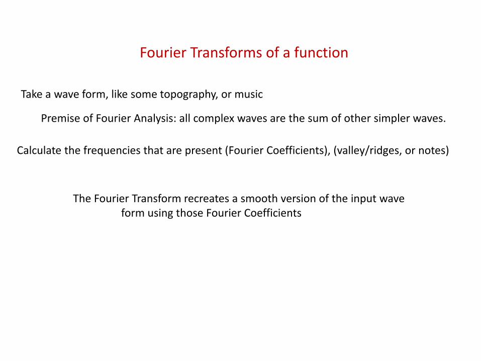
Fourier Transforms of a function
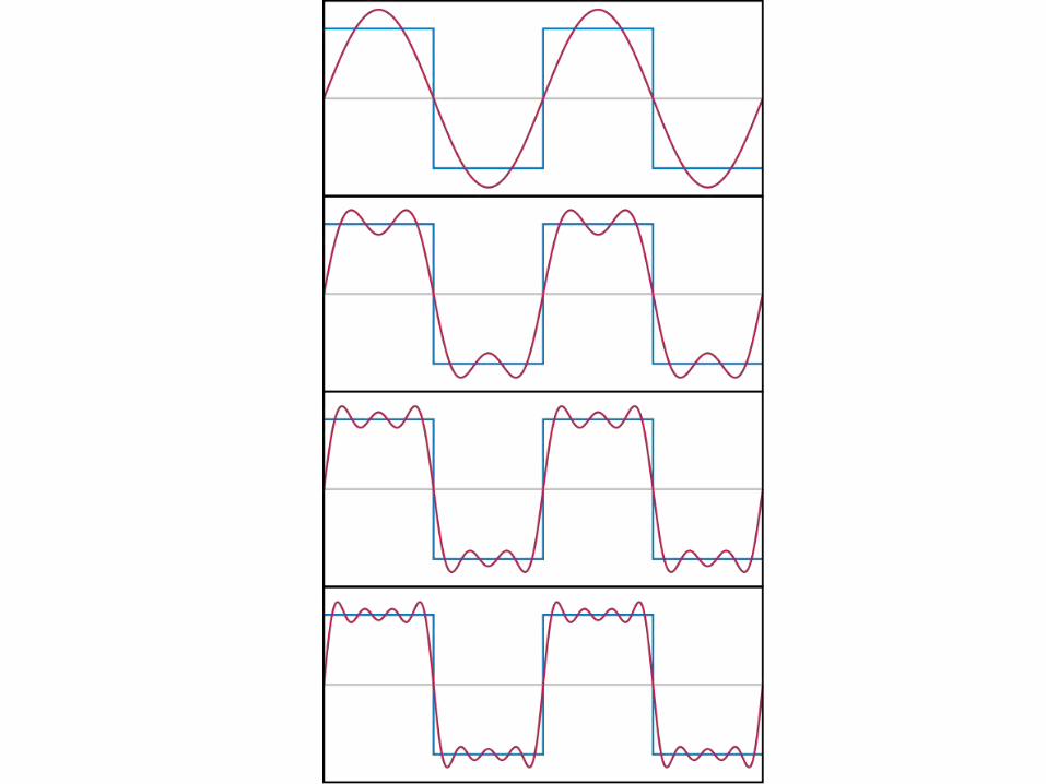
Take a wave form, like some topography, or music
Calculate the frequencies that are present (Fourier Coefficients), (valley/ridges, or notes)
The Fourier Transform recreates a smooth version of the input wave form using those Fourier Coefficients
Premise of Fourier Analysis: all complex waves are the sum of other simpler waves.
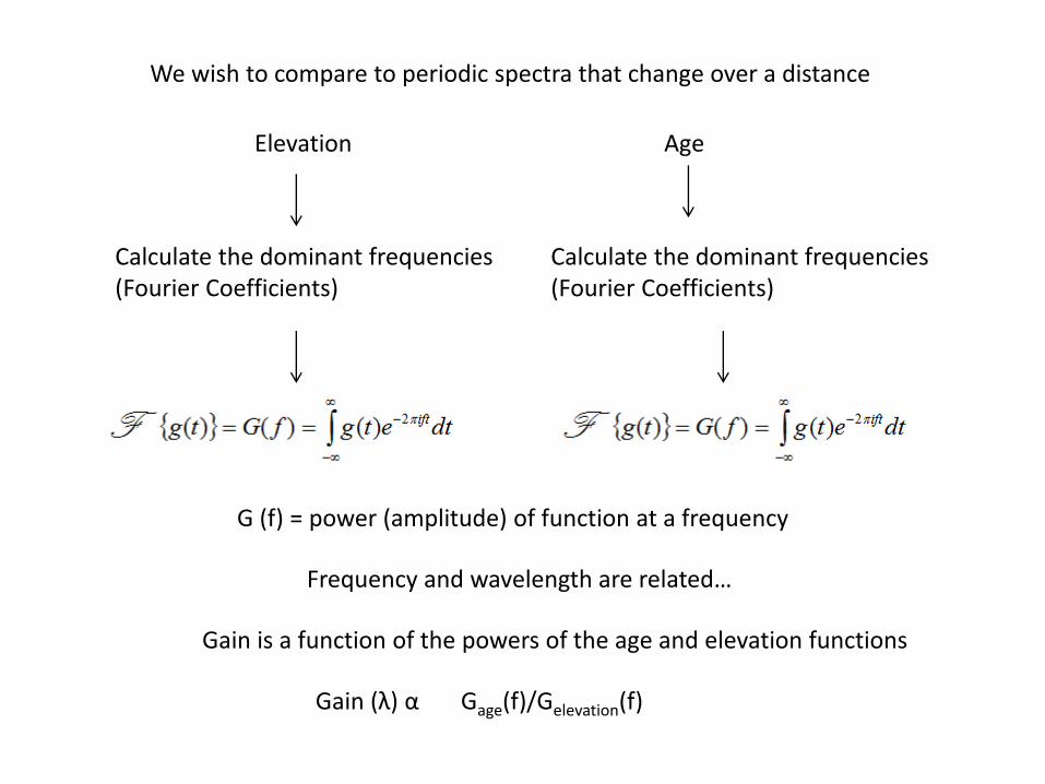
Elevation Age
We wish to compare to periodic spectra that change over a distance
Calculate the dominant frequencies (Fourier Coefficients)
Calculate the dominant frequencies (Fourier Coefficients)
G (f) = power (amplitude) of function at a frequency
Frequency and wavelength are related…
Gage(f)/Gelevation(f)
Gain is a function of the powers of the age and elevation functions
Gain (λ) α