history and current status of the corvallis mill race
TRANSCRIPT
THE CORVALLIS MILL RACE
An Urban Orphan?
Phillip Sollins, College of Forestry, Oregon State UniversityProfessor of Forest Ecology and Soils, Emeritus
June 15, 2015
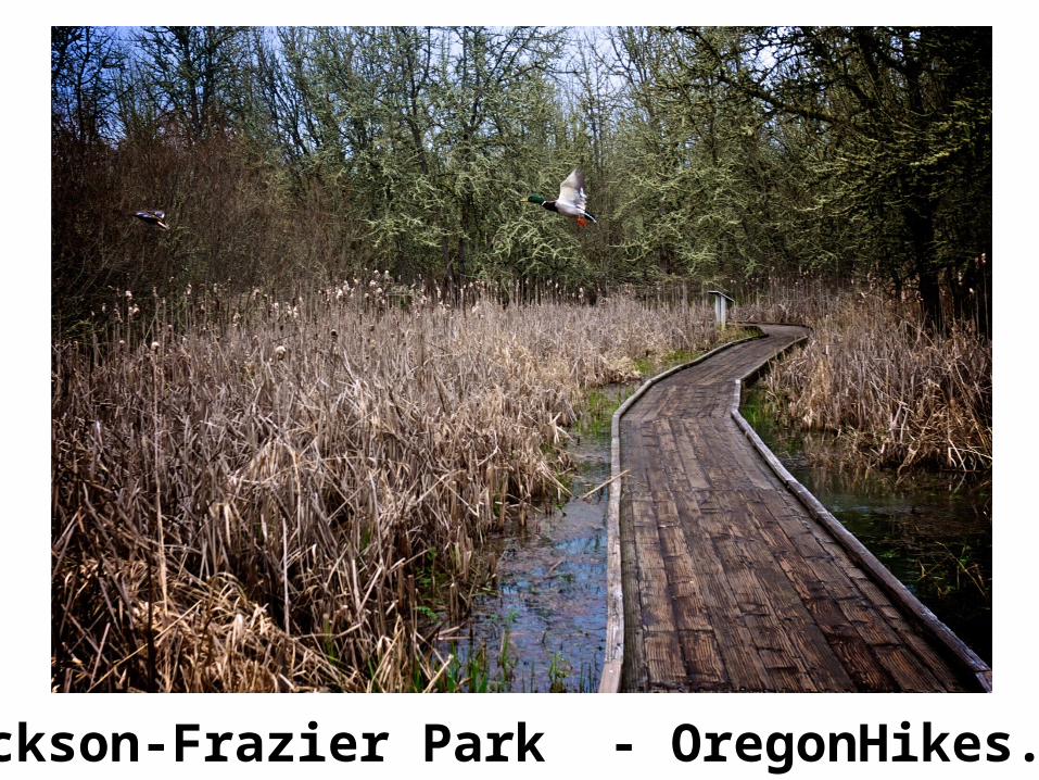
Jackson-Frazier Park - OregonHikes.net
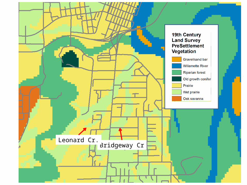
Bridgeway CrLeonard Cr.
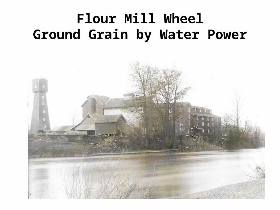
Flour Mill WheelGround Grain by Water Power
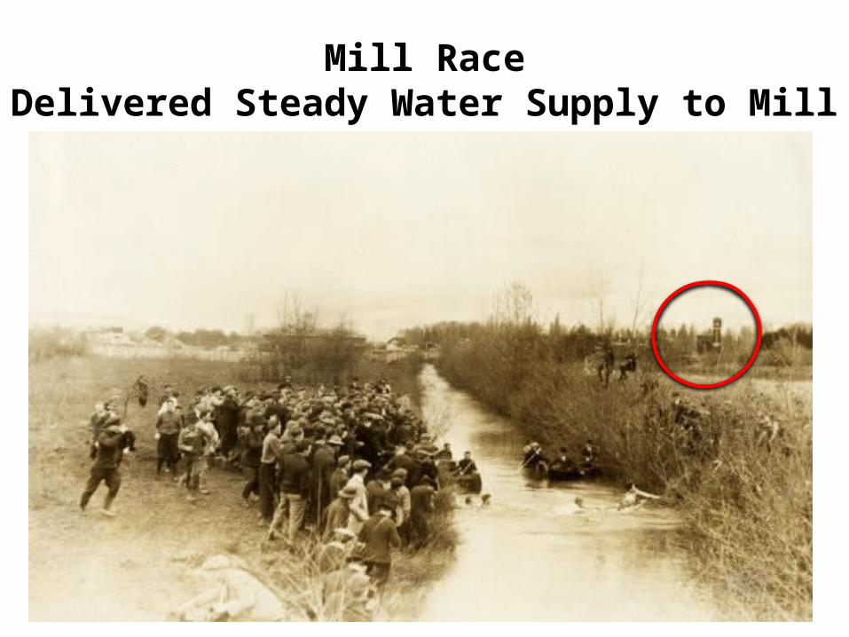
Mill RaceDelivered Steady Water Supply to Mill
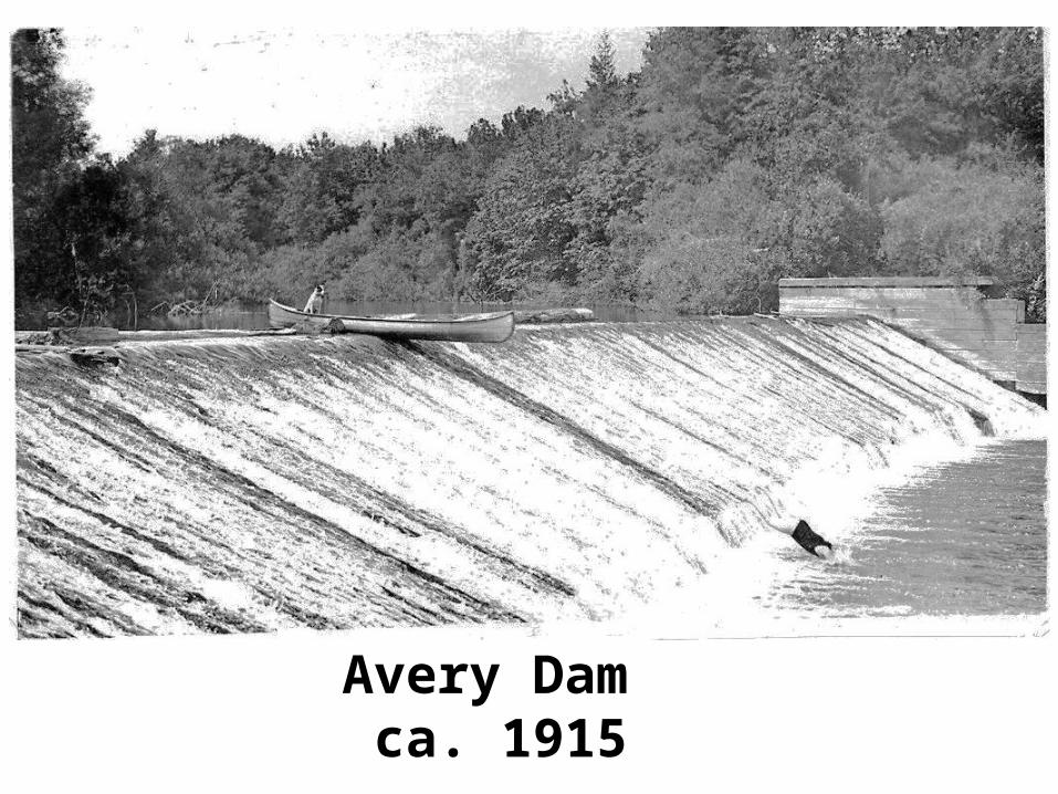
Avery Dam ca. 1915
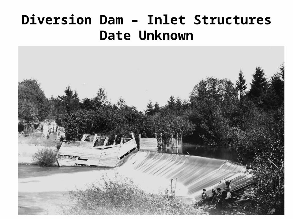
Diversion Dam – Inlet StructuresDate Unknown
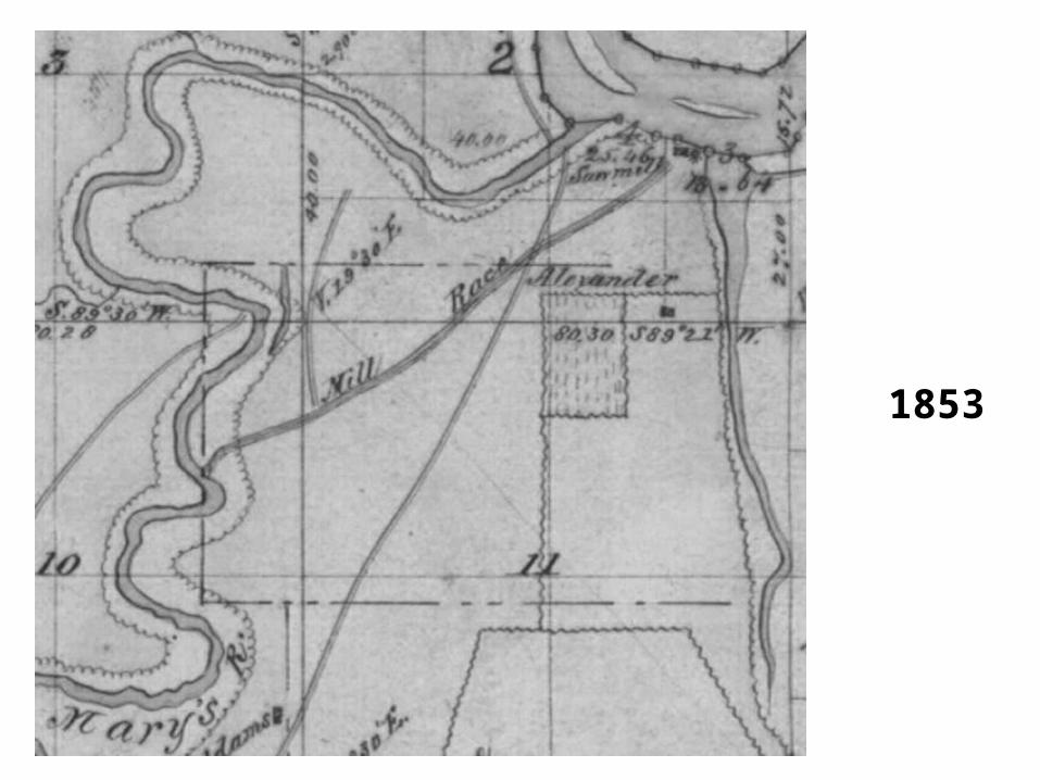
1853
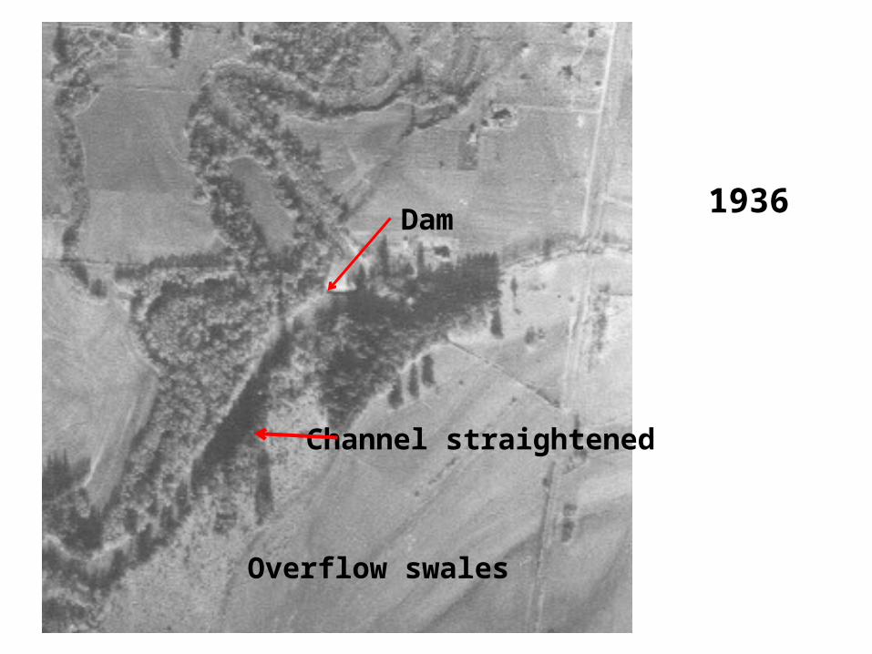
1936Dam
Channel straightened
Overflow swales
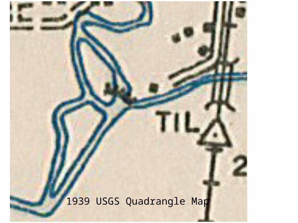
1939 USGS Quadrangle Map
1944
Dam
Spillway
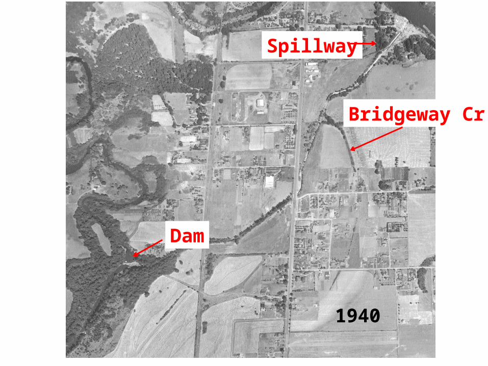
1940
Dam
Spillway
Bridgeway Cr.
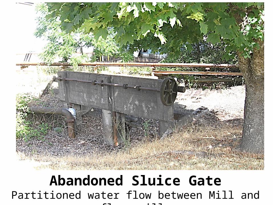
Abandoned Sluice GatePartitioned water flow between Mill and overflow spillway
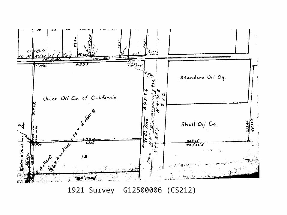
1921 Survey G12500006 (CS212)
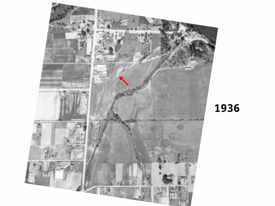
1936
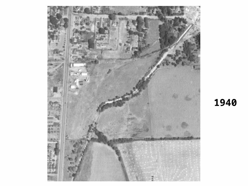
1940
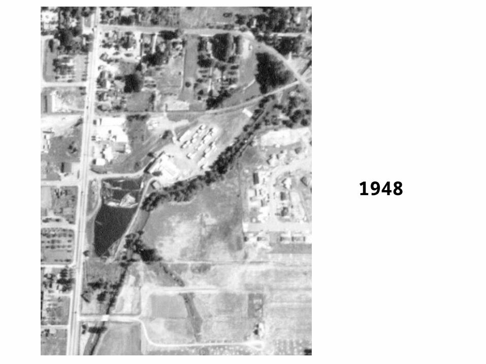
1948
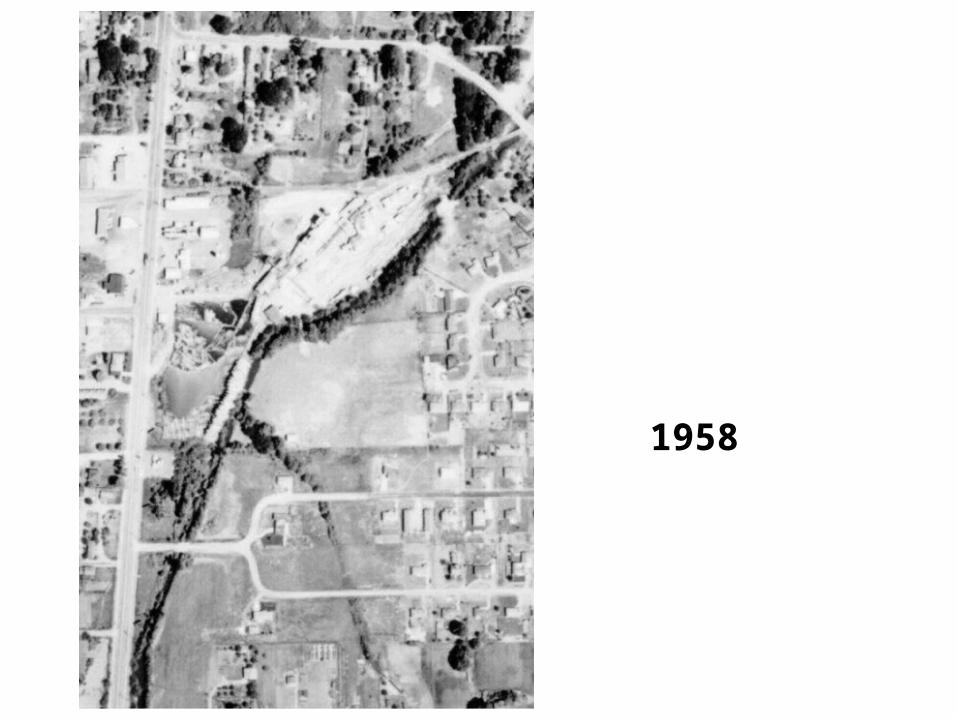
1958
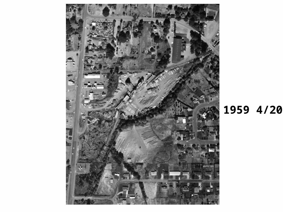
1959 4/20
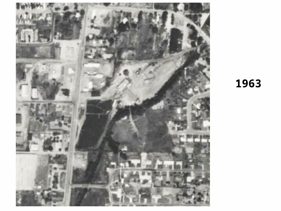
1963
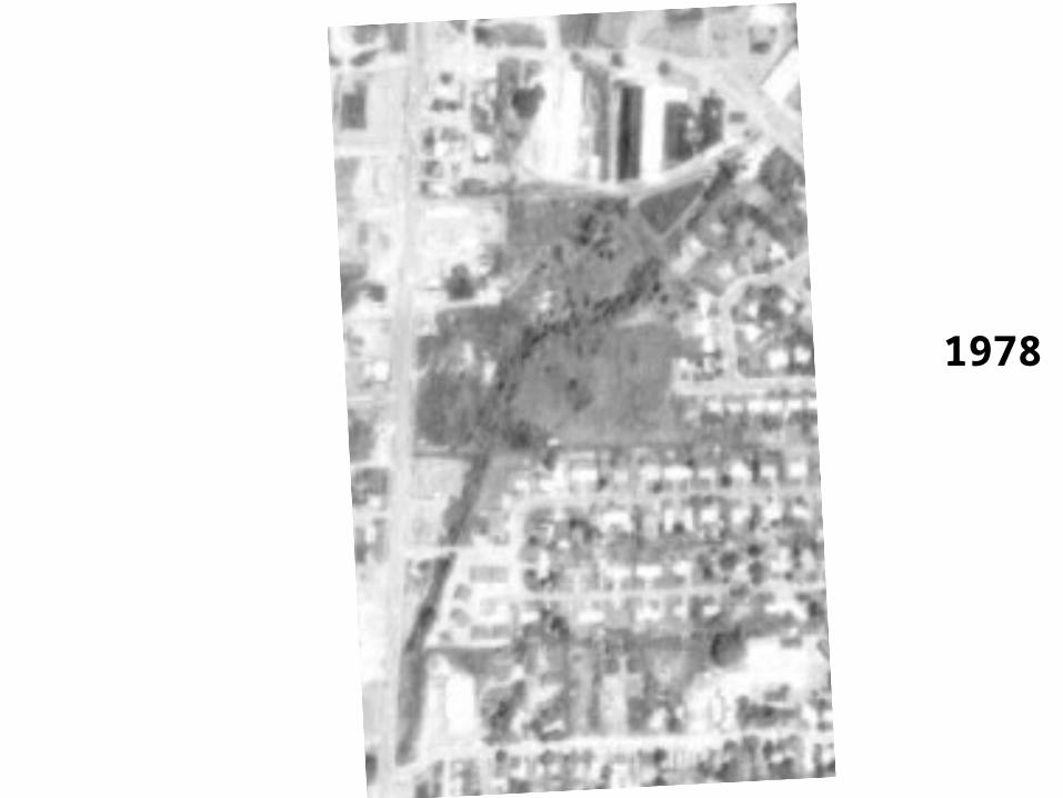
1978
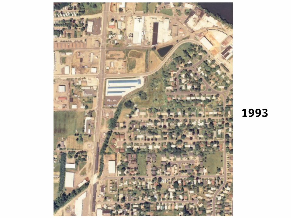
1993
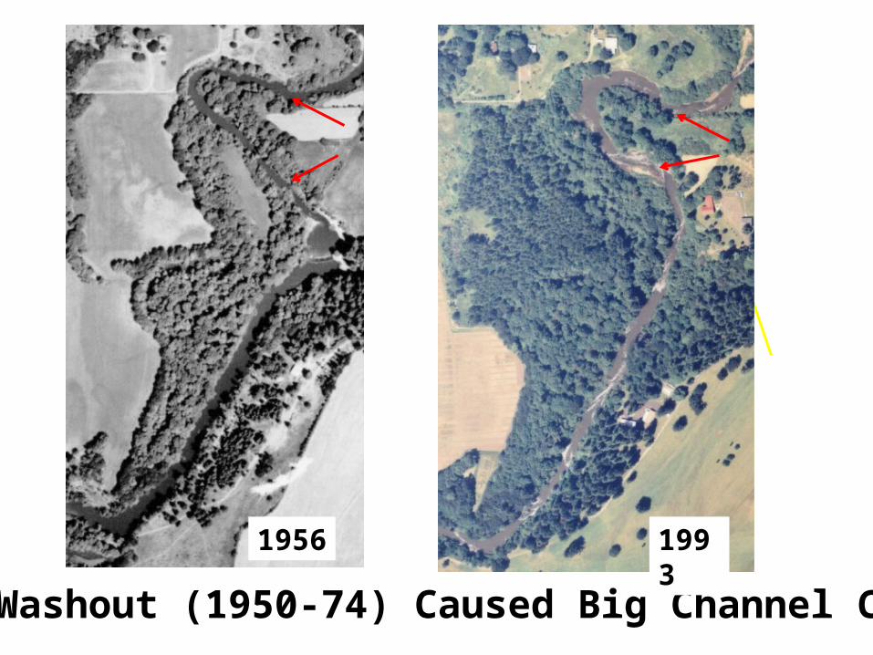
Dam Washout (1950-74) Caused Big Channel Change
1956 1993
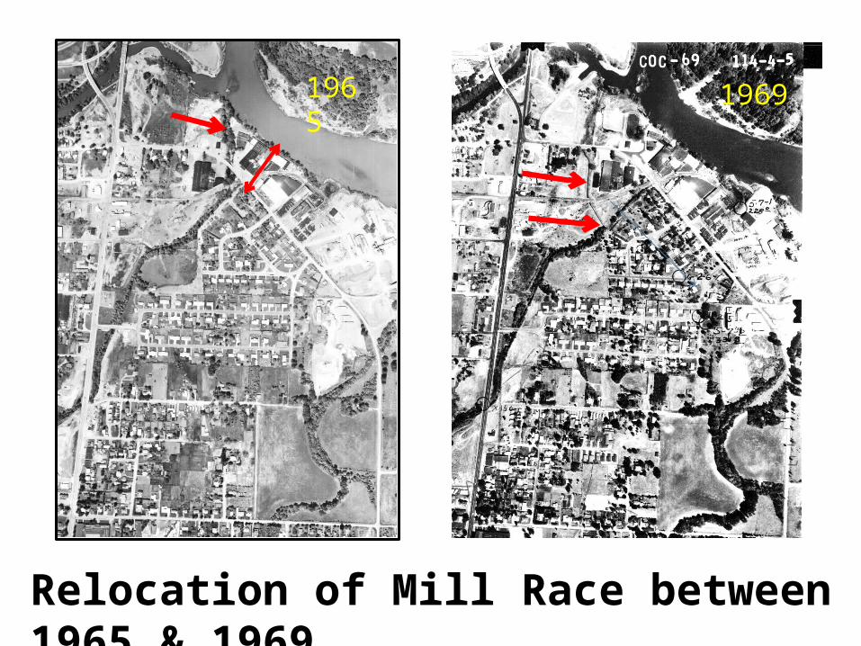
Relocation of Mill Race between 1965 & 1969
19691965
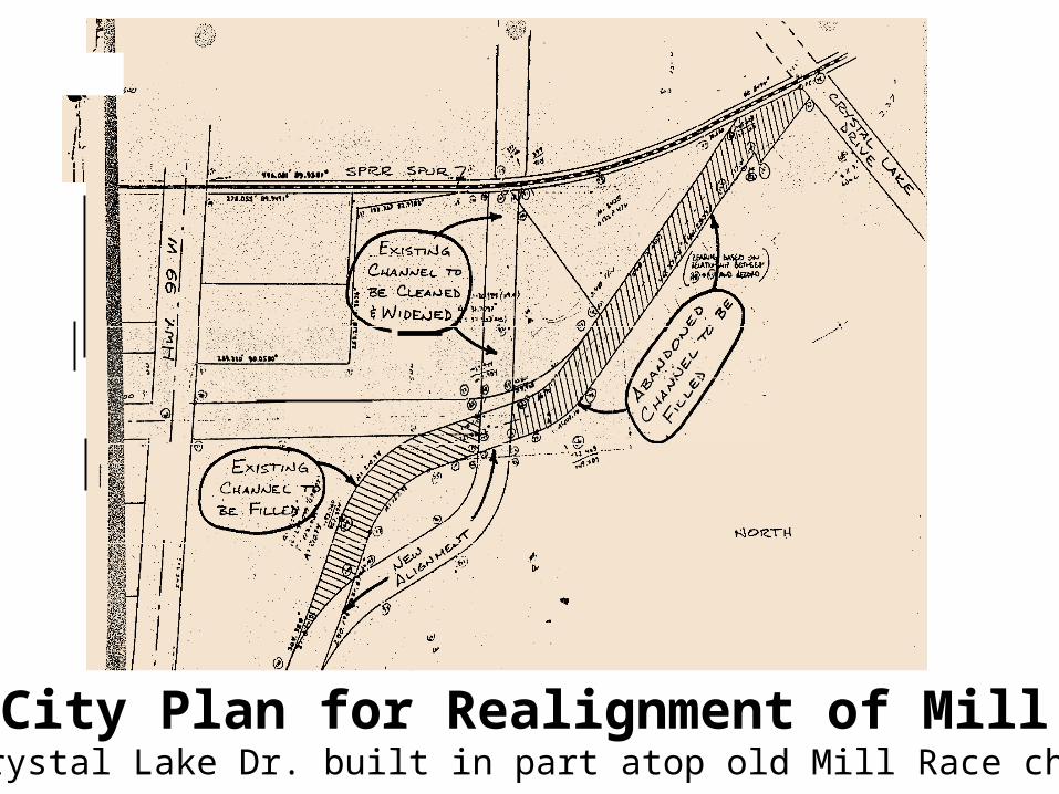
1981 City Plan for Realignment of Mill RaceNew Crystal Lake Dr. built in part atop old Mill Race channel
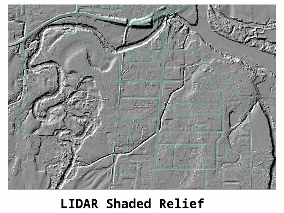
LIDAR Shaded Relief
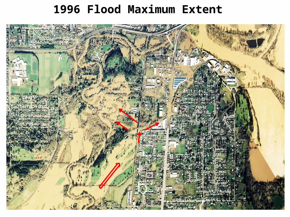
1996 Flood Maximum Extent
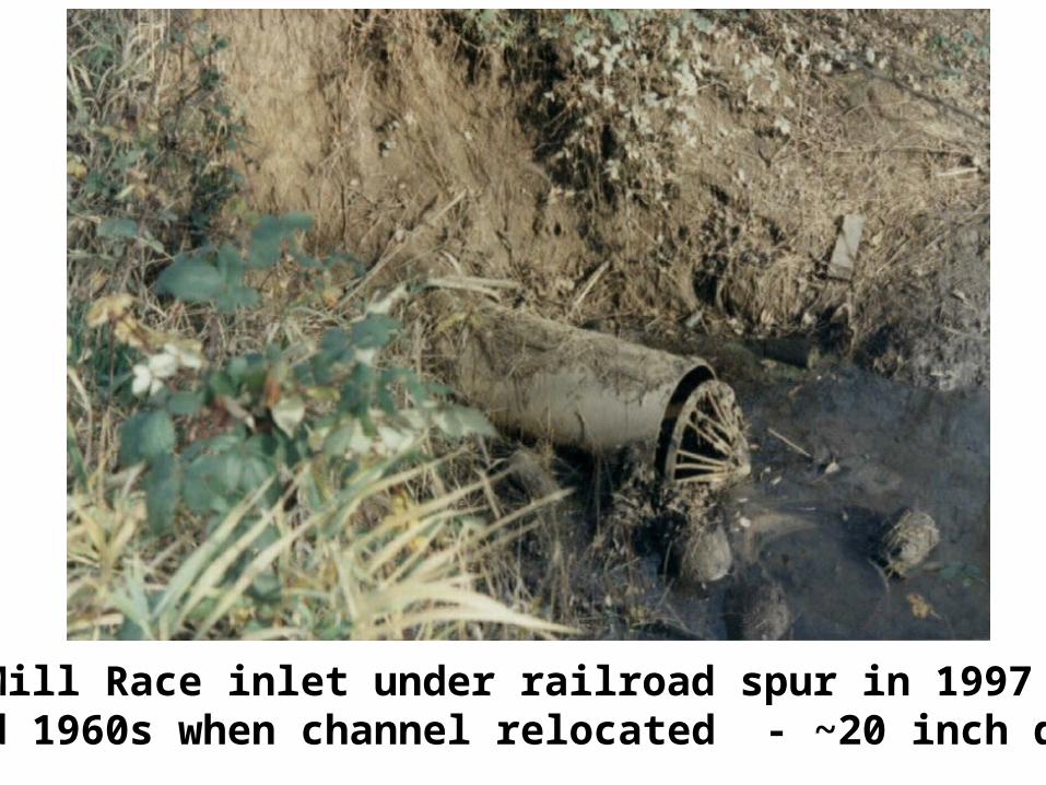
Mill Race inlet under railroad spur in 1997 Installed 1960s when channel relocated - ~20 inch diameter
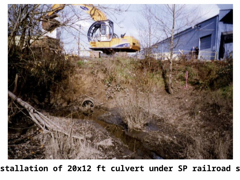
Day 1 – Installation of 20x12 ft culvert under SP railroad spur (1997)
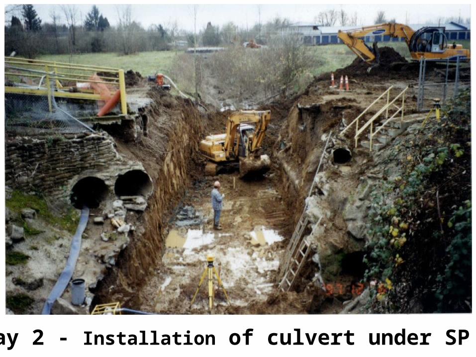
1997 – Day 2 - Installation of culvert under SP rr spur
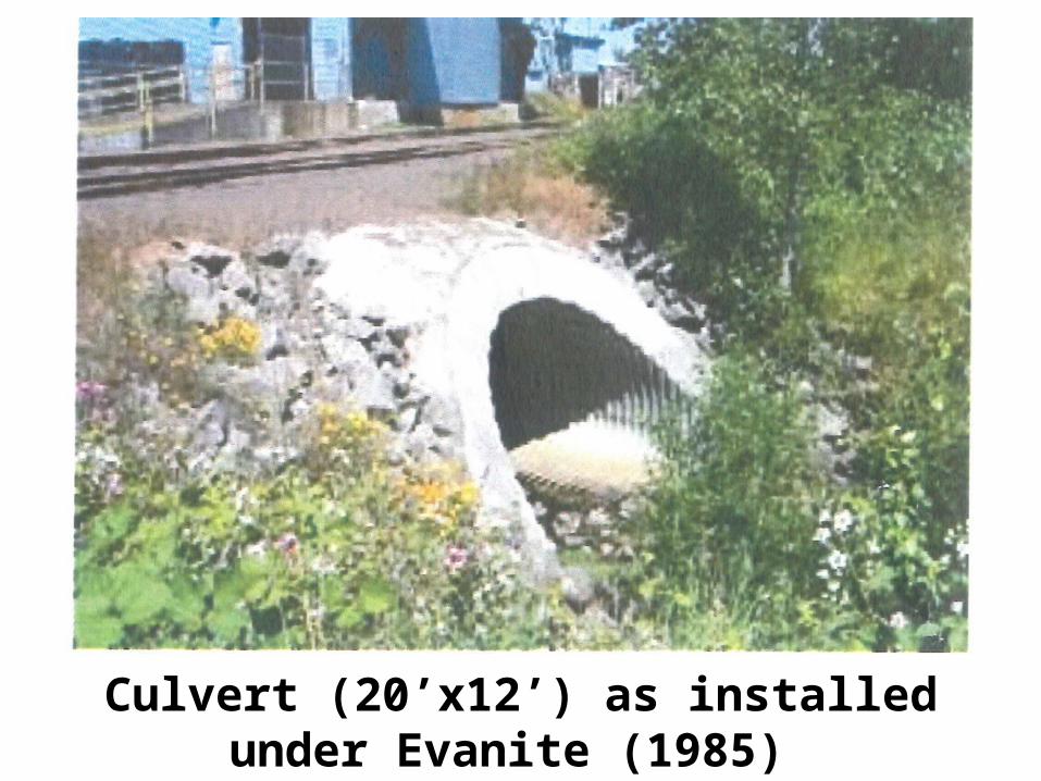
Culvert (20’x12’) as installed under Evanite (1985) & Southern Pacific RR spur (1997)
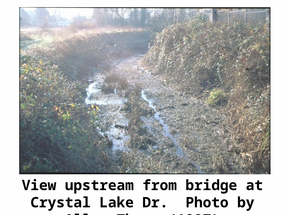
View upstream from bridge at Crystal Lake Dr. Photo by Allen Throop(1997)
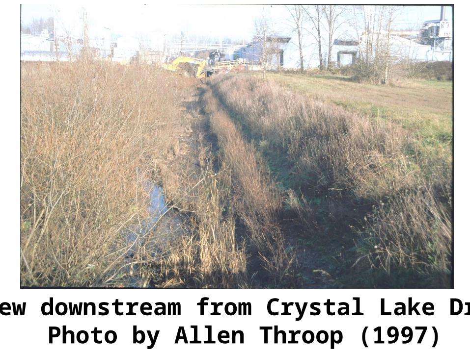
View downstream from Crystal Lake Dr. Photo by Allen Throop (1997)
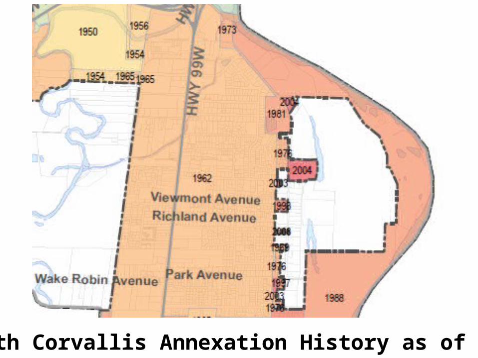
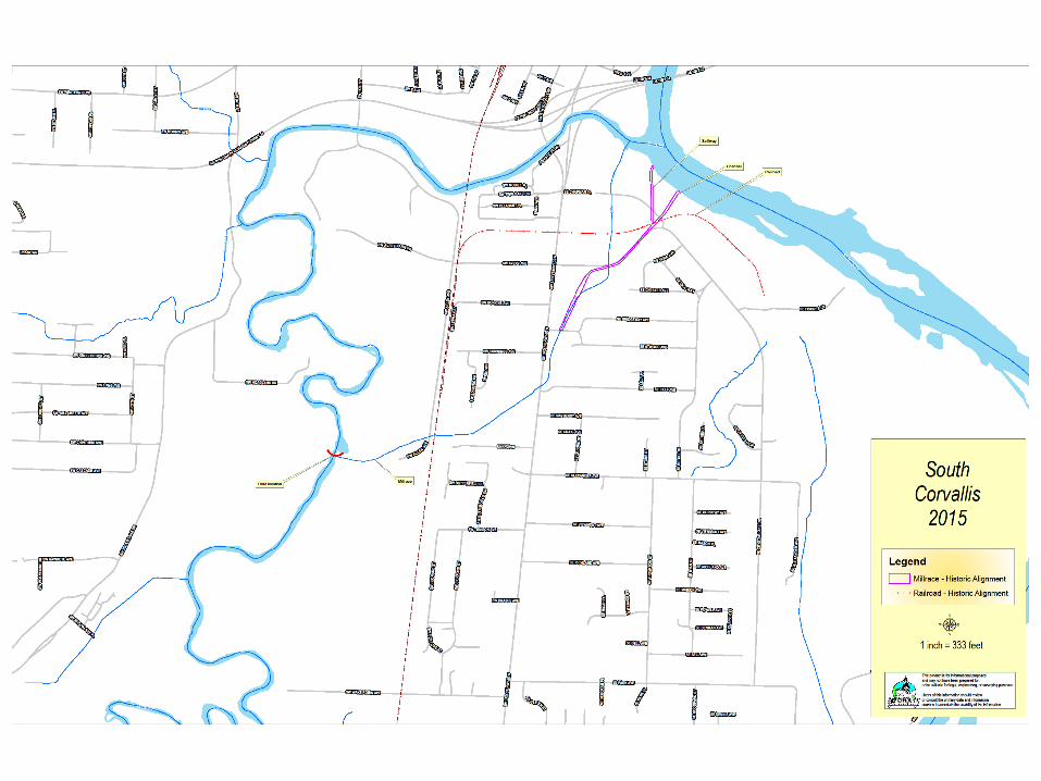
South Corvallis Annexation History as of 2011
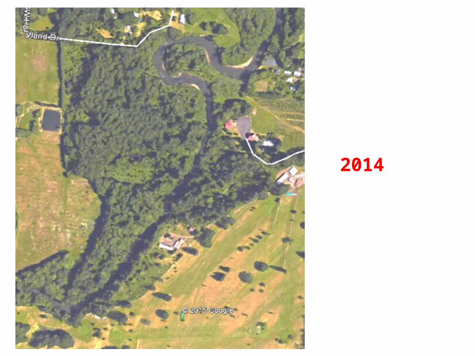
2014
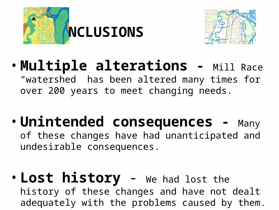
CONCLUSIONS
• Multiple alterations - Mill Race “watershed” has been altered many times for over 200 years to meet changing needs.
• Unintended consequences - Many of these changes have had unanticipated and undesirable consequences.
• Lost history - We had lost the history of these changes and have not dealt adequately with the problems caused by them.
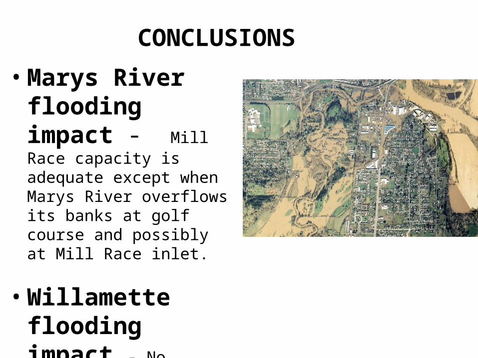
• Marys River flooding impact - Mill Race capacity is adequate except when Marys River overflows its banks at golf course and possibly at Mill Race inlet.
• Willamette flooding impact - No alterations to the Mill Race will eliminate the periodic flooding of South Corvallis by the Willamette.
CONCLUSIONS
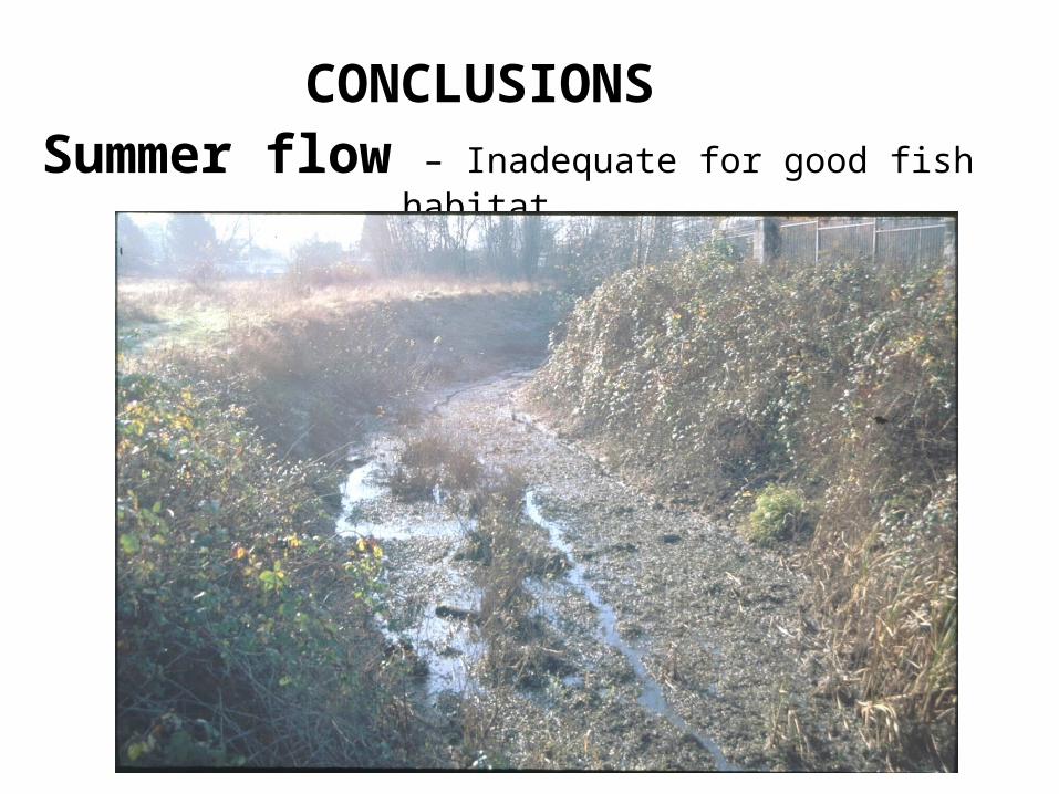
Summer flow – Inadequate for good fish habitat.
CONCLUSIONS
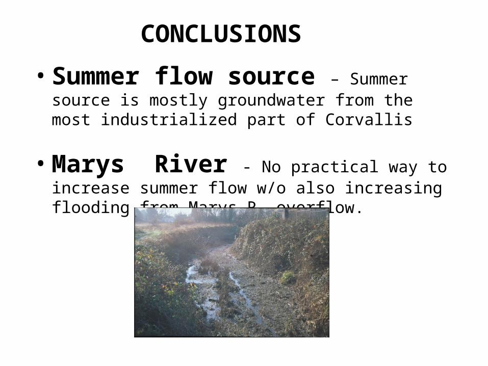
• Summer flow source – Summer source is mostly groundwater from the most industrialized part of Corvallis
• Marys River - No practical way to increase summer flow w/o also increasing flooding from Marys R. overflow.
CONCLUSIONS
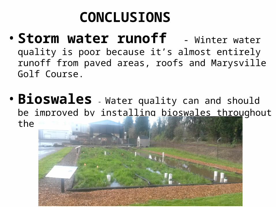
• Storm water runoff - Winter water quality is poor because it’s almost entirely runoff from paved areas, roofs and Marysville Golf Course.
• Bioswales - Water quality can and should be improved by installing bioswales throughout the watershed.
CONCLUSIONS
Acknowledgements
Doug Sackinger, Joe Mardis, Jason Hotchkiss (Benton County)Linda Stevens, Kevin Loso, Clay Brooks, and Matt Gressel (City of Corvallis); Mary Gallagher (Benton County Historical Museum)Dave Eckert (Corvallis Sustainability Coalition, Water Action Team)Bill Gellatly (Marys River Watershed Council)Charles Newlin (long-time Allen Street resident)Meghna Babbar-Sebens (OSU College of Engineering) Anita Ragan (H&V)Bill Pepper (Pepper Construction) OSU LibraryU of O Aerial Photo Library
Literature Cited
Christy JA, Alverson ER (2011) Historical vegetation of the Willamette Valley, Oregon, circa 1850. Northwest Science, 85, 93–107.