hamilton pier 7&8 - city of hamilton, ontario, … pier 7&8 draft urban design plan public...
TRANSCRIPT
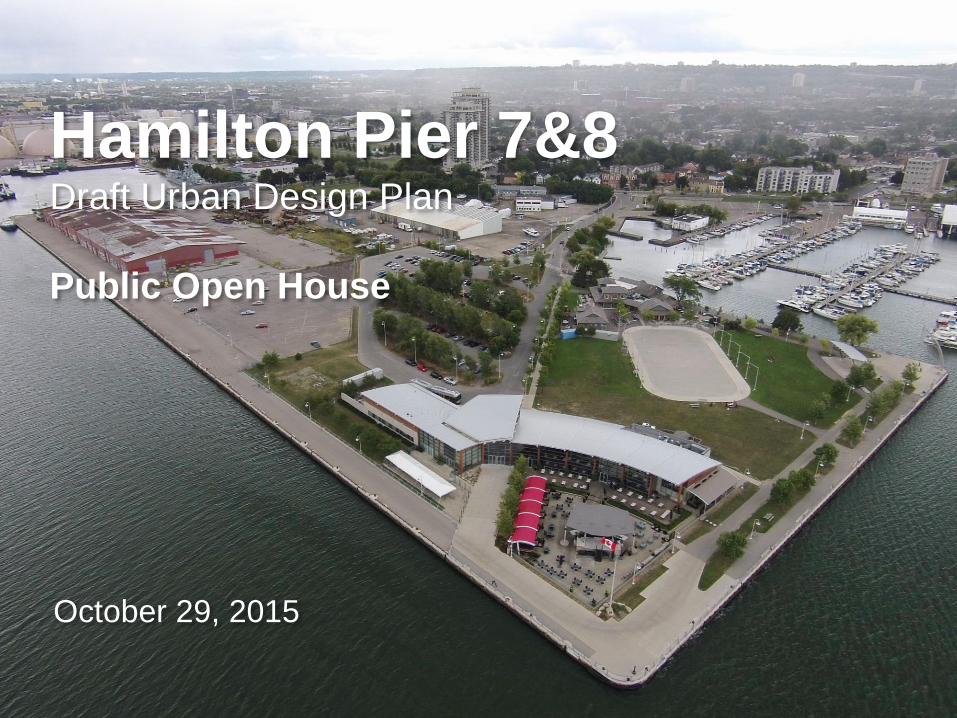
Hamilton Pier 7&8Draft Urban Design Plan
Public Open House
October 29, 2015
Contents
1. Study Overview2. Area Design Goals3. Urban Structure 4. Public Realm 5. Urban Design Plan Options6. Next Steps
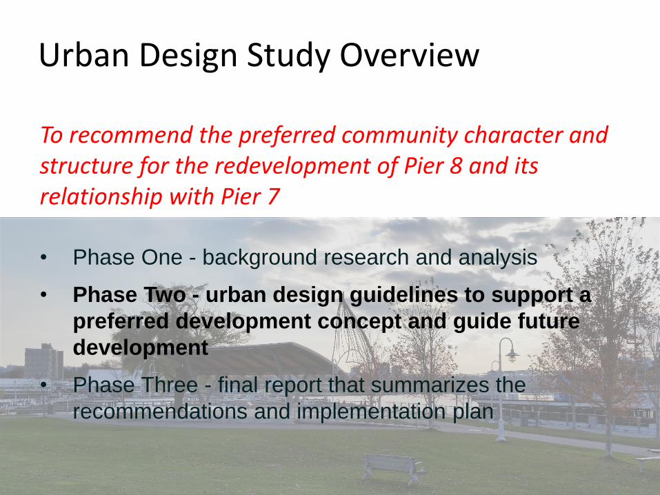
Urban Design Study Overview
To recommend the preferred community character and structure for the redevelopment of Pier 8 and its relationship with Pier 7
• Phase One - background research and analysis
• Phase Two - urban design guidelines to support a
preferred development concept and guide future
development
• Phase Three - final report that summarizes the
recommendations and implementation plan
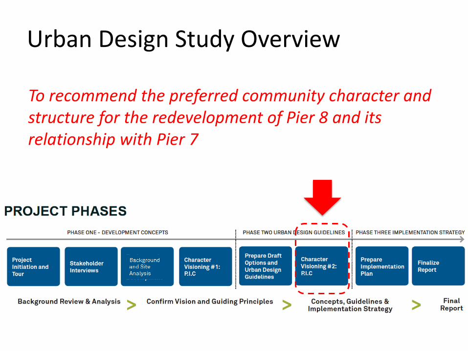
Urban Design Study Overview
To recommend the preferred community character and structure for the redevelopment of Pier 8 and its relationship with Pier 7
We are here
Policy Structure Guidance
• Building Heights: 3-8 Storeys
• Open Spaces: Existing and continuous along the
shoreline – approximately 30 metres wide
• Road and Trails: Recommends future and existing
road and trail connections
• Setting Sail Guiding Principles:1. Promote a healthy harbour; 2. Strengthen existing neighbourhoods; 3. Provide safe, continuous public access along the water’s edge; 4. Create a diverse, balanced and animated waterfront; 5. Enhance physical and visual connections; 6. Promote a balanced transportation network; 7. Celebrate the City’s heritage; and, 8. Promote excellence in design.
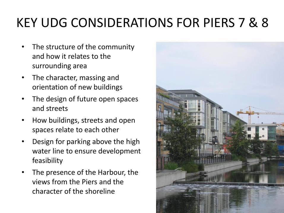
KEY UDG CONSIDERATIONS FOR PIERS 7 & 8
• The structure of the community and how it relates to the surrounding area
• The character, massing and orientation of new buildings
• The design of future open spaces and streets
• How buildings, streets and open spaces relate to each other
• Design for parking above the high water line to ensure development feasibility
• The presence of the Harbour, the views from the Piers and the character of the shoreline
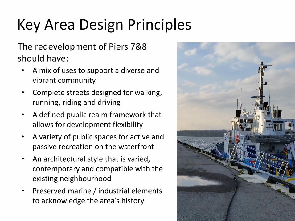
Key Area Design PrinciplesThe redevelopment of Piers 7&8 should have:• A mix of uses to support a diverse and
vibrant community
• Complete streets designed for walking, running, riding and driving
• A defined public realm framework that allows for development flexibility
• A variety of public spaces for active and passive recreation on the waterfront
• An architectural style that is varied, contemporary and compatible with the existing neighbourhood
• Preserved marine / industrial elements to acknowledge the area’s history
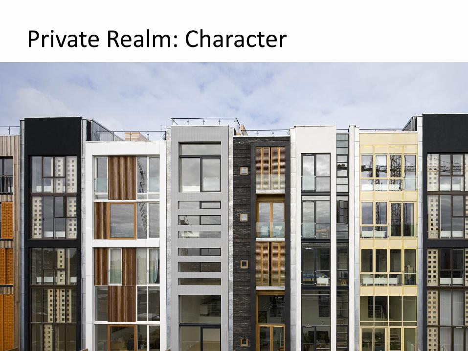
Private Realm: Character

Private Realm: Sustainability

Private Realm: Façade Design

Private Realm: Parking
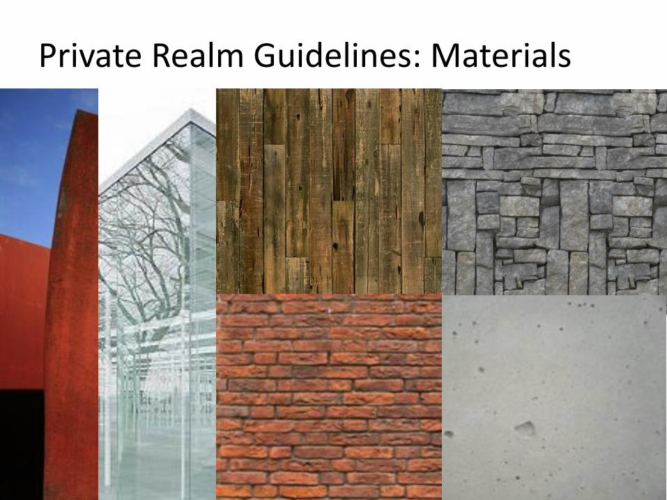
Private Realm Guidelines: Materials
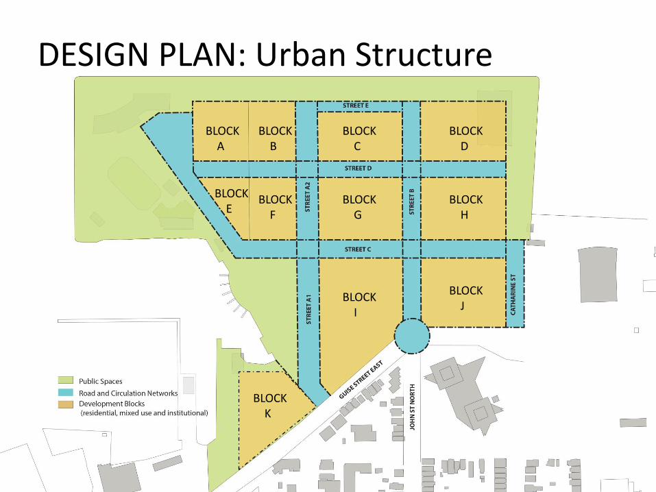
DESIGN PLAN: Urban Structure
BLOCKA
BLOCKB
BLOCKC
BLOCKD
BLOCKE
BLOCKG
BLOCKH
BLOCKI
BLOCKJ
BLOCKK
BLOCKF
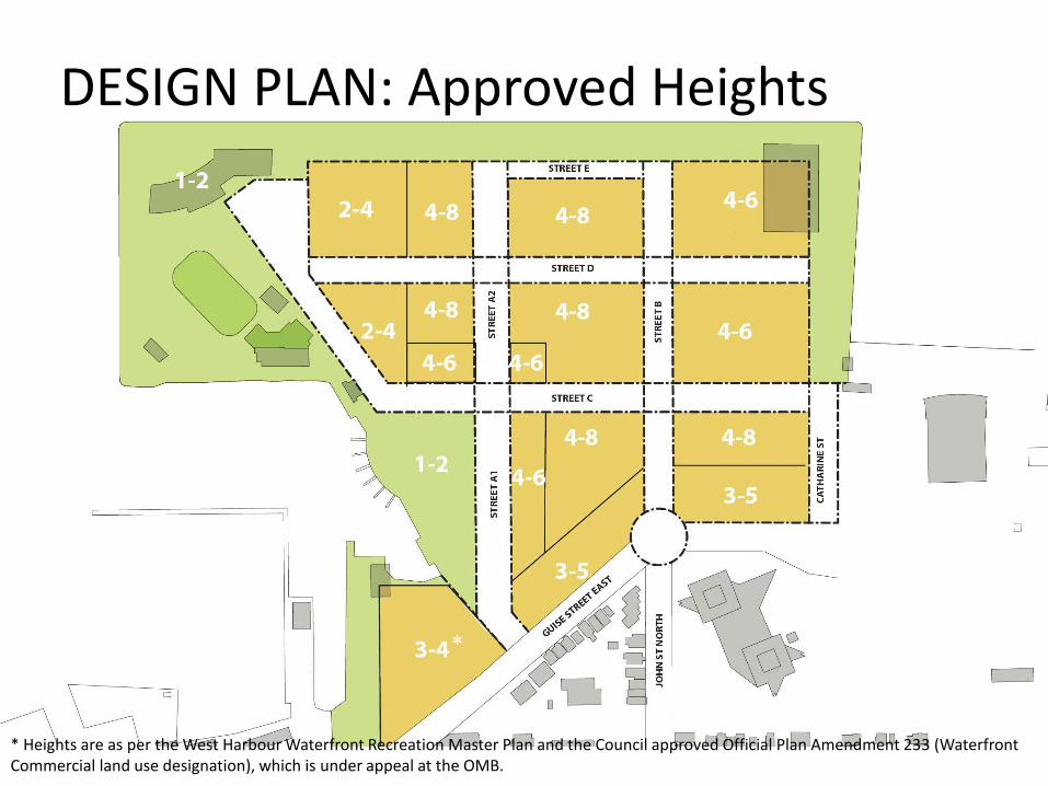
DESIGN PLAN: Approved Heights
*
* Heights are as per the West Harbour Waterfront Recreation Master Plan and the Council approved Official Plan Amendment 233 (Waterfront Commercial land use designation), which is under appeal at the OMB.
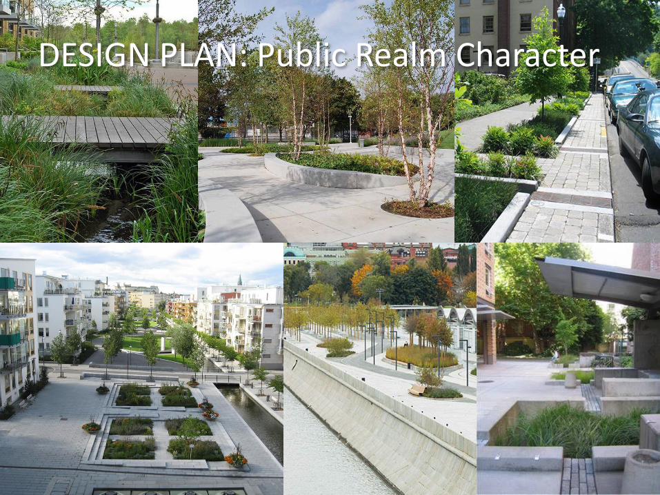
DESIGN PLAN: Public Realm Character
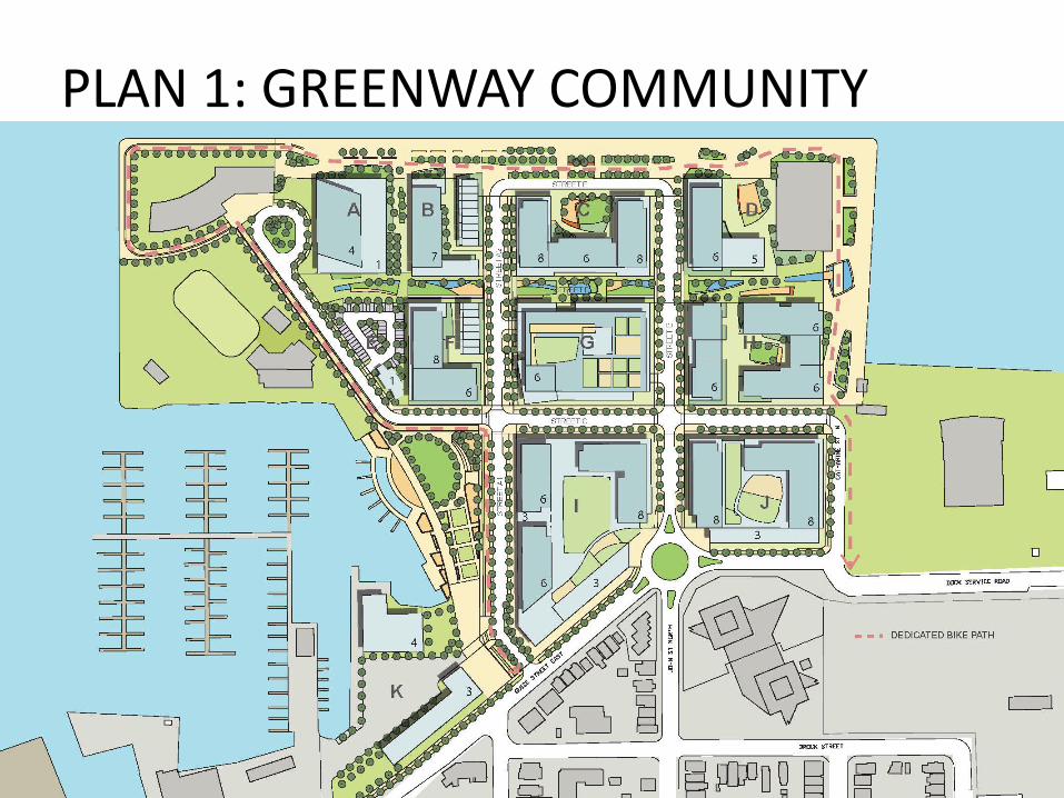
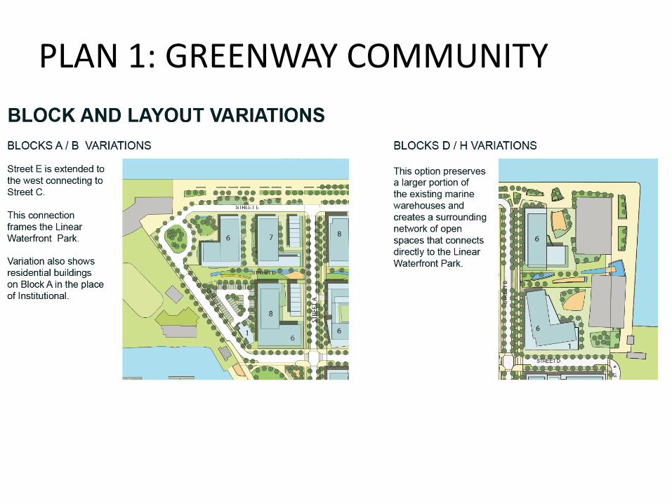
PLAN 1: GREENWAY COMMUNITY
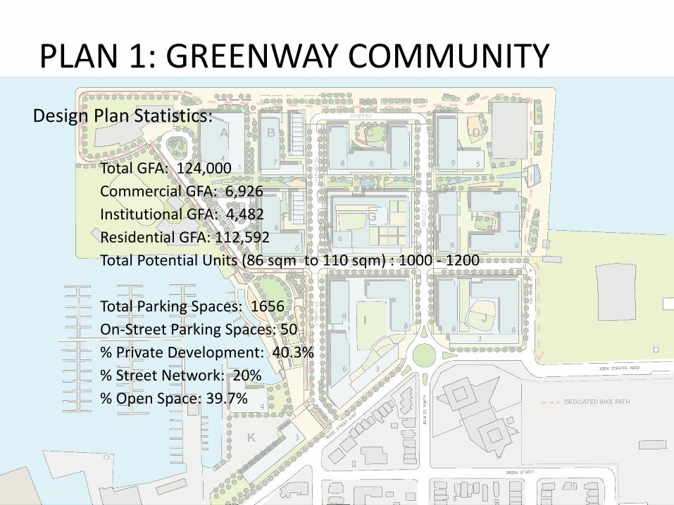
Design Plan Statistics:
Total GFA: 124,000
Commercial GFA: 6,926
Institutional GFA: 4,482
Residential GFA: 112,592
Total Potential Units (86 sqm to 110 sqm) : 1000 - 1200
Total Parking Spaces: 1656
On-Street Parking Spaces: 50
% Private Development: 40.3%
% Street Network: 20%
% Open Space: 39.7%
PLAN 1: GREENWAY COMMUNITY
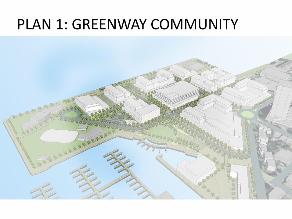
PLAN 1: GREENWAY COMMUNITY
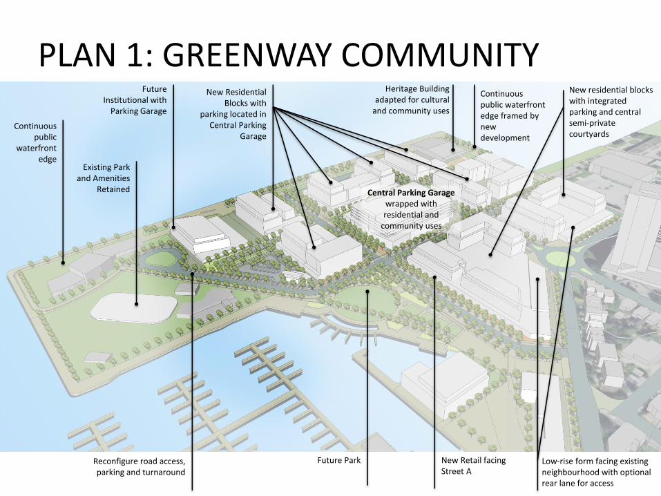
Existing Park and Amenities
Retained
Future Institutional with
Parking Garage
New Residential Blocks with
parking located in Central Parking
Garage
Heritage Building adapted for cultural
and community uses
Future ParkReconfigure road access, parking and turnaround
Low-rise form facing existing neighbourhood with optional rear lane for access
New residential blocks with integrated parking and central semi-private courtyards
New Retail facing Street A
Central Parking Garage wrapped with residential and
community uses
Continuous public
waterfront edge
Continuous public waterfront edge framed by new development
PLAN 1: GREENWAY COMMUNITY
PLAN 1: GREENWAY COMMUNITY
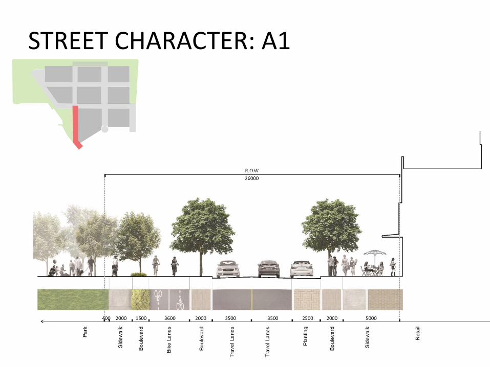
STREET CHARACTER: A1
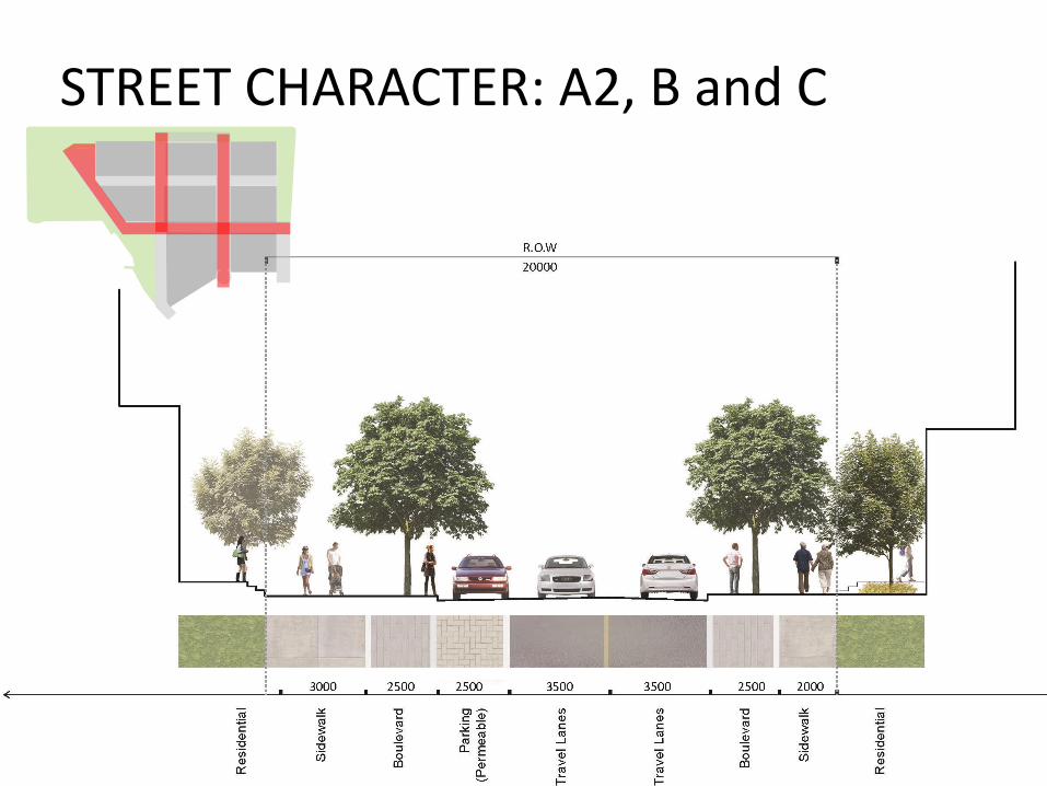
STREET CHARACTER: A2, B and C
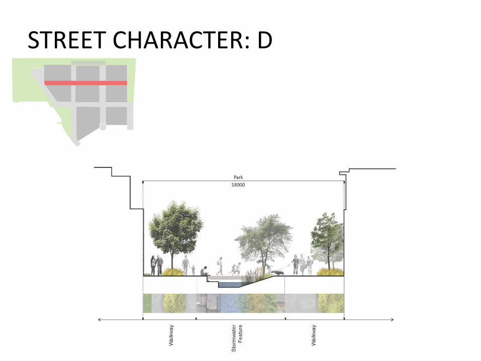
STREET CHARACTER: D

STREET CHARACTER: E
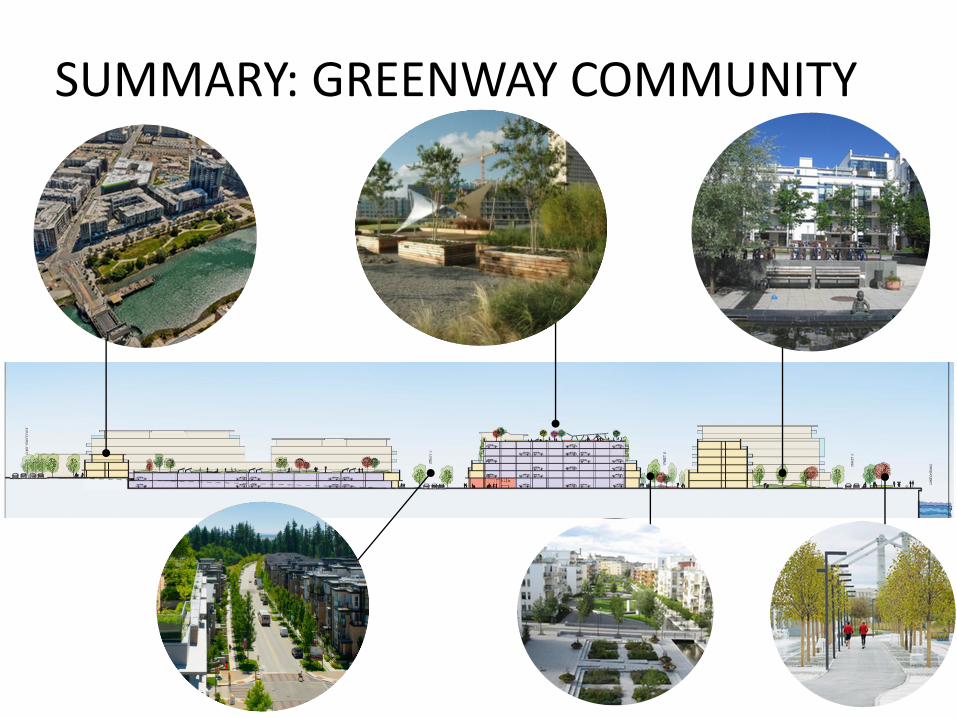
SUMMARY: GREENWAY COMMUNITY
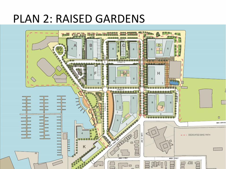
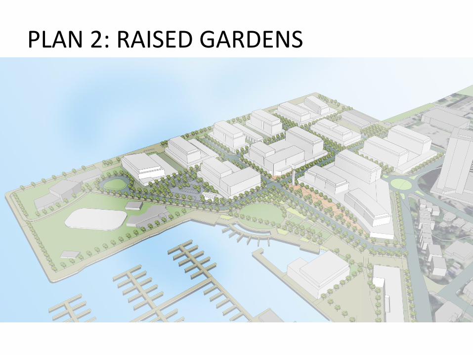
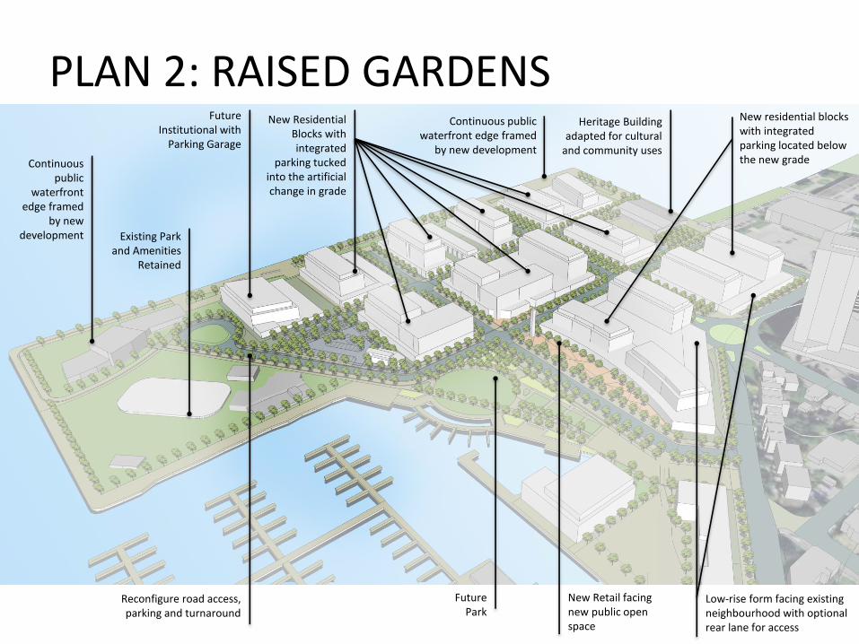
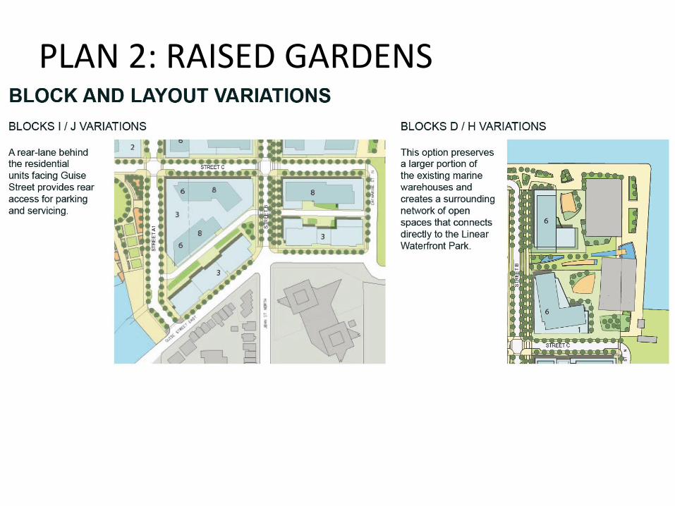
PLAN 2: RAISED GARDENS
Design Plan Statistics:
Total GFA: 111,726
Commercial GFA: 7,523
Institutional GFA: 4,482
Residential GFA: 99,721
Total Potential Units (86 sqm - 110 sqm) : 900-1100
Total Parking Spaces: 1680
On-Street Parking Spaces: 90
% Private Development: 40.6%
% Street Network: 23.6%
% Open Space: 35.8%
PLAN 2: RAISED GARDENS
PLAN 2: RAISED GARDENS
PLAN 2: RAISED GARDENS
Existing Park and Amenities
Retained
Future Institutional with
Parking Garage
New Residential Blocks with integrated
parking tucked into the artificial change in grade
Future Park
Reconfigure road access, parking and turnaround
Low-rise form facing existing neighbourhood with optional rear lane for access
New residential blocks with integrated parking located below the new grade
New Retail facing new public open space
Heritage Building adapted for cultural
and community usesContinuous
public waterfront
edge framed by new
development
Continuous public waterfront edge framed
by new development
PLAN 2: RAISED GARDENS
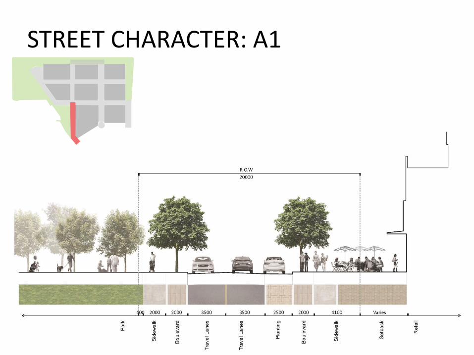
STREET CHARACTER: A1
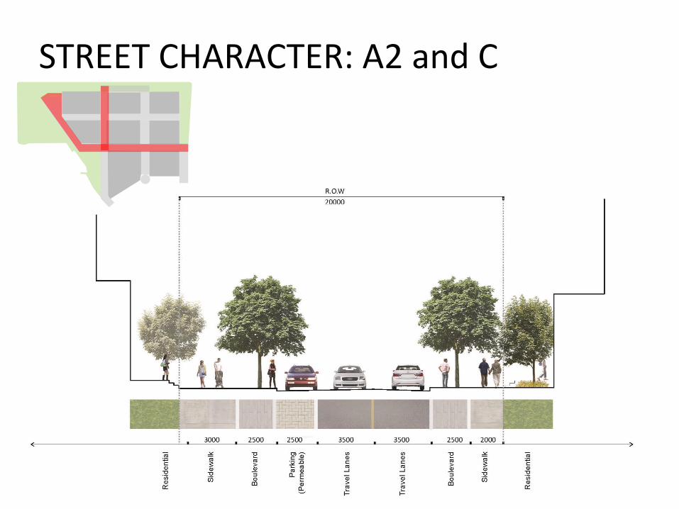
STREET CHARACTER: A2 and C
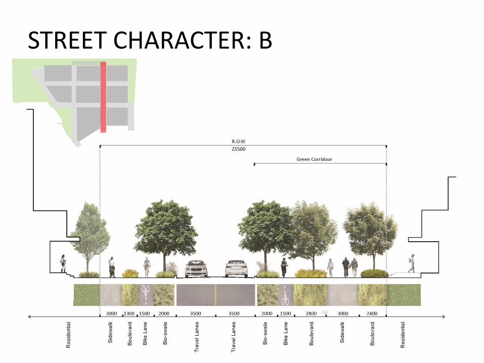
STREET CHARACTER: B
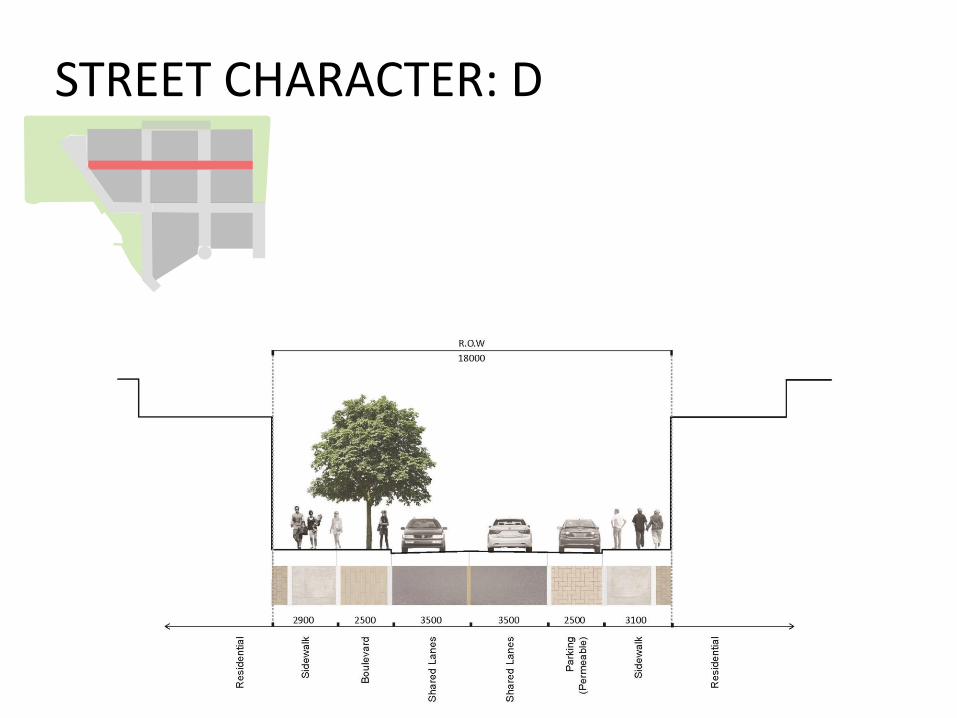
STREET CHARACTER: D
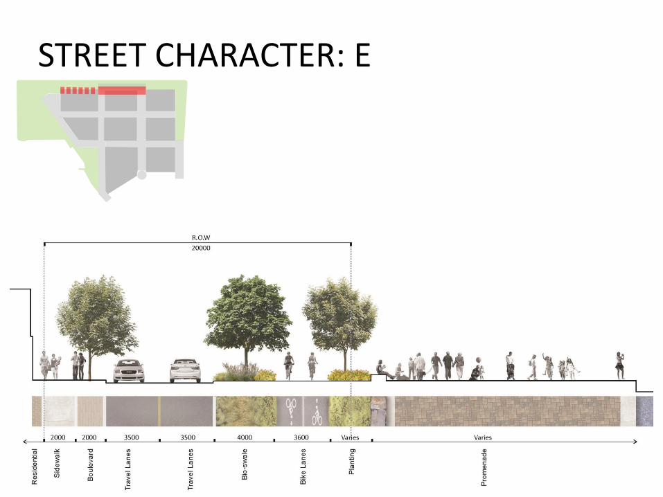
STREET CHARACTER: E
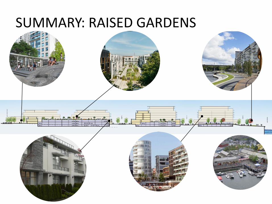
SUMMARY: RAISED GARDENS
Feedback
• Review open house material at Stations
• Station #1 - Background and Guiding Principles
• Station #2 - Character
• Station #3 - Options
• Provide feedback on comment sheets available ateach stations or directly on the boards with apost-it note
Next Steps
• Finalize UDG Contents and Structure
• Finalize UDG Document
• Present to Council Early 2015