habs no. wv-296lcweb2.loc.gov/master/pnp/habshaer/wv/wv0400/wv0452/data/... · 2014-09-10 ·...
TRANSCRIPT

WOODS HOMESTEAD County Route 12 on the north side of the North Fork
of the Hughes River, 2.2 miles north and east of Goose Run Road intersection
Harrisville Ritchie County West Virginia
PHOTOGRAPHS
HABS No. WV-296
ltMs wvA 43- t\A~VLJ J-
WRITTEN IDSTORICAL AND DESCRIPTIVE DATA
IDSTORIC AMERICAN BUILDINGS SURVEY National Pm Service
Northeast Region Philadelphia Support Office
U.S. Custom House 200 Chestnut Street
Philadelphia, PA 19106
Location:
Present Owners:
Present Use:
Significance:
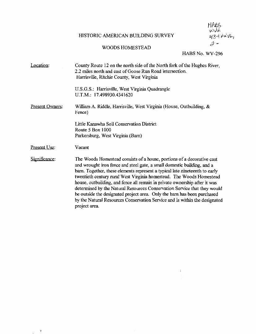
HISTORIC AMERICAN BUILDING SURVEY
WOODS HOMESTEAD
HA5S wvf4 43~.f,tl:r{\JJ...,
HABS No. WV-296
County Route 12 on the north side of the North fork of the Hughes River, 2.2 miles north and east of Goose Run Road intersection. Harrisville, Ritchie County, West Virginia
U.S.G.S.: Harrisville, West Virginia Quadrangle U.T.M.: 17.498930.4341620
William A. Riddle, Harrisville, West Virginia (House, Outbuilding, & Fence)
Little Kanawha Soil Conservation District Route 5 Box 1000 Parkersburg, West Virginia (Barn)
Vacant
The Woods Homestead consists of a house, portions of a decorative cast and wrought iron fence and steel gate, a small domestic building, and a barn. Together, these elements represent a typical late nineteenth to early twentieth century rural West Virginia homestead. The Woods Homestead house, outbuilding, and fence all remain in private ownership after it was determined by the Natural Resources Conservation Service that they would be outside the designated project area. Only the barn has been purchased by the Natural Resources Conservation Service and is within the designated project area.

Historical Background
WOODS HOMESTEAD HABS No. WV-296
(Page 2)
The history of the Ohio River drainage area is linked to its fertile valleys, abundant game, and vast natural resources. Early inhabitants used agriculture and the natural trade routes of the rivers and streams to develop their cultures and later native groups used the drainage for hunting grounds. European settlers first entered the area to obtain furs, but soon found the fertile ground and open spaces suitable for settlement. Modem residents have taken advantage of the vast natural gas and oil reserves. With such valuable resources, the struggle for control has created a unique, mysterious, colorful, and interesting history.
The earliest known inhabitants in the Ohio River drainage area of West Virginia lived during the Paleo-Indian Period (12,000-8,000 B.C. ), which terminated at the end of the Pleistocene and the beginning of a more stable, warmer modem environment. This period is divided into the Early, Middle, and Late Archaic (8,000-1,000 B.C. ). Early Archaic peoples continued the basic subsistence practices of the previous period, although evidence indicates more specialized technology and trade. The Middle Archaic witnessed a continued moderation of the climate and increasingly sophisticated technology among its people, and the Late Archaic people began the pattern of seasonal activities, increased the gathering and processing of foods, and introduced steatite bowls as containers (Gray & Pape Vol. I 1995, 26-28).
Next came the Woodland Period of habitation (1,000 B.C.-A.D. 1650), which is characterized by the introduction of ceramic technology. It represents a greater tendency toward territorial permanence, elaborate ceremonial exchange and mortuary rituals, and a hunting and gathering subsistence with seasonal relocation. During the Early Woodland the principal inhabitants lived in the Adena Tradition, a culture best known for its conical burial mounds. The Adena people were an agricultural group, but they also developed products from woven cloth, clay, and copper. Archaeological studies reveal that the Adena engaged in primitive commerce. Excavations have found teeth, volcanic glass, sea shells, and copper, all items that could only be found in the Rocky Mountain, Great Lakes, and Eastern Shore regions (Gray & Pape Vol. I, 29-30).
While burial mounds provide a great deal of information, they do not tell what happened to the Adena people. Like other prehistoric cultures the Adena disappeared, leaving scholars to speculate on the cause. It is generally assumed that at some point in the distant past the Adena groups moved from the area, but there is little evidence to indicate exactly when or where they went. Two major or Adena centers are recognized: one near Charleston, West Virginia, in the Kanawha Valley, and the other in Ohio on the Scioto River. Smaller centers were located in northern Kentucky, eastern Indiana, western Ohio, and northeastern West Virginia (Ambler and Summers 1958, 13-18).
Life in the Middle Woodland period is generally regarded as a time of complex societal integration through trade. To this culture has been ascribed the name of Hopewell, which denotes a particular archaeological assemblage that appears from western New York to Kansas City and

WOODS HOMESTEAD HABS No. WV-296
(Page 3) from the Gulf of Mexico to Lake Huron. Hopewellian culture is characterized by elaborate geometric earthworks, enclosures, and mounds. Ceremonial centers were abandoned and burial ceremonialism became less important during the Late Woodland Period, a time when subsistence agriculture was supplemented by hunting and gathering activities. Inhabitants of the Kanawha Basin during the late prehistoric period are referred to as the Fort Ancient culture (Gray 6r Rape Vol. I, 30-31 ).
Initial contact between indigenous cultures and Europeans occurred along the coast of North America after A.D. 1600, but no Europeans ventured into present-day West Virginia at this early date. Explorations of the western country were eventually spurred on by an expanding fur trade. Abraham Wood became the first European into the Virginia mountains in 1650, followed by the Batts and Fallam expedition which reached the New River near the Virginia-West Virginia border in 1671. A third expedition traveled into the Kanawha Valley in 1673 (Rice 1972).
Few native people remained in West Virginia by the time the earliest European settlers arrived in the 1730s. Settlement expanded up the Greenbrier Valley after the end of King George's War, but the start of the French and Indian War in 1754 discouraged further settlement along the frontier in West Virginia. By the end of hostilities in 1763 only a few Shawnee tribes could be found living near the mouth of the Kanawha River. One theory suggests that the indigenous people were decimated by diseases transferred from European settlers to America, while a more plausible one asserts that they moved west of the Ohio River as a result of raiding Iroquois who gained control of most of the Northeastern tribes in the 1640s. As a result, the Shawnee, Mingoes, and other tribes abandoned the area and moved west to avoid war parties from the north. However, the dislocated tribes could not completely abandon the area because of the abundant game, so the region that became West Virginia was used as a hunting ground (Rice 1972, 14).
While the native tribes shared the region as a hunting ground, the French and English were less willing to share the vast natural resources of the Ohio River drainage. Both crowns claimed the Ohio River and disputed any rival claims for the area. The French based their claim on the exploration of LaSalle and their long-standing fur trade in the Ohio Valley. Conversely, the English based their claim under the Virginia Charter of 1609 and the activities of their traders west of the Allegheny Mountains. To push their claim to the Ohio Valley, the English parliament chartered the Ohio Company in 1747 to develop settlements. To counter the British claims, the French placed lead plates along the Ohio River in 1749 to solidify their claim to the abundant natural resources of the area. Both sides demanded loyalty to their cause, which forced native tribes to support one or the other as the European powers waged war for control. Tensions rose as the European powers rushed to establish their claim to the Ohio Valley. The French began to build a series of forts south of Canada. In response, Virginia governor Dinwiddie sent a young George Washington to request that the French stop encroaching on land owned by the English crown. In 1754, hostilities eventually triggered the start of the French and Indian War on the continent (Ambler and Summers 1958, 40-46).

WOODS HOMESTEAD HABS No. WV-296
(Page 4) After their defeat in 1763 the French signed a treaty relinquishing all claims to Canada and lands east of the Mississippi River. During this peaceful interlude on the frontier, William Lowther, · Jesse Hughes, and Elias Hughes made their way from Clarksburg through the wilds that would become Ritchie County. The exploration of the area began in 1772 when the group traveled up the west fork of the Monongahela River to its source. After crossing over a ridge, the companions traveled down Sandy Creek until it emptied into the Little Kanawha River. They floated down the Little Kanawha, naming the streams along the way. When the group reached a rapid current emptying into the river, Jesse Hughes claimed the streams as his namesake, dubbing it the Hughes River. The hearty band traveled up the newly named river until the stream split, and they named the divergent streams the North Fork and South Fork of Hughes River. After returning to the Little Kanawha, the explorers floated downstream until they reached the Ohio River, where they ended their journey and returned to Clarksburg. (Hardesty's West Virginia 1974, 37).
Other early settlers in the region included: Joseph Sims, a Philadelphia merchant who owned around 20,000 acres; William Worth, who owned 15,000 acres; Thomas Proctor, with 20,000 acres; James McGuire, who held 15,000 acres; John Phillips, who claimed 39,000 acres; and Henry Banks, a Richmond merchant who owned 44,400 acres by 1784. It would not be until the middle to late 1800s before these large parcels were broken up and sold to area residents (Cox 1979, 158).
The relative calm that had settled over the region after 1763 abruptly ended in 1774 when settlers perpetrated several atrocities against the Indians. In retaliation for the brutal murders of the family of the peaceful Chief Logan, native war parties swept through the western settlements killing or capturing any Europeans that they found. This campaign became known as Lord Dunmore's War, with the major battle occurring at the mouth of the Kanawha River at Point Pleasant, West Virginia, where General Andrew Lewis defeated a Shawnee force led by Cornstalk. As a result of this battle, the Shawnee relinquished all rights to hunt south of the Ohio River (Ambler and Summers, 61).
Less than two years after Dunmore's War, the American colonies began their War of Independence against British rule. While the British crown relinquished its control of the colonies when the war ended in 1782, their native allies continued to wage war on the encroaching tide of settlers in West Virginia. Ritchie County was on the edge of the western frontier, and like other parts of West Virginia it became a battleground during the border wars that continued throughout the 1780s and early 1790s. Settlement was curtailed as Indian raiding parties moved through the region on search and destroy missions in the futile attempt to turn back European settlers. In order to end the bloodshed in the west, the new President of the United States, George Washington, sent expeditions to meet the natives. After several failed attempts, General "Mad Anthony" Wayne defeated the natives at the Battle of Fallen Timbers, Ohio; on August 20, 1794, resulting in the Treaty of Greenville and the restoration of peace on the West Virginia frontier (Rice 1972).

WOODS HOMESTEAD HABS No. WV-296
(Page 5)
Westward expansion exploded as European settlers moved up the Little Kanawha and Hughes River watersheds in ever-increasing numbers. Many of the early settlers were Virginians that came out of the east through Clarksburg, but they also included Pennsylvanians and slaveholders from Eastern Virginia, as well as a few immigrants form Ireland and England who traveled up the Ohio and Little Kanawha rivers in search of land. Settlement on the headwaters of the North Fork Hughes River was led by Jacob Collins, John Garner, and James Marsh. By 1800, present-day Ritchie County remained a wilderness and did not attract many settlers until construction of a state road from Clarksburg to Marietta. This road was one of the principal east-west routes through the region and became a conduit for settlers moving westward across north central West Virginia. A string of small towns grew up along the road and feeder routes spread out from it into the sparsely populated countryside. Most of the early settlers were Virginians that came through Clarksburg, but they also included Pennsylvanians and slaveholders from eastern Virginia, as well as a few immigrants form Ireland and England (Hardesty's 1974, 40).
Passage of an act by the Virginia General Assembly in 1832 providing for the satisfactory adjustment of land titles and the sale of delinquent and forfeited lands spurred settlement; the state ultimately sold thousands of acres in Ritchie County at a discounted rate when they became available after being declared delinquent for taxes. Construction of the Northwestern Turnpike in the 1830s Winchester to Parkersburg also brought an influx of settlers to Ritchie County. The original act incorporating the turnpike, which was Virginia's bid for the lucrative Ohio Valley trade, passed in 1827 and authorized subscriptions from towns along the proposed route laid out by principal engineer Claudius Crozet (Rice 1972). In the 1840s, the Staunton to Parkersburg Turnpike helped to open up southern Ritchie County.
In 1822, Thomas Harris planned to lay out a town with the prospect of becoming the seat of government for a new county. It took over two decades to become a reality, but the formation of Ritchie County eventually occurred in 1843. Although the newly-formed village of Harrisville had but two stores, two churches, and 15 houses, it became the county seat. Harrisville eventually incorporated in 1869 with Smith C. Hall as the first mayor (Hardesty's 1974).
Railroads have impacted the region's history in a major way. One of the most important events was the completion of the Northwestern Virginia Railroad in 1858. This important line, which ran from Grafton to Parkersburg and passed through Ritchie County, later became the Parkersburg Branch of the Baltimore 6r Ohio Railroad. Unfortunately for the county seat of Harrisville, the railroad came within five miles of town but did not enter it. This led to stagnation and gave rise to a number of newer railroad communities, including Pennsboro, Cornwallis, and Cairo. Harrisville finally got its first railroad in the 1880s with construction of the Pennsboro and Harrisville Railway. The P&H Railway was a "dinky" or narrow gauge line incorporated in 1873 to operate between Pennsboro and Harrisville. Aided by the railroad, Harrisville grew to become a bustling county seat by 1883. It supported five mercantile establishments, three churches, three
WOODS HOMESTEAD HABS No. WV-296
(Page 6) hotels, a post office, drug store, artist's gallery, furniture store, flour mill, two blacksmiths, one printing shop, four doctors, and seven attorneys (Hardesty's 1974).
Despite the presence of two railroads, Ritchie County essentially remained a rural county throughout the nineteenth century, with its residents relying mainly on subsistence agriculture for their food supply. Early settlers kept a few cattle before 1840, and the region came to support increasingly larger numbers after that time. Sheep farming developed into an economic mainstay by the early twentieth century; com provided the principal agricultural crop as production steadily increased from 1840 to 1900. Other agricultural products produced in the county included wheat and oats, hay and rye, tobacco, and fruit (Grimsley 1910).
Area residents maintained a rural agricultural economy until the nation's demand for natural resources grew in the late 1800s. The first major exploitation of Ritchie County's natural resources occurred at Ritchie Mines, where a naturally-occurring asphalt was harvested and sold from 1858 until 1877, when operations ceased after a series of explosions. Native inhabitants knew of petroleum seepage along the Hughes and Little Kanawha Rivers long before Europeans arrived in the area. Petroleum had limited use as a lubricant, as lamp oil, and medicinal purposes, but little use was found for the oil before George S. Lemon arrived in 1835 and began the first commercial business of collecting and selling oil from seeps along the stream banks. He dug pits where the "mud oil" collected, enabling him to gather it with cloth and other devices for sale at Parkersburg, Marietta, and Cincinnati. Lemon perfected a method of separating the oil and water, and sold his "sand oil" at a higher price than the less refined mud oil. In 1844, he struck oil and gas while drilling a brine well along the Hughes River and developed a siphon arrangement that produced a "sand oil" that he sold for medicinal purposes and commanded a higher price than the less-refined mud oil. He eventually lost a land dispute with Bushrod W. Creel, who became associated with a petroleum firm from Marietta and purchased oil from Hughes River from 1847 until 1860 (Harris 1916, 505-07).
After cleaning out an abandoned salt well near the mouth of Burning Springs Run in neighboring Wirt County in 1859, Samuel D. Karnes drilled and struck oil. His well produced only seven barrels a day, but it attracted the attention of other developers who were inspired by his success. Shortly thereafter, entrepreneurs drilled a well that yielded 100 barrels a day (Harris 1916, 505-07). These developments occurred on the heels of Edwin Drake's strike in Titusville, Pennsylvania, and laid the basis for a burgeoning oil industry centered around Burning Springs Run.
Oil and gas are present in Ritchie County as a result of the great Burning Springs-Volcano Anticline that passes beneath the western end of the county. Oil fever struck Ritchie County in the 1860s with the first wildcat wells. Fortunately, the Hughes River oil region escaped serious damage from confederate raids that virtually destroyed the Burning Springs Run fields during the Civil War. When the Burning Springs area was slow to recover from the severe damage inflicted upon it, the center of oil production shifted to the Hughes River area. Production increased

WOODS HOMESTEAD HABS No. WV-296
(Page 7)
around Petroleum on the Northwestern Virginia Railroad, which dwarfed the output of the Burning Springs field and soon became the center of activity. By 1870, Ritchie County had become the state's second largest oil supplier with 2,810,500 gallons produced (Thoenen 1964, 29). Many boom towns sprang up during this period as county population increased between I 880 and 1900. Production in the 1890s shifted to the Cairo vicinity where deeper wells were drilled. Ritchie County continued producing West Virginia oil for a century, and many of its old wells still produce to this day.
In the earliest days, abandoned wells frequently remained uncapped so that natural gas bubbled to the surface. For years the gas vented into the air before it was eventually trapped and piped into the town of Burning Springs to fire a boiler that operated steam engines that powered individual wells. The first real use of natural gas as a fuel source came in the I 860s but it did not become a major industry until I the I 870s (Thoenen I 964 , 98) . Eventually, residents and business owners in Ritchie County tapped the abundant fuel source that lay beneath the ground.
The Northwestern Virginia Railroad [which later became part of the Baltimore C Ohio Railroad] and several short lines remained the major transportation routes through Ritchie County in the first half of the twentieth century. By I 920, population in the county topped the 16,000 mark and the county seat of Harrisville numbered I ,036 (1920 Census). Fortunes began to change after World War II as declining economic opportunities resulted in a net population loss. A major demographic shift came in the 1960s with the construction of new U.S. Route 50, a modem four-lane highway between Clarksburg and Parkersburg that allowed travelers to bypass Harrisville, Ellenboro, Cairo, and other Ritchie County towns. Another economic setback occurred in the 1980s when the old B 6r 0 (later Chessie System) main line ceased operating between Clarksburg and Parkersburg. Ritchie County in the 1990s is experiencing a minor economic resurgence as the region emerges as a desirable tourist destination. Two featured attractions are North Bend State Park, located along the North Fork of Hughes River near the community of Cairo, and the 61 -mile North Bend Rail Trail, which runs along the abandoned Northwestern Virginia rail line from Walker, near Parkersburg in Wood County, through Ritchie County, to Wolf Summit, near Clarksburg in Harrison County, West Virginia.
Site History
The North Fork Hughes River watershed encompasses roughly 130,220 acres of rugged, mountainous topography characterized by narrow floodplains. It is located in Ritchie County, West Virginia within the Central Allegheny Plateau section of the Appalachian Plateau and is a tributary of the Hughes River. The Hughes River drains into the Little Kanawha River, which empties into the Ohio River at Parkersburg, West Virginia.
Topographically, the area is characterized by narrow ridgetops and deep, V-shaped valleys with steep or very steep side slopes. Maximum elevation in the watershed is 1,440 feet above mean sea level on the Ritchie-Tyler county border. About eighty-seven percent of the North Fork

WOODS HOMESTEAD HABS No. WV-296
(Page 8) Hughes River watershed is in forest, making it the major land use in the study area. Much of the remaining land is occupied with low-intensity farming, with only one percent of the watershed in urban development.
Tributaries within the North Fork Hughes River watershed meander within relatively narrow and steep-walled valleys that contain precipitous slopes, bedrock outcrops, and colluvial deposits along foot slopes. The region is deeply dissected by stream erosion and the resulting drainage pattern is mature and dendritic in nature. The Woods Homestead lies within the North Fork Hughes River watershed.
The Woods Homestead is a typical example of an early twentieth century rural West Virginia homestead. It contains a residence, remnants of a cast and wrought iron fence, a small domestic outbuilding, and a barn. A previous study undertaken for the U.S. Department of Agriculture Natural Resources Conservation Service identified this property as the Woods Homestead built in 1818 for Salina Wells Woods by her father, William Wells (Sheehan et al. 1993). This information is incorrect. Salina Wells Woods was actually the granddaughter of William Wells and the daughter oflsaiah Wells of Sugar Grove Mill. Also, county records do not support ownership of the property by either Salina Wells Woods or her husband Peter A. Woods. It is possible that William Wells owned the Woods Homestead in the early nineteenth century, but no history of his ownership exists in county records since it predates the formation of Ritchie County in 1843. Isaiah Wells is confirmed as the property owner at least from the time Ritchie County was formed until he sold it to Benjamin Wells in 1851.
The 1818 construction date for the Woods Homestead residence is also thought to be incorrect, given the fact that its architectural details are representative of a later period. Based on this evidence, as well as increased tax valuations for buildings located on the property in 1884 and 1906, it is likely that the residence was constructed in either of these two years (Ritchie County Land Records, 1884-1906). An adjacent house that stands to the north of the Woods Homestead appears to be the older of the two houses and it may have been built by the Wells family for Salina in the early 1800s. However, no historical information about that house has been sought since it was located outside the project study area.
Although no direct affiliation exists between Salina Wells Woods and the Woods Homestead, the property is inextricably linked with the William Wells family who were well-known millers and leading citizens of Ritchie County. William and Elizabeth Wells were devout Baptists who helped organize the first Baptist church in the area--the Hughes River Baptist Church--in 1810. They were later among the first 19 charter members of the Harrisville Baptist Church, which came into existence in 1825 as the "Mab Zeal" Baptist Church. William Wells also served as the church's first deacon. In 1850, Elizabeth Wells passed away at the age of87. In that same year William, who was 85 years old, resided in the Ritchie County household of his daughter, Mary McLain, her husband Abijab, and their seven children. William Wells died in 1851 and is buried alongside his wife in the Harrisville cemetery (Lowther 30).

WOODS HOMESTEAD HABS No. WV-296
(Page 9)
The Wells family operated mills up and down the North Fork Hughes River and on some of its larger tributaries. William Wells, who was born in 1766, is considered one of the first Europeans to settle near the mouth of Bunnell's Run and is credited with building one of the first grist mills in the county there. He allegedly sold this mill at an early day to John Whitney, who turned it into a horse mill before demolishing it in 1840 (Lowther 30).
William Wells and his wife Elizabeth had five children: Isaiah, Rachel, Hester, Mary, and Eleanor. Their first and only boy, Isaiah, was born in 1796 and relocated with his parents from Fayette County, Pennsylvania, to present-day Ritchie County, West Virginia, in 1808. Isaiah married Jane Taylor at Pruntytown in Taylor County, West Virginia, in 1816. They eventually settled along the North Fork Hughes River just northwest of Harrisville on a farm that Joseph Wilkinson had originally improved but became better known as the Wells Homestead. Isaiah and Jane Wells went on to parent nine children: Benjamin, William, Levi, Elizabeth, Mary, Salina, Cynthia, George W., and Isaiah. They were original members of the Mab Zeal Baptist Church in Harrisville.
Isaiah and Jane Wells were widely known and respected throughout the region for their hospitality and charitable dispositions. They figured prominently in the early history of Ritchie County and maintained a strong association with the Baptist church during their adult lives. The pair resided in Ritchie County until their deaths. Jane Wells passed away on October 7, 1868, at 69 years of age. By 1870, Isaiah had retired from the milling business and continued to reside on his farm near Harrisville and the Sugar Grove Mill. He died on May 17, 1876, at the age of79 and is buried alongside his wife in the family cemetery on the Wells Homestead (Lowther, 419-20).
Like his father before him, Isaiah Wells prospered as a dominant miller in the North Fork Hughes River watershed. History records that he built and/or operated at least three separate milling operations in Ritchie Cm.µ1ty by the mid-nineteenth century. They were located at the Wells Homestead, at Cornwallis, and near the mouth ofBunnell's Run. The mill at the Wells Homestead was known as the Sugar Grove Mill which came into being in 1842. It was a large complex that contained a gristmill and the region's first sawmill and carding machine. Heirs of Isaiah Wells kept it in operation for sometime after his death, but they eventually sold it and it was demolished in 1908. Isaiah Wells built his third and final grist mill at Cornwallis in 1858. His son, George H. Wells, operated it until 1875 when it became the property of James Taylor (Lowther 1911, 418-20). Like his previous operations, the Cornwallis mill eventually fell into disrepair and was demolished.
Isaiah Wells' mill near the mouth ofBunnell's Run is generally considered to be the second mill in that section of the county. It was operated for many years by Isaiah Wells and then by his son Benjamin, and may have been built by Isaiah's father, William Wells. This operation was built on the same location as the famous William Wells mill that is considered the first grist mill in Ritchie County. Wells allegedly sold this mill to John Whitney, who demolished it by 1840 (Lowther 30).

WOODS HOMESTEAD HABS No. WV-296
(Page 10)
Documentary evidence indicates that a mill stood on this property as early as 1851 and perhaps earlier, and it may have been operated by three generations of the Wells family starting with William Wells in the early 1800s. Tax records indicate that a catastrophic event around 1876 [probably the flood of 1875] caused the value of the property to drop by about $1,000. Valuations on the buildings continued to decline until they reached a low of $25 in 1900 (Ritchie County Tax Records, 1876-1900). Little more is known about the demise of the operation other than the mill building was "fast crumbling to decay" by 1911 (Lowther 418). It appears that time and neglect demolished the old mill, as archaeological investigations revealed no evidence of fire or scavenging of construction materials that would have been apparent if the structure had been purposely leveled (Gray & Pape Vol. II 1995, 332).
The Woods Homestead is located adjacent to the site of the historic William Wells Mill, and the histories of these two properties are closely intertwined. Isaiah Wells owned the Woods Homestead at the time of Ritchie County's formation in 1843. He also owned the adjacent mill which ground corn, buckwheat, and oats, and had a wooden millrace and dam that was part of a larger 69-acre parcel with buildings valued at $1,200. In January 1851, Isaiah sold slightly over nine acres ofland to his son, Benjamin Wells, who already owned property in the area. The deed for the sale property described it as containing a water-powered grist mill, waterpowered saw mill, and a horse mill along the North Fork Hughes River (Ritchie County Deed Book 4, 458).
Benjamin Wells was born in 1817, the oldest son oflsaiah and Jane Wells. He married his first wife Louisa in 1844 and she gave birth to three children: Benjamin F., Elite J., and Elizabeth. Louisa died in 1852. Benjamin married Mahaley J. Turner in 1853 and she bore three children: George W., Levisa, and Margaret E. Wells. Benjamin Wells died in 1908 at the age of91. During his long and active life, Wells was a prominent area miller and a participant in local government. He was sheriff ofRitchie County for two years beginning in 1860 and also served on the county board of supervisors between 1863 and 1873 (Lowther 418).
Benjamin Wells took out a deed of trust on his land along the North Fork Hughes River in 1872, and in 1877 the Woods Homestead and the adjoining mill property were collectively sold to John M. Wilson for $705 "as required by law" by trustee James McKinney, the County Clerk of Ritchie County. In 1879, Wilson and G.W. Butcher traded land, and in the following year Butcher sold 24-114 acres with buildings valued at $800 to B. F. Wells (Ritchie County Deed Book 19, 9).
B. F. [Benjamin Franklin] Wells was born in 1845 and the eldest child of Benjamin and Louisa Wells. Like his father, grandfather, and great-grandfather before him, B. F. Wells became a Ritchie County miller. The 1884 assessment of B. F. Wells' property indicates that it had buildings valued at $880, which shows a slight increase over the $800 value when the trustee sold the property in 1880. This higher valuation may reflect the first possible construction date for the Woods Homestead residence. The buildings continued to be assessed at $880 in 1890, but their value dropped to $580 the next year and to $350 in 1892. By 1900, the buildings had been
WOODS HOMESTEAD HABS No. WV-296
(Page 11) devalued to a meager $25, which indicates that something drastic had happened to them. Most likely, the mill had ceased operation and the buildings were abandoned by then. Building value increased dramatically to $403 in 1906, which may indicate the construction date for the Woods Homestead residence. In 1910, the building value decreased to $400 where it remained for the duration ofB. F. Wells' ownership (Ritchie County Land Records 1846-1919).
After owning the Woods Homestead parcel for 39 years, 73-year-old B. F. Wells and his wife Mary sold it and two other tracts to Marcus Aaron Dorsey Broadwater for $2,500 in 1919. The Broadwater family had owned land in Ritchie County since its inception in 1843. Peter Broadwater was born in 1820 and came to the area from Maryland with his brother Jefferson in 1842. Jefferson Broadwater is credited with erecting the first sawmill in Clay District of Ritchie County near Tollgate in 1855, as well as the Valley flour mill at Pennsboro. His brother Peter married Lovisa Taylor and settled with her on a farm at Hannahdale near the Woods Homestead, where they had five children. Peter Broadwater died in 1858 (Lowther 426).
Peter and Lovisa's son Marcus M. Broadwater [born December 1852] married Martha M. Fry in 1876, In 1900, he and his wife lived with their six children on the property adjoining Benjamin and Mahaley Wells. Their youngest child was a son named Marcus Aaron Dorsey Broadwater, born in December of 1895 (Ritchie County, West Virginia 1900 Census, 35). Marcus A. D. Broadwater eventually purchased the Woods Homestead property in 1919. Value of the buildings remained constant at $400 until 1920, when the assessment jumped to $1,000 (Ritchie County Land Records 1920). According to Arnold Broadwater, nephew of Marcus A. D. Broadwater, his uncle remodeled the old William Wells mill into a barn around this time (Arnold Broadwater, personal communication 1995). In 1926, Marcus A. D. Broadwater and his wife Virgil conveyed three parcels of land, one fourth of the oil and gas royalties from producing wells leased by the Champion Oil Company and one-fourth of the mineral rights, to E. D. Grose of Ritchie County in exchange for Lots 16, 17, and 18 in Harrisville's Oakwood Addition (Ritchie County Deed Book 92, 306).
In 1929, E. D. and Susan Grose sold the land containing the millturned-barn and the extant residence to P. C. and D. A. Lawrence for $1,500 (Ritchie County Deed Book 95, 97). The Lawrences owned the property until 1950 when they conveyed it to Nellie and Thirl Moore (Ritchie County Deed Book 123, 583). The Moores, in turn, sold it to the current owner, William A. Riddle, in 1954 (Ritchie County Deed Book 130, 378). No tenants have lived in the house for many years. The dwelling is currently used for storage and the first floor is cluttered with appliances, furniture, and other debris (Arnold Broadwater, personal communication 1995).
Original and Subsequent Owners
prior to 1818 1851 1872
Isaiah and Jane Wells Benjamin Wells James McKinney (trustee)

1877 1879 1880 1919 1926 1929 1950 1954
Site Description
John M. Wilson G. W. Butcher B. F. Wells Marcus Aaron Dorsey Broadwater E. D. Grose P. C. and D. A. Lawrence Nellie and Thirl Moore William A. Riddle
WOODS HOMESTEAD HABS No. WV-296
(Page 12)
The Woods Homestead consists of3 structures and the remains of an iron fence situated on the north side of North Fork Hughes River along Goose Run Road near the mouth ofBunnell's Run. The principal structure is a two-story L-style frame house that sits at the base of a slight slope on the second terrace above the stream at approximately 720 feet above sea level. Just west of the residence is the remnant of a cast and wrought iron fence that runs parallel to the road. A single domestic outbuilding is in close proximity to the residence on the east. This single story 8' x 12' frame structure with a shed roof was probably used for storage. A large barn is situated to the southwest. The residence, small shed outbuilding, and fence remain in private ownership after it was determined by the Natural Resources Conservation Service that they would be above the 100-year flood elevation and outside the designated North Fork Hughes River dam project area. They are not part of the mitigation project, only the barn is within the project area.
Access to the site is via Goose Run Road, which borders the residence on the north and east, there is no evidence of formal landscape plantings around the residence or a vegetable garden on the property. The surrounding acreage appears to be well-tended and regularly mowed, and may be utilized as a hay field.
Sources of Infonnation
Ambler, Charles and Festus Summers. West Virginia the Mountain State. Englewood Cliffs, N.J.: Prentice-Hall, Inc, 1958.
Broadwater, Arnold. Personal communication, Long-time resident of Ritchie County, born in 1918 and grew up near the Woods Homestead.
Cochran, Wee, Martha Metz, Linda Camp, Ritchie County Census 1860. Parkersburg, W.Va.: Wes Cochran.
Cochran, Wee. Ritchie County Census 1900. Parkersburg, W.Va.,: Wee Cochran, 1992.

WOODS HOMESTEAD HABS No. WV-296
(Page 13) Comstock, Jim, editor. Hardesty's West Virginia Counties, West Virginia Heritage Encyclopedia, Volume 7, Richwood, W.Va. Jim Comstock, 1974. Reprinted from 1883 original.
Core, Earl L. The Monongahela Story A Bicentennial History; vol. I. Prelude. Parsons, W.Va.: McClain Printing Company, 1974.
Cox, William A. Jr. Ritchie County, West Virginia: From Prehistory to the First White Settlements. Ritchie County Public Library, 1979.
Gray & Pape, Inc. Phase II: Cultural Resource Investigations on the North Fork Hughes River, Ritchie County, West Virginia, Volumes I, II, and III. U.S. Department of Agriculture, Natural Resources Conservation Service, 1995.
Grimsley, G. P. West Virginia Geological Survey, Reports and Maps, Pleasants, Wood and Ritchie Counties, Morgantown, W.Va.: Acme Publishing Company, 1910.
Harris, John T. West Virginia Legislative Handbook and Manual and Official Register. Charleston, W.Va.: The Tribune Printing Company, 1916.
Lowther, Minnie Kendall. History of Ritchie County. Harrisville, W.Va.: reprinted by Eloise Beyer Summers, 1967.
Rice, Otis K. West Virginia: The State and its People. Parsons, W.Va.: McClain Publishing, 1972.
Ritchie County Historical Society. The History of Ritchie County, West Virginia to 1980. Harrisville, W.Va: Ritchie County Historical Society, 1980.
Ritchie County Historical Society. Ritchie County Census 1850. Harrisville, W.Va., 1974.
Ritchie County Deed Books, Ritchie County Courthouse, Harrisville, W.V. 1844-1954.
Ritchie County Land Records, Ritchie County Courthouse, Harrisville, W.V. 1844-1954.
Sheehan, Glen W., David Wolfe, Diana A. Loren and Randall Wise. North Fork of the Hughes River Phase I Archaeological Survey. SCS Contract 53-3047-3-1. North Fork of the Hughes River, Ritchie County, West Virginia. USDA Soil Conservation Service, Morgantown, W. Va., 1993.
Thoenen, Eugene D. History of Oil and Gas in West Virginia. Charleston, W.Va.: Educational Foundation, Inc., 1964.

WOODS HOMESTEAD HABS No. WV-296
(Page 14) U.S. Geological Survey, Harrisville, W.Va., 15 Minute Topographic Quadrangle Map, 1907.
U.S. Geological Survey, Harrisville, W.Va., 15 Minute Topographic Quadrangle Map, 1924.
Project Information
This homestead is part of a larger mitigation study undertaken at the behest of the Natural Resources Conservation Service in connection with their projected reservoir scheme. The house and small shed outbuilding remain in private hands and are above the 100-year flood elevation of the proposed reservoir. They are not part of the mitigation project.
Photodocumentation Narrative History Sketch Site Plan Project Supervisor
John Nicely Billy Joe Peyton Paul Boxley Past & Present, The Kemp Group, Inc. April 1998

Site Plan
Unpaved Road
Fenceline
WOODS HOMESTEAD HASS No. WV-296
(Pa e 15)
north
o· 2s· so· 1 oo· scale: 1 "=50'-o"