grade 5 term 2 – 2016 geography high places and low places ... … · 1 . high places and low...
TRANSCRIPT
1
High places and low places on a physical map in South Africa
Land, on a map, is shown in a different colour to the sea. The sea is always shown in
the colour blue. On a physical map, different heights of land above sea level are
also shown in different colours. Green usually shows the lowest land and white or
purple shows the highest land. The information about the height is given in the map
key.
Land is measured in meters above sea level, with sea level at 0 meters. High land is
often further away from the sea. The highest part of South Africa is in the
uKhahlamba – Drakensberg Mountains. This area is over 3300 meters above sea
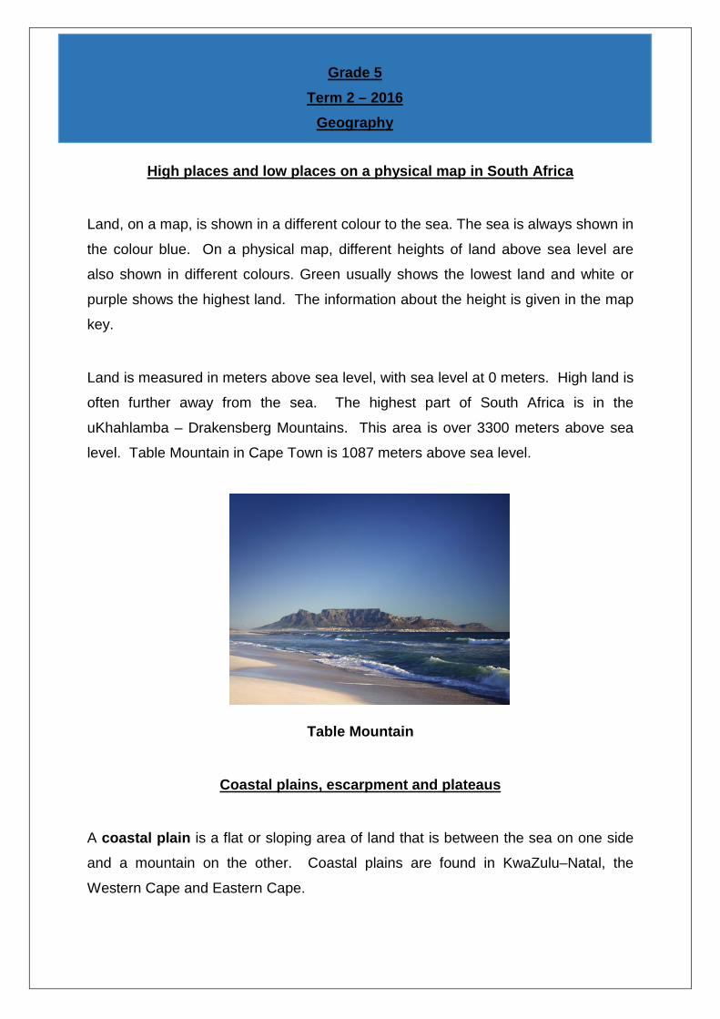
level. Table Mountain in Cape Town is 1087 meters above sea level.
Table Mountain
Coastal plains, escarpment and plateaus
A coastal plain is a flat or sloping area of land that is between the sea on one side
and a mountain on the other. Coastal plains are found in KwaZulu–Natal, the
Western Cape and Eastern Cape.
Grade 5
Term 2 – 2016 Geography
2
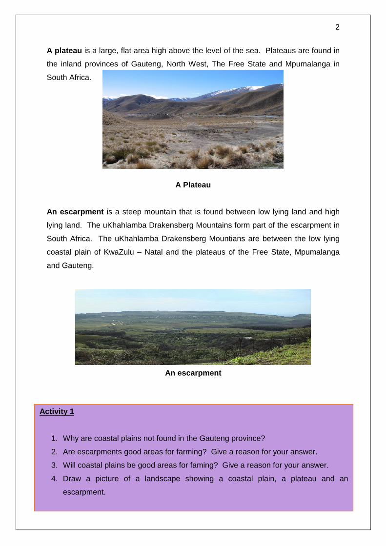
A plateau is a large, flat area high above the level of the sea. Plateaus are found in
the inland provinces of Gauteng, North West, The Free State and Mpumalanga in
South Africa.
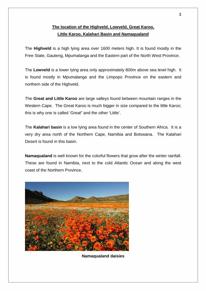
A Plateau An escarpment is a steep mountain that is found between low lying land and high
lying land. The uKhahlamba Drakensberg Mountains form part of the escarpment in
South Africa. The uKhahlamba Drakensberg Mountians are between the low lying
coastal plain of KwaZulu – Natal and the plateaus of the Free State, Mpumalanga
and Gauteng.
An escarpment
Activity 1
1. Why are coastal plains not found in the Gauteng province?
2. Are escarpments good areas for farming? Give a reason for your answer.
3. Will coastal plains be good areas for faming? Give a reason for your answer.
4. Draw a picture of a landscape showing a coastal plain, a plateau and an
escarpment.
3
The location of the Highveld, Lowveld, Great Karoo, Little Karoo, Kalahari Basin and Namaqualand
The Highveld is a high lying area over 1600 meters high. It is found mostly in the
Free State, Gauteng, Mpumalanga and the Eastern part of the North West Province.
The Lowveld is a lower lying area only approximately 800m above sea level high. It
is found mostly in Mpumalanga and the Limpopo Province on the eastern and
northern side of the Highveld.
The Great and Little Karoo are large valleys found between mountain ranges in the
Western Cape. The Great Karoo is much bigger in size compared to the little Karoo;
this is why one is called ‘Great” and the other ‘Little’.
The Kalahari basin is a low lying area found in the center of Southern Africa. It is a
very dry area north of the Northern Cape, Namibia and Botswana. The Kalahari
Desert is found in this basin.
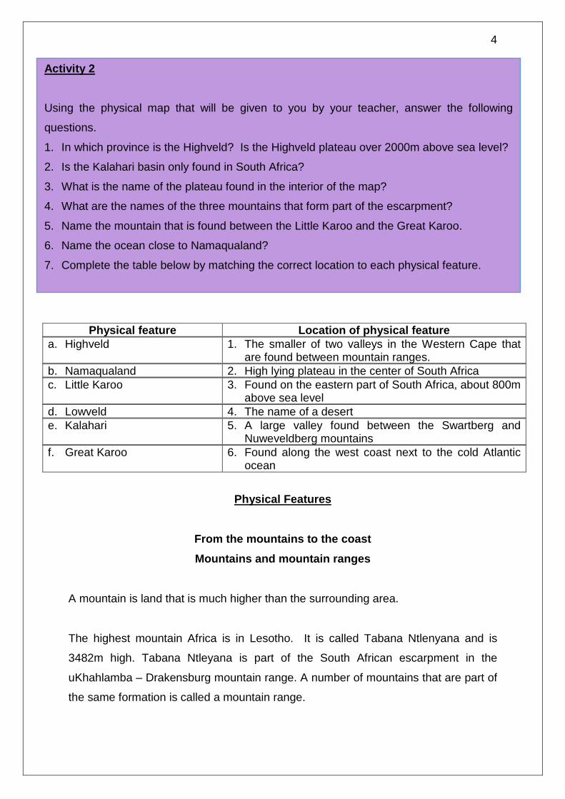
Namaqualand is well known for the colorful flowers that grow after the winter rainfall.
These are found in Namibia, next to the cold Atlantic Ocean and along the west
coast of the Northern Province.
Namaqualand daisies
4
Physical feature Location of physical feature a. Highveld 1. The smaller of two valleys in the Western Cape that
are found between mountain ranges. b. Namaqualand 2. High lying plateau in the center of South Africa c. Little Karoo 3. Found on the eastern part of South Africa, about 800m
above sea level d. Lowveld 4. The name of a desert e. Kalahari 5. A large valley found between the Swartberg and
Nuweveldberg mountains f. Great Karoo 6. Found along the west coast next to the cold Atlantic
ocean
Physical Features
From the mountains to the coast Mountains and mountain ranges
A mountain is land that is much higher than the surrounding area.
The highest mountain Africa is in Lesotho. It is called Tabana Ntlenyana and is
3482m high. Tabana Ntleyana is part of the South African escarpment in the
uKhahlamba – Drakensburg mountain range. A number of mountains that are part of
the same formation is called a mountain range.
Activity 2 Using the physical map that will be given to you by your teacher, answer the following
questions.
1. In which province is the Highveld? Is the Highveld plateau over 2000m above sea level?
2. Is the Kalahari basin only found in South Africa?
3. What is the name of the plateau found in the interior of the map?
4. What are the names of the three mountains that form part of the escarpment?
5. Name the mountain that is found between the Little Karoo and the Great Karoo.
6. Name the ocean close to Namaqualand?
7. Complete the table below by matching the correct location to each physical feature.
5
Valleys and hills Valleys are found between hills and mountains. Valleys are usually formed by rivers.
As the water flows, it drags rocks along the bottom of the river. The rocks erode or
cut into the mountain to form valleys.
Higher up the mountain, the valleys are steeper and narrower. Lower down the
valley becomes less steep and wider.
The valley is very wide and the slope is gentle at the sea or mouth of the river.
To more water there is in a river, the more energy a river has, to make the valley
bigger. As the river flows towards the sea, it will join with other rivers and become
larger. Higher up in the mountains, the river has less water, so the valleys are
smaller. Lower down, the river has more water and the valley is wider.
The uKhahlamba – Drakensberg Mountains
New word:
Erode: the breaking down of rock by moving water, wind or ice. In Geography
this means when something like a river cuts into soil or rock, or when the sea’s
waves cut into the land.
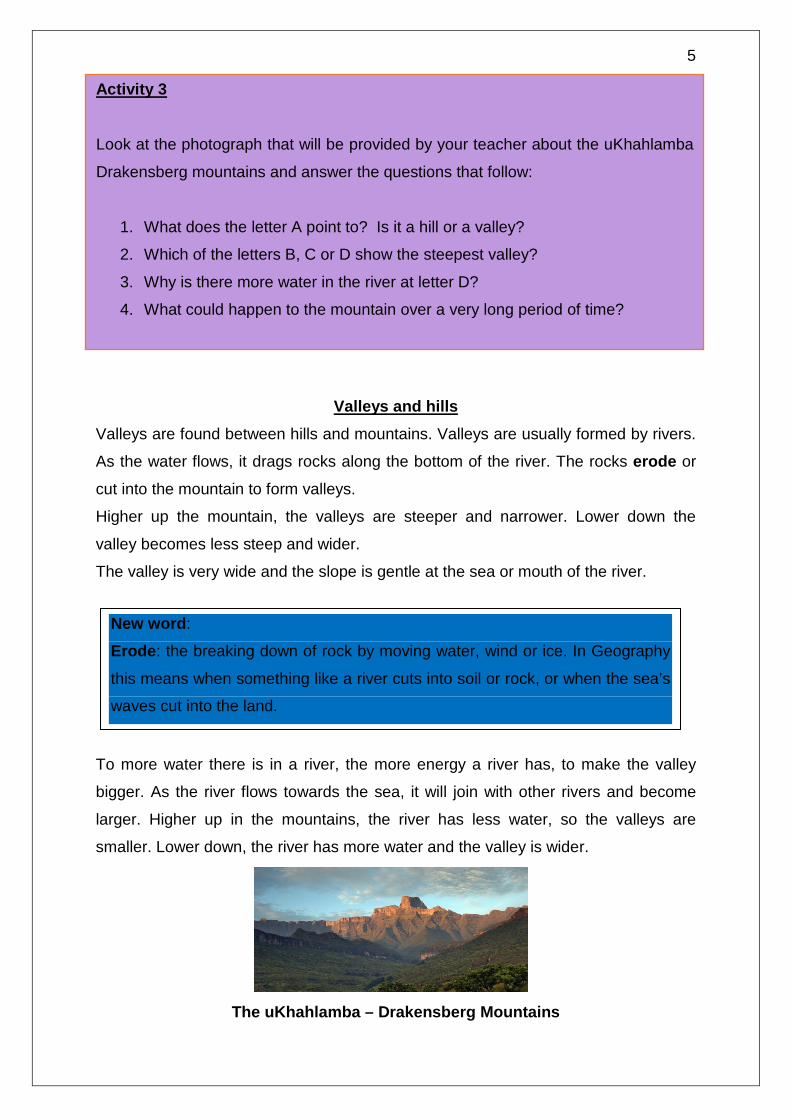
Activity 3 Look at the photograph that will be provided by your teacher about the uKhahlamba
Drakensberg mountains and answer the questions that follow:
1. What does the letter A point to? Is it a hill or a valley?
2. Which of the letters B, C or D show the steepest valley?
3. Why is there more water in the river at letter D?
4. What could happen to the mountain over a very long period of time?

6
Rivers and waterfalls A river flows from the mountains to the sea. The place where the river starts is
called its source. This is high up in the mountains where the rainfall collects. Rivers
end up flowing into the sea. This is called the mouth of the river.
Rivers tend to flow very strongly when there is a lot of rain. Some rivers flow all the
time. These rivers are shown as blue lines on a map. Others only flow when it has
rained and then they dry up when the rainy season stops. These rivers are shown
as broken blue lines on a map.
When water flows very over a steep drop in the riverbed, it is called a waterfall. The
water falls quickly over the steep slope. Waterfalls are usually found in rivers
because the river bottom is not always flat. When there is a steep drop in the river
bottom then the water will cascade down very rapidly.
A waterfall
Activity 4 Look at the drawing of the river landscape from the mountains to the sea, which
will be provided by the teacher, and answer the questions that follow:
1. Write down the letters A – E and write the position they show: a steep
valley, a wide valley, the source of the river, a waterfall and the mouth of
the river.
2. Why do you think a river starts in the mountains?
3. What happens to the amount of water in the river as it flows to the sea?

7
Capes and Bays – these are found along coastlines. Capes are pieces of land that
stick out into the sea. Bays are found between capes and are u-shaped. The bays
are areas where the land is soft and the sea can erode the land away more easily.
Capes on the other hand take long to erode because they have hard rock.
A Cape A bay
The location of some physical features in South Africa
Province Mountains Valleys and hills
Rivers Waterfalls Capes and bays
Northern Cape Richtersveldt Range
Orange/ Gariep Valley
Orange/ Gariep Augrabies West Coast Cape
Eastern Cape Escarpment Sneeuberge Amatola
Gamtoos valley Langkloof valley
Sundays Fish Kei
Riviersonderend Algoa Bay Cape Recife
Western Cape Cedarberg Mountains Table Mountain
Breede River Valley Berg River Valley
Breede Berg Olifants
Magwa Table Bay Saldanha Bay Cape Agulhas
Kwazulu - Natal Drakensberg Sneeuberge Escarpment
Valley of a thousand hills
Tugela Duzi Mzimkulu
Oribi Tugela
Richards Bay Umzinto Bay
Free State
Escarpment Drakensberg Maluti
Clarence valley Caledon Vaal Ash
none
Mpumulanga
Escarpment Drakensberg Lebombo
Loskop valley Crocodile Olifants
Berlin Lisbon
None
North west Pilanesberg Magaliesberg
Pilanesberg
Crocodile Hartz
None
Gauteng
Witwatersrand Magaliesberg
Lonehill Koppie
Vaal Apies
None
Limpopo Soutpansberge Waterberge
Limpopo valley
Limpopo Lephalala
None

8
Information about some features in the provinces of South Africa
How places got their names The name of a place often gives people an idea of what the place looks like or
sounds like. They are sometimes named after an important person, animal, event or
plant, which was closely linked to the culture of the people who found and named the
place.
After 1994, when South Africa became a democratic country, many names were
changed to traditional names. The following two places all have are interesting
because of the names they were given:
The Augrabies Falls were named by the Khoi people. Augrabies means ‘the water
that smokes.’ This was because the waterfall causes a lot of spray that looks like
smoke.
The uKhahlamba Mountains: The word uKhahlamba is a Zulu word. It means
barrier of spears. A spear is an important weapon that was used by the Zulu people
who lived in the area that is today called Kwazulu-Natal. The Dutch word for this
mountain is Drakensberg, which means ‘the mountain of the dragon.’
Where rivers begin and end
You have already learnt how water gets from the sea to the land and back to the
sea. The drawing below will remind you how the water cycle works:
9
A river will flow downwards from a mountain or high place to the ocean at sea level.
This downward movement is caused by the earth’s gravity. You also know that a
river flows from its source, which is in the mountains, to the river mouth at the sea.
River systems – tributaries and catchment areas
When many rivers join together to form a bigger river, all these rivers together are
called a river system. The rivers that make up the large river are called tributaries.
Rivers get their water from rain falling into the river. They also get water from the
land around the river and this is called the catchment area. All rivers have their own
catchment areas. When rivers join with other rivers, the size of the catchment area
gets bigger. The bigger the catchment area, the more water there will be in a river.
The main rivers of South Africa
The escarpment is the highest and longest range of mountains in South Africa. Most
of South Africa’s rivers have their source in these mountains. This means that most
rivers start in the high mountains of the escarpment. The shorter rivers in South
Africa flow from the escarpment east and south wards to the sea. Examples are the
Great Fish River in the Eastern Cape and the Tugela River in Kwazulu Natal. The
Limpopo River starts in the Highveld in the North West Province and flows northeast
to the Indian Ocean. The Orange/Gariep River flows from the escarpment in
Lesotho in a northwest direction, to the Atlantic Ocean. The Vaal River in Gauteng is
a tributary of the Orange/Gariep River.
Activity 5 Look at the physical map and the diagram of the main rivers of South Africa that will be
given to you in class and answer the following questions:
1. Name the longest river in South Africa.
2. Why the coastal rivers so short?
3. Name all the tributaries of the Orange/Gariep River?
4. How do you think the Crocodile River, a tributary of the Limpopo River, got its
name?
10
How the physical landscape in South Africa affects people’s lifestyles
Few people live on high mountains. This is because it is difficult to get up to the top
of a mountain. Soil on the top of mountains is also unsuitable to grow crops. Not
many people live in deserts as it is too hot and there is very little water to grow crops.
More people live in valleys because the soil is good and water is readily available
from the rivers. Valleys are good catchment areas for rivers so, in valleys, people
can grow crops, plant trees and farm animals. Many people live next to warm
oceans. The reason for this is that the climate is comfortable and the rainfall is good
for growing crops. Fewer people live next to cold oceans because the climate is not
very comfortable and the rainfall is less. This means it is difficult to grow crops. In
South Africa, most people live in the province of Gauteng and the cities of Durban,
Port Elizabeth and Cape Town.
How human activities change landscapes
Mostly, people stay in homes near other people in some sort of settlement. Land is
used for farming and sometimes for mining minerals or drilling for fuels and oils.
People also need land for producing goods in factories and industries. These
activities can be harmful to the land. For all our activities, we use water, transport,
electricity or other power.
Dams, roads and power stations take up a lot of the land. In order to build places to
live or mines or factories and all other things that humans need, people have had to
change the landscape. As cities and towns become bigger, factories and homes are
built very close to rivers and the ocean.
Climate change has resulted in more storms and this causes rivers to flood and
waves to crash into the coast. Over the last few years, there have been many
reports of buildings and roads being washed away and people killed near rivers and
oceans. Houses built too close to oceans are being destroyed and man–made sea
walls get broken down in storms or tsunamis.
11
How a dam changes the physical environment
Dams are important to people because they store water for us to use for many
things. There are many things to consider before a dam can be built. Sometimes
the negative results of building a dam are not identified and this can have disastrous
effects on the land around the dam or on the success of the dam.
We need to think about the following things before building a dam:
• Is the dam wide and deep enough?
• Does the river system have enough water to keep the dam full?
• How many people live in the valley?
• Do they really need the river water that the dam will catch?
• What will happen to the animals and plants if a dam is built?
• What happens if the dam is damaged in a flood?
The Katse dam is built in Lesotho. Water from the dam is used in South Africa. The
dam wall is 185m high. The catchment area is 32 km long.
How roads change the physical environment
Roads are built to link towns and cities. Some roads are built to bring resources to
the towns. Roads follow the shape of the landscape. This means they will go along
the side of a cliff or they will follow the shape of a coastline. Roads cannot be too
steep. When roads have to cross mountains they are cut into mountains or tunnels
are made through the mountains. When roads have to cross a river, bridges need to
be built.
Sometimes, cutting into a mountain loosens the earth and rock. Thus, when it rains,
landslides are caused. Roads sometimes block off the natural flow of water. The
flowing rain water can break down the road. Engineers have to design roads
carefully to prevent this as much as possible.

12
Highways and fly-overs are built so that traffic can flow easily in towns and cities.
More roads and bigger roads can result in an increase in the number of cars on the
roads. In South Africa, the government is trying to reduce the traffic on roads by
encouraging people to use public transport. It is cheaper and much healthier for
people to use public transport, as there is a lot of pollution from exhaust fumes of
cars and trucks. This pollution affects the environment, causing damage to people,
plants and animals.
Bibliography: Angier K; Carr D; Cockburn J; Wallace J – Our World, Our Society
Grade 5.