goddard 2015: steve volz, noaa
TRANSCRIPT
On the Cusp: What’s Next?
53rd Robert H. Goddard Memorial Symposium
March 11, 2015
NOAA Satellite and Information Service
NOAA Satellite and Information ServiceDr. Stephen Volz, Assistant Administrator
2
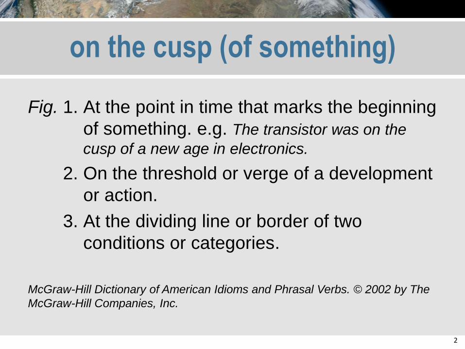
on the cusp (of something)
Fig. 1. At the point in time that marks the beginning
of something. e.g. The transistor was on the
cusp of a new age in electronics.
2. On the threshold or verge of a development
or action.
3. At the dividing line or border of two
conditions or categories.
McGraw-Hill Dictionary of American Idioms and Phrasal Verbs. © 2002 by The
McGraw-Hill Companies, Inc.
3
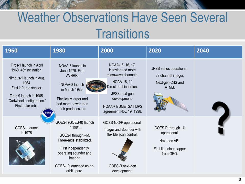
1960 1980 2000 2020 2040
Weather Observations Have Seen Several
Transitions
Tiros-1 launch in April
1960. 48o inclination.
Nimbus-1 launch in Aug.
1964.
First infrared sensor.
Tiros-9 launch in 1965.
“Cartwheel configuration.”
First polar orbit.
GOES-1 launch
in 1975.
NOAA-6 launch in
June 1979. First
AVHRR.
NOAA-8 launch
in March 1983.
Physically larger and
had more power than
their predecessorsNOAA + EUMETSAT IJPS
agreement Nov. 19, 1998.
GOES-I (GOES-8) launch
in 1994.
GOES-I through –M.
Three-axis stabilized.
First independently
operating sounder and
imager.
GOES-10 launched as on-
orbit spare.
GOES-R through –U
operational.
Next-gen ABI.
First lightning mapper
from GEO.
GOES-R next-gen
development.
GOES-N/O/P operational.
Imager and Sounder with
flexible scan control.
NOAA-15, 16, 17.
Heavier and more
microwave channels.
NOAA-18, 19
Direct orbit insertion.
JPSS next-gen
development.
JPSS series operational.
22 channel imager.
Next-gen CrIS and
ATMS.
4
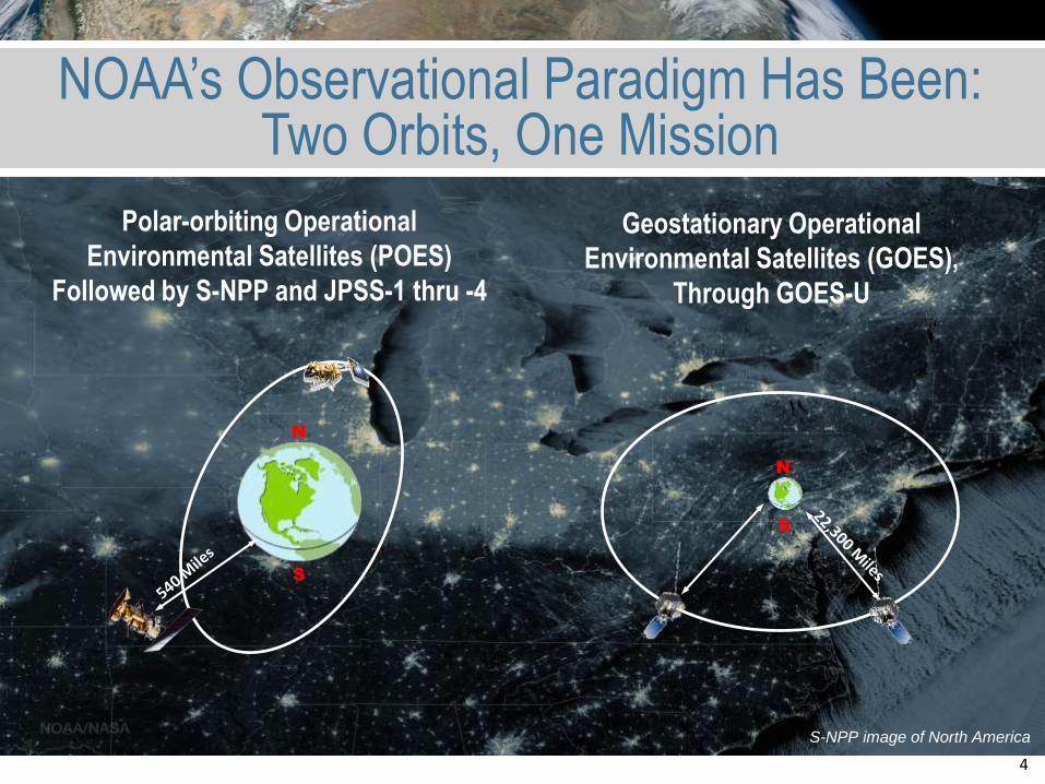
NOAA’s Observational Paradigm Has Been: Two Orbits, One Mission
N
S
N
S
Polar-orbiting Operational
Environmental Satellites (POES)
Followed by S-NPP and JPSS-1 thru -4
Geostationary Operational
Environmental Satellites (GOES),
Through GOES-U
S-NPP image of North America
5
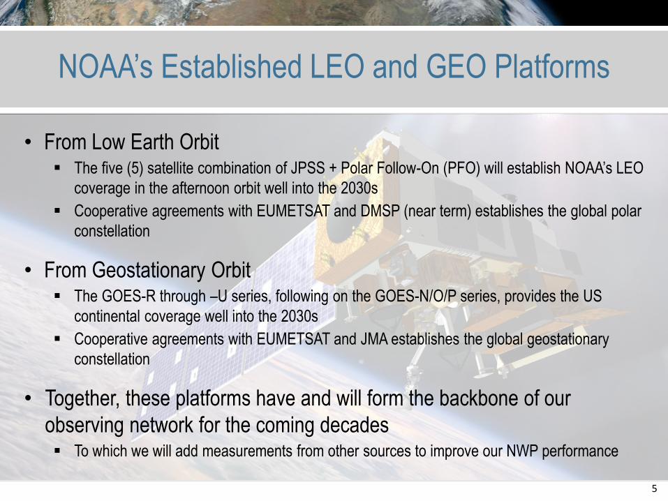
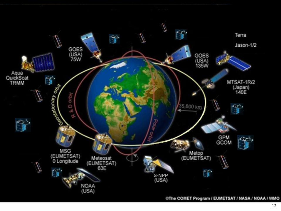
NOAA’s Established LEO and GEO Platforms
• From Low Earth Orbit The five (5) satellite combination of JPSS + Polar Follow-On (PFO) will establish NOAA’s LEO
coverage in the afternoon orbit well into the 2030s
Cooperative agreements with EUMETSAT and DMSP (near term) establishes the global polar
constellation
• From Geostationary Orbit The GOES-R through –U series, following on the GOES-N/O/P series, provides the US
continental coverage well into the 2030s
Cooperative agreements with EUMETSAT and JMA establishes the global geostationary
constellation
• Together, these platforms have and will form the backbone of our
observing network for the coming decades To which we will add measurements from other sources to improve our NWP performance
6
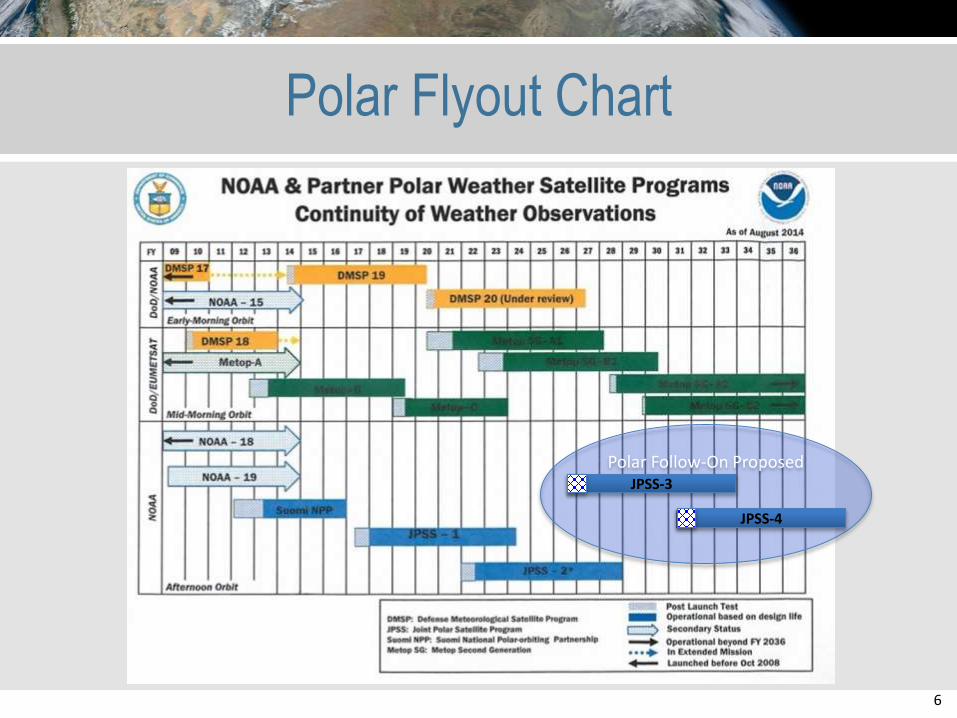
Polar Flyout Chart
Polar Follow-On ProposedJPSS-3
JPSS-4
7
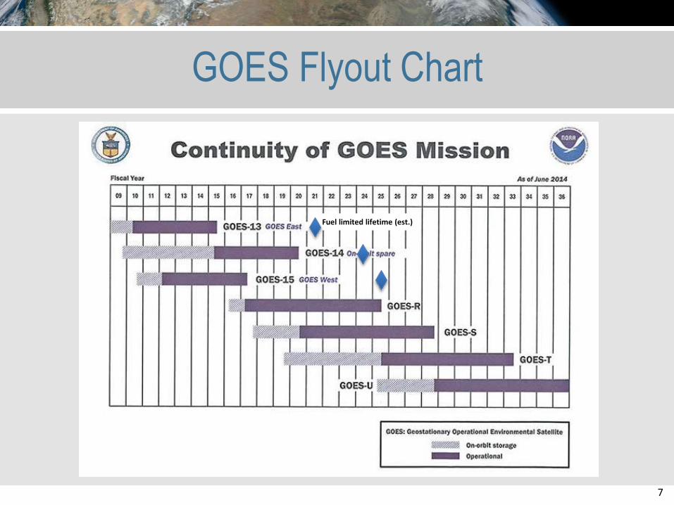
GOES Flyout Chart
Fuel limited lifetime (est.)
8
S-NPP
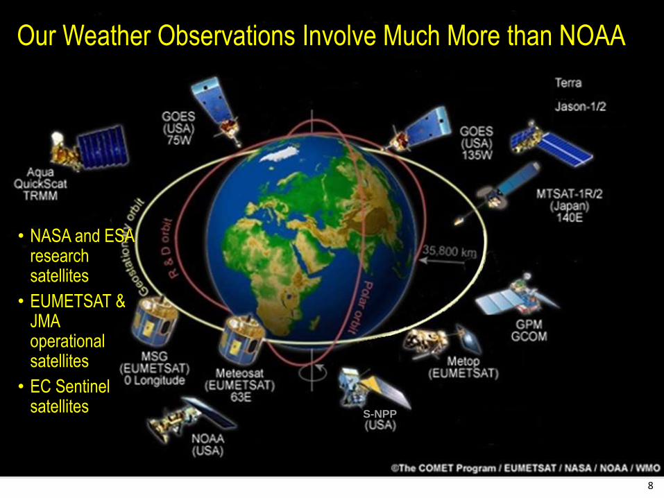
Our Weather Observations Involve Much More than NOAA
• NASA and ESA research satellites
• EUMETSAT & JMA operational satellites
• EC Sentinel satellites
9
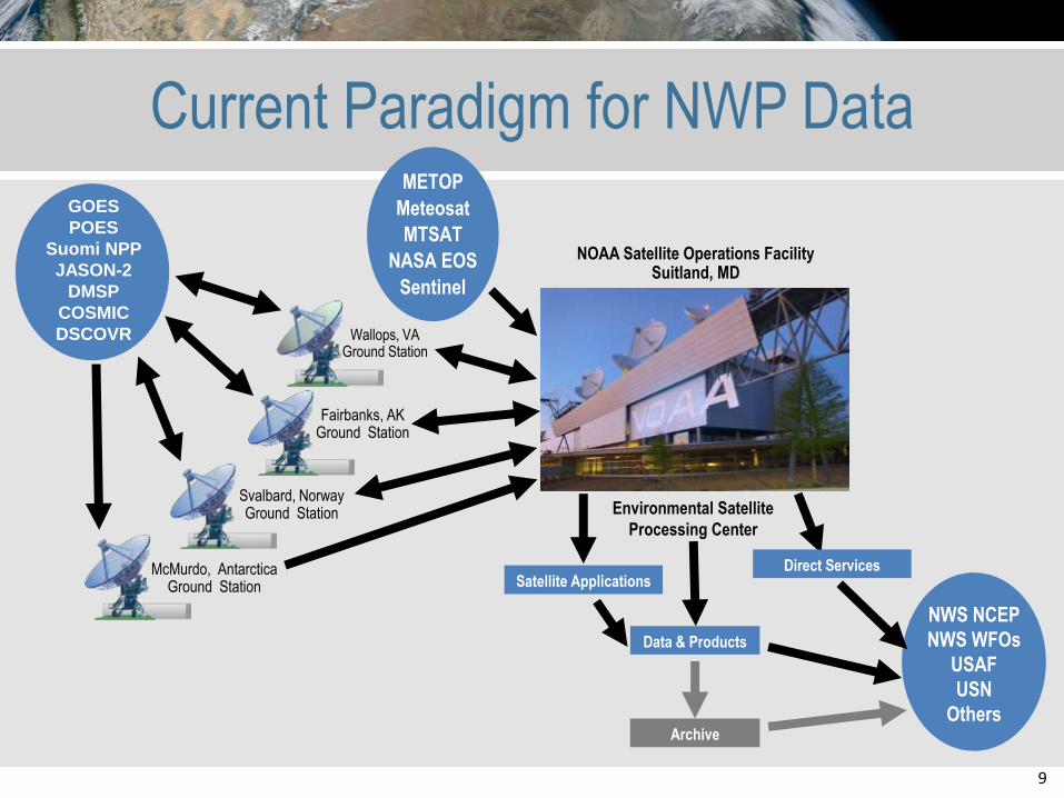
Current Paradigm for NWP Data
Fairbanks, AK Ground Station
Wallops, VA Ground Station
NOAA Satellite Operations FacilitySuitland, MD
NWS NCEP
NWS WFOs
USAF
USN
Others
METOP
Meteosat
MTSAT
NASA EOS
Sentinel
GOES
POES
Suomi NPP
JASON-2
DMSP
COSMIC
DSCOVR
Svalbard, Norway Ground Station Environmental Satellite
Processing Center
Satellite Applications
Data & Products
Archive
Direct ServicesMcMurdo, AntarcticaGround Station
10
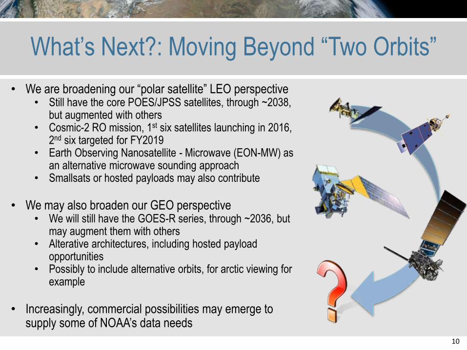
What’s Next?: Moving Beyond “Two Orbits”
• We are broadening our “polar satellite” LEO perspective• Still have the core POES/JPSS satellites, through ~2038,
but augmented with others• Cosmic-2 RO mission, 1st six satellites launching in 2016,
2nd six targeted for FY2019• Earth Observing Nanosatellite - Microwave (EON-MW) as
an alternative microwave sounding approach• Smallsats or hosted payloads may also contribute
• We may also broaden our GEO perspective• We will still have the GOES-R series, through ~2036, but
may augment them with others• Alterative architectures, including hosted payload
opportunities• Possibly to include alternative orbits, for arctic viewing for
example
• Increasingly, commercial possibilities may emerge to supply some of NOAA’s data needs
11
NOAA’s Ongoing Commercial Discussions
NOAA Commercial Data Policy
Policy to guide the use of space-based commercial data and
services to meet NOAA requirements
NESDIS Commercial Solutions Assessment Process
Defines NESDIS process for engaging with the commercial
sector to leverage commercial solutions for space-based earth
observation requirements
Both are in review in the Administration, expected release
2015.
12
S-NPP
13
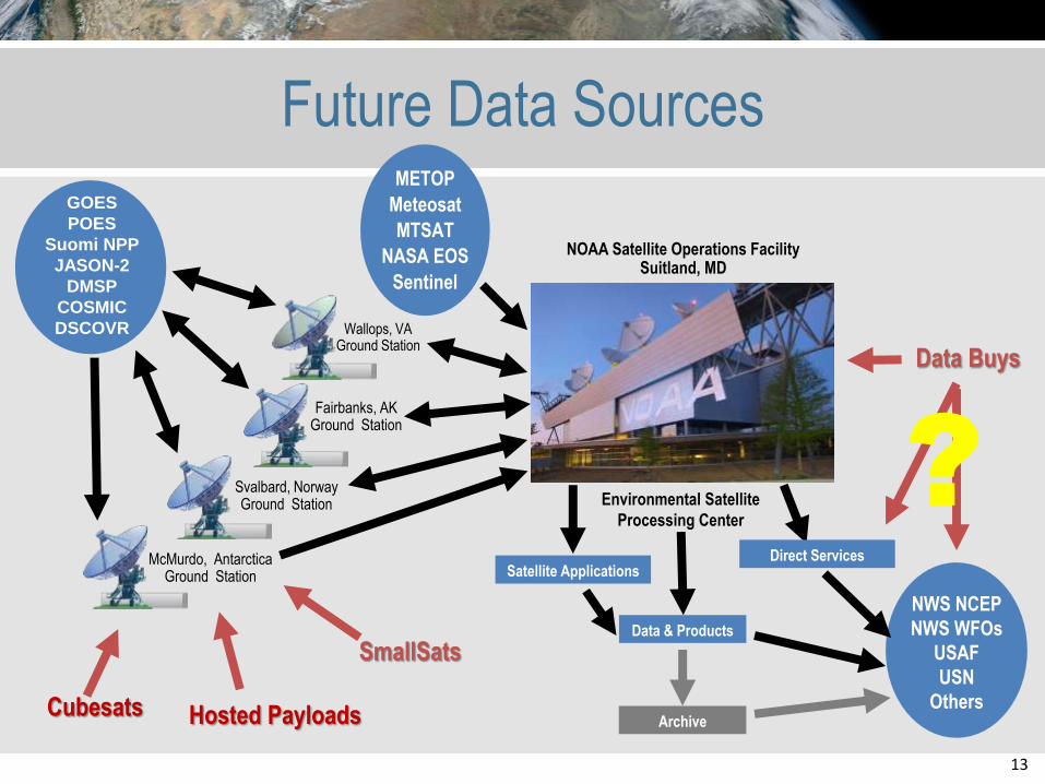
Future Data Sources
Fairbanks, AK Ground Station
Wallops, VA Ground Station
NOAA Satellite Operations FacilitySuitland, MD
NWS NCEP
NWS WFOs
USAF
USN
Others
GOES
POES
Suomi NPP
JASON-2
DMSP
COSMIC
DSCOVR
Svalbard, Norway Ground Station Environmental Satellite
Processing Center
Satellite Applications
Data & Products
Archive
Direct ServicesMcMurdo, AntarcticaGround Station
Cubesats Hosted Payloads
Data Buys
SmallSats
?
METOP
Meteosat
MTSAT
NASA EOS
Sentinel
14
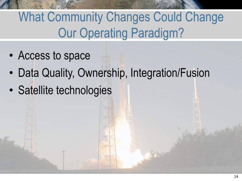
What Community Changes Could Change
Our Operating Paradigm?
• Access to space
• Data Quality, Ownership, Integration/Fusion
• Satellite technologies
15
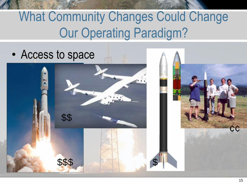
What Community Changes Could Change
Our Operating Paradigm?
• Access to space
• Data Quality, Ownership, Integration/Fusion
• Satellite technologies
$$$
$$
$
¢¢
16
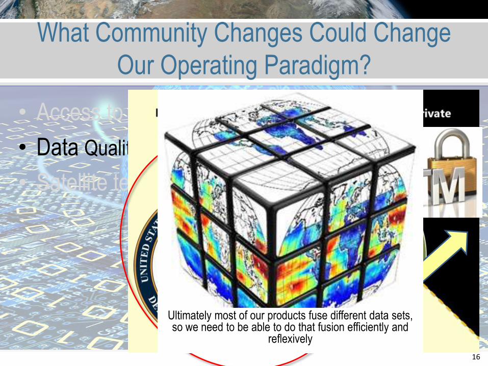
What Community Changes Could Change
Our Operating Paradigm?
• Access to space
• Data Quality, Ownership, Integration/Fusion
• Satellite technologies
Ultimately most of our products fuse different data sets, so we need to be able to do that fusion efficiently and
reflexively
17
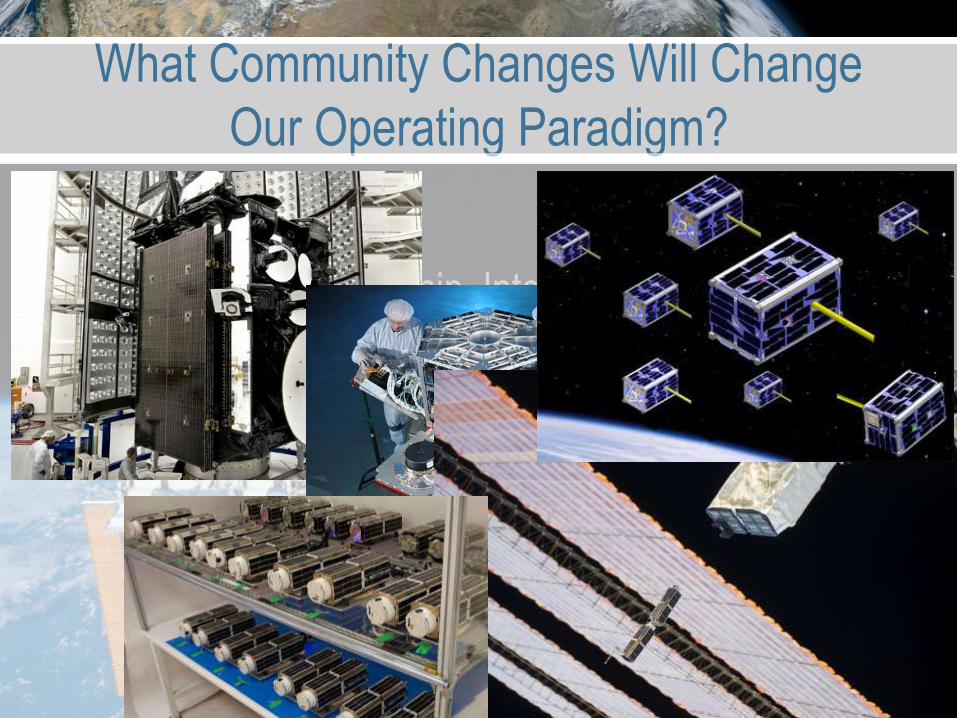
What Community Changes Will Change
Our Operating Paradigm?
• Access to space
• Data Quality, Ownership, Integration/Fusion
• Satellite technologies
18
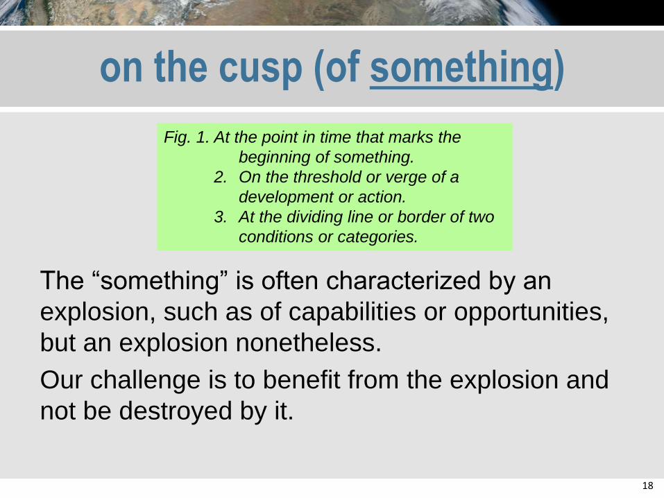
on the cusp (of something)
The “something” is often characterized by an
explosion, such as of capabilities or opportunities,
but an explosion nonetheless.
Our challenge is to benefit from the explosion and
not be destroyed by it.
Fig. 1. At the point in time that marks the
beginning of something.
2. On the threshold or verge of a
development or action.
3. At the dividing line or border of two
conditions or categories.