global space-time soil organic carbon assessment
TRANSCRIPT

Global space-time soil organic carbon assessment
José PadarianUta Stockmann
Budiman MinasnyAlex B. McBratney
Dominique Arrouays

Background
● Increasing demand on global and digital soil information
● GlobalSoilMap project initiated during IUSS Digital Soil mapping WG conference (2006) in Rio de Janeiro
Deliver a global, digital database of soil properties (and associated uncertainties) at 100m resolution

GSM Product
● 0 to 2-m, 6 harmonised depth intervals
● List of attributes critical for modelling and management○ Soil organic carbon○ Bulk density○ …
● Predictions + uncertainties
● Harmonised specifications
0 - 5 cm5 – 15 cm15 – 30 cm30 – 60 cm60-100 cm100-200 cm

GSM Product
● Bottom-up (country-by-country) approach
● Using legacy data
● Capacity building...

Global soil organic carbon assessment

~64,000 profiles with date information (out of ~150,000)

Methodology
S = f(s,c,o,r,p,a,n) + ε
Covariates (soil forming factors):s: (other) soil propertiesc: climateo: organisms (landcover)r: relief, topographyp: parent materiala: age (time)n: geographic position

Results

Dependingon landcover
Simple model
topo + climate + landcover
Without “memory”

Stage two approach: Two-step model
Baseline
● Generate SOC predictions for 2001 (scorpan approach)
Landcover tracking
● Where a landcover change occurs● When a landcover change occurs● From landover X to Y● How long the landcover persists

Magnitude, rate and shape● Magnitude depends on landcover and
Köppen-Geiger classification● Rate depends on temperature and
precipitation● Shape depends on direction of the
change (gain or loss)
~14,890 million(land) pixels tracked
~193,570 millionpixels between 2001-2003
Rate
Shape

2,100 ha. in Kalimantan (Indonesia) showing a transition fromnative forest to palm tree plantation
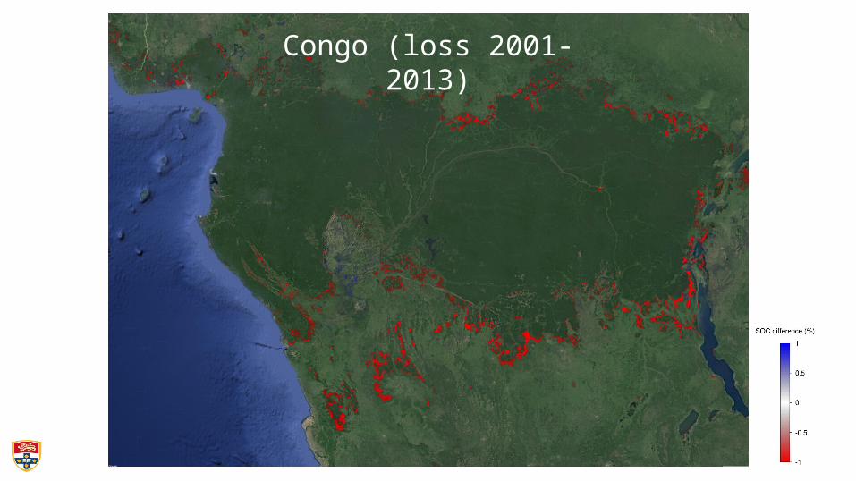
Congo (loss 2001-2013)

Global carbon loss 2001-2013

Final resolution: 100 m (Rondônia State, Brazil)
Landsat2001
Prediction2013
SOC change(2001-2013)
Landsat2013

Current work
Propagating uncertainty
Developing pedotransfer functions to predict BD Stocks
Modelling special cases (wetlands, peatland, gelisols)
Estimating SOC critical values

Conclusions
• We can generate products following GSM specifications and…
- we add a dynamic component.
• We would love more data and most of all collaboration
• All work done, and results served, in Google Earth Engine
...

Global Soil Map 2017Conference
Moscow, RussiaV.V. DOKUCHAEV SOIL SCIENCE INSTITUTE
RUDN UNIVERSITY SOIL SCIENTISTS SOCIETY NAMED
AFTER V.V.DOKUCHAEV
V.V. DokuchaevSoil Science Institute
RUDNUniversity
4 - 6 July 2017
WG Global Soil Map

GLOBAL SOIL SECURITYPEDOMETRICSDIGITAL SOIL MAPPINGDIGITAL AGRICULTUREPossumus Volumus
We can. We shall.
SYDNEY INSTITUTE OF AGRICULTURE