gfoss day 2012 geonetwork presentation
DESCRIPTION
Presentation on GeoNetwork given at the GFOSS Day 2012TRANSCRIPT
GeoNetwork, The Open Source Solution
for the interoperable management of geospatial metadata
Ing. Emanuele Tajariol, GeoSolutions
Ing. Simone Giannecchini, GeoSolutions
GFOSS DAY 2012, Torino
November 14th 2012
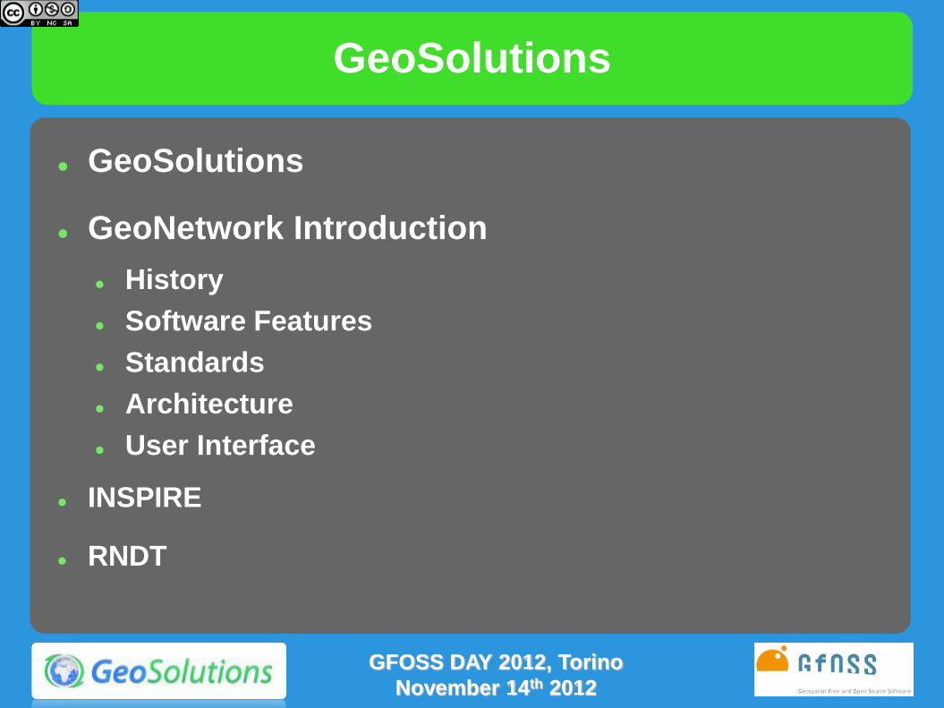
GeoSolutions
GeoSolutions
GeoNetwork Introduction
History
Software Features
Standards
Architecture
User Interface
INSPIRE
RNDT
GFOSS DAY 2012, Torino
November 14th 2012
GeoSolutions
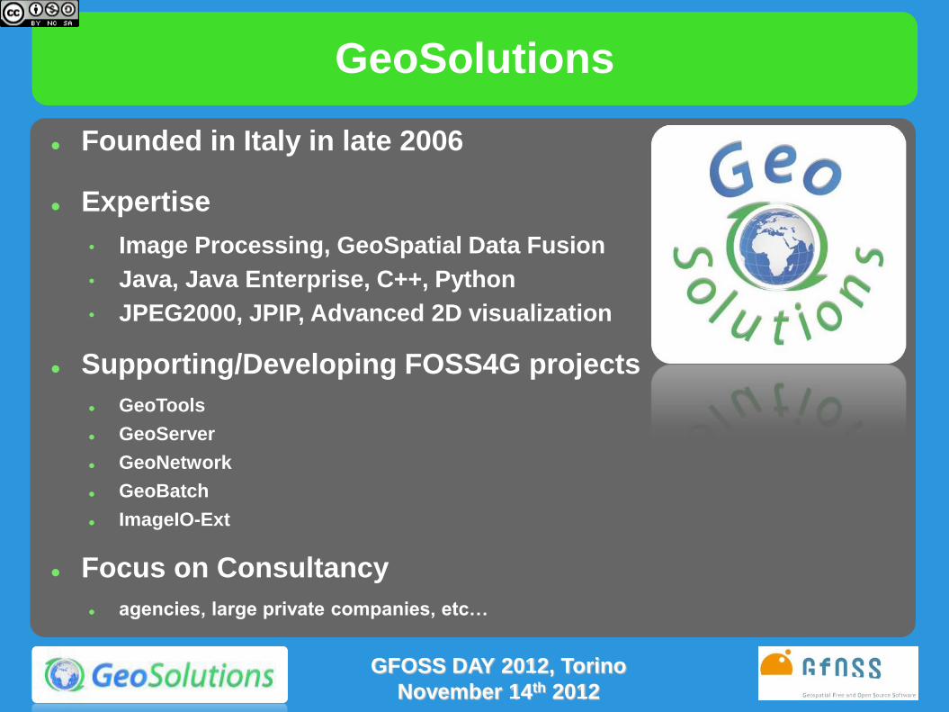
Founded in Italy in late 2006
Expertise
• Image Processing, GeoSpatial Data Fusion
• Java, Java Enterprise, C++, Python
• JPEG2000, JPIP, Advanced 2D visualization
Supporting/Developing FOSS4G projects
GeoTools
GeoServer
GeoNetwork
GeoBatch
ImageIO-Ext
Focus on Consultancy
agencies, large private companies, etc…
GFOSS DAY 2012, Torino
November 14th 2012

GeoNetwork
(GeoSpatial) Catalog
Registry of Metadata
Repository
Enterprise Search Appliance
GeoPortal
SDI entry point
Information Broker
Metadata Editor
Standards Based
Implemented with Java Enterprise technologies
GFOSS DAY 2012, Torino
November 14th 2012

Technologies
Java Enterprise
Apache Lucene for speed light search
Support for different backends
MYSQL, Oracle, Postgresql, etc..
XSL Templates for flexible presentation
XML Schema
Metadata Validation and Editing
Support for Enterprise Security
LDAP
Shibboleth
GFOSS DAY 2012, Torino
November 14th 2012

Standards
ISO TC 211
19110:2005
19115:2003
19115:2005
19119:2005
19139:2007
23950/Z39.50
OGC
CSW 2.0.2 (ISO
Profile)
INSPIRE
Discovery Service
Others
FGDC
OpenSearch Geo
RSS/GeoRSS
WebDAV
OAI-PMH
Dublin Core
GFOSS DAY 2012, Torino
November 14th 2012

GeoNetwork: features (1)
Search capabilities to access local and distributed geospatial catalogues
Up- and downloading of data, graphics, documents, pdf files and any other content type
An interactive Web Map Viewer to combine Web Map Services from local and distributed servers around the world
On-line editing of metadata with a powerful template system
XSD schema and schematron validation of metadata
Native support for international metadata standards
Multilingual metadata support for the ISO19115/19119/19110
GFOSS DAY 2012, Torino
November 14th 2012

GeoNetwork: features (2)
INSPIRE advanced search option
Data and metadata export/import procedures
Scheduled harvesting and synchronization of metadata between distributed catalogues (GeoNetwork, CSW, Z39.50, OGC WxS, WebDav, Thredds, OAI-PMH)
Support CSW 2.0.2 ISO Profile, OAI-PMH, Z39.50 protocols
Administration of groups and users through Web interface
Multi-lingual user interface
Data updates dissemination via RSS news feeds and as GeoRSS
GFOSS DAY 2012, Torino
November 14th 2012

Standards
COMMON LANGUAGES
EXCHANGE FORMATS
CATALOGUES/ WEB SERVICES
• Metadata – ISO19115:2003, ISO19119:2005, ISO19110:2005,
ISO19139:2007
– FGDC, Dublin Core
• Export/Import – RSS & GeoRSS newsfeeds
– XML + XSL
• Catalogue interfaces – OGC CSW 2.0.2 ISO Profile
– OAI-PMH
– Z39.50
– Geo-OpenSearch
– GeoRSS
– WebDAV
• Web Mapping Client – OGC standards for WMS, WMC
• Web Map Server (through GeoServer) – WMS, WFS, WFS-t, WCS, KML
GFOSS DAY 2012, Torino
November 14th 2012

Architecture
Metadata registry
Spatial data repository
Lucene index
Search Edit
View map
Frontend - UI
GeoServer
Backend - GeoNetwork Backend - GeoServer
GFOSS DAY 2012, Torino
November 14th 2012

Registry
Manage, Publish and
Search collections of
metadata about Data,
Services and related
information ISO 19115 Metadata about
Data
ISO 19119 Metadata about
Services
Enterprise Unique
entry point
Act as a Broker (SOA)
Can work in federation
Multilingualism
GFOSS DAY 2012, Torino
November 14th 2012

Repository
GeoNetwork can be used as a repository
for the data it describes
Authorization on data are independent from
authorization on related metadata
Easy-to-use editor controls to upload data
and set automatically the onLineResource
URL
GFOSS DAY 2012, Torino
November 14th 2012

Registry - Federation
Multiple Registries for Multiple Enterprise Clouds
Different data/services
Different Organizations
Federation reduces complexity
Available Paradigms
Harvesting
Synchronized Local Copy of remote Metadata
Remote Search
Federating node as NoCache proxy for queries
GeoNetwork supports both
GFOSS DAY 2012, Torino
November 14th 2012

GeoNetwork
OGC Portal Reference Architecture
GFOSS DAY 2012, Torino
November 14th 2012

Architecture
• Desktop and server versions running on any platform – Windows, Linux, Mac OSX
• Java Application using – XML+XSL
– Lucene (Apache Project for XML file indexing) – Jeeves (Open Source project for XMLDB interface)
Java Application
DB
McKoi (Desktop), MySQL, Oracle
GeoNetwork Template
XSL
Indexing
Lucene
Jetty (Desktop), Tomcat
Jeeves
(DB XML)
GFOSS DAY 2012, Torino
November 14th 2012

Metadata harvesting
GeoNetwork
Nodes
Hierarchical
harvesting
Multiple paths
to same
source Loops
GFOSS DAY 2012, Torino
November 14th 2012

Enterprise GeoPortal
User Friendly Search/View GeoPortal
Customizable Presentation
Search Forms
Results Presentation
Based on XSL templates
Embedding in third party sites
Integrate with A&A layers
Different views for different
roles
Metadata Profiling
GFOSS DAY 2012, Torino
November 14th 2012

Enterprise GeoPortal
Metadata Profiling
Authentication
Internal user management for smaller deploys
LDAP integration
Shibboleth integration (federated SSO)
Authorization
User groups (grants on metadata) - customizable
User profiles (grants on operations) - fixed
Metadata access authorization is fine grained at group
level
GFOSS DAY 2012, Torino
November 14th 2012

User interface/Home page
GFOSS DAY 2012, Torino
November 14th 2012

Web user interface/Search
Simple/local search
Advanced search
GFOSS DAY 2012, Torino
November 14th 2012

Web user interface/Search
Inspire-based search options
GFOSS DAY 2012, Torino
November 14th 2012
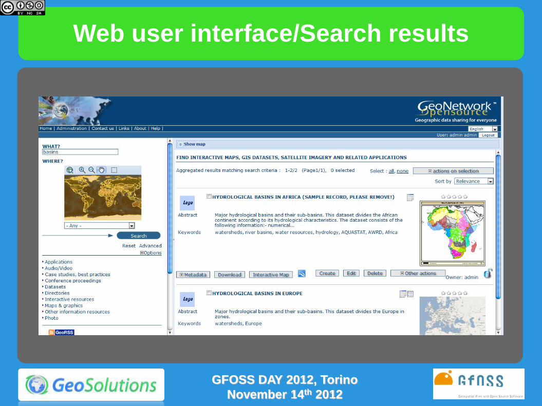
Web user interface/Search results
GFOSS DAY 2012, Torino
November 14th 2012

Web user interface/Metadata Display
Metadata
details
Metadata
summary
GFOSS DAY 2012, Torino
November 14th 2012

Web user interface/Search results
GFOSS DAY 2012, Torino
November 14th 2012

Web user interface/Search results
GFOSS DAY 2012, Torino
November 14th 2012

Web user interface/Search results
GFOSS DAY 2012, Torino
November 14th 2012

Embedded Web Map Client
Map viewer
opened Layer tree
section
Add data layer
(layers toolbar)
Map toolbar
Web user interface/Web map viewer
GFOSS DAY 2012, Torino
November 14th 2012

Google Earth Support
View in Google Earth
GFOSS DAY 2012, Torino
November 14th 2012

Administration section
Login/Logout
Administration
Add new metadata
GFOSS DAY 2012, Torino
November 14th 2012

Metadata editor/Default View
GFOSS DAY 2012, Torino
November 14th 2012

Metadata editor/XML View
Full ISO metadata support ISO19115:2003 / ISO19139:2007
GFOSS DAY 2012, Torino
November 14th 2012

Metadata editor/Categories assignment
GFOSS DAY 2012, Torino
November 14th 2012

Metadata editor/Data upload
GFOSS DAY 2012, Torino
November 14th 2012

Metadata editor/Privileges assignment
GFOSS DAY 2012, Torino
November 14th 2012

Harvesting management
GFOSS DAY 2012, Torino
November 14th 2012

Localization Support
GFOSS DAY 2012, Torino
November 14th 2012

Metadata Editor
Terms and Rules from ISO 19115 and 19119
Encoding in 19139, FGDC and Dublin Core
Intuitive Web-Based Editor with Validation
Identification Section
Distribution Section
Reference System Section
Data Quality Section
Metadata Section
Highly Customizable
Presentation
Validation
GFOSS DAY 2012, Torino
November 14th 2012

Metadata Editor
Additional capabilities Extensible Templates’ set
Visual Validation
Extensive online resource
management (WMS, File
download, etc..)
Additional Metadata Linking
(dataset/service, parent/child,
feature catalog/dataset
metadata)
Role assignment for
presentation profiling
Multilingual Support
Batch Import/Insert from XML
GFOSS DAY 2012, Torino
November 14th 2012

INSPIRE: about
The INSPIRE directive aims to create a European Union (EU)
spatial data infrastructure.
This will enable the sharing of environmental spatial information
among public sector organisations and better facilitate public
access to spatial information across Europe.
The INSPIRE directive came into force on 15 May 2007 and will
be implemented in various stages, with full implementation
required by 2019.
Institutional site: http://inspire.jrc.ec.europa.eu/
GFOSS DAY 2012, Torino
November 14th 2012

INSPIRE: about
Infrastructure for Spatial Information in the European
Community 2007/2/EC Directive, 14/03/2007
Fully in place by 2019
Implementing Rules and Technical Guidance to implement
EU-wide Interoperable SDIs IR are legally binding
TC are not legally binding
Main Aspects Covered Metadata
Network Services
Data and Service Sharing
Data Specification
Monitoring and Reporting
Maximum Reuse of existing standards (OGC, ISO, W3C)
GFOSS DAY 2012, Torino
November 14th 2012

INSPIRE: Who does What
Discovery service GeoNetwork
View, Download, InvokeSD, Transformation
Service GeoServer
GFOSS DAY 2012, Torino
November 14th 2012

INSPIRE: discovery services
Discovery of spatial dataset and services
Provide operations on services
query about service capabilities
register other federated Discovery Services
Provide operations on metadata
search
update (both push and pull modes),
perform federated searches
Based on Metadata specs from ISO
TG requires CSW 2.0.2 ISO AP as starting point
GFOSS DAY 2012, Torino
November 14th 2012

INSPIRE: discovery services in GeoNetwork
GeoNetwork implements CSW 2.0.2 ISO Profile
INPIRE extended constraints in metadata should be
explicitly enabled in GeoNetwork
Complies with almost all main requirements in Metadata
Implementation and Discovery Services
Main compliancy issues in:
Handling federated catalogues
in Discovery Service Metadata and Link Discovery Service
operations
Federated metadata retrieving
no CSW, only Z39.50
Publishing in pull mode
matching CSW Harvest operation in GN is not stable yet
GFOSS DAY 2012, Torino
November 14th 2012

INSPIRE and ISO19115/19139
INSPIRE supported metadata are based on
• ISO19115/19139 (metadata)
• ISO19119 (services)
There are some differences in constraints on metadata
elements between ISO19115 and INSPIRE.
The use of the INSPIRE guidelines to create INSPIRE
metadata ensures that the metadata is not in conflict
with ISO 19115. However, full conformance to ISO
19115 implies the provision of additional metadata
elements which are not required by INSPIRE.
GFOSS DAY 2012, Torino
November 14th 2012

INSPIRE support in GeoNetwork
• Editing view that underlines INSPIRE required
elements
• Easy check and insertion of INSPIRE required
elements
• Schematron rules to check for INSPIRE conformance
• Search using INSPIRE codelists
• Extended CSW queryables fields to match INSPIRE
requirements
GFOSS DAY 2012, Torino
November 14th 2012

RNDT: about
• RNDT («Repertorio Nazionale dei Dati Territoriali») is
the Italian national metadata catalog - instituted in
2005 and managed by DigitPA - whose purpose is to
facilitate the dissemination of the data of general
interest, available in the public administration
agencies at different levels.
• RNDT is based on ISO19115, 19119 and 19139
standards.
• Conformance to the RNDT metadata standard should
ensure conformance to INSPIRE guidelines
GFOSS DAY 2012, Torino
November 14th 2012

RNDT support in GeoNetwork
GeoSolutions’ first work with RNDT was with a
GeoNetwork customization for CSI Piemonte.
Issues:
• Some RNDT interpretations of ISO19139 differ from
GeoNetwork standard implementation.
• Some constraints in RNDT are looser than ISO19139
GFOSS DAY 2012, Torino
November 14th 2012

RNDT support in GeoNetwork
Search on PSR thesaurus
GFOSS DAY 2012, Torino
November 14th 2012

Real World Use Cases: City of FIorence OpenData Portal
GFOSS DAY 2012, Torino
November 14th 2012

Real World Use Cases: City of FIorence OpenData Portal
GFOSS DAY 2012, Torino
November 14th 2012

GeoNetwork 2.8
What’s new • Metadata versioning
• Subtemplates
• GeoServer publishing integration
• Pluggable metadata schemas
• Improved database connection pooling
• Virtual CSW endpoints
GFOSS DAY 2012, Torino
November 14th 2012


Maps & metadata view in Google Earth
GFOSS DAY 2012, Torino
November 14th 2012