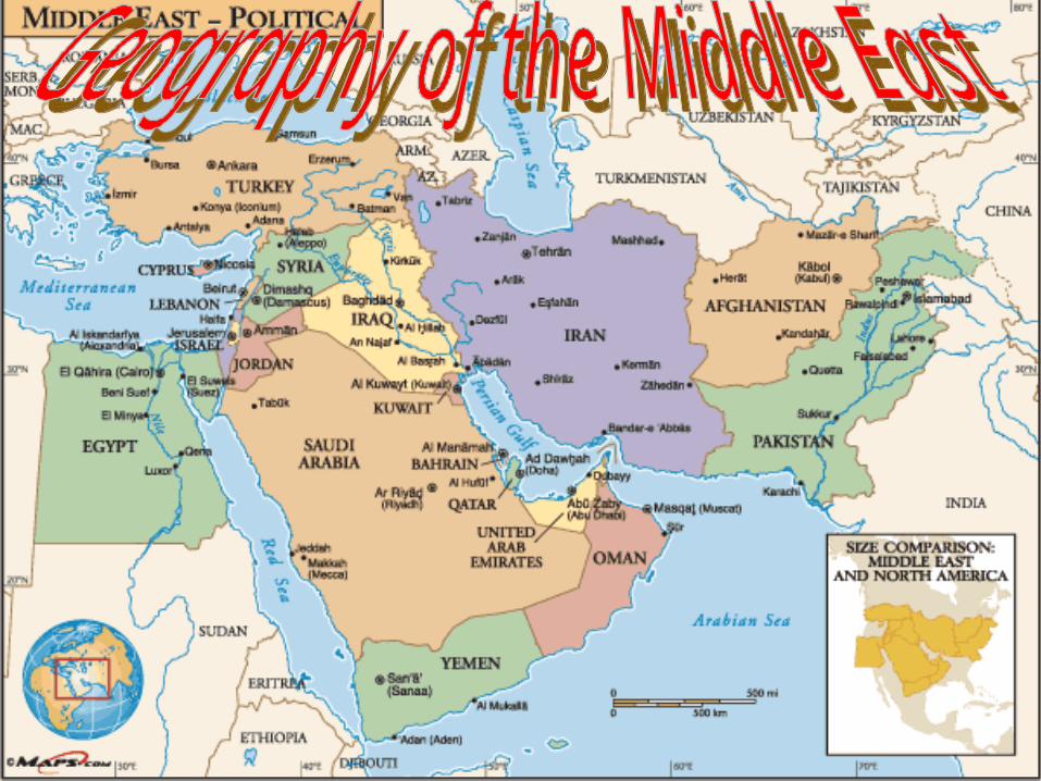
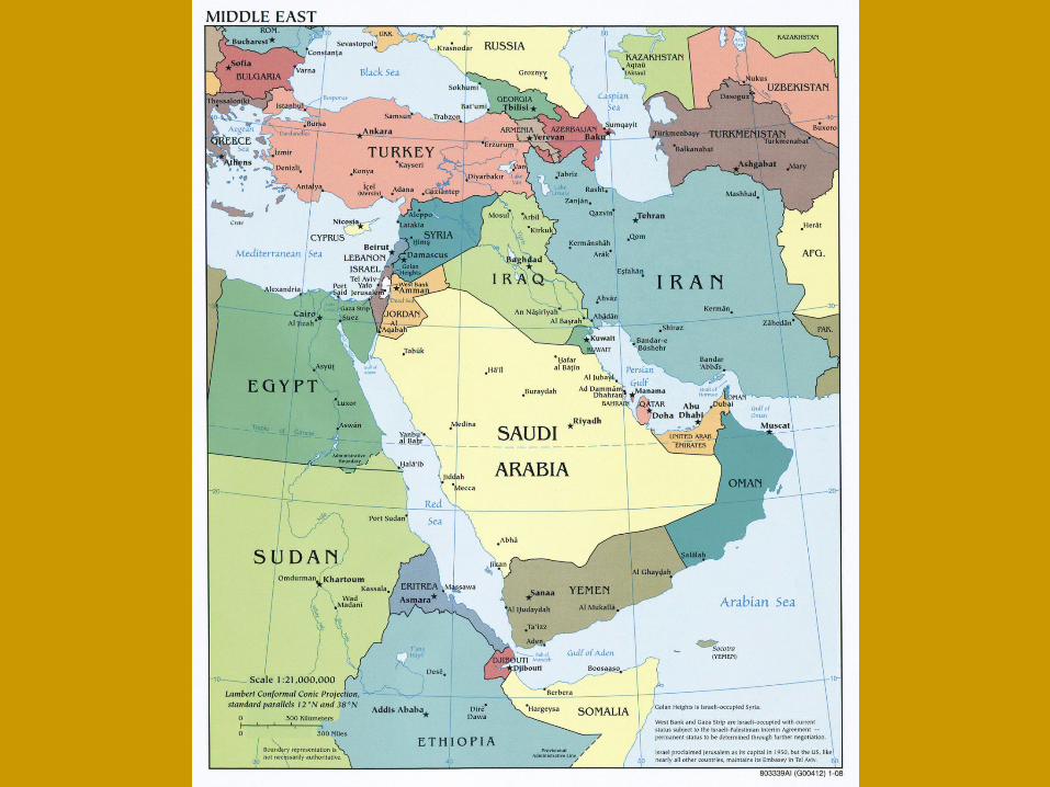
geography of the middle east
DESCRIPTION
Geography of the Middle East. PENINSULAS. Peninsula – a piece of land surrounded by water on three sides There are three peninsulas in the area – Sinai , Arabian , Anatolia , The Sinai Peninsula is separated from Africa by the Suez Canal, which was dug in 1868. - PowerPoint PPT PresentationTRANSCRIPT
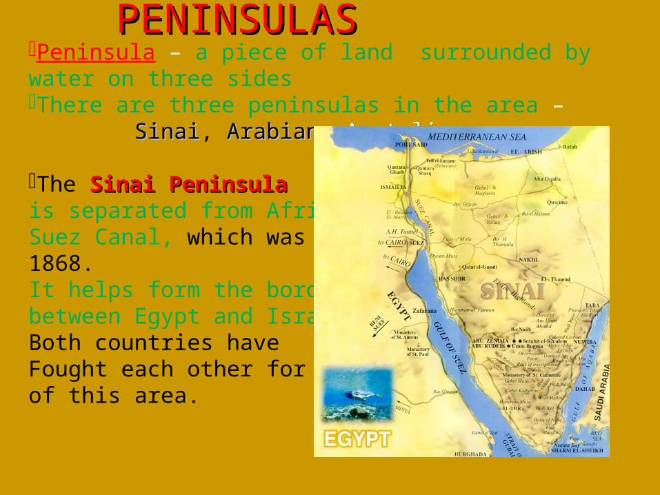
Peninsula – a piece of land surrounded by water on three sides There are three peninsulas in the area – SinaiSinai, ArabianArabian, AnatoliaAnatolia,
The Sinai Peninsula Sinai Peninsula is separated from Africa by the Suez Canal, which was dug in 1868.It helps form the border between Egypt and IsraelBoth countries have Fought each other for control of this area.
PENINSULASPENINSULAS
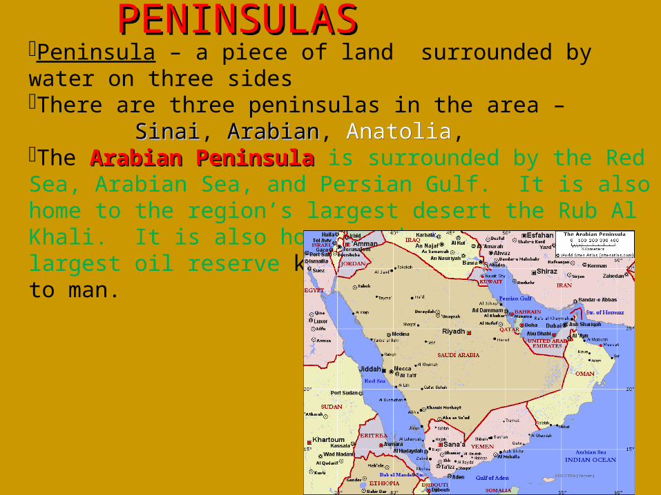
Peninsula – a piece of land surrounded by water on three sides There are three peninsulas in the area – SinaiSinai, ArabianArabian, AnatoliaAnatolia, The Arabian Peninsula Arabian Peninsula is surrounded by the Red Sea, Arabian Sea, and Persian Gulf. It is also home to the region’s largest desert the Rub Al Khali. It is also home to the largest oil reserve known to man.
PENINSULASPENINSULAS
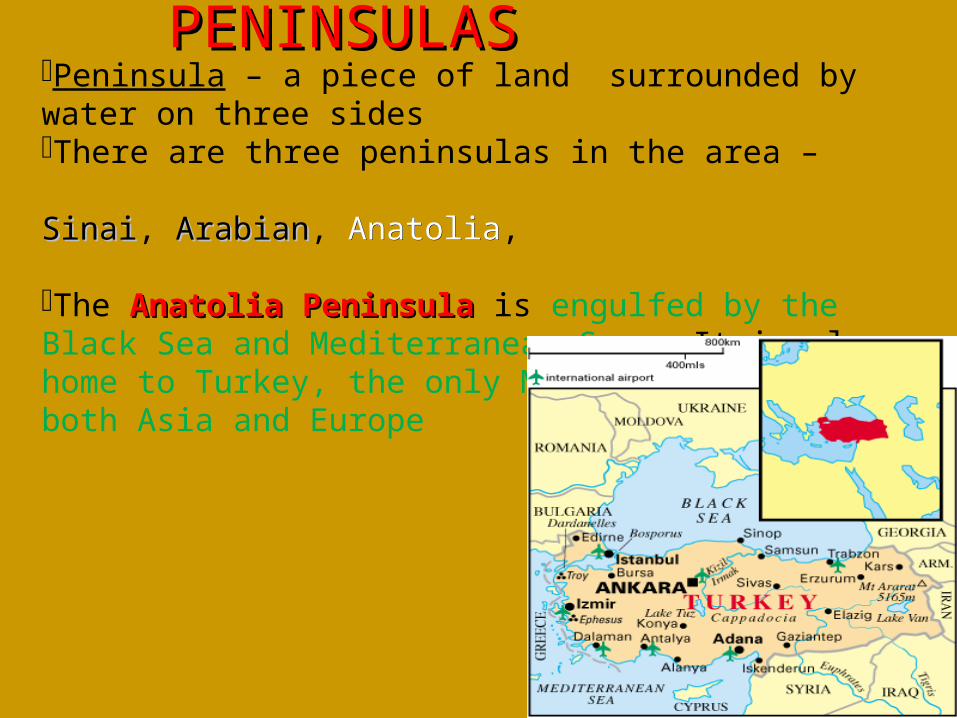
Peninsula – a piece of land surrounded by water on three sides There are three peninsulas in the area – SinaiSinai, ArabianArabian, AnatoliaAnatolia,
The Anatolia Peninsula Anatolia Peninsula is engulfed by the Black Sea and Mediterranean Sea. It is also home to Turkey, the only Middle East country in both Asia and Europe
PENINSULASPENINSULAS
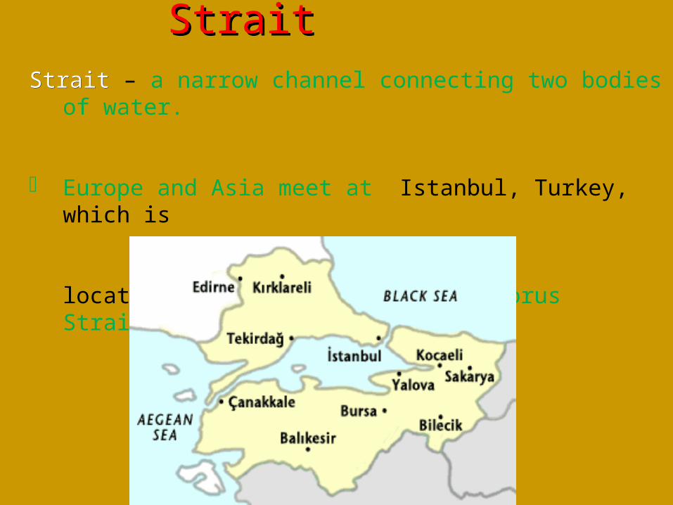
StraitStrait – a narrow channel connecting two bodies of water.
Europe and Asia meet at Istanbul, Turkey, which is located on both sides of the Bosporus Strait.
StraitStrait
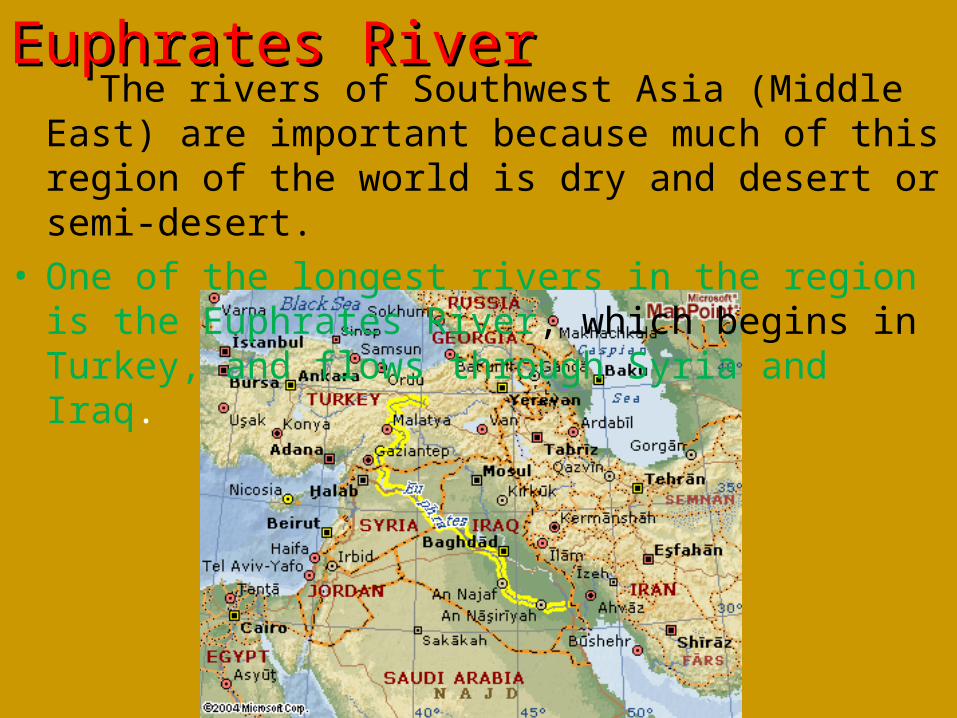
The rivers of Southwest Asia (Middle East) are important because much of this region of the world is dry and desert or semi-desert.
• One of the longest rivers in the region is the Euphrates River, which begins in Turkey, and flows through Syria and Iraq.
Euphrates RiverEuphrates River
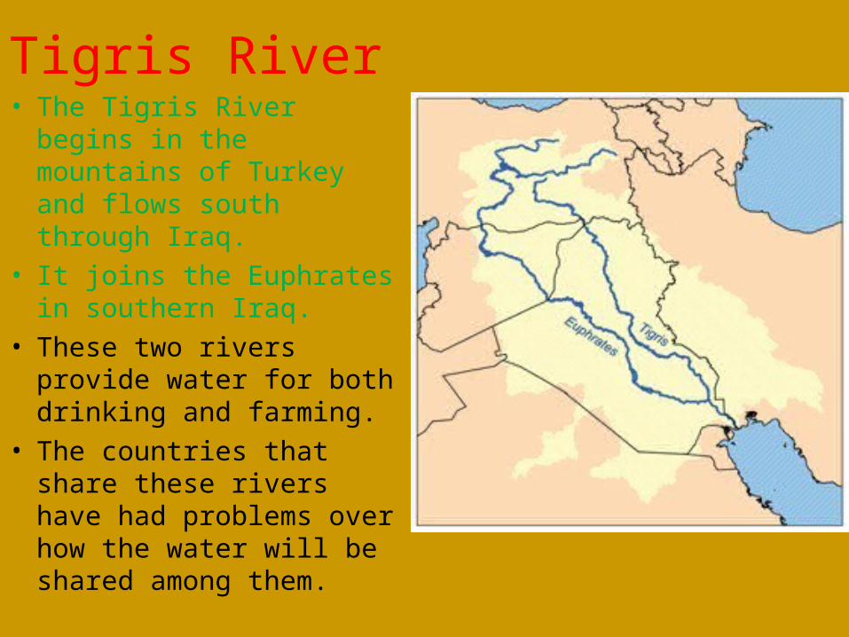
Tigris River• The Tigris River begins in the
mountains of Turkey and flows south through Iraq.
• It joins the Euphrates in southern Iraq.
• These two rivers provide water for both drinking and farming.
• The countries that share these rivers have had problems over how the water will be shared among them.
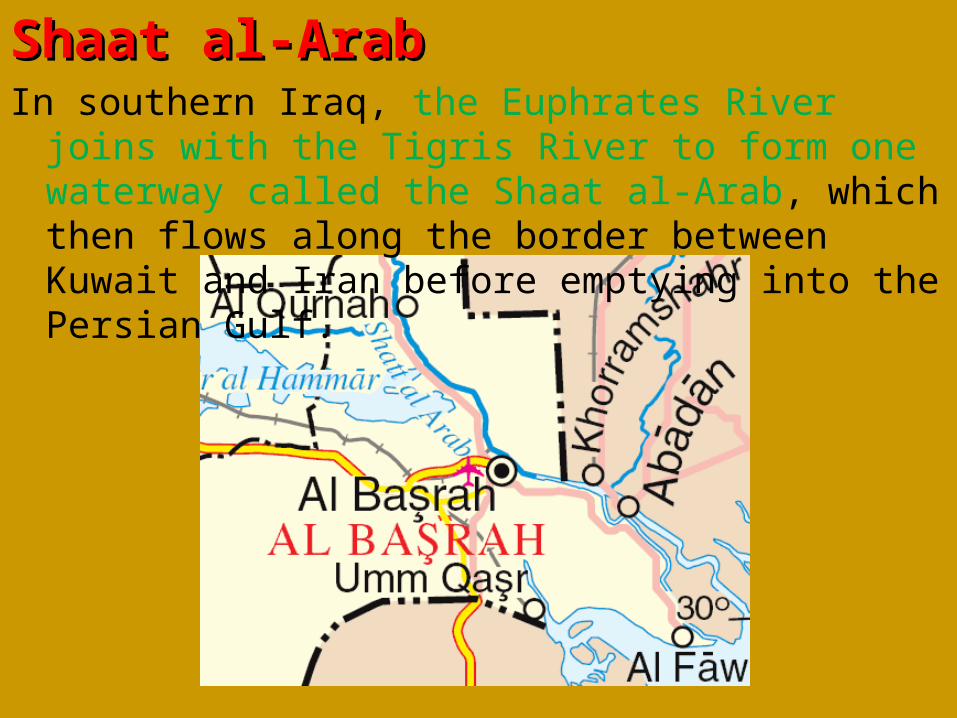
Shaat al-Arab Shaat al-Arab In southern Iraq, the Euphrates River joins with the Tigris
River to form one waterway called the Shaat al-Arab, which then flows along the border between Kuwait and Iran before emptying into the Persian Gulf.
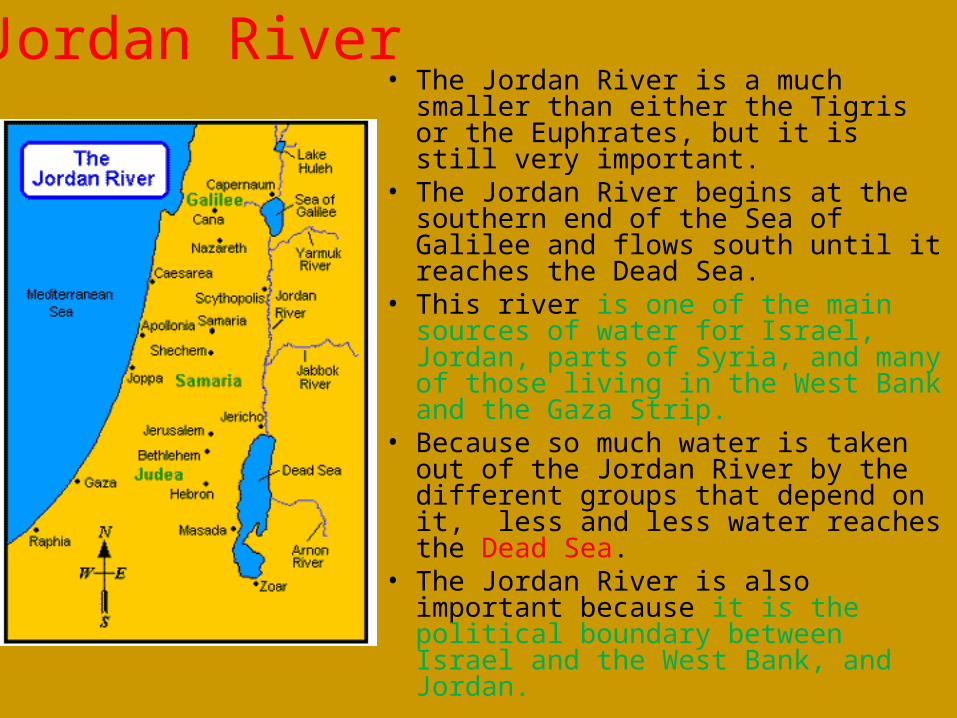
Jordan River• The Jordan River is a much smaller than
either the Tigris or the Euphrates, but it is still very important.
• The Jordan River begins at the southern end of the Sea of Galilee and flows south until it reaches the Dead Sea.
• This river is one of the main sources of water for Israel, Jordan, parts of Syria, and many of those living in the West Bank and the Gaza Strip.
• Because so much water is taken out of the Jordan River by the different groups that depend on it, less and less water reaches the Dead Sea.
• The Jordan River is also important because it is the political boundary between Israel and the West Bank, and Jordan.
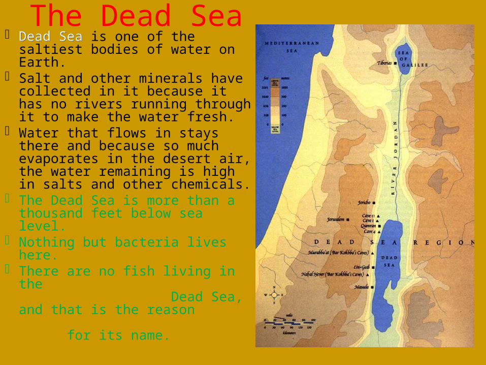
The Dead Sea Dead SeaDead Sea is one of the saltiest
bodies of water on Earth. Salt and other minerals have
collected in it because it has no rivers running through it to make the water fresh.
Water that flows in stays there and because so much evaporates in the desert air, the water remaining is high in salts and other chemicals.
The Dead Sea is more than a thousand feet below sea level.
Nothing but bacteria lives here. There are no fish living in the
Dead Sea, and that is the reason for its name.
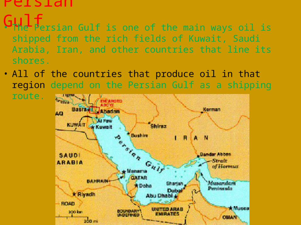
Persian Gulf• The Persian Gulf is one of the main ways oil is shipped from
the rich fields of Kuwait, Saudi Arabia, Iran, and other countries that line its shores.
• All of the countries that produce oil in that region depend on the Persian Gulf as a shipping route.
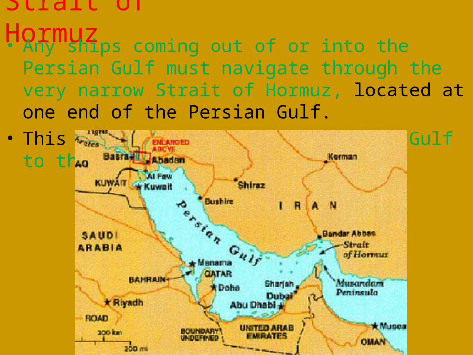
Strait of Hormuz• Any ships coming out of or into the Persian Gulf must
navigate through the very narrow Strait of Hormuz, located at one end of the Persian Gulf.
• This waterway connects the Persian Gulf to the Arabian Sea.
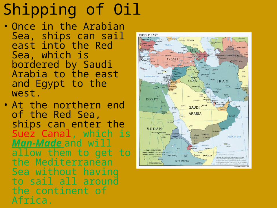
Shipping of Oil• Once in the Arabian Sea,
ships can sail east into the Red Sea, which is bordered by Saudi Arabia to the east and Egypt to the west.
• At the northern end of the Red Sea, ships can enter the Suez Canal, which is Man-Made and will allow them to get to the Mediterranean Sea without having to sail all around the continent of Africa.
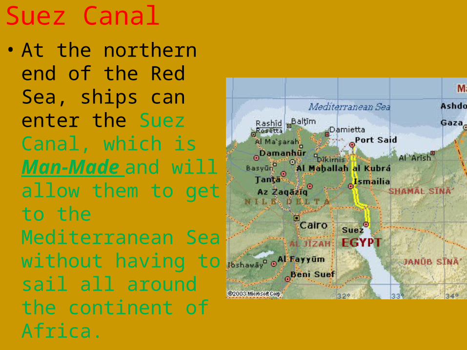
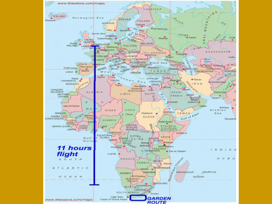
Suez Canal• At the northern end of
the Red Sea, ships can enter the Suez Canal, which is Man-Made and will allow them to get to the Mediterranean Sea without having to sail all around the continent of Africa.
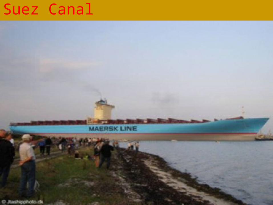
Suez Canal
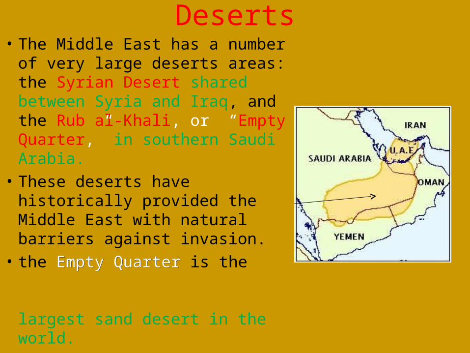
Deserts• The Middle East has a number
of very large deserts areas: the Syrian Desert shared between Syria and Iraq, and the Rub al-Khali, or “Empty Quarter,” in southern Saudi Arabia.
• These deserts have historically provided the Middle East with natural barriers against invasion.
• the Empty QuarterEmpty Quarter is the largest sand desert in the world.
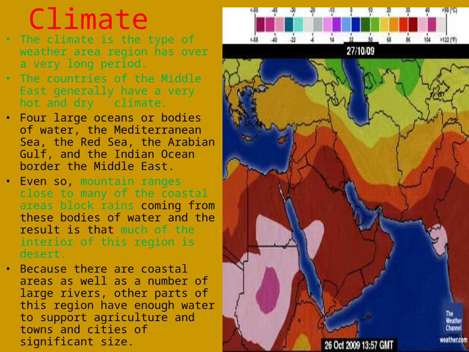
Climate• The climate is the type of weather
area region has over a very long period.
• The countries of the Middle East generally have a very hot and dry climate.
• Four large oceans or bodies of water, the Mediterranean Sea, the Red Sea, the Arabian Gulf, and the Indian Ocean border the Middle East.
• Even so, mountain ranges close to many of the coastal areas block rains coming from these bodies of water and the result is that much of the interior of this region is desert.
• Because there are coastal areas as well as a number of large rivers, other parts of this region have enough water to support agriculture and towns and cities of significant size.