florence- firestoneplanning.lacounty.gov/assets/upl/project/ffcp_final_20190903.pdf ·...
TRANSCRIPT
Florence-FirestoneCommunity PlanLA County Department of Regional Planning
September 2019
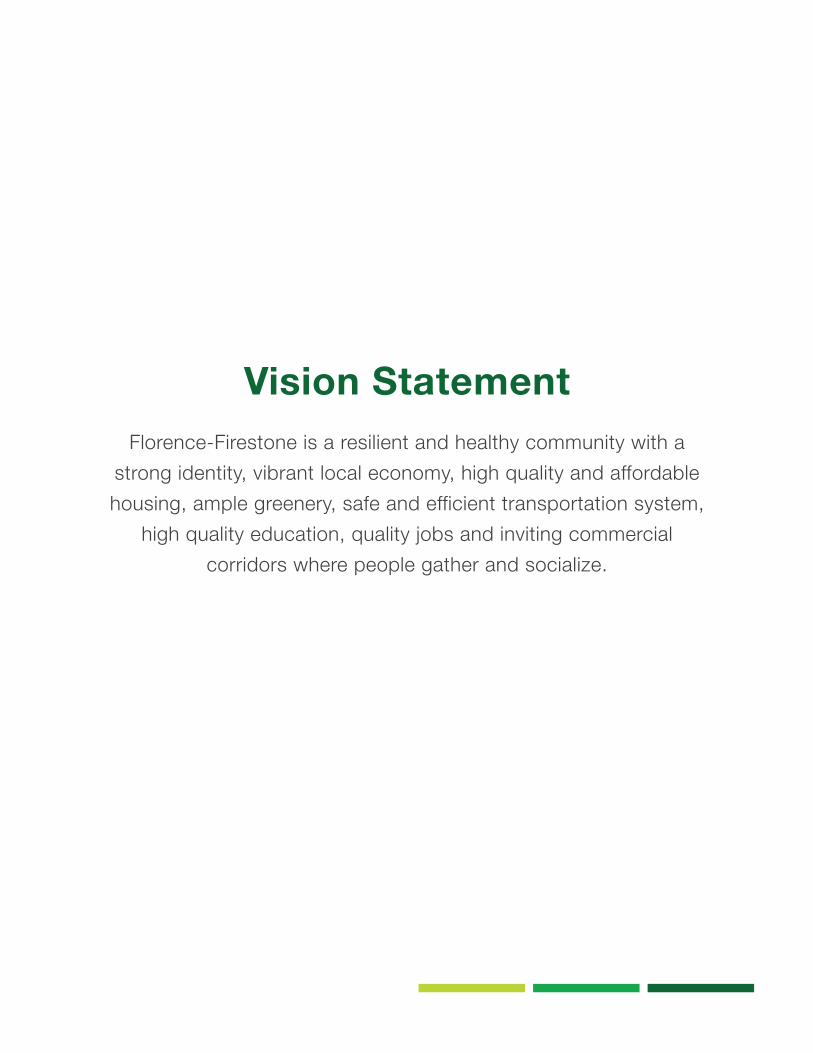
Vision Statement Florence-Firestone is a resilient and healthy community with a
strong identity, vibrant local economy, high quality and affordable housing, ample greenery, safe and efficient transportation system,
high quality education, quality jobs and inviting commercial corridors where people gather and socialize.
AcknowledgmentsBoard of SupervisorsHilda L. Solis, Supervisorial District 1Mark Ridley-Thomas, Supervisorial District 2Sheila Kuehl, Supervisorial District 3Janice Hahn, Supervisorial District 4Kathryn Barger, Supervisorial District 5
Board DeputyKarly Katona, Associate Chief Deputy, 2SD David Riccitiello, Economic Development, 2SDCharles Turner, Economic Development, 2SD
Regional Planning Commission Doug Smith, Supervisorial District 1David W. Louie, Supervisorial District 2Laura Shell, Supervisorial District 3Elvin W. Moon, Supervisorial District 4Pat Modugno, Supervisorial District 5
Florence-Firestone Community PartnersFlorence-Firestone Employment Resource Center Florence-Firestone/Walnut Park Chamber of CommerceFlorence-Firestone Community Leaders Rick Aldridge Mary Rose Cortese Joseph J. Titus Percy Ealy Sandra Tamayo William Allen Art Jones Daryl Koonce
Department of Regional PlanningAmy Bodek, Director Dennis Slavin, Chief Deputy Director Richard J. Bruckner, Former DirectorMark Child, Deputy Director
Community Studies East Mi Kim, Supervising PlannerAdrine Arakelian, Senior PlannerNorman Ornelas Jr., PlannerJames Drevno, Planner
Geographic Information Systems (GIS)Nick Franchino, GIS ManagerDan Hoffman, Principal GIS Analyst Martha Selig, GISP
Strategic Planning and Program ServicesMisty Fong, Graphic Designer
Former Staff and Plan ContributorsDean Edwards, Senior PlannerPhillip Estes, Principal PlannerAmanda Reeck, Planner Lilian Berticevich, Student Intern Susana Franco-Rogan, Supervising Planner Jennifer Jung, Planner David McDonald, Planner Lisbeth Sinclair, PlannerVeronica Siranosian, PlannerCarmen Sainz, Supervising PlannerFlorence-Firestone Workgroup Jonathan P. Bell, Planner Travis Seawards, Principal Planner Kevin Finkel, Senior Planner Michelle Lynch, Planner Timothy Murphy, Planner Richard Marshalian, Planner Susie Tae, Supervising Planner Pat Hachiya, Supervising PlannerSpanish Translation Committee Israel Cruz, Planner Diana Esparza, Planner Maria Masis, Supervising Planner
Contributing County DepartmentsDepartment of Parks and RecreationDepartment of Public HealthDepartment of Public Works Arts CommissionCommunity Development CommissionFire Department Office of County Counsel
5
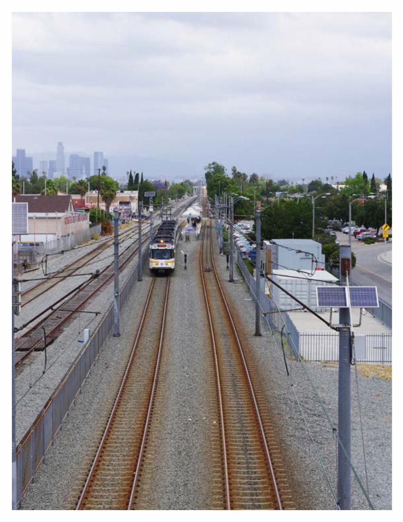
Table of Contents
Chapter 1: Introduction The Community......................................................................... The Community Plan Organization and Methodology.............. Relationship to the Los Angeles County General Plan.............General Plan Guiding Principles...............................................Land Use Policy Documents....................................................
Chapter 2: Community HistoryEarly History..............................................................................Turn of the Century................................................................... Early 1900s............................................................................... Post-war...................................................................................Recent Development................................................................
Chapter 3: Existing ConditionsLand Use..................................................................................Demographics..........................................................................Income......................................................................................Education..................................................................................Employment..............................................................................Transportation...........................................................................Public Facilities.........................................................................
Chapter 4: Goals and PoliciesResidential Areas......................................................................Commercial Areas....................................................................Industrial Areas.........................................................................Environmental Justice..............................................................Connectivity..............................................................................Transit Oriented Development.................................................. Community Identity...................................................................Economic Development...........................................................Parks and Recreation...............................................................Safety and Health.....................................................................Public Facilities.........................................................................Building Partnerships................................................................
Chapter 5: Implementation
Glossary
22313535363840
8
16
22
46
146
174
89
131314
1616171718
4856667480
100108114120128134140
CHAPTER 1INTRODUCTION
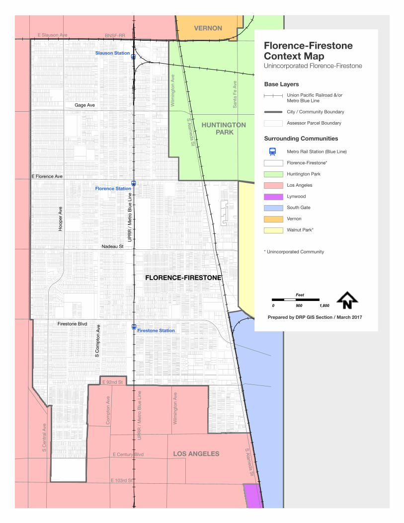
Florence-Firestone is an unincorporated community located approximately six miles south of Downtown Los Angeles and has an area of 3.6 square miles. (See Florence-Firestone Context Map, p.15). The community is surrounded on the north, south and west by the City of Los Angeles and on the east by the City of Huntington Park, City of South Gate, and the unincorporated community of Walnut Park.
The community is located between Downtown Los Angeles and Downtown Long Beach in proximity to major employment centers, including Downtown Los Angeles, the Ports of Long Beach and Los Angeles, and the industrial sector in southeast Los Angeles County.
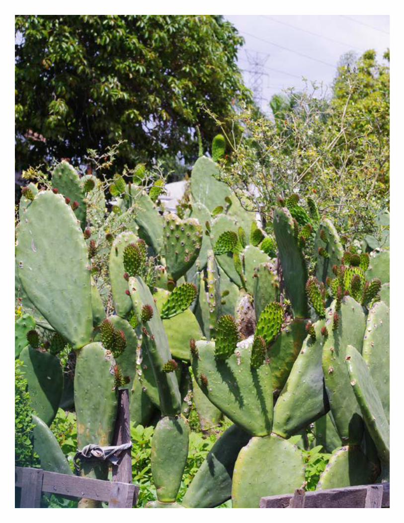
Florence-Firestone is a resilient community with a rich history. Traces of its history are evident throughout the community and are reflected in the street names, family histories, and existing structures. The community transformed from ranches and farmland in the 1800s to industrialization in the early 1900s, went through major demographic shifts in the 1960s and 1980s and became one of the most populous unincorporated communities in Los Angeles County today. According to 2016 ESRI Demographic data, Florence-Firestone has a population of 64,334 and a population density of 17,870 people per square mile. The community is primarily comprised of single- and multi-family residential neighborhoods. Commercial activity is concentrated along major transportation routes. The community still has clusters of industrial uses, especially along the Alameda Corridor, from its industrial heyday. Throughout its history, the community has adapted to changing conditions but has also retained its deep roots. Many residents have lived in the community for decades and others have returned to the community to retire. Longtime residents and shared local histories help anchor the community.
Florence-Firestone has many assets. Safety, jobs, deteriorating infrastructure, and residential-industrial land use conflicts are concerns. However, the community can continue to build upon its assets to address these concerns. The community’s assets include proximity to job centers, connections to the regional transit system, successful collaboration between County agencies and community members, local entrepreneurial energy, new schools with active parent involvement, and a young population.
The Community
9
The community is well connected to the regional transportation system. The Metro Blue Line, which connects Downtown Los Angeles to Long Beach, has three stations in Florence-Firestone and operates numerous bus routes in the community. Three freeways (I-110, I-105, I-10) are located within a 2½ mile radius of the community.
Florence-Firestone also has a young, employable population in proximity to local and regional employment centers. According to the 2016 ESRI Demographics data, Florence-Firestone has a population of 64,334 residents, with 94% of the population under 65 years old and 57% of the population between the ages of 20 to 64, demonstrating that a majority of the population is working age. Thirty-seven percent of the population is under 20 years old. In recent years, several new schools were constructed to accommodate the growing number of students and relieve overcrowding in schools. The Diego Rivera Learning Complex was constructed in 2011, and the Walnut Park Middle School campus was constructed in 2013.
The community also has active, energetic residents who care deeply about working with the County and others to address community concerns.
Planning efforts in the community have sought to build upon these assets, while addressing issues and concerns voiced by community members.
The Community Plan The Florence-Firestone Community Plan (Community Plan) is a policy document for the future development, conservation and maintenance of the Florence-Firestone community. The Community Plan is a reflection of the community’s shared vision of the future and establishes goals, policies, and implementation actions to achieve that vision.
Purpose
The Community Plan is a land use development guide intended to direct development and land use decisions to achieve the community’s vision. The plan provides guidance on community specific concerns to planners, property owners, business owners, decision-makers, public agencies, and other stakeholders.
INTRODUCTION
Organization
The Community Plan is organized into five chapters.
• Chapter 1: Introduction, provides a summary of the Plan and how it was developed.
• Chapter 2: Community History, relates the area’s long and rich history.
• Chapter 3: Existing Conditions, describes the community’s current physical condition, including demographic and land use data, providing the context for the community vision, goals, policies, and recommended actions in the subsequent chapter.
• Chapter 4: Goals and Policies, is organized into twelve categories. Each category contains a vision statement, background information, description of opportunities, and goals and policies. The goals and policies establish the means for achieving the community’s shared vision.
• Chapter 5: Implementation, contains a list of recommended actions that help realize the goals and policies presented in Chapter 4. The implementation actions are optional and are to be carried out upon allocation of funding and resources.
Themes
The Community Plan organizes goals and policies into broad land use categories. However, there are themes that cut across more than one policy category. These recurring themes or issues have been identified in various studies and reports, as well as voiced by community members. At its core, all the goals and policies address the themes identified below.
• Public Safety. Reduce crime and pedestrian-vehicular conflict, and improve safety around schools and areas of pedestrian activity, including commercial corridors, crosswalks, transit stations, bus stops, parks and other public spaces.
• Industrial-ResidentialLandUseConflict. Resolve the incompatibility between proximate industrial and residential land uses to improve the health and welfare of the community.
• Maintenance. Invest in public and private facilities, including maintaining and improving structures, renovating residential properties, maintaining and upgrading multifamily residences, clearing litter and illegal dumping in
11
the public right-of-way, improving building facades in commercial and industrial areas, and enhancing pedestrian corridors with trees, lighting, and pedestrian amenities, where appropriate and feasible.
• Enforcement. Proactively enforce code rules and regulations. Require unpermitted uses to comply with regulations and development standards to improve quality of life.
• Economic Development. Preserve existing jobs, expand the job base, support diversification of commercial and industrial uses, promote job training programs, and increase economic development opportunities within the community.
• Public Space. Establish a community center/plaza, increase open space/ parks, and improve park facilities, including safety, lighting, and meeting rooms within County facilities.
• Transit-Oriented Development. For areas around Metro Blue Line Stations, encourage development of high-density affordable housing, promote the establishment of job-generating uses, support the development of community-serving retail uses, and adopt a Transit Oriented District specific plan for Florence, Firestone, and Slauson Blue Line Stations,
• Housing. Increase housing opportunities, including the availability of affordable housing, preserve existing residential neighborhoods, increase homeownership, and relieve overcrowding.
• Environmental Justice. Promote clean and sustainable business practices and reduce negative environmental impacts in industrial and commercial areas, provide more open space, encourage public participation in decision-making processes, and increase access to information.
• Mobility and Connectivity. Increase safe, clean, and easy access to alternative modes of transportation and create an integrated network of rail lines, bus routes, pedestrian walkways and bicycle facilities.
• Funding/grants. Take advantage of the Cap-and-Trade funds available to disadvantaged communities and seek funding from both public and private resources for community improvement projects.
Applicability
Completed applications filed prior to the effective date of this Community Plan shall be reviewed for consistency with the Los Angeles County General Plan
INTRODUCTION
(“General Plan”). New applications filed after the effective date of the Community Plan are subject to the provisions herein. Existing projects may be maintained as originally approved provided the approval is still valid, has not expired, and is consistent with applicable policies.
Methodology
The Community Plan was developed with the help of many planners and community members who volunteered their time to share their knowledge and expertise, review draft documents, and provide feedback.
The Community Plan builds on past planning efforts, drawing information from a variety of studies and reports on the community. The 2009 Florence-Firestone Vision Plan provided a comprehensive, long-term vision for the community through the collaborative effort of residents, businesses, stakeholders, County departments, and local organizations. Following the Vision Plan, studies focused on market feasibility, land use and transportation. These reports and studies, and their recommendations informed this Community Plan. A complete list of the source materials is listed below.
• Florence-Firestone Community Background Report, Los Angeles County Department of Regional Planning (DRP) – 1970
• Florence-Firestone Community General Plan Staff Report, DRP – 1971
• Florence-Firestone Community Standards District Ordinance, DRP – 2004
• Florence-Firestone Vision Plan, Raimi + Associates – 2009
• Florence Mile Parking Study Report, Gin Wong Associates – 2008
• Florence-Firestone Community Parks and Recreation Plan, Los Angeles County Department of Parks and Recreation – 2010
• Slauson Blue Line Station Transit Oriented Development (Technical Assistance Panel Program), Urban Land Institute – 2010
• Florence-Firestone Community Plan Market Feasibility Analysis, URS – 2010
• Florence-Firestone Community Plan Land Use and Sustainability Indicators Report, URS – 2010
• Florence-Firestone Community Plan Transportation Planning and Transit Oriented Development Evaluation, URS – 2010
• Florence-Firestone Community Plan Background Report, DRP – 2011
• Los Angeles County General Plan Industrial Land Analysis, DRP – 2011
• Los Angeles County Bicycle Master Plan – 2012
• Los Angeles Countywide Comprehensive Parks and Recreation Needs Assessment – 2016
13
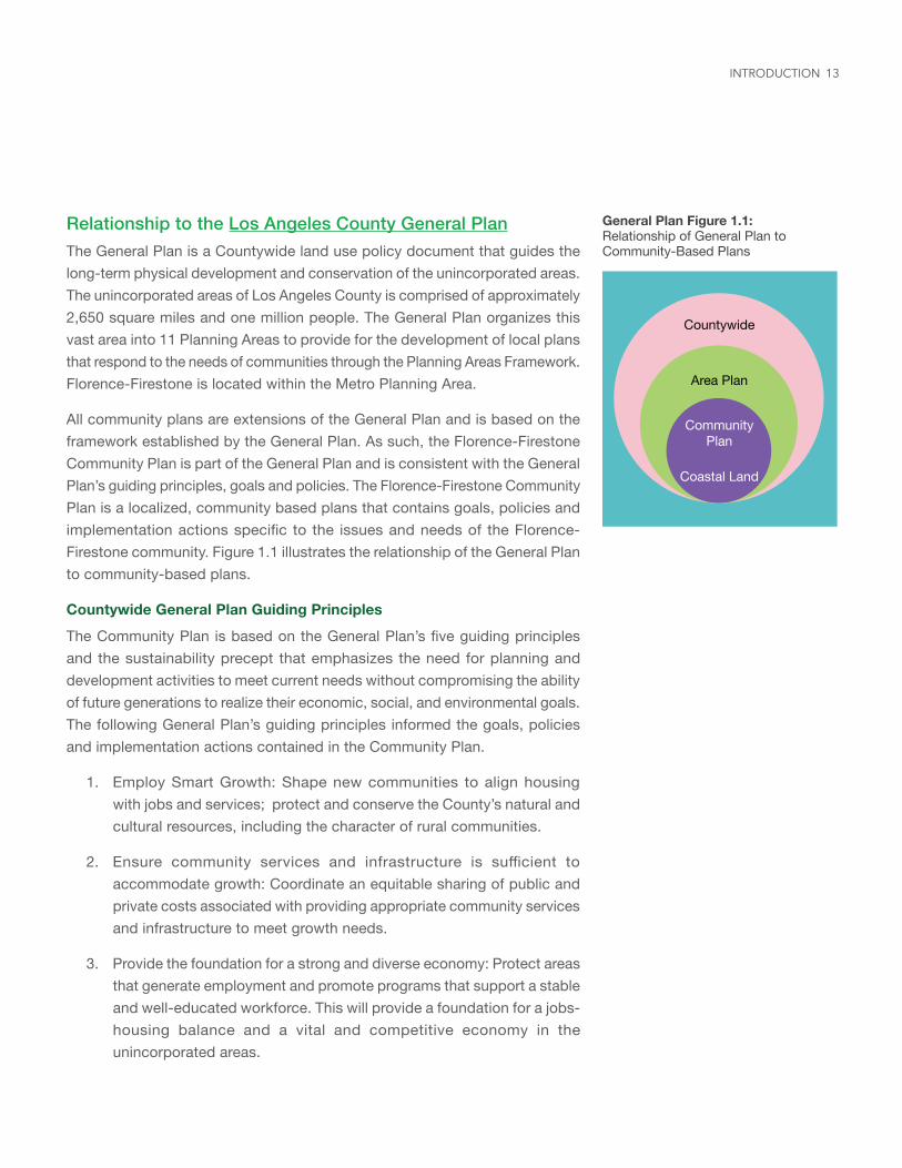
General Plan Figure 1.1: Relationship of General Plan to Community-Based Plans
Countywide
Area Plan
Community Plan
Coastal Land
Relationship to the Los Angeles County General PlanThe General Plan is a Countywide land use policy document that guides the long-term physical development and conservation of the unincorporated areas. The unincorporated areas of Los Angeles County is comprised of approximately 2,650 square miles and one million people. The General Plan organizes this vast area into 11 Planning Areas to provide for the development of local plans that respond to the needs of communities through the Planning Areas Framework. Florence-Firestone is located within the Metro Planning Area.
All community plans are extensions of the General Plan and is based on the framework established by the General Plan. As such, the Florence-Firestone Community Plan is part of the General Plan and is consistent with the General Plan’s guiding principles, goals and policies. The Florence-Firestone Community Plan is a localized, community based plans that contains goals, policies and implementation actions specific to the issues and needs of the Florence-Firestone community. Figure 1.1 illustrates the relationship of the General Plan to community-based plans.
Countywide General Plan Guiding Principles
The Community Plan is based on the General Plan’s five guiding principles and the sustainability precept that emphasizes the need for planning and development activities to meet current needs without compromising the ability of future generations to realize their economic, social, and environmental goals. The following General Plan’s guiding principles informed the goals, policies and implementation actions contained in the Community Plan.
1. Employ Smart Growth: Shape new communities to align housing with jobs and services; protect and conserve the County’s natural and cultural resources, including the character of rural communities.
2. Ensure community services and infrastructure is sufficient to accommodate growth: Coordinate an equitable sharing of public and private costs associated with providing appropriate community services and infrastructure to meet growth needs.
3. Provide the foundation for a strong and diverse economy: Protect areas that generate employment and promote programs that support a stable and well-educated workforce. This will provide a foundation for a jobs-housing balance and a vital and competitive economy in the unincorporated areas.
INTRODUCTION
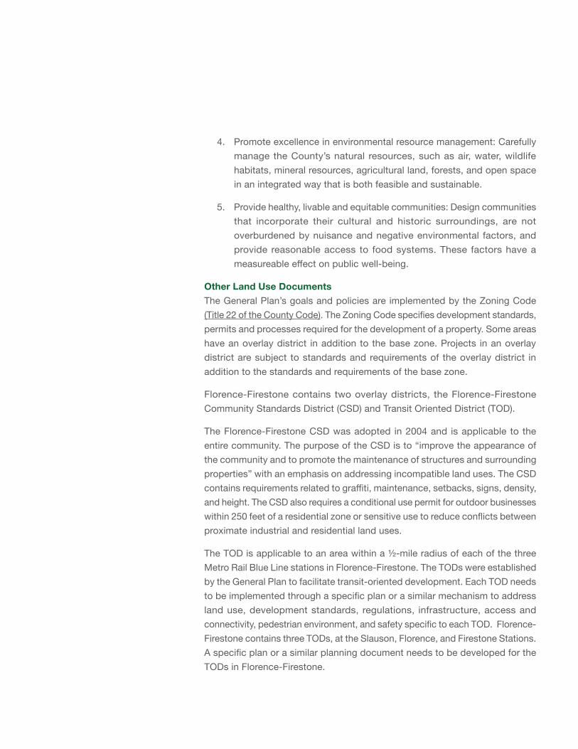
4. Promote excellence in environmental resource management: Carefully manage the County’s natural resources, such as air, water, wildlife habitats, mineral resources, agricultural land, forests, and open space in an integrated way that is both feasible and sustainable.
5. Provide healthy, livable and equitable communities: Design communities that incorporate their cultural and historic surroundings, are not overburdened by nuisance and negative environmental factors, and provide reasonable access to food systems. These factors have a measureable effect on public well-being.
Other Land Use DocumentsThe General Plan’s goals and policies are implemented by the Zoning Code (Title 22 of the County Code). The Zoning Code specifies development standards, permits and processes required for the development of a property. Some areas have an overlay district in addition to the base zone. Projects in an overlay district are subject to standards and requirements of the overlay district in addition to the standards and requirements of the base zone.
Florence-Firestone contains two overlay districts, the Florence-Firestone Community Standards District (CSD) and Transit Oriented District (TOD).
The Florence-Firestone CSD was adopted in 2004 and is applicable to the entire community. The purpose of the CSD is to “improve the appearance of the community and to promote the maintenance of structures and surrounding properties” with an emphasis on addressing incompatible land uses. The CSD contains requirements related to graffiti, maintenance, setbacks, signs, density, and height. The CSD also requires a conditional use permit for outdoor businesses within 250 feet of a residential zone or sensitive use to reduce conflicts between proximate industrial and residential land uses.
The TOD is applicable to an area within a ½-mile radius of each of the three Metro Rail Blue Line stations in Florence-Firestone. The TODs were established by the General Plan to facilitate transit-oriented development. Each TOD needs to be implemented through a specific plan or a similar mechanism to address land use, development standards, regulations, infrastructure, access and connectivity, pedestrian environment, and safety specific to each TOD. Florence-Firestone contains three TODs, at the Slauson, Florence, and Firestone Stations. A specific plan or a similar planning document needs to be developed for the TODs in Florence-Firestone.
15
FLORENCE-FIRESTONE
Firestone Blvd
S C
ompt
on A
ve
Nadeau St
E Florence Ave
Hoo
per A
ve
UPR
R / M
etro
Blu
e Li
ne
Gage Ave
E 103rd St
E Century Blvd
Wilm
ingt
on A
ve
UPR
R / M
etro
Blu
e Li
ne
Com
pton
Ave
S C
entra
l Ave
E 92nd St
LOS ANGELES
HUNTINGTON PARK
VERNON
S Alameda St
S Alameda St
Wilm
ingt
on A
ve
Sant
a Fe
Ave
E Slauson Ave BNSF-RR
Slauson Station
Florence Station
Firestone Station
Metro Rail Station (Blue Line)
Florence-Firestone*
Huntington Park
Los Angeles
Lynwood
South Gate
Vernon
Walnut Park*
Florence-FirestoneContext MapUnincorporated Florence-Firestone
0 900 1,800
Feet
Prepared by DRP GIS Section / March 2017
Base LayersUnion Pacific Railroad &/or Metro Blue Line
City / Community Boundary
Assessor Parcel Boundary
Surrounding Communities
* Unincorporated Community
CHAPTER 2COMMUNITY HISTORY
Early History
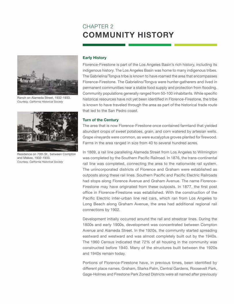
Florence-Firestone is part of the Los Angeles Basin’s rich history, including its indigenous history. The Los Angeles Basin was home to many indigenous tribes. The Gabrielina/Tongva tribe is known to have roamed the area that encompasses Florence-Firestone. The Gabrielino/Tongva were hunter-gatherers and lived in permanent communities near a stable food supply and protection from flooding. Community populations generally ranged from 50-100 inhabitants. While specific historical resources have not yet been identified in Florence-Firestone, the tribe is known to have traveled through the area as part of the historical trade route that led to the San Pedro coast.
Turn of the CenturyThe area that is now Florence-Firestone once contained farmland that yielded abundant crops of sweet potatoes, grain, and corn watered by artesian wells. Grape vineyards were common, as were eucalyptus groves planted for firewood. Farms in the area ranged in size from 40 to several hundred acres.
In 1869, a rail line paralleling Alameda Street from Los Angeles to Wilmington was completed by the Southern Pacific Railroad. In 1876, the trans-continental rail line was completed, connecting the area to the nationwide rail system. The unincorporated districts of Florence and Graham were established as outposts along these rail lines. Southern Pacific and Pacific Electric Railroads had stops along Florence Avenue and Graham Avenue. The name Florence-Firestone may have originated from these outposts. In 1877, the first post office in Florence-Firestone was established. With the construction of the Pacific Electric inter-urban line red cars, which ran from Los Angeles to Long Beach along Graham Avenue, the area had additional regional rail connections by 1902.
Development initially occurred around the rail and streetcar lines. During the 1800s and early 1900s, development was concentrated between Compton Avenue and Alameda Street. In the 1920s, the community started spreading eastward and westward and was almost completely built out by the 1940s. The 1960 Census indicated that 72% of all housing in the community was constructed before 1940. Many of the structures built between the 1920s and 1940s remain today.
Portions of Florence-Firestone have, in previous times, been identified by different place names. Graham, Starks Palm, Central Gardens, Roosevelt Park, Gage-Holmes and Firestone Park Zoned Districts were all named after previously
Ranch on Alameda Street, 1932-1933.Courtesy, California Historical Society
Residence on 70th St., between Compton and Makee, 1932-1933.Courtesy, California Historical Society
17
existing neighborhoods in Florence-Firestone. Watts, an adjacent community to the south, was incorporated as an independent city in 1907 and was annexed to the City of Los Angeles in 1926.
Early 1900’s
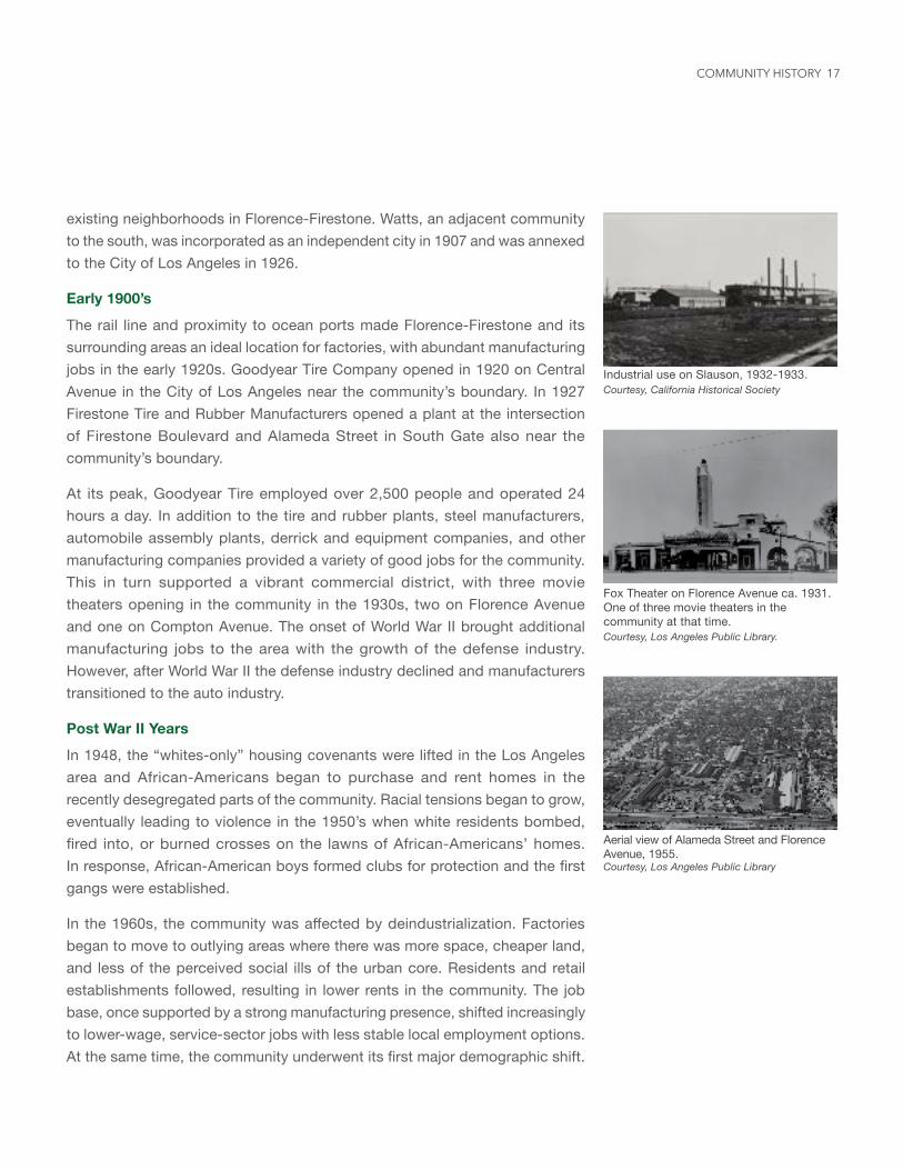
The rail line and proximity to ocean ports made Florence-Firestone and its surrounding areas an ideal location for factories, with abundant manufacturing jobs in the early 1920s. Goodyear Tire Company opened in 1920 on Central Avenue in the City of Los Angeles near the community’s boundary. In 1927 Firestone Tire and Rubber Manufacturers opened a plant at the intersection of Firestone Boulevard and Alameda Street in South Gate also near the community’s boundary.
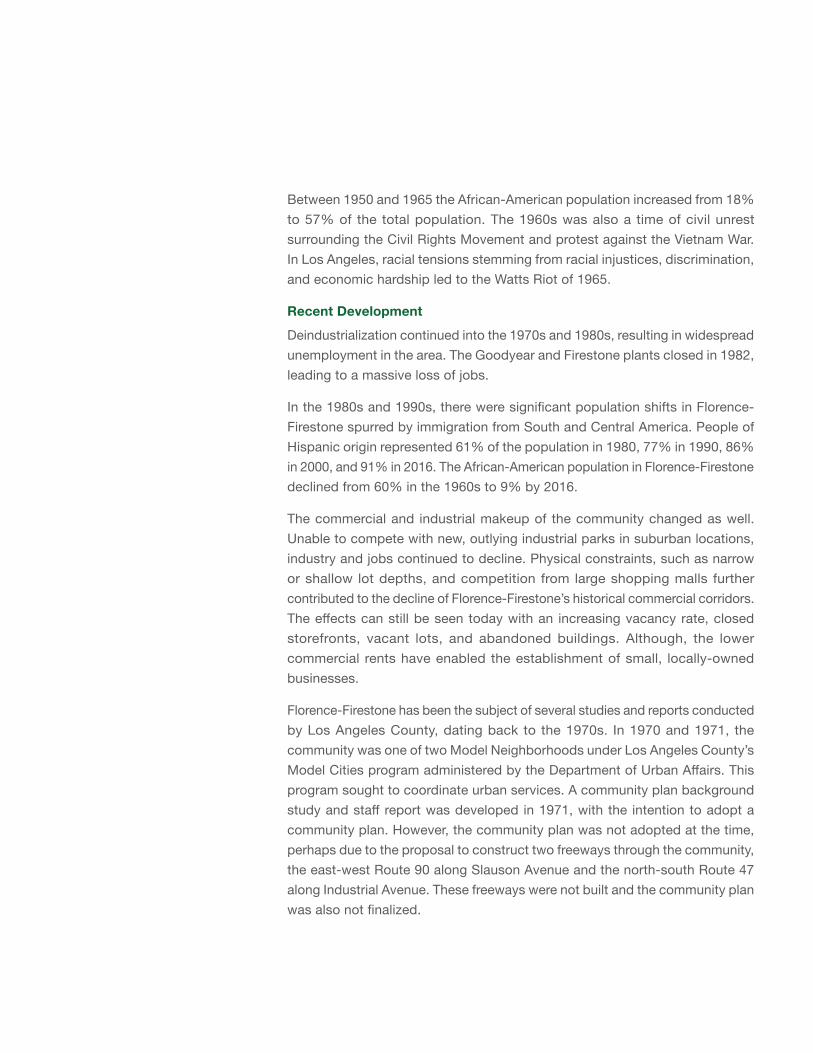
At its peak, Goodyear Tire employed over 2,500 people and operated 24 hours a day. In addition to the tire and rubber plants, steel manufacturers, automobile assembly plants, derrick and equipment companies, and other manufacturing companies provided a variety of good jobs for the community. This in turn supported a vibrant commercial district, with three movie theaters opening in the community in the 1930s, two on Florence Avenue and one on Compton Avenue. The onset of World War II brought additional manufacturing jobs to the area with the growth of the defense industry. However, after World War II the defense industry declined and manufacturers transitioned to the auto industry.
Post War II Years
In 1948, the “whites-only” housing covenants were lifted in the Los Angeles area and African-Americans began to purchase and rent homes in the recently desegregated parts of the community. Racial tensions began to grow, eventually leading to violence in the 1950’s when white residents bombed, fired into, or burned crosses on the lawns of African-Americans’ homes. In response, African-American boys formed clubs for protection and the first gangs were established.
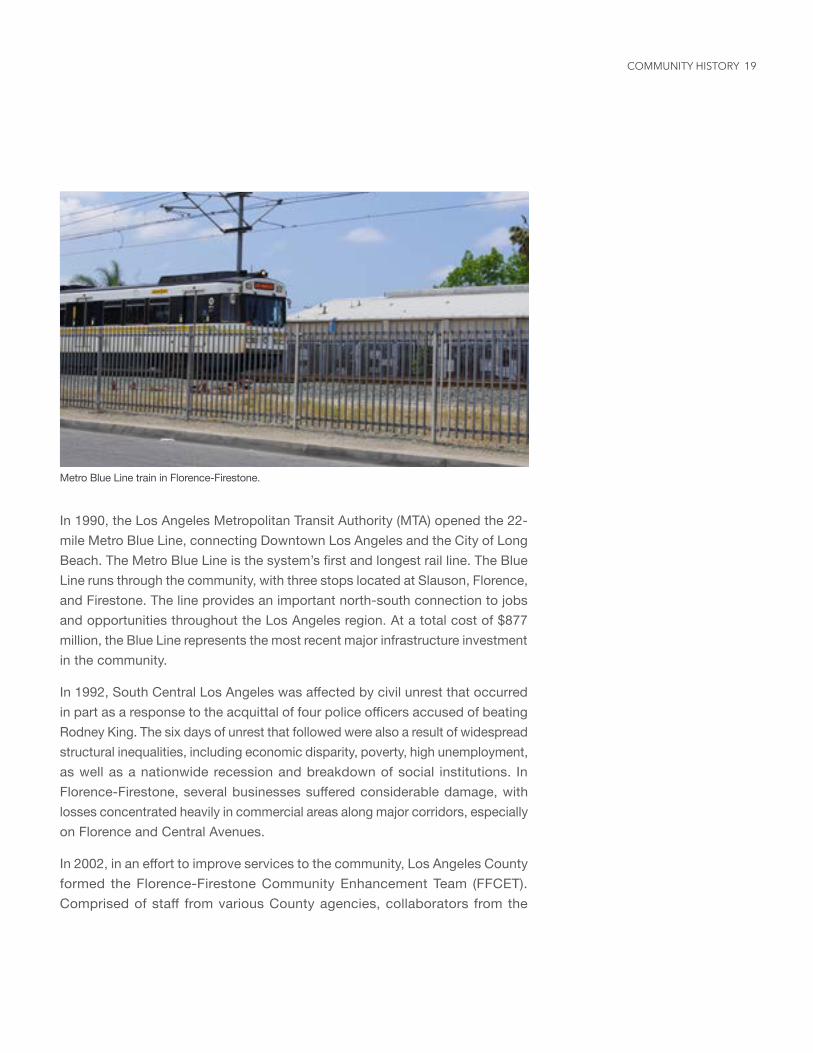
In the 1960s, the community was affected by deindustrialization. Factories began to move to outlying areas where there was more space, cheaper land, and less of the perceived social ills of the urban core. Residents and retail establishments followed, resulting in lower rents in the community. The job base, once supported by a strong manufacturing presence, shifted increasingly to lower-wage, service-sector jobs with less stable local employment options. At the same time, the community underwent its first major demographic shift.
Industrial use on Slauson, 1932-1933.Courtesy, California Historical Society
Fox Theater on Florence Avenue ca. 1931. One of three movie theaters in the community at that time. Courtesy, Los Angeles Public Library.
Aerial view of Alameda Street and Florence Avenue, 1955. Courtesy, Los Angeles Public Library
COMMUNITY HISTORY
Between 1950 and 1965 the African-American population increased from 18% to 57% of the total population. The 1960s was also a time of civil unrest surrounding the Civil Rights Movement and protest against the Vietnam War. In Los Angeles, racial tensions stemming from racial injustices, discrimination, and economic hardship led to the Watts Riot of 1965.
Recent Development
Deindustrialization continued into the 1970s and 1980s, resulting in widespread unemployment in the area. The Goodyear and Firestone plants closed in 1982, leading to a massive loss of jobs.
In the 1980s and 1990s, there were significant population shifts in Florence-Firestone spurred by immigration from South and Central America. People of Hispanic origin represented 61% of the population in 1980, 77% in 1990, 86% in 2000, and 91% in 2016. The African-American population in Florence-Firestone declined from 60% in the 1960s to 9% by 2016.
The commercial and industrial makeup of the community changed as well. Unable to compete with new, outlying industrial parks in suburban locations, industry and jobs continued to decline. Physical constraints, such as narrow or shallow lot depths, and competition from large shopping malls further contributed to the decline of Florence-Firestone’s historical commercial corridors. The effects can still be seen today with an increasing vacancy rate, closed storefronts, vacant lots, and abandoned buildings. Although, the lower commercial rents have enabled the establishment of small, locally-owned businesses.
Florence-Firestone has been the subject of several studies and reports conducted by Los Angeles County, dating back to the 1970s. In 1970 and 1971, the community was one of two Model Neighborhoods under Los Angeles County’s Model Cities program administered by the Department of Urban Affairs. This program sought to coordinate urban services. A community plan background study and staff report was developed in 1971, with the intention to adopt a community plan. However, the community plan was not adopted at the time, perhaps due to the proposal to construct two freeways through the community, the east-west Route 90 along Slauson Avenue and the north-south Route 47 along Industrial Avenue. These freeways were not built and the community plan was also not finalized.
19
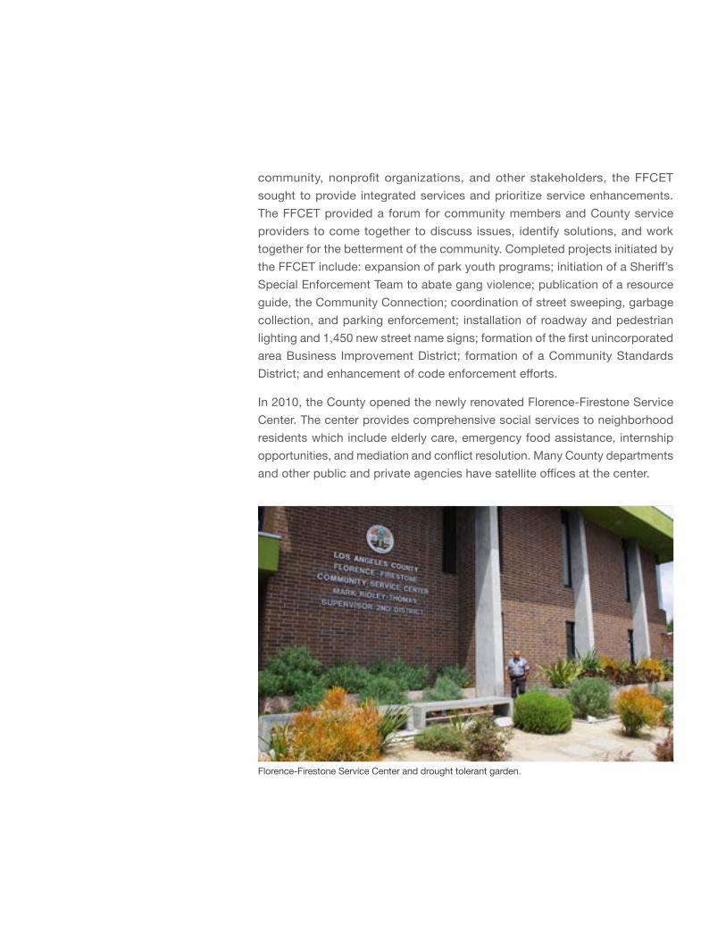
Metro Blue Line train in Florence-Firestone.
In 1990, the Los Angeles Metropolitan Transit Authority (MTA) opened the 22-mile Metro Blue Line, connecting Downtown Los Angeles and the City of Long Beach. The Metro Blue Line is the system’s first and longest rail line. The Blue Line runs through the community, with three stops located at Slauson, Florence, and Firestone. The line provides an important north-south connection to jobs and opportunities throughout the Los Angeles region. At a total cost of $877 million, the Blue Line represents the most recent major infrastructure investment in the community.
In 1992, South Central Los Angeles was affected by civil unrest that occurred in part as a response to the acquittal of four police officers accused of beating Rodney King. The six days of unrest that followed were also a result of widespread structural inequalities, including economic disparity, poverty, high unemployment, as well as a nationwide recession and breakdown of social institutions. In Florence-Firestone, several businesses suffered considerable damage, with losses concentrated heavily in commercial areas along major corridors, especially on Florence and Central Avenues.
In 2002, in an effort to improve services to the community, Los Angeles County formed the Florence-Firestone Community Enhancement Team (FFCET). Comprised of staff from various County agencies, collaborators from the
COMMUNITY HISTORY
Florence-Firestone Service Center and drought tolerant garden.
community, nonprofit organizations, and other stakeholders, the FFCET sought to provide integrated services and prioritize service enhancements. The FFCET provided a forum for community members and County service providers to come together to discuss issues, identify solutions, and work together for the betterment of the community. Completed projects initiated by the FFCET include: expansion of park youth programs; initiation of a Sheriff’s Special Enforcement Team to abate gang violence; publication of a resource guide, the Community Connection; coordination of street sweeping, garbage collection, and parking enforcement; installation of roadway and pedestrian lighting and 1,450 new street name signs; formation of the first unincorporated area Business Improvement District; formation of a Community Standards District; and enhancement of code enforcement efforts.
In 2010, the County opened the newly renovated Florence-Firestone Service Center. The center provides comprehensive social services to neighborhood residents which include elderly care, emergency food assistance, internship opportunities, and mediation and conflict resolution. Many County departments and other public and private agencies have satellite offices at the center.
21
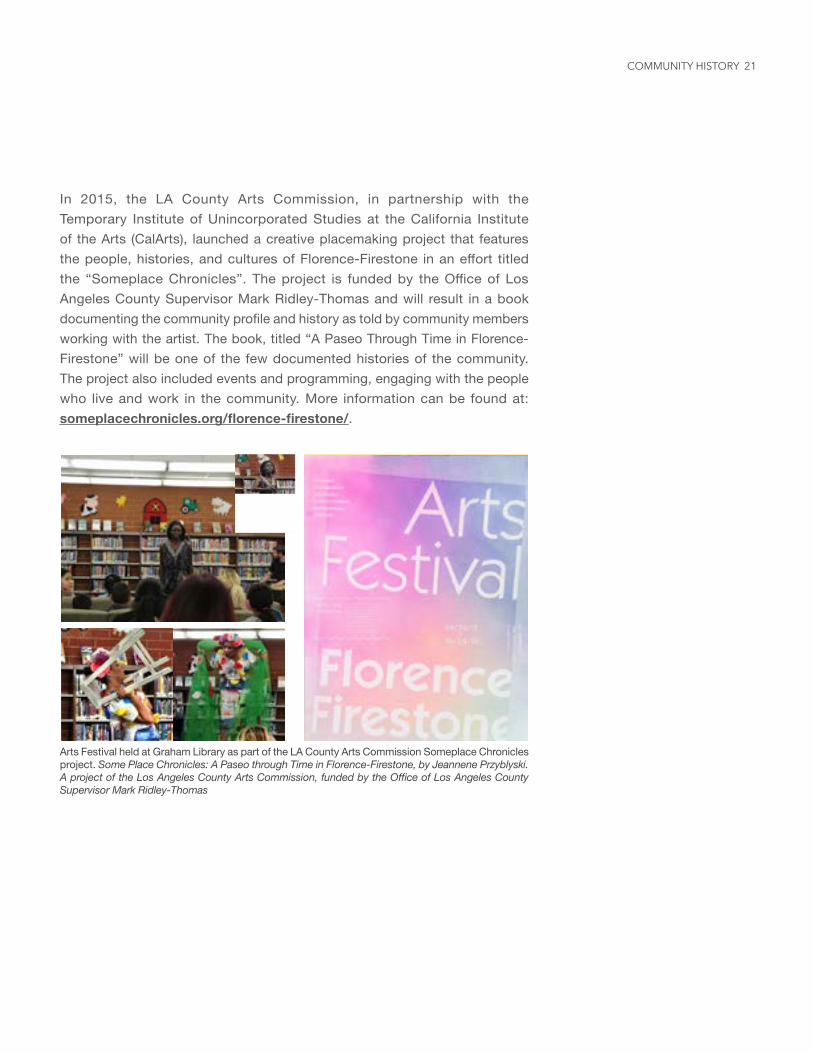
In 2015, the LA County Arts Commission, in partnership with the Temporary Institute of Unincorporated Studies at the California Institute of the Arts (CalArts), launched a creative placemaking project that features the people, histories, and cultures of Florence-Firestone in an effort titled the “Someplace Chronicles”. The project is funded by the Office of Los Angeles County Supervisor Mark Ridley-Thomas and will result in a book documenting the community profile and history as told by community members working with the artist. The book, titled “A Paseo Through Time in Florence-Firestone” will be one of the few documented histories of the community. The project also included events and programming, engaging with the people who live and work in the community. More information can be found at: someplacechronicles.org/florence-firestone/.
49 49 48 coda: a temporary arts festival at graham library
Arts Festival held at Graham Library as part of the LA County Arts Commission Someplace Chronicles project. Some Place Chronicles: A Paseo through Time in Florence-Firestone, by Jeannene Przyblyski. A project of the Los Angeles County Arts Commission, funded by the Office of Los Angeles County Supervisor Mark Ridley-Thomas
COMMUNITY HISTORY
CHAPTER 3EXISTING CONDITIONS
This chapter provides a statistical overview of existing conditions in the community, including demographics, income, employment, land use, and transportation. This information is based on data from 2016 ESRI Demographics and 2010-2014 US Census-American Community Survey.
A. Land Use
Land use policy and zoning together determine the type and intensity of land use allowed on a property. Information on land use policy, zoning and existing use is provided below.
Zoning in Florence-Firestone was established as early as the 1920s. The most recent comprehensive update to the land use policy and zoning occurred in 2015 with the adoption of the General Plan. An analysis of land use policies, zoning, and existing uses show that Florence-Firestone is predominantly a residential community, with industrial uses comprising the second most common land use, but far less than residential uses.
23
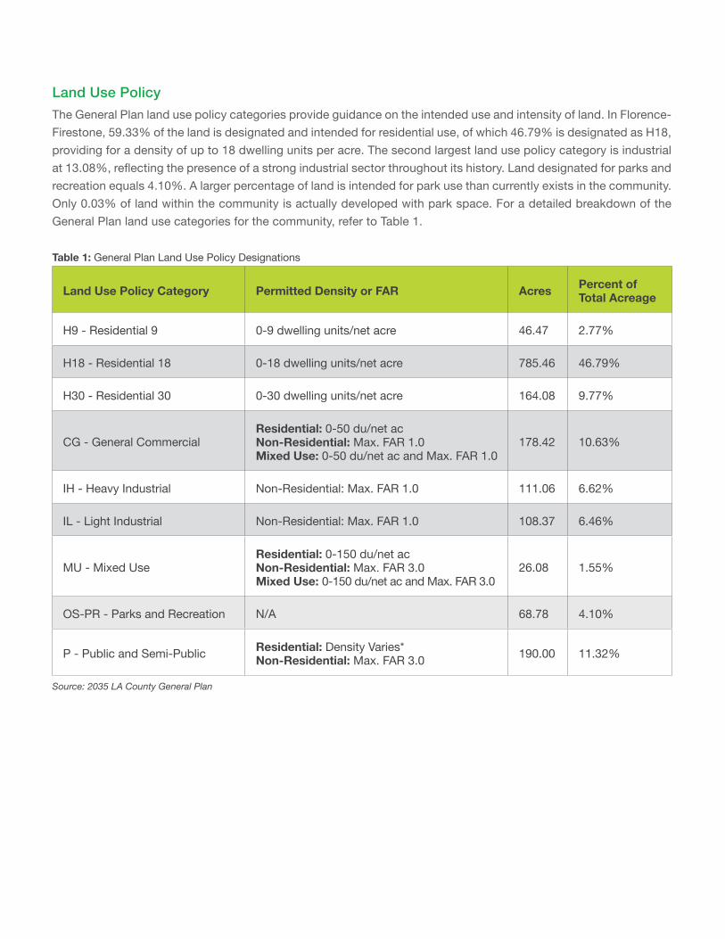
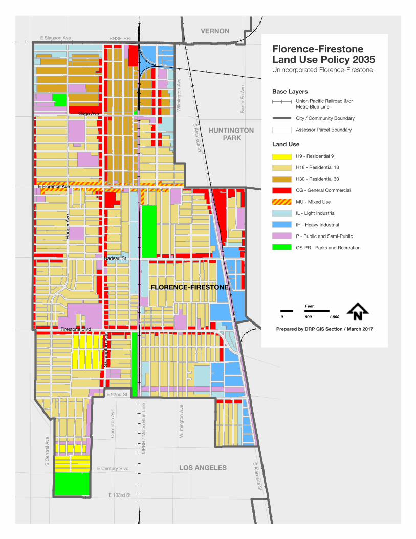
Table 1: General Plan Land Use Policy Designations
Land Use Policy Category Permitted Density or FAR Acres Percent of Total Acreage
H9 - Residential 9 0-9 dwelling units/net acre 46.47 2.77%
H18 - Residential 18 0-18 dwelling units/net acre 785.46 46.79%
H30 - Residential 30 0-30 dwelling units/net acre 164.08 9.77%
CG - General CommercialResidential: 0-50 du/net ac Non-Residential: Max. FAR 1.0 Mixed Use: 0-50 du/net ac and Max. FAR 1.0
178.42 10.63%
IH - Heavy Industrial Non-Residential: Max. FAR 1.0 111.06 6.62%
IL - Light Industrial Non-Residential: Max. FAR 1.0 108.37 6.46%
MU - Mixed UseResidential: 0-150 du/net ac Non-Residential: Max. FAR 3.0 Mixed Use: 0-150 du/net ac and Max. FAR 3.0
26.08 1.55%
OS-PR - Parks and Recreation N/A 68.78 4.10%
P - Public and Semi-Public Residential: Density Varies* Non-Residential: Max. FAR 3.0 190.00 11.32%
Source: 2035 LA County General Plan
Land Use PolicyThe General Plan land use policy categories provide guidance on the intended use and intensity of land. In Florence-Firestone, 59.33% of the land is designated and intended for residential use, of which 46.79% is designated as H18, providing for a density of up to 18 dwelling units per acre. The second largest land use policy category is industrial at 13.08%, reflecting the presence of a strong industrial sector throughout its history. Land designated for parks and recreation equals 4.10%. A larger percentage of land is intended for park use than currently exists in the community. Only 0.03% of land within the community is actually developed with park space. For a detailed breakdown of the General Plan land use categories for the community, refer to Table 1.
25
E 103rd St
E Century Blvd
Wilm
ingt
on A
ve
UPR
R / M
etro
Blu
e Li
ne
Com
pton
Ave
S C
entra
l Ave
E 92nd St
LOS ANGELES
HUNTINGTON PARK
VERNON
S Alameda St
S Alameda St
Wilm
ingt
on A
ve
Sant
a Fe
Ave
E Slauson Ave BNSF-RR
FLORENCE-FIRESTONE
Firestone Blvd
S C
ompt
on A
ve
Nadeau St
E Florence Ave
Hoo
per A
ve
Gage Ave
H9 - Residential 9
H18 - Residential 18
H30 - Residential 30
CG - General Commercial
MU - Mixed Use
IL - Light Industrial
IH - Heavy Industrial
P - Public and Semi-Public
OS-PR - Parks and Recreation
Base Layers
Land Use
Florence-FirestoneLand Use Policy 2035Unincorporated Florence-Firestone
0 900 1,800
Feet
Prepared by DRP GIS Section / March 2017
Union Pacific Railroad &/or Metro Blue Line
City / Community Boundary
Assessor Parcel Boundary
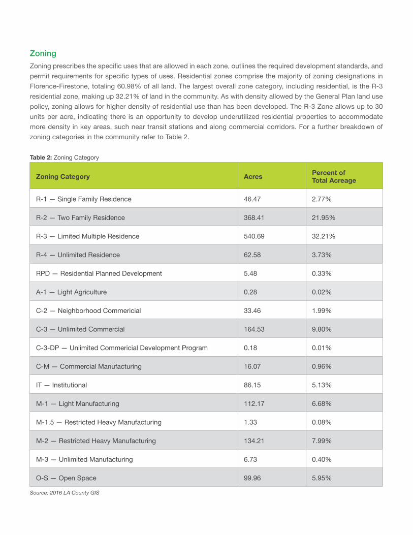
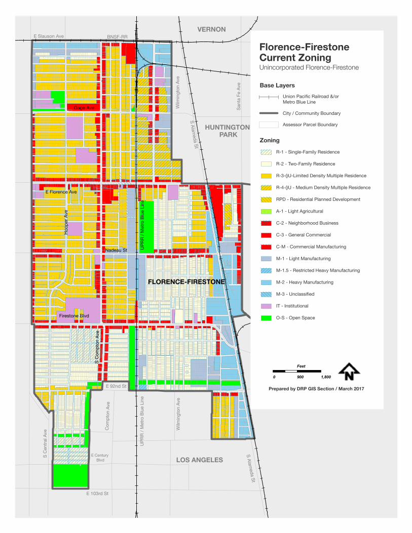
ZoningZoning prescribes the specific uses that are allowed in each zone, outlines the required development standards, and permit requirements for specific types of uses. Residential zones comprise the majority of zoning designations in Florence-Firestone, totaling 60.98% of all land. The largest overall zone category, including residential, is the R-3 residential zone, making up 32.21% of land in the community. As with density allowed by the General Plan land use policy, zoning allows for higher density of residential use than has been developed. The R-3 Zone allows up to 30 units per acre, indicating there is an opportunity to develop underutilized residential properties to accommodate more density in key areas, such near transit stations and along commercial corridors. For a further breakdown of zoning categories in the community refer to Table 2.
Table 2: Zoning Category
Zoning Category Acres Percent of Total Acreage
R-1 — Single Family Residence 46.47 2.77%
R-2 — Two Family Residence 368.41 21.95%
R-3 — Limited Multiple Residence 540.69 32.21%
R-4 — Unlimited Residence 62.58 3.73%
RPD — Residential Planned Development 5.48 0.33%
A-1 — Light Agriculture 0.28 0.02%
C-2 — Neighborhood Commericial 33.46 1.99%
C-3 — Unlimited Commercial 164.53 9.80%
C-3-DP — Unlimited Commericial Development Program 0.18 0.01%
C-M — Commercial Manufacturing 16.07 0.96%
IT — Institutional 86.15 5.13%
M-1 — Light Manufacturing 112.17 6.68%
M-1.5 — Restricted Heavy Manufacturing 1.33 0.08%
M-2 — Restricted Heavy Manufacturing 134.21 7.99%
M-3 — Unlimited Manufacturing 6.73 0.40%
O-S — Open Space 99.96 5.95%
Source: 2016 LA County GIS
27
E 103rd St
E Century Blvd
Wilm
ingt
on A
ve
UPR
R / M
etro
Blu
e Li
ne
Com
pton
Ave
S C
entra
l Ave
E 92nd St
LOS ANGELES
HUNTINGTON PARK
VERNON
S Alameda St
S Alameda St
Wilm
ingt
on A
ve
Sant
a Fe
Ave
E Slauson Ave BNSF-RR
FLORENCE-FIRESTONE
Firestone Blvd
S C
ompt
on A
ve
Nadeau St
E Florence Ave
Hoo
per A
ve
UPR
R / M
etro
Blu
e Li
ne
Gage Ave
R-1 - Single-Family Residence
R-2 - Two-Family Residence
R-3-()U-Limited Density Multiple Residence
R-4-()U - Medium Density Multiple Residence
RPD - Residential Planned Development
A-1 - Light Agricultural
C-2 - Neighborhood Business
C-3 - General Commercial
C-M - Commercial Manufacturing
M-1 - Light Manufacturing
M-1.5 - Restricted Heavy Manufacturing
M-2 - Heavy Manufacturing
M-3 - Unclassified
IT - Institutional
O-S - Open Space
Florence-FirestoneCurrent Zoning Unincorporated Florence-Firestone
0 900 1,800
Feet
Prepared by DRP GIS Section / March 2017
Base LayersUnion Pacific Railroad &/or Metro Blue Line
City / Community Boundary
Assessor Parcel Boundary
Zoning
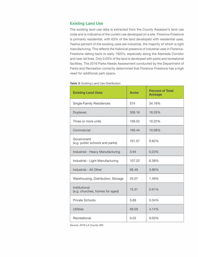
Existing Land UseThe existing land use data is extracted from the County Assessor’s land use code and is indicative of the current use developed on a site. Florence-Firestone is primarily residential, with 63% of the land developed with residential uses. Twelve percent of the existing uses are industrial, the majority of which is light manufacturing. This reflects the historical presence of industrial uses in Florence-Firestone dating back to early 1920’s, especially along the Alameda Corridor and near rail lines. Only 0.03% of the land is developed with parks and recreational facilities. The 2016 Parks Needs Assessment conducted by the Department of Parks and Recreation correctly determined that Florence-Firestone has a high need for additional park space.
Table 3: Existing Land Use Distribution
Existing Land Uses Acres Percent of Total Acreage
Single-Family Residences 574 34.18%
Duplexes 308.16 18.35%
Three or more units 169.52 10.22%
Commercial 169.44 10.09%
Government (e.g. public schools and parks) 161.57 9.62%
Industrial - Heavy Manufacturing 3.94 0.23%
Industrial - Light Manufacturing 107.22 6.38%
Industrial - All Other 66.49 3.96%
Warehousing, Distribution, Storage 25.07 1.49%
Institutional (e.g. churches, homes for aged) 15.31 0.91%
Private Schools 5.69 0.34%
Utilities 69.59 4.14%
Recreational 0.53 0.03%
Source: 2016 LA County GIS
29
Residential
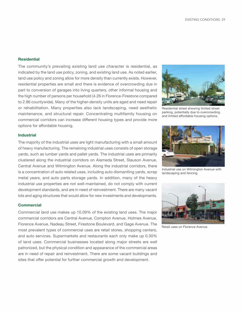
The community’s prevailing existing land use character is residential, as indicated by the land use policy, zoning, and existing land use. As noted earlier, land use policy and zoning allow for more density than currently exists. However, residential properties are small and there is evidence of overcrowding due in part to conversion of garages into living quarters, other informal housing and the high number of persons per household (4.26 in Florence-Firestone compared to 2.86 countywide). Many of the higher-density units are aged and need repair or rehabilitation. Many properties also lack landscaping, need aesthetic maintenance, and structural repair. Concentrating multifamily housing on commercial corridors can increase different housing types and provide more options for affordable housing.
Industrial
The majority of the industrial uses are light manufacturing with a small amount of heavy manufacturing. The remaining industrial uses consists of open storage yards, such as lumber yards and pallet yards. The industrial uses are primarily clustered along the industrial corridors on Alameda Street, Slauson Avenue, Central Avenue and Wilmington Avenue. Along the industrial corridors, there is a concentration of auto related uses, including auto dismantling yards, scrap metal years, and auto parts storage yards. In addition, many of the heavy industrial use properties are not well-maintained, do not comply with current development standards, and are in need of reinvestment. There are many vacant lots and aging structures that would allow for new investments and developments.
Commercial
Commercial land use makes up 10.09% of the existing land uses. The major commercial corridors are Central Avenue, Compton Avenue, Holmes Avenue, Florence Avenue, Nadeau Street, Firestone Boulevard, and Gage Avenue. The most prevalent types of commercial uses are retail stores, shopping centers, and auto services. Supermarkets and restaurants each only make up 0.30% of land uses. Commercial businesses located along major streets are well patronized, but the physical condition and appearance of the commercial areas are in need of repair and reinvestment. There are some vacant buildings and sites that offer potential for further commercial growth and development.
Residential street showing limited street parking, potentially due to overcrowding and limited affordable housing options.
Industrial use on Wilmington Avenue with landscaping and fencing.
Retail uses on Florence Avenue.
EXISTING CONDITIONS
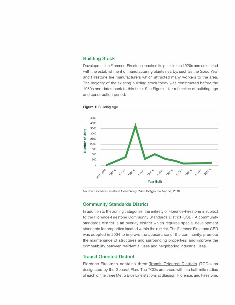
Figure 1: Building Age
Source: Florence-Firestone Community Plan Background Report, 2010
4500
4000
3500
3000
2500
2000
1500
1000
500
0
1823
-1899
1900
’s19
10’s
1920
’s19
30’s
1940
’s19
50’s
1960
’s19
70’s
1980
’s19
90’s
2000
’s
Year Built
Num
ber o
f Uni
ts
Building StockDevelopment in Florence-Firestone reached its peak in the 1920s and coincided with the establishment of manufacturing plants nearby, such as the Good Year and Firestone tire manufacturers which attracted many workers to the area. The majority of the existing building stock today was constructed before the 1960s and dates back to this time. See Figure 1 for a timeline of building age and construction period.
Community Standards DistrictIn addition to the zoning categories, the entirety of Florence-Firestone is subject to the Florence-Firestone Community Standards District (CSD). A community standards district is an overlay district which requires special development standards for properties located within the district. The Florence Firestone CSD was adopted in 2004 to improve the appearance of the community, promote the maintenance of structures and surrounding properties, and improve the compatibility between residential uses and neighboring industrial uses.
Transit Oriented DistrictFlorence-Firestone contains three Transit Oriented Districts (TODs) as designated by the General Plan. The TODs are areas within a half-mile radius of each of the three Metro Blue Line stations at Slauson, Florence, and Firestone.
31
TODs were established to promote transit- and pedestrian-friendly development and community-serving uses near transit stations, increase transit use, manage congestion, and improve air quality. Approximately 52% of all land within the community is located in a TOD area (within half-mile of a station), totaling 1,160.8 acres. The General Plan TOD implementation program requires that TOD Specific Plans are adopted for each TOD area. None of the stations in the Florence-Firestone community currently have an adopted TOD Specific Plan.
B. Demographics
The information in this section is based on the following data sources: 2000 and 2010 U. S. Census, 2010-2014 American Community Survey Estimates, 2016 ESRI Demographics.
Population
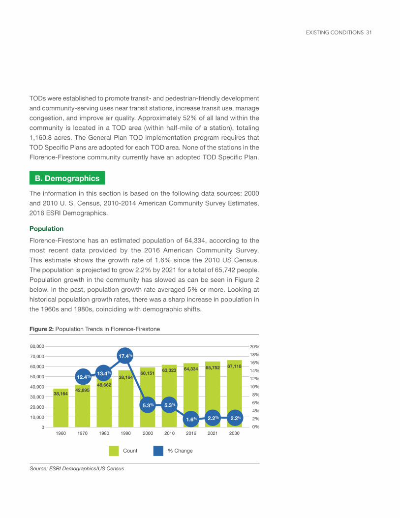
Florence-Firestone has an estimated population of 64,334, according to the most recent data provided by the 2016 American Community Survey. This estimate shows the growth rate of 1.6% since the 2010 US Census. The population is projected to grow 2.2% by 2021 for a total of 65,742 people. Population growth in the community has slowed as can be seen in Figure 2 below. In the past, population growth rate averaged 5% or more. Looking at historical population growth rates, there was a sharp increase in population in the 1960s and 1980s, coinciding with demographic shifts.
80,000
70,000
60,000
50,000
40,000
30,000
20,000
10,000
0
20%18%16%14%12%10%8%6%4%2%0%
1960 1970 1980 1990 2000 2010 2016 2021 2030
Count % Change
Figure 2: Population Trends in Florence-Firestone
Source: ESRI Demographics/US Census
12.4% 13.4%
17.4%
5.3% 5.3%
1.6% 2.2% 2.2%
38,16442,895
48,66238,164
60,151 63,323 64,334 65,752 67,118
EXISTING CONDITIONS
The sharp increase in population in the 1960s corresponds to a dramatic demographic shift in the community. Between 1950 and 1965, the African-American population increased from 18% to 57% of the total population. By 1980, the community had gone through another dramatic demographic shift, with people of Hispanic Origin making up 61% of the population by 1980 and 90.73% by 2016.
Race and Ethnicity
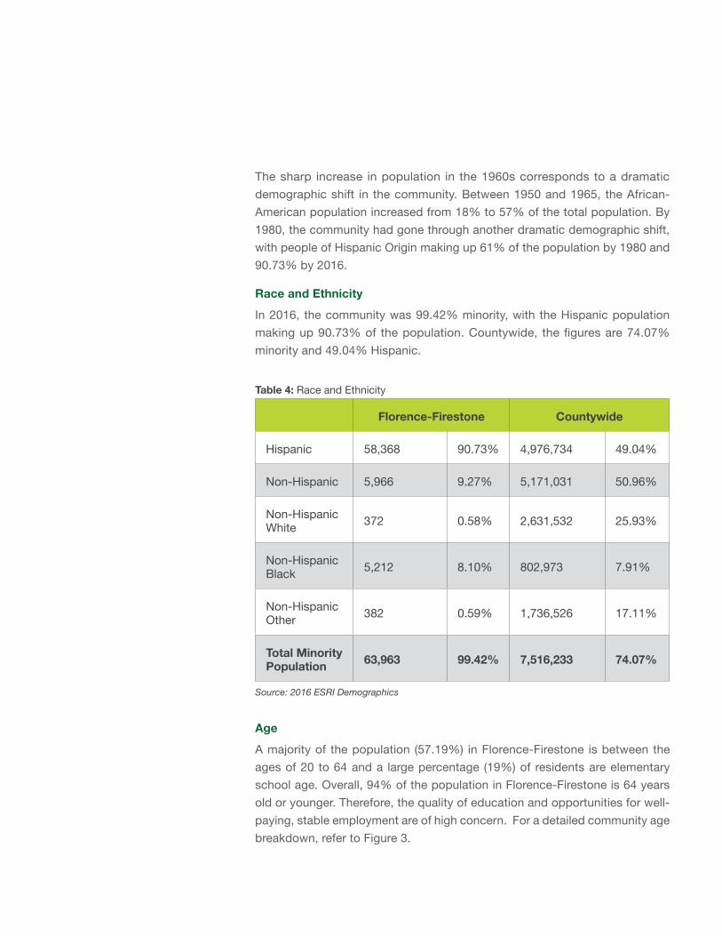
In 2016, the community was 99.42% minority, with the Hispanic population making up 90.73% of the population. Countywide, the figures are 74.07% minority and 49.04% Hispanic.
Table 4: Race and Ethnicity
Florence-Firestone Countywide
Hispanic 58,368 90.73% 4,976,734 49.04%
Non-Hispanic 5,966 9.27% 5,171,031 50.96%
Non-Hispanic White 372 0.58% 2,631,532 25.93%
Non-Hispanic Black 5,212 8.10% 802,973 7.91%
Non-Hispanic Other 382 0.59% 1,736,526 17.11%
Total Minority Population 63,963 99.42% 7,516,233 74.07%
Source: 2016 ESRI Demographics
Age
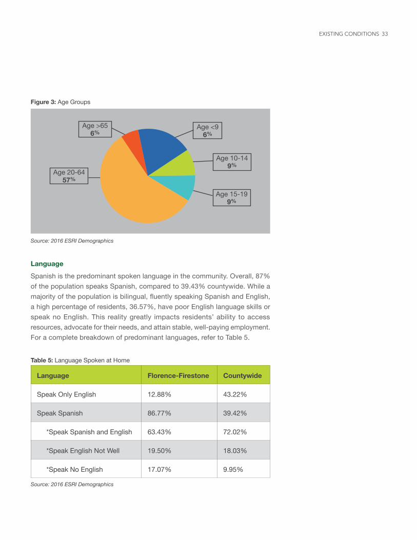
A majority of the population (57.19%) in Florence-Firestone is between the ages of 20 to 64 and a large percentage (19%) of residents are elementary school age. Overall, 94% of the population in Florence-Firestone is 64 years old or younger. Therefore, the quality of education and opportunities for well-paying, stable employment are of high concern. For a detailed community age breakdown, refer to Figure 3.
33
Figure 3: Age Groups
Source: 2016 ESRI Demographics
Language
Spanish is the predominant spoken language in the community. Overall, 87% of the population speaks Spanish, compared to 39.43% countywide. While a majority of the population is bilingual, fluently speaking Spanish and English, a high percentage of residents, 36.57%, have poor English language skills or speak no English. This reality greatly impacts residents’ ability to access resources, advocate for their needs, and attain stable, well-paying employment. For a complete breakdown of predominant languages, refer to Table 5.
Table 5: Language Spoken at Home
Language Florence-Firestone Countywide
Speak Only English 12.88% 43.22%
Speak Spanish 86.77% 39.42%
*Speak Spanish and English 63.43% 72.02%
*Speak English Not Well 19.50% 18.03%
*Speak No English 17.07% 9.95%
Source: 2016 ESRI Demographics
Age 20-64 57%
Age >65 6%
Age 10-14 9%
Age <9 6%
Age 15-19 9%
EXISTING CONDITIONS
Housing
According to the 2010 U.S. Census, the number of housing units in Florence-Firestone was 14,754. According to 2016 ESRI Demographics, the number of housing units increased by 2.2% to 15,073 units. The housing unit vacancy rate was 7.35% and a majority of the units were renter occupied (60.31%). For a complete breakdown of owner, renter, and vacant units refer to Table 6.
Table 6: 2016 Housing Units
Housing Units Percent
Owner Occupied 4,874 32.34%
Renter Occupied 9,091 60.31%
Vacant Housing 1,108 7.35%
Total 15,073 100%
Source: 2016 ESRI Demographics/US Census
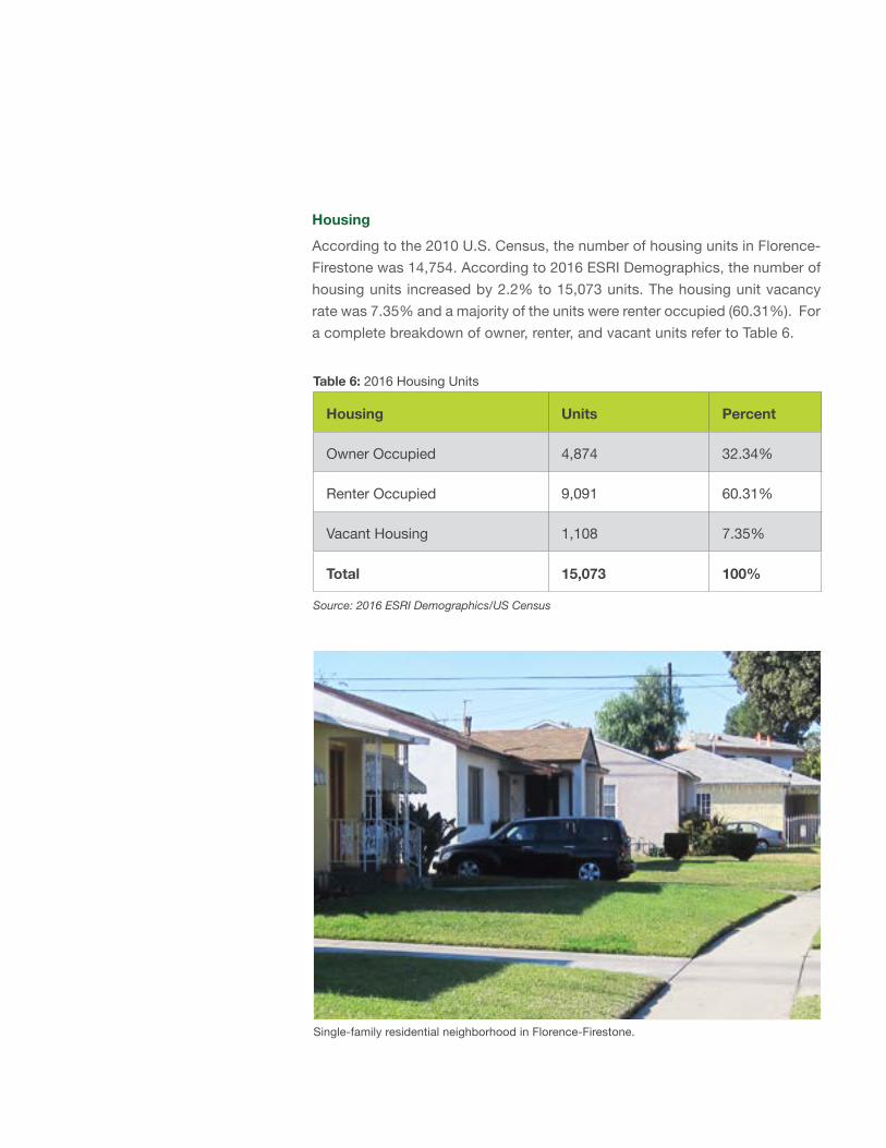
Single-family residential neighborhood in Florence-Firestone.
35
Dwelling units are predominantly single-family and the character of the community is generally low-density, interspersed with medium-density apartment buildings. Current zoning allows for additional housing units, particularly in the residential areas north of E. Firestone Boulevard and west of Maie Avenue, where properties are zoned R3. Although the potential for higher residential density exists and there is a need for it, current services, utilities, and resources may not be able to sustain future growth without large-scale reinvestment in the community. According to the 2008 Claritas report, 49% of all housing units in the community were built before 1960 and an additional 28% were built before 1990.
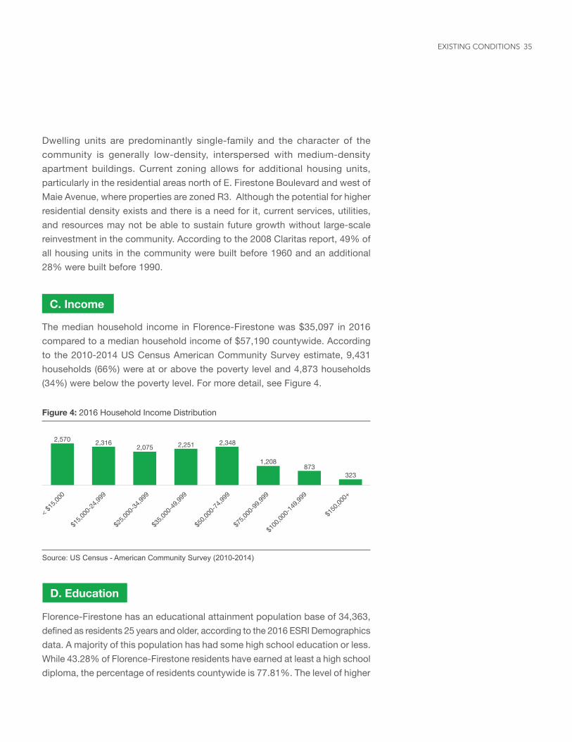
The median household income in Florence-Firestone was $35,097 in 2016 compared to a median household income of $57,190 countywide. According to the 2010-2014 US Census American Community Survey estimate, 9,431 households (66%) were at or above the poverty level and 4,873 households (34%) were below the poverty level. For more detail, see Figure 4.
C. Income
Figure 4: 2016 Household Income Distribution
Source: US Census - American Community Survey (2010-2014)
2,570 2,3162,075 2,251 2,348
1,208
323873
< $15,0
00
$15,0
00-24
,999
$25,0
00-34
,999
$35,0
00-49
,999
$50,0
00-74
,999
$75,0
00-99
,999
$100
,000-1
49,99
9
$150
,000+
D. Education
Florence-Firestone has an educational attainment population base of 34,363, defined as residents 25 years and older, according to the 2016 ESRI Demographics data. A majority of this population has had some high school education or less. While 43.28% of Florence-Firestone residents have earned at least a high school diploma, the percentage of residents countywide is 77.81%. The level of higher
EXISTING CONDITIONS
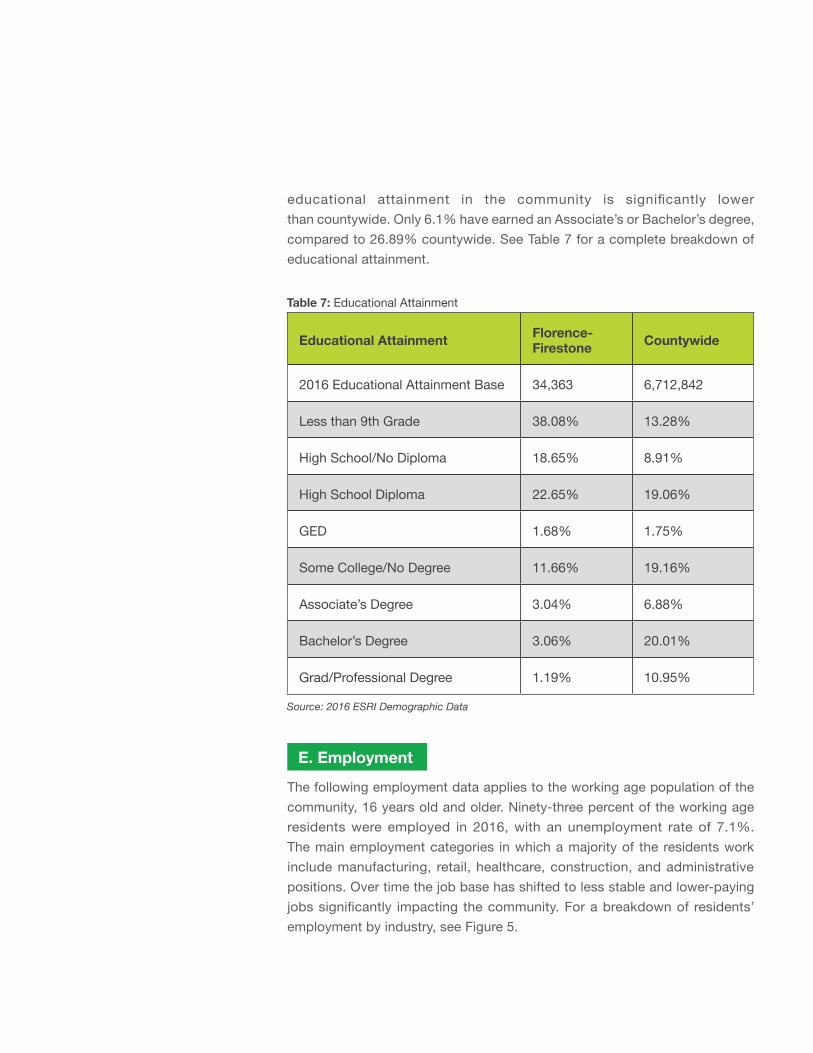
educational attainment in the community is significantly lower than countywide. Only 6.1% have earned an Associate’s or Bachelor’s degree, compared to 26.89% countywide. See Table 7 for a complete breakdown of educational attainment.
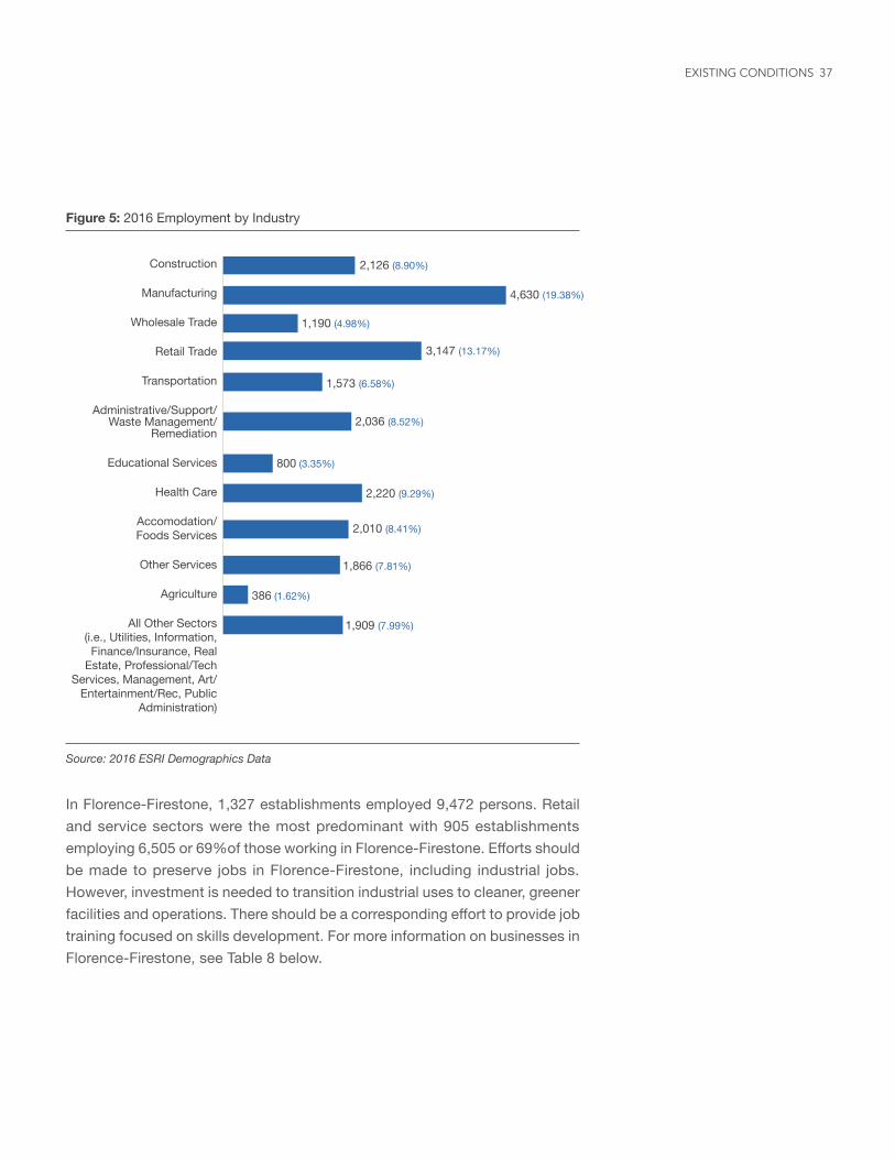
The following employment data applies to the working age population of the community, 16 years old and older. Ninety-three percent of the working age residents were employed in 2016, with an unemployment rate of 7.1%. The main employment categories in which a majority of the residents work include manufacturing, retail, healthcare, construction, and administrative positions. Over time the job base has shifted to less stable and lower-paying jobs significantly impacting the community. For a breakdown of residents’ employment by industry, see Figure 5.
E. Employment
Table 7: Educational Attainment
Educational Attainment Florence- Firestone Countywide
2016 Educational Attainment Base 34,363 6,712,842
Less than 9th Grade 38.08% 13.28%
High School/No Diploma 18.65% 8.91%
High School Diploma 22.65% 19.06%
GED 1.68% 1.75%
Some College/No Degree 11.66% 19.16%
Associate’s Degree 3.04% 6.88%
Bachelor’s Degree 3.06% 20.01%
Grad/Professional Degree 1.19% 10.95%
Source: 2016 ESRI Demographic Data
37
Figure 5: 2016 Employment by Industry
Source: 2016 ESRI Demographics Data
Construction
Manufacturing
Wholesale Trade
Retail Trade
Transportation
Administrative/Support/Waste Management/
Remediation
Educational Services
Health Care
Accomodation/ Foods Services
Other Services
Agriculture
All Other Sectors (i.e., Utilities, Information, Finance/Insurance, Real
Estate, Professional/Tech Services, Management, Art/
Entertainment/Rec, Public Administration)
2,126 (8.90%)
4,630 (19.38%)
1,190 (4.98%)
3,147 (13.17%)
1,573 (6.58%)
2,036 (8.52%)
800 (3.35%)
2,220 (9.29%)
2,010 (8.41%)
1,866 (7.81%)
386 (1.62%)
1,909 (7.99%)
In Florence-Firestone, 1,327 establishments employed 9,472 persons. Retail and service sectors were the most predominant with 905 establishments employing 6,505 or 69%of those working in Florence-Firestone. Efforts should be made to preserve jobs in Florence-Firestone, including industrial jobs. However, investment is needed to transition industrial uses to cleaner, greener facilities and operations. There should be a corresponding effort to provide job training focused on skills development. For more information on businesses in Florence-Firestone, see Table 8 below.
EXISTING CONDITIONS
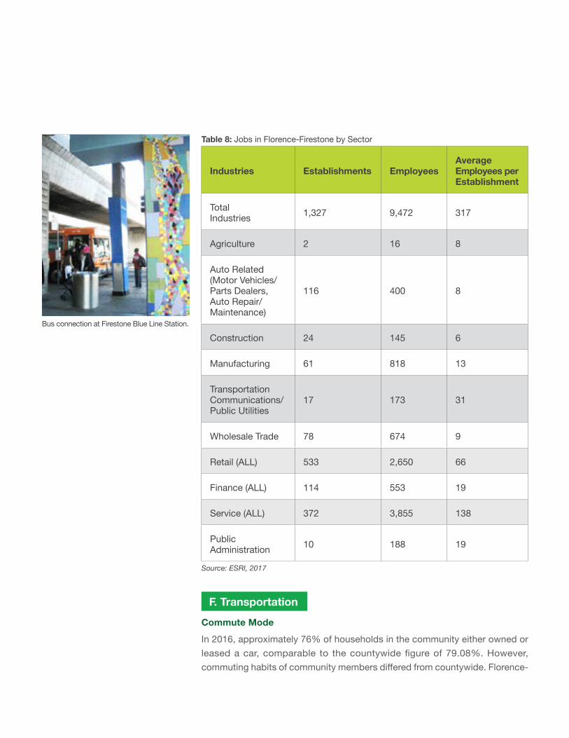
Table 8: Jobs in Florence-Firestone by Sector
Industries Establishments EmployeesAverage Employees per Establishment
Total Industries 1,327 9,472 317
Agriculture 2 16 8
Auto Related (Motor Vehicles/Parts Dealers, Auto Repair/Maintenance)
116 400 8
Construction 24 145 6
Manufacturing 61 818 13
Transportation Communications/ Public Utilities
17 173 31
Wholesale Trade 78 674 9
Retail (ALL) 533 2,650 66
Finance (ALL) 114 553 19
Service (ALL) 372 3,855 138
Public Administration 10 188 19
Source: ESRI, 2017
F. TransportationCommute Mode
In 2016, approximately 76% of households in the community either owned or leased a car, comparable to the countywide figure of 79.08%. However, commuting habits of community members differed from countywide. Florence-
Bus connection at Firestone Blue Line Station.
39
Table 9: Commute Mode (Labor Force 16+)
Florence-Firestone Countywide
Total Workers Percent Total Workers Percent
Total Workers 26,689 100% 4,746,130 100%
Drive Alone 14,986 56.15% 3,217,518 67.79%
Carpool 2,967 11.12% 457,403 9.64%
Bus 3,362 12.60% 276,946 5.84%
Bicycle 90 0.34% 39,547 0.83%
Public Transportation 3,650 13.68% 311,556 6.56%
Walk 508 1.90% 126,714 2.67%
Work at home 549 2.06% 224,676 4.73%
Other means 577 2.16% 91,770 1.93%
Source: US Census ACS 2010-2014
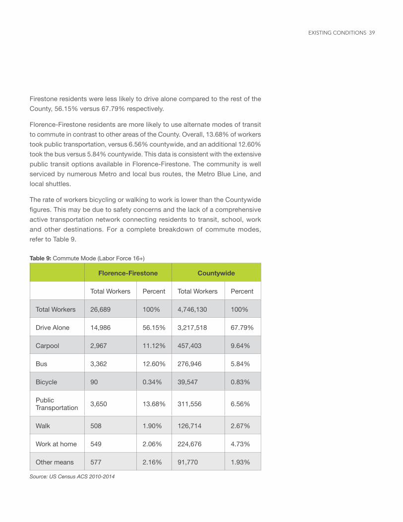
Firestone residents were less likely to drive alone compared to the rest of the County, 56.15% versus 67.79% respectively.
Florence-Firestone residents are more likely to use alternate modes of transit to commute in contrast to other areas of the County. Overall, 13.68% of workers took public transportation, versus 6.56% countywide, and an additional 12.60% took the bus versus 5.84% countywide. This data is consistent with the extensive public transit options available in Florence-Firestone. The community is well serviced by numerous Metro and local bus routes, the Metro Blue Line, and local shuttles.
The rate of workers bicycling or walking to work is lower than the Countywide figures. This may be due to safety concerns and the lack of a comprehensive active transportation network connecting residents to transit, school, work and other destinations. For a complete breakdown of commute modes, refer to Table 9.
EXISTING CONDITIONS
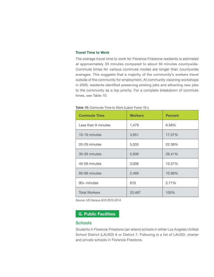
Travel Time to Work
The average travel time to work for Florence-Firestone residents is estimated at approximately 33 minutes compared to about 30 minutes countywide. Commute times for various commute modes are longer than countywide averages. This suggests that a majority of the community’s workers travel outside of the community for employment. At community visioning workshops in 2009, residents identified preserving existing jobs and attracting new jobs to the community as a top priority. For a complete breakdown of commute times, see Table 10.
Table 10: Commute Time to Work (Labor Force 16+)
Commute Time Workers Percent
Less than 9 minutes 1,479 6.58%
10-19 minutes 3,951 17.57%
20-29 minutes 5,033 22.38%
30-39 minutes 5,939 26.41%
40-59 minutes 3,006 13.37%
60-89 minutes 2,469 10.98%
90+ minutes 610 2.71%
Total Workers 22,487 100%
Source: US Census ACS 2010-2014
G. Public Facilities
Schools
Students in Florence-Firestone can attend schools in either Los Angeles Unified School District (LAUSD) 6 or District 7. Following is a list of LAUSD, charter and private schools in Florence-Firestone.
41
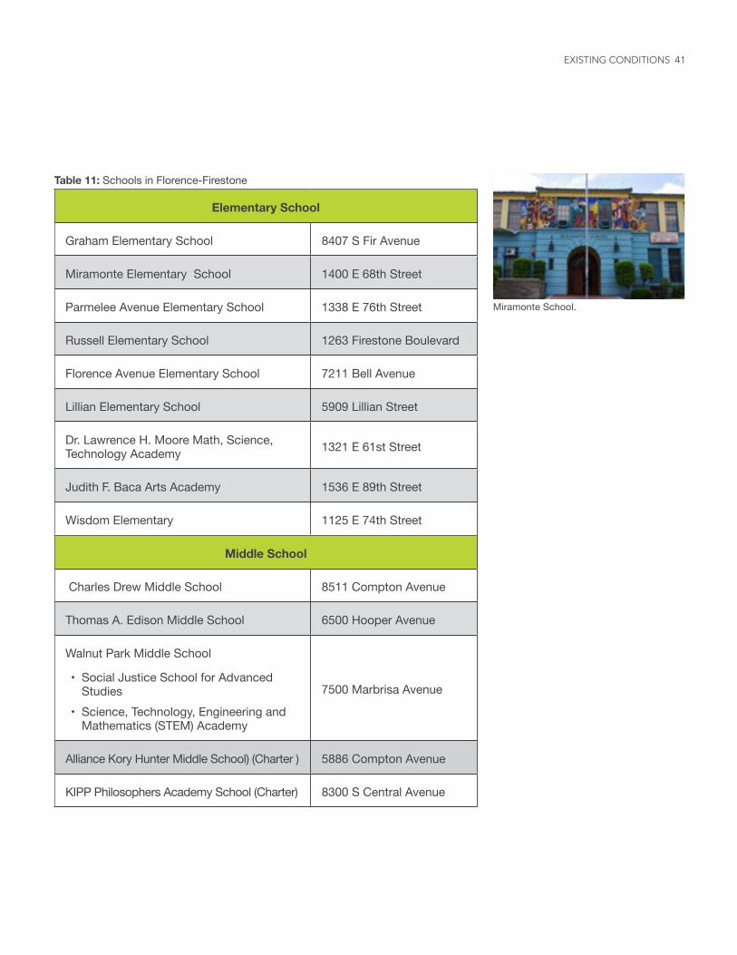
Miramonte School.
Table 11: Schools in Florence-Firestone
Elementary School
Graham Elementary School 8407 S Fir Avenue
Miramonte Elementary School 1400 E 68th Street
Parmelee Avenue Elementary School 1338 E 76th Street
Russell Elementary School 1263 Firestone Boulevard
Florence Avenue Elementary School 7211 Bell Avenue
Lillian Elementary School 5909 Lillian Street
Dr. Lawrence H. Moore Math, Science, Technology Academy 1321 E 61st Street
Judith F. Baca Arts Academy 1536 E 89th Street
Wisdom Elementary 1125 E 74th Street
Middle School
Charles Drew Middle School 8511 Compton Avenue
Thomas A. Edison Middle School 6500 Hooper Avenue
Walnut Park Middle School
• Social Justice School for Advanced Studies
• Science, Technology, Engineering and Mathematics (STEM) Academy
7500 Marbrisa Avenue
Alliance Kory Hunter Middle School) (Charter ) 5886 Compton Avenue
KIPP Philosophers Academy School (Charter) 8300 S Central Avenue
EXISTING CONDITIONS
County Facilities and ServicesSeveral County agencies operate field offices, service centers, and facilities in Florence-Firestone. County services are also offered at the Florence-Firestone Service Center. Los Angeles County agencies providing field service in Florence-Firestone include:
Roosevelt Park Senior Center.
High School
Diego Rivera Learning Complex
• School of Public Service Community• School of Communication and
Technology• School of Green Design• School of Performing Arts and
Community
6100 S Central Avenue
Alliance Margaret M. Bloomfield Technology Academy High School (Charter) 7907 Santa Fe Avenue
Animo Pat Brown School (Charter) 8255 Beach Street
Private School
St. Malachy Catholic Elementary (Pre-K – 8) 1200 E 81st Street
St. Aloysius School (TK – 8) 2023 E Nadeau Street
Table 11: Schools in Florence-Firestone (Continue)
43
Table 12: County Facilities and Services
Los Angeles County Service Provider Location
Florence-Firestone Service Center
• Board of Supervisors, Second District Field Office
• Registrar-Recorder and County Clerk Service Center
• Consumer Affairs Field Office
• Community and Senior Services Service Center
7807 S Compton Avenue
Workforce Investment Act, Rescare (Employment And Business Center) 1816 E Firestone Boulevard
Fire Station 16 8010 Compton Avenue
Probation Field Office - Juvenile Field Services Bureau 8526 Grape Street
Public Social Services Service Center 1740 Gage Avenue
Public Works Field Yard 1129 E 59th Street
Florence-Firestone Childcare Center 7217 Mace Place
Sheriff’s Youth Foundation, Century Youth Activity League
• Youth Center• Boxing Center
• 7901 Compton Avenue• 7116 Makee Avenue
Florence Library 1610 E Florence Avenue
Graham Library 1900 E Firestone Boulevard
Public Health Point of Dispensing (POD)
• Roosevelt Park• Ted Watkins Park
• 7600 Graham Avenue• 1335 E 103rd Street
Roosevelt Park Senior Center 7600 Graham Avenue
Washington Park Gymnasium and Community Center 8908 S Maie Avenue
EXISTING CONDITIONS
ParksThere are five parks in the community, totaling 70 acres of park space. This equals approximately one acre of parkland per 1,000 residents, far below the standard of four acres of parkland per 1,000 residents established by the Los Angeles County General Plan. The parks within the community are as follows:
Ted Watkins Memorial Park, 1335 E 103rd Street
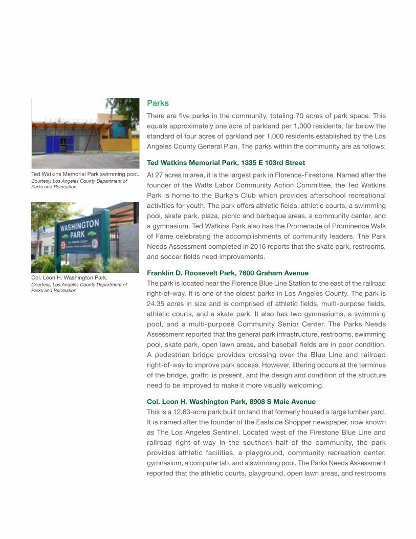
At 27 acres in area, it is the largest park in Florence-Firestone. Named after the founder of the Watts Labor Community Action Committee, the Ted Watkins Park is home to the Burke’s Club which provides afterschool recreational activities for youth. The park offers athletic fields, athletic courts, a swimming pool, skate park, plaza, picnic and barbeque areas, a community center, and a gymnasium. Ted Watkins Park also has the Promenade of Prominence Walk of Fame celebrating the accomplishments of community leaders. The Park Needs Assessment completed in 2016 reports that the skate park, restrooms, and soccer fields need improvements.
Franklin D. Roosevelt Park, 7600 Graham AvenueThe park is located near the Florence Blue Line Station to the east of the railroad right-of-way. It is one of the oldest parks in Los Angeles County. The park is 24.35 acres in size and is comprised of athletic fields, multi-purpose fields, athletic courts, and a skate park. It also has two gymnasiums, a swimming pool, and a multi-purpose Community Senior Center. The Parks Needs Assessment reported that the general park infrastructure, restrooms, swimming pool, skate park, open lawn areas, and baseball fields are in poor condition. A pedestrian bridge provides crossing over the Blue Line and railroad right-of-way to improve park access. However, littering occurs at the terminus of the bridge, graffiti is present, and the design and condition of the structure need to be improved to make it more visually welcoming.
Col. Leon H. Washington Park, 8908 S Maie AvenueThis is a 12.63-acre park built on land that formerly housed a large lumber yard. It is named after the founder of the Eastside Shopper newspaper, now known as The Los Angeles Sentinel. Located west of the Firestone Blue Line and railroad right-of-way in the southern half of the community, the park provides athletic facilities, a playground, community recreation center, gymnasium, a computer lab, and a swimming pool. The Parks Needs Assessment reported that the athletic courts, playground, open lawn areas, and restrooms
Ted Watkins Memorial Park swimming pool.Courtesy, Los Angeles County Department of Parks and Recreation
Col. Leon H. Washington Park. Courtesy, Los Angeles County Department of Parks and Recreation
45
are in poor condition. Residents who use the community recreation room have remarked on its poor acoustics, making it difficult for community groups to use as an effective meeting space.
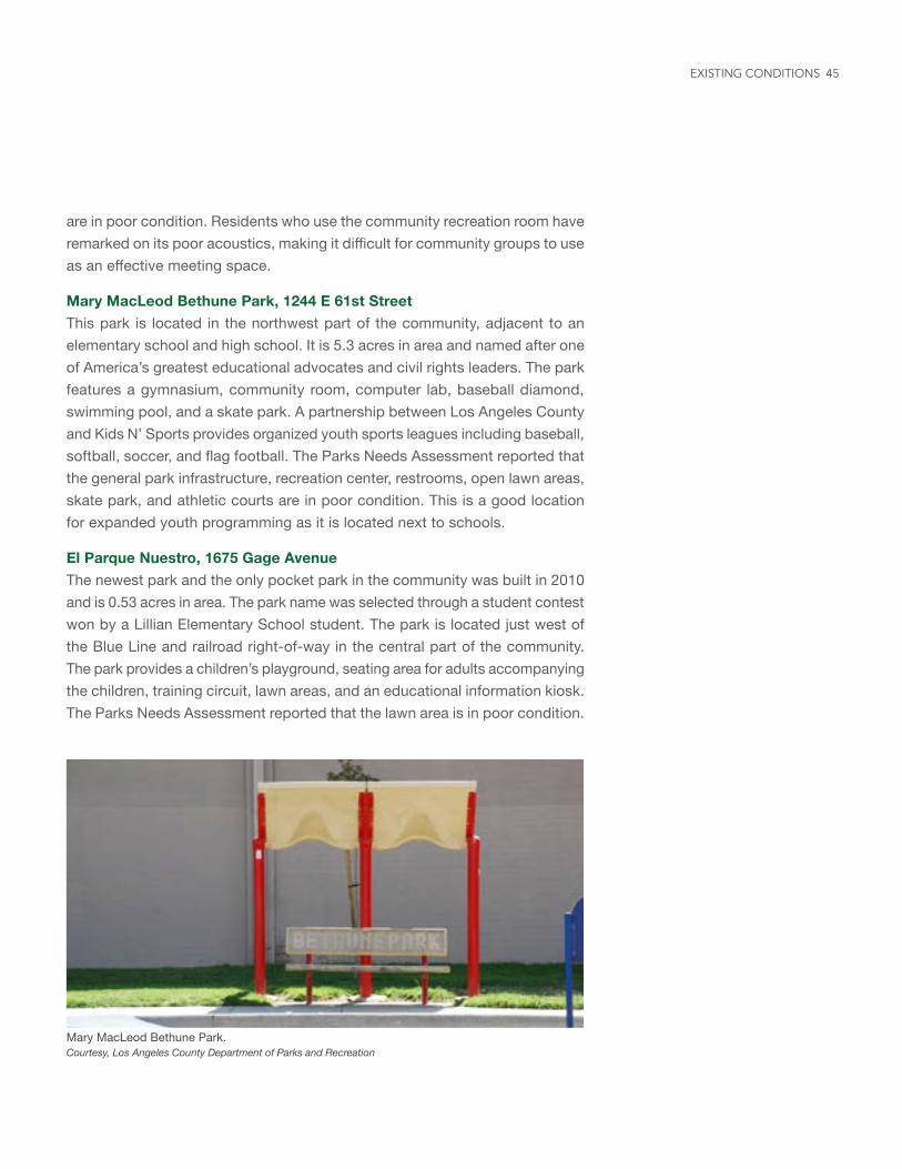
Mary MacLeod Bethune Park, 1244 E 61st StreetThis park is located in the northwest part of the community, adjacent to an elementary school and high school. It is 5.3 acres in area and named after one of America’s greatest educational advocates and civil rights leaders. The park features a gymnasium, community room, computer lab, baseball diamond, swimming pool, and a skate park. A partnership between Los Angeles County and Kids N’ Sports provides organized youth sports leagues including baseball, softball, soccer, and flag football. The Parks Needs Assessment reported that the general park infrastructure, recreation center, restrooms, open lawn areas, skate park, and athletic courts are in poor condition. This is a good location for expanded youth programming as it is located next to schools.
El Parque Nuestro, 1675 Gage AvenueThe newest park and the only pocket park in the community was built in 2010 and is 0.53 acres in area. The park name was selected through a student contest won by a Lillian Elementary School student. The park is located just west of the Blue Line and railroad right-of-way in the central part of the community. The park provides a children’s playground, seating area for adults accompanying the children, training circuit, lawn areas, and an educational information kiosk. The Parks Needs Assessment reported that the lawn area is in poor condition.
Mary MacLeod Bethune Park.Courtesy, Los Angeles County Department of Parks and Recreation
EXISTING CONDITIONS
CHAPTER 4GOALS AND POLICIES
Goals identify the physical, economic, and social outcomes that the community wishes to achieve. The goals are organized into broad categories.
Polices articulate the desired outcome and establish a course of action for decision-makers to accomplish the community’s desired vision. Policies are organized under each goal heading as appropriate.
Community Meeting, 2017
Community Meeting, 2012
47
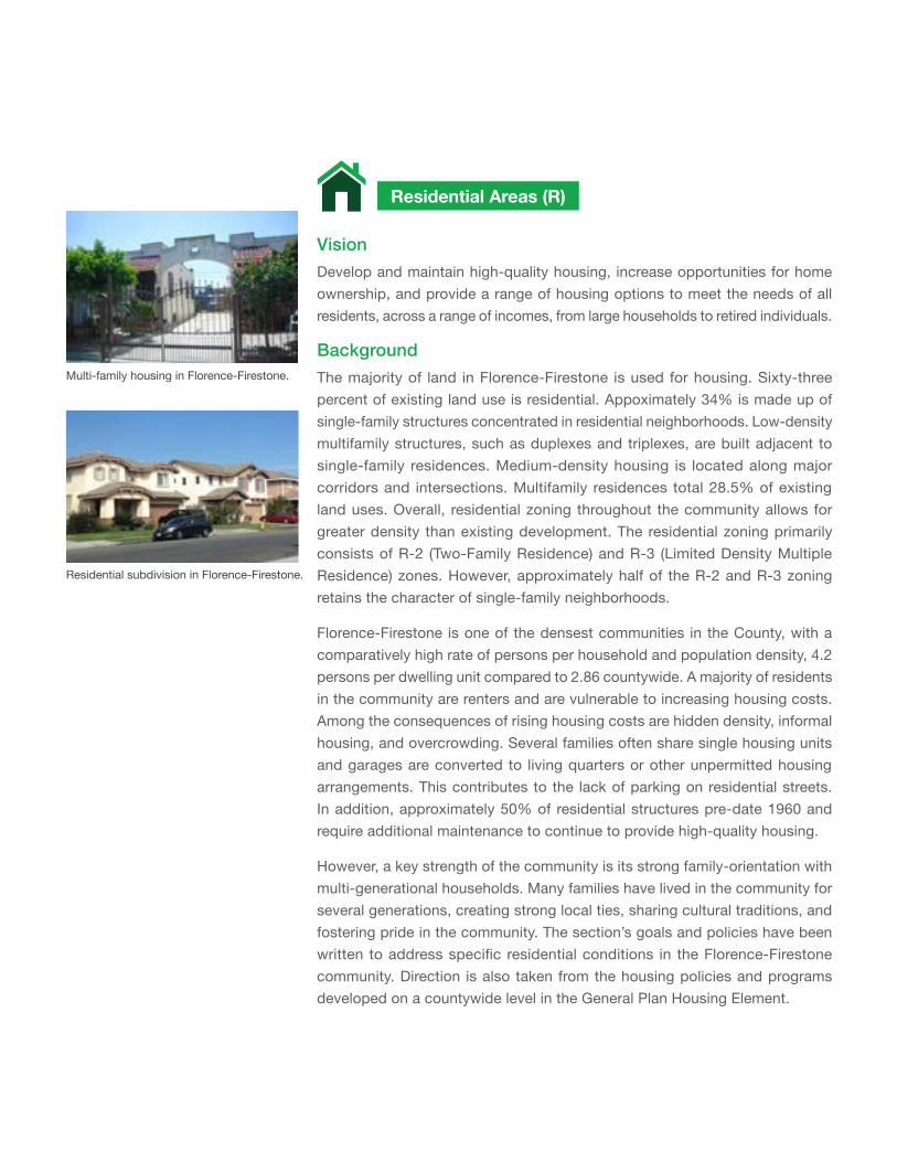
VisionDevelop and maintain high-quality housing, increase opportunities for home ownership, and provide a range of housing options to meet the needs of all residents, across a range of incomes, from large households to retired individuals.
Background
The majority of land in Florence-Firestone is used for housing. Sixty-three percent of existing land use is residential. Appoximately 34% is made up of single-family structures concentrated in residential neighborhoods. Low-density multifamily structures, such as duplexes and triplexes, are built adjacent to single-family residences. Medium-density housing is located along major corridors and intersections. Multifamily residences total 28.5% of existing land uses. Overall, residential zoning throughout the community allows for greater density than existing development. The residential zoning primarily consists of R-2 (Two-Family Residence) and R-3 (Limited Density Multiple Residence) zones. However, approximately half of the R-2 and R-3 zoning retains the character of single-family neighborhoods.
Florence-Firestone is one of the densest communities in the County, with a comparatively high rate of persons per household and population density, 4.2 persons per dwelling unit compared to 2.86 countywide. A majority of residents in the community are renters and are vulnerable to increasing housing costs. Among the consequences of rising housing costs are hidden density, informal housing, and overcrowding. Several families often share single housing units and garages are converted to living quarters or other unpermitted housing arrangements. This contributes to the lack of parking on residential streets. In addition, approximately 50% of residential structures pre-date 1960 and require additional maintenance to continue to provide high-quality housing.
However, a key strength of the community is its strong family-orientation with multi-generational households. Many families have lived in the community for several generations, creating strong local ties, sharing cultural traditions, and fostering pride in the community. The section’s goals and policies have been written to address specific residential conditions in the Florence-Firestone community. Direction is also taken from the housing policies and programs developed on a countywide level in the General Plan Housing Element.
Residential Areas (R)
Multi-family housing in Florence-Firestone.
Residential subdivision in Florence-Firestone.
49
E 103rd St
E Century Blvd
Wilm
ingt
on A
ve
UPR
R / M
etro
Blu
e Li
ne
Com
pton
Ave
S C
entra
l Ave
E 92nd St
LOS ANGELES
HUNTINGTON PARK
VERNON
S Alameda St
S Alameda St
Wilm
ingt
on A
ve
Sant
a Fe
Ave
E Slauson Ave BNSF-RR
FLORENCE-FIRESTONE
Firestone Blvd
S C
ompt
on A
ve
Nadeau St
E Florence Ave
Hoo
per A
ve
UPR
R / M
etro
Blu
e Li
ne
Gage Ave
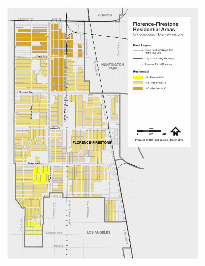
H9 - Residential 9
H18 - Residential 18
H30 - Residential 30
Base Layers
Residential
Florence-FirestoneResidential AreasUnincorporated Florence-Firestone
0 900 1,800
Feet
Prepared by DRP GIS Section / March 2017
Union Pacific Railroad &/or Metro Blue Line
City / Community Boundary
Assessor Parcel Boundary
Opportunities and Challenges
Increase Housing SupplyThere is need for additional housing options in strategic locations to allow aging in place, purchase of starter homes for families, and to accommodate a range of needs, family sizes, and incomes. Changes to state law regulating accessory dwelling units (ADU) will ease the legalization of existing ADUs and construction of permitted ADUs. This will help increase the housing supply and affordability, and enable current residents to live in legally permitted housing.
Higher-density housing should be directed to TODs and commercial areas to support transit access and the development of diverse retail and community services. This would enable greater diversity of housing types in the community and increase the affordable housing supply. This will also help protect single-family residential neighborhoods from potential development pressures and overcrowding. Investment in infrastructure, community resources, and community services would be needed to support higher density development in TOD and commercial areas.
New housing should be also directed towards infill development of vacant properties. Current zoning allows for higher density housing development than exists. Infill development in existing residential neighborhoods should reflect the character of the neighborhood and be consistent with the low-scale, single-family character of residential streets.
Residential RevitalizationResidential structures in the community are aging due to the high percentage of rental properties with deferred maintenance and difficulty in obtaining financing for improvements. With public outreach and strategic reinvestment by property owners, including supportive programs provided by public agencies, housing can be well-maintained and the lifespan of the structures expanded.
Investment in the public realm, such as improvements to streetscapes, sidewalks, pedestrian and bike infrastructure, and increased lighting in residential areas to improve access to transit, schools, parks, and support community well-being, can further contribute to a higher quality of life.
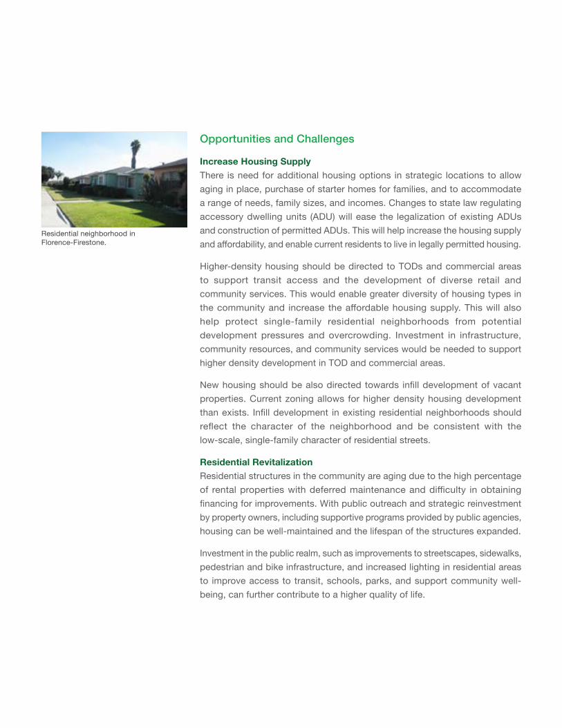
Residential neighborhood in Florence-Firestone.
51
Goals and PoliciesINCREASE HOUSING OPPORTUNITIES
GOAL R-1 Housing options meet a range of residents’ needs, income levels, and householdsizes,providingforincreasedhousingsupplyandaffordability.
Policy R-1.1 Accessory Dwelling Units. Support legalization of accessory dwelling units. Ensure protections for residents living in unpermitted units and offer alternate affordable housing options as needed.
Policy R-1.2 AffordableHousingSupply. Increase the supply of different housing types affordable to the community.
Policy R-1.3 Housing for Large Households. Design housing that meets the needs of large households and multigenerational families, which can include projects featuring multiple units with three or more bedrooms and other amenities and supportive services. (Refer to Equal Housing Opportunity policies in the Housing Element of the General Plan for more information.)
Policy R-1.4 StreamlineAffordableHousingDevelopment. Streamline and expedite affordable housing projects through the project and environmental review process and coordinate with private and non-profit organizations.
Policy R-1.5 Residential Overcrowding. Provide a range of housing choices and programs targeted to alleviate overcrowding.
Policy R-1.6 Displacement of Residents. Discourage the displacement of existing residents as new housing opportunities are developed.
Policy R-1.7 NoNetLossofAffordableUnits. Ensure that there is no net loss of affordable housing units in the community.
GOALS AND POLICIES - RESIDENTIAL AREAS (R)
General Plan Policies
Housing Element, Housing Affordability Policy 3.1: Promote mixed income neighborhoods and a diversity of housing types throughout the unincorporated areas to increase housing choices for all economic segments of the population.
Housing Element, Equal Housing Opportunity Policy 8.1: Support the distribution of affordable housing, shelters, and transitional housing in geographically diverse locations throughout the unincorporated areas, where appropriate support services and facilities are available in close proximity.
GOAL R-2 Development of new higher density housing is located near transit stations and along major corridors.
Policy R-2.1 Housing in Commercial Areas. Facilitate by-right development of higher-density mixed-use and multi-family housing along major corridors and within walking distance of transit stations.
Policy R-2.2 Incentivize Communal Spaces. Incentivize new mixed use and multi-family developments to include open space, including plazas, common areas, gardens, and walking paths.
Policy R-2.3 Appropriate Higher-Density Housing. Locate higher residential density housing, including senior, affordable, and mixed-income housing along major commercial corridors, near transit stops, and adjacent to public service facilities and ensure context-sensitive design.
GOAL R-3 Residents can own the homes where they live.
Policy R-3.1 Increase For-Sale Housing. Increase the supply of for-sale housing, affordable to a wide range of income levels through provision of diverse housing types.
Policy R-3.2 Homeownership Programs. Expand and increase access to homeownership programs, connecting residents to resources and financing.
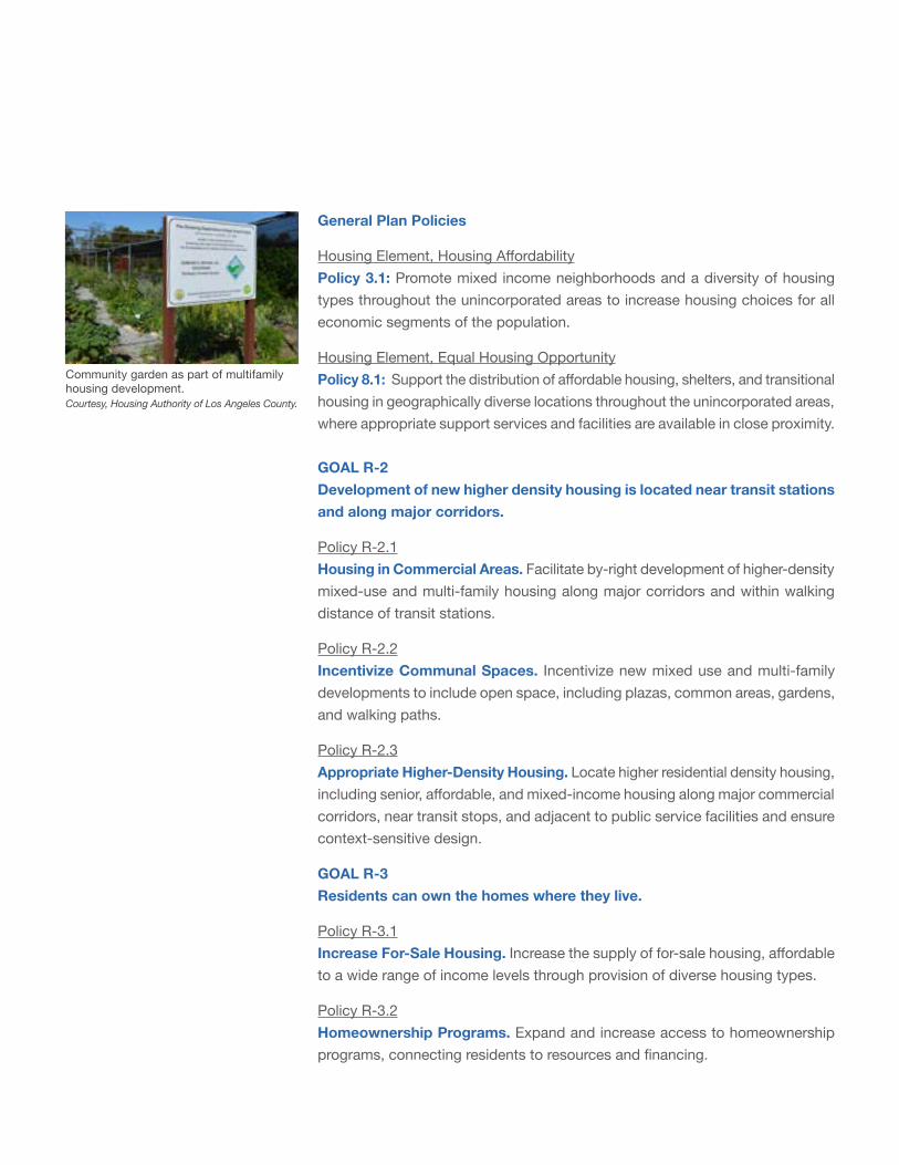
Community garden as part of multifamily housing development. Courtesy, Housing Authority of Los Angeles County.
53
RESIDENTIAL REVITALIZATION
GOAL R-4 Residential neighborhoods are safe and attractive places to live.
Policy R-4.1 Residential Maintenance. Support residents’ active involvement in neighborhood improvement efforts, to monitor housing needs and concerns, and to facilitate maintenance of residential sites and structures.
Policy R-4.2 Tenants’ Access to Information. Ensure that multi-lingual information is made easily available to tenants regarding tenant’s rights and rental housing maintenance requirements.
Policy R-4.3 Fence Heights. Allow taller fence heights in residential areas, where appropriate, to offer options in maintaining safety of neighborhoods.
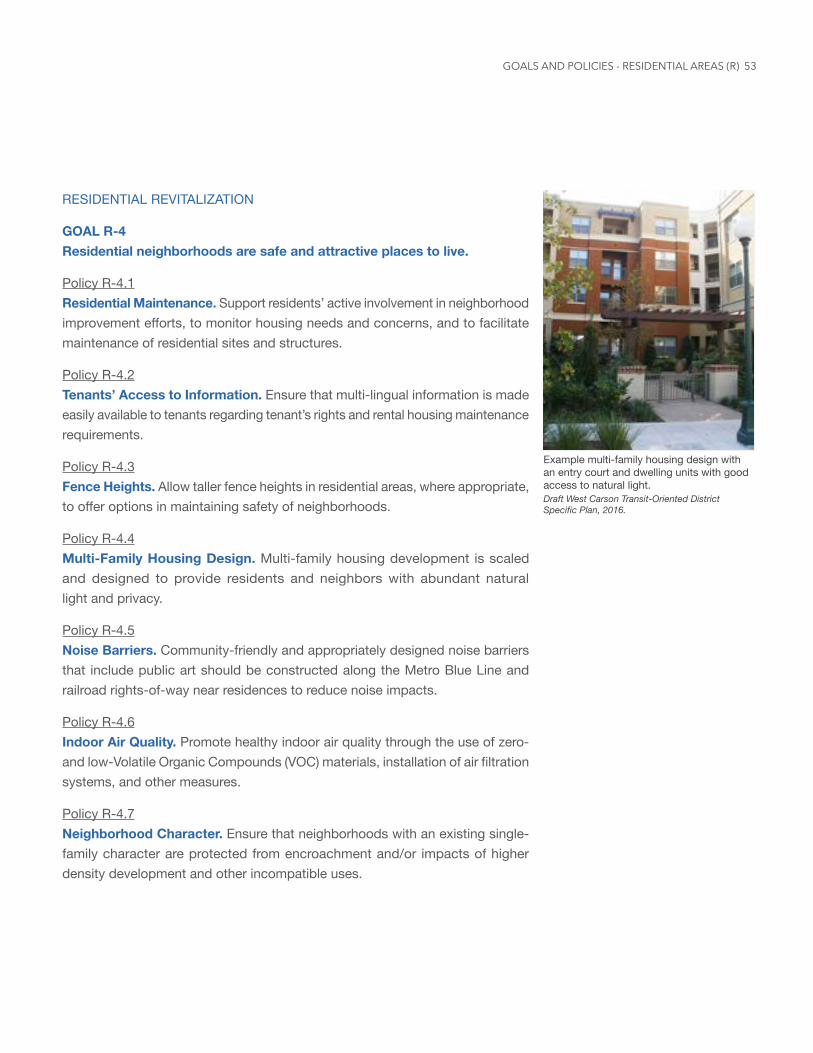
Policy R-4.4 Multi-Family Housing Design. Multi-family housing development is scaled and designed to provide residents and neighbors with abundant natural light and privacy.
Policy R-4.5 Noise Barriers. Community-friendly and appropriately designed noise barriers that include public art should be constructed along the Metro Blue Line and railroad rights-of-way near residences to reduce noise impacts.
Policy R-4.6 Indoor Air Quality. Promote healthy indoor air quality through the use of zero- and low-Volatile Organic Compounds (VOC) materials, installation of air filtration systems, and other measures.
Policy R-4.7 Neighborhood Character. Ensure that neighborhoods with an existing single-family character are protected from encroachment and/or impacts of higher density development and other incompatible uses.
Example multi-family housing design with an entry court and dwelling units with good access to natural light. Draft West Carson Transit-Oriented District Specific Plan, 2016.
GOALS AND POLICIES - RESIDENTIAL AREAS (R)
General Plan Policies
Community Design Policy LU 10.3: Consider the built environment of the surrounding area and location in the design and scale of new or remodeled buildings, architectural styles, and reflect appropriate features such as massing, materials, color, detailing or ornament.
Housing Element, Equal Housing Opportunity Policy 5.3: Enforce health, safety, building, and zoning laws directed at property maintenance as an ongoing function of the County government.
Policy 6.1: Invest public and private resources in the maintenance and rehabilitation of existing housing to prevent or reverse neighborhood deterioration.
Policy 6.3: Inspect multi-family rental housing (with five or more units), contract shelters, and voucher hotels on a regular basis to ensure that landlords are maintaining properties, and not allowing them to fall into disrepair.
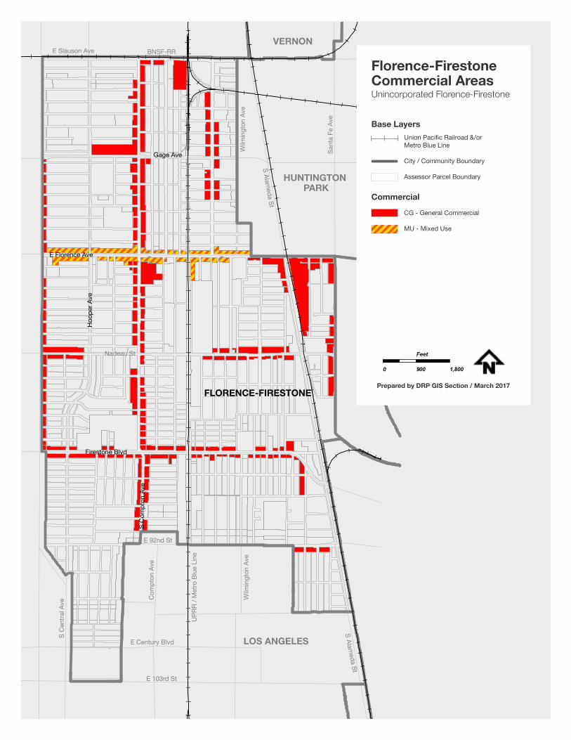
55
E 103rd St
E Century Blvd
Wilm
ingt
on A
ve
UPR
R / M
etro
Blu
e Li
ne
Com
pton
Ave
S C
entra
l Ave
E 92nd St
LOS ANGELES
HUNTINGTON PARK
VERNON
S Alameda St
Nadeau St
S Alameda St
Wilm
ingt
on A
ve
Sant
a Fe
Ave
E Slauson Ave BNSF-RR
FLORENCE-FIRESTONE
Firestone Blvd
S C
ompt
on A
ve
E Florence Ave
Hoo
per A
ve
Gage Ave
CG - General Commercial
MU - Mixed Use
Base Layers
Commercial
Florence-FirestoneCommercial AreasUnincorporated Florence-Firestone
0 900 1,800
Feet
Prepared by DRP GIS Section / March 2017
Union Pacific Railroad &/or Metro Blue Line
City / Community Boundary
Assessor Parcel Boundary
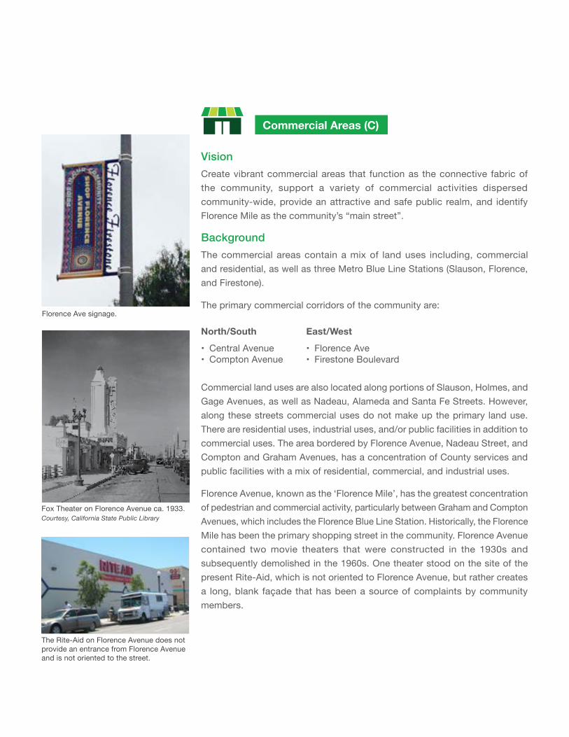
VisionCreate vibrant commercial areas that function as the connective fabric of the community, support a variety of commercial activities dispersed community-wide, provide an attractive and safe public realm, and identify Florence Mile as the community’s “main street”.
Background
The commercial areas contain a mix of land uses including, commercial and residential, as well as three Metro Blue Line Stations (Slauson, Florence, and Firestone).
The primary commercial corridors of the community are:
Commercial Areas (C)
Florence Ave signage.
North/South
• Central Avenue• Compton Avenue
East/West
• Florence Ave• Firestone Boulevard
Commercial land uses are also located along portions of Slauson, Holmes, and Gage Avenues, as well as Nadeau, Alameda and Santa Fe Streets. However, along these streets commercial uses do not make up the primary land use. There are residential uses, industrial uses, and/or public facilities in addition to commercial uses. The area bordered by Florence Avenue, Nadeau Street, and Compton and Graham Avenues, has a concentration of County services and public facilities with a mix of residential, commercial, and industrial uses.
Florence Avenue, known as the ‘Florence Mile’, has the greatest concentration of pedestrian and commercial activity, particularly between Graham and Compton Avenues, which includes the Florence Blue Line Station. Historically, the Florence Mile has been the primary shopping street in the community. Florence Avenue contained two movie theaters that were constructed in the 1930s and subsequently demolished in the 1960s. One theater stood on the site of the present Rite-Aid, which is not oriented to Florence Avenue, but rather creates a long, blank façade that has been a source of complaints by community members.
The Rite-Aid on Florence Avenue does not provide an entrance from Florence Avenue and is not oriented to the street.
Fox Theater on Florence Avenue ca. 1933. Courtesy, California State Public Library
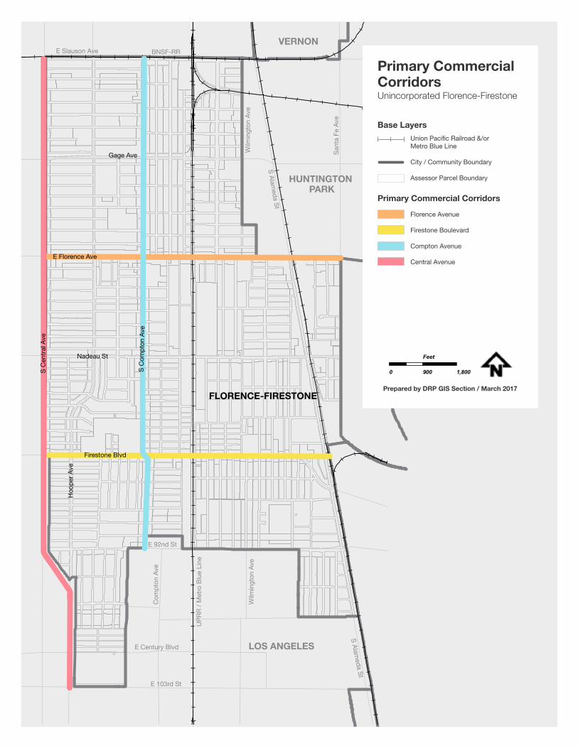
57
E 103rd St
E Century Blvd
Wilm
ingt
on A
ve
UPR
R / M
etro
Blu
e Li
ne
Com
pton
Ave
E 92nd St
LOS ANGELES
HUNTINGTON PARK
VERNON
S Alameda St
S Alameda St
Wilm
ingt
on A
ve
Sant
a Fe
Ave
E Slauson Ave BNSF-RRS
Cen
tral A
ve
Firestone Blvd
S C
ompt
on A
ve
Hoo
per A
ve
Nadeau St
E Florence Ave
Gage Ave
FLORENCE-FIRESTONE
Florence Avenue
Firestone Boulevard
Compton Avenue
Central Avenue
Base Layers
Primary Commercial Corridors
Primary Commercial CorridorsUnincorporated Florence-Firestone
0 900 1,800
Feet
Prepared by DRP GIS Section / March 2017
Union Pacific Railroad &/or Metro Blue Line
City / Community Boundary
Assessor Parcel Boundary
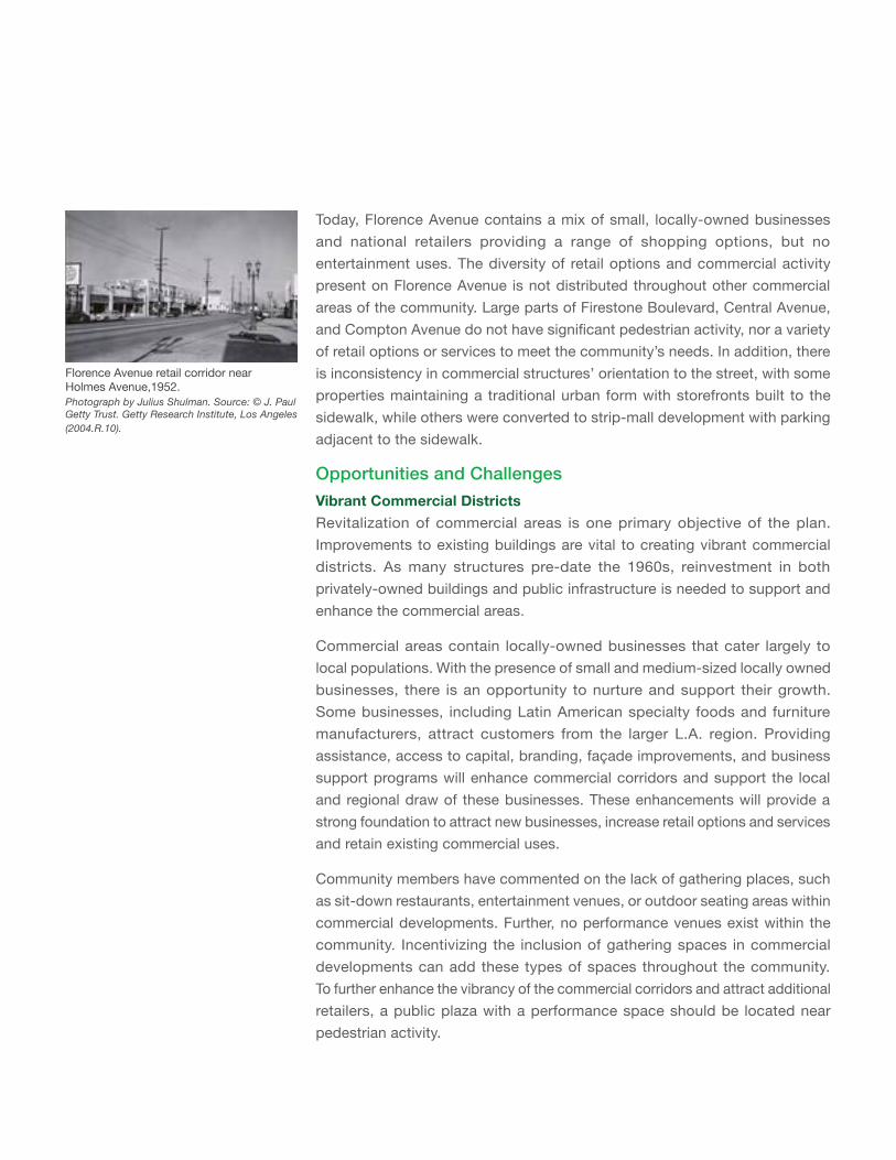
Today, Florence Avenue contains a mix of small, locally-owned businesses and national retailers providing a range of shopping options, but no entertainment uses. The diversity of retail options and commercial activity present on Florence Avenue is not distributed throughout other commercial areas of the community. Large parts of Firestone Boulevard, Central Avenue, and Compton Avenue do not have significant pedestrian activity, nor a variety of retail options or services to meet the community’s needs. In addition, there is inconsistency in commercial structures’ orientation to the street, with some properties maintaining a traditional urban form with storefronts built to the sidewalk, while others were converted to strip-mall development with parking adjacent to the sidewalk.
Opportunities and ChallengesVibrant Commercial DistrictsRevitalization of commercial areas is one primary objective of the plan. Improvements to existing buildings are vital to creating vibrant commercial districts. As many structures pre-date the 1960s, reinvestment in both privately-owned buildings and public infrastructure is needed to support and enhance the commercial areas.
Commercial areas contain locally-owned businesses that cater largely to local populations. With the presence of small and medium-sized locally owned businesses, there is an opportunity to nurture and support their growth. Some businesses, including Latin American specialty foods and furniture manufacturers, attract customers from the larger L.A. region. Providing assistance, access to capital, branding, façade improvements, and business support programs will enhance commercial corridors and support the local and regional draw of these businesses. These enhancements will provide a strong foundation to attract new businesses, increase retail options and services and retain existing commercial uses.
Community members have commented on the lack of gathering places, such as sit-down restaurants, entertainment venues, or outdoor seating areas within commercial developments. Further, no performance venues exist within the community. Incentivizing the inclusion of gathering spaces in commercial developments can add these types of spaces throughout the community. To further enhance the vibrancy of the commercial corridors and attract additional retailers, a public plaza with a performance space should be located near pedestrian activity.
Florence Avenue retail corridor near Holmes Avenue,1952. Photograph by Julius Shulman. Source: © J. Paul Getty Trust. Getty Research Institute, Los Angeles (2004.R.10).
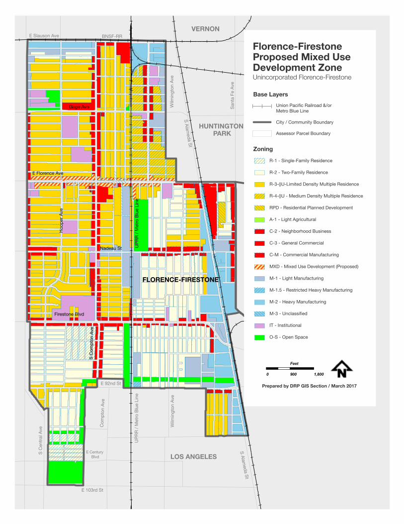
59
E 103rd St
E Century Blvd
Wilm
ingt
on A
ve
UPR
R / M
etro
Blu
e Li
ne
Com
pton
Ave
S C
entra
l Ave
E 92nd St
LOS ANGELES
HUNTINGTON PARK
VERNON
S Alameda St
S Alameda St
Wilm
ingt
on A
ve
Sant
a Fe
Ave
E Slauson Ave BNSF-RR
FLORENCE-FIRESTONE
Firestone Blvd
S C
ompt
on A
ve
Nadeau St
E Florence Ave
Hoo
per A
ve
UPR
R / M
etro
Blu
e Li
ne
Gage Ave
R-1 - Single-Family Residence
R-2 - Two-Family Residence
R-3-()U-Limited Density Multiple Residence
R-4-()U - Medium Density Multiple Residence
RPD - Residential Planned Development
A-1 - Light Agricultural
C-2 - Neighborhood Business
C-3 - General Commercial
C-M - Commercial Manufacturing
MXD - Mixed Use Development (Proposed)
M-1 - Light Manufacturing
M-1.5 - Restricted Heavy Manufacturing
M-2 - Heavy Manufacturing
M-3 - Unclassified
IT - Institutional
O-S - Open Space
Florence-FirestoneProposed Mixed UseDevelopment ZoneUnincorporated Florence-Firestone
0 900 1,800
Feet
Prepared by DRP GIS Section / March 2017
Base LayersUnion Pacific Railroad &/or Metro Blue Line
City / Community Boundary
Assessor Parcel Boundary
Zoning
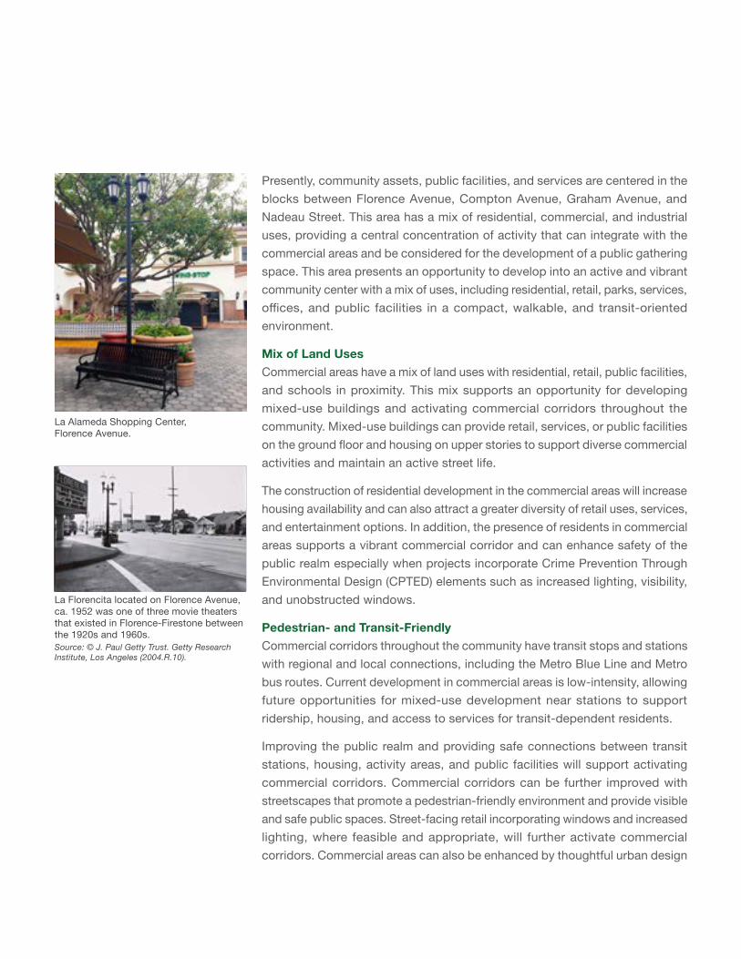
Presently, community assets, public facilities, and services are centered in the blocks between Florence Avenue, Compton Avenue, Graham Avenue, and Nadeau Street. This area has a mix of residential, commercial, and industrial uses, providing a central concentration of activity that can integrate with the commercial areas and be considered for the development of a public gathering space. This area presents an opportunity to develop into an active and vibrant community center with a mix of uses, including residential, retail, parks, services, offices, and public facilities in a compact, walkable, and transit-oriented environment.
Mix of Land UsesCommercial areas have a mix of land uses with residential, retail, public facilities, and schools in proximity. This mix supports an opportunity for developing mixed-use buildings and activating commercial corridors throughout the community. Mixed-use buildings can provide retail, services, or public facilities on the ground floor and housing on upper stories to support diverse commercial activities and maintain an active street life.
The construction of residential development in the commercial areas will increase housing availability and can also attract a greater diversity of retail uses, services, and entertainment options. In addition, the presence of residents in commercial areas supports a vibrant commercial corridor and can enhance safety of the public realm especially when projects incorporate Crime Prevention Through Environmental Design (CPTED) elements such as increased lighting, visibility, and unobstructed windows.
Pedestrian- and Transit-FriendlyCommercial corridors throughout the community have transit stops and stations with regional and local connections, including the Metro Blue Line and Metro bus routes. Current development in commercial areas is low-intensity, allowing future opportunities for mixed-use development near stations to support ridership, housing, and access to services for transit-dependent residents.
Improving the public realm and providing safe connections between transit stations, housing, activity areas, and public facilities will support activating commercial corridors. Commercial corridors can be further improved with streetscapes that promote a pedestrian-friendly environment and provide visible and safe public spaces. Street-facing retail incorporating windows and increased lighting, where feasible and appropriate, will further activate commercial corridors. Commercial areas can also be enhanced by thoughtful urban design
La Alameda Shopping Center, Florence Avenue.
La Florencita located on Florence Avenue, ca. 1952 was one of three movie theaters that existed in Florence-Firestone between the 1920s and 1960s.Source: © J. Paul Getty Trust. Getty Research Institute, Los Angeles (2004.R.10).
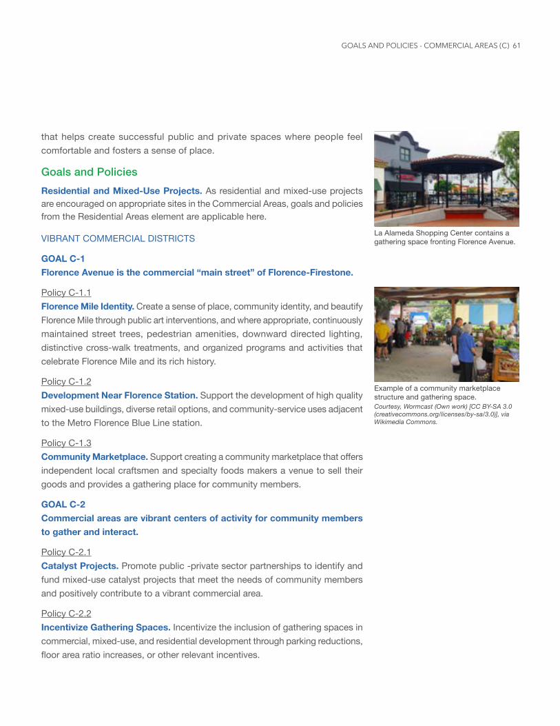
61
that helps create successful public and private spaces where people feel comfortable and fosters a sense of place.
Goals and PoliciesResidential and Mixed-Use Projects. As residential and mixed-use projects are encouraged on appropriate sites in the Commercial Areas, goals and policies from the Residential Areas element are applicable here.
VIBRANT COMMERCIAL DISTRICTS
GOAL C-1 Florence Avenue is the commercial “main street” of Florence-Firestone.
Policy C-1.1 Florence Mile Identity. Create a sense of place, community identity, and beautify Florence Mile through public art interventions, and where appropriate, continuously maintained street trees, pedestrian amenities, downward directed lighting, distinctive cross-walk treatments, and organized programs and activities that celebrate Florence Mile and its rich history.
Policy C-1.2 Development Near Florence Station. Support the development of high quality mixed-use buildings, diverse retail options, and community-service uses adjacent to the Metro Florence Blue Line station.
Policy C-1.3 Community Marketplace. Support creating a community marketplace that offers independent local craftsmen and specialty foods makers a venue to sell their goods and provides a gathering place for community members.
GOAL C-2 Commercial areas are vibrant centers of activity for community members to gather and interact.
Policy C-2.1 Catalyst Projects. Promote public -private sector partnerships to identify and fund mixed-use catalyst projects that meet the needs of community members and positively contribute to a vibrant commercial area.
Policy C-2.2 Incentivize Gathering Spaces. Incentivize the inclusion of gathering spaces in commercial, mixed-use, and residential development through parking reductions, floor area ratio increases, or other relevant incentives.
Example of a community marketplace structure and gathering space. Courtesy, Wormcast (Own work) [CC BY-SA 3.0 (creativecommons.org/licenses/by-sa/3.0)], via Wikimedia Commons.
La Alameda Shopping Center contains a gathering space fronting Florence Avenue.
GOALS AND POLICIES - COMMERCIAL AREAS (C)
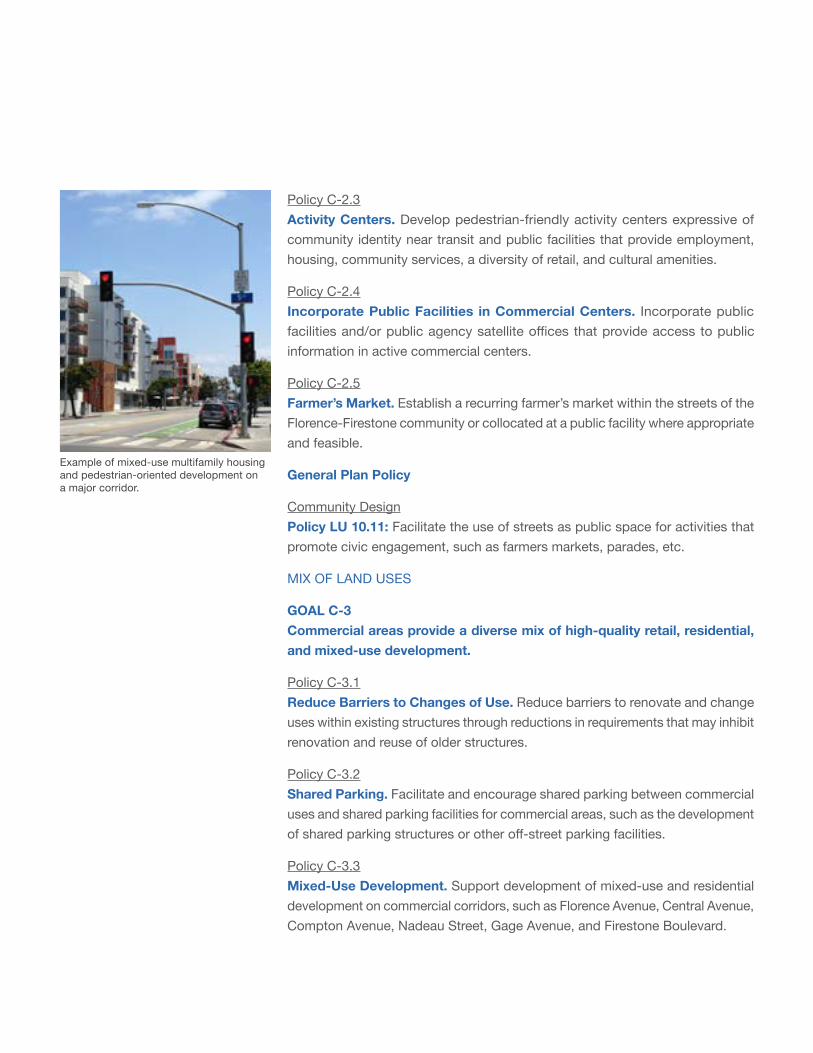
Example of mixed-use multifamily housing and pedestrian-oriented development on a major corridor.
Policy C-2.3 Activity Centers. Develop pedestrian-friendly activity centers expressive of community identity near transit and public facilities that provide employment, housing, community services, a diversity of retail, and cultural amenities.
Policy C-2.4 Incorporate Public Facilities in Commercial Centers. Incorporate public facilities and/or public agency satellite offices that provide access to public information in active commercial centers.
Policy C-2.5 Farmer’s Market. Establish a recurring farmer’s market within the streets of the Florence-Firestone community or collocated at a public facility where appropriate and feasible.
General Plan Policy
Community DesignPolicy LU 10.11: Facilitate the use of streets as public space for activities that promote civic engagement, such as farmers markets, parades, etc.
MIX OF LAND USES
GOAL C-3 Commercial areas provide a diverse mix of high-quality retail, residential, and mixed-use development.
Policy C-3.1 Reduce Barriers to Changes of Use. Reduce barriers to renovate and change uses within existing structures through reductions in requirements that may inhibit renovation and reuse of older structures.
Policy C-3.2 Shared Parking. Facilitate and encourage shared parking between commercial uses and shared parking facilities for commercial areas, such as the development of shared parking structures or other off-street parking facilities.
Policy C-3.3 Mixed-Use Development. Support development of mixed-use and residential development on commercial corridors, such as Florence Avenue, Central Avenue, Compton Avenue, Nadeau Street, Gage Avenue, and Firestone Boulevard.
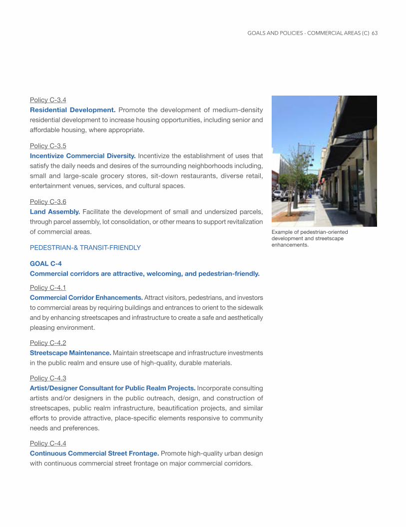
63
Policy C-3.4 Residential Development. Promote the development of medium-density residential development to increase housing opportunities, including senior and affordable housing, where appropriate.
Policy C-3.5 Incentivize Commercial Diversity. Incentivize the establishment of uses that satisfy the daily needs and desires of the surrounding neighborhoods including, small and large-scale grocery stores, sit-down restaurants, diverse retail, entertainment venues, services, and cultural spaces.
Policy C-3.6 Land Assembly. Facilitate the development of small and undersized parcels, through parcel assembly, lot consolidation, or other means to support revitalization of commercial areas.
PEDESTRIAN-& TRANSIT-FRIENDLY
GOAL C-4 Commercial corridors are attractive, welcoming, and pedestrian-friendly.
Policy C-4.1 Commercial Corridor Enhancements. Attract visitors, pedestrians, and investors to commercial areas by requiring buildings and entrances to orient to the sidewalk and by enhancing streetscapes and infrastructure to create a safe and aesthetically pleasing environment.
Policy C-4.2 Streetscape Maintenance. Maintain streetscape and infrastructure investments in the public realm and ensure use of high-quality, durable materials.
Policy C-4.3 Artist/Designer Consultant for Public Realm Projects. Incorporate consulting artists and/or designers in the public outreach, design, and construction of streetscapes, public realm infrastructure, beautification projects, and similar efforts to provide attractive, place-specific elements responsive to community needs and preferences.
Policy C-4.4 Continuous Commercial Street Frontage. Promote high-quality urban design with continuous commercial street frontage on major commercial corridors.
Example of pedestrian-oriented development and streetscape enhancements.
GOALS AND POLICIES - COMMERCIAL AREAS (C)
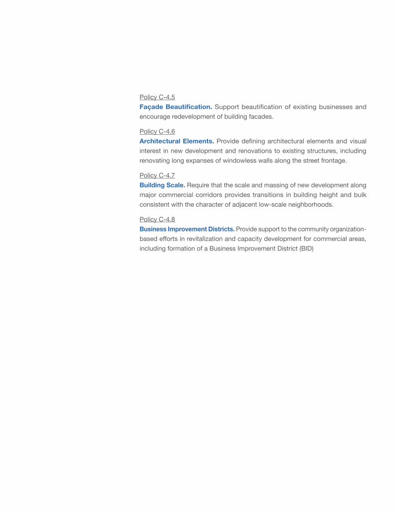
Policy C-4.5 FaçadeBeautification. Support beautification of existing businesses and encourage redevelopment of building facades.
Policy C-4.6 Architectural Elements. Provide defining architectural elements and visual interest in new development and renovations to existing structures, including renovating long expanses of windowless walls along the street frontage.
Policy C-4.7 Building Scale. Require that the scale and massing of new development along major commercial corridors provides transitions in building height and bulk consistent with the character of adjacent low-scale neighborhoods.
Policy C-4.8 Business Improvement Districts. Provide support to the community organization-based efforts in revitalization and capacity development for commercial areas, including formation of a Business Improvement District (BID)
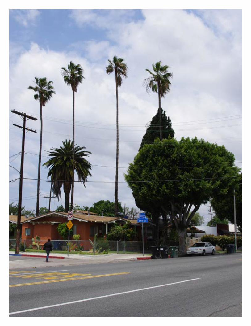
65
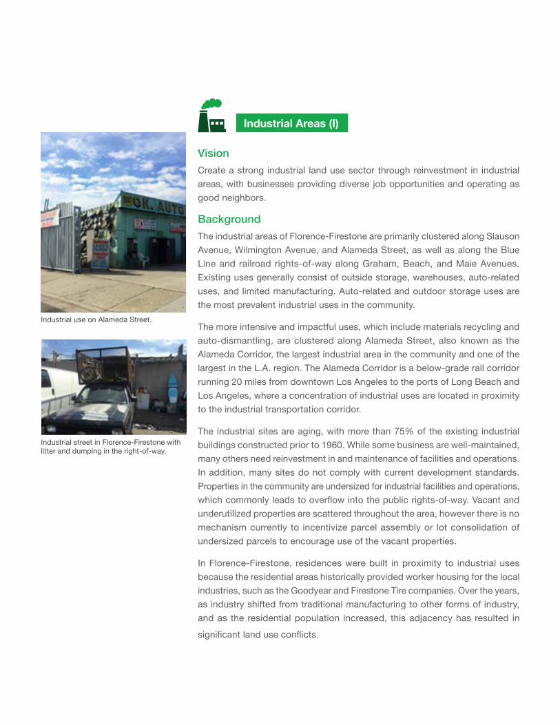
VisionCreate a strong industrial land use sector through reinvestment in industrial areas, with businesses providing diverse job opportunities and operating as good neighbors.
Background
The industrial areas of Florence-Firestone are primarily clustered along Slauson Avenue, Wilmington Avenue, and Alameda Street, as well as along the Blue Line and railroad rights-of-way along Graham, Beach, and Maie Avenues. Existing uses generally consist of outside storage, warehouses, auto-related uses, and limited manufacturing. Auto-related and outdoor storage uses are the most prevalent industrial uses in the community.
The more intensive and impactful uses, which include materials recycling and auto-dismantling, are clustered along Alameda Street, also known as the Alameda Corridor, the largest industrial area in the community and one of the largest in the L.A. region. The Alameda Corridor is a below-grade rail corridor running 20 miles from downtown Los Angeles to the ports of Long Beach and Los Angeles, where a concentration of industrial uses are located in proximity to the industrial transportation corridor.
The industrial sites are aging, with more than 75% of the existing industrial buildings constructed prior to 1960. While some business are well-maintained, many others need reinvestment in and maintenance of facilities and operations. In addition, many sites do not comply with current development standards. Properties in the community are undersized for industrial facilities and operations, which commonly leads to overflow into the public rights-of-way. Vacant and underutilized properties are scattered throughout the area, however there is no mechanism currently to incentivize parcel assembly or lot consolidation of undersized parcels to encourage use of the vacant properties.
In Florence-Firestone, residences were built in proximity to industrial uses because the residential areas historically provided worker housing for the local industries, such as the Goodyear and Firestone Tire companies. Over the years, as industry shifted from traditional manufacturing to other forms of industry, and as the residential population increased, this adjacency has resulted in
significant land use conflicts.
Industrial Areas (I)
Industrial use on Alameda Street.
Industrial street in Florence-Firestone with litter and dumping in the right-of-way.
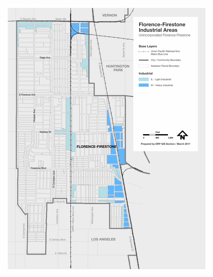
67
E 103rd St
E Century Blvd
Wilm
ingt
on A
ve
UPR
R / M
etro
Blu
e Li
ne
Com
pton
Ave
S C
entra
l Ave
E 92nd St
LOS ANGELES
HUNTINGTON PARK
VERNON
S Alameda St
S Alameda St
Wilm
ingt
on A
ve
Sant
a Fe
Ave
E Slauson Ave BNSF-RR
FLORENCE-FIRESTONE
Firestone Blvd
S C
ompt
on A
ve
Nadeau St
E Florence Ave
Hoo
per A
ve
Gage Ave
IL - Light Industrial
IH - Heavy Industrial
Base Layers
Industrial
Florence-FirestoneIndustrial AreasUnincorporated Florence-Firestone
0 900 1,800
Feet
Prepared by DRP GIS Section / March 2017
Union Pacific Railroad &/or Metro Blue Line
City / Community Boundary
Assessor Parcel Boundary
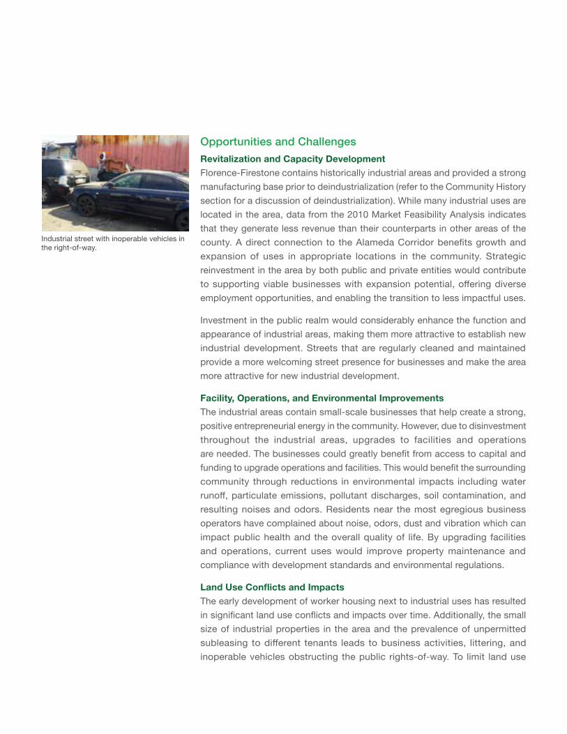
Opportunities and ChallengesRevitalization and Capacity DevelopmentFlorence-Firestone contains historically industrial areas and provided a strong manufacturing base prior to deindustrialization (refer to the Community History section for a discussion of deindustrialization). While many industrial uses are located in the area, data from the 2010 Market Feasibility Analysis indicates that they generate less revenue than their counterparts in other areas of the county. A direct connection to the Alameda Corridor benefits growth and expansion of uses in appropriate locations in the community. Strategic reinvestment in the area by both public and private entities would contribute to supporting viable businesses with expansion potential, offering diverse employment opportunities, and enabling the transition to less impactful uses.
Investment in the public realm would considerably enhance the function and appearance of industrial areas, making them more attractive to establish new industrial development. Streets that are regularly cleaned and maintained provide a more welcoming street presence for businesses and make the area more attractive for new industrial development.
Facility, Operations, and Environmental ImprovementsThe industrial areas contain small-scale businesses that help create a strong, positive entrepreneurial energy in the community. However, due to disinvestment throughout the industrial areas, upgrades to facilities and operations are needed. The businesses could greatly benefit from access to capital and funding to upgrade operations and facilities. This would benefit the surrounding community through reductions in environmental impacts including water runoff, particulate emissions, pollutant discharges, soil contamination, and resulting noises and odors. Residents near the most egregious business operators have complained about noise, odors, dust and vibration which can impact public health and the overall quality of life. By upgrading facilities and operations, current uses would improve property maintenance and compliance with development standards and environmental regulations.
LandUseConflictsandImpactsThe early development of worker housing next to industrial uses has resulted in significant land use conflicts and impacts over time. Additionally, the small size of industrial properties in the area and the prevalence of unpermitted subleasing to different tenants leads to business activities, littering, and inoperable vehicles obstructing the public rights-of-way. To limit land use
Industrial street with inoperable vehicles in the right-of-way.
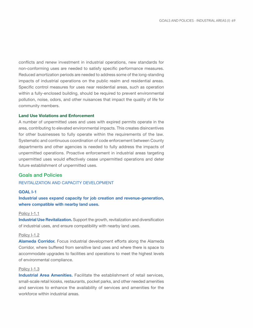
69
conflicts and renew investment in industrial operations, new standards for non-conforming uses are needed to satisfy specific performance measures. Reduced amortization periods are needed to address some of the long-standing impacts of industrial operations on the public realm and residential areas. Specific control measures for uses near residential areas, such as operation within a fully-enclosed building, should be required to prevent environmental pollution, noise, odors, and other nuisances that impact the quality of life for community members.
Land Use Violations and EnforcementA number of unpermitted uses and uses with expired permits operate in the area, contributing to elevated environmental impacts. This creates disincentives for other businesses to fully operate within the requirements of the law. Systematic and continuous coordination of code enforcement between County departments and other agencies is needed to fully address the impacts of unpermitted operations. Proactive enforcement in industrial areas targeting unpermitted uses would effectively cease unpermitted operations and deter future establishment of unpermitted uses.
Goals and PoliciesREVITALIZATION AND CAPACITY DEVELOPMENT
GOAL I-1 Industrial uses expand capacity for job creation and revenue-generation, where compatible with nearby land uses.
Policy I-1.1 Industrial Use Revitalization. Support the growth, revitalization and diversification of industrial uses, and ensure compatibility with nearby land uses.
Policy I-1.2 Alameda Corridor. Focus industrial development efforts along the Alameda Corridor, where buffered from sensitive land uses and where there is space to accommodate upgrades to facilities and operations to meet the highest levels of environmental compliance.
Policy I-1.3 Industrial Area Amenities. Facilitate the establishment of retail services, small-scale retail kiosks, restaurants, pocket parks, and other needed amenities and services to enhance the availability of services and amenities for the workforce within industrial areas.
GOALS AND POLICIES - INDUSTRIAL AREAS (I)
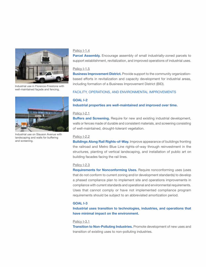
Policy I-1.4 Parcel Assembly. Encourage assembly of small industrially-zoned parcels to support establishment, revitalization, and improved operations of industrial uses.
Policy I-1.5 Business Improvement District. Provide support to the community organization-based efforts in revitalization and capacity development for industrial areas, including formation of a Business Improvement District (BID).
FACILITY, OPERATIONS, AND ENVIRONMENTAL IMPROVEMENTS
GOAL I-2 Industrial properties are well-maintained and improved over time.
Policy I-2.1 BuffersandScreening. Require for new and existing industrial development, walls or fences made of durable and consistent materials, and screening consisting of well-maintained, drought-tolerant vegetation.
Policy I-2.2 Buildings Along Rail Rights-of-Way. Improve appearance of buildings fronting the railroad and Metro Blue Line rights-of-way through reinvestment in the structures, planting of vertical landscaping, and installation of public art on building facades facing the rail lines.
Policy I-2.3 Requirements for Nonconforming Uses. Require nonconforming uses (uses that do not conform to current zoning and/or development standards) to develop a phased compliance plan to implement site and operations improvements in compliance with current standards and operational and environmental requirements. Uses that cannot comply or have not implemented compliance program requirements should be subject to an abbreviated amortization period.
GOAL I-3 Industrial uses transition to technologies, industries, and operations that have minimal impact on the environment.
Policy I-3.1 Transition to Non-Polluting Industries. Promote development of new uses and transition of existing uses to non-polluting industries.
Industrial use in Florence-Firestone with well-maintained façade and fencing.
Industrial use on Slauson Avenue with landscaping and walls for buffering and screening.
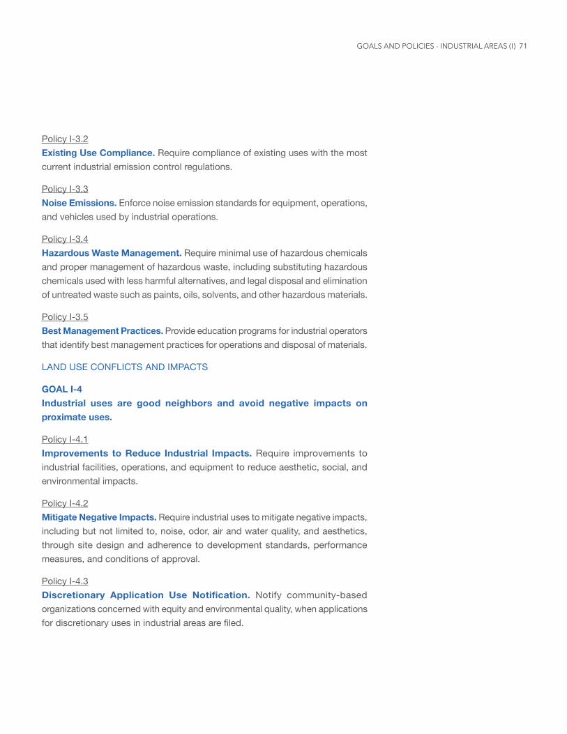
71
Policy I-3.2 Existing Use Compliance. Require compliance of existing uses with the most current industrial emission control regulations.
Policy I-3.3 Noise Emissions. Enforce noise emission standards for equipment, operations, and vehicles used by industrial operations.
Policy I-3.4 Hazardous Waste Management. Require minimal use of hazardous chemicals and proper management of hazardous waste, including substituting hazardous chemicals used with less harmful alternatives, and legal disposal and elimination of untreated waste such as paints, oils, solvents, and other hazardous materials.
Policy I-3.5 Best Management Practices. Provide education programs for industrial operators that identify best management practices for operations and disposal of materials.
LAND USE CONFLICTS AND IMPACTS
GOAL I-4 Industrial uses are good neighbors and avoid negative impacts on proximate uses.
Policy I-4.1 Improvements to Reduce Industrial Impacts. Require improvements to industrial facilities, operations, and equipment to reduce aesthetic, social, and environmental impacts.
Policy I-4.2 Mitigate Negative Impacts. Require industrial uses to mitigate negative impacts, including but not limited to, noise, odor, air and water quality, and aesthetics, through site design and adherence to development standards, performance measures, and conditions of approval.
Policy I-4.3 Discretionary Application Use Notification. Notify community-based organizations concerned with equity and environmental quality, when applications for discretionary uses in industrial areas are filed.
GOALS AND POLICIES - INDUSTRIAL AREAS (I)
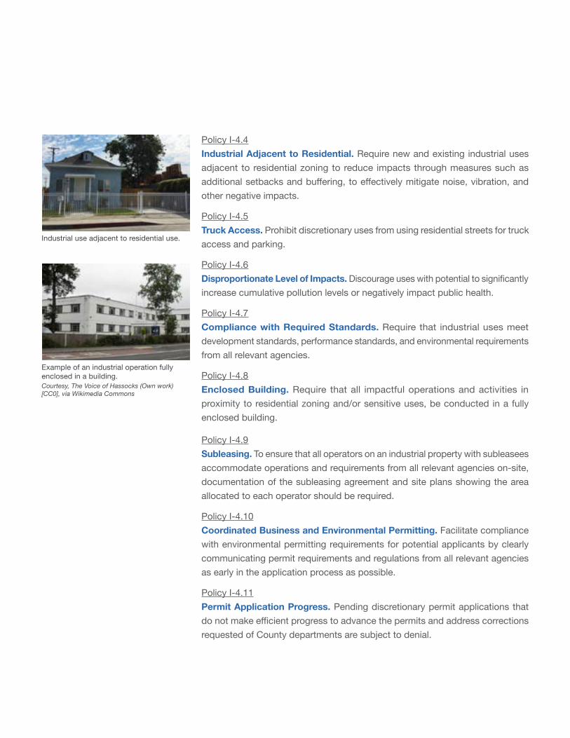
Industrial use adjacent to residential use.
Policy I-4.4 Industrial Adjacent to Residential. Require new and existing industrial uses adjacent to residential zoning to reduce impacts through measures such as additional setbacks and buffering, to effectively mitigate noise, vibration, and other negative impacts.
Policy I-4.5 Truck Access. Prohibit discretionary uses from using residential streets for truck access and parking.
Policy I-4.6 Disproportionate Level of Impacts. Discourage uses with potential to significantly increase cumulative pollution levels or negatively impact public health.
Policy I-4.7 Compliance with Required Standards. Require that industrial uses meet development standards, performance standards, and environmental requirements from all relevant agencies.
Policy I-4.8 Enclosed Building. Require that all impactful operations and activities in proximity to residential zoning and/or sensitive uses, be conducted in a fully enclosed building.
Policy I-4.9 Subleasing. To ensure that all operators on an industrial property with subleasees accommodate operations and requirements from all relevant agencies on-site, documentation of the subleasing agreement and site plans showing the area allocated to each operator should be required.
Policy I-4.10 Coordinated Business and Environmental Permitting. Facilitate compliance with environmental permitting requirements for potential applicants by clearly communicating permit requirements and regulations from all relevant agencies as early in the application process as possible.
Policy I-4.11 Permit Application Progress. Pending discretionary permit applications that do not make efficient progress to advance the permits and address corrections requested of County departments are subject to denial.
Example of an industrial operation fully enclosed in a building. Courtesy, The Voice of Hassocks (Own work) [CC0], via Wikimedia Commons
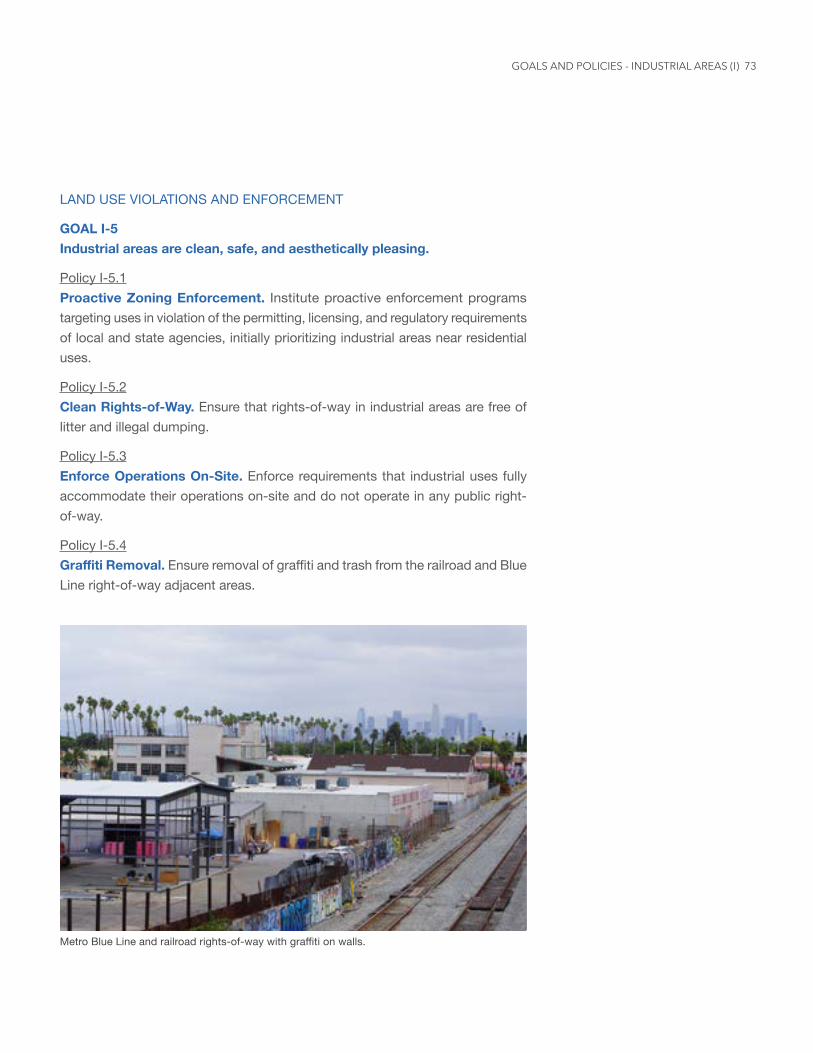
73
LAND USE VIOLATIONS AND ENFORCEMENT
GOAL I-5 Industrial areas are clean, safe, and aesthetically pleasing.
Policy I-5.1 Proactive Zoning Enforcement. Institute proactive enforcement programs targeting uses in violation of the permitting, licensing, and regulatory requirements of local and state agencies, initially prioritizing industrial areas near residential uses.
Policy I-5.2 Clean Rights-of-Way. Ensure that rights-of-way in industrial areas are free of litter and illegal dumping.
Policy I-5.3 Enforce Operations On-Site. Enforce requirements that industrial uses fully accommodate their operations on-site and do not operate in any public right-of-way.
Policy I-5.4 GraffitiRemoval. Ensure removal of graffiti and trash from the railroad and Blue Line right-of-way adjacent areas.
Metro Blue Line and railroad rights-of-way with graffiti on walls.
GOALS AND POLICIES - INDUSTRIAL AREAS (I)
VisionCreate a community where negative environmental impacts are reduced to protect the health, safety, and well-being of community members, where commercial and industrial uses employ clean, sustainable energy technologies, and where resources and information regarding environmental-related issues are readily available.
Background
Environmental justice is defined by the California Environmental Protection Agency (CalEPA) and the L.A. County General Plan, as the fair treatment and meaningful involvement of all people regardless of race, color, national origin, or income with respect to the development, implementation, and enforcement of environmental laws, regulations, and policies.
An environmentally just Florence-Firestone is a place where:
• Environmental risks and hazards associated with land use incompatibility are alleviated, and services to mitigate negative environmental impacts are equally accessible throughout the community;
• Existing and future negative environmental impacts are reduced to the fullest extent and clean energy use is incentivized to protect the community’s health, safety, and well-being;
• Access to environmental investments, benefits, and resources, such as parks and open space, are equally distributed throughout the community; and
• Information, participation in decision-making, and access to resources regarding environmental concerns is made available in multiple languages and a variety of platforms.
CalEPA released CalEnviroScreen version 1.0 in 2013 to implement state law SB 535, which requires investment of state cap-and-trade funds in disadvantaged communities. CalEnviroScreen is a comparative environmental health mapping and screening tool applied to communities throughout California. The cap-and-trade funds are aimed at improving public health, quality of life, and economic opportunity in California’s most burdened communities, while at the same time reducing pollution that causes climate change. CalEPA has used CalEnviroScreen to designate disadvantaged communities, defining these
Environmental Justice (EJ)
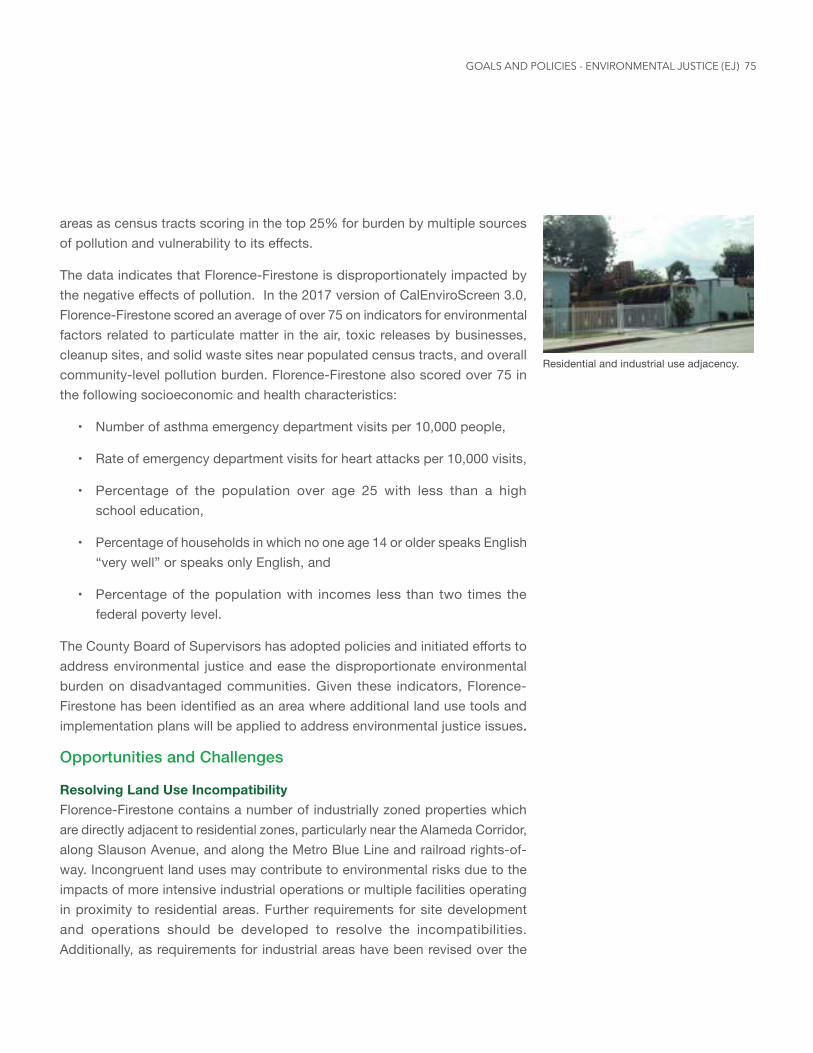
75
areas as census tracts scoring in the top 25% for burden by multiple sources of pollution and vulnerability to its effects.
The data indicates that Florence-Firestone is disproportionately impacted by the negative effects of pollution. In the 2017 version of CalEnviroScreen 3.0, Florence-Firestone scored an average of over 75 on indicators for environmental factors related to particulate matter in the air, toxic releases by businesses, cleanup sites, and solid waste sites near populated census tracts, and overall community-level pollution burden. Florence-Firestone also scored over 75 in the following socioeconomic and health characteristics:
• Number of asthma emergency department visits per 10,000 people,
• Rate of emergency department visits for heart attacks per 10,000 visits,
• Percentage of the population over age 25 with less than a high school education,
• Percentage of households in which no one age 14 or older speaks English “very well” or speaks only English, and
• Percentage of the population with incomes less than two times the federal poverty level.
The County Board of Supervisors has adopted policies and initiated efforts to address environmental justice and ease the disproportionate environmental burden on disadvantaged communities. Given these indicators, Florence-Firestone has been identified as an area where additional land use tools and implementation plans will be applied to address environmental justice issues.
Opportunities and Challenges
Resolving Land Use IncompatibilityFlorence-Firestone contains a number of industrially zoned properties which are directly adjacent to residential zones, particularly near the Alameda Corridor, along Slauson Avenue, and along the Metro Blue Line and railroad rights-of-way. Incongruent land uses may contribute to environmental risks due to the impacts of more intensive industrial operations or multiple facilities operating in proximity to residential areas. Further requirements for site development and operations should be developed to resolve the incompatibilities. Additionally, as requirements for industrial areas have been revised over the
Residential and industrial use adjacency.
GOALS AND POLICIES - ENVIRONMENTAL JUSTICE (EJ)
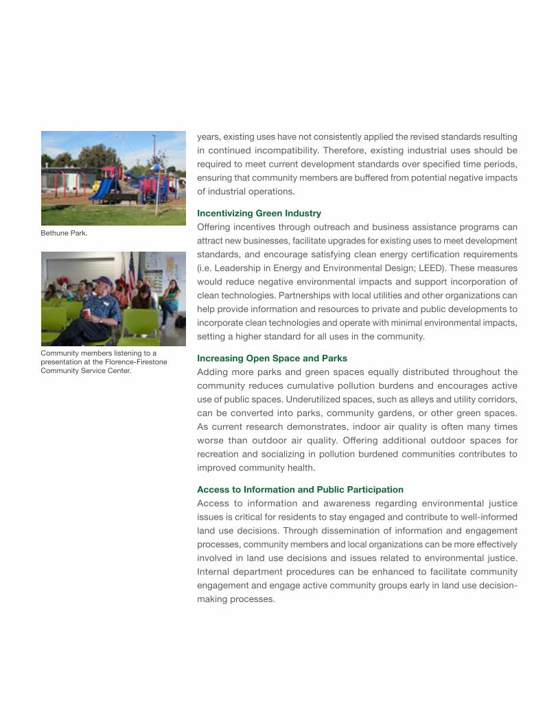
years, existing uses have not consistently applied the revised standards resulting in continued incompatibility. Therefore, existing industrial uses should be required to meet current development standards over specified time periods, ensuring that community members are buffered from potential negative impacts of industrial operations.
Incentivizing Green IndustryOffering incentives through outreach and business assistance programs can attract new businesses, facilitate upgrades for existing uses to meet development standards, and encourage satisfying clean energy certification requirements (i.e. Leadership in Energy and Environmental Design; LEED). These measures would reduce negative environmental impacts and support incorporation of clean technologies. Partnerships with local utilities and other organizations can help provide information and resources to private and public developments to incorporate clean technologies and operate with minimal environmental impacts, setting a higher standard for all uses in the community.
Increasing Open Space and ParksAdding more parks and green spaces equally distributed throughout the community reduces cumulative pollution burdens and encourages active use of public spaces. Underutilized spaces, such as alleys and utility corridors, can be converted into parks, community gardens, or other green spaces. As current research demonstrates, indoor air quality is often many times worse than outdoor air quality. Offering additional outdoor spaces for recreation and socializing in pollution burdened communities contributes to improved community health.
Access to Information and Public ParticipationAccess to information and awareness regarding environmental justice issues is critical for residents to stay engaged and contribute to well-informed land use decisions. Through dissemination of information and engagement processes, community members and local organizations can be more effectively involved in land use decisions and issues related to environmental justice. Internal department procedures can be enhanced to facilitate community engagement and engage active community groups early in land use decision-making processes.
Bethune Park.
Community members listening to a presentation at the Florence-Firestone Community Service Center.
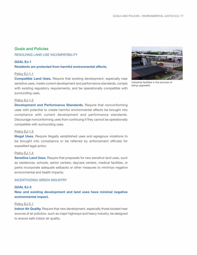
77
Goals and PoliciesRESOLVING LAND USE INCOMPATIBILITY
GOAL EJ-1 Residentsareprotectedfromharmfulenvironmentaleffects.
Policy EJ-1.1 Compatible Land Uses. Require that existing development, especially near sensitive uses, meets current development and performance standards, comply with existing regulatory requirements, and be operationally compatible with surrounding uses.
Policy EJ-1.2 Development and Performance Standards. Require that nonconforming uses with potential to create harmful environmental effects be brought into compliance with current development and performance standards. Discourage nonconforming uses from continuing if they cannot be operationally compatible with surrounding uses.
Policy EJ-1.3 Illegal Uses. Require illegally established uses and egregious violations to be brought into compliance or be referred by enforcement officials for expedited legal action.
Policy EJ-1.4 Sensitive Land Uses. Require that proposals for new sensitive land uses, such as residences, schools, senior centers, daycare centers, medical facilities, or parks incorporate adequate setbacks or other measures to minimize negative environmental and health impacts.
INCENTIVIZING GREEN INDUSTRY
GOAL EJ-2 New and existing development and land uses have minimal negative environmental impact.
Policy EJ-2.1 Indoor Air Quality. Require that new development, especially those located near sources of air pollution, such as major highways and heavy industry, be designed to ensure safe indoor air quality.
Industrial facilities in the process of being upgraded.
GOALS AND POLICIES - ENVIRONMENTAL JUSTICE (EJ)
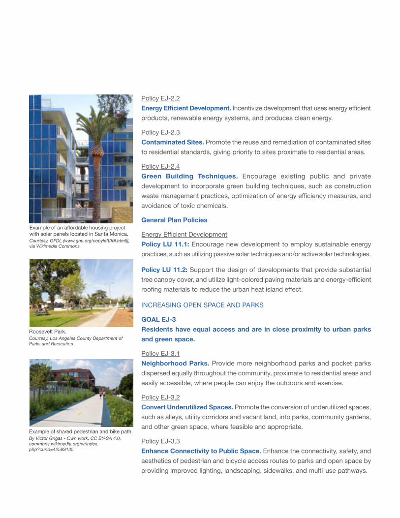
Roosevelt Park. Courtesy, Los Angeles County Department of Parks and Recreation
Example of shared pedestrian and bike path. By Victor Grigas - Own work, CC BY-SA 4.0, commons.wikimedia.org/w/index.php?curid=42589135
Policy EJ-2.2 EnergyEfficientDevelopment. Incentivize development that uses energy efficient products, renewable energy systems, and produces clean energy.
Policy EJ-2.3 Contaminated Sites. Promote the reuse and remediation of contaminated sites to residential standards, giving priority to sites proximate to residential areas.
Policy EJ-2.4 Green Building Techniques. Encourage existing public and private development to incorporate green building techniques, such as construction waste management practices, optimization of energy efficiency measures, and avoidance of toxic chemicals.
General Plan Policies
Energy Efficient Development Policy LU 11.1: Encourage new development to employ sustainable energy practices, such as utilizing passive solar techniques and/or active solar technologies.
Policy LU 11.2: Support the design of developments that provide substantial tree canopy cover, and utilize light-colored paving materials and energy-efficient roofing materials to reduce the urban heat island effect.
INCREASING OPEN SPACE AND PARKS
GOAL EJ-3 Residents have equal access and are in close proximity to urban parks and green space.
Policy EJ-3.1 Neighborhood Parks. Provide more neighborhood parks and pocket parks dispersed equally throughout the community, proximate to residential areas and easily accessible, where people can enjoy the outdoors and exercise.
Policy EJ-3.2 Convert Underutilized Spaces. Promote the conversion of underutilized spaces, such as alleys, utility corridors and vacant land, into parks, community gardens, and other green space, where feasible and appropriate.
Policy EJ-3.3 Enhance Connectivity to Public Space. Enhance the connectivity, safety, and aesthetics of pedestrian and bicycle access routes to parks and open space by providing improved lighting, landscaping, sidewalks, and multi-use pathways.
Example of an affordable housing project with solar panels located in Santa Monica. Courtesy, GFDL (www.gnu.org/copyleft/fdl.html)], via Wikimedia Commons
79
ACCESS TO INFORMATION AND PUBLIC PARTICIPATION
GOAL EJ-4 The community is engaged and has access to information and resources related to environmental justice issues.
Policy EJ-4.1 Environmental Justice Decision Making. Ensure environmental justice, cumulative environmental impacts, and public health outcomes are analyzed in discretionary land use proposals and taken into account during the decision-making process.
Policy EJ-4.2 Public Awareness About Land Use. Increase public participation and ensure the public and other stakeholders are informed and have access to information on environmental justice issues and environmental and health risks impacting their community.
Policy EJ-4.3 Toxic Materials Awareness. Provide culturally and linguistically appropriate information and educational materials to residents about the effect of projects with toxic materials or emissions.
Policy EJ-4.4 Access to Public Information. Encourage community member participation in local matters, such as land use decision-making, by providing multilingual notices and translation services as needed.
GOALS AND POLICIES - ENVIRONMENTAL JUSTICE (EJ)
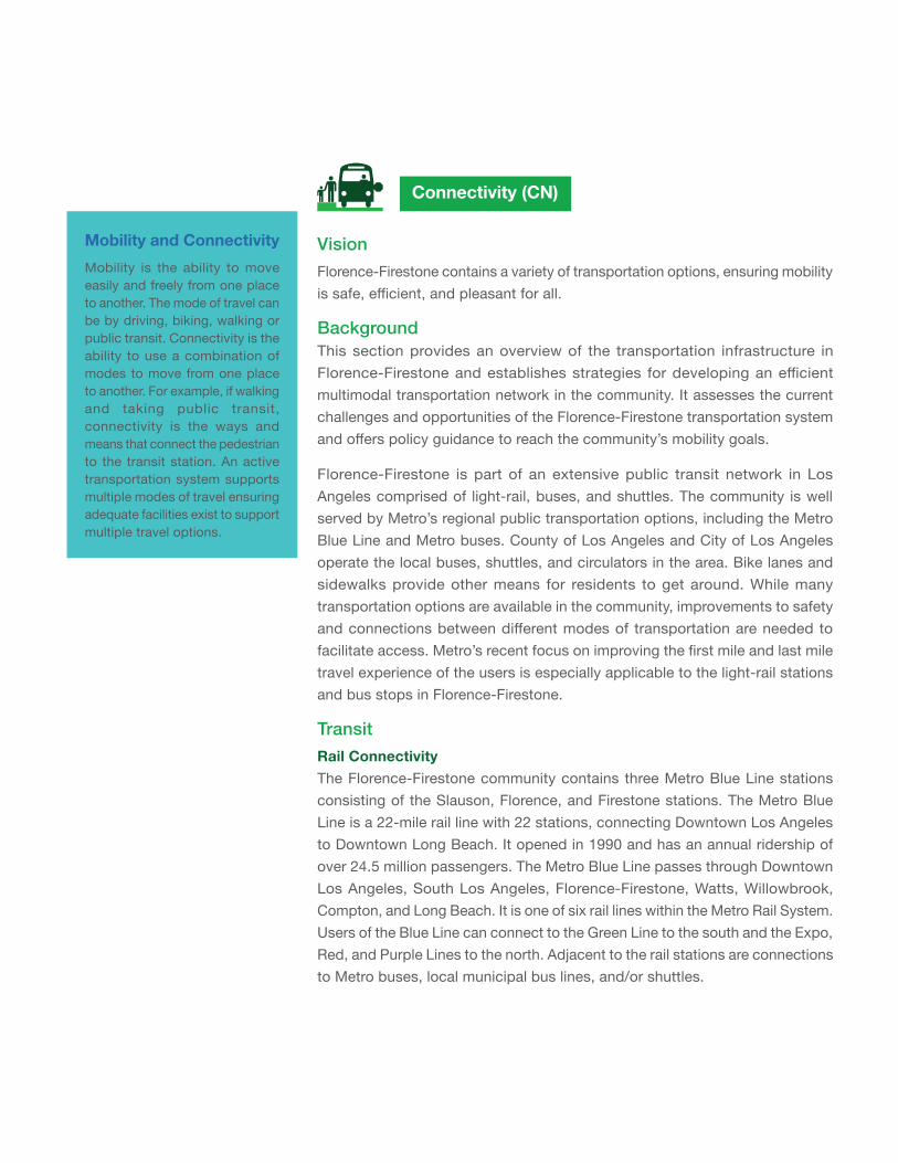
VisionFlorence-Firestone contains a variety of transportation options, ensuring mobility is safe, efficient, and pleasant for all.
Background This section provides an overview of the transportation infrastructure in Florence-Firestone and establishes strategies for developing an efficient multimodal transportation network in the community. It assesses the current challenges and opportunities of the Florence-Firestone transportation system and offers policy guidance to reach the community’s mobility goals.
Florence-Firestone is part of an extensive public transit network in Los Angeles comprised of light-rail, buses, and shuttles. The community is well served by Metro’s regional public transportation options, including the Metro Blue Line and Metro buses. County of Los Angeles and City of Los Angeles operate the local buses, shuttles, and circulators in the area. Bike lanes and sidewalks provide other means for residents to get around. While many transportation options are available in the community, improvements to safety and connections between different modes of transportation are needed to facilitate access. Metro’s recent focus on improving the first mile and last mile travel experience of the users is especially applicable to the light-rail stations and bus stops in Florence-Firestone.
TransitRail ConnectivityThe Florence-Firestone community contains three Metro Blue Line stations consisting of the Slauson, Florence, and Firestone stations. The Metro Blue Line is a 22-mile rail line with 22 stations, connecting Downtown Los Angeles to Downtown Long Beach. It opened in 1990 and has an annual ridership of over 24.5 million passengers. The Metro Blue Line passes through Downtown Los Angeles, South Los Angeles, Florence-Firestone, Watts, Willowbrook, Compton, and Long Beach. It is one of six rail lines within the Metro Rail System. Users of the Blue Line can connect to the Green Line to the south and the Expo, Red, and Purple Lines to the north. Adjacent to the rail stations are connections to Metro buses, local municipal bus lines, and/or shuttles.
Connectivity (CN)
Mobility and Connectivity Mobility is the ability to move easily and freely from one place to another. The mode of travel can be by driving, biking, walking or public transit. Connectivity is the ability to use a combination of modes to move from one place to another. For example, if walking and taking public transit, connectivity is the ways and means that connect the pedestrian to the transit station. An active transportation system supports multiple modes of travel ensuring adequate facilities exist to support multiple travel options.
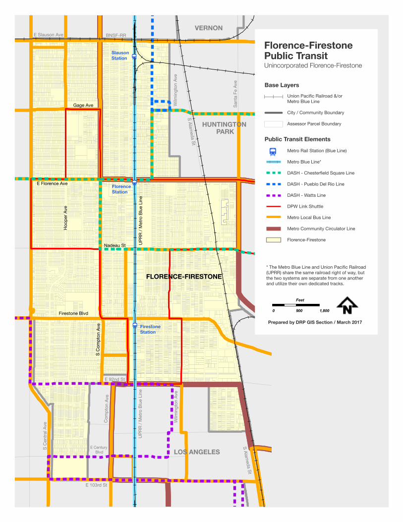
81
E 103rd St
E Century Blvd
Wilm
ingt
on A
ve
UPR
R / M
etro
Blu
e Li
ne
Com
pton
Ave
S C
entra
l Ave
E 92nd St
LOS ANGELES
HUNTINGTON PARK
VERNON
S Alameda St
S Alameda St
Wilm
ingt
on A
ve
Sant
a Fe
Ave
E Slauson Ave BNSF-RR
FLORENCE-FIRESTONE
Firestone Blvd
S C
ompt
on A
ve
Nadeau St
E Florence Ave
Hoo
per A
ve
UPR
R / M
etro
Blu
e Li
ne
Gage Ave
Slauson Station
Florence Station
Firestone Station
Metro Rail Station (Blue Line)
Metro Blue Line*
DASH - Chesterfield Square Line
DASH - Pueblo Del Rio Line
DASH - Watts Line
DPW Link Shuttle
Metro Local Bus Line
Metro Community Circulator Line
Florence-Firestone
Florence-FirestonePublic TransitUnincorporated Florence-Firestone
0 900 1,800
Feet
Prepared by DRP GIS Section / March 2017
Base LayersUnion Pacific Railroad &/or Metro Blue Line
City / Community Boundary
Assessor Parcel Boundary
Public Transit Elements
* The Metro Blue Line and Union Pacific Railroad(UPRR) share the same railroad right of way, butthe two systems are separate from one anotherand utilize their own dedicated tracks.
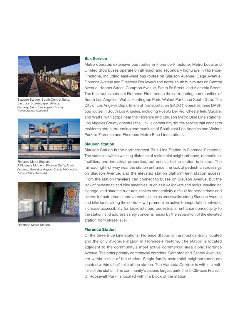
Bus ServiceMetro operates extensive bus routes in Florence-Firestone. Metro Local and Limited Stop buses operate on all major and secondary highways in Florence-Firestone, including east-west bus routes on Slauson Avenue, Gage Avenue, Florence Avenue and Firestone Boulevard and north-south bus routes on Central Avenue, Hooper Street, Compton Avenue, Santa Fe Street, and Alameda Street. The bus routes connect Florence-Firestone to the surrounding communities of South Los Angeles, Watts, Huntington Park, Walnut Park, and South Gate. The City of Los Angeles Department of Transportation (LADOT) operates three DASH bus routes in South Los Angeles, including Pueblo Del Rio, Chesterfield Square, and Watts, with stops near the Florence and Slauson Metro Blue Line stations. Los Angeles County operates the Link, a community shuttle service that connects residents and surrounding communities of Southeast Los Angeles and Walnut Park to Florence and Firestone Metro Blue Line stations.
Slauson StationSlauson Station is the northernmost Blue Line Station in Florence-Firestone. The station is within walking distance of residential neighborhoods, recreational facilities, and industrial properties, but access to the station is limited. The railroad right-of-way near the station entrance, the lack of pedestrian crossings on Slauson Avenue, and the elevated station platform limit station access. From the station travelers can connect to buses on Slauson Avenue, but the lack of pedestrian and bike amenities, such as bike lockers and racks, wayfinding signage, and shade structures, makes connectivity difficult for pedestrians and bikers. Infrastructure improvements, such as crosswalks along Slauson Avenue and bike lanes along the corridor, will promote an active transportation network, increase accessibility for bicyclists and pedestrians, enhance connectivity to the station, and address safety concerns raised by the separation of the elevated station from street-level.
Florence StationOf the three Blue Line stations, Florence Station is the most centrally located and the only at-grade station in Florence-Firestone. The station is located adjacent to the community’s most active commercial area along Florence Avenue. The other primary commercial corridors, Compton and Central Avenues, are within a mile of the station. Single-family residential neighborhoods are located within a half-mile of the station. The Alameda Corridor is within a half-mile of the station. The community’s second largest park, the 24.35-acre Franklin D. Roosevelt Park, is located within a block of the station.
Slauson Station, South Central Suite, East Los Streetscaper, Artists. Courtesy, Metro (Los Angeles County Transportation Authority).
Florence Metro Station. A Florence Moment, Ricardo Duffy, Artist. Courtesy, Metro (Los Angeles County Metropolitan Transportation Authority).
Firestone Metro Station.
83
Of the three stations, Florence Station is the most accessible from the surrounding area, but improving pedestrian access, bicycle paths, and wayfinding signage would further enhance mobility. The station has a 100-space surface parking lot, but limited pedestrian and bicycle amenities. The community is bisected by the rail and Metro Blue Line rights-of-way. Additional pedestrian crossings over the railway lines are needed to provide better connections between the station, park, commercial areas, and residential neighborhoods. Currently, there is one elevated bridge that provides pedestrian access over the railway.
Firestone StationSimilar to the Slauson Station, the Firestone Station is situated above-grade, creating similar safety and visibility concerns for transit riders. The majority of land uses within a half-mile radius of the Firestone Station are residential neighborhoods. Firestone Boulevard is a commercial corridor, but it is less active with commercial and pedestrian activity than Florence Avenue. The Alameda Corridor is located a half mile to the east of the station. Washington Park is located next to the station, but is obscured by the station overpass. There are bike rack facilities at this station, but additional bike- and pedestrian-oriented amenities would improve connectivity.
Transit Opportunties and ChallengesExisting Transit ServiceMobility in Florence-Firestone is supported by the presence of three Metro Blue Line rail stations. The area around each station has been established as a Transit Oriented District (TOD) by the General Plan. TODs were established to promote pedestrian-friendly development near transit hubs. Implementation of TOD policies in Florence-Firestone would support active transportation and increase transit ridership.
Transit AmenitiesDespite the number of bus routes operating in Florence-Firestone, many bus stops lack benches, shelters, recycling and trash cans, and transit information. Rail stations in the community have some of these amenities but more amenities are needed, such as bicycle racks, security lighting, and landscaping.
Safety ConcernsPublic safety at the Metro Blue Line Stations in Florence-Firestone, especially at the Slauson and Firestone Stations, is identified as an issue by the community. The elevated platforms of these stations decrease visibility of activity at the stations and further contribute to safety concerns.
GOALS AND POLICIES - CONNECTIVITY (CN)
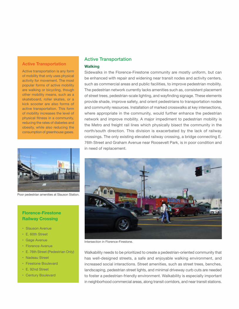
Active TransportationWalkingSidewalks in the Florence-Firestone community are mostly uniform, but can be enhanced with repair and widening near transit nodes and activity centers, such as commercial areas and public facilities, to improve pedestrian mobility. The pedestrian network currently lacks amenities such as, consistent placement of street trees, pedestrian-scale lighting, and wayfinding signage. These elements provide shade, improve safety, and orient pedestrians to transportation nodes and community resources. Installation of marked crosswalks at key intersections, where appropriate in the community, would further enhance the pedestrian network and improve mobility. A major impediment to pedestrian mobility is the Metro and freight rail lines which physically bisect the community in the north/south direction. This division is exacerbated by the lack of railway crossings. The only existing elevated railway crossing, a bridge connecting E. 76th Street and Graham Avenue near Roosevelt Park, is in poor condition and in need of replacement.
Active TransportationActive transportation is any form of mobility that only uses physical activity for movement. The most popular forms of active mobility are walking or bicycling, though other mobility means, such as a skateboard, roller skates, or a kick scooter are also forms of active transportation. This form of mobility increases the level of physical fitness in a community, reducing the rates of diabetes and obesity, while also reducing the consumption of greenhouse gases.
Florence-Firestone Railway Crossing
• Slauson Avenue• E. 60th Street• Gage Avenue• Florence Avenue• E. 76th Street (Pedestrian Only)• Nadeau Street• Firestone Boulevard• E. 92nd Street• Century Boulevard
Poor pedestrian amenities at Slauson Station.
Intersection in Florence-Firestone.
Walkability needs to be prioritized to create a pedestrian-oriented community that has well-designed streets, a safe and enjoyable walking environment, and increased social interactions. Street amenities, such as street trees, benches, landscaping, pedestrian street lights, and minimal driveway curb cuts are needed to foster a pedestrian-friendly environment. Walkability is especially important in neighborhood commercial areas, along transit corridors, and near transit stations.
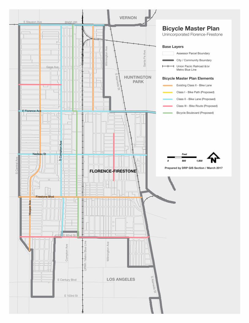
85
E 103rd St
E Century Blvd
Wilm
ingt
on A
ve
UPR
R / M
etro
Blu
e Li
ne
Com
pton
Ave
S C
entra
l Ave
E 92nd St
LOS ANGELES
HUNTINGTON PARK
VERNON
S Alameda St
S Alameda St
Wilm
ingt
on A
ve
Sant
a Fe
Ave
Gage Ave
E Slauson Ave BNSF-RR
FLORENCE-FIRESTONE
Firestone Blvd
S C
ompt
on A
ve
Hoo
per A
ve
Nadeau St
E Florence Ave
Existing Class II - Bike Lane
Class I - Bike Path (Proposed)
Class II - Bike Lane (Proposed)
Class III - Bike Route (Proposed)
Bicycle Boulevard (Proposed)
Assessor Parcel Boundary
City / Community Boundary
Union Paciic Railroad &/or Metro Blue Line
Base Layers
Bicycle Master Plan Elements
Bicycle Master PlanUnincorporated Florence-Firestone
0 900 1,800
Feet
Prepared by DRP GIS Section / March 2017
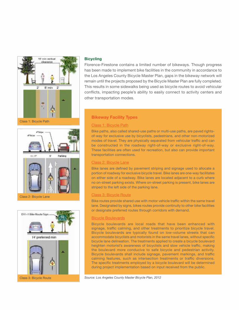
Bikeway Facility Types
Class 1: Bicycle PathBike paths, also called shared-use paths or multi-use paths, are paved rights-of-way for exclusive use by bicyclists, pedestrians, and other non-motorized modes of travel. They are physically separated from vehicular traffic and can be constructed in the roadway right-of-way or exclusive right-of-way. These facilities are often used for recreation, but also can provide important transportation connections.
Class 2: Bicycle LaneBike lanes are defined by pavement striping and signage used to allocate a portion of roadway for exclusive bicycle travel. Bike lanes are one-way facilitates on either side of a roadway. Bike lanes are located adjacent to a curb where no on-street parking exists. Where on-street parking is present, bike lanes are striped to the left side of the parking lane.
Class 3: Bicycle RouteBike routes provide shared use with motor vehicle traffic within the same travel lane. Designated by signs, bikes routes provide continuity to other bike facilities or designate preferred routes through corridors with demand.
Bicycle BoulevardsBicycle boulevards are local roads that have been enhanced with signage, traffic calming, and other treatments to prioritize bicycle travel. Bicycle boulevards are typically found on low-volume streets that can accommodate bicyclists and motorists in the same travel lanes, without specific bicycle lane delineation. The treatments applied to create a bicycle boulevard heighten motorist’s awareness of bicyclists and slow vehicle traffic, making the boulevard more conducive to safe bicycle and pedestrian activity. Bicycle boulevards shall include signage, pavement markings, and traffic calming features, such as intersection treatments or traffic diversions. The specific treatments employed by a bicycle boulevard will be determined during project implementation based on input received from the public.
BicyclingFlorence-Firestone contains a limited number of bikeways. Though progress has been made to implement bike facilities in the community in accordance to the Los Angeles County Bicycle Master Plan, gaps in the bikeway network will remain until the projects proposed by the Bicycle Master Plan are fully completed. This results in some sidewalks being used as bicycle routes to avoid vehicular conflicts, impacting people’s ability to easily connect to activity centers and other transportation modes.
Source: Los Angeles County Master Bicycle Plan, 2012Class 3: Bicycle Route
Class 2: Bicycle Lane
Class 1: Bicycle Path
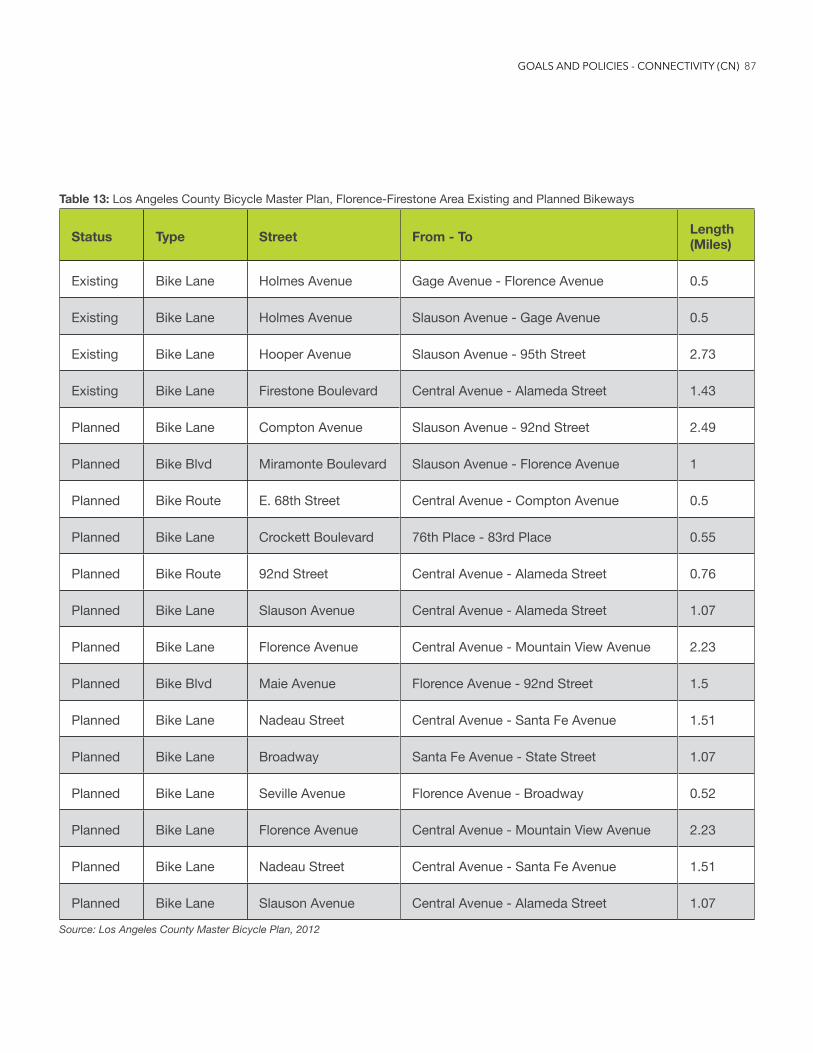
87
Table 13: Los Angeles County Bicycle Master Plan, Florence-Firestone Area Existing and Planned Bikeways
Status Type Street From - To Length (Miles)
Existing Bike Lane Holmes Avenue Gage Avenue - Florence Avenue 0.5
Existing Bike Lane Holmes Avenue Slauson Avenue - Gage Avenue 0.5
Existing Bike Lane Hooper Avenue Slauson Avenue - 95th Street 2.73
Existing Bike Lane Firestone Boulevard Central Avenue - Alameda Street 1.43
Planned Bike Lane Compton Avenue Slauson Avenue - 92nd Street 2.49
Planned Bike Blvd Miramonte Boulevard Slauson Avenue - Florence Avenue 1
Planned Bike Route E. 68th Street Central Avenue - Compton Avenue 0.5
Planned Bike Lane Crockett Boulevard 76th Place - 83rd Place 0.55
Planned Bike Route 92nd Street Central Avenue - Alameda Street 0.76
Planned Bike Lane Slauson Avenue Central Avenue - Alameda Street 1.07
Planned Bike Lane Florence Avenue Central Avenue - Mountain View Avenue 2.23
Planned Bike Blvd Maie Avenue Florence Avenue - 92nd Street 1.5
Planned Bike Lane Nadeau Street Central Avenue - Santa Fe Avenue 1.51
Planned Bike Lane Broadway Santa Fe Avenue - State Street 1.07
Planned Bike Lane Seville Avenue Florence Avenue - Broadway 0.52
Planned Bike Lane Florence Avenue Central Avenue - Mountain View Avenue 2.23
Planned Bike Lane Nadeau Street Central Avenue - Santa Fe Avenue 1.51
Planned Bike Lane Slauson Avenue Central Avenue - Alameda Street 1.07
Source: Los Angeles County Master Bicycle Plan, 2012
GOALS AND POLICIES - CONNECTIVITY (CN)
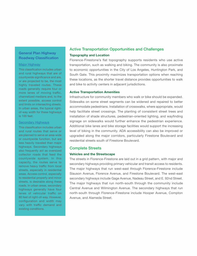
General Plan Highway RoadwayClassification
Major HighwayThis classification includes urban and rural highways that are of countywide significance and are, or are projected to be, the most highly traveled routes. These roads generally require four or more lanes of moving traffic, channelized medians and, to the extent possible, access control and limits on intersecting streets. In urban areas, the typical right-of-way width for these highways is 100 feet.
Secondary HighwaysThis classification includes urban and rural routes that serve or are planned to serve an area-wide or countywide function, but are less heavily traveled than major highways. Secondary highways also frequently act as oversized collector roads that feed the countywide system. In this capacity, the routes serve to remove heavy traffic from local streets, especially in residential areas. Access control, especially to residential property and minor streets, is desirable along these roads. In urban areas, secondary highways generally have four lanes of vehicular traffic on 80 feet of right-of-way. However, configuration and width may vary with traffic demand and existing conditions.
Active Transportation Opportunities and ChallengesTopography and LocationFlorence-Firestone’s flat topography supports residents who use active transportation, such as walking and biking. The community is also proximate to economic opportunities in the City of Los Angeles, Huntington Park, and South Gate. This proximity maximizes transportation options when reaching these locations, as the shorter travel distance provides opportunities to walk and bike to activity centers in adjacent jurisdictions.
Active Transportation AmenitiesInfrastructure for community members who walk or bike should be expanded. Sidewalks on some street segments can be widened and repaired to better accommodate pedestrians. Installation of crosswalks, where appropriate, would help facilitate street crossings. The planting of consistent street trees and installation of shade structures, pedestrian-oriented lighting, and wayfinding signage on sidewalks would further enhance the pedestrian experience. Additional bike lanes and bike storage facilities would support the increasing level of biking in the community. ADA accessibility can also be improved or upgraded along the major corridors, particularly Firestone Boulevard and residential streets south of Firestone Boulevard.
Complete StreetsVehicles and the StreetscapeThe streets in Florence-Firestone are laid out in a grid pattern, with major and secondary highways providing primary vehicular and transit access to residents. The major highways that run west-east through Florence-Firestone include Slauson Avenue, Florence Avenue, and Firestone Boulevard. The west-east secondary highways include Gage Avenue, Nadeau Street, and E. 92nd Street. The major highways that run north-south through the community include Central Avenue and Wilmington Avenue. The secondary highways that run north-south through Florence-Firestone include Hooper Avenue, Compton Avenue, and Alameda Street.
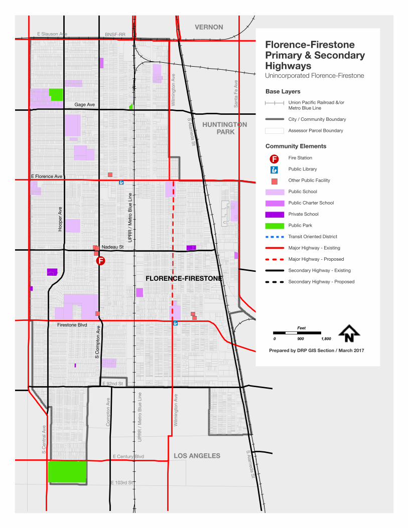
89
FLORENCE-FIRESTONE
Firestone Blvd
S C
ompt
on A
ve
Nadeau St
E Florence Ave
Hoo
per A
ve
UPR
R / M
etro
Blu
e Li
ne
Gage Ave
E 103rd St
E Century Blvd
Wilm
ingt
on A
ve
UPR
R / M
etro
Blu
e Li
ne
Com
pton
Ave
S C
entra
l Ave
E 92nd St
LOS ANGELES
HUNTINGTON PARK
VERNON
S Alameda St
S Alameda St
Wilm
ingt
on A
ve
Sant
a Fe
Ave
E Slauson Ave BNSF-RR
Fire Station
Public Library
Other Public Facility
Public School
Public Charter School
Private School
Public Park
Transit Oriented District
Major Highway - Existing
Major Highway - Proposed
Secondary Highway - Existing
Secondary Highway - Proposed
Florence-FirestonePrimary & SecondaryHighwaysUnincorporated Florence-Firestone
0 900 1,800
Feet
Prepared by DRP GIS Section / March 2017
Base LayersUnion Pacific Railroad &/or Metro Blue Line
City / Community Boundary
Assessor Parcel Boundary
Community Elements
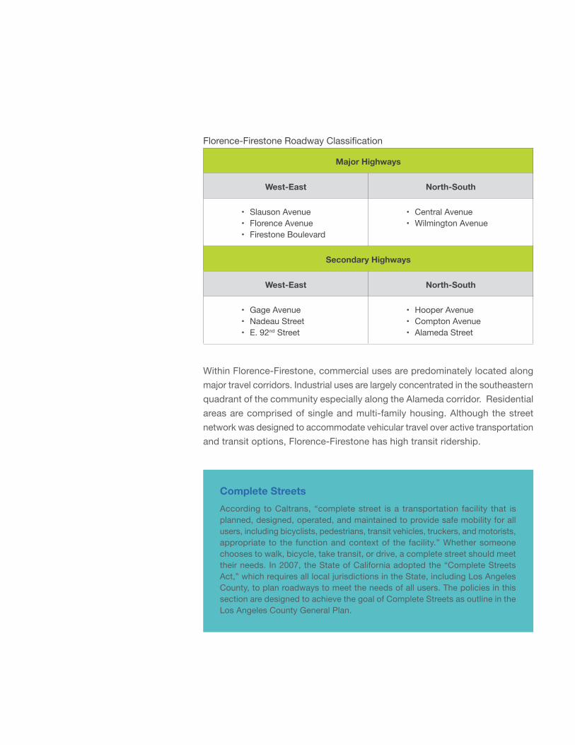
Florence-Firestone Roadway Classification
Major Highways
West-East North-South
• Slauson Avenue• Florence Avenue• Firestone Boulevard
• Central Avenue• Wilmington Avenue
Secondary Highways
West-East North-South
• Gage Avenue• Nadeau Street• E. 92nd Street
• Hooper Avenue• Compton Avenue• Alameda Street
Within Florence-Firestone, commercial uses are predominately located along major travel corridors. Industrial uses are largely concentrated in the southeastern quadrant of the community especially along the Alameda corridor. Residential areas are comprised of single and multi-family housing. Although the street network was designed to accommodate vehicular travel over active transportation and transit options, Florence-Firestone has high transit ridership.
Complete StreetsAccording to Caltrans, “complete street is a transportation facility that is planned, designed, operated, and maintained to provide safe mobility for all users, including bicyclists, pedestrians, transit vehicles, truckers, and motorists, appropriate to the function and context of the facility.” Whether someone chooses to walk, bicycle, take transit, or drive, a complete street should meet their needs. In 2007, the State of California adopted the “Complete Streets Act,” which requires all local jurisdictions in the State, including Los Angeles County, to plan roadways to meet the needs of all users. The policies in this section are designed to achieve the goal of Complete Streets as outline in the Los Angeles County General Plan.
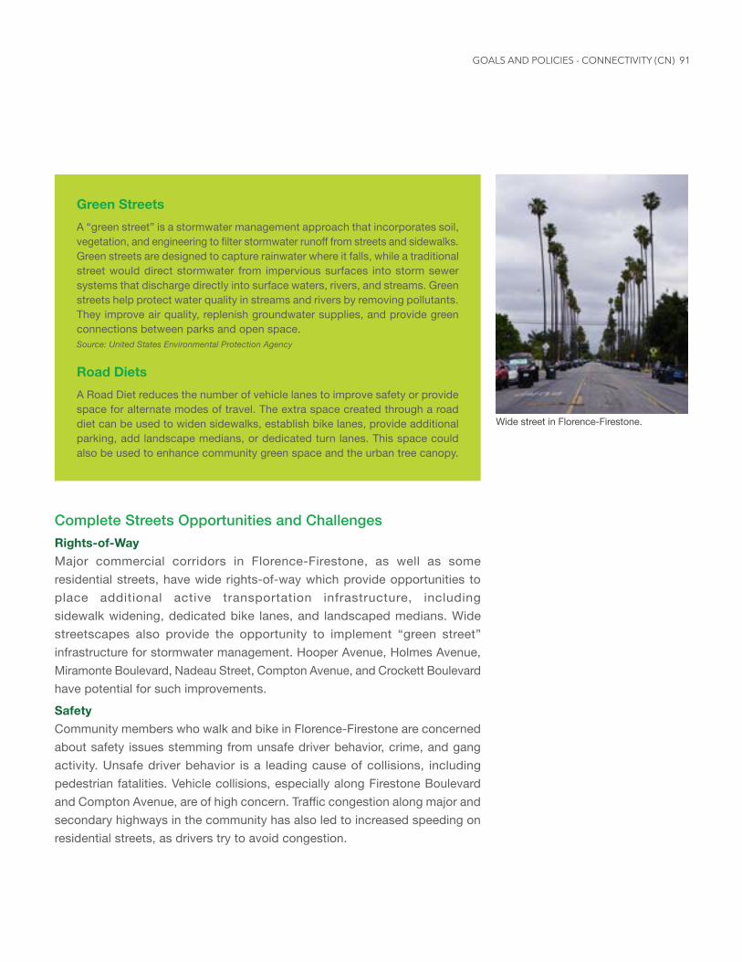
91
Green StreetsA “green street” is a stormwater management approach that incorporates soil, vegetation, and engineering to filter stormwater runoff from streets and sidewalks. Green streets are designed to capture rainwater where it falls, while a traditional street would direct stormwater from impervious surfaces into storm sewer systems that discharge directly into surface waters, rivers, and streams. Green streets help protect water quality in streams and rivers by removing pollutants. They improve air quality, replenish groundwater supplies, and provide green connections between parks and open space.Source: United States Environmental Protection Agency
Road DietsA Road Diet reduces the number of vehicle lanes to improve safety or provide space for alternate modes of travel. The extra space created through a road diet can be used to widen sidewalks, establish bike lanes, provide additional parking, add landscape medians, or dedicated turn lanes. This space could also be used to enhance community green space and the urban tree canopy.
Complete Streets Opportunities and ChallengesRights-of-WayMajor commercial corridors in Florence-Firestone, as well as some residential streets, have wide rights-of-way which provide opportunities to place additional active transportation infrastructure, including sidewalk widening, dedicated bike lanes, and landscaped medians. Wide streetscapes also provide the opportunity to implement “green street” infrastructure for stormwater management. Hooper Avenue, Holmes Avenue, Miramonte Boulevard, Nadeau Street, Compton Avenue, and Crockett Boulevard have potential for such improvements.
SafetyCommunity members who walk and bike in Florence-Firestone are concerned about safety issues stemming from unsafe driver behavior, crime, and gang activity. Unsafe driver behavior is a leading cause of collisions, including pedestrian fatalities. Vehicle collisions, especially along Firestone Boulevard and Compton Avenue, are of high concern. Traffic congestion along major and secondary highways in the community has also led to increased speeding on residential streets, as drivers try to avoid congestion.
Wide street in Florence-Firestone.
GOALS AND POLICIES - CONNECTIVITY (CN)
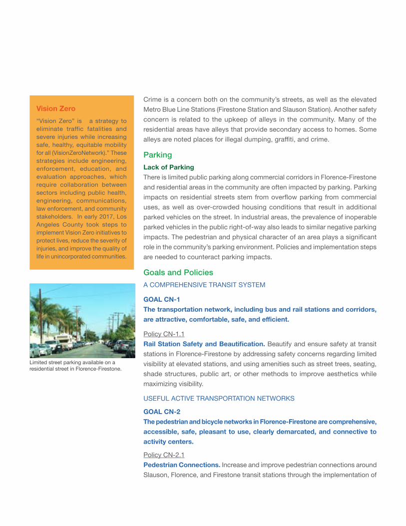
Vision Zero“Vision Zero” is a strategy to eliminate traffic fatalities and severe injuries while increasing safe, healthy, equitable mobility for all (VisionZeroNetwork).” These strategies include engineering, enforcement, education, and evaluation approaches, which require collaboration between sectors including public health, engineering, communications, law enforcement, and community stakeholders. In early 2017, Los Angeles County took steps to implement Vision Zero initiatives to protect lives, reduce the severity of injuries, and improve the quality of life in unincorporated communities.
Crime is a concern both on the community’s streets, as well as the elevated Metro Blue Line Stations (Firestone Station and Slauson Station). Another safety concern is related to the upkeep of alleys in the community. Many of the residential areas have alleys that provide secondary access to homes. Some alleys are noted places for illegal dumping, graffiti, and crime.
ParkingLack of ParkingThere is limited public parking along commercial corridors in Florence-Firestone and residential areas in the community are often impacted by parking. Parking impacts on residential streets stem from overflow parking from commercial uses, as well as over-crowded housing conditions that result in additional parked vehicles on the street. In industrial areas, the prevalence of inoperable parked vehicles in the public right-of-way also leads to similar negative parking impacts. The pedestrian and physical character of an area plays a significant role in the community’s parking environment. Policies and implementation steps are needed to counteract parking impacts.
Goals and PoliciesA COMPREHENSIVE TRANSIT SYSTEM
GOAL CN-1 The transportation network, including bus and rail stations and corridors, areattractive,comfortable,safe,andefficient.
Policy CN-1.1 RailStationSafetyandBeautification. Beautify and ensure safety at transit stations in Florence-Firestone by addressing safety concerns regarding limited visibility at elevated stations, and using amenities such as street trees, seating, shade structures, public art, or other methods to improve aesthetics while maximizing visibility.
USEFUL ACTIVE TRANSPORTATION NETWORKS
GOAL CN-2 The pedestrian and bicycle networks in Florence-Firestone are comprehensive, accessible, safe, pleasant to use, clearly demarcated, and connective to activity centers.
Policy CN-2.1 Pedestrian Connections. Increase and improve pedestrian connections around Slauson, Florence, and Firestone transit stations through the implementation of
Limited street parking available on a residential street in Florence-Firestone.
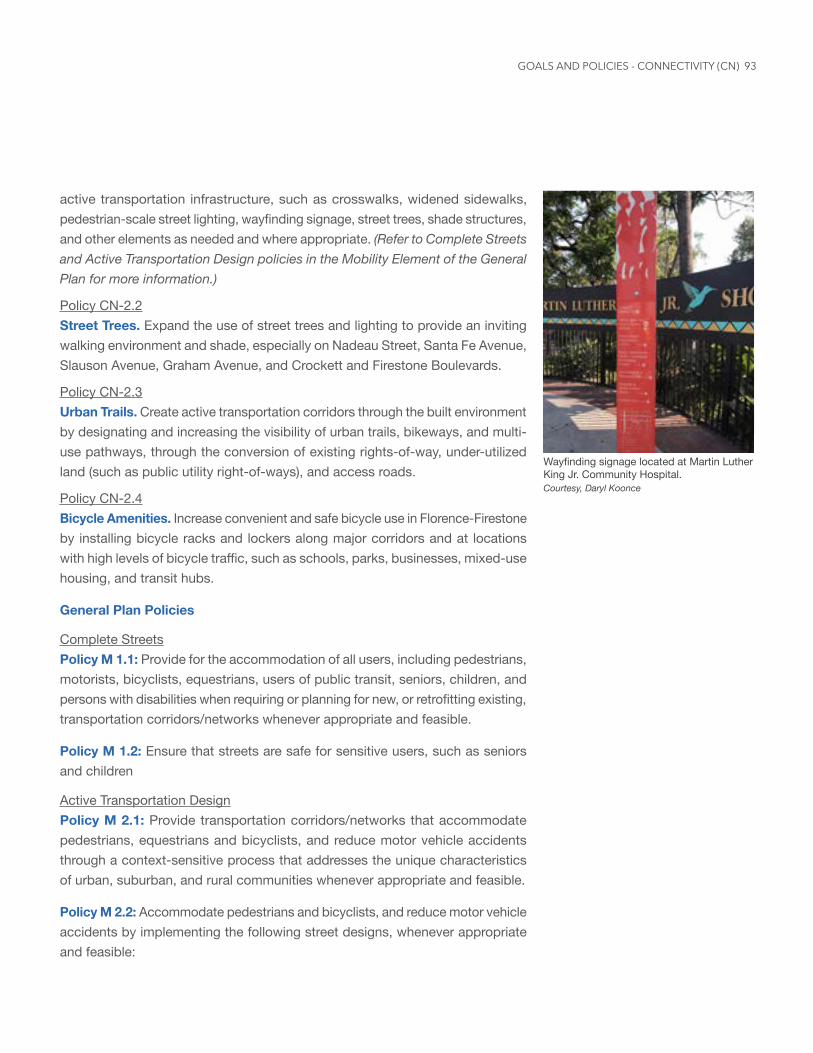
93
active transportation infrastructure, such as crosswalks, widened sidewalks, pedestrian-scale street lighting, wayfinding signage, street trees, shade structures, and other elements as needed and where appropriate. (Refer to Complete Streets and Active Transportation Design policies in the Mobility Element of the General Plan for more information.)
Policy CN-2.2 Street Trees. Expand the use of street trees and lighting to provide an inviting walking environment and shade, especially on Nadeau Street, Santa Fe Avenue, Slauson Avenue, Graham Avenue, and Crockett and Firestone Boulevards.
Policy CN-2.3 Urban Trails. Create active transportation corridors through the built environment by designating and increasing the visibility of urban trails, bikeways, and multi-use pathways, through the conversion of existing rights-of-way, under-utilized land (such as public utility right-of-ways), and access roads.
Policy CN-2.4 Bicycle Amenities. Increase convenient and safe bicycle use in Florence-Firestone by installing bicycle racks and lockers along major corridors and at locations with high levels of bicycle traffic, such as schools, parks, businesses, mixed-use housing, and transit hubs.
General Plan Policies
Complete StreetsPolicy M 1.1: Provide for the accommodation of all users, including pedestrians, motorists, bicyclists, equestrians, users of public transit, seniors, children, and persons with disabilities when requiring or planning for new, or retrofitting existing, transportation corridors/networks whenever appropriate and feasible.
Policy M 1.2: Ensure that streets are safe for sensitive users, such as seniors and children
Active Transportation DesignPolicy M 2.1: Provide transportation corridors/networks that accommodate pedestrians, equestrians and bicyclists, and reduce motor vehicle accidents through a context-sensitive process that addresses the unique characteristics of urban, suburban, and rural communities whenever appropriate and feasible.
Policy M 2.2: Accommodate pedestrians and bicyclists, and reduce motor vehicle accidents by implementing the following street designs, whenever appropriate and feasible:
Wayfinding signage located at Martin Luther King Jr. Community Hospital. Courtesy, Daryl Koonce
GOALS AND POLICIES - CONNECTIVITY (CN)
• Lane width reductions to 10 or 11 feet in low speed environments with a low volume of heavy vehicles.
• Wider lanes may still be required for lanes adjacent to the curb, and where buses and trucks are expected.
• Low-speed designs.
• Access management practices developed through a community-driven process.
• Back in angle parking at locations that have available roadway width and bike lanes, where appropriate.
Policy M 2.3: Accommodate pedestrians and bicyclists, and reduce motor vehicle accidents by implementing the following intersection designs, whenever appropriate and feasible:
• Right angle intersections that reduce intersection skew.
• Smaller corner radii to reduce crossing distances and slow turning vehicles.
• Traffic calming measures, such as bulb-outs, sharrows, medians, roundabouts, and narrowing or reducing the number of lanes (road diets) on streets.
• Crossings at all legs of an intersection.
• Shorter crossing distances for pedestrians.
• Right-turn channelization islands. Sharper angles of slip lanes may also be utilized.
• Signal progression at speeds that support the target speed of the corridor.
• Pedestrian push buttons when pedestrian signals are not automatically recalled.
• Walk interval on recall for short crossings.
• Left-turn phasing.
• Prohibit right turn on red.
• Signs to remind drivers to yield to pedestrians.
Policy M 2.4: Ensure a comfortable walking environment for pedestrians by implementing the following, whenever appropriate and feasible:
• Designs that limit dead-end streets and dead-end sidewalks.
• Adequate lighting on pedestrian paths, particularly around building entrances and exits, and transit stops.
• Designs for curb ramps, which are pedestrian friendly and compliant with the American Disability Act (ADA).
• Perpendicular curb ramps at locations where it is feasible.
• Pedestrian walking speed based on the latest standard for signal timing. Slower speeds should be used when appropriate (i.e., near senior housing, rehabilitation centers, etc.)
95
• Approved devices to extend the pedestrian clearance times at signalized intersections.
• Accessible Pedestrian Signals (APS) at signalized intersections.
• Pedestrian crossings at signalized intersections without double or triple left or right turn lanes.
• Pedestrian signal heads, countdown pedestrian heads, pedestrian phasing and leading pedestrian intervals at signalized intersections.
• Exclusive pedestrian phases (pedestrian scrambles) where turning volume conflicts with very high pedestrian volumes.
• Advance stop lines at signalized intersections.
• Pedestrian Hybrid Beacons.
• Medians or crossing islands to divide long crossings.
• High visibility crosswalks.
• Pedestrian signage.
• Advanced yield lines for uncontrolled crosswalks.
• Rectangular Rapid Flashing Beacon or other similar approved technology at locations of high pedestrian traffic.
• Safe and convenient crossing locations at transit stations and transit stops located at safe intersections.
Policy M 2.5: Ensure a comfortable bicycling environment by implementing the following, whenever appropriate and feasible:
• Bicycle signal heads at intersections.
• Bicycle signal detection at all signalized intersections.
• Wayfinding signage.
• Road diet techniques, such as lane narrowing, lane removal, and parking removal/restriction.
• Appropriate lighting on all bikeways, including those in rural areas.
• Designs, or other similar features, such as: shoulder bikeways, cycle tracks, contra flow bike lanes, shared use paths, buffered bike lanes, raised bike lanes, and bicycle boulevards.
Policy M 2.6: Encourage the implementation of future designs concepts that promote active transportation, whenever available and feasible.
Policy M 2.7: Require sidewalks, trails and bikeways to accommodate the existing and projected volume of pedestrian, equestrian and bicycle activity, considering both the paved width and the unobstructed width available for walking.
GOALS AND POLICIES - CONNECTIVITY (CN)
Policy M 2.8: Connect trails and pedestrian and bicycle paths to schools, public transportation, major employment centers, shopping centers, government buildings, residential neighborhoods, and other destinations.
Policy M 2.9: Encourage the planting of trees along streets and other forms of landscaping to enliven streetscapes by blending natural features with built features.
Policy M 2.10: Encourage the provision of amenities, such as benches, shelters, secure bicycle storage, and street furniture, and comfortable, safe waiting areas near transit stops.
Policy M 2.11: In urban and suburban areas, promote the continuity of streets and sidewalks through design features, such as limiting mid-block curb cuts, encouraging access through side streets or alleys, and promoting shorter block lengths.
Land Use and TransportationPolicy M 5.1: Facilitate transit-oriented land uses and pedestrian-oriented design, particularly in the first-last mile connections to transit, to encourage transit ridership.
Policy M 5.3: Maintain transportation right-of-way corridors for future transportation uses, including bikeways, or new passenger rail or bus services.
COMPLETE STREETS
GOAL CN-3 Streets and sidewalks meet the needs of pedestrians, bicyclists, transit users, and motorists.
Policy CN-3.1 Safety Campaigns. Provide and distribute information to the public on mobility safety for all mode users, including motorists, pedestrians, bicyclists, and transit users.
Policy CN-3.2 Focused Enforcement. Enforce speeding and traffic-related restrictions near schools and other activity centers, with the intent to dissuade dangerous driving behavior.
Policy CN-3.3 Car Sharing and Carpooling. Support initiatives and programs to expand car sharing and carpooling opportunities to Florence-Firestone residents.
97
Policy CN-3.4 CirculationEfficiency. Monitor the Florence-Firestone circulation system to ensure that travel across modes is efficient and properly connective. (Refer to Transit Efficiency, Multimodal Transportation and Travel Demand Management policies in the Mobility Element of the General Plan for more information)
General Plan Policies
Transit Efficiency Multimodal TransportationPolicy M 4.1: Expand transportation options that reduce automobile dependence.
Policy M 4.2: Expand shuttle services to connect major transit centers to community points of interest.
Policy M 4.3: Maintain transit services within the unincorporated areas that are affordable, timely, cost-effective, and responsive to growth patterns and community input.
Policy M 4.4: Ensure expanded mobility and increase transit access for underserved transit users, such as seniors, students, low income households, and persons with disabilities.
Policy M 4.5: Encourage continuous, direct routes through a connected system of streets, with small blocks and minimal dead ends (cul-de-sacs), as feasible.
Policy M 4.8: Provide and maintain appropriate signage for streets, roads and transit.
Policy M 4.9: Ensure the participation of all potentially affected communities in the transportation planning and decision-making process.
Policy M 4.10: Support the linkage of regional and community-level transportation systems, including multimodal networks.
Policy M 4.11: Improve the efficiency of the public transportation system with bus lanes, signal prioritization, and connections to the larger regional transportation network.
Policy M 4.12: Work with adjacent jurisdictions to ensure connectivity and the creation of an integrated regional network.
Policy M 4.13: Coordinate with adjacent jurisdictions in the review of land development projects near jurisdictional borders to ensure appropriate roadway transitions and multimodal connectivity.
GOALS AND POLICIES - CONNECTIVITY (CN)
Innovative Street DesignPolicy M 3.3: Complete the following studies prior to the implementation of innovative design concepts:
• An analysis of the current and future context of the community and neighborhood in which they are proposed;
• A balanced assessment of the needs of all users and travel modes (i.e., pedestrian, bicycle, transit, vehicular, and equestrian, where appropriate);
• A technical assessment of the operational and safety characteristics for each mode; and
• A consistency check with transportation network plans, including the Highway Plan, Bicycle Master Plan, and Community Pedestrian Plans.
Travel Demand ManagementPolicy M 4.15: Reduce vehicle trips through the use of mobility management practices, such as the reduction of parking requirements, employer/institution based transit passes, regional carpooling programs, and telecommuting.
Transportation FundingPolicy M 5.4: Support and pursue funding for the construction, maintenance and improvement of roadway, public transit, and equestrian, pedestrian and bicycle transportation systems.
Environmentally Sensitive Transportation DesignPolicy M 7.1: Minimize roadway runoff through the use of permeable surface materials, and other low impact designs, wherever feasible.
CONNECTIVE COMMUNITY PARKING
GOAL CN-4 Parking throughout the community is adequate, compliant with all applicable regulations, and is connective to other transportation modes.
Policy CN-4.1 Neighborhood Parking. Ensure that parking in residential neighborhoods is orderly and complies with all applicable regulations.
Policy CN-4.2 Parking Lots. Design surface parking lots to accommodate pedestrians, bicyclists, and motorists.
Policy CN-4.3 TOD Parking Requirements. Reduce parking requirements for projects located within the Transit Oriented Districts, and support strategies to allow alternative parking proximate to transit centers, such as underutilized vacant lots.
99
Policy CN-4.4 SharedOff-StreetParking. Design surface parking lots to accommodate pedestrians, bicyclists, and motorists.
Policy CN-4.5 Right-of-Way Enforcement. Enforce requirements that commercial and industrial uses need to accommodate all business activities on-site and not in the public right-of-way.
General Plan Policies
Goods MovementPolicy M 6.4: Minimize noise and other impacts of goods movement, truck traffic, deliveries, and staging in residential and mixed-use neighborhoods.
Land Use and TransportationPolicy M 5.2: Implement parking strategies that facilitate transit use and reduce automobile dependence.
GOALS AND POLICIES - CONNECTIVITY (CN)
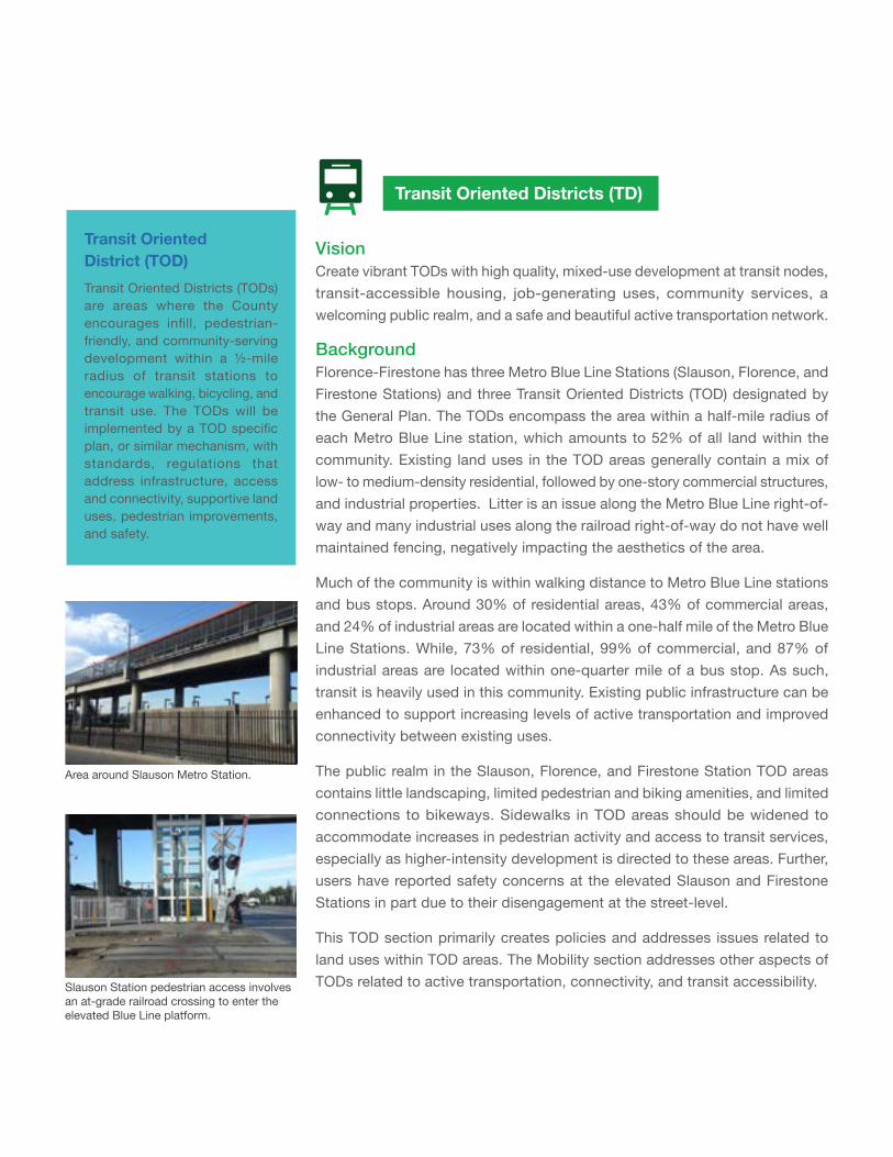
Transit Oriented Districts (TD)
Transit Oriented District (TOD)Transit Oriented Districts (TODs) are areas where the County encourages infill, pedestrian-friendly, and community-serving development within a ½-mile radius of transit stations to encourage walking, bicycling, and transit use. The TODs will be implemented by a TOD specific plan, or similar mechanism, with standards, regulations that address infrastructure, access and connectivity, supportive land uses, pedestrian improvements, and safety.
VisionCreate vibrant TODs with high quality, mixed-use development at transit nodes, transit-accessible housing, job-generating uses, community services, a welcoming public realm, and a safe and beautiful active transportation network.
Background Florence-Firestone has three Metro Blue Line Stations (Slauson, Florence, and Firestone Stations) and three Transit Oriented Districts (TOD) designated by the General Plan. The TODs encompass the area within a half-mile radius of each Metro Blue Line station, which amounts to 52% of all land within the community. Existing land uses in the TOD areas generally contain a mix of low- to medium-density residential, followed by one-story commercial structures, and industrial properties. Litter is an issue along the Metro Blue Line right-of-way and many industrial uses along the railroad right-of-way do not have well maintained fencing, negatively impacting the aesthetics of the area.
Much of the community is within walking distance to Metro Blue Line stations and bus stops. Around 30% of residential areas, 43% of commercial areas, and 24% of industrial areas are located within a one-half mile of the Metro Blue Line Stations. While, 73% of residential, 99% of commercial, and 87% of industrial areas are located within one-quarter mile of a bus stop. As such, transit is heavily used in this community. Existing public infrastructure can be enhanced to support increasing levels of active transportation and improved connectivity between existing uses.
The public realm in the Slauson, Florence, and Firestone Station TOD areas contains little landscaping, limited pedestrian and biking amenities, and limited connections to bikeways. Sidewalks in TOD areas should be widened to accommodate increases in pedestrian activity and access to transit services, especially as higher-intensity development is directed to these areas. Further, users have reported safety concerns at the elevated Slauson and Firestone Stations in part due to their disengagement at the street-level.
This TOD section primarily creates policies and addresses issues related to land uses within TOD areas. The Mobility section addresses other aspects of TODs related to active transportation, connectivity, and transit accessibility.
Area around Slauson Metro Station.
Slauson Station pedestrian access involves an at-grade railroad crossing to enter the elevated Blue Line platform.
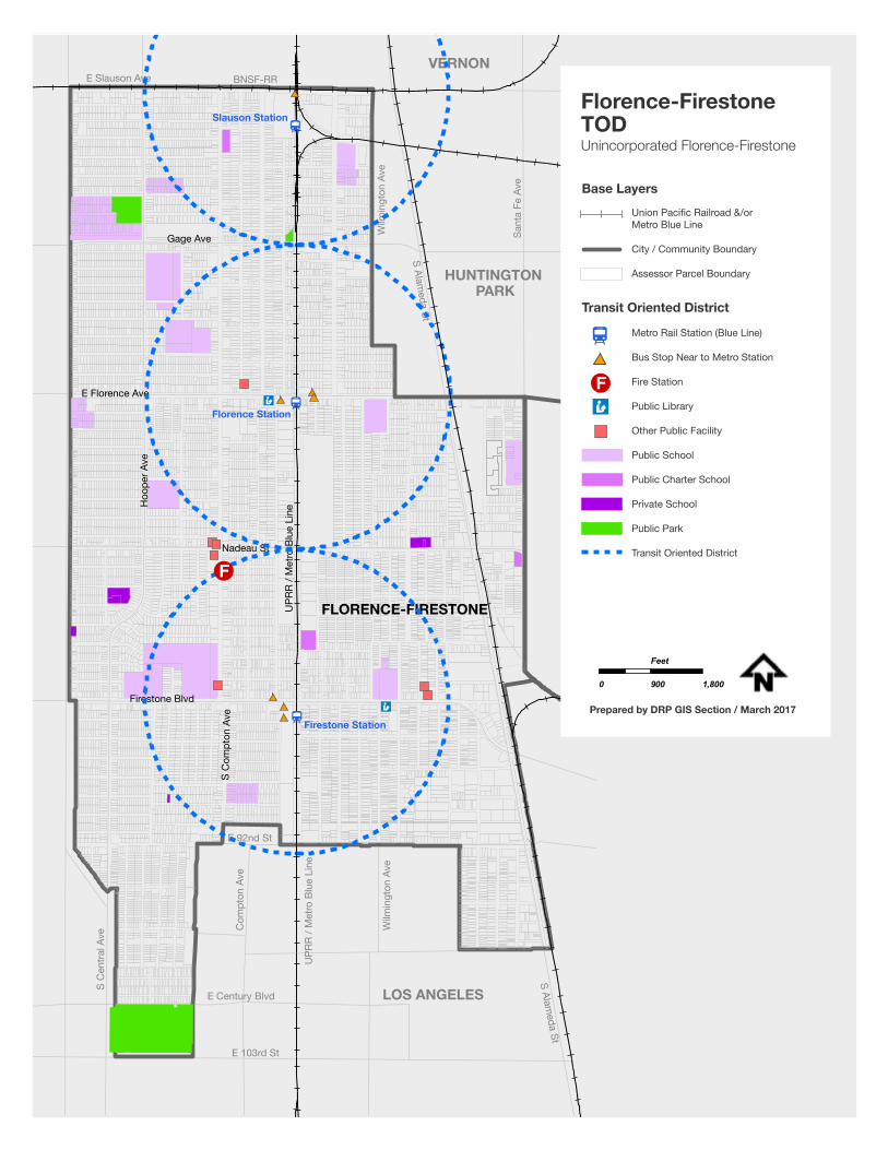
101
FLORENCE-FIRESTONE
Firestone Blvd
S C
ompt
on A
ve
Nadeau St
E Florence Ave
Hoo
per A
ve
UPR
R / M
etro
Blu
e Li
ne
Gage Ave
Slauson Station
Florence Station
Firestone Station
E 103rd St
E Century Blvd
Wilm
ingt
on A
ve
UPR
R / M
etro
Blu
e Li
ne
Com
pton
Ave
S C
entra
l Ave
E 92nd St
LOS ANGELES
HUNTINGTON PARK
VERNON
S Alameda St
S Alameda St
Wilm
ingt
on A
ve
Sant
a Fe
Ave
E Slauson Ave BNSF-RR
Metro Rail Station (Blue Line)
Bus Stop Near to Metro Station
Fire Station
Public Library
Other Public Facility
Public School
Public Charter School
Private School
Public Park
Transit Oriented District
Florence-FirestoneTODUnincorporated Florence-Firestone
0 900 1,800
Feet
Prepared by DRP GIS Section / March 2017
Base LayersUnion Pacific Railroad &/or Metro Blue Line
City / Community Boundary
Assessor Parcel Boundary
Transit Oriented District
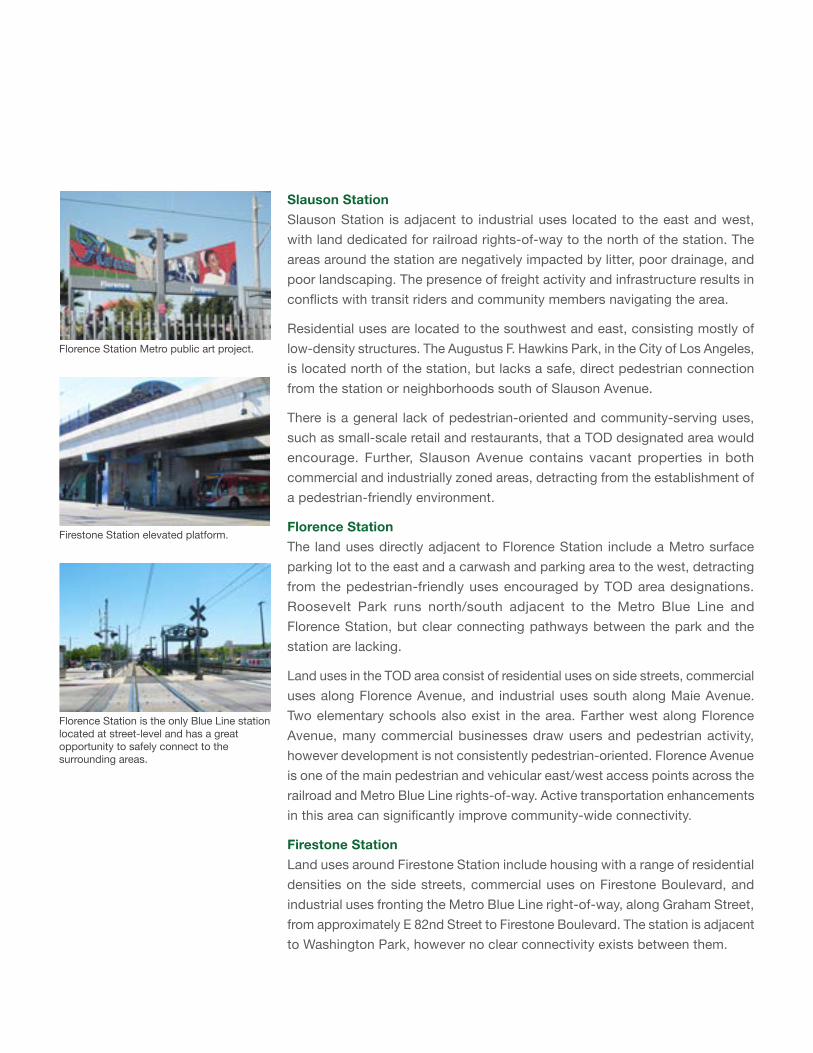
Slauson StationSlauson Station is adjacent to industrial uses located to the east and west, with land dedicated for railroad rights-of-way to the north of the station. The areas around the station are negatively impacted by litter, poor drainage, and poor landscaping. The presence of freight activity and infrastructure results in conflicts with transit riders and community members navigating the area.
Residential uses are located to the southwest and east, consisting mostly of low-density structures. The Augustus F. Hawkins Park, in the City of Los Angeles, is located north of the station, but lacks a safe, direct pedestrian connection from the station or neighborhoods south of Slauson Avenue.
There is a general lack of pedestrian-oriented and community-serving uses, such as small-scale retail and restaurants, that a TOD designated area would encourage. Further, Slauson Avenue contains vacant properties in both commercial and industrially zoned areas, detracting from the establishment of a pedestrian-friendly environment.
Florence StationThe land uses directly adjacent to Florence Station include a Metro surface parking lot to the east and a carwash and parking area to the west, detracting from the pedestrian-friendly uses encouraged by TOD area designations. Roosevelt Park runs north/south adjacent to the Metro Blue Line and Florence Station, but clear connecting pathways between the park and the station are lacking.
Land uses in the TOD area consist of residential uses on side streets, commercial uses along Florence Avenue, and industrial uses south along Maie Avenue. Two elementary schools also exist in the area. Farther west along Florence Avenue, many commercial businesses draw users and pedestrian activity, however development is not consistently pedestrian-oriented. Florence Avenue is one of the main pedestrian and vehicular east/west access points across the railroad and Metro Blue Line rights-of-way. Active transportation enhancements in this area can significantly improve community-wide connectivity.
Firestone StationLand uses around Firestone Station include housing with a range of residential densities on the side streets, commercial uses on Firestone Boulevard, and industrial uses fronting the Metro Blue Line right-of-way, along Graham Street, from approximately E 82nd Street to Firestone Boulevard. The station is adjacent to Washington Park, however no clear connectivity exists between them.
Florence Station is the only Blue Line station located at street-level and has a great opportunity to safely connect to the surrounding areas.
Florence Station Metro public art project.
Firestone Station elevated platform.
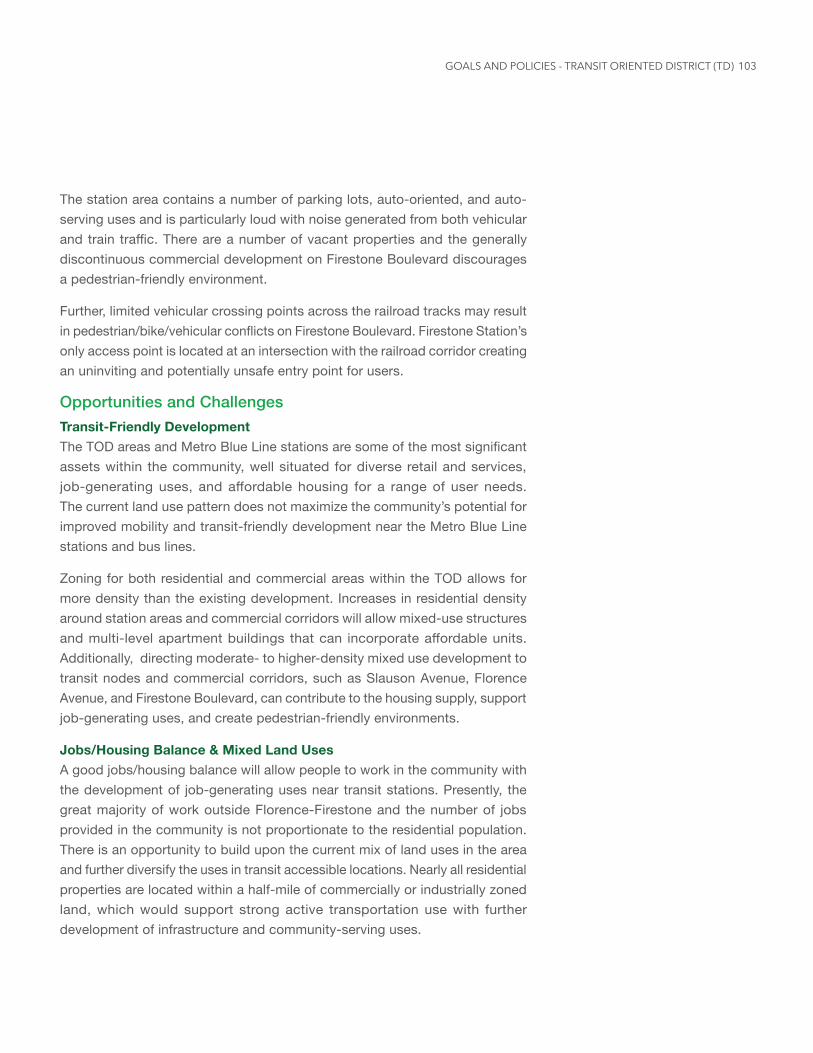
103
The station area contains a number of parking lots, auto-oriented, and auto-serving uses and is particularly loud with noise generated from both vehicular and train traffic. There are a number of vacant properties and the generally discontinuous commercial development on Firestone Boulevard discourages a pedestrian-friendly environment.
Further, limited vehicular crossing points across the railroad tracks may result in pedestrian/bike/vehicular conflicts on Firestone Boulevard. Firestone Station’s only access point is located at an intersection with the railroad corridor creating an uninviting and potentially unsafe entry point for users.
Opportunities and ChallengesTransit-Friendly DevelopmentThe TOD areas and Metro Blue Line stations are some of the most significant assets within the community, well situated for diverse retail and services, job-generating uses, and affordable housing for a range of user needs. The current land use pattern does not maximize the community’s potential for improved mobility and transit-friendly development near the Metro Blue Line stations and bus lines.
Zoning for both residential and commercial areas within the TOD allows for more density than the existing development. Increases in residential density around station areas and commercial corridors will allow mixed-use structures and multi-level apartment buildings that can incorporate affordable units. Additionally, directing moderate- to higher-density mixed use development to transit nodes and commercial corridors, such as Slauson Avenue, Florence Avenue, and Firestone Boulevard, can contribute to the housing supply, support job-generating uses, and create pedestrian-friendly environments.
Jobs/Housing Balance & Mixed Land UsesA good jobs/housing balance will allow people to work in the community with the development of job-generating uses near transit stations. Presently, the great majority of work outside Florence-Firestone and the number of jobs provided in the community is not proportionate to the residential population. There is an opportunity to build upon the current mix of land uses in the area and further diversify the uses in transit accessible locations. Nearly all residential properties are located within a half-mile of commercially or industrially zoned land, which would support strong active transportation use with further development of infrastructure and community-serving uses.
GOALS AND POLICIES - TRANSIT ORIENTED DISTRICT (TD)
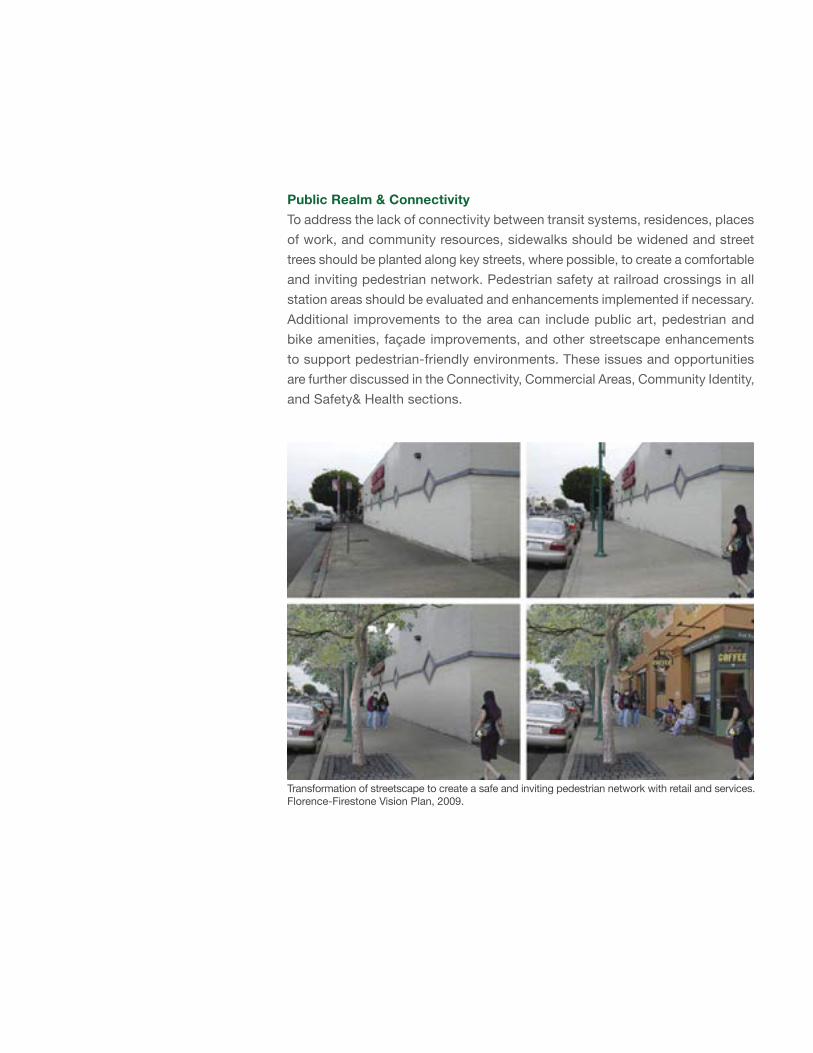
Public Realm & ConnectivityTo address the lack of connectivity between transit systems, residences, places of work, and community resources, sidewalks should be widened and street trees should be planted along key streets, where possible, to create a comfortable and inviting pedestrian network. Pedestrian safety at railroad crossings in all station areas should be evaluated and enhancements implemented if necessary. Additional improvements to the area can include public art, pedestrian and bike amenities, façade improvements, and other streetscape enhancements to support pedestrian-friendly environments. These issues and opportunities are further discussed in the Connectivity, Commercial Areas, Community Identity, and Safety& Health sections.
Transformation of streetscape to create a safe and inviting pedestrian network with retail and services. Florence-Firestone Vision Plan, 2009.
105
Goals and PoliciesResidential and Mixed-Use Projects. As residential and mixed-use projects are encouraged on appropriate sites in the Transit Oriented Districts, goals and policies from the Residential Areas element are applicable here.
TRANSIT-FRIENDLY DEVELOPMENT
GOAL TD-1 Residents can live, work, learn, and recreate in a transit-oriented community.
Policy TD-1.1 Housing and Mixed-Use Development. Provide mixed-use, medium- to high-density mixed-income residential development, and/or affordable housing in TOD areas. (Refer to Infill Development policies in the Land Use Element and Housing Availability policies in the Housing Element of the General Plan for more information)
Policy TD-1.2 Urban Design. Promote compact development that is well-designed, pedestrian-oriented, and environmentally sustainable.
Policy TD-1.3 Public Facilities and Transit. Encourage new public facilities and open spaces in transit-accessible locations with high pedestrian activity and visibility.
Policy TD-1.4 IncentivizeSpecificUses. Incentivize development that incorporates desired uses, such as affordable housing, job-generating uses, community-serving retail and services, entertainment venues, or other uses that meet the public’s daily needs. Incentives can include reduced parking requirements, increased floor area ratio, increased height allowance, or other methods.
Policy TD-1.5 Active Ground Floor. Require that the first floor frontage of structures in commercial zones be designed to include retail, services, or other active public uses and be easily accessible to pedestrians.
Policy TD-1.6 Infrastructure Improvements. Require infrastructure (sewer, transportation, waste management, stormwater, public water, and open space) improvements as needed to support development and revitalization efforts in TOD areas.
GOALS AND POLICIES - TRANSIT ORIENTED DISTRICT (TD)
JOBS/HOUSING BALANCE & MIXED LAND USES
GOAL TD-2 TODs are vibrant, job-rich areas providing quality work opportunities to community members.
Policy TD-2.1 Mix of Land Uses. Support a balanced mix of land uses to provide jobs, housing, and commercial services in proximity to one another, ensuring compatibility between land uses and their environments. (Refer to Business and Environmental Justice policies in the Economic Development Element and Employment Generating Uses policies in the Land Use Element of the General Plan for more information)
Policy TD-2.2 Transition of Industrial Uses. Support the transition of aged industrial spaces to revitalized job-generating uses that are compatible with their immediate environment.
Policy TD-2.3 Florence Avenue Station Land Uses. Transition land uses in the industrially zoned area near the Florence Blue Line Station to higher density job-generating uses that include a mix of commercial, office, research and development, and compatible light industrial development with a pedestrian-oriented urban presence.
Policy TD-2.4 Slauson Avenue Station Land Uses. Promote locating high-density job-generating uses near the Slauson Metro Blue Line Station with a focus on commercial, light industrial, research and development, and office uses.
Policy TD-2.5 Firestone Boulevard Station Land Uses. Develop diverse community-serving commercial retail and services with continuous, pedestrian-oriented street frontage to activate the Firestone Blvd. commercial corridor and station adjacent areas.
PUBLIC REALM & CONNECTIVITY
GOAL TD-3 Development in TODs supports transit use, encourages active transportation connectivity, and revitalizes station areas.
Policy TD-3.1 Commercial Uses. Provide neighborhood services and commercial uses near station areas that can be easily accessed by walking or bicycling, including retail
107
goods and services that meet the daily needs of residents and workers.
Policy TD-3.2 Active Transportation. Design station area development to support active transportation and connectivity to the pedestrian and bicycle networks.
Policy TD-3.3 Building Revitalization. Revitalize existing buildings that positively contribute to the urban environment to support an improved pedestrian experience and identity for the TOD areas.
Policy TD-3.4 Station Area Identity. Create physical and visual connections between each Metro Blue Line station and adjacent neighborhoods, public facilities, public parks, and activity centers through installation of identifiable public art elements, inclusive of lighting, community markers, or other elements. (Refer to Active Transportation Design policies in the Mobility Element of the General Plan and the Connectivity section of this plan for related policies.)
Policy TD-3.5 Station Safety & Maintenance. Support local and regional agencies to improve safety, maintenance, beautification and coordination of services in station areas.
Policy TD-3.6 Public Art. Integrate public art throughout TOD areas, including on Metro right-of-way infrastructure, overpasses, within the public realm, and other visible areas.
GOALS AND POLICIES - TRANSIT ORIENTED DISTRICT (TD)
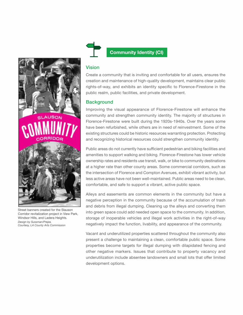
Community Identity (CI)
VisionCreate a community that is inviting and comfortable for all users, ensures the creation and maintenance of high-quality development, maintains clear public rights-of-way, and exhibits an identity specific to Florence-Firestone in the public realm, public facilities, and private development.
Background
Improving the visual appearance of Florence-Firestone will enhance the community and strengthen community identity. The majority of structures in Florence-Firestone were built during the 1920s-1940s. Over the years some have been refurbished, while others are in need of reinvestment. Some of the existing structures could be historic resources warranting protection. Protecting and recognizing historical resources could strengthen community identity.
Public areas do not currently have sufficient pedestrian and biking facilities and amenities to support walking and biking. Florence-Firestone has lower vehicle ownership rates and residents use transit, walk, or bike to community destinations at a higher rate than other county areas. Some commercial corridors, such as the intersection of Florence and Compton Avenues, exhibit vibrant activity, but less active areas have not been well-maintained. Public areas need to be clean, comfortable, and safe to support a vibrant, active public space.
Alleys and easements are common elements in the community but have a negative perception in the community because of the accumulation of trash and debris from illegal dumping. Cleaning up the alleys and converting them into green space could add needed open space to the community. In addition, storage of inoperable vehicles and illegal work activities in the right-of-way negatively impact the function, livability, and appearance of the community.
Vacant and underutilized properties scattered throughout the community also present a challenge to maintaining a clean, comfortable public space. Some properties become targets for illegal dumping with dilapidated fencing and other negative markers. Issues that contribute to property vacancy and underutilization include absentee landowners and small lots that offer limited development options.
Street banners created for the Slauson Corridor revitalization project in View Park, Windsor Hills, and Ladera Heights. Design by Sussman/Prejza. Courtesy, LA County Arts Commission
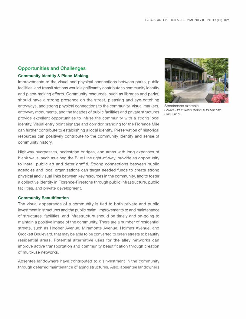
109
Opportunities and ChallengesCommunity Identity & Place-MakingImprovements to the visual and physical connections between parks, public facilities, and transit stations would significantly contribute to community identity and place-making efforts. Community resources, such as libraries and parks, should have a strong presence on the street, pleasing and eye-catching entryways, and strong physical connections to the community. Visual markers, entryway monuments, and the facades of public facilities and private structures provide excellent opportunities to infuse the community with a strong local identity. Visual entry point signage and corridor branding for the Florence Mile can further contribute to establishing a local identity. Preservation of historical resources can positively contribute to the community identity and sense of community history.
Highway overpasses, pedestrian bridges, and areas with long expanses of blank walls, such as along the Blue Line right-of-way, provide an opportunity to install public art and deter graffiti. Strong connections between public agencies and local organizations can target needed funds to create strong physical and visual links between key resources in the community, and to foster a collective identity in Florence-Firestone through public infrastructure, public facilities, and private development.
CommunityBeautificationThe visual appearance of a community is tied to both private and public investment in structures and the public realm. Improvements to and maintenance of structures, facilities, and infrastructure should be timely and on-going to maintain a positive image of the community. There are a number of residential streets, such as Hooper Avenue, Miramonte Avenue, Holmes Avenue, and Crockett Boulevard, that may be able to be converted to green streets to beautify residential areas. Potential alternative uses for the alley networks can improve active transportation and community beautification through creation of multi-use networks.
Absentee landowners have contributed to disinvestment in the community through deferred maintenance of aging structures. Also, absentee landowners
Streetscape example. Source Draft West Carson TOD Specific Plan, 2016.
GOALS AND POLICIES - COMMUNITY IDENTITY (CI)
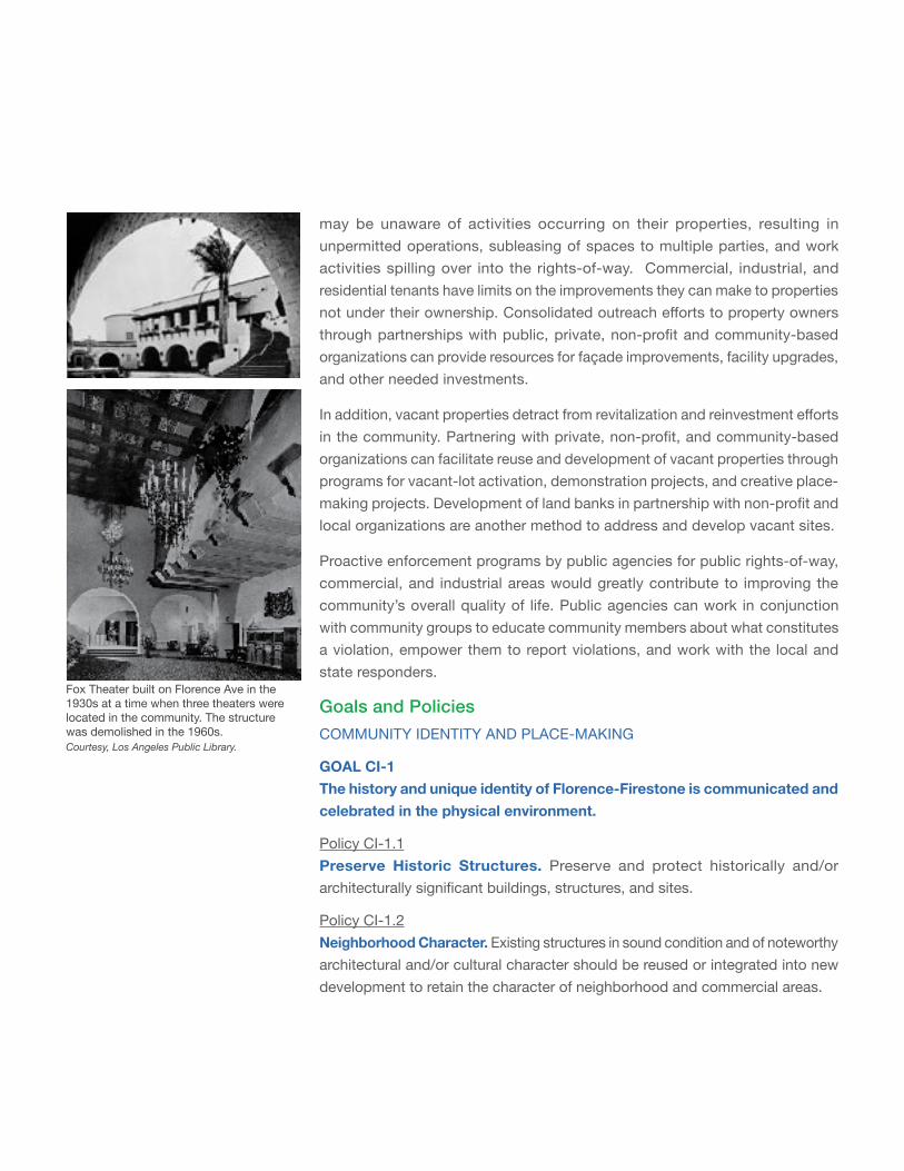
may be unaware of activities occurring on their properties, resulting in unpermitted operations, subleasing of spaces to multiple parties, and work activities spilling over into the rights-of-way. Commercial, industrial, and residential tenants have limits on the improvements they can make to properties not under their ownership. Consolidated outreach efforts to property owners through partnerships with public, private, non-profit and community-based organizations can provide resources for façade improvements, facility upgrades, and other needed investments.
In addition, vacant properties detract from revitalization and reinvestment efforts in the community. Partnering with private, non-profit, and community-based organizations can facilitate reuse and development of vacant properties through programs for vacant-lot activation, demonstration projects, and creative place-making projects. Development of land banks in partnership with non-profit and local organizations are another method to address and develop vacant sites.
Proactive enforcement programs by public agencies for public rights-of-way, commercial, and industrial areas would greatly contribute to improving the community’s overall quality of life. Public agencies can work in conjunction with community groups to educate community members about what constitutes a violation, empower them to report violations, and work with the local and state responders.
Goals and PoliciesCOMMUNITY IDENTITY AND PLACE-MAKING
GOAL CI-1 The history and unique identity of Florence-Firestone is communicated and celebrated in the physical environment.
Policy CI-1.1 Preserve Historic Structures. Preserve and protect historically and/or architecturally significant buildings, structures, and sites.
Policy CI-1.2 Neighborhood Character. Existing structures in sound condition and of noteworthy architectural and/or cultural character should be reused or integrated into new development to retain the character of neighborhood and commercial areas.
Fox Theater built on Florence Ave in the 1930s at a time when three theaters were located in the community. The structure was demolished in the 1960s. Courtesy, Los Angeles Public Library.
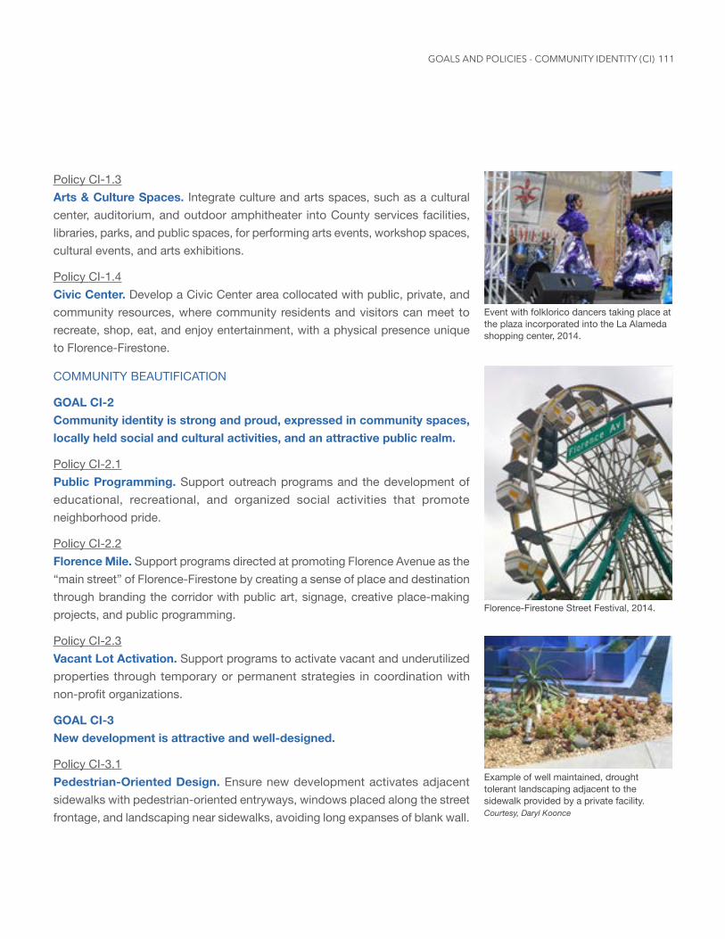
111
Policy CI-1.3 Arts & Culture Spaces. Integrate culture and arts spaces, such as a cultural center, auditorium, and outdoor amphitheater into County services facilities, libraries, parks, and public spaces, for performing arts events, workshop spaces, cultural events, and arts exhibitions.
Policy CI-1.4 Civic Center. Develop a Civic Center area collocated with public, private, and community resources, where community residents and visitors can meet to recreate, shop, eat, and enjoy entertainment, with a physical presence unique to Florence-Firestone.
COMMUNITY BEAUTIFICATION
GOAL CI-2 Community identity is strong and proud, expressed in community spaces, locally held social and cultural activities, and an attractive public realm.
Policy CI-2.1 Public Programming. Support outreach programs and the development of educational, recreational, and organized social activities that promote neighborhood pride.
Policy CI-2.2 Florence Mile. Support programs directed at promoting Florence Avenue as the “main street” of Florence-Firestone by creating a sense of place and destination through branding the corridor with public art, signage, creative place-making projects, and public programming.
Policy CI-2.3 Vacant Lot Activation. Support programs to activate vacant and underutilized properties through temporary or permanent strategies in coordination with non-profit organizations.
GOAL CI-3 New development is attractive and well-designed.
Policy CI-3.1 Pedestrian-Oriented Design. Ensure new development activates adjacent sidewalks with pedestrian-oriented entryways, windows placed along the street frontage, and landscaping near sidewalks, avoiding long expanses of blank wall.
Event with folklorico dancers taking place at the plaza incorporated into the La Alameda shopping center, 2014.
Florence-Firestone Street Festival, 2014.
Example of well maintained, drought tolerant landscaping adjacent to the sidewalk provided by a private facility. Courtesy, Daryl Koonce
GOALS AND POLICIES - COMMUNITY IDENTITY (CI)
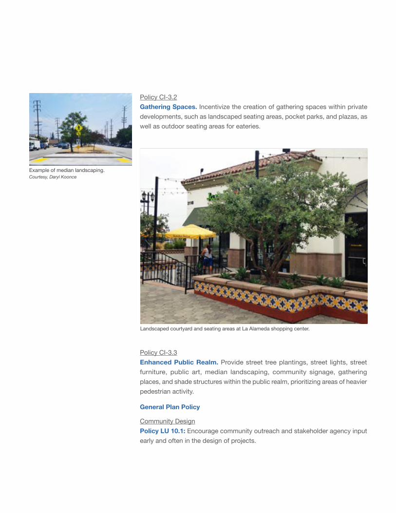
Policy CI-3.2 Gathering Spaces. Incentivize the creation of gathering spaces within private developments, such as landscaped seating areas, pocket parks, and plazas, as well as outdoor seating areas for eateries.
Landscaped courtyard and seating areas at La Alameda shopping center.
Example of median landscaping. Courtesy, Daryl Koonce
Policy CI-3.3 Enhanced Public Realm. Provide street tree plantings, street lights, street furniture, public art, median landscaping, community signage, gathering places, and shade structures within the public realm, prioritizing areas of heavier pedestrian activity.
General Plan Policy
Community DesignPolicy LU 10.1: Encourage community outreach and stakeholder agency input early and often in the design of projects.
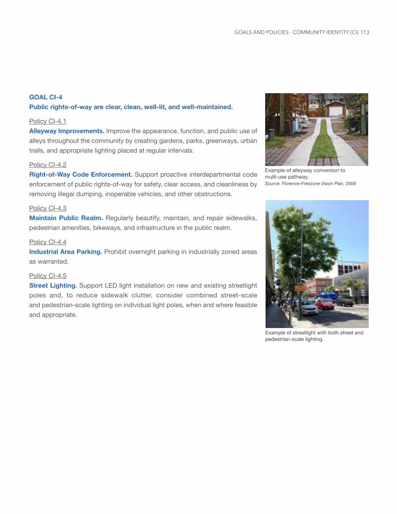
113
Example of streetlight with both street and pedestrian-scale lighting.
GOAL CI-4 Public rights-of-way are clear, clean, well-lit, and well-maintained.
Policy CI-4.1 Alleyway Improvements. Improve the appearance, function, and public use of alleys throughout the community by creating gardens, parks, greenways, urban trails, and appropriate lighting placed at regular intervals.
Policy CI-4.2 Right-of-Way Code Enforcement. Support proactive interdepartmental code enforcement of public rights-of-way for safety, clear access, and cleanliness by removing illegal dumping, inoperable vehicles, and other obstructions.
Policy CI-4.3 Maintain Public Realm. Regularly beautify, maintain, and repair sidewalks, pedestrian amenities, bikeways, and infrastructure in the public realm.
Policy CI-4.4 Industrial Area Parking. Prohibit overnight parking in industrially zoned areas as warranted.
Policy CI-4.5 Street Lighting. Support LED light installation on new and existing streetlight poles and, to reduce sidewalk clutter, consider combined street-scale and pedestrian-scale lighting on individual light poles, when and where feasible and appropriate.
Example of alleyway conversion to multi-use pathway.Source: Florence-Firestone Vision Plan, 2009
GOALS AND POLICIES - COMMUNITY IDENTITY (CI)
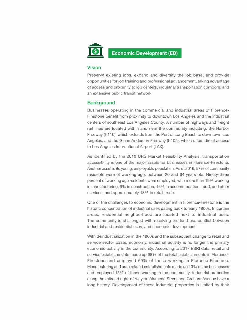
Economic Development (ED)
VisionPreserve existing jobs, expand and diversify the job base, and provide opportunities for job training and professional advancement, taking advantage of access and proximity to job centers, industrial transportation corridors, and an extensive public transit network.
Background
Businesses operating in the commercial and industrial areas of Florence-Firestone benefit from proximity to downtown Los Angeles and the industrial centers of southeast Los Angeles County. A number of highways and freight rail lines are located within and near the community including, the Harbor Freeway (I-110), which extends from the Port of Long Beach to downtown Los Angeles, and the Glenn Anderson Freeway (I-105), which offers direct access to Los Angeles International Airport (LAX).
As identified by the 2010 URS Market Feasibility Analysis, transportation accessibility is one of the major assets for businesses in Florence-Firestone. Another asset is its young, employable population. As of 2016, 57% of community residents were of working age, between 20 and 64 years old. Ninety-three percent of working age residents were employed, with more than 19% working in manufacturing, 9% in construction, 16% in accommodation, food, and other services, and approximately 13% in retail trade.
One of the challenges to economic development in Florence-Firestone is the historic concentration of industrial uses dating back to early 1900s. In certain areas, residential neighborhood are located next to industrial uses. The community is challenged with resolving the land use conflict between industrial and residential uses, and economic development.
With deindustrialization in the 1960s and the subsequent change to retail and service sector based economy, industrial activity is no longer the primary economic activity in the community. According to 2017 ESRI data, retail and service establishments made up 68% of the total establishments in Florence-Firestone and employed 69% of those working in Florence-Firestone. Manufacturing and auto related establishments made up 13% of the businesses and employed 13% of those working in the community. Industrial properties along the railroad right-of-way on Alameda Street and Graham Avenue have a long history. Development of these industrial properties is limited by their
115
proximity to residential uses. In addition, small lots and long standing existing uses make it difficult to assemble the industrial lots for redevelopment. To decrease the industrial and residential land use conflict, existing industrial uses need to be brought into compliance with new regulations and green standards and need the assistance of business assistance programs and access to capital to upgrade facilities.
Opportunities and ChallengesEconomic Revitalization for Commercial and Industrial BusinessesThe community’s residents are culturally and ethnically diverse. As such, local retailers provide an opportunity for marketing specialized goods and services. Concentrations of specific local industries attract customers from outside the community, successfully generating sales that exceed local demand. These industries include auto services, autobody parts, furniture manufacturers, furniture stores, and specialty foods. Auto body parts/recycling uses are concentrated along the Alameda Corridor, while retail sales are concentrated along Florence Avenue and dispersed along other commercial corridors. Furniture manufacturing and retail are located on Nadeau Street and Central Avenue, which is adjacent to the Decorative Arts District in the City of Los Angeles. Limited retail and a concentration of auto services are located on Central Avenue and Firestone Boulevard.
Supporting the growth of the industrial sector while addressing its impacts on residential areas is a challenge. Heavy industrial uses concentrated along the Alameda Corridor have long been a source of jobs and economic activity. However, the proximity of these industries to residential areas negatively affects residents. Connecting existing industrial uses to funds and resources to improve site design and street presence, enclose operations within a building, and operate within strict controls on air quality, water runoff, and waste management would significantly reduce the present incompatibility and environmental impacts.
Area Focused Growth and InvestmentWhile the community is well-connected by public transit, major corridors, and highways, key goods and services are not easily available. The community lacks diverse retail, including pharmacies, health and personal care stores, and ticketed entertainment (e.g., movies, concerts, sports events). As a result, residents travel outside the community to access these goods and services. Given the local population density, there is demand for these uses and an
Intersection with vibrant surrounding commercial uses.
GOALS AND POLICIES - ECONOMIC DEVELOPMENT (ED)
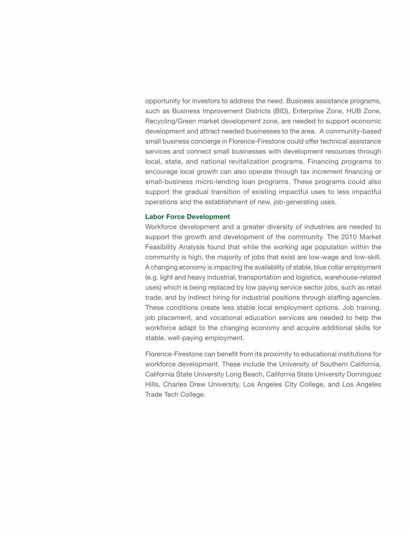
opportunity for investors to address the need. Business assistance programs, such as Business Improvement Districts (BID), Enterprise Zone, HUB Zone, Recycling/Green market development zone, are needed to support economic development and attract needed businesses to the area. A community-based small business concierge in Florence-Firestone could offer technical assistance services and connect small businesses with development resources through local, state, and national revitalization programs. Financing programs to encourage local growth can also operate through tax increment financing or small-business micro-lending loan programs. These programs could also support the gradual transition of existing impactful uses to less impactful operations and the establishment of new, job-generating uses.
Labor Force DevelopmentWorkforce development and a greater diversity of industries are needed to support the growth and development of the community. The 2010 Market Feasibility Analysis found that while the working age population within the community is high, the majority of jobs that exist are low-wage and low-skill. A changing economy is impacting the availability of stable, blue collar employment (e.g. light and heavy industrial, transportation and logistics, warehouse-related uses) which is being replaced by low paying service sector jobs, such as retail trade, and by indirect hiring for industrial positions through staffing agencies. These conditions create less stable local employment options. Job training, job placement, and vocational education services are needed to help the workforce adapt to the changing economy and acquire additional skills for stable, well-paying employment.
Florence-Firestone can benefit from its proximity to educational institutions for workforce development. These include the University of Southern California, California State University Long Beach, California State University Dominguez Hills, Charles Drew University, Los Angeles City College, and Los Angeles Trade Tech College.
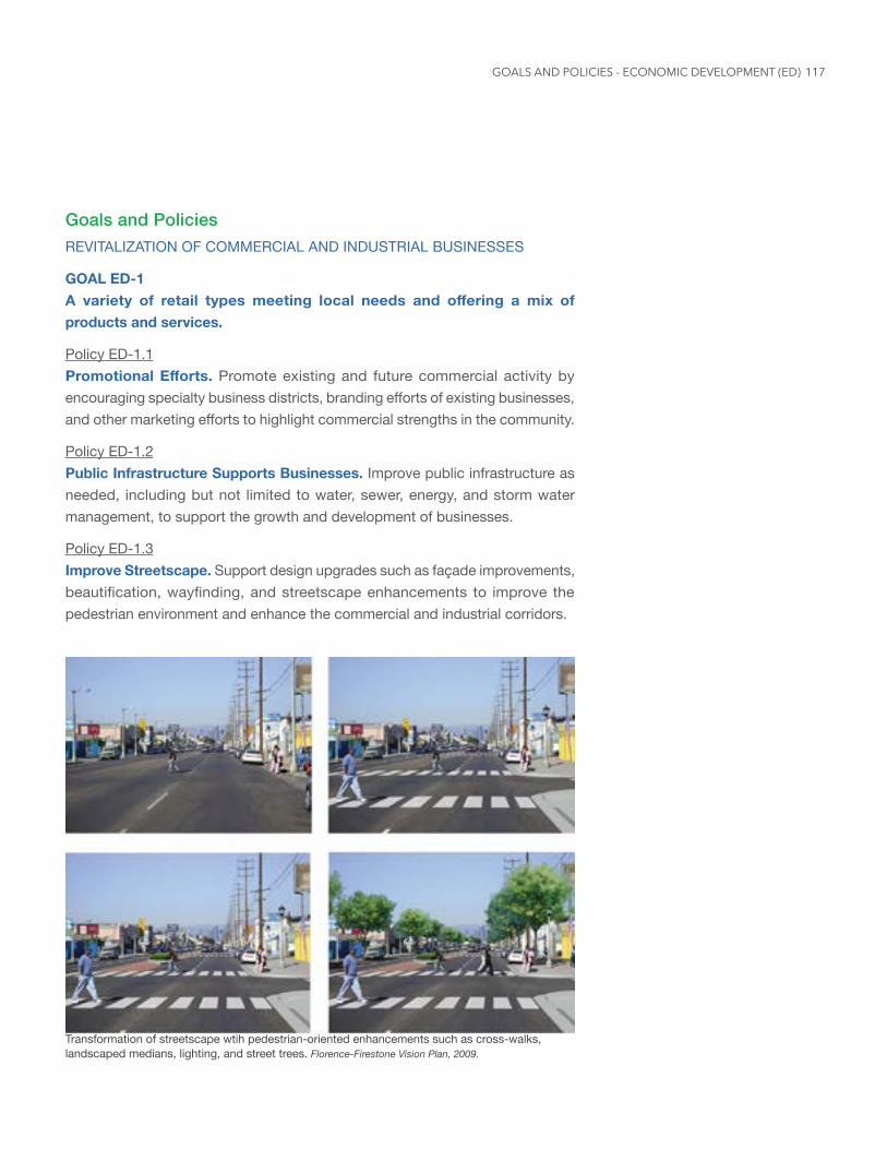
117
Goals and PoliciesREVITALIZATION OF COMMERCIAL AND INDUSTRIAL BUSINESSES
GOAL ED-1 A variety of retail types meeting local needs and offering a mix of products and services.
Policy ED-1.1 PromotionalEfforts. Promote existing and future commercial activity by encouraging specialty business districts, branding efforts of existing businesses, and other marketing efforts to highlight commercial strengths in the community.
Policy ED-1.2 Public Infrastructure Supports Businesses. Improve public infrastructure as needed, including but not limited to water, sewer, energy, and storm water management, to support the growth and development of businesses.
Policy ED-1.3 Improve Streetscape. Support design upgrades such as façade improvements, beautification, wayfinding, and streetscape enhancements to improve the pedestrian environment and enhance the commercial and industrial corridors.
Transformation of streetscape wtih pedestrian-oriented enhancements such as cross-walks, landscaped medians, lighting, and street trees. Florence-Firestone Vision Plan, 2009.
GOALS AND POLICIES - ECONOMIC DEVELOPMENT (ED)
AREA FOCUSED GROWTH AND DEVELOPMENT
GOAL ED-2 Capitalize on Florence-Firestone’s regional location, access to transit, and existing economic resources
Policy ED-2.1 Diversify Commercial Uses. Promote business retention, relocation and entrepreneurialism in Florence-Firestone to fulfill commercial needs in the community, and offer incentives to businesses and property owners to develop properties.
Policy ED-2.2 Economic Growth in Transit Hubs. Improve the surrounding pedestrian and bicycle infrastructure near transit hubs to increase retail activity and act as a catalyst for economic growth and development.
Policy ED-2.3 Green Industry. Encourage facility upgrades to meet environmentally sustainable development and performance standards and provide incentives to attract green businesses and make processes for existing businesses cleaner.
Policy ED-2.4 Land Use Assembly. Support land use assembly by allowing low impact industries by right and/or streamlining the permitting process to provide development certainty.
Policy ED-2.5 Encourage Employees to Use Public Transit. Incentivize local businesses to encourage employees to use rail, bus, and ride-sharing services.
LABOR FORCE DEVELOPMENT
GOAL ED-3 Capitalize on Florence-Firestone’s regional location, access to transit, and existing economic resources
Policy ED-3.1 Preserve and Increase Job Opportunities. Preserve and increase job opportunities in industrial and commercial areas that match residents’ skill levels.
119
Policy ED-3.2 Local Hiring. Encourage local hiring and targeted hiring of workers from the community through the use of development agreements or community benefit agreements in discretionary projects.
Policy ED-3.3 Workforce Development. Connect residents to local educational institutions, enrichment classes, job training, and information on job opportunities that respond to community interests and support workforce development.
General Plan Policy
Business and Environmental JusticePolicy ED 2.6: Encourage community-serving uses, such as child care centers and personal services, to be located in proximity to employment centers.
GOALS AND POLICIES - ECONOMIC DEVELOPMENT (ED)
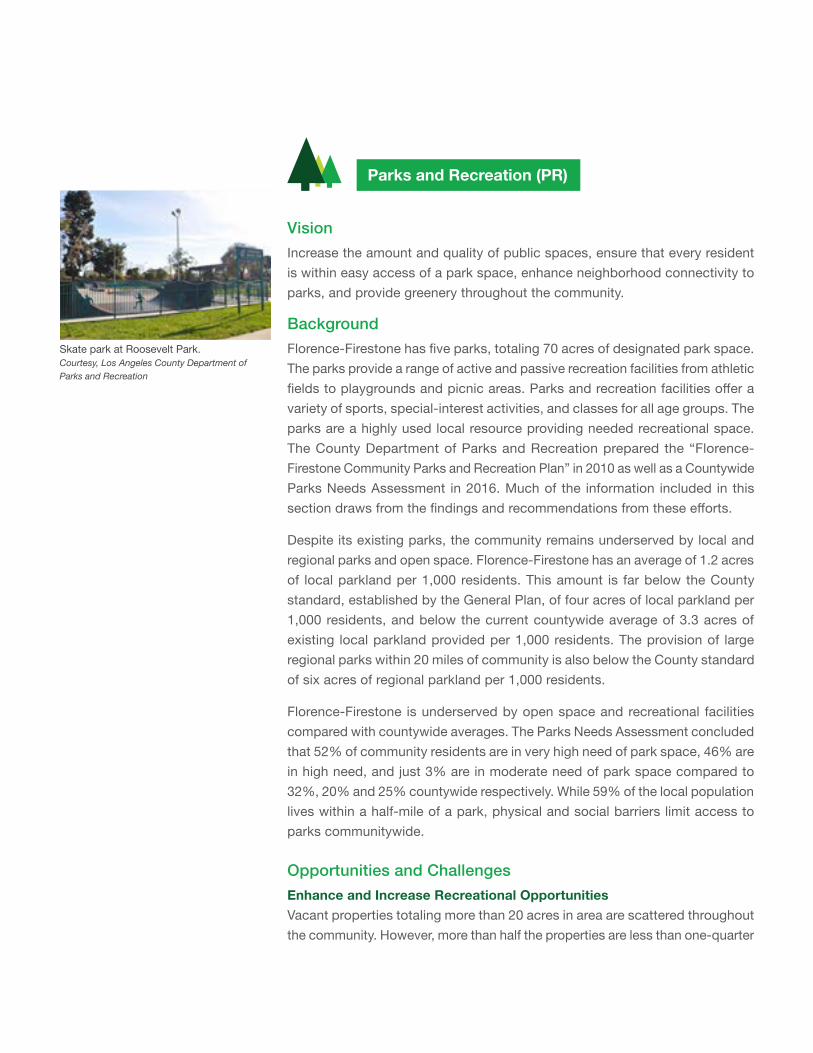
Parks and Recreation (PR)
VisionIncrease the amount and quality of public spaces, ensure that every resident is within easy access of a park space, enhance neighborhood connectivity to parks, and provide greenery throughout the community.
Background
Florence-Firestone has five parks, totaling 70 acres of designated park space. The parks provide a range of active and passive recreation facilities from athletic fields to playgrounds and picnic areas. Parks and recreation facilities offer a variety of sports, special-interest activities, and classes for all age groups. The parks are a highly used local resource providing needed recreational space. The County Department of Parks and Recreation prepared the “Florence-Firestone Community Parks and Recreation Plan” in 2010 as well as a Countywide Parks Needs Assessment in 2016. Much of the information included in this section draws from the findings and recommendations from these efforts.
Despite its existing parks, the community remains underserved by local and regional parks and open space. Florence-Firestone has an average of 1.2 acres of local parkland per 1,000 residents. This amount is far below the County standard, established by the General Plan, of four acres of local parkland per 1,000 residents, and below the current countywide average of 3.3 acres of existing local parkland provided per 1,000 residents. The provision of large regional parks within 20 miles of community is also below the County standard of six acres of regional parkland per 1,000 residents.
Florence-Firestone is underserved by open space and recreational facilities compared with countywide averages. The Parks Needs Assessment concluded that 52% of community residents are in very high need of park space, 46% are in high need, and just 3% are in moderate need of park space compared to 32%, 20% and 25% countywide respectively. While 59% of the local population lives within a half-mile of a park, physical and social barriers limit access to parks communitywide.
Opportunities and ChallengesEnhance and Increase Recreational OpportunitiesVacant properties totaling more than 20 acres in area are scattered throughout the community. However, more than half the properties are less than one-quarter
Skate park at Roosevelt Park.Courtesy, Los Angeles County Department of Parks and Recreation
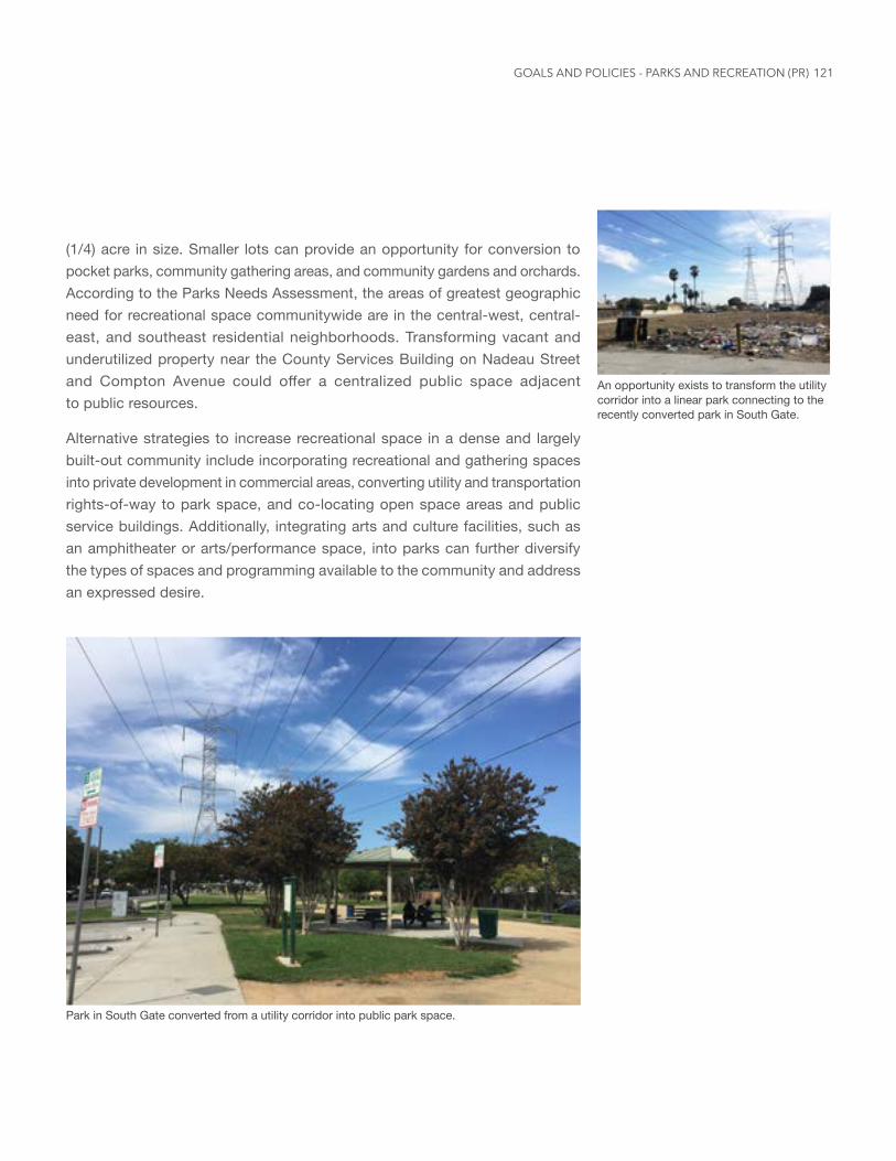
121
(1/4) acre in size. Smaller lots can provide an opportunity for conversion to pocket parks, community gathering areas, and community gardens and orchards. According to the Parks Needs Assessment, the areas of greatest geographic need for recreational space communitywide are in the central-west, central-east, and southeast residential neighborhoods. Transforming vacant and underutilized property near the County Services Building on Nadeau Street and Compton Avenue could offer a centralized public space adjacent to public resources.
Alternative strategies to increase recreational space in a dense and largely built-out community include incorporating recreational and gathering spaces into private development in commercial areas, converting utility and transportation rights-of-way to park space, and co-locating open space areas and public service buildings. Additionally, integrating arts and culture facilities, such as an amphitheater or arts/performance space, into parks can further diversify the types of spaces and programming available to the community and address an expressed desire.
An opportunity exists to transform the utility corridor into a linear park connecting to the recently converted park in South Gate.
Park in South Gate converted from a utility corridor into public park space.
GOALS AND POLICIES - PARKS AND RECREATION (PR)
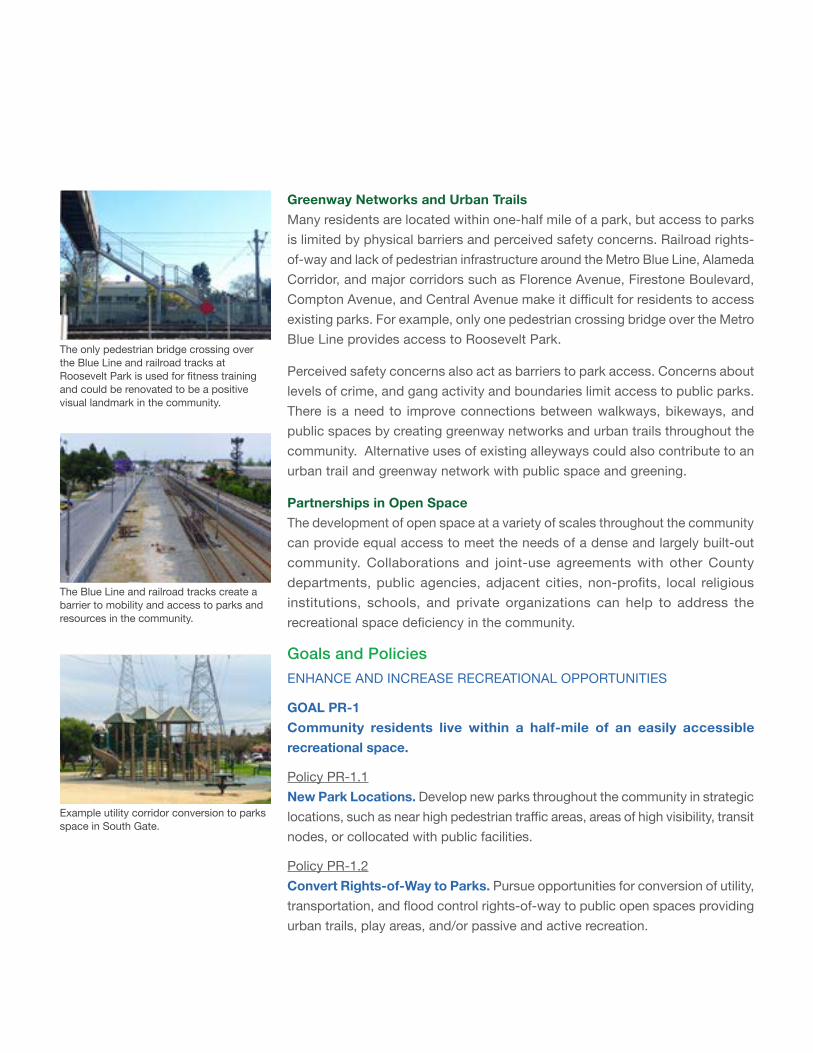
Greenway Networks and Urban Trails Many residents are located within one-half mile of a park, but access to parks is limited by physical barriers and perceived safety concerns. Railroad rights-of-way and lack of pedestrian infrastructure around the Metro Blue Line, Alameda Corridor, and major corridors such as Florence Avenue, Firestone Boulevard, Compton Avenue, and Central Avenue make it difficult for residents to access existing parks. For example, only one pedestrian crossing bridge over the Metro Blue Line provides access to Roosevelt Park.
Perceived safety concerns also act as barriers to park access. Concerns about levels of crime, and gang activity and boundaries limit access to public parks. There is a need to improve connections between walkways, bikeways, and public spaces by creating greenway networks and urban trails throughout the community. Alternative uses of existing alleyways could also contribute to an urban trail and greenway network with public space and greening.
Partnerships in Open SpaceThe development of open space at a variety of scales throughout the community can provide equal access to meet the needs of a dense and largely built-out community. Collaborations and joint-use agreements with other County departments, public agencies, adjacent cities, non-profits, local religious institutions, schools, and private organizations can help to address the recreational space deficiency in the community.
Goals and PoliciesENHANCE AND INCREASE RECREATIONAL OPPORTUNITIES
GOAL PR-1 Community residents live within a half-mile of an easily accessible recreational space.
Policy PR-1.1 New Park Locations. Develop new parks throughout the community in strategic locations, such as near high pedestrian traffic areas, areas of high visibility, transit nodes, or collocated with public facilities.
Policy PR-1.2 Convert Rights-of-Way to Parks. Pursue opportunities for conversion of utility, transportation, and flood control rights-of-way to public open spaces providing urban trails, play areas, and/or passive and active recreation.
The only pedestrian bridge crossing over the Blue Line and railroad tracks at Roosevelt Park is used for fitness training and could be renovated to be a positive visual landmark in the community.
The Blue Line and railroad tracks create a barrier to mobility and access to parks and resources in the community.
Example utility corridor conversion to parks space in South Gate.
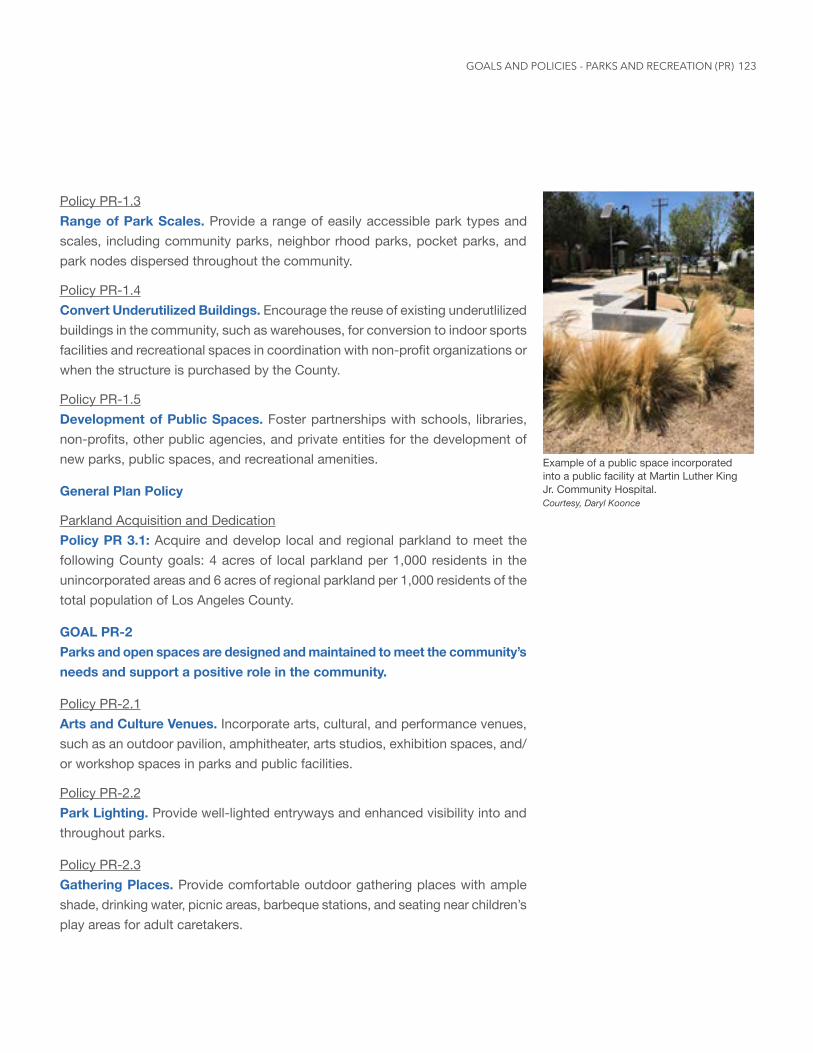
123
Policy PR-1.3 Range of Park Scales. Provide a range of easily accessible park types and scales, including community parks, neighbor rhood parks, pocket parks, and park nodes dispersed throughout the community.
Policy PR-1.4 Convert Underutilized Buildings. Encourage the reuse of existing underutlilized buildings in the community, such as warehouses, for conversion to indoor sports facilities and recreational spaces in coordination with non-profit organizations or when the structure is purchased by the County.
Policy PR-1.5 Development of Public Spaces. Foster partnerships with schools, libraries, non-profits, other public agencies, and private entities for the development of new parks, public spaces, and recreational amenities.
General Plan Policy
Parkland Acquisition and DedicationPolicy PR 3.1: Acquire and develop local and regional parkland to meet the following County goals: 4 acres of local parkland per 1,000 residents in the unincorporated areas and 6 acres of regional parkland per 1,000 residents of the total population of Los Angeles County.
GOAL PR-2 Parks and open spaces are designed and maintained to meet the community’s needs and support a positive role in the community.
Policy PR-2.1 Arts and Culture Venues. Incorporate arts, cultural, and performance venues, such as an outdoor pavilion, amphitheater, arts studios, exhibition spaces, and/or workshop spaces in parks and public facilities.
Policy PR-2.2 Park Lighting. Provide well-lighted entryways and enhanced visibility into and throughout parks.
Policy PR-2.3 Gathering Places. Provide comfortable outdoor gathering places with ample shade, drinking water, picnic areas, barbeque stations, and seating near children’s play areas for adult caretakers.
Example of a public space incorporated into a public facility at Martin Luther King Jr. Community Hospital. Courtesy, Daryl Koonce
GOALS AND POLICIES - PARKS AND RECREATION (PR)
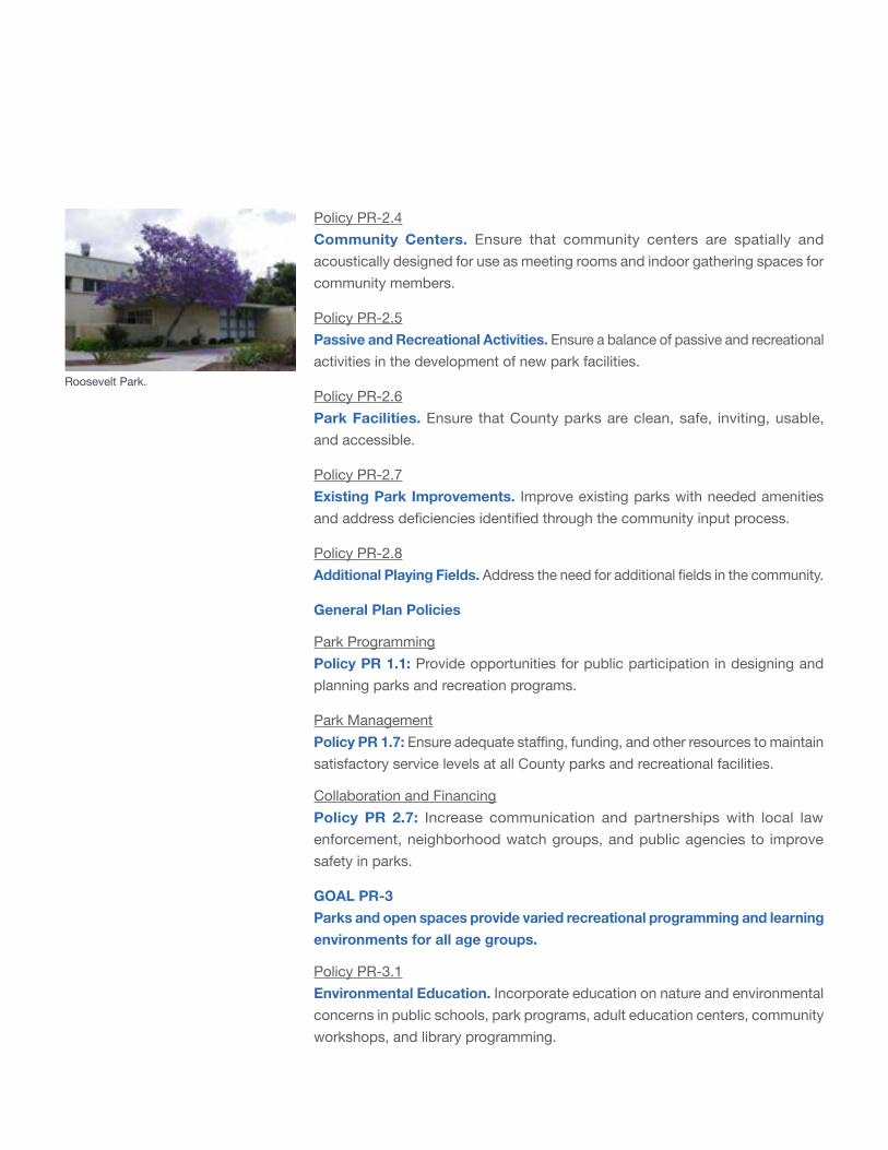
Policy PR-2.4 Community Centers. Ensure that community centers are spatially and acoustically designed for use as meeting rooms and indoor gathering spaces for community members.
Policy PR-2.5 Passive and Recreational Activities. Ensure a balance of passive and recreational activities in the development of new park facilities.
Policy PR-2.6 Park Facilities. Ensure that County parks are clean, safe, inviting, usable, and accessible.
Policy PR-2.7 Existing Park Improvements. Improve existing parks with needed amenities and address deficiencies identified through the community input process.
Policy PR-2.8 Additional Playing Fields. Address the need for additional fields in the community.
General Plan Policies
Park ProgrammingPolicy PR 1.1: Provide opportunities for public participation in designing and planning parks and recreation programs.
Park ManagementPolicy PR 1.7: Ensure adequate staffing, funding, and other resources to maintain satisfactory service levels at all County parks and recreational facilities.
Collaboration and FinancingPolicy PR 2.7: Increase communication and partnerships with local law enforcement, neighborhood watch groups, and public agencies to improve safety in parks.
GOAL PR-3 Parks and open spaces provide varied recreational programming and learning environments for all age groups.
Policy PR-3.1 Environmental Education. Incorporate education on nature and environmental concerns in public schools, park programs, adult education centers, community workshops, and library programming.
Roosevelt Park.
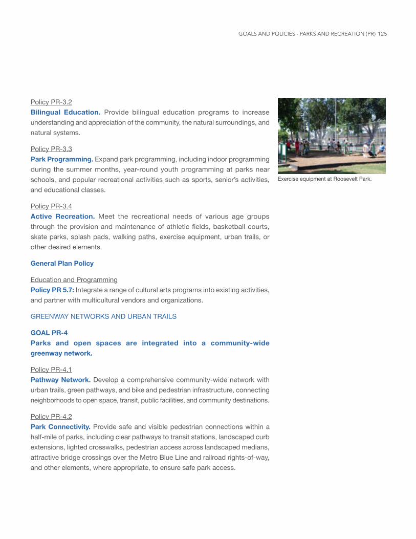
125
Policy PR-3.2 Bilingual Education. Provide bilingual education programs to increase understanding and appreciation of the community, the natural surroundings, and natural systems.
Policy PR-3.3 Park Programming. Expand park programming, including indoor programming during the summer months, year-round youth programming at parks near schools, and popular recreational activities such as sports, senior’s activities, and educational classes.
Policy PR-3.4 Active Recreation. Meet the recreational needs of various age groups through the provision and maintenance of athletic fields, basketball courts, skate parks, splash pads, walking paths, exercise equipment, urban trails, or other desired elements.
General Plan Policy
Education and ProgrammingPolicy PR 5.7: Integrate a range of cultural arts programs into existing activities, and partner with multicultural vendors and organizations.
GREENWAY NETWORKS AND URBAN TRAILS
GOAL PR-4 Parks and open spaces are integrated into a community-wide greenway network.
Policy PR-4.1 Pathway Network. Develop a comprehensive community-wide network with urban trails, green pathways, and bike and pedestrian infrastructure, connecting neighborhoods to open space, transit, public facilities, and community destinations.
Policy PR-4.2 Park Connectivity. Provide safe and visible pedestrian connections within a half-mile of parks, including clear pathways to transit stations, landscaped curb extensions, lighted crosswalks, pedestrian access across landscaped medians, attractive bridge crossings over the Metro Blue Line and railroad rights-of-way, and other elements, where appropriate, to ensure safe park access.
Exercise equipment at Roosevelt Park.
GOALS AND POLICIES - PARKS AND RECREATION (PR)
Policy PR-4.3 Connecting to Regional Open Space. Develop safe connections to parks and open spaces in adjacent communities, linking to larger open space networks, such as the Los Angeles and Rio Hondo River trails.
Policy PR-4.4 Convert Alleyways. Convert alleyways to multi-use pathways and community green spaces, where feasible and appropriate.
PARTNERSHIPS IN OPEN SPACE
GOAL PR-5 Publicagenciesandprivate,non-profit,andcommunity-basedorganizationspartner to create a robust local network of parks and connect residents to regional open spaces.
Policy PR-5.1 Joint-Use Agreements. Incentivize joint-use agreements with schools and local organizations to expand access to recreational facilities and to organize joint recreational and educational programs.
Policy PR-5.2 Recreational Space Incentive. Incentivize the provision of public recreational spaces and amenities, such as plazas, walking/jogging paths, squares, and park spaces, within commercial or retail projects.
Policy PR-5.3 Partnerships for Parks Development. Pursue partnerships to acquire and develop public open space and recreational facilities with adjacent jurisdictions, public agencies, and non-profit, community-based, and private organizations. (Refer to the Collaboration and Financing and Parkland Acquisition and Development policies in the Parks and Recreation Element of the General Plan for further information.)
Policy PR-5.4 Access to Regional Open Space. Provide transportation to recreational and cultural facilities, such as beaches, regional, state, and national parks, located outside of the community.
Policy PR-5.5 Park Volunteer Program. Promote a park volunteer program, and actively recruit community groups, youth, and seniors to conduct recreational programs and services.
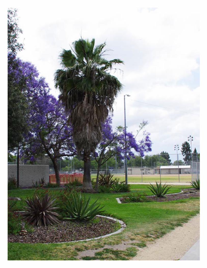
127
Safety and Health (SH)
VisionImprove safety through physical improvements and community-centered code enforcement, encourage active and healthy lifestyles, and expand health and safety resources within Florence-Firestone.
Background
A safe and healthy environment where community members feel secure in their homes, schools, parks, places of employment, and shopping and entertainment areas is key to achieving the community’s vision. Public safety is basic to all aspects of community development and cross cuts other land use elements, including the Environmental Justice and Industrial Areas elements. Access to recreation and healthy food is also important to improving public health in the community.
In 2017, CalEPA updated the CalEnviroscreen 3.0 to identify disadvantaged communities as those census tracts with a score of 75% or higher. A score of 75% or higher demonstrates a disproportionate burden on the community for particular environmental risks. Florence-Firestone received an average score of 75% and above on indicators related to particulate matter in the air, toxic releases, cleanup sites, solid waste sites near populated blocks, and overall pollution burden. Florence-Firestone also achieved scores of over 75% in a number of public health factors, including asthma related emergency visits and the rate of emergency department visits for heart attacks.
At community meetings, residents raised crime, gang activity, and safety as top issues. Litter and graffiti seen along the railroad and Blue Line rights-of-way, overpasses, billboards, vacant properties, alleyways, blank walls, and inoperable vehicles in the public right-of-way add to the negative view of safety. In addition to law enforcement, regular removal of litter and graffiti, greater visibility into public spaces and parks, and pedestrian-scale street lighting where feasible would enhance the perception of safety and comfort in public spaces.
Community SafetyThe Sheriff’s Department has coordinated with the California Highway Patrol to enhance the presence of law enforcement officers in the community. In addition, the community has developed active neighborhood block watch groups. Further coordination between public safety agencies, County

129
Departments and local neighborhood groups could more effectively promote community safety and strengthen community relations with government services.
Given the community’s young population, particular attention should be focused on strengthening safety around schools, such as enforcement of traffic regulations near schools, implementation of the “Safe Routes to School Initiative,” and traffic calming measures near public spaces and schools.
Environmental DesignThe perception of safety influences behavior in and use of public spaces, including streets, sidewalks, parks, and transit stations. Enhancing the pedestrian environment with wider sidewalks, more crosswalks, and pedestrian-scale lighting can promote mobility and active use of public space and increase visibility. Clean, active, visible public space can improve the perception of safety.
Proactively addressing code violations, including removal of illegal outdoor storage in commercial and industrial areas as well as enhanced maintenance, removal of litter, junk and salvage materials, and graffiti would improve the physical environment and help with the perception of safety.
Active and Healthy ResidentsImproving street infrastructure and recreational space to support physical activity, such as walking and bicycling, can increase the level of physical activity in the community. Improvement to bicycle facilities may discourage bicyclist who often use sidewalks and decrease conflict with pedestrians. Joint use of schools for recreational purpose during non-school hours should be explored to increase recreational opportunities and take advantage of existing resources in the community.
Ongoing public outreach and education by the County Department of Public Health and Department of Health Services should be supported to increase the level of knowledge on health and wellness programs, nutrition, and healthy health issues and available resources.
Healthy FoodCommunity members have identified a need to easily access high quality, affordable, and healthy food options at local grocery stores, supermarkets, eateries, and in schools. In addition, community members have commented
Florence-Firestone Health Fair
GOALS AND POLICIES - SAFETY AND HEALTH (SH)
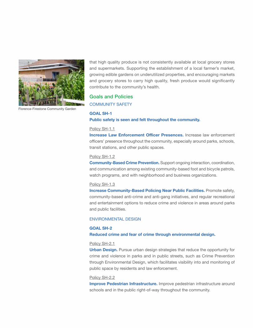
that high quality produce is not consistently available at local grocery stores and supermarkets. Supporting the establishment of a local farmer’s market, growing edible gardens on underutilized properties, and encouraging markets and grocery stores to carry high quality, fresh produce would significantly contribute to the community’s health.
Goals and PoliciesCOMMUNITY SAFETY
GOAL SH-1 Public safety is seen and felt throughout the community.
Policy SH-1.1 IncreaseLawEnforcementOfficerPresences. Increase law enforcement officers’ presence throughout the community, especially around parks, schools, transit stations, and other public spaces.
Policy SH-1.2 Community-Based Crime Prevention. Support ongoing interaction, coordination, and communication among existing community-based foot and bicycle patrols, watch programs, and with neighborhood and business organizations.
Policy SH-1.3 Increase Community-Based Policing Near Public Facilities. Promote safety, community-based anti-crime and anti-gang initiatives, and regular recreational and entertainment options to reduce crime and violence in areas around parks and public facilities.
ENVIRONMENTAL DESIGN
GOAL SH-2 Reduced crime and fear of crime through environmental design.
Policy SH-2.1 Urban Design. Pursue urban design strategies that reduce the opportunity for crime and violence in parks and in public streets, such as Crime Prevention through Environmental Design, which facilitates visibility into and monitoring of public space by residents and law enforcement.
Policy SH-2.2 Improve Pedestrian Infrastructure. Improve pedestrian infrastructure around schools and in the public right-of-way throughout the community.
Florence-Firestone Community Garden
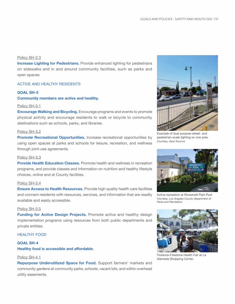
131
Policy SH-2.3 Increase Lighting for Pedestrians. Provide enhanced lighting for pedestrians on sidewalks and in and around community facilities, such as parks and open spaces.
ACTIVE AND HEALTHY RESIDENTS
GOAL SH-3 Community members are active and healthy.
Policy SH-3.1 Encourage Walking and Bicycling. Encourage programs and events to promote physical activity and encourage residents to walk or bicycle to community destinations such as schools, parks, and libraries.
Policy SH-3.2 Promote Recreational Opportunities. Increase recreational opportunities by using open spaces at parks and schools for leisure, recreation, and wellness through joint-use agreements.
Policy SH-3.3 Provide Health Education Classes. Promote health and wellness in recreation programs, and provide classes and information on nutrition and healthy lifestyle choices, online and at County facilities.
Policy SH-3.4 Ensure Access to Health Resources. Provide high quality health care facilities and connect residents with resources, services, and information that are readily available and easily accessible.
Policy SH-3.5 Funding for Active Design Projects. Promote active and healthy design implementation programs using resources from both public departments and private entities.
HEALTHY FOOD
GOAL SH-4 Healthyfoodisaccessibleandaffordable.
Policy SH-4.1 Repurpose Underutilized Space for Food. Support farmers’ markets and community gardens at community parks, schools, vacant lots, and within overhead utility easements.
Active recreation at Roosevelt Park PoolCourtesy, Los Angeles County Department of Parks and Recreation
Example of dual purpose street- and pedestrian-scale lighting on one pole. Courtesy, Daryl Koonce
Florence-Firestone Health Fair at La Alameda Shopping Center.
GOALS AND POLICIES - SAFETY AND HEALTH (SH)
Policy SH-4.2 Repurpose Underutilized Space for Food. Support farmers’ markets and community gardens at community parks, schools, vacant lots, and within overhead utility easements.
Policy SH-4.2 Urban Agriculture. Promote the use of the Urban Agriculture Incentive Zone (UAIZ) and other incentives to convert underutilized properties and expand access to healthy and affordable foods.
Policy SH-4.3 Encourage Fresh Food Options Through Permits. Encourage supermarkets, food vendors, eateries, and other food related retailers to provide healthy, fresh food options through outreach and also by applying conditions in discretionary projects.
Policy SH-4.4 Edible Gardens in New Developments. Provide space for edible gardens within new developments.
General Plan Policy
Community WellnessPolicy LU 9.3: Encourage patterns of development that increase convenient, safe access to healthy foods, especially fresh produce, in all neighborhoods.
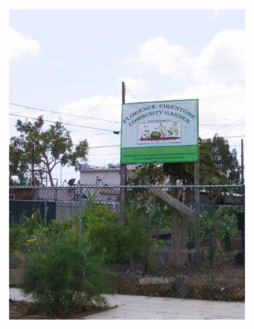
133
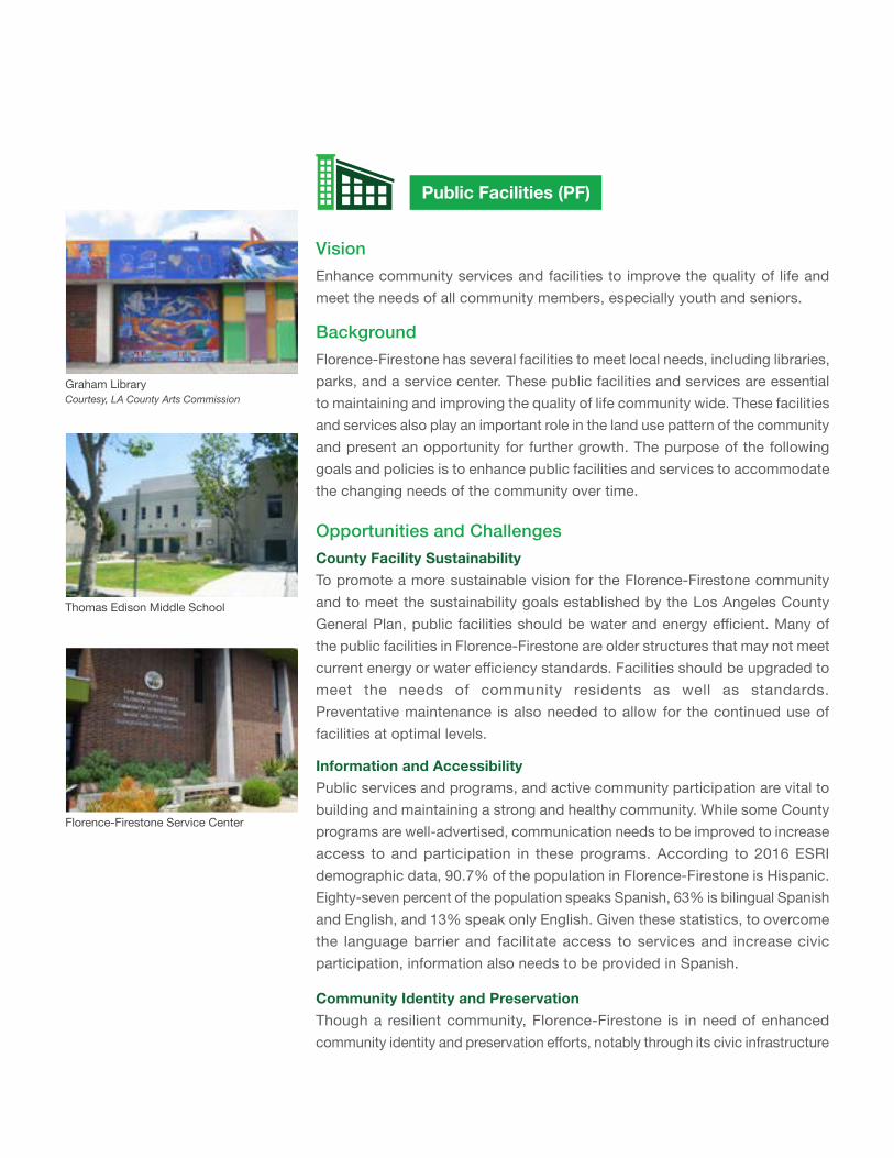
Public Facilities (PF)
VisionEnhance community services and facilities to improve the quality of life and meet the needs of all community members, especially youth and seniors.
Background
Florence-Firestone has several facilities to meet local needs, including libraries, parks, and a service center. These public facilities and services are essential to maintaining and improving the quality of life community wide. These facilities and services also play an important role in the land use pattern of the community and present an opportunity for further growth. The purpose of the following goals and policies is to enhance public facilities and services to accommodate the changing needs of the community over time.
Opportunities and ChallengesCounty Facility SustainabilityTo promote a more sustainable vision for the Florence-Firestone community and to meet the sustainability goals established by the Los Angeles County General Plan, public facilities should be water and energy efficient. Many of the public facilities in Florence-Firestone are older structures that may not meet current energy or water efficiency standards. Facilities should be upgraded to meet the needs of community residents as well as standards. Preventative maintenance is also needed to allow for the continued use of facilities at optimal levels.
Information and AccessibilityPublic services and programs, and active community participation are vital to building and maintaining a strong and healthy community. While some County programs are well-advertised, communication needs to be improved to increase access to and participation in these programs. According to 2016 ESRI demographic data, 90.7% of the population in Florence-Firestone is Hispanic. Eighty-seven percent of the population speaks Spanish, 63% is bilingual Spanish and English, and 13% speak only English. Given these statistics, to overcome the language barrier and facilitate access to services and increase civic participation, information also needs to be provided in Spanish.
Community Identity and PreservationThough a resilient community, Florence-Firestone is in need of enhanced community identity and preservation efforts, notably through its civic infrastructure
Graham LibraryCourtesy, LA County Arts Commission
Thomas Edison Middle School
Florence-Firestone Service Center
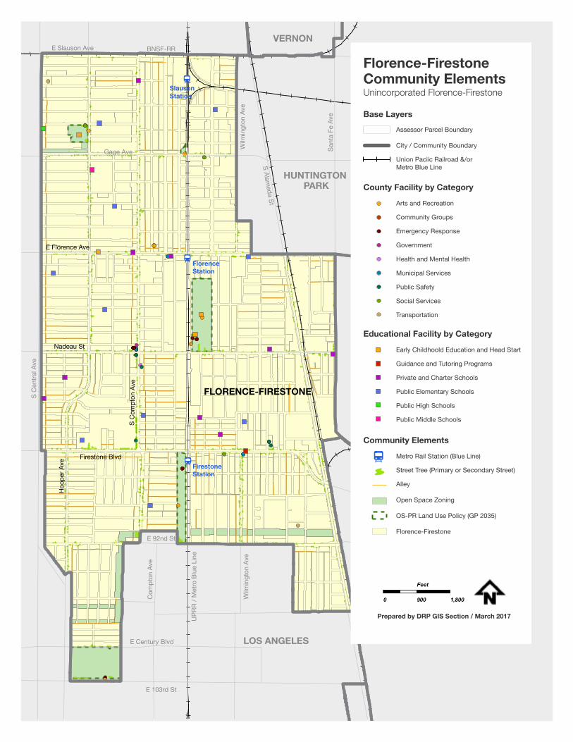
135
Slauson Station
Florence Station
Firestone Station
E 103rd St
E Century Blvd
Wilm
ingt
on A
ve
UPR
R / M
etro
Blu
e Li
ne
Com
pton
Ave
S C
entra
l Ave
E 92nd St
LOS ANGELES
HUNTINGTON PARK
VERNON
S Alameda St
Wilm
ingt
on A
ve
Sant
a Fe
Ave
Gage Ave
E Slauson Ave BNSF-RR
FLORENCE-FIRESTONE
Firestone Blvd
S C
ompt
on A
ve
Hoo
per A
ve
Nadeau St
E Florence Ave
Arts and Recreation
Community Groups
Emergency Response
Government
Health and Mental Health
Municipal Services
Public Safety
Social Services
Transportation
Assessor Parcel Boundary
City / Community Boundary
Union Paciic Railroad &/or Metro Blue Line
Base Layers
County Facility by Category
Florence-FirestoneCommunity ElementsUnincorporated Florence-Firestone
0 900 1,800
Feet
Prepared by DRP GIS Section / March 2017
Early Childhoold Education and Head Start
Guidance and Tutoring Programs
Private and Charter Schools
Public Elementary Schools
Public High Schools
Public Middle Schools
Educational Facility by Category
Metro Rail Station (Blue Line)
Street Tree (Primary or Secondary Street)
Alley
Open Space Zoning
OS-PR Land Use Policy (GP 2035)
Florence-Firestone
Community Elements
and public facilities. Residents have commented on the lack of accessible community spaces in Florence-Firestone, while existing public facilities have been consolidated or moved. Though the building stock in the community is relatively old compared to surrounding communities, several public facilities of historic significance lack protected status, and could eventually be threatened with development. One such building is the old Firestone Sheriff’s Station, which was the first sheriff’s station in the county to have an African American captain, as well as the first station that allowed African American officers to ride in patrol cars. This structure no longer houses a sheriff’s station, but hosts the Youth Activity League, a foundation partnered with the Sheriff’s Department. Historic properties act as cornerstones on which to build community identity. Community programs and public involvement also help bolster a sense of community identity. Though there are several existing programs in place, such as the Youth Activity League, there is a need for more youth programs and recreation opportunities.
Goals and PoliciesCOUNTY FACILITY SUSTAINABILITY AND MAINTENANCE
GOAL PF-1 County facilities in Florence-Firestone are well-maintained, environmentally sustainable,andefficient.
Policy PF-1.1 Sustainability Benchmarks. Ensure all new County buildings meet the goals of environmental sustainability, carbon footprint reduction, water conservation, and energy conservation by conducting an environmental audit of all County facilities in Florence-Firestone.
Policy PF-1.2 Facility Maintenance. Ensure that routine maintenance and operations work optimizes water and energy conservation, and prolong the life of existing County buildings and facilities through preventative maintenance programs and procedures.
Policy PF-1.3 Renewable Energy and Conservation. Utilize strategies to conserve water and energy in Florence-Firestone public facilities and transition to alternative renewable energy sources, such as wind and solar, where feasible.
137
General Plan Policies
Sufficient InfrastructurePolicy PS/F 1.4: Ensure the adequate maintenance of infrastructure.
Policy PS/F 1.7: Consider resource preservation in the planning of public facilities.
Water ConservationPolicy PS/F 2.1: Support water conservation measures.
Policy PS/F 2.2: Support educational outreach efforts that discourage wasteful water consumption.
Utility InfrastructurePolicy PS/F 6.8: Encourage projects that incorporate onsite renewable energy systems.
INFORMATION AND ACCESSIBILITY
GOAL PF-2 Community residents are well-informed of County services and resources, which are easily and safely accessible.
Policy PF-2.1 Public Spaces. Increase awareness and engage residents about County resources through community events in public spaces, including parks and schools.
Policy PF-2.2 Service Information. Require all County public service agencies to provide coordinated, up to date information on County services at community parks, libraries, and service centers.
Policy PF-2.3 Language Accessibility. Provide informational materials in multiple languages to increase accessibility.
Policy PF-2.4 Existing Services. Raise awareness of existing County services available to community members through multiple forms of engagement including mailings, social media, pop-up outreach events, and handouts available at community centers.
GOALS AND POLICIES - PUBLIC FACILITIES (PF)
Policy PF-2.5 Health Clinics. Provide public information and ensure access to community health clinics and surrounding medical institutions.
Policy PF-2.6 Safe Access. Target public safety measures to ensure safe access to parks, playgrounds, other recreational facilities, and public facilities.
General Plan Policies
Sufficient InfrastructurePolicy PS/F 1.3: Ensure coordinated service provision through collaboration between County departments and service providers.
Policy PS/F 1.6: Support multi-faceted public facility expansion efforts, such as substations, mobile units, and satellite offices.
PUBLIC FACILITIES AND ENRICHMENT
GOAL PF-3 Public facilities in Florence-Firestone reinforce shared community identity, offeringspacesforinteractionandenrichment.
Policy PF-3.1 Civic Center. Establish a location to focus the concentration of public services around the intersection of Compton Avenue and Nadeau Street, including the implementation of signage and streetscape improvements to brand the intersection as a Civic Center district of Florence-Firestone.
Policy PF-3.2 Shared Use of Public Facilities. Provide space to use within public facilities for the community and community-serving non-profit organizations for community meetings, events, workshops, or other such uses.
Policy PF-3.3 Youth Engagement. Provide designated spaces for youth within County facilities, and encourage opportunities for youth to engage in community development, volunteer efforts, and recreation programs.
Policy PF-3.4 Library Resources. Expand library facilities and educational resources in Florence-Firestone. (Refer to the Library System section of the Public Services and Facilities element of the General Plan for more information.)
139
Policy PF-3.5 Historic Preservation. Protect and preserve historic public facilities in Florence-Firestone, through inventory, repair, and restoration.
Policy PF-3.6 Signage. Improve and enhance educational, informational, and regulatory signage at County parks and facilities, as appropriate.
Policy PF-3.7 Joint-Use Agreements. Require new public school development subject to discretionary review in Florence-Firestone to include Joint-Use Agreements to maximize public use and enrichment opportunities. (Refer to the Early Care and Educational Facilities section of the Public Services and Facilities element of the General Plan for more information.)
Policy PF-3.8 Local Sponsorships. Support youth programs and activities by partnering with local organizations and businesses to leverage community resources and hold events in public facilities.
Policy PF-3.9 Alternative Uses. Encourage alternative use of public facilities outside of normal works hours for community activities, including farmer’s markets, community events, community meeting space, storage space for local community organizations, or other uses.
General Plan Policies
Early Care and Educational FacilitiesPolicy PS/F 7.1: Encourage the joint-use of school sites for community activities and other appropriate uses.
Policy PS/F 7.2: Proactively work with school facilities and education providers to coordinate land use and facilities planning.
Policy PS/F 7.3: Encourage adequate facilities for early care and education.
Library SystemPolicy PS/F 8.1: Ensure a desired level of library service through coordinated land use and facilities planning.
GOALS AND POLICIES - PUBLIC FACILITIES (PF)
Building Partnerships (B)
VisionTo promote strong civic engagement, support community-based organizations, build partnerships across the public, private, and nonprofit sectors, and empower community members to access local resources and effectively respond to local concerns.
Background Florence Firestone has strong community partnerships. While the community is home to several community-based organizations (CBO’s), one of the exemplary public-private partnerships is the Florence-Firestone Community Leaders (FFCL). This group grew out of the Florence-Firestone Community Enhancement Team (FFCET), which was formed in 2002, and comprised of County departments and community advocates. The FFCET focused on improving service delivery and nuisance abatement, including enhancing commercial corridors, graffiti removal, and crime suppression with the support of the County.
The FFCL was formed in 2005 as a stakeholder led coalition. The FFCL is comprised of residents, merchants, chamber of commerce representatives, nonprofits, faith-based groups, County departments, and law enforcement officers. Community members are elected to the executive board and lead the organization’s efforts. The County worked with the FFCL on education campaigns against illegal dumping, neighborhood clean-ups, and the countywide Yard Sale Ordinance. The FFCL also maintains strong relationships with the local Century Sheriff’s Station and California Highway Patrol (CHP) office. Century Sheriff’s Station coordinates the annual National Night Out and Neighborhood Watch programs with Florence-Firestone community members and offers an annual eight-week Citizen’s Academy to educate the community about policing. This model relationship between law enforcement and community members exemplifies the importance of public-private partnerships in Florence-Firestone.
Other community-based organizations with a strong presence in Florence-Firestone include:
• Florence-Firestone / Walnut Park Chamber of Commerce• Florence-Firestone Merchants Association• Florence-Firestone / Walnut Park Community Partnership• Bethune Block Club• Whitsett Block Club• Antwerp Environmental Block Watch Group (over 40 years of service)
141
• Rescare / Worksource• Inner City Visions• Faith-based organizations, including St. Aloysius Catholic Church, St.
Malachy Catholic Church, and St. Stephen AME Church, among others.
Opportunities and Challenges
Enhanced and New PartnershipsWhile Florence-Firestone enjoys strong community partnerships, there is room to improve relationships and explore new collaborations. The community will benefit from enhancing partnerships with existing state government partners, including the State Assembly and Senate offices to gain insight and provide feedback on policy issues and impacts in the community. Further, local stakeholders should expand partnerships with L.A. County departments that are working on local projects and providing local services, including but not limited to the Departments of Regional Planning, Public Health, Mental Health, Probation, Parks and Recreation, Consumer and Business Affairs, Public Works, and Arts Commission. Also, a strong relationship with Metro representatives would greatly enhance the community and improve the areas around the three Metro Blue Line Stations. In addition, an expanded partnership with L.A. Unified School District representatives would help address local education concerns. Currently, representatives of various agencies attend community group meetings to introduce new project initiatives when requested by community members. Staff at state and local agencies have expertise on local issues, the ability to share knowledge and resources, and the ability to respond to community concerns. Expanding community group partnerships with state and local agencies can greatly enhance collaborative problem solving in Florence-Firestone.
Opportunities exist to explore innovative partnerships and further expand problem solving capacities in Florence-Firestone. Quality of life issues do not stop at municipal boundaries. Therefore, the Florence-Firestone community would benefit from partnering with adjacent jurisdictions, including Los Angeles Council Districts 9 and 15, City of South Gate, City of Huntington Park, and community groups in neighboring areas, including Watts and Green Meadows in City of L.A., South Gate, Huntington Park, and the Walnut Park Residents Association in unincorporated Walnut Park. As similar issues are raised in neighboring communities, reaching out and developing partnerships with
GOALS AND POLICIES - BUILDING PARTNERSHIPS (B)
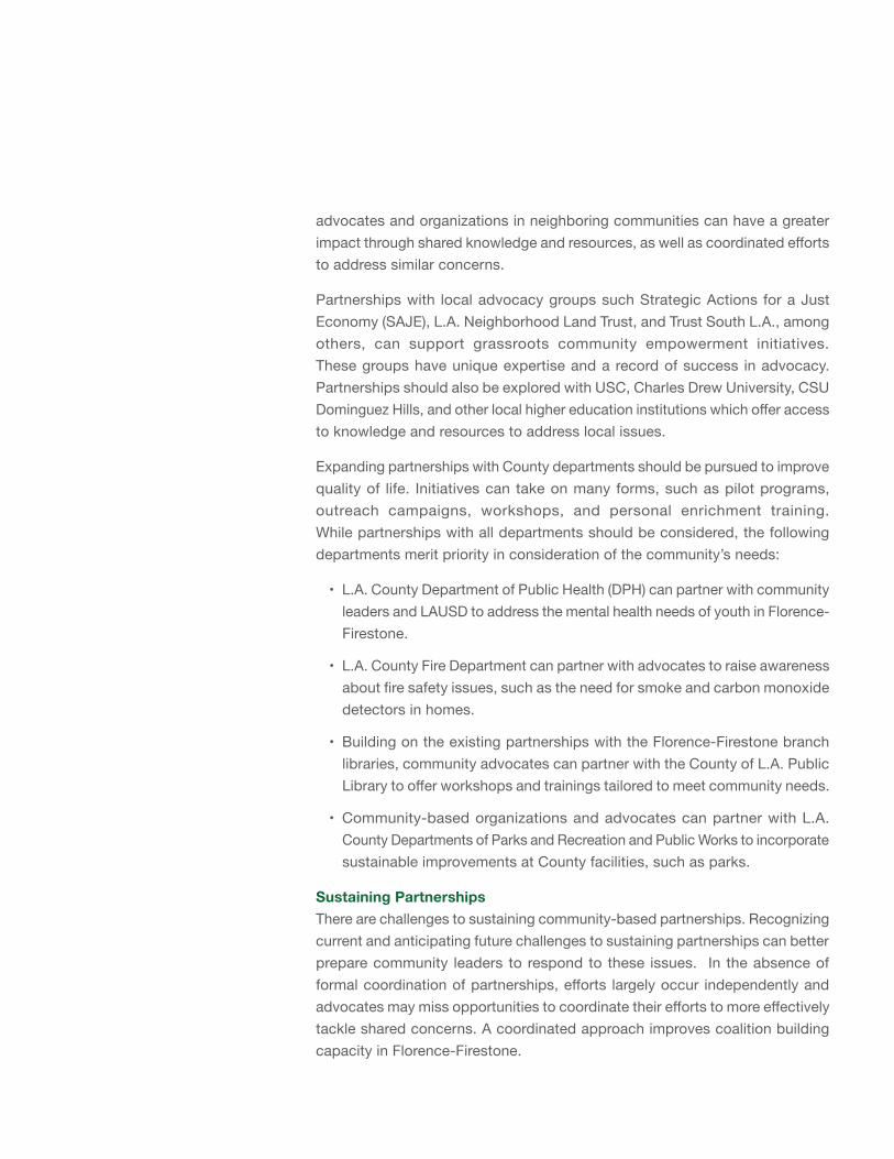
advocates and organizations in neighboring communities can have a greater impact through shared knowledge and resources, as well as coordinated efforts to address similar concerns.
Partnerships with local advocacy groups such Strategic Actions for a Just Economy (SAJE), L.A. Neighborhood Land Trust, and Trust South L.A., among others, can support grassroots community empowerment initiatives. These groups have unique expertise and a record of success in advocacy. Partnerships should also be explored with USC, Charles Drew University, CSU Dominguez Hills, and other local higher education institutions which offer access to knowledge and resources to address local issues.
Expanding partnerships with County departments should be pursued to improve quality of life. Initiatives can take on many forms, such as pilot programs, outreach campaigns, workshops, and personal enrichment training. While partnerships with all departments should be considered, the following departments merit priority in consideration of the community’s needs:
• L.A. County Department of Public Health (DPH) can partner with community leaders and LAUSD to address the mental health needs of youth in Florence-Firestone.
• L.A. County Fire Department can partner with advocates to raise awareness about fire safety issues, such as the need for smoke and carbon monoxide detectors in homes.
• Building on the existing partnerships with the Florence-Firestone branch libraries, community advocates can partner with the County of L.A. Public Library to offer workshops and trainings tailored to meet community needs.
• Community-based organizations and advocates can partner with L.A. County Departments of Parks and Recreation and Public Works to incorporate sustainable improvements at County facilities, such as parks.
Sustaining PartnershipsThere are challenges to sustaining community-based partnerships. Recognizing current and anticipating future challenges to sustaining partnerships can better prepare community leaders to respond to these issues. In the absence of formal coordination of partnerships, efforts largely occur independently and advocates may miss opportunities to coordinate their efforts to more effectively tackle shared concerns. A coordinated approach improves coalition building capacity in Florence-Firestone.
143
Currently, the community lacks educational programs to support partnership development and advocacy training. Community members draw from life and work experiences to inform their leadership efforts. While this approach has proven valuable, community members would benefit from formal training in community organizing, coalition building, and leadership to grow and sustain partnerships, as well as expand participation in community groups.
Further, a language barrier persists creating difficulties for Spanish-speaking community members to equally participate in advocacy efforts. This has the potential to isolate large segments of the local population. Partnerships must reflect the languages spoken in Florence-Firestone. Communications and advocacy work, to be effective, must reflect the community’s bilingualism. Training and information services delivered in Spanish should be offered for Spanish-speaking community advocates.
There is a great need for funding to support community-based efforts. Partnerships require an investment of time and resources from individuals and organizations. These investments come at a cost. Funding is needed to sustain existing partnerships and build new ones.
Finally, there is the potential for complacency among community groups and members. A risk exists in the assumption that civic engagement is unnecessary when circumstances improve or in the negative assumption that engagement will have no impact. Empowerment education and leadership training discredits these views. Training community advocates and encouraging civic engagement through community-based partnerships will enable continued, long-term community engagement.
Goals and Policies
GOAL B-1 Florence-Firestone is a community with strong public, private, and non-profitpartnerships.
Policy B-1.1 Encourage Partnerships. Encourage partnerships among community members and county and state agencies, non-profits, and community-based organizations, including public-private partnerships and interagency groups.
Policy B-1.2 Neighborhood Quality. Support partnerships that improve overall neighborhood quality, with an emphasis on civic engagement, improved public safety, and blight removal.
GOALS AND POLICIES - BUILDING PARTNERSHIPS (B)
Policy B-1.3 Non-ProfitStatus. Support nonprofit status for community groups to strengthen fundraising and organizing capabilities.
Policy B-1.4 Celebrate Partnerships. Celebrate and recognize the hard work of stakeholders and partners.
GOAL B-2 The community is empowered to organize, and community members are activelyengagedinmunicipalaffairsandlocaldecision-making.
Policy B 2.1 Community Organizing. Encourage and provide resources in support of community organizing.
Policy B-2.2 Community Participation. Promote community participation in planning, economic development, social policy, and public safety decision-making.
Policy B-2.3 Shared Responsibility in Partnerships. Foster shared responsibility and strengthen community-based organizations and partnerships to improve public space and private property.
Policy B-2.4 Grow Community-Based Organizations. Grow existing community-based organizations and initiate new partnerships to take a role in improving the neighborhood.
GOAL B-3 Community members have the knowledge, skills, and ability to take an active role in improving neighborhood conditions.
Policy B 3.1 Education and Training. Support education and training in community organizing and leadership for all community members to increase participation in neighborhood improvement, prioritizing training for members of the Florence-Firestone Community Leaders.
Policy B 3.2 Workshops. Support development of workshops and training programs at County library branches and other County facilities.
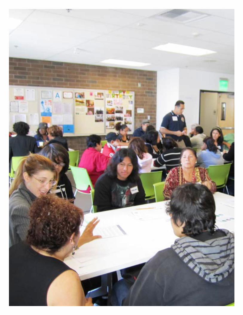
145
CHAPTER 5IMPLEMENTATION
The Implementation section presents a list of possible actions which help to realize the goals and policies of the plan. The actions, programs or procedures listed here are optional and are contingent on funding and allocation of resources.
The implementation table below lists the related policies and identifies the potential coordinating agencies. The list of actions is not intended to be comprehensive, but rather is presented as a list of possible actions to implement during the life of the plan to move the community closer to its vision. The actions are based on input from community members, stakeholder agencies, and studies prepared for the Community Plan.

147
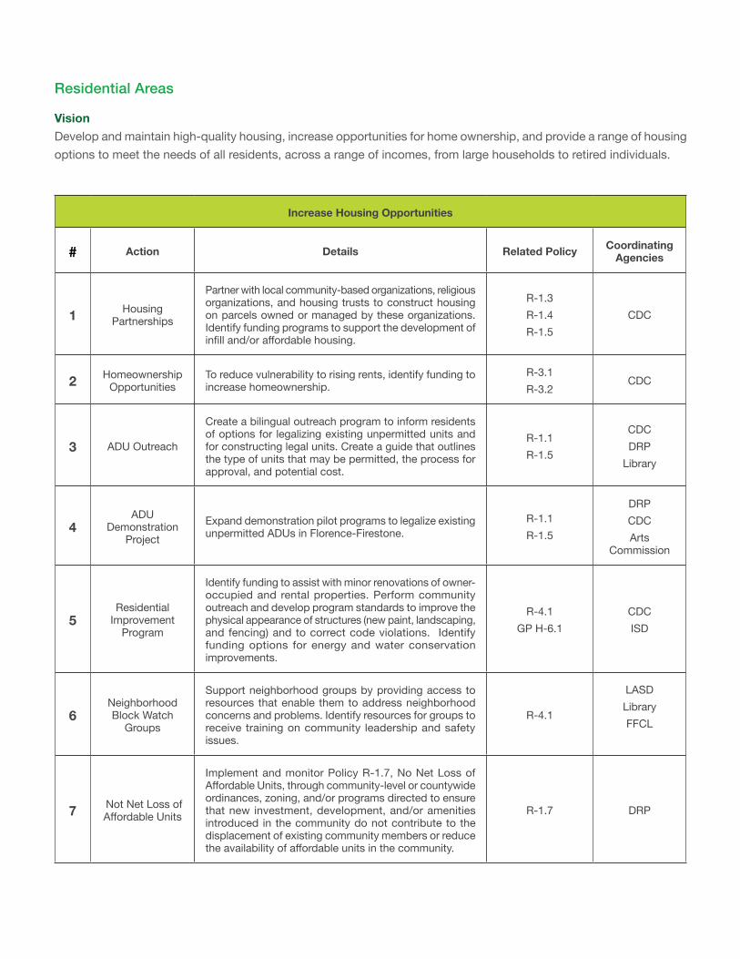
Increase Housing Opportunities
# Action Details Related Policy Coordinating Agencies
1 Housing Partnerships
Partner with local community-based organizations, religious organizations, and housing trusts to construct housing on parcels owned or managed by these organizations. Identify funding programs to support the development of infill and/or affordable housing.
R-1.3 R-1.4 R-1.5
CDC
2 Homeownership Opportunities
To reduce vulnerability to rising rents, identify funding to increase homeownership.
R-3.1 R-3.2
CDC
3 ADU Outreach
Create a bilingual outreach program to inform residents of options for legalizing existing unpermitted units and for constructing legal units. Create a guide that outlines the type of units that may be permitted, the process for approval, and potential cost.
R-1.1 R-1.5
CDC DRP
Library
4ADU
Demonstration Project
Expand demonstration pilot programs to legalize existing unpermitted ADUs in Florence-Firestone.
R-1.1 R-1.5
DRP CDC Arts
Commission
5Residential
Improvement Program
Identify funding to assist with minor renovations of owner-occupied and rental properties. Perform community outreach and develop program standards to improve the physical appearance of structures (new paint, landscaping, and fencing) and to correct code violations. Identify funding options for energy and water conservation improvements.
R-4.1 GP H-6.1
CDC ISD
6Neighborhood Block Watch
Groups
Support neighborhood groups by providing access to resources that enable them to address neighborhood concerns and problems. Identify resources for groups to receive training on community leadership and safety issues.
R-4.1
LASD Library FFCL
7 Not Net Loss of Affordable Units
Implement and monitor Policy R-1.7, No Net Loss of Affordable Units, through community-level or countywide ordinances, zoning, and/or programs directed to ensure that new investment, development, and/or amenities introduced in the community do not contribute to the displacement of existing community members or reduce the availability of affordable units in the community.
R-1.7 DRP
Residential Areas
VisionDevelop and maintain high-quality housing, increase opportunities for home ownership, and provide a range of housing options to meet the needs of all residents, across a range of incomes, from large households to retired individuals.
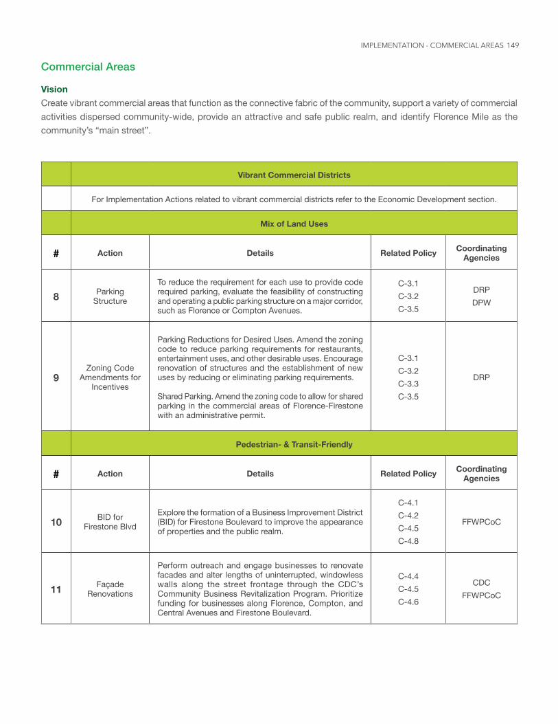
149
Commercial Areas
VisionCreate vibrant commercial areas that function as the connective fabric of the community, support a variety of commercial activities dispersed community-wide, provide an attractive and safe public realm, and identify Florence Mile as the community’s “main street”.
Vibrant Commercial Districts
For Implementation Actions related to vibrant commercial districts refer to the Economic Development section.
Mix of Land Uses
# Action Details Related Policy Coordinating Agencies
8 Parking Structure
To reduce the requirement for each use to provide code required parking, evaluate the feasibility of constructing and operating a public parking structure on a major corridor, such as Florence or Compton Avenues.
C-3.1 C-3.2 C-3.5
DRP DPW
9Zoning Code
Amendments for Incentives
Parking Reductions for Desired Uses. Amend the zoning code to reduce parking requirements for restaurants, entertainment uses, and other desirable uses. Encourage renovation of structures and the establishment of new uses by reducing or eliminating parking requirements.
Shared Parking. Amend the zoning code to allow for shared parking in the commercial areas of Florence-Firestone with an administrative permit.
C-3.1 C-3.2 C-3.3 C-3.5
DRP
Pedestrian- & Transit-Friendly
# Action Details Related Policy Coordinating Agencies
10 BID for Firestone Blvd
Explore the formation of a Business Improvement District (BID) for Firestone Boulevard to improve the appearance of properties and the public realm.
C-4.1 C-4.2 C-4.5 C-4.8
FFWPCoC
11 Façade Renovations
Perform outreach and engage businesses to renovate facades and alter lengths of uninterrupted, windowless walls along the street frontage through the CDC’s Community Business Revitalization Program. Prioritize funding for businesses along Florence, Compton, and Central Avenues and Firestone Boulevard.
C-4.4 C-4.5 C-4.6
CDC FFWPCoC
IMPLEMENTATION - COMMERCIAL AREAS
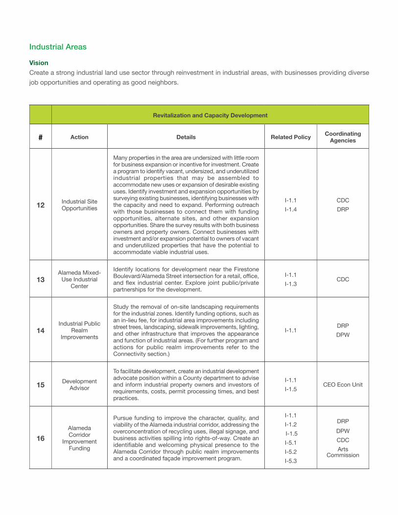
Industrial Areas
VisionCreate a strong industrial land use sector through reinvestment in industrial areas, with businesses providing diverse job opportunities and operating as good neighbors.
Revitalization and Capacity Development
# Action Details Related Policy Coordinating Agencies
12 Industrial Site Opportunities
Many properties in the area are undersized with little room for business expansion or incentive for investment. Create a program to identify vacant, undersized, and underutilized industrial properties that may be assembled to accommodate new uses or expansion of desirable existing uses. Identify investment and expansion opportunities by surveying existing businesses, identifying businesses with the capacity and need to expand. Performing outreach with those businesses to connect them with funding opportunities, alternate sites, and other expansion opportunities. Share the survey results with both business owners and property owners. Connect businesses with investment and/or expansion potential to owners of vacant and underutilized properties that have the potential to accommodate viable industrial uses.
I-1.1 I-1.4
CDC DRP
13Alameda Mixed-
Use Industrial Center
Identify locations for development near the Firestone Boulevard/Alameda Street intersection for a retail, office, and flex industrial center. Explore joint public/private partnerships for the development.
I-1.1 I-1.3
CDC
14Industrial Public
Realm Improvements
Study the removal of on-site landscaping requirements for the industrial zones. Identify funding options, such as an in-lieu fee, for industrial area improvements including street trees, landscaping, sidewalk improvements, lighting, and other infrastructure that improves the appearance and function of industrial areas. (For further program and actions for public realm improvements refer to the Connectivity section.)
I-1.1DRP DPW
15 Development Advisor
To facilitate development, create an industrial development advocate position within a County department to advise and inform industrial property owners and investors of requirements, costs, permit processing times, and best practices.
I-1.1 I-1.5
CEO Econ Unit
16Alameda Corridor
Improvement Funding
Pursue funding to improve the character, quality, and viability of the Alameda industrial corridor, addressing the overconcentration of recycling uses, illegal signage, and business activities spilling into rights-of-way. Create an identifiable and welcoming physical presence to the Alameda Corridor through public realm improvements and a coordinated façade improvement program.
I-1.1 I-1.2 I-1.5 I-5.1 I-5.2 I-5.3
DRP DPW CDC Arts
Commission
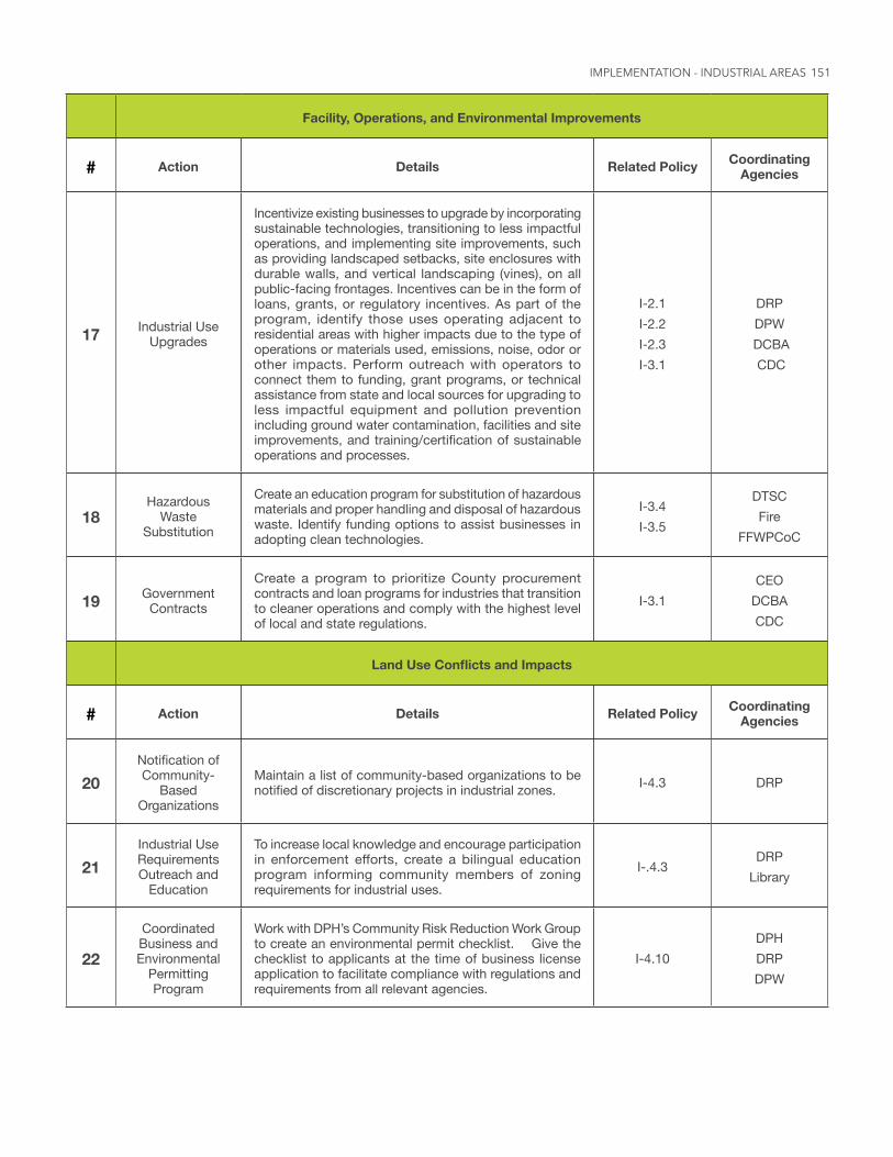
151
Facility, Operations, and Environmental Improvements
# Action Details Related Policy Coordinating Agencies
17 Industrial Use Upgrades
Incentivize existing businesses to upgrade by incorporating sustainable technologies, transitioning to less impactful operations, and implementing site improvements, such as providing landscaped setbacks, site enclosures with durable walls, and vertical landscaping (vines), on all public-facing frontages. Incentives can be in the form of loans, grants, or regulatory incentives. As part of the program, identify those uses operating adjacent to residential areas with higher impacts due to the type of operations or materials used, emissions, noise, odor or other impacts. Perform outreach with operators to connect them to funding, grant programs, or technical assistance from state and local sources for upgrading to less impactful equipment and pollution prevention including ground water contamination, facilities and site improvements, and training/certification of sustainable operations and processes.
I-2.1 I-2.2 I-2.3 I-3.1
DRP DPW
DCBA CDC
18Hazardous
Waste Substitution
Create an education program for substitution of hazardous materials and proper handling and disposal of hazardous waste. Identify funding options to assist businesses in adopting clean technologies.
I-3.4 I-3.5
DTSC Fire
FFWPCoC
19 Government Contracts
Create a program to prioritize County procurement contracts and loan programs for industries that transition to cleaner operations and comply with the highest level of local and state regulations.
I-3.1CEO
DCBA CDC
LandUseConflictsandImpacts
# Action Details Related Policy Coordinating Agencies
20Notification of Community-
Based Organizations
Maintain a list of community-based organizations to be notified of discretionary projects in industrial zones. I-4.3 DRP
21Industrial Use Requirements Outreach and
Education
To increase local knowledge and encourage participation in enforcement efforts, create a bilingual education program informing community members of zoning requirements for industrial uses.
I-.4.3 DRP
Library
22
Coordinated Business and Environmental
Permitting Program
Work with DPH’s Community Risk Reduction Work Group to create an environmental permit checklist. Give the checklist to applicants at the time of business license application to facilitate compliance with regulations and requirements from all relevant agencies.
I-4.10DPH DRP DPW
IMPLEMENTATION - INDUSTRIAL AREAS
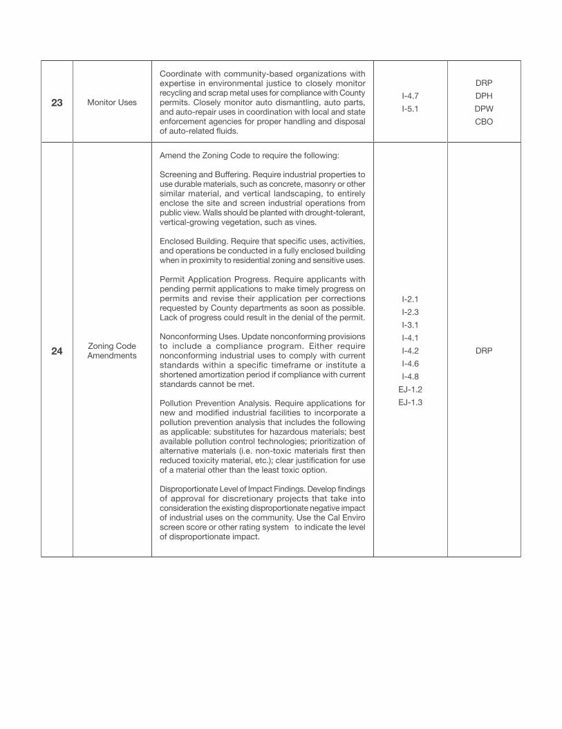
23 Monitor Uses
Coordinate with community-based organizations with expertise in environmental justice to closely monitor recycling and scrap metal uses for compliance with County permits. Closely monitor auto dismantling, auto parts, and auto-repair uses in coordination with local and state enforcement agencies for proper handling and disposal of auto-related fluids.
I-4.7 I-5.1
DRP DPH DPW CBO
24 Zoning Code Amendments
Amend the Zoning Code to require the following:
Screening and Buffering. Require industrial properties to use durable materials, such as concrete, masonry or other similar material, and vertical landscaping, to entirely enclose the site and screen industrial operations from public view. Walls should be planted with drought-tolerant, vertical-growing vegetation, such as vines.
Enclosed Building. Require that specific uses, activities, and operations be conducted in a fully enclosed building when in proximity to residential zoning and sensitive uses.
Permit Application Progress. Require applicants with pending permit applications to make timely progress on permits and revise their application per corrections requested by County departments as soon as possible. Lack of progress could result in the denial of the permit. Nonconforming Uses. Update nonconforming provisions to include a compliance program. Either require nonconforming industrial uses to comply with current standards within a specific timeframe or institute a shortened amortization period if compliance with current standards cannot be met.
Pollution Prevention Analysis. Require applications for new and modified industrial facilities to incorporate a pollution prevention analysis that includes the following as applicable: substitutes for hazardous materials; best available pollution control technologies; prioritization of alternative materials (i.e. non-toxic materials first then reduced toxicity material, etc.); clear justification for use of a material other than the least toxic option.
Disproportionate Level of Impact Findings. Develop findings of approval for discretionary projects that take into consideration the existing disproportionate negative impact of industrial uses on the community. Use the Cal Enviro screen score or other rating system to indicate the level of disproportionate impact.
I-2.1 I-2.3 I-3.1 I-4.1 I-4.2 I-4.6 I-4.8
EJ-1.2 EJ-1.3
DRP
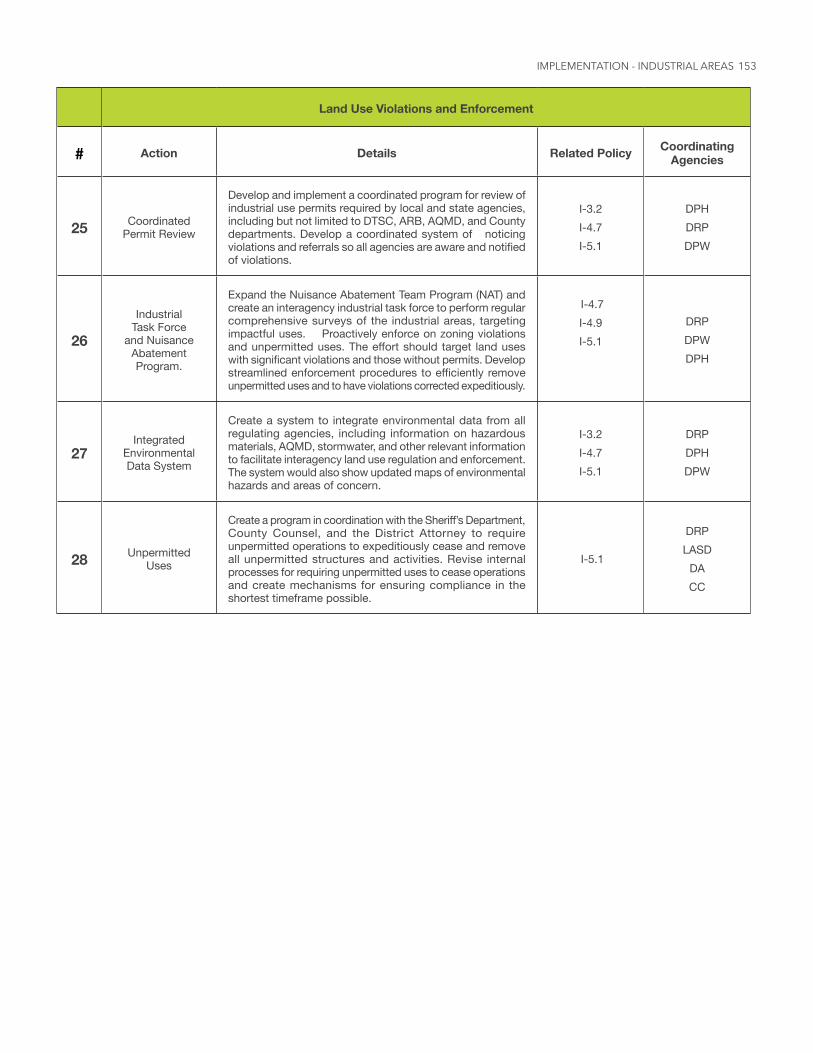
153
Land Use Violations and Enforcement
# Action Details Related Policy Coordinating Agencies
25 Coordinated Permit Review
Develop and implement a coordinated program for review of industrial use permits required by local and state agencies, including but not limited to DTSC, ARB, AQMD, and County departments. Develop a coordinated system of noticing violations and referrals so all agencies are aware and notified of violations.
I-3.2 I-4.7 I-5.1
DPH DRP DPW
26
Industrial Task Force
and Nuisance Abatement Program.
Expand the Nuisance Abatement Team Program (NAT) and create an interagency industrial task force to perform regular comprehensive surveys of the industrial areas, targeting impactful uses. Proactively enforce on zoning violations and unpermitted uses. The effort should target land uses with significant violations and those without permits. Develop streamlined enforcement procedures to efficiently remove unpermitted uses and to have violations corrected expeditiously.
I-4.7 I-4.9 I-5.1
DRP DPW DPH
27Integrated
Environmental Data System
Create a system to integrate environmental data from all regulating agencies, including information on hazardous materials, AQMD, stormwater, and other relevant information to facilitate interagency land use regulation and enforcement. The system would also show updated maps of environmental hazards and areas of concern.
I-3.2 I-4.7 I-5.1
DRP DPH DPW
28 Unpermitted Uses
Create a program in coordination with the Sheriff’s Department, County Counsel, and the District Attorney to require unpermitted operations to expeditiously cease and remove all unpermitted structures and activities. Revise internal processes for requiring unpermitted uses to cease operations and create mechanisms for ensuring compliance in the shortest timeframe possible.
I-5.1
DRP LASD
DA CC
IMPLEMENTATION - INDUSTRIAL AREAS
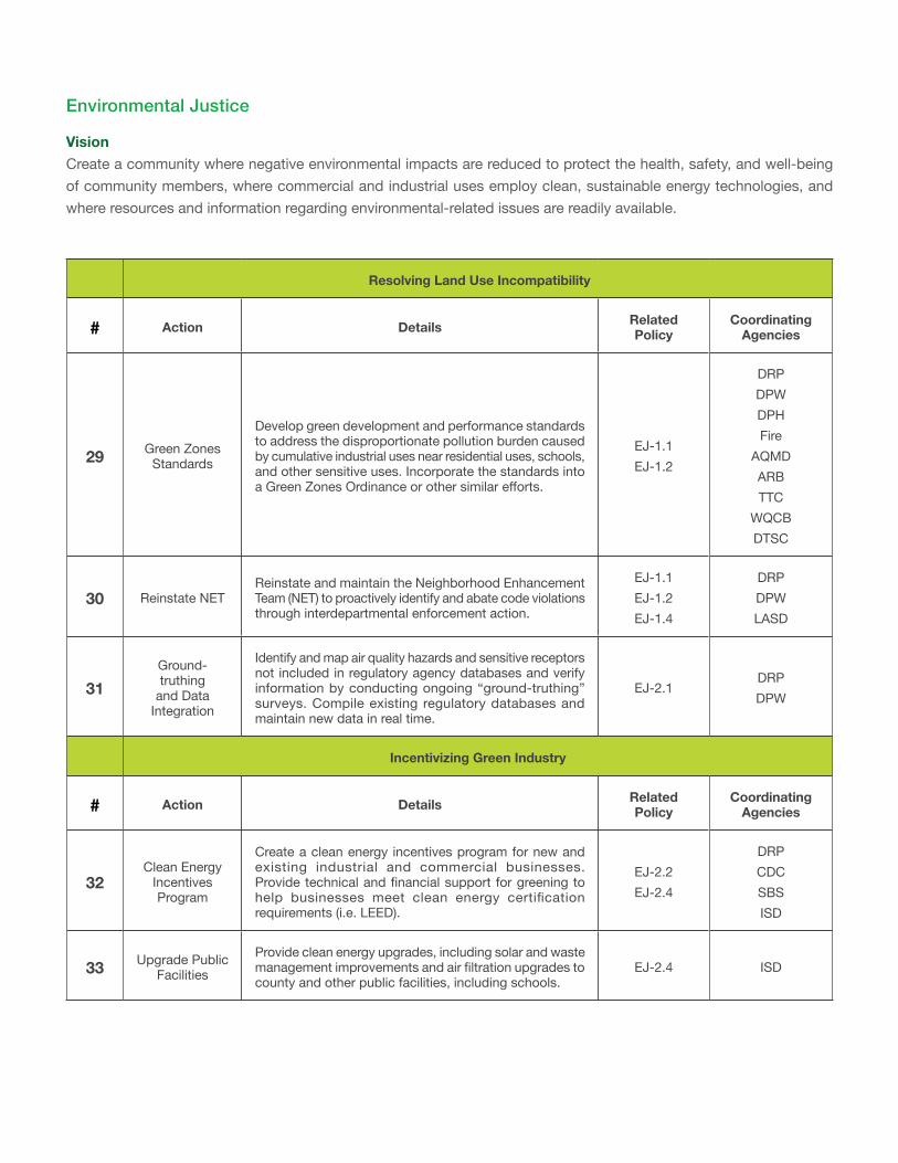
Environmental Justice
VisionCreate a community where negative environmental impacts are reduced to protect the health, safety, and well-being of community members, where commercial and industrial uses employ clean, sustainable energy technologies, and where resources and information regarding environmental-related issues are readily available.
Resolving Land Use Incompatibility
# Action Details Related Policy
Coordinating Agencies
29 Green Zones Standards
Develop green development and performance standards to address the disproportionate pollution burden caused by cumulative industrial uses near residential uses, schools, and other sensitive uses. Incorporate the standards into a Green Zones Ordinance or other similar efforts.
EJ-1.1 EJ-1.2
DRP DPW DPH Fire
AQMD ARB TTC
WQCB DTSC
30 Reinstate NETReinstate and maintain the Neighborhood Enhancement Team (NET) to proactively identify and abate code violations through interdepartmental enforcement action.
EJ-1.1 EJ-1.2 EJ-1.4
DRP DPW LASD
31Ground-truthing
and Data Integration
Identify and map air quality hazards and sensitive receptors not included in regulatory agency databases and verify information by conducting ongoing “ground-truthing” surveys. Compile existing regulatory databases and maintain new data in real time.
EJ-2.1DRP DPW
Incentivizing Green Industry
# Action Details Related Policy
Coordinating Agencies
32Clean Energy
Incentives Program
Create a clean energy incentives program for new and existing industrial and commercial businesses. Provide technical and financial support for greening to help businesses meet clean energy certification requirements (i.e. LEED).
EJ-2.2 EJ-2.4
DRP CDC SBS ISD
33 Upgrade Public Facilities
Provide clean energy upgrades, including solar and waste management improvements and air filtration upgrades to county and other public facilities, including schools.
EJ-2.4 ISD
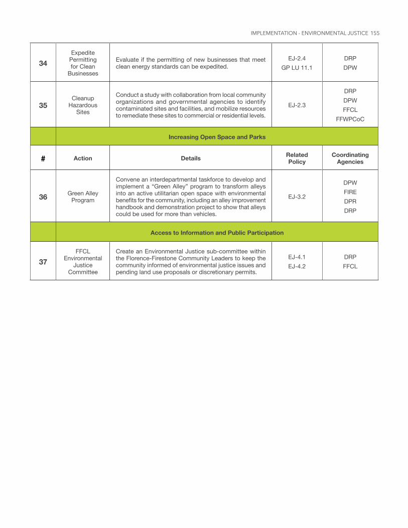
155
34Expedite
Permitting for Clean
Businesses
Evaluate if the permitting of new businesses that meet clean energy standards can be expedited.
EJ-2.4 GP LU 11.1
DRP DPW
35Cleanup
Hazardous Sites
Conduct a study with collaboration from local community organizations and governmental agencies to identify contaminated sites and facilities, and mobilize resources to remediate these sites to commercial or residential levels.
EJ-2.3
DRP DPW FFCL
FFWPCoC
Increasing Open Space and Parks
# Action Details Related Policy
Coordinating Agencies
36 Green Alley Program
Convene an interdepartmental taskforce to develop and implement a “Green Alley” program to transform alleys into an active utilitarian open space with environmental benefits for the community, including an alley improvement handbook and demonstration project to show that alleys could be used for more than vehicles.
EJ-3.2
DPW FIRE DPR DRP
Access to Information and Public Participation
37FFCL
Environmental Justice
Committee
Create an Environmental Justice sub-committee within the Florence-Firestone Community Leaders to keep the community informed of environmental justice issues and pending land use proposals or discretionary permits.
EJ-4.1 EJ-4.2
DRP FFCL
IMPLEMENTATION - ENVIRONMENTAL JUSTICE
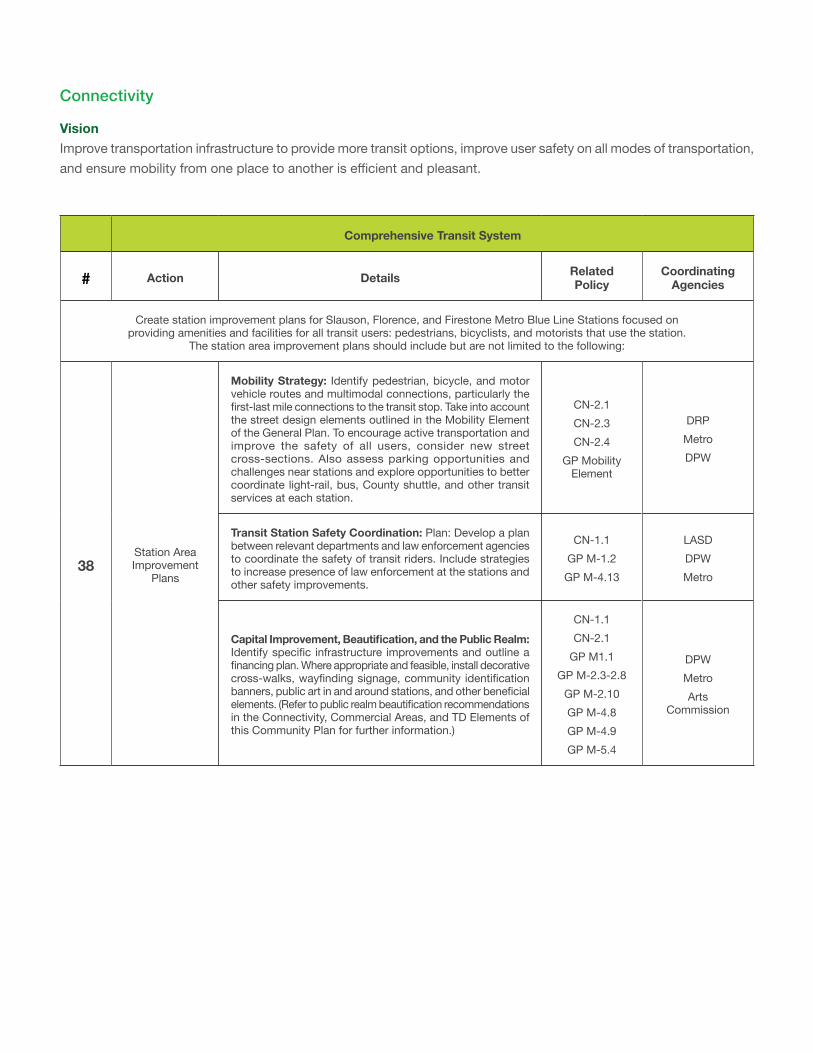
Comprehensive Transit System
# Action Details Related Policy
Coordinating Agencies
Create station improvement plans for Slauson, Florence, and Firestone Metro Blue Line Stations focused on providing amenities and facilities for all transit users: pedestrians, bicyclists, and motorists that use the station.
The station area improvement plans should include but are not limited to the following:
38Station Area Improvement
Plans
Mobility Strategy: Identify pedestrian, bicycle, and motor vehicle routes and multimodal connections, particularly the first-last mile connections to the transit stop. Take into account the street design elements outlined in the Mobility Element of the General Plan. To encourage active transportation and improve the safety of all users, consider new street cross-sections. Also assess parking opportunities and challenges near stations and explore opportunities to better coordinate light-rail, bus, County shuttle, and other transit services at each station.
CN-2.1 CN-2.3 CN-2.4
GP Mobility Element
DRP Metro DPW
Transit Station Safety Coordination: Plan: Develop a plan between relevant departments and law enforcement agencies to coordinate the safety of transit riders. Include strategies to increase presence of law enforcement at the stations and other safety improvements.
CN-1.1 GP M-1.2
GP M-4.13
LASD DPW Metro
CapitalImprovement,Beautification,andthePublicRealm:Identify specific infrastructure improvements and outline a financing plan. Where appropriate and feasible, install decorative cross-walks, wayfinding signage, community identification banners, public art in and around stations, and other beneficial elements. (Refer to public realm beautification recommendations in the Connectivity, Commercial Areas, and TD Elements of this Community Plan for further information.)
CN-1.1 CN-2.1
GP M1.1 GP M-2.3-2.8
GP M-2.10 GP M-4.8 GP M-4.9 GP M-5.4
DPW Metro Arts
Commission
Connectivity
VisionImprove transportation infrastructure to provide more transit options, improve user safety on all modes of transportation, and ensure mobility from one place to another is efficient and pleasant.
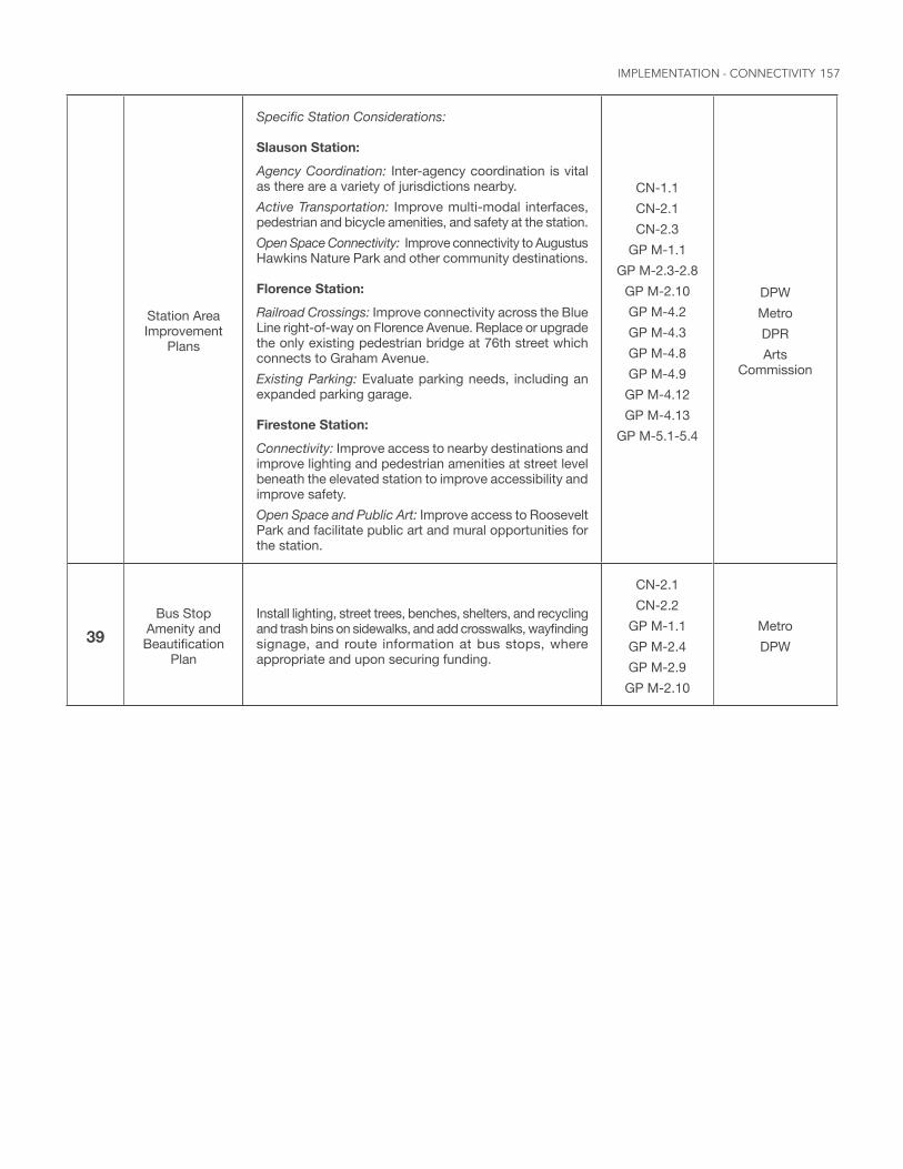
157
Station Area Improvement
Plans
Specific Station Considerations:
Slauson Station:Agency Coordination: Inter-agency coordination is vital as there are a variety of jurisdictions nearby.Active Transportation: Improve multi-modal interfaces, pedestrian and bicycle amenities, and safety at the station.Open Space Connectivity: Improve connectivity to Augustus Hawkins Nature Park and other community destinations.
Florence Station:Railroad Crossings: Improve connectivity across the Blue Line right-of-way on Florence Avenue. Replace or upgrade the only existing pedestrian bridge at 76th street which connects to Graham Avenue.Existing Parking: Evaluate parking needs, including an expanded parking garage.
Firestone Station:Connectivity: Improve access to nearby destinations and improve lighting and pedestrian amenities at street level beneath the elevated station to improve accessibility and improve safety.Open Space and Public Art: Improve access to Roosevelt Park and facilitate public art and mural opportunities for the station.
CN-1.1 CN-2.1 CN-2.3
GP M-1.1 GP M-2.3-2.8
GP M-2.10 GP M-4.2 GP M-4.3 GP M-4.8 GP M-4.9
GP M-4.12 GP M-4.13
GP M-5.1-5.4
DPW Metro DPR Arts
Commission
39Bus Stop
Amenity and Beautification
Plan
Install lighting, street trees, benches, shelters, and recycling and trash bins on sidewalks, and add crosswalks, wayfinding signage, and route information at bus stops, where appropriate and upon securing funding.
CN-2.1 CN-2.2
GP M-1.1 GP M-2.4 GP M-2.9
GP M-2.10
Metro DPW
IMPLEMENTATION - CONNECTIVITY
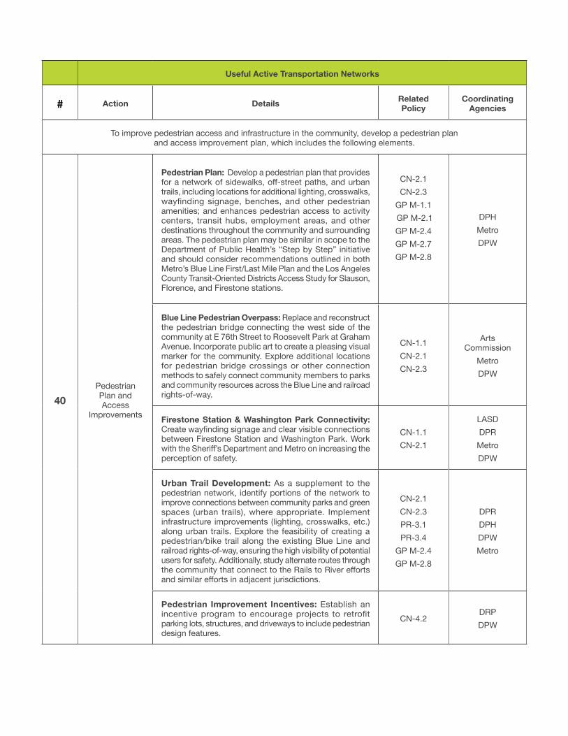
Useful Active Transportation Networks
# Action Details Related Policy
Coordinating Agencies
To improve pedestrian access and infrastructure in the community, develop a pedestrian plan and access improvement plan, which includes the following elements.
40Pedestrian Plan and Access
Improvements
Pedestrian Plan: Develop a pedestrian plan that provides for a network of sidewalks, off-street paths, and urban trails, including locations for additional lighting, crosswalks, wayfinding signage, benches, and other pedestrian amenities; and enhances pedestrian access to activity centers, transit hubs, employment areas, and other destinations throughout the community and surrounding areas. The pedestrian plan may be similar in scope to the Department of Public Health’s “Step by Step” initiative and should consider recommendations outlined in both Metro’s Blue Line First/Last Mile Plan and the Los Angeles County Transit-Oriented Districts Access Study for Slauson, Florence, and Firestone stations.
CN-2.1 CN-2.3
GP M-1.1 GP M-2.1 GP M-2.4 GP M-2.7 GP M-2.8
DPH Metro DPW
Blue Line Pedestrian Overpass: Replace and reconstruct the pedestrian bridge connecting the west side of the community at E 76th Street to Roosevelt Park at Graham Avenue. Incorporate public art to create a pleasing visual marker for the community. Explore additional locations for pedestrian bridge crossings or other connection methods to safely connect community members to parks and community resources across the Blue Line and railroad rights-of-way.
CN-1.1 CN-2.1 CN-2.3
Arts Commission
Metro DPW
Firestone Station & Washington Park Connectivity: Create wayfinding signage and clear visible connections between Firestone Station and Washington Park. Work with the Sheriff’s Department and Metro on increasing the perception of safety.
CN-1.1 CN-2.1
LASD DPR
Metro DPW
Urban Trail Development: As a supplement to the pedestrian network, identify portions of the network to improve connections between community parks and green spaces (urban trails), where appropriate. Implement infrastructure improvements (lighting, crosswalks, etc.) along urban trails. Explore the feasibility of creating a pedestrian/bike trail along the existing Blue Line and railroad rights-of-way, ensuring the high visibility of potential users for safety. Additionally, study alternate routes through the community that connect to the Rails to River efforts and similar efforts in adjacent jurisdictions.
CN-2.1 CN-2.3 PR-3.1 PR-3.4
GP M-2.4 GP M-2.8
DPR DPH DPW Metro
Pedestrian Improvement Incentives: Establish an incentive program to encourage projects to retrofit parking lots, structures, and driveways to include pedestrian design features.
CN-4.2DRP DPW
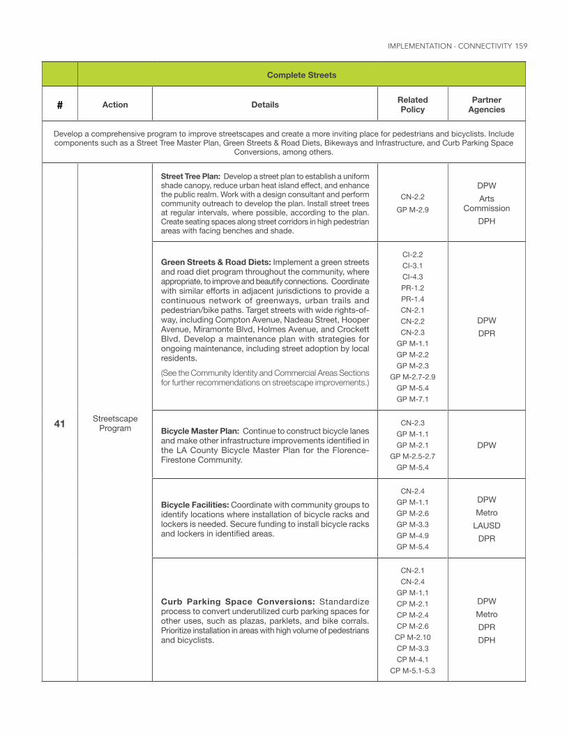
159
Complete Streets
# Action Details Related Policy
Partner Agencies
Develop a comprehensive program to improve streetscapes and create a more inviting place for pedestrians and bicyclists. Include components such as a Street Tree Master Plan, Green Streets & Road Diets, Bikeways and Infrastructure, and Curb Parking Space
Conversions, among others.
41 Streetscape Program
Street Tree Plan: Develop a street plan to establish a uniform shade canopy, reduce urban heat island effect, and enhance the public realm. Work with a design consultant and perform community outreach to develop the plan. Install street trees at regular intervals, where possible, according to the plan. Create seating spaces along street corridors in high pedestrian areas with facing benches and shade.
CN-2.2 GP M-2.9
DPW Arts
Commission DPH
Green Streets & Road Diets: Implement a green streets and road diet program throughout the community, where appropriate, to improve and beautify connections. Coordinate with similar efforts in adjacent jurisdictions to provide a continuous network of greenways, urban trails and pedestrian/bike paths. Target streets with wide rights-of-way, including Compton Avenue, Nadeau Street, Hooper Avenue, Miramonte Blvd, Holmes Avenue, and Crockett Blvd. Develop a maintenance plan with strategies for ongoing maintenance, including street adoption by local residents.(See the Community Identity and Commercial Areas Sections for further recommendations on streetscape improvements.)
CI-2.2 CI-3.1 CI-4.3 PR-1.2 PR-1.4 CN-2.1 CN-2.2 CN-2.3
GP M-1.1 GP M-2.2 GP M-2.3
GP M-2.7-2.9 GP M-5.4 GP M-7.1
DPW DPR
Bicycle Master Plan: Continue to construct bicycle lanes and make other infrastructure improvements identified in the LA County Bicycle Master Plan for the Florence-Firestone Community.
CN-2.3 GP M-1.1 GP M-2.1
GP M-2.5-2.7 GP M-5.4
DPW
Bicycle Facilities: Coordinate with community groups to identify locations where installation of bicycle racks and lockers is needed. Secure funding to install bicycle racks and lockers in identified areas.
CN-2.4 GP M-1.1 GP M-2.6 GP M-3.3 GP M-4.9 GP M-5.4
DPW Metro
LAUSD DPR
Curb Parking Space Conversions: Standardize process to convert underutilized curb parking spaces for other uses, such as plazas, parklets, and bike corrals. Prioritize installation in areas with high volume of pedestrians and bicyclists.
CN-2.1 CN-2.4
GP M-1.1 CP M-2.1 CP M-2.4 CP M-2.6 CP M-2.10 CP M-3.3 CP M-4.1
CP M-5.1-5.3
DPW Metro DPR DPH
IMPLEMENTATION - CONNECTIVITY
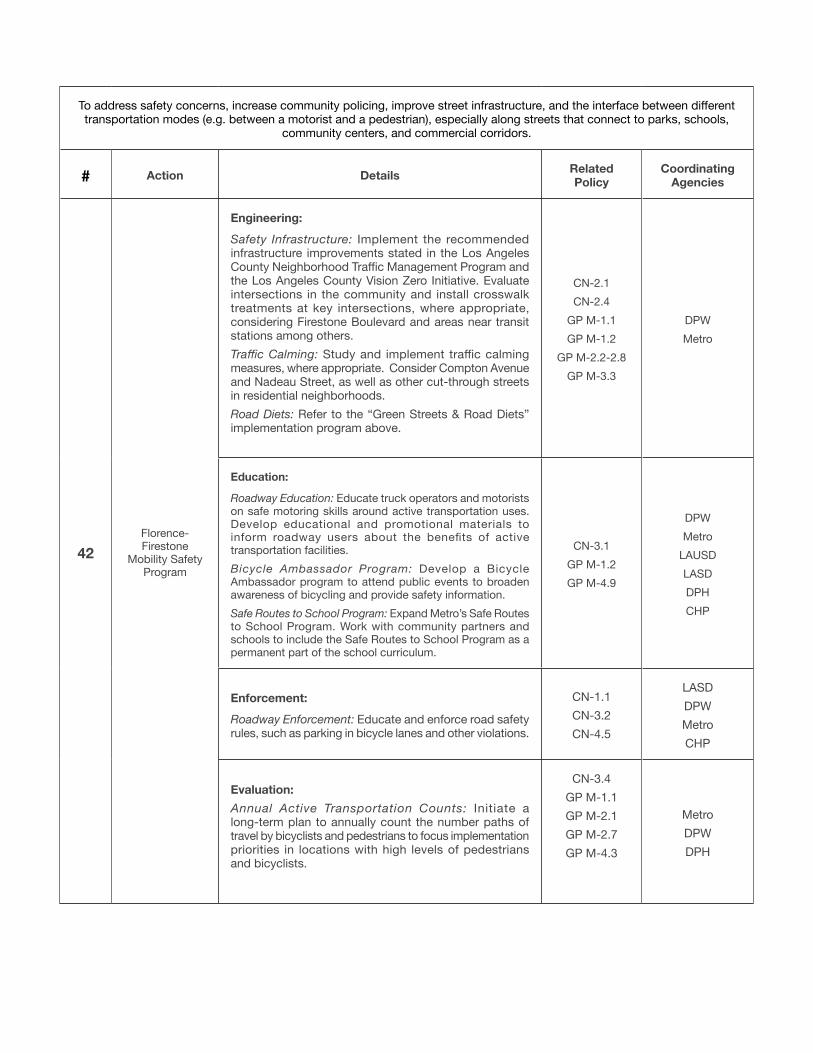
To address safety concerns, increase community policing, improve street infrastructure, and the interface between different transportation modes (e.g. between a motorist and a pedestrian), especially along streets that connect to parks, schools,
community centers, and commercial corridors.
# Action Details Related Policy
Coordinating Agencies
42Florence-Firestone
Mobility Safety Program
Engineering:Safety Infrastructure: Implement the recommended infrastructure improvements stated in the Los Angeles County Neighborhood Traffic Management Program and the Los Angeles County Vision Zero Initiative. Evaluate intersections in the community and install crosswalk treatments at key intersections, where appropriate, considering Firestone Boulevard and areas near transit stations among others.Traffic Calming: Study and implement traffic calming measures, where appropriate. Consider Compton Avenue and Nadeau Street, as well as other cut-through streets in residential neighborhoods.Road Diets: Refer to the “Green Streets & Road Diets” implementation program above.
CN-2.1 CN-2.4
GP M-1.1 GP M-1.2
GP M-2.2-2.8 GP M-3.3
DPW Metro
Education:
Roadway Education: Educate truck operators and motorists on safe motoring skills around active transportation uses. Develop educational and promotional materials to inform roadway users about the benefits of active transportation facilities.Bicycle Ambassador Program: Develop a Bicycle Ambassador program to attend public events to broaden awareness of bicycling and provide safety information. Safe Routes to School Program: Expand Metro’s Safe Routes to School Program. Work with community partners and schools to include the Safe Routes to School Program as a permanent part of the school curriculum.
CN-3.1 GP M-1.2 GP M-4.9
DPW Metro
LAUSD LASD DPH CHP
Enforcement: Roadway Enforcement: Educate and enforce road safety rules, such as parking in bicycle lanes and other violations.
CN-1.1 CN-3.2 CN-4.5
LASD DPW Metro CHP
Evaluation: Annual Active Transportation Counts: Initiate a long-term plan to annually count the number paths of travel by bicyclists and pedestrians to focus implementation priorities in locations with high levels of pedestrians and bicyclists.
CN-3.4 GP M-1.1 GP M-2.1 GP M-2.7 GP M-4.3
Metro DPW DPH
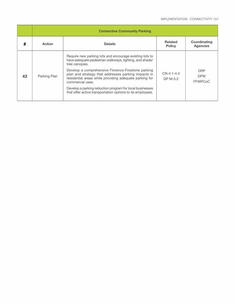
161
Connective Community Parking
# Action Details Related Policy
Coordinating Agencies
43 Parking Plan
Require new parking lots and encourage existing lots to have adequate pedestrian walkways, lighting, and shade/tree canopies.Develop a comprehensive Florence-Firestone parking plan and strategy that addresses parking impacts in residential areas while providing adequate parking for commercial uses.Develop a parking reduction program for local businesses that offer active transportation options to its employees.
CN-4.1-4.4 GP M-5.2
DRP DPW
FFWPCoC
IMPLEMENTATION - CONNECTIVITY
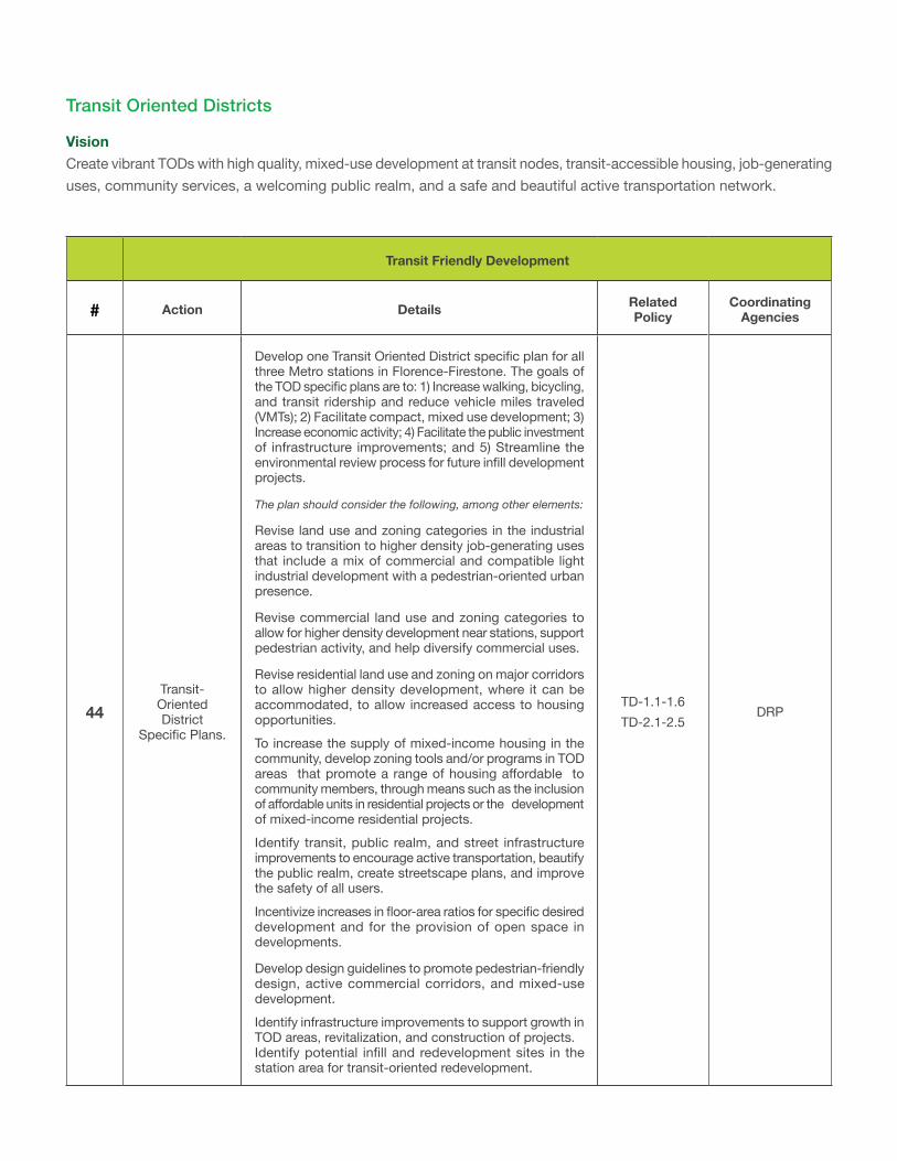
Transit Friendly Development
# Action Details Related Policy
Coordinating Agencies
44Transit-Oriented District
Specific Plans.
Develop one Transit Oriented District specific plan for all three Metro stations in Florence-Firestone. The goals of the TOD specific plans are to: 1) Increase walking, bicycling, and transit ridership and reduce vehicle miles traveled (VMTs); 2) Facilitate compact, mixed use development; 3) Increase economic activity; 4) Facilitate the public investment of infrastructure improvements; and 5) Streamline the environmental review process for future infill development projects.
The plan should consider the following, among other elements:
Revise land use and zoning categories in the industrial areas to transition to higher density job-generating uses that include a mix of commercial and compatible light industrial development with a pedestrian-oriented urban presence.
Revise commercial land use and zoning categories to allow for higher density development near stations, support pedestrian activity, and help diversify commercial uses.
Revise residential land use and zoning on major corridors to allow higher density development, where it can be accommodated, to allow increased access to housing opportunities.To increase the supply of mixed-income housing in the community, develop zoning tools and/or programs in TOD areas that promote a range of housing affordable to community members, through means such as the inclusion of affordable units in residential projects or the development of mixed-income residential projects.Identify transit, public realm, and street infrastructure improvements to encourage active transportation, beautify the public realm, create streetscape plans, and improve the safety of all users.Incentivize increases in floor-area ratios for specific desired development and for the provision of open space in developments.
Develop design guidelines to promote pedestrian-friendly design, active commercial corridors, and mixed-use development.Identify infrastructure improvements to support growth in TOD areas, revitalization, and construction of projects.Identify potential infill and redevelopment sites in the station area for transit-oriented redevelopment.
TD-1.1-1.6 TD-2.1-2.5
DRP
Transit Oriented Districts
VisionCreate vibrant TODs with high quality, mixed-use development at transit nodes, transit-accessible housing, job-generating uses, community services, a welcoming public realm, and a safe and beautiful active transportation network.
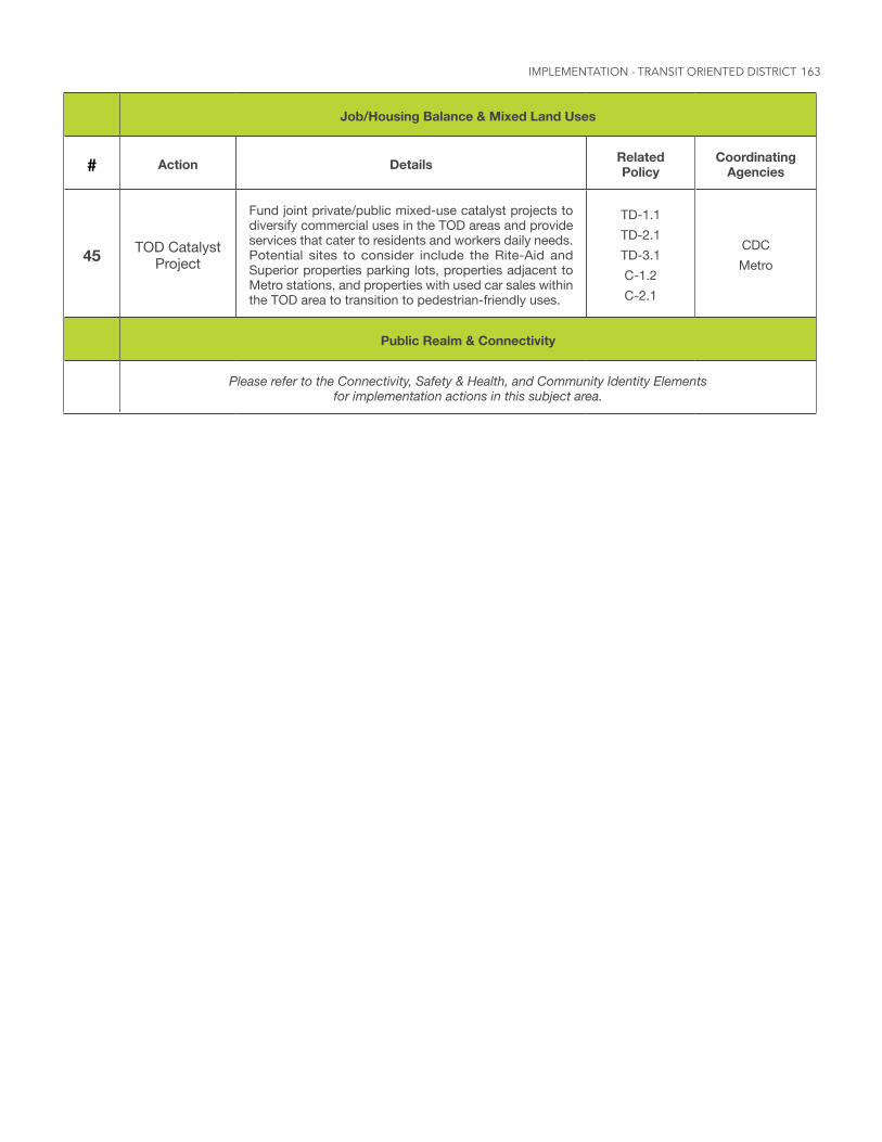
163
Job/Housing Balance & Mixed Land Uses
# Action Details Related Policy
Coordinating Agencies
45 TOD Catalyst Project
Fund joint private/public mixed-use catalyst projects to diversify commercial uses in the TOD areas and provide services that cater to residents and workers daily needs. Potential sites to consider include the Rite-Aid and Superior properties parking lots, properties adjacent to Metro stations, and properties with used car sales within the TOD area to transition to pedestrian-friendly uses.
TD-1.1 TD-2.1 TD-3.1 C-1.2 C-2.1
CDC Metro
Public Realm & Connectivity
Please refer to the Connectivity, Safety & Health, and Community Identity Elements for implementation actions in this subject area.
IMPLEMENTATION - TRANSIT ORIENTED DISTRICT
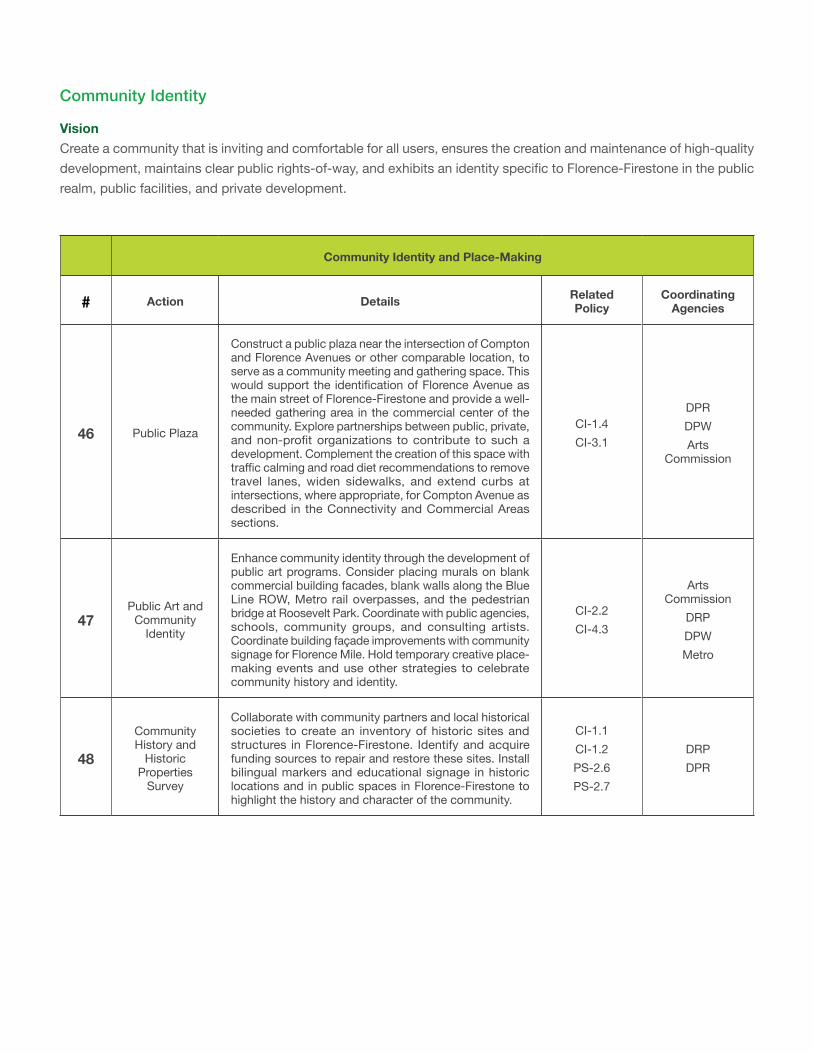
Community Identity and Place-Making
# Action Details Related Policy
Coordinating Agencies
46 Public Plaza
Construct a public plaza near the intersection of Compton and Florence Avenues or other comparable location, to serve as a community meeting and gathering space. This would support the identification of Florence Avenue as the main street of Florence-Firestone and provide a well-needed gathering area in the commercial center of the community. Explore partnerships between public, private, and non-profit organizations to contribute to such a development. Complement the creation of this space with traffic calming and road diet recommendations to remove travel lanes, widen sidewalks, and extend curbs at intersections, where appropriate, for Compton Avenue as described in the Connectivity and Commercial Areas sections.
CI-1.4 CI-3.1
DPR DPW Arts
Commission
47Public Art and
Community Identity
Enhance community identity through the development of public art programs. Consider placing murals on blank commercial building facades, blank walls along the Blue Line ROW, Metro rail overpasses, and the pedestrian bridge at Roosevelt Park. Coordinate with public agencies, schools, community groups, and consulting artists. Coordinate building façade improvements with community signage for Florence Mile. Hold temporary creative place-making events and use other strategies to celebrate community history and identity.
CI-2.2 CI-4.3
Arts Commission
DRP DPW Metro
48
Community History and
Historic Properties
Survey
Collaborate with community partners and local historical societies to create an inventory of historic sites and structures in Florence-Firestone. Identify and acquire funding sources to repair and restore these sites. Install bilingual markers and educational signage in historic locations and in public spaces in Florence-Firestone to highlight the history and character of the community.
CI-1.1 CI-1.2 PS-2.6 PS-2.7
DRP DPR
Community Identity
VisionCreate a community that is inviting and comfortable for all users, ensures the creation and maintenance of high-quality development, maintains clear public rights-of-way, and exhibits an identity specific to Florence-Firestone in the public realm, public facilities, and private development.
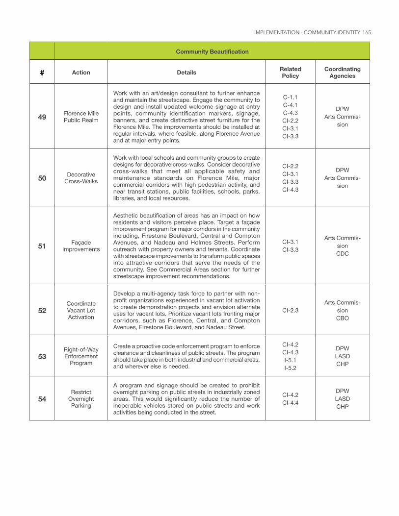
165
CommunityBeautification
# Action Details Related Policy
Coordinating Agencies
49 Florence Mile Public Realm
Work with an art/design consultant to further enhance and maintain the streetscape. Engage the community to design and install updated welcome signage at entry points, community identification markers, signage, banners, and create distinctive street furniture for the Florence Mile. The improvements should be installed at regular intervals, where feasible, along Florence Avenue and at major entry points.
C-1.1 C-4.1 C-4.3 CI-2.2 CI-3.1 CI-3.3
DPW Arts Commis-
sion
50 Decorative Cross-Walks
Work with local schools and community groups to create designs for decorative cross-walks. Consider decorative cross-walks that meet all applicable safety and maintenance standards on Florence Mile, major commercial corridors with high pedestrian activity, and near transit stations, public facilities, schools, parks, libraries, and local resources.
CI-2.2 CI-3.1 CI-3.3 CI-4.3
DPW Arts Commis-
sion
51 Façade Improvements
Aesthetic beautification of areas has an impact on how residents and visitors perceive place. Target a façade improvement program for major corridors in the community including, Firestone Boulevard, Central and Compton Avenues, and Nadeau and Holmes Streets. Perform outreach with property owners and tenants. Coordinate with streetscape improvements to transform public spaces into attractive corridors that serve the needs of the community. See Commercial Areas section for further streetscape improvement recommendations.
CI-3.1 CI-3.3
Arts Commis-sion CDC
52Coordinate Vacant Lot Activation
Develop a multi-agency task force to partner with non-profit organizations experienced in vacant lot activation to create demonstration projects and envision alternate uses for vacant lots. Prioritize vacant lots fronting major corridors, such as Florence, Central, and Compton Avenues, Firestone Boulevard, and Nadeau Street.
CI-2.3Arts Commis-
sion CBO
53Right-of-Way Enforcement
Program
Create a proactive code enforcement program to enforce clearance and cleanliness of public streets. The program should take place in both industrial and commercial areas, and wherever else is needed.
CI-4.2 CI-4.3 I-5.1 I-5.2
DPW LASD CHP
54Restrict
Overnight Parking
A program and signage should be created to prohibit overnight parking on public streets in industrially zoned areas. This would significantly reduce the number of inoperable vehicles stored on public streets and work activities being conducted in the street.
CI-4.2 CI-4.4
DPW LASD CHP
IMPLEMENTATION - COMMUNITY IDENTITY
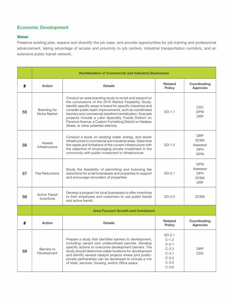
Revitalization of Commercial and Industrial Businesses
# Action Details Related Policy
Coordinating Agencies
55 Branding for Niche Market
Conduct an area branding study to revisit and expand on the conclusions of the 2010 Market Feasibility Study. Identify specific areas to brand for specific industries and consider public realm improvements, such as coordinated banners and commercial storefront revitalization. Example projects include a Latin Specialty Foods District on Florence Avenue, a Custom Furnishing District on Nadeau Street, or other potential districts.
ED-1.1CDC DPW DRP
56 Assess Infrastructure
Conduct a study on existing water, energy, and sewer infrastructure in commercial and industrial areas. Determine the needs and limitations of the current infrastructure with the objective of encouraging private investment in the community with public investment in infrastructure.
ED-1.2
DRP DCBA
Assessor DPH DPW
57 Fee ReductionsStudy the feasibility of permitting and licensing fee reductions for small businesses and properties to support and encourage renovation of properties.
ED-2.1
DPW Assessor
DPH DCBA DRP
58 Active Transit Incentives
Develop a program for local businesses to offer incentives to their employees and customers to use public transit and active transit.
ED-2.5 DCBA
Area Focused Growth and Investment
# Action Details Related Policy
Coordinating Agencies
59 Barriers to Development
Prepare a study that identifies barriers to development, including vacant and underutilized parcels. Develop specific actions to overcome development barriers. The study should determine viable locations for development and identify several catalyst projects where joint public-private partnerships can be developed to include a mix of retail, services, housing, and/or office space.
ED-2.1 C-1.2 C-2.1 C-2.3 C-3.1 C-3.3 C-3.5 C-3.6
DRP CDC
Economic Development
VisionPreserve existing jobs, expand and diversify the job base, and provide opportunities for job training and professional advancement, taking advantage of access and proximity to job centers, industrial transportation corridors, and an extensive public transit network.
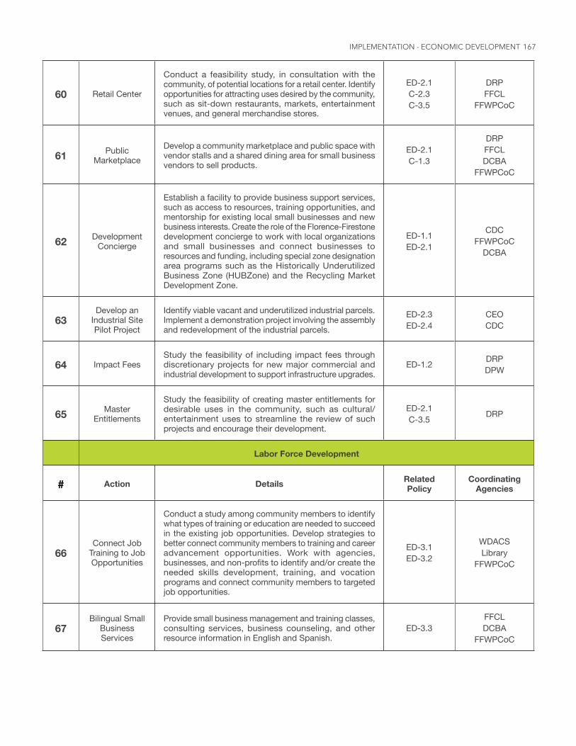
167
60 Retail Center
Conduct a feasibility study, in consultation with the community, of potential locations for a retail center. Identify opportunities for attracting uses desired by the community, such as sit-down restaurants, markets, entertainment venues, and general merchandise stores.
ED-2.1 C-2.3 C-3.5
DRP FFCL
FFWPCoC
61 Public Marketplace
Develop a community marketplace and public space with vendor stalls and a shared dining area for small business vendors to sell products.
ED-2.1 C-1.3
DRP FFCL DCBA
FFWPCoC
62 Development Concierge
Establish a facility to provide business support services, such as access to resources, training opportunities, and mentorship for existing local small businesses and new business interests. Create the role of the Florence-Firestone development concierge to work with local organizations and small businesses and connect businesses to resources and funding, including special zone designation area programs such as the Historically Underutilized Business Zone (HUBZone) and the Recycling Market Development Zone.
ED-1.1 ED-2.1
CDC FFWPCoC
DCBA
63Develop an
Industrial Site Pilot Project
Identify viable vacant and underutilized industrial parcels. Implement a demonstration project involving the assembly and redevelopment of the industrial parcels.
ED-2.3 ED-2.4
CEO CDC
64 Impact FeesStudy the feasibility of including impact fees through discretionary projects for new major commercial and industrial development to support infrastructure upgrades.
ED-1.2 DRP DPW
65 Master Entitlements
Study the feasibility of creating master entitlements for desirable uses in the community, such as cultural/entertainment uses to streamline the review of such projects and encourage their development.
ED-2.1 C-3.5 DRP
Labor Force Development
# Action Details Related Policy
Coordinating Agencies
66Connect Job
Training to Job Opportunities
Conduct a study among community members to identify what types of training or education are needed to succeed in the existing job opportunities. Develop strategies to better connect community members to training and career advancement opportunities. Work with agencies, businesses, and non-profits to identify and/or create the needed skills development, training, and vocation programs and connect community members to targeted job opportunities.
ED-3.1 ED-3.2
WDACS Library
FFWPCoC
67Bilingual Small
Business Services
Provide small business management and training classes, consulting services, business counseling, and other resource information in English and Spanish.
ED-3.3FFCL DCBA
FFWPCoC
IMPLEMENTATION - ECONOMIC DEVELOPMENT
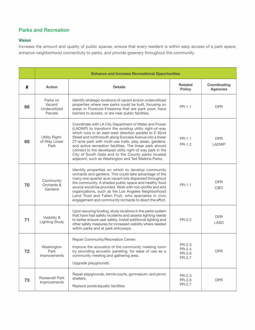
Enhance and Increase Recreational Opportunities
# Action Details Related Policy
Coordinating Agencies
68Parks on Vacant/
Underutilized Parcels
Identify strategic locations of vacant and/or underutilized properties where new parks could be built, focusing on areas in Florence-Firestone that are park poor, have barriers to access, or are near public facilities.
PR-1.1 DPR
69Utility Right-
of-Way Linear Park
Coordinate with LA City Department of Water and Power (LADWP) to transform the existing utility right-of-way which runs in an east-west direction parallel to E 92nd Street and north/south along Success Avenue into a linear 27-acre park with multi-use trails, play areas, gardens, and active recreation facilities. The linear park should connect to the developed utility right-of way park in the City of South Gate and to the County parks located adjacent, such as Washington and Ted Watkins Parks.
PR-1.1 PR-1.2
DPR LADWP
70Community Orchards &
Gardens
Identify properties on which to develop community orchards and gardens. This could take advantage of the many one-quarter acre vacant lots dispersed throughout the community. A shaded public space and healthy food source would be provided. Work with non-profits and arts organizations, such as the Los Angeles Neighborhood Land Trust and Fallen Fruit, who specialize in civic engagement and community orchards to direct the effort.
PR-1.1DPR CBO
71 Visibility & Lighting Study
Upon securing funding, study locations in the parks system that have had safety incidents and assess lighting needs to better ensure user safety. Install additional lighting and other safety measures for increased visibility where needed within parks and at park entryways.
PR-2.2DPR LASD
72Washington
Park Improvements
Repair Community/Recreation Center.
Improve the acoustics of the community meeting room by providing acoustic paneling, for ease of use as a community meeting and gathering area.
Upgrade playgrounds.
PR-2.3 PR-2.4 PR-2.6 PR-2.7
DPR
73 Roosevelt Park Improvements
Repair playgrounds, tennis courts, gymnasium, and picnic shelters.
Replace pools/aquatic facilities
PR-2.3 PR-2.6 PR-2.7
DPR
Parks and Recreation
VisionIncrease the amount and quality of public spaces, ensure that every resident is within easy access of a park space, enhance neighborhood connectivity to parks, and provide greenery throughout the community.
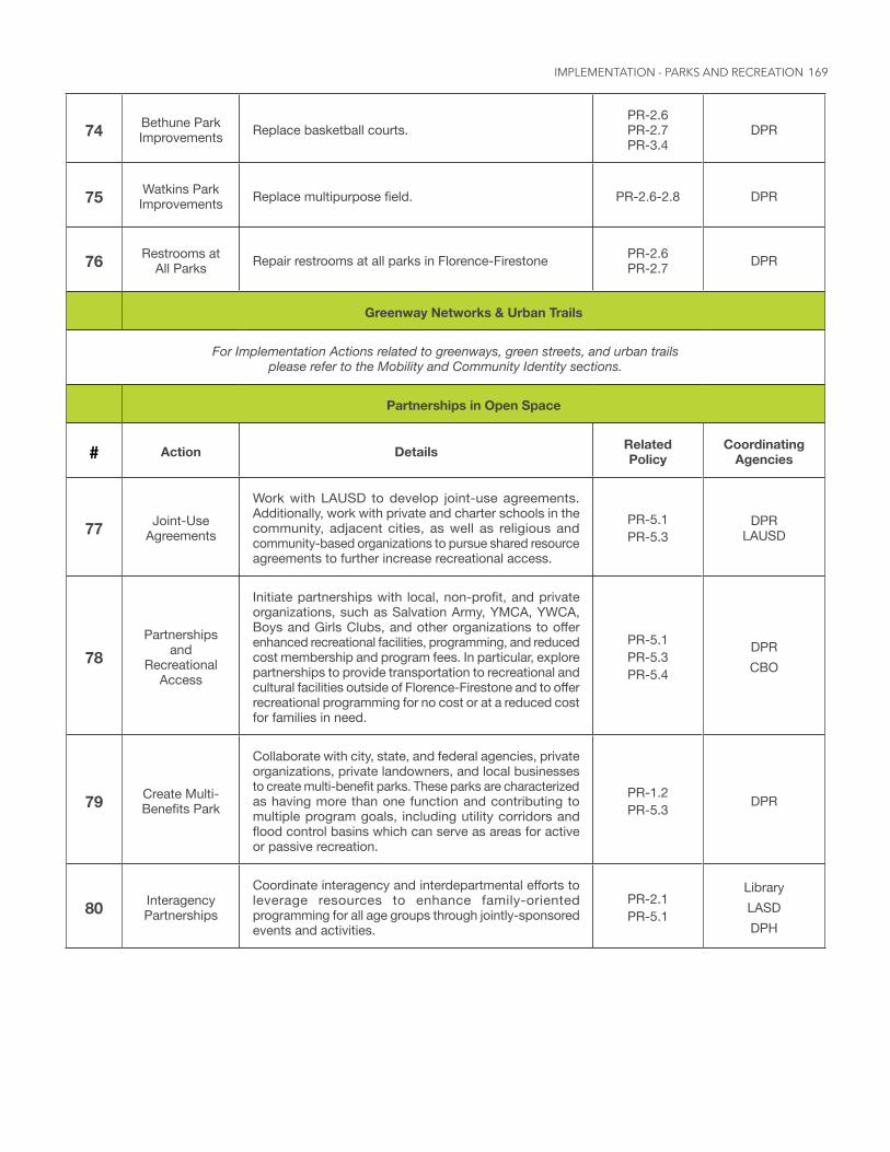
169
74 Bethune Park Improvements Replace basketball courts.
PR-2.6 PR-2.7 PR-3.4
DPR
75 Watkins Park Improvements Replace multipurpose field. PR-2.6-2.8 DPR
76 Restrooms at All Parks Repair restrooms at all parks in Florence-Firestone PR-2.6
PR-2.7 DPR
Greenway Networks & Urban Trails
For Implementation Actions related to greenways, green streets, and urban trails please refer to the Mobility and Community Identity sections.
Partnerships in Open Space
# Action Details Related Policy
Coordinating Agencies
77 Joint-Use Agreements
Work with LAUSD to develop joint-use agreements. Additionally, work with private and charter schools in the community, adjacent cities, as well as religious and community-based organizations to pursue shared resource agreements to further increase recreational access.
PR-5.1 PR-5.3
DPR LAUSD
78Partnerships
and Recreational
Access
Initiate partnerships with local, non-profit, and private organizations, such as Salvation Army, YMCA, YWCA, Boys and Girls Clubs, and other organizations to offer enhanced recreational facilities, programming, and reduced cost membership and program fees. In particular, explore partnerships to provide transportation to recreational and cultural facilities outside of Florence-Firestone and to offer recreational programming for no cost or at a reduced cost for families in need.
PR-5.1 PR-5.3 PR-5.4
DPR CBO
79 Create Multi-Benefits Park
Collaborate with city, state, and federal agencies, private organizations, private landowners, and local businesses to create multi-benefit parks. These parks are characterized as having more than one function and contributing to multiple program goals, including utility corridors and flood control basins which can serve as areas for active or passive recreation.
PR-1.2 PR-5.3 DPR
80 Interagency Partnerships
Coordinate interagency and interdepartmental efforts to leverage resources to enhance family-oriented programming for all age groups through jointly-sponsored events and activities.
PR-2.1 PR-5.1
Library LASD DPH
IMPLEMENTATION - PARKS AND RECREATION
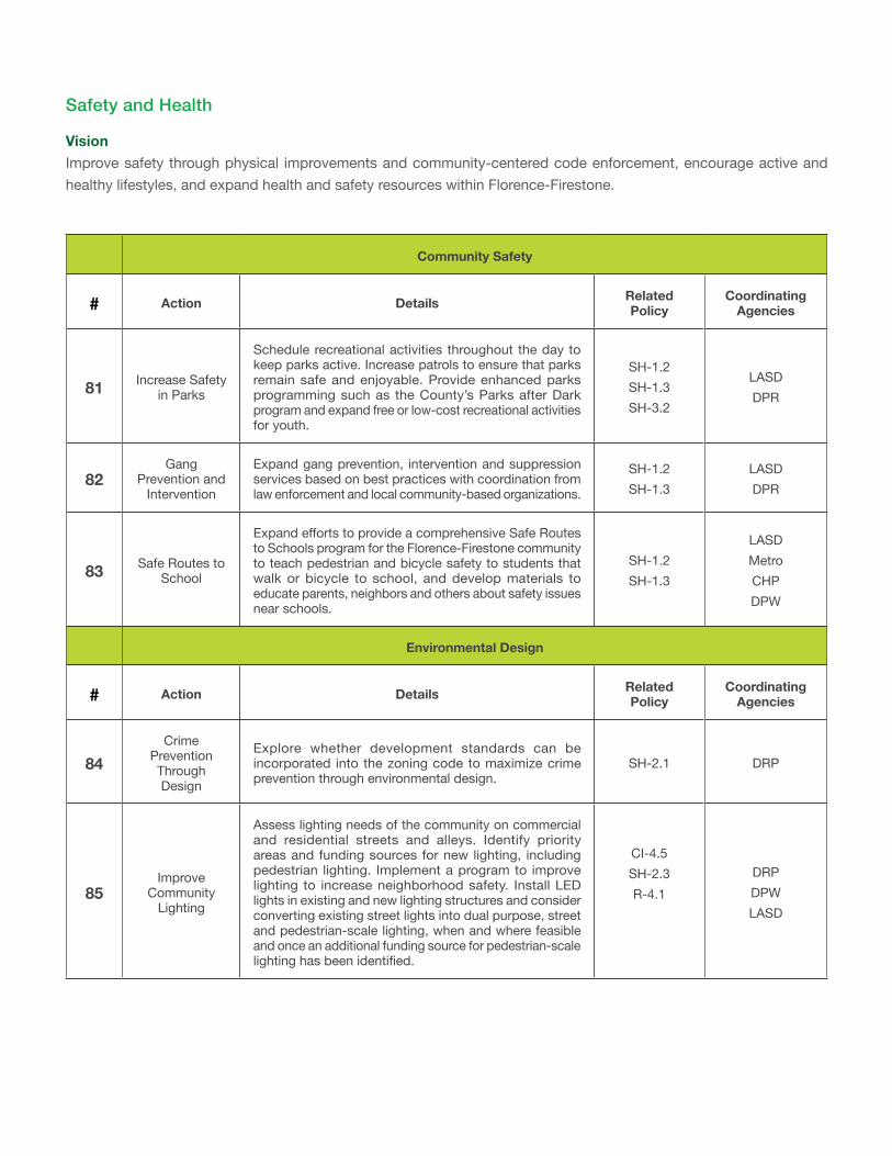
Community Safety
# Action Details Related Policy
Coordinating Agencies
81 Increase Safety in Parks
Schedule recreational activities throughout the day to keep parks active. Increase patrols to ensure that parks remain safe and enjoyable. Provide enhanced parks programming such as the County’s Parks after Dark program and expand free or low-cost recreational activities for youth.
SH-1.2 SH-1.3 SH-3.2
LASD DPR
82Gang
Prevention and Intervention
Expand gang prevention, intervention and suppression services based on best practices with coordination from law enforcement and local community-based organizations.
SH-1.2 SH-1.3
LASD DPR
83 Safe Routes to School
Expand efforts to provide a comprehensive Safe Routes to Schools program for the Florence-Firestone community to teach pedestrian and bicycle safety to students that walk or bicycle to school, and develop materials to educate parents, neighbors and others about safety issues near schools.
SH-1.2 SH-1.3
LASD Metro CHP DPW
Environmental Design
# Action Details Related Policy
Coordinating Agencies
84Crime
Prevention Through Design
Explore whether development standards can be incorporated into the zoning code to maximize crime prevention through environmental design.
SH-2.1 DRP
85Improve
Community Lighting
Assess lighting needs of the community on commercial and residential streets and alleys. Identify priority areas and funding sources for new lighting, including pedestrian lighting. Implement a program to improve lighting to increase neighborhood safety. Install LED lights in existing and new lighting structures and consider converting existing street lights into dual purpose, street and pedestrian-scale lighting, when and where feasible and once an additional funding source for pedestrian-scale lighting has been identified.
CI-4.5 SH-2.3 R-4.1
DRP DPW LASD
Safety and Health
VisionImprove safety through physical improvements and community-centered code enforcement, encourage active and healthy lifestyles, and expand health and safety resources within Florence-Firestone.
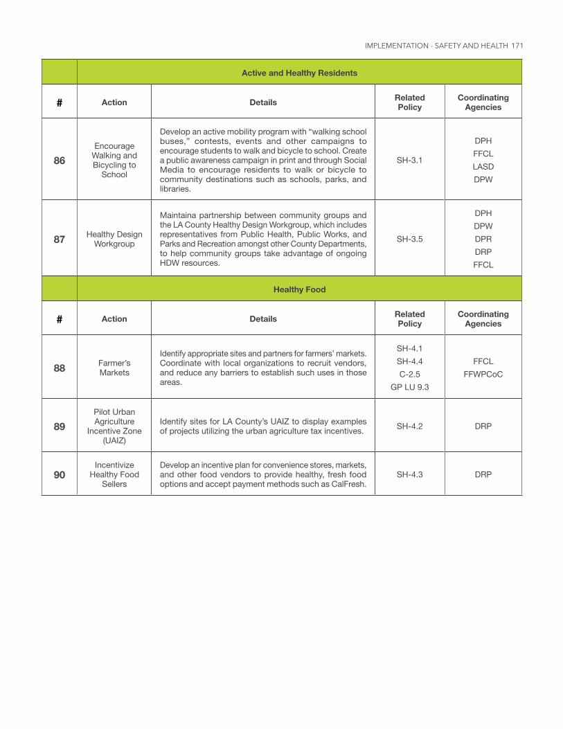
171
Active and Healthy Residents
# Action Details Related Policy
Coordinating Agencies
86Encourage
Walking and Bicycling to
School
Develop an active mobility program with “walking school buses,” contests, events and other campaigns to encourage students to walk and bicycle to school. Create a public awareness campaign in print and through Social Media to encourage residents to walk or bicycle to community destinations such as schools, parks, and libraries.
SH-3.1
DPH FFCL LASD DPW
87 Healthy Design Workgroup
Maintaina partnership between community groups and the LA County Healthy Design Workgroup, which includes representatives from Public Health, Public Works, and Parks and Recreation amongst other County Departments, to help community groups take advantage of ongoing HDW resources.
SH-3.5
DPH DPW DPR DRP FFCL
Healthy Food
# Action Details Related Policy
Coordinating Agencies
88 Farmer’s Markets
Identify appropriate sites and partners for farmers’ markets. Coordinate with local organizations to recruit vendors, and reduce any barriers to establish such uses in those areas.
SH-4.1 SH-4.4 C-2.5
GP LU 9.3
FFCL FFWPCoC
89Pilot Urban Agriculture
Incentive Zone (UAIZ)
Identify sites for LA County’s UAIZ to display examples of projects utilizing the urban agriculture tax incentives. SH-4.2 DRP
90Incentivize
Healthy Food Sellers
Develop an incentive plan for convenience stores, markets, and other food vendors to provide healthy, fresh food options and accept payment methods such as CalFresh.
SH-4.3 DRP
IMPLEMENTATION - SAFETY AND HEALTH
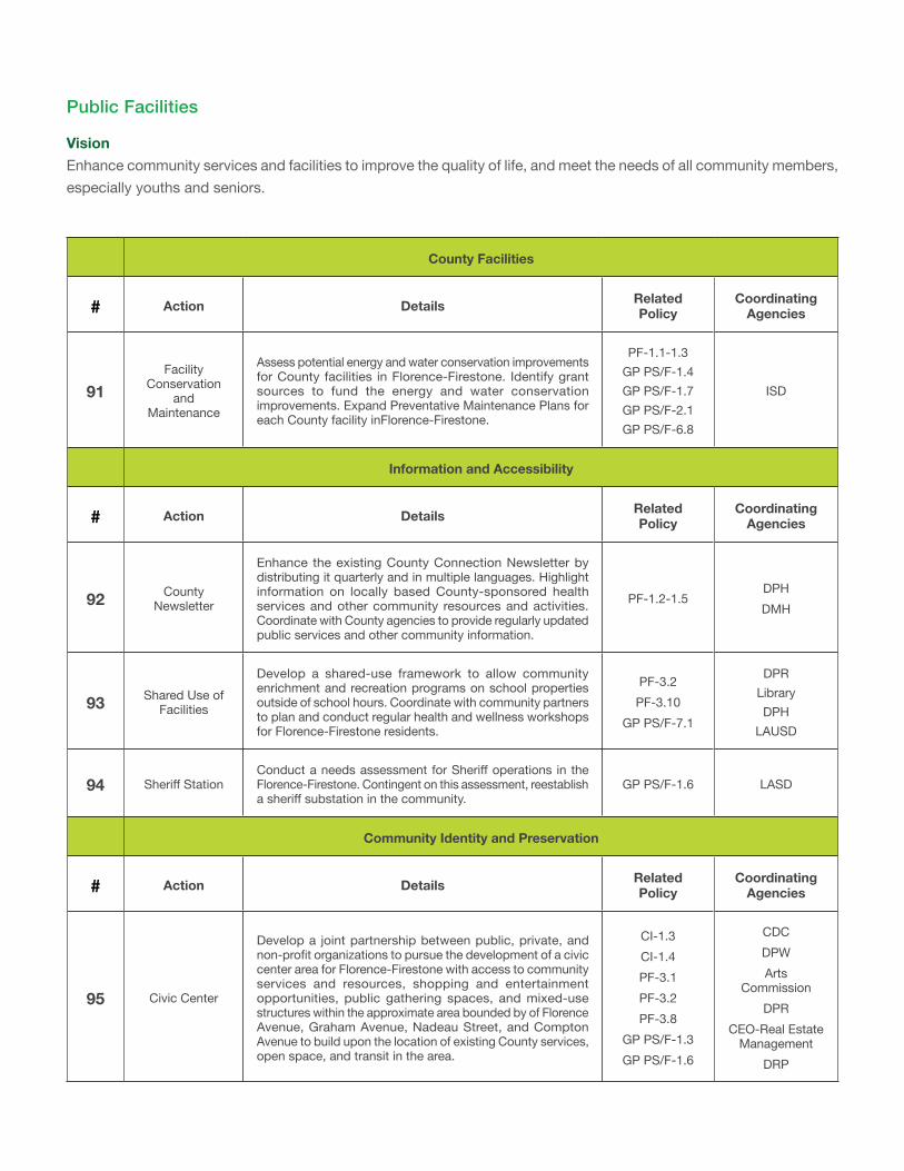
County Facilities
# Action Details Related Policy
Coordinating Agencies
91Facility
Conservation and
Maintenance
Assess potential energy and water conservation improvements for County facilities in Florence-Firestone. Identify grant sources to fund the energy and water conservation improvements. Expand Preventative Maintenance Plans for each County facility inFlorence-Firestone.
PF-1.1-1.3 GP PS/F-1.4 GP PS/F-1.7 GP PS/F-2.1 GP PS/F-6.8
ISD
Information and Accessibility
# Action Details Related Policy
Coordinating Agencies
92 County Newsletter
Enhance the existing County Connection Newsletter by distributing it quarterly and in multiple languages. Highlight information on locally based County-sponsored health services and other community resources and activities. Coordinate with County agencies to provide regularly updated public services and other community information.
PF-1.2-1.5DPH DMH
93 Shared Use of Facilities
Develop a shared-use framework to allow community enrichment and recreation programs on school properties outside of school hours. Coordinate with community partners to plan and conduct regular health and wellness workshops for Florence-Firestone residents.
PF-3.2 PF-3.10
GP PS/F-7.1
DPR Library DPH
LAUSD
94 Sheriff StationConduct a needs assessment for Sheriff operations in the Florence-Firestone. Contingent on this assessment, reestablish a sheriff substation in the community.
GP PS/F-1.6 LASD
Community Identity and Preservation
# Action Details Related Policy
Coordinating Agencies
95 Civic Center
Develop a joint partnership between public, private, and non-profit organizations to pursue the development of a civic center area for Florence-Firestone with access to community services and resources, shopping and entertainment opportunities, public gathering spaces, and mixed-use structures within the approximate area bounded by of Florence Avenue, Graham Avenue, Nadeau Street, and Compton Avenue to build upon the location of existing County services, open space, and transit in the area.
CI-1.3 CI-1.4 PF-3.1 PF-3.2 PF-3.8
GP PS/F-1.3 GP PS/F-1.6
CDC DPW Arts
Commission DPR
CEO-Real Estate Management
DRP
Public Facilities
VisionEnhance community services and facilities to improve the quality of life, and meet the needs of all community members, especially youths and seniors.
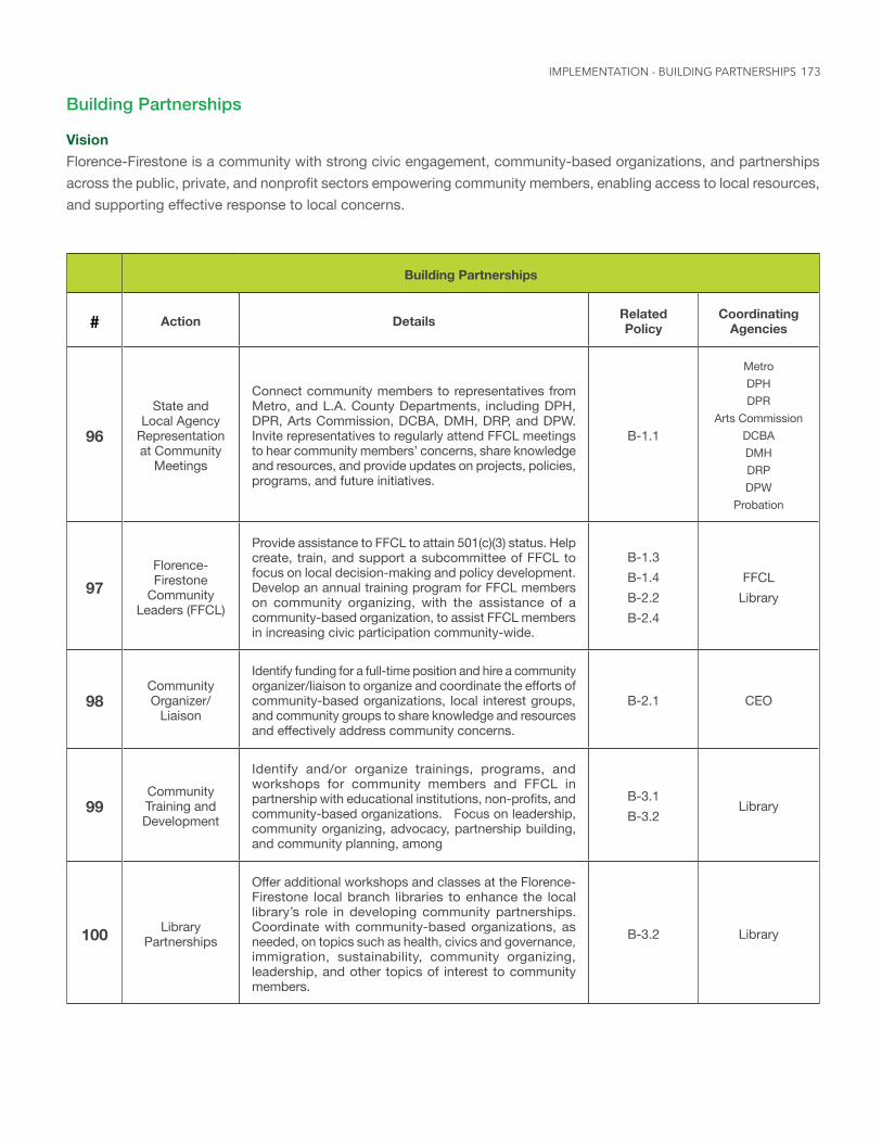
173
Building Partnerships
VisionFlorence-Firestone is a community with strong civic engagement, community-based organizations, and partnerships across the public, private, and nonprofit sectors empowering community members, enabling access to local resources, and supporting effective response to local concerns.
Building Partnerships
# Action Details Related Policy
Coordinating Agencies
96
State and Local Agency
Representation at Community
Meetings
Connect community members to representatives from Metro, and L.A. County Departments, including DPH, DPR, Arts Commission, DCBA, DMH, DRP, and DPW. Invite representatives to regularly attend FFCL meetings to hear community members’ concerns, share knowledge and resources, and provide updates on projects, policies, programs, and future initiatives.
B-1.1
Metro DPH DPR
Arts Commission DCBA DMH DRP DPW
Probation
97Florence-Firestone
Community Leaders (FFCL)
Provide assistance to FFCL to attain 501(c)(3) status. Help create, train, and support a subcommittee of FFCL to focus on local decision-making and policy development. Develop an annual training program for FFCL members on community organizing, with the assistance of a community-based organization, to assist FFCL members in increasing civic participation community-wide.
B-1.3 B-1.4 B-2.2 B-2.4
FFCL Library
98Community Organizer/
Liaison
Identify funding for a full-time position and hire a community organizer/liaison to organize and coordinate the efforts of community-based organizations, local interest groups, and community groups to share knowledge and resources and effectively address community concerns.
B-2.1 CEO
99Community Training and Development
Identify and/or organize trainings, programs, and workshops for community members and FFCL in partnership with educational institutions, non-profits, and community-based organizations. Focus on leadership, community organizing, advocacy, partnership building, and community planning, among
B-3.1 B-3.2
Library
100 Library Partnerships
Offer additional workshops and classes at the Florence-Firestone local branch libraries to enhance the local library’s role in developing community partnerships. Coordinate with community-based organizations, as needed, on topics such as health, civics and governance, immigration, sustainability, community organizing, leadership, and other topics of interest to community members.
B-3.2 Library
IMPLEMENTATION - BUILDING PARTNERSHIPS
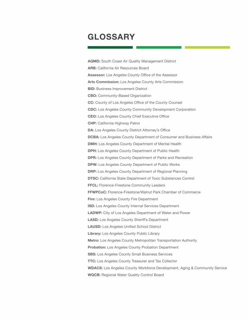
GLOSSARY
AQMD: South Coast Air Quality Management District
ARB: California Air Resources Board
Assessor: Los Angeles County Office of the Assessor
Arts Commission: Los Angeles County Arts Commission
BID: Business Improvement District
CBO: Community-Based Organization
CC: County of Los Angeles Office of the County Counsel
CDC: Los Angeles County Community Development Corporation
CEO: Los Angeles County Chief Executive Office
CHP: California Highway Patrol
DA: Los Angeles County District Attorney’s Office
DCBA: Los Angeles County Department of Consumer and Business Affairs
DMH: Los Angeles County Department of Mental Health
DPH: Los Angeles County Department of Public Health
DPR: Los Angeles County Department of Parks and Recreation
DPW: Los Angeles County Department of Public Works
DRP: Los Angeles County Department of Regional Planning
DTSC: California State Department of Toxic Substances Control
FFCL: Florence-Firestone Community Leaders
FFWPCoC: Florence-Firestone/Walnut Park Chamber of Commerce
Fire: Los Angeles County Fire Department
ISD: Los Angeles County Internal Services Department
LADWP: City of Los Angeles Department of Water and Power
LASD: Los Angeles County Sheriff’s Department
LAUSD: Los Angeles Unified School District
Library: Los Angeles County Public Library
Metro: Los Angeles County Metropolitan Transportation Authority
Probation: Los Angeles County Probation Department
SBS: Los Angeles County Small Business Services
TTC: Los Angeles County Treasurer and Tax Collector
WDACS: Los Angeles County Workforce Development, Aging & Community Service
WQCB: Regional Water Quality Control Board

175