federal emergency management agency automated hydrology and hydraulics john liou fema region viii
TRANSCRIPT
FEDERAL EMERGENCY MANAGEMENT AGENCYFEDERAL EMERGENCY MANAGEMENT AGENCY
AUTOMATED HYDROLOGY AND AUTOMATED HYDROLOGY AND HYDRAULICSHYDRAULICS
John LiouJohn Liou
FEMA Region VIIIFEMA Region VIII
FEDERAL EMERGENCY MANAGEMENT AGENCYFEDERAL EMERGENCY MANAGEMENT AGENCY
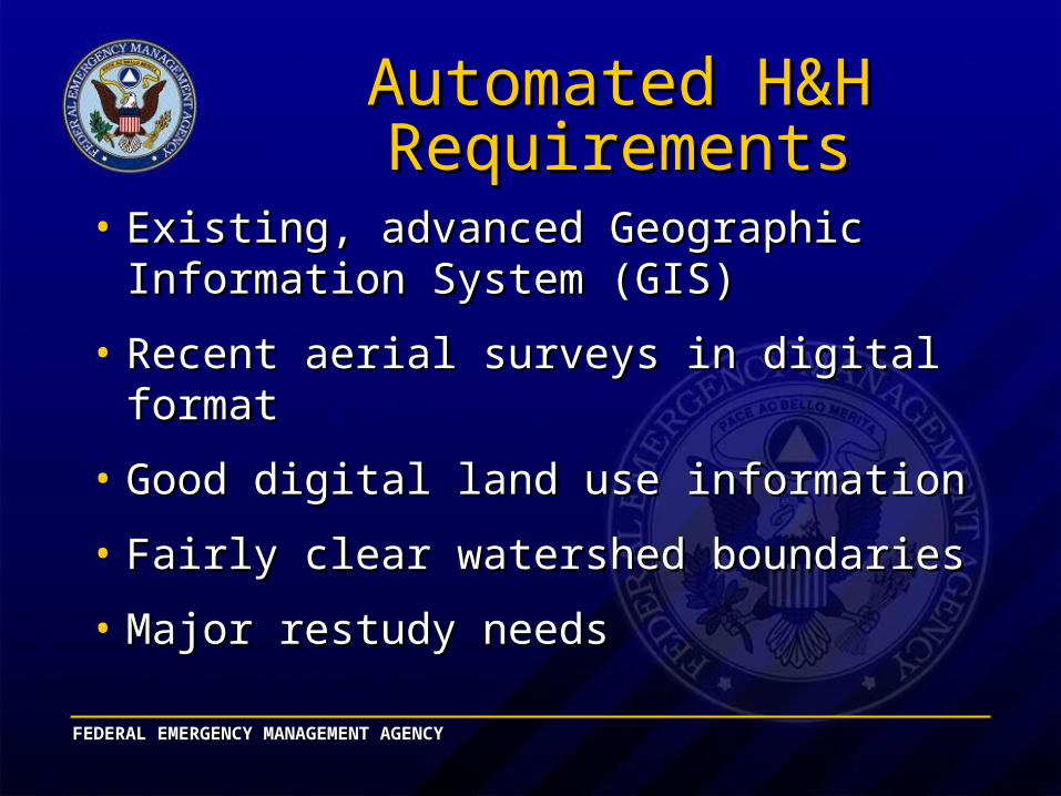
Automated H&H Automated H&H RequirementsRequirements
• Existing, advanced Geographic Information Existing, advanced Geographic Information System (GIS)System (GIS)
• Recent aerial surveys in digital formatRecent aerial surveys in digital format
• Good digital land use informationGood digital land use information
• Fairly clear watershed boundariesFairly clear watershed boundaries
• Major restudy needsMajor restudy needs
FEDERAL EMERGENCY MANAGEMENT AGENCYFEDERAL EMERGENCY MANAGEMENT AGENCY
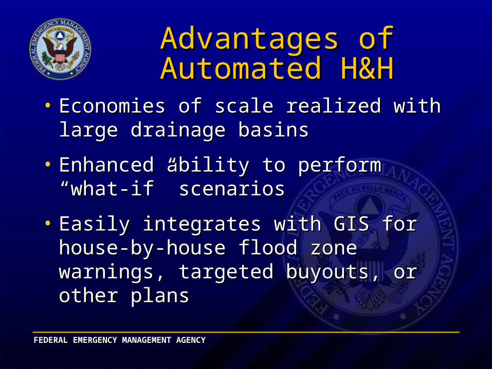
Advantages of Automated Advantages of Automated H&HH&H
• Economies of scale realized with large Economies of scale realized with large drainage basinsdrainage basins
• Enhanced ability to perform “what-if” Enhanced ability to perform “what-if” scenariosscenarios
• Easily integrates with GIS forEasily integrates with GIS forhouse-by-house flood zone warnings, house-by-house flood zone warnings, targeted buyouts, or other planstargeted buyouts, or other plans
FEDERAL EMERGENCY MANAGEMENT AGENCYFEDERAL EMERGENCY MANAGEMENT AGENCY
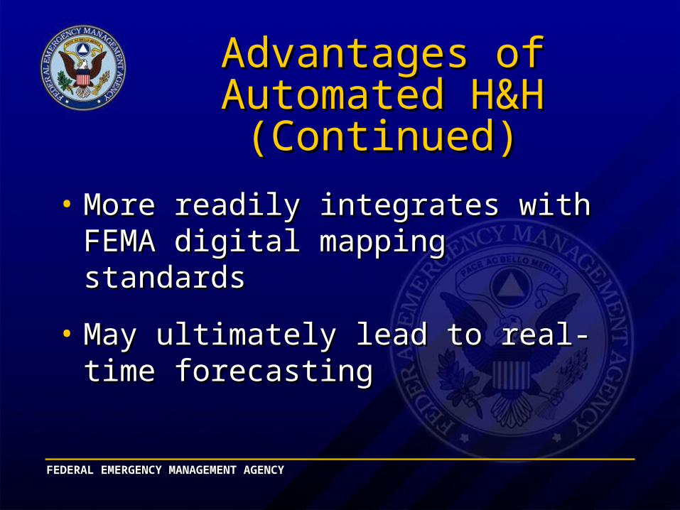
Advantages of Automated Advantages of Automated H&H (Continued)H&H (Continued)
• More readily integrates with FEMA digital More readily integrates with FEMA digital mapping standardsmapping standards
• May ultimately lead to real-time forecastingMay ultimately lead to real-time forecasting
FEDERAL EMERGENCY MANAGEMENT AGENCYFEDERAL EMERGENCY MANAGEMENT AGENCY
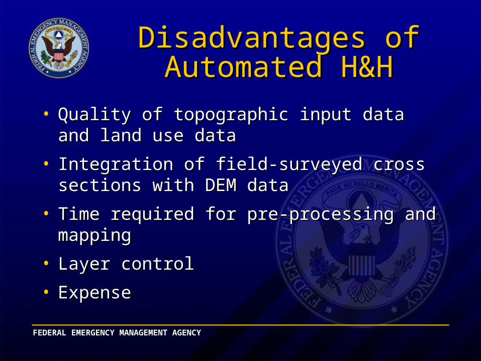
Disadvantages of Automated Disadvantages of Automated H&HH&H
• Quality of topographic input data and land use Quality of topographic input data and land use datadata
• Integration of field-surveyed cross sections with Integration of field-surveyed cross sections with DEM data DEM data
• Time required for pre-processing and mappingTime required for pre-processing and mapping
• Layer controlLayer control
• ExpenseExpense
FEDERAL EMERGENCY MANAGEMENT AGENCYFEDERAL EMERGENCY MANAGEMENT AGENCY
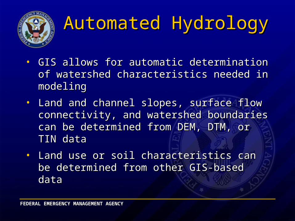
Automated HydrologyAutomated Hydrology
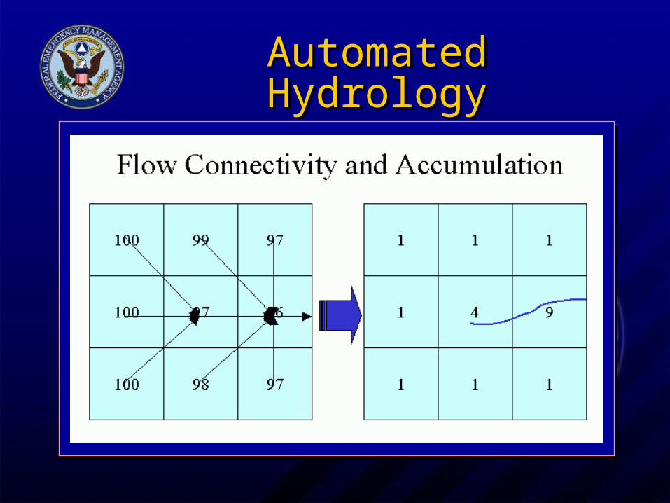
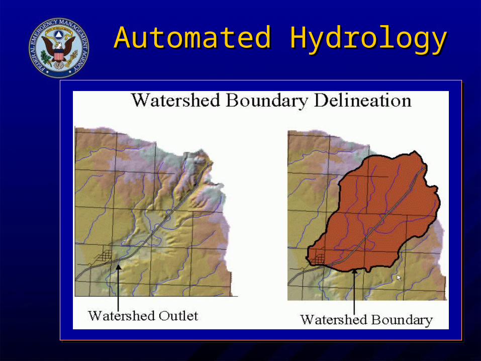
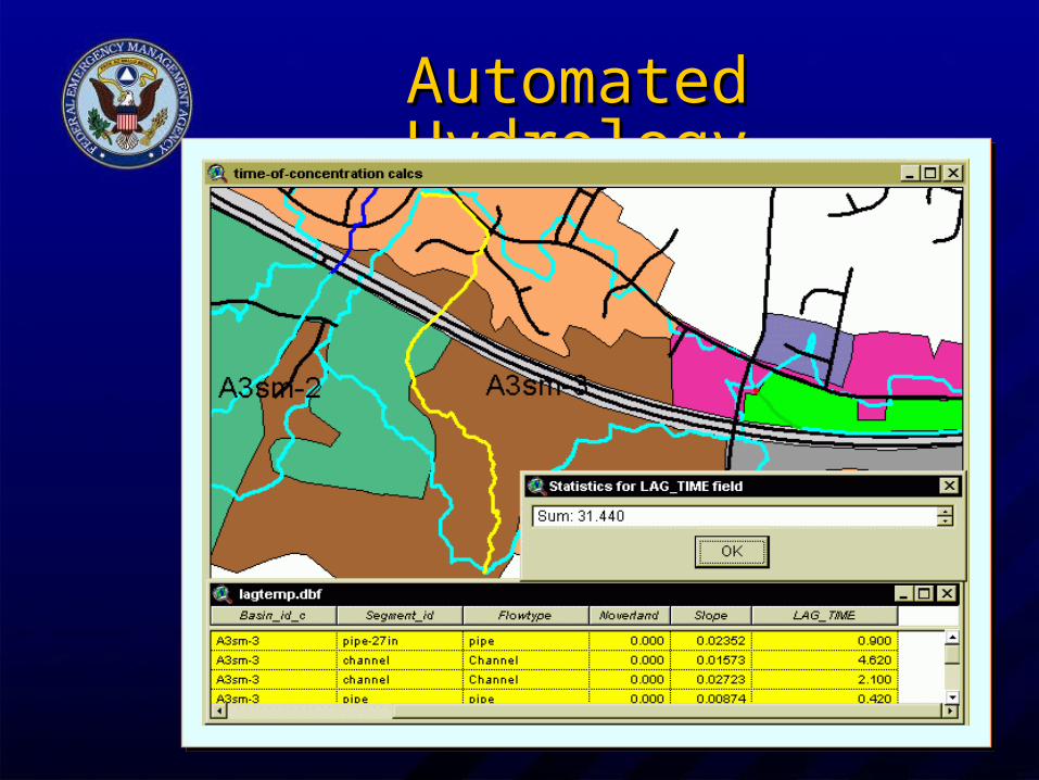
• GIS allows for automatic determination of GIS allows for automatic determination of watershed characteristics needed in modelingwatershed characteristics needed in modeling
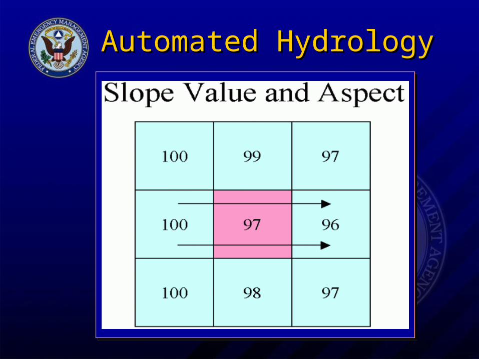
• Land and channel slopes, surface flow Land and channel slopes, surface flow connectivity, and watershed boundaries can connectivity, and watershed boundaries can be determined from DEM, DTM, or TIN databe determined from DEM, DTM, or TIN data
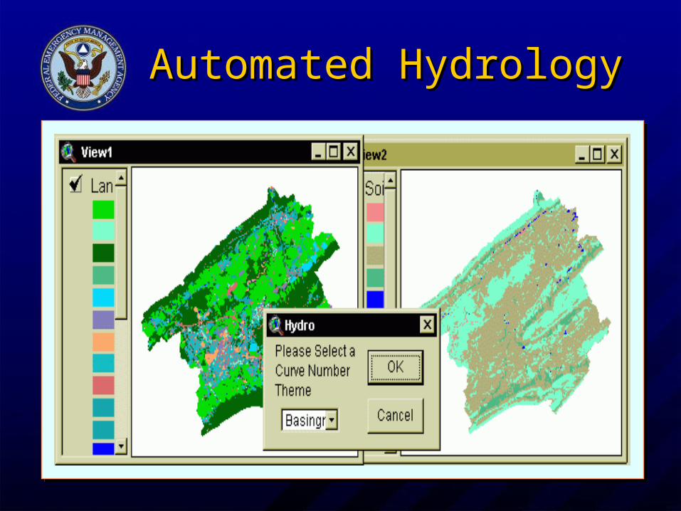
• Land use or soil characteristics can be Land use or soil characteristics can be determined from other GIS-based datadetermined from other GIS-based data
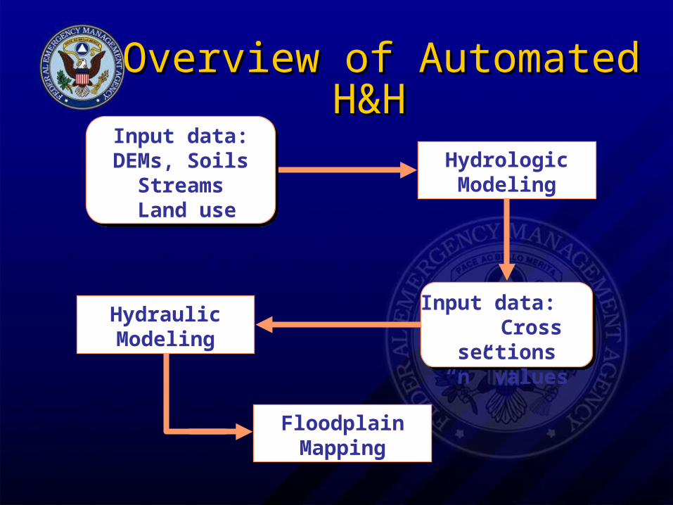
Overview of Automated H&H Overview of Automated H&H
Hydrologic Modeling
Hydraulic Modeling
Floodplain Mapping
Input data: Cross sections
“n” values
Input data: DEMs, Soils
Streams Land use
Automated HydrologyAutomated Hydrology
Automated HydrologyAutomated Hydrology
Automated HydrologyAutomated Hydrology
Automated HydrologyAutomated Hydrology
Automated HydrologyAutomated Hydrology

Automated HydrologyAutomated Hydrology
FEDERAL EMERGENCY MANAGEMENT AGENCYFEDERAL EMERGENCY MANAGEMENT AGENCY
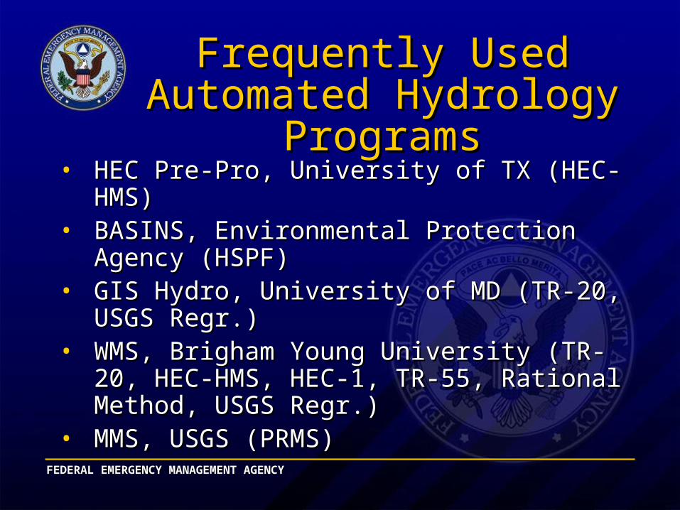
Frequently Used Automated Frequently Used Automated Hydrology ProgramsHydrology Programs
• HEC Pre-Pro, University of TX (HEC-HMS)HEC Pre-Pro, University of TX (HEC-HMS)• BASINS, Environmental Protection Agency BASINS, Environmental Protection Agency
(HSPF)(HSPF)• GIS Hydro, University of MD (TR-20, USGS GIS Hydro, University of MD (TR-20, USGS
Regr.)Regr.)• WMS, Brigham Young University (TR-20, HEC-WMS, Brigham Young University (TR-20, HEC-
HMS, HEC-1, TR-55, Rational Method, USGS HMS, HEC-1, TR-55, Rational Method, USGS Regr.)Regr.)
• MMS, USGS (PRMS)MMS, USGS (PRMS)
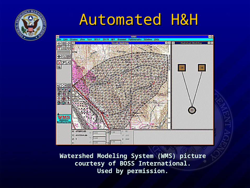
Automated H&HAutomated H&H
Watershed Modeling System (WMS) Watershed Modeling System (WMS) picture courtesy of BOSS International.picture courtesy of BOSS International.
Used by permission.Used by permission.
FEDERAL EMERGENCY MANAGEMENT AGENCYFEDERAL EMERGENCY MANAGEMENT AGENCY
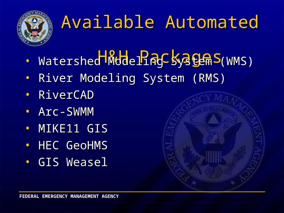
Available Automated Available Automated H&H PackagesH&H Packages
• Watershed Modeling System (WMS)Watershed Modeling System (WMS)
• River Modeling System (RMS)River Modeling System (RMS)
• RiverCADRiverCAD
• Arc-SWMMArc-SWMM
• MIKE11 GISMIKE11 GIS
• HEC GeoHMSHEC GeoHMS
• GIS WeaselGIS Weasel
FEDERAL EMERGENCY MANAGEMENT AGENCYFEDERAL EMERGENCY MANAGEMENT AGENCY
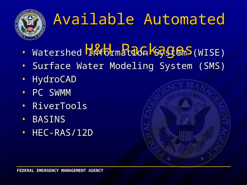
Available Automated Available Automated H&H PackagesH&H Packages
• Watershed Information System (WISE)Watershed Information System (WISE)
• Surface Water Modeling System (SMS)Surface Water Modeling System (SMS)
• HydroCADHydroCAD
• PC SWMMPC SWMM
• RiverToolsRiverTools
• BASINSBASINS
• HEC-RAS/12DHEC-RAS/12D
FEDERAL EMERGENCY MANAGEMENT AGENCYFEDERAL EMERGENCY MANAGEMENT AGENCY
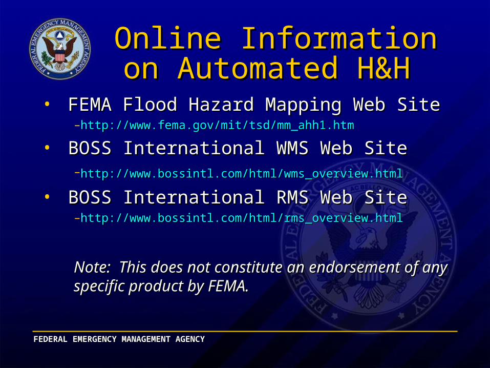
Online Information on Online Information on Automated H&H Automated H&H
• FEMA Flood Hazard Mapping Web Site FEMA Flood Hazard Mapping Web Site –http://www.fema.gov/mit/tsd/mm_ahh1.htmhttp://www.fema.gov/mit/tsd/mm_ahh1.htm
• BOSS International WMS Web SiteBOSS International WMS Web Site–http://www.bossintl.com/html/wms_overview.htmlhttp://www.bossintl.com/html/wms_overview.html
• BOSS International RMS Web SiteBOSS International RMS Web Site–http://www.bossintl.com/html/rms_overview.htmlhttp://www.bossintl.com/html/rms_overview.html
Note: This does not constitute an endorsement of any Note: This does not constitute an endorsement of any specific product by FEMA.specific product by FEMA.
FEDERAL EMERGENCY MANAGEMENT AGENCYFEDERAL EMERGENCY MANAGEMENT AGENCY
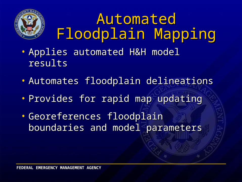
Automated Floodplain Automated Floodplain MappingMapping
• Applies automated H&H model resultsApplies automated H&H model results
• Automates floodplain delineationsAutomates floodplain delineations
• Provides for rapid map updatingProvides for rapid map updating
• Georeferences floodplain boundaries and Georeferences floodplain boundaries and model parametersmodel parameters