evaluation of multilingual land surveying dictionaries...
TRANSCRIPT
GEOMATICS AND ENVIRONMENTAL ENGINEERING • Volume 10 • Number 4 • 2016
http://dx.doi.org/10.7494/geom.2016.10.4.57
57
Ewelina Kwiatek*
Evaluation of Multilingual Land Surveying Dictionaries –
Part I
1. Introduction
Before starting the discussion of lexicographic resources that might be useful for land surveyors, the name of the fi eld needs to be clarifi ed as it is both intriguing and ambiguous. The fi eld is commonly referred to as surveying, or most recently geomatics, in Anglo-Saxon countries, while in the continental European tradition, it is called geodesy (geodezja in Polish). Arguably, the name surveying is too general because it indicates that anything can be surveyed, e.g. a literature survey. Many re-searchers opt for the name land surveying, which was used in the past. However, the paradigm changed in the Anglo-Saxon tradition and the current name of the fi eld is surveying [9: XIII]. The name geomatics can also be found in the literature as the dis-cipline evolves in the direction of computer science and sophisticated mathematical calculations. It is important to note that the terms surveying, land surveying, geodesy, geomatics are often used as synonyms although we must be aware of the fact that they represent diff erent concepts. We will see it clearly in the titles of dictionaries that will be described in this paper.
This paper provides an overview of multilingual land surveying dictionaries that were published in Poland as hard copies. The full bibliographic information for dictionaries discussed in this paper is provided in the References section at the end of this paper.
2. Land Surveying Dictionaries as Representatives of LSP Dictionaries
Land surveying dictionaries belong to the group of specialised dictionaries, which are often called language for specifi c purposes (LSP) dictionaries. These
* Pedagogical University of Cracow, Institute of Modern Languages, Krakow, Poland
58 E. Kwiatek
dictionaries are more specialised than, for example, scientifi c and technical diction-aries. In contrast to these dictionaries, LSP dictionaries cover a limited number of disciplines. It is typically one major discipline and a few other fi elds directly related with it. In the case of land surveying dictionaries, the main discipline is geodesy and related disciplines include cadastre, real estates, photogrammetry, optics, etc.
LSP dictionaries are not so common or easily available as general language dic-tionaries due to the fact that the number of their users is limited to professionals and technical writers who deal with the fi eld in their work.
This paper provides a chronological overview of paper land surveying diction-aries that were published in Poland.
2.1. Słownik geodezyjny w 5 językach: polskim, rosyjskim, niemieckim, angielskim, francuskim‘Geodetic Dictionary in 5 Languages: Polish, Russian, German, English and French’ by Wacław Sztompke
The oldest mutilingual land surveying dictionary is Słownik geodezyjny w 5 ję-zykach: polskim, rosyjskim, niemieckim, angielskim, francuskim ‘Geodetic dictionary in 5 languages: Polish, Russian, German, English and French’ [10]. After World War Two researchers in the fi eld of geodesy noticed that they had problems studying foreign literature on the subject and they needed a specialised geodetic dictionary. The Scientifi c-Technical Association of Polish Surveyors, whose members were Pol-ish surveying engineers and technicians, decided to elaborate a 5-language geodetic dictionary. The Scientifi c-Technical Association of Polish Surveyors appointed Geo-detic Terminology Commission in 1949.
Its fi rst major tasks encompassed (Introduction to [10]): – fi nding Polish equivalents for terms included in the Technical Dictionary
elaborated by Fédération Internationale des Géomètres, – fi nding Polish equivalents for terms in the Photogrammetric Dictionary com-
piled by the Société Internationale de Photogrammétrie.
In 1951 the Commission started working on the 5-language geodetic dictionary. The decision was made that the dictionary should include terms from the following domains: astronomy, photogrammetry, geodesy and land surveying, instrumenta-tion and optics, cartography, cadastre, measures, mining surveying, rail surveys, marine surveys, agricultural surveys, topography and topographic map symbols. The Commission decided that in order to provide the rich content, the dictionary should contain about 15,000 terms and should be compiled relatively quickly, possi-bly in the course of 3 or 4 years. Shortly, this task turned out to be too overwhelming and Commission agreed to limit the scope and content of the dictionary to 5,000 terms, being the feasible task in the planned period of time [10]. The Commission appointed teams of professionals who were responsible for fi nding terms in the
Evaluation of Multilingual Land Surveying Dictionaries – Part I 59
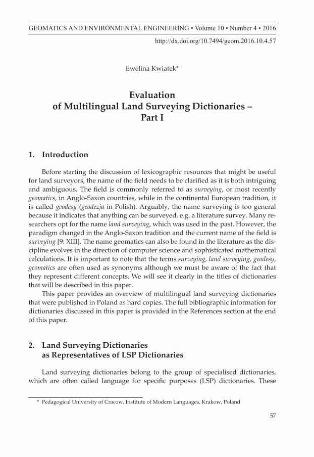
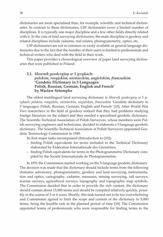
To save space Polish and foreign synonyms were put together with the main entry under the same number. If a Polish term cannot be found in the major part of the dictionary, one might try to search for it in the Polish index. Foreign indices include both main terms and synonyms, which are arranged in alphabetical order.
Fig. 1. Entry in the dictionary by Sztompke (1955)Source: [10: 256–257]
Fig. 2. Polish index in the dictionarySource: [10: 361]
fi elds of their specialisations and matching them with their equivalents. Terms were identifi ed in Polish literature as Polish is the fi rst language of the dictionary. The Commission did not decide on grouping terms according to their subject fi eld spe-cialisation as in their view it would make the dictionary complicated and confusing for its users. Instead, all terms were put together and arranged in the alphabetical order.
The dictionary compiled by the Commission consists of:a) the main part which includes numbered entries that are arranged in alpha-
betical order (Fig. 1); entries are in Polish, followed by Russian, German, English and French equivalents; gender specifi cation is provided for Pol-ish, Russian, German and French nouns in the form of abbreviations, where (m) means masculine, (f) stands for feminine and (n) for neuter; this part ends with a list of topographic map symbols, also arranged alphabetically;
b) indices in foreign languages and an index of Polish synonyms (Fig. 2).
60 E. Kwiatek
The dictionary includes many words which are archaic. They refer to meas-uring methods and instruments which are no longer in use, e.g. adiator and to ca-dastral terms which were used in the past, e.g księga łanowa, łąka służna. The scope of information in the dictionary is limited to equivalents and gender specifi cation for nouns. The dictionary is out of print. It may occasionally be purchased in sec-ond-hand bookstores.
2.2. Słownik geodezyjny polsko-angielsko-niemiecki ‘Polish-English-German Land Surveying Dictionary’ by Jerzy Tatarczyk
The second oldest dictionary is Słownik geodezyjny polsko-angielsko-niemiecki by Jerzy Tatarczyk [12]. As the name of the dictionary suggest, it consists of three parts: Polish, English and German.
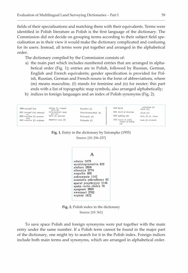
Entries in the Polish part of the dictionary are arranged in alphabetical order. The terms is preceded by the reference number and followed by its English and Ger-man equivalents presented in separate columns. German nouns are accompanied by gender specifi cation that comes right after the noun in the form of abbreviation (‘m’ means masculine, ‘f’ stands for feminine and ‘n’ for neuter).
Polish terms that are ambiguous are followed by subject fi eld specifi cation (Fig. 3). Polish entries in the dictionary belong to 13 diff erent disciplines that are represented by the following abbreviations:
astr. for astronomia ‘astronomy’aut. for automatyka ‘automatics’bud. for budownictwo ‘civil engineering’fi z. for fi zyka ‘physics’fot. for fotografi a ‘photography’geom. for geometria ‘geometry’geol. for geologia ‘geology’górn. for górnictwo ‘mining’inf. for informatyka ‘computer science’mat. for matematyka ‘mathematics’mech. for mechanika ‘mechanics’met. for metrologia ‘metrology’opt. for optyka ‘optics’
Fig. 3. Entry in Słownik geodezyjny polsko-angielsko-niemieckiSource: [12: 114]
Evaluation of Multilingual Land Surveying Dictionaries – Part I 61
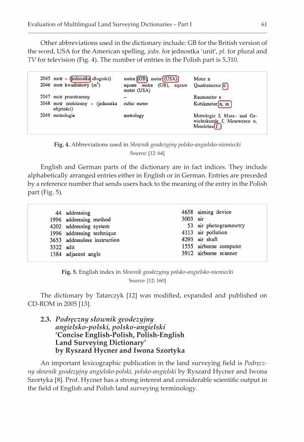
Other abbreviations used in the dictionary include: GB for the British version of the word, USA for the American spelling, jedn. for jednostka ‘unit’, pl. for plural and TV for television (Fig. 4). The number of entries in the Polish part is 5,310.
Fig. 4. Abbreviations used in Słownik geodezyjny polsko-angielsko-niemieckiSource: [12: 64]
Fig. 5. English index in Słownik geodezyjny polsko-angielsko-niemieckiSource: [12: 160]
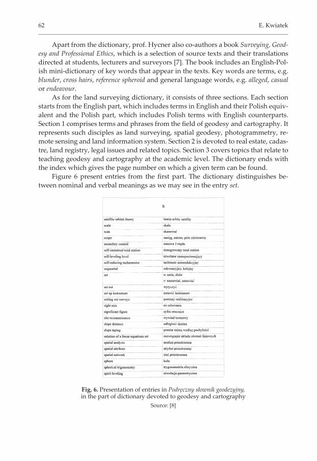
English and German parts of the dictionary are in fact indices. They include alphabetically arranged entries either in English or in German. Entries are preceded by a reference number that sends users back to the meaning of the entry in the Polish part (Fig. 5).
The dictionary by Tatarczyk [12] was modifi ed, expanded and published on CD-ROM in 2005 [13].
2.3. Podręczny słownik geodezyjny angielsko-polski, polsko-angielski ‘Concise English-Polish, Polish-English Land Surveying Dictionary’ by Ryszard Hycner and Iwona Szortyka
An important lexicographic publication in the land surveying fi eld is Podręcz-ny słownik geodezyjny angielsko-polski, polsko-angielski by Ryszard Hycner and Iwona Szortyka [8]. Prof. Hycner has a strong interest and considerable scientifi c output in the fi eld of English and Polish land surveying terminology.
62 E. Kwiatek
Apart from the dictionary, prof. Hycner also co-authors a book Surveying, Geod-esy and Professional Ethics, which is a selection of source texts and their translations directed at students, lecturers and surveyors [7]. The book includes an English-Pol-ish mini-dictionary of key words that appear in the texts. Key words are terms, e.g. blunder, cross hairs, reference spheroid and general language words, e.g. alleged, casual or endeavour.
As for the land surveying dictionary, it consists of three sections. Each section starts from the English part, which includes terms in English and their Polish equiv-alent and the Polish part, which includes Polish terms with English counterparts. Section 1 comprises terms and phrases from the fi eld of geodesy and cartography. It represents such disciples as land surveying, spatial geodesy, photogrammetry, re-mote sensing and land information system. Section 2 is devoted to real estate, cadas-tre, land registry, legal issues and related topics. Section 3 covers topics that relate to teaching geodesy and cartography at the academic level. The dictionary ends with the index which gives the page number on which a given term can be found.
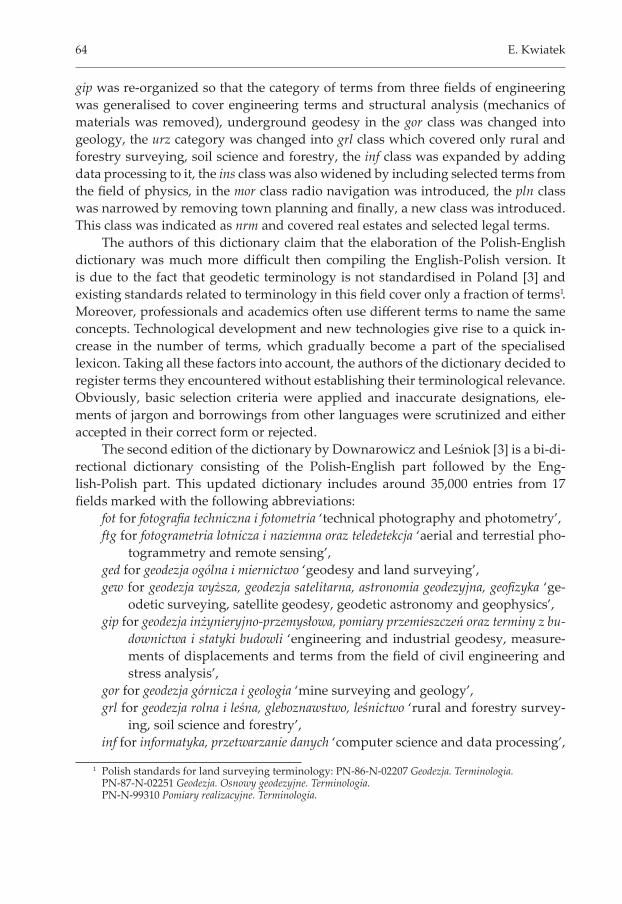
Figure 6 present entries from the fi rst part. The dictionary distinguishes be-tween nominal and verbal meanings as we may see in the entry set.
Fig. 6. Presentation of entries in Podręczny słownik geodezyjny, in the part of dictionary devoted to geodesy and cartography
Source: [8]

Evaluation of Multilingual Land Surveying Dictionaries – Part I 63
2.4. Polsko-angielski, angielsko-polski słownik terminów z zakresu geodezji, map i nieruchomości ‘Polish-English, English-Polish Dictionary of Land Surveying, Mapping and Real Estates’ by Jerzy Downarowicz and Henryk Leśniok
The most recent land surveying dictionary is Polsko-angielski, angielsko-polski słownik terminów z zakresu geodezji, map i nieruchomości [4]. It is the third edition of the dictionary elaborated by Jerzy Downarowicz and Leśniok.
The fi rst edition of this dictionary was published in two stages as Angielsko--polski słownik dla geodetów ‘English-Polish dictionary for land surveyors’ [1] and Polsko-angielski słownik dla specjalistów z zakresu pomiarów geodezyjnych, map, planów i nieruchomości ‘Polish-English Dictionary for Professionals from the Fields of Land Surveys, Maps, Plans and Real Estates’ [2]. The English-Polish dictionary included nearly 13,000 terms from geodesy and related fi elds covering sixteen domains which have some common points with land surveying. These domains are indicated in entries by the following abbreviations:
fot for technical photography,ftg for aerial and terrestial photogrammetry,ged for geodesy and land surveying,gew for geodetic surveying, satellite geodesy, geodetic astronomy and geophys-
ics,gip for engineering and industrial geodesy, measurements of displacements
and terms from the fi eld of civil engineering, industrial engineering, hy-drological engineering, structural analysis, mechanics of materials,
gor for mine and underground surveying,inf for computer science,ins for surveying instrumentation,krt for cartography, technical drawing and printing,mat for mathematics,mor for marine surveys and metrology,ogl for general technical vocabulary,pln for spatial planning and town planning,rwy for adjustment calculus, error theory, mathematical statistics,urz for rural and forestry surveying, agriculture, soil science, mass appraisal
and measurements in forests,top for topohraphy, land and geologic forms.
The English-Polish dictionary [1] was the starting point for the elaboration of the Polish-English dictionary which was published four years later [2]. The termi-nology in the new dictionary was expanded compared to the English-Polish version, some domains were modifi ed, e.g. photometry was added to technical photogra-phy (fot), remote sensing was added to aerial and terrestrial photogrammetry (ftg),
64 E. Kwiatek
gip was re-organized so that the category of terms from three fi elds of engineering was generalised to cover engineering terms and structural analysis (mechanics of materials was removed), underground geodesy in the gor class was changed into geology, the urz category was changed into grl class which covered only rural and forestry surveying, soil science and forestry, the inf class was expanded by adding data processing to it, the ins class was also widened by including selected terms from the fi eld of physics, in the mor class radio navigation was introduced, the pln class was narrowed by removing town planning and fi nally, a new class was introduced. This class was indicated as nrm and covered real estates and selected legal terms.
The authors of this dictionary claim that the elaboration of the Polish-English dictionary was much more diffi cult then compiling the English-Polish version. It is due to the fact that geodetic terminology is not standardised in Poland [3] and existing standards related to terminology in this fi eld cover only a fraction of terms1. Moreover, professionals and academics often use diff erent terms to name the same concepts. Technological development and new technologies give rise to a quick in-crease in the number of terms, which gradually become a part of the specialised lexicon. Taking all these factors into account, the authors of the dictionary decided to register terms they encountered without establishing their terminological relevance. Obviously, basic selection criteria were applied and inaccurate designations, ele-ments of jargon and borrowings from other languages were scrutinized and either accepted in their correct form or rejected.
The second edition of the dictionary by Downarowicz and Leśniok [3] is a bi-di-rectional dictionary consisting of the Polish-English part followed by the Eng-lish-Polish part. This updated dictionary includes around 35,000 entries from 17 fi elds marked with the following abbreviations:
fot for fotografi a techniczna i fotometria ‘technical photography and photometry’,ftg for fotogrametria lotnicza i naziemna oraz teledetekcja ‘aerial and terrestial pho-
togrammetry and remote sensing’,ged for geodezja ogólna i miernictwo ‘geodesy and land surveying’,gew for geodezja wyższa, geodezja satelitarna, astronomia geodezyjna, geofi zyka ‘ge-
odetic surveying, satellite geodesy, geodetic astronomy and geophysics’,gip for geodezja inżynieryjno-przemysłowa, pomiary przemieszczeń oraz terminy z bu-
downictwa i statyki budowli ‘engineering and industrial geodesy, measure-ments of displacements and terms from the fi eld of civil engineering and stress analysis’,
gor for geodezja górnicza i geologia ‘mine surveying and geology’,grl for geodezja rolna i leśna, gleboznawstwo, leśnictwo ‘rural and forestry survey-
ing, soil science and forestry’,inf for informatyka, przetwarzanie danych ‘computer science and data processing’,
1 Polish standards for land surveying terminology: PN-86-N-02207 Geodezja. Terminologia. PN-87-N-02251 Geodezja. Osnowy geodezyjne. Terminologia. PN-N-99310 Pomiary realizacyjne. Terminologia.
Evaluation of Multilingual Land Surveying Dictionaries – Part I 65
ins for instrumentoznawstwo geodezyjne i wybrane terminy z fi zyki ‘surveying in-strumentation and selected terms from the fi eld of physics’,
krt for kartografi a, rysunek techniczny, poligrafi a ‘cartography, technical drawing and printing’,
mat for matematyka ‘mathematics’,mor for pomiary morskie, radionawigacja, metrologia ‘marine surveys, radio navi-
gation and metrology’,nrm for nieruchomości i wybrane terminy prawnicze ‘real estates and selected legal
terms’,ogl for terminy ogólnotechniczne ‘general technical vocabulary’,pln for planowanie przestrzenne ‘spatial planning’,rwy for rachunek wyrównawczy, teoria błędów, statystyka matematyczna ‘adjustment
calculus, error theory, mathematical statistics’,top for topografi a, formy terenowe i geologiczne ‘topography, land and geologic forms’.
It is worth noting that categories (both names and content) and their abbre-viations in the second edition of the dictionary are exactly the same as in the Pol-ish-English dictionary2. The abbreviations play a very important role as they enable people who are not professionals in the fi eld of geodesy, e.g. translators, students, layers, to fi nd terms they are looking for.
Apart from designations of disciplines, we fi nd other symbols in the dictionary, such as US for American spelling, * for archaisms and = for synonyms and acronyms.
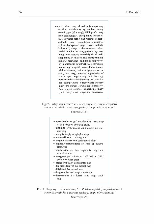
Entries in the dictionary are arranged in alphabetical order. The organization of entries is very interesting. In the Polish-English part, entries which are seman-tically related are grouped together under one entry. For example, the entry mapa ‘map’ contains such terms as aktualizacja mapy ‘map revision’ nazwa mapy ‘map ti-tle’, oznaczenie mapy ‘sheet designation’. These terms are presented as a continuous sequence of information that is separated with semi colons. Each term referring to a new concept is capitalised for bett er recognition (Fig. 7).
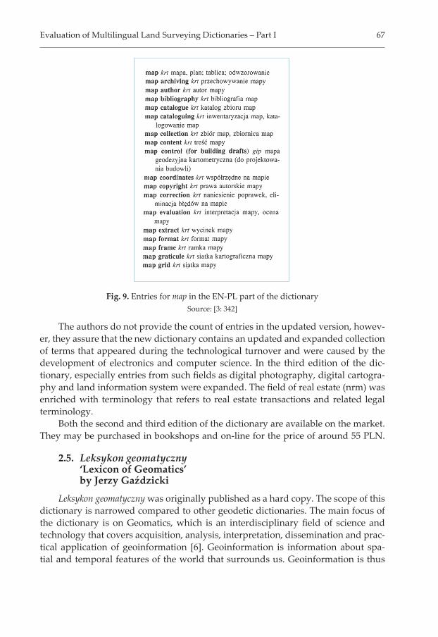
Hyponyms (types) of the term are provided as separate entries after the main term. Each of them is given in a new line which starts from the tilde that replaces the main entry name. For example, after the term mapa ‘map’ we fi nd ~ agrochemiczna ‘agrochemical map’, ~ bogactw naturalnych ‘map of mineral resources’, ~ drzewost-anu ‘forest stand map’ (Fig. 8).
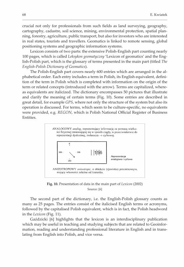
In the English-Polish part, terms referring to related concepts are presented as separate entries. Therefore, for map we fi nd such entries as map control, map coordi-nates, map scale, map use (Fig. 9).
The dictionary by Downarowicz and Leśniok is now available in the updated version, which is the third edition of this lexicographical publication [4]. The diff er-ences between the second and third edition seem to be minimal as both the macro-structure (the organization of the dictionary) and microstructure (the appearance of individual entries) remain the same.
66 E. Kwiatek
Fig. 7. Entry mapa ‘map’ in Polsko-angielski, angielsko-polski słownik terminów z zakresu geodezji, map i nieruchomości
Source: [3: 78]
Fig. 8. Hyponym of mapa ‘map’ in Polsko-angielski, angielsko-polski słownik terminów z zakresu geodezji, map i nieruchomości
Source: [3: 79]
Evaluation of Multilingual Land Surveying Dictionaries – Part I 67
The authors do not provide the count of entries in the updated version, howev-er, they assure that the new dictionary contains an updated and expanded collection of terms that appeared during the technological turnover and were caused by the development of electronics and computer science. In the third edition of the dic-tionary, especially entries from such fi elds as digital photography, digital cartogra-phy and land information system were expanded. The fi eld of real estate (nrm) was enriched with terminology that refers to real estate transactions and related legal terminology.
Both the second and third edition of the dictionary are available on the market. They may be purchased in bookshops and on-line for the price of around 55 PLN.
2.5. Leksykon geomatyczny ‘Lexicon of Geomatics’ by Jerzy Gaździcki
Leksykon geomatyczny was originally published as a hard copy. The scope of this dictionary is narrowed compared to other geodetic dictionaries. The main focus of the dictionary is on Geomatics, which is an interdisciplinary fi eld of science and technology that covers acquisition, analysis, interpretation, dissemination and prac-tical application of geoinformation [6]. Geoinformation is information about spa-tial and temporal features of the world that surrounds us. Geoinformation is thus
Fig. 9. Entries for map in the EN-PL part of the dictionarySource: [3: 342]
68 E. Kwiatek
crucial not only for professionals from such fi elds as land surveying, geography, cartography, cadastre, soil science, mining, environmental protection, spatial plan-ning, forestry, agriculture, public transport, but also for investors who are interested in real states, tourists and travellers. Geomatics is linked to remote sensing, global positioning systems and geographic information systems.
Lexicon consists of two parts: the extensive Polish-English part counting nearly 100 pages, which is called Leksykon geomatyczny ‘Lexicon of geomatics’ and the Eng-lish-Polish part, which is the glossary of terms presented in the main part (titled The English-Polish Dictionary of Geomatics).
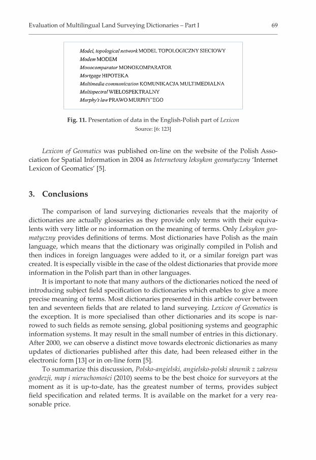
The Polish-English part covers nearly 600 entries which are arranged in the al-phabetical order. Each entry includes a term in Polish, its English equivalent, defi ni-tion of the term in Polish which is completed with information on the origin of the term or related concepts (introduced with the arrow). Terms are capitalized, where-as equivalents are italicized. The dictionary encompasses 50 pictures that illustrate and clarify the meaning of certain terms (Fig. 10). Some entries are described in great detail, for example GPS, where not only the structure of the system but also its operation is discussed. For terms, which seem to be culture-specifi c, no equivalents were provided, e.g. REGON, which is Polish National Offi cial Register of Business Entities.
The second part of the dictionary, i.e. the English-Polish glossary counts as many as 25 pages. The entries consist of the italicised English terms or acronyms, followed by the capitalised Polish equivalent, which is in fact, the Polish headword in the Lexicon (Fig. 11).
Gaździcki [6] highlights that the lexicon is an interdisciplinary publication which may be useful in teaching and studying subjects that are related to Geoinfor-mation, reading and understanding professional literature in English and in trans-lating from English into Polish, and vice versa.
Fig. 10. Presentation of data in the main part of Lexicon (2002)Source: [6]
Evaluation of Multilingual Land Surveying Dictionaries – Part I 69
Lexicon of Geomatics was published on-line on the website of the Polish Asso-ciation for Spatial Information in 2004 as Internetowy leksykon geomatyczny ‘Internet Lexicon of Geomatics’ [5].
3. Conclusions
The comparison of land surveying dictionaries reveals that the majority of dictionaries are actually glossaries as they provide only terms with their equiva-lents with very litt le or no information on the meaning of terms. Only Leksykon geo-matyczny provides defi nitions of terms. Most dictionaries have Polish as the main language, which means that the dictionary was originally compiled in Polish and then indices in foreign languages were added to it, or a similar foreign part was created. It is especially visible in the case of the oldest dictionaries that provide more information in the Polish part than in other languages.
It is important to note that many authors of the dictionaries noticed the need of introducing subject fi eld specifi cation to dictionaries which enables to give a more precise meaning of terms. Most dictionaries presented in this article cover between ten and seventeen fi elds that are related to land surveying. Lexicon of Geomatics is the exception. It is more specialised than other dictionaries and its scope is nar-rowed to such fi elds as remote sensing, global positioning systems and geographic information systems. It may result in the small number of entries in this dictionary. After 2000, we can observe a distinct move towards electronic dictionaries as many updates of dictionaries published after this date, had been released either in the electronic form [13] or in on-line form [5].
To summarize this discussion, Polsko-angielski, angielsko-polski słownik z zakresu geodezji, map i nieruchomości (2010) seems to be the best choice for surveyors at the moment as it is up-to-date, has the greatest number of terms, provides subject fi eld specifi cation and related terms. It is available on the market for a very rea-sonable price.
Fig. 11. Presentation of data in the English-Polish part of LexiconSource: [6: 123]
70 E. Kwiatek
References
[1] Downarowicz J., Leśniok H.: Angielsko-polski słownik dla geodetów. Ofi cyna Wydawnicza Politechniki Warszawskiej, Warszawa 1993.
[2] Downarowicz J., Leśniok H.: Polsko-angielski słownik dla specjalistów z zakresu pomiarów geodezyjnych, map, planów i nieruchomości. Ofi cyna Wydawnicza Po-litechniki Warszawskiej, Warszawa 1997.
[3] Downarowicz J., Leśniok H.: Polsko-angielski, angielsko-polski słownik terminów z zakresu geodezji, map i nieruchomości. Wyd. 2. Ofi cyna Wydawnicza Politech-niki Warszawskiej, Warszawa 2006.
[4] Downarowicz J., Leśniok H.: Polsko-angielski, angielsko-polski słownik terminów z zakresu geodezji, map i nieruchomości. Wyd. 3. Ofi cyna Wydawnicza Politech-niki Warszawskiej, Warszawa 2010.
[5] Gaździcki J.: Internetowey leksykon geomatyczny. 2004, [on-line:] htt p://www.ptip.org.pl/auto.php?page=Encyclopedia&enc=1 [access: 20 April 2015].
[6] Gaździcki J.: Leksykon geomatyczny – Lexicon of Geomatics. Polskie Towarzyst-wo Informacji Przestrzennej/Wieś Jutra, Warszawa 2002.
[7] Hycner R., Dobrowolska-Wesołowska M.: Geodesy, Surveying and Professional Ethics. Gall, Katowice 2008.
[8] Hycner R., Szortyka I.: Podręczny słownik geodezyjny angielsko-polski, polsko--angielski. Stowarzyszenie na Rzecz Rozwoju Wyższej Szkoły Biznesu i Przedsiębiorczości, Ostrowiec Świętokrzyski 2005.
[9] Kwiatek E.: Contrastive Analysis of English and Polish Surveying Terminology. Cambridge Scholars Publishing, Newcastle UK 2012.
[10] Sztompke W.: Słownik geodezyjny w 5 językach: polskim, rosyjskim, niemieckim, angielskim, francuskim. Państwowe Przedsiębiorstwo Wydawnictw Kartogra-fi cznych, Warszawa 1955.
[11] Tarp S.: Specialised lexicography: 20 years in slow motion. Iberica, vol. 24, 2012, pp. 117–128.
[12] Tatarczyk J.: Słownik geodezyjny polsko-angielsko-niemiecki. Wydawnictwa AGH, Kraków 1991.
[13] Tatarczyk J.: Słownik geodezyjny polsko-angielsko-niemiecki [CD]. Gall, Katowi-ce 2005.
[14] Volk M., Graën J., Callegaro E.: Innovations in Parallel Corpus Search Tools. [in:] Ninth International Conference on Language Resources and Evaluation (LREC’14). Reykjavik, 26 May 2014 – 31 May 2014, 2014, pp. 3172–3178, [on-line:] www.lrec-conf.org/proceedings/lrec2014/pdf/504_Paper.pdf.