estimating soil organic carbon changes: is it feasible?
TRANSCRIPT
ESTIMATING SOIL ORGANIC CARBON CHANGES: IS IT FEASIBLE?
Eleanor Milne, Mark Easter and Keith PaustianThe Natural Resource Ecology Laboratory,
Colorado State University (CSU)
GSOC17 - Global Symposium on Soil Organic Carbon21-23 March 2017 - FAO HQ - Rome, Italy
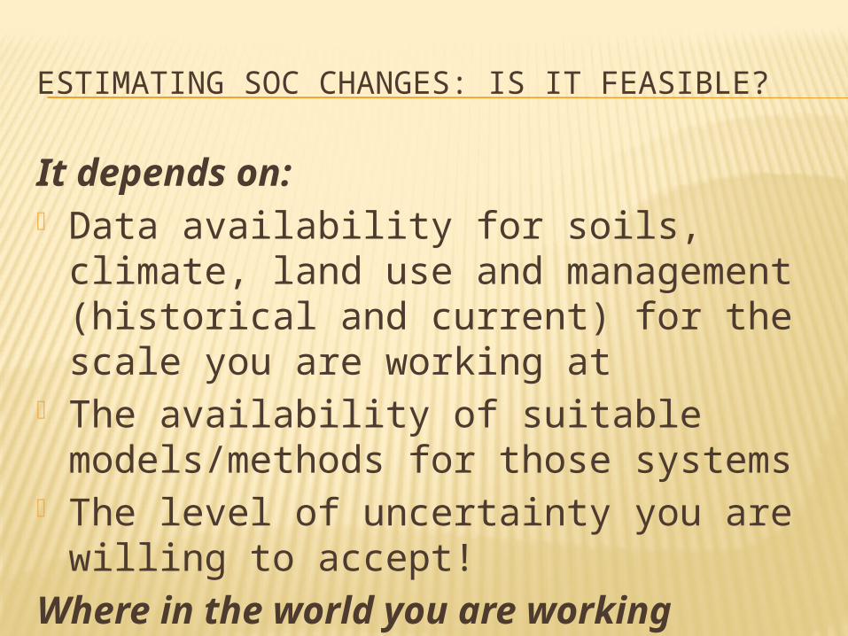
ESTIMATING SOC CHANGES: IS IT FEASIBLE?
It depends on: Data availability for soils, climate, land
use and management (historical and current) for the scale you are working at
The availability of suitable models/methods for those systems
The level of uncertainty you are willing to accept!
Where in the world you are working
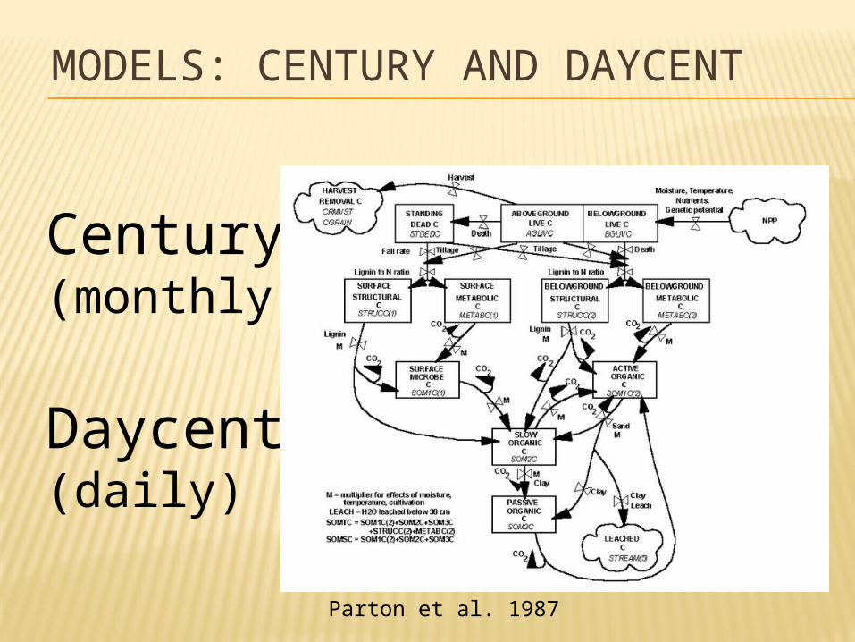
MODELS: CENTURY AND DAYCENT
Century(monthly)
Daycent(daily)
Parton et al. 1987
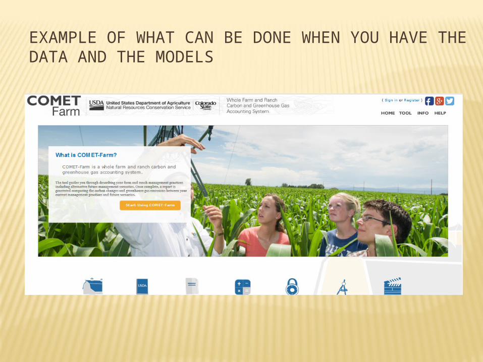
EXAMPLE OF WHAT CAN BE DONE WHEN YOU HAVE THE DATA AND THE MODELS
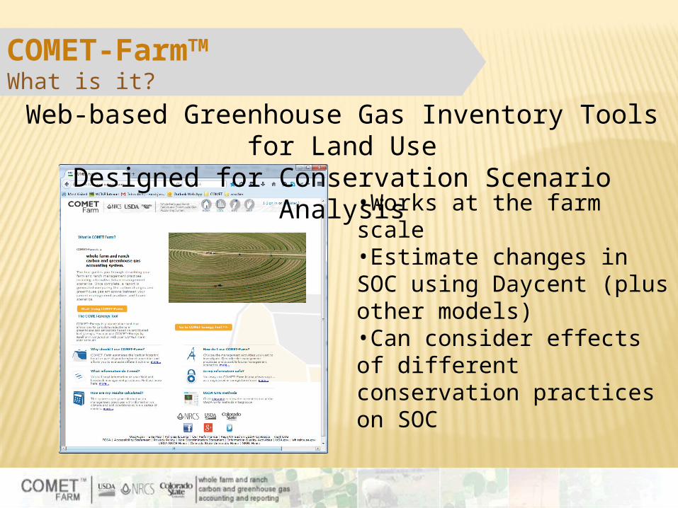
COMET-FarmTM What is it?
Web-based Greenhouse Gas Inventory Tools for Land Use
Designed for Conservation Scenario Analysis•Works at the farm scale •Estimate changes in SOC using Daycent (plus other models)•Can consider effects of different conservation practices on SOC
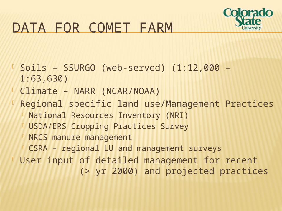
DATA FOR COMET FARM
Soils – SSURGO (web-served) (1:12,000 – 1:63,630)
Climate – NARR (NCAR/NOAA) Regional specific land use/Management Practices
National Resources Inventory (NRI) USDA/ERS Cropping Practices Survey NRCS manure management CSRA – regional LU and management surveys
User input of detailed management for recent (> yr 2000) and projected practices
EquationFactors,USDA
Methods,IPCC
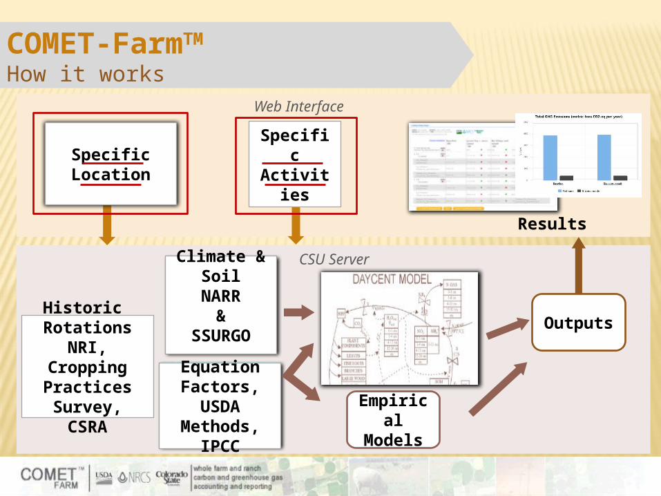
COMET-FarmTM
How it works
Historic Rotations
NRI, Cropping Practices Survey,CSRA
Climate & Soil
NARR&
SSURGO
Web Interface
CSU Server
Empirical
Models
Outputs
Results
SpecificLocation
SpecificActivitie
s
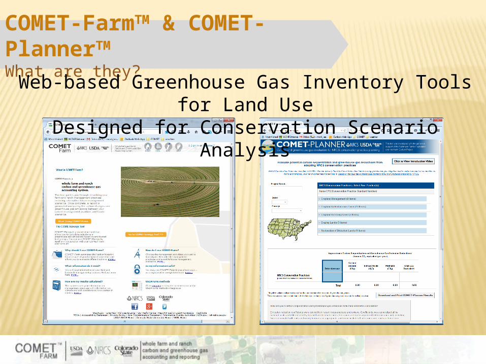
COMET-FarmTM & COMET-PlannerTM
What are they?Web-based Greenhouse Gas Inventory Tools for Land Use
Designed for Conservation Scenario Analysis
EquationFactors,USDA
Methods,IPCC
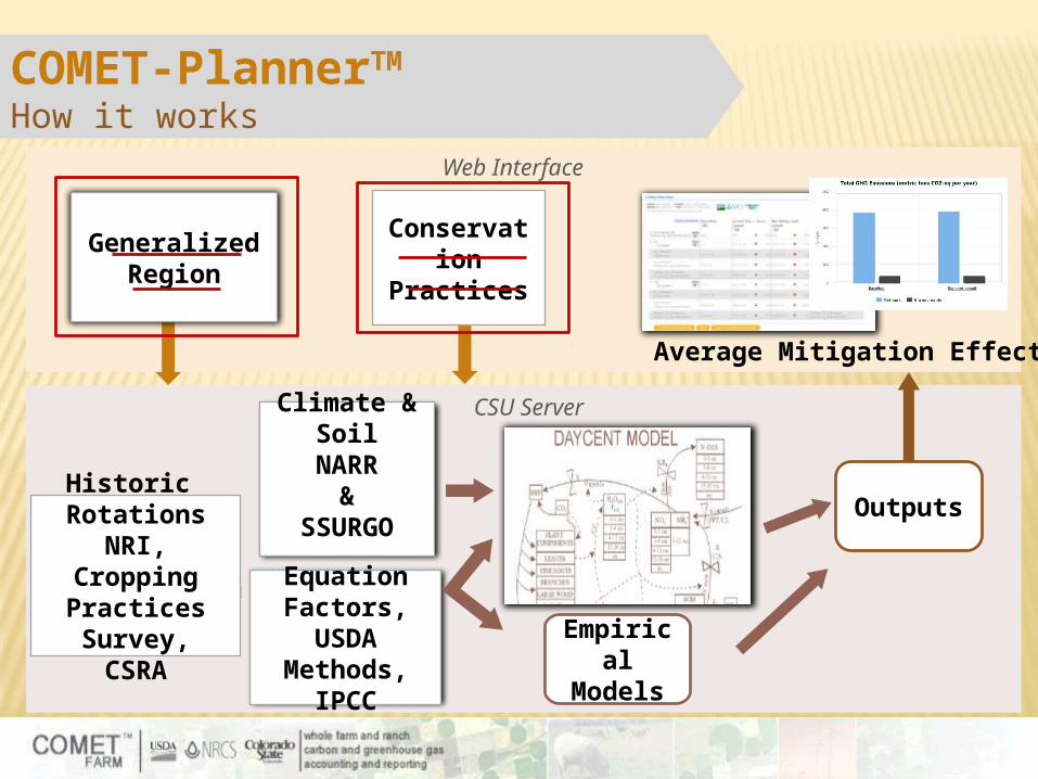
COMET-PlannerTM
How it works
Historic Rotations
NRI, Cropping Practices Survey,CSRA
Climate & Soil
NARR&
SSURGO
Web Interface
CSU Server
Empirical
Models
Outputs
Average Mitigation Effect
GeneralizedRegion
Conservation
Practices
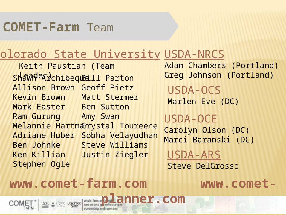
COMET-Farm Team
www.comet-farm.com www.comet-planner.com
USDA-NRCSAdam Chambers (Portland)Greg Johnson (Portland)
USDA-ARSSteve DelGrosso
Colorado State University
USDA-OCSMarlen Eve (DC)
Keith Paustian (Team Leader)Shawn Archibeque
Allison BrownKevin BrownMark EasterRam GurungMelannie HartmanAdriane HuberBen JohnkeKen KillianStephen Ogle
Bill PartonGeoff PietzMatt StermerBen SuttonAmy SwanCrystal ToureeneSobha VelayudhanSteve WilliamsJustin Ziegler
USDA-OCECarolyn Olson (DC)Marci Baranski (DC)
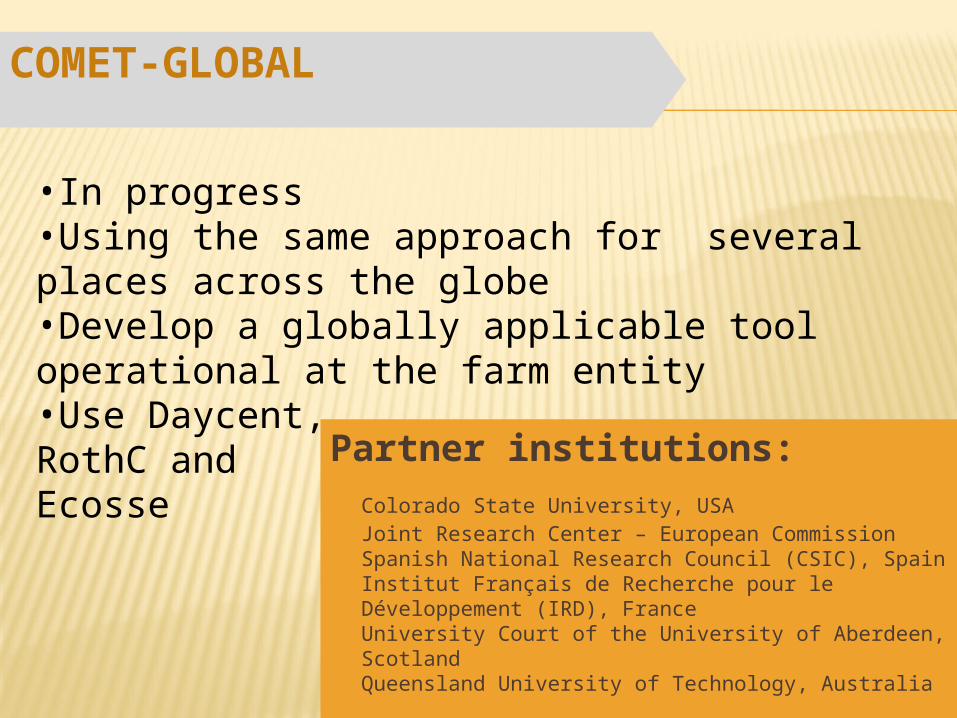
Partner institutions:Colorado State University, USAJoint Research Center – European CommissionSpanish National Research Council (CSIC), SpainInstitut Français de Recherche pour le Développement (IRD), FranceUniversity Court of the University of Aberdeen, ScotlandQueensland University of Technology, Australia
COMET-GLOBAL
•In progress•Using the same approach for several places across the globe •Develop a globally applicable tool operational at the farm entity•Use Daycent, RothC and Ecosse
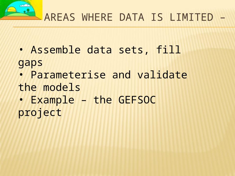
AREAS WHERE DATA IS LIMITED –
• Assemble data sets, fill gaps• Parameterise and validate the models• Example – the GEFSOC project
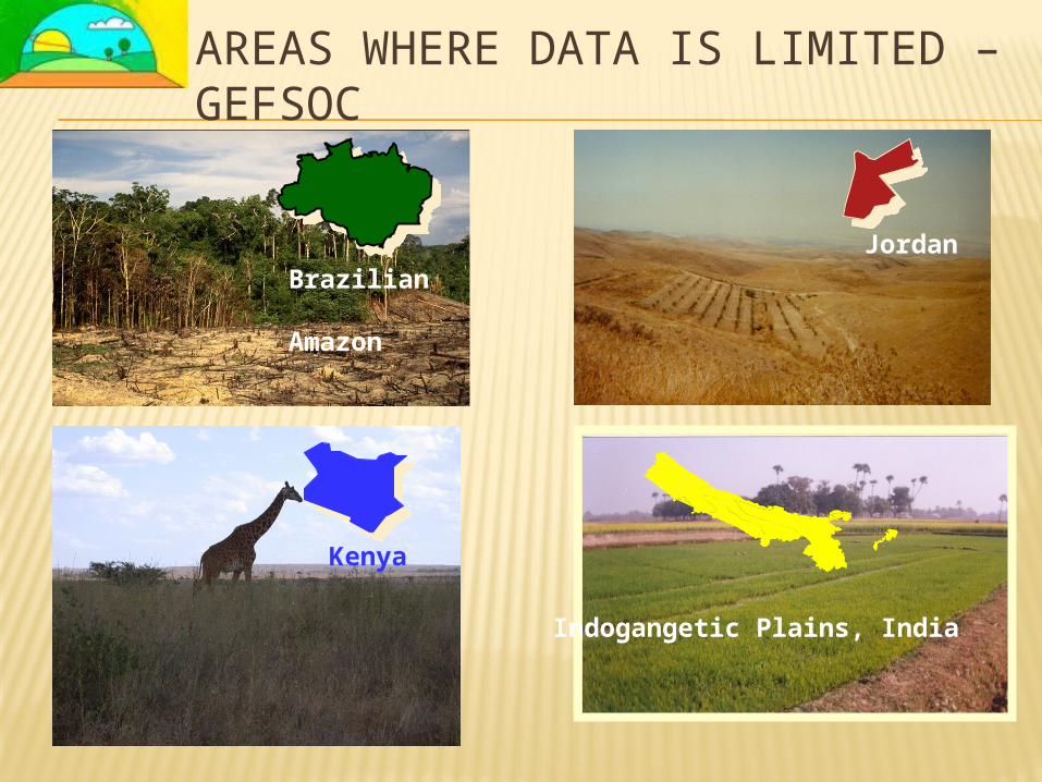
AREAS WHERE DATA IS LIMITED – GEFSOC
Kenya
Brazilian Amazon
Indogangetic Plains, India
Jordan
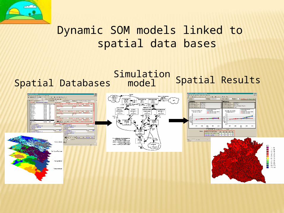
Dynamic SOM models linked to spatial data bases
Spatial DatabasesSimulation
model Spatial Results
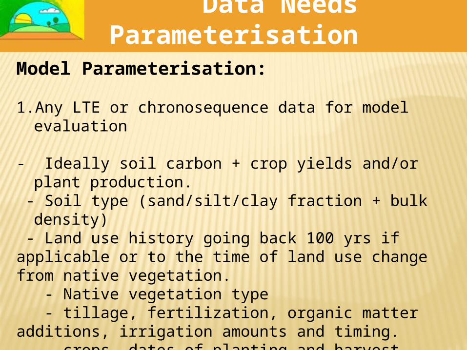
Data Needs Parameterisation
Model Parameterisation:
1. Any LTE or chronosequence data for model evaluation
- Ideally soil carbon + crop yields and/or plant production.
- Soil type (sand/silt/clay fraction + bulk density) - Land use history going back 100 yrs if applicable or to the time of land use change from native vegetation. - Native vegetation type - tillage, fertilization, organic matter additions, irrigation amounts and timing. - crops, dates of planting and harvest, extent of residue removal. - timing and extent of ditch and/or tile drainage, if applicable
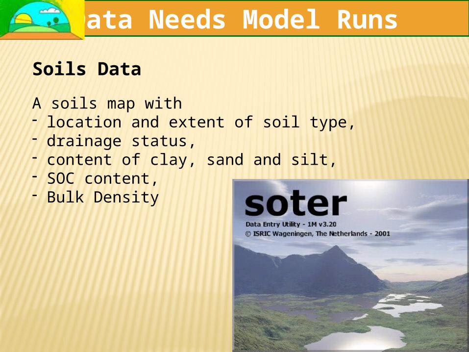
Soils DataA soils map with - location and extent of soil type,- drainage status, - content of clay, sand and silt, - SOC content, - Bulk Density
GEFSOC DATA NEEDSData Needs Model Runs
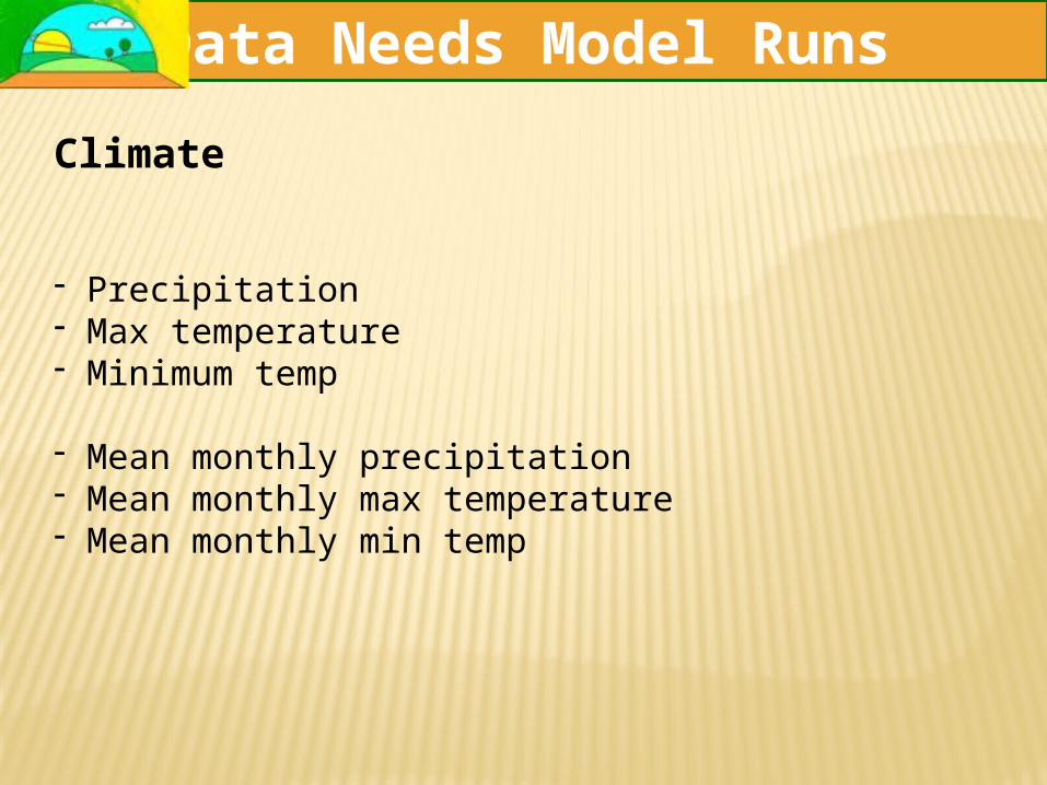
Data Needs Model Runs
Climate
- Precipitation- Max temperature- Minimum temp
- Mean monthly precipitation- Mean monthly max temperature- Mean monthly min temp
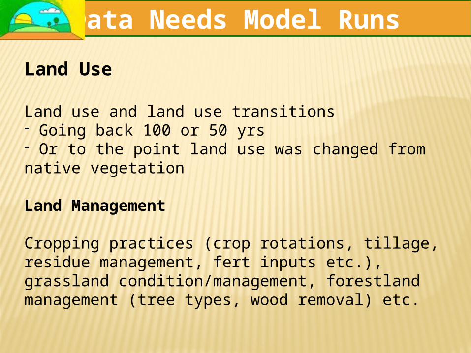
Land Use
Land use and land use transitions - Going back 100 or 50 yrs- Or to the point land use was changed from native vegetation
Land Management
Cropping practices (crop rotations, tillage, residue management, fert inputs etc.), grassland condition/management, forestland management (tree types, wood removal) etc.
Data Needs Model Runs
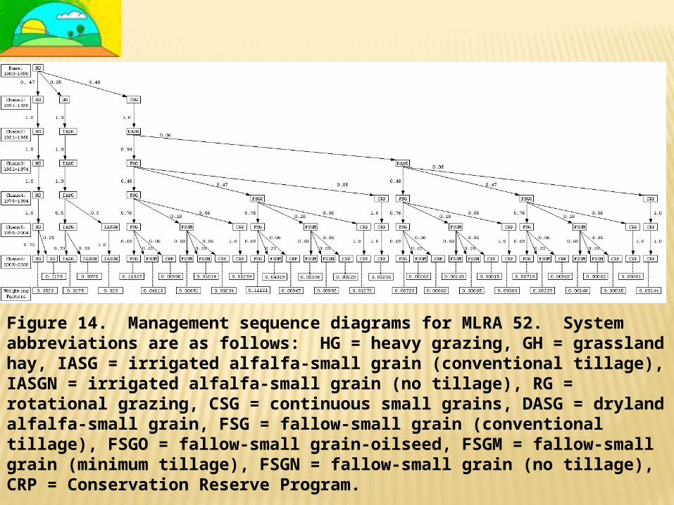
Figure 14. Management sequence diagrams for MLRA 52. System abbreviations are as follows: HG = heavy grazing, GH = grassland hay, IASG = irrigated alfalfa-small grain (conventional tillage), IASGN = irrigated alfalfa-small grain (no tillage), RG = rotational grazing, CSG = continuous small grains, DASG = dryland alfalfa-small grain, FSG = fallow-small grain (conventional tillage), FSGO = fallow-small grain-oilseed, FSGM = fallow-small grain (minimum tillage), FSGN = fallow-small grain (no tillage), CRP = Conservation Reserve Program.
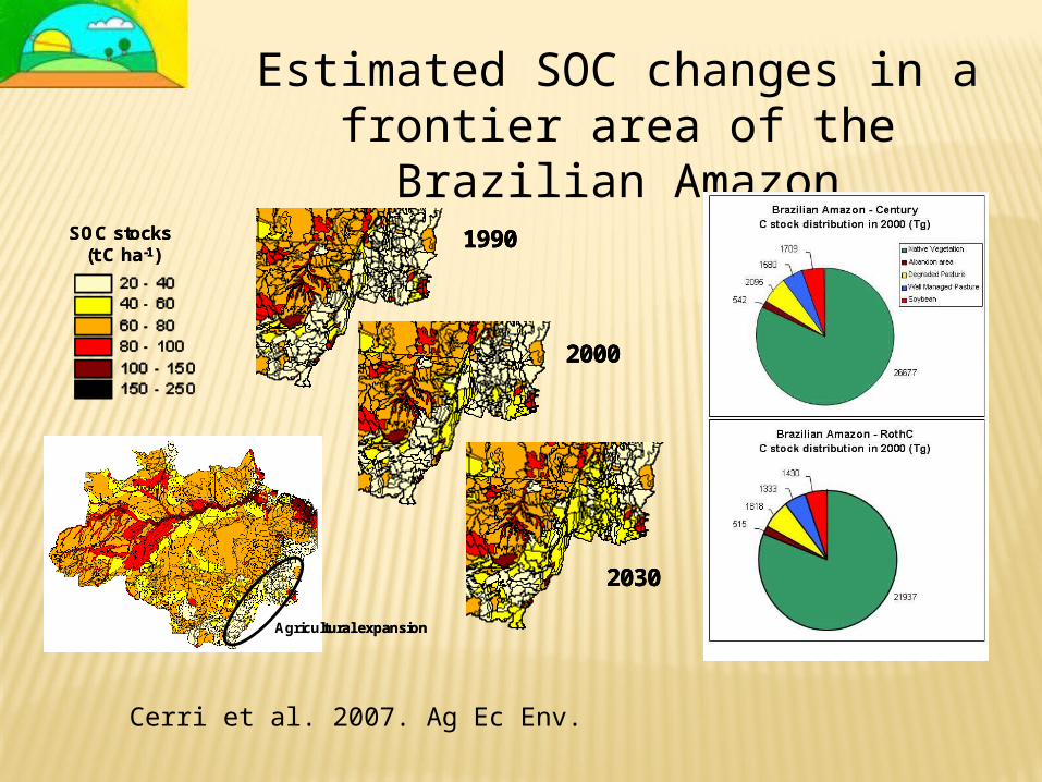
SOC stocks (t C ha-1)
1990
2000
2030
Agricultural expansion
SOC stocks (t C ha-1)
19901990
20002000
20302030
Agricultural expansion
Estimated SOC changes in a frontier area of the Brazilian
Amazon
Cerri et al. 2007. Ag Ec Env.
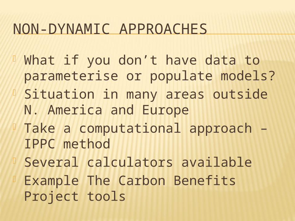
NON-DYNAMIC APPROACHES What if you don’t have data to
parameterise or populate models? Situation in many areas outside N.
America and Europe Take a computational approach – IPPC
method Several calculators available Example The Carbon Benefits Project
tools
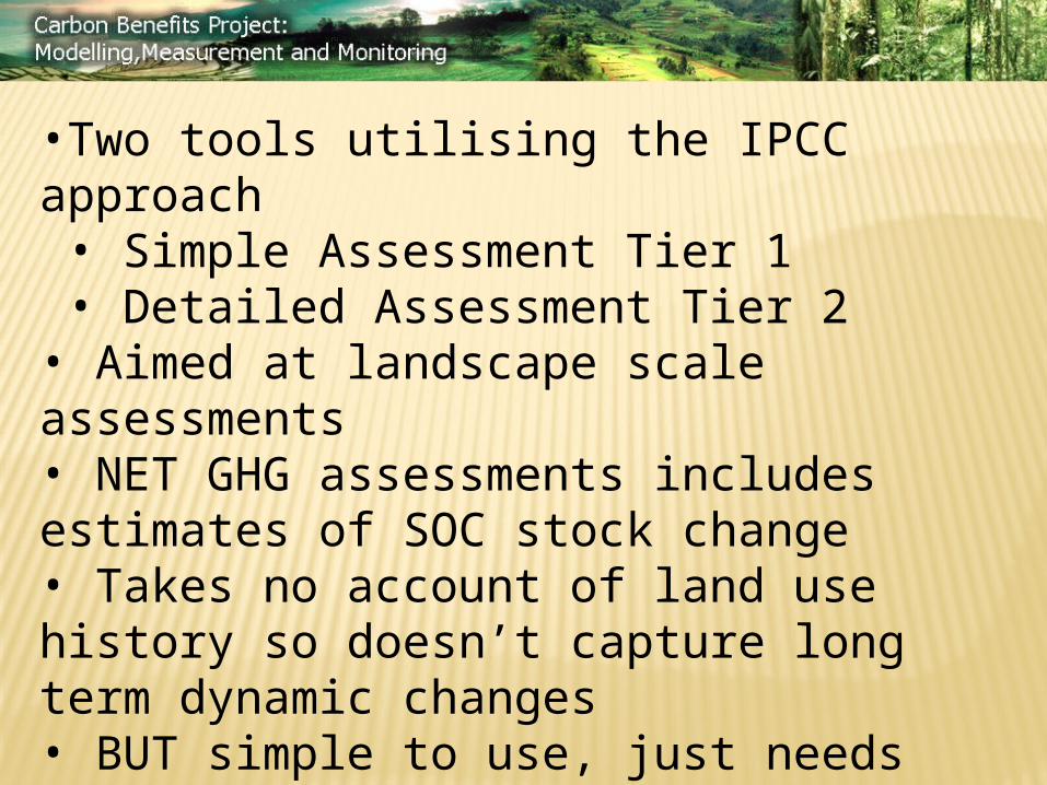
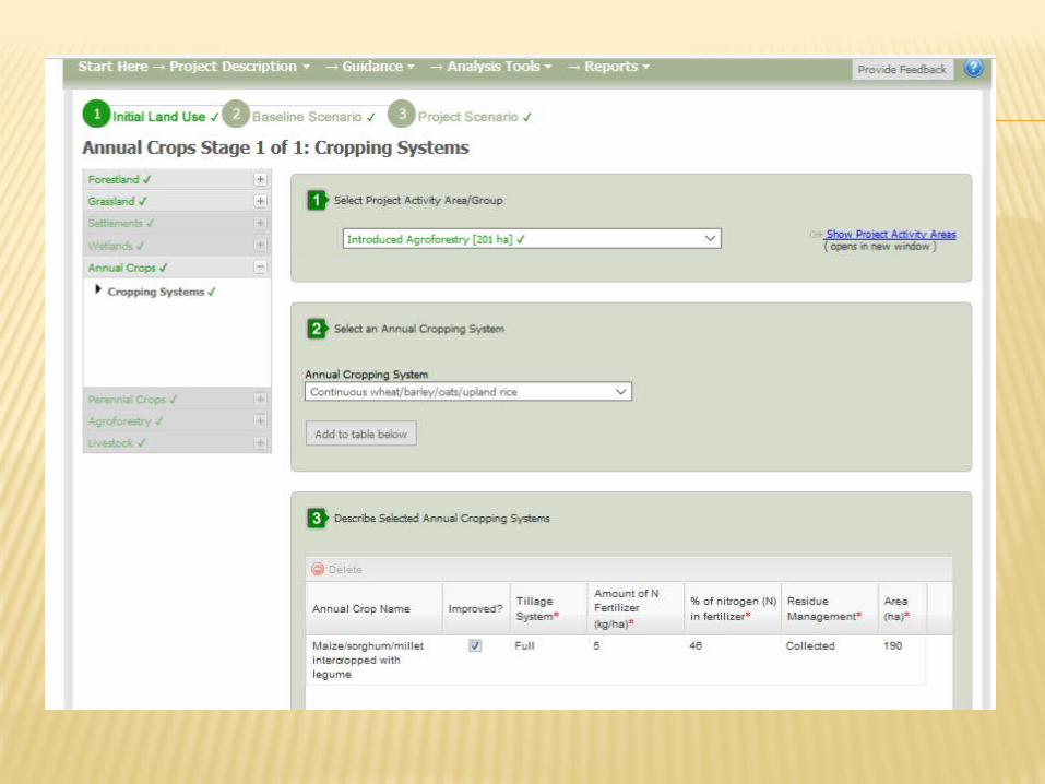
•Two tools utilising the IPCC approach• Simple Assessment Tier 1• Detailed Assessment Tier 2• Aimed at landscape scale assessments• NET GHG assessments includes estimates of SOC stock change• Takes no account of land use history so doesn’t capture long term dynamic changes• BUT simple to use, just needs land use and management info (soils and climate defaults provided)
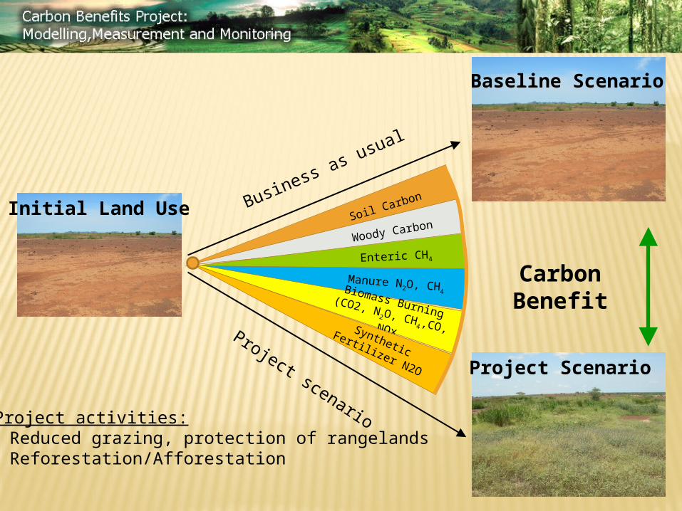
Initial Land Use
Baseline Scenario
Project Scenario
Project activities:- Reduced grazing, protection of rangelands - Reforestation/Afforestation
Project scenario
Business as usual
Soil Carbon
Woody Carbon
Enteric CH4
Manure N2O, CH4Biomass Burning (CO2, N2O, CH4,CO, NOx
Synthetic Fertilizer N2O
CarbonBenefit
ESTIMATING SOC CHANGES: IS IT FEASIBLE?
It depends on: Data availability for soils, climate, land use
and management (historical and current) for the scale you are working at
The availability of suitable models/methods for those systems
The level of uncertainty you are willing to accept!
Gaps in our understanding of the determinants of C sequestration potential
www.vivo.colostate.edu/lccrsp/reports/GrazingLandsLivestockClimateMitigation_Paper1_Final6Aug2015editedv4a.pdf
GRAZING LANDS IN SUB-SAHARAN AFRICA P and the role it plays in C
sequestration in C4 grasslands Effect of ultraviolet radiation on
decomposition Termites- how they affect the amount
and distribution of OM and C in soils Shifts between shrublands and
grasslands & impact on above and below C stocks
Rate of C sequestration and saturation levels
Milne et al. 2016 Environmental Development
THANK-YOU!
COMET Farm - http://cometfarm.nrel.colostate.edu/
GEFSOC – Vol 122, Issue 1 Agriculture Ecosystems and Environment
Carbon Benefits Project - http://cbp-web1.nrel.colostate.edu/
Sub-Saharan Africa report - www.vivo.colostate.edu/lccrsp/reports/GrazingLandsLivestockClimateMitigation_Paper1_Final6Aug2015editedv4a.pdf
and Milne et al. 2016 Environmental Development Vol 19, 70-74