erdas imagine 2013 - hexagon...
TRANSCRIPT

PR
OD
UC
T
DE
SC
RI
PT
IO
N
ERDAS IMAGINE® 2013 Product Features and Comparisons

ERDAS IMAGINE® 2013
2
ERDAS IMAGINE®, the world’s leading geospatial data authoring system, incorporates geospatial image
processing and analysis, remote sensing, and GIS capabilities into a single powerful, convenient package. ERDAS IMAGINE enables users to easily create value-added products such as 2D and 3D images, 3D flythrough movies, and cartographic-quality map compositions from geospatial data. Featuring a ribbon interface and custom workflow tabs so you can consolidate your favorite tools, ERDAS IMAGINE makes it easier to access what you need to work efficiently and productively. ERDAS IMAGINE also provides advanced tools for parallel batch processing, spatial modeling, map production, mosaicking, and change detection. In addition, ERDAS IMAGINE also incorporates the ERDAS ER Mapper algorithms and implements OGC standards. Available in three different product tiers, ERDAS IMAGINE provides an ideal solution for a broad range of organizations and projects so everyone can achieve superior results. Click on a link below for quick navigation:
Return to Page 2
IMAGINE Essentials®
IMAGINE Advantage®
IMAGINE Professional®

ERDAS IMAGINE® 2013
3
Features Comparison Chart
Functionality Essentials Advantage Professional
Geographically connect files across viewers • • •
Compress imagery into MrSID, ECW and JPEG2000 formats • • •
Use more than 190 image and GIS data formats • • •
Rapidly display and roam through imagery • • •
Create and edit Esri®’s Arc coverages and shapefiles • • •
Create and print maps in more than a thousand projected coordinate systems • • •
Display and analyze data in Esri Geodatabases, and Oracle® 10g • • •
2D, 3D, and profile viewing of point clouds • • •
Virtual mosaic of imagery • • •
Polynomial-based rectification of images • • •
Batch processing • • •
Parallel batch processing • •
Point cloud editing in 2D and profile view • •
Orthorectify images • •
Advanced image mosaic into a single image or image tiles • •
Interpolate surfaces with more than 50 million points • •
Perform spatial, radiometric and spectral enhancement • •
Analyze information in radar images •
Classification of point cloud data •
Perform advanced multispectral image classification and segmentation •
Perform graphical spatial modeling •
Extract information from hyperspectral imagery •
Return to Page 2

ERDAS IMAGINE® 2013
4
IMAGINE Essentials® More than 30 years of geospatial research and software development has culminated in the ERDAS IMAGINE suite of software. IMAGINE Essentials is the entry-level tier of ERDAS IMAGINE. Other than IMAGINE Advantage and IMAGINE Professional, there is no more powerful and carefully designed product for creating, visualizing, geocorrecting, reprojecting and compressing geospatial data in single or batch modes than IMAGINE Essentials. IMAGINE Essentials offers the basic tools for geospatial mapping, visualization, enhancement, and geocorrection, including enterprise-enabled access to OGC
® web services and relational databases
such as ArcSDE and Oracle Spatial. At the heart of IMAGINE Essentials is the viewer, which provides multi-threaded, high-performance interactive display and processing. The viewer displays, combines, geographically links, analyzes, and presents imagery and feature data from files or OGC web services in multiple geographic views and maps to facilitate understanding of geographic phenomena.
Key Features
Data Types and Integration There are two types of file data format access: direct access to data formats for the use of files in their native format without conversion, and import and export routines for data exchange to a broader spectrum of data. ERDAS IMAGINE also supports the import and export of numerous satellite, GIS, point data, and image file formats.
Easy to Learn and Use
Intuitive ribbon user interface
Common interface used throughout the ERDAS IMAGINE suite
Context-sensitive, hypertext-linked help
Dock and undock elements in the user interface, including viewers
Customize the layout, color, create custom workflows and quick access buttons
Bubble help
Extensive PDF help, including ERDAS Field Guide, and various user and tour guides
Extensive preferences with keyboard search and tracks changes to defaults
Optional use of the familiar Windows® file chooser
Data Visualization The ERDAS IMAGINE viewer efficiently displays, combines, analyzes, and presents geographic data:
Drag-and-drop data loading to the viewer
International 2-byte fonts supported
Overlay multiple feature and image data types
Treat multiple image layers as
Discrete, independent files
Virtual mosaic
Virtual layer stack
Arrange layers index

ERDAS IMAGINE® 2013
5
Multi-view linking by
Geographical
Spectral
Real-time roam and rotation locking
User-definable projection system for data display
Base map as aerial maps or hybrid layer available from Open Street Maps, user-defined, or Bing®
with a key
Dynamic roam
Fractional zoom, rectangle zoom, pyramid level zoom, and continuous zoom and continuous rotate
Zoom to a specific scale
Zoom to layer extent
Font-to-symbol utility
User-selectable resampling techniques
Nearest Neighbor
Bilinear Interpolation
Cubic Convolution
Bicubic Spline
Rotation of data to user-defined angles
Interactive north arrow and scale bar
On-the-fly reprojection of image, RADAR, feature, and point data
Print using Map Composer templates
Area of Interest (AOI) definition
Use AOI layers for masking
Image histogram modification
Automatic statistics calculation option
Simple brightness/contrast tools
Piecewise linear adjustments
Standard, statistically-based automatic lookup tables (LUTs)
Full graphical histogram contrast adjustment tool
Save and reload multiple LUTs
Window extent statistics
Avoids poor utilization of available screen contrast
Quickly calculate statistics for current viewer
Pseudo color table editing for thematic layers
Define new attribute fields
Switch thematic layers classes on or off individually
Apply color patches

ERDAS IMAGINE® 2013
6
Statistical report generation
Attribute-based criteria selection and display
Point-and-click attribute selection
Recode class values
Filtering for thematic images (Neighborhood Analysis)
Filtering for continuous images
Standard smoothing, edge enhancement, and edge detection filters
Custom filter editor and librarian
Interpolation methods for editing image regions
General raster editing tools
Visual change detection between any data types
Ribbonized for ease of use
Swipe
Blend
Flicker
Interactive direction swipe
Automatic Blend and swipe with fine controls over directions and speed
Detailed layer control
Inquire cursor and inquire box
Measurement tool
Point locations
Ribbonized for ease of use
Lengths, bearings, and angles
Polygonal areas and perimeters
Cylinder lying on ground
Ellipse
Region grow
Height from layover, shadow top, shadow base
Zenith and elevation
Control of units and coordinate systems for reporting
Write measure directly to vector attribute or on-screen annotation
MGRS coordinate display and drive to
Profile tools
Spectral profile for hyperspectral analysis
Spectral reference libraries
Spatial profile for cross-section, surface distance, and line-of-sight analysis
Surface profile for rapid isometric surface views
ERDAS IMAGINE® 2013
7
Point Cloud Tools
Direct read of LAS in planimetric, 3D, and profile
Auto-roam along a profile
Measure in 2D and profile view
View by Classification, elevation, return, RGB, and intensity
Define colors and gradients
Link 2D and 3D views, clip to 2D extent and follow 2D
3D terrain offset
Change z-scale and point size
Image Drape tool for creating perspective views on platforms supporting OpenGL
Rendering of DEM or any surface information as a 2.5D view
Control vertical exaggeration
Specify observer position and viewing geometry
Customizable backgrounds
Atmospheric effects
Draping of multiple data layers
Retention of geographic coordinates
Annotation layers
Manually digitize objects
Objects include text, polylines, rectangles, ellipses, polygons, symbols, arcs, and points
Style editor
Freehand (streaming) polyline editor
Lock annotation rotation angle
Vector layers
Built-in ArcInfo® coverage, geodatabase, shapefile, and ArcSDE
® vector data models
GeoMedia® Warehouse read and query access
Display and present as points, polygons, polylines, tics, or in combination
Select features by point-and-click, regional selection, or attribute-based criteria
Style editor, including attribute-based symbolization
Display and print all or selected features only
Zoom to selected feature(s)
TerraModel layers
Define color palettes
Image analyst capabilities are found in the ERDAS IMAGINE ribbon interface. The features include:
Multiple viewers embedded into a single dialog for easy screen management
Dedicated “overview” linked window, ideal for dual monitor configurations
DirectX hardware acceleration and multi-threaded for multi-CPU support
Thumbwheels for brightness, contrast, zoom, and rotation control
ERDAS IMAGINE® 2013
8
Percentage lookup table (ideal for 16-bit data such as IKONOS and QuickBird)
Dynamic Range Adjustment (DRA) with user definable clipping parameters
Snail trails
Flicker-free raster and vector auto-roaming with regular or user-defined search paths
Contextual magnifier (lens magnifier)
Auto-rotate images
Grid north
True north
Sensor look angle (up is up)
Common rotation angles (45°, 90°, etc.)
Lock rotation angles of GLT with overviews
Image chipping
Snapshot view content to standard image format
Copy view content to Microsoft® Windows clipboard
Feature Counting Tool with user-customizable categories and icons
Ruler integration (Ruler 14 and 16.x)
Intelligent (sensor-specific) band combination selectors
Session saving and loading
Jump roam to a user-selected location from overview
Research and negation tools for multi-image change detection
Automatic application of MTFC kernels
Spectral Mixer tool for predefined weighted-band combinations
Inset view
Metadata insertion tool for map reports (NITF)
Improved text layout including text wrapping and in-place editing
Option to keep text horizontal to screen
Support for recent items in the gallery
Use Microsoft Windows fonts
Manipulate all map template elements
New and improved templates
Automatically insert country map
Multiple views in a map report template
Automatically update scale bars, north arrow, etc.
Improved GeoPoint tool
Send view or map report to Microsoft PowerPoint®/Word or JPEG
LPS Block File read

ERDAS IMAGINE® 2013
9
Raster Data Handling
Write everywhere using raster DLLs for IMG, ECW, JPEG2000, TIFF (including GeoTIFF and TIFF World) and ESRI GRID Stack formats
Create an unlimited number of ECW and JPEG2000 compressed images from input images up to 250 Gpixel with either export or direct-write.
Create an unlimited number of MrSID images up to 50 MB with export; increase MrSID compression capabilities with the IMAGINE MrSID Encoders
Enhanced TIFF, BigTIFF and JPEG file reading and creation
I/O support for terabyte-sized images
DLL extendible
Default format filtering including “All Rasters” option
Multi-threaded pyramid layer and statistics generation for rapid and visually accurate image zooming
Vector Data Handling IMAGINE Essentials enables shapefile and coverage data to be rapidly viewed, created, and/or edited and provides extensive tools for this purpose through the viewer.
Convert from GeoMedia warehouse to shapefile, and shapefile to GeoMedia warehouse
GeoMedia utilities for creating supporting files
GeoMedia warehouse read
ArcSDE and Enterprise Geodatabase vector clients
Esri shapefile, Arc coverage, and simple personal geodatabase read/write/create
Create points, arcs, polygons, and tics
Digitize and split existing polygons with shared boundaries
Reshape an existing shape
Create and enter attribute data
Cut, copy, paste, and delete
Unlimited undo levels
User-defined symbolization
Simple Windows context-based style galleries
Node and arc snapping
Split and unsplit arcs
Specify weed and grain tolerance
Splining, densifying, and generalization
Node and polygon error detection
Arc reshaping
Drag and drop individual arc vertices or arc segments
Continuous, “hands-free” roam while editing
Automatic feature extraction

ERDAS IMAGINE® 2013
10
Heads-up digitizing in viewer, digitizing tablet input, or keyboard data entry
Rename, copy, delete, and external coverages
Reproject to another projection
Add hyperlinks to Microsoft Windows applications or web pages from vector features
Subset shapefile
OGC Data Handling ERDAS IMAGINE is a client application for consuming OGC services.
WMS 1.0, WMS 1.1.1, WCS 1.0, WMS 1.3.0, WCS 1.0.0
Point Cloud Data Handling IMAGINE Essentials enables LAS data to be rapidly viewed and imported.
Direct read of LAS
Direct read MrSID compressed LAS
Uses pyramid layers and spatial indexing for rapid viewing
Import from multiple point formats
Measure in 2D and profile view
View by Classification, elevation, return, RGB, and intensity
Define colors and gradients using the style gallery
Link 2D and 3D views, clip to 2D extent and follow 2D
3D terrain offset
Change z-scale and point size
Box and polyline profile
Auto roam along a profile
File Management IMAGINE Essentials provides several tools to manage imagery and feature data.
IMAGINE Image Catalog for raster data, a database that serves as an image library, softcopy search, and information management system
Attribute-based querying of records (images)
View image footprints on reference maps
Customize reference maps
Display selected images
Retriever provides quick drag and drop access to data in project
XML based, easy to create and modify
Can open quickly with a saved session, or close quickly to open more viewing space
Access ERDAS APOLLO Catalog and other OGC-compliant web services
Add images to the ERDAS APOLLO Catalog from ERDAS IMAGINE
Geocoding services available with a Bing key
ERDAS IMAGINE® 2013
11
Batch Wizard Processing
Serial process many thousands of files (parallel processing available in IMAGINE Advantage)
Record and repeat common functions
Automation to provide multi-file input/output support
Wildcard selection of files
Drag-and-drop data loading
Image Command tool for changing projection and map information and other image metadata
Geometric Correction IMAGINE Essentials provides an intuitive set of tools to georeference raw image data.
Automatic geometric correction from valid ephemeris information
Manual georeferencing can be applied to any raster data
Affine
Polynomial (first to tenth order)
Rubber sheeting
Reprojection
Edit Ground Control Points (GCPs)
Intuitive graphical user interface
GCP selection from map, image, vector, or keyboard
Automatic coordinate conversion
Automatic error reporting
Independent verification of accuracy with check points
Chip extraction (magnifier) viewers
Automatic drive-to-point
Automatic point prediction
Automatically position a predicted GCP
Drop-point geocoding for fast and simple shift correction
Image resampling to coordinate system
Nearest Neighbor, Bilinear, Cubic Convolution, or Bicubic Spline resampling
User-defined pixel sizes and geographic subsets
DLL extendible
Over 1000 projected coordinate systems included
Over 65 spheroids and 500 datums included
User may add more spheroids and datums
Vertical datums, including vertical datum transformations
Support for both standard and user-defined projection libraries, allowing thousands of projection systems to be defined
ArcInfo vector transformations: affine or projective

ERDAS IMAGINE® 2013
12
Viewer geographic link by reproject
Viewer reproject images on-the-fly
Mapmaker reproject images on-the-fly
Reproject command interface
Read/create ESRI world files and projection files (.prj)
Simple Classification Easy-to-use unsupervised classification routine (ISODATA) with only file names and the number of classes needed for input. User control of:
Number of iterations
Number of classes
Skip factors
Initial class means on diagonal or principal axis
Scaling of class ranges
Color scheme initialization options
Convergence threshold
Map Composer Create or access individual custom maps of user-defined size. Add any of the following:
Copy and paste into any product using Microsoft clipboard (PowerPoint, Word, etc.)
Multiple data frames containing one or more data layers each
Automatically generated grid ticks, lines, and graticules
Titles
Lines, bounding boxes, and symbols
Annotation
Logos
North arrows
Scale bars
Automatically generated legends
User-definable styles
Build customized map templates
Automatically generate USGS maps at standard scales
Automatically generate international map series at any scale
Industry-standard printer languages and devices
Automatically populate dynamic elements in the map view
Automatically provide a map location overview
ERDAS IMAGINE® 2013
13
Google Earth™ Integration ERDAS IMAGINE displays a Google Earth tab on the ribbon if Google Earth is detected on the computer. Users can match the Google Earth view to the ERDAS IMAGINE viewer and even synchronize the views. Users can also export image footprints and annotation layers from ERDAS IMAGINE to KML files.
General Tools and Utilities
File chooser mechanism
File system and network navigation
Connection mechanism for database access
Recent list of files accessed
“Go to” list of directories accessed
Select multiple files at once
Preview thumbnail
Rename/delete/set permissions on files
“All Rasters” and “All Vectors” filters
Enterprise database spatial selection tool, including:
User-customizable backdrop maps
MBR footprint display
Thumbnail image display
Image selection by attribute query, spatial and/or point and click criteria
Quickly customize ERDAS IMAGINE to the production environment through the Preference Editor
Access to peripherals and networks
Text editor
Layer information tools
View binary data
Coordinate calculator
Subset tool
Movie player and sequence editor
Spreadsheet functionality via the CellArray™
Convert fonts to symbol libraries
Extensibility
ERDAS Macro Language (EML)
Font manager
Return to Page 2

ERDAS IMAGINE® 2013
14
IMAGINE Advantage® More than 30 years of geospatial research and software development has culminated in the ERDAS IMAGINE suite of software. IMAGINE Advantage is the mid-level tier of ERDAS IMAGINE. Other than IMAGINE Professional, there is no more powerful and carefully designed product for creating, visualizing, geocorrecting, reprojecting, and compressing geospatial data in single or batch modes than IMAGINE Advantage. IMAGINE Advantage builds upon the geospatial capabilities of IMAGINE Essentials to offer more advanced and precise mapping and image processing capabilities. IMAGINE Advantage gives GIS professionals, image analysts, and photogrammetrists more analysis capabilities to make better, more informed decisions. IMAGINE Advantage can provide strategic value to a variety of industries including data providers, agriculture, forestry, natural resource management, telecommunications, environmental engineering, and the extractive industries. Please also review the IMAGINE Essentials® product description for the capabilities and features available for all levels of the ERDAS IMAGINE suite.
Key Features
Parallel Batch Processing IMAGINE Advantage extends the serial process capabilities available within IMAGINE Essentials to introduce a parallel processing capability. Up to four processes, such as reprojection, compression, or image enhancement functions can be run simultaneously for each IMAGINE Advantage license. Multiple floating licenses of IMAGINE Advantage may be accessed to go far beyond four parallel processes.
Orthocorrection IMAGINE Advantage expands the standard techniques available in IMAGINE Essentials to include sensor-based modeling and single-frame orthocorrection.
Sensor models for orthocorrecting data
Frame camera
Digital camera
ALOS AVNIR Rigorous Orbital model
ALOS PRISM Rigorous Orbital model
ALOS PRISM with RPC
ASTER Rigorous Orbital model
CARTOSAT RPC
DEIMOS RPC
DPPDB
EROS 1A & 1B Rigorous Orbital model
FORMOSAT2 Rigorous Orbital model
GEOEYE-1 Rigorous Orbital model
GEOEYE RPC
IKONOS NITF
IKONOS RPCs
IND High Res RPC

ERDAS IMAGINE® 2013
15
IRS-1C/1D
KOMPSAT RPC
Landsat TM, MSS, ETM+
MODIS
NITF RPC
ORBIMAGE Rigorous Orbital model
PLEIADES RPC
QuickBird RPC
QuickBird/WorldView (including NCDRD format) Rigorous Orbital model
RADARSAT
RAPIDEYE RPC
RESOURCESAT
SPOT 5 Rigorous Orbital model
SPOT Pan, XS, XI
THEOS1 – Rigorous Orbital model
WorldView RPC
Orthocorrection models for solving when ephemeris information is lacking
Direct Linear Transform (DLT)
Projective Transform
Specify principal point and focal length for the camera
Select fiducial layout type and record film location template
Measure fiducial image locations
Specify/calculate rotation angles for Omega, Phi, Kappa
Specify/calculate perspective center position for X, Y, Z
Account for the Earth’s curvature
User-specified number of iterations
Specify output projection system
Select GCP reference coordinates from map, image, vector, or keyboard
Standard GCP editor extended to allow the definition of Z values
Raster Product Format (RPF) production
Controlled Image Base (CIB)
Compressed Arc Digital Raster Graphics (CADRG)
Increase in ECW / JPEG2000 Capability above IMAGINE Essentials
Create an unlimited number of ECW and JPEG2000 compressed images from input images up to 500 Gpixel with export, direct-write, and MosaicPro.

ERDAS IMAGINE® 2013
16
GeoMedia Data Handling
Buffer analysis for feature tables in a GeoMedia warehouse
Radar Analyst
Real-time georeferences for RADARSAT 2, TerraSAR-X, and COSMO SkyMed
Select display mode
Magnitude
Edge enhance with interactive illumination setting
Interactive level slice
Show look direction
Real-time AIS feed
Point Clouds
Encode LAS files with raster pixel values such as RGB
Edit (constant Z, Offset, Reclass, Delete)
Subset, filter, split, merge
LiDAR command tool for batch update of pyramids and projection information
Metric Accuracy Assessment (MAA) Tool When delivering products derived from imagery, users should always be able to state the spatial accuracy of those products. The MAA tool enables calculation of the accuracy of mono or stereo pair imagery (stereo analysis restricted to RPC models) using photo-identifiable ground control points.
Control (or Test & Evaluation – T&E) points can be manually entered or read from file
Calculation of error statistics
Individual point error and statistics report
Error computations are based on MIL-STD-600001, with bias taken into account
CE is computed using horizontal error as input to the LE formula with bias
Mosaicking IMAGINE Advantage provides MosaicPro, the geospatial industry’s most robust mosaicking tool. MosaicPro provides cutline creation and editing, color-balancing, illumination correction, feathering, dodging, and more for the creation of seamless mosaics and image tiles. From a pair of images to over 16,000 images, MosaicPro handles it all.
MosaicPro user interface to manage all aspects of the mosaic process including graphics and image display options
Mosaic Express for easy learning and rapid setup times
Command line interface for production batch processing
Mosaic multiple images with:
Differing or like resolution (pixel sizes)
Differing or like projection systems

ERDAS IMAGINE® 2013
17
Geometric calibration or finished orthorectification
Select the images to mosaic individually, by all the files in the directory, or by all the files in a file list
Use relatively positioned images or images with just map information in addition to fully georeferenced images.
Load images directly from a LPS block file
Select elevation sources in any supported raster format
Control the image area considered for mosaicking
Use the entire image
Compute an active area
Use a template AOI
Use an individual AOI
Crop edges by percentages (provides for automatic clipping of fiducials from scanned frame imagery)
Automatic image loading and unloading based on user setting for large product efficiency
Multiple options for ordering and sorting imagery
Promote and demote individual images or selected groups
Order by source date, and write source date and image name metadata to output seamline shapefile
Sort images to minimize overlap areas
For overlap areas, cutlines can be defined automatically or by the user
Save to/load from shapefile
Automatic geometry based cutlines
Automatic weighted cutlines
Additional cutline options for triangulated data
Most Nadir
Most Nadir Narrow
Most Nadir by DTM
Cutline editing in interface with WYSIWG (what you see is what you get) approach to provide real-time feedback of included imagery changes
View reference seam polygons for working on geographically adjacent products
Color Corrections
Exclude Areas
Manual or semi-automated
Define abnormal areas for exclusion from processing
Dodging
User definable grid size
Band dependent or independent
Dodge across images or individually
Manually editable correction settings
Preview

ERDAS IMAGINE® 2013
18
Color Balancing
Adjustable or manual
Surface-fitting removes spatially varying illumination effects such as hot spots
Option to use existing lookup tables
Preview color balancing effects
Histogram matching based on:
Image to image
Overlap areas only
Ideal target histogram
Illumination equalization to adjust illumination variations (from sun glint, etc.)
Full control over the algorithm applied at each image overlap region
Radiometric seam smoothing and feathering
Preview finished mosaic results in a local user-defined area including seam feathering, smoothing, radiometric adjustments, and output GSD changes. This allows for parametric optimization before running a full mosaic job.
Output a single file or cut into project files
Union of all inputs to single file
User-defined AOI to single file
Multiple AOIs to separate files
Use Map Series file to output to multiple files on user defined grid pattern
ASCII sheet file definition
Rotated output sheets
Global clip boundary
Specify output projection cell size and data type
Image Processing & Spatial Analysis IMAGINE Advantage provides access to over 100 standard image processing and GIS techniques for enhancing and analyzing data.
Radiometric enhancement
Look-Up table stretch
Rescale data
Noise reduction
Periodic noise removal
Landsat 7 reflectance and radiance conversion
Destripe Landsat
Replace bad lines
Histogram match
Brightness inversion
Histogram equalization
Topographic normalize

ERDAS IMAGINE® 2013
19
Spatial enhancement
Resample/reproject
Degrade
Convolution filters
Non-directional edge detection
Texture analysis
Wallis adaptive filter
Crisp
Statistical filter
Homomorphic filter
Morphological operators
Open
Close
Erode
Dilate
Focal (neighborhood) analysis
Wallis adaptive filter
Pan sharpen
Hyperspherical Color Space pan sharpening
Developed specifically for WorldView-2
Subtractive resolution merge
High Pass Filter (HPF) resolution merge
Trade color for sharpness, or vice versa
2Two-pass process for high spatial-disparity images
Modified IHS resolution merge
Tailored to be sensor-specific
Maintains spectral radiometry
Merge multiple bands, not just three
Wavelet resolution merge
Ehlers Fusion
Wavelet based pan sharpening
Automatic or manual filtering schemes
Resolution merge
Principal Component
Multiplicative
Brovey Transform
Spectral enhancement
Layer stack

ERDAS IMAGINE® 2013
20
Principal component
Inverse principal component
Independent component
Tasseled cap transformation
Decorrelation stretch
RGB to IHS
IHS to RGB
Spectral mixer
Hyperspectral tools
Normalize spectrum
Internal Average Relative Reflectance (IARR)
Log residuals
3D Rescale
Spectrum Average
Signal-to-noise ratio
Mean per pixel
Profile tools
Thematic (GIS, many applicable for vector as well as raster)
Thematic to RGB
Random class colors
Recode
Neighborhood functions
Morphological
Search (buffer)
Clump, sieve and eliminate classes
Perimeter of clumps
Aggregation of thematic classes
Zonal attributes (parcel statistics)
Matrix union
Summary report of matrix union)
Overlay (minimum or maximum)
Index (weighted summation)
Fourier analysis
Fourier transform
Graphical fourier transform editor
Inverse fourier transform
Fourier magnitude
Classification
ERDAS IMAGINE® 2013
21
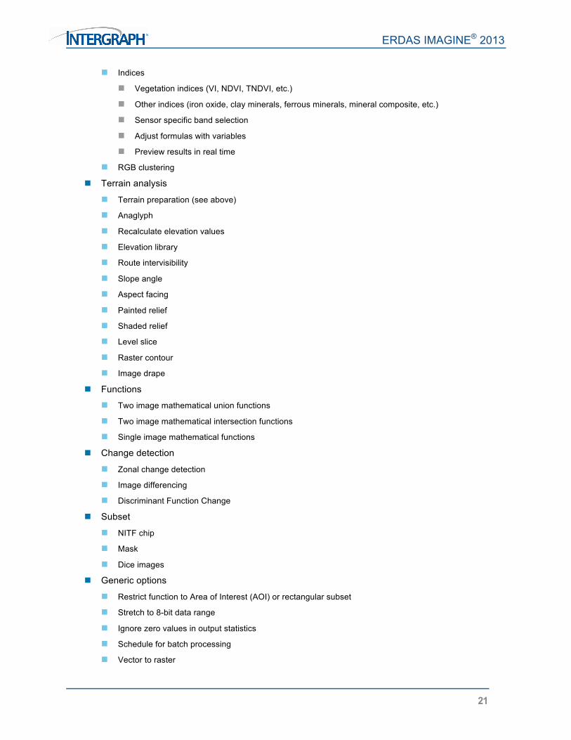
Indices
Vegetation indices (VI, NDVI, TNDVI, etc.)
Other indices (iron oxide, clay minerals, ferrous minerals, mineral composite, etc.)
Sensor specific band selection
Adjust formulas with variables
Preview results in real time
RGB clustering
Terrain analysis
Terrain preparation (see above)
Anaglyph
Recalculate elevation values
Elevation library
Route intervisibility
Slope angle
Aspect facing
Painted relief
Shaded relief
Level slice
Raster contour
Image drape
Functions
Two image mathematical union functions
Two image mathematical intersection functions
Single image mathematical functions
Change detection
Zonal change detection
Image differencing
Discriminant Function Change
Subset
NITF chip
Mask
Dice images
Generic options
Restrict function to Area of Interest (AOI) or rectangular subset
Stretch to 8-bit data range
Ignore zero values in output statistics
Schedule for batch processing
Vector to raster

ERDAS IMAGINE® 2013
22
Modeling Language The Spatial Modeling Language (SML) is highly flexible, enabling users to create and run customized models for image processing and GIS analysis. The Spatial Modeler fully supports the input of calibrated imagery and will output it to a specified projection system. The majority of Image Interpreter functions, which use the underlying Spatial Modeler programs, now also support multiple input projection systems and calibrated imagery.
Model librarian with built-in editor
Over 80 example SML scripts to customize
Specify the projection system when inputting two or more images of differing projections into a model
Function types (over 200 provided)
Point
Neighborhood (focal)
Global
Zonal
Layer
Statements
Declarations
Assignments
Show, read, and write
Set
Macro definitions
Quit
Flow control
Statement blocks
Object types
Scalar
Table
Matrix
Raster
Vector
Data types
Binary
Integer
Float
Complex
Color
String
Variables
Windows

ERDAS IMAGINE® 2013
23
Syntax error checking
Calibration and reprojection support
Knowledge Classifier Using knowledge bases created with IMAGINE Professional, IMAGINE Advantage users can classify geographic data with the simple, user-friendly Knowledge Classifier wizard interface.
Evaluate classification classes
Automatically identify missing files
Output fuzzy sets, confidence layers and feedback layers, as well as classifications Knowledge bases created by expert users in IMAGINE Professional can be distributed to IMAGINE Advantage users anywhere in the world to apply classification processes to their data. This portability is one of the keys to the strength of the expert systems approach. See the IMAGINE Expert Classifier™ section in the IMAGINE Professional Product Description for more details about the IMAGINE Expert Classifier. Return to Page 2

ERDAS IMAGINE® 2013
24
IMAGINE Professional® More than 30 years of geospatial research and software development has culminated in the ERDAS IMAGINE suite of software. IMAGINE Professional is the top-level tier of ERDAS IMAGINE and is the most powerful and carefully-designed product in the world today for creating, visualizing, geo-correcting, re-projecting, modeling, classifying and compressing geospatial imagery. IMAGINE Professional is a comprehensive geographic imaging package for advanced image processing, remote sensing and GIS professionals. IMAGINE Professional includes all the capabilities of IMAGINE Essentials and IMAGINE Advantage and advanced features such as graphical data modeling, advanced classification, and radar analysis tools. ERDAS IMAGINE is one of the first commercial software packages to enable users to create expert systems that use geographic data to solve geographic problems. With the IMAGINE Expert Classifier, IMAGINE Professional users have a tool for building and executing expert systems for image classification, post classification refinement, and advanced GIS modeling. In addition, IMAGE Professional customers also receive ERDAS ER Mapper. Together, these products provide the most powerful image processing and raster GIS engine available on the same desktop. Please refer to the product pages at http://geospatial.intergraph.com for detailed information on ERDAS ER Mapper capabilities. Please also review the IMAGINE Essentials® and IMAGINE Advantage® product descriptions for the capabilities and features available for all levels of the ERDAS IMAGINE suite.
Key Features
Spectral Analysis Extending the hyperspectral tools found in IMAGINE Advantage, Spectral Analysis allows customers to quickly extract material mapping information with minimal effort and knowledge of hyperspectral image processing theory. Spectral Analysis tools include:
Standard task-based workflows
Anomaly and target detection
Material mapping and identification
Hyperspectral image preprocessing steps
Band wavelength/width specification
Bad band identification
Spectral and spatial subset
Atmospheric adjustment
Minimum noise fraction
Spectral libraries
ASTER
JPL
USGS
Import new versions of the above libraries
Import SITAC libraries

ERDAS IMAGINE® 2013
25
Import SPECMIN libraries
Spectral Analysis Workstation
Multi-pane workspace providing access to all the tools and viewers that enable interactive analysis
of hyperspectral imagery, spectral signatures, and other data displays
Three geospatially-linked views (main view, an overview view of the whole image extent, and a zoom view showing magnified detail of a specific location)
Embedded spectral plot tools
Embedded spectral libraries
Drag and drop interaction between the image pixels, plots, and libraries
Access to all preprocessing and task processes
Spectral Analysis Methodologies
Orthogonal Subspace Projection (OSP)
Spectral Angle Mapper (SAM)
Spectral Correlation Mapper (SCM)
Constrained Energy Minimization (CEM)
IMAGINE Expert Classifier The IMAGINE Expert Classifier is made up of two components: the Knowledge Engineer and the Knowledge Classifier. Key features of the Knowledge Engineer include:
A graphical drag-and-drop interface for building a knowledge base
Confidence value definition and propagation—the ability to handle uncertainty
The use of variables from various sources including images, vectors, scalars, graphical models, and other user-defined programs
The ability to include prompts for particular data files for the creation of portable knowledge bases
Quick feedback on the results of a classification to aid in developing and fine-tuning a knowledge base
Access to other ERDAS IMAGINE tools, such as Model Maker, for defining spectral/spatial operators
The Knowledge Classifier enables users to apply a knowledge base to geographic data with the simple user-friendly Knowledge Classifier wizard interface.
Perform classifications
Evaluate classification classes
Automatically identify missing files
Output fuzzy sets, confidence layers, and feedback layers, as well as classifications While the Knowledge Engineer is a standard part of IMAGINE Professional, the Knowledge Classifier is a standard part of IMAGINE Advantage. Consequently, expert users who design and test knowledge bases using IMAGINE Professional can distribute them to IMAGINE Advantage users anywhere in the world to apply the classification process to their data.

ERDAS IMAGINE® 2013
26
Multispectral Classification
Unsupervised classification
ISODATA algorithm
Initialize class means from image statistics or optional signature file means
Set convergence threshold, maximum iterations and skip factors
Classify only the AOI
Output a signature set
Specify the number of classes and color scheme in the output cluster file
Open and modify indices in the Spatial Modeler with all presets from GUI
Grouping Tool for assigning classes to land cover types
Define target land cover classes
Interactively select and highlight working groups of classes
Boolean operators to compare and separate working groups
Highlight similarity/conflict geographically
Dendrogram tool visually represents similarity of classes
Distance measures
Euclidean
Mean scaled
Divergence
Spectral angle
Agglomeration methods
Simple linkage
Complete linkage
Simple average linkage
Average linkage
Centroid
Median
Save grouped classes to image
Fuzzy classification, fuzzy convolution filtering, and fuzzy recode
Accuracy assessment through use of ancillary data to measure errors of commission/omission
Post-classification class editing
Chi-square or Euclidean distance class thresholding
Threshold interactively on a histogram display
Threshold based on statistics or graphic editing
Preview threshold results
Classification accuracy assessment
Random or user-defined ground truth locations
ERDAS IMAGINE® 2013
27
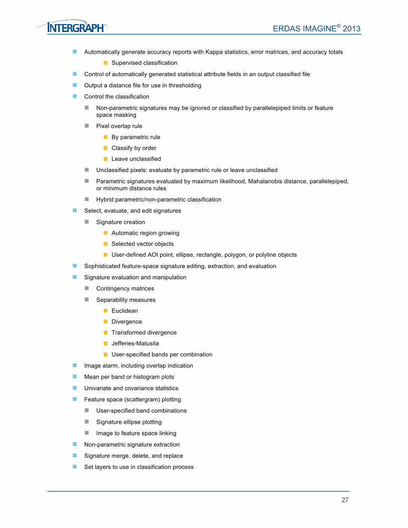
Automatically generate accuracy reports with Kappa statistics, error matrices, and accuracy totals
Supervised classification
Control of automatically generated statistical attribute fields in an output classified file
Output a distance file for use in thresholding
Control the classification
Non-parametric signatures may be ignored or classified by parallelepiped limits or feature space masking
Pixel overlap rule
By parametric rule
Classify by order
Leave unclassified
Unclassified pixels: evaluate by parametric rule or leave unclassified
Parametric signatures evaluated by maximum likelihood, Mahalanobis distance, parallelepiped,
or minimum distance rules
Hybrid parametric/non-parametric classification
Select, evaluate, and edit signatures
Signature creation
Automatic region growing
Selected vector objects
User-defined AOI point, ellipse, rectangle, polygon, or polyline objects
Sophisticated feature-space signature editing, extraction, and evaluation
Signature evaluation and manipulation
Contingency matrices
Separability measures
Euclidean
Divergence
Transformed divergence
Jefferies-Matusita
User-specified bands per combination
Image alarm, including overlap indication
Mean per band or histogram plots
Univariate and covariance statistics
Feature space (scattergram) plotting
User-specified band combinations
Signature ellipse plotting
Image to feature space linking
Non-parametric signature extraction
Signature merge, delete, and replace
Set layers to use in classification process

ERDAS IMAGINE® 2013
28
Manual editing of parallelepiped limits
Set output class values, colors, a priori probabilities, and classification order
Subpixel Classification The IMAGINE Subpixel Classifier characterizes the scene being processed by the amount (fraction) of one specific material, rather than multiple materials, in each image pixel. This allows the classification of objects smaller than the spatial resolution of the sensor.
Train the classifier
Perform environmental corrections
Develop training signatures
Combine signatures
Perform quality assurance
Point Clouds Classify point clouds as bare earth, buildings, or vegetation.
Area Frame Sampling A statistical approach to estimating land cover extent within a given region, based on interpretation of higher resolution imagery samples.
Project manager and wizard
Stratum file definition
Sampling grid generation
Graphical sample selection
Dot grid analysis to label samples
Polygon analysis to label samples
Calculate estimates and error tolerances
Model Maker The first object-based graphical geospatial data modeling tool.
Based on Spatial Modeler Language (SML)
Over 50 prepackaged models
Use graphical flow charts to quickly perform sophisticated GIS analysis
Combine GIS and image processing functions in the same spatial model
Combine raster, vector, and attribute data in a single model
Use GeoMedia vector and grid operators
Enhance and build models with Python
Apply a model to new data or a different geographical area at the push of a button
Double-click to define objects
Function object
Access to over 200 separate functions
Function syntax “prototypes”

ERDAS IMAGINE® 2013
29
Use and output attribute information
Set operating geographic window and resolution
Accepts calibrated images
Reproject input data on-the-fly
Quickly modify and rerun the model
Run a model directly or generate an SML script for integration with EML
Publish models to ERDAS APOLLO as a Web Processing Service (WPS)
Unlimited ECW / JPEG2000 Compression Capability
Create an unlimited number of ECW and JPEG2000 images of unlimited size with export, direct-write, and MosaicPro
IMAGINE Radar Interpreter™
Sensor merge
Principal components
Intensity Hue Saturation (IHS)
Multiplicative, radar data re-map options, etc.
Texture enhancement
Variance
Skewness
Kurtosis
Mean Euclidean distance
Speckle suppression
Mean
Median
Lee-Sigma
Local region
Lee
Frost
Gamma-MAP
Edge enhancement
Wallis adaptive filter
Bandwise, IHS, or Principal Component
User-defined scene contrast multiplier
Luminance modification
Produce high-luminance or low-luminance images with no image degradation
Specify local luminance intercept
Normalize illumination in the range direction
User-defined scene contrast multiplier

ERDAS IMAGINE® 2013
30
Correct luminance in row or column
Slant-to-ground range adjustment
Specify sensor
Depression angle
Beam width
Adjust to flat plain or user-defined spheroid
Radar Conversions
Domain
Magnitude and Phase (MP)
Intensity and Phase
Real and Imaginary (IQ)
Magnitude Only (M)
Intensity Only
Phase Only (P)
Radiometric
Media DN to Beta-Naught (Linear)
Media DN to Beta-Naught (Decibels)
Linear to Decibels and Decibels to Linear
Radiometric Terrain Correction, producing
Radar backscatter coefficient Sigma-Nought
Incidence angle mask
Return to Page 2
Intergraph is part of Hexagon (Nordic exchange: HEXA B; www. hexagon.com), a leading global provider of design, measurement, and visualization technologies that enable customers to design, measure and position objects, and process and present data. For more information, visit geospatial.intergraph.com and www.hexagon.com.
ABOUT INTERGRAPH Intergraph helps the world work smarter. The company’s software and solutions improve the lives of millions of people through better facilities, safer communities and more reliable operations.
Intergraph Process, Power, & Marine (PP&M) is the world’s leading provider of enterprise engineering software enabling smarter design and operation of plants, ships and offshore facilities. Intergraph Security, Government, & Infrastructure (SG&I) is the leader in smart solutions for emergency response, utilities, transportation and other global challenges. For more information, visit www.intergraph.com
©2014 Intergraph Corporation. All rights reserved. Intergraph is part of Hexagon. Intergraph, the Intergraph logo, ERDAS IMAGINE, IMAGINE Essentials, IMAGINE Advantage, IMAGINE Professional,
and GeoMedia are registered trademarks of Intergraph Corporation or its subsidiaries in the United States and in other countries. IMAGINE Expert Classifier and IMAGINE Radar Interpreter are
trademarks of Intergraph Corporation or its subsidiaries in the United States and in other countries. Microsoft and Windows are registered trademarks of Microsoft Corporation. Other products and brand names are trademarks of their respective owners. GEO-US-0143B-ENG 11/13