emergency and humanitarian action (eha), who...
TRANSCRIPT

1
Emergency Situation Report ESR (5)
9 September 2010
Emergency and Humanitarian Action (EHA), WHO Indonesia Mt. Sinabung Volcano Eruption, North Sumatera Province, Republic of Indonesia
Long-dormant Mt. Sinabung in Tanah Karo District, North Sumatra erupted on Sunday, 29th of August 2010 at 00:15 AM local time, spewing sand and ash up to a mile high, while hot lava only moved around the crater.
Since its first eruption, the volcano has erupted 3 times, each time with a bigger intensity. The latest and biggest one is on Tuesday, 7 September 2010 at 00:24 AM local time, spewing volcanic ashes as far as 8 km from the summit, accompanied by volcanic earthquakes which can be felt up to 12 – 13 km from the summit.
The eruptions affected 25 villages 3 sub-districts: Namanteran Sub-District, Tiganderket Sub-District, and Payung Sub-District within 6 km radius from the summit.
The population at risk is defined as people from villages within 6 km radius from the summit (hazardous area).
The number of Internally Displaced People has gone back up to 23,829 in 25 evacuation points in 9 sub-districts.
Based on the observation of The Center of Volcanology and Disaster Management, Mt. Sinabung alert level remains at level 4. Therefore, the emergency response phase has been extended until further notice.
According to Crisis Centre, Ministry of Health, 1 person died due to respiratory complications, 171 people have been referred to Kabanjahe Hospital for further treatment. Majority of health problems diagnosed are Upper Respiratory Tract Infection (URTI), fever, dyspepsia, hypertension, and gastroenteritis.
The latest eruption cut off power to at least seven villages. The power is now back to normal. Ministry of Transportation has released Notice to Airman regarding the disrupted visual flight around
Mt. Sinabung area for the nexth month. On 6 September 2010, Ministry of Health in collaboration with other institutions has deployed Mental
Health Team to conduct Post-Traumatic Stress Disorder Counseling to IDPs. MOH, Regional Crisis Center of North Sumatra, Provincial Health Office and District Health Office
are in close collaboration with WHO Indonesia, provided integrated Emergency Health Services according to Standard Operating Procedures.
HIGHLIGHTS
Affected Areas and Incident Site Mapping
Level 4: Alert, major eruption is imminent (within 24 hours).
Mt Sinabung Level 4

2
Emergency Situation Report ESR (5)
9 September 2010
Map of North Sumatra
Caption: Mt. Sinabung 06-09-10
SSS UUU KKK AAAMMM EEE RRR III AAAHHH
SSS UUU KKK AAANNN AAALLL UUU
NNN AAA MMM AAANNN
KKK UUU TTT AAARRR AAAYYY AAATTT KKK UUU TTT AAAGGG UUU GGG UUU NNN GGG
MMM AAARRR DDD III NNN DDD III NNN GGG
GGG UUU RRR UUU KKK III NNN AAAYYY AAANNN
GGG EEE MMM BBB EEE RRR
KKK UUU TTTAAA TTTEEE NNN GGG AAAHHH
BBB RRR AAASSS TTTEEE PPP UUU
KKK UUU TTT AAAMMM BBB AAARRR UUU
TTT III GGG AAA NNN DDD EEE RRR KKK EEE TTT PPP EEE RRR BBB AAAJJJ III
SSS EEE LLL AAANNN DDD III
PPP AAAYYY UUU NNN GGG
SSS III MMM AAACCC EEE MMM
BBB EEE KKK EEE RRR AAAHHH KKK UUU TTT AAATTT OOO NNN GGG GGG OOO LLL
TTT III GGG AAAPPP AAANNN CCC UUU RRR
PPP III NNN TTTUUU BBB EEE SSS III
KKK UUU TTTAAAMMM BBB EEE LLL III NNN
TTT AAANNN JJJ UUU NNN GGG MMM EEE RRR AAAWWW AAA
UUU JJJ UUU NNN GGG PPP AAAYYY UUU NNN GGG
SSS III GGG AAARRR AAANNN GGG --- GGG AAARRR AAA NNN GGG
TTTEEE MMM BBB UUU RRR UUU NNN
Vulnerability Map 25 Villages within 6 km radius
from Sinabung Summit

3
Emergency Situation Report ESR (5)
9 September 2010
Since its first eruption on 29 august 2010, Mt. Sinabung has erupted three times 30 August
2010, 3 September 2010, and 7 September each time with a bigger intensity. For almost 410 years Mt. Sinabung showed no dangerous volcanic activity and categorized
as a dormant or type B volcano, therefore, the Center of Volcanology and Disaster Management has not been actively monitoring its volcanic activity. This is the first time in Indonesian history that a type B volcano suddenly turned into a dangerous one, or a type A volcano. From now on, there will be no difference between these two types of volcano in terms of monitoring.
The eruptions affected 3 sub-districts: Naman Teran Sub-District Tiganderket Sub-District and Payung Sub-District with 25 villages in hazardous area (within 6 km radius from the summit).
Based on the observation and analysis of The Center of Volcanology and Disaster Management, the volcano remains at alert level 4. In accordance with this alert level, the following recommendations have been developed:
o Communities living and working within 6 km radius circle around the volcano have been relocated to safer areas.
o People should use protective mask and shield drinking water source in case of heavy volcanic ashfall
o People along the riverbank should be aware of the possibility of secondary hazard in the form of lahar volcanic mudflow due to heavy rain that is likely to fall based on weather forecast.
Situation Analysis
15 Points 13,837 IDPs
1 Point 2,775 IDPs
1 Point 325 IDPs
2 Points 507 IDPs
2 Points 1,709 IDPs
2 Points 2,154 IDPs
1 Point 1,702 IDPs
Evacuation Points Map (06/09/10)
Legend: Distance from Volcano
DOLAT RAYAT
1 Point 619 IDPs
MEREK
1 Point 201 IDPs
4
Emergency Situation Report ESR (5)
9 September 2010
Based on the analysis of Environmental Health Centre Medan, the air quality of the area surrounding Mt. Sinabung is still below threshold. After the thrid eruption which However, the number of patients with Upper Repiratory Tract Infection is still expected to be high due to the inhalation of volcanic ash from the eruptions, especialy after the latest one.
Table showing casualties & damage:
Dead Inpatient(s) Outpatients IDP Damaged Health Facilities 1 37 21,521 23,829 0
The number of patients referred to Kabanhaje Hospital has reached 171, of which 134 have been discharged. The highest number of cases include: Fever Observation, Upper Respiratory Tract Infection, Dyspepsia, Hypertension, and Gastroenteritis. Due to the last two biggest eruptions, the number of Internally Displaced People has gone back up to 23,829 in 26 evacuation points in 9 sub-districts. The table below shows the number of registered IDPs as per 6 September 2010. Table showing number of people in IDP camps as per 6 September 2010:
District Sub-District Evacuation Point(s) Registered IDP Karo Kabanjahe 15 13,837
Tiga Binanga 2 1,709 Brastagi 1 2,775 Dolat Rakyat 1 619 Tiganderket 2 507 Munte 1 325 Merek 1 201 Kutabuluh 2 2,154
Sub Total 25 22,127 Langkat Seibinge 1 1,702
Sub Total 1 1,702 Total 26 23,829
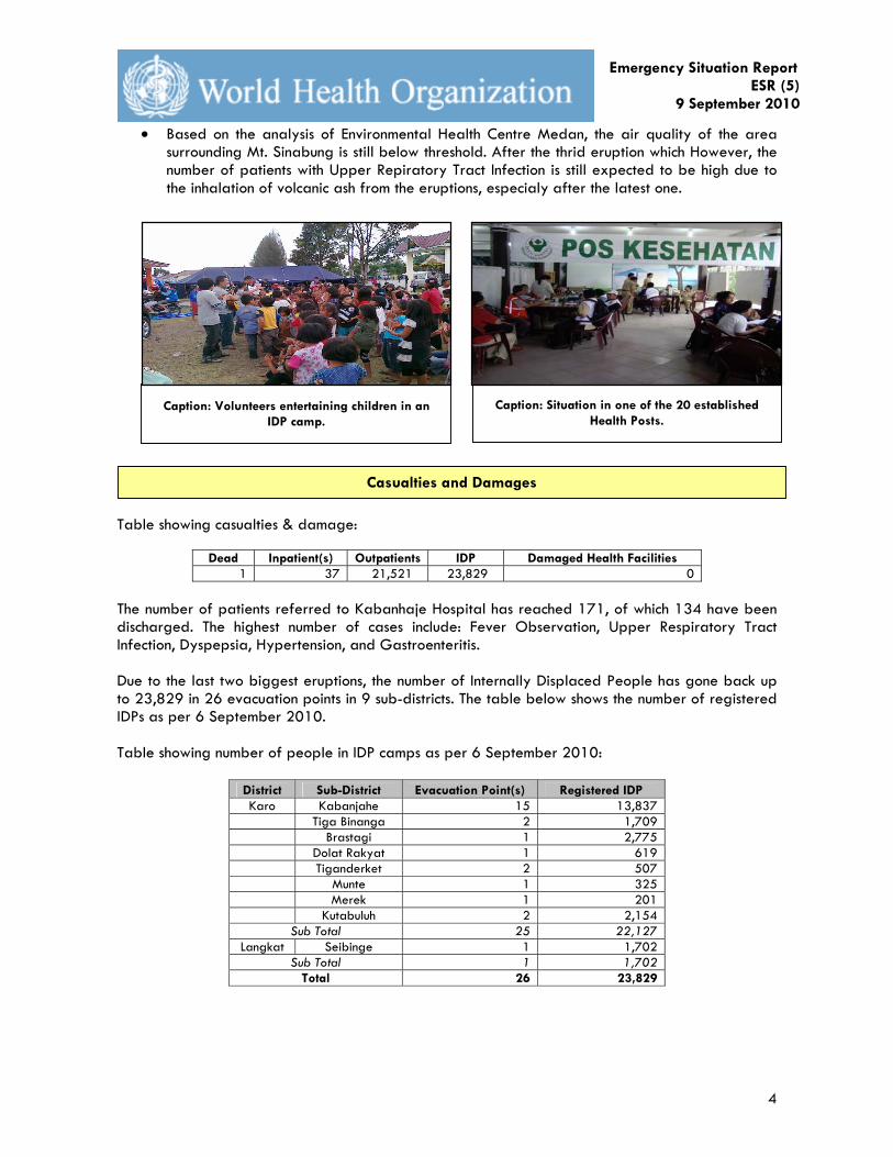
Casualties and Damages
Caption: Volunteers entertaining children in an IDP camp.
Caption: Situation in one of the 20 established Health Posts.
5
Emergency Situation Report ESR (5)
9 September 2010
Table and graph showing day-to-day number of outpatients in health posts based on diagnosis:
Date/Diagnosis Anxiety URTI Conjunctivitis Gastritis Diarrhea Hypertension Dermatitis Total
29-Aug-10 1,058 459 563 379 0 18 0 2,477
30-Aug-10 725 1,144 282 539 24 93 0 2,807
31-Aug-10 262 1,727 214 444 397 137 57 3,238
1-Sep-10 120 1,349 114 332 270 117 143 2,445
2-Sep-10 175 829 115 293 177 125 52 1,766
3-Sep-10 153 1,186 78 262 220 111 78 2,088
4-Sep-10 107 975 110 231 194 76 78 1,771
5-Sep-10 29 970 112 329 169 67 77 1,753
6-Sep-10 22 1,126 43 208 170 73 87 1,729
7-Sep-10 57 873 91 169 154 62 41 1,447
Total 2,708 10,638 1,722 3,186 1,775 879 613 21,521
Communication and Electricity Powers are still working. Electricity in villages within the hazardous area was disrupted for 10 minutes following the latest biggest eruption on 7 September 2010.
Land transportation beyond 6 km restricted area is not disrupted. Ministry of Transportation has released Notice to Airman regarding the disrupted visual
flight around Mt. Sinabung area for the next month. Disrupted flight routes include Medan to Meulaboh (Aceh), Silangit (Tapanuli), Tapaktuan (Aceh), Gunung Sitoli, and Pulau Batu (Nias Selatan). Eruption may effect flight traffic to and from the province depending on the direction of the wind. Decision to continue inter-province regular flights is left to respective airlines.
Communication, Transportation and Electricity Power
Health Problems among IDPs
0
200
400
600
800
1,000
1,200
1,400
1,600
1,800
2,000
8/29
/201
0
8/30
/201
0
8/31
/201
0
9/1/
2010
9/2/
2010
9/3/
2010
9/4/
2010
9/5/
2010
9/6/
2010
9/7/
2010
Date
To
tal
Anxiety
URTI
Conjunctivitis
Gastritis
Diarrhea
Hypertension
Dermatitis

6
Emergency Situation Report ESR (5)
9 September 2010
MOH – WHO Indonesia Ministry of Health:
o Ministry of Health has provided operational fund 100,000,000 IDR on 3 September 2010.
o Ministry of Health (MOH) has deployed three batches of medical teams which will work a 5-day shift and mental health team with the following details:
No Team Number of members
Members Period Purpose
1 Advance team 4 Crisis Center (2), MATRA (1), surveillance (1)
29-31 August 2010
Distribute health supply and support RHA
2 2nd batch 7
Crisis Centre, Surveillance, Environmental Health,
Pharmacy, Health Service, Nutrition, and Community
Health (1 staff each)
31 August – 4 September
2010
Distribute the 2nd batch health supply and support health assessment
3 3rd batch 1 Crisis Center 1-5
September 2010
Monitor the situation and prepare for Minister visit
4 Minister of
Health Team Ministry of Health 3 September
2010
Observing the situation and distribute health supply and operational fund
5 Mental Health
Team 20
Mental Health Directorate, MOH (2), Medan Mental Hospital (3), UI Nursing Faculty (1), USU Nursing
Faculty (5), Mutiara Health Institute (2), Palkesi (2)
tbc Post-Traumatic Stress Disorder Counsling
o The medical teams distributed health supplies with the following details:
No. Item Total 1 Garbage Bags 9,000
2 Mist blower 3
3 Insecticide 155 L
4 Hygiene Kit 770 sets
The District Health Office has prepared Kabanjahe Hospital with 140 beds, 20 general
practitioner, 3 surgical rooms, and 1 radiology unit. Medan Environmental Health Unit is monitoring air quality level WHO and MOH up-dating the situation and filling the gaps in collaboration with National
Board for Disaster Management (BNPB) WHO is in close communication with MOH in monitoring the situation through Crisis Center as
well as District and Provincial Health Offices.
Response

7
Emergency Situation Report ESR (5)
9 September 2010
The following table shows health resources distribution in Kabanjahe Hospital:
No Doctor (Field) Number 1 General Practice 20 2 Internal Medicine 3 3 Paediatrics 2 4 Obstetrics and Gynecology 3 5 Ear Nose Throat 1 6 Ophtalmology 1 7 Neurology 2 8 Radiology 1 9 Clinical Pathology 3
Total 36 The following table shows health resources distribution in health posts:
5-Sep-01 No. Health Post
Doctor Nurse Other
1 Main Post 4 5 31
2 Jambur Lige 4 6 0
3 Jambur Sempakta 5 6 0
4 Jambur Adil Makmur 5 6 0
5 Jambur Dalihan Natolu 3 6 0
6 Multi Function Hall 4 6 0
7 Jambur Tuah Lopati 2 6 0
8 Jamburta Ras Berastagi 5 6 0
9 GBKP Office Klasis Kabanjahe 3 6 0
10 Jambur Guru Pulungen 4 4 0
11 Ministry of Religious Affair Post 0 6 0 12 KAKR Building Simp. Katepul 0 6 0
13 Tigabinanga 2 6 0
14 Singgamanik 6 12 0
15 Perbesi 0 12 0
16 Tanjung Mbelang 1 4 0
17 Tanjung Pulo 0 0 0 18 Dolat Rakyat/Tongkoh 1 6 0
19 Kutabuluh 1 3 0
20 Siabang-abang 1 3 0
21 Singa 1 2 0
Total 52 117 31
The Center of Volcanology and Disaster Management
Emergency Response Team has been on the field (Bekerah Cimace, Namanteran Sub-District) since 28 August 2010 and has been coordinating with local government. The team will continuously monitor the activity of M. Sinabung and report updates every 6 hours.

8
Emergency Situation Report ESR (5)
9 September 2010
Financial Aid
No Source Amount 1 President 3,000,000,000 2 National Disaster Management Agency 1,700,000,000 3 House of Representative 100,000,000 4 N. Sumatra Head of Police 50,000,000 5 Other Province 25,000,000 6 Others 82,264,000
Total 4,957,264,000 Status of International Aid So far the government has not officially requested any international aid. The local authorities, with support from central government and ministries, are trying their best to manage the situation so far. Important Contacts JAKARTA OFFICE FOCAL PERSON
CRISIS CENTER -MOH
No Name Designation Phone Fax Email Address
1 Mr. Mudjiharto, SKM, MM
Head of Department 0878 77288238 021 5271111 [email protected]
2 Dr. Lucky Tjahjono Head of Emergency Response & Recovery Unit
0811 902 378 021 5271111 [email protected]
3 YusRizal, M.Epid Head of Information and Monitoring Unit
0816 117 4320 021 5271111 [email protected]
EHA-WHO JAKARTA
No Name Designation Phone Fax Email Address
1 Dr. Vijay Nath Kyaw Win
Medical Officer 0856 94155323 021 5201164 [email protected]
2 Dr. Suci Melati Wulandari
Program Officer 0856 2916 016 021 5201164 [email protected]
3 Ms. Intani Nur Kusuma
Information & Communication Officer
0818 0414 5225 021 5201164 [email protected]
Source of Information from Indonesia Information is gathered from the following sources. This report is for reference only and should not be quoted as factual accuracy can change. 1. WHO 2. Crisis Center (PPK), MoH 3. UN System 4. BNPB 5. Local and international news media