drought preparedness · 2 drought preparedness for tribes in the four corners region nidis the...
TRANSCRIPT
1
Report produced by
The Climate Assessment for the Southwest (CLIMAS)
The Institute of the Environment
The University of Arizona
Daniel Ferguson
Christina Alvord
Michael Crimmins
Margaret Hiza Redsteer
Michael Hayes
Chad McNutt
Roger Pulwarty
Mark Svoboda
Drought Preparedness
for Tribes in the Four Corners Region
Workshop Report
April 8-9, 2010 | Flagstaff, Arizona
Drought Preparedness
for Tribes in the Four Corners Region Workshop Report
Report produced by
The Climate Assessment for the Southwest (CLIMAS)
The Institute of the Environment
The University of Arizona
Daniel Ferguson
Christina Alvord
Michael Crimmins
Margaret Hiza Redsteer
Michael Hayes
Chad McNutt
Roger Pulwarty
Mark Svoboda

This report was prepared by the CLIMAS program at the University of Arizona in collaboration with the National Integrated Drought Information System (NIDIS) program, the U.S. Geological Survey, and the National Drought Mitigation Center. The statements, findings, conclusions, and recommendations are those of the authors and do not reflect the views of any of the agencies who provided support.
Suggested citation:
Ferguson, D.B., C. Alvord, M. Crimmins, M. Hiza Redsteer, C. McNutt, M. Hayes, M. Svoboda, and R. Pulwarty. 2011. Drought Preparedness for Tribes in the Four Corners Region. Report from April 2010 Workshop. Tucson, AZ: Climate Assessment for the Southwest.
Climate Assessment for the Southwest

Table of Contents
Introduction ......................................................................................................................................................... 1
NIDIS Background .............................................................................................................................................. 2
NIDIS Early Warning Information System Pilots ............................................................................................... 3
Drought on the Colorado Plateau ................................................................................................................... 5
Workshop Summary .......................................................................................................................................... 7
Current Impacts and Vulnerabilities ................................................................................................................. 7
Critical Needs for Improving Drought Planning and Response .................................................................... 13
Priorities for Developing a Drought Early Warning System in the Four Corners ........................................... 23
Prototyping a Drought Early Warning System in the Four Corners: Next Steps ............................................ 27
Activities since the April 2010 Workshop .................................................................................................... 29
Appendices ........................................................................................................................................................ 31
Workshop Participant List .............................................................................................................................. 31
Workshop Agenda .......................................................................................................................................... 35

Drought Preparedness for Tribes in the Four Corners Region

1
IntroductionThe National Integrated Drought Information System (NIDIS), in conjunction with the U.S. Geological Survey (USGS), the National Drought Mitigation Center (NDMC), and the Climate Assessment for the Southwest (CLIMAS), hosted a workshop at the USGS Flagstaff Science Center in Flagstaff, Arizona, on April 8-9, 2010, to begin the process of developing a drought early warning system for the Four Corners region of the U.S. Southwest. Approximately 40 participants attended, representing a broad spectrum of groups concerned about drought and climate change in the region: the Hopi Tribe, the Hualapai Tribe, the Navajo Nation, the Southern Ute Indian Tribe, the Tohono O’odham Nation, the Pueblo of Zuni, the Institute for Tribal Environmental Professionals (ITEP), the U.S. Bureau of Reclamation (BoR), the Western Regional Climate Center (WRCC), the National Weather Service, the USGS, the Western Water Assessment (WWA), NDMC, NIDIS, and CLIMAS (see Appendix 1 for a complete participant list).
Two overarching workshop objectives guided the discussion: identifying critical
information and data needs and developing a knowledge network.
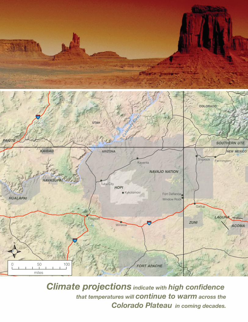
Opposite Page: Monument Valley, Photo: Zack Guido
Drought Preparedness
for Tribes in the Four Corners Region Workshop Report

Drought Preparedness for Tribes in the Four Corners Region 2
NIDISThe National Integrated Drought Information System (NIDIS) is an interagency and interstate effort to establish a national drought early warning information system. NIDIS builds on existing products and service networks like the U.S. Drought Monitor and Seasonal Outlooks to provide better coordination of monitoring, forecasting, and impact assessment efforts at national, watershed, state, and local levels. NIDIS is providing a better
understanding of how and why droughts affect
society, the economy, and the environment, and
is improving accessibility, dissemination, and
use of early warning information for drought risk
management. NIDIS incorporates numerous federal agencies, tribal nations, emergency managers and planners, six Regional Climate Centers, Regional Integrated Sciences and Assessments (RISA), state climatologists, and local National Oceanic and Atmospheric Administration (NOAA) Weather Forecast Offices.
Background

3
NIDIS Early WarningInformation System Pilots
NIDIS is undertaking several pilot projects to prototype and develop a drought early warning information system for the U.S. The goal of the NIDIS pilots is to explore and demonstrate a variety of early warning and drought risk reduction strategies that incorporate drought monitoring and prediction information in partnership with users and federal, state, regional, tribal, and local agencies. Pilots are currently underway in the Upper Colorado River Basin and the Apalachicola-Chattahoochee-Flint River Basin in the Southeast, and the California Pilot is in its initial scoping phase. The Four Corners Pilot will link to upper Colorado River activities, drawing on lessons learned from existing projects. Over the next four years, NIDIS will build on the successes of the U.S. Drought Monitor, Seasonal Outlooks, and other tools and products through better coordination of relevant monitoring, forecasting, educational, and impact assessment efforts tailored to watersheds, regions, and local levels to design and establish a drought early warning information system.
The guiding framework for designing each pilot will be completed over two years and will contain the following steps:
Year 1: Scoping the Drought Early Warning Information System
» Gap analyses to identify what information and data currently exist in a given area and how are they being coordinated and used.
» Focus on characterizing and communicating risks across timescales with existing information for two to three critical issues.
» Develop sub-teams to assess (1) monitoring and forecasting, (2) impact indicators and triggers, and (3) preparedness and education. Examples of outputs could include:
» assembling drought-sensitive planning indicators and management triggers database; assessing present drought information coordination partnerships and processes
» identifying federal- and state-level partnerships, decision support tools, and actions needed to improve information development, coordination, and flow for preparedness and risk reduction
» developing an operational plan for designing and implementing an Early Warning System process
Year 2: Implementation of the Drought Early Warning System (seasonal, multi-year, longer-term trends)
» Develop drought sub-portals that provide region- or basin-specific information and data.
» Embed information into preparedness and adaptation plans.
» Establish network for ongoing briefings on impacts and projections across climate timescales.
» Initiate development of region- or basin-specific Drought Information Monitor and Portal (as a subset of the U.S. Drought Portal (USDP, www.drought.gov).
» Develop decision-support tools for demand projections and revise triggering criteria.
» Evaluate whether better data and information coordination would have improved responses to past events. This will involve assessing:
» value of improved information using past conditions
» responses for projections/scenarios (decadal, climate change)
» feedback on priorities (e.g., data gaps) to federal program managers through the NIDIS Executive Council.
Drought Preparedness for Tribes in the Four Corners Region 4 Drought Preparedness for Tribes in the Four Corners Region 4
Shiprock
Flagstaff
Winslow
Gallup
Fort Defiance
Window Rock
Kykotsmovi
FarmingtonKayenta
Tuba City
0 50 100
miles
40
17
17
25
NAVAJO NATION
HOPI
ZUNI
SOUTHERN UTE
ACOMA
FORT APACHE
KAIBAB
PAIUTE
NEW MEXICO
COLORADO
UTAH
ARIZONA
Colora
do Riv
er
HAVASUPAI
HUALAPAI
LAGUNA
Climate projections indicate with high confidence
that temperatures will continue to warm across the
Colorado Plateau in coming decades.

5 5
Drought on the Colorado Plateau
Tribal nations live on and manage a substantial portion of the landscape that makes up the southern Colorado Plateau. Topography varies across this region, with elevations ranging from more than 8,000 feet in the Chuska Mountains to less than 4,000 feet along the banks of the Colorado River. This diverse topography supports dramatically varying climatic regimes and resultant vegetation communities ranging from conifer forest to desert scrub. Mean annual precipitation varies from more than 20 inches per year in mountaintop locations to less than 6 inches in low desert areas, with the majority of precipitation occurring during the winter and spring. Summer precipitation from monsoon thunderstorms typically accounts for less than 30 percent of annual precipitation totals but can bring intense, highly localized rain and flash floods. High interannual variability in precipitation with rapid swings between wet and dry periods also characterizes the climate of the region and is evident in the historical climate record.
Even though this is an arid region, limited hydroclimatic observations, bolstered by numerous anecdotal drought impact reports, illustrate that drought has gripped the region for more than a decade. Winter precipitation has been below average for 11 of the past 15 years, with below-average summer rainfall occurring in several of these years, compounding the impact of short-term drought conditions. Precipitation deficits over this period have resulted in abundant and wide-ranging impacts to tribal life, including reduction of agricultural productivity and deterioration of natural resources. Observations of specific impacts include:
» a rapid decline in range conditions and rangeland-carrying capacity, forcing reductions in livestock grazing numbers
» poor dryland farming seasons in which crops have failed to mature
» diminishing numbers of culturally important native ceremonial and medicinal plants
» reduction in surface water flows and perennial springs, creating local water shortages and conflicts over water resources
» loss of homes and damage to infrastructure from wind-driven soil erosion events caused, in part, by drought-related land cover changes
Warming temperatures also have been implicated in exacerbating recent drought impacts through increased evapotranspiration rates, reduced soil moisture levels, and intensified stress on vegetation and local water resources. This has sparked concern that rising regional temperatures related to anthropogenic global warming will continue to threaten the region with increasing and deepening drought conditions. Climate models point with reasonable confidence to the prospect of a continued drying trend in the winter and spring as the winter storm track shifts north in response to an enhanced Hadley cell circulation. Already reeling from current drought impacts and threatened by a shift towards a more arid climate due to anthropogenic global warming, tribal nations on the Colorado Plateau need—and are calling for—cutting-edge strategies to monitor and prepare for drought.
Facing Page: Map of the Four Corners region indicating major tribal lands. Map created by Alison Meadow. This Page: Dry conditions for more than a decade in the Four Corners region of the Southwest have impacted
farming and ranching across tribal lands. Photos: Hopi Department of Natural Resources

Drought Preparedness for Tribes in the Four Corners Region 6
Climate of the Southwest
Fundamentals of Southwest climateThe climate of the Southwest takes its shape from global, regional, and local forces. Although many factors influence the climate of a particular year or season, predictable patterns hold across the years and decades to define the region’s climate. Two climatic hallmarks for the Southwest are high temperatures and low precipitation, but why is the region’s climate so prone to dry conditions and why do conditions change from year to year?
Overall aridityMuch of the Southwest lies in the subtropical zone, where warm, dry air is flowing back down to Earth following its rain-inducing rise in the tropics. Descending air in the subtropics is caused by Hadley cell circulation (Figure 1). Where the descending branch of Hadley circulation comes down, dry, descending air creates a zone of atmospheric high pressure that makes it difficult for clouds to form. Evaporation rates often soar in the absence of clouds and rainfall. Phoenix sunshine, for instance, could evaporate roughly 10 times more water from the landscape than the 8 inches of rainfall it receives in an average year.
High evaporation rates coupled with low precipitation rates create the region’s arid to semi-arid climate and its characteristic vegetation. The signature saguaro and other cacti grow in the lower elevations, while forests are restricted to the mountains. Grasslands can grow at various elevations, favoring sites with precipitation levels that generally fall between the amounts that sustain cacti and those that support forests.
High temperaturesRegional temperatures run warmer compared to northern climes because the subtropics receive more direct sunlight and there is little water available to temper that solar power. Our arid climate tends to switch more rapidly from cool to warm than the humid northern climes that experience four distinct seasons. Climate researchers in the Southwest often think in terms of the “cool season,” roughly October through March, and the “warm season,” the other half of the year. The “rainy season” comes during summer in areas affected by the regional monsoon.
Precipitation and a related factor, humidity, also influence temperature at both the local and regional scale. When humidity levels are low, most commonly during winter and spring, there are greater swings from daytime highs to nighttime lows. When humidity levels are relatively high, such as during the summer monsoon, temperatures often fluctuate less dramatically from day to night.
Figure 1. The Hadley cell circulation. Rising air in the superheated tropics descends in the subtropics, creating high-pressure zones in subtropical regions,
including the U.S. Southwest. Credit: Barbara Summey, NASA Goddard VisAnalysis Lab
When there’s not much water available for evaporation, more of the sun’s energy can go toward boosting temperatures. That’s partly why Phoenix temperatures can regularly climb above 110 degrees Fahrenheit while the mercury rarely exceeds 100 degrees in more humid climates closer to the equator.
Because water vapor is a greenhouse gas, its presence in the atmosphere tends to hold in heat that might otherwise escape. In desert climates, this influence is most noticeable on summer nights, when cloudy skies can keep nighttime temperatures higher than they are on clear nights.
Variability in regional climateIn the Southwest, year-to-year variability in climate is shaped in part by changes in sea surface temperatures in the tropical Pacific and north Pacific Ocean. These natural patterns can sometimes reinforce each other to produce pronounced and prolonged dry periods.
El Niño-Southern Oscillation El Niño-Southern Oscillation (ENSO) involves a change in ocean sea surface temperatures and atmospheric wind strength in and above the equatorial Pacific Ocean. These two events are entwined, each causing and reinforcing the other. El Niño events involve the warming of the tropical Pacific Ocean surface waters from the region near Tahiti to the west coast of South America. La Niña events occur when the ocean waters in the same region cool. Changes in sea surface temperatures alter atmospheric pressures which, in turn, change the strength of the trade winds. The Southern Oscillation is characterized by these changes in the trade winds and also by modifications to precipitation and atmospheric heating.
ENSO events cause changes in weather patterns all over the globe. During La Niña events it is common for the Southwest to have reduced precipitation, particularly in the winter and spring, while El Niño events tend to increase the odds of more precipitation in the region, particularly in the winter.
Pacific Decadal Oscillation The Pacific Decadal Oscillation (PDO) is a natural pattern of climate variability that is observed in Pacific Ocean sea surface temperatures north of 20°N latitude. The pattern switches between a cool and warm phase about every 20 to 30 years. During the warm, or positive phase, the western Pacific Ocean cools, while the eastern ocean warms; during a cool, or negative phase, the opposite pattern occurs.
Research suggests that these PDO phases can combine with El Niño and La Niña conditions to influence precipitation in the West, particularly in winter. The warm, or positive, phase of the PDO tends to enhance El Niño conditions and weaken the effects of La Niña events; the cool, or negative, phase has the opposite effect. When the PDO is in its positive phase, the Southwest tends to experience wetter El Niño winters and relatively average La Niña winters.
Adapted from articles by Melanie Lenart and Zack Guido available at www.southwestclimatechange.org/climate/southwest/introduction
www.southwestclimatechange.org/climate/global/dynamics

7
The one-and-a-half-day workshop, held April 8-9, 2010 in Flagstaff, AZ, began and ended with plenary discussions but focused on small group discussions (see Appendix 2 for full meeting agenda). This summary, based primarily on those discussions, is divided into four sections:
» Current impacts and vulnerabilities tied to drought and climate change
» Critical needs for improving drought planning and response
» Priorities for developing a drought early warning system in the Four Corners region
» Prototyping drought early warning in the Four Corners region: next steps
Current Impacts and Vulnerabilities Land surface and cultural impacts
For tribal resource managers in the Four Corners, the impacts of the current drought are of primary concern on a nearly daily basis. Throughout the region high wind events during times of drought result in a whole host of impacts, including sand dune migration (and the threats to roads and settlements these can bring), range and archeological sites becoming heavily impacted by blowing dust, highway closures from poor visibility, and public health threats from poor air quality. The people of the region are also experiencing other climate impacts including shifting plant ranges, absence of or reduction in ceremonial and medicinal plants, springs drying up, declining surface water supplies, and economic impacts from livestock reductions tied to poor range conditions. The region is clearly in the midst of a series of climate-related changes that are becoming more and more challenging to manage. Several participants felt that these changes open the door to significant threats to livelihoods in the region. While the discussion of impacts could have gone on for many hours, the bulk of discussion focused on defining local vulnerabilities and some of the ways people can and are reducing their exposure to them.
Workshop Summary
Current impacts & vulnerabilities: » Multiple impacts from seasonal dust storms
» Shifting plant ranges and absence of or reduction in ceremonial and medicinal plants
» Drying of springs and declines in surface water supplies
» Economic consequences of livestock reductions tied to poor range conditions
» Regional population growth and reliance on groundwater by multiple sectors contribute to water security uncertainty for tribes
» Water infrastructure inadequate for growing demand in the region
» Bureaucracy and institutional conflict contributes to tribal climate vulnerability
» Social issues and climate impacts combine to increase climate vulnerabilities
This page: A fast moving sand dune near Teesto, AZ, in the southern part of the Navajo Nation. Photo: Margaret Hiza Redsteer

Drought Preparedness for Tribes in the Four Corners Region 8
Drying of the Four Corners Region
Initiatives by NIDIS, the USGS, and associated partners aim to address aridification of tribal and adjacent lands in the Four Corners region of the U.S. Southwest. The trend toward warming and drying in the region is bringing about increased risk to the livelihoods of tribal communities. At the workshop Margaret Hiza Redsteer of the USGS presented her research on sand dune mobility and corresponding drought and climate implications in the Four Corners region. Her research and those of others attribute prolonged drought conditions to widespread instability of regional topsoils and sand dunes. This vulnerability impacts subsistence farming practices and contributes to transportation and health issues and partial or complete burial of community and resident homes, buildings, and cultural resources. Impacts to tribal community and daily living are far reaching. For example, many residents of the Navajo Nation must haul water substantial distances due to unreliable and unclean water supplies where they live. Diminished recharge levels of surface and groundwater supplies and springs force residents to travel greater distances or wait extended periods of time to obtain necessary drinking water.
In addition to these local impacts, recent research has linked dry and unstable topsoil in the Four Corners region to dust depositions on the snow-covered peaks of the southern Rocky Mountains of Colorado and Utah. This seasonal dust cover of the snowpack results in earlier melting of mountain snow. Because snow in the mountains of the West provides a substantial amount of water storage each year, this change in the timing and intensity of snowmelt has far-reaching impacts on water resources throughout the West.
Scientists from the Center for Snow and Avalanche Studies collecting snow samples that contain layers of dust in the Colorado mountains.
Photo © Center for Snow and Avalanche Studies.
Water resource vulnerabilities
One of the most pressing issues facing everyone in the Southwest is future water supply in the region, particularly allocations of the Colorado River. Among the themes raised during workshop discussions was the ongoing shift in use of Colorado River water from agriculture to urban and suburban consumption and the potential competition for limited resources. The status of Colorado River water rights has significant ramifications for tribes in the region that have unsettled
claims to the river. Until the tribal allocations to Colorado River water are fully settled, major questions about surface water supplies will remain unresolved; this uncertainty is perceived as a major vulnerability.
Given the complexity of allocating limited surface water and the multiple stresses placed on groundwater, access to clean and affordable drinking water is still a significant problem throughout Indian Country in the Four Corners. One widespread problem in the region

9
is the heavy reliance on very old groundwater held in deep aquifers. This ancient water is a nonrenewable resource for all practical purposes, given the extremely long time scales for replenishing these supplies. Aside from the potentially finite supply of groundwater, workshop participants mentioned an array of problems related to water quality, including elevated levels of arsenic and other toxic substances in the water. Because groundwater is used by a variety of sectors in the region, the vulnerabilities tied to groundwater have a potential impact on everything from mining and energy production to ranching and consumptive use by communities. These vulnerabilities are becoming especially serious in the face of the current decade-long drought.
One set of vulnerabilities related to both surface water and groundwater is the lack of adequate infrastructure to convey what water does exist in the region. In particular, participants mentioned an aging infrastructure that is often inefficient and therefore wasteful. Participants also voiced a need for new pipelines to ensure more access to safe and affordable water but noted the high cost of building and maintaining such systems in this primarily rural region. These particular vulnerabilities, therefore, are directly linked to the overall lack of financial resources available for supporting basic infrastructure in the region.
Institutional challenges
Many of the workshop discussions focused on institutional issues that lead to increased climate vulnerabilities. There was a pervasive sense that some basic institutional problems that make people in the
region vulnerable to drought and climate change are rooted in the sometimes fractious relations between tribes and the federal government. Participants mentioned specific challenges to securing funding from federal partners for drought mitigation and, especially, infrastructure improvement. Several people expressed frustration with the lack of commitment to federal trust responsibilities when it comes to supporting the management of Indian lands. The layers of bureaucracy that complicate tribal access to resources (both in terms of funding and information) were also seen as contributing to tribal vulnerability. As one participant noted, “Decisions need to be made locally; it takes too long to get anything done at the D.C. level.” Along these lines, the challenges of working within some federal drought relief programs were noted. For example, emergency feed to ranchers does little to address the long-term problem of range degradation from exceptionally dry conditions. Permitting requirements and other restrictions also can complicate projects on federal trust lands. In addition, federal policies fail to account for the much higher vulnerabilities that tribal communities face when it comes to water resources.
Aside from institutional challenges that arise between tribes and the federal government, institutional issues within Indian Country make communities more vulnerable to climate, participants said. A key vulnerability identified during these discussions is the overall lack of adequate policies and management plans related to drought and water resources among Native nations in the region. Several people suggested that when management plans or policies do exist, often they are poorly coordinated with neighboring
Sand dunes encroaching on residences in Kayeta, AZ, on the Navajo Nation. Photo: Margaret Hiza Redsteer
An Arizona Department of Public Safety officer took this photo showing the limited visibility created by a dust storm that shutdown Interstate 40
on May 11, 2010.

Drought Preparedness for Tribes in the Four Corners Region 10
The challenge, as one of the breakout groups explicitly
discussed, is connecting lessons of the past to present and future social, economic, cultural, and environmental conditions.
local, state, federal, and tribal managers, opening up the possibility of conflicting management priorities and actions. An additional complexity arises from the difficulty resource managers face in coordinating policies or management actions across a large number of small communities (e.g., across the vast but sparsely populated Navajo Nation).
Several people also described the challenge of managing resources amid frequent changes in tribal leadership. With elected or politically appointed officials coming and going relatively quickly, managers struggle to instill a sense of continuity on resource management. This turnover is considered a significant vulnerability for some communities when it comes to drought and climate change, both of which are slowly developing problems that need long-term vision and planning. One participant pointed out that “short- term thinking results in higher vulnerability.” The turnover in leadership and a general emphasis on short-term planning is not just a problem within tribes; participants mentioned the problem of shifting and evolving priorities within federal programs and with national leaders that makes long-term planning and resource management challenging.
Vulnerabilities in ecological systems
A short discussion focused on the vulnerability of natural systems to drought, climate changes, and development. For instance, many aquatic native species are often the first to be impacted by reduced in-stream flows. In addition, many springs in the region, which help support native plants and animals and wetlands, are culturally important and present an aspect of social vulnerability when they are threatened. Monitoring these ecological impacts is extremely challenging and it often falls to locals to document and communicate ecosystem threats.
Societal vulnerabilities
One consistent message that emerged from the workshop was the need to communicate to state, regional, and national leaders the threats to livelihoods like farming and ranching that many people in the region face. Many participants mentioned the ongoing challenges of dryland farming in a region that is getting hotter and dryer. Although much of the farming is small-scale subsistence farming and therefore might not result in large impacts to tribal economies, it provides
supplemental food for families and is fundamental to cultural life. A related message that arose during the discussions was the need for regional and national leaders to truly understand that many Indian lands are in marginal locations that are more vulnerable to climate extremes and therefore should have better access to support for drought and climate adaptation planning.
The complacent attitude about drought among many local, state, regional, tribal, and national citizens and leaders today also contributes to increased climate vulnerability in the region. Several participants mentioned that people in their communities gave too little respect to the preciousness of water and to the general principles of living lightly within these challenging landscapes. A breakdown in the transfer of knowledge from older generations also is
problematic. Tribal peoples of the region have been through significant climate changes in the past and may have substantial adaptive capacity built into their cultures and ways of living. The challenge, as one of the breakout groups explicitly discussed, is connecting lessons of the past to present and future social, economic, cultural, and environmental conditions.
The “brain drain” confronting many Native communities also presents a problem. This longstanding challenge
An intense storm on July 28, 2010 resulted in damage across Hopi and Navajo lands. A flash flood ruptured this sewer line near the Hopi village of
Polacca. Photo: Richard Alun Davis, KUYI Hopi Radio

11
arises when younger generations leave their home communities for education and job opportunities and often do not return. Participants agreed that these motivated and educated young people will be the scientists and leaders that tribal communities need to help tackle the substantial environmental issues their communities face. The challenge is creating opportunities for these people to thrive in their home communities.
Finally, one participant noted that technology has made all of us more vulnerable when it comes to environmental issues, making the point that technological innovations have opened up areas that once were considered too challenging for farming, ranching, mining, or residential and commercial development. His feeling was that just because societies have the ability to develop resources does
not necessarily mean they should in this highly drought-prone region.
Nearly all of the tribal managers who attended the workshop had success stories from their communities about drought mitigation efforts (e.g., improving water catchments, removing or reducing invasive plants in streambeds to increase in-stream flows, building rainwater collection systems, and reducing feral animals on rangelands). These anecdotes made it clear that efforts are underway to reduce vulnerabilities to drought. What is needed is an avenue for sharing and disseminating successful response strategies. The most consistent theme during the discussions about vulnerability related to communicating the problems to leaders of all sorts and sharing information and successful strategies among managers in the region.
Dry winters and unreliable summer rains over the last several years have resulted in many Hopi farmers either not planting at all or finding crops withering in the fields. Photo: Hopi Department of Natural Resources

If dollars are wisely invested in public and tribal leader education initiatives as well as technical training for tribal
resource management staff, the overall return on the investment would be high.

13
Funding for drought monitoring, mitigation, and response
There was widespread agreement among workshop participants that funding for tribal drought mitigation, response, planning, and basic drought and climate monitoring was insufficient.
Aside from the general lack of funding for tribes to confront climate-related challenges, many participants provided examples of bureaucratic problems and restrictions related to grants programs that made it very difficult to productively utilize the funds that are available. The fundamental problem is rooted in the reality that many tribes are forced to use short-term grants to deal with long-range planning, mitigation, and response issues. For example, it is common for tribes to have access to resources to start a program (including purchasing start-up equipment like monitoring instruments) but then essentially have no resources to keep up long-term monitoring or staffing. One example of a “funding trap” was noted in relation to settling or adjudicating water rights: once water rights are secured, the incentive and therefore the funding to monitor water quantity or even quality essentially evaporates. A specific grant restriction that inspired discussion was the cost sharing requirement that is attached to some funding. One group asked, “How can tribes keep the funds coming and decrease the cost sharing?” The overall idea to emerge from the discussion was the need for long-term sustainable funding options that better match the long-term planning, mitigation, and response issues facing tribes in the region.
Because the group felt a clear need for more spending on infrastructure, one solution offered was to identify federal partners who would allocate more funds for “on-the-ground” projects like helping small towns and villages increase their water storage capacity. Participants also noted the multiplier effect that comes from spending money on education and training: if dollars are wisely invested in public and tribal leader
Opposite Page: A student drops a seed ball as part of a project to help stabilize sand dunes on the Navajo Nation. Photo: Margaret Hiza Redsteer.
This Page: This sewer line near the Hopi village of Polacca was damaged by flash flood in July 2010. Photo: Richard Alun Davis, KUYI Hopi Radio
Critical needs: » Reliable resources to support tribal drought planning and response
» Methods for integrating local and traditional knowledge into environmental monitoring and planning
» Education and outreach programs about drought, climate change, and water scarcity
» Technical training opportunities related to climate monitoring for tribal resource managers
» Better climate monitoring and improved access to available regional data
Critical Needs for Improving Drought Planning and Response
Drought Preparedness for Tribes in the Four Corners Region 14
education initiatives as well as technical training for tribal resource management staff, the overall return on the investment would be high. Many people specifically suggested that more technical training for tribal staff could build capacity and therefore increase a tribe’s access to funds.
Integrated drought planning
Throughout the workshop, discussions consistently returned to the idea that local and traditional knowledge (LTK) has a role to play in improving drought planning and response in the region. The critical need is finding ways to begin truly integrating LTK into drought and climate change monitoring, response strategies, and policies.
A common theme throughout the discussions about local and traditional knowledge was the importance of native plant species, water sources (e.g., springs), and weather regimes in many cultural practices. Because these cultural systems and environmental conditions are so closely linked, abundant observational knowledge could be used to improve drought monitoring. The challenge is devising ways to capture and utilize this knowledge appropriately to improve monitoring and, therefore, drought planning. A variety
of ideas emerged for how this can be done at the local level and with support from regional, state, and federal partners.
Many of the discussions centered on the need to engage elders in efforts to utilize LTK for monitoring. Several participants mentioned ongoing LTK projects in their communities and endorsed the idea of similar efforts for drought monitoring. Two specific, related ideas participants suggested: developing local “crack teams” of elders working with tribal natural resource managers to help assess conditions and pairing elders with children from their communities to conduct these assessments. Both of these ideas have the added value of helping to strengthen cross-generational bonds. Related to this are the inherent challenges of trust that arise when trying to bring western science together with LTK. Because some cultural knowledge is not intended for use outside of the community in which it resides, any efforts to use LTK to inform drought monitoring for the region would have to be carefully constructed to address local interests and strongly supported by elders, the local community, and tribal leaders. An advisory board of tribal leaders was proposed as a method for helping develop acceptable ways for capturing LTK for use in drought monitoring.
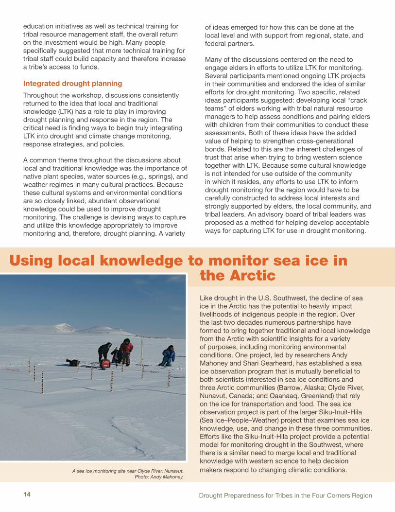
Using local knowledge to monitor sea ice in the ArcticLike drought in the U.S. Southwest, the decline of sea ice in the Arctic has the potential to heavily impact livelihoods of indigenous people in the region. Over the last two decades numerous partnerships have formed to bring together traditional and local knowledge from the Arctic with scientific insights for a variety of purposes, including monitoring environmental conditions. One project, led by researchers Andy Mahoney and Shari Gearheard, has established a sea ice observation program that is mutually beneficial to both scientists interested in sea ice conditions and three Arctic communities (Barrow, Alaska; Clyde River, Nunavut, Canada; and Qaanaaq, Greenland) that rely on the ice for transportation and food. The sea ice observation project is part of the larger Siku-Inuit-Hila (Sea Ice–People–Weather) project that examines sea ice knowledge, use, and change in these three communities. Efforts like the Siku-Inuit-Hila project provide a potential model for monitoring drought in the Southwest, where there is a similar need to merge local and traditional knowledge with western science to help decision makers respond to changing climatic conditions.A sea ice monitoring site near Clyde River, Nunavut.
Photo: Andy Mahoney.

15
Closely related to the importance of LTK for drought monitoring is the critical need for drought planning that fully integrates the cultural knowledge and norms of Native communities. This was a prominent theme that ran through the entire workshop. The general lack of integrated planning is commonly reflected in the conflict that often exists between western scientific data and LTK. Participants discussed the common situation where drought planning documents and processes rely heavily on scientifically driven response triggers (e.g., a drought threshold defined by the Standardized Precipitation Index or SPI), but have no inherent means for considering cultural inputs. This privileging of western science over local knowledge is especially frustrating to tribal communities with large areas that are essentially unmonitored by scientific instruments.
The conflicts between western scientific knowledge and local knowledge are not limited to monitoring. Many workshop participants talked about the importance of incorporating local knowledge into all elements of drought planning so that potential mitigation and response activities are more rooted in the cultures of the region. For example, a disconnect often exists between standard drought mitigation and response actions related to local tribal agricultural practices in the Four Corners region. Because many tribal farmers on the Colorado Plateau use dryland-farming techniques to grow subsistence crops, standard drought mitigation and response actions may be inappropriate (e.g., Farm Service Administration programs designed for commercial producers). Another example is the lack of integration of cultural systems tied to weather conditions (e.g., ceremonies that may be triggered by dry conditions) and drought plans. Participants felt that local drought adaptation and mitigation responses inherent in regional Native cultures are underrepresented in drought planning. While no clear answers emerged from these discussions, moving toward a more integrated (in terms of culture and geography) drought-planning paradigm was identified as a critical need.
The conversations about local and traditional knowledge also touched on ways to engage locals to expand or bolster existing monitoring efforts. For example, several people cited the wealth of information that exists in the ongoing work by their tribal agencies to gather basic hydrologic and weather data and information on range conditions, plant health, the status of stock tanks and wells, and many other environmental
variables. One group pointed out the usefulness of projects that place scientific instruments like weather stations at schools and engage teachers and students in data collection. Another group talked about working with locals at the chapter level on the Navajo Nation to develop monitoring metrics and reporting systems, which could help monitor a very large landscape in fine detail. One group discussed the potential for using existing remote sensing products and geographic information systems to help fill in large areas that lack weather stations or stream gauges.
An additional challenge to tapping local knowledge lies in how to incorporate this information into state, regional, and national monitoring networks. One group mentioned the online Arizona DroughtWatch system as a good starting point for “feeding the information up the chain.” Discussion also focused on the critical need for building long-lasting and strong partnerships among tribal, state, and federal resource managers so that there are multiple channels for communicating local conditions to various entities. NIDIS also was mentioned repeatedly as being instrumental in helping address the long-standing challenge of tying more weather stations to NOAA’s official network on tribal lands.
Education and technical training
Participants described a poor overall understanding of climate and drought among the public and political leaders in the region. Finding ways to raise the “climate literacy” in the region could help combat the apathy and ignorance that often confront efforts to plan for drought and climate change. Ideas for increasing knowledge included community-based climate or drought education programs that are culturally and socially relevant; more focused work with schools to involve teachers and students; an “Adopt a Wash” program similar to “Adopt a River” or “Adopt a Highway” programs; and finding opportunities for internships so that students (or even interested community members) can learn skills and gather new knowledge useful for climate adaptation and drought planning. Many people felt a critical need to engage young Native students in science and engineering and the attendant need, mentioned above, for desirable science and planning jobs on reservations so that students have an incentive to come back to their communities after college.
Finding ways to raise the “climate literacy” in the
region could help combat the apathy and ignorance
that often confront efforts to plan for drought and climate change.

Drought Preparedness for Tribes in the Four Corners Region 16
Aside from general education programs, many participants offered examples of technical training needs. The call for more data collection and analysis capacity within tribal offices was a consistent theme. Participants recommended that federal agencies (NOAA and the USGS were specifically named) provide technical training workshops for tribal resource managers on a variety of topics related to monitoring and analyzing data, as well as workshops specifically focused on drought planning and mitigation. It was suggested that one of the agencies could support a climatologist whose job involves periodic visits to reservations to help resource managers and technicians spot check data and calibrate instruments. A federal agency, most likely NOAA, also could provide technical consulting services to tribes to design new or improve existing monitoring systems. A desire clearly exists among tribal resource managers to find ways to acquire and sustain the capacity within their offices not only to monitor climate, but also contribute to the local,
regional, and national monitoring networks. A role is emerging for tribal colleges and universities (TCUs) as educational and cultural institutions that are focused on research questions and issues unique to Native nations and resources. TCUs can serve as a bridge between tribal leadership and federal and university initiatives dedicated to understanding and responding to climate related problems.
Participants identified the Institute of Tribal Environmental Professionals (ITEP) at Northern Arizona University as an ideal host for periodic training seminars. Online training resources were seen as a useful platform for relatively straightforward tasks (e.g., developing data collection protocols). Partnering federal agencies also could host short courses on a regular basis so that tribal professionals could remain up to date on the latest technology and information. Participants also suggested that tribal natural resource offices
could find ways to coordinate and cross-train each other to leverage each other’s expertise. Capacity-building initiatives should be developed and partnerships should be established with entities such as ITEP as an effective entry point for federal and state agencies interested in building partnerships with regional tribal communities.
Workshop discussions touched on some of the challenges facing efforts to improve tribal capacity, including the common problem that many tribal environmental offices are short-staffed and cash-strapped, so training can be difficult to arrange. What’s more, quality professional development requires time and money, and it can be a challenge to retain staff once they are trained.
Arizona DroughtWatchDrought has gripped much of Arizona in some form for more than 10 years. Historically, drought monitoring and the calculation of drought status have been based solely on sparse networks of hydroclimatological data collected across the state. Qualitative observations of drought impacts in conjunction with these data offer the promise of a better and more nuanced characterization
of drought given Arizona’s complex and highly variable climate. Arizona DroughtWatch (AZDW), a pilot, volunteer drought impact monitoring program, has been developed to systematically collect this type of information to support drought status determination and local drought vulnerability assessments. The Web-based reporting system allows observers to create accounts and submit impact observations for multiple locations on a monthly basis. These observations are summarized and displayed anonymously in maps and tables on the open website. The beta system was launched in 2009 and has collected several hundred individual drought impact observations that have been instrumental in both ground-truthing and adjusting state and national drought status maps. Work is underway to connect Arizona DroughtWatch to the National Drought Impacts Reporter to ensure seamless data sharing in support of national efforts like NIDIS. www.azdroughtwatch.org

17
Online Climate Resources for the Southwest
Southwest Climate Outlook
The Southwest Climate Outlook (SWCO) is a monthly e-publication that summarizes climate and weather information related to Arizona and New Mexico. Monthly information includes a precipitation summary for the previous 30 days, a spring streamflow forecast, and an El Nino-Southern Oscillation outlook. SWCO contributors, including the Arizona state climatologist, scientists from the University of Arizona, and Arizona Cooperative Extension agents, blend graphics and text to present a clear and concise picture of the Southwest climate. www.climas.arizona.edu/
TreeFlow
Scientists use the widths of tree rings to recreate accurate climate and streamflow records that extend hundreds of years prior to the onset of instrumental observations. This long-term perspective, reaching back more than 1,000 years in some places, has become a valuable tool for drought planning and water resource management. TreeFlow is a comprehensive Web resource that brings together streamflow and climate records reconstructed from tree rings for the western U.S. It provides access to data as well as information on the process of tree-ring reconstructions and appropriate applications of the data.
http://treeflow.info
WestMap
WestMap provides access to gridded, monthly temperature and precipitation data at the high resolution of 4 square kilometers. WestMap uses Parameter-elevation Regressions on Independent Slopes Model (PRISM) data generated each month by Oregon State University. Users can extract the raw data, generate time-series graphs, or create maps. Users also can customize data searches for regions, such as the Colorado River Basin, and specific places, like Tuba City. www.cefa.dri.edu/Westmap
Southwest Climate Change Network
The Southwest Climate Change Network (SWCCN) increases access to and understanding of climate-related information for the Southwest, with an eye toward helping the region prepare for, adapt to, and solve pressing climate-related challenges. University of Arizona scientists contribute to SWCCN and highlight pertinent news, write feature articles, blog about current climate issues, catalog events, and provide important foundational knowledge about climate. All of these services help foster a more informed public and more effective environmental decision-making. www.southwestclimatechange.org

Drought Preparedness for Tribes in the Four Corners Region 18
Improved coordination and communicationWorkshop participants expressed frustration about the lack of consistent and systematic tribal consultation and collaboration in many areas related to drought and climate change, with a specific emphasis on federal monitoring efforts. A prominent theme to emerge from the workshop was the problem of poor communication and poor coordination among local, state, tribal, and federal agencies on many of the issues surrounding drought planning and monitoring. One participant felt that the US Drought Monitor (USDM) suffered from the lack of local input that could be provided by tribal resource managers. This point was reflected in many comments about the common problem of information not making it from the local level, where conditions can be observed directly, up to the national level, where funds are allocated and major decisions are made. Difficulties also arise from poor coordination between and among tribal, local, state, and federal agencies working in the region. Although many agencies are engaged in similar activities (e.g., monitoring for drought impacts), there is little coordination, which can result in duplication of effort as well as occasional information vacuums in which no one knows exactly what’s going on or who is doing what.
To address some of these challenges, the participants endorsed the idea of developing better mechanisms for tribes to communicate their needs, challenges, and funding priorities to the various responsible federal and state agencies. Two ideas for improving communication emerged: 1) more dedicated federal staff from various agencies to work with tribes (e.g., tribal liaisons), preferably with budgets to support tribal projects, and 2) routine regional dialogues between tribal and federal staff who are working on the ground.
Participants also discussed hurdles in coordinating activities and communication within and between tribes in the region. One common theme was the difficulty resource managers often have engaging tribal leadership on the issues of drought and climate change. This can impede initiating actions (e.g., recommending drought emergencies) and seizing on grant opportunities that require buy-in from leadership. With the attention of tribal leaders being pulled in many directions, the question raised was how can we communicate the gravity of drought and climate change issues?
A related problem is trying to coordinate and facilitate good communication among many villages or chapters about drought and climate. For example, one participant suggested that chapters across the Navajo Nation should coordinate on drought mitigation and response. Ideally, each chapter would have a water plan that is integrated into the Nation’s drought plan. However, this level of coordination is quite difficult to achieve, partly because drought is not necessarily perceived as a priority across the whole Nation. Developing methods to easily communicate climate-related issues would both facilitate knowledge exchange and more readily allow tribes to build coalitions for advancing their collective needs at a national level.
Data and monitoring
Given the importance of data and monitoring to a well-designed drought early warning system, it is no surprise that there was a substantial amount of discussion about what is needed to improve monitoring in the Four Corners region. Improved coordination and communication were viewed by
participants as a necessary starting point for an early warning system. In particular, the generally uncoordinated nature of current data collection by a broad assemblage of organizations in the region is a key barrier. For example, the U.S. Environmental Protection Agency, the U.S. Fish and Wildlife Service, NOAA, USGS, BoR, and a variety of state and tribal agencies are gathering data that are potentially useful for monitoring drought. Data standards among these groups are inconsistent, and there are few data sharing agreements that would facilitate easier access to or use of all data. Aside from simply preventing access to existing data, participants described the existing ad hoc system as highly inefficient, especially when it results in duplicative data collection. The fundamental problem appears to be the lack of cohesion among all the parties monitoring different (but often overlapping) aspects of the environment. Among the barriers to achieving better coordination is the general reluctance of some agencies to use tribal data because of quality concerns. Participants also mentioned the related issue of tribes being unwilling to share some data for legitimate reasons related to the proprietary nature of the information.
Many of the participants saw the NIDIS efforts to develop a drought early warning system for the region as a positive step toward a better, more coordinated federal response
that may help facilitate better monitoring.

19
While coordinating existing data collection is a key first step toward a more integrated monitoring system, there was a clear consensus among the participants that the Four Corners region was generally poorly monitored for drought. The well-known data gap in NOAA’s official weather and climate monitoring network was described as a basic challenge for monitoring drought in the region. Participants noted that NOAA’s Historical Climate Network-Modernization (HCN-M) program was missing an opportunity to improve monitoring in the region by failing to site HCN-M locations on tribal lands. In terms of hydrologic monitoring, the removal of several stream gauges in Indian Country at precisely the time when more monitoring is necessary was seen as a critical problem that needs to be addressed. Similarly, participants noted an overall lack of usable groundwater data and identified more focused monitoring of springs and the many wells in the region as a critical need. Any efforts to more closely monitor springs or wells would need to incorporate the wealth of local knowledge, since some springs and wells are more sensitive than others and therefore may provide more useful information.
Participants also called for more data that quantify changes to sand dunes and more consistent range data. On the latter point, one participant suggested that repeating the Bureau of Indian Affairs (BIA) range management survey, completed many years ago, would yield useful data for managers.
Several ideas emerged for overcoming problems related to relatively sparse data for monitoring drought. Integration of more remotely sensed data (e.g., Normalized Difference Vegetation Index, NDVI) to help assess range and forest conditions is a potentially useful path. Participants discussed ways to more usefully present some data that do exist. For example, one participant asked, “Is there a better way to represent snowpack other than percent of normal for drought monitoring?” Similar frustration stems from the challenge of calculating drought indices (e.g., SPI), often necessary in drought plans, on the scale of tribal lands if adequate data are unavailable.
To create a monitoring network for a drought early warning system, a coordinated effort to better define
The US Drought MonitorSince its development and inception in 1999, the U.S. Drought Monitor (USDM) has become the nation’s state-of-the-art drought monitoring product. The USDM is a joint endeavor between the U.S. Department of Agriculture (USDA), the National Oceanic and Atmospheric Administration (NOAA) and the National Drought Mitigation Center (NDMC), located at the University of Nebraska-Lincoln. The USDM map summarizes information from numerous drought indicators and indices, as well as data and impact information collected from a network of 300 experts around the country, to provide a weekly overview of drought across the nation. The USDM identifies general drought areas, labeling droughts by intensity, with D1 being the least intense and D4 being the most intense. D0, or abnormally dry, areas are noted as either drying
out and possibly heading into drought, or are reflective of those areas recovering from drought but not yet back to normal. The USDM has been used by USDA (and within the U.S. Farm Bill), the National Weather Service, the Internal Revenue Service, the media, and several states as a drought trigger and means of communicating the drought issue with the public. www.droughtmonitor.unl.edu
Drought Preparedness for Tribes in the Four Corners Region 20
the key drought indicators in the region is required, participants said. Data and information that mapped to those indicators would then be identified and used to develop the early warning system. For example, can wildlife and landscape drought indicators that do not require sophisticated instrumentation be utilized more broadly? The Hualapai Tribe currently has a drought system that uses triggers, including observations of wildlife and water levels in earthtanks. These sorts of alternative indicators could prove fruitful for drought monitoring across the region.
Collecting less but higher quality data also could be a useful strategy. This is an issue that the Navajo Nation already is tackling to improve their hydrometeorological network over the last few years. In the case of Navajo, the goal is to place weather instruments strategically, in essence downsizing the network. This would in part better position the Nation to maintain the network and therefore make it more sustainable for long-term monitoring. Similarly, a need exists to develop methods for identifying key locations for measuring groundwater and lake levels in such a way that fewer (and therefore less expensive and time consuming) observations might be sufficient.
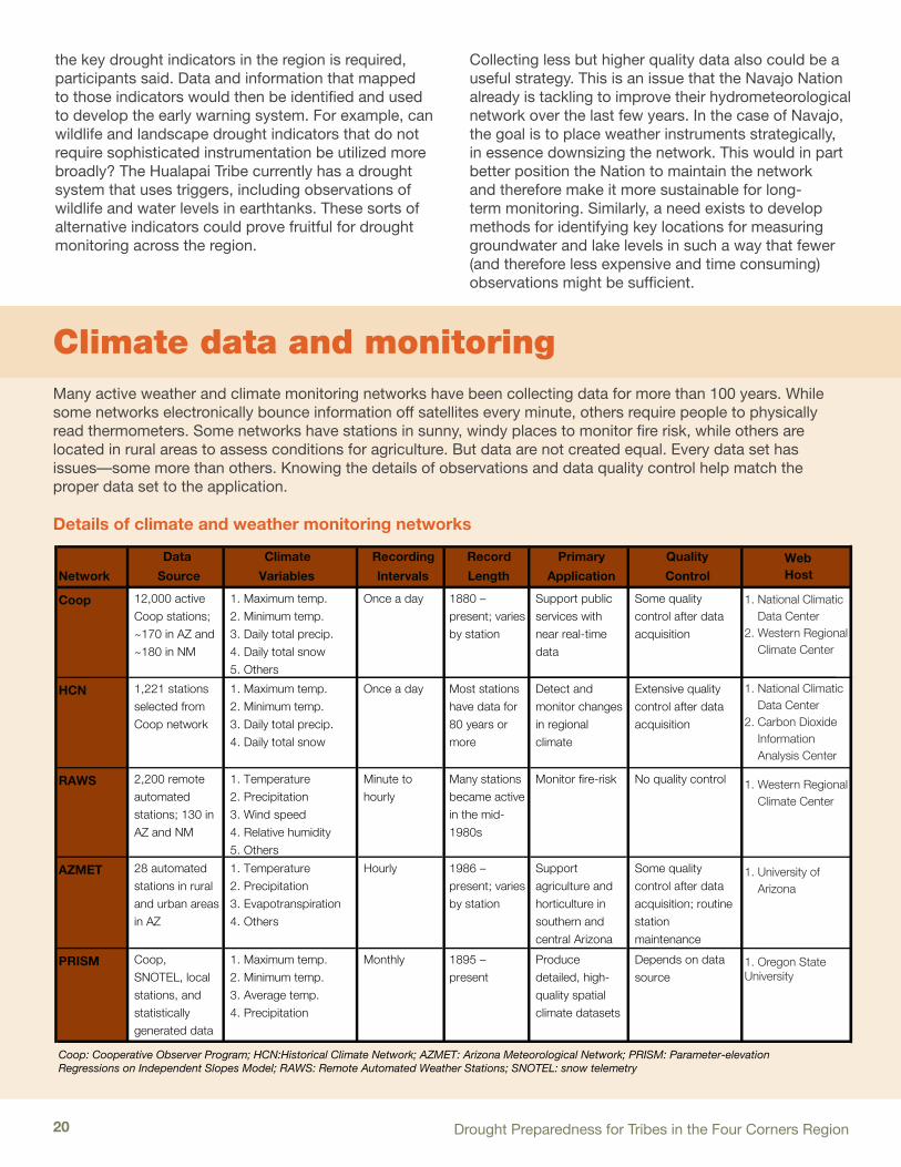
Climate data and monitoring Many active weather and climate monitoring networks have been collecting data for more than 100 years. While some networks electronically bounce information off satellites every minute, others require people to physically read thermometers. Some networks have stations in sunny, windy places to monitor fire risk, while others are located in rural areas to assess conditions for agriculture. But data are not created equal. Every data set has issues—some more than others. Knowing the details of observations and data quality control help match the proper data set to the application.
Details of climate and weather monitoring networks
Network
Data
Source
Climate
Variables
Recording
Intervals
Record
Length
Primary
Application
Quality
Control
Coop 12,000 active Coop stations; ~170 in AZ and ~180 in NM
1. Maximum temp.2. Minimum temp.3. Daily total precip. 4. Daily total snow5. Others
Once a day 1880 – present; varies by station
Support public services with near real-time data
Some quality control after data acquisition
HCN 1,221 stations selected from Coop network
1. Maximum temp. 2. Minimum temp. 3. Daily total precip. 4. Daily total snow
Once a day Most stations have data for 80 years or more
Detect and monitor changes in regional climate
Extensive quality control after data acquisition
RAWS 2,200 remote automated stations; 130 in AZ and NM
1. Temperature2. Precipitation3. Wind speed4. Relative humidity5. Others
Minute to hourly
Many stations became active in the mid-1980s
Monitor fire-risk No quality control
AZMET 28 automated stations in rural and urban areas in AZ
1. Temperature2. Precipitation3. Evapotranspiration4. Others
Hourly 1986 – present; varies by station
Support agriculture and horticulture in southern and central Arizona
Some quality control after data acquisition; routine station maintenance
PRISM Coop, SNOTEL, local stations, and statistically generated data
1. Maximum temp.2. Minimum temp.3. Average temp.4. Precipitation
Monthly 1895 – present
Produce detailed, high-quality spatial climate datasets
Depends on data source
Coop: Cooperative Observer Program; HCN:Historical Climate Network; AZMET: Arizona Meteorological Network; PRISM: Parameter-elevationRegressions on Independent Slopes Model; RAWS: Remote Automated Weather Stations; SNOTEL: snow telemetry
Web Host
1. National Climatic Data Center2. Western Regional Climate Center
1. National Climatic Data Center2. Carbon Dioxide Information Analysis Center
1. University of Arizona
Details of Climate and Weather Monitoring Networks
1. Western Regional Climate Center
1. Oregon State University

21
Assessment of the Navajo Nation Hydroclimate Network
Investigators from Arizona’s three state universities undertook an investigation of Navajo Nation’s hydroclimate network in 2007 in a project funded by the Arizona Water Institute (AWI). The Navajo Nation Department of Water Resources (NNDWR) requested the work to follow up on a 2003 Technical Memorandum. That document, among its many conclusions, stated that NNDWR needed to reduce its network to facilitate data collection, reduction, and quality control commensurate with its human resources. The goal of the project was to provide science-based advice to improve data collection and processing in support of climate, drought, and hydrologic analyses, while reducing the manpower required to manage the network. In consultation with NNDWR, the AWI project team visited data collection stations, interviewed staff, analyzed NNDWR hydroclimate data, evaluated instrumentation and data communication needs, identified potential improvements, and determined options for reducing overall network size—while filling in key data gaps. At NNDWR’s request, the AWI project team convened a workshop to explore possibilities for NNDWR to achieve its goals through collaboration and exchange of data with outside agencies.
Based on its investigations, the AWI project team recommended the following strategies:
1. Develop a master plan for NNDWR data use. Well-articulated needs and uses for hydrologic, climate, and weather data will guide optimization of station locations and will create a basis for identifying needs for collaboration and opportunities to leverage data and hydroclimate monitoring to mutual advantage. Master planning is especially important, because in most cases data continuity and data quality cannot be used to guide selection of existing gauges for future use; thus, needs will drive key selection criteria.
2. Enhance data communication. Automating data collection, adding telecommunications, and locating automated stations where telecommunications are easily accessed will reduce visits to stations, alert staff to equipment malfunction, and facilitate data sharing, which can shift the burden of data reduction and quality control to collaborators. Moreover, data communicated through data-sharing networks, such as MesoWest, will improve real-time data visualization and reduce the burden of metadata management.
3. Leverage existing data collection networks to reduce time and human resources devoted to manual data collection. While this may require some initial effort to establish procedures and routines for acquiring electronic data, leveraging data from other networks may obviate the need for much of the existing rain can network.
4. Fill in gaps in the NNDWR automated weather station network. Station density analysis suggests six accessible locations with nearby telecommuncations. For precipitation, NNDWR can fill gaps with inexpensive automatic-logging precipitation gauges that provide digital data at daily or sub-daily time scales.
5. Augment rain can observations by enlisting cooperative observers. The AWI team recommends (a) daily data collection (for which procedures are less confusing than those required for monthly collection), and (b) ensuring the cooperators’ rain cans or weather stations are located near telecommunications so values can be phoned (or input via Internet) directly to the National Weather Service, which will take on responsibility for data reduction and quality control.
6. Do not remove stream gauges but shift streamflow data collection emphasis from time consuming, sheet-recorded chart digitizing to efforts that improve data quality and usability. Examples include gauge maintenance, regular calibration, and timely and consistent data collection and communication.
Navajo Nation and the precipitation gauge (“rain can”) network as of 2007. Shading indicates elevation. Red stars are stations in the
west region, black squares are stations in the mountain region, and blue triangles are stations in the east region.
The full report from this project is available at: www.climas.arizona.edu/library/publications/63

Development of fair and equitable ways to share data and information more effectively among tribes, between tribes
and states, and between tribes and federal agencies is a critical step in building a true early warning system.

23
The penultimate plenary discussion of the workshop focused on priorities for designing a Drought Early Warning System (DEWS) in the Four Corners. A DEWS is designed to identify negative trends and predict the occurrence and impact of a drought. An effective DEWS also provides information in the context of vulnerability and risk, and, therefore, provides information that improves planning and preparedness.
1. Integrating tribal observations and data into national and state monitoring efforts
No mechanism currently exists for integrating tribal drought assessments into other assessment activities. A potential first step could be developing systems to make data from the region available through the drought portal, Arizona DroughtWatch (AZDW), and/or the NDMC’s Drought Impact Reporter (a national drought impact database for the U.S.). A “data and monitoring” point of contact within state and federal agencies also could improve coordination and integration of impacts assessment and monitoring activities. More tribally-focused points of contact within agencies focused on drought are necessary for a more truly integrated and coordinated monitoring, response, and mitigation system. A focused discussion or series of discussions with key state and federal agencies could be an effective first step in bringing this about. These discussions could involve, for example, identification of specific monitoring needs by sub-region, and points of contact could be identified within the agencies and the tribes for collaborating to address specific needs.
Observational data for drought monitoring in the Four Corners region is currently insufficient. The data that do exist must be better integrated into national or state monitoring efforts. Several participants expressed the
Opposite Page: A corn field on the Hopi reservation that was damaged by a severe storm and flood event in July 2010.
This Page: The same July 2010 storm damaged this tribal road near the Hopi village of Walpi. Photos: Richard Alun Davis, KUYI Hopi Radio
Priorities for developing a regional drought early warning system:
» Integrate tribal observations and data into national and state monitoring efforts
» Ensure maintenance and sustainability of existing observation networks
» Facilitate data sharing and access
» Explore ways to use existing data and provide technical training for tribal staff
Priorities for Developing
a Drought Early Warning System in the Four Corners

Drought Preparedness for Tribes in the Four Corners Region 24
Students working to stabilize a sand dune near Teesto, AZ. Photo: Margaret Hiza Redsteer
need for a more transparent process for integrating data that may be available from sources outside official networks. Because of the generally uncoordinated nature of data collection across the region, it is unclear what data exist or if there are ways to integrate data into official networks used to create operational climate products. Specifically, many participants wanted to know what format data needed to be in and what temporal and spatial scales were necessary for integration into existing monitoring activities.
The experimental AZDW drought impact reporting system (see inset box on page 16) has been designed specifically to get qualitative, observational local drought impact information, which could help fill in the large gaps in quantitative data. However, AZDW success is predicated on identifying people who can act as impact observers across the region. At the national level, better local impact data can improve drought characterization and help identify areas in need of assistance. Because AZDW is already tied to NDMC’s Drought Impact Reporter, gathering more local impact reports from the Four Corners could result in better understanding nationally of the
ground conditions in this region. Introducing a Tribal Community section on the U.S. Drought Portal (USDP), for example, would provide a forum for discussing observation and monitoring issues and could be used to develop sub-portals to integrate data and provide information and monitoring tools to groups in the region.
The effective use of LTK for monitoring and the development of more integrated drought plans require communication at nearly every scale. Development of fair and equitable ways to share data and information more effectively among tribes, between tribes and
states, and between tribes and federal agencies is a critical step in building a true early warning system in the Four Corners. Poor communication between federal agencies and tribes about many aspects of drought, including federal mitigation efforts, drought programs, and monitoring issues was seen as a hurdle that must be addressed.
2. Maintenance and sustainability of existing observation networks
Existing monitoring networks run by tribes in the region, such as the Navajo hydrometeorological network (see inset box on page 21), provide valuable data on current and past conditions in a data-sparse area. The challenge, as discussed throughout the workshop, is how to make these disparate networks function as components in a coordinated early warning system. Aside from the substantial need to better coordinate these data collection activities, the fundamental need for help in shaping these ad hoc networks into an early warning system centered on resources for upgrading, siting, and maintaining the equipment. A common challenge to maintaining a data collection network is finding adequate resources to keep the network operating at a sufficient level so that the data can be useful. Among the specific challenges discussed by participants in the plenary was the need for help identifying the best locations to site monitoring stations and technical assistance to calibrate the equipment and train field staff on routine maintenance. The fundamental need is essentially for funds to support robust, tribally-run observational networks.
A critical first step to data sharing and access is
understanding what data exist in the first place, who is
producing the data, and how to access the information.

25
3. Data sharing and access
While data integration, maintenance, and sustainability of existing monitoring networks are important, it is equally important to have access to the data that do exist. This includes data produced from the tribes in the Four Corners as well as state and federal data. A critical first step to data sharing and access is understanding what data exist in the first place, who is producing the data, and how to access the information. Participants voiced concern that data is housed in different and obscured locations, a situation that further complicates access. A common data clearinghouse was suggested as a way of making data and information available in one location regardless of where they originally were produced. One of the primary objectives of NIDIS was to establish the USDP to consolidate drought-related information, making it relevant to local users by allowing the data to be customized. The USDP is an obvious candidate to integrate these types of data and was noted by the participants as a good start. While the portal can aggregate data and information in one place, it does not solve the problem of data sharing and access.
4. Use of existing data and technical training
While much of the workshop focused on improving overall monitoring efforts in the Four Corners, the last discussion of critical needs for designing a DEWS concentrated on making better use of existing data and information. Participants recommended a series of workshops or training sessions for tribal resource managers on interpreting climate and weather-related products to improve their ability to prepare and plan for drought. This could include assistance with understanding where to access the information, how to interpret products (e.g., seasonal climate predictions, drought indices, soil moisture products), and the limitations of the information. Participants also recommended assistance to help tribal resource managers develop specific tools for assessing drought. Some examples include help developing focused drought indices or integrating sets of climate variables into local drought planning efforts. The four state climatologists in the region, the Western Regional Climate Center, and ITEP could be key participants in this process of training and tool development in support of designing a DEWS in the Four Corners.
This Page: Tribal resource managers across the Four Corners maintain their own weather monitoring networks, although instrument and data maintence
can present challenges for understaffed communities. Photo: Michael Crimmins

An educated and aware public is essential for effective drought planning and preparedness.
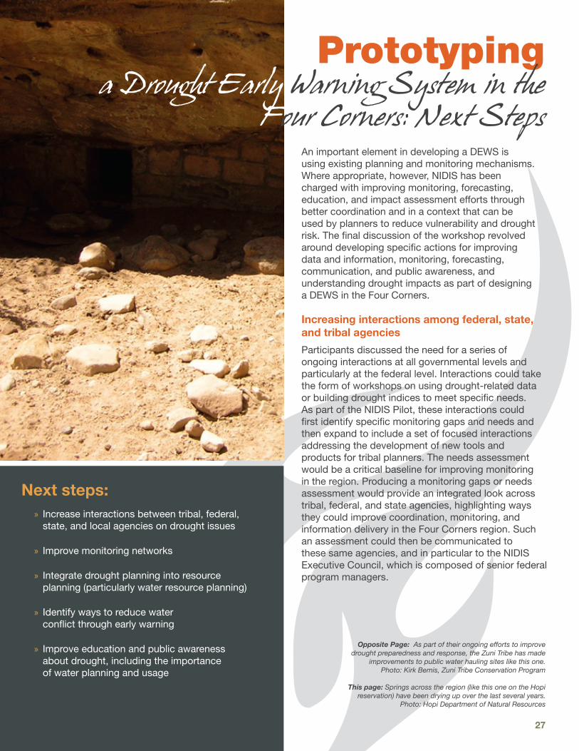
27
An important element in developing a DEWS is using existing planning and monitoring mechanisms. Where appropriate, however, NIDIS has been charged with improving monitoring, forecasting, education, and impact assessment efforts through better coordination and in a context that can be used by planners to reduce vulnerability and drought risk. The final discussion of the workshop revolved around developing specific actions for improving data and information, monitoring, forecasting, communication, and public awareness, and understanding drought impacts as part of designing a DEWS in the Four Corners.
Increasing interactions among federal, state, and tribal agencies
Participants discussed the need for a series of ongoing interactions at all governmental levels and particularly at the federal level. Interactions could take the form of workshops on using drought-related data or building drought indices to meet specific needs. As part of the NIDIS Pilot, these interactions could first identify specific monitoring gaps and needs and then expand to include a set of focused interactions addressing the development of new tools and products for tribal planners. The needs assessment would be a critical baseline for improving monitoring in the region. Producing a monitoring gaps or needs assessment would provide an integrated look across tribal, federal, and state agencies, highlighting ways they could improve coordination, monitoring, and information delivery in the Four Corners region. Such an assessment could then be communicated to these same agencies, and in particular to the NIDIS Executive Council, which is composed of senior federal program managers.
Opposite Page: As part of their ongoing efforts to improve drought preparedness and response, the Zuni Tribe has made
improvements to public water hauling sites like this one. Photo: Kirk Bemis, Zuni Tribe Conservation Program
This page: Springs across the region (like this one on the Hopi reservation) have been drying up over the last several years.
Photo: Hopi Department of Natural Resources
Next steps: » Increase interactions between tribal, federal, state, and local agencies on drought issues
» Improve monitoring networks
» Integrate drought planning into resource planning (particularly water resource planning)
» Identify ways to reduce water conflict through early warning
» Improve education and public awareness about drought, including the importance of water planning and usage
Prototyping a Drought Early Warning System in the
Four Corners: Next Steps

Drought Preparedness for Tribes in the Four Corners Region 28
Improving data and monitoring networks
As previously noted, workshop participants requested assistance with streamlining existing monitoring networks and enhancing capacity for long-term maintenance. As part of the NIDIS Pilot, a first step could involve building on the assessment of the Navajo Nation’s hyrdoclimate network, conducted in 2007 by examining other tribal networks in the region. The new assessment would investigate how the networks could improve data quality and become more efficient, recognizing the long-term challenges associated with maintaining a large network. A fundamental purpose of the project would be to place these tribal monitoring networks in the context of the NOAA Historical Climate Network Modernization (HCN-M) sites (both existing and planned new sites) as well as other monitoring networks such as the Community Collaborative Rain, Hail, and Snow Network (CoCoRaHS) to gain a greater understanding of what a fully realized climate monitoring network in the Four Corners region should look like.
Integration of drought and water resource planning
Integrating drought and water resource planning is not as simple as adding two plans together. The occurrence of drought and floods are connected to a number of cultural practices, and so planning for a drought or flood event takes on cultural significance. Because rain—and water in general—are critical elements to the cultures of the arid Southwest, any integration of drought and water resources planning must be conducted in the context of and with sensitivity to the local culture. As discussed previously, recognizing the importance of LTK is crucial for successfully integrating drought and water resource planning. In the final discussion, participants recommended piloting how to integrate drought and water planning through the development of a water resource database in a particular area or with a specific tribe. The database would be a comprehensive data storage system for water-related data such as surface and groundwater supply and water use and demand information, including flow requirements for ecosystems. Cultural knowledge and norms would be incorporated into this planning tool that would help highlight vulnerabilities to reduced supply and ultimately inform water resource planning. Understanding vulnerability also is crucial to drought early warning and could help inform how to assess and monitor drought. The purpose of piloting this work would be to test the feasibility and usefulness in the Four Corners and whether it could be expanded to other tribes in the region.
Reducing water conflict through early warning
One of the primary tenets of early warning is to reduce conflict. The Four Corners is an arid region with a long history of drought and water scarcity, and conflict still occurs over access to available water supply. Workshop participants mentioned several instances of local conflicts that occurred over access to water in the region in 2009. Would the existence of a DEWS have prevented some of the problems that occurred? Are there ways to use drought-related data, such as observations and forecasts, that establish expectations and create common understanding among people in the basin? Could communication of this information create an environment that encourages proactive decisions? These are basic questions that should be considered as part of developing a DEWS in the Four Corners.
Workshop participants recommended first better characterizing some of the issues that drove water-related conflicts among Navajo and Hopi community members in 2009. The purpose would be to explore how a drought early warning system could have reduced conflict associated with access to the available water supply. To understand how to moderate these issues through drought early warning, NIDIS could support work to assess the different pathways that lead to water conflict and how drought assessments, predictions, and increased communication can reduce conflict through better planning and preparedness using the Navajo and Hopi as a test case.
Education and public awareness campaign on water usage and planning
An educated and aware public is essential for effective drought planning and preparedness. As described previously, workshop participants called for more public education on the value of water, particularly for the younger generations. The participants expressed concern that this lack of understanding and awareness would ultimately increase climate vulnerability and therefore impact community sustainability in the future. The idea was put forth for a coordinated education campaign that would target pre-K to grade 12 on the importance of water conservation and tap the vast knowledge that resides in community elders. The workshop group strongly endorsed the idea of public information campaigns that bring together local and traditional knowledge with the knowledge of professional resource managers.

29
Tribal Climate Change Adaptation Planning and Intergovernmental Coordination Workshop, October 2010
NIDIS, Wester Water Assessment (WWA), and the National Wildlife Federation convened a workshop for tribal resource professionals and council members on climate adaptation planning. The workshop brought together experts on tribal climate adaptation from the Northwest, northern Plains, and Southwest to facilitate and information exchange and create a network for academic, agency, tribal resource management, and other experts to provide assistance in areas of identified need.
Request for Additional Funding for Department of Interior Climate Change Initiative, November 2010
Drawing from workshop recommendations at the Tribal Climate Change Adaptation Planning and Intergovernmental Coordination Workshop, a group of participants drafted a model letter to U.S. Interior Secretary Ken Salazar requesting a substantial funding increase for tribes from $200,000 to $8.4 million as part of the Department of Interior (DOI) Climate Change Adaptation Initiative. Interested tribes were encouraged to personalize and submit the letter to Secretary Salazar; 40 tribes had done so as of July 2011. Using the letter as a template, the National Congress of American Indians (NCAI) passed a resolution in December 2010 calling for increased funding for climate adaptation as well.
Tribal DrI-MAP Project
With funding from the NOAA Sectoral Applications Research Program, a team of University of Arizona researchers, led by Michael Crimmins and Daniel Ferguson, began the 2 year Tribal Drought Information for Monitoring, Assessment, and Planning (DrI-MAP) project with natural resource managers at Hopi in fall 2010. The goals of the project are to 1) identify drought monitoring needs within the context of their current drought preparedness plan, 2) explore and assess the use of existing, but underutilized, drought monitoring products, and 3) develop prototype training and decision support tools that build the capacity of managers to access and utilize optimal drought monitoring products for the region.
Renewable Energy Action and Climate Adaptation Reports
University of Colorado law students drafted two renewable energy action and climate adaptation reports, which have been circulated to tribal resource managers and other tribal officials. The reports, one for the Navajo Nation and one for the Southern Ute Indian Tribe, provide information and localized data about energy and climate change, relevant legal and policy frameworks, and funding constraints and options. As of summer 2011, these reports were being reviewed by tribal managers and leaders.
Tribal climate change website and database
With funding from WWA, researchers at the University of Colorado, led by Julie Anne Teel, have developed a searchable Web-based database (www.tribesandclimatechange.org) that focuses on climate change information and response strategies specifically relevant to tribes, intertribal organizations, and agencies and other partners working with tribes on adaptation planning and related issues. Please contact Julie Anne Teel ([email protected]) or Daniel Cordalis ([email protected]) for more information.
Prototyping a NIDIS Drought Early Warning Information System in the Four Corners Region
As a follow-up to the two regional scoping workshops held in 2010, NIDIS has begun a long-term commitment to provide tribes with drought information and resources to better monitor and respond to interannual drought conditions and long-term climate change. Working in collaboration with identified stakeholders and partners, NIDIS will initiate activities to 1) improve communication and outreach to raise awareness of drought and climate change issues, 2) improve monitoring capacity by holding training workshops, 3) document impacts of drought conditions in rural tribal communities by conducting surveys and publishing papers that focus on how people are coping with challenges to water availability and drought impacts to ecosystems and their resources, and 4) work with local communities to develop strategies to mitigate rangeland impacts. For more information, visit www.drought.gov/portal/server.pt/community/fctl.
Many activities related to drought and climate change issues on tribal lands in the Four Corners have taken place since the “Drought Preparedness for Tribes in the Four Corners Region” workshop in April 2010. Below is a short summary of some of those activities as of July 2011.
Activities since the April 2010 workshop


31
Appendix: 1. Workshop Participants
Christina AlvordAssociate ScientistThe Western Water Assessment, NOAA-CIRESR/PSD 1 UCB 216325 BroadwayBoulder, CO [email protected]
William AuberleProfessor, Civil & Environmental EngineeringNorthern Arizona UniversityP.O. Box 15600Flagstaff, AZ [email protected]
Kirk BemisHydrologistConservation ProgramZuni TribeP.O. Box 339Zuni, NM 87327505-782-5852 [email protected]
Roman BitsuieExecutive Director Navajo-Hopi Land Commission Office, Navajo NationPO Box 2549Window Rock, AZ [email protected]
Debra BlockGeologistFlagstaff Science CenterUnited States Geological Survey2255 N. Gemini Dr.Flagstaff, AZ [email protected]
Alex CabilloWater Resource Manager for the Hualapai TribeHualapai Department of Natural ResourcesP.O. Box 300Peach Springs, AZ [email protected]
Karletta ChiefPost-Doctoral FellowDivision of Hydrologic Sciences Desert Research Institute 755 E. Flamingo RoadLas Vegas, NV [email protected]
Jeff ColeDepartment of Fish and WildlifeDivision of Natural ResourcesNavajo NationP.O. Box 9000Window Rock, AZ [email protected]
Garrett CollinsTribal LiaisonIndigenous Waters Network18 Bronco LoopRiverton, WY 82501307-851-5964 or [email protected]
Michael A. CrimminsAsst. Professor/Climate Science Extension SpecialistDept. of Soil, Water, and Environmental ScienceUniversity of ArizonaP.O. Box 210038Shantz Building #38, Room 520Tucson, AZ [email protected]
Drought Preparedness for Tribes in the Four Corners Region Workshop
8-9 April 2010, Flagstaff, AZ

Drought Preparedness for Tribes in the Four Corners Region 32
Appendix: 1. Workshop Participants
Helen C. FairleySociocultural Program ManagerGrand Canyon Monitoring and Research CenterU.S. Geological Survey2255 North Gemini Dr.Flagstaff, AZ [email protected]
Daniel FergusonProgram Manager, Climate Assessment for the Southwest (CLIMAS)Institute for the EnvironmentUniversity of ArizonaP.O. Box 210156Tucson, AZ [email protected]
Brian GideonForestry Division HeadSouthern Ute Indian TribePO Box 737Ignacio, CO 81137970-563-4780 x [email protected]
Bernard HavierStudentTohono O’odham Community CollegeP.O. Box 3129Sells, AZ 85634
Michael J. HayesDirectorNational Drought Mitigation CenterSchool of Natural ResourcesUniversity of Nebraska-Lincoln819 Hardin Hall3310 Holdrege St.Lincoln, NE 68583-0988402-472–[email protected]
Paul HeinrichResearch AssociateMerriam Powell Center for Environmental ResearchNorthern Arizona UniversityP.O. Box 6077Flagstaff, AZ [email protected]
Margaret M. Hiza RedsteerResearch ScientistU.S. Geological Survey2255 N. Gemini Dr. Flagstaff, AZ [email protected]
Clayton HonyumptewaActing ManagerWater Resources ProgramThe Hopi TribeP.O. Box 123Kykotsmovi, AZ [email protected]
Ron JonesManager, Grazing Management OfficeNavajo Department of AgricultureP.O. Box 4889Window Rock, AZ [email protected]
Margie JuanStudentTohono O’odham Community CollegeP.O. Box 3129Sells, AZ 85634

33
Appendix: 1. Workshop Participants
Mehrdad KhatibiInterim DirectorInstitute for Tribal Environmental ProfessionalsNorthern Arizona UniversityP.O. Box 15004Flagstaff, AZ [email protected]
Douglas KluckClimate Services Program LeaderNOAA National Weather Service7220 NW 101st TerraceKansas City, MO [email protected]
Benita LitsonDirectorDiné College Land Grant OfficeP.O. Box 7BTsaile, AZ [email protected]
Jon MasonActing DirectorWater Resources ProgramDepartment of Natural ResourcesThe Hopi TribeP.O. Box 123Kykotsmovi, AZ 86039928-527-4242 [email protected]
Chad McNuttNational Integrated Drought Information System (NIDIS) Program OfficeNOAA Earth System Research Laboratory325 Broadway (R/PSD)Boulder, CO [email protected]
Theodore MelisActing ChiefGrand Canyon Monitoring & Research CenterU.S. Geological Survey2255 N. Gemini Dr.Flagstaff, AZ [email protected]
Leslie MeyersU.S. Department of the Interior Bureau of Reclamation6150 West Thunderbird RoadGlendale, AZ [email protected]
Annette MorganWildlife, Fisheries, and Parks Program ManagerHualapai Department of Natural ResourcesP.O. Box 300947 Rodeo WayPeach Springs, AZ [email protected]
Priscilla PavateaRange ManagementHopi TribeP.O. Box 123Kykotsmovi, AZ [email protected]
Lionel PuhuyesvaDirectorHopi Water Resources ProgramPO Box 123Kykotsmovi, AZ [email protected]

Drought Preparedness for Tribes in the Four Corners Region 34
Appendix: 1. Workshop Participants
Roger PulwartyDirector, National Integrated Drought Information System (NIDIS) Program OfficeNOAA Earth System Research Laboratory325 Broadway (R/PSD)Boulder, CO [email protected]
Kelly T. RedmondRegional Climatologist/Deputy DirectorWestern Regional Climate CenterDesert Research Institute2215 Raggio Pkwy.Reno, NV [email protected]
Teresa M. ShowaPrincipal HydrologistNavajo Water Management BranchNavajo NationWindow Rock, AZ [email protected]
Mark SvobodaClimatologistNational Drought Mitigation CenterSchool for Natural ResourcesUniversity of Nebraska-Lincoln815 Hardin Hall3310 Holdrege St.Lincoln, NE 68583-0988402-472–[email protected]
David TallmanCivil EngineerTechnical Construction and Operations BranchNavajo Nation Department of Water ResourcesBox 678Fort Defiance, AZ [email protected]
Arnold TaylorSelf-employed1502 W. Greenlee St. Tucson, AZ [email protected]
James VerdinDeputy DirectorNIDISUSGS/NOAA Earth System Research LaboratoryBoulder, CO [email protected]
Travis WheelerForestry TechnicianSouthern Ute Indian Tribe PO Box 737Ignacio, CO 81137970-563-4780 x [email protected]
Frederick H. WhiteDeputy Division DirectorDivision of Natural ResourcesThe Navajo NationP.O. Box 9000Window Rock, AZ 86515928-871-6592 or [email protected]
Melanie WhitmireMeeting PlannerJoint Office for Science SupportUniversity Corporation for Atmospheric ResearchP.O. Box 3000 - FL4, Rm. 2320Boulder, CO [email protected]
Sue WotkynsProgram ManagerInstitute for Tribal Environmental ProfessionalsNorthern Arizona UniversityP.O. Box 15004Flagstaff, AZ [email protected]

35
Appendix: 2. Workshop Agenda
Drought Preparedness for Tribes in the Four Corners Region WorkshopApril 8-9, 2010, Flagstaff, Arizona
Agenda
DAY 1: Thursday, April 8, 2010
8:30 am Opening ceremony
8:45 am Introductory remarks and framing of workshop objectives (Workshop Steering Committee)
9:05 am Introductions
9:25 am Climate of the Southwest and critical issues in the Four Corners region (Kelly Redmond, Western Regional Climate Center, Desert Research Institute; Margaret Hiza Redsteer, USGS)
10:00 am BREAK
10:20 am Tribal perspectives on critical issues: Place-based response from tribal perspectives representing different Tribes and/or regions, (Jon Mason, Hopi Water Resource Program; Brian Gideon, Forestry Division, The Southern Ute, Ron Jones, Navajo Department of Agriculture)
11:25 am Drought resources & products Examples of climate and drought products, agency grants/resources (Mike Hayes and Mark Svoboda, National Drought Mitigation Center (NDMC); Mike Crimmins, Climate Assessment for the Southwest, CLIMAS)
12:00 pm LUNCH
Breakout 1: Local Knowledge & Drought: How do we incorporate local knowledge?
1:15 pm Framing of session (Roman Bitsuie, Navajo-Hopi Land Commission Office; Clayton Honyumptewa, Department of Natural Resources, Hopi Tribe)
1:25 pm Breakout 1: Local knowledge and applications for drought planning
2:15 pm Report to plenary on major needs identified by breakouts: highlight 3-5 main ideas
Breakout 2: What are current vulnerabilities and impacts tied to drought and climate change?
2:30 pm Framing of session (Margaret Hiza Redsteer, USGS)
2:40 pm Breakout 2: Current vulnerabilities and impacts
3:30 pm Report to plenary on 3-5 major needs identified by breakouts, prioritize list of needs
3:50 pm BREAK
Breakout 3: Critical drought-related information needs on tribal lands in Four Corners region
4:05 pm Framing of session: (Ron Jones, Navajo Department of Agriculture)
4:15 pm Breakout 3: Drought-related critical information needs
5:05 pm Report to plenary on major needs identified by breakouts: highlight 3-5 main ideas
5:30 pm Adjourn

Drought Preparedness for Tribes in the Four Corners Region 36
DAY 2: Friday, April 9, 2010
8:30 am Opening ceremony
8:45 am Recap of Day 1: Major critical needs identified, impacts and vulnerabilities, response strategies
8:55 am Showcase of tribal/state/county drought plans (Mike Hayes, NDMC; overview of state drought plans, Kirk Bemis, Zuni Conservation Program)
Breakout 1: What is needed to improve drought planning and response?
9:20 am Framing of session (Jon Mason, Hopi Water Resource Program; Mehrdad Khatibi, Institute for Tribal Environmental Professionals (ITEP), NAU)
9:30 am Building off of Day 1, what kind of training and technical assistance would tribes need to develop and maintain a drought monitoring/response program?
9:50 am Report to plenary on major needs identified by breakouts: highlight 3-5 main ideas
10:05 am BREAK
Next Steps: Developing a regional early warning drought information system for the Four Corners region: Identifying projects, collaborators, location, resources needed (plenary discussion)
10:20 am Framing (Roger Pulwarty, NIDIS; Dan Ferguson, CLIMAS; Margaret Hiza Redsteer, USGS)
10:40 am Plenary discussion: Identify partners, objectives (Mark Svoboda NDMC; Jim Verdin, NIDIS/USGS to lead discussion)
Improving Coordination
11:45 am Plenary discussion focused on how to develop/support/build functional knowledge network for tribal drought and climate adaptation in the Four Corners and Southwest How can we better strengthen partnerships?
Next Steps
12:15 pm Brief recap of workshop, draft next steps
12:30 pm Adjourn
Appendix: 2. Workshop Agenda

Drought Preparedness for Tribes in the Four Corners Region 37
Climate Assessment for the Southwest