Weber Stream Restoration Initiative Progress Report, July 2008 (rev. October 2008)
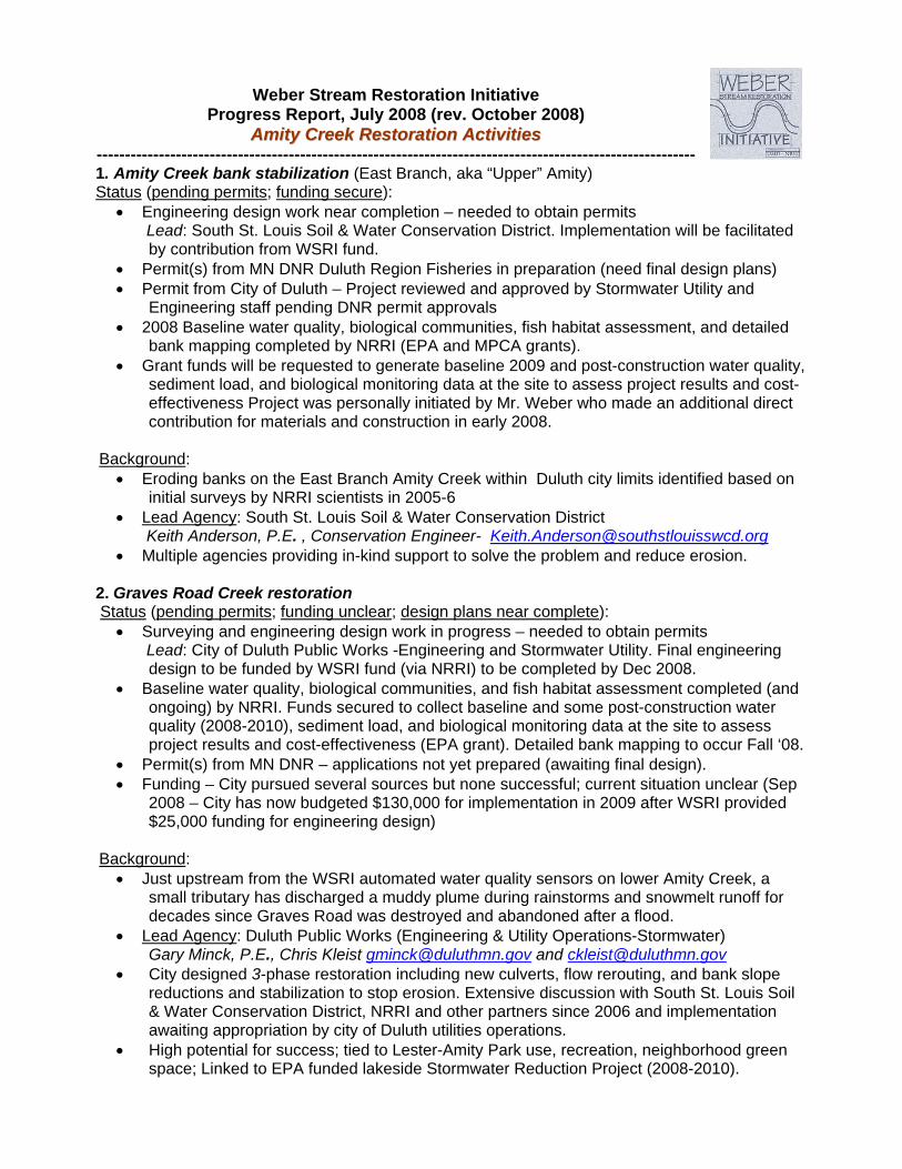
AAmmiittyy CCrreeeekk RReessttoorraattiioonn AAccttiivviittiieess ---------------------------------------------------------------------------------------------------------- 1. Amity Creek bank stabilization (East Branch, aka “Upper” Amity) Status (pending permits; funding secure):
Engineering design work near completion – needed to obtain permits Lead: South St. Louis Soil & Water Conservation District. Implementation will be facilitated
by contribution from WSRI fund. Permit(s) from MN DNR Duluth Region Fisheries in preparation (need final design plans) Permit from City of Duluth – Project reviewed and approved by Stormwater Utility and
Engineering staff pending DNR permit approvals 2008 Baseline water quality, biological communities, fish habitat assessment, and detailed
bank mapping completed by NRRI (EPA and MPCA grants). Grant funds will be requested to generate baseline 2009 and post-construction water quality,
sediment load, and biological monitoring data at the site to assess project results and cost-effectiveness Project was personally initiated by Mr. Weber who made an additional direct contribution for materials and construction in early 2008.
Background:
Eroding banks on the East Branch Amity Creek within Duluth city limits identified based on initial surveys by NRRI scientists in 2005-6
Lead Agency: South St. Louis Soil & Water Conservation District Keith Anderson, P.E. , Conservation Engineer- [email protected]
Multiple agencies providing in-kind support to solve the problem and reduce erosion.
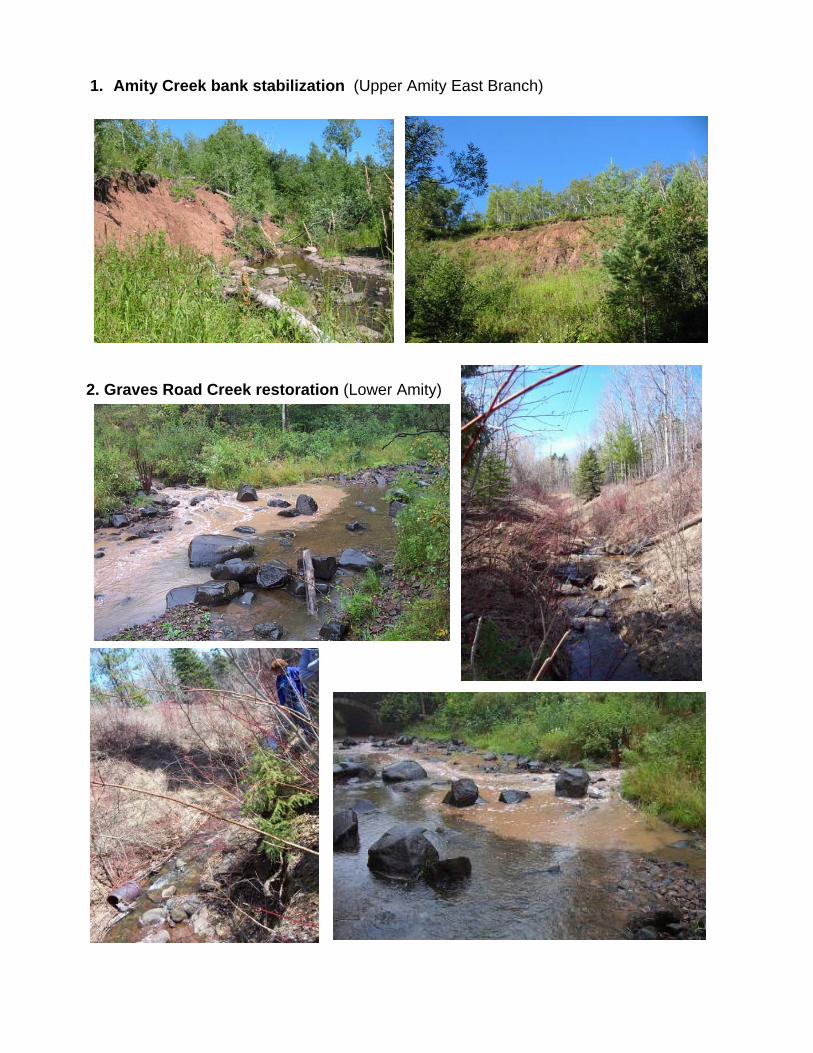
2. Graves Road Creek restoration Status (pending permits; funding unclear; design plans near complete):
Surveying and engineering design work in progress – needed to obtain permits Lead: City of Duluth Public Works -Engineering and Stormwater Utility. Final engineering
design to be funded by WSRI fund (via NRRI) to be completed by Dec 2008. Baseline water quality, biological communities, and fish habitat assessment completed (and
ongoing) by NRRI. Funds secured to collect baseline and some post-construction water quality (2008-2010), sediment load, and biological monitoring data at the site to assess project results and cost-effectiveness (EPA grant). Detailed bank mapping to occur Fall ‘08.
Permit(s) from MN DNR – applications not yet prepared (awaiting final design). Funding – City pursued several sources but none successful; current situation unclear (Sep
2008 – City has now budgeted $130,000 for implementation in 2009 after WSRI provided $25,000 funding for engineering design)
Background:
Just upstream from the WSRI automated water quality sensors on lower Amity Creek, a small tributary has discharged a muddy plume during rainstorms and snowmelt runoff for decades since Graves Road was destroyed and abandoned after a flood.
Lead Agency: Duluth Public Works (Engineering & Utility Operations-Stormwater) Gary Minck, P.E., Chris Kleist [email protected] and [email protected]
City designed 3-phase restoration including new culverts, flow rerouting, and bank slope reductions and stabilization to stop erosion. Extensive discussion with South St. Louis Soil & Water Conservation District, NRRI and other partners since 2006 and implementation awaiting appropriation by city of Duluth utilities operations.
High potential for success; tied to Lester-Amity Park use, recreation, neighborhood green space; Linked to EPA funded lakeside Stormwater Reduction Project (2008-2010).
1. Amity Creek bank stabilization (Upper Amity East Branch)
2. Graves Road Creek restoration (Lower Amity)


