
PHASE I ENVIRONMENTAL SITE ASSESSMENT REPORT
SOUTHEAST ELEMENTARY SCHOOL
134 WARRENVILLE ROAD
MANSFIELD CENTER, CONNECTICUT
FOR TOWN OF MANSFIELD
C/O COLLIERS INTERNATIONAL 135 NEW ROAD
MADISON, CONNECTICUT

March 22, 2019
Town of Mansfield c/o Colliers International Mr. Scott Pellman, AIA 135 New Road Madison, CT 06443
RE: Phase I Environmental Site Assessment Southeast Elementary School 134 Warrenville Road Mansfield Center, Connecticut Eagle Project No. 19-046.12T1
Dear Mr. Pellman:
Eagle Environmental, Inc. (Eagle) completed a Phase I Environmental Site Assessment for the Southeast Elementary School located at 134 Warrenville Road in Mansfield Center, Connecticut (the “Site”). The Phase I Environmental Site Assessment was performed in general accordance with American Testing and Materials (ASTM) standards E1527-13 and meets EPA’s All Appropriate Inquiry (AAI) standard. This assessment has revealed evidence of two (2) historic and one (1) recognized environmental condition (HRECs and REC) in connection with the property at the time of this report.
Eagle recommends a Phase II environmental site investigation to assess if a release of oil and/or hazardous substances have occurred at the two (2) HRECs and one (1) REC.
In our opinion, the Site does not appear to qualify as an “Establishment” as defined by the Connecticut Property Transfer Law.
Please contact us directly if you have any questions related to the report.
Sincerely, Eagle Environmental, Inc.
Report Prepared By: Kristi Gagnon Environmental Consultant II
Report Reviewed By: Martin Brogie, LEP
EXECUTIVE SUMMARY
Eagle Environmental, Inc. (Eagle) conducted a Phase I Environmental Site Assessment (ESA) at Southeast Elementary School located at 134 Warrenville Road in Mansfield Center, Connecticut (hereinafter referred to as “the Site”). This Phase I ESA was performed in accordance with the scope and limitations of American Society for Testing and Materials (ASTM) standards E1527-13 and meets EPA’s All Appropriate Inquiry (AAI) standard. The Phase I ESA included an environmental databases search, review of local, state, and federal regulatory agency files, and a limited reconnaissance of the Site and vicinity for potential off-site contamination sources. No sampling or other intrusive activities were conducted as part of the Phase I ESA. Additionally, an evaluation for the presence of suspected asbestos-containing material (ACM), lead-based paint (LBP), poly-chlorinated biphenyls (PCB) containing building materials or radon gas was not included in the scope of work for the ESA.
The major findings of the Phase I ESA are as follows:
• The Site consists of one (1) parcel of land totaling 16.1-acres;
• The Site is improved by one (1) single-story masonry building of approximately 34,594 square feet originally constructed in 1957. Construction consists of slab-on-grade with a basement boiler room and pipe tunnels, masonry framing, pitched and flat roofing and a septic system. Two (2) additions were added to the east end of the school in the late 1960s in early 2000s. Construction consists of slab-on-grade, masonry/wood framing and flat roofing. The Site includes 41,500 square feet of asphalt paving to the north and south of the building. An approximate 600 square foot concession stand with a bathroom was constructed in 2009 northeast of the Site building. Construction consists of slab-on-grade, wood framing, pitched roofing and an independent septic system. A storage shed, greenhouse/storage shed and a masonry block well pump house also exists on-Site;
• The school building includes twenty-three (23) classrooms, one (1) multi-purpose room (cafeteria, gymnasium & auditorium), one (1) kitchen, four (4) custodial closets throughout the building, one (1) boiler room in the basement and one (1) maintenance bay adjacent to the boiler room. Approximately 150 students, grades Pre-K through 4th grade, utilize the building with associated faculty;
• The Site is currently occupied by Southeast Elementary School. Historically, the Site was utilized for agricultural fields with mixed raw land until the Site building was constructed in 1957;
• The Site building utilizes an on-Site septic system, onsite water supply wells, and #2 fuel oil for heating;
• One (1) approximate 10,000-gallon sti-P3 #2 heating oil underground storage tank (UST) exists on the north side of the school building. The UST was installed 07/01/1988 and has exceeded the thirty (30) year life expectancy of sti-P3 USTs. A former 10,000-gallon
PHASE I ESA ES-1 MARCH 2019
heating oil UST was reportedly located within the same area installed in 1957 andremoved from the ground 07/01/1988;
• One (1) backup generator with a self-contained diesel tank exists north of the schoolwithin a wood enclosure. Staining on or adjacent to the generator was not observed;
• One (1) concrete pad-mounted transformer exists north of the school within a woodenclosure. No label indicating the presence or absence of PCB containing di-electricfluid was observed;
• The Site is listed on the CT UST, SPILLS and FINDS databases contained in an EDRenvironmental database report for two (2) registered USTs and a release of 2-gallons of#2 fuel oil in 2015;
• There is low potential that a vapor encroachment condition VEC exists at the Site basedupon a lack of documented releases within the area and current and historic chemicalutilization/storage on and off-Site;
• An ACM inspection was not included as part of this Phase I ESA, however, suspectACM may exist within the pipe tunnels below the school and within inaccessible areas(above ceilings/behind walls). The Site building appeared to have been recentlyrenovated with new floor tile; and,
• The Site does not appear to qualify as an “Establishment” as defined by the ConnecticutTransfer Act due to a lack of observed evidence that on or after November 19, 1980 theSite generated more than one hundred (100) kilograms of hazardous waste in any onemonth. Advice from legal counsel is suggested to confirm a final determination.
Eagle identified one (1) significant data gap, as defined by ASTM E1527-13, during the Site reconnaissance and records review that would significantly affect the ability of Eagle to identify recognized environmental conditions in connection with the Site.
One (1) former 10,000-gallon heating oil UST (Tank ID A1) was reportedly located within the same area as the current UST and removed from the ground June 1, 1988. No additional information was available to review. Specifically, a closure report or analytical summary of soil and/or groundwater results from the tank removal activity was not observed at the Town of Mansfield Municipal Departments or at CTDEEP at the time of this report.
This assessment has revealed evidence of two (2) historic and one (1) recognized environmental conditions in connection with the Site at the time of this report.
HREC No. 1: Septic System Leaching Fields Southeast Elementary School was constructed in 1957 with an on-Site septic system and leaching fields located southeast of the building. If halogenated solvents (commonly found in floor strippers and cleaners prior to 1980) or other products potentially containing contaminant compounds were previously used in the building, the constituents and residual rinse water may
PHASE I ESA ES-2 MARCH 2019
have been disposed of into the septic system with potential to impact soil and/or groundwater within the vicinity of the leaching fields. HREC No. 2: Underground Storage Tank A1 One (1) former 10,000-gallon heating oil UST (Tank ID A1) was reportedly located within the same area as the current UST and removed from the ground 07/01/1988. No additional information was available to review. Specifically, a closure report or analytical summary of soil and/or groundwater results from the tank removal activity was not observed at the time of this report. Should a release of fuel oil have occurred, there is potential for an impact to soil and/or groundwater unless official documentation can prove a release had not occurred. REC No. 1: Underground Storage Tank A1R1 One (1) 10,000-gallon sti-P3 #2 fuel oil UST (Tank ID A1R1) exists on-Site north of the building. The UST was installed 07/01/1988 and has exceeded the thirty (30) year life expectancy of sti-P3 USTs. Mansfield Facilities Department provided a copy of the cathodic protection monitoring log dated June 15, 2018 indicating the UST passed testing. It is unclear however, if just the UST was cathodically tested or if the return/supply piping was included. Until the UST is removed from the ground, or abandoned in place, there is potential for a release to soil and/or groundwater within the vicinity of the UST and associated piping.
Based on the findings and conclusions discussed herein, Eagle offers the following recommendations:
Eagle recommends conducting a Phase II Environmental Site Investigation (ESI) to assess the presence of a release of regulated substances to soil and/or groundwater at the Site to address the two (2) HRECs and one (1) REC observed in connection with the property.
Eagle also recommends the timely removal and replacement of the underground storage tank (UST) A1 and associated piping due to the exceedance of the thirty (30) year life expectancy. Prior to any tank removal activities, thirty (30) day notification is required by the Connecticut Department of Energy and Environmental Protection (CTDEEP) as well as any applicable permits through the Town of Mansfield.
PHASE I ESA ES-3 MARCH 2019
TABLE OF CONTENTS EXECUTIVE SUMMARY ...................................................................................................... ES-1
LIST OF FIGURES ........................................................................................................ III LIST OF APPENDICIES .............................................................................................. III 1.0 INTRODUCTION .............................................................................................................. 1-1
1.1. PURPOSE ........................................................................................................................ 1-2
2.0 SITE DESCRIPTION ........................................................................................................ 2-1 2.1 SITE OWNERSHIP AND LOCATION ................................................................................... 2-1 2.2 CURRENT USE OF THE PROPERTY ................................................................................... 2-1 2.3 DESCRIPTION OF STRUCTURES, ROADS, OTHER IMPROVEMENTS ON THE SITE .............. 2-1 2.4 CURRENT USES OF ADJOINING PROPERTIES ................................................................... 2-2
3.0 USER PROVIDED INFORMATION ........................................................................ 3-1 3.1 ENVIRONMENTAL LIENS ................................................................................................. 3-1 3.2 ENVIRONMENTAL LAND USE RESTRICTIONS .................................................................. 3-1 3.3 SPECIALIZED KNOWLEDGE ............................................................................................. 3-1 3.4 COMMONLY KNOWN OR REASONABLE ASCERTAINABLE INFORMATION ........................ 3-1 3.5 VALUATION REDUCTION FOR ENVIRONMENTAL ISSUES ................................................. 3-1 3.6 DEGREE OF OBVIOUSNESS OF CONTAMINATION ............................................................. 3-1
4.0 PREVIOUS ENVIRONMENTAL ASSESSMENTS .................................................. 4-1 5.0 DATABASE SEARCH REPORT AND MUNICIPAL RECORDS ............................ 5-1
5.1 STANDARD ENVIRONMENTAL RECORD SOURCES ........................................................... 5-1 5.2 ON-SITE FEDERAL REGULATORY INFORMATION ............................................................ 5-1
5.2.1 Environmental Protection Agency (EPA) National Priorities List (NPL) ............ 5-2 5.2.2 Environmental Protection Agency (EPA) National Priorities List (NPL) Delisted
Sites ...................................................................................................................... 5-2 5.2.3 Comprehensive Environmental Response, Compensation and Liability Act
(CERCLA) Status ................................................................................................ 5-2 5.2.4 EPA Comprehensive Environmental Response, Compensation, and Liability
Information System Archived Sites (CERCLIS NFRAP) Status ........................ 5-2 5.2.5 Resource Conservation and Recovery Act (RCRA) Notification Status .............. 5-2 5.2.6 Federal IC/EC Status ............................................................................................. 5-2 5.2.7 Response Notification System (ERNS) Status ...................................................... 5-2 5.2.8 Tribal Lands Status ................................................................................................ 5-2
5.3 ON-SITE CT DEEP REGULATORY INFORMATION .......................................................... 5-2 5.3.1 State/Tribal Hazardous Waste Sites Status ........................................................... 5-2 5.3.2 State/Tribal Spills Site Status ................................................................................ 5-2 5.3.3 State/Tribal Waste Landfill Site Status ................................................................. 5-2 5.3.4 State/Tribal Underground Storage Tank (UST) and Aboveground Storage Tank
(AST) Site Status ................................................................................................. 5-2 5.3.5 State/Tribal Leaking Underground Storage Tank (LUST) Sites Status ................ 5-3 5.3.6 State/Tribal Institutional Control Database Status ................................................ 5-3 5.3.7 State/Tribal Brownfields Status............................................................................. 5-3 5.3.8 State/Tribal Voluntary Cleanup Program Sites Status .......................................... 5-3
PHASE I ESA i MARCH 2019
5.3.9 State Other (CT DEEP Property Transfer Program) Database Status ................... 5-3 5.4 OFF-SITE FEDERAL REGULATORY INFORMATION .......................................................... 5-3
5.4.1 NPL Sites/Delisted NPL Sites Within the Specified Minimum Search Radius .... 5-3 5.4.2 CERCLA & CERCLA-NFRAP Sites Within a 1/2-Mile Radius ......................... 5-3 5.4.3 RCRA Notifiers Within the Specified Minimum Search Radius .......................... 5-3 5.4.4 Federal IC/EC Wihtin a 1/2-Mile Radius .............................................................. 5-3 5.4.5 ERNS Listing Within a 1/8-Mile Radius .............................................................. 5-3 5.4.6 Tribal Lands Within a 1-Mile Radius .................................................................... 5-3
5.5 OFF-SITE CT DEEP REGULATORY INFORMATION ......................................................... 5-4 5.5.1 State/Tribal Hazardous Waste Sites Within a 1-Mile Radius ............................... 5-4 5.5.2 State/Tribal Waste Spill Sites Within a 1/8-Mile Radius ...................................... 5-4 5.5.3 State/Tribal Waste Landfill Sites Within a 1/2-Mile Radius ................................ 5-4 5.5.4 State/Tribal USTs and ASTs within a 1/4-Mile Radius ........................................ 5-4 5.5.5 State/Tribal LUSTs Within a 1/2-Mile Radius ...................................................... 5-4 5.5.6 State/Tribal IC Within a 1/4-Mile Radius ............................................................. 5-4 5.5.7 State/Tribal Brownfield Sites Within a 1/2-Mile Radius ...................................... 5-4 5.5.8 State/Tribal Voluntary Cleanup program Sites Within a 1/2-Mile Radius ........... 5-4 5.5.9 State Other (CT DEEP Property Transfer Program Sites) Within a 1/4-Mile Radius
.............................................................................................................................. 5-4 5.6 SUPPLEMENTAL CT DEEP FILE REVIEW ....................................................................... 5-5 5.7 MUNICIPAL FILE REVIEW ............................................................................................... 5-5
5.7.1 Tax Assessor .......................................................................................................... 5-5 5.7.2 Building Department ............................................................................................. 5-5 5.7.3 Town Clerk ............................................................................................................ 5-5 5.7.4 Facilities Department ............................................................................................ 5-5 5.7.5 Fire Marshal’s Office ............................................................................................ 5-6 5.7.6 Health Department ................................................................................................ 5-6 5.7.7 Planning & Zoning ................................................................................................ 5-6 5.7.8 Pubic Works .......................................................................................................... 5-6
5.8 CONNECTICUT TRANSFER ACT ....................................................................................... 5-7
6.0 SITE AND AREA HISTORY ........................................................................................... 6-1 6.1 SANBORN FIRE INSURANCE MAPS .................................................................................. 6-1 6.2 TOPOGRAPHIC MAPS ...................................................................................................... 6-1 6.3 AERIAL PHOTOGRAPHS .................................................................................................. 6-1 6.4 CITY DIRECTORIES ......................................................................................................... 6-2
7.0 SITE RECONNAISSANCE .............................................................................................. 7-1 7.1 PHYSICAL SETTING ........................................................................................................ 7-1
7.1.1 Site Setting and Topography ................................................................................. 7-1 7.1.2 Groundwater Characteristics ................................................................................. 7-1 7.1.3 Geologic Characteristics ........................................................................................ 7-1 7.1.4 Potential Environmental Receptors ....................................................................... 7-1
7.2 PHYSICAL CHARACTERISTICS ......................................................................................... 7-1 7.2.1 Land Area .............................................................................................................. 7-2 7.2.2 Site Operation ........................................................................................................ 7-2 7.2.3 Petroleum Product and Raw Chemical Storage .................................................... 7-2 7.2.4 Petroleum and Chemical Waste Generation and Disposal .................................... 7-3 7.2.5 Air Emisson Sources ............................................................................................. 7-3 7.2.6 Wastewater Discharge Sources ............................................................................. 7-3
PHASE I ESA ii MARCH 2019
7.2.7 Visual Indications of Contamination of Building Interior .................................... 7-3 7.2.8 Solid Waste or Hazardous Waste Deposits Observed On-Site ............................. 7-3 7.2.9 On-Site Sources of Contamination Observed During Site Visit ........................... 7-3 7.2.10 Dielectric Fluid-Containing Electrical Devices .................................................... 7-3 7.2.11 Floor Drains, Dry Wells, Pits, Sumps or Lagoons ............................................... 7-4 7.2.12 Asbestos Containing Materials (ACMs) ............................................................... 7-4 7.2.13 Off-Site Sources of Contamination Observed During Site Visit ......................... 7-4
8.0 INTERVIEWS ......................................................................................................... 8-1
8.1 USER...…………………………………………………………………………......…. 8-1 8.2 KEY SITE MANAGER ...................................................................................................... 8-1 8.3 INTERVIEW WITH STATE AND/OR LOCAL OFFICIALS ...................................................... 8-1 8.4 ASTM ENVIRONMENTAL QUESTIONNAIRE .................................................................... 8-1
9.0 DATA GAPS ............................................................................................................ 9-1
10.0 VAPOR ENCROACHMENT SCREENING ................................................... 10-1
10.1 VAPOR ENCROACHMENT SCREENING ........................................................................... 10-1
11.0 FINDINGS ........................................................................................................... 11-1
12.0 CONCLUSIONS ................................................................................................. 12-1
13.0 RECOMMENDATION ...................................................................................... 13-1
14.0 LIMITATIONS ................................................................................................... 14-1
15.0 REFERENCES .................................................................................................... 15-1
16.0 SIGNATURE AND QUALIFICATIONS OF ENVIRONMENTAL PROFESSIONAL .................................................................................................. 16-1
LIST OF FIGURES Figure 1 Location Map Figure 2 Topographic Map Figure 3 Site Plan LIST OF APPENDICES Appendix A AAI User Questionnaire/ ASTM Environmental Questionnaire Appendix B Previous Report Appendix C Environmental Database Report Appendix D Municipal Information Appendix E Sanborn Maps Appendix F Topographic Maps Appendix G Aerial Photographs Appendix H City Directories Appendix I Site Photographs Appendix J FIRM Map Appendix K Vapor Encroachment Survey Report
PHASE I ESA iii MARCH 2019
1.0 INTRODUCTION
Eagle Environmental, Inc. (Eagle) conducted a Phase I Environmental Site Assessment (ESA) at Southeast Elementary School located at 134 Warrenville Road in Mansfield Center, Connecticut (hereinafter referred to as “the Site”). The Phase I ESA is being conducted to support the potential future consolidation of the three (3) Mansfield Elementary Schools into a single centrally located facility. The purpose of the Phase I ESA is to determine if Recognized Environmental Conditions (RECs)1 are present in connection with the Site from past or present property usage in accordance with the Comprehensive Environmental Response, Compensation and Liability Act (CERCLA) of 1980 as amended, 40 USC 9601, et seq. Furthermore, the Phase I ESA will assess applicable levels of environmental compliance; environmental liability; hazardous material stored, released or disposed of on Site; and the need for characterization investigation, if required. In addition, this Phase I ESA renders an opinion as to whether the Site is an “Establishment” as defined under the Connecticut Transfer Act (Sections 22a-134 through 22a -134e of the Connecticut General Statutes), as amended by Public Acts 09-235 and 09-3. This Phase I ESA was conducted in conformance with the scope and limitations of American Society for Testing and Materials (ASTM) standard for the Phase I Environmental Site Assessment Process (ASTM E1527-13) which is compliant with EPA’s All Appropriate Inquiry (AAI) rule (40 CFR §312). In addition, this Phase I ESA meets the requirements of the Site Characterization Guidance Document published by the Connecticut Department of Energy and Environmental Protection (CT DEEP) and the Connecticut Housing Finance Authority (CHFA) Construction Guidelines: Environmental & Hazardous Materials Review January 2018. 1.1 Purpose
This assessment utilized the general quality principles and practices towards the preparation of a report that incorporates suggested methods under the ASTM. The term “recognized environmental condition” (REC) referenced in the revised ASTM E1527-13 refers to “the presence or likely presence of any hazardous substances or petroleum products in, on or at a property under conditions that indicate an existing release, a past release or a material threat of a release of hazardous substance or petroleum products into structures on the property or into the ground, groundwater, or surface water of the property.” The ASTM definition does not include “de minimis” conditions, which generally do not present a threat to human health or the environment and that generally would not be the subject of an enforcement action if brought to the attention of the appropriate government agencies. Therefore, de minimis conditions are not considered RECs. A new term “controlled recognized environmental condition” (CREC) referenced in the revised ASTM E1527-13 refer to “sites where a REC from past releases has been addressed to standards and either hazardous substances or petroleum remain in place with implementation of required controls”. The Phase I ESA includes the following tasks:
1 Recognized environmental conditions – the presence or likely presence of any hazardous substances or petroleum products in, on or at a property: (1) due to release to the environment; (2) under conditions indicative of a release to the environment; or (3) under conditions that pose a material threat of a future release to the environment. De minimis conditions are not recognized environmental conditions.
PHASE I ESA 1-1 MARCH 2019

• Review of an environmental database search report for sites identified on databases including National Priorities List (NPL); Comprehensive Environmental Response Compensation and Liability Act (CERCLA); Resource Conservation and Recovery Act (RCRA); emergency response notification sites; a state spill, release, and landfill sites;
• Review of files at the Tax Assessor’s Office, Health Department, Town Clerk, Fire Marshal’s Office and the Building/Engineering/Zoning Department;
• Site reconnaissance to observe conditions exposed at the ground surface for evidence of previous and current property usage, and indications of environmental impact (e.g., stressed vegetation, staining, etc.);
• Reconnaissance of surrounding properties to identify potential off-site sources of
contamination; and
• Vapor encroachment screening based on information obtained via the environmental database report, local and/or state research and interview documentation.
In accordance with the approved scope of work, Eagle did not collect samples for suspect asbestos containing material (ACM), lead-based paint (LBP), or radon gas. This Phase I ESA was performed in accordance with the limitations and exceptions identified in Section 14.0 of this report.
PHASE I ESA 1-2 MARCH 2019
2.0 SITE DESCRIPTION
2.1 Site Ownership and Location
Site Owner: Town of Mansfield
Site Occupants: Southeast Elementary School
Site Location: 134 Warrenville Road, Mansfield Center, Connecticut
County: Tolland
Parcel ID: 29.116.1
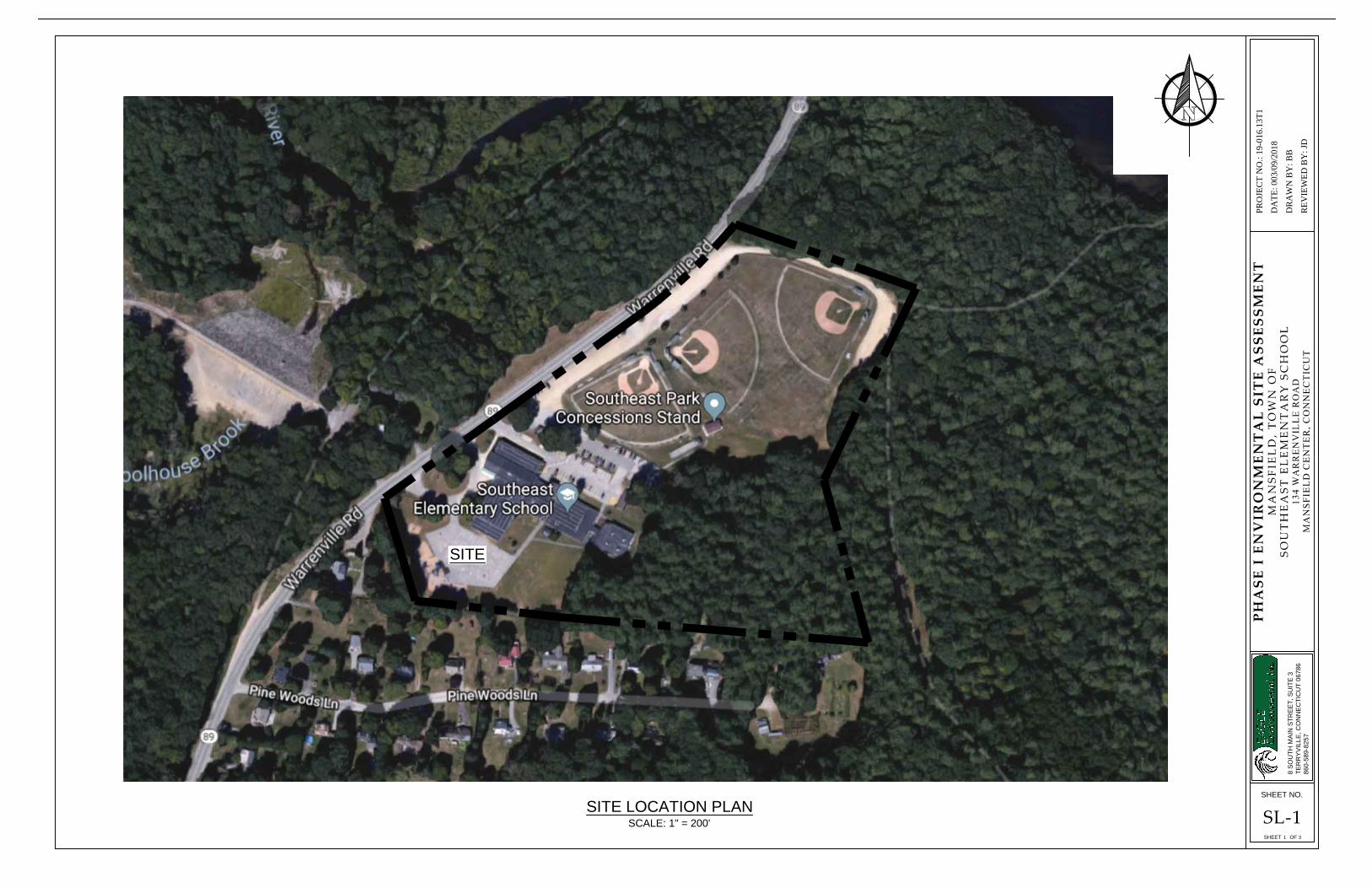
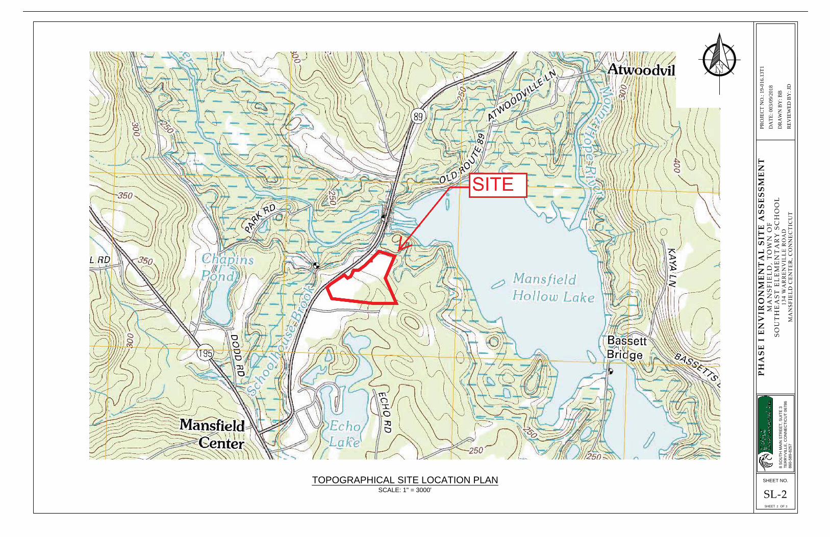
Latitude/Longitude: 41° 46' 24" N, -72° 11' 27" W UTM Coordinates: X: 733480.86, Y: 4628416.88 Size: 16.1 Acres Elevation: 274.23' Above Sea Level The 16.1-acre Site is located at 134 Warrenville Road in Mansfield Center, Connecticut. The Site is accessed via two (2) asphalt paved driveways off the east side of Warrenville Road. The location of the Site is depicted on a Locus Map and Topographic Map enclosed as Figure 1 and Figure 2, respectively. 2.2 Current Use of the Property
The Site is currently occupied by Southeast Elementary School. 2.3 Description of Structures, Roads, Other Improvements on the Site
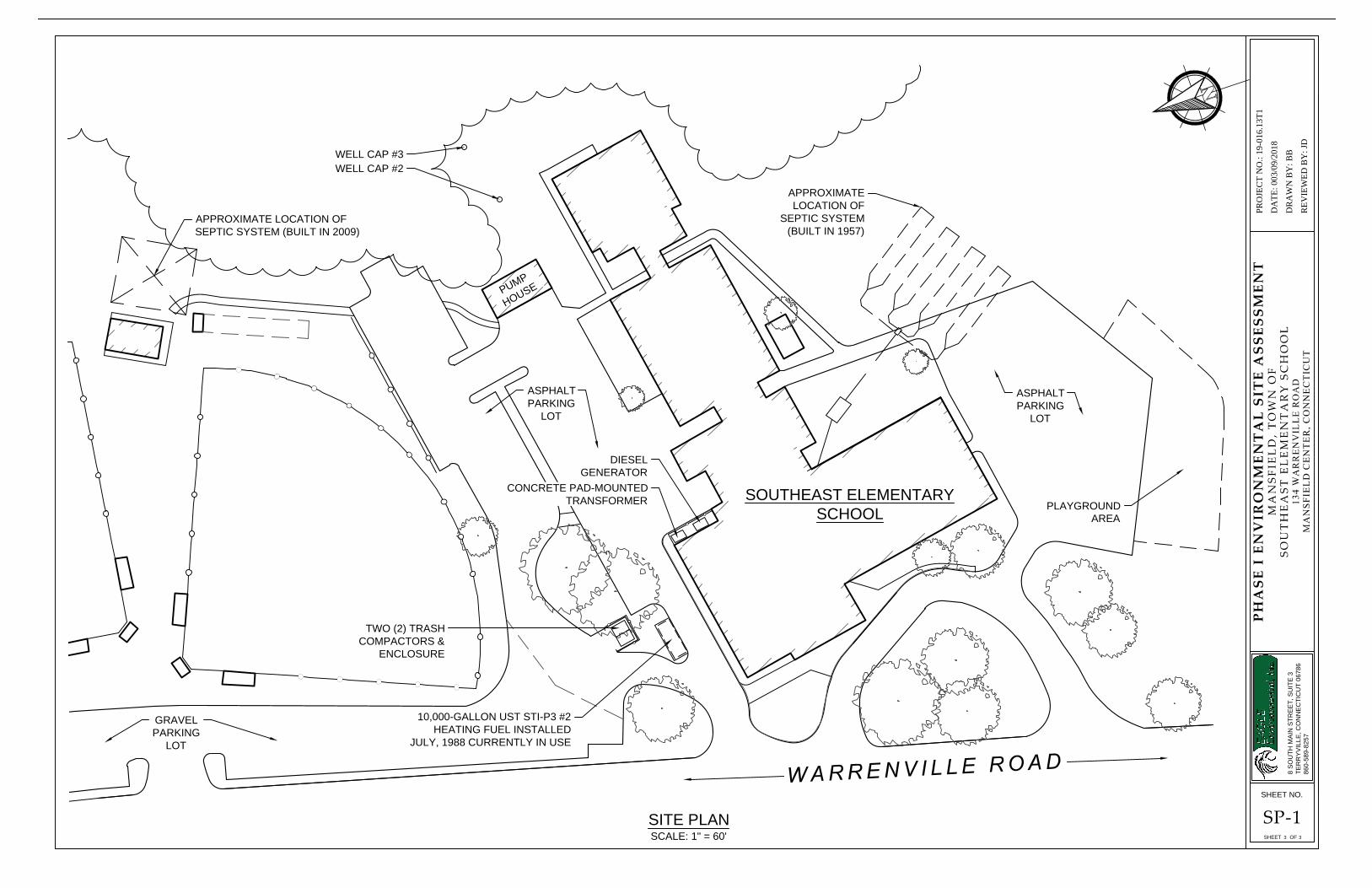
The Site is improved by one (1) single-story masonry building of approximately 34,594 square feet originally constructed in 1957. Construction consists of slab-on-grade with a basement boiler room and pipe tunnels, masonry walls, pitched and flat roofing. The building is served by a septic system. Two (2) additions were added to the east end of the school in the late 1960s and in the early 2000s. Construction consists of slab-on-grade, masonry/wood framing and flat roofing. The Site includes 41,500 square feet of asphalt paving to the north and south of the building. An approximate 600 square foot concession stand with a bathroom was constructed in 2009 northeast of the Site building. Construction consists of slab-on-grade, wood framing, pitched roofing. The stand is equipped with an independent septic system. A storage shed, greenhouse/storage shed and a masonry block well pump house also exist on-Site. A Site plan is enclosed as Figure 3.
The school building includes twenty-three (23) classrooms, one (1) multi-purpose room (cafeteria, gymnasium & auditorium), one (1) kitchen, four (4) custodial closets throughout the building, one (1) boiler room in the basement and one (1) maintenance bay adjacent to the boiler
PHASE I ESA 2-1 MARCH 2019
room. Approximately 150 students, grades Pre-K through 4th grade, utilize the building with associated faculty.
2.4 Current Uses of Adjoining Properties
Eagle conducted an area reconnaissance by walking around the property on March 12, 2019. The property and surrounding areas are described below: Northerly: Route 89 (Warrenville Road), Forested land
Easterly: Forested land (Mansfield Hollow State Park)
Southerly: Residential
Westerly: Forested land, Army Corps of Engineers Dam (Schoolhouse Brook)
PHASE I ESA 2-2 MARCH 2019
3.0 USER PROVIDED INFORMATION
A User Questionnaire was completed by Mr. Allen Corson, Director of Facilities Management Department for the Town of Mansfield, pertaining to the Site. A summary of the information provided by Mr. Corson from the questionnaire is provided below. A copy of the questionnaire is provided in Appendix A.
Note that a complete title search, valuation, and other real estate information are beyond the scope of work of this Phase I ESA.
Historical information is provided in Section 4.0, 5.0 and 6.0 of this report. The information presented in this section was based primarily on the information collected from Mr. Corson.
3.1 Environmental Liens
The above-referenced individual indicated in the User Questionnaire that he is not aware of any environmental liens issued against the subject Site.
3.2 Environmental Land Use Restrictions
The above-referenced individual indicated in the User Questionnaire that he is not aware of any environmental land use restrictions that are in place at the Site or that have been filed/ recorded in public land records for the Site.
3.3 Specialized Knowledge
The above-referenced individual indicated in the User Questionnaire that he is unaware of specialized knowledge or experience relating to the subject Site.
3.4 Valuation Reduction for Environmental Issues
The above-referenced individual indicated in the User Questionnaire that he is unaware if the purchase price would reasonably reflect the fair market value of the property.
3.5 Commonly Known or Reasonable Ascertainable Information
The above-referenced individual indicated in the User Questionnaire that he is not aware of known or reasonable ascertainable information pertaining to the subject Site.
3.6 Degree of Obviousness of Contamination
The above-referenced individual indicated in the User Questionnaire he is not aware of any obvious indicators that point to the presence or likely presence of contamination on the property.
PHASE I ESA 3-1 MARCH 2019
4.0 PREVIOUS ENVIRONMENTAL ASSESSMENTS
The User of this report did not provide a previous environmental investigation report for Eagle for review. This information would be provided in Appendix B.
PHASE I ESA 4-1 MARCH 2019
5.0 DATABASE SEARCH REPORT AND MUNICIPAL RECORDS
5.1 Standard Environmental Record Sources
Eagle retained Environmental Data Resource, Inc. (EDR) of Milford, Connecticut to perform an on-line radius search (based on AAI standards) of applicable State and federal environmental databases. The EDR (Appendix C), dated March 8, 2019, reviewed the following databases for the area within the specified radius of the subject parcel:
• Environmental Protection Agency (EPA) National Priorities List (NPL), 1-mile radius;
• Environmental Protection Agency (EPA) National Priorities List (NPL) Delisted site, 1/2-mile radius;
• EPA Comprehensive Environmental Response Compensation Liability Information System (CERCLIS) List (which included EPA Superfunds sites), 1/2-mile radius;
• EPA Comprehensive Environmental Response Compensation and Liability Information System Archived sites (CERCLIS NFRAP), 1/2-mile radius;
• Resource Conservation and Recovery Act (RCRA) sites (Generators within 1/2-mile radius; Treatment, Storage and Disposal facilities within 1/2-mile radius; and Corrective Action sites within 1-mile radius);
• Federal Institutional Controls/Engineering Controls (IC/EC), 1/2-mile radius; • Emergency Response Notification System (ERNS) sites, 1/8-mile radius; • Tribal Lands (database of boundaries in which American Indian tribes have primary
governmental authority, administered by the Bureau of Indian Affairs), 1-mile radius; • State/Tribal Hazardous Waste sites, 1-mile radius; • State/Tribal Spill Sites; 1/8-mile radius; • Solid/Tribal Waste Landfill sites, 1/2-mile radius; • State/Tribal Registered Underground storage Tanks (USTs) and Aboveground
Storage Tanks (ASTs) listings,) 1/4-mile radius; • State/Tribal Leaking Underground Storage Tanks (LUSTs) listing, 1/2-mile radius; • State/Tribal Institutional Control (IC) database, 1/2-mile radius; • State/Tribal Brownfields sites, 1/2-mile radius; • State/Tribal Voluntary Cleanup Program (VCP) sites, 1/2-mile radius; and, • State Other (database of sites within the (CTDEEP’s Property Transfer Program), 1/4-
mile radius.
Eagle reviewed the area topography as it relates to the Site and determined an inferred direction of groundwater flow through the Site and adjacent area to be northwesterly/northerly towards Schoolhouse Brook that discharges to Mansfield Hollow Lake. Based on this inferred direction of groundwater flow, properties (within the search radii specified above) located south/southeast and upgradient of the Site will be discussed as it relates to the potential environmental impact to the Site. The location of the Site is depicted on the Topographic Map enclosed as Figure 2. 5.2 On-Site Federal Regulatory Information
PHASE I ESA 5-1 MARCH 2019
5.2.1 Environmental Protection Agency (EPA) National Priorities List (NPL): Site is not listed.
5.2.2 Environmental Protection Agency (EPA) National Priorities List (NPL) Delisted Sites: Site is not listed. 5.2.3 Comprehensive Environmental Response, Compensation and Liability Act (CERCLA)
Status: Site is not listed.
5.2.4 EPA Comprehensive Environmental Response, Compensation, and Liability Information
System Archived Sites (CERCLIS NFRAP) Status: Site is not listed.
5.2.5 Resource Conservation and Recovery Act (RCRA) Notification Status: Site is not listed. 5.2.6 Federal IC/EC Status: Site is not listed.
5.2.7 Emergency Response Notification System (ERNS) Status: Site is not listed.
5.2.8 Tribal Lands Status: Site is not listed.
5.3 On-Site CT DEEP Regulatory Information
5.3.1 State/Tribal Hazardous Waste Sites Status: Site is not listed.
5.3.2 State/Tribal Spills Site Status: The Site is listed for one (1) Spill:
1. On 06/01/2015, the Site had a release of 2-gallons of #2 fuel oil from an overfill of the UST. The Spill was cleaned and status is terminated.
Based on the de minimis quantity and response action associated with the Spill, there is low potential for an adverse impact to the subject Site.
5.3.3 State/Tribal Waste Landfill Site Status: Site is not listed.
5.3.4 State/Tribal Underground Storage Tank (UST) and Aboveground Storage Tank (AST)
Site Status: The Site is listed for two (2) USTs.
PHASE I ESA 5-2 MARCH 2019
1. Tank ID A1 – 10,000-gallon asphalt coated or bare steel heating oil UST installed 06/01/1955 and removed from the ground 07/01/1988. 2. Tank ID A1R1 – 10,000-gallon coated & cathodically protected steel (sti-P3) heating oil UST installed 07/01/1988 currently in use.
5.3.5 State/Tribal Leaking Underground Storage Tank (LUST) Sites Status: Site is not listed.
5.3.6 State/Tribal Institutional Control Database Status: Site is not listed. 5.3.7 State/Tribal Brownfields Status: Site is not listed. 5.3.8 State/Tribal Voluntary Cleanup Program Sites Status: Site is not listed. 5.3.9 State Other (CT DEEP Property Transfer Program) Database Status: Site is not listed 5.4 Off-Site Federal Regulatory Information 5.4.1 NPL Sites/Delisted NPL Sites Within the Specified Minimum Search Radius: No federal NPL sites were identified within a 1-mile radius and upgradient of the subject Site. In addition, no delisted NPL sites were identified within a 1/2-mile radius of the subject Site. 5.4.2 CERCLA & CERCLA-NFRAP Sites Within a 1/2–Mile Radius: No Federal CERCLA-NFRAP Sites (Now renamed SEMS-ARCHIVE by the EPA in 2015) were identified to be upgradient and within a 1/2–mile radius of the subject Site. 5.4.3 RCRA Notifiers Within the Specified Minimum Search Radius: No Federal RCRA Notifiers were identified to be upgradient and within a 1/8-mile radius of the subject Site. 5.4.4 Federal IC/EC Within a 1/2-Mile Radius: No Federal Institutional Controls/Engineering Controls (IC/EC) Sites were found to be upgradient and within the 1/2-mile radius of the subject Site. 5.4.5 ERNS Listing Within a 1/8-Mile Radius: No Federal ERNS Sites were found to be upgradient and within a 1/8-mile radius of the subject Site. 5.4.6 Tribal Lands Within a 1-Mile Radius: No Federal Tribal Lands were found to be upgradient and within a 1-mile radius of the subject Site.
PHASE I ESA 5-3 MARCH 2019
5.5 Off-Site CT DEEP Regulatory Information
5.5.1 State/Tribal Hazardous Waste Sites Within a 1-Mile Radius No State/Tribal Hazardous Waste Sites were found to be upgradient and within a 1-mile radius of the subject Site. 5.5.2 State/Tribal Waste Spill Sites Within a 1/8-Mile Radius No State/Tribal Waste Spill Sites were found to be upgradient and within a 1/8-mile radius of the subject Site. 5.5.3 State/Tribal Waste Landfill Sites Within a 1/2–Mile Radius No State/Tribal Waste Landfill Sites were found to be upgradient and within a 1/2-mile radius of the subject Site. 5.5.4 State/Tribal USTs and ASTs Within a 1/4–Mile Radius No State/Tribal USTs were found to be upgradient and within a 1/4-mile radius of the subject Site. 5.5.5 State/Tribal LUSTs Within a 1/2–Mile Radius No State/Tribal LUSTs were found to be upgradient and within a 1/2-mile radius of the subject Site: 5.5.6 State/Tribal IC Within a 1/4–Mile Radius No State/Tribal Institutional Controls (IC) were found to be upgradient and within a 1/4-mile radius of the subject Site. 5.5.7 State/Tribal Brownfield Sites Within a 1/2–Mile Radius No State/Tribal Brownfield Sites were found to be upgradient and within a 1/2-mile radius of the subject Site. 5.5.8 State/Tribal Voluntary Cleanup Program Sites Within a 1/2–Mile Radius No State/Tribal Voluntary Cleanup Program Sites were found upgradient and within a 1/2-mile radius of the subject Site: 5.5.9 State Other (CTDEEP Property Transfer Program Sites) Within a 1/4–Mile Radius No State Other (CTDEEP Property Transfer Program Sites) were found upgradient and within a 1/4-mile radius of the subject Site.
5.6 Supplemental CTDEEP File Review
Eagle conducted a CTDEEP file review on March 12, 2019 for UST information, remediation files, manifest files, oil and chemical spill files, oil and chemical spill correspondences, soil vapor recovery, solid waste and any additional documents deemed relevant to the scope of this Phase I ESA. Eagle reviewed three (3) documents for the subject Site. A copy of each file is provided in Appendix D
PHASE I ESA 5-4 MARCH 2019
1. Underground/Aboveground U.L. Storage Tanks - September 23, 1988 A correspondence between Riggott Manufacturing, Inc. and the Town of Mansfield Fire Marshal indicated the Site UST was inspected September 21, 1988 and found to be installed using the recommended installation practices of NFPA-30 and of Riggott Manufacturing and is fully warranted as is. Riggott Manufacturing manufactured the UST and Chem-Tech installed it on-Site.
2. Emergency Incident Report - January 20, 1989
A release of #2 heating oil occurred at Southeast School in sand backfill of the new tank. Approximately 2-5 cubic yards of soil was removed to a landfill. No additional information was available to review.
3. Underground Storage Facilities Notification - November 20, 1991
One (1) 10,000-gallon steel #2 fuel oil UST (Tank ID A1) was installed June 1955 on-Site. The 10,000-gallon UST A1 was replaced July 1988 by a 10,000-gallon sti-P3 #2 fuel oil UST (Tank ID A1R1). A Site plan was included with the notification indicating UST A1 was located within the same area as the current UST A1R1. See Section 8.2 for further detail on the location of UST A1.
5.7 Municipal File Review
Eagle conducted a Municipal Office review on March 12, 2019. Municipal offices researched as part of this Phase I ESA study include the Mansfield Assessor’s Office, Town Clerk, Fire Marshal’s Office, Building Department, Public Works, Planning & Zoning, Facilities Department and Health Department. All municipal files are included in Appendix D.
5.7.1 Tax Assessor Mansfield Tax Assessors property cards were reviewed and provided information regarding the parcel size and building layout, size and construction previously described in Section 2.0.
5.7.2 Building Department Eagle visited the Mansfield Building Department, but no pertinent or relevant records to the scope of this report were found for the subject Site. 5.7.3 Town Clerk Eagle visited the Mansfield Town Clerk’s Office, but no pertinent or relevant records to the scope of this report were found for the subject Site. 5.7.4 Facilities Department Eagle visited the Mansfield Facilities Department and reviewed the following documents.
1. Service Station Equipment, Inc. - June 15, 2018
A Cathodic Protection Monitoring Log indicated the 10,000-gallon UST located at the Site passed Cathodic protection testing.
2. Septic Suitability Report – January 26, 2010
PHASE I ESA 5-5 MARCH 2019
A septic suitability study was conducted on-Site to determine the potential suitability to support an 800 student facility through data collection, field and laboratory testing, topographic surveying and preliminary subsurface waste absorption system (SWAS) calculations. Four (4) monitoring wells were installed north of the Site building around the turf fields. Groundwater was observed at depths from 45-58 feet below ground surface. Groundwater was observed to flow dominantly north towards the Fenton River and Mansfield Hollow Lake. Based on the observations of the Site and surrounding area, including topography, soils, and groundwater depths, the report concluded that the Site can adequately accept the wastewater flows of an 800 student facility.
5.7.5 Fire Marshal’s Office Eagle visited the Mansfield Fire Department and reviewed one (1) underground storage facilities notification consistent with the information discussed in Section 5.6.
5.7.6 Health Department Eagle visited the Eastern Highlands Health District and reviewed two (2) correspondence emails dated June 20, 2007 from the Connecticut Department of Public Health to Mr. Allen Corson of the Town of Mansfield indicating that Well #2 and #3 used for on-Site drinking water installed in the early 2000s were approved for public water supply use.
5.7.7 Planning & Zoning Eagle visited the Mansfield Public Works and reviewed the following documents.
1. Topographic Map A topographic map provided by the Town of Mansfield Web GIS revealed detailed contours of the Site parcel. Based upon localized topography, a groundwater divide may exist on-Site with the northern portion flowing northerly and the southern more northwesterly towards Schoolhouse Brook and the Fenton River.
2. Wetland/Stream Map A wetland/stream map provided by the Town of Mansfield Web GIS revealed that wetlands and/or streams mapped by the National Wetland Inventory and Town Wetlands do not appear to exist on-Site.
3. Natural Diversity Database Map A natural diversity database map provided by the Town of Mansfield Web GIS revealed that the Site parcel appears to include natural diversity areas on the north, south, east and western parcel boundary lines.
5.7.8 Public Works Eagle visited the Mansfield Public Works and reviewed the following document.
1. Site Plan
A Site Plan prepared by the Malmfeldt Associates Architects of Hartford, Connecticut (date unknown) revealed a preliminary Site sketch of the building and surrounding parcel. The septic system tank and leaching fields are located southeast of the Site
PHASE I ESA 5-6 MARCH 2019
building, well #1 is located near or within the building foot print and an oil tank is said to be located just northeast of the boiler room within the pavement. See Section 8.2 for further detail on the location of UST A1.
5.8 Connecticut Transfer Act
Based on the information reviewed to date, in our opinion the Site does not meet the requirements set forth in the Connecticut Transfer Act to be considered an “Establishment” and, therefore, would not be subject to the legal and technical requirements of the Connecticut Transfer Act in the event of a transfer of ownership. Advise from legal counsel is suggested to confirm a final determination.
PHASE I ESA 5-7 MARCH 2019
6.0 SITE AND AREA HISTORY
The Site and area history has been compiled from Sanborn Maps, City Directories, Historical Topographic Maps and Aerial Photographs of the Site.
6.1 Sanborn Fire Insurance Maps
Certified Sanborn® Fire Insurance Maps were unavailable for the Site due to the property being unmapped. Copies of the Sanborn Fire Insurance Map report are included in Appendix E.
6.2 Topographic Maps
Topographic maps were obtained via the EDR Topographic Map Library. Specific maps reviewed included the United States Geological Survey (USGS): Woodstock and Norwich 15-minute Quadrangle for the 1892, Woodstock 15-minute Quadrangle for the years 1915 and 1921, Spring Hill 7.5-minute Quadrangle for 1943 and Spring Hill and Willimantic 7.5-minute Quadrangle for 1945, 1953, 1970, 1983, 1984 and 2012. Copies of the topographic maps are included in Appendix F.
• From 1892 to 1945, Site topography remained relatively consistent with higher elevation to the northeast and lower to the southwest.
• In 1953, the southern adjacent parcel becomes developed for residential housing and the dam constructed by the Army Corps of Engineers is visible west of the Site, across Warrenville Road.
• In 1970, the Site building is visible. Localized grading of the Site to facilitate the building is evident. The outline of the new Mansfield Hollow Lake is also depicted north of the Site.
• In 1983 and 1984, Mansfield Hollow Lake appears fully developed (flooded) north of the Site.
• In 2012, the Site and surrounding area appears as current conditions exist today. The Site is located at an approximate elevation of 275 feet above sea level.
6.3 Aerial Photographs
Aerial photographs were obtained via EDR through their Aerial Photo Decade Package sourced from CTMAGIC, USGS, USDA, MAGIC, FAIR, USGS/DOQQ and USDA/NAIP collections. Aerial photographs reviewed were for the years 1934, 1941, 1951, 1959, 1963, 1969, 1970, 1974, 1980, 1986, 1990, 1991, 1995, 2005, 2008, 2012 and 2016. Copies of the aerial photographs are included in Appendix G.
• Aerial photographs from 1934 to 1941, show the northeast and southwest portions of the Site appear to consist of cultivated agricultural fields. An apparent farmstead with several barns is located offsite, adjacent to the northwest.
PHASE I ESA 6-1 MARCH 2019
• The 1951 aerial photograph depicts some partial clearing of the site. The 1959 aerial photograph, depicts the current main sections (central and west) of the building near the western property boundary.
• From 1963 to 1980, the Site appears to remain unchanged however, one (1) addition
was added to the east side of the building in the late 1960s. In 1986, the turf fields north of the Site building appear.
• From 1990 to 2016, the Site appears as current conditions exist today with the second addition added to east side of the building in the early 2000s.
6.4 City Directories
City directories were obtained by Eagle via EDR Digital Archive. City directories reviewed were from 1977, 1982, 1987, 1992, 1995, 2000, 2005, 2010 and 2014. Copies of the city directories are included as Appendix H.
• In 1977, the subject Site is not listed.
• From 1982 to 2014, the subject Site is listed as Southeast/Mansfield Public School District.
PHASE I ESA 6-2 MARCH 2019
7.0 SITE RECONNAISSANCE
Ms. Kristi Gagnon and Ms. Taylor Carfiro performed visual observations of the subject property during a Site Reconnaissance on March 12, 2019. The Site visit included walking around the property, entering the building and surveying the surrounding property area. The purpose of the Site reconnaissance was to observe current Site conditions and assess, based on visual observations, if there were release(s) of OHM to the surface or subsurface. Full inspection of the exterior portions of the Site property was inhibited by snow cover at the time of inspection. Pertinent Site characteristics are shown on the Site plan presented as Figure 3 and on photographs included in Appendix I.
7.1 Physical Setting
7.1.1 Site Setting and Topography The Physical Setting of the Site are discussed in Section 2.0 of this report and shown in Figure 1 and Figure 2. The Site is generally flat with higher elevation to the east and located at an elevation approximately 275 feet above mean sea level. The Site is located on the “Woodstock, Norwich, Spring Hill and Willimantic 7.5, 15 and 30 Minute Quadrangle Series Topographic” maps. Based on the topographic maps, inferred groundwater flow direction is northwesterly/northerly towards Schoolhouse Brook that discharges to Mansfield Hollow Lake. 7.1.2 Groundwater Characteristics According to the CT DEEP Water Quality Classifications Map of Connecticut (2015), the Site is a GA, GAA groundwater classification area that may not meet current standards of the presumption that groundwater is suitable for drinking without prior treatment. The Site is also located in an area that contributes to a public supply well. 7.1.3 Geologic Characteristics According to the CT DEEP Surficial Materials Map of Connecticut (Stone 1992), the materials beneath the Site are mapped as sand and gravel overlying sand overlying fines. Sand and gravel is generally less than 20ft thick, horizontally bedded and overlies thicker inclined beds of sand which in turn overlie thinly bedded fines of variable thickness (deltaic deposits overlying lake-bottom sediment).
According to the “Bedrock Geological Map of Connecticut” (Rodgers, 1985), the bedrock underlying the Site is described as the Waterford Group. Bedrock is characteristically light to dark, medium-grained gneiss.
7.1.4 Potential Environmental Receptors Based on USGS topographic maps, the nearest natural surface water body is Schoolhouse Brook located approximately 400 feet west of the Site which discharges to the Fenton River and then Mansfield Hollow Lake. The Site is located in Flood Zone C (X); areas determined to be outside the 1.0% and 0.2% annual chance floodplain according to the Flood Insurance Rate Map for this area of Tolland County. A copy of the FEMA Map is included in Appendix J. 7.2 Physical Characteristics
The following is a list of observations made during the reconnaissance of the Site.
PHASE I ESA 7-1 MARCH 2019
7.2.1 Land Area The land area for the Site was observed to be generally flat with higher elevation to the east. Adjacent parcels to the north and west sloped steeply down, away from the Site.
The 16.1-acre Site is located at 134 Warrenville Road in Mansfield, Connecticut. The Site is accessed via two (2) asphalt paved driveways off the east side of Warrenville Road. The Site is currently occupied by Southeast Elementary School. The Site is improved by one (1) single-story masonry building of approximately 34,594 square feet originally constructed in 1957. Two (2) additions were added to the east end of the school in the late 1960s in early 2000s.
The school building includes twenty-three (23) classrooms, one (1) multi-purpose room one (1) kitchen, four (4) custodial closets throughout the building, one (1) boiler room in the basement, several office areas and one (1) maintenance bay adjacent to the boiler room. The interior of the school appeared recently renovated with new floor covering and vinyl windows.
The Site includes 40,120 square feet of asphalt paving to the north and southwest around the building. The northern portion of the parcel includes three (3) turf fields, one (1) storage shed for equipment and one (1) concession stand with an independent septic system built in 2009. A single-story masonry block well pump house exists northeast of the Site building that houses storage and well equipment for the three (3) groundwater drinking wells located on-Site. A greenhouse/storage shed also exists south the Site building with two (2) propane tanks for heating. A suspected septic system tank cover was observed south of the Site building with an associated leaching field area southeast of the Site building.
Warrenville Road (Route 89) borders the Site to the west and northwest. An Army Corps of Engineers Dam (Mansfield Hollow Dam) is located on the parcel, across the road, to the west of the Site. Forested land is located across the road to the northwest and southwest. Residential dwellings exist south of the Site. Forested land extends east, northeast and north from the site, extending to Mansfield Hollow Reservoir.
7.2.2 Site Operation The Site currently operates as Southeast Elementary School housing approximately 150 students grades Pre-K through Grade 4. The building utilizes twenty-three (23) classrooms. Science labs were not observed during the Site visit. One (1) multi-purpose room in the northwest corner of the building is used as the cafeteria, auditorium and gymnasium. One (1) kitchen exists east of the multi-purpose room. The boiler room is located within the only basement area including one (1) new and one (1) retired oil furnace. A maintenance bay for landscape equipment and extra storage is accessed from the exterior adjacent to the boiler room. Site operation has remained consistent since first constructed in 1957. Prior to Site development, the Site parcel appears to have been occupied by agricultural fields and forested land. 7.2.3 Petroleum Product and Raw Chemical Storage The following petroleum and chemical storage was observed on-Site:
• One (1) 10,000-gallon sti-P3 #2 heating oil UST adjacent to the northwest side of the Site building;
• One (1) self-contained diesel generator north of the Site entrance within a wood enclosure;
• Two (2) propane cylinders for greenhouse/storage shed heat;
PHASE I ESA 7-2 MARCH 2019
• One (1) 5-gallon diesel and one (1) 5-gallon gasoline steel containers in the maintenance bay;
• One (1) plastic bin of ice melt (approximately 200-lbs) was observed near the maintenance bay;
• Fuel and petroleum products within landscape equipment (tractor, snow blower and weed-wacker;
• De minimis quantity petroleum products and lubricants were observed within the boiler room area; and,
• De minimis quantity Hillyard Arsenal cleaners, strippers, soaps and disinfectants including (Top Clean 10, Citrus-Scrub, Suprox-D, Carpet pH Rinse, Extraction pH Rinse, Suprox-Multi-Purpose and Green Select Glass Cleaner) throughout each of the four (4) custodial closets, kitchen and nurse area. De minimis quantity penetrating spray (WD40) and adhesives were also observed within the custodial areas.
7.2.4 Petroleum and Chemical Waste Generation and Disposal Petroleum and chemical waste generation and disposal was not observed on-Site other than typical solid waste disposal discussed in Section 7.2.8. Gasoline/diesel fuel is utilized as needed to refill landscape equipment and any waste oil from equipment is disposed in conjunction with the Town of Mansfield Public Works Facility.
7.2.5 Air Emission Sources One (1) chimney associated with the boiler room was observed on-Site. One (1) vent pipe was observed on the greenhouse/storage shed associated with the propane heater. 7.2.6 Wastewater Discharge Sources Not observed on-Site other than floor drains discussed in Section 7.2.11. 7.2.7 Visual Indications of Contamination of Building Interior Suspect petroleum staining (appeared de minimis in nature) was observed within the boiler room adjacent to the west wall. UST supply and return piping was observed at the north wall. De minimis petroleum/possible gasoline staining was observed below the tractor within the maintenance bay. 7.2.8 Solid Waste or Hazardous Waste Deposits Observed On-Site Two (2) hydraulic trash compactors exist on-Site north of the building within a wood enclosure on a concrete pad. The two (2) compactors were formerly located on a separate concrete pad closer to the Site building but were moved to the current location. Staining on or adjacent to the area of each compactor was not observed. Staining was also not observed on the former concrete pad. 7.2.9 On-Site Sources of Contamination Observed During Site Visit A de minimis petroleum sheen was observed within the catch basin located just north of the Site building within the asphalt parking lot. The source of the sheen is likely from sheetflow off the parking lot and typical, incidental vehicle discharges. 7.2.10 Dielectric Fluid-Containing Electrical Devices
PHASE I ESA 7-3 MARCH 2019
One (1) concrete pad-mounted transformer exists at the north side of the building within a wood enclosure. No label indicating the presence or absence of PCB dielectric fluid was observed. Staining on or adjacent to the concrete pad was not observed. 7.2.11 Floor Drains, Dry Wells, Pits, Sumps or Lagoons Four (4) floor drains were observed within each custodial closet. One (1) floor drain was observed within the boiler room and one (1) within the kitchen area. Staining on or adjacent to the area of each drain was not observed.
7.2.12 Asbestos Containing Materials (ACMs) An ACM inspection was not included as part of this Phase I ESA, however, suspect ACM may exist within the pipe tunnels below the school and within inaccessible areas (above ceilings/behind walls). The Site building appeared to have been recently renovated with new floor tile. 7.2.13 Off-Site Sources of Contamination Observed During Site Visit No offsite sources of potential contamination were noted.
PHASE I ESA 7-4 MARCH 2019
8.0 INTERVIEWS 8.1 User
The User is typically interviewed about their knowledge of the Site during the Phase I ESA study. The User of the report, Town of Mansfield, referred Eagle to the User Questionnaire discussed in Section 3.0 of this report.
8.2 Key Site Manager
Mr. Allen Corson, Director of Facilities Management Department for the Town of Mansfield was identified as the “Key Site Manager” and was interviewed by Eagle on March 12 and 14, 2019. Information gathered through interview with Mr. Corson is as follows:
• A Septic System Study was conducted in 2010;
• A 10,000-gallon #2 heating oil UST (A1R1) exists on-Site; and
• The former 10,000-gallon #2 heating oil (A1) was reportedly located within the same area as the current UST when the UST’s were exchanged during a renovation project in the early 1990s.
8.3 Interview with State and/or Local Officials
Various City officials were interviewed on March 12, 2018. No additional or pertinent information was found related to the subject Site.
8.4 ASTM Environmental Questionnaire
In addition to an interview with the Site User, an ASTM environmental site assessment questionnaire was also completed by Mr. Corson, as well as the Eagle personnel that completed the Site Reconnaissance, and can be found in Appendix A. The questionnaire did not provide additional information of environmental significance that was not already addressed during the Site Reconnaissance.
PHASE I ESA 8-1 MARCH 2019
9.0 DATA GAPS
Eagle identified one (1) significant data gap, as defined by ASTM E1527-13, during the Site reconnaissance and records review that would significantly affect the ability of Eagle to identify recognized environmental conditions in connection with the Site.
One (1) former 10,000-gallon heating oil UST (Tank ID A1) was reportedly located within the same area as the current UST and removed from the ground June 1, 1988. No additional information was available to review. Specifically, a closure report or analytical summary of soil and/or groundwater results from the tank removal activity was not observed at the Town of Mansfield Municipal Departments or at CTDEEP at the time of this report.
PHASE I ESA 9-1 MARCH 2019
10.0 VAPOR ENCROACHMENT SCREENING
10.1 Vapor Encroachment Screening
In 2010, ASTM international issued its revised Standard E2600-10 entitled “Standard Guide for Vapor Encroachment Screening on Property Involved in Real Estate Transactions.” This standard guide has been adopted into the ASTM E1527-13 Phase I Environmental Site Assessment Standard. The purpose of the standard is to define good commercial and customary practice for real estate transactions in the United States for conducting a screening assessment directed solely at the likelihood for migrating vapors to encroach upon a target property (i.e. the Site) creating a vapor encroachment condition (VEC). The presence of vapors in a building that has migrated from a release to the environment (i.e. from a release outside of the building) can result in CERCLA liability. Thus, this screening serves to assess the likelihood of a VEC. Determining whether or not encroaching vapors result in a vapor intrusion problem requires further investigation that is beyond the scope of the standard.
A VEC is defined as the presence or likely presence of chemicals of concern (COC) vapors in the subsurface of the Site caused by the release of vapors from contaminated soil or groundwater on or near the Site. An area of concern (AOC) as defined in the E2600-10 is measured 0.33-miles from the Site for known or suspect contaminated sites with volatile organic compound (VOC) or semi-VOCs; 0.1-mile from the Site for known or suspect petroleum hydrocarbon releases. The identification of AOCs may be reduced if the groundwater flow direction is known relative to the Site. Critical distances are taken into account for contaminated groundwater plumes in any direction for COCs including petroleum light non-aqueous phase liquid (LNAPL) accumulating above the water table at a distance of 100 ft. from the edge of the plume to the Site and 30 ft. for dissolved volatile petroleum hydrocarbons.
A Vapor Encroachment Screen (VES) was obtained by Eagle via EDR. Based on this VEC assessment, and the Site reconnaissance, there is low potential that a VEC exists at the Site based upon a lack of documented releases within the area and current and historic chemical utilization/storage on and off-Site. A copy of the VES report is provided in Appendix K.
PHASE I ESA 10-1 MARCH 2019
11.0 FINDINGS
Based on the information compiled in this Phase I ESA, Eagle offers the following pertinent findings for the Site:
• The Site consists of one (1) parcel of land totaling 16.1-acres;
• The Site is improved by one (1) single-story masonry building of approximately 34,594 square feet originally constructed in 1957. Construction consists of slab-on-grade with a basement boiler room and pipe tunnels, masonry framing, pitched and flat roofing and a septic system. Two (2) additions were added to the east end of the school in the late 1960s in early 2000s. Construction consists of slab-on-grade, masonry/wood framing and flat roofing. The Site includes 41,500 square feet of asphalt paving to the north and south of the building. An approximate 600 square foot concession stand with a bathroom was constructed in 2009 northeast of the Site building. Construction consists of slab-on-grade, wood framing, pitched roofing and an independent septic system. A storage shed, greenhouse/storage shed and a masonry block well pump house also exists on-Site;
• The school building includes twenty-three (23) classrooms, one (1) multi-purpose room (cafeteria, gymnasium & auditorium), one (1) kitchen, four (4) custodial closets throughout the building, one (1) boiler room in the basement and one (1) maintenance bay adjacent to the boiler room. Approximately 150 students, grades Pre-K through 4th grade, utilize the building with associated faculty;
• The Site is currently occupied by Southeast Elementary School. Historically, the Site was utilized for agricultural fields with mixed raw land until the Site building was constructed in 1957. Additions were constructed in the late 1960s and early 2000s;
• The Site building utilizes an on-Site septic system, onsite water supply wells, and #2 fuel oil for heating;
• One (1) approximate 10,000-gallon sti-P3 #2 heating oil underground storage tank (UST) exists on the north side of the school building. The UST was installed 07/01/1988 and has exceeded the thirty (30) year life expectancy of sti-P3 USTs. A former 10,000-gallon heating oil UST was reportedly located within the same area and removed from the ground 07/01/1988;
• One (1) backup generator with a self-contained diesel tank exists north of the school within a wood enclosure. Staining on or adjacent to the generator was not observed;
• One (1) concrete pad-mounted transformer exists north of the school within a wood enclosure. No label indicating the presence or absence of PCB containing di-electric fluid was observed;
PHASE I ESA 11-1 MARCH 2019
• The Site is listed on the CT UST, SPILLS and FINDS databases contained in an EDR environmental database report for two (2) recorded USTs and a release of 2-gallons of #2 fuel oil in 2015;
• There is low potential that a vapor encroachment condition (VEC) exists at the Site based upon a lack of documented releases within the area and current and historic chemical utilization/storage on and off-Site;
• An ACM inspection was not included as part of this Phase I ESA, however, suspect ACM may exist within the pipe tunnels below the school and within inaccessible areas (above ceilings/behind walls). The Site building appeared to have been recently renovated with new floor tile; and,
• The Site does not appear to qualify as an “Establishment” as defined by the Connecticut Transfer Act due to a lack of observed evidence that on or after November 19, 1980 the Site generated more than one hundred (100) kilograms of hazardous waste in any one month. Advice from legal counsel is suggested to confirm a final determination.
PHASE I ESA 11-2 MARCH 2019
12.0 CONCLUSIONS
Eagle has performed a Phase I Environmental Site Assessment in general conformance with the scope and limitations of ASTM Practice E1527-13 at Southeast Elementary School located at 134 Warrenville Road in Mansfield, Connecticut (depicted on Figure 3). Any exceptions to, or deletions from, this practice are described in Section 14.0 of this report. This assessment has revealed evidence of two (2) historic and one (1) recognized environmental conditions in connection with the Site at the time of this report. HREC No. 1: Septic System Leaching Fields Southeast Elementary School was constructed in 1957 with an on-Site septic system and leaching fields located southeast of the building. If halogenated solvents (commonly found in floor strippers and cleaners prior to 1980) or other products potentially containing contaminant compounds were previously used in the building, the constituents and residual rinse water may have been disposed of into the septic system with potential to impact soil and/or groundwater within the vicinity of the leaching fields. HREC No. 2: Underground Storage Tank A1 One (1) former 10,000-gallon heating oil UST (Tank ID A1) was reportedly located within the same area as the current UST and removed from the ground 07/01/1988. No additional information was available to review. Specifically, a closure report or analytical summary of soil and/or groundwater results from the tank removal activity was not observed at the time of this report. Should a release of fuel oil have occurred, there is potential for an impact to soil and/or groundwater unless official documentation can prove a release had not occurred. REC No. 1: Underground Storage Tank A1R1 One (1) 10,000-gallon sti-P3 #2 fuel oil UST (Tank ID A1R1) exists on-Site north of the building. The UST was installed 07/01/1988 and has exceeded the thirty (30) year life expectancy of sti-P3 USTs. Mansfield Facilities Department provided a copy of the cathodic protection monitoring log dated June 15, 2018 indicating the UST passed testing. It is unclear however, if just the UST was cathodically tested or if the return/supply piping was included. Until the UST is removed from the ground, or abandoned in place, there is potential for a release to soil and/or groundwater within the vicinity of the UST and associated piping.
PHASE I ESA 12-1 MARCH 2019
13.0 RECOMMENDATION
Based on the findings and conclusions discussed herein, Eagle offers the following recommendations:
Eagle recommends conducting a Phase II Environmental Site Investigation (ESI) to assess the presence of a release of regulated substances to soil and/or groundwater at the Site to address the one (2) HRECs and one (1) REC observed in connection with the property.
Eagle also recommends the timely removal and replacement of the underground storage tank (UST) A1 and associated piping due to the exceedance of the thirty (30) year life expectancy. Prior to any tank removal activities, thirty (30) day notification is required by the Connecticut Department of Energy and Environmental Protection (CTDEEP) as well as any applicable permits through the Town of Mansfield.
PHASE I ESA 13-1 MARCH 2019
14.0 LIMITATIONS
All work product and reports provided in connection with the performance of this Program are subject to the following limitations.
The program was based on the observations of Eagle Environmental, Inc. (Eagle) of the Site condition and a review of information provided by the state and local officials and information and representations made by other parties and on information contained in the files of State and/or local agencies made available to Eagle at the time of the Site assessment. To the extent that such files are missing, incomplete or not provided, Eagle is not responsible. Although there may have been some degree of overlap in the information provided by these various sources, Eagle did not attempt to independently verify the accuracy or completeness of all information reviewed or received during the course of this Phase I ESA.
The purpose of this report is to assess the physical characteristics of the subject Sites with respect to the presence of environmental hazardous substance, such as potentially hazardous waste or petroleum and chemical products and wastes as defined in Connecticut General Statutes section 22a-452. No specific attempt was made to check the compliance of present or past owners or operators of the Sites with Federal, State or local laws and regulations, environmental or otherwise.
Eagle’s work presented herein was performed in accordance with generally accepted practices of other consultants undertaking similar studies at the same time and in the same geographical area, and Eagle observed that degree of care and skill generally exercised by other consultants under similar circumstances and conditions. Eagle’s findings and conclusions must be considered not as scientific certainties, but as a professional opinion concerning the significance of the limited data gathered during the course of the Program. Specifically, Eagle does not and cannot represent that the Sites contains no hazardous material, oil, or other latent condition beyond that observed by Eagle during this Program.
PHASE I ESA 14-1 MARCH 2019
15.0 REFERENCES
CTDEEP, Emergency Incident Report, Southeast School 134 Warrenville Rd. January 20, 1989
CTDEEP, Underground Storage Facilities Notification, Southeast Elementary School. November 20, 1991
CTDEEP Water Quality Classification Map, Mansfield, CT via www.ct.gov/deep.
EDR Aerial Photographs: 1934, 1941, 1943, 1951, 1959, 1963, 1969, 1970, 1974, 1980, 1986, 1990, 1991, 1995, 2005, 2008, 2012 and 2016. March 08, 2019.
EDR Certified Sanborn® Fire Insurance, Unmapped Property. March 08, 2019.
EDR City Directories: 1977, 1982, 1987, 1992, 1995, 2000, 2005, 2010 and 2014. March 08, 2019.
EDR Environmental Database Report, Environmental Data Resources, Inc. March 08, 2019.
EDR Topographic Maps, United States Geological Survey (USGS) Woodstock, Norwich, Spring Hill and Willimantic: 1892, 1915, 1921, 1943, 1945, 1953, 1970, 1983, 1984 and 2012. March 08, 2019.
EDR Vapor Encroachment Screen. March 08, 2019.
Federal Emergency Management Agency (FEMA), Flood Insurance Rate Map (FIRM), Map Number 0901280010C for Mansfield, Connecticut. January 2, 1981.
Riggott Manufacturing, Inc. Underground/Aboveground U.L. Storage Tanks. September 23, 1988
Rodgers, John, Bedrock Geological Map of Connecticut, USGS, 1985.
Stone, Janet Radway, et al. Surficial Materials Map of Connecticut, USGS, 1992.
Town of Mansfield. Assessor Property Card. June 9, 2016.
Town of Mansfield. Eastern Highland Health Department. State of Connecticut Department of Public Health Well Use. Cathodic Protection Monitoring Log. June 20, 2007.
Town of Mansfield. Facilities Department. Septic Suitability Report-Anchor Engineering Services, Inc. January 26, 2010.
Town of Mansfield. Facilities Department. Service Station Equipment, Inc. Cathodic Protection Monitoring Log. January 26, 2010.
Town of Mansfield. GIS Map. March 11, 2019.
Town of Mansfield. Public Works Department. Site Plan-Malmfeldt Associates Architects.
PHASE I ESA 15-1 MARCH 2019
16.0 SIGNATURE AND QUALIFICATIONS OF ENVIRONMENTAL PROFESSIONAL
I declare that, to the best of my professional knowledge and belief, I meet the definition of an Environmental Professional as defined in “§312.10 of 40 CFR §312” and I have the specific qualifications based on education, training, and experience to assess a property of the nature, history, and setting of the subject property. I have developed and performed the all appropriate inquiries in general conformance with the standards and practices set forth in 40 CFR Part 312.
Mr. Martin Brogie, LEP is a Licensed Environmental Professional (LEP) in Connecticut and has over 28 years of environmental experience conducting site assessments, field investigations, and remedial actions in Connecticut and has a Bachelor of Science degree in Natural Resource Management and Engineering.
Report Prepared By: Kristi Gagnon Environmental Consultant II Report Reviewed By: Martin Brogie LEP
PHASE I ESA 16-1 MARCH 2019

FIGURES
SITE
SL-1
8 S
OU
TH M
AIN
STR
EE
T, S
UIT
E 3
TER
RY
VIL
LE, C
ON
NE
CTI
CU
T 06
786
860-
589-
8257
PH
AS
E I E
NV
IR
ON
ME
NT
AL
S
IT
E A
SS
ES
SM
EN
T
MA
NS
FIE
LD
, T
OW
N O
F
SO
UT
HE
AS
T E
LE
ME
NT
AR
Y S
CH
OO
L
134
WA
RR
ENV
ILLE
RO
AD
MA
NSF
IELD
CEN
TER
, CO
NN
ECTI
CU
T
PRO
JEC
T N
O.:
19-0
16.1
3T1
DA
TE: 0
03/0
9/20
18
DR
AW
N B
Y: B
B
REV
IEW
ED B
Y: J
D
SHEET OF
SHEET NO.
SITE LOCATION PLANSCALE: 1" = 200'
1 3
SL-2
8 S
OU
TH M
AIN
STR
EE
T, S
UIT
E 3
TER
RY
VIL
LE, C
ON
NE
CTI
CU
T 06
786
860-
589-
8257
PH
AS
E I E
NV
IR
ON
ME
NT
AL
S
IT
E A
SS
ES
SM
EN
T
MA
NS
FIE
LD
, T
OW
N O
F
SO
UT
HE
AS
T E
LE
ME
NT
AR
Y S
CH
OO
L
134
WA
RR
ENV
ILLE
RO
AD
MA
NSF
IELD
CEN
TER
, CO
NN
ECTI
CU
T
PRO
JEC
T N
O.:
19-0
16.1
3T1
DA
TE: 0
03/0
9/20
18
DR
AW
N B
Y: B
B
REV
IEW
ED B
Y: J
D
SHEET OF
SHEET NO.TOPOGRAPHICAL SITE LOCATION PLANSCALE: 1" = 3000'
2 3
WA
RR
EN
VIL
LE R
OA
D
TWO (2) TRASHCOMPACTORS &
ENCLOSURE
10,000-GALLON UST STI-P3 #2HEATING FUEL INSTALLED
JULY, 1988 CURRENTLY IN USE
APPROXIMATE LOCATION OFSEPTIC SYSTEM (BUILT IN 2009)
APPROXIMATELOCATION OF
SEPTIC SYSTEM(BUILT IN 1957)
SOUTHEAST ELEMENTARYSCHOOL
ASPHALTPARKING
LOT
ASPHALTPARKING
LOT
PLAYGROUNDAREA
GRAVELPARKING
LOT
DIESELGENERATOR
CONCRETE PAD-MOUNTEDTRANSFORMER
WELL CAP #2
PUMP
HOUSE
WELL CAP #3
SP-1
8 S
OU
TH M
AIN
STR
EE
T, S
UIT
E 3
TER
RY
VIL
LE, C
ON
NE
CTI
CU
T 06
786
860-
589-
8257
PH
AS
E I E
NV
IR
ON
ME
NT
AL
S
IT
E A
SS
ES
SM
EN
T
MA
NS
FIE
LD
, T
OW
N O
F
SO
UT
HE
AS
T E
LE
ME
NT
AR
Y S
CH
OO
L
134
WA
RR
ENV
ILLE
RO
AD
MA
NSF
IELD
CEN
TER
, CO
NN
ECTI
CU
T
PRO
JEC
T N
O.:
19-0
16.1
3T1
DA
TE: 0
03/0
9/20
18
DR
AW
N B
Y: B
B
REV
IEW
ED B
Y: J
D
SHEET OF
SHEET NO.
SITE PLANSCALE: 1" = 60' 3 3
Appendix A
AAI User Questionnaire/ASTM Environmental Questionnaire
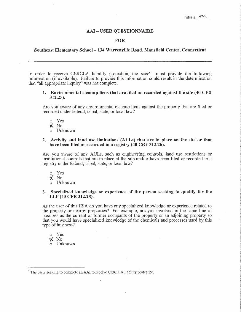
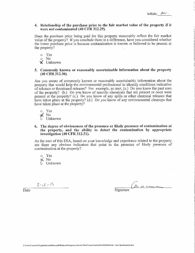

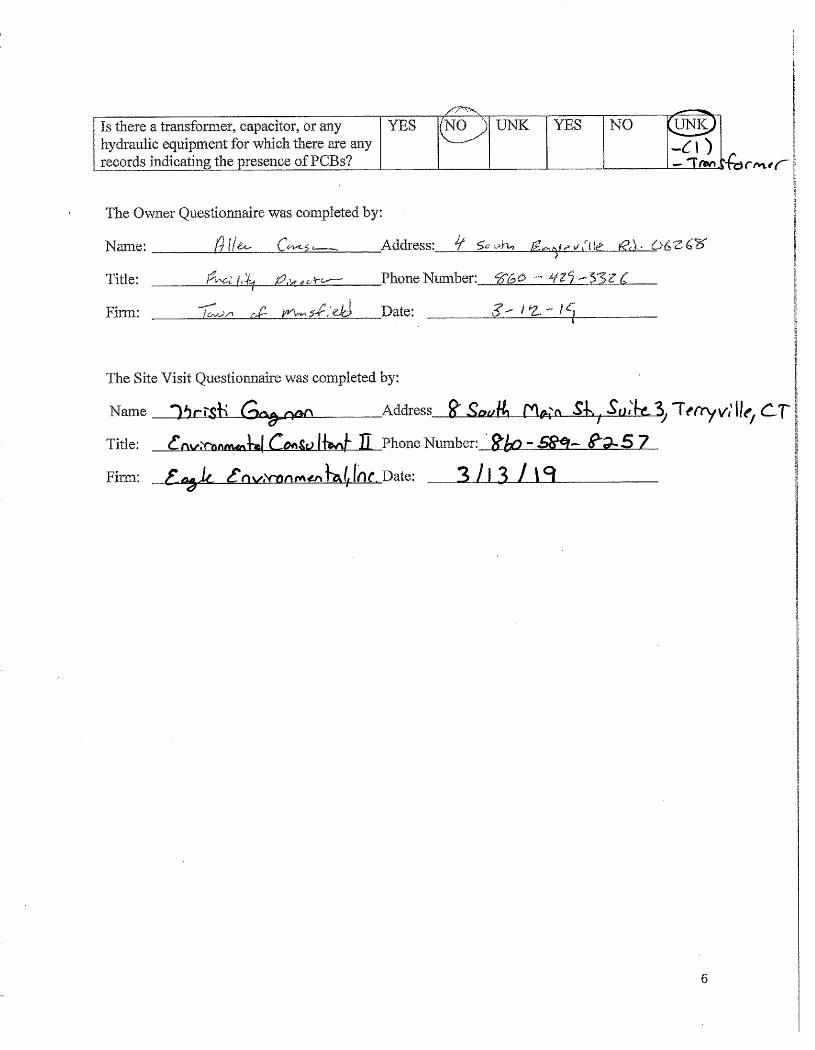

Appendix B
Previous Environmental Assessments
Appendix C
Environmental Database Report
FORM-LBC-BCS
®kcehCoeG htiw tropeR ™paM suidaR RDE ehT
6 Armstrong Road, 4th floorShelton, CT 06484Toll Free: 800.352.0050www.edrnet.com
Southeast Elementary School134 Warrenville RdMansfield Center, CT 06250
Inquiry Number: 5584178.2sMarch 08, 2019
SECTION PAGE
Executive Summary ES1
Overview Map 2
Detail Map 3
Map Findings Summary 4
Map Findings 8
Orphan Summary 17
Government Records Searched/Data Currency Tracking GR-1
GEOCHECK ADDENDUM
Physical Setting Source Addendum A-1
Physical Setting Source Summary A-2
Physical Setting SSURGO Soil Map A-5
Physical Setting Source Map A-17
Physical Setting Source Map Findings A-19
Physical Setting Source Records Searched PSGR-1
TC5584178.2s Page 1
Thank you for your business.Please contact EDR at 1-800-352-0050
with any questions or comments.
Disclaimer - Copyright and Trademark Notice
This Report contains certain information obtained from a variety of public and other sources reasonably available to Environmental DataResources, Inc. It cannot be concluded from this Report that coverage information for the target and surrounding properties does not exist fromother sources. NO WARRANTY EXPRESSED OR IMPLIED, IS MADE WHATSOEVER IN CONNECTION WITH THIS REPORT. ENVIRONMENTALDATA RESOURCES, INC. SPECIFICALLY DISCLAIMS THE MAKING OF ANY SUCH WARRANTIES, INCLUDING WITHOUT LIMITATION,MERCHANTABILITY OR FITNESS FOR A PARTICULAR USE OR PURPOSE. ALL RISK IS ASSUMED BY THE USER. IN NO EVENT SHALLENVIRONMENTAL DATA RESOURCES, INC. BE LIABLE TO ANYONE, WHETHER ARISING OUT OF ERRORS OR OMISSIONS, NEGLIGENCE,ACCIDENT OR ANY OTHER CAUSE, FOR ANY LOSS OF DAMAGE, INCLUDING, WITHOUT LIMITATION, SPECIAL, INCIDENTAL,CONSEQUENTIAL, OR EXEMPLARY DAMAGES. ANY LIABILITY ON THE PART OF ENVIRONMENTAL DATA RESOURCES, INC. IS STRICTLYLIMITED TO A REFUND OF THE AMOUNT PAID FOR THIS REPORT. Purchaser accepts this Report "AS IS". Any analyses, estimates, ratings,environmental risk levels or risk codes provided in this Report are provided for illustrative purposes only, and are not intended to provide, norshould they be interpreted as providing any facts regarding, or prediction or forecast of, any environmental risk for any property. Only a Phase IEnvironmental Site Assessment performed by an environmental professional can provide information regarding the environmental risk for anyproperty. Additionally, the information provided in this Report is not to be construed as legal advice.
Copyright 2019 by Environmental Data Resources, Inc. All rights reserved. Reproduction in any media or format, in wholeor in part, of any report or map of Environmental Data Resources, Inc., or its affiliates, is prohibited without prior written permission.
EDR and its logos (including Sanborn and Sanborn Map) are trademarks of Environmental Data Resources, Inc. or its affiliates. All othertrademarks used herein are the property of their respective owners.
TABLE OF CONTENTS
EXECUTIVE SUMMARY
TC5584178.2s EXECUTIVE SUMMARY 1
A search of available environmental records was conducted by Environmental Data Resources, Inc (EDR).The report was designed to assist parties seeking to meet the search requirements of EPA’s Standardsand Practices for All Appropriate Inquiries (40 CFR Part 312), the ASTM Standard Practice forEnvironmental Site Assessments (E 1527-13), the ASTM Standard Practice for Environmental SiteAssessments for Forestland or Rural Property (E 2247-16), the ASTM Standard Practice for LimitedEnvironmental Due Diligence: Transaction Screen Process (E 1528-14) or custom requirements developedfor the evaluation of environmental risk associated with a parcel of real estate.
TARGET PROPERTY INFORMATION
ADDRESS
134 WARRENVILLE RDMANSFIELD CENTER, CT 06250
COORDINATES
41.7732620 - 41˚ 46’ 23.74’’Latitude (North): 72.1908620 - 72˚ 11’ 27.10’’Longitude (West): Zone 18Universal Tranverse Mercator: 733487.2UTM X (Meters): 4628204.0UTM Y (Meters): 274 ft. above sea levelElevation:
USGS TOPOGRAPHIC MAP ASSOCIATED WITH TARGET PROPERTY
5642455 SPRING HILL, CTTarget Property Map:2012Version Date:
AERIAL PHOTOGRAPHY IN THIS REPORT
20140712Portions of Photo from:USDASource:
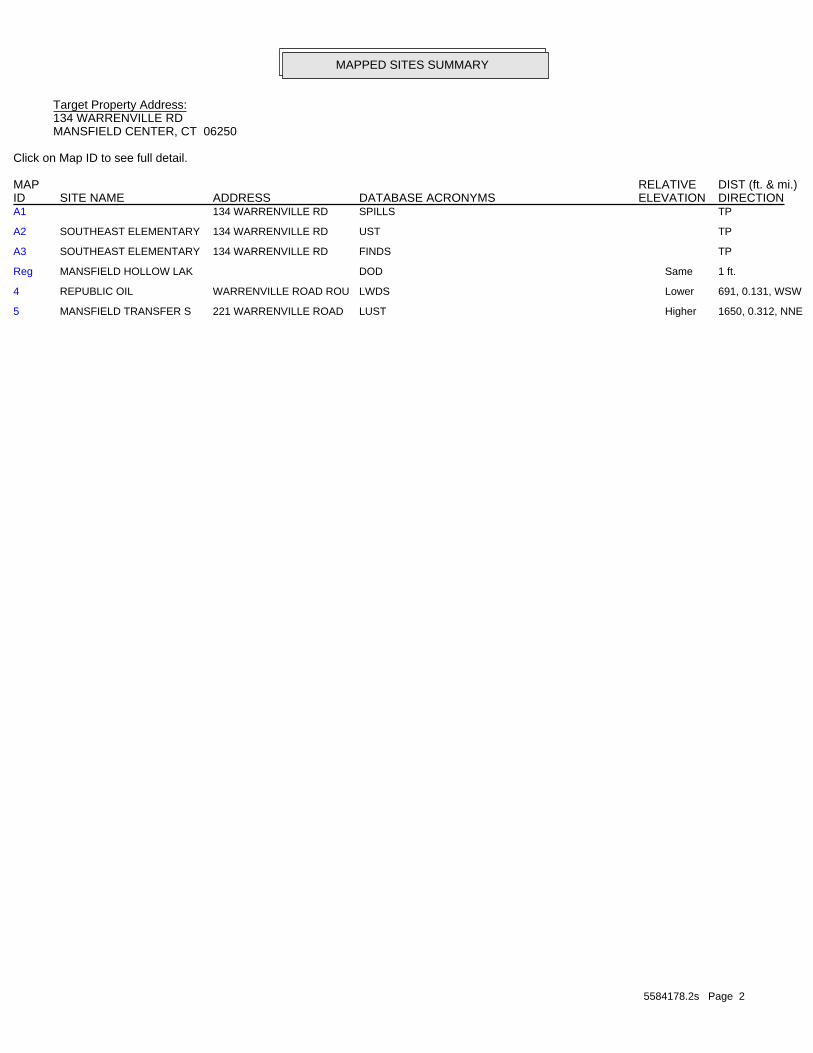
5584178.2s Page 2
5 MANSFIELD TRANSFER S 221 WARRENVILLE ROAD LUST Higher 1650, 0.312, NNE
4 REPUBLIC OIL WARRENVILLE ROAD ROU LWDS Lower 691, 0.131, WSW
Reg MANSFIELD HOLLOW LAK DOD Same 1 ft.
A3 SOUTHEAST ELEMENTARY 134 WARRENVILLE RD FINDS TP
A2 SOUTHEAST ELEMENTARY 134 WARRENVILLE RD UST TP
A1 134 WARRENVILLE RD SPILLS TP
MAPPED SITES SUMMARY
Target Property Address:134 WARRENVILLE RDMANSFIELD CENTER, CT 06250
Click on Map ID to see full detail.
MAP RELATIVE DIST (ft. & mi.)ID DATABASE ACRONYMS ELEVATION DIRECTIONSITE NAME ADDRESS
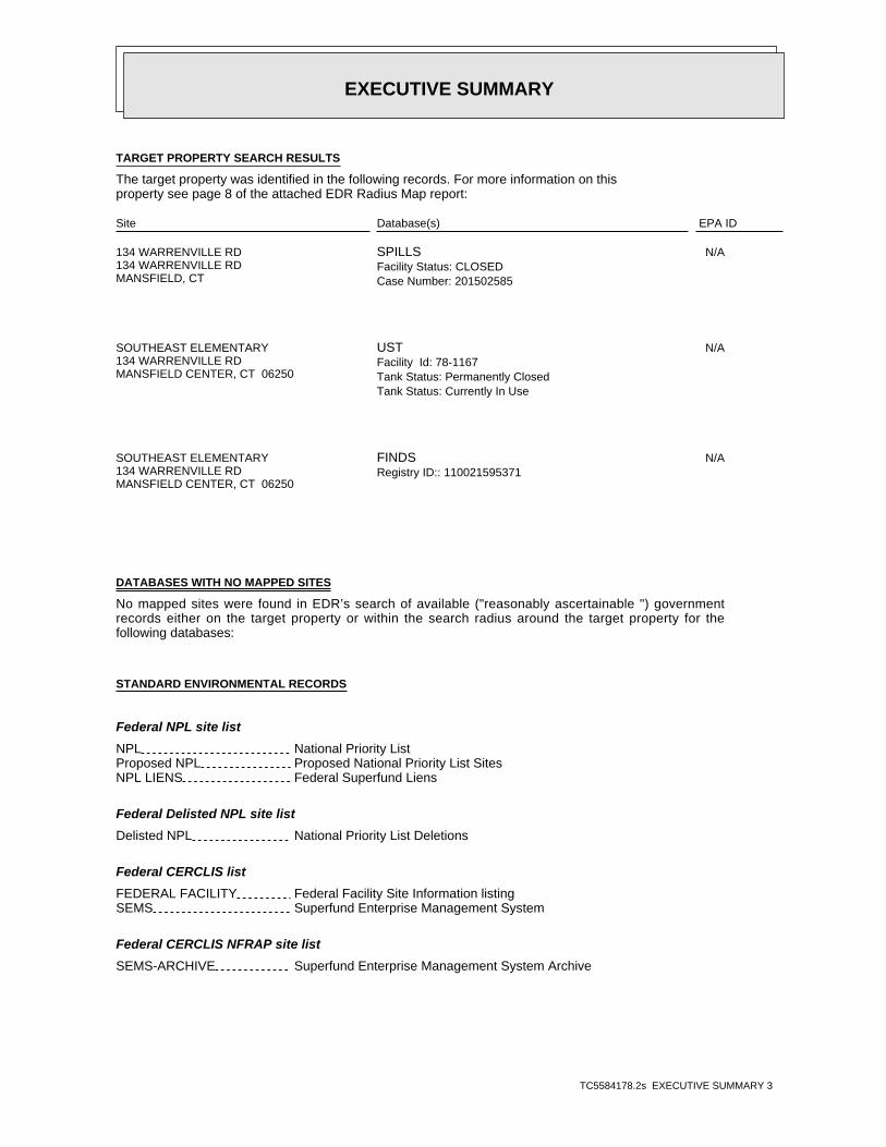
EXECUTIVE SUMMARY
TC5584178.2s EXECUTIVE SUMMARY 3
TARGET PROPERTY SEARCH RESULTS
The target property was identified in the following records. For more information on thisproperty see page 8 of the attached EDR Radius Map report:
EPA IDDatabase(s)Site
134 WARRENVILLE RD134 WARRENVILLE RDMANSFIELD, CT
N/ASPILLSFacility Status: CLOSEDCase Number: 201502585
SOUTHEAST ELEMENTARY134 WARRENVILLE RDMANSFIELD CENTER, CT 06250
N/AUSTFacility Id: 78-1167Tank Status: Permanently ClosedTank Status: Currently In Use
SOUTHEAST ELEMENTARY134 WARRENVILLE RDMANSFIELD CENTER, CT 06250
N/AFINDSRegistry ID:: 110021595371
DATABASES WITH NO MAPPED SITES
No mapped sites were found in EDR’s search of available ("reasonably ascertainable ") governmentrecords either on the target property or within the search radius around the target property for thefollowing databases:
STANDARD ENVIRONMENTAL RECORDS
Federal NPL site list
NPL National Priority ListProposed NPL Proposed National Priority List SitesNPL LIENS Federal Superfund Liens
Federal Delisted NPL site list
Delisted NPL National Priority List Deletions
Federal CERCLIS list
FEDERAL FACILITY Federal Facility Site Information listingSEMS Superfund Enterprise Management System
Federal CERCLIS NFRAP site list
SEMS-ARCHIVE Superfund Enterprise Management System Archive

EXECUTIVE SUMMARY
TC5584178.2s EXECUTIVE SUMMARY 4
Federal RCRA CORRACTS facilities list
CORRACTS Corrective Action Report
Federal RCRA non-CORRACTS TSD facilities list
RCRA-TSDF RCRA - Treatment, Storage and Disposal
Federal RCRA generators list
RCRA-LQG RCRA - Large Quantity GeneratorsRCRA-SQG RCRA - Small Quantity GeneratorsRCRA-CESQG RCRA - Conditionally Exempt Small Quantity Generator
Federal institutional controls / engineering controls registries
LUCIS Land Use Control Information SystemUS ENG CONTROLS Engineering Controls Sites ListUS INST CONTROL Sites with Institutional Controls
Federal ERNS list
ERNS Emergency Response Notification System
State- and tribal - equivalent CERCLIS
SHWS Inventory of Hazardous Disposal SitesSDADB Site Discovery and Assessment Database
State and tribal landfill and/or solid waste disposal site lists
SWF/LF List of Landfills/Transfer Stations
State and tribal leaking storage tank lists
INDIAN LUST Leaking Underground Storage Tanks on Indian Land
State and tribal registered storage tank lists
FEMA UST Underground Storage Tank ListingAST Marine Terminals and Tank InformationINDIAN UST Underground Storage Tanks on Indian Land
State and tribal institutional control / engineering control registries
ENG CONTROLS Engineering Controls ListingAUL ELUR Sites
State and tribal voluntary cleanup sites
INDIAN VCP Voluntary Cleanup Priority ListingVCP Voluntary Remediation Sites
State and tribal Brownfields sites
BROWNFIELDS Brownfields Inventory
EXECUTIVE SUMMARY
TC5584178.2s EXECUTIVE SUMMARY 5
ADDITIONAL ENVIRONMENTAL RECORDS
Local Brownfield lists
US BROWNFIELDS A Listing of Brownfields Sites
Local Lists of Landfill / Solid Waste Disposal Sites
SWRCY Recycling FacilitiesINDIAN ODI Report on the Status of Open Dumps on Indian LandsDEBRIS REGION 9 Torres Martinez Reservation Illegal Dump Site LocationsODI Open Dump InventoryIHS OPEN DUMPS Open Dumps on Indian Land
Local Lists of Hazardous waste / Contaminated Sites
US HIST CDL Delisted National Clandestine Laboratory RegisterCDL Clandestine Drug Lab ListingUS CDL National Clandestine Laboratory Register
Local Land Records
CT PROPERTY Property Transfer FilingsLIENS Environmental Liens ListingLIENS 2 CERCLA Lien Information
Records of Emergency Release Reports
HMIRS Hazardous Materials Information Reporting SystemSPILLS 90 SPILLS 90 data from FirstSearch
Other Ascertainable Records
RCRA NonGen / NLR RCRA - Non Generators / No Longer RegulatedFUDS Formerly Used Defense SitesSCRD DRYCLEANERS State Coalition for Remediation of Drycleaners ListingUS FIN ASSUR Financial Assurance InformationEPA WATCH LIST EPA WATCH LIST2020 COR ACTION 2020 Corrective Action Program ListTSCA Toxic Substances Control ActTRIS Toxic Chemical Release Inventory SystemSSTS Section 7 Tracking SystemsROD Records Of DecisionRMP Risk Management PlansRAATS RCRA Administrative Action Tracking SystemPRP Potentially Responsible PartiesPADS PCB Activity Database SystemICIS Integrated Compliance Information SystemFTTS FIFRA/ TSCA Tracking System - FIFRA (Federal Insecticide, Fungicide, & Rodenticide Act)/TSCA (Toxic Substances Control Act)MLTS Material Licensing Tracking SystemCOAL ASH DOE Steam-Electric Plant Operation DataCOAL ASH EPA Coal Combustion Residues Surface Impoundments List
EXECUTIVE SUMMARY
TC5584178.2s EXECUTIVE SUMMARY 6
PCB TRANSFORMER PCB Transformer Registration DatabaseRADINFO Radiation Information DatabaseHIST FTTS FIFRA/TSCA Tracking System Administrative Case ListingDOT OPS Incident and Accident DataCONSENT Superfund (CERCLA) Consent DecreesINDIAN RESERV Indian ReservationsFUSRAP Formerly Utilized Sites Remedial Action ProgramUMTRA Uranium Mill Tailings SitesLEAD SMELTERS Lead Smelter SitesUS AIRS Aerometric Information Retrieval System Facility SubsystemUS MINES Mines Master Index FileABANDONED MINES Abandoned MinesUXO Unexploded Ordnance SitesDOCKET HWC Hazardous Waste Compliance Docket ListingECHO Enforcement & Compliance History InformationFUELS PROGRAM EPA Fuels Program Registered ListingAIRS Permitted Air Sources ListingASBESTOS Asbestos Notification ListingCPCS Contaminated or Potentially Contaminated SitesDRYCLEANERS Drycleaner FacilitiesENF Enforcement Case ListingFinancial Assurance Financial Assurance Information ListingLEAD Lead Inspection DatabaseMANIFEST Hazardous Waste Manifest DataNPDES Wastewater Permit ListingSEH List of Significant Environmental Hazards Report to DEEPUIC Underground Injection Control Listing
EDR HIGH RISK HISTORICAL RECORDS
EDR Exclusive Records
EDR MGP EDR Proprietary Manufactured Gas PlantsEDR Hist Auto EDR Exclusive Historical Auto StationsEDR Hist Cleaner EDR Exclusive Historical Cleaners
EDR RECOVERED GOVERNMENT ARCHIVES
Exclusive Recovered Govt. Archives
RGA HWS Recovered Government Archive State Hazardous Waste Facilities ListRGA LUST Recovered Government Archive Leaking Underground Storage Tank
SURROUNDING SITES: SEARCH RESULTS
Surrounding sites were identified in the following databases.
Elevations have been determined from the USGS Digital Elevation Model and should be evaluated ona relative (not an absolute) basis. Relative elevation information between sites of close proximityshould be field verified. Sites with an elevation equal to or higher than the target property have beendifferentiated below from sites with an elevation lower than the target property.Page numbers and map identification numbers refer to the EDR Radius Map report where detaileddata on individual sites can be reviewed.
Sites listed in bold italics are in multiple databases.
Unmappable (orphan) sites are not considered in the foregoing analysis.
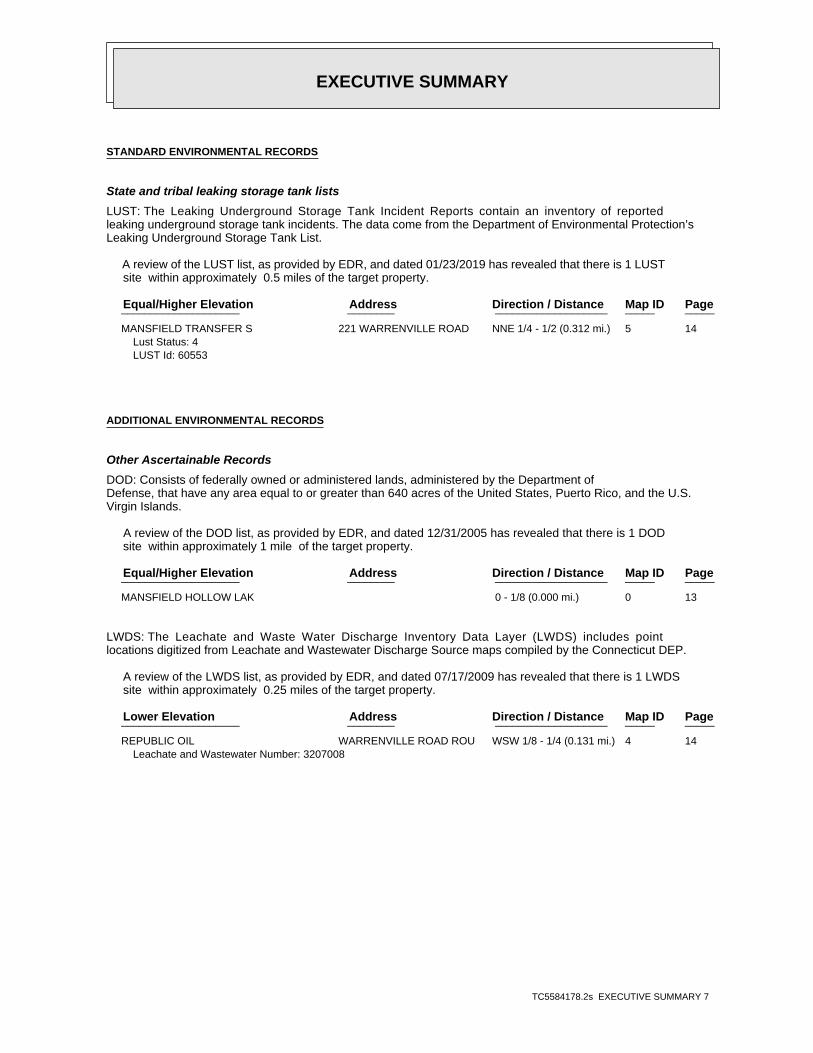
EXECUTIVE SUMMARY
TC5584178.2s EXECUTIVE SUMMARY 7
STANDARD ENVIRONMENTAL RECORDS
State and tribal leaking storage tank lists
LUST: The Leaking Underground Storage Tank Incident Reports contain an inventory of reportedleaking underground storage tank incidents. The data come from the Department of Environmental Protection’sLeaking Underground Storage Tank List.
A review of the LUST list, as provided by EDR, and dated 01/23/2019 has revealed that there is 1 LUST site within approximately 0.5 miles of the target property.
PageMap IDDirection / Distance Address Equal/Higher Elevation ____________________ ________ ___________________ _____ _____
MANSFIELD TRANSFER S 221 WARRENVILLE ROAD NNE 1/4 - 1/2 (0.312 mi.) 5 14Lust Status: 4LUST Id: 60553
ADDITIONAL ENVIRONMENTAL RECORDS
Other Ascertainable Records
DOD: Consists of federally owned or administered lands, administered by the Department ofDefense, that have any area equal to or greater than 640 acres of the United States, Puerto Rico, and the U.S.Virgin Islands.
A review of the DOD list, as provided by EDR, and dated 12/31/2005 has revealed that there is 1 DOD site within approximately 1 mile of the target property.
PageMap IDDirection / Distance Address Equal/Higher Elevation ____________________ ________ ___________________ _____ _____
MANSFIELD HOLLOW LAK 0 - 1/8 (0.000 mi.) 0 13
LWDS: The Leachate and Waste Water Discharge Inventory Data Layer (LWDS) includes pointlocations digitized from Leachate and Wastewater Discharge Source maps compiled by the Connecticut DEP.
A review of the LWDS list, as provided by EDR, and dated 07/17/2009 has revealed that there is 1 LWDS site within approximately 0.25 miles of the target property.
PageMap IDDirection / Distance Address Lower Elevation ____________________ ________ ___________________ _____ _____
REPUBLIC OIL WARRENVILLE ROAD ROU WSW 1/8 - 1/4 (0.131 mi.) 4 14Leachate and Wastewater Number: 3207008
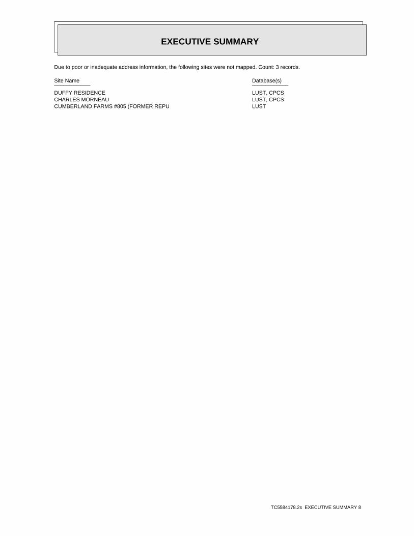
EXECUTIVE SUMMARY
TC5584178.2s EXECUTIVE SUMMARY 8
Due to poor or inadequate address information, the following sites were not mapped. Count: 3 records.
Site Name Database(s)____________ ____________
DUFFY RESIDENCE LUST, CPCSCHARLES MORNEAU LUST, CPCSCUMBERLAND FARMS #805 (FORMER REPU LUST
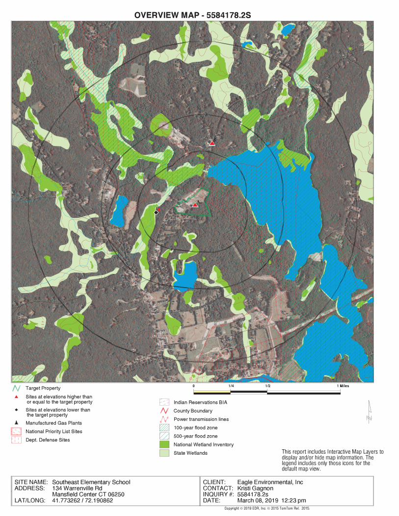
EDR Inc.EDR Inc.EDR Inc.EDR Inc.EDR Inc.EDR Inc.EDR Inc.EDR Inc.EDR Inc.EDR Inc.EDR Inc.EDR Inc.EDR Inc.EDR Inc.EDR Inc.EDR Inc.EDR Inc.EDR Inc.EDR Inc.EDR Inc.EDR Inc.EDR Inc.EDR Inc.EDR Inc.EDR Inc.EDR Inc.EDR Inc.EDR Inc.EDR Inc.EDR Inc.EDR Inc.EDR Inc.EDR Inc.EDR Inc.EDR Inc.EDR Inc.EDR Inc.EDR Inc.EDR Inc.EDR Inc.
280
2
8 02 80
280
40 0
3 60
36
0
28
0
28
0
3603
6 0
360
2 8 0
280
44
0
2 8 0
2 8 0
40
0
280
28
0
28
0 28 0
2 8 0
28
0
2 8 0
2 80
28
0
2 80 2 80
480
480
2 8 0
4
8 0
48
04804 80
200
48
0
4 4 0
44
0
0
4 0 0
4
4 4 0
4 0 0
40
0
360
3 6 0
36
0
36
0
36
0
36
0
36
0
36
0
2 4 0 2 4 028
0
2 8 0
2 8 0
28
08
0
2 8 0
2 80
2 8 0
28
0
28
0
2 80
280
3 2 0
32
0
3 2 0
32
03
20
32
0
32
0
32
0
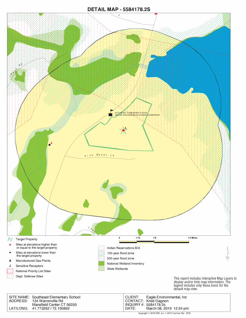
EDR Inc.EDR Inc.EDR Inc.EDR Inc.EDR Inc.EDR Inc.EDR Inc.EDR Inc.EDR Inc.EDR Inc.EDR Inc.EDR Inc.EDR Inc.EDR Inc.EDR Inc.EDR Inc.EDR Inc.EDR Inc.EDR Inc.EDR Inc.EDR Inc.EDR Inc.EDR Inc.EDR Inc.EDR Inc.EDR Inc.EDR Inc.EDR Inc.EDR Inc.EDR Inc.EDR Inc.EDR Inc.EDR Inc.EDR Inc.EDR Inc.EDR Inc.EDR Inc.EDR Inc.EDR Inc.EDR Inc.
280
280
280
2 80
280
280
280
280
280
280
280
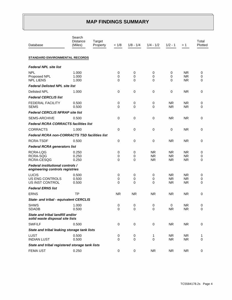
MAP FINDINGS SUMMARY
SearchTargetDistance Total
Database Property(Miles) < 1/8 1/8 - 1/4 1/4 - 1/2 1/2 - 1 > 1 Plotted
STANDARD ENVIRONMENTAL RECORDS
Federal NPL site list
0 NR 0 0 0 0 1.000NPL 0 NR 0 0 0 0 1.000Proposed NPL 0 NR 0 0 0 0 1.000NPL LIENS
Federal Delisted NPL site list
0 NR 0 0 0 0 1.000Delisted NPL
Federal CERCLIS list
0 NR NR 0 0 0 0.500FEDERAL FACILITY 0 NR NR 0 0 0 0.500SEMS
Federal CERCLIS NFRAP site list
0 NR NR 0 0 0 0.500SEMS-ARCHIVE
Federal RCRA CORRACTS facilities list
0 NR 0 0 0 0 1.000CORRACTS
Federal RCRA non-CORRACTS TSD facilities list
0 NR NR 0 0 0 0.500RCRA-TSDF
Federal RCRA generators list
0 NR NR NR 0 0 0.250RCRA-LQG 0 NR NR NR 0 0 0.250RCRA-SQG 0 NR NR NR 0 0 0.250RCRA-CESQG
Federal institutional controls /engineering controls registries
0 NR NR 0 0 0 0.500LUCIS 0 NR NR 0 0 0 0.500US ENG CONTROLS 0 NR NR 0 0 0 0.500US INST CONTROL
Federal ERNS list
0 NR NR NR NR NR TPERNS
State- and tribal - equivalent CERCLIS
0 NR 0 0 0 0 1.000SHWS 0 NR NR 0 0 0 0.500SDADB
State and tribal landfill and/orsolid waste disposal site lists
0 NR NR 0 0 0 0.500SWF/LF
State and tribal leaking storage tank lists
1 NR NR 1 0 0 0.500LUST 0 NR NR 0 0 0 0.500INDIAN LUST
State and tribal registered storage tank lists
0 NR NR NR 0 0 0.250FEMA UST
TC5584178.2s Page 4
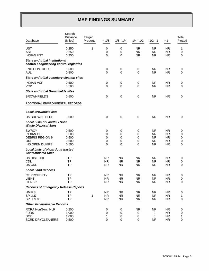
MAP FINDINGS SUMMARY
SearchTargetDistance Total
Database Property(Miles) < 1/8 1/8 - 1/4 1/4 - 1/2 1/2 - 1 > 1 Plotted
1 NR NR NR 0 0 0.250 1UST 0 NR NR NR 0 0 0.250AST 0 NR NR NR 0 0 0.250INDIAN UST
State and tribal institutionalcontrol / engineering control registries
0 NR NR 0 0 0 0.500ENG CONTROLS 0 NR NR 0 0 0 0.500AUL
State and tribal voluntary cleanup sites
0 NR NR 0 0 0 0.500INDIAN VCP 0 NR NR 0 0 0 0.500VCP
State and tribal Brownfields sites
0 NR NR 0 0 0 0.500BROWNFIELDS
ADDITIONAL ENVIRONMENTAL RECORDS
Local Brownfield lists
0 NR NR 0 0 0 0.500US BROWNFIELDS
Local Lists of Landfill / SolidWaste Disposal Sites
0 NR NR 0 0 0 0.500SWRCY 0 NR NR 0 0 0 0.500INDIAN ODI 0 NR NR 0 0 0 0.500DEBRIS REGION 9 0 NR NR 0 0 0 0.500ODI 0 NR NR 0 0 0 0.500IHS OPEN DUMPS
Local Lists of Hazardous waste /Contaminated Sites
0 NR NR NR NR NR TPUS HIST CDL 0 NR NR NR NR NR TPCDL 0 NR NR NR NR NR TPUS CDL
Local Land Records
0 NR NR NR NR NR TPCT PROPERTY 0 NR NR NR NR NR TPLIENS 0 NR NR NR NR NR TPLIENS 2
Records of Emergency Release Reports
0 NR NR NR NR NR TPHMIRS 1 NR NR NR NR NR TP 1SPILLS 0 NR NR NR NR NR TPSPILLS 90
Other Ascertainable Records
0 NR NR NR 0 0 0.250RCRA NonGen / NLR 0 NR 0 0 0 0 1.000FUDS 1 NR 0 0 0 1 1.000DOD 0 NR NR 0 0 0 0.500SCRD DRYCLEANERS
TC5584178.2s Page 5
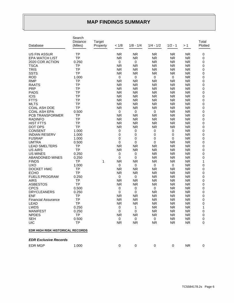
MAP FINDINGS SUMMARY
SearchTargetDistance Total
Database Property(Miles) < 1/8 1/8 - 1/4 1/4 - 1/2 1/2 - 1 > 1 Plotted
0 NR NR NR NR NR TPUS FIN ASSUR 0 NR NR NR NR NR TPEPA WATCH LIST 0 NR NR NR 0 0 0.2502020 COR ACTION 0 NR NR NR NR NR TPTSCA 0 NR NR NR NR NR TPTRIS 0 NR NR NR NR NR TPSSTS 0 NR 0 0 0 0 1.000ROD 0 NR NR NR NR NR TPRMP 0 NR NR NR NR NR TPRAATS 0 NR NR NR NR NR TPPRP 0 NR NR NR NR NR TPPADS 0 NR NR NR NR NR TPICIS 0 NR NR NR NR NR TPFTTS 0 NR NR NR NR NR TPMLTS 0 NR NR NR NR NR TPCOAL ASH DOE 0 NR NR 0 0 0 0.500COAL ASH EPA 0 NR NR NR NR NR TPPCB TRANSFORMER 0 NR NR NR NR NR TPRADINFO 0 NR NR NR NR NR TPHIST FTTS 0 NR NR NR NR NR TPDOT OPS 0 NR 0 0 0 0 1.000CONSENT 0 NR 0 0 0 0 1.000INDIAN RESERV 0 NR 0 0 0 0 1.000FUSRAP 0 NR NR 0 0 0 0.500UMTRA 0 NR NR NR NR NR TPLEAD SMELTERS 0 NR NR NR NR NR TPUS AIRS 0 NR NR NR 0 0 0.250US MINES 0 NR NR NR 0 0 0.250ABANDONED MINES 1 NR NR NR NR NR TP 1FINDS 0 NR 0 0 0 0 1.000UXO 0 NR NR NR NR NR TPDOCKET HWC 0 NR NR NR NR NR TPECHO 0 NR NR NR 0 0 0.250FUELS PROGRAM 0 NR NR NR NR NR TPAIRS 0 NR NR NR NR NR TPASBESTOS 0 NR NR 0 0 0 0.500CPCS 0 NR NR NR 0 0 0.250DRYCLEANERS 0 NR NR NR NR NR TPENF 0 NR NR NR NR NR TPFinancial Assurance 0 NR NR NR NR NR TPLEAD 1 NR NR NR 1 0 0.250LWDS 0 NR NR NR 0 0 0.250MANIFEST 0 NR NR NR NR NR TPNPDES 0 NR NR 0 0 0 0.500SEH 0 NR NR NR NR NR TPUIC
EDR HIGH RISK HISTORICAL RECORDS
EDR Exclusive Records
0 NR 0 0 0 0 1.000EDR MGP
TC5584178.2s Page 6
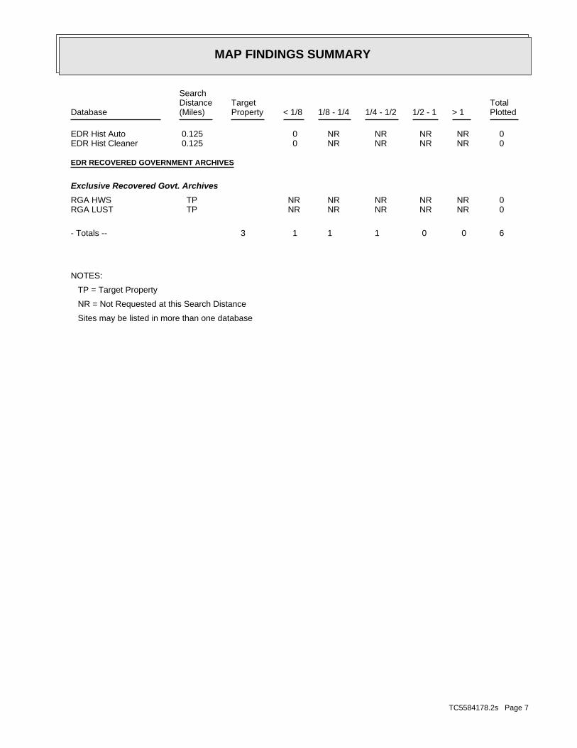
MAP FINDINGS SUMMARY
SearchTargetDistance Total
Database Property(Miles) < 1/8 1/8 - 1/4 1/4 - 1/2 1/2 - 1 > 1 Plotted
0 NR NR NR NR 0 0.125EDR Hist Auto 0 NR NR NR NR 0 0.125EDR Hist Cleaner
EDR RECOVERED GOVERNMENT ARCHIVES
Exclusive Recovered Govt. Archives
0 NR NR NR NR NR TPRGA HWS 0 NR NR NR NR NR TPRGA LUST
6 0 0 1 1 1 3- Totals --
NOTES:
TP = Target Property
NR = Not Requested at this Search Distance
Sites may be listed in more than one database
TC5584178.2s Page 7
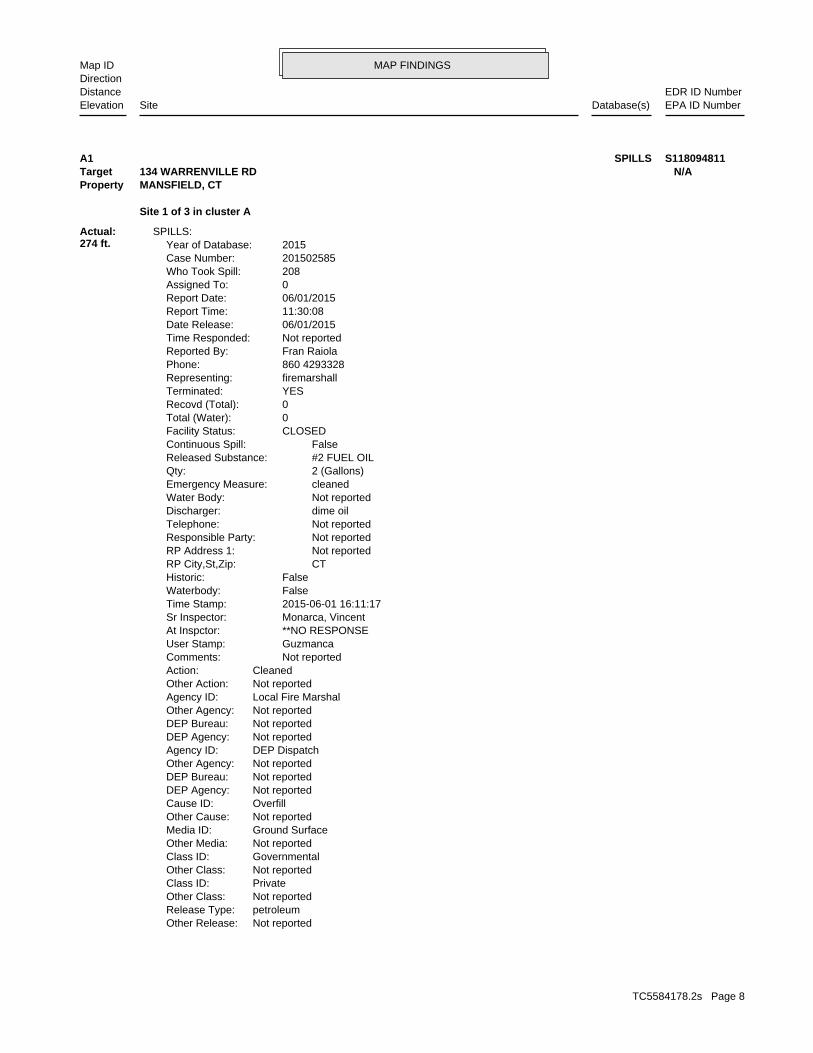
MAP FINDINGSMap IDDirection
EDR ID NumberDistanceEPA ID NumberDatabase(s)SiteElevation
Not reportedOther Release:petroleumRelease Type:Not reportedOther Class:PrivateClass ID:Not reportedOther Class:GovernmentalClass ID:Not reportedOther Media:Ground SurfaceMedia ID:Not reportedOther Cause:OverfillCause ID:Not reportedDEP Agency:Not reportedDEP Bureau:Not reportedOther Agency:DEP DispatchAgency ID:Not reportedDEP Agency:Not reportedDEP Bureau:Not reportedOther Agency:Local Fire MarshalAgency ID:Not reportedOther Action:CleanedAction: Not reportedComments: GuzmancaUser Stamp: **NO RESPONSEAt Inspctor: Monarca, VincentSr Inspector: 2015-06-01 16:11:17Time Stamp: FalseWaterbody: FalseHistoric: CTRP City,St,Zip: Not reportedRP Address 1: Not reportedResponsible Party: Not reportedTelephone: dime oilDischarger: Not reportedWater Body: cleanedEmergency Measure: 2 (Gallons)Qty: #2 FUEL OILReleased Substance: FalseContinuous Spill: CLOSEDFacility Status: 0Total (Water): 0Recovd (Total): YESTerminated: firemarshallRepresenting: 860 4293328Phone: Fran RaiolaReported By: Not reportedTime Responded: 06/01/2015Date Release: 11:30:08Report Time: 06/01/2015Report Date: 0Assigned To: 208Who Took Spill: 201502585Case Number: 2015Year of Database:
SPILLS:
Site 1 of 3 in cluster A
Actual:274 ft.
Property MANSFIELD, CT Target 134 WARRENVILLE RD N/AA1 SPILLS S118094811
TC5584178.2s Page 8
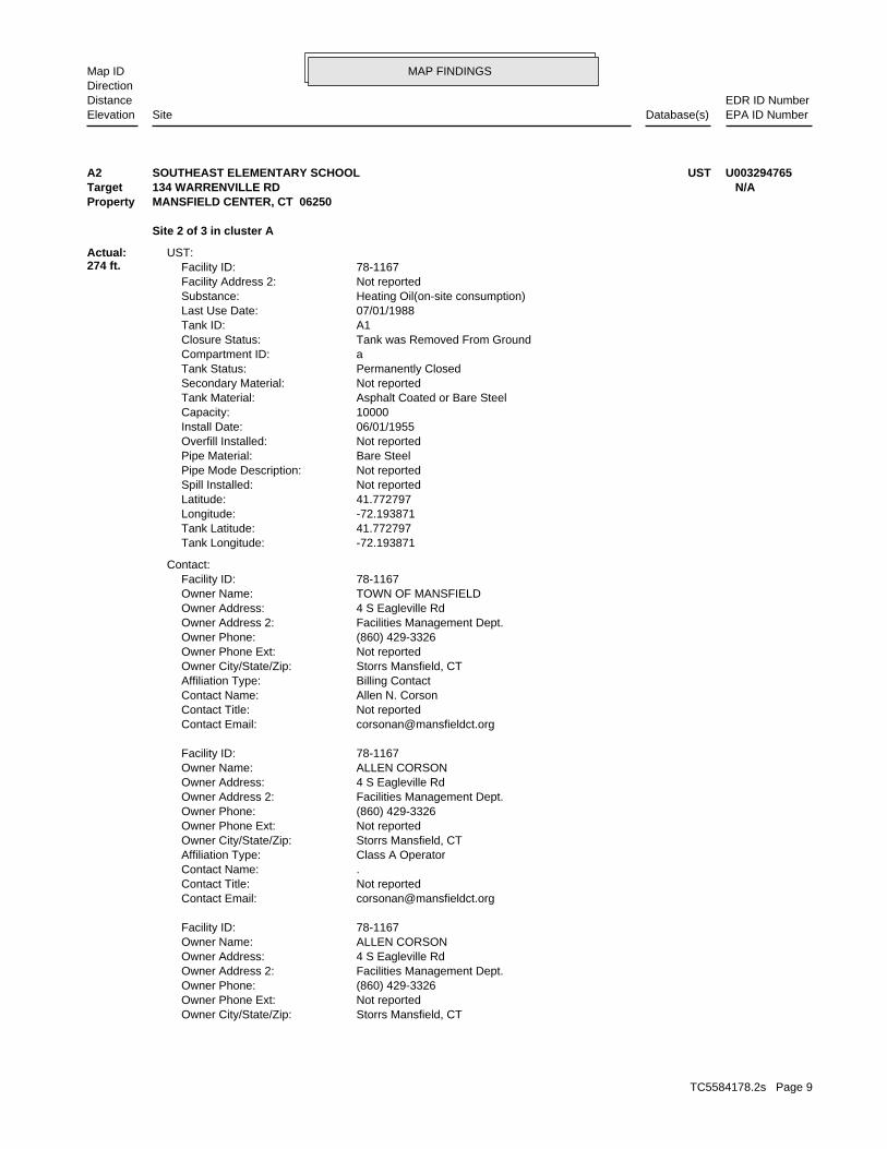
MAP FINDINGSMap IDDirection
EDR ID NumberDistanceEPA ID NumberDatabase(s)SiteElevation
Storrs Mansfield, CTOwner City/State/Zip: Not reportedOwner Phone Ext: (860) 429-3326Owner Phone: Facilities Management Dept.Owner Address 2: 4 S Eagleville RdOwner Address: ALLEN CORSONOwner Name: 78-1167Facility ID:
[email protected] Email: Not reportedContact Title: .Contact Name: Class A OperatorAffiliation Type: Storrs Mansfield, CTOwner City/State/Zip: Not reportedOwner Phone Ext: (860) 429-3326Owner Phone: Facilities Management Dept.Owner Address 2: 4 S Eagleville RdOwner Address: ALLEN CORSONOwner Name: 78-1167Facility ID:
[email protected] Email: Not reportedContact Title: Allen N. CorsonContact Name: Billing ContactAffiliation Type: Storrs Mansfield, CTOwner City/State/Zip: Not reportedOwner Phone Ext: (860) 429-3326Owner Phone: Facilities Management Dept.Owner Address 2: 4 S Eagleville RdOwner Address: TOWN OF MANSFIELDOwner Name: 78-1167Facility ID:
Contact:
-72.193871Tank Longitude: 41.772797Tank Latitude: -72.193871Longitude: 41.772797Latitude: Not reportedSpill Installed: Not reportedPipe Mode Description: Bare SteelPipe Material: Not reportedOverfill Installed: 06/01/1955Install Date: 10000Capacity: Asphalt Coated or Bare SteelTank Material: Not reportedSecondary Material: Permanently ClosedTank Status: aCompartment ID: Tank was Removed From GroundClosure Status: A1Tank ID: 07/01/1988Last Use Date: Heating Oil(on-site consumption)Substance: Not reportedFacility Address 2: 78-1167Facility ID:
UST:
Site 2 of 3 in cluster A
Actual:274 ft.
Property MANSFIELD CENTER, CT 06250Target 134 WARRENVILLE RD N/AA2 USTSOUTHEAST ELEMENTARY SCHOOL U003294765
TC5584178.2s Page 9
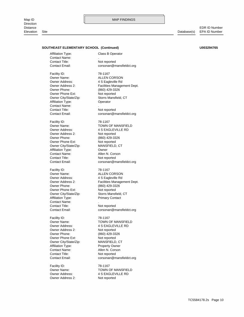
MAP FINDINGSMap IDDirection
EDR ID NumberDistanceEPA ID NumberDatabase(s)SiteElevation
Not reportedOwner Address 2: 4 S EAGLEVILLE RDOwner Address: TOWN OF MANSFIELDOwner Name: 78-1167Facility ID:
[email protected] Email: Not reportedContact Title: Allen N. CorsonContact Name: Property OwnerAffiliation Type: MANSFIELD, CTOwner City/State/Zip: Not reportedOwner Phone Ext: (860) 429-3326Owner Phone: Not reportedOwner Address 2: 4 S EAGLEVILLE RDOwner Address: TOWN OF MANSFIELDOwner Name: 78-1167Facility ID:
[email protected] Email: Not reportedContact Title: .Contact Name: Primary ContactAffiliation Type: Storrs Mansfield, CTOwner City/State/Zip: Not reportedOwner Phone Ext: (860) 429-3326Owner Phone: Facilities Management Dept.Owner Address 2: 4 S Eagleville RdOwner Address: ALLEN CORSONOwner Name: 78-1167Facility ID:
[email protected] Email: Not reportedContact Title: Allen N. CorsonContact Name: OwnerAffiliation Type: MANSFIELD, CTOwner City/State/Zip: Not reportedOwner Phone Ext: (860) 429-3326Owner Phone: Not reportedOwner Address 2: 4 S EAGLEVILLE RDOwner Address: TOWN OF MANSFIELDOwner Name: 78-1167Facility ID:
[email protected] Email: Not reportedContact Title: .Contact Name: OperatorAffiliation Type: Storrs Mansfield, CTOwner City/State/Zip: Not reportedOwner Phone Ext: (860) 429-3326Owner Phone: Facilities Management Dept.Owner Address 2: 4 S Eagleville RdOwner Address: ALLEN CORSONOwner Name: 78-1167Facility ID:
[email protected] Email: Not reportedContact Title: .Contact Name: Class B OperatorAffiliation Type:
SOUTHEAST ELEMENTARY SCHOOL (Continued) U003294765
TC5584178.2s Page 10
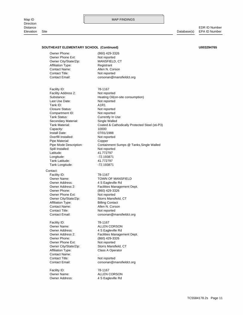
MAP FINDINGSMap IDDirection
EDR ID NumberDistanceEPA ID NumberDatabase(s)SiteElevation
4 S Eagleville RdOwner Address: ALLEN CORSONOwner Name: 78-1167Facility ID:
[email protected] Email: Not reportedContact Title: .Contact Name: Class A OperatorAffiliation Type: Storrs Mansfield, CTOwner City/State/Zip: Not reportedOwner Phone Ext: (860) 429-3326Owner Phone: Facilities Management Dept.Owner Address 2: 4 S Eagleville RdOwner Address: ALLEN CORSONOwner Name: 78-1167Facility ID:
[email protected] Email: Not reportedContact Title: Allen N. CorsonContact Name: Billing ContactAffiliation Type: Storrs Mansfield, CTOwner City/State/Zip: Not reportedOwner Phone Ext: (860) 429-3326Owner Phone: Facilities Management Dept.Owner Address 2: 4 S Eagleville RdOwner Address: TOWN OF MANSFIELDOwner Name: 78-1167Facility ID:
Contact:
-72.193871Tank Longitude: 41.772797Tank Latitude: -72.193871Longitude: 41.772797Latitude: Not reportedSpill Installed: Containment Sumps @ Tanks,Single WalledPipe Mode Description: CopperPipe Material: Not reportedOverfill Installed: 07/01/1988Install Date: 10000Capacity: Coated & Cathodically Protected Steel (sti-P3)Tank Material: Single WalledSecondary Material: Currently In UseTank Status: Not reportedCompartment ID: Not reportedClosure Status: A1R1Tank ID: Not reportedLast Use Date: Heating Oil(on-site consumption)Substance: Not reportedFacility Address 2: 78-1167Facility ID:
[email protected] Email: Not reportedContact Title: Allen N. CorsonContact Name: RegistrantAffiliation Type: MANSFIELD, CTOwner City/State/Zip: Not reportedOwner Phone Ext: (860) 429-3326Owner Phone:
SOUTHEAST ELEMENTARY SCHOOL (Continued) U003294765
TC5584178.2s Page 11
MAP FINDINGSMap IDDirection
EDR ID NumberDistanceEPA ID NumberDatabase(s)SiteElevation
[email protected] Email: Not reportedContact Title: Allen N. CorsonContact Name: Property OwnerAffiliation Type: MANSFIELD, CTOwner City/State/Zip: Not reportedOwner Phone Ext: (860) 429-3326Owner Phone: Not reportedOwner Address 2: 4 S EAGLEVILLE RDOwner Address: TOWN OF MANSFIELDOwner Name: 78-1167Facility ID:
[email protected] Email: Not reportedContact Title: .Contact Name: Primary ContactAffiliation Type: Storrs Mansfield, CTOwner City/State/Zip: Not reportedOwner Phone Ext: (860) 429-3326Owner Phone: Facilities Management Dept.Owner Address 2: 4 S Eagleville RdOwner Address: ALLEN CORSONOwner Name: 78-1167Facility ID:
[email protected] Email: Not reportedContact Title: Allen N. CorsonContact Name: OwnerAffiliation Type: MANSFIELD, CTOwner City/State/Zip: Not reportedOwner Phone Ext: (860) 429-3326Owner Phone: Not reportedOwner Address 2: 4 S EAGLEVILLE RDOwner Address: TOWN OF MANSFIELDOwner Name: 78-1167Facility ID:
[email protected] Email: Not reportedContact Title: .Contact Name: OperatorAffiliation Type: Storrs Mansfield, CTOwner City/State/Zip: Not reportedOwner Phone Ext: (860) 429-3326Owner Phone: Facilities Management Dept.Owner Address 2: 4 S Eagleville RdOwner Address: ALLEN CORSONOwner Name: 78-1167Facility ID:
[email protected] Email: Not reportedContact Title: .Contact Name: Class B OperatorAffiliation Type: Storrs Mansfield, CTOwner City/State/Zip: Not reportedOwner Phone Ext: (860) 429-3326Owner Phone: Facilities Management Dept.Owner Address 2:
SOUTHEAST ELEMENTARY SCHOOL (Continued) U003294765
TC5584178.2s Page 12
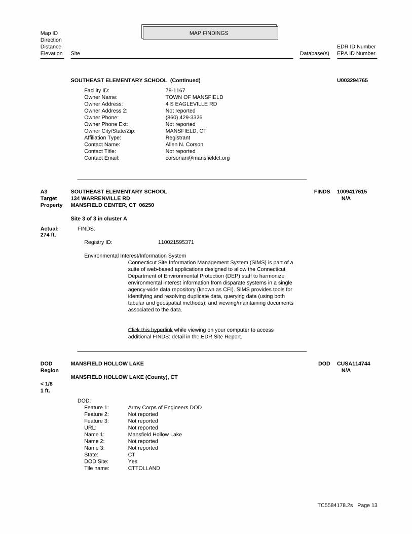
MAP FINDINGSMap IDDirection
EDR ID NumberDistanceEPA ID NumberDatabase(s)SiteElevation
[email protected] Email: Not reportedContact Title: Allen N. CorsonContact Name: RegistrantAffiliation Type: MANSFIELD, CTOwner City/State/Zip: Not reportedOwner Phone Ext: (860) 429-3326Owner Phone: Not reportedOwner Address 2: 4 S EAGLEVILLE RDOwner Address: TOWN OF MANSFIELDOwner Name: 78-1167Facility ID:
SOUTHEAST ELEMENTARY SCHOOL (Continued) U003294765
additional FINDS: detail in the EDR Site Report.Click this hyperlink while viewing on your computer to access
associated to the data.tabular and geospatial methods), and viewing/maintaining documentsidentifying and resolving duplicate data, querying data (using bothagency-wide data repository (known as CFI). SIMS provides tools forenvironmental interest information from disparate systems in a singleDepartment of Environmental Protection (DEP) staff to harmonizesuite of web-based applications designed to allow the ConnecticutConnecticut Site Information Management System (SIMS) is part of a Environmental Interest/Information System
110021595371Registry ID:
FINDS:
Site 3 of 3 in cluster A
Actual:274 ft.
Property MANSFIELD CENTER, CT 06250Target 134 WARRENVILLE RD N/AA3 FINDSSOUTHEAST ELEMENTARY SCHOOL 1009417615
CTTOLLANDTile name:YesDOD Site:CTState:Not reportedName 3:Not reportedName 2:Mansfield Hollow LakeName 1:Not reportedURL:Not reportedFeature 3:Not reportedFeature 2:Army Corps of Engineers DODFeature 1:
DOD:
1 ft.< 1/8
MANSFIELD HOLLOW LAKE (County), CT Region N/ADOD DODMANSFIELD HOLLOW LAKE CUSA114744
TC5584178.2s Page 13
MAP FINDINGSMap IDDirection
EDR ID NumberDistanceEPA ID NumberDatabase(s)SiteElevation
Not reportedAlias2: Republic Oil Truck OverturnAlias: GroundLeachate and Waste Flow: InactiveStatus of the Discharge Activity: 3207008Leachate and Wastewater Number:
LWDS:
691 ft.0.131 mi.
Relative:Lower
Actual:255 ft.
1/8-1/4 MANSFIELD, CT WSW WARRENVILLE ROAD ROUTE 89 N/A4 LWDSREPUBLIC OIL S109937470
President2nd Contact Type: 86064299532nd Contact Fax Number: 86064299522nd Contact Phone Number: Lebanon2nd Contact City 2: 32 Exeter Road2nd Contact Address 2: 71, CT 062492nd Contact City,St,Zip: P.O. Box 2582nd Contact Address: Not reported2nd Contact EMail: Sally Kropp (Kropp Environmental Contractors, Inc.)2nd Contact: UNKNOWNSite Contact City,St,Zip: Not reportedContact EMail: Not reportedContact Info: 0UST Event Id: Not reportedLUST Owner Id: 8463UST Owner Id: 0Monthly Report Id: 0Case Log Id: 0Old SITS Number: 0Cost Recovery Spill Case #: 0UST Site Id: 0Site Case Id: 11/15/2013Entry Date: 10/25/2013Incident Date: TrueRemoval: FalseOverfill: FalsePiping: TrueTank: FalseLeak: TrueNo Release: Not reportedOther Release: FalseOther: FalseGasoline: FalseDiesel: FalseMotor Fuel: FalseEPA Reportable: Not reportedProcessing Status: Lust CompletedLust Status: 60553LUST Case Id: 11933UST Facility Id: 0LUST Id:
LUST:
1650 ft.0.312 mi.
Relative:Higher
Actual:294 ft.
1/4-1/2 MANSFIELD, CT 06250NNE 221 WARRENVILLE ROAD N/A5 LUSTMANSFIELD TRANSFER STATION AND LANDFILL S115593475
TC5584178.2s Page 14
MAP FINDINGSMap IDDirection
EDR ID NumberDistanceEPA ID NumberDatabase(s)SiteElevation
NoFund Outlayed: NoFund Obligated: NoFund Planned: Not reportedFund Date: 0Free Product Inches: Not reportedAreas Of Concern: Not reportedGround Water Depth: Not reportedGround Water Flow Direction: Not reportedReceptor: GAAGround Water Classification: Not reportedGeo Setting: Not reportedDrastic: Not reportedHydro Basin: Not reportedGround Water Gradient: Not reportedGround Water Direction: Not reportedPopulation Setting: Not reportedAffected Population: Not reportedAnnual Precipitation: Not reportedArea Lextent: Not reportedFollow Update: 0Investigator Id: Not reportedResp Party Phone 2: Not reportedResp Party Address 2: Bill Hammon (Contact)Resp Party Name 2: Not reportedResp Party Fax: Not reportedResp Party Phone: 78Resp Party Town Number: Mansfield, CT 06268Resp Party City,St,Zip: 4 South Eagleville RoadResp Party Address: Town of MansfieldResp Party Name: Not reportedResponsible EMail: FalseResponsible Party: FalseRelocation: FalseAlternate Water Supply: FalseFollow Up Flag: FalseOCSRD Complete: FalseCost Recvry Prgm Candidate: FalseNo LUST Site: FalseCommercial HF - Size Unk: FalseCommercial HF > 2100 Gal.: FalseCommercial HF < 2100 Gal.: FalseCommercial Heating Fuel: TruePrivate Heating Fuel: FalseEmergency: Not reportedDate Referred: FalseOffsite Source: Not reportedReferral Source: Not reportedDepartment Contact 2: Not reportedDepartment Contact 1: Not reportedSite Contact Type: Not reportedSite Contact Fax: Not reportedSite Contact Phone: Not reportedSite Contact City 2: Not reportedSite Contact Add 2: Not reportedSite Contact Address: Not reportedSite Contact: 78Facility City Num:
MANSFIELD TRANSFER STATION AND LANDFILL (Continued) S115593475
TC5584178.2s Page 15
MAP FINDINGSMap IDDirection
EDR ID NumberDistanceEPA ID NumberDatabase(s)SiteElevation
Not reportedWork Performed: Spills Files and UST Enforcement FilesRunning Comments: Not reportedRelease Desc: Not reportedNOV Comments: Not reportedLocation Desc: Not reportedGW Comments: Not reportedFollowUp: Not reportedEnvironmental Impact: Not reportedCorrespondence: 08/07/2014Date Stamp: Allison Forrest/forrestaUser Stamp: 0Lph Wells: 0No Wells: Not reportedReferred To: FalseDEP Closure Letter: FalseClosure Req Rpt: FalseQrtly Gwater Mon Rpts: FalseRem Sys Monitoring Rpt: Not reportedClosure Date: Not reportedRem Sys Install Date: FalseRem Sys Install: FalseDEP App Letter 2: FalseCorrect Action Plan: FalseDEP App Letter 1: FalseRelease Invest Rpt: FalseStop All NOV Actions: Not reportedNOV Referred To Ag: Not reportedNOV Admin Order: Not reportedNOV Compliance Sched: Not reportedNOV Issued Date: Not reportedNOV Disc Date: Not reportedNOV Closed: Not reportedNOV Received: Not reportedNOV Due: Not reportedNOV Issued: NoneNOV Action: TrueActive: FalseSoil Venting: FalseGround Water Gauging: FalseSample MWS: FalsePotable Well Sample: FalseSurvey: FalseGeo Probe: FalseSoil Excavate: FalseSite Inspect: FalseSoil Gas: TrueSoil Sample: FalseGround Water Sample: FalseInstall Micro Wells: FalseCellar Borings: NoFund Recovered: NoFund Judgment:
MANSFIELD TRANSFER STATION AND LANDFILL (Continued) S115593475
TC5584178.2s Page 16
ORPHAN SUMMARY
City EDR ID Site Name Site Address Zip Database(s)
Count: 3 records.
MANSFIELD S109822279 CUMBERLAND FARMS #805 (FORMER REPU 1660 STORRS ROAD (ROUTE 195 AN 06250 LUSTMANSFIELD S105456686 DUFFY RESIDENCE 1097 STORRS RD. 06250 LUST, CPCSMANSFIELD CENTER S110775136 CHARLES MORNEAU 699 STORRS - COMMERCIAL PROPER 06250 LUST, CPCS
TC5584178.2s Page 17
To maintain currency of the following federal and state databases, EDR contacts the appropriate governmental agencyon a monthly or quarterly basis, as required.
Number of Days to Update: Provides confirmation that EDR is reporting records that have been updated within 90 daysfrom the date the government agency made the information available to the public.
STANDARD ENVIRONMENTAL RECORDS
Federal NPL site list
NPL: National Priority ListNational Priorities List (Superfund). The NPL is a subset of CERCLIS and identifies over 1,200 sites for prioritycleanup under the Superfund Program. NPL sites may encompass relatively large areas. As such, EDR provides polygoncoverage for over 1,000 NPL site boundaries produced by EPA’s Environmental Photographic Interpretation Center(EPIC) and regional EPA offices.
Date of Government Version: 12/12/2018Date Data Arrived at EDR: 12/28/2018Date Made Active in Reports: 01/11/2019Number of Days to Update: 14
Source: EPATelephone: N/ALast EDR Contact: 02/15/2019Next Scheduled EDR Contact: 04/15/2019Data Release Frequency: Quarterly
NPL Site Boundaries
Sources:
EPA’s Environmental Photographic Interpretation Center (EPIC)Telephone: 202-564-7333
EPA Region 1 EPA Region 6Telephone 617-918-1143 Telephone: 214-655-6659
EPA Region 3 EPA Region 7Telephone 215-814-5418 Telephone: 913-551-7247
EPA Region 4 EPA Region 8Telephone 404-562-8033 Telephone: 303-312-6774
EPA Region 5 EPA Region 9Telephone 312-886-6686 Telephone: 415-947-4246
EPA Region 10Telephone 206-553-8665
Proposed NPL: Proposed National Priority List SitesA site that has been proposed for listing on the National Priorities List through the issuance of a proposed rulein the Federal Register. EPA then accepts public comments on the site, responds to the comments, and places onthe NPL those sites that continue to meet the requirements for listing.
Date of Government Version: 12/12/2018Date Data Arrived at EDR: 12/28/2018Date Made Active in Reports: 01/11/2019Number of Days to Update: 14
Source: EPATelephone: N/ALast EDR Contact: 02/15/2019Next Scheduled EDR Contact: 04/15/2019Data Release Frequency: Quarterly
NPL LIENS: Federal Superfund LiensFederal Superfund Liens. Under the authority granted the USEPA by CERCLA of 1980, the USEPA has the authorityto file liens against real property in order to recover remedial action expenditures or when the property ownerreceived notification of potential liability. USEPA compiles a listing of filed notices of Superfund Liens.
TC5584178.2s Page GR-1
GOVERNMENT RECORDS SEARCHED / DATA CURRENCY TRACKING
Date of Government Version: 10/15/1991Date Data Arrived at EDR: 02/02/1994Date Made Active in Reports: 03/30/1994Number of Days to Update: 56
Source: EPATelephone: 202-564-4267Last EDR Contact: 08/15/2011Next Scheduled EDR Contact: 11/28/2011Data Release Frequency: No Update Planned
Federal Delisted NPL site list
Delisted NPL: National Priority List DeletionsThe National Oil and Hazardous Substances Pollution Contingency Plan (NCP) establishes the criteria that theEPA uses to delete sites from the NPL. In accordance with 40 CFR 300.425.(e), sites may be deleted from theNPL where no further response is appropriate.
Date of Government Version: 12/12/2018Date Data Arrived at EDR: 12/28/2018Date Made Active in Reports: 01/11/2019Number of Days to Update: 14
Source: EPATelephone: N/ALast EDR Contact: 02/15/2019Next Scheduled EDR Contact: 04/15/2019Data Release Frequency: Quarterly
Federal CERCLIS list
FEDERAL FACILITY: Federal Facility Site Information listingA listing of National Priority List (NPL) and Base Realignment and Closure (BRAC) sites found in the ComprehensiveEnvironmental Response, Compensation and Liability Information System (CERCLIS) Database where EPA Federal FacilitiesRestoration and Reuse Office is involved in cleanup activities.
Date of Government Version: 11/07/2016Date Data Arrived at EDR: 01/05/2017Date Made Active in Reports: 04/07/2017Number of Days to Update: 92
Source: Environmental Protection AgencyTelephone: 703-603-8704Last EDR Contact: 01/04/2019Next Scheduled EDR Contact: 04/15/2019Data Release Frequency: Varies
SEMS: Superfund Enterprise Management SystemSEMS (Superfund Enterprise Management System) tracks hazardous waste sites, potentially hazardous waste sites,and remedial activities performed in support of EPA’s Superfund Program across the United States. The list wasformerly know as CERCLIS, renamed to SEMS by the EPA in 2015. The list contains data on potentially hazardouswaste sites that have been reported to the USEPA by states, municipalities, private companies and private persons,pursuant to Section 103 of the Comprehensive Environmental Response, Compensation, and Liability Act (CERCLA).This dataset also contains sites which are either proposed to or on the National Priorities List (NPL) and thesites which are in the screening and assessment phase for possible inclusion on the NPL.
Date of Government Version: 12/12/2018Date Data Arrived at EDR: 12/28/2018Date Made Active in Reports: 01/11/2019Number of Days to Update: 14
Source: EPATelephone: 800-424-9346Last EDR Contact: 02/15/2019Next Scheduled EDR Contact: 04/29/2019Data Release Frequency: Quarterly
Federal CERCLIS NFRAP site list
SEMS-ARCHIVE: Superfund Enterprise Management System Archive
TC5584178.2s Page GR-2
GOVERNMENT RECORDS SEARCHED / DATA CURRENCY TRACKING
SEMS-ARCHIVE (Superfund Enterprise Management System Archive) tracks sites that have no further interest underthe Federal Superfund Program based on available information. The list was formerly known as the CERCLIS-NFRAP,renamed to SEMS ARCHIVE by the EPA in 2015. EPA may perform a minimal level of assessment work at a site whileit is archived if site conditions change and/or new information becomes available. Archived sites have been removedand archived from the inventory of SEMS sites. Archived status indicates that, to the best of EPA’s knowledge,assessment at a site has been completed and that EPA has determined no further steps will be taken to list thesite on the National Priorities List (NPL), unless information indicates this decision was not appropriate orother considerations require a recommendation for listing at a later time. The decision does not necessarily meanthat there is no hazard associated with a given site; it only means that. based upon available information, thelocation is not judged to be potential NPL site.
Date of Government Version: 12/13/2018Date Data Arrived at EDR: 12/28/2018Date Made Active in Reports: 01/11/2019Number of Days to Update: 14
Source: EPATelephone: 800-424-9346Last EDR Contact: 02/15/2019Next Scheduled EDR Contact: 04/29/2019Data Release Frequency: Quarterly
Federal RCRA CORRACTS facilities list
CORRACTS: Corrective Action ReportCORRACTS identifies hazardous waste handlers with RCRA corrective action activity.
Date of Government Version: 03/01/2018Date Data Arrived at EDR: 03/28/2018Date Made Active in Reports: 06/22/2018Number of Days to Update: 86
Source: EPATelephone: 800-424-9346Last EDR Contact: 12/03/2018Next Scheduled EDR Contact: 04/08/2019Data Release Frequency: Quarterly
Federal RCRA non-CORRACTS TSD facilities list
RCRA-TSDF: RCRA - Treatment, Storage and DisposalRCRAInfo is EPA’s comprehensive information system, providing access to data supporting the Resource Conservationand Recovery Act (RCRA) of 1976 and the Hazardous and Solid Waste Amendments (HSWA) of 1984. The databaseincludes selective information on sites which generate, transport, store, treat and/or dispose of hazardous wasteas defined by the Resource Conservation and Recovery Act (RCRA). Transporters are individuals or entities thatmove hazardous waste from the generator offsite to a facility that can recycle, treat, store, or dispose of thewaste. TSDFs treat, store, or dispose of the waste.
Date of Government Version: 03/01/2018Date Data Arrived at EDR: 03/28/2018Date Made Active in Reports: 06/22/2018Number of Days to Update: 86
Source: Environmental Protection AgencyTelephone: (888) 372-7341Last EDR Contact: 12/03/2018Next Scheduled EDR Contact: 04/08/2019Data Release Frequency: Quarterly
Federal RCRA generators list
RCRA-LQG: RCRA - Large Quantity GeneratorsRCRAInfo is EPA’s comprehensive information system, providing access to data supporting the Resource Conservationand Recovery Act (RCRA) of 1976 and the Hazardous and Solid Waste Amendments (HSWA) of 1984. The databaseincludes selective information on sites which generate, transport, store, treat and/or dispose of hazardous wasteas defined by the Resource Conservation and Recovery Act (RCRA). Large quantity generators (LQGs) generateover 1,000 kilograms (kg) of hazardous waste, or over 1 kg of acutely hazardous waste per month.
Date of Government Version: 03/01/2018Date Data Arrived at EDR: 03/28/2018Date Made Active in Reports: 06/22/2018Number of Days to Update: 86
Source: Environmental Protection AgencyTelephone: (888) 372-7341Last EDR Contact: 12/03/2018Next Scheduled EDR Contact: 04/08/2019Data Release Frequency: Quarterly
TC5584178.2s Page GR-3
GOVERNMENT RECORDS SEARCHED / DATA CURRENCY TRACKING

RCRA-SQG: RCRA - Small Quantity GeneratorsRCRAInfo is EPA’s comprehensive information system, providing access to data supporting the Resource Conservationand Recovery Act (RCRA) of 1976 and the Hazardous and Solid Waste Amendments (HSWA) of 1984. The databaseincludes selective information on sites which generate, transport, store, treat and/or dispose of hazardous wasteas defined by the Resource Conservation and Recovery Act (RCRA). Small quantity generators (SQGs) generatebetween 100 kg and 1,000 kg of hazardous waste per month.
Date of Government Version: 03/01/2018Date Data Arrived at EDR: 03/28/2018Date Made Active in Reports: 06/22/2018Number of Days to Update: 86
Source: Environmental Protection AgencyTelephone: (888) 372-7341Last EDR Contact: 12/03/2018Next Scheduled EDR Contact: 04/08/2019Data Release Frequency: Quarterly
RCRA-CESQG: RCRA - Conditionally Exempt Small Quantity GeneratorsRCRAInfo is EPA’s comprehensive information system, providing access to data supporting the Resource Conservationand Recovery Act (RCRA) of 1976 and the Hazardous and Solid Waste Amendments (HSWA) of 1984. The databaseincludes selective information on sites which generate, transport, store, treat and/or dispose of hazardous wasteas defined by the Resource Conservation and Recovery Act (RCRA). Conditionally exempt small quantity generators(CESQGs) generate less than 100 kg of hazardous waste, or less than 1 kg of acutely hazardous waste per month.
Date of Government Version: 03/01/2018Date Data Arrived at EDR: 03/28/2018Date Made Active in Reports: 06/22/2018Number of Days to Update: 86
Source: Environmental Protection AgencyTelephone: (888) 372-7341Last EDR Contact: 12/03/2018Next Scheduled EDR Contact: 04/08/2019Data Release Frequency: Quarterly
Federal institutional controls / engineering controls registries
LUCIS: Land Use Control Information SystemLUCIS contains records of land use control information pertaining to the former Navy Base Realignment and Closureproperties.
Date of Government Version: 10/17/2018Date Data Arrived at EDR: 10/25/2018Date Made Active in Reports: 12/07/2018Number of Days to Update: 43
Source: Department of the NavyTelephone: 843-820-7326Last EDR Contact: 02/07/2019Next Scheduled EDR Contact: 05/27/2019Data Release Frequency: Varies
US ENG CONTROLS: Engineering Controls Sites ListA listing of sites with engineering controls in place. Engineering controls include various forms of caps, buildingfoundations, liners, and treatment methods to create pathway elimination for regulated substances to enter environmentalmedia or effect human health.
Date of Government Version: 07/31/2018Date Data Arrived at EDR: 08/28/2018Date Made Active in Reports: 09/14/2018Number of Days to Update: 17
Source: Environmental Protection AgencyTelephone: 703-603-0695Last EDR Contact: 02/04/2019Next Scheduled EDR Contact: 06/10/2019Data Release Frequency: Varies
US INST CONTROL: Sites with Institutional ControlsA listing of sites with institutional controls in place. Institutional controls include administrative measures,such as groundwater use restrictions, construction restrictions, property use restrictions, and post remediationcare requirements intended to prevent exposure to contaminants remaining on site. Deed restrictions are generallyrequired as part of the institutional controls.
Date of Government Version: 07/31/2018Date Data Arrived at EDR: 08/28/2018Date Made Active in Reports: 09/14/2018Number of Days to Update: 17
Source: Environmental Protection AgencyTelephone: 703-603-0695Last EDR Contact: 02/04/2019Next Scheduled EDR Contact: 06/10/2019Data Release Frequency: Varies
TC5584178.2s Page GR-4
GOVERNMENT RECORDS SEARCHED / DATA CURRENCY TRACKING
Federal ERNS list
ERNS: Emergency Response Notification SystemEmergency Response Notification System. ERNS records and stores information on reported releases of oil and hazardoussubstances.
Date of Government Version: 09/24/2018Date Data Arrived at EDR: 09/25/2018Date Made Active in Reports: 11/09/2018Number of Days to Update: 45
Source: National Response Center, United States Coast GuardTelephone: 202-267-2180Last EDR Contact: 02/08/2019Next Scheduled EDR Contact: 04/08/2019Data Release Frequency: Quarterly
State- and tribal - equivalent CERCLIS
SHWS: Inventory of Hazardous Disposal SitesState Hazardous Waste Sites. State hazardous waste site records are the states’ equivalent to CERCLIS. These sitesmay or may not already be listed on the federal CERCLIS list. Priority sites planned for cleanup using state funds(state equivalent of Superfund) are identified along with sites where cleanup will be paid for by potentiallyresponsible parties. Available information varies by state.
Date of Government Version: 04/23/2010Date Data Arrived at EDR: 04/23/2010Date Made Active in Reports: 05/25/2010Number of Days to Update: 32
Source: Department of Energy & Environmental ProtectionTelephone: 860-424-3705Last EDR Contact: 12/26/2018Next Scheduled EDR Contact: 04/15/2019Data Release Frequency: No Update Planned
SDADB: Site Discovery and Assessment DatabaseAll sites reported to Permitting, Enforcement, and Remediation Division where it is suspected that hazardous wastemay have been disposed or sites that are eligible for listing on the State Inventory of Hazardous Waste DisposalSites.
Date of Government Version: 04/23/2010Date Data Arrived at EDR: 04/23/2010Date Made Active in Reports: 05/25/2010Number of Days to Update: 32
Source: Department of Energy & Environmental ProtectionTelephone: 860-424-3705Last EDR Contact: 12/26/2018Next Scheduled EDR Contact: 04/15/2019Data Release Frequency: No Update Planned
State and tribal landfill and/or solid waste disposal site lists
SWF/LF: List of Landfills/Transfer StationsSolid Waste Facilities/Landfill Sites. SWF/LF type records typically contain an inventory of solid waste disposalfacilities or landfills in a particular state. Depending on the state, these may be active or inactive facilitiesor open dumps that failed to meet RCRA Subtitle D Section 4004 criteria for solid waste landfills or disposalsites.
Date of Government Version: 01/24/2019Date Data Arrived at EDR: 01/25/2019Date Made Active in Reports: 03/04/2019Number of Days to Update: 38
Source: Department of Energy & Environmental ProtectionTelephone: 860-424-3366Last EDR Contact: 01/25/2019Next Scheduled EDR Contact: 05/06/2019Data Release Frequency: Annually
State and tribal leaking storage tank lists
LUST: Leaking Underground Storage Tank ListLeaking Underground Storage Tank Incident Reports. LUST records contain an inventory of reported leaking undergroundstorage tank incidents. Not all states maintain these records, and the information stored varies by state.
Date of Government Version: 01/23/2019Date Data Arrived at EDR: 01/25/2019Date Made Active in Reports: 03/04/2019Number of Days to Update: 38
Source: Department of Energy & Environmental ProtectionTelephone: 860-424-3376Last EDR Contact: 12/27/2018Next Scheduled EDR Contact: 04/15/2019Data Release Frequency: Semi-Annually
TC5584178.2s Page GR-5
GOVERNMENT RECORDS SEARCHED / DATA CURRENCY TRACKING
INDIAN LUST R5: Leaking Underground Storage Tanks on Indian LandLeaking underground storage tanks located on Indian Land in Michigan, Minnesota and Wisconsin.
Date of Government Version: 04/12/2018Date Data Arrived at EDR: 05/18/2018Date Made Active in Reports: 07/20/2018Number of Days to Update: 63
Source: EPA, Region 5Telephone: 312-886-7439Last EDR Contact: 03/07/2019Next Scheduled EDR Contact: 05/06/2019Data Release Frequency: Varies
INDIAN LUST R10: Leaking Underground Storage Tanks on Indian LandLUSTs on Indian land in Alaska, Idaho, Oregon and Washington.
Date of Government Version: 04/12/2018Date Data Arrived at EDR: 05/18/2018Date Made Active in Reports: 07/20/2018Number of Days to Update: 63
Source: EPA Region 10Telephone: 206-553-2857Last EDR Contact: 03/07/2019Next Scheduled EDR Contact: 05/06/2019Data Release Frequency: Varies
INDIAN LUST R9: Leaking Underground Storage Tanks on Indian LandLUSTs on Indian land in Arizona, California, New Mexico and Nevada
Date of Government Version: 04/10/2018Date Data Arrived at EDR: 05/18/2018Date Made Active in Reports: 07/20/2018Number of Days to Update: 63
Source: Environmental Protection AgencyTelephone: 415-972-3372Last EDR Contact: 03/07/2019Next Scheduled EDR Contact: 05/06/2019Data Release Frequency: Varies
INDIAN LUST R8: Leaking Underground Storage Tanks on Indian LandLUSTs on Indian land in Colorado, Montana, North Dakota, South Dakota, Utah and Wyoming.
Date of Government Version: 04/25/2018Date Data Arrived at EDR: 05/18/2018Date Made Active in Reports: 07/20/2018Number of Days to Update: 63
Source: EPA Region 8Telephone: 303-312-6271Last EDR Contact: 03/07/2019Next Scheduled EDR Contact: 05/06/2019Data Release Frequency: Varies
INDIAN LUST R7: Leaking Underground Storage Tanks on Indian LandLUSTs on Indian land in Iowa, Kansas, and Nebraska
Date of Government Version: 04/24/2018Date Data Arrived at EDR: 05/18/2018Date Made Active in Reports: 07/20/2018Number of Days to Update: 63
Source: EPA Region 7Telephone: 913-551-7003Last EDR Contact: 03/07/2019Next Scheduled EDR Contact: 05/06/2019Data Release Frequency: Varies
INDIAN LUST R6: Leaking Underground Storage Tanks on Indian LandLUSTs on Indian land in New Mexico and Oklahoma.
Date of Government Version: 04/01/2018Date Data Arrived at EDR: 05/18/2018Date Made Active in Reports: 07/20/2018Number of Days to Update: 63
Source: EPA Region 6Telephone: 214-665-6597Last EDR Contact: 03/07/2019Next Scheduled EDR Contact: 05/06/2019Data Release Frequency: Varies
INDIAN LUST R4: Leaking Underground Storage Tanks on Indian LandLUSTs on Indian land in Florida, Mississippi and North Carolina.
Date of Government Version: 05/08/2018Date Data Arrived at EDR: 05/18/2018Date Made Active in Reports: 07/20/2018Number of Days to Update: 63
Source: EPA Region 4Telephone: 404-562-8677Last EDR Contact: 03/05/2019Next Scheduled EDR Contact: 05/06/2019Data Release Frequency: Varies
TC5584178.2s Page GR-6
GOVERNMENT RECORDS SEARCHED / DATA CURRENCY TRACKING
INDIAN LUST R1: Leaking Underground Storage Tanks on Indian LandA listing of leaking underground storage tank locations on Indian Land.
Date of Government Version: 04/13/2018Date Data Arrived at EDR: 05/18/2018Date Made Active in Reports: 07/20/2018Number of Days to Update: 63
Source: EPA Region 1Telephone: 617-918-1313Last EDR Contact: 03/07/2019Next Scheduled EDR Contact: 05/06/2019Data Release Frequency: Varies
State and tribal registered storage tank lists
FEMA UST: Underground Storage Tank ListingA listing of all FEMA owned underground storage tanks.
Date of Government Version: 05/15/2017Date Data Arrived at EDR: 05/30/2017Date Made Active in Reports: 10/13/2017Number of Days to Update: 136
Source: FEMATelephone: 202-646-5797Last EDR Contact: 01/08/2019Next Scheduled EDR Contact: 04/22/2019Data Release Frequency: Varies
UST: Underground Storage Tank DataRegistered Underground Storage Tanks. UST’s are regulated under Subtitle I of the Resource Conservation and RecoveryAct (RCRA) and must be registered with the state department responsible for administering the UST program. Availableinformation varies by state program.
Date of Government Version: 12/04/2018Date Data Arrived at EDR: 12/18/2018Date Made Active in Reports: 01/28/2019Number of Days to Update: 41
Source: Department of Energy & Environmental ProtectionTelephone: 860-424-3376Last EDR Contact: 02/22/2019Next Scheduled EDR Contact: 06/10/2019Data Release Frequency: Semi-Annually
AST: Marine Terminals and Tank InformationA listing of bulk petroleum facilities that receive petroleum by a vessel.
Date of Government Version: 06/30/2018Date Data Arrived at EDR: 08/09/2018Date Made Active in Reports: 09/10/2018Number of Days to Update: 32
Source: Department of Energy & Environmental ProtectionTelephone: 860-424-3233Last EDR Contact: 01/31/2019Next Scheduled EDR Contact: 05/20/2019Data Release Frequency: Varies
INDIAN UST R7: Underground Storage Tanks on Indian LandThe Indian Underground Storage Tank (UST) database provides information about underground storage tanks on Indianland in EPA Region 7 (Iowa, Kansas, Missouri, Nebraska, and 9 Tribal Nations).
Date of Government Version: 04/24/2018Date Data Arrived at EDR: 05/18/2018Date Made Active in Reports: 07/20/2018Number of Days to Update: 63
Source: EPA Region 7Telephone: 913-551-7003Last EDR Contact: 03/07/2019Next Scheduled EDR Contact: 05/06/2019Data Release Frequency: Varies
INDIAN UST R6: Underground Storage Tanks on Indian LandThe Indian Underground Storage Tank (UST) database provides information about underground storage tanks on Indianland in EPA Region 6 (Louisiana, Arkansas, Oklahoma, New Mexico, Texas and 65 Tribes).
Date of Government Version: 04/01/2018Date Data Arrived at EDR: 05/18/2018Date Made Active in Reports: 07/20/2018Number of Days to Update: 63
Source: EPA Region 6Telephone: 214-665-7591Last EDR Contact: 03/07/2019Next Scheduled EDR Contact: 05/06/2019Data Release Frequency: Varies
TC5584178.2s Page GR-7
GOVERNMENT RECORDS SEARCHED / DATA CURRENCY TRACKING
INDIAN UST R10: Underground Storage Tanks on Indian LandThe Indian Underground Storage Tank (UST) database provides information about underground storage tanks on Indianland in EPA Region 10 (Alaska, Idaho, Oregon, Washington, and Tribal Nations).
Date of Government Version: 04/12/2018Date Data Arrived at EDR: 05/18/2018Date Made Active in Reports: 07/20/2018Number of Days to Update: 63
Source: EPA Region 10Telephone: 206-553-2857Last EDR Contact: 03/07/2019Next Scheduled EDR Contact: 05/06/2019Data Release Frequency: Varies
INDIAN UST R1: Underground Storage Tanks on Indian LandThe Indian Underground Storage Tank (UST) database provides information about underground storage tanks on Indianland in EPA Region 1 (Connecticut, Maine, Massachusetts, New Hampshire, Rhode Island, Vermont and ten TribalNations).
Date of Government Version: 04/13/2018Date Data Arrived at EDR: 05/18/2018Date Made Active in Reports: 07/20/2018Number of Days to Update: 63
Source: EPA, Region 1Telephone: 617-918-1313Last EDR Contact: 03/07/2019Next Scheduled EDR Contact: 05/06/2019Data Release Frequency: Varies
INDIAN UST R4: Underground Storage Tanks on Indian LandThe Indian Underground Storage Tank (UST) database provides information about underground storage tanks on Indianland in EPA Region 4 (Alabama, Florida, Georgia, Kentucky, Mississippi, North Carolina, South Carolina, Tennesseeand Tribal Nations)
Date of Government Version: 05/08/2018Date Data Arrived at EDR: 05/18/2018Date Made Active in Reports: 07/20/2018Number of Days to Update: 63
Source: EPA Region 4Telephone: 404-562-9424Last EDR Contact: 03/05/2019Next Scheduled EDR Contact: 05/06/2019Data Release Frequency: Varies
INDIAN UST R5: Underground Storage Tanks on Indian LandThe Indian Underground Storage Tank (UST) database provides information about underground storage tanks on Indianland in EPA Region 5 (Michigan, Minnesota and Wisconsin and Tribal Nations).
Date of Government Version: 04/12/2018Date Data Arrived at EDR: 05/18/2018Date Made Active in Reports: 07/20/2018Number of Days to Update: 63
Source: EPA Region 5Telephone: 312-886-6136Last EDR Contact: 03/07/2019Next Scheduled EDR Contact: 05/06/2019Data Release Frequency: Varies
INDIAN UST R9: Underground Storage Tanks on Indian LandThe Indian Underground Storage Tank (UST) database provides information about underground storage tanks on Indianland in EPA Region 9 (Arizona, California, Hawaii, Nevada, the Pacific Islands, and Tribal Nations).
Date of Government Version: 04/10/2018Date Data Arrived at EDR: 05/18/2018Date Made Active in Reports: 07/20/2018Number of Days to Update: 63
Source: EPA Region 9Telephone: 415-972-3368Last EDR Contact: 03/07/2019Next Scheduled EDR Contact: 05/06/2019Data Release Frequency: Varies
INDIAN UST R8: Underground Storage Tanks on Indian LandThe Indian Underground Storage Tank (UST) database provides information about underground storage tanks on Indianland in EPA Region 8 (Colorado, Montana, North Dakota, South Dakota, Utah, Wyoming and 27 Tribal Nations).
Date of Government Version: 04/25/2018Date Data Arrived at EDR: 05/18/2018Date Made Active in Reports: 07/20/2018Number of Days to Update: 63
Source: EPA Region 8Telephone: 303-312-6137Last EDR Contact: 03/07/2019Next Scheduled EDR Contact: 05/06/2019Data Release Frequency: Varies
TC5584178.2s Page GR-8
GOVERNMENT RECORDS SEARCHED / DATA CURRENCY TRACKING
State and tribal institutional control / engineering control registries
ENG CONTROLS: Engineering Controls ListingAn Engineered Control is a permanent physical structure designed to safely isolate pollutants which would otherwisenot comply with the self-implementing remedial options allowed in the Connecticut Remediation Standard Regulations(RSRs). The ECGD includes a description of what is eligible to be considered as an Engineered Control undersection 22a-133k-2(f)(2) of the RSRs, a description of the information necessary for the preparation of completeand approvable applications, a step-by-step outline of the review and approval process, and supplemental resourcesprovided in the appendices.
Date of Government Version: 03/05/2013Date Data Arrived at EDR: 05/07/2013Date Made Active in Reports: 06/19/2013Number of Days to Update: 43
Source: Department of Energy & Environmental ProtectionTelephone: 860-424-3000Last EDR Contact: 03/04/2019Next Scheduled EDR Contact: 06/17/2019Data Release Frequency: Varies
AUL: ELUR SitesEnvironmental Land Use Restriction sites.
Date of Government Version: 11/14/2018Date Data Arrived at EDR: 11/15/2018Date Made Active in Reports: 12/04/2018Number of Days to Update: 19
Source: Department of Energy & Environmental ProtectionTelephone: 860-424-3912Last EDR Contact: 01/31/2019Next Scheduled EDR Contact: 05/20/2019Data Release Frequency: Varies
State and tribal voluntary cleanup sites
INDIAN VCP R1: Voluntary Cleanup Priority ListingA listing of voluntary cleanup priority sites located on Indian Land located in Region 1.
Date of Government Version: 07/27/2015Date Data Arrived at EDR: 09/29/2015Date Made Active in Reports: 02/18/2016Number of Days to Update: 142
Source: EPA, Region 1Telephone: 617-918-1102Last EDR Contact: 12/19/2018Next Scheduled EDR Contact: 04/08/2019Data Release Frequency: Varies
INDIAN VCP R7: Voluntary Cleanup Priority LisitngA listing of voluntary cleanup priority sites located on Indian Land located in Region 7.
Date of Government Version: 03/20/2008Date Data Arrived at EDR: 04/22/2008Date Made Active in Reports: 05/19/2008Number of Days to Update: 27
Source: EPA, Region 7Telephone: 913-551-7365Last EDR Contact: 04/20/2009Next Scheduled EDR Contact: 07/20/2009Data Release Frequency: Varies
VCP: Voluntary Remediation SitesSites involved in the Voluntary Remediation Program.
Date of Government Version: 11/14/2018Date Data Arrived at EDR: 11/15/2018Date Made Active in Reports: 12/04/2018Number of Days to Update: 19
Source: Department of Energy & Environmental ProtectionTelephone: 860-424-3705Last EDR Contact: 01/31/2019Next Scheduled EDR Contact: 02/20/2047Data Release Frequency: Varies
State and tribal Brownfields sites
BROWNFIELDS: Brownfields InventoryCBRA has identified over 200 brownfield sites eligible for redevelopment. In most cases these are prime propertiesfor commercial or industrial use. CBRA’s grants, assistance and financing lower the financial risks and eliminatethe legal, regulatory and environmental risks of redevelopment.
TC5584178.2s Page GR-9
GOVERNMENT RECORDS SEARCHED / DATA CURRENCY TRACKING
Date of Government Version: 03/25/2016Date Data Arrived at EDR: 03/29/2016Date Made Active in Reports: 05/18/2016Number of Days to Update: 50
Source: Connecticut Brownfields Redevelopment AuthorityTelephone: 860-258-7833Last EDR Contact: 12/12/2018Next Scheduled EDR Contact: 04/01/2019Data Release Frequency: Varies
BROWNFIELDS 2: Brownfields InventoryA brownfield site is generally defined as "real property, the expansion, redevelopment, or reuse of which maybe complicated by the presence or potential presence of a hazardous substance, pollutant or contaminanta?|"
Date of Government Version: 08/03/2017Date Data Arrived at EDR: 09/20/2017Date Made Active in Reports: 09/26/2017Number of Days to Update: 6
Source: Department of Energy & Environmental ProtectionTelephone: 860-424-3705Last EDR Contact: 12/17/2018Next Scheduled EDR Contact: 04/01/2019Data Release Frequency: Varies
ADDITIONAL ENVIRONMENTAL RECORDS
Local Brownfield lists
US BROWNFIELDS: A Listing of Brownfields SitesBrownfields are real property, the expansion, redevelopment, or reuse of which may be complicated by the presenceor potential presence of a hazardous substance, pollutant, or contaminant. Cleaning up and reinvesting in theseproperties takes development pressures off of undeveloped, open land, and both improves and protects the environment.Assessment, Cleanup and Redevelopment Exchange System (ACRES) stores information reported by EPA Brownfieldsgrant recipients on brownfields properties assessed or cleaned up with grant funding as well as information onTargeted Brownfields Assessments performed by EPA Regions. A listing of ACRES Brownfield sites is obtained fromCleanups in My Community. Cleanups in My Community provides information on Brownfields properties for which informationis reported back to EPA, as well as areas served by Brownfields grant programs.
Date of Government Version: 12/17/2018Date Data Arrived at EDR: 12/18/2018Date Made Active in Reports: 01/11/2019Number of Days to Update: 24
Source: Environmental Protection AgencyTelephone: 202-566-2777Last EDR Contact: 12/18/2018Next Scheduled EDR Contact: 04/01/2019Data Release Frequency: Semi-Annually
Local Lists of Landfill / Solid Waste Disposal Sites
SWRCY: Recycling FacilitiesA listing of recycling facilities.
Date of Government Version: 12/07/2018Date Data Arrived at EDR: 12/26/2018Date Made Active in Reports: 01/24/2019Number of Days to Update: 29
Source: Department of Energy & Environmental ProtectionTelephone: 860-424-3223Last EDR Contact: 12/06/2018Next Scheduled EDR Contact: 03/25/2019Data Release Frequency: Varies
INDIAN ODI: Report on the Status of Open Dumps on Indian LandsLocation of open dumps on Indian land.
Date of Government Version: 12/31/1998Date Data Arrived at EDR: 12/03/2007Date Made Active in Reports: 01/24/2008Number of Days to Update: 52
Source: Environmental Protection AgencyTelephone: 703-308-8245Last EDR Contact: 01/29/2019Next Scheduled EDR Contact: 05/13/2019Data Release Frequency: Varies
DEBRIS REGION 9: Torres Martinez Reservation Illegal Dump Site LocationsA listing of illegal dump sites location on the Torres Martinez Indian Reservation located in eastern RiversideCounty and northern Imperial County, California.
TC5584178.2s Page GR-10
GOVERNMENT RECORDS SEARCHED / DATA CURRENCY TRACKING
Date of Government Version: 01/12/2009Date Data Arrived at EDR: 05/07/2009Date Made Active in Reports: 09/21/2009Number of Days to Update: 137
Source: EPA, Region 9Telephone: 415-947-4219Last EDR Contact: 01/17/2019Next Scheduled EDR Contact: 05/06/2019Data Release Frequency: No Update Planned
ODI: Open Dump InventoryAn open dump is defined as a disposal facility that does not comply with one or more of the Part 257 or Part 258Subtitle D Criteria.
Date of Government Version: 06/30/1985Date Data Arrived at EDR: 08/09/2004Date Made Active in Reports: 09/17/2004Number of Days to Update: 39
Source: Environmental Protection AgencyTelephone: 800-424-9346Last EDR Contact: 06/09/2004Next Scheduled EDR Contact: N/AData Release Frequency: No Update Planned
IHS OPEN DUMPS: Open Dumps on Indian LandA listing of all open dumps located on Indian Land in the United States.
Date of Government Version: 04/01/2014Date Data Arrived at EDR: 08/06/2014Date Made Active in Reports: 01/29/2015Number of Days to Update: 176
Source: Department of Health & Human Serivces, Indian Health ServiceTelephone: 301-443-1452Last EDR Contact: 02/01/2019Next Scheduled EDR Contact: 05/13/2019Data Release Frequency: Varies
Local Lists of Hazardous waste / Contaminated Sites
US HIST CDL: National Clandestine Laboratory RegisterA listing of clandestine drug lab locations that have been removed from the DEAs National Clandestine LaboratoryRegister.
Date of Government Version: 09/21/2018Date Data Arrived at EDR: 09/21/2018Date Made Active in Reports: 11/09/2018Number of Days to Update: 49
Source: Drug Enforcement AdministrationTelephone: 202-307-1000Last EDR Contact: 02/21/2019Next Scheduled EDR Contact: 06/10/2019Data Release Frequency: No Update Planned
CDL: Clandestine Drug Lab ListingA listing of clandestine drug lab locations included in the Spills database.
Date of Government Version: 01/23/2019Date Data Arrived at EDR: 01/25/2019Date Made Active in Reports: 03/04/2019Number of Days to Update: 38
Source: Department of Energy & Environmental ProtectionTelephone: 860-424-3361Last EDR Contact: 12/27/2018Next Scheduled EDR Contact: 04/15/2019Data Release Frequency: Quarterly
US CDL: Clandestine Drug LabsA listing of clandestine drug lab locations. The U.S. Department of Justice ("the Department") provides thisweb site as a public service. It contains addresses of some locations where law enforcement agencies reportedthey found chemicals or other items that indicated the presence of either clandestine drug laboratories or dumpsites.In most cases, the source of the entries is not the Department, and the Department has not verified the entryand does not guarantee its accuracy. Members of the public must verify the accuracy of all entries by, for example,contacting local law enforcement and local health departments.
Date of Government Version: 09/21/2018Date Data Arrived at EDR: 09/21/2018Date Made Active in Reports: 11/09/2018Number of Days to Update: 49
Source: Drug Enforcement AdministrationTelephone: 202-307-1000Last EDR Contact: 02/21/2019Next Scheduled EDR Contact: 06/10/2019Data Release Frequency: Quarterly
Local Land Records
TC5584178.2s Page GR-11
GOVERNMENT RECORDS SEARCHED / DATA CURRENCY TRACKING
CT PROPERTY: Property Transfer FilingsA listing of sites that meet the definition of a hazardous waste establishment. They can be generators, dry cleaners,furniture strippers, etc. These sites have been sold to another owner.
Date of Government Version: 11/14/2018Date Data Arrived at EDR: 11/15/2018Date Made Active in Reports: 12/04/2018Number of Days to Update: 19
Source: Department of Energy & Environmental ProtectionTelephone: 860-424-3705Last EDR Contact: 01/31/2019Next Scheduled EDR Contact: 05/20/2019Data Release Frequency: Semi-Annually
LIENS: Environmental Liens ListingA listing of environmental liens placed by the Cost Recovery Program.
Date of Government Version: 02/11/2019Date Data Arrived at EDR: 02/19/2019Date Made Active in Reports: 03/04/2019Number of Days to Update: 13
Source: Department of Energy & Environmental ProtectionTelephone: 860-424-3120Last EDR Contact: 02/11/2019Next Scheduled EDR Contact: 05/27/2019Data Release Frequency: Varies
LIENS 2: CERCLA Lien InformationA Federal CERCLA (’Superfund’) lien can exist by operation of law at any site or property at which EPA has spentSuperfund monies. These monies are spent to investigate and address releases and threatened releases of contamination.CERCLIS provides information as to the identity of these sites and properties.
Date of Government Version: 12/12/2018Date Data Arrived at EDR: 12/28/2018Date Made Active in Reports: 01/11/2019Number of Days to Update: 14
Source: Environmental Protection AgencyTelephone: 202-564-6023Last EDR Contact: 02/15/2019Next Scheduled EDR Contact: 05/06/2019Data Release Frequency: Semi-Annually
Records of Emergency Release Reports
HMIRS: Hazardous Materials Information Reporting SystemHazardous Materials Incident Report System. HMIRS contains hazardous material spill incidents reported to DOT.
Date of Government Version: 03/26/2018Date Data Arrived at EDR: 03/27/2018Date Made Active in Reports: 06/08/2018Number of Days to Update: 73
Source: U.S. Department of TransportationTelephone: 202-366-4555Last EDR Contact: 02/08/2019Next Scheduled EDR Contact: 04/08/2019Data Release Frequency: Quarterly
SPILLS: Oil & Chemical Spill DatabaseOil and Chemical Spill Data.
Date of Government Version: 01/23/2019Date Data Arrived at EDR: 01/25/2019Date Made Active in Reports: 03/04/2019Number of Days to Update: 38
Source: Department of Energy & Environmental ProtectionTelephone: 860-424-3024Last EDR Contact: 12/27/2018Next Scheduled EDR Contact: 04/15/2019Data Release Frequency: Semi-Annually
SPILLS 90: SPILLS90 data from FirstSearchSpills 90 includes those spill and release records available exclusively from FirstSearch databases. Typically,they may include chemical, oil and/or hazardous substance spills recorded after 1990. Duplicate records that arealready included in EDR incident and release records are not included in Spills 90.
Date of Government Version: 10/15/2012Date Data Arrived at EDR: 01/03/2013Date Made Active in Reports: 02/11/2013Number of Days to Update: 39
Source: FirstSearchTelephone: N/ALast EDR Contact: 01/03/2013Next Scheduled EDR Contact: N/AData Release Frequency: No Update Planned
TC5584178.2s Page GR-12
GOVERNMENT RECORDS SEARCHED / DATA CURRENCY TRACKING
Other Ascertainable Records
RCRA NonGen / NLR: RCRA - Non Generators / No Longer RegulatedRCRAInfo is EPA’s comprehensive information system, providing access to data supporting the Resource Conservationand Recovery Act (RCRA) of 1976 and the Hazardous and Solid Waste Amendments (HSWA) of 1984. The databaseincludes selective information on sites which generate, transport, store, treat and/or dispose of hazardous wasteas defined by the Resource Conservation and Recovery Act (RCRA). Non-Generators do not presently generate hazardouswaste.
Date of Government Version: 03/01/2018Date Data Arrived at EDR: 03/28/2018Date Made Active in Reports: 06/22/2018Number of Days to Update: 86
Source: Environmental Protection AgencyTelephone: (888) 372-7341Last EDR Contact: 12/03/2018Next Scheduled EDR Contact: 04/08/2019Data Release Frequency: Quarterly
FUDS: Formerly Used Defense SitesThe listing includes locations of Formerly Used Defense Sites properties where the US Army Corps of Engineersis actively working or will take necessary cleanup actions.
Date of Government Version: 01/31/2015Date Data Arrived at EDR: 07/08/2015Date Made Active in Reports: 10/13/2015Number of Days to Update: 97
Source: U.S. Army Corps of EngineersTelephone: 202-528-4285Last EDR Contact: 02/22/2019Next Scheduled EDR Contact: 06/03/2019Data Release Frequency: Varies
DOD: Department of Defense SitesThis data set consists of federally owned or administered lands, administered by the Department of Defense, thathave any area equal to or greater than 640 acres of the United States, Puerto Rico, and the U.S. Virgin Islands.
Date of Government Version: 12/31/2005Date Data Arrived at EDR: 11/10/2006Date Made Active in Reports: 01/11/2007Number of Days to Update: 62
Source: USGSTelephone: 888-275-8747Last EDR Contact: 01/11/2019Next Scheduled EDR Contact: 04/22/2019Data Release Frequency: Semi-Annually
FEDLAND: Federal and Indian LandsFederally and Indian administrated lands of the United States. Lands included are administrated by: Army Corpsof Engineers, Bureau of Reclamation, National Wild and Scenic River, National Wildlife Refuge, Public Domain Land,Wilderness, Wilderness Study Area, Wildlife Management Area, Bureau of Indian Affairs, Bureau of Land Management,Department of Justice, Forest Service, Fish and Wildlife Service, National Park Service.
Date of Government Version: 12/31/2005Date Data Arrived at EDR: 02/06/2006Date Made Active in Reports: 01/11/2007Number of Days to Update: 339
Source: U.S. Geological SurveyTelephone: 888-275-8747Last EDR Contact: 01/11/2019Next Scheduled EDR Contact: 04/22/2019Data Release Frequency: N/A
SCRD DRYCLEANERS: State Coalition for Remediation of Drycleaners ListingThe State Coalition for Remediation of Drycleaners was established in 1998, with support from the U.S. EPA Officeof Superfund Remediation and Technology Innovation. It is comprised of representatives of states with establisheddrycleaner remediation programs. Currently the member states are Alabama, Connecticut, Florida, Illinois, Kansas,Minnesota, Missouri, North Carolina, Oregon, South Carolina, Tennessee, Texas, and Wisconsin.
Date of Government Version: 01/01/2017Date Data Arrived at EDR: 02/03/2017Date Made Active in Reports: 04/07/2017Number of Days to Update: 63
Source: Environmental Protection AgencyTelephone: 615-532-8599Last EDR Contact: 02/15/2019Next Scheduled EDR Contact: 05/27/2019Data Release Frequency: Varies
TC5584178.2s Page GR-13
GOVERNMENT RECORDS SEARCHED / DATA CURRENCY TRACKING
US FIN ASSUR: Financial Assurance InformationAll owners and operators of facilities that treat, store, or dispose of hazardous waste are required to provideproof that they will have sufficient funds to pay for the clean up, closure, and post-closure care of their facilities.
Date of Government Version: 08/31/2018Date Data Arrived at EDR: 09/25/2018Date Made Active in Reports: 11/09/2018Number of Days to Update: 45
Source: Environmental Protection AgencyTelephone: 202-566-1917Last EDR Contact: 02/04/2019Next Scheduled EDR Contact: 04/08/2019Data Release Frequency: Quarterly
EPA WATCH LIST: EPA WATCH LISTEPA maintains a "Watch List" to facilitate dialogue between EPA, state and local environmental agencies on enforcementmatters relating to facilities with alleged violations identified as either significant or high priority. Beingon the Watch List does not mean that the facility has actually violated the law only that an investigation byEPA or a state or local environmental agency has led those organizations to allege that an unproven violationhas in fact occurred. Being on the Watch List does not represent a higher level of concern regarding the allegedviolations that were detected, but instead indicates cases requiring additional dialogue between EPA, state andlocal agencies - primarily because of the length of time the alleged violation has gone unaddressed or unresolved.
Date of Government Version: 08/30/2013Date Data Arrived at EDR: 03/21/2014Date Made Active in Reports: 06/17/2014Number of Days to Update: 88
Source: Environmental Protection AgencyTelephone: 617-520-3000Last EDR Contact: 02/08/2019Next Scheduled EDR Contact: 05/20/2019Data Release Frequency: Quarterly
2020 COR ACTION: 2020 Corrective Action Program ListThe EPA has set ambitious goals for the RCRA Corrective Action program by creating the 2020 Corrective ActionUniverse. This RCRA cleanup baseline includes facilities expected to need corrective action. The 2020 universecontains a wide variety of sites. Some properties are heavily contaminated while others were contaminated buthave since been cleaned up. Still others have not been fully investigated yet, and may require little or no remediation.Inclusion in the 2020 Universe does not necessarily imply failure on the part of a facility to meet its RCRA obligations.
Date of Government Version: 09/30/2017Date Data Arrived at EDR: 05/08/2018Date Made Active in Reports: 07/20/2018Number of Days to Update: 73
Source: Environmental Protection AgencyTelephone: 703-308-4044Last EDR Contact: 02/08/2019Next Scheduled EDR Contact: 05/20/2019Data Release Frequency: Varies
TSCA: Toxic Substances Control ActToxic Substances Control Act. TSCA identifies manufacturers and importers of chemical substances included on theTSCA Chemical Substance Inventory list. It includes data on the production volume of these substances by plantsite.
Date of Government Version: 12/31/2016Date Data Arrived at EDR: 06/21/2017Date Made Active in Reports: 01/05/2018Number of Days to Update: 198
Source: EPATelephone: 202-260-5521Last EDR Contact: 12/21/2018Next Scheduled EDR Contact: 04/01/2019Data Release Frequency: Every 4 Years
TRIS: Toxic Chemical Release Inventory SystemToxic Release Inventory System. TRIS identifies facilities which release toxic chemicals to the air, water andland in reportable quantities under SARA Title III Section 313.
Date of Government Version: 12/31/2016Date Data Arrived at EDR: 01/10/2018Date Made Active in Reports: 01/12/2018Number of Days to Update: 2
Source: EPATelephone: 202-566-0250Last EDR Contact: 02/20/2019Next Scheduled EDR Contact: 06/03/2019Data Release Frequency: Annually
TC5584178.2s Page GR-14
GOVERNMENT RECORDS SEARCHED / DATA CURRENCY TRACKING
SSTS: Section 7 Tracking SystemsSection 7 of the Federal Insecticide, Fungicide and Rodenticide Act, as amended (92 Stat. 829) requires allregistered pesticide-producing establishments to submit a report to the Environmental Protection Agency by March1st each year. Each establishment must report the types and amounts of pesticides, active ingredients and devicesbeing produced, and those having been produced and sold or distributed in the past year.
Date of Government Version: 12/31/2009Date Data Arrived at EDR: 12/10/2010Date Made Active in Reports: 02/25/2011Number of Days to Update: 77
Source: EPATelephone: 202-564-4203Last EDR Contact: 01/25/2019Next Scheduled EDR Contact: 05/06/2019Data Release Frequency: Annually
ROD: Records Of DecisionRecord of Decision. ROD documents mandate a permanent remedy at an NPL (Superfund) site containing technicaland health information to aid in the cleanup.
Date of Government Version: 12/12/2018Date Data Arrived at EDR: 12/28/2018Date Made Active in Reports: 01/11/2019Number of Days to Update: 14
Source: EPATelephone: 703-416-0223Last EDR Contact: 02/15/2019Next Scheduled EDR Contact: 03/18/2019Data Release Frequency: Annually
RMP: Risk Management PlansWhen Congress passed the Clean Air Act Amendments of 1990, it required EPA to publish regulations and guidancefor chemical accident prevention at facilities using extremely hazardous substances. The Risk Management ProgramRule (RMP Rule) was written to implement Section 112(r) of these amendments. The rule, which built upon existingindustry codes and standards, requires companies of all sizes that use certain flammable and toxic substancesto develop a Risk Management Program, which includes a(n): Hazard assessment that details the potential effectsof an accidental release, an accident history of the last five years, and an evaluation of worst-case and alternativeaccidental releases; Prevention program that includes safety precautions and maintenance, monitoring, and employeetraining measures; and Emergency response program that spells out emergency health care, employee training measuresand procedures for informing the public and response agencies (e.g the fire department) should an accident occur.
Date of Government Version: 10/26/2018Date Data Arrived at EDR: 11/06/2018Date Made Active in Reports: 01/11/2019Number of Days to Update: 66
Source: Environmental Protection AgencyTelephone: 202-564-8600Last EDR Contact: 01/22/2019Next Scheduled EDR Contact: 05/06/2019Data Release Frequency: Varies
RAATS: RCRA Administrative Action Tracking SystemRCRA Administration Action Tracking System. RAATS contains records based on enforcement actions issued under RCRApertaining to major violators and includes administrative and civil actions brought by the EPA. For administrationactions after September 30, 1995, data entry in the RAATS database was discontinued. EPA will retain a copy ofthe database for historical records. It was necessary to terminate RAATS because a decrease in agency resourcesmade it impossible to continue to update the information contained in the database.
Date of Government Version: 04/17/1995Date Data Arrived at EDR: 07/03/1995Date Made Active in Reports: 08/07/1995Number of Days to Update: 35
Source: EPATelephone: 202-564-4104Last EDR Contact: 06/02/2008Next Scheduled EDR Contact: 09/01/2008Data Release Frequency: No Update Planned
PRP: Potentially Responsible PartiesA listing of verified Potentially Responsible Parties
Date of Government Version: 08/13/2018Date Data Arrived at EDR: 10/04/2018Date Made Active in Reports: 11/09/2018Number of Days to Update: 36
Source: EPATelephone: 202-564-6023Last EDR Contact: 02/15/2019Next Scheduled EDR Contact: 05/20/2019Data Release Frequency: Quarterly
TC5584178.2s Page GR-15
GOVERNMENT RECORDS SEARCHED / DATA CURRENCY TRACKING
PADS: PCB Activity Database SystemPCB Activity Database. PADS Identifies generators, transporters, commercial storers and/or brokers and disposersof PCB’s who are required to notify the EPA of such activities.
Date of Government Version: 09/14/2018Date Data Arrived at EDR: 10/11/2018Date Made Active in Reports: 12/07/2018Number of Days to Update: 57
Source: EPATelephone: 202-566-0500Last EDR Contact: 01/11/2019Next Scheduled EDR Contact: 04/22/2019Data Release Frequency: Annually
ICIS: Integrated Compliance Information SystemThe Integrated Compliance Information System (ICIS) supports the information needs of the national enforcementand compliance program as well as the unique needs of the National Pollutant Discharge Elimination System (NPDES)program.
Date of Government Version: 11/18/2016Date Data Arrived at EDR: 11/23/2016Date Made Active in Reports: 02/10/2017Number of Days to Update: 79
Source: Environmental Protection AgencyTelephone: 202-564-2501Last EDR Contact: 01/07/2019Next Scheduled EDR Contact: 04/22/2019Data Release Frequency: Quarterly
FTTS: FIFRA/ TSCA Tracking System - FIFRA (Federal Insecticide, Fungicide, & Rodenticide Act)/TSCA (Toxic Substances Control Act)FTTS tracks administrative cases and pesticide enforcement actions and compliance activities related to FIFRA,TSCA and EPCRA (Emergency Planning and Community Right-to-Know Act). To maintain currency, EDR contacts theAgency on a quarterly basis.
Date of Government Version: 04/09/2009Date Data Arrived at EDR: 04/16/2009Date Made Active in Reports: 05/11/2009Number of Days to Update: 25
Source: EPA/Office of Prevention, Pesticides and Toxic SubstancesTelephone: 202-566-1667Last EDR Contact: 08/18/2017Next Scheduled EDR Contact: 12/04/2017Data Release Frequency: Quarterly
FTTS INSP: FIFRA/ TSCA Tracking System - FIFRA (Federal Insecticide, Fungicide, & Rodenticide Act)/TSCA (Toxic Substances Control Act)A listing of FIFRA/TSCA Tracking System (FTTS) inspections and enforcements.
Date of Government Version: 04/09/2009Date Data Arrived at EDR: 04/16/2009Date Made Active in Reports: 05/11/2009Number of Days to Update: 25
Source: EPATelephone: 202-566-1667Last EDR Contact: 08/18/2017Next Scheduled EDR Contact: 12/04/2017Data Release Frequency: Quarterly
MLTS: Material Licensing Tracking SystemMLTS is maintained by the Nuclear Regulatory Commission and contains a list of approximately 8,100 sites whichpossess or use radioactive materials and which are subject to NRC licensing requirements. To maintain currency,EDR contacts the Agency on a quarterly basis.
Date of Government Version: 08/30/2016Date Data Arrived at EDR: 09/08/2016Date Made Active in Reports: 10/21/2016Number of Days to Update: 43
Source: Nuclear Regulatory CommissionTelephone: 301-415-7169Last EDR Contact: 01/22/2019Next Scheduled EDR Contact: 05/06/2019Data Release Frequency: Quarterly
COAL ASH DOE: Steam-Electric Plant Operation DataA listing of power plants that store ash in surface ponds.
Date of Government Version: 12/31/2005Date Data Arrived at EDR: 08/07/2009Date Made Active in Reports: 10/22/2009Number of Days to Update: 76
Source: Department of EnergyTelephone: 202-586-8719Last EDR Contact: 03/07/2019Next Scheduled EDR Contact: 06/17/2019Data Release Frequency: Varies
TC5584178.2s Page GR-16
GOVERNMENT RECORDS SEARCHED / DATA CURRENCY TRACKING
COAL ASH EPA: Coal Combustion Residues Surface Impoundments ListA listing of coal combustion residues surface impoundments with high hazard potential ratings.
Date of Government Version: 07/01/2014Date Data Arrived at EDR: 09/10/2014Date Made Active in Reports: 10/20/2014Number of Days to Update: 40
Source: Environmental Protection AgencyTelephone: N/ALast EDR Contact: 03/05/2019Next Scheduled EDR Contact: 06/17/2019Data Release Frequency: Varies
PCB TRANSFORMER: PCB Transformer Registration DatabaseThe database of PCB transformer registrations that includes all PCB registration submittals.
Date of Government Version: 05/24/2017Date Data Arrived at EDR: 11/30/2017Date Made Active in Reports: 12/15/2017Number of Days to Update: 15
Source: Environmental Protection AgencyTelephone: 202-566-0517Last EDR Contact: 01/25/2019Next Scheduled EDR Contact: 05/06/2019Data Release Frequency: Varies
RADINFO: Radiation Information DatabaseThe Radiation Information Database (RADINFO) contains information about facilities that are regulated by U.S.Environmental Protection Agency (EPA) regulations for radiation and radioactivity.
Date of Government Version: 10/02/2018Date Data Arrived at EDR: 10/03/2018Date Made Active in Reports: 11/09/2018Number of Days to Update: 37
Source: Environmental Protection AgencyTelephone: 202-343-9775Last EDR Contact: 01/03/2019Next Scheduled EDR Contact: 04/15/2019Data Release Frequency: Quarterly
HIST FTTS: FIFRA/TSCA Tracking System Administrative Case ListingA complete administrative case listing from the FIFRA/TSCA Tracking System (FTTS) for all ten EPA regions. Theinformation was obtained from the National Compliance Database (NCDB). NCDB supports the implementation of FIFRA(Federal Insecticide, Fungicide, and Rodenticide Act) and TSCA (Toxic Substances Control Act). Some EPA regionsare now closing out records. Because of that, and the fact that some EPA regions are not providing EPA Headquarterswith updated records, it was decided to create a HIST FTTS database. It included records that may not be includedin the newer FTTS database updates. This database is no longer updated.
Date of Government Version: 10/19/2006Date Data Arrived at EDR: 03/01/2007Date Made Active in Reports: 04/10/2007Number of Days to Update: 40
Source: Environmental Protection AgencyTelephone: 202-564-2501Last EDR Contact: 12/17/2007Next Scheduled EDR Contact: 03/17/2008Data Release Frequency: No Update Planned
HIST FTTS INSP: FIFRA/TSCA Tracking System Inspection & Enforcement Case ListingA complete inspection and enforcement case listing from the FIFRA/TSCA Tracking System (FTTS) for all ten EPAregions. The information was obtained from the National Compliance Database (NCDB). NCDB supports the implementationof FIFRA (Federal Insecticide, Fungicide, and Rodenticide Act) and TSCA (Toxic Substances Control Act). SomeEPA regions are now closing out records. Because of that, and the fact that some EPA regions are not providingEPA Headquarters with updated records, it was decided to create a HIST FTTS database. It included records thatmay not be included in the newer FTTS database updates. This database is no longer updated.
Date of Government Version: 10/19/2006Date Data Arrived at EDR: 03/01/2007Date Made Active in Reports: 04/10/2007Number of Days to Update: 40
Source: Environmental Protection AgencyTelephone: 202-564-2501Last EDR Contact: 12/17/2008Next Scheduled EDR Contact: 03/17/2008Data Release Frequency: No Update Planned
DOT OPS: Incident and Accident DataDepartment of Transporation, Office of Pipeline Safety Incident and Accident data.
TC5584178.2s Page GR-17
GOVERNMENT RECORDS SEARCHED / DATA CURRENCY TRACKING
Date of Government Version: 10/01/2018Date Data Arrived at EDR: 10/30/2018Date Made Active in Reports: 01/18/2019Number of Days to Update: 80
Source: Department of Transporation, Office of Pipeline SafetyTelephone: 202-366-4595Last EDR Contact: 01/29/2019Next Scheduled EDR Contact: 05/11/2019Data Release Frequency: Quarterly
CONSENT: Superfund (CERCLA) Consent DecreesMajor legal settlements that establish responsibility and standards for cleanup at NPL (Superfund) sites. Releasedperiodically by United States District Courts after settlement by parties to litigation matters.
Date of Government Version: 09/30/2018Date Data Arrived at EDR: 10/12/2018Date Made Active in Reports: 12/07/2018Number of Days to Update: 56
Source: Department of Justice, Consent Decree LibraryTelephone: VariesLast EDR Contact: 01/07/2019Next Scheduled EDR Contact: 04/22/2019Data Release Frequency: Varies
BRS: Biennial Reporting SystemThe Biennial Reporting System is a national system administered by the EPA that collects data on the generationand management of hazardous waste. BRS captures detailed data from two groups: Large Quantity Generators (LQG)and Treatment, Storage, and Disposal Facilities.
Date of Government Version: 12/31/2015Date Data Arrived at EDR: 02/22/2017Date Made Active in Reports: 09/28/2017Number of Days to Update: 218
Source: EPA/NTISTelephone: 800-424-9346Last EDR Contact: 02/13/2019Next Scheduled EDR Contact: 06/03/2019Data Release Frequency: Biennially
INDIAN RESERV: Indian ReservationsThis map layer portrays Indian administered lands of the United States that have any area equal to or greaterthan 640 acres.
Date of Government Version: 12/31/2014Date Data Arrived at EDR: 07/14/2015Date Made Active in Reports: 01/10/2017Number of Days to Update: 546
Source: USGSTelephone: 202-208-3710Last EDR Contact: 01/07/2019Next Scheduled EDR Contact: 04/22/2019Data Release Frequency: Semi-Annually
FUSRAP: Formerly Utilized Sites Remedial Action ProgramDOE established the Formerly Utilized Sites Remedial Action Program (FUSRAP) in 1974 to remediate sites whereradioactive contamination remained from Manhattan Project and early U.S. Atomic Energy Commission (AEC) operations.
Date of Government Version: 08/08/2017Date Data Arrived at EDR: 09/11/2018Date Made Active in Reports: 09/14/2018Number of Days to Update: 3
Source: Department of EnergyTelephone: 202-586-3559Last EDR Contact: 01/31/2019Next Scheduled EDR Contact: 05/20/2019Data Release Frequency: Varies
UMTRA: Uranium Mill Tailings SitesUranium ore was mined by private companies for federal government use in national defense programs. When the millsshut down, large piles of the sand-like material (mill tailings) remain after uranium has been extracted fromthe ore. Levels of human exposure to radioactive materials from the piles are low; however, in some cases tailingswere used as construction materials before the potential health hazards of the tailings were recognized.
Date of Government Version: 06/23/2017Date Data Arrived at EDR: 10/11/2017Date Made Active in Reports: 11/03/2017Number of Days to Update: 23
Source: Department of EnergyTelephone: 505-845-0011Last EDR Contact: 02/22/2019Next Scheduled EDR Contact: 06/03/2019Data Release Frequency: Varies
TC5584178.2s Page GR-18
GOVERNMENT RECORDS SEARCHED / DATA CURRENCY TRACKING
LEAD SMELTER 1: Lead Smelter SitesA listing of former lead smelter site locations.
Date of Government Version: 12/12/2018Date Data Arrived at EDR: 12/28/2018Date Made Active in Reports: 01/11/2019Number of Days to Update: 14
Source: Environmental Protection AgencyTelephone: 703-603-8787Last EDR Contact: 02/15/2019Next Scheduled EDR Contact: 04/15/2019Data Release Frequency: Varies
LEAD SMELTER 2: Lead Smelter SitesA list of several hundred sites in the U.S. where secondary lead smelting was done from 1931and 1964. These sitesmay pose a threat to public health through ingestion or inhalation of contaminated soil or dust
Date of Government Version: 04/05/2001Date Data Arrived at EDR: 10/27/2010Date Made Active in Reports: 12/02/2010Number of Days to Update: 36
Source: American Journal of Public HealthTelephone: 703-305-6451Last EDR Contact: 12/02/2009Next Scheduled EDR Contact: N/AData Release Frequency: No Update Planned
US AIRS (AFS): Aerometric Information Retrieval System Facility Subsystem (AFS)The database is a sub-system of Aerometric Information Retrieval System (AIRS). AFS contains compliance dataon air pollution point sources regulated by the U.S. EPA and/or state and local air regulatory agencies. Thisinformation comes from source reports by various stationary sources of air pollution, such as electric power plants,steel mills, factories, and universities, and provides information about the air pollutants they produce. Action,air program, air program pollutant, and general level plant data. It is used to track emissions and compliancedata from industrial plants.
Date of Government Version: 10/12/2016Date Data Arrived at EDR: 10/26/2016Date Made Active in Reports: 02/03/2017Number of Days to Update: 100
Source: EPATelephone: 202-564-2496Last EDR Contact: 09/26/2017Next Scheduled EDR Contact: 01/08/2018Data Release Frequency: Annually
US AIRS MINOR: Air Facility System DataA listing of minor source facilities.
Date of Government Version: 10/12/2016Date Data Arrived at EDR: 10/26/2016Date Made Active in Reports: 02/03/2017Number of Days to Update: 100
Source: EPATelephone: 202-564-2496Last EDR Contact: 09/26/2017Next Scheduled EDR Contact: 01/08/2018Data Release Frequency: Annually
US MINES: Mines Master Index FileContains all mine identification numbers issued for mines active or opened since 1971. The data also includesviolation information.
Date of Government Version: 08/01/2018Date Data Arrived at EDR: 08/29/2018Date Made Active in Reports: 10/05/2018Number of Days to Update: 37
Source: Department of Labor, Mine Safety and Health AdministrationTelephone: 303-231-5959Last EDR Contact: 02/27/2019Next Scheduled EDR Contact: 06/10/2019Data Release Frequency: Semi-Annually
US MINES 2: Ferrous and Nonferrous Metal Mines Database ListingThis map layer includes ferrous (ferrous metal mines are facilities that extract ferrous metals, such as ironore or molybdenum) and nonferrous (Nonferrous metal mines are facilities that extract nonferrous metals, suchas gold, silver, copper, zinc, and lead) metal mines in the United States.
Date of Government Version: 12/05/2005Date Data Arrived at EDR: 02/29/2008Date Made Active in Reports: 04/18/2008Number of Days to Update: 49
Source: USGSTelephone: 703-648-7709Last EDR Contact: 03/01/2019Next Scheduled EDR Contact: 06/10/2019Data Release Frequency: Varies
TC5584178.2s Page GR-19
GOVERNMENT RECORDS SEARCHED / DATA CURRENCY TRACKING
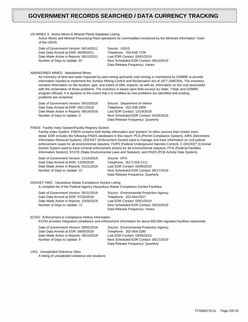
US MINES 3: Active Mines & Mineral Plants Database ListingActive Mines and Mineral Processing Plant operations for commodities monitored by the Minerals Information Teamof the USGS.
Date of Government Version: 04/14/2011Date Data Arrived at EDR: 06/08/2011Date Made Active in Reports: 09/13/2011Number of Days to Update: 97
Source: USGSTelephone: 703-648-7709Last EDR Contact: 03/01/2019Next Scheduled EDR Contact: 06/10/2019Data Release Frequency: Varies
ABANDONED MINES: Abandoned MinesAn inventory of land and water impacted by past mining (primarily coal mining) is maintained by OSMRE to provideinformation needed to implement the Surface Mining Control and Reclamation Act of 1977 (SMCRA). The inventorycontains information on the location, type, and extent of AML impacts, as well as, information on the cost associatedwith the reclamation of those problems. The inventory is based upon field surveys by State, Tribal, and OSMREprogram officials. It is dynamic to the extent that it is modified as new problems are identified and existingproblems are reclaimed.
Date of Government Version: 09/10/2018Date Data Arrived at EDR: 09/11/2018Date Made Active in Reports: 09/14/2018Number of Days to Update: 3
Source: Department of InteriorTelephone: 202-208-2609Last EDR Contact: 12/19/2018Next Scheduled EDR Contact: 03/25/2019Data Release Frequency: Quarterly
FINDS: Facility Index System/Facility Registry SystemFacility Index System. FINDS contains both facility information and ’pointers’ to other sources that contain moredetail. EDR includes the following FINDS databases in this report: PCS (Permit Compliance System), AIRS (AerometricInformation Retrieval System), DOCKET (Enforcement Docket used to manage and track information on civil judicialenforcement cases for all environmental statutes), FURS (Federal Underground Injection Control), C-DOCKET (CriminalDocket System used to track criminal enforcement actions for all environmental statutes), FFIS (Federal FacilitiesInformation System), STATE (State Environmental Laws and Statutes), and PADS (PCB Activity Data System).
Date of Government Version: 11/15/2018Date Data Arrived at EDR: 12/05/2018Date Made Active in Reports: 01/11/2019Number of Days to Update: 37
Source: EPATelephone: (617) 918-1111Last EDR Contact: 03/05/2019Next Scheduled EDR Contact: 06/17/2019Data Release Frequency: Quarterly
DOCKET HWC: Hazardous Waste Compliance Docket ListingA complete list of the Federal Agency Hazardous Waste Compliance Docket Facilities.
Date of Government Version: 05/31/2018Date Data Arrived at EDR: 07/26/2018Date Made Active in Reports: 10/05/2018Number of Days to Update: 71
Source: Environmental Protection AgencyTelephone: 202-564-0527Last EDR Contact: 03/01/2019Next Scheduled EDR Contact: 06/10/2019Data Release Frequency: Varies
ECHO: Enforcement & Compliance History InformationECHO provides integrated compliance and enforcement information for about 800,000 regulated facilities nationwide.
Date of Government Version: 09/02/2018Date Data Arrived at EDR: 09/05/2018Date Made Active in Reports: 09/14/2018Number of Days to Update: 9
Source: Environmental Protection AgencyTelephone: 202-564-2280Last EDR Contact: 03/05/2019Next Scheduled EDR Contact: 06/17/2019Data Release Frequency: Quarterly
UXO: Unexploded Ordnance SitesA listing of unexploded ordnance site locations
TC5584178.2s Page GR-20
GOVERNMENT RECORDS SEARCHED / DATA CURRENCY TRACKING
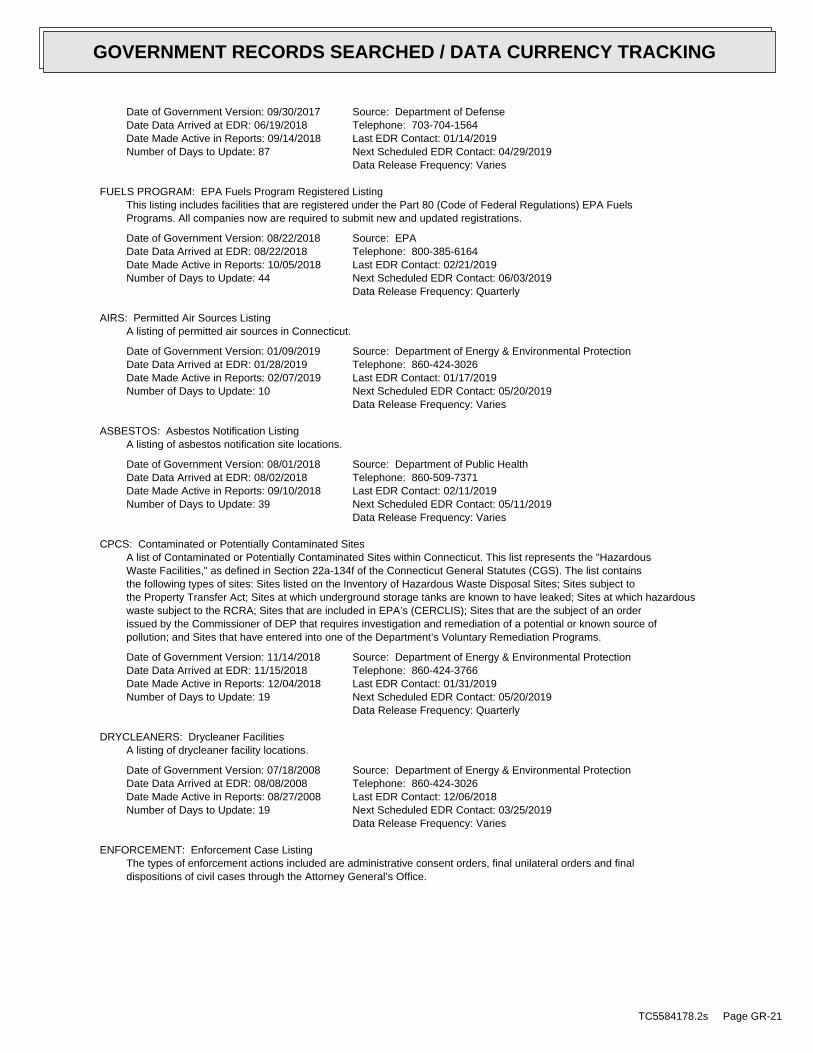
Date of Government Version: 09/30/2017Date Data Arrived at EDR: 06/19/2018Date Made Active in Reports: 09/14/2018Number of Days to Update: 87
Source: Department of DefenseTelephone: 703-704-1564Last EDR Contact: 01/14/2019Next Scheduled EDR Contact: 04/29/2019Data Release Frequency: Varies
FUELS PROGRAM: EPA Fuels Program Registered ListingThis listing includes facilities that are registered under the Part 80 (Code of Federal Regulations) EPA FuelsPrograms. All companies now are required to submit new and updated registrations.
Date of Government Version: 08/22/2018Date Data Arrived at EDR: 08/22/2018Date Made Active in Reports: 10/05/2018Number of Days to Update: 44
Source: EPATelephone: 800-385-6164Last EDR Contact: 02/21/2019Next Scheduled EDR Contact: 06/03/2019Data Release Frequency: Quarterly
AIRS: Permitted Air Sources ListingA listing of permitted air sources in Connecticut.
Date of Government Version: 01/09/2019Date Data Arrived at EDR: 01/28/2019Date Made Active in Reports: 02/07/2019Number of Days to Update: 10
Source: Department of Energy & Environmental ProtectionTelephone: 860-424-3026Last EDR Contact: 01/17/2019Next Scheduled EDR Contact: 05/20/2019Data Release Frequency: Varies
ASBESTOS: Asbestos Notification ListingA listing of asbestos notification site locations.
Date of Government Version: 08/01/2018Date Data Arrived at EDR: 08/02/2018Date Made Active in Reports: 09/10/2018Number of Days to Update: 39
Source: Department of Public HealthTelephone: 860-509-7371Last EDR Contact: 02/11/2019Next Scheduled EDR Contact: 05/11/2019Data Release Frequency: Varies
CPCS: Contaminated or Potentially Contaminated SitesA list of Contaminated or Potentially Contaminated Sites within Connecticut. This list represents the "HazardousWaste Facilities," as defined in Section 22a-134f of the Connecticut General Statutes (CGS). The list containsthe following types of sites: Sites listed on the Inventory of Hazardous Waste Disposal Sites; Sites subject tothe Property Transfer Act; Sites at which underground storage tanks are known to have leaked; Sites at which hazardouswaste subject to the RCRA; Sites that are included in EPA’s (CERCLIS); Sites that are the subject of an orderissued by the Commissioner of DEP that requires investigation and remediation of a potential or known source ofpollution; and Sites that have entered into one of the Department’s Voluntary Remediation Programs.
Date of Government Version: 11/14/2018Date Data Arrived at EDR: 11/15/2018Date Made Active in Reports: 12/04/2018Number of Days to Update: 19
Source: Department of Energy & Environmental ProtectionTelephone: 860-424-3766Last EDR Contact: 01/31/2019Next Scheduled EDR Contact: 05/20/2019Data Release Frequency: Quarterly
DRYCLEANERS: Drycleaner FacilitiesA listing of drycleaner facility locations.
Date of Government Version: 07/18/2008Date Data Arrived at EDR: 08/08/2008Date Made Active in Reports: 08/27/2008Number of Days to Update: 19
Source: Department of Energy & Environmental ProtectionTelephone: 860-424-3026Last EDR Contact: 12/06/2018Next Scheduled EDR Contact: 03/25/2019Data Release Frequency: Varies
ENFORCEMENT: Enforcement Case ListingThe types of enforcement actions included are administrative consent orders, final unilateral orders and finaldispositions of civil cases through the Attorney General’s Office.
TC5584178.2s Page GR-21
GOVERNMENT RECORDS SEARCHED / DATA CURRENCY TRACKING
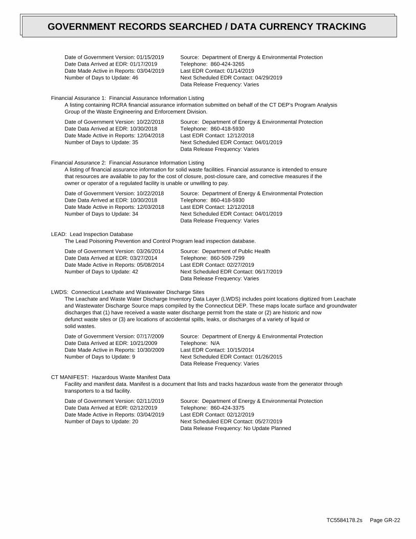
Date of Government Version: 01/15/2019Date Data Arrived at EDR: 01/17/2019Date Made Active in Reports: 03/04/2019Number of Days to Update: 46
Source: Department of Energy & Environmental ProtectionTelephone: 860-424-3265Last EDR Contact: 01/14/2019Next Scheduled EDR Contact: 04/29/2019Data Release Frequency: Varies
Financial Assurance 1: Financial Assurance Information ListingA listing containing RCRA financial assurance information submitted on behalf of the CT DEP’s Program AnalysisGroup of the Waste Engineering and Enforcement Division.
Date of Government Version: 10/22/2018Date Data Arrived at EDR: 10/30/2018Date Made Active in Reports: 12/04/2018Number of Days to Update: 35
Source: Department of Energy & Environmental ProtectionTelephone: 860-418-5930Last EDR Contact: 12/12/2018Next Scheduled EDR Contact: 04/01/2019Data Release Frequency: Varies
Financial Assurance 2: Financial Assurance Information ListingA listing of financial assurance information for solid waste facilities. Financial assurance is intended to ensurethat resources are available to pay for the cost of closure, post-closure care, and corrective measures if theowner or operator of a regulated facility is unable or unwilling to pay.
Date of Government Version: 10/22/2018Date Data Arrived at EDR: 10/30/2018Date Made Active in Reports: 12/03/2018Number of Days to Update: 34
Source: Department of Energy & Environmental ProtectionTelephone: 860-418-5930Last EDR Contact: 12/12/2018Next Scheduled EDR Contact: 04/01/2019Data Release Frequency: Varies
LEAD: Lead Inspection DatabaseThe Lead Poisoning Prevention and Control Program lead inspection database.
Date of Government Version: 03/26/2014Date Data Arrived at EDR: 03/27/2014Date Made Active in Reports: 05/08/2014Number of Days to Update: 42
Source: Department of Public HealthTelephone: 860-509-7299Last EDR Contact: 02/27/2019Next Scheduled EDR Contact: 06/17/2019Data Release Frequency: Varies
LWDS: Connecticut Leachate and Wastewater Discharge SitesThe Leachate and Waste Water Discharge Inventory Data Layer (LWDS) includes point locations digitized from Leachateand Wastewater Discharge Source maps compiled by the Connecticut DEP. These maps locate surface and groundwaterdischarges that (1) have received a waste water discharge permit from the state or (2) are historic and nowdefunct waste sites or (3) are locations of accidental spills, leaks, or discharges of a variety of liquid orsolid wastes.
Date of Government Version: 07/17/2009Date Data Arrived at EDR: 10/21/2009Date Made Active in Reports: 10/30/2009Number of Days to Update: 9
Source: Department of Energy & Environmental ProtectionTelephone: N/ALast EDR Contact: 10/15/2014Next Scheduled EDR Contact: 01/26/2015Data Release Frequency: Varies
CT MANIFEST: Hazardous Waste Manifest DataFacility and manifest data. Manifest is a document that lists and tracks hazardous waste from the generator throughtransporters to a tsd facility.
Date of Government Version: 02/11/2019Date Data Arrived at EDR: 02/12/2019Date Made Active in Reports: 03/04/2019Number of Days to Update: 20
Source: Department of Energy & Environmental ProtectionTelephone: 860-424-3375Last EDR Contact: 02/12/2019Next Scheduled EDR Contact: 05/27/2019Data Release Frequency: No Update Planned
TC5584178.2s Page GR-22
GOVERNMENT RECORDS SEARCHED / DATA CURRENCY TRACKING
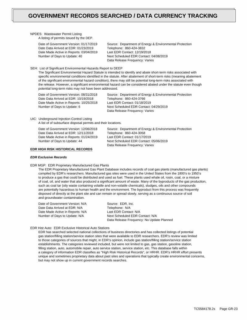
NPDES: Wastewater Permit ListingA listing of permits issued by the DEP.
Date of Government Version: 01/17/2019Date Data Arrived at EDR: 01/23/2019Date Made Active in Reports: 03/04/2019Number of Days to Update: 40
Source: Department of Energy & Environmental ProtectionTelephone: 860-424-3832Last EDR Contact: 12/19/2018Next Scheduled EDR Contact: 04/08/2019Data Release Frequency: Varies
SEH: List of Significant Environmental Hazards Report to DEEPThe Significant Environmental Hazard Statute is intended to identify and abate short-term risks associated withspecific environmental conditions identified in the statute. After abatement of short-term risks (meaning abatementof the significant environmental hazard condition), there may still be potential long-term risks associated withthe release. However, a significant environmental hazard can be considered abated under the statute even thoughpotential long-term risks may not have been addressed.
Date of Government Version: 08/31/2018Date Data Arrived at EDR: 10/19/2018Date Made Active in Reports: 10/25/2018Number of Days to Update: 6
Source: Department of Energy & Environmental ProtectionTelephone: 860-424-3766Last EDR Contact: 01/18/2019Next Scheduled EDR Contact: 04/29/2019Data Release Frequency: Varies
UIC: Underground Injection Control ListingA list of of subsurface disposal permits and their locations.
Date of Government Version: 12/06/2018Date Data Arrived at EDR: 12/11/2018Date Made Active in Reports: 01/24/2019Number of Days to Update: 44
Source: Department of Energy & Environmental ProtectionTelephone: 860-424-3058Last EDR Contact: 01/17/2019Next Scheduled EDR Contact: 05/06/2019Data Release Frequency: Varies
EDR HIGH RISK HISTORICAL RECORDS
EDR Exclusive Records
EDR MGP: EDR Proprietary Manufactured Gas PlantsThe EDR Proprietary Manufactured Gas Plant Database includes records of coal gas plants (manufactured gas plants)compiled by EDR’s researchers. Manufactured gas sites were used in the United States from the 1800’s to 1950’sto produce a gas that could be distributed and used as fuel. These plants used whale oil, rosin, coal, or a mixtureof coal, oil, and water that also produced a significant amount of waste. Many of the byproducts of the gas production,such as coal tar (oily waste containing volatile and non-volatile chemicals), sludges, oils and other compoundsare potentially hazardous to human health and the environment. The byproduct from this process was frequentlydisposed of directly at the plant site and can remain or spread slowly, serving as a continuous source of soiland groundwater contamination.
Date of Government Version: N/ADate Data Arrived at EDR: N/ADate Made Active in Reports: N/ANumber of Days to Update: N/A
Source: EDR, Inc.Telephone: N/ALast EDR Contact: N/ANext Scheduled EDR Contact: N/AData Release Frequency: No Update Planned
EDR Hist Auto: EDR Exclusive Historical Auto StationsEDR has searched selected national collections of business directories and has collected listings of potentialgas station/filling station/service station sites that were available to EDR researchers. EDR’s review was limitedto those categories of sources that might, in EDR’s opinion, include gas station/filling station/service stationestablishments. The categories reviewed included, but were not limited to gas, gas station, gasoline station,filling station, auto, automobile repair, auto service station, service station, etc. This database falls withina category of information EDR classifies as "High Risk Historical Records", or HRHR. EDR’s HRHR effort presentsunique and sometimes proprietary data about past sites and operations that typically create environmental concerns,but may not show up in current government records searches.
TC5584178.2s Page GR-23
GOVERNMENT RECORDS SEARCHED / DATA CURRENCY TRACKING
Date of Government Version: N/ADate Data Arrived at EDR: N/ADate Made Active in Reports: N/ANumber of Days to Update: N/A
Source: EDR, Inc.Telephone: N/ALast EDR Contact: N/ANext Scheduled EDR Contact: N/AData Release Frequency: Varies
EDR Hist Cleaner: EDR Exclusive Historical CleanersEDR has searched selected national collections of business directories and has collected listings of potentialdry cleaner sites that were available to EDR researchers. EDR’s review was limited to those categories of sourcesthat might, in EDR’s opinion, include dry cleaning establishments. The categories reviewed included, but werenot limited to dry cleaners, cleaners, laundry, laundromat, cleaning/laundry, wash & dry etc. This database fallswithin a category of information EDR classifies as "High Risk Historical Records", or HRHR. EDR’s HRHR effortpresents unique and sometimes proprietary data about past sites and operations that typically create environmentalconcerns, but may not show up in current government records searches.
Date of Government Version: N/ADate Data Arrived at EDR: N/ADate Made Active in Reports: N/ANumber of Days to Update: N/A
Source: EDR, Inc.Telephone: N/ALast EDR Contact: N/ANext Scheduled EDR Contact: N/AData Release Frequency: Varies
EDR RECOVERED GOVERNMENT ARCHIVES
Exclusive Recovered Govt. Archives
RGA HWS: Recovered Government Archive State Hazardous Waste Facilities ListThe EDR Recovered Government Archive State Hazardous Waste database provides a list of SHWS incidents derivedfrom historical databases and includes many records that no longer appear in current government lists. Compiledfrom Records formerly available from the Department of Energy & Environmental Protection formerly know as theDEP which changes in July 2011 in Connecticut.
Date of Government Version: N/ADate Data Arrived at EDR: 07/01/2013Date Made Active in Reports: 01/02/2014Number of Days to Update: 185
Source: Department of Energy & Environmental ProtectionTelephone: N/ALast EDR Contact: 06/01/2012Next Scheduled EDR Contact: N/AData Release Frequency: Varies
RGA LUST: Recovered Government Archive Leaking Underground Storage TankThe EDR Recovered Government Archive Leaking Underground Storage Tank database provides a list of LUST incidentsderived from historical databases and includes many records that no longer appear in current government lists.Compiled from Records formerly available from the Department of Energy & Environmental Protection formerly knowas the DEP which changes in July 2011 in Connecticut.
Date of Government Version: N/ADate Data Arrived at EDR: 07/01/2013Date Made Active in Reports: 01/02/2014Number of Days to Update: 185
Source: Department of Energy & Environmental ProtectionTelephone: N/ALast EDR Contact: 06/01/2012Next Scheduled EDR Contact: N/AData Release Frequency: Varies
OTHER DATABASE(S)
Depending on the geographic area covered by this report, the data provided in these specialty databases may or may not becomplete. For example, the existence of wetlands information data in a specific report does not mean that all wetlands in thearea covered by the report are included. Moreover, the absence of any reported wetlands information does not necessarilymean that wetlands do not exist in the area covered by the report.
NJ MANIFEST: Manifest InformationHazardous waste manifest information.
TC5584178.2s Page GR-24
GOVERNMENT RECORDS SEARCHED / DATA CURRENCY TRACKING
Date of Government Version: 12/31/2017Date Data Arrived at EDR: 07/13/2018Date Made Active in Reports: 08/01/2018Number of Days to Update: 19
Source: Department of Environmental ProtectionTelephone: N/ALast EDR Contact: 01/07/2019Next Scheduled EDR Contact: 04/22/2019Data Release Frequency: Annually
NY MANIFEST: Facility and Manifest DataManifest is a document that lists and tracks hazardous waste from the generator through transporters to a TSDfacility.
Date of Government Version: 01/01/2019Date Data Arrived at EDR: 01/30/2019Date Made Active in Reports: 02/14/2019Number of Days to Update: 15
Source: Department of Environmental ConservationTelephone: 518-402-8651Last EDR Contact: 01/30/2019Next Scheduled EDR Contact: 05/11/2019Data Release Frequency: Quarterly
PA MANIFEST: Manifest InformationHazardous waste manifest information.
Date of Government Version: 12/31/2017Date Data Arrived at EDR: 10/23/2018Date Made Active in Reports: 11/27/2018Number of Days to Update: 35
Source: Department of Environmental ProtectionTelephone: 717-783-8990Last EDR Contact: 01/11/2019Next Scheduled EDR Contact: 04/29/2019Data Release Frequency: Annually
RI MANIFEST: Manifest informationHazardous waste manifest information
Date of Government Version: 12/31/2017Date Data Arrived at EDR: 02/23/2018Date Made Active in Reports: 04/09/2018Number of Days to Update: 45
Source: Department of Environmental ManagementTelephone: 401-222-2797Last EDR Contact: 02/19/2019Next Scheduled EDR Contact: 06/03/2019Data Release Frequency: Annually
VT MANIFEST: Hazardous Waste Manifest DataHazardous waste manifest information.
Date of Government Version: 01/16/2019Date Data Arrived at EDR: 01/17/2019Date Made Active in Reports: 02/19/2019Number of Days to Update: 33
Source: Department of Environmental ConservationTelephone: 802-241-3443Last EDR Contact: 01/14/2019Next Scheduled EDR Contact: 04/29/2019Data Release Frequency: Annually
WI MANIFEST: Manifest InformationHazardous waste manifest information.
Date of Government Version: 12/31/2017Date Data Arrived at EDR: 06/15/2018Date Made Active in Reports: 07/09/2018Number of Days to Update: 24
Source: Department of Natural ResourcesTelephone: N/ALast EDR Contact: 12/07/2018Next Scheduled EDR Contact: 03/25/2019Data Release Frequency: Annually
Oil/Gas PipelinesSource: PennWell CorporationPetroleum Bundle (Crude Oil, Refined Products, Petrochemicals, Gas Liquids (LPG/NGL), and SpecialtyGases (Miscellaneous)) N = Natural Gas Bundle (Natural Gas, Gas Liquids (LPG/NGL), and Specialty Gases(Miscellaneous)). This map includes information copyrighted by PennWell Corporation. This informationis provided on a best effort basis and PennWell Corporation does not guarantee its accuracy nor warrantits fitness for any particular purpose. Such information has been reprinted with the permission of PennWell.
Electric Power Transmission Line DataSource: PennWell CorporationThis map includes information copyrighted by PennWell Corporation. This information is provided on a besteffort basis and PennWell Corporation does not guarantee its accuracy nor warrant its fitness for anyparticular purpose. Such information has been reprinted with the permission of PennWell.
TC5584178.2s Page GR-25
GOVERNMENT RECORDS SEARCHED / DATA CURRENCY TRACKING
Sensitive Receptors: There are individuals deemed sensitive receptors due to their fragile immune systems and special sensitivityto environmental discharges. These sensitive receptors typically include the elderly, the sick, and children. While the location of allsensitive receptors cannot be determined, EDR indicates those buildings and facilities - schools, daycares, hospitals, medical centers,and nursing homes - where individuals who are sensitive receptors are likely to be located.
AHA Hospitals:Source: American Hospital Association, Inc.Telephone: 312-280-5991The database includes a listing of hospitals based on the American Hospital Association’s annual survey of hospitals.
Medical Centers: Provider of Services ListingSource: Centers for Medicare & Medicaid ServicesTelephone: 410-786-3000A listing of hospitals with Medicare provider number, produced by Centers of Medicare & Medicaid Services,a federal agency within the U.S. Department of Health and Human Services.
Nursing HomesSource: National Institutes of HealthTelephone: 301-594-6248Information on Medicare and Medicaid certified nursing homes in the United States.
Public SchoolsSource: National Center for Education StatisticsTelephone: 202-502-7300The National Center for Education Statistics’ primary database on elementaryand secondary public education in the United States. It is a comprehensive, annual, national statisticaldatabase of all public elementary and secondary schools and school districts, which contains data that arecomparable across all states.
Private SchoolsSource: National Center for Education StatisticsTelephone: 202-502-7300The National Center for Education Statistics’ primary database on private school locations in the United States.
Daycare Centers: Licensed Child Care FacilitiesSource: Department of Public HealthTelephone: 860-509-8045
Flood Zone Data: This data was obtained from the Federal Emergency Management Agency (FEMA). It depicts 100-year and500-year flood zones as defined by FEMA. It includes the National Flood Hazard Layer (NFHL) which incorporates FloodInsurance Rate Map (FIRM) data and Q3 data from FEMA in areas not covered by NFHL.
Source: FEMATelephone: 877-336-2627Date of Government Version: 2003, 2015
NWI: National Wetlands Inventory. This data, available in select counties across the country, was obtained by EDRin 2002, 2005 and 2010 from the U.S. Fish and Wildlife Service.
State Wetlands Data: Tidal WetlandsSource: Department of Energy & Environmental ProtectionTelephone: 860-424-4054
Current USGS 7.5 Minute Topographic MapSource: U.S. Geological Survey
TC5584178.2s Page GR-26
GOVERNMENT RECORDS SEARCHED / DATA CURRENCY TRACKING
STREET AND ADDRESS INFORMATION
© 2015 TomTom North America, Inc. All rights reserved. This material is proprietary and the subject of copyright protectionand other intellectual property rights owned by or licensed to Tele Atlas North America, Inc. The use of this material is subjectto the terms of a license agreement. You will be held liable for any unauthorized copying or disclosure of this material.
TC5584178.2s Page GR-27
GOVERNMENT RECORDS SEARCHED / DATA CURRENCY TRACKING
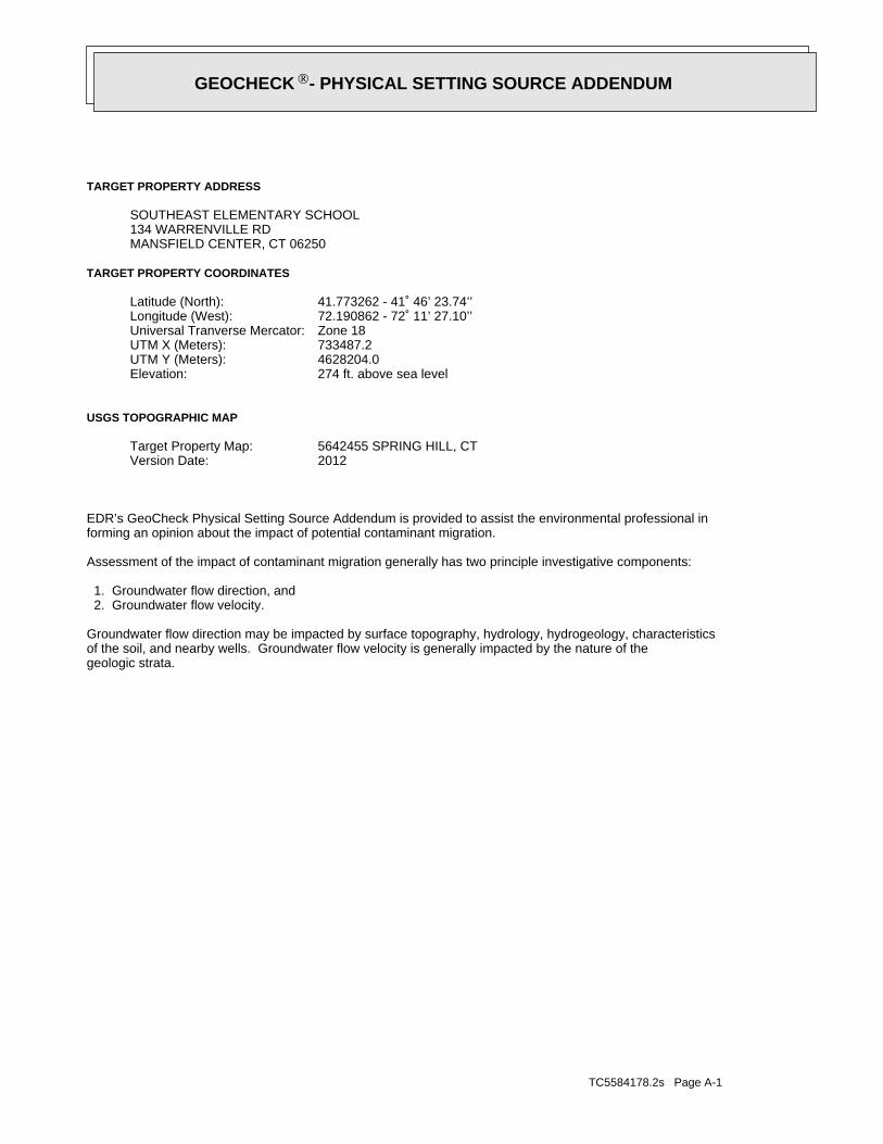
TC5584178.2s Page A-1
geologic strata.of the soil, and nearby wells. Groundwater flow velocity is generally impacted by the nature of theGroundwater flow direction may be impacted by surface topography, hydrology, hydrogeology, characteristics
2. Groundwater flow velocity. 1. Groundwater flow direction, and
Assessment of the impact of contaminant migration generally has two principle investigative components:
forming an opinion about the impact of potential contaminant migration.EDR’s GeoCheck Physical Setting Source Addendum is provided to assist the environmental professional in
2012Version Date:5642455 SPRING HILL, CTTarget Property Map:
USGS TOPOGRAPHIC MAP
274 ft. above sea levelElevation:4628204.0UTM Y (Meters): 733487.2UTM X (Meters): Zone 18Universal Tranverse Mercator: 72.190862 - 72˚ 11’ 27.10’’Longitude (West): 41.773262 - 41˚ 46’ 23.74’’Latitude (North):
TARGET PROPERTY COORDINATES
MANSFIELD CENTER, CT 06250134 WARRENVILLE RDSOUTHEAST ELEMENTARY SCHOOL
TARGET PROPERTY ADDRESS
®GEOCHECK - PHYSICAL SETTING SOURCE ADDENDUM®
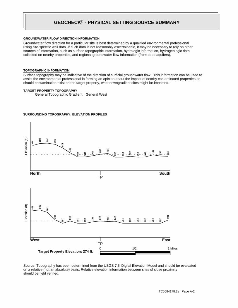
TC5584178.2s Page A-2
should be field verified.on a relative (not an absolute) basis. Relative elevation information between sites of close proximitySource: Topography has been determined from the USGS 7.5’ Digital Elevation Model and should be evaluated
SURROUNDING TOPOGRAPHY: ELEVATION PROFILES
Ele
vatio
n (f
t)E
leva
tion
(ft)
TP
TP0 1/2 1 Miles
✩Target Property Elevation: 274 ft.
North South
West East
258
262
271255
252
259
253
253
281
274264
255
255
287
325
353
362
361344354
360 341
282 255
274 255
255
267
274
269
271 255
255
255
255
255
255
281
General WestGeneral Topographic Gradient:TARGET PROPERTY TOPOGRAPHY
should contamination exist on the target property, what downgradient sites might be impacted.assist the environmental professional in forming an opinion about the impact of nearby contaminated properties or,Surface topography may be indicative of the direction of surficial groundwater flow. This information can be used toTOPOGRAPHIC INFORMATION
collected on nearby properties, and regional groundwater flow information (from deep aquifers).sources of information, such as surface topographic information, hydrologic information, hydrogeologic datausing site-specific well data. If such data is not reasonably ascertainable, it may be necessary to rely on otherGroundwater flow direction for a particular site is best determined by a qualified environmental professionalGROUNDWATER FLOW DIRECTION INFORMATION
®GEOCHECK - PHYSICAL SETTING SOURCE SUMMARY®
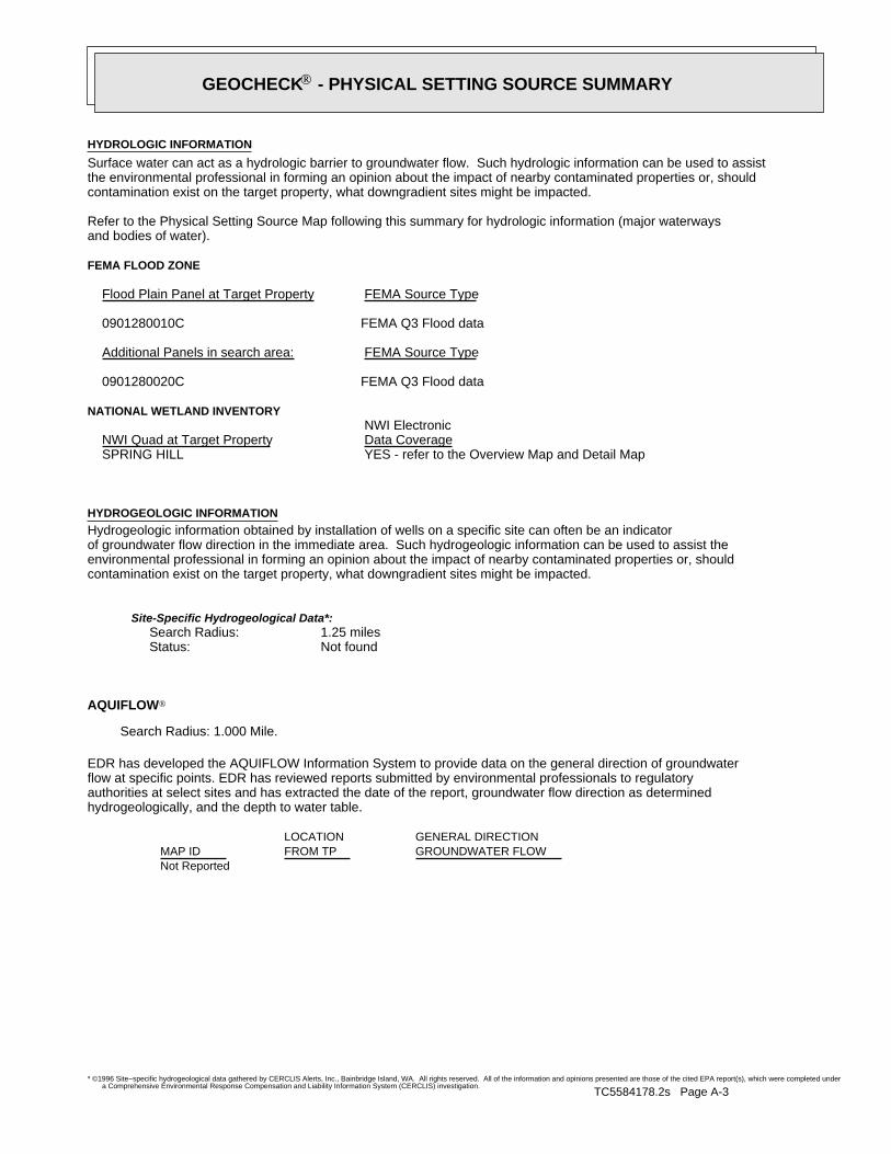
TC5584178.2s Page A-3
Not Reported
GENERAL DIRECTIONLOCATIONGROUNDWATER FLOWFROM TPMAP ID
hydrogeologically, and the depth to water table.authorities at select sites and has extracted the date of the report, groundwater flow direction as determinedflow at specific points. EDR has reviewed reports submitted by environmental professionals to regulatoryEDR has developed the AQUIFLOW Information System to provide data on the general direction of groundwater
AQUIFLOW®
Search Radius: 1.000 Mile.
Not found Status:1.25 miles Search Radius:
Site-Specific Hydrogeological Data*:
* ©1996 Site−specific hydrogeological data gathered by CERCLIS Alerts, Inc., Bainbridge Island, WA. All rights reserved. All of the information and opinions presented are those of the cited EPA report(s), which were completed undera Comprehensive Environmental Response Compensation and Liability Information System (CERCLIS) investigation.
contamination exist on the target property, what downgradient sites might be impacted.environmental professional in forming an opinion about the impact of nearby contaminated properties or, shouldof groundwater flow direction in the immediate area. Such hydrogeologic information can be used to assist theHydrogeologic information obtained by installation of wells on a specific site can often be an indicatorHYDROGEOLOGIC INFORMATION
YES - refer to the Overview Map and Detail MapSPRING HILL
NATIONAL WETLAND INVENTORYNWI ElectronicData CoverageNWI Quad at Target Property
FEMA Q3 Flood data0901280020C
Additional Panels in search area: FEMA Source Type
FEMA Q3 Flood data0901280010C
Flood Plain Panel at Target Property FEMA Source Type
FEMA FLOOD ZONE
and bodies of water).Refer to the Physical Setting Source Map following this summary for hydrologic information (major waterways
contamination exist on the target property, what downgradient sites might be impacted.the environmental professional in forming an opinion about the impact of nearby contaminated properties or, shouldSurface water can act as a hydrologic barrier to groundwater flow. Such hydrologic information can be used to assistHYDROLOGIC INFORMATION
®GEOCHECK - PHYSICAL SETTING SOURCE SUMMARY®
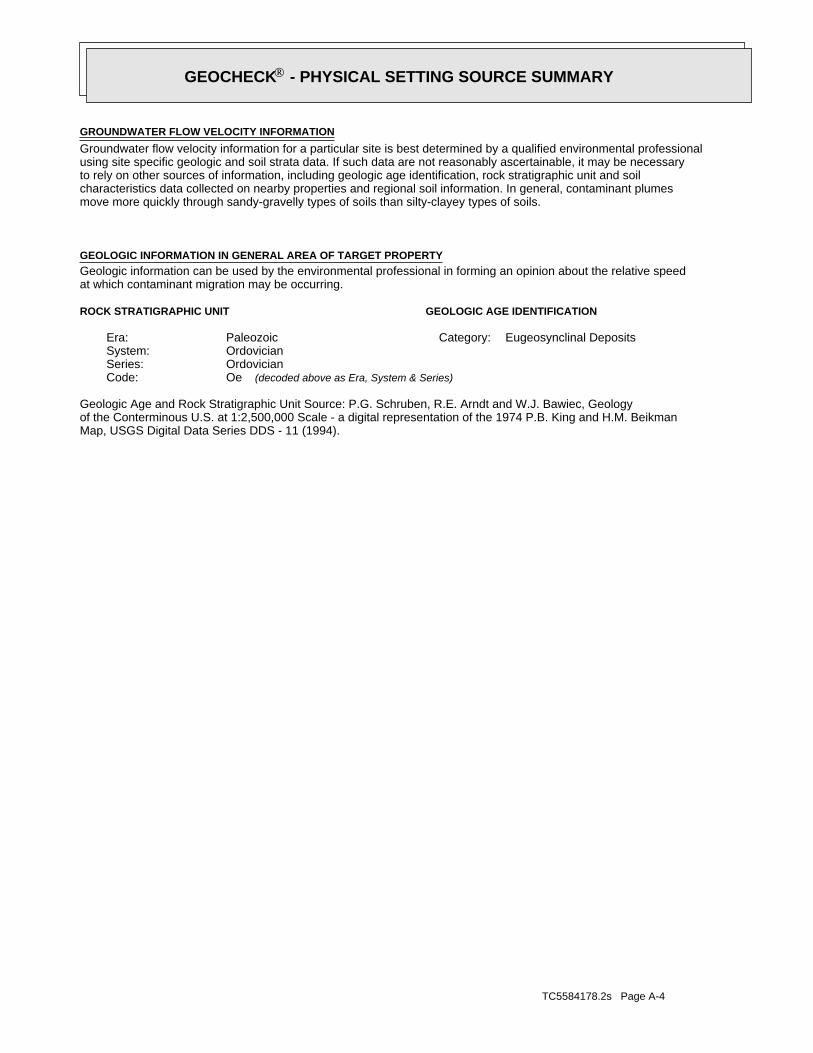
TC5584178.2s Page A-4
Map, USGS Digital Data Series DDS - 11 (1994).of the Conterminous U.S. at 1:2,500,000 Scale - a digital representation of the 1974 P.B. King and H.M. BeikmanGeologic Age and Rock Stratigraphic Unit Source: P.G. Schruben, R.E. Arndt and W.J. Bawiec, Geology
ROCK STRATIGRAPHIC UNIT GEOLOGIC AGE IDENTIFICATION
Eugeosynclinal DepositsCategory:PaleozoicEra:OrdovicianSystem:OrdovicianSeries:OeCode: (decoded above as Era, System & Series)
at which contaminant migration may be occurring.Geologic information can be used by the environmental professional in forming an opinion about the relative speedGEOLOGIC INFORMATION IN GENERAL AREA OF TARGET PROPERTY
move more quickly through sandy-gravelly types of soils than silty-clayey types of soils.characteristics data collected on nearby properties and regional soil information. In general, contaminant plumesto rely on other sources of information, including geologic age identification, rock stratigraphic unit and soilusing site specific geologic and soil strata data. If such data are not reasonably ascertainable, it may be necessaryGroundwater flow velocity information for a particular site is best determined by a qualified environmental professionalGROUNDWATER FLOW VELOCITY INFORMATION
®GEOCHECK - PHYSICAL SETTING SOURCE SUMMARY®
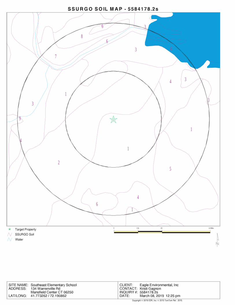
EDR Inc.EDR Inc.EDR Inc.EDR Inc.EDR Inc.EDR Inc.EDR Inc.EDR Inc.EDR Inc.EDR Inc.EDR Inc.EDR Inc.EDR Inc.EDR Inc.EDR Inc.EDR Inc.EDR Inc.EDR Inc.EDR Inc.EDR Inc.EDR Inc.EDR Inc.EDR Inc.EDR Inc.EDR Inc.EDR Inc.EDR Inc.EDR Inc.EDR Inc.EDR Inc.EDR Inc.EDR Inc.EDR Inc.EDR Inc.EDR Inc.EDR Inc.EDR Inc.EDR Inc.EDR Inc.EDR Inc.
6
86
3
37
6
4
3
1
2
3
1
1
3
9
5
4
46
1
0 1/16 1/8 1/4 Miles
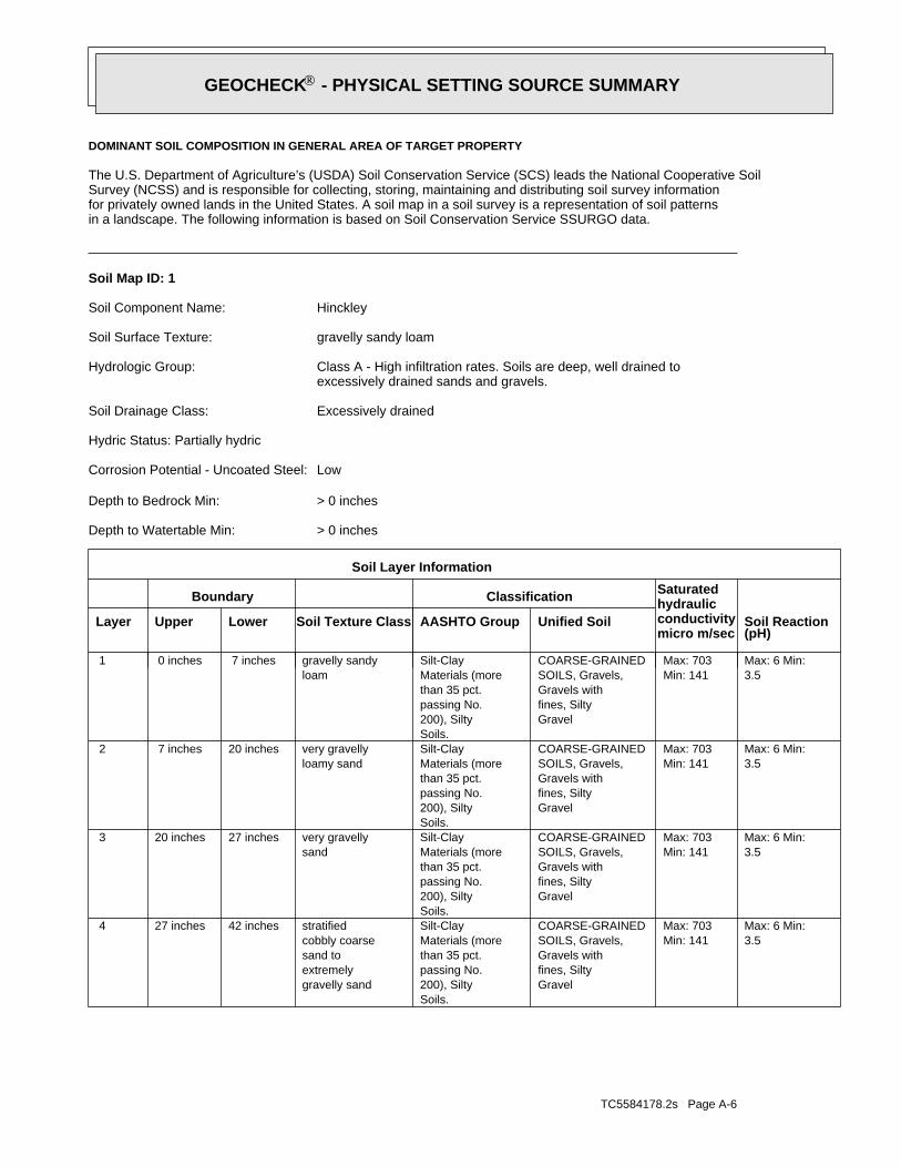
TC5584178.2s Page A-6
3.5Max: 6 Min:
Min: 141Max: 703
Gravelfines, SiltyGravels withSOILS, Gravels,COARSE-GRAINED
Soils.200), Siltypassing No.than 35 pct.Materials (moreSilt-Clay
gravelly sandextremelysand tocobbly coarsestratified42 inches27 inches 4
3.5Max: 6 Min:
Min: 141Max: 703
Gravelfines, SiltyGravels withSOILS, Gravels,COARSE-GRAINED
Soils.200), Siltypassing No.than 35 pct.Materials (moreSilt-Clay
sandvery gravelly27 inches20 inches 3
3.5Max: 6 Min:
Min: 141Max: 703
Gravelfines, SiltyGravels withSOILS, Gravels,COARSE-GRAINED
Soils.200), Siltypassing No.than 35 pct.Materials (moreSilt-Clay
loamy sandvery gravelly20 inches 7 inches 2
3.5Max: 6 Min:
Min: 141Max: 703
Gravelfines, SiltyGravels withSOILS, Gravels,COARSE-GRAINED
Soils.200), Siltypassing No.than 35 pct.Materials (moreSilt-Clay
loamgravelly sandy 7 inches 0 inches 1
Soil Layer Information
Boundary Classification Saturatedhydraulicconductivitymicro m/sec
Layer Upper Lower Soil Texture Class AASHTO Group Unified Soil Soil Reaction(pH)
> 0 inchesDepth to Watertable Min:
> 0 inchesDepth to Bedrock Min:
LowCorrosion Potential - Uncoated Steel:
Hydric Status: Partially hydric
Excessively drainedSoil Drainage Class:
excessively drained sands and gravels.Class A - High infiltration rates. Soils are deep, well drained toHydrologic Group:
gravelly sandy loamSoil Surface Texture:
HinckleySoil Component Name:
Soil Map ID: 1
in a landscape. The following information is based on Soil Conservation Service SSURGO data.for privately owned lands in the United States. A soil map in a soil survey is a representation of soil patternsSurvey (NCSS) and is responsible for collecting, storing, maintaining and distributing soil survey informationThe U.S. Department of Agriculture’s (USDA) Soil Conservation Service (SCS) leads the National Cooperative Soil
DOMINANT SOIL COMPOSITION IN GENERAL AREA OF TARGET PROPERTY
®GEOCHECK - PHYSICAL SETTING SOURCE SUMMARY®
TC5584178.2s Page A-7
5.1Max: 6 Min:
Min: 42Max: 703
Silty Sand.Sands with fines,SOILS, Sands,COARSE-GRAINEDsand.Poorly gradedClean Sands,SOILS, Sands,COARSE-GRAINED
Soils.200), Siltypassing No.than 35 pct.Materials (moreSilt-Claysandy loam 9 inches 0 inches 1
Soil Layer Information
Boundary Classification Saturatedhydraulicconductivitymicro m/sec
Layer Upper Lower Soil Texture Class AASHTO Group Unified Soil Soil Reaction(pH)
> 0 inchesDepth to Watertable Min:
> 0 inchesDepth to Bedrock Min:
LowCorrosion Potential - Uncoated Steel:
Hydric Status: Partially hydric
Somewhat excessively drainedSoil Drainage Class:
textures.moderately well and well drained soils with moderately coarseClass B - Moderate infiltration rates. Deep and moderately deep,Hydrologic Group:
sandy loamSoil Surface Texture:
MerrimacSoil Component Name:
Soil Map ID: 2
3.5Max: 6 Min:
Min: 141Max: 703
Gravelfines, SiltyGravels withSOILS, Gravels,COARSE-GRAINED
Soils.200), Siltypassing No.than 35 pct.Materials (moreSilt-Clay
gravelly sandextremelysand tocobbly coarsestratified59 inches42 inches 5
Soil Layer Information
Boundary Classification Saturatedhydraulicconductivitymicro m/sec
Layer Upper Lower Soil Texture Class AASHTO Group Unified Soil Soil Reaction(pH)
®GEOCHECK - PHYSICAL SETTING SOURCE SUMMARY®
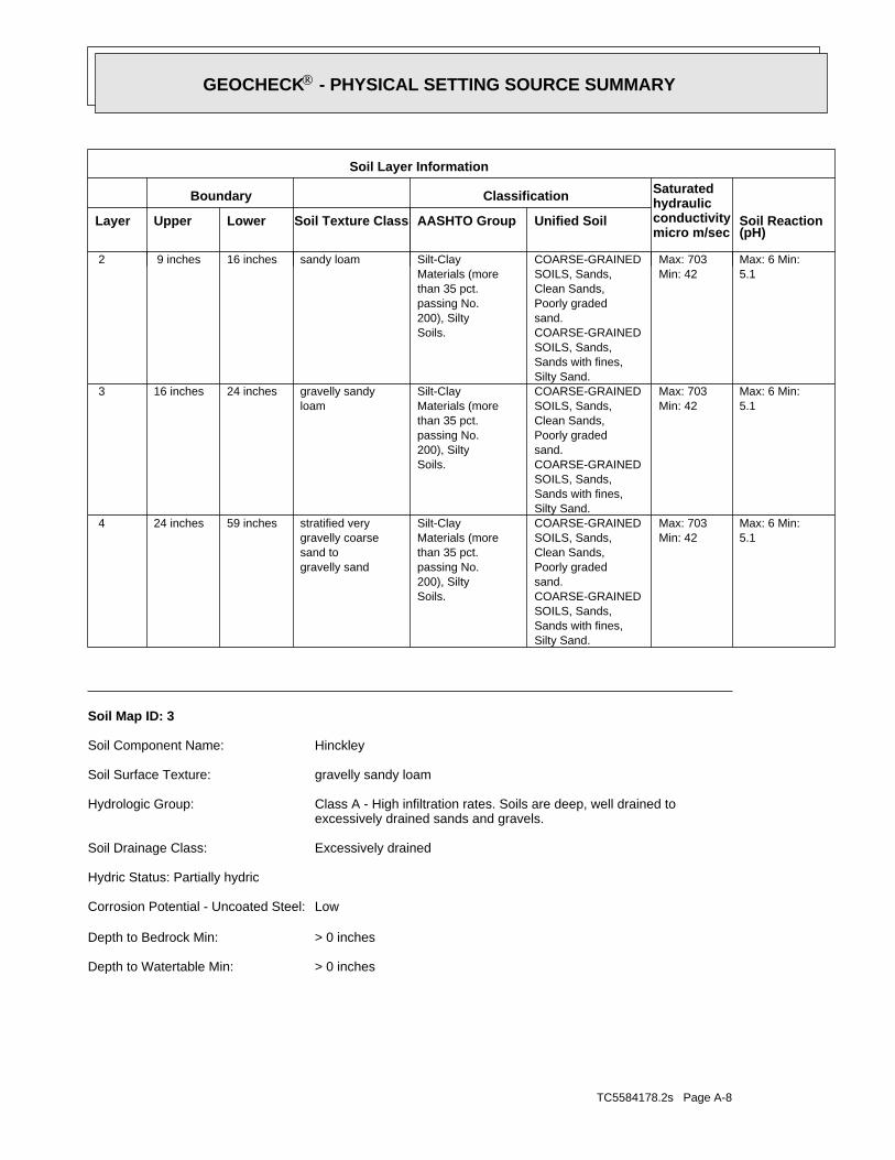
TC5584178.2s Page A-8
> 0 inchesDepth to Watertable Min:
> 0 inchesDepth to Bedrock Min:
LowCorrosion Potential - Uncoated Steel:
Hydric Status: Partially hydric
Excessively drainedSoil Drainage Class:
excessively drained sands and gravels.Class A - High infiltration rates. Soils are deep, well drained toHydrologic Group:
gravelly sandy loamSoil Surface Texture:
HinckleySoil Component Name:
Soil Map ID: 3
5.1Max: 6 Min:
Min: 42Max: 703
Silty Sand.Sands with fines,SOILS, Sands,COARSE-GRAINEDsand.Poorly gradedClean Sands,SOILS, Sands,COARSE-GRAINED
Soils.200), Siltypassing No.than 35 pct.Materials (moreSilt-Clay
gravelly sandsand togravelly coarsestratified very59 inches24 inches 4
5.1Max: 6 Min:
Min: 42Max: 703
Silty Sand.Sands with fines,SOILS, Sands,COARSE-GRAINEDsand.Poorly gradedClean Sands,SOILS, Sands,COARSE-GRAINED
Soils.200), Siltypassing No.than 35 pct.Materials (moreSilt-Clay
loamgravelly sandy24 inches16 inches 3
5.1Max: 6 Min:
Min: 42Max: 703
Silty Sand.Sands with fines,SOILS, Sands,COARSE-GRAINEDsand.Poorly gradedClean Sands,SOILS, Sands,COARSE-GRAINED
Soils.200), Siltypassing No.than 35 pct.Materials (moreSilt-Claysandy loam16 inches 9 inches 2
Soil Layer Information
Boundary Classification Saturatedhydraulicconductivitymicro m/sec
Layer Upper Lower Soil Texture Class AASHTO Group Unified Soil Soil Reaction(pH)
®GEOCHECK - PHYSICAL SETTING SOURCE SUMMARY®
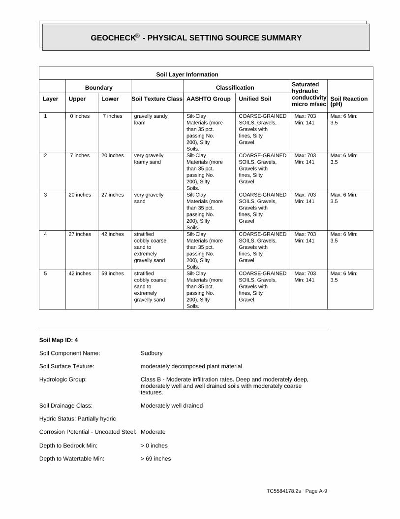
TC5584178.2s Page A-9
> 69 inchesDepth to Watertable Min:
> 0 inchesDepth to Bedrock Min:
ModerateCorrosion Potential - Uncoated Steel:
Hydric Status: Partially hydric
Moderately well drainedSoil Drainage Class:
textures.moderately well and well drained soils with moderately coarseClass B - Moderate infiltration rates. Deep and moderately deep,Hydrologic Group:
moderately decomposed plant materialSoil Surface Texture:
SudburySoil Component Name:
Soil Map ID: 4
3.5Max: 6 Min:
Min: 141Max: 703
Gravelfines, SiltyGravels withSOILS, Gravels,COARSE-GRAINED
Soils.200), Siltypassing No.than 35 pct.Materials (moreSilt-Clay
gravelly sandextremelysand tocobbly coarsestratified59 inches42 inches 5
3.5Max: 6 Min:
Min: 141Max: 703
Gravelfines, SiltyGravels withSOILS, Gravels,COARSE-GRAINED
Soils.200), Siltypassing No.than 35 pct.Materials (moreSilt-Clay
gravelly sandextremelysand tocobbly coarsestratified42 inches27 inches 4
3.5Max: 6 Min:
Min: 141Max: 703
Gravelfines, SiltyGravels withSOILS, Gravels,COARSE-GRAINED
Soils.200), Siltypassing No.than 35 pct.Materials (moreSilt-Clay
sandvery gravelly27 inches20 inches 3
3.5Max: 6 Min:
Min: 141Max: 703
Gravelfines, SiltyGravels withSOILS, Gravels,COARSE-GRAINED
Soils.200), Siltypassing No.than 35 pct.Materials (moreSilt-Clay
loamy sandvery gravelly20 inches 7 inches 2
3.5Max: 6 Min:
Min: 141Max: 703
Gravelfines, SiltyGravels withSOILS, Gravels,COARSE-GRAINED
Soils.200), Siltypassing No.than 35 pct.Materials (moreSilt-Clay
loamgravelly sandy 7 inches 0 inches 1
Soil Layer Information
Boundary Classification Saturatedhydraulicconductivitymicro m/sec
Layer Upper Lower Soil Texture Class AASHTO Group Unified Soil Soil Reaction(pH)
®GEOCHECK - PHYSICAL SETTING SOURCE SUMMARY®
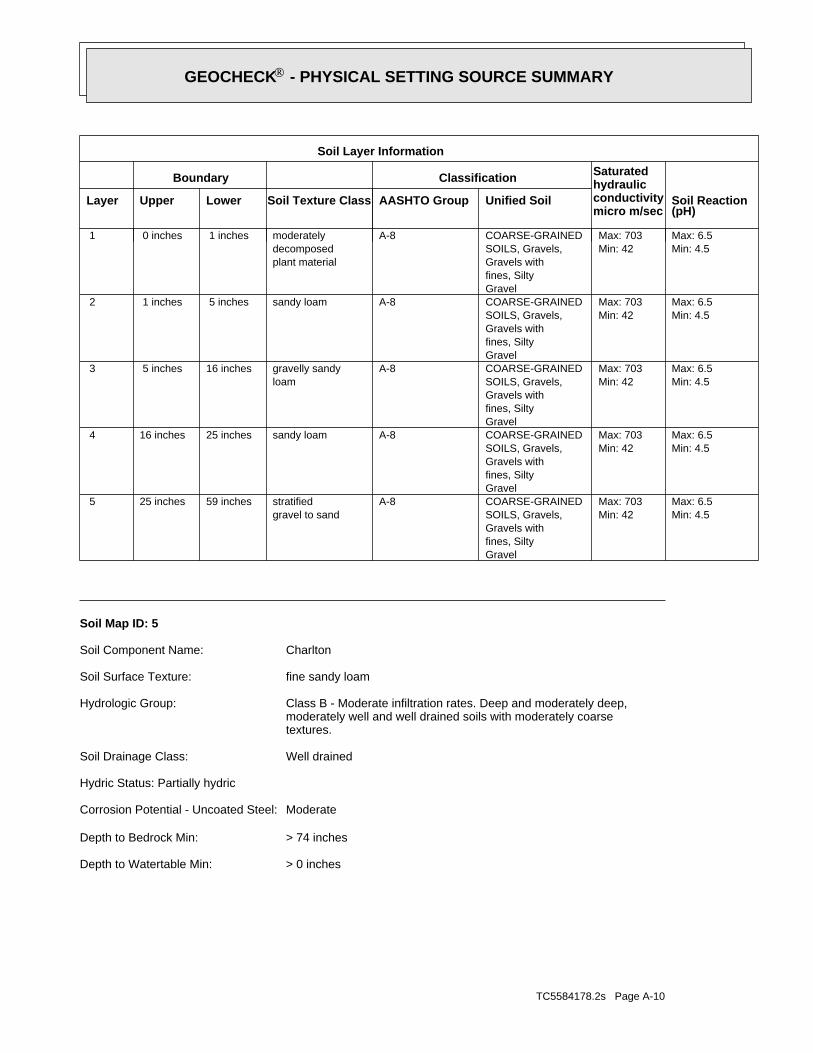
TC5584178.2s Page A-10
> 0 inchesDepth to Watertable Min:
> 74 inchesDepth to Bedrock Min:
ModerateCorrosion Potential - Uncoated Steel:
Hydric Status: Partially hydric
Well drainedSoil Drainage Class:
textures.moderately well and well drained soils with moderately coarseClass B - Moderate infiltration rates. Deep and moderately deep,Hydrologic Group:
fine sandy loamSoil Surface Texture:
CharltonSoil Component Name:
Soil Map ID: 5
Min: 4.5Max: 6.5
Min: 42Max: 703
Gravelfines, SiltyGravels withSOILS, Gravels,COARSE-GRAINEDA-8
gravel to sandstratified59 inches25 inches 5
Min: 4.5Max: 6.5
Min: 42Max: 703
Gravelfines, SiltyGravels withSOILS, Gravels,COARSE-GRAINEDA-8sandy loam25 inches16 inches 4
Min: 4.5Max: 6.5
Min: 42Max: 703
Gravelfines, SiltyGravels withSOILS, Gravels,COARSE-GRAINEDA-8
loamgravelly sandy16 inches 5 inches 3
Min: 4.5Max: 6.5
Min: 42Max: 703
Gravelfines, SiltyGravels withSOILS, Gravels,COARSE-GRAINEDA-8sandy loam 5 inches 1 inches 2
Min: 4.5Max: 6.5
Min: 42Max: 703
Gravelfines, SiltyGravels withSOILS, Gravels,COARSE-GRAINEDA-8
plant materialdecomposedmoderately 1 inches 0 inches 1
Soil Layer Information
Boundary Classification Saturatedhydraulicconductivitymicro m/sec
Layer Upper Lower Soil Texture Class AASHTO Group Unified Soil Soil Reaction(pH)
®GEOCHECK - PHYSICAL SETTING SOURCE SUMMARY®
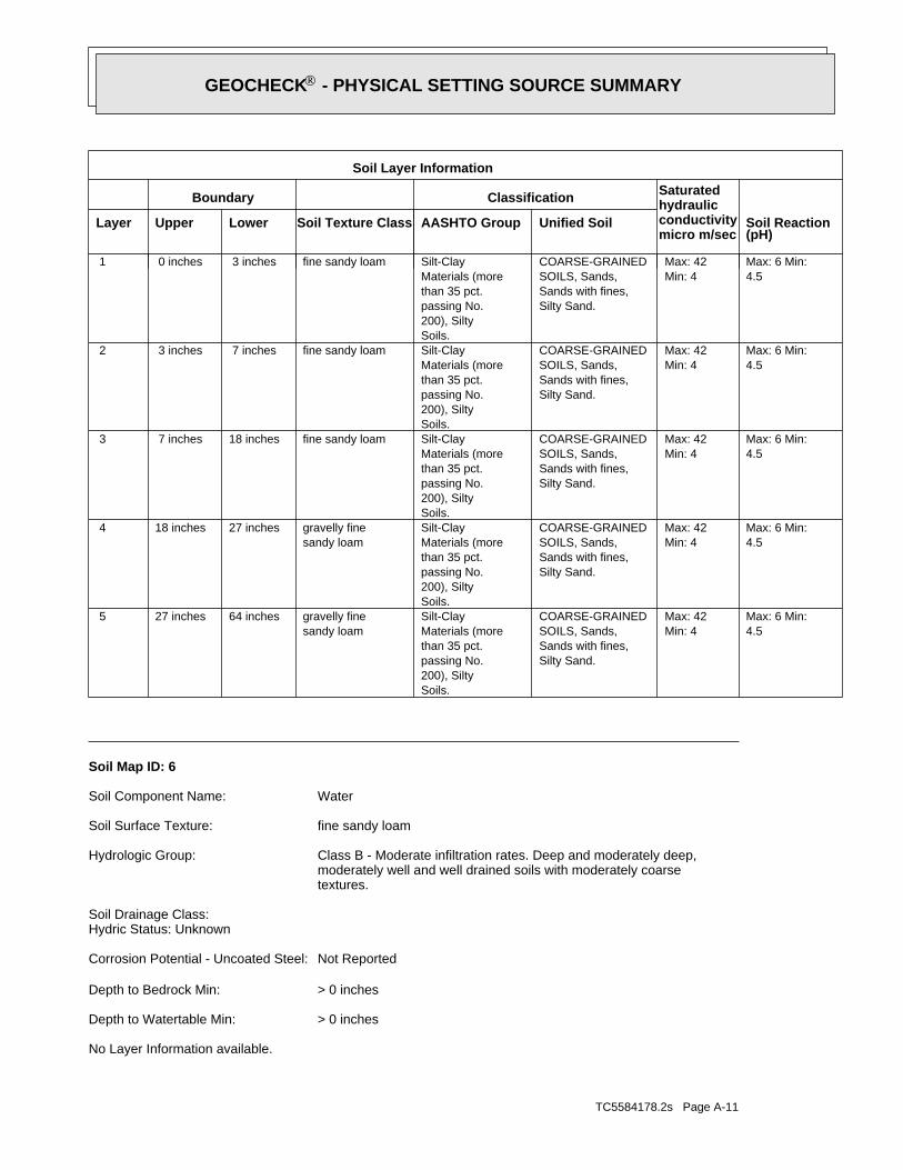
TC5584178.2s Page A-11
No Layer Information available.
> 0 inchesDepth to Watertable Min:
> 0 inchesDepth to Bedrock Min:
Not ReportedCorrosion Potential - Uncoated Steel:
Hydric Status: UnknownSoil Drainage Class:
textures.moderately well and well drained soils with moderately coarseClass B - Moderate infiltration rates. Deep and moderately deep,Hydrologic Group:
fine sandy loamSoil Surface Texture:
WaterSoil Component Name:
Soil Map ID: 6
4.5Max: 6 Min:
Min: 4Max: 42
Silty Sand.Sands with fines,SOILS, Sands,COARSE-GRAINED
Soils.200), Siltypassing No.than 35 pct.Materials (moreSilt-Clay
sandy loamgravelly fine64 inches27 inches 5
4.5Max: 6 Min:
Min: 4Max: 42
Silty Sand.Sands with fines,SOILS, Sands,COARSE-GRAINED
Soils.200), Siltypassing No.than 35 pct.Materials (moreSilt-Clay
sandy loamgravelly fine27 inches18 inches 4
4.5Max: 6 Min:
Min: 4Max: 42
Silty Sand.Sands with fines,SOILS, Sands,COARSE-GRAINED
Soils.200), Siltypassing No.than 35 pct.Materials (moreSilt-Clayfine sandy loam18 inches 7 inches 3
4.5Max: 6 Min:
Min: 4Max: 42
Silty Sand.Sands with fines,SOILS, Sands,COARSE-GRAINED
Soils.200), Siltypassing No.than 35 pct.Materials (moreSilt-Clayfine sandy loam 7 inches 3 inches 2
4.5Max: 6 Min:
Min: 4Max: 42
Silty Sand.Sands with fines,SOILS, Sands,COARSE-GRAINED
Soils.200), Siltypassing No.than 35 pct.Materials (moreSilt-Clayfine sandy loam 3 inches 0 inches 1
Soil Layer Information
Boundary Classification Saturatedhydraulicconductivitymicro m/sec
Layer Upper Lower Soil Texture Class AASHTO Group Unified Soil Soil Reaction(pH)
®GEOCHECK - PHYSICAL SETTING SOURCE SUMMARY®
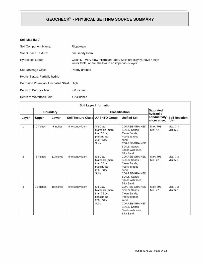
TC5584178.2s Page A-12
Min: 5.6Max: 7.3
Min: 42Max: 703
Silty Sand.Sands with fines,SOILS, Sands,COARSE-GRAINEDsand.Poorly gradedClean Sands,SOILS, Sands,COARSE-GRAINED
Soils.200), Siltypassing No.than 35 pct.Materials (moreSilt-Clayfine sandy loam18 inches11 inches 3
Min: 5.6Max: 7.3
Min: 42Max: 703
Silty Sand.Sands with fines,SOILS, Sands,COARSE-GRAINEDsand.Poorly gradedClean Sands,SOILS, Sands,COARSE-GRAINED
Soils.200), Siltypassing No.than 35 pct.Materials (moreSilt-Clayfine sandy loam11 inches 5 inches 2
Min: 5.6Max: 7.3
Min: 42Max: 703
Silty Sand.Sands with fines,SOILS, Sands,COARSE-GRAINEDsand.Poorly gradedClean Sands,SOILS, Sands,COARSE-GRAINED
Soils.200), Siltypassing No.than 35 pct.Materials (moreSilt-Clayfine sandy loam 5 inches 0 inches 1
Soil Layer Information
Boundary Classification Saturatedhydraulicconductivitymicro m/sec
Layer Upper Lower Soil Texture Class AASHTO Group Unified Soil Soil Reaction(pH)
> 23 inchesDepth to Watertable Min:
> 0 inchesDepth to Bedrock Min:
HighCorrosion Potential - Uncoated Steel:
Hydric Status: Partially hydric
Poorly drainedSoil Drainage Class:
water table, or are shallow to an impervious layer.Class D - Very slow infiltration rates. Soils are clayey, have a highHydrologic Group:
fine sandy loamSoil Surface Texture:
RippowamSoil Component Name:
Soil Map ID: 7
®GEOCHECK - PHYSICAL SETTING SOURCE SUMMARY®
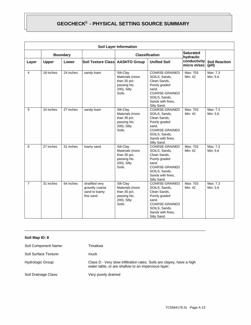
TC5584178.2s Page A-13
Very poorly drainedSoil Drainage Class:
water table, or are shallow to an impervious layer.Class D - Very slow infiltration rates. Soils are clayey, have a highHydrologic Group:
muckSoil Surface Texture:
TimakwaSoil Component Name:
Soil Map ID: 8
Min: 5.6Max: 7.3
Min: 42Max: 703
Silty Sand.Sands with fines,SOILS, Sands,COARSE-GRAINEDsand.Poorly gradedClean Sands,SOILS, Sands,COARSE-GRAINED
Soils.200), Siltypassing No.than 35 pct.Materials (moreSilt-Clay
fine sandsand to loamygravelly coarsestratified very64 inches31 inches 7
Min: 5.6Max: 7.3
Min: 42Max: 703
Silty Sand.Sands with fines,SOILS, Sands,COARSE-GRAINEDsand.Poorly gradedClean Sands,SOILS, Sands,COARSE-GRAINED
Soils.200), Siltypassing No.than 35 pct.Materials (moreSilt-Clayloamy sand31 inches27 inches 6
Min: 5.6Max: 7.3
Min: 42Max: 703
Silty Sand.Sands with fines,SOILS, Sands,COARSE-GRAINEDsand.Poorly gradedClean Sands,SOILS, Sands,COARSE-GRAINED
Soils.200), Siltypassing No.than 35 pct.Materials (moreSilt-Claysandy loam27 inches24 inches 5
Min: 5.6Max: 7.3
Min: 42Max: 703
Silty Sand.Sands with fines,SOILS, Sands,COARSE-GRAINEDsand.Poorly gradedClean Sands,SOILS, Sands,COARSE-GRAINED
Soils.200), Siltypassing No.than 35 pct.Materials (moreSilt-Claysandy loam24 inches18 inches 4
Soil Layer Information
Boundary Classification Saturatedhydraulicconductivitymicro m/sec
Layer Upper Lower Soil Texture Class AASHTO Group Unified Soil Soil Reaction(pH)
®GEOCHECK - PHYSICAL SETTING SOURCE SUMMARY®
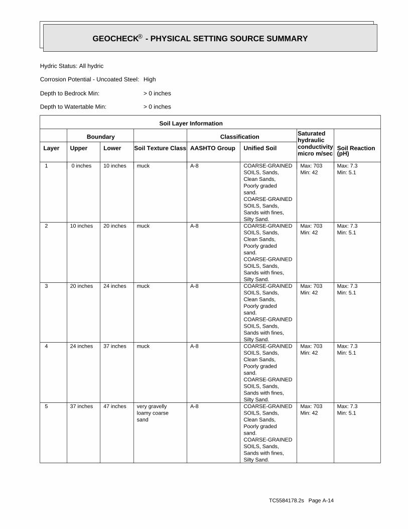
TC5584178.2s Page A-14
Min: 5.1Max: 7.3
Min: 42Max: 703
Silty Sand.Sands with fines,SOILS, Sands,COARSE-GRAINEDsand.Poorly gradedClean Sands,SOILS, Sands,COARSE-GRAINEDA-8
sandloamy coarsevery gravelly47 inches37 inches 5
Min: 5.1Max: 7.3
Min: 42Max: 703
Silty Sand.Sands with fines,SOILS, Sands,COARSE-GRAINEDsand.Poorly gradedClean Sands,SOILS, Sands,COARSE-GRAINEDA-8muck37 inches24 inches 4
Min: 5.1Max: 7.3
Min: 42Max: 703
Silty Sand.Sands with fines,SOILS, Sands,COARSE-GRAINEDsand.Poorly gradedClean Sands,SOILS, Sands,COARSE-GRAINEDA-8muck24 inches20 inches 3
Min: 5.1Max: 7.3
Min: 42Max: 703
Silty Sand.Sands with fines,SOILS, Sands,COARSE-GRAINEDsand.Poorly gradedClean Sands,SOILS, Sands,COARSE-GRAINEDA-8muck20 inches10 inches 2
Min: 5.1Max: 7.3
Min: 42Max: 703
Silty Sand.Sands with fines,SOILS, Sands,COARSE-GRAINEDsand.Poorly gradedClean Sands,SOILS, Sands,COARSE-GRAINEDA-8muck10 inches 0 inches 1
Soil Layer Information
Boundary Classification Saturatedhydraulicconductivitymicro m/sec
Layer Upper Lower Soil Texture Class AASHTO Group Unified Soil Soil Reaction(pH)
> 0 inchesDepth to Watertable Min:
> 0 inchesDepth to Bedrock Min:
HighCorrosion Potential - Uncoated Steel:
Hydric Status: All hydric
®GEOCHECK - PHYSICAL SETTING SOURCE SUMMARY®
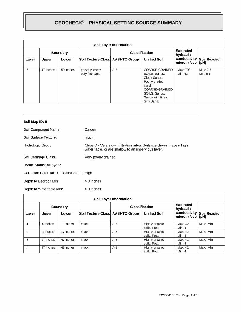
TC5584178.2s Page A-15
Max: Min: Min: 4Max: 42
soils, Peat.Highly organicA-8muck48 inches47 inches 4
Max: Min: Min: 4Max: 42
soils, Peat.Highly organicA-8muck47 inches17 inches 3
Max: Min: Min: 4Max: 42
soils, Peat.Highly organicA-8muck17 inches 1 inches 2
Max: Min: Min: 4Max: 42
soils, Peat.Highly organicA-8muck 1 inches 0 inches 1
Soil Layer Information
Boundary Classification Saturatedhydraulicconductivitymicro m/sec
Layer Upper Lower Soil Texture Class AASHTO Group Unified Soil Soil Reaction(pH)
> 0 inchesDepth to Watertable Min:
> 0 inchesDepth to Bedrock Min:
HighCorrosion Potential - Uncoated Steel:
Hydric Status: All hydric
Very poorly drainedSoil Drainage Class:
water table, or are shallow to an impervious layer.Class D - Very slow infiltration rates. Soils are clayey, have a highHydrologic Group:
muckSoil Surface Texture:
CatdenSoil Component Name:
Soil Map ID: 9
Min: 5.1Max: 7.3
Min: 42Max: 703
Silty Sand.Sands with fines,SOILS, Sands,COARSE-GRAINEDsand.Poorly gradedClean Sands,SOILS, Sands,COARSE-GRAINEDA-8
very fine sandgravelly loamy59 inches47 inches 6
Soil Layer Information
Boundary Classification Saturatedhydraulicconductivitymicro m/sec
Layer Upper Lower Soil Texture Class AASHTO Group Unified Soil Soil Reaction(pH)
®GEOCHECK - PHYSICAL SETTING SOURCE SUMMARY®
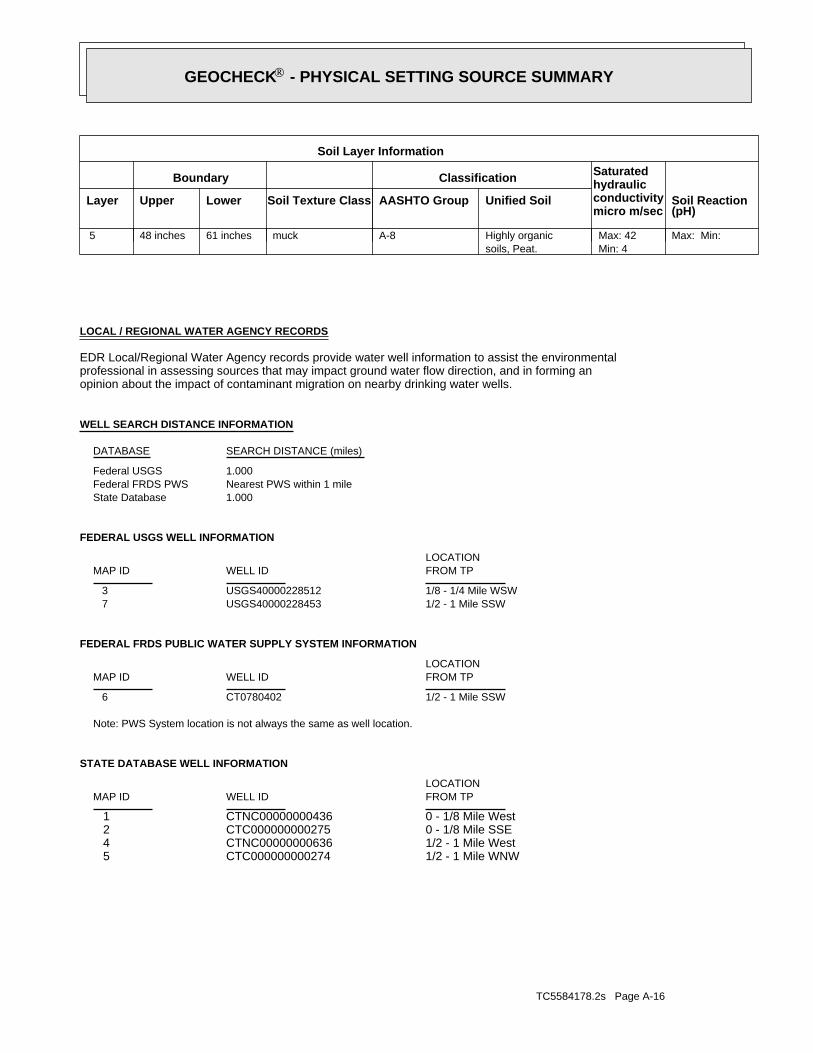
TC5584178.2s Page A-16
1/2 - 1 Mile WNWCTC000000000274 51/2 - 1 Mile WestCTNC00000000636 40 - 1/8 Mile SSECTC000000000275 20 - 1/8 Mile WestCTNC00000000436 1
STATE DATABASE WELL INFORMATION
LOCATIONFROM TPWELL IDMAP ID
Note: PWS System location is not always the same as well location.
1/2 - 1 Mile SSWCT0780402 6
FEDERAL FRDS PUBLIC WATER SUPPLY SYSTEM INFORMATION
LOCATIONFROM TPWELL IDMAP ID
1/2 - 1 Mile SSWUSGS40000228453 71/8 - 1/4 Mile WSWUSGS40000228512 3
FEDERAL USGS WELL INFORMATION
LOCATIONFROM TPWELL IDMAP ID
1.000State DatabaseNearest PWS within 1 mileFederal FRDS PWS1.000Federal USGS
WELL SEARCH DISTANCE INFORMATION
SEARCH DISTANCE (miles)DATABASE
opinion about the impact of contaminant migration on nearby drinking water wells.professional in assessing sources that may impact ground water flow direction, and in forming anEDR Local/Regional Water Agency records provide water well information to assist the environmental
LOCAL / REGIONAL WATER AGENCY RECORDS
Max: Min: Min: 4Max: 42
soils, Peat.Highly organicA-8muck61 inches48 inches 5
Soil Layer Information
Boundary Classification Saturatedhydraulicconductivitymicro m/sec
Layer Upper Lower Soil Texture Class AASHTO Group Unified Soil Soil Reaction(pH)
®GEOCHECK - PHYSICAL SETTING SOURCE SUMMARY®
TC5584178.2s Page A-17
1/2 - 1 Mile SouthCTNC00000000163 8
STATE DATABASE WELL INFORMATION
LOCATIONFROM TPWELL IDMAP ID
®GEOCHECK - PHYSICAL SETTING SOURCE SUMMARY®
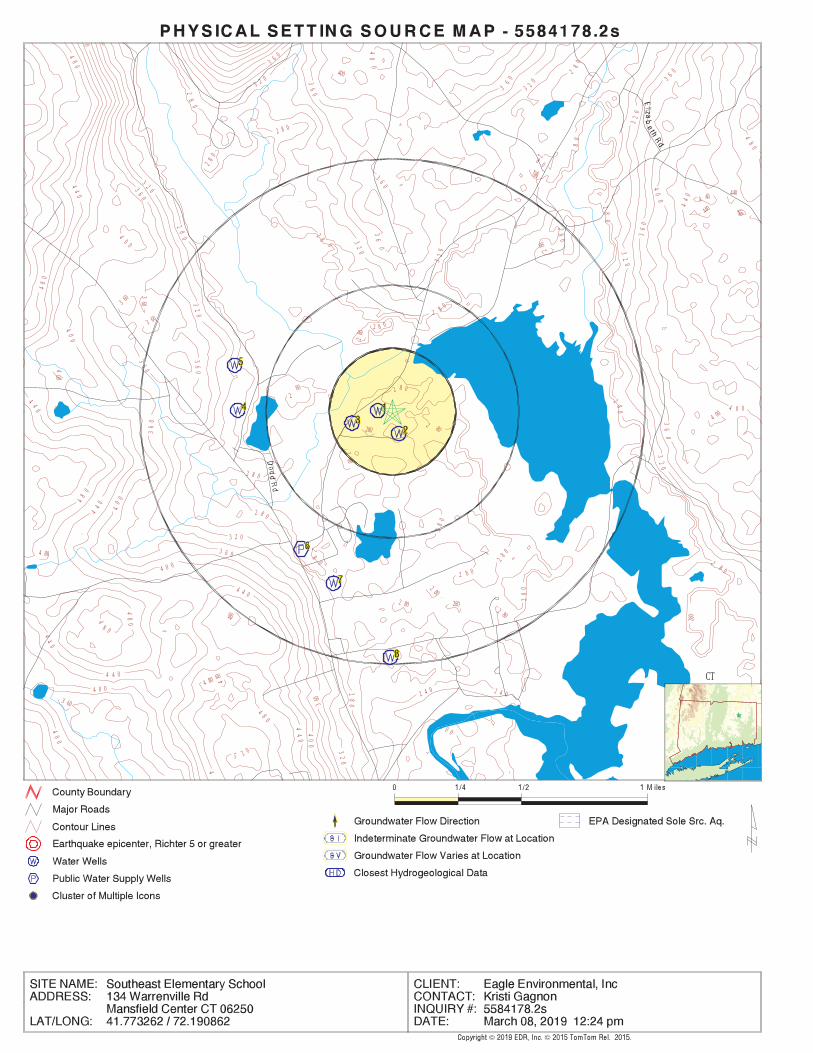
EDR Inc.EDR Inc.EDR Inc.EDR Inc.EDR Inc.EDR Inc.EDR Inc.EDR Inc.EDR Inc.EDR Inc.EDR Inc.EDR Inc.EDR Inc.EDR Inc.EDR Inc.EDR Inc.EDR Inc.EDR Inc.EDR Inc.EDR Inc.EDR Inc.EDR Inc.EDR Inc.EDR Inc.EDR Inc.EDR Inc.EDR Inc.EDR Inc.EDR Inc.EDR Inc.EDR Inc.EDR Inc.EDR Inc.EDR Inc.EDR Inc.EDR Inc.EDR Inc.EDR Inc.EDR Inc.EDR Inc.
40
0
400 2
80
2
8 028
0
48
0
280
4404 40
440440
4
0 0
3 60
36
0 280
28
0
3603 60
3 602 8 0
280
44
0
400
2 8 02
80
4 00
40
0
4 0 0
280
280
4 80
28
0 28 0
2 802
80
2 8 0
2 80
28
0
2 80 280
480 2 80
4
8 0
48
0
480
4 80
3 60
5 2 0
48
0
48
0
48
0
44
0
4 4 0
44
0
4 40
44
0
40
0
4 0 0
4 8 0
4
44
0
4 4 0
40
0
4 0 0
40
0
40
0
0
360
3 6 0
36
0
36
0
36
0
36
0
3 6 0
36
0 3
60 3 6 0
36
0
36
0
2 0 0
2 4 0 2 4 028
0
2 8 0
2 8 0
28
02
80
2 8 0
2 80
2 8 0
28
0
28
02 8
0
2
8 0
280
32
0
3 2 0
32
0
3 2 0
3 2 0
32
0
32
0
3 20
32
0
32
0
32
0
CT
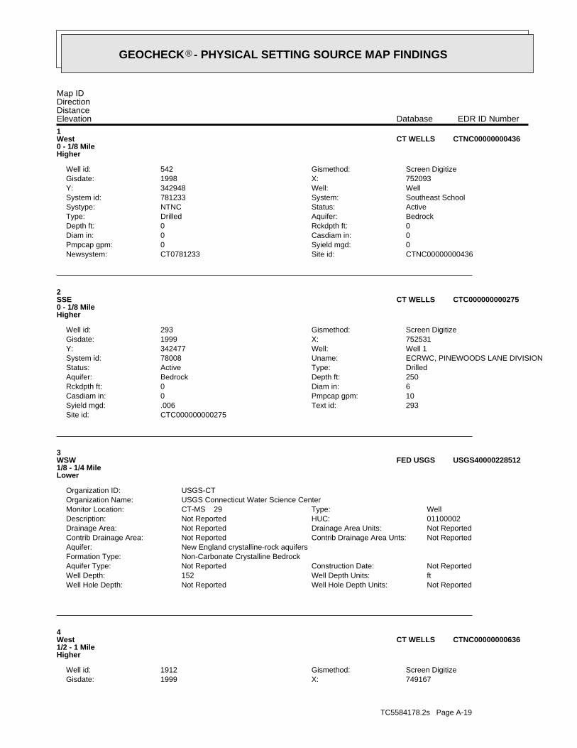
TC5584178.2s Page A-19
749167X:1999Gisdate:Screen DigitizeGismethod:1912Well id:
4West1/2 - 1 MileHigher
CTNC00000000636CT WELLS
Not ReportedWell Hole Depth Units: Not ReportedWell Hole Depth: ftWell Depth Units: 152Well Depth: Not ReportedConstruction Date: Not ReportedAquifer Type:
Non-Carbonate Crystalline BedrockFormation Type: New England crystalline-rock aquifersAquifer:
Not ReportedContrib Drainage Area Unts: Not ReportedContrib Drainage Area: Not ReportedDrainage Area Units: Not ReportedDrainage Area: 01100002HUC: Not ReportedDescription: WellType: CT-MS 29Monitor Location:
USGS Connecticut Water Science CenterOrganization Name: USGS-CTOrganization ID:
3WSW1/8 - 1/4 MileLower
USGS40000228512FED USGS
CTC000000000275Site id:293Text id:.006Syield mgd:10Pmpcap gpm:0Casdiam in:6Diam in:0Rckdpth ft:250Depth ft:BedrockAquifer:DrilledType:ActiveStatus:ECRWC, PINEWOODS LANE DIVISIONUname:78008System id:Well 1Well:342477Y:752531X:1999Gisdate:Screen DigitizeGismethod:293Well id:
2SSE0 - 1/8 MileHigher
CTC000000000275CT WELLS
CTNC00000000436Site id:CT0781233Newsystem:0Syield mgd:0Pmpcap gpm:0Casdiam in:0Diam in:0Rckdpth ft:0Depth ft:BedrockAquifer:DrilledType:ActiveStatus:NTNCSystype:Southeast SchoolSystem:781233System id:WellWell:342948Y:752093X:1998Gisdate:Screen DigitizeGismethod:542Well id:
1West0 - 1/8 MileHigher
CTNC00000000436CT WELLS
Map IDDirectionDistanceElevation EDR ID NumberDatabase
®GEOCHECK - PHYSICAL SETTING SOURCE MAP FINDINGS®
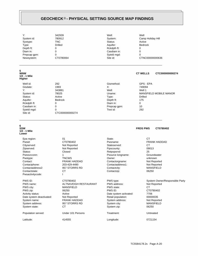
TC5584178.2s Page A-20
0721154Longitude: 414555Latitude:
UntreatedTreatment: Under 101 PersonsPopulation served:
06250System zip: CTSystem state: MANSFIELDSystem city: 957 STORRS RDSystem address: Not ReportedSystem address: FRANK HADDADSystem name: 00000035Retail population: Not ReportedDate system deactivated: 7706Date system activated: ActiveActivity status: CT0780402PWS ID: 06250PWS zip: CTPWS state: MANSFIELDPWS city: Not ReportedPWS address: ALTNAVEIGH RESTAURANTPWS name: System Owner/Responsible PartyPWS type: CT0780402PWS ID:
IPwsactivitycode: 06250Contactzip: CTContactstate: MANSFIELDContactcity: 957 STORRS RDContactaddress2: Not ReportedContactaddress1: 203-429-4490Contactphone: Not ReportedContactorgname: FRANK HADDADContact: unknownOwner: TNCWSPwstype: GroundwaterPsource longname: 1Pwssvcconn: 25Retpopsrvd: ClosedStatus: 09013Fipscounty: Not ReportedZipserved: CTStateserved: Not ReportedCityserved: FRANK HADDADPwsname: CT0780402Pwsid: CTState: 01Epa region:
6SSW1/2 - 1 MileLower
CT0780402FRDS PWS
CTC000000000274Site id:292Text id:0Syield mgd:10Pmpcap gpm:0Casdiam in:0Diam in:0Rckdpth ft:175Depth ft:BedrockAquifer:DrilledType:ActiveStatus:MANSFIELD MOBILE MANORUname:78025System id:Well 1Well:343881Y:749094X:1993Gisdate:GPS - EPAGismethod:292Well id:
5WNW1/2 - 1 MileHigher
CTC000000000274CT WELLS
CTNC00000000636Site id:CT0780064Newsystem:0Syield mgd:0Pmpcap gpm:0Casdiam in:0Diam in:0Rckdpth ft:0Depth ft:BedrockAquifer:DrilledType:ActiveStatus:TNCSystype:Camp Holiday HillSystem:780912System id:WellWell:342939Y:
®GEOCHECK - PHYSICAL SETTING SOURCE MAP FINDINGS®
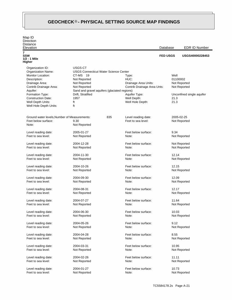
TC5584178.2s Page A-21
Not ReportedNote: Not ReportedFeet to sea level: 10.73Feet below surface: 2004-01-27Level reading date:
Not ReportedNote: Not ReportedFeet to sea level: 11.11Feet below surface: 2004-02-26Level reading date:
Not ReportedNote: Not ReportedFeet to sea level: 10.95Feet below surface: 2004-03-31Level reading date:
Not ReportedNote: Not ReportedFeet to sea level: 8.55Feet below surface: 2004-04-28Level reading date:
Not ReportedNote: Not ReportedFeet to sea level: 9.12Feet below surface: 2004-05-26Level reading date:
Not ReportedNote: Not ReportedFeet to sea level: 10.03Feet below surface: 2004-06-30Level reading date:
Not ReportedNote: Not ReportedFeet to sea level: 11.64Feet below surface: 2004-07-27Level reading date:
Not ReportedNote: Not ReportedFeet to sea level: 12.17Feet below surface: 2004-08-31Level reading date:
Not ReportedNote: Not ReportedFeet to sea level: 12.09Feet below surface: 2004-09-30Level reading date:
Not ReportedNote: Not ReportedFeet to sea level: 12.15Feet below surface: 2004-10-26Level reading date:
Not ReportedNote: Not ReportedFeet to sea level: 12.14Feet below surface: 2004-11-30Level reading date:
Not ReportedNote: Not ReportedFeet to sea level: Not ReportedFeet below surface: 2004-12-28Level reading date:
Not ReportedNote: Not ReportedFeet to sea level: 9.34Feet below surface: 2005-01-27Level reading date:
Not ReportedNote: Not ReportedFeet to sea level: 9.30Feet below surface: 2005-02-25Level reading date: 835Ground water levels,Number of Measurements:
ftWell Hole Depth Units: 21.3Well Hole Depth: ftWell Depth Units: 21.3Well Depth: 1957Construction Date: Unconfined single aquiferAquifer Type: Drift, StratifiedFormation Type:
Sand and gravel aquifers (glaciated regions)Aquifer: Not ReportedContrib Drainage Area Unts: Not ReportedContrib Drainage Area: Not ReportedDrainage Area Units: Not ReportedDrainage Area: 01100002HUC: Not ReportedDescription: WellType: CT-MS 19Monitor Location:
USGS Connecticut Water Science CenterOrganization Name: USGS-CTOrganization ID:
7SSW1/2 - 1 MileHigher
USGS40000228453FED USGS
Map IDDirectionDistanceElevation EDR ID NumberDatabase
®GEOCHECK - PHYSICAL SETTING SOURCE MAP FINDINGS®

TC5584178.2s Page A-22
Not ReportedNote: Not ReportedFeet to sea level: 11.98Feet below surface: 2002-05-24Level reading date:
Not ReportedNote: Not ReportedFeet to sea level: 11.80Feet below surface: 2002-05-28Level reading date:
Not ReportedNote: Not ReportedFeet to sea level: 11.35Feet below surface: 2002-06-25Level reading date:
Not ReportedNote: Not ReportedFeet to sea level: 12.36Feet below surface: 2002-07-25Level reading date:
Not ReportedNote: Not ReportedFeet to sea level: 13.30Feet below surface: 2002-08-26Level reading date:
Not ReportedNote: Not ReportedFeet to sea level: 13.90Feet below surface: 2002-09-24Level reading date:
Not ReportedNote: Not ReportedFeet to sea level: 14.46Feet below surface: 2002-10-29Level reading date:
Not ReportedNote: Not ReportedFeet to sea level: 13.85Feet below surface: 2002-11-25Level reading date:
Not ReportedNote: Not ReportedFeet to sea level: 12.35Feet below surface: 2002-12-26Level reading date:
Not ReportedNote: Not ReportedFeet to sea level: 11.40Feet below surface: 2003-01-27Level reading date:
Not ReportedNote: Not ReportedFeet to sea level: 11.25Feet below surface: 2003-02-24Level reading date:
Not ReportedNote: Not ReportedFeet to sea level: 10.22Feet below surface: 2003-03-26Level reading date:
Not ReportedNote: Not ReportedFeet to sea level: 9.43Feet below surface: 2003-04-25Level reading date:
Not ReportedNote: Not ReportedFeet to sea level: 9.47Feet below surface: 2003-05-29Level reading date:
Not ReportedNote: Not ReportedFeet to sea level: 8.97Feet below surface: 2003-06-25Level reading date:
Not ReportedNote: Not ReportedFeet to sea level: 10.57Feet below surface: 2003-07-29Level reading date:
Not ReportedNote: Not ReportedFeet to sea level: 11.55Feet below surface: 2003-08-26Level reading date:
Not ReportedNote: Not ReportedFeet to sea level: 12.21Feet below surface: 2003-09-29Level reading date:
Not ReportedNote: Not ReportedFeet to sea level: 12.54Feet below surface: 2003-10-28Level reading date:
Not ReportedNote: Not ReportedFeet to sea level: 11.97Feet below surface: 2003-11-24Level reading date:
Not ReportedNote: Not ReportedFeet to sea level: 10.80Feet below surface: 2003-12-23Level reading date:
®GEOCHECK - PHYSICAL SETTING SOURCE MAP FINDINGS®

TC5584178.2s Page A-23
Not ReportedNote: Not ReportedFeet to sea level: 10.52Feet below surface: 2001-06-27Level reading date:
Not ReportedNote: Not ReportedFeet to sea level: 11.71Feet below surface: 2001-07-30Level reading date:
Not ReportedNote: Not ReportedFeet to sea level: 12.55Feet below surface: 2001-08-28Level reading date:
Not ReportedNote: Not ReportedFeet to sea level: 13.24Feet below surface: 2001-09-25Level reading date:
Not ReportedNote: Not ReportedFeet to sea level: 13.80Feet below surface: 2001-10-26Level reading date:
Not ReportedNote: Not ReportedFeet to sea level: 14.58Feet below surface: 2001-11-27Level reading date:
Not ReportedNote: Not ReportedFeet to sea level: 15.00Feet below surface: 2001-12-28Level reading date:
Not ReportedNote: Not ReportedFeet to sea level: 15.19Feet below surface: 2002-01-30Level reading date:
Not ReportedNote: Not ReportedFeet to sea level: 15.27Feet below surface: 2002-02-27Level reading date:
Not ReportedNote: Not ReportedFeet to sea level: 15.36Feet below surface: 2002-03-07Level reading date:
Not ReportedNote: Not ReportedFeet to sea level: 14.99Feet below surface: 2002-03-14Level reading date:
Not ReportedNote: Not ReportedFeet to sea level: 15.08Feet below surface: 2002-03-21Level reading date:
Not ReportedNote: Not ReportedFeet to sea level: 14.60Feet below surface: 2002-03-26Level reading date:
Not ReportedNote: Not ReportedFeet to sea level: 14.70Feet below surface: 2002-04-04Level reading date:
Not ReportedNote: Not ReportedFeet to sea level: 13.52Feet below surface: 2002-04-12Level reading date:
Not ReportedNote: Not ReportedFeet to sea level: 13.23Feet below surface: 2002-04-19Level reading date:
Not ReportedNote: Not ReportedFeet to sea level: 13.14Feet below surface: 2002-04-25Level reading date:
Not ReportedNote: Not ReportedFeet to sea level: 13.05Feet below surface: 2002-04-29Level reading date:
Not ReportedNote: Not ReportedFeet to sea level: 12.97Feet below surface: 2002-05-02Level reading date:
Not ReportedNote: Not ReportedFeet to sea level: 13.01Feet below surface: 2002-05-09Level reading date:
Not ReportedNote: Not ReportedFeet to sea level: 12.60Feet below surface: 2002-05-16Level reading date:
®GEOCHECK - PHYSICAL SETTING SOURCE MAP FINDINGS®

TC5584178.2s Page A-24
Not ReportedNote: Not ReportedFeet to sea level: 13.50Feet below surface: 1999-08-24Level reading date:
Not ReportedNote: Not ReportedFeet to sea level: 13.28Feet below surface: 1999-09-23Level reading date:
Not ReportedNote: Not ReportedFeet to sea level: 13.69Feet below surface: 1999-10-26Level reading date:
Not ReportedNote: Not ReportedFeet to sea level: 12.87Feet below surface: 1999-11-23Level reading date:
Not ReportedNote: Not ReportedFeet to sea level: 12.27Feet below surface: 1999-12-27Level reading date:
Not ReportedNote: Not ReportedFeet to sea level: 11.90Feet below surface: 2000-01-26Level reading date:
Not ReportedNote: Not ReportedFeet to sea level: 11.75Feet below surface: 2000-02-22Level reading date:
Not ReportedNote: Not ReportedFeet to sea level: 10.48Feet below surface: 2000-03-28Level reading date:
Not ReportedNote: Not ReportedFeet to sea level: 9.59Feet below surface: 2000-04-27Level reading date:
Not ReportedNote: Not ReportedFeet to sea level: 10.34Feet below surface: 2000-05-23Level reading date:
Not ReportedNote: Not ReportedFeet to sea level: 10.61Feet below surface: 2000-06-26Level reading date:
Not ReportedNote: Not ReportedFeet to sea level: 11.52Feet below surface: 2000-07-24Level reading date:
Not ReportedNote: Not ReportedFeet to sea level: 12.35Feet below surface: 2000-08-28Level reading date:
Not ReportedNote: Not ReportedFeet to sea level: 12.98Feet below surface: 2000-09-26Level reading date:
Not ReportedNote: Not ReportedFeet to sea level: 13.83Feet below surface: 2000-10-30Level reading date:
Not ReportedNote: Not ReportedFeet to sea level: 14.27Feet below surface: 2000-11-27Level reading date:
Not ReportedNote: Not ReportedFeet to sea level: 13.49Feet below surface: 2000-12-26Level reading date:
Not ReportedNote: Not ReportedFeet to sea level: 13.56Feet below surface: 2001-01-31Level reading date:
Not ReportedNote: Not ReportedFeet to sea level: 13.00Feet below surface: 2001-02-23Level reading date:
Not ReportedNote: Not ReportedFeet to sea level: 10.49Feet below surface: 2001-03-27Level reading date:
Not ReportedNote: Not ReportedFeet to sea level: 10.04Feet below surface: 2001-04-25Level reading date:
®GEOCHECK - PHYSICAL SETTING SOURCE MAP FINDINGS®

TC5584178.2s Page A-25
Not ReportedNote: Not ReportedFeet to sea level: 13.90Feet below surface: 1997-11-24Level reading date:
Not ReportedNote: Not ReportedFeet to sea level: 13.60Feet below surface: 1997-12-31Level reading date:
Not ReportedNote: Not ReportedFeet to sea level: 11.30Feet below surface: 1998-01-30Level reading date:
Not ReportedNote: Not ReportedFeet to sea level: 10.51Feet below surface: 1998-02-26Level reading date:
Not ReportedNote: Not ReportedFeet to sea level: 9.29Feet below surface: 1998-03-30Level reading date:
Not ReportedNote: Not ReportedFeet to sea level: 9.96Feet below surface: 1998-04-30Level reading date:
Not ReportedNote: Not ReportedFeet to sea level: 9.98Feet below surface: 1998-05-28Level reading date:
Not ReportedNote: Not ReportedFeet to sea level: 8.72Feet below surface: 1998-06-30Level reading date:
Not ReportedNote: Not ReportedFeet to sea level: 12.11Feet below surface: 1998-07-30Level reading date:
Not ReportedNote: Not ReportedFeet to sea level: 11.74Feet below surface: 1998-08-28Level reading date:
Not ReportedNote: Not ReportedFeet to sea level: 12.51Feet below surface: 1998-09-29Level reading date:
Not ReportedNote: Not ReportedFeet to sea level: 12.75Feet below surface: 1998-10-28Level reading date:
Not ReportedNote: Not ReportedFeet to sea level: 13.35Feet below surface: 1998-11-24Level reading date:
Not ReportedNote: Not ReportedFeet to sea level: 13.11Feet below surface: 1998-12-24Level reading date:
Not ReportedNote: Not ReportedFeet to sea level: 11.68Feet below surface: 1999-01-27Level reading date:
Not ReportedNote: Not ReportedFeet to sea level: 10.51Feet below surface: 1999-02-24Level reading date:
Not ReportedNote: Not ReportedFeet to sea level: 9.60Feet below surface: 1999-03-25Level reading date:
Not ReportedNote: Not ReportedFeet to sea level: 10.50Feet below surface: 1999-04-27Level reading date:
Not ReportedNote: Not ReportedFeet to sea level: 11.00Feet below surface: 1999-05-25Level reading date:
Not ReportedNote: Not ReportedFeet to sea level: 11.88Feet below surface: 1999-06-25Level reading date:
Not ReportedNote: Not ReportedFeet to sea level: 12.70Feet below surface: 1999-07-26Level reading date:
®GEOCHECK - PHYSICAL SETTING SOURCE MAP FINDINGS®
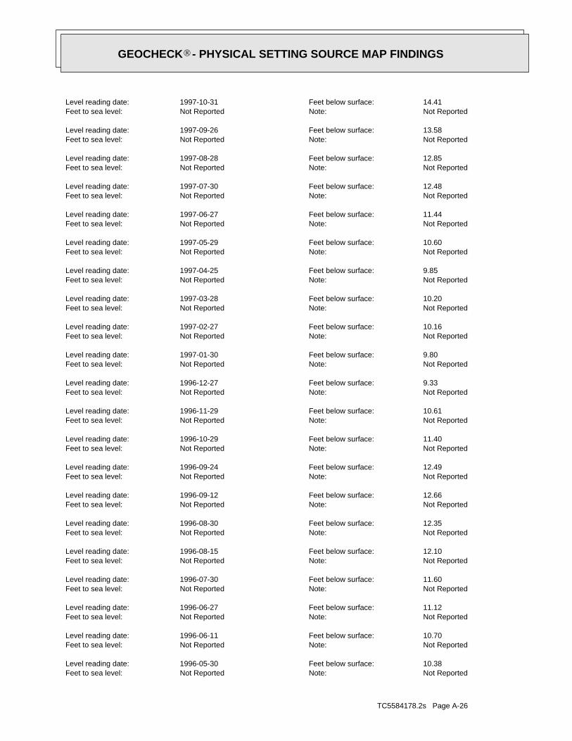
TC5584178.2s Page A-26
Not ReportedNote: Not ReportedFeet to sea level: 10.38Feet below surface: 1996-05-30Level reading date:
Not ReportedNote: Not ReportedFeet to sea level: 10.70Feet below surface: 1996-06-11Level reading date:
Not ReportedNote: Not ReportedFeet to sea level: 11.12Feet below surface: 1996-06-27Level reading date:
Not ReportedNote: Not ReportedFeet to sea level: 11.60Feet below surface: 1996-07-30Level reading date:
Not ReportedNote: Not ReportedFeet to sea level: 12.10Feet below surface: 1996-08-15Level reading date:
Not ReportedNote: Not ReportedFeet to sea level: 12.35Feet below surface: 1996-08-30Level reading date:
Not ReportedNote: Not ReportedFeet to sea level: 12.66Feet below surface: 1996-09-12Level reading date:
Not ReportedNote: Not ReportedFeet to sea level: 12.49Feet below surface: 1996-09-24Level reading date:
Not ReportedNote: Not ReportedFeet to sea level: 11.40Feet below surface: 1996-10-29Level reading date:
Not ReportedNote: Not ReportedFeet to sea level: 10.61Feet below surface: 1996-11-29Level reading date:
Not ReportedNote: Not ReportedFeet to sea level: 9.33Feet below surface: 1996-12-27Level reading date:
Not ReportedNote: Not ReportedFeet to sea level: 9.80Feet below surface: 1997-01-30Level reading date:
Not ReportedNote: Not ReportedFeet to sea level: 10.16Feet below surface: 1997-02-27Level reading date:
Not ReportedNote: Not ReportedFeet to sea level: 10.20Feet below surface: 1997-03-28Level reading date:
Not ReportedNote: Not ReportedFeet to sea level: 9.85Feet below surface: 1997-04-25Level reading date:
Not ReportedNote: Not ReportedFeet to sea level: 10.60Feet below surface: 1997-05-29Level reading date:
Not ReportedNote: Not ReportedFeet to sea level: 11.44Feet below surface: 1997-06-27Level reading date:
Not ReportedNote: Not ReportedFeet to sea level: 12.48Feet below surface: 1997-07-30Level reading date:
Not ReportedNote: Not ReportedFeet to sea level: 12.85Feet below surface: 1997-08-28Level reading date:
Not ReportedNote: Not ReportedFeet to sea level: 13.58Feet below surface: 1997-09-26Level reading date:
Not ReportedNote: Not ReportedFeet to sea level: 14.41Feet below surface: 1997-10-31Level reading date:
®GEOCHECK - PHYSICAL SETTING SOURCE MAP FINDINGS®

TC5584178.2s Page A-27
Not ReportedNote: Not ReportedFeet to sea level: 11.51Feet below surface: 1995-06-20Level reading date:
Not ReportedNote: Not ReportedFeet to sea level: 11.76Feet below surface: 1995-06-28Level reading date:
Not ReportedNote: Not ReportedFeet to sea level: 12.20Feet below surface: 1995-07-13Level reading date:
Not ReportedNote: Not ReportedFeet to sea level: 12.55Feet below surface: 1995-07-30Level reading date:
Not ReportedNote: Not ReportedFeet to sea level: 13.15Feet below surface: 1995-08-17Level reading date:
Not ReportedNote: Not ReportedFeet to sea level: 13.56Feet below surface: 1995-08-31Level reading date:
Not ReportedNote: Not ReportedFeet to sea level: 13.97Feet below surface: 1995-09-15Level reading date:
Not ReportedNote: Not ReportedFeet to sea level: 14.30Feet below surface: 1995-09-28Level reading date:
Not ReportedNote: Not ReportedFeet to sea level: 14.15Feet below surface: 1995-10-17Level reading date:
Not ReportedNote: Not ReportedFeet to sea level: 13.80Feet below surface: 1995-10-31Level reading date:
Not ReportedNote: Not ReportedFeet to sea level: 12.50Feet below surface: 1995-11-28Level reading date:
Not ReportedNote: Not ReportedFeet to sea level: 12.37Feet below surface: 1995-12-11Level reading date:
Not ReportedNote: Not ReportedFeet to sea level: 12.80Feet below surface: 1996-01-10Level reading date:
Not ReportedNote: Not ReportedFeet to sea level: 10.13Feet below surface: 1996-01-30Level reading date:
Not ReportedNote: Not ReportedFeet to sea level: 10.25Feet below surface: 1996-02-15Level reading date:
Not ReportedNote: Not ReportedFeet to sea level: 10.14Feet below surface: 1996-02-28Level reading date:
Not ReportedNote: Not ReportedFeet to sea level: 10.15Feet below surface: 1996-03-13Level reading date:
Not ReportedNote: Not ReportedFeet to sea level: 10.13Feet below surface: 1996-03-29Level reading date:
Not ReportedNote: Not ReportedFeet to sea level: 9.93Feet below surface: 1996-04-12Level reading date:
Not ReportedNote: Not ReportedFeet to sea level: 9.60Feet below surface: 1996-04-30Level reading date:
Not ReportedNote: Not ReportedFeet to sea level: 10.02Feet below surface: 1996-05-15Level reading date:
®GEOCHECK - PHYSICAL SETTING SOURCE MAP FINDINGS®

TC5584178.2s Page A-28
Not ReportedNote: Not ReportedFeet to sea level: 12.11Feet below surface: 1994-07-25Level reading date:
Not ReportedNote: Not ReportedFeet to sea level: 12.50Feet below surface: 1994-08-11Level reading date:
Not ReportedNote: Not ReportedFeet to sea level: 12.06Feet below surface: 1994-08-27Level reading date:
Not ReportedNote: Not ReportedFeet to sea level: 12.52Feet below surface: 1994-09-15Level reading date:
Not ReportedNote: Not ReportedFeet to sea level: 12.33Feet below surface: 1994-10-03Level reading date:
Not ReportedNote: Not ReportedFeet to sea level: 12.55Feet below surface: 1994-10-12Level reading date:
Not ReportedNote: Not ReportedFeet to sea level: 12.94Feet below surface: 1994-10-31Level reading date:
Not ReportedNote: Not ReportedFeet to sea level: 13.12Feet below surface: 1994-11-09Level reading date:
Not ReportedNote: Not ReportedFeet to sea level: 13.13Feet below surface: 1994-11-23Level reading date:
Not ReportedNote: Not ReportedFeet to sea level: 12.08Feet below surface: 1994-12-13Level reading date:
Not ReportedNote: Not ReportedFeet to sea level: 11.31Feet below surface: 1994-12-29Level reading date:
Not ReportedNote: Not ReportedFeet to sea level: 10.92Feet below surface: 1995-01-11Level reading date:
Not ReportedNote: Not ReportedFeet to sea level: 10.58Feet below surface: 1995-01-29Level reading date:
Not ReportedNote: Not ReportedFeet to sea level: 10.75Feet below surface: 1995-02-09Level reading date:
Not ReportedNote: Not ReportedFeet to sea level: 10.82Feet below surface: 1995-02-28Level reading date:
Not ReportedNote: Not ReportedFeet to sea level: 10.60Feet below surface: 1995-03-08Level reading date:
Not ReportedNote: Not ReportedFeet to sea level: 10.28Feet below surface: 1995-03-29Level reading date:
Not ReportedNote: Not ReportedFeet to sea level: 10.50Feet below surface: 1995-04-13Level reading date:
Not ReportedNote: Not ReportedFeet to sea level: 10.66Feet below surface: 1995-04-26Level reading date:
Not ReportedNote: Not ReportedFeet to sea level: 10.74Feet below surface: 1995-05-15Level reading date:
Not ReportedNote: Not ReportedFeet to sea level: 11.06Feet below surface: 1995-05-31Level reading date:
®GEOCHECK - PHYSICAL SETTING SOURCE MAP FINDINGS®
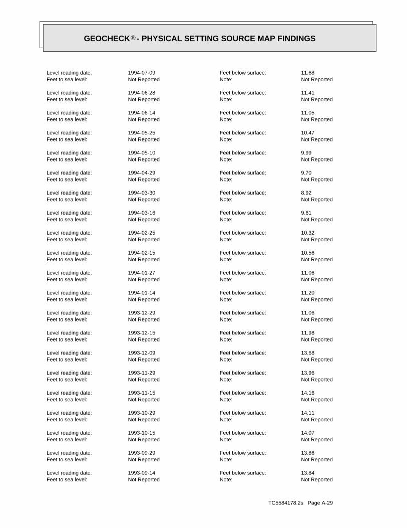
TC5584178.2s Page A-29
Not ReportedNote: Not ReportedFeet to sea level: 13.84Feet below surface: 1993-09-14Level reading date:
Not ReportedNote: Not ReportedFeet to sea level: 13.86Feet below surface: 1993-09-29Level reading date:
Not ReportedNote: Not ReportedFeet to sea level: 14.07Feet below surface: 1993-10-15Level reading date:
Not ReportedNote: Not ReportedFeet to sea level: 14.11Feet below surface: 1993-10-29Level reading date:
Not ReportedNote: Not ReportedFeet to sea level: 14.16Feet below surface: 1993-11-15Level reading date:
Not ReportedNote: Not ReportedFeet to sea level: 13.96Feet below surface: 1993-11-29Level reading date:
Not ReportedNote: Not ReportedFeet to sea level: 13.68Feet below surface: 1993-12-09Level reading date:
Not ReportedNote: Not ReportedFeet to sea level: 11.98Feet below surface: 1993-12-15Level reading date:
Not ReportedNote: Not ReportedFeet to sea level: 11.06Feet below surface: 1993-12-29Level reading date:
Not ReportedNote: Not ReportedFeet to sea level: 11.20Feet below surface: 1994-01-14Level reading date:
Not ReportedNote: Not ReportedFeet to sea level: 11.06Feet below surface: 1994-01-27Level reading date:
Not ReportedNote: Not ReportedFeet to sea level: 10.56Feet below surface: 1994-02-15Level reading date:
Not ReportedNote: Not ReportedFeet to sea level: 10.32Feet below surface: 1994-02-25Level reading date:
Not ReportedNote: Not ReportedFeet to sea level: 9.61Feet below surface: 1994-03-16Level reading date:
Not ReportedNote: Not ReportedFeet to sea level: 8.92Feet below surface: 1994-03-30Level reading date:
Not ReportedNote: Not ReportedFeet to sea level: 9.70Feet below surface: 1994-04-29Level reading date:
Not ReportedNote: Not ReportedFeet to sea level: 9.99Feet below surface: 1994-05-10Level reading date:
Not ReportedNote: Not ReportedFeet to sea level: 10.47Feet below surface: 1994-05-25Level reading date:
Not ReportedNote: Not ReportedFeet to sea level: 11.05Feet below surface: 1994-06-14Level reading date:
Not ReportedNote: Not ReportedFeet to sea level: 11.41Feet below surface: 1994-06-28Level reading date:
Not ReportedNote: Not ReportedFeet to sea level: 11.68Feet below surface: 1994-07-09Level reading date:
®GEOCHECK - PHYSICAL SETTING SOURCE MAP FINDINGS®
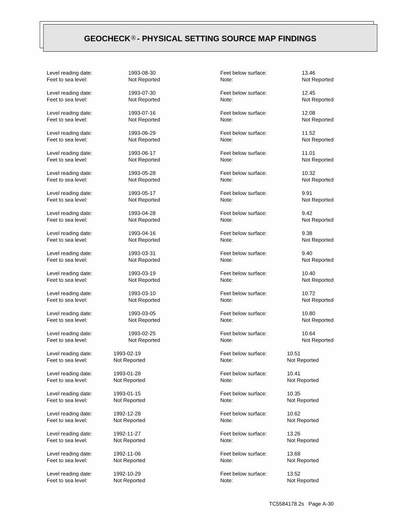
TC5584178.2s Page A-30
Not ReportedNote:Not ReportedFeet to sea level:13.52Feet below surface:1992-10-29Level reading date:
Not ReportedNote:Not ReportedFeet to sea level:13.68Feet below surface:1992-11-06Level reading date:
Not ReportedNote:Not ReportedFeet to sea level:13.26Feet below surface:1992-11-27Level reading date:
Not ReportedNote:Not ReportedFeet to sea level:10.62Feet below surface:1992-12-28Level reading date:
Not ReportedNote:Not ReportedFeet to sea level:10.35Feet below surface:1993-01-15Level reading date:
Not ReportedNote:Not ReportedFeet to sea level:10.41Feet below surface:1993-01-28Level reading date:
Not ReportedNote:Not ReportedFeet to sea level:10.51Feet below surface:1993-02-19Level reading date:
Not ReportedNote: Not ReportedFeet to sea level: 10.64Feet below surface: 1993-02-25Level reading date:
Not ReportedNote: Not ReportedFeet to sea level: 10.80Feet below surface: 1993-03-05Level reading date:
Not ReportedNote: Not ReportedFeet to sea level: 10.72Feet below surface: 1993-03-10Level reading date:
Not ReportedNote: Not ReportedFeet to sea level: 10.40Feet below surface: 1993-03-19Level reading date:
Not ReportedNote: Not ReportedFeet to sea level: 9.40Feet below surface: 1993-03-31Level reading date:
Not ReportedNote: Not ReportedFeet to sea level: 9.38Feet below surface: 1993-04-16Level reading date:
Not ReportedNote: Not ReportedFeet to sea level: 9.42Feet below surface: 1993-04-28Level reading date:
Not ReportedNote: Not ReportedFeet to sea level: 9.91Feet below surface: 1993-05-17Level reading date:
Not ReportedNote: Not ReportedFeet to sea level: 10.32Feet below surface: 1993-05-28Level reading date:
Not ReportedNote: Not ReportedFeet to sea level: 11.01Feet below surface: 1993-06-17Level reading date:
Not ReportedNote: Not ReportedFeet to sea level: 11.52Feet below surface: 1993-06-29Level reading date:
Not ReportedNote: Not ReportedFeet to sea level: 12.08Feet below surface: 1993-07-16Level reading date:
Not ReportedNote: Not ReportedFeet to sea level: 12.45Feet below surface: 1993-07-30Level reading date:
Not ReportedNote: Not ReportedFeet to sea level: 13.46Feet below surface: 1993-08-30Level reading date:
®GEOCHECK - PHYSICAL SETTING SOURCE MAP FINDINGS®

TC5584178.2s Page A-31
Not ReportedNote:Not ReportedFeet to sea level:10.48Feet below surface:1992-03-17Level reading date:
Not ReportedNote:Not ReportedFeet to sea level:10.56Feet below surface:1992-03-26Level reading date:
Not ReportedNote:Not ReportedFeet to sea level:9.76Feet below surface:1992-03-31Level reading date:
Not ReportedNote:Not ReportedFeet to sea level:10.39Feet below surface:1992-04-20Level reading date:
Not ReportedNote:Not ReportedFeet to sea level:10.45Feet below surface:1992-04-29Level reading date:
Not ReportedNote:Not ReportedFeet to sea level:10.58Feet below surface:1992-05-08Level reading date:
Not ReportedNote:Not ReportedFeet to sea level:10.82Feet below surface:1992-05-20Level reading date:
Not ReportedNote:Not ReportedFeet to sea level:11.05Feet below surface:1992-05-29Level reading date:
Not ReportedNote:Not ReportedFeet to sea level:11.02Feet below surface:1992-06-18Level reading date:
Not ReportedNote:Not ReportedFeet to sea level:11.22Feet below surface:1992-06-29Level reading date:
Not ReportedNote:Not ReportedFeet to sea level:11.36Feet below surface:1992-07-08Level reading date:
Not ReportedNote:Not ReportedFeet to sea level:11.61Feet below surface:1992-07-22Level reading date:
Not ReportedNote:Not ReportedFeet to sea level:11.72Feet below surface:1992-07-28Level reading date:
Not ReportedNote:Not ReportedFeet to sea level:12.06Feet below surface:1992-08-07Level reading date:
Not ReportedNote:Not ReportedFeet to sea level:12.14Feet below surface:1992-08-12Level reading date:
Not ReportedNote:Not ReportedFeet to sea level:11.98Feet below surface:1992-08-21Level reading date:
Not ReportedNote:Not ReportedFeet to sea level:12.23Feet below surface:1992-08-31Level reading date:
Not ReportedNote:Not ReportedFeet to sea level:12.52Feet below surface:1992-09-15Level reading date:
Not ReportedNote:Not ReportedFeet to sea level:12.70Feet below surface:1992-09-21Level reading date:
Not ReportedNote:Not ReportedFeet to sea level:12.88Feet below surface:1992-09-29Level reading date:
Not ReportedNote:Not ReportedFeet to sea level:13.30Feet below surface:1992-10-19Level reading date:
®GEOCHECK - PHYSICAL SETTING SOURCE MAP FINDINGS®

TC5584178.2s Page A-32
Not ReportedNote:Not ReportedFeet to sea level:12.24Feet below surface:1991-07-23Level reading date:
Not ReportedNote:Not ReportedFeet to sea level:12.44Feet below surface:1991-07-30Level reading date:
Not ReportedNote:Not ReportedFeet to sea level:12.85Feet below surface:1991-08-16Level reading date:
Not ReportedNote:Not ReportedFeet to sea level:11.93Feet below surface:1991-08-26Level reading date:
Not ReportedNote:Not ReportedFeet to sea level:12.46Feet below surface:1991-09-12Level reading date:
Not ReportedNote:Not ReportedFeet to sea level:12.10Feet below surface:1991-09-17Level reading date:
Not ReportedNote:Not ReportedFeet to sea level:12.23Feet below surface:1991-09-24Level reading date:
Not ReportedNote:Not ReportedFeet to sea level:11.75Feet below surface:1991-09-30Level reading date:
Not ReportedNote:Not ReportedFeet to sea level:11.61Feet below surface:1991-10-11Level reading date:
Not ReportedNote:Not ReportedFeet to sea level:11.58Feet below surface:1991-10-22Level reading date:
Not ReportedNote:Not ReportedFeet to sea level:11.71Feet below surface:1991-10-29Level reading date:
Not ReportedNote:Not ReportedFeet to sea level:11.82Feet below surface:1991-11-04Level reading date:
Not ReportedNote:Not ReportedFeet to sea level:11.69Feet below surface:1991-11-18Level reading date:
Not ReportedNote:Not ReportedFeet to sea level:11.19Feet below surface:1991-11-26Level reading date:
Not ReportedNote:Not ReportedFeet to sea level:10.81Feet below surface:1991-12-09Level reading date:
Not ReportedNote:Not ReportedFeet to sea level:10.85Feet below surface:1991-12-31Level reading date:
Not ReportedNote:Not ReportedFeet to sea level:10.94Feet below surface:1992-01-13Level reading date:
Not ReportedNote:Not ReportedFeet to sea level:10.37Feet below surface:1992-01-30Level reading date:
Not ReportedNote:Not ReportedFeet to sea level:10.76Feet below surface:1992-02-10Level reading date:
Not ReportedNote:Not ReportedFeet to sea level:10.67Feet below surface:1992-02-21Level reading date:
Not ReportedNote:Not ReportedFeet to sea level:10.69Feet below surface:1992-02-28Level reading date:
®GEOCHECK - PHYSICAL SETTING SOURCE MAP FINDINGS®

TC5584178.2s Page A-33
Not ReportedNote:Not ReportedFeet to sea level:11.33Feet below surface:1990-11-29Level reading date:
Not ReportedNote:Not ReportedFeet to sea level:10.74Feet below surface:1990-12-18Level reading date:
Not ReportedNote:Not ReportedFeet to sea level:10.50Feet below surface:1990-12-27Level reading date:
Not ReportedNote:Not ReportedFeet to sea level:10.34Feet below surface:1991-01-02Level reading date:
Not ReportedNote:Not ReportedFeet to sea level:10.44Feet below surface:1991-01-15Level reading date:
Not ReportedNote:Not ReportedFeet to sea level:10.08Feet below surface:1991-01-30Level reading date:
Not ReportedNote:Not ReportedFeet to sea level:10.18Feet below surface:1991-02-06Level reading date:
Not ReportedNote:Not ReportedFeet to sea level:10.10Feet below surface:1991-02-15Level reading date:
Not ReportedNote:Not ReportedFeet to sea level:10.21Feet below surface:1991-02-27Level reading date:
Not ReportedNote:Not ReportedFeet to sea level:9.62Feet below surface:1991-03-05Level reading date:
Not ReportedNote:Not ReportedFeet to sea level:9.43Feet below surface:1991-03-14Level reading date:
Not ReportedNote:Not ReportedFeet to sea level:9.50Feet below surface:1991-03-20Level reading date:
Not ReportedNote:Not ReportedFeet to sea level:9.27Feet below surface:1991-03-28Level reading date:
Not ReportedNote:Not ReportedFeet to sea level:9.64Feet below surface:1991-04-15Level reading date:
Not ReportedNote:Not ReportedFeet to sea level:9.73Feet below surface:1991-04-25Level reading date:
Not ReportedNote:Not ReportedFeet to sea level:9.81Feet below surface:1991-04-30Level reading date:
Not ReportedNote:Not ReportedFeet to sea level:9.64Feet below surface:1991-05-16Level reading date:
Not ReportedNote:Not ReportedFeet to sea level:9.89Feet below surface:1991-05-31Level reading date:
Not ReportedNote:Not ReportedFeet to sea level:10.55Feet below surface:1991-06-11Level reading date:
Not ReportedNote:Not ReportedFeet to sea level:10.90Feet below surface:1991-06-20Level reading date:
Not ReportedNote:Not ReportedFeet to sea level:11.66Feet below surface:1991-07-08Level reading date:
®GEOCHECK - PHYSICAL SETTING SOURCE MAP FINDINGS®

TC5584178.2s Page A-34
Not ReportedNote:Not ReportedFeet to sea level:9.78Feet below surface:1990-04-09Level reading date:
Not ReportedNote:Not ReportedFeet to sea level:9.63Feet below surface:1990-04-30Level reading date:
Not ReportedNote:Not ReportedFeet to sea level:9.53Feet below surface:1990-05-10Level reading date:
Not ReportedNote:Not ReportedFeet to sea level:9.26Feet below surface:1990-05-23Level reading date:
Not ReportedNote:Not ReportedFeet to sea level:9.42Feet below surface:1990-05-29Level reading date:
Not ReportedNote:Not ReportedFeet to sea level:9.68Feet below surface:1990-06-15Level reading date:
Not ReportedNote:Not ReportedFeet to sea level:10.03Feet below surface:1990-06-21Level reading date:
Not ReportedNote:Not ReportedFeet to sea level:10.32Feet below surface:1990-06-28Level reading date:
Not ReportedNote:Not ReportedFeet to sea level:10.93Feet below surface:1990-07-09Level reading date:
Not ReportedNote:Not ReportedFeet to sea level:11.71Feet below surface:1990-07-30Level reading date:
Not ReportedNote:Not ReportedFeet to sea level:11.99Feet below surface:1990-08-07Level reading date:
Not ReportedNote:Not ReportedFeet to sea level:12.04Feet below surface:1990-08-21Level reading date:
Not ReportedNote:Not ReportedFeet to sea level:12.14Feet below surface:1990-08-28Level reading date:
Not ReportedNote:Not ReportedFeet to sea level:12.33Feet below surface:1990-09-05Level reading date:
Not ReportedNote:Not ReportedFeet to sea level:12.61Feet below surface:1990-09-17Level reading date:
Not ReportedNote:Not ReportedFeet to sea level:12.82Feet below surface:1990-09-26Level reading date:
Not ReportedNote:Not ReportedFeet to sea level:13.02Feet below surface:1990-10-04Level reading date:
Not ReportedNote:Not ReportedFeet to sea level:12.15Feet below surface:1990-10-16Level reading date:
Not ReportedNote:Not ReportedFeet to sea level:11.50Feet below surface:1990-10-26Level reading date:
Not ReportedNote:Not ReportedFeet to sea level:11.35Feet below surface:1990-10-31Level reading date:
Not ReportedNote:Not ReportedFeet to sea level:11.19Feet below surface:1990-11-19Level reading date:
®GEOCHECK - PHYSICAL SETTING SOURCE MAP FINDINGS®
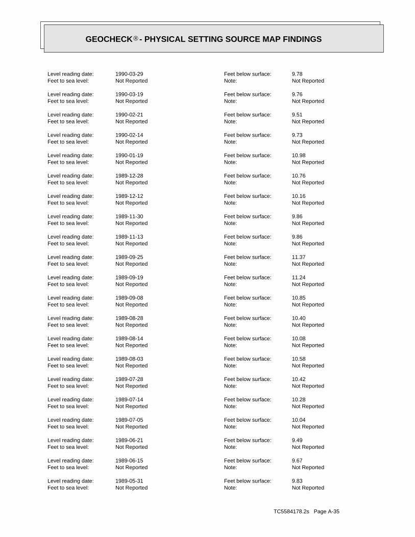
TC5584178.2s Page A-35
Not ReportedNote:Not ReportedFeet to sea level:9.83Feet below surface:1989-05-31Level reading date:
Not ReportedNote:Not ReportedFeet to sea level:9.67Feet below surface:1989-06-15Level reading date:
Not ReportedNote:Not ReportedFeet to sea level:9.49Feet below surface:1989-06-21Level reading date:
Not ReportedNote:Not ReportedFeet to sea level:10.04Feet below surface:1989-07-05Level reading date:
Not ReportedNote:Not ReportedFeet to sea level:10.28Feet below surface:1989-07-14Level reading date:
Not ReportedNote:Not ReportedFeet to sea level:10.42Feet below surface:1989-07-28Level reading date:
Not ReportedNote:Not ReportedFeet to sea level:10.58Feet below surface:1989-08-03Level reading date:
Not ReportedNote:Not ReportedFeet to sea level:10.08Feet below surface:1989-08-14Level reading date:
Not ReportedNote:Not ReportedFeet to sea level:10.40Feet below surface:1989-08-28Level reading date:
Not ReportedNote:Not ReportedFeet to sea level:10.85Feet below surface:1989-09-08Level reading date:
Not ReportedNote:Not ReportedFeet to sea level:11.24Feet below surface:1989-09-19Level reading date:
Not ReportedNote:Not ReportedFeet to sea level:11.37Feet below surface:1989-09-25Level reading date:
Not ReportedNote:Not ReportedFeet to sea level:9.86Feet below surface:1989-11-13Level reading date:
Not ReportedNote:Not ReportedFeet to sea level:9.86Feet below surface:1989-11-30Level reading date:
Not ReportedNote:Not ReportedFeet to sea level:10.16Feet below surface:1989-12-12Level reading date:
Not ReportedNote:Not ReportedFeet to sea level:10.76Feet below surface:1989-12-28Level reading date:
Not ReportedNote:Not ReportedFeet to sea level:10.98Feet below surface:1990-01-19Level reading date:
Not ReportedNote:Not ReportedFeet to sea level:9.73Feet below surface:1990-02-14Level reading date:
Not ReportedNote:Not ReportedFeet to sea level:9.51Feet below surface:1990-02-21Level reading date:
Not ReportedNote:Not ReportedFeet to sea level:9.76Feet below surface:1990-03-19Level reading date:
Not ReportedNote:Not ReportedFeet to sea level:9.78Feet below surface:1990-03-29Level reading date:
®GEOCHECK - PHYSICAL SETTING SOURCE MAP FINDINGS®

TC5584178.2s Page A-36
Not ReportedNote:Not ReportedFeet to sea level:14.01Feet below surface:1988-10-27Level reading date:
Not ReportedNote:Not ReportedFeet to sea level:14.02Feet below surface:1988-11-02Level reading date:
Not ReportedNote:Not ReportedFeet to sea level:13.78Feet below surface:1988-11-15Level reading date:
Not ReportedNote:Not ReportedFeet to sea level:12.47Feet below surface:1988-11-28Level reading date:
Not ReportedNote:Not ReportedFeet to sea level:12.05Feet below surface:1988-12-08Level reading date:
Not ReportedNote:Not ReportedFeet to sea level:11.99Feet below surface:1988-12-14Level reading date:
Not ReportedNote:Not ReportedFeet to sea level:12.05Feet below surface:1988-12-28Level reading date:
Not ReportedNote:Not ReportedFeet to sea level:12.20Feet below surface:1989-01-10Level reading date:
Not ReportedNote:Not ReportedFeet to sea level:12.19Feet below surface:1989-01-20Level reading date:
Not ReportedNote:Not ReportedFeet to sea level:12.28Feet below surface:1989-01-31Level reading date:
Not ReportedNote:Not ReportedFeet to sea level:12.43Feet below surface:1989-02-16Level reading date:
Not ReportedNote:Not ReportedFeet to sea level:12.02Feet below surface:1989-02-24Level reading date:
Not ReportedNote:Not ReportedFeet to sea level:11.94Feet below surface:1989-03-02Level reading date:
Not ReportedNote:Not ReportedFeet to sea level:11.95Feet below surface:1989-03-15Level reading date:
Not ReportedNote:Not ReportedFeet to sea level:11.98Feet below surface:1989-03-22Level reading date:
Not ReportedNote:Not ReportedFeet to sea level:11.66Feet below surface:1989-03-31Level reading date:
Not ReportedNote:Not ReportedFeet to sea level:11.24Feet below surface:1989-04-07Level reading date:
Not ReportedNote:Not ReportedFeet to sea level:10.31Feet below surface:1989-04-21Level reading date:
Not ReportedNote:Not ReportedFeet to sea level:10.27Feet below surface:1989-04-27Level reading date:
Not ReportedNote:Not ReportedFeet to sea level:9.93Feet below surface:1989-05-10Level reading date:
Not ReportedNote:Not ReportedFeet to sea level:9.74Feet below surface:1989-05-23Level reading date:
®GEOCHECK - PHYSICAL SETTING SOURCE MAP FINDINGS®

TC5584178.2s Page A-37
Not ReportedNote:Not ReportedFeet to sea level:10.41Feet below surface:1988-06-01Level reading date:
Not ReportedNote:Not ReportedFeet to sea level:10.57Feet below surface:1988-06-07Level reading date:
Not ReportedNote:Not ReportedFeet to sea level:10.82Feet below surface:1988-06-14Level reading date:
Not ReportedNote:Not ReportedFeet to sea level:11.04Feet below surface:1988-06-20Level reading date:
Not ReportedNote:Not ReportedFeet to sea level:11.32Feet below surface:1988-06-27Level reading date:
Not ReportedNote:Not ReportedFeet to sea level:11.63Feet below surface:1988-07-05Level reading date:
Not ReportedNote:Not ReportedFeet to sea level:11.85Feet below surface:1988-07-11Level reading date:
Not ReportedNote:Not ReportedFeet to sea level:11.99Feet below surface:1988-07-15Level reading date:
Not ReportedNote:Not ReportedFeet to sea level:12.13Feet below surface:1988-07-21Level reading date:
Not ReportedNote:Not ReportedFeet to sea level:11.71Feet below surface:1988-07-25Level reading date:
Not ReportedNote:Not ReportedFeet to sea level:11.69Feet below surface:1988-07-27Level reading date:
Not ReportedNote:Not ReportedFeet to sea level:12.01Feet below surface:1988-08-08Level reading date:
Not ReportedNote:Not ReportedFeet to sea level:12.21Feet below surface:1988-08-17Level reading date:
Not ReportedNote:Not ReportedFeet to sea level:12.41Feet below surface:1988-08-25Level reading date:
Not ReportedNote:Not ReportedFeet to sea level:12.58Feet below surface:1988-08-31Level reading date:
Not ReportedNote:Not ReportedFeet to sea level:12.74Feet below surface:1988-09-07Level reading date:
Not ReportedNote:Not ReportedFeet to sea level:12.95Feet below surface:1988-09-16Level reading date:
Not ReportedNote:Not ReportedFeet to sea level:13.21Feet below surface:1988-09-26Level reading date:
Not ReportedNote:Not ReportedFeet to sea level:13.33Feet below surface:1988-09-30Level reading date:
Not ReportedNote:Not ReportedFeet to sea level:13.66Feet below surface:1988-10-12Level reading date:
Not ReportedNote:Not ReportedFeet to sea level:13.99Feet below surface:1988-10-18Level reading date:
®GEOCHECK - PHYSICAL SETTING SOURCE MAP FINDINGS®

TC5584178.2s Page A-38
Not ReportedFeet to sea level:Not ReportedFeet below surface:1987-12-31Level reading date:
Not ReportedNote:Not ReportedFeet to sea level:13.54Feet below surface:1988-01-08Level reading date:
Not ReportedNote:Not ReportedFeet to sea level:13.63Feet below surface:1988-01-19Level reading date:
Not ReportedNote:Not ReportedFeet to sea level:13.45Feet below surface:1988-01-26Level reading date:
Not ReportedNote:Not ReportedFeet to sea level:13.30Feet below surface:1988-02-01Level reading date:
Not ReportedNote:Not ReportedFeet to sea level:12.93Feet below surface:1988-02-08Level reading date:
Not ReportedNote:Not ReportedFeet to sea level:12.46Feet below surface:1988-02-17Level reading date:
Not ReportedNote:Not ReportedFeet to sea level:11.85Feet below surface:1988-02-23Level reading date:
Not ReportedNote:Not ReportedFeet to sea level:11.58Feet below surface:1988-02-29Level reading date:
Not ReportedNote:Not ReportedFeet to sea level:11.42Feet below surface:1988-03-07Level reading date:
Not ReportedNote:Not ReportedFeet to sea level:11.33Feet below surface:1988-03-16Level reading date:
Not ReportedNote:Not ReportedFeet to sea level:11.40Feet below surface:1988-03-23Level reading date:
Not ReportedNote:Not ReportedFeet to sea level:10.90Feet below surface:1988-03-29Level reading date:
Not ReportedNote:Not ReportedFeet to sea level:10.62Feet below surface:1988-04-05Level reading date:
Not ReportedNote:Not ReportedFeet to sea level:10.70Feet below surface:1988-04-13Level reading date:
Not ReportedNote:Not ReportedFeet to sea level:10.77Feet below surface:1988-04-19Level reading date:
Not ReportedNote:Not ReportedFeet to sea level:10.95Feet below surface:1988-04-27Level reading date:
Not ReportedNote:Not ReportedFeet to sea level:10.62Feet below surface:1988-05-02Level reading date:
Not ReportedNote:Not ReportedFeet to sea level:10.60Feet below surface:1988-05-12Level reading date:
Not ReportedNote:Not ReportedFeet to sea level:10.67Feet below surface:1988-05-18Level reading date:
Not ReportedNote:Not ReportedFeet to sea level:10.67Feet below surface:1988-05-24Level reading date:
®GEOCHECK - PHYSICAL SETTING SOURCE MAP FINDINGS®
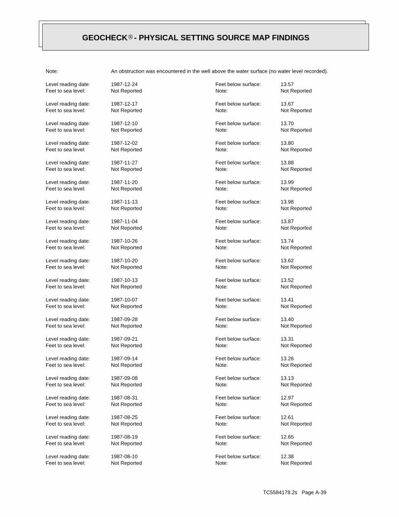
TC5584178.2s Page A-39
Not ReportedNote:Not ReportedFeet to sea level:12.38Feet below surface:1987-08-10Level reading date:
Not ReportedNote:Not ReportedFeet to sea level:12.65Feet below surface:1987-08-19Level reading date:
Not ReportedNote:Not ReportedFeet to sea level:12.61Feet below surface:1987-08-25Level reading date:
Not ReportedNote:Not ReportedFeet to sea level:12.97Feet below surface:1987-08-31Level reading date:
Not ReportedNote:Not ReportedFeet to sea level:13.13Feet below surface:1987-09-08Level reading date:
Not ReportedNote:Not ReportedFeet to sea level:13.26Feet below surface:1987-09-14Level reading date:
Not ReportedNote:Not ReportedFeet to sea level:13.31Feet below surface:1987-09-21Level reading date:
Not ReportedNote:Not ReportedFeet to sea level:13.40Feet below surface:1987-09-28Level reading date:
Not ReportedNote:Not ReportedFeet to sea level:13.41Feet below surface:1987-10-07Level reading date:
Not ReportedNote:Not ReportedFeet to sea level:13.52Feet below surface:1987-10-13Level reading date:
Not ReportedNote:Not ReportedFeet to sea level:13.62Feet below surface:1987-10-20Level reading date:
Not ReportedNote:Not ReportedFeet to sea level:13.74Feet below surface:1987-10-26Level reading date:
Not ReportedNote:Not ReportedFeet to sea level:13.87Feet below surface:1987-11-04Level reading date:
Not ReportedNote:Not ReportedFeet to sea level:13.98Feet below surface:1987-11-13Level reading date:
Not ReportedNote:Not ReportedFeet to sea level:13.99Feet below surface:1987-11-20Level reading date:
Not ReportedNote:Not ReportedFeet to sea level:13.88Feet below surface:1987-11-27Level reading date:
Not ReportedNote:Not ReportedFeet to sea level:13.80Feet below surface:1987-12-02Level reading date:
Not ReportedNote:Not ReportedFeet to sea level:13.70Feet below surface:1987-12-10Level reading date:
Not ReportedNote:Not ReportedFeet to sea level:13.67Feet below surface:1987-12-17Level reading date:
Not ReportedNote:Not ReportedFeet to sea level:13.57Feet below surface:1987-12-24Level reading date:
An obstruction was encountered in the well above the water surface (no water level recorded).Note:
®GEOCHECK - PHYSICAL SETTING SOURCE MAP FINDINGS®

TC5584178.2s Page A-40
Not ReportedNote:Not ReportedFeet to sea level:10.34Feet below surface:1987-01-28Level reading date:
Not ReportedNote:Not ReportedFeet to sea level:10.50Feet below surface:1987-02-04Level reading date:
Not ReportedNote:Not ReportedFeet to sea level:10.71Feet below surface:1987-02-13Level reading date:
Not ReportedNote:Not ReportedFeet to sea level:10.92Feet below surface:1987-02-20Level reading date:
Not ReportedNote:Not ReportedFeet to sea level:11.06Feet below surface:1987-02-25Level reading date:
Not ReportedNote:Not ReportedFeet to sea level:10.41Feet below surface:1987-03-10Level reading date:
Not ReportedNote:Not ReportedFeet to sea level:10.45Feet below surface:1987-03-19Level reading date:
Not ReportedNote:Not ReportedFeet to sea level:10.61Feet below surface:1987-03-25Level reading date:
Not ReportedNote:Not ReportedFeet to sea level:9.51Feet below surface:1987-04-02Level reading date:
Not ReportedNote:Not ReportedFeet to sea level:8.51Feet below surface:1987-04-09Level reading date:
Not ReportedNote:Not ReportedFeet to sea level:8.95Feet below surface:1987-04-20Level reading date:
Not ReportedNote:Not ReportedFeet to sea level:9.24Feet below surface:1987-04-30Level reading date:
Not ReportedNote:Not ReportedFeet to sea level:9.38Feet below surface:1987-05-11Level reading date:
Not ReportedNote:Not ReportedFeet to sea level:9.61Feet below surface:1987-05-18Level reading date:
Not ReportedNote:Not ReportedFeet to sea level:9.99Feet below surface:1987-05-28Level reading date:
Not ReportedNote:Not ReportedFeet to sea level:10.59Feet below surface:1987-06-06Level reading date:
Not ReportedNote:Not ReportedFeet to sea level:10.95Feet below surface:1987-06-25Level reading date:
Not ReportedNote:Not ReportedFeet to sea level:11.08Feet below surface:1987-06-30Level reading date:
Not ReportedNote:Not ReportedFeet to sea level:11.33Feet below surface:1987-07-08Level reading date:
Not ReportedNote:Not ReportedFeet to sea level:11.54Feet below surface:1987-07-15Level reading date:
Not ReportedNote:Not ReportedFeet to sea level:12.05Feet below surface:1987-07-30Level reading date:
®GEOCHECK - PHYSICAL SETTING SOURCE MAP FINDINGS®
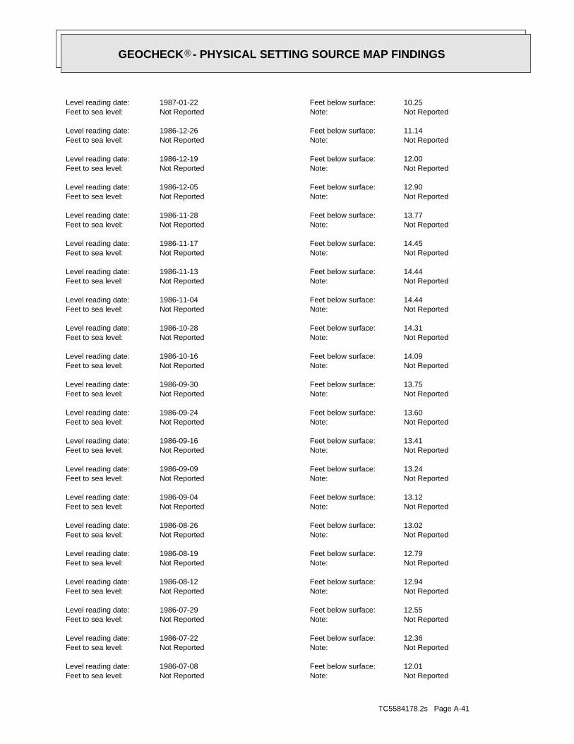
TC5584178.2s Page A-41
Not ReportedNote:Not ReportedFeet to sea level:12.01Feet below surface:1986-07-08Level reading date:
Not ReportedNote:Not ReportedFeet to sea level:12.36Feet below surface:1986-07-22Level reading date:
Not ReportedNote:Not ReportedFeet to sea level:12.55Feet below surface:1986-07-29Level reading date:
Not ReportedNote:Not ReportedFeet to sea level:12.94Feet below surface:1986-08-12Level reading date:
Not ReportedNote:Not ReportedFeet to sea level:12.79Feet below surface:1986-08-19Level reading date:
Not ReportedNote:Not ReportedFeet to sea level:13.02Feet below surface:1986-08-26Level reading date:
Not ReportedNote:Not ReportedFeet to sea level:13.12Feet below surface:1986-09-04Level reading date:
Not ReportedNote:Not ReportedFeet to sea level:13.24Feet below surface:1986-09-09Level reading date:
Not ReportedNote:Not ReportedFeet to sea level:13.41Feet below surface:1986-09-16Level reading date:
Not ReportedNote:Not ReportedFeet to sea level:13.60Feet below surface:1986-09-24Level reading date:
Not ReportedNote:Not ReportedFeet to sea level:13.75Feet below surface:1986-09-30Level reading date:
Not ReportedNote:Not ReportedFeet to sea level:14.09Feet below surface:1986-10-16Level reading date:
Not ReportedNote:Not ReportedFeet to sea level:14.31Feet below surface:1986-10-28Level reading date:
Not ReportedNote:Not ReportedFeet to sea level:14.44Feet below surface:1986-11-04Level reading date:
Not ReportedNote:Not ReportedFeet to sea level:14.44Feet below surface:1986-11-13Level reading date:
Not ReportedNote:Not ReportedFeet to sea level:14.45Feet below surface:1986-11-17Level reading date:
Not ReportedNote:Not ReportedFeet to sea level:13.77Feet below surface:1986-11-28Level reading date:
Not ReportedNote:Not ReportedFeet to sea level:12.90Feet below surface:1986-12-05Level reading date:
Not ReportedNote:Not ReportedFeet to sea level:12.00Feet below surface:1986-12-19Level reading date:
Not ReportedNote:Not ReportedFeet to sea level:11.14Feet below surface:1986-12-26Level reading date:
Not ReportedNote:Not ReportedFeet to sea level:10.25Feet below surface:1987-01-22Level reading date:
®GEOCHECK - PHYSICAL SETTING SOURCE MAP FINDINGS®

TC5584178.2s Page A-42
Not ReportedNote:Not ReportedFeet to sea level:11.29Feet below surface:1985-12-11Level reading date:
Not ReportedNote:Not ReportedFeet to sea level:11.35Feet below surface:1985-12-24Level reading date:
Not ReportedNote:Not ReportedFeet to sea level:11.53Feet below surface:1986-01-03Level reading date:
Not ReportedNote:Not ReportedFeet to sea level:11.41Feet below surface:1986-01-10Level reading date:
Not ReportedNote:Not ReportedFeet to sea level:11.59Feet below surface:1986-01-17Level reading date:
Not ReportedNote:Not ReportedFeet to sea level:11.60Feet below surface:1986-01-23Level reading date:
Not ReportedNote:Not ReportedFeet to sea level:10.88Feet below surface:1986-01-31Level reading date:
Not ReportedNote:Not ReportedFeet to sea level:10.43Feet below surface:1986-02-10Level reading date:
Not ReportedNote:Not ReportedFeet to sea level:10.24Feet below surface:1986-02-26Level reading date:
Not ReportedNote:Not ReportedFeet to sea level:10.42Feet below surface:1986-03-06Level reading date:
Not ReportedNote:Not ReportedFeet to sea level:10.53Feet below surface:1986-03-14Level reading date:
Not ReportedNote:Not ReportedFeet to sea level:10.04Feet below surface:1986-03-20Level reading date:
Not ReportedNote:Not ReportedFeet to sea level:10.08Feet below surface:1986-04-02Level reading date:
Not ReportedNote:Not ReportedFeet to sea level:10.25Feet below surface:1986-04-14Level reading date:
Not ReportedNote:Not ReportedFeet to sea level:10.52Feet below surface:1986-04-29Level reading date:
Not ReportedNote:Not ReportedFeet to sea level:10.72Feet below surface:1986-05-07Level reading date:
Not ReportedNote:Not ReportedFeet to sea level:10.96Feet below surface:1986-05-14Level reading date:
Not ReportedNote:Not ReportedFeet to sea level:11.26Feet below surface:1986-05-27Level reading date:
Not ReportedNote:Not ReportedFeet to sea level:11.48Feet below surface:1986-06-09Level reading date:
Not ReportedNote:Not ReportedFeet to sea level:11.71Feet below surface:1986-06-23Level reading date:
Not ReportedNote:Not ReportedFeet to sea level:11.77Feet below surface:1986-06-27Level reading date:
®GEOCHECK - PHYSICAL SETTING SOURCE MAP FINDINGS®
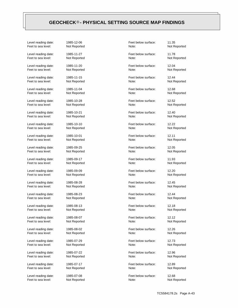
TC5584178.2s Page A-43
Not ReportedNote:Not ReportedFeet to sea level:12.68Feet below surface:1985-07-08Level reading date:
Not ReportedNote:Not ReportedFeet to sea level:12.89Feet below surface:1985-07-17Level reading date:
Not ReportedNote:Not ReportedFeet to sea level:12.96Feet below surface:1985-07-22Level reading date:
Not ReportedNote:Not ReportedFeet to sea level:12.73Feet below surface:1985-07-29Level reading date:
Not ReportedNote:Not ReportedFeet to sea level:12.26Feet below surface:1985-08-02Level reading date:
Not ReportedNote:Not ReportedFeet to sea level:12.12Feet below surface:1985-08-07Level reading date:
Not ReportedNote:Not ReportedFeet to sea level:12.18Feet below surface:1985-08-13Level reading date:
Not ReportedNote:Not ReportedFeet to sea level:12.44Feet below surface:1985-08-23Level reading date:
Not ReportedNote:Not ReportedFeet to sea level:12.45Feet below surface:1985-08-28Level reading date:
Not ReportedNote:Not ReportedFeet to sea level:12.20Feet below surface:1985-09-09Level reading date:
Not ReportedNote:Not ReportedFeet to sea level:11.93Feet below surface:1985-09-17Level reading date:
Not ReportedNote:Not ReportedFeet to sea level:12.05Feet below surface:1985-09-25Level reading date:
Not ReportedNote:Not ReportedFeet to sea level:12.11Feet below surface:1985-10-01Level reading date:
Not ReportedNote:Not ReportedFeet to sea level:12.22Feet below surface:1985-10-10Level reading date:
Not ReportedNote:Not ReportedFeet to sea level:12.40Feet below surface:1985-10-21Level reading date:
Not ReportedNote:Not ReportedFeet to sea level:12.52Feet below surface:1985-10-28Level reading date:
Not ReportedNote:Not ReportedFeet to sea level:12.68Feet below surface:1985-11-04Level reading date:
Not ReportedNote:Not ReportedFeet to sea level:12.44Feet below surface:1985-11-15Level reading date:
Not ReportedNote:Not ReportedFeet to sea level:12.04Feet below surface:1985-11-20Level reading date:
Not ReportedNote:Not ReportedFeet to sea level:11.78Feet below surface:1985-11-27Level reading date:
Not ReportedNote:Not ReportedFeet to sea level:11.35Feet below surface:1985-12-06Level reading date:
®GEOCHECK - PHYSICAL SETTING SOURCE MAP FINDINGS®

TC5584178.2s Page A-44
Not ReportedNote:Not ReportedFeet to sea level:12.71Feet below surface:1985-01-28Level reading date:
Not ReportedNote:Not ReportedFeet to sea level:12.88Feet below surface:1985-02-05Level reading date:
Not ReportedNote:Not ReportedFeet to sea level:12.55Feet below surface:1985-02-15Level reading date:
Not ReportedNote:Not ReportedFeet to sea level:12.48Feet below surface:1985-02-21Level reading date:
Not ReportedNote:Not ReportedFeet to sea level:12.43Feet below surface:1985-02-28Level reading date:
Not ReportedNote:Not ReportedFeet to sea level:12.40Feet below surface:1985-03-07Level reading date:
Not ReportedNote:Not ReportedFeet to sea level:11.91Feet below surface:1985-03-19Level reading date:
Not ReportedNote:Not ReportedFeet to sea level:11.80Feet below surface:1985-03-26Level reading date:
Not ReportedNote:Not ReportedFeet to sea level:11.79Feet below surface:1985-04-01Level reading date:
Not ReportedNote:Not ReportedFeet to sea level:11.86Feet below surface:1985-04-10Level reading date:
Not ReportedNote:Not ReportedFeet to sea level:11.98Feet below surface:1985-04-19Level reading date:
Not ReportedNote:Not ReportedFeet to sea level:12.00Feet below surface:1985-04-23Level reading date:
Not ReportedNote:Not ReportedFeet to sea level:12.11Feet below surface:1985-04-30Level reading date:
Not ReportedNote:Not ReportedFeet to sea level:11.93Feet below surface:1985-05-10Level reading date:
Not ReportedNote:Not ReportedFeet to sea level:11.94Feet below surface:1985-05-17Level reading date:
Not ReportedNote:Not ReportedFeet to sea level:12.07Feet below surface:1985-05-23Level reading date:
Not ReportedNote:Not ReportedFeet to sea level:12.16Feet below surface:1985-05-30Level reading date:
Not ReportedNote:Not ReportedFeet to sea level:12.25Feet below surface:1985-06-07Level reading date:
Not ReportedNote:Not ReportedFeet to sea level:12.35Feet below surface:1985-06-17Level reading date:
Not ReportedNote:Not ReportedFeet to sea level:12.43Feet below surface:1985-06-24Level reading date:
Not ReportedNote:Not ReportedFeet to sea level:12.58Feet below surface:1985-07-03Level reading date:
®GEOCHECK - PHYSICAL SETTING SOURCE MAP FINDINGS®

TC5584178.2s Page A-45
Not ReportedNote:Not ReportedFeet to sea level:11.39Feet below surface:1984-08-27Level reading date:
Not ReportedNote:Not ReportedFeet to sea level:11.69Feet below surface:1984-09-04Level reading date:
Not ReportedNote:Not ReportedFeet to sea level:11.37Feet below surface:1984-09-10Level reading date:
Not ReportedNote:Not ReportedFeet to sea level:12.10Feet below surface:1984-09-17Level reading date:
Not ReportedNote:Not ReportedFeet to sea level:12.30Feet below surface:1984-09-24Level reading date:
Not ReportedNote:Not ReportedFeet to sea level:12.50Feet below surface:1984-10-01Level reading date:
Not ReportedNote:Not ReportedFeet to sea level:12.66Feet below surface:1984-10-10Level reading date:
Not ReportedNote:Not ReportedFeet to sea level:12.79Feet below surface:1984-10-15Level reading date:
Not ReportedNote:Not ReportedFeet to sea level:12.97Feet below surface:1984-10-22Level reading date:
Not ReportedNote:Not ReportedFeet to sea level:13.00Feet below surface:1984-10-29Level reading date:
Not ReportedNote:Not ReportedFeet to sea level:12.89Feet below surface:1984-11-05Level reading date:
Not ReportedNote:Not ReportedFeet to sea level:12.71Feet below surface:1984-11-13Level reading date:
Not ReportedNote:Not ReportedFeet to sea level:12.57Feet below surface:1984-11-19Level reading date:
Not ReportedNote:Not ReportedFeet to sea level:12.73Feet below surface:1984-11-26Level reading date:
Not ReportedNote:Not ReportedFeet to sea level:12.82Feet below surface:1984-12-05Level reading date:
Not ReportedNote:Not ReportedFeet to sea level:12.63Feet below surface:1984-12-12Level reading date:
Not ReportedNote:Not ReportedFeet to sea level:12.61Feet below surface:1984-12-17Level reading date:
Not ReportedNote:Not ReportedFeet to sea level:12.57Feet below surface:1984-12-24Level reading date:
Not ReportedNote:Not ReportedFeet to sea level:12.43Feet below surface:1985-01-02Level reading date:
Not ReportedNote:Not ReportedFeet to sea level:12.43Feet below surface:1985-01-10Level reading date:
Not ReportedNote:Not ReportedFeet to sea level:12.61Feet below surface:1985-01-21Level reading date:
®GEOCHECK - PHYSICAL SETTING SOURCE MAP FINDINGS®

TC5584178.2s Page A-46
Not ReportedNote:Not ReportedFeet to sea level:9.07Feet below surface:1983-03-28Level reading date:
Not ReportedNote:Not ReportedFeet to sea level:7.85Feet below surface:1983-04-26Level reading date:
Not ReportedNote:Not ReportedFeet to sea level:9.73Feet below surface:1983-05-26Level reading date:
Not ReportedNote:Not ReportedFeet to sea level:10.37Feet below surface:1983-06-27Level reading date:
Not ReportedNote:Not ReportedFeet to sea level:11.50Feet below surface:1983-07-26Level reading date:
Not ReportedNote:Not ReportedFeet to sea level:12.46Feet below surface:1983-08-26Level reading date:
Not ReportedNote:Not ReportedFeet to sea level:13.37Feet below surface:1983-09-27Level reading date:
Not ReportedNote:Not ReportedFeet to sea level:13.33Feet below surface:1983-10-31Level reading date:
Not ReportedNote:Not ReportedFeet to sea level:12.34Feet below surface:1983-11-28Level reading date:
Not ReportedNote:Not ReportedFeet to sea level:10.23Feet below surface:1983-12-28Level reading date:
Not ReportedNote:Not ReportedFeet to sea level:10.62Feet below surface:1984-01-31Level reading date:
Not ReportedNote:Not ReportedFeet to sea level:9.84Feet below surface:1984-02-27Level reading date:
Not ReportedNote:Not ReportedFeet to sea level:9.07Feet below surface:1984-03-28Level reading date:
Not ReportedNote:Not ReportedFeet to sea level:9.22Feet below surface:1984-04-26Level reading date:
Not ReportedNote:Not ReportedFeet to sea level:10.00Feet below surface:1984-05-29Level reading date:
Not ReportedNote:Not ReportedFeet to sea level:9.78Feet below surface:1984-06-27Level reading date:
Not ReportedNote:Not ReportedFeet to sea level:10.07Feet below surface:1984-07-26Level reading date:
Not ReportedNote:Not ReportedFeet to sea level:10.17Feet below surface:1984-07-30Level reading date:
Not ReportedNote:Not ReportedFeet to sea level:10.56Feet below surface:1984-08-06Level reading date:
Not ReportedNote:Not ReportedFeet to sea level:10.82Feet below surface:1984-08-13Level reading date:
Not ReportedNote:Not ReportedFeet to sea level:11.09Feet below surface:1984-08-20Level reading date:
®GEOCHECK - PHYSICAL SETTING SOURCE MAP FINDINGS®

TC5584178.2s Page A-47
Not ReportedNote:Not ReportedFeet to sea level:11.45Feet below surface:1981-06-25Level reading date:
Not ReportedNote:Not ReportedFeet to sea level:12.17Feet below surface:1981-07-29Level reading date:
Not ReportedNote:Not ReportedFeet to sea level:13.15Feet below surface:1981-08-27Level reading date:
Not ReportedNote:Not ReportedFeet to sea level:13.92Feet below surface:1981-09-25Level reading date:
Not ReportedNote:Not ReportedFeet to sea level:14.27Feet below surface:1981-10-28Level reading date:
Not ReportedNote:Not ReportedFeet to sea level:14.24Feet below surface:1981-11-24Level reading date:
Not ReportedNote:Not ReportedFeet to sea level:12.70Feet below surface:1981-12-28Level reading date:
Not ReportedNote:Not ReportedFeet to sea level:10.50Feet below surface:1982-01-26Level reading date:
Not ReportedNote:Not ReportedFeet to sea level:10.19Feet below surface:1982-02-23Level reading date:
Not ReportedNote:Not ReportedFeet to sea level:10.34Feet below surface:1982-03-25Level reading date:
Not ReportedNote:Not ReportedFeet to sea level:9.79Feet below surface:1982-04-27Level reading date:
Not ReportedNote:Not ReportedFeet to sea level:10.65Feet below surface:1982-05-26Level reading date:
Not ReportedNote:Not ReportedFeet to sea level:9.38Feet below surface:1982-06-28Level reading date:
Not ReportedNote:Not ReportedFeet to sea level:10.77Feet below surface:1982-07-27Level reading date:
Not ReportedNote:Not ReportedFeet to sea level:11.53Feet below surface:1982-08-25Level reading date:
Not ReportedNote:Not ReportedFeet to sea level:12.36Feet below surface:1982-09-27Level reading date:
Not ReportedNote:Not ReportedFeet to sea level:12.90Feet below surface:1982-10-27Level reading date:
Not ReportedNote:Not ReportedFeet to sea level:12.57Feet below surface:1982-11-22Level reading date:
Not ReportedNote:Not ReportedFeet to sea level:12.52Feet below surface:1982-12-28Level reading date:
Not ReportedNote:Not ReportedFeet to sea level:11.47Feet below surface:1983-01-25Level reading date:
Not ReportedNote:Not ReportedFeet to sea level:10.28Feet below surface:1983-02-23Level reading date:
®GEOCHECK - PHYSICAL SETTING SOURCE MAP FINDINGS®

TC5584178.2s Page A-48
Not ReportedNote:Not ReportedFeet to sea level:12.42Feet below surface:1979-09-24Level reading date:
Not ReportedNote:Not ReportedFeet to sea level:12.33Feet below surface:1979-10-24Level reading date:
Not ReportedNote:Not ReportedFeet to sea level:11.84Feet below surface:1979-11-28Level reading date:
Not ReportedNote:Not ReportedFeet to sea level:12.02Feet below surface:1979-12-27Level reading date:
Not ReportedNote:Not ReportedFeet to sea level:11.98Feet below surface:1980-01-28Level reading date:
Not ReportedNote:Not ReportedFeet to sea level:12.50Feet below surface:1980-02-25Level reading date:
Not ReportedNote:Not ReportedFeet to sea level:10.21Feet below surface:1980-03-27Level reading date:
Not ReportedNote:Not ReportedFeet to sea level:9.67Feet below surface:1980-04-25Level reading date:
Not ReportedNote:Not ReportedFeet to sea level:10.35Feet below surface:1980-05-27Level reading date:
Not ReportedNote:Not ReportedFeet to sea level:11.30Feet below surface:1980-06-24Level reading date:
Not ReportedNote:Not ReportedFeet to sea level:12.15Feet below surface:1980-07-29Level reading date:
Not ReportedNote:Not ReportedFeet to sea level:12.27Feet below surface:1980-08-25Level reading date:
Not ReportedNote:Not ReportedFeet to sea level:13.21Feet below surface:1980-09-25Level reading date:
Not ReportedNote:Not ReportedFeet to sea level:13.60Feet below surface:1980-10-28Level reading date:
Not ReportedNote:Not ReportedFeet to sea level:13.88Feet below surface:1980-11-25Level reading date:
Not ReportedNote:Not ReportedFeet to sea level:13.23Feet below surface:1980-12-29Level reading date:
Not ReportedNote:Not ReportedFeet to sea level:13.70Feet below surface:1981-01-26Level reading date:
Not ReportedNote:Not ReportedFeet to sea level:12.44Feet below surface:1981-02-25Level reading date:
Not ReportedNote:Not ReportedFeet to sea level:11.23Feet below surface:1981-03-24Level reading date:
Not ReportedNote:Not ReportedFeet to sea level:10.85Feet below surface:1981-04-27Level reading date:
Not ReportedNote:Not ReportedFeet to sea level:11.05Feet below surface:1981-05-27Level reading date:
®GEOCHECK - PHYSICAL SETTING SOURCE MAP FINDINGS®

TC5584178.2s Page A-49
Not ReportedNote:Not ReportedFeet to sea level:10.06Feet below surface:1977-12-20Level reading date:
Not ReportedNote:Not ReportedFeet to sea level:9.70Feet below surface:1978-01-23Level reading date:
Not ReportedNote:Not ReportedFeet to sea level:10.00Feet below surface:1978-02-21Level reading date:
Not ReportedNote:Not ReportedFeet to sea level:9.83Feet below surface:1978-03-24Level reading date:
Not ReportedNote:Not ReportedFeet to sea level:9.47Feet below surface:1978-04-24Level reading date:
Not ReportedNote:Not ReportedFeet to sea level:10.22Feet below surface:1978-05-23Level reading date:
Not ReportedNote:Not ReportedFeet to sea level:10.82Feet below surface:1978-06-22Level reading date:
Not ReportedNote:Not ReportedFeet to sea level:11.52Feet below surface:1978-07-21Level reading date:
Not ReportedNote:Not ReportedFeet to sea level:11.98Feet below surface:1978-08-24Level reading date:
Not ReportedNote:Not ReportedFeet to sea level:12.88Feet below surface:1978-09-25Level reading date:
Not ReportedNote:Not ReportedFeet to sea level:13.30Feet below surface:1978-10-23Level reading date:
Not ReportedNote:Not ReportedFeet to sea level:13.85Feet below surface:1978-11-28Level reading date:
Not ReportedNote:Not ReportedFeet to sea level:13.27Feet below surface:1978-12-21Level reading date:
Not ReportedNote:Not ReportedFeet to sea level:10.12Feet below surface:1979-01-24Level reading date:
Not ReportedNote:Not ReportedFeet to sea level:10.22Feet below surface:1979-02-23Level reading date:
Not ReportedNote:Not ReportedFeet to sea level:9.79Feet below surface:1979-03-26Level reading date:
Not ReportedNote:Not ReportedFeet to sea level:10.07Feet below surface:1979-04-24Level reading date:
Not ReportedNote:Not ReportedFeet to sea level:9.93Feet below surface:1979-05-29Level reading date:
Not ReportedNote:Not ReportedFeet to sea level:10.47Feet below surface:1979-06-25Level reading date:
Not ReportedNote:Not ReportedFeet to sea level:11.61Feet below surface:1979-07-24Level reading date:
Not ReportedNote:Not ReportedFeet to sea level:11.94Feet below surface:1979-08-24Level reading date:
®GEOCHECK - PHYSICAL SETTING SOURCE MAP FINDINGS®
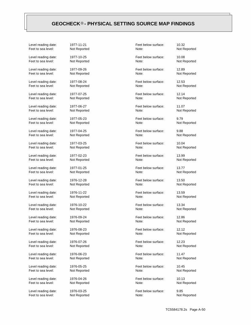
TC5584178.2s Page A-50
Not ReportedNote:Not ReportedFeet to sea level:9.85Feet below surface:1976-03-25Level reading date:
Not ReportedNote:Not ReportedFeet to sea level:10.13Feet below surface:1976-04-26Level reading date:
Not ReportedNote:Not ReportedFeet to sea level:10.45Feet below surface:1976-05-25Level reading date:
Not ReportedNote:Not ReportedFeet to sea level:11.47Feet below surface:1976-06-23Level reading date:
Not ReportedNote:Not ReportedFeet to sea level:12.23Feet below surface:1976-07-26Level reading date:
Not ReportedNote:Not ReportedFeet to sea level:12.12Feet below surface:1976-08-23Level reading date:
Not ReportedNote:Not ReportedFeet to sea level:12.86Feet below surface:1976-09-24Level reading date:
Not ReportedNote:Not ReportedFeet to sea level:13.34Feet below surface:1976-10-22Level reading date:
Not ReportedNote:Not ReportedFeet to sea level:13.59Feet below surface:1976-11-22Level reading date:
Not ReportedNote:Not ReportedFeet to sea level:13.50Feet below surface:1976-12-28Level reading date:
Not ReportedNote:Not ReportedFeet to sea level:13.77Feet below surface:1977-01-25Level reading date:
Not ReportedNote:Not ReportedFeet to sea level:13.99Feet below surface:1977-02-23Level reading date:
Not ReportedNote:Not ReportedFeet to sea level:10.04Feet below surface:1977-03-25Level reading date:
Not ReportedNote:Not ReportedFeet to sea level:9.88Feet below surface:1977-04-25Level reading date:
Not ReportedNote:Not ReportedFeet to sea level:9.79Feet below surface:1977-05-23Level reading date:
Not ReportedNote:Not ReportedFeet to sea level:11.07Feet below surface:1977-06-27Level reading date:
Not ReportedNote:Not ReportedFeet to sea level:12.14Feet below surface:1977-07-25Level reading date:
Not ReportedNote:Not ReportedFeet to sea level:12.53Feet below surface:1977-08-24Level reading date:
Not ReportedNote:Not ReportedFeet to sea level:12.89Feet below surface:1977-09-26Level reading date:
Not ReportedNote:Not ReportedFeet to sea level:10.08Feet below surface:1977-10-25Level reading date:
Not ReportedNote:Not ReportedFeet to sea level:10.32Feet below surface:1977-11-21Level reading date:
®GEOCHECK - PHYSICAL SETTING SOURCE MAP FINDINGS®

TC5584178.2s Page A-51
Not ReportedNote:Not ReportedFeet to sea level:11.32Feet below surface:1974-06-21Level reading date:
Not ReportedNote:Not ReportedFeet to sea level:12.43Feet below surface:1974-07-24Level reading date:
Not ReportedNote:Not ReportedFeet to sea level:13.39Feet below surface:1974-08-27Level reading date:
Not ReportedNote:Not ReportedFeet to sea level:12.95Feet below surface:1974-09-23Level reading date:
Not ReportedNote:Not ReportedFeet to sea level:12.29Feet below surface:1974-10-24Level reading date:
Not ReportedNote:Not ReportedFeet to sea level:12.08Feet below surface:1974-11-22Level reading date:
Not ReportedNote:Not ReportedFeet to sea level:10.77Feet below surface:1974-12-26Level reading date:
Not ReportedNote:Not ReportedFeet to sea level:10.30Feet below surface:1975-01-23Level reading date:
Not ReportedNote:Not ReportedFeet to sea level:10.57Feet below surface:1975-02-24Level reading date:
Not ReportedNote:Not ReportedFeet to sea level:10.14Feet below surface:1975-03-21Level reading date:
Not ReportedNote:Not ReportedFeet to sea level:10.20Feet below surface:1975-04-21Level reading date:
Not ReportedNote:Not ReportedFeet to sea level:10.63Feet below surface:1975-05-20Level reading date:
Not ReportedNote:Not ReportedFeet to sea level:10.94Feet below surface:1975-06-25Level reading date:
Not ReportedNote:Not ReportedFeet to sea level:11.62Feet below surface:1975-07-25Level reading date:
Not ReportedNote:Not ReportedFeet to sea level:12.82Feet below surface:1975-08-25Level reading date:
Not ReportedNote:Not ReportedFeet to sea level:13.24Feet below surface:1975-09-24Level reading date:
Not ReportedNote:Not ReportedFeet to sea level:11.70Feet below surface:1975-10-23Level reading date:
Not ReportedNote:Not ReportedFeet to sea level:10.85Feet below surface:1975-11-20Level reading date:
Not ReportedNote:Not ReportedFeet to sea level:10.27Feet below surface:1975-12-26Level reading date:
Not ReportedNote:Not ReportedFeet to sea level:10.16Feet below surface:1976-01-26Level reading date:
Not ReportedNote:Not ReportedFeet to sea level:9.77Feet below surface:1976-02-24Level reading date:
®GEOCHECK - PHYSICAL SETTING SOURCE MAP FINDINGS®

TC5584178.2s Page A-52
Not ReportedNote:Not ReportedFeet to sea level:11.61Feet below surface:1972-09-25Level reading date:
Not ReportedNote:Not ReportedFeet to sea level:11.91Feet below surface:1972-10-25Level reading date:
Not ReportedNote:Not ReportedFeet to sea level:10.04Feet below surface:1972-11-22Level reading date:
Not ReportedNote:Not ReportedFeet to sea level:9.33Feet below surface:1972-12-20Level reading date:
Not ReportedNote:Not ReportedFeet to sea level:9.82Feet below surface:1973-01-22Level reading date:
Not ReportedNote:Not ReportedFeet to sea level:9.67Feet below surface:1973-02-22Level reading date:
Not ReportedNote:Not ReportedFeet to sea level:9.87Feet below surface:1973-03-23Level reading date:
Not ReportedNote:Not ReportedFeet to sea level:9.64Feet below surface:1973-04-23Level reading date:
Not ReportedNote:Not ReportedFeet to sea level:10.05Feet below surface:1973-05-22Level reading date:
Not ReportedNote:Not ReportedFeet to sea level:10.71Feet below surface:1973-06-21Level reading date:
Not ReportedNote:Not ReportedFeet to sea level:11.14Feet below surface:1973-07-24Level reading date:
Not ReportedNote:Not ReportedFeet to sea level:10.92Feet below surface:1973-08-22Level reading date:
Not ReportedNote:Not ReportedFeet to sea level:11.43Feet below surface:1973-09-25Level reading date:
Not ReportedNote:Not ReportedFeet to sea level:11.88Feet below surface:1973-10-23Level reading date:
Not ReportedNote:Not ReportedFeet to sea level:11.87Feet below surface:1973-11-26Level reading date:
Not ReportedNote:Not ReportedFeet to sea level:9.43Feet below surface:1973-12-27Level reading date:
Not ReportedNote:Not ReportedFeet to sea level:9.75Feet below surface:1974-01-22Level reading date:
Not ReportedNote:Not ReportedFeet to sea level:9.83Feet below surface:1974-02-20Level reading date:
Not ReportedNote:Not ReportedFeet to sea level:9.60Feet below surface:1974-03-22Level reading date:
Not ReportedNote:Not ReportedFeet to sea level:9.61Feet below surface:1974-04-24Level reading date:
Not ReportedNote:Not ReportedFeet to sea level:10.34Feet below surface:1974-05-20Level reading date:
®GEOCHECK - PHYSICAL SETTING SOURCE MAP FINDINGS®
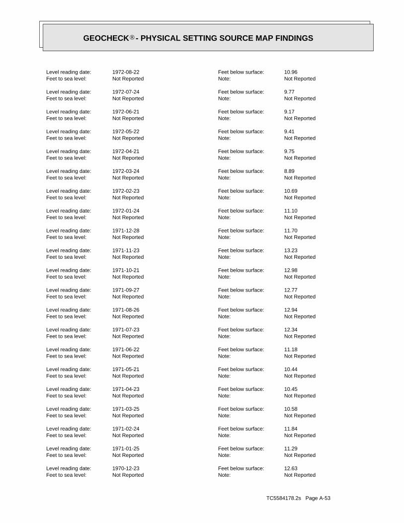
TC5584178.2s Page A-53
Not ReportedNote:Not ReportedFeet to sea level:12.63Feet below surface:1970-12-23Level reading date:
Not ReportedNote:Not ReportedFeet to sea level:11.29Feet below surface:1971-01-25Level reading date:
Not ReportedNote:Not ReportedFeet to sea level:11.84Feet below surface:1971-02-24Level reading date:
Not ReportedNote:Not ReportedFeet to sea level:10.58Feet below surface:1971-03-25Level reading date:
Not ReportedNote:Not ReportedFeet to sea level:10.45Feet below surface:1971-04-23Level reading date:
Not ReportedNote:Not ReportedFeet to sea level:10.44Feet below surface:1971-05-21Level reading date:
Not ReportedNote:Not ReportedFeet to sea level:11.18Feet below surface:1971-06-22Level reading date:
Not ReportedNote:Not ReportedFeet to sea level:12.34Feet below surface:1971-07-23Level reading date:
Not ReportedNote:Not ReportedFeet to sea level:12.94Feet below surface:1971-08-26Level reading date:
Not ReportedNote:Not ReportedFeet to sea level:12.77Feet below surface:1971-09-27Level reading date:
Not ReportedNote:Not ReportedFeet to sea level:12.98Feet below surface:1971-10-21Level reading date:
Not ReportedNote:Not ReportedFeet to sea level:13.23Feet below surface:1971-11-23Level reading date:
Not ReportedNote:Not ReportedFeet to sea level:11.70Feet below surface:1971-12-28Level reading date:
Not ReportedNote:Not ReportedFeet to sea level:11.10Feet below surface:1972-01-24Level reading date:
Not ReportedNote:Not ReportedFeet to sea level:10.69Feet below surface:1972-02-23Level reading date:
Not ReportedNote:Not ReportedFeet to sea level:8.89Feet below surface:1972-03-24Level reading date:
Not ReportedNote:Not ReportedFeet to sea level:9.75Feet below surface:1972-04-21Level reading date:
Not ReportedNote:Not ReportedFeet to sea level:9.41Feet below surface:1972-05-22Level reading date:
Not ReportedNote:Not ReportedFeet to sea level:9.17Feet below surface:1972-06-21Level reading date:
Not ReportedNote:Not ReportedFeet to sea level:9.77Feet below surface:1972-07-24Level reading date:
Not ReportedNote:Not ReportedFeet to sea level:10.96Feet below surface:1972-08-22Level reading date:
®GEOCHECK - PHYSICAL SETTING SOURCE MAP FINDINGS®

TC5584178.2s Page A-54
Not ReportedNote:Not ReportedFeet to sea level:12.50Feet below surface:1969-02-25Level reading date:
Not ReportedNote:Not ReportedFeet to sea level:12.43Feet below surface:1969-03-21Level reading date:
Not ReportedNote:Not ReportedFeet to sea level:10.38Feet below surface:1969-04-21Level reading date:
Not ReportedNote:Not ReportedFeet to sea level:9.51Feet below surface:1969-05-21Level reading date:
Not ReportedNote:Not ReportedFeet to sea level:11.29Feet below surface:1969-06-23Level reading date:
Not ReportedNote:Not ReportedFeet to sea level:11.91Feet below surface:1969-07-22Level reading date:
Not ReportedNote:Not ReportedFeet to sea level:12.20Feet below surface:1969-08-25Level reading date:
Not ReportedNote:Not ReportedFeet to sea level:12.40Feet below surface:1969-09-25Level reading date:
Not ReportedNote:Not ReportedFeet to sea level:12.99Feet below surface:1969-10-22Level reading date:
Not ReportedNote:Not ReportedFeet to sea level:12.46Feet below surface:1969-11-24Level reading date:
Not ReportedNote:Not ReportedFeet to sea level:11.20Feet below surface:1969-12-23Level reading date:
Not ReportedNote:Not ReportedFeet to sea level:9.84Feet below surface:1970-01-22Level reading date:
Not ReportedNote:Not ReportedFeet to sea level:9.58Feet below surface:1970-02-19Level reading date:
Not ReportedNote:Not ReportedFeet to sea level:9.58Feet below surface:1970-04-27Level reading date:
Not ReportedNote:Not ReportedFeet to sea level:9.69Feet below surface:1970-05-21Level reading date:
Not ReportedNote:Not ReportedFeet to sea level:10.34Feet below surface:1970-06-22Level reading date:
Not ReportedNote:Not ReportedFeet to sea level:11.75Feet below surface:1970-07-22Level reading date:
Not ReportedNote:Not ReportedFeet to sea level:12.86Feet below surface:1970-08-24Level reading date:
Not ReportedNote:Not ReportedFeet to sea level:13.39Feet below surface:1970-09-23Level reading date:
Not ReportedNote:Not ReportedFeet to sea level:13.98Feet below surface:1970-10-23Level reading date:
Not ReportedNote:Not ReportedFeet to sea level:13.84Feet below surface:1970-11-24Level reading date:
®GEOCHECK - PHYSICAL SETTING SOURCE MAP FINDINGS®
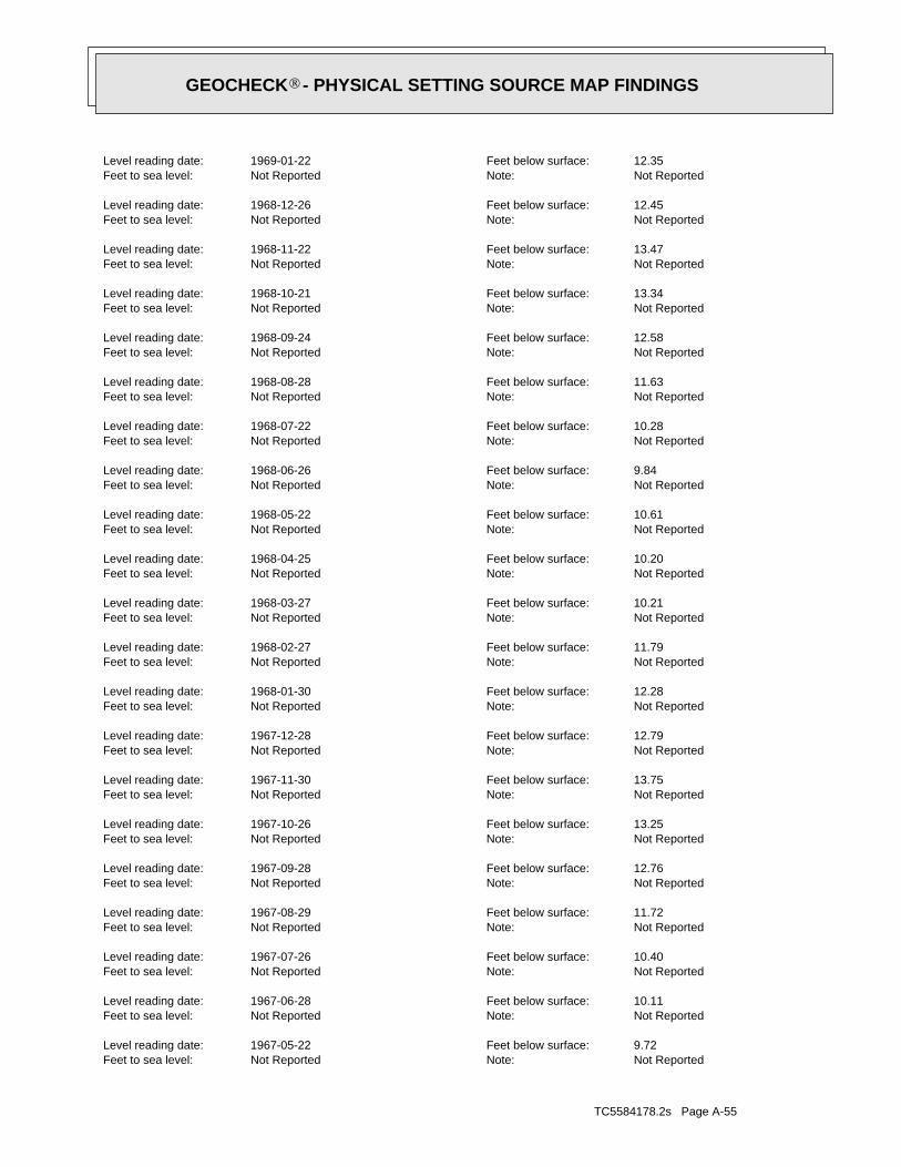
TC5584178.2s Page A-55
Not ReportedNote:Not ReportedFeet to sea level:9.72Feet below surface:1967-05-22Level reading date:
Not ReportedNote:Not ReportedFeet to sea level:10.11Feet below surface:1967-06-28Level reading date:
Not ReportedNote:Not ReportedFeet to sea level:10.40Feet below surface:1967-07-26Level reading date:
Not ReportedNote:Not ReportedFeet to sea level:11.72Feet below surface:1967-08-29Level reading date:
Not ReportedNote:Not ReportedFeet to sea level:12.76Feet below surface:1967-09-28Level reading date:
Not ReportedNote:Not ReportedFeet to sea level:13.25Feet below surface:1967-10-26Level reading date:
Not ReportedNote:Not ReportedFeet to sea level:13.75Feet below surface:1967-11-30Level reading date:
Not ReportedNote:Not ReportedFeet to sea level:12.79Feet below surface:1967-12-28Level reading date:
Not ReportedNote:Not ReportedFeet to sea level:12.28Feet below surface:1968-01-30Level reading date:
Not ReportedNote:Not ReportedFeet to sea level:11.79Feet below surface:1968-02-27Level reading date:
Not ReportedNote:Not ReportedFeet to sea level:10.21Feet below surface:1968-03-27Level reading date:
Not ReportedNote:Not ReportedFeet to sea level:10.20Feet below surface:1968-04-25Level reading date:
Not ReportedNote:Not ReportedFeet to sea level:10.61Feet below surface:1968-05-22Level reading date:
Not ReportedNote:Not ReportedFeet to sea level:9.84Feet below surface:1968-06-26Level reading date:
Not ReportedNote:Not ReportedFeet to sea level:10.28Feet below surface:1968-07-22Level reading date:
Not ReportedNote:Not ReportedFeet to sea level:11.63Feet below surface:1968-08-28Level reading date:
Not ReportedNote:Not ReportedFeet to sea level:12.58Feet below surface:1968-09-24Level reading date:
Not ReportedNote:Not ReportedFeet to sea level:13.34Feet below surface:1968-10-21Level reading date:
Not ReportedNote:Not ReportedFeet to sea level:13.47Feet below surface:1968-11-22Level reading date:
Not ReportedNote:Not ReportedFeet to sea level:12.45Feet below surface:1968-12-26Level reading date:
Not ReportedNote:Not ReportedFeet to sea level:12.35Feet below surface:1969-01-22Level reading date:
®GEOCHECK - PHYSICAL SETTING SOURCE MAP FINDINGS®

TC5584178.2s Page A-56
Not ReportedNote:Not ReportedFeet to sea level:14.28Feet below surface:1965-09-27Level reading date:
Not ReportedNote:Not ReportedFeet to sea level:15.12Feet below surface:1965-10-28Level reading date:
Not ReportedNote:Not ReportedFeet to sea level:15.11Feet below surface:1965-11-24Level reading date:
Not ReportedNote:Not ReportedFeet to sea level:15.39Feet below surface:1965-12-29Level reading date:
Not ReportedNote:Not ReportedFeet to sea level:15.72Feet below surface:1966-01-26Level reading date:
Not ReportedNote:Not ReportedFeet to sea level:14.12Feet below surface:1966-02-23Level reading date:
Not ReportedNote:Not ReportedFeet to sea level:11.96Feet below surface:1966-03-30Level reading date:
Not ReportedNote:Not ReportedFeet to sea level:12.07Feet below surface:1966-04-27Level reading date:
Not ReportedNote:Not ReportedFeet to sea level:11.74Feet below surface:1966-05-26Level reading date:
Not ReportedNote:Not ReportedFeet to sea level:12.39Feet below surface:1966-06-29Level reading date:
Not ReportedNote:Not ReportedFeet to sea level:13.18Feet below surface:1966-07-28Level reading date:
Not ReportedNote:Not ReportedFeet to sea level:13.93Feet below surface:1966-08-30Level reading date:
Not ReportedNote:Not ReportedFeet to sea level:15.14Feet below surface:1966-08-31Level reading date:
Not ReportedNote:Not ReportedFeet to sea level:14.75Feet below surface:1966-09-27Level reading date:
Not ReportedNote:Not ReportedFeet to sea level:15.12Feet below surface:1966-10-27Level reading date:
Not ReportedNote:Not ReportedFeet to sea level:14.24Feet below surface:1966-11-30Level reading date:
Not ReportedNote:Not ReportedFeet to sea level:14.42Feet below surface:1966-12-28Level reading date:
Not ReportedNote:Not ReportedFeet to sea level:13.63Feet below surface:1967-01-25Level reading date:
Not ReportedNote:Not ReportedFeet to sea level:13.19Feet below surface:1967-02-27Level reading date:
Not ReportedNote:Not ReportedFeet to sea level:11.33Feet below surface:1967-03-31Level reading date:
Not ReportedNote:Not ReportedFeet to sea level:9.53Feet below surface:1967-04-25Level reading date:
®GEOCHECK - PHYSICAL SETTING SOURCE MAP FINDINGS®

TC5584178.2s Page A-57
Not ReportedNote:Not ReportedFeet to sea level:14.82Feet below surface:1963-12-27Level reading date:
Not ReportedNote:Not ReportedFeet to sea level:13.52Feet below surface:1964-01-29Level reading date:
Not ReportedNote:Not ReportedFeet to sea level:11.62Feet below surface:1964-02-26Level reading date:
Not ReportedNote:Not ReportedFeet to sea level:10.84Feet below surface:1964-03-30Level reading date:
Not ReportedNote:Not ReportedFeet to sea level:9.44Feet below surface:1964-04-26Level reading date:
Not ReportedNote:Not ReportedFeet to sea level:9.10Feet below surface:1964-05-26Level reading date:
Not ReportedNote:Not ReportedFeet to sea level:11.55Feet below surface:1964-06-26Level reading date:
Not ReportedNote:Not ReportedFeet to sea level:12.40Feet below surface:1964-07-28Level reading date:
Not ReportedNote:Not ReportedFeet to sea level:13.49Feet below surface:1964-08-26Level reading date:
Not ReportedNote:Not ReportedFeet to sea level:14.51Feet below surface:1964-09-28Level reading date:
Not ReportedNote:Not ReportedFeet to sea level:14.64Feet below surface:1964-10-27Level reading date:
Not ReportedNote:Not ReportedFeet to sea level:15.19Feet below surface:1964-11-25Level reading date:
Not ReportedNote:Not ReportedFeet to sea level:14.77Feet below surface:1964-12-29Level reading date:
Not ReportedNote:Not ReportedFeet to sea level:14.04Feet below surface:1965-01-27Level reading date:
Not ReportedNote:Not ReportedFeet to sea level:12.88Feet below surface:1965-02-23Level reading date:
Not ReportedNote:Not ReportedFeet to sea level:11.75Feet below surface:1965-03-30Level reading date:
Not ReportedNote:Not ReportedFeet to sea level:11.82Feet below surface:1965-04-29Level reading date:
Not ReportedNote:Not ReportedFeet to sea level:11.95Feet below surface:1965-05-27Level reading date:
Not ReportedNote:Not ReportedFeet to sea level:12.94Feet below surface:1965-06-30Level reading date:
Not ReportedNote:Not ReportedFeet to sea level:13.25Feet below surface:1965-07-28Level reading date:
Not ReportedNote:Not ReportedFeet to sea level:13.64Feet below surface:1965-08-30Level reading date:
®GEOCHECK - PHYSICAL SETTING SOURCE MAP FINDINGS®

TC5584178.2s Page A-58
Not ReportedNote:Not ReportedFeet to sea level:10.39Feet below surface:1962-04-02Level reading date:
Not ReportedNote:Not ReportedFeet to sea level:10.12Feet below surface:1962-05-02Level reading date:
Not ReportedNote:Not ReportedFeet to sea level:11.05Feet below surface:1962-06-02Level reading date:
Not ReportedNote:Not ReportedFeet to sea level:11.75Feet below surface:1962-06-30Level reading date:
Not ReportedNote:Not ReportedFeet to sea level:12.63Feet below surface:1962-07-30Level reading date:
Not ReportedNote:Not ReportedFeet to sea level:13.41Feet below surface:1962-08-29Level reading date:
Not ReportedNote:Not ReportedFeet to sea level:14.28Feet below surface:1962-09-29Level reading date:
Not ReportedNote:Not ReportedFeet to sea level:14.43Feet below surface:1962-10-29Level reading date:
Not ReportedNote:Not ReportedFeet to sea level:14.11Feet below surface:1962-11-29Level reading date:
Not ReportedNote:Not ReportedFeet to sea level:14.15Feet below surface:1962-12-29Level reading date:
Not ReportedNote:Not ReportedFeet to sea level:13.96Feet below surface:1963-01-29Level reading date:
Not ReportedNote:Not ReportedFeet to sea level:13.45Feet below surface:1963-02-28Level reading date:
Not ReportedNote:Not ReportedFeet to sea level:11.22Feet below surface:1963-03-29Level reading date:
Not ReportedNote:Not ReportedFeet to sea level:11.43Feet below surface:1963-05-01Level reading date:
Not ReportedNote:Not ReportedFeet to sea level:11.71Feet below surface:1963-05-29Level reading date:
Not ReportedNote:Not ReportedFeet to sea level:12.09Feet below surface:1963-06-26Level reading date:
Not ReportedNote:Not ReportedFeet to sea level:12.84Feet below surface:1963-07-31Level reading date:
Not ReportedNote:Not ReportedFeet to sea level:13.84Feet below surface:1963-08-27Level reading date:
Not ReportedNote:Not ReportedFeet to sea level:14.55Feet below surface:1963-09-26Level reading date:
Not ReportedNote:Not ReportedFeet to sea level:15.08Feet below surface:1963-10-30Level reading date:
Not ReportedNote:Not ReportedFeet to sea level:15.24Feet below surface:1963-11-27Level reading date:
®GEOCHECK - PHYSICAL SETTING SOURCE MAP FINDINGS®
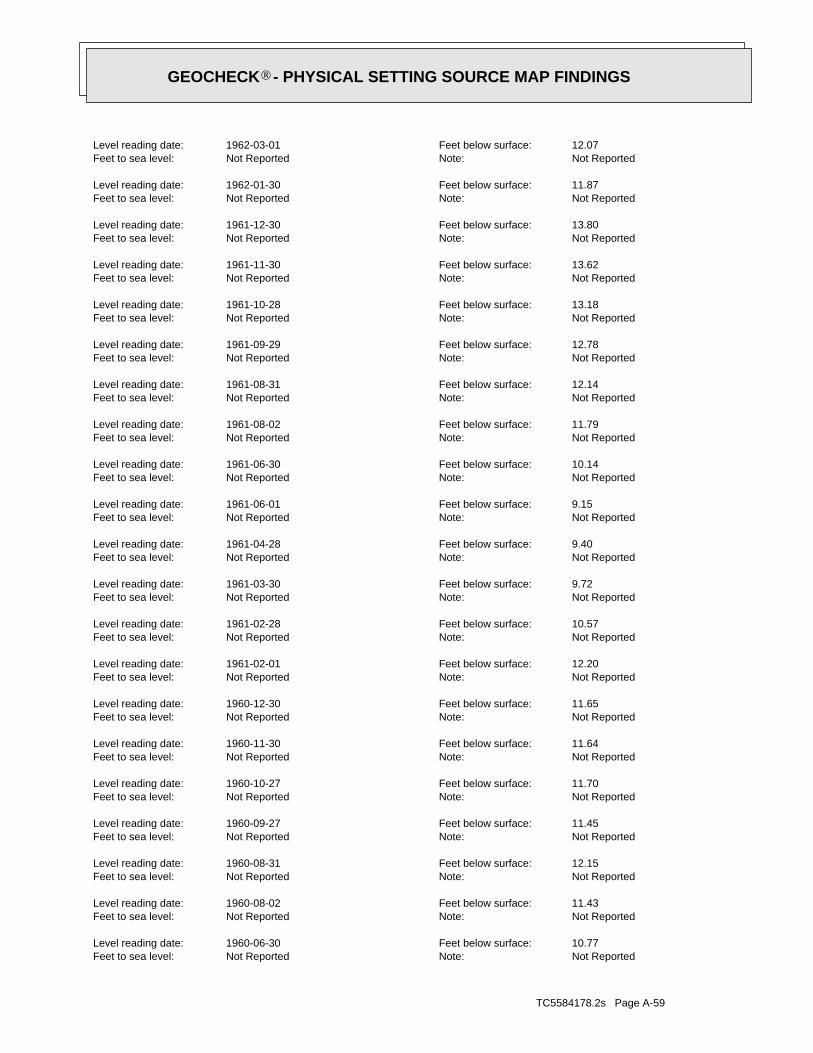
TC5584178.2s Page A-59
Not ReportedNote:Not ReportedFeet to sea level:10.77Feet below surface:1960-06-30Level reading date:
Not ReportedNote:Not ReportedFeet to sea level:11.43Feet below surface:1960-08-02Level reading date:
Not ReportedNote:Not ReportedFeet to sea level:12.15Feet below surface:1960-08-31Level reading date:
Not ReportedNote:Not ReportedFeet to sea level:11.45Feet below surface:1960-09-27Level reading date:
Not ReportedNote:Not ReportedFeet to sea level:11.70Feet below surface:1960-10-27Level reading date:
Not ReportedNote:Not ReportedFeet to sea level:11.64Feet below surface:1960-11-30Level reading date:
Not ReportedNote:Not ReportedFeet to sea level:11.65Feet below surface:1960-12-30Level reading date:
Not ReportedNote:Not ReportedFeet to sea level:12.20Feet below surface:1961-02-01Level reading date:
Not ReportedNote:Not ReportedFeet to sea level:10.57Feet below surface:1961-02-28Level reading date:
Not ReportedNote:Not ReportedFeet to sea level:9.72Feet below surface:1961-03-30Level reading date:
Not ReportedNote:Not ReportedFeet to sea level:9.40Feet below surface:1961-04-28Level reading date:
Not ReportedNote:Not ReportedFeet to sea level:9.15Feet below surface:1961-06-01Level reading date:
Not ReportedNote:Not ReportedFeet to sea level:10.14Feet below surface:1961-06-30Level reading date:
Not ReportedNote:Not ReportedFeet to sea level:11.79Feet below surface:1961-08-02Level reading date:
Not ReportedNote:Not ReportedFeet to sea level:12.14Feet below surface:1961-08-31Level reading date:
Not ReportedNote:Not ReportedFeet to sea level:12.78Feet below surface:1961-09-29Level reading date:
Not ReportedNote:Not ReportedFeet to sea level:13.18Feet below surface:1961-10-28Level reading date:
Not ReportedNote:Not ReportedFeet to sea level:13.62Feet below surface:1961-11-30Level reading date:
Not ReportedNote:Not ReportedFeet to sea level:13.80Feet below surface:1961-12-30Level reading date:
Not ReportedNote:Not ReportedFeet to sea level:11.87Feet below surface:1962-01-30Level reading date:
Not ReportedNote:Not ReportedFeet to sea level:12.07Feet below surface:1962-03-01Level reading date:
®GEOCHECK - PHYSICAL SETTING SOURCE MAP FINDINGS®

TC5584178.2s Page A-60
Not ReportedNote:Not ReportedFeet to sea level:11.71Feet below surface:1958-08-29Level reading date:
Not ReportedNote:Not ReportedFeet to sea level:12.15Feet below surface:1958-09-27Level reading date:
Not ReportedNote:Not ReportedFeet to sea level:11.66Feet below surface:1958-10-31Level reading date:
Not ReportedNote:Not ReportedFeet to sea level:11.53Feet below surface:1958-11-28Level reading date:
Not ReportedNote:Not ReportedFeet to sea level:11.12Feet below surface:1958-12-30Level reading date:
Not ReportedNote:Not ReportedFeet to sea level:11.04Feet below surface:1959-01-30Level reading date:
Not ReportedNote:Not ReportedFeet to sea level:10.84Feet below surface:1959-02-27Level reading date:
Not ReportedNote:Not ReportedFeet to sea level:10.03Feet below surface:1959-03-28Level reading date:
Not ReportedNote:Not ReportedFeet to sea level:9.41Feet below surface:1959-04-29Level reading date:
Not ReportedNote:Not ReportedFeet to sea level:10.28Feet below surface:1959-05-29Level reading date:
Not ReportedNote:Not ReportedFeet to sea level:11.24Feet below surface:1959-06-30Level reading date:
Not ReportedNote:Not ReportedFeet to sea level:11.67Feet below surface:1959-07-31Level reading date:
Not ReportedNote:Not ReportedFeet to sea level:12.73Feet below surface:1959-09-01Level reading date:
Not ReportedNote:Not ReportedFeet to sea level:13.22Feet below surface:1959-09-30Level reading date:
Not ReportedNote:Not ReportedFeet to sea level:12.51Feet below surface:1959-10-30Level reading date:
Not ReportedNote:Not ReportedFeet to sea level:11.02Feet below surface:1959-12-01Level reading date:
Not ReportedNote:Not ReportedFeet to sea level:10.14Feet below surface:1959-12-30Level reading date:
Not ReportedNote:Not ReportedFeet to sea level:9.97Feet below surface:1960-01-29Level reading date:
Not ReportedNote:Not ReportedFeet to sea level:9.62Feet below surface:1960-04-01Level reading date:
Not ReportedNote:Not ReportedFeet to sea level:9.30Feet below surface:1960-04-29Level reading date:
Not ReportedNote:Not ReportedFeet to sea level:9.78Feet below surface:1960-06-01Level reading date:
®GEOCHECK - PHYSICAL SETTING SOURCE MAP FINDINGS®
TC5584178.2s Page A-61
CTNC00000000163Site id:CT0780122Newsystem:0Syield mgd:0Pmpcap gpm:0Casdiam in:0Diam in:0Rckdpth ft:0Depth ft:BedrockAquifer:DrilledType:ActiveStatus:NTNCSystype:Mt Hope Montessori SchoolSystem:780122System id:WellWell:337801Y:752381X:1993Gisdate:EPA-GPSGismethod:185Well id:
8South1/2 - 1 MileLower
CTNC00000000163CT WELLS
Not ReportedNote:Not ReportedFeet to sea level:9.84Feet below surface:1958-05-27Level reading date:
Not ReportedNote:Not ReportedFeet to sea level:11.17Feet below surface:1958-06-28Level reading date:
Not ReportedNote:Not ReportedFeet to sea level:11.41Feet below surface:1958-08-02Level reading date:
®GEOCHECK - PHYSICAL SETTING SOURCE MAP FINDINGS®
TC5584178.2s Page A-62
0%50%50%5.500 pCi/LBasementNot ReportedNot ReportedNot ReportedNot ReportedLiving Area - 2nd FloorNot ReportedNot ReportedNot ReportedNot ReportedLiving Area - 1st Floor
% >20 pCi/L% 4-20 pCi/L% <4 pCi/LAverage ActivityArea
Number of sites tested: 6
Federal Area Radon Information for Zip Code: 06250
: Zone 3 indoor average level < 2 pCi/L. : Zone 2 indoor average level >= 2 pCi/L and <= 4 pCi/L. Note: Zone 1 indoor average level > 4 pCi/L.
Federal EPA Radon Zone for TOLLAND County: 2
0 (0)0 (0)0 (0)0 (0)0 (0)2 (100)2Somers0 (0)0 (0)0 (0)0 (0)13 (13)87 (87)100Mansfield0 (0)0 (0)0 (0)2 (10.5)2 (10.5)15 (78.9)19Ellington0 (0)0 (0)0 (0)2 (12.5)1 (6.25)13 (81.25)16Coventry0 (0)0 (0)0 (0)0 (0)3 (27.3)8 (72.7)11Columbia0 (0)0 (0)0 (0)1 (10)2 (20)7(70)10Bolton0 (0)0 (0)1 (1)6 (6.2)15 (15.5)74 (76.3)97Andover0 (0)0 (0)0 (0)1 (10)4 (40)5 (50)10Amston0 (0)0 (0)0 (0)0 (0)10 (29.4)24 (70.6)34Manchester0 (0)0 (0)0 (0)0 (0)0 (0)2 (100)1Willington0 (0)0 (0)0 (0)0 (0)0 (0)1 (100)1West Willington0 (0)0 (0)0 (0)1 (3.5)4 (13.8)24 (82.7)29Vernon0 (0)0 (0)0 (0)1 (6.6)4 (26.7)10 (66.7)15Tolland0 (0)0 (0)0 (0)1 (25)0 (0)3 (75)4Storrs0 (0)0 (0)0 (0)0 (0)0 (0)2 (100)2Stafford Springs
___________________________________________________________________________> 100 Pci/L50 < 100 Pci/L20 < 50 Pci/L10 < 20 Pci/L4 < 10 Pci/L< 4 Pci/L# SitesCity
Radon Test Results
State Database: CT Radon
AREA RADON INFORMATION
GEOCHECK - PHYSICAL SETTING SOURCE MAP FINDINGSRADON
®
TOPOGRAPHIC INFORMATION
USGS 7.5’ Digital Elevation Model (DEM)Source: United States Geologic SurveyEDR acquired the USGS 7.5’ Digital Elevation Model in 2002 and updated it in 2006. The 7.5 minute DEM correspondsto the USGS 1:24,000- and 1:25,000-scale topographic quadrangle maps. The DEM provides elevation datawith consistent elevation units and projection.
Current USGS 7.5 Minute Topographic MapSource: U.S. Geological Survey
HYDROLOGIC INFORMATION
Flood Zone Data: This data was obtained from the Federal Emergency Management Agency (FEMA). It depicts 100-year and500-year flood zones as defined by FEMA. It includes the National Flood Hazard Layer (NFHL) which incorporates FloodInsurance Rate Map (FIRM) data and Q3 data from FEMA in areas not covered by NFHL.
Source: FEMATelephone: 877-336-2627Date of Government Version: 2003, 2015
NWI: National Wetlands Inventory. This data, available in select counties across the country, was obtained by EDRin 2002, 2005 and 2010 from the U.S. Fish and Wildlife Service.
State Wetlands Data: Tidal WetlandsSource: Department of Energy & Environmental ProtectionTelephone: 860-424-4054
HYDROGEOLOGIC INFORMATION
AQUIFLOW Information SystemR
Source: EDR proprietary database of groundwater flow informationEDR has developed the AQUIFLOW Information System (AIS) to provide data on the general direction of groundwater
flow at specific points. EDR has reviewed reports submitted to regulatory authorities at select sites and hasextracted the date of the report, hydrogeologically determined groundwater flow direction and depth to water tableinformation.
GEOLOGIC INFORMATION
Geologic Age and Rock Stratigraphic UnitSource: P.G. Schruben, R.E. Arndt and W.J. Bawiec, Geology of the Conterminous U.S. at 1:2,500,000 Scale - A digitalrepresentation of the 1974 P.B. King and H.M. Beikman Map, USGS Digital Data Series DDS - 11 (1994).
STATSGO: State Soil Geographic DatabaseSource: Department of Agriculture, Natural Resources Conservation Service (NRCS)The U.S. Department of Agriculture’s (USDA) Natural Resources Conservation Service (NRCS) leads the nationalConservation Soil Survey (NCSS) and is responsible for collecting, storing, maintaining and distributing soilsurvey information for privately owned lands in the United States. A soil map in a soil survey is a representationof soil patterns in a landscape. Soil maps for STATSGO are compiled by generalizing more detailed (SSURGO)soil survey maps.
SSURGO: Soil Survey Geographic DatabaseSource: Department of Agriculture, Natural Resources Conservation Service (NRCS)Telephone: 800-672-5559SSURGO is the most detailed level of mapping done by the Natural Resources Conservation Service, mappingscales generally range from 1:12,000 to 1:63,360. Field mapping methods using national standards are used toconstruct the soil maps in the Soil Survey Geographic (SSURGO) database. SSURGO digitizing duplicates theoriginal soil survey maps. This level of mapping is designed for use by landowners, townships and countynatural resource planning and management.
TC5584178.2s Page PSGR-1
PHYSICAL SETTING SOURCE RECORDS SEARCHED
LOCAL / REGIONAL WATER AGENCY RECORDS
FEDERAL WATER WELLS
PWS: Public Water SystemsSource: EPA/Office of Drinking WaterTelephone: 202-564-3750Public Water System data from the Federal Reporting Data System. A PWS is any water system which provides water to at
least 25 people for at least 60 days annually. PWSs provide water from wells, rivers and other sources.
PWS ENF: Public Water Systems Violation and Enforcement DataSource: EPA/Office of Drinking WaterTelephone: 202-564-3750Violation and Enforcement data for Public Water Systems from the Safe Drinking Water Information System (SDWIS) after
August 1995. Prior to August 1995, the data came from the Federal Reporting Data System (FRDS).
USGS Water Wells: USGS National Water Inventory System (NWIS)This database contains descriptive information on sites where the USGS collects or has collected data on surfacewater and/or groundwater. The groundwater data includes information on wells, springs, and other sources of groundwater.
STATE RECORDS
Community and Non-Community Water System WellsSource: Department of Public Health, Water Supplies SectionTelephone: 860-509-7333Active, emergency and inactive wells used for potable purposes that are owned and operated by active community
and non-community water systems in Connecticut.
OTHER STATE DATABASE INFORMATION
Connecticut Leachate and Wastewater Discharge SitesSource: Department of Environmental ProtectionTelephone:The Leachate and Waste Water Discharge Inventory Data Layer (LWDS) includes point locations digitized from Leachate
and Wastewater Discharge Source maps compiled by the Connecticut DEP. These maps locate surface and groundwaterdischarges that (1) have received a waste water discharge permit from the state or (2) are historic and nowdefunct waste sites or (3) are locations of accidental spills, leaks, or discharges of a variety of liquid orsolid wastes.
EPA-Approved Sole Source Aquifers in ConnecticutSource: EPATelephone:Sole source aquifers are defined as an aquifer designated as the sole or principal source of drinking water for
a given aquifer service area; that is, an aquifer which is needed to supply 50% or more of the drinking waterfor the area and for which there are no reasonable alternative sources should the aquifer become contaminated.
RADON
State Database: CT RadonSource: Department of Public HealthTelephone: 860-509-7367Radon Statistical Summary
Area Radon InformationSource: USGSTelephone: 703-356-4020The National Radon Database has been developed by the U.S. Environmental Protection Agency(USEPA) and is a compilation of the EPA/State Residential Radon Survey and the National Residential Radon Survey.The study covers the years 1986 - 1992. Where necessary data has been supplemented by information collected atprivate sources such as universities and research institutions.
TC5584178.2s Page PSGR-2
PHYSICAL SETTING SOURCE RECORDS SEARCHED
EPA Radon ZonesSource: EPATelephone: 703-356-4020Sections 307 & 309 of IRAA directed EPA to list and identify areas of U.S. with the potential for elevated indoorradon levels.
OTHER
Airport Landing Facilities: Private and public use landing facilitiesSource: Federal Aviation Administration, 800-457-6656
Epicenters: World earthquake epicenters, Richter 5 or greaterSource: Department of Commerce, National Oceanic and Atmospheric Administration
Earthquake Fault Lines: The fault lines displayed on EDR’s Topographic map are digitized quaternary faultlines, preparedin 1975 by the United State Geological Survey
STREET AND ADDRESS INFORMATION
© 2015 TomTom North America, Inc. All rights reserved. This material is proprietary and the subject of copyright protectionand other intellectual property rights owned by or licensed to Tele Atlas North America, Inc. The use of this material is subjectto the terms of a license agreement. You will be held liable for any unauthorized copying or disclosure of this material.
TC5584178.2s Page PSGR-3
PHYSICAL SETTING SOURCE RECORDS SEARCHED
Appendix D
Municipal Information
Other ID:
CURRENT OWNER TOPO. UTILITIES STRT./ROAD LOCATION CURRENT ASSESSMENTDescription Code Appraised Value Assessed Value
SUPPLEMENTAL DATA
Ex C LandEx C BldgEx Com OB
212225
313,2003,251,000
153,600
219,2002,275,700
107,500
Total 3,717,800 2,602,400
MANSFIELD, CT6078
MANSFIELD TOWN OFSOUTHEAST SCHOOL4 SOUTH EAGLEVILLE RD
STORRS, CT 06268Additional Owners:
VISIONGIS ID: 29.116.1
BK-VOL/PAGE SALE DATE q/u v/i SALE PRICE V.C. PREVIOUS ASSESSMENTS (HISTORY)84/ 559 05/23/1958 U I
EXEMPTIONS OTHER ASSESSMENTS This signature acknowledges a visit by a Data Collector or AssessorYear Description Amount Code Description Number Amount Comm. Int.
APPRAISED VALUE SUMMARY
NOTES
Net Total Appraised Parcel Value 3,717,800
3,190,4000
148,000313,200
0
3,717,800
Appraised Bldg. Value (Card)
RECORD OF OWNERSHIP
-FLDDC:FIELD DATA COLLECTIONSOUTHEAST SCHOOL-RT SIDE
MANSFIELD TOWN OF
5/13/1992-FROM USA .018AC VOL320 PG361 C
BUILDING PERMIT RECORDPermit ID Issue Date Type Description Amount Insp. Date % Comp. Date Comp. Comments Date ID Cd. Purpose/Result13-14-10611-12-82205-06-77406-07-31690-91-153
06/19/201206/30/200604/25/200603/20/1995
CMCMCMCMCM
CommercialCommercialCommercialCommercialCommercial
06,700
067,000
300
09/06/2013
08/18/200908/04/2008
100100100100100
ENTRANCE MTER-FLDBP:09/06/2013-CO(BP#13-14-106)9X12 VESTIBULE ENTRANCESTORAGE AND ANNOUNCERS BOOTH FIELD A AND B BEHIND BACKSTOPS. TRENCH POWER WITH SUB PANEL FROM RESTROOM BLDGCOMMERCIAL BUILDING MTER-FLDBP:08/18/2009-CO(BP#05-06-774)CONCESSION BUILDINGOTHER COMMERCIAL MTER-FLDBP:08/04/2008-CERT OF APP(BP#06-07-316)WELL HOUSEUTILITY SHED
01/04/201009/30/2009
APMT
1615
Appraiser DateCollector Date
LAND LINE VALUATION SECTION
Census 8811Devel. Lot#
Appraised XF (B) Value (Bldg)Appraised OB (L) Value (Bldg)Appraised Land Value (Bldg)Special Land Value
Total Appraised Parcel ValueValuation Method:
Total:ASSESSING NEIGHBORHOOD
Type ISVISIT/ CHANGE HISTORY
ASSOC PID#
Adjustment: 0
Type
Yr. Code Assessed Value Yr. Code Assessed Value Yr. Code Assessed Value212225
219,2002,275,700
107,500
201420142014
212225
219,2002,275,700
107,500
201420142014
900900900
2,275,700219,200107,500
Total: 2,602,400 Total: Total:
201520152015
NBHD/ SUB0001/A
NBHD Name Street Index Name Tracing Batch
2,602,400 2,602,400
B#11
Total Card Land Units:
9019AC2
Use Code
UseDescription
Town MDL-ComExcess Front
RAR90Zone D Front Depth
2.0014.10
UnitsACAC
AC16.10 Parcel Total Land Area:
135,000.006,000.00
1.00001.0000
I. FactorUnit Price S.A.
50
16.1 AC
1.00000.8300
AcreAcre C. Factor
1.001.00
C090
ST.Idx Adj.
0.900.00
Total Land Value:
Notes- Adj Special PricingSF1AC2
121,500.004,980.00
Adj. Unit Price Land Value243,000
70,200
313,200
DiscDisc
Property Location: 134 WARRENVILLE RD MAP ID: 29/ 116/ 1/ /Bldg #: 1 of 2 Card 1 of 2 Print Date: 05/09/2016 17:42Vision ID: 3923 Account #
Parcel Description29 116 1
Bldg Name: State Use: 901Sec #: 1 ofof 1
S AdjFact
1.001.00
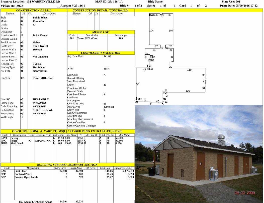
FEP
FOP
FOP
BAS
FOP
129
4011
89
36 373 36
104
2512
26
4614
20119
36
47 4
37129
3
11
4022
405
465282
98
45 33
9893153226
5112
37
104
82
Model
CONSTRUCTION DETAILElement Cd. Ch. Description
COST/MARKET VALUATION
BUILDING SUB-AREA SUMMARY SECTIONCode
Ttl. Gross Liv/Lease Area:
Style
GradeStoriesOccupancy
Exterior Wall 2Roof StructureRoof CoverInterior Wall 1
Exterior Wall 1
Interior Wall 2Interior Floor 1Interior Floor 2Heating FuelHeating TypeAC Type
Bldg Use
49 Pubilc School94 Comm/Ind07 C1119 Brick Veneer
03 Gable04 Tar + Gravel05 Drywall
Heat/ACFrame TypeBaths/PlumbingCeiling/WallRooms/PrtnsWall Height
MIXED USE
Element Cd. Ch. DescriptionCONSTRUCTION DETAIL (CONTINUED)
06 Vnl Linolium
09 Typical05 Hot Water01 None/partial
901 Town MDL-Com
00 HEAT ONLY03 MASONRY02 AVERAGE05 SUS-CEIL & WL02 AVERAGE10
Code901
DescriptionTown MDL-Com
Percentage100
BASFEPFOP
DescriptionFirst FloorEnclosed PorchFramed Open Porch
Living Area34,594
00
Gross Area34,594
34,594
108528
35,230
Eff. Area Unit Cost141.06
91.4335.27
Undeprec. Value4,879,830
9,87418,620
Apr Value52,30089,6006,100
Adj. Base Rate: 141.06
AYB
Dep CodeRemodel RatingYear RemodeledDep %Functional ObslncExternal Obslnc
1Cost Trend Factor
1957
A
35
Condition% CompleteOverall % CondApprais ValDep % OvrDep Ovr CommentMisc Imp OvrMisc Imp Ovr CommentCost to Cure OvrCost to Cure Ovr Comment
653,190,4000
0
0
OB-OUTBUILDING & YARD ITEMS(L) / XF-BUILDING EXTRA FEATURES(B)Code SubDescription
PAV1FNCSHD2
CPavingFenceShed Good
Sub Descript
CHAINLINK
L/BLLL
Units41,50016,000468
Unit Price Yr Gde Dp Rt Cnd %Cnd1.808.0015.00
195719571991
CB
AAA
707070
Property Location: 134 WARRENVILLE RD MAP ID: 29/ 116/ 1/ /Bldg #: 1 of 2 Card 1 of 2 Print Date: 05/09/2016 17:42Vision ID: 3923 Account #
Parcel Description29 116 1
Bldg Name: State Use: 901Sec #: 1 ofof 1
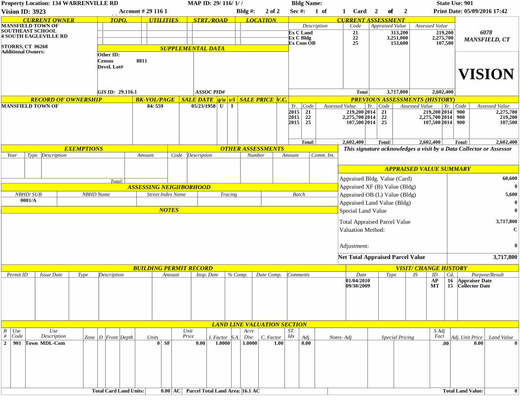
Other ID:
CURRENT OWNER TOPO. UTILITIES STRT./ROAD LOCATION CURRENT ASSESSMENTDescription Code Appraised Value Assessed Value
SUPPLEMENTAL DATA
Ex C LandEx C BldgEx Com OB
212225
313,2003,251,000
153,600
219,2002,275,700
107,500
Total 3,717,800 2,602,400
MANSFIELD, CT6078
MANSFIELD TOWN OFSOUTHEAST SCHOOL4 SOUTH EAGLEVILLE RD
STORRS, CT 06268Additional Owners:
VISIONGIS ID: 29.116.1
BK-VOL/PAGE SALE DATE q/u v/i SALE PRICE V.C. PREVIOUS ASSESSMENTS (HISTORY)84/ 559 05/23/1958 U I
EXEMPTIONS OTHER ASSESSMENTS This signature acknowledges a visit by a Data Collector or AssessorYear Description Amount Code Description Number Amount Comm. Int.
APPRAISED VALUE SUMMARY
NOTES
Net Total Appraised Parcel Value 3,717,800
60,6000
5,60000
3,717,800
Appraised Bldg. Value (Card)
RECORD OF OWNERSHIPMANSFIELD TOWN OF
C
BUILDING PERMIT RECORDPermit ID Issue Date Type Description Amount Insp. Date % Comp. Date Comp. Comments Date ID Cd. Purpose/Result
01/04/201009/30/2009
APMT
1615
Appraiser DateCollector Date
LAND LINE VALUATION SECTION
Census 8811Devel. Lot#
Appraised XF (B) Value (Bldg)Appraised OB (L) Value (Bldg)Appraised Land Value (Bldg)Special Land Value
Total Appraised Parcel ValueValuation Method:
Total:ASSESSING NEIGHBORHOOD
Type ISVISIT/ CHANGE HISTORY
ASSOC PID#
Adjustment: 0
Type
Yr. Code Assessed Value Yr. Code Assessed Value Yr. Code Assessed Value212225
219,2002,275,700
107,500
201420142014
212225
219,2002,275,700
107,500
201420142014
900900900
2,275,700219,200107,500
Total: 2,602,400 Total: Total:
201520152015
NBHD/ SUB0001/A
NBHD Name Street Index Name Tracing Batch
2,602,400 2,602,400
B#2
Total Card Land Units:
901
Use Code
UseDescription
Town MDL-ComZone D Front Depth
0Units
SF
AC0.00 Parcel Total Land Area:
0.00 1.0000I. Factor
Unit Price S.A.
16.1 AC
1.0000
AcreC. Factor
1.00
ST.Idx Adj.
0.00
Total Land Value:
Notes- Adj Special Pricing0.00
Adj. Unit Price Land Value0
0
Disc
Property Location: 134 WARRENVILLE RD MAP ID: 29/ 116/ 1/ /Bldg #: 2 of 2 Card 2 of 2 Print Date: 05/09/2016 17:42Vision ID: 3923 Account #
Parcel Description29 116 1
Bldg Name: State Use: 901Sec #: 1 ofof 1
S AdjFact
.00
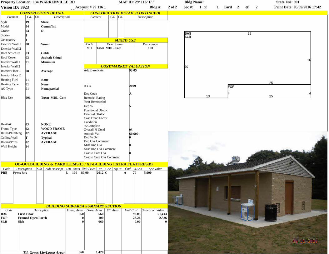
BASSLB
FOP
20
134
25
16
38
425
Model
CONSTRUCTION DETAILElement Cd. Ch. Description
COST/MARKET VALUATION
BUILDING SUB-AREA SUMMARY SECTIONCode
Ttl. Gross Liv/Lease Area:
Style
GradeStoriesOccupancy
Exterior Wall 2Roof StructureRoof CoverInterior Wall 1
Exterior Wall 1
Interior Wall 2Interior Floor 1Interior Floor 2Heating FuelHeating TypeAC Type
Bldg Use
19 Store94 Comm/Ind04 D1108 Wood
03 Gable03 Asphalt Shingl01 Minimum
Heat/ACFrame TypeBaths/PlumbingCeiling/WallRooms/PrtnsWall Height
MIXED USE
Element Cd. Ch. DescriptionCONSTRUCTION DETAIL (CONTINUED)
08 Average
01 None01 None01 None/partial
901 Town MDL-Com
03 NONE02 WOOD FRAME02 AVERAGET Typical02 AVERAGE14
Code901
DescriptionTown MDL-Com
Percentage100
BASFOPSLB
DescriptionFirst FloorFramed Open PorchSlab
Living Area660
00
Gross Area660
660
100660
1,420
Eff. Area Unit Cost93.0523.26
0.00
Undeprec. Value61,413
2,3260
Apr Value5,600
Adj. Base Rate: 93.05
AYB
Dep CodeRemodel RatingYear RemodeledDep %Functional ObslncExternal ObslncCost Trend Factor
2009
A
5
Condition% CompleteOverall % CondApprais ValDep % OvrDep Ovr CommentMisc Imp OvrMisc Imp Ovr CommentCost to Cure OvrCost to Cure Ovr Comment
9560,6000
0
0
OB-OUTBUILDING & YARD ITEMS(L) / XF-BUILDING EXTRA FEATURES(B)Code SubDescription
PRB Press BoxSub Descript L/B
LUnits100
Unit Price Yr Gde Dp Rt Cnd %Cnd80.00 2012 C A 70
Property Location: 134 WARRENVILLE RD MAP ID: 29/ 116/ 1/ /Bldg #: 2 of 2 Card 2 of 2 Print Date: 05/09/2016 17:42Vision ID: 3923 Account #
Parcel Description29 116 1
Bldg Name: State Use: 901Sec #: 1 ofof 1
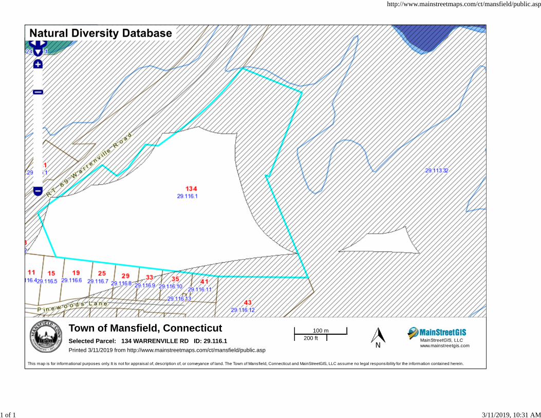
Town of Mansfield, ConnecticutMainStreetGIS, LLCwww.mainstreetgis.com
Selected Parcel: 134 WARRENVILLE RD ID: 29.116.1Printed 3/11/2019 from http://www.mainstreetmaps.com/ct/mansfield/public.asp
This map is for informational purposes only. It is not for appraisal of, description of, or conveyance of land. The Town of Mansfield, Connecticut and MainStreetGIS, LLC assume no legal responsibility for the information contained herein.
100 m200 ft
http://www.mainstreetmaps.com/ct/mansfield/public.asp
1 of 1 3/11/2019, 10:31 AM
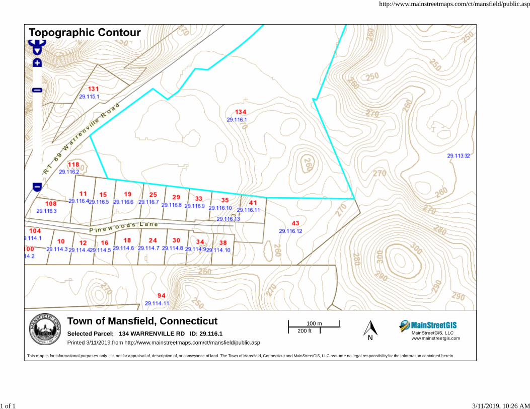
Town of Mansfield, ConnecticutMainStreetGIS, LLCwww.mainstreetgis.com
Selected Parcel: 134 WARRENVILLE RD ID: 29.116.1Printed 3/11/2019 from http://www.mainstreetmaps.com/ct/mansfield/public.asp
This map is for informational purposes only. It is not for appraisal of, description of, or conveyance of land. The Town of Mansfield, Connecticut and MainStreetGIS, LLC assume no legal responsibility for the information contained herein.
100 m200 ft
http://www.mainstreetmaps.com/ct/mansfield/public.asp
1 of 1 3/11/2019, 10:26 AM

Town of Mansfield, ConnecticutMainStreetGIS, LLCwww.mainstreetgis.com
Selected Parcel: 134 WARRENVILLE RD ID: 29.116.1Printed 3/11/2019 from http://www.mainstreetmaps.com/ct/mansfield/public.asp
This map is for informational purposes only. It is not for appraisal of, description of, or conveyance of land. The Town of Mansfield, Connecticut and MainStreetGIS, LLC assume no legal responsibility for the information contained herein.
100 m200 ft
http://www.mainstreetmaps.com/ct/mansfield/public.asp
1 of 1 3/11/2019, 10:30 AM
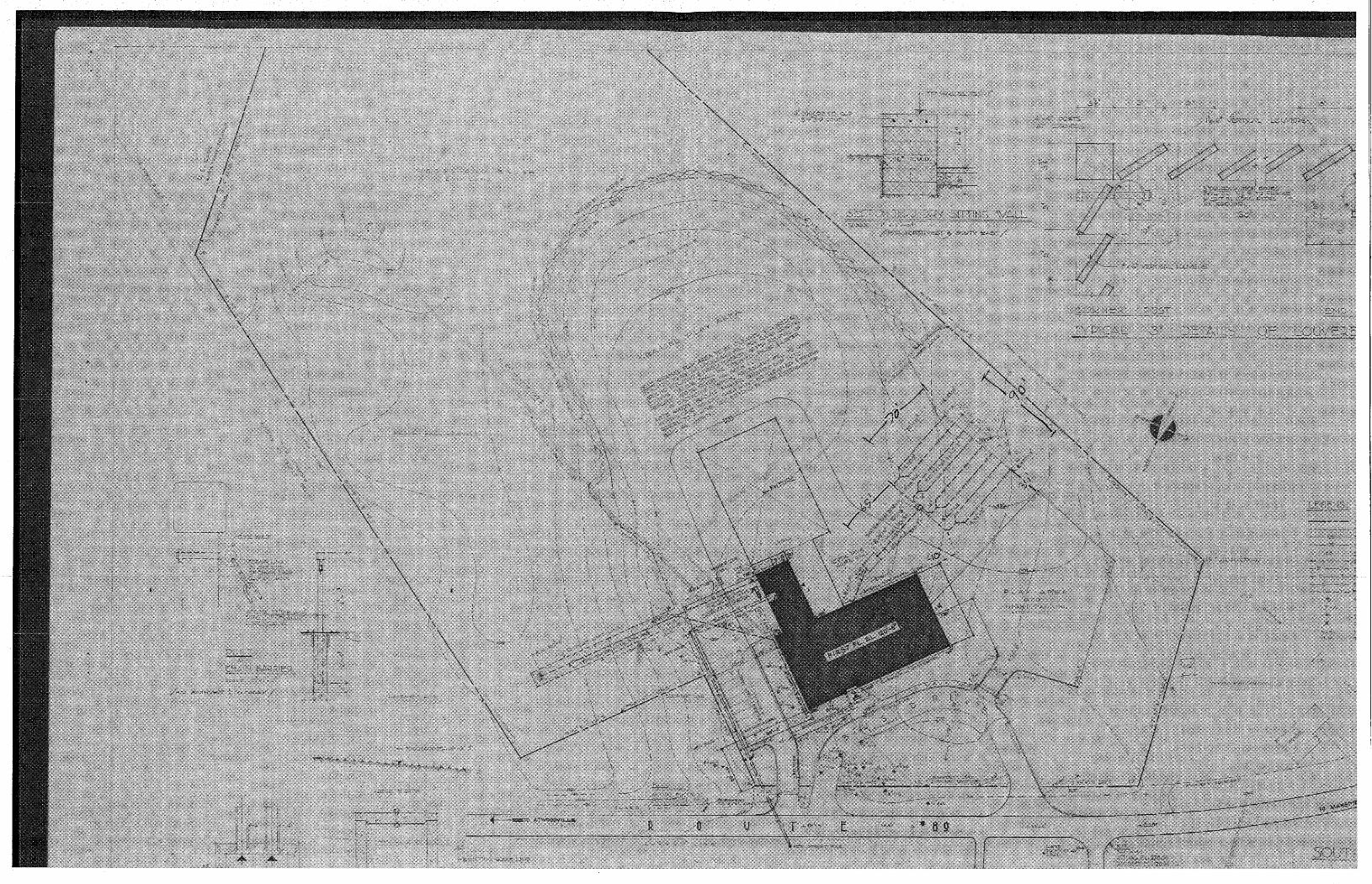
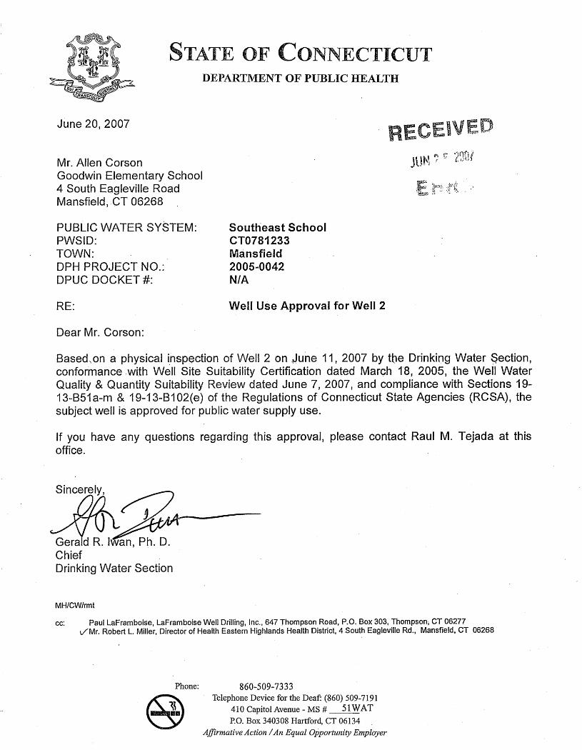

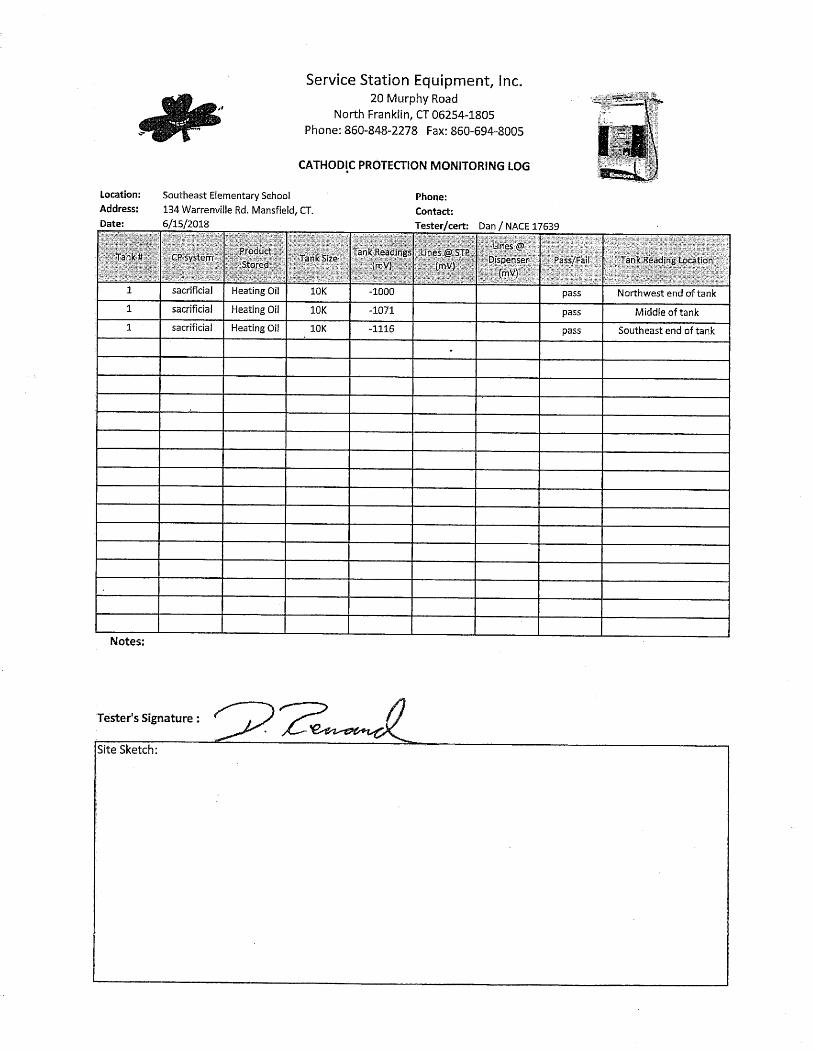
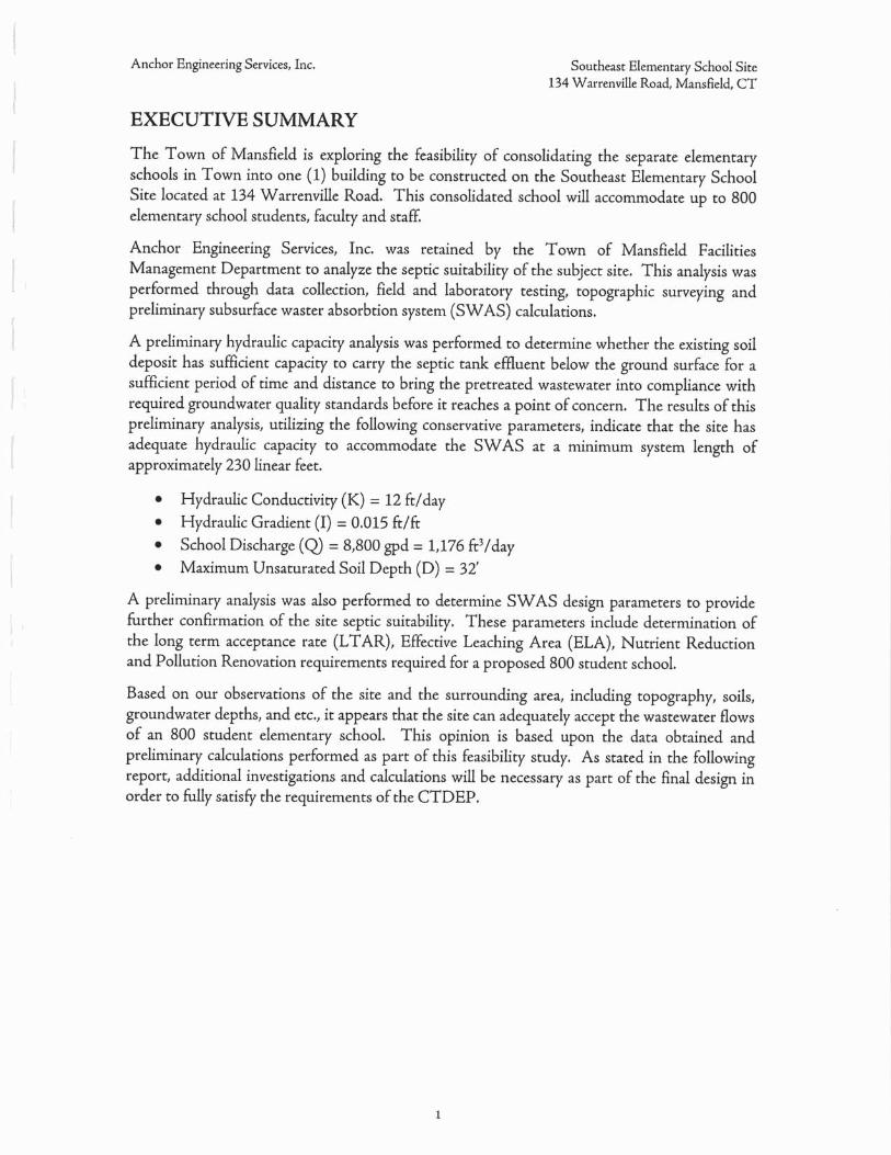
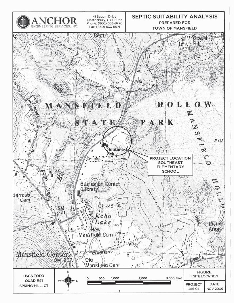
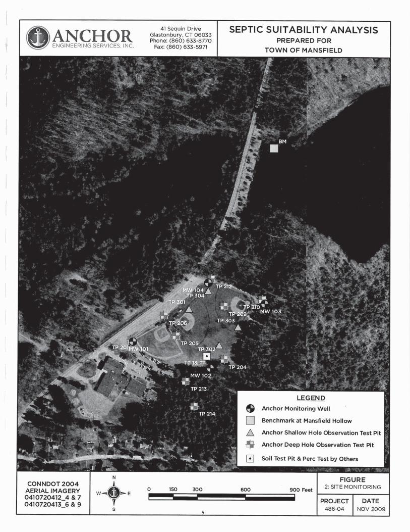
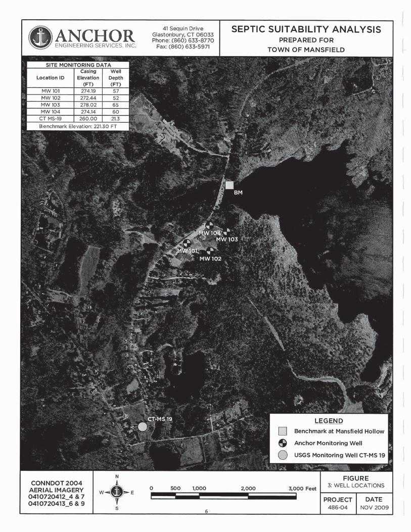
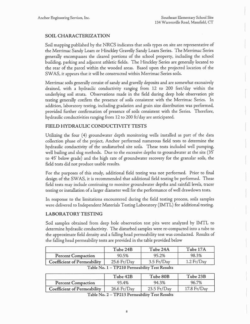
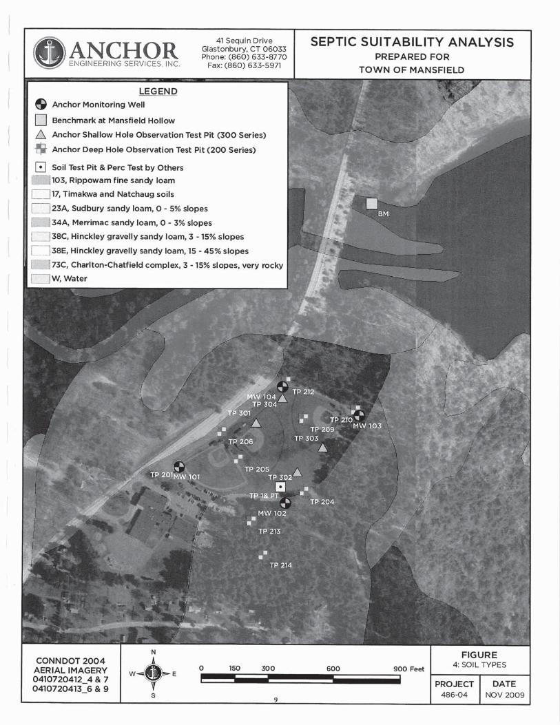
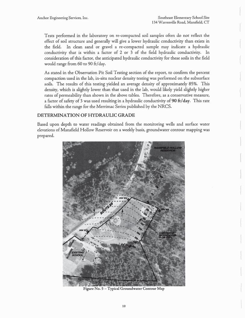
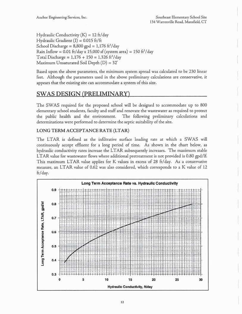


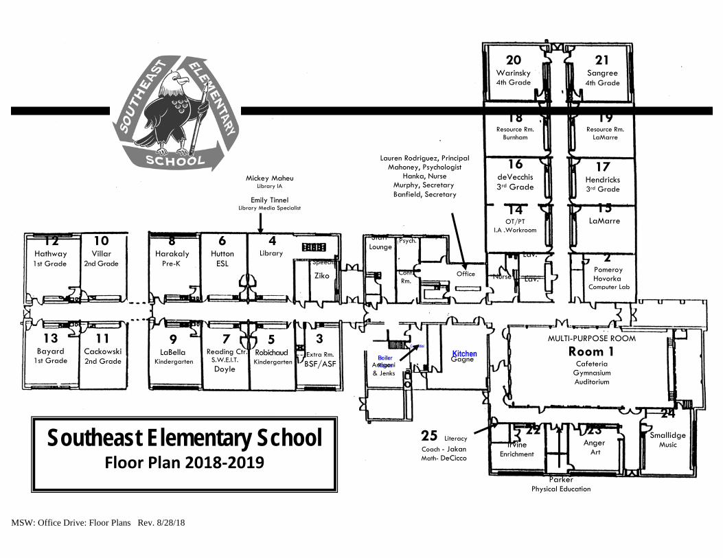
20 Warinsky 4th Grade
21 Sangree 4th Grade
18 Resource Rm.
Burnham
19 Resource Rm.
LaMarre
16 deVecchis 3rd Grade
17 Hendricks 3rd Grade
14 OT/PT
I.A .Workroom
15 LaMarre
2 Pomeroy Hovorka
Computer Lab
13 Bayard
1st Grade
12 Hathway 1st Grade
11 Cackowski 2nd Grade
10 Villar
2nd Grade
9 LaBella
Kindergarten
7 Reading Ctr.
S.W.E.I.T. Doyle
5 Robichaud
Kindergarten
8 Harakaly
Pre-K
6 Hutton
ESL
4 Library
3
Extra Rm. BSF/ASF
24
Smallidge Music
23 Anger
Art
22
Irvine Enrichment
Lauren Rodriguez, Principal Mahoney, Psychologist
Hanka, Nurse Murphy, Secretary Banfield, Secretary
25 Literacy Coach - Jakan Math- DeCicco
Parker Physical Education
MULTI-PURPOSE ROOM
Room 1 Cafeteria
Gymnasium Auditorium
Gagne
Arrigoni & Jenks
Lav.
Lav.
Staff Lounge
Conf. Rm.
Nurse
Speech
Ziko
Southeast Elementary School Floor Plan 2018-2019
Psych. Principal
Office
Mickey Maheu Library IA
Emily Tinnel Library Media Specialist
MSW: Office Drive: Floor Plans Rev. 8/28/18
Appendix E
Sanborn Fire Insurance Maps

Certified Sanborn® Map Report
Inquiry Number:
6 Armstrong Road, 4th floor Shelton, CT 06484Toll Free: 800.352.0050 www.edrnet.com
Southeast Elementary School
134 Warrenville Rd
Mansfield Center, CT 06250
March 08, 2019
5584178.3
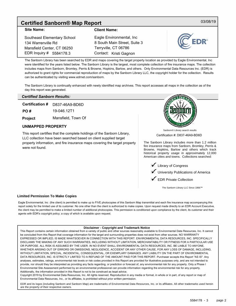
Certified Sanborn® Map Report
Certified Sanborn Results:
Disclaimer - Copyright and Trademark Notice
EDR and its logos (including Sanborn and Sanborn Map) are trademarks of Environmental Data Resources, Inc. or its affiliates. All other trademarks used herein are the property of their respective owners.
page-
The Sanborn Library includes more than 1.2 millionfire insurance maps from Sanborn, Bromley, Perris &Browne, Hopkins, Barlow and others which trackhistorical property usage in approximately 12,000American cities and towns. Collections searched:
Library of Congress
University Publications of America
EDR Private Collection
The Sanborn Library LLC Since 1866™
Limited Permission To Make Copies
Sanborn® Library search results
Contact:EDR Inquiry #
Site Name: Client Name:
Certification #
PO #
Project
03/08/19
134 Warrenville RdSoutheast Elementary School Eagle Environmental, Inc
8 South Main Street, Suite 3Mansfield Center, CT 06250
5584178.3Terryville, CT 06786
Kristi GagnonThe Sanborn Library has been searched by EDR and maps covering the target property location as provided by Eagle Environmental, Incwere identified for the years listed below. The Sanborn Library is the largest, most complete collection of fire insurance maps. The collectionincludes maps from Sanborn, Bromley, Perris & Browne, Hopkins, Barlow, and others. Only Environmental Data Resources Inc. (EDR) isauthorized to grant rights for commercial reproduction of maps by the Sanborn Library LLC, the copyright holder for the collection. Resultscan be authenticated by visiting www.edrnet.com/sanborn.
The Sanborn Library is continually enhanced with newly identified map archives. This report accesses all maps in the collection as of theday this report was generated.
D837-46A9-BD6D19-046.12T1
UNMAPPED PROPERTY
Mansfield, Town Of
This report certifies that the complete holdings of the Sanborn Library,LLC collection have been searched based on client supplied targetproperty information, and fire insurance maps covering the target propertywere not found.
Certification #: D837-46A9-BD6D
Eagle Environmental, Inc (the client) is permitted to make up to FIVE photocopies of this Sanborn Map transmittal and each fire insurance map accompanying thisreport solely for the limited use of its customer. No one other than the client is authorized to make copies. Upon request made directly to an EDR Account Executive,the client may be permitted to make a limited number of additional photocopies. This permission is conditioned upon compliance by the client, its customer and theiragents with EDR's copyright policy; a copy of which is available upon request.
This Report contains certain information obtained from a variety of public and other sources reasonably available to Environmental Data Resources, Inc. It cannotbe concluded from this Report that coverage information for the target and surrounding properties does not exist from other sources. NO WARRANTYEXPRESSED OR IMPLIED, IS MADE WHATSOEVER IN CONNECTION WITH THIS REPORT. ENVIRONMENTAL DATA RESOURCES, INC. SPECIFICALLYDISCLAIMS THE MAKING OF ANY SUCH WARRANTIES, INCLUDING WITHOUT LIMITATION, MERCHANTABILITY OR FITNESS FOR A PARTICULAR USEOR PURPOSE. ALL RISK IS ASSUMED BY THE USER. IN NO EVENT SHALL ENVIRONMENTAL DATA RESOURCES, INC. BE LIABLE TO ANYONE,WHETHER ARISING OUT OF ERRORS OR OMISSIONS, NEGLIGENCE, ACCIDENT OR ANY OTHER CAUSE, FOR ANY LOSS OF DAMAGE, INCLUDING,WITHOUT LIMITATION, SPECIAL, INCIDENTAL, CONSEQUENTIAL, OR EXEMPLARY DAMAGES. ANY LIABILITY ON THE PART OF ENVIRONMENTALDATA RESOURCES, INC. IS STRICTLY LIMITED TO A REFUND OF THE AMOUNT PAID FOR THIS REPORT. Purchaser accepts this Report "AS IS". Anyanalyses, estimates, ratings, environmental risk levels or risk codes provided in this Report are provided for illustrative purposes only, and are not intended toprovide, nor should they be interpreted as providing any facts regarding, or prediction or forecast of, any environmental risk for any property. Only a Phase IEnvironmental Site Assessment performed by an environmental professional can provide information regarding the environmental risk for any property.Additionally, the information provided in this Report is not to be construed as legal advice.Copyright 2019 by Environmental Data Resources, Inc. All rights reserved. Reproduction in any media or format, in whole or in part, of any report or map ofEnvironmental Data Resources, Inc., or its affiliates, is prohibited without prior written permission.
5584178 3 2

Appendix F
Topographic Maps
EDR Historical Topo Map Report
Inquiry Number:
6 Armstrong Road, 4th floor Shelton, CT 06484Toll Free: 800.352.0050 www.edrnet.com
with QuadMatch™
Southeast Elementary School
134 Warrenville Rd
Mansfield Center, CT 06250
March 08, 2019
5584178.4
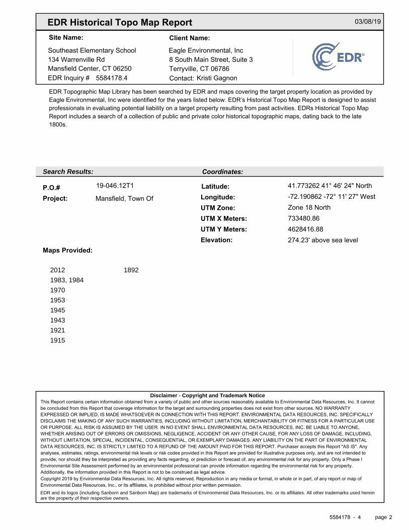
EDR Historical Topo Map Report
EDR Inquiry #
Search Results:
P.O.# Project:
Maps Provided:
Disclaimer - Copyright and Trademark Notice
EDR and its logos (including Sanborn and Sanborn Map) are trademarks of Environmental Data Resources, Inc. or its affiliates. All other trademarks used herein are the property of their respective owners.
page-
Coordinates:
Latitude: Longitude: UTM Zone: UTM X Meters: UTM Y Meters: Elevation:
Contact:
Site Name: Client Name:
2012
1983, 1984
1970
1953
1945
1943
1921
1915
1892
03/08/19
Southeast Elementary School Eagle Environmental, Inc134 Warrenville Rd 8 South Main Street, Suite 3Mansfield Center, CT 06250 Terryville, CT 06786
5584178.4 Kristi Gagnon
EDR Topographic Map Library has been searched by EDR and maps covering the target property location as provided byEagle Environmental, Inc were identified for the years listed below. EDR’s Historical Topo Map Report is designed to assistprofessionals in evaluating potential liability on a target property resulting from past activities. EDRs Historical Topo MapReport includes a search of a collection of public and private color historical topographic maps, dating back to the late1800s.
19-046.12T1 41.773262 41° 46' 24" North
Mansfield, Town Of -72.190862 -72° 11' 27" WestZone 18 North733480.864628416.88274.23' above sea level
This Report contains certain information obtained from a variety of public and other sources reasonably available to Environmental Data Resources, Inc. It cannotbe concluded from this Report that coverage information for the target and surrounding properties does not exist from other sources. NO WARRANTYEXPRESSED OR IMPLIED, IS MADE WHATSOEVER IN CONNECTION WITH THIS REPORT. ENVIRONMENTAL DATA RESOURCES, INC. SPECIFICALLYDISCLAIMS THE MAKING OF ANY SUCH WARRANTIES, INCLUDING WITHOUT LIMITATION, MERCHANTABILITY OR FITNESS FOR A PARTICULAR USEOR PURPOSE. ALL RISK IS ASSUMED BY THE USER. IN NO EVENT SHALL ENVIRONMENTAL DATA RESOURCES, INC. BE LIABLE TO ANYONE,WHETHER ARISING OUT OF ERRORS OR OMISSIONS, NEGLIGENCE, ACCIDENT OR ANY OTHER CAUSE, FOR ANY LOSS OF DAMAGE, INCLUDING,WITHOUT LIMITATION, SPECIAL, INCIDENTAL, CONSEQUENTIAL, OR EXEMPLARY DAMAGES. ANY LIABILITY ON THE PART OF ENVIRONMENTALDATA RESOURCES, INC. IS STRICTLY LIMITED TO A REFUND OF THE AMOUNT PAID FOR THIS REPORT. Purchaser accepts this Report "AS IS". Anyanalyses, estimates, ratings, environmental risk levels or risk codes provided in this Report are provided for illustrative purposes only, and are not intended toprovide, nor should they be interpreted as providing any facts regarding, or prediction or forecast of, any environmental risk for any property. Only a Phase IEnvironmental Site Assessment performed by an environmental professional can provide information regarding the environmental risk for any property.Additionally, the information provided in this Report is not to be construed as legal advice.Copyright 2019 by Environmental Data Resources, Inc. All rights reserved. Reproduction in any media or format, in whole or in part, of any report or map ofEnvironmental Data Resources, Inc., or its affiliates, is prohibited without prior written permission.
5584178 4 2
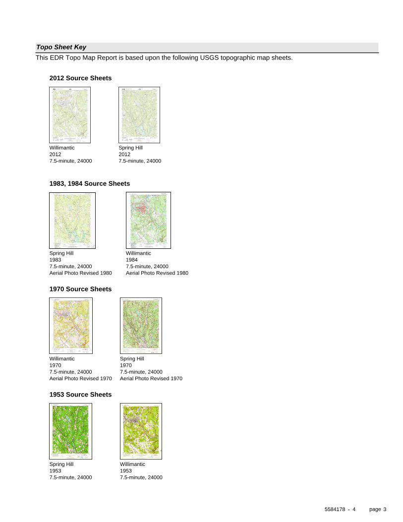
page
Topo Sheet KeyThis EDR Topo Map Report is based upon the following USGS topographic map sheets.
-
2012 Source Sheets
2012Willimantic
7.5-minute, 240002012Spring Hill
7.5-minute, 24000
1983, 1984 Source Sheets
1983Spring Hill
7.5-minute, 24000Aerial Photo Revised 1980
1984Willimantic
7.5-minute, 24000Aerial Photo Revised 1980
1970 Source Sheets
1970Willimantic
7.5-minute, 24000Aerial Photo Revised 1970
1970Spring Hill
7.5-minute, 24000Aerial Photo Revised 1970
1953 Source Sheets
1953Spring Hill
7.5-minute, 240001953Willimantic
7.5-minute, 24000
5584178 4 3
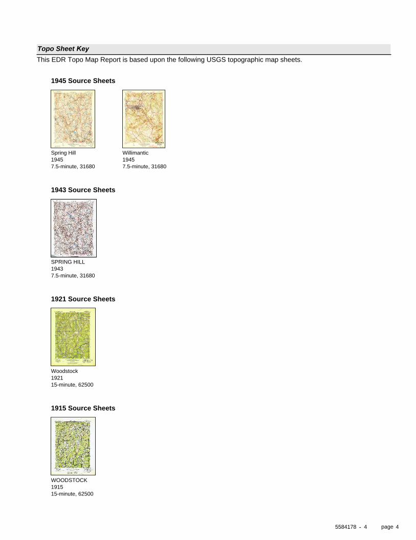
page
Topo Sheet KeyThis EDR Topo Map Report is based upon the following USGS topographic map sheets.
-
1945 Source Sheets
1945Spring Hill
7.5-minute, 316801945Willimantic
7.5-minute, 31680
1943 Source Sheets
1943SPRING HILL
7.5-minute, 31680
1921 Source Sheets
1921Woodstock
15-minute, 62500
1915 Source Sheets
1915WOODSTOCK
15-minute, 62500
5584178 4 4
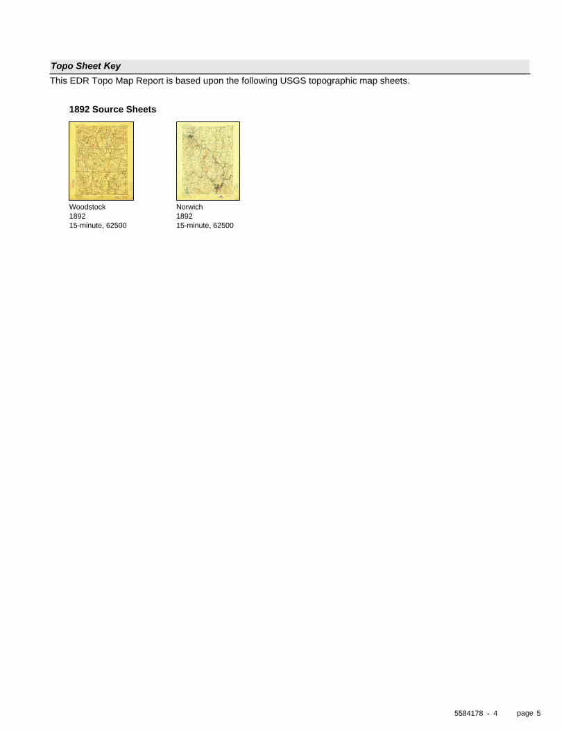
page
Topo Sheet KeyThis EDR Topo Map Report is based upon the following USGS topographic map sheets.
-
1892 Source Sheets
1892Woodstock
15-minute, 625001892Norwich
15-minute, 62500
5584178 4 5
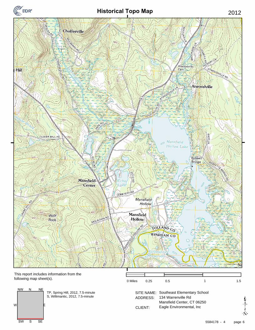
Historical Topo Map
page
SITE NAME: ADDRESS:
CLIENT:
This report includes information from the following map sheet(s).
-
EW
SW S SE
NW N NE
2012
0 Miles 0.25 0.5 1 1.5
Southeast Elementary School134 Warrenville RdMansfield Center, CT 06250Eagle Environmental, Inc
TP, Spring Hill, 2012, 7.5-minuteS, Willimantic, 2012, 7.5-minute
5584178 4 6
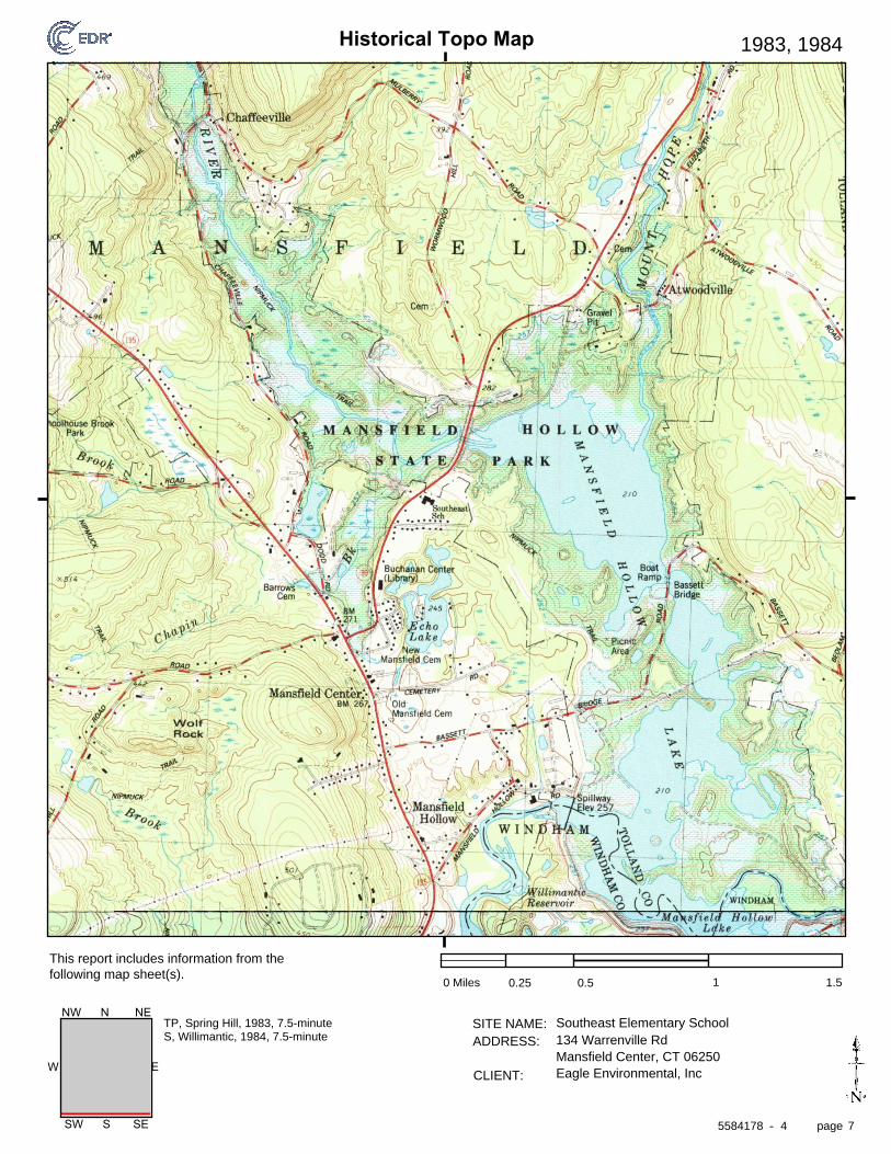
Historical Topo Map
page
SITE NAME: ADDRESS:
CLIENT:
This report includes information from the following map sheet(s).
-
EW
SW S SE
NW N NE
1983, 1984
0 Miles 0.25 0.5 1 1.5
Southeast Elementary School134 Warrenville RdMansfield Center, CT 06250Eagle Environmental, Inc
TP, Spring Hill, 1983, 7.5-minuteS, Willimantic, 1984, 7.5-minute
5584178 4 7
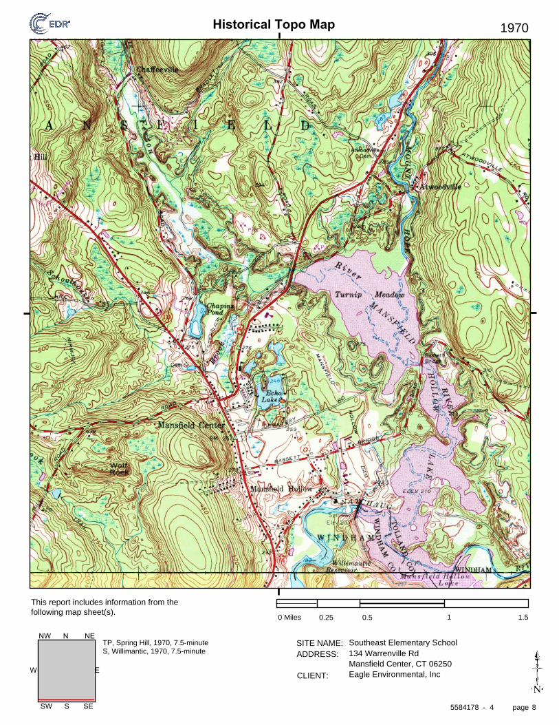
Historical Topo Map
page
SITE NAME: ADDRESS:
CLIENT:
This report includes information from the following map sheet(s).
-
EW
SW S SE
NW N NE
1970
0 Miles 0.25 0.5 1 1.5
Southeast Elementary School134 Warrenville RdMansfield Center, CT 06250Eagle Environmental, Inc
TP, Spring Hill, 1970, 7.5-minuteS, Willimantic, 1970, 7.5-minute
5584178 4 8
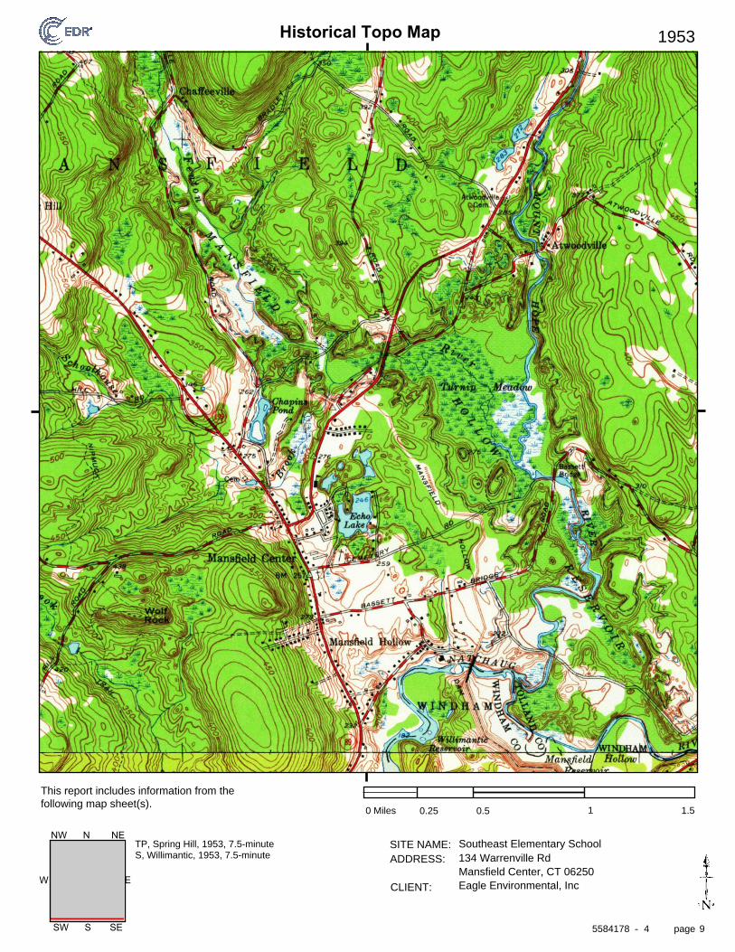
Historical Topo Map
page
SITE NAME: ADDRESS:
CLIENT:
This report includes information from the following map sheet(s).
-
EW
SW S SE
NW N NE
1953
0 Miles 0.25 0.5 1 1.5
Southeast Elementary School134 Warrenville RdMansfield Center, CT 06250Eagle Environmental, Inc
TP, Spring Hill, 1953, 7.5-minuteS, Willimantic, 1953, 7.5-minute
5584178 4 9
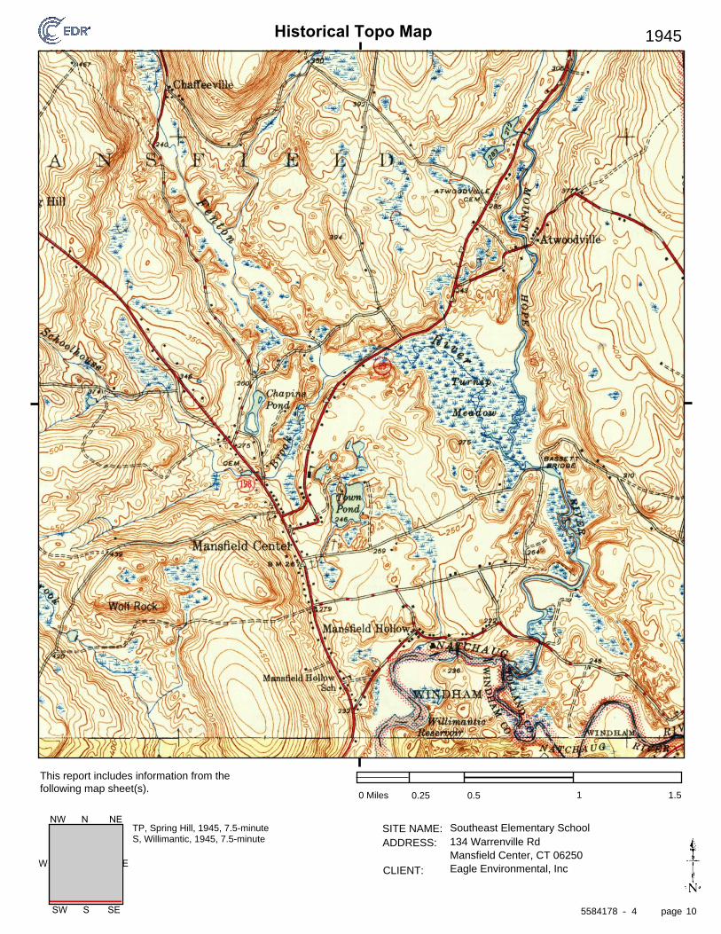
Historical Topo Map
page
SITE NAME: ADDRESS:
CLIENT:
This report includes information from the following map sheet(s).
-
EW
SW S SE
NW N NE
1945
0 Miles 0.25 0.5 1 1.5
Southeast Elementary School134 Warrenville RdMansfield Center, CT 06250Eagle Environmental, Inc
TP, Spring Hill, 1945, 7.5-minuteS, Willimantic, 1945, 7.5-minute
5584178 4 10
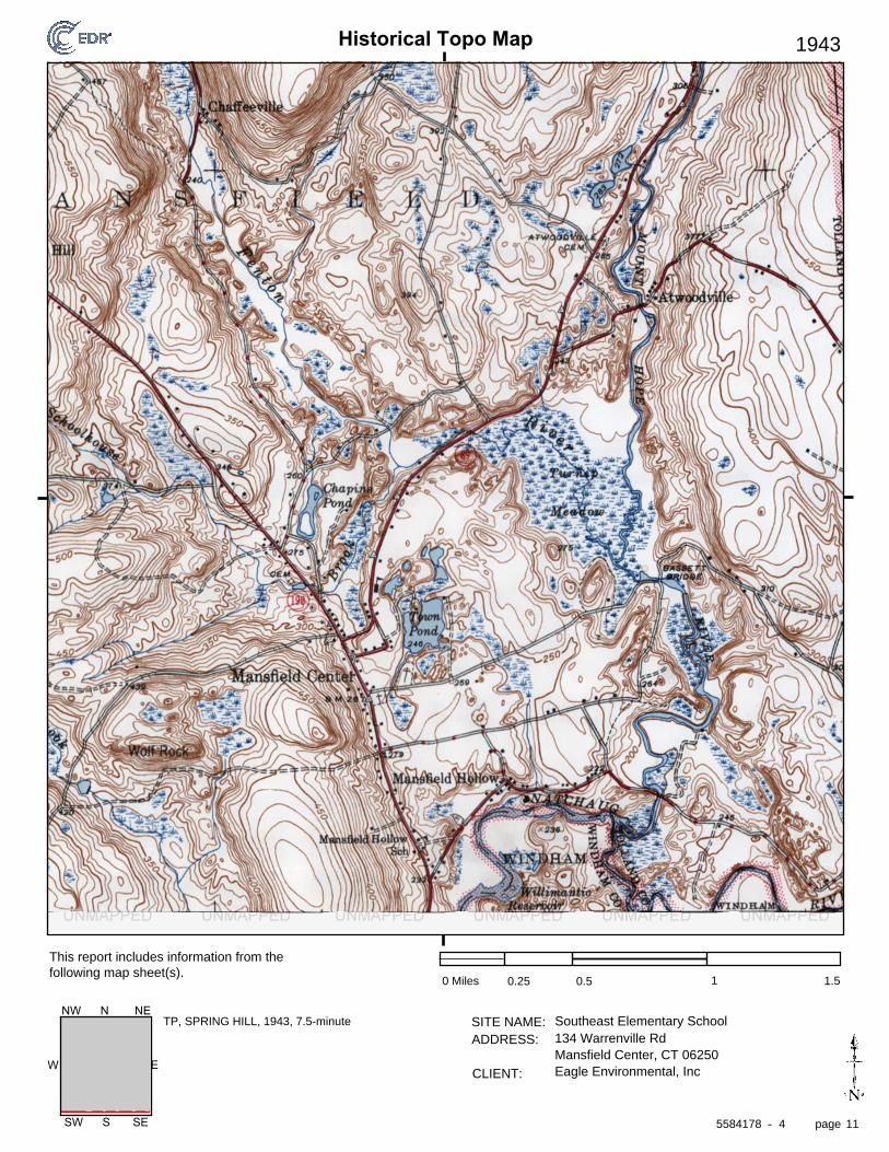
Historical Topo Map
page
SITE NAME: ADDRESS:
CLIENT:
This report includes information from the following map sheet(s).
-
EW
SW S SE
NW N NE
1943
0 Miles 0.25 0.5 1 1.5
Southeast Elementary School134 Warrenville RdMansfield Center, CT 06250Eagle Environmental, Inc
TP, SPRING HILL, 1943, 7.5-minute
5584178 4 11
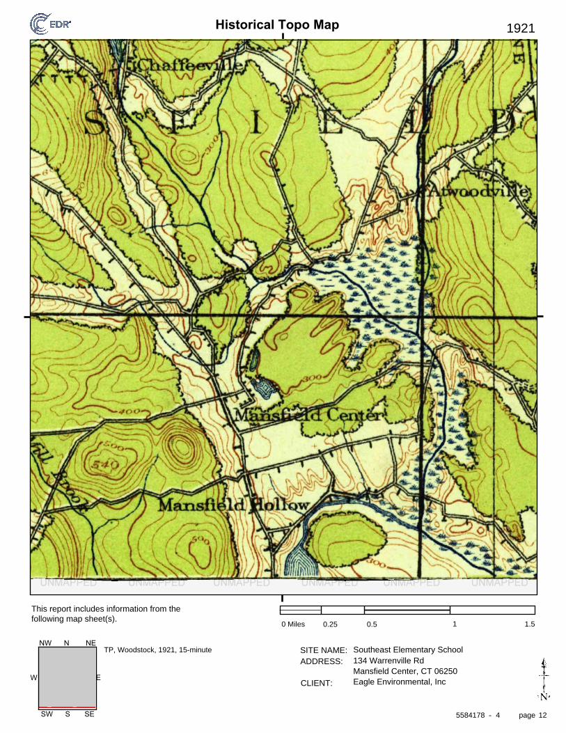
Historical Topo Map
page
SITE NAME: ADDRESS:
CLIENT:
This report includes information from the following map sheet(s).
-
EW
SW S SE
NW N NE
1921
0 Miles 0.25 0.5 1 1.5
Southeast Elementary School134 Warrenville RdMansfield Center, CT 06250Eagle Environmental, Inc
TP, Woodstock, 1921, 15-minute
5584178 4 12
Historical Topo Map
page
SITE NAME: ADDRESS:
CLIENT:
This report includes information from the following map sheet(s).
-
EW
SW S SE
NW N NE
1915
0 Miles 0.25 0.5 1 1.5
Southeast Elementary School134 Warrenville RdMansfield Center, CT 06250Eagle Environmental, Inc
TP, WOODSTOCK, 1915, 15-minute
5584178 4 13
Historical Topo Map
page
SITE NAME: ADDRESS:
CLIENT:
This report includes information from the following map sheet(s).
-
EW
SW S SE
NW N NE
1892
0 Miles 0.25 0.5 1 1.5
Southeast Elementary School134 Warrenville RdMansfield Center, CT 06250Eagle Environmental, Inc
TP, Woodstock, 1892, 15-minuteS, Norwich, 1892, 15-minute
5584178 4 14

Appendix G
Aerial Photographs
The EDR Aerial Photo Decade Package
Southeast Elementary School
134 Warrenville Rd
Mansfield Center, CT 06250
Inquiry Number:
March 08, 2019
5584178.8
6 Armstrong Road, 4th floorShelton, CT 06484Toll Free: 800.352.0050www.edrnet.com
2016 1"=500' Flight Year: 2016 USDA/NAIP
2012 1"=500' Flight Year: 2012 USDA/NAIP
2008 1"=500' Flight Year: 2008 USDA/NAIP
2005 1"=500' Flight Year: 2005 USDA/NAIP
1995 1"=500' Flight Date: April 25, 1995 CTMAGIC
1991 1"=500' Acquisition Date: April 12, 1991 USGS/DOQQ
1990 1"=500' Flight Date: April 27, 1990 MAGIC
1986 1"=500' Flight Date: March 31, 1986 USDA
1980 1"=1000' Flight Date: March 19, 1980 USGS
1974 1"=500' Flight Date: February 24, 1974 USGS
1970 1"=500' Flight Date: May 29, 1970 USGS
1969 1"=500' Flight Date: May 17, 1969 CTMAGIC
1963 1"=500' Flight Date: October 06, 1963 CTMAGIC
1959 1"=500' Flight Date: October 29, 1959 USGS
1951 1"=500' Flight Date: September 09, 1951 CTMAGIC
1943 1"=500' Flight Date: October 13, 1943 USGS
1941 1"=750' Flight Date: November 12, 1941 USGS
1934 1"=500' Flight Date: April 10, 1934 FAIR
EDR Aerial Photo Decade Package 03/08/19
Southeast Elementary School
Site Name: Client Name:
Eagle Environmental, Inc134 Warrenville Rd 8 South Main Street, Suite 3Mansfield Center, CT 06250 Terryville, CT 06786EDR Inquiry # 5584178.8 Contact: Kristi Gagnon
Environmental Data Resources, Inc. (EDR) Aerial Photo Decade Package is a screening tool designed to assistenvironmental professionals in evaluating potential liability on a target property resulting from past activities. EDR’sprofessional researchers provide digitally reproduced historical aerial photographs, and when available, provide one photoper decade.
Search Results:
Year Scale Details Source
When delivered electronically by EDR, the aerial photo images included with this report are for ONE TIME USEONLY. Further reproduction of these aerial photo images is prohibited without permission from EDR. For moreinformation contact your EDR Account Executive.
Disclaimer - Copyright and Trademark NoticeThis Report contains certain information obtained from a variety of public and other sources reasonably available to Environmental Data Resources, Inc. It cannotbe concluded from this Report that coverage information for the target and surrounding properties does not exist from other sources. NO WARRANTYEXPRESSED OR IMPLIED, IS MADE WHATSOEVER IN CONNECTION WITH THIS REPORT. ENVIRONMENTAL DATA RESOURCES, INC. SPECIFICALLYDISCLAIMS THE MAKING OF ANY SUCH WARRANTIES, INCLUDING WITHOUT LIMITATION, MERCHANTABILITY OR FITNESS FOR A PARTICULAR USEOR PURPOSE. ALL RISK IS ASSUMED BY THE USER. IN NO EVENT SHALL ENVIRONMENTAL DATA RESOURCES, INC. BE LIABLE TO ANYONE,WHETHER ARISING OUT OF ERRORS OR OMISSIONS, NEGLIGENCE, ACCIDENT OR ANY OTHER CAUSE, FOR ANY LOSS OF DAMAGE, INCLUDING,WITHOUT LIMITATION, SPECIAL, INCIDENTAL, CONSEQUENTIAL, OR EXEMPLARY DAMAGES. ANY LIABILITY ON THE PART OF ENVIRONMENTALDATA RESOURCES, INC. IS STRICTLY LIMITED TO A REFUND OF THE AMOUNT PAID FOR THIS REPORT. Purchaser accepts this Report "AS IS". Anyanalyses, estimates, ratings, environmental risk levels or risk codes provided in this Report are provided for illustrative purposes only, and are not intended toprovide, nor should they be interpreted as providing any facts regarding, or prediction or forecast of, any environmental risk for any property. Only a Phase IEnvironmental Site Assessment performed by an environmental professional can provide information regarding the environmental risk for any property.Additionally, the information provided in this Report is not to be construed as legal advice.
Copyright 2019 by Environmental Data Resources, Inc. All rights reserved. Reproduction in any media or format, in whole or in part, of any report or map ofEnvironmental Data Resources, Inc., or its affiliates, is prohibited without prior written permission.
EDR and its logos (including Sanborn and Sanborn Map) are trademarks of Environmental Data Resources, Inc. or its affiliates. All other trademarks used herein arethe property of their respective owners.
5584178 8- page 2
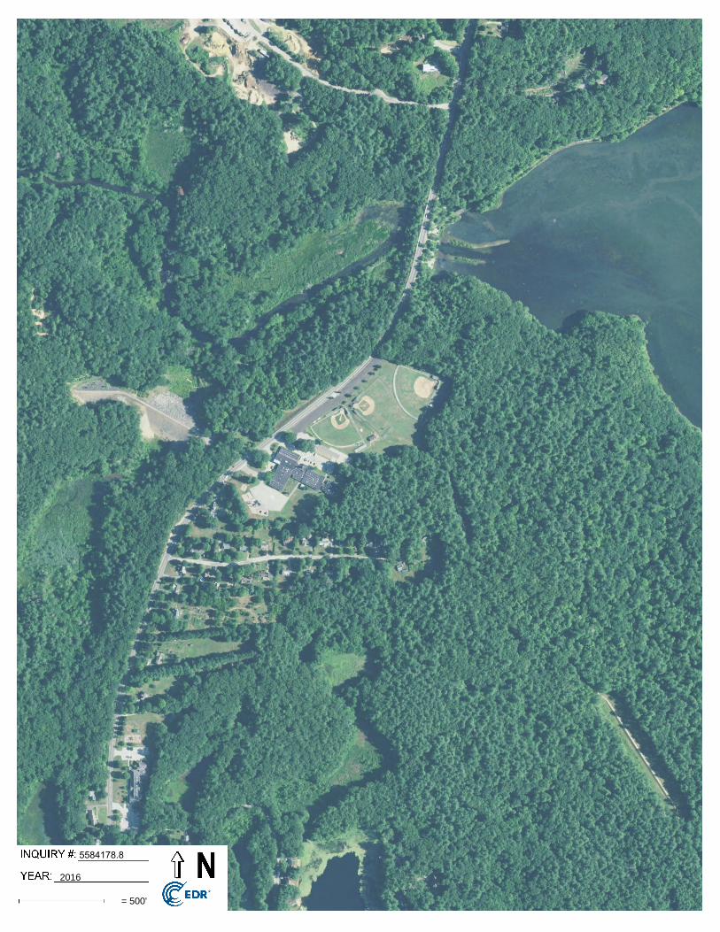
5584178.8
2016
= 500'
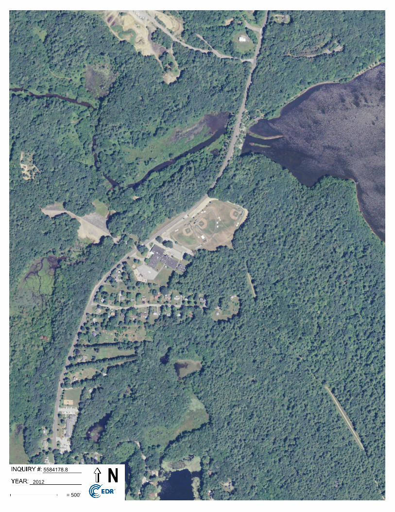
5584178.8
2012
= 500'
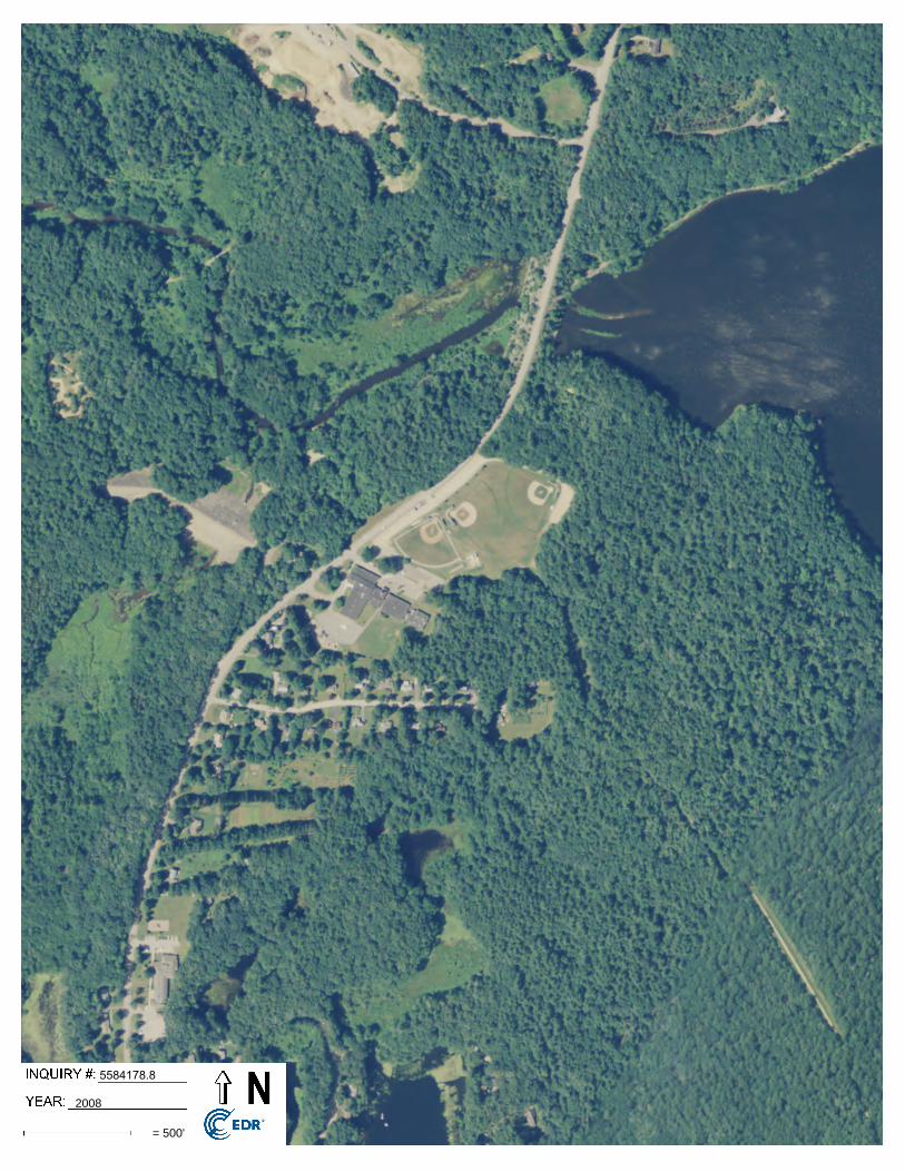
5584178.8
2008
= 500'
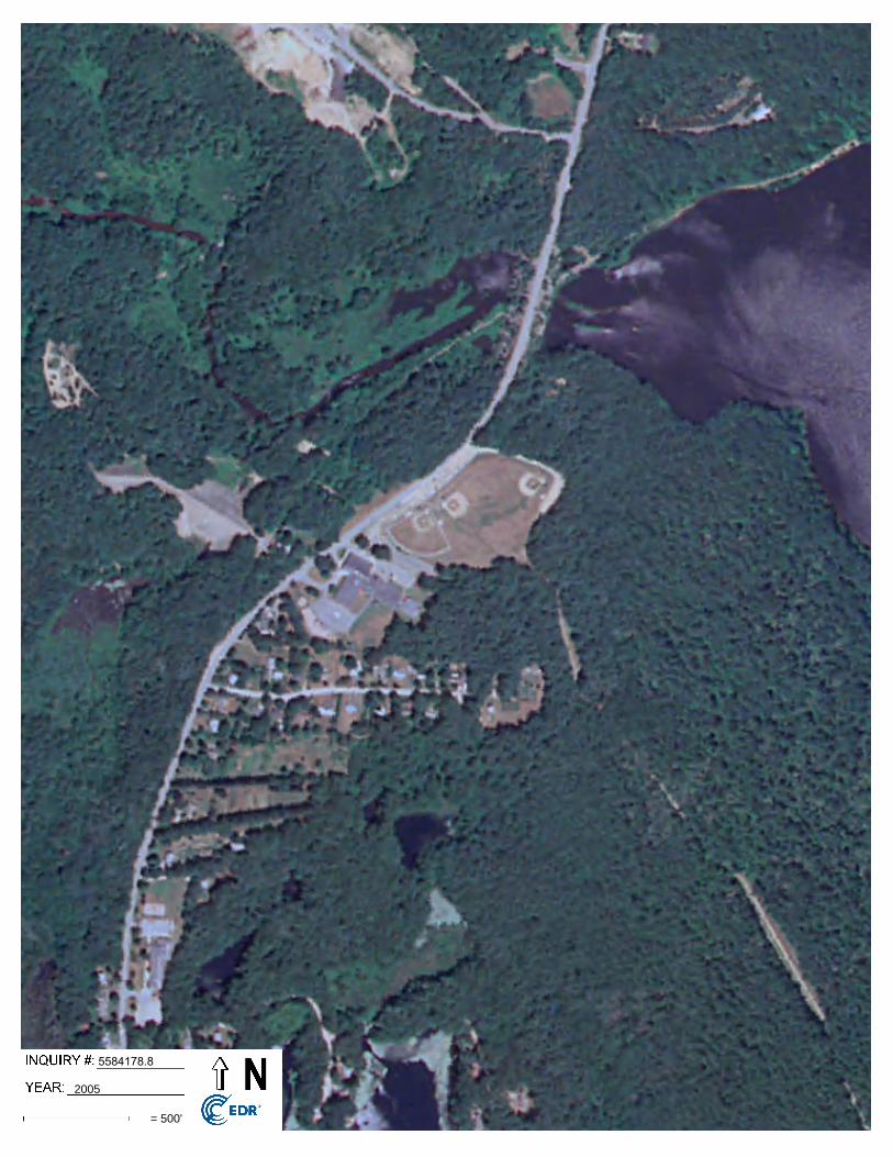
5584178.8
2005
= 500'
5584178.8
1995
= 500'
5584178.8
1991
= 500'
5584178.8
1990
= 500'
5584178.8
1986
= 500'
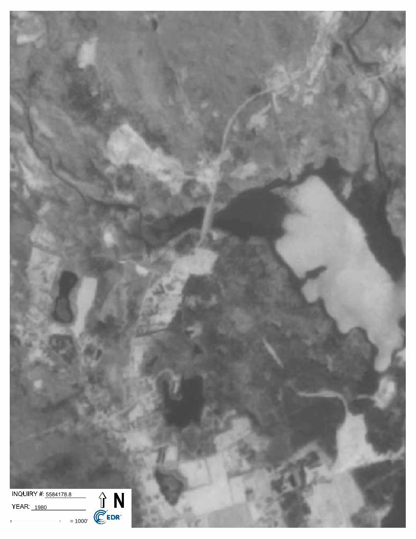
5584178.8
1980
= 1000'
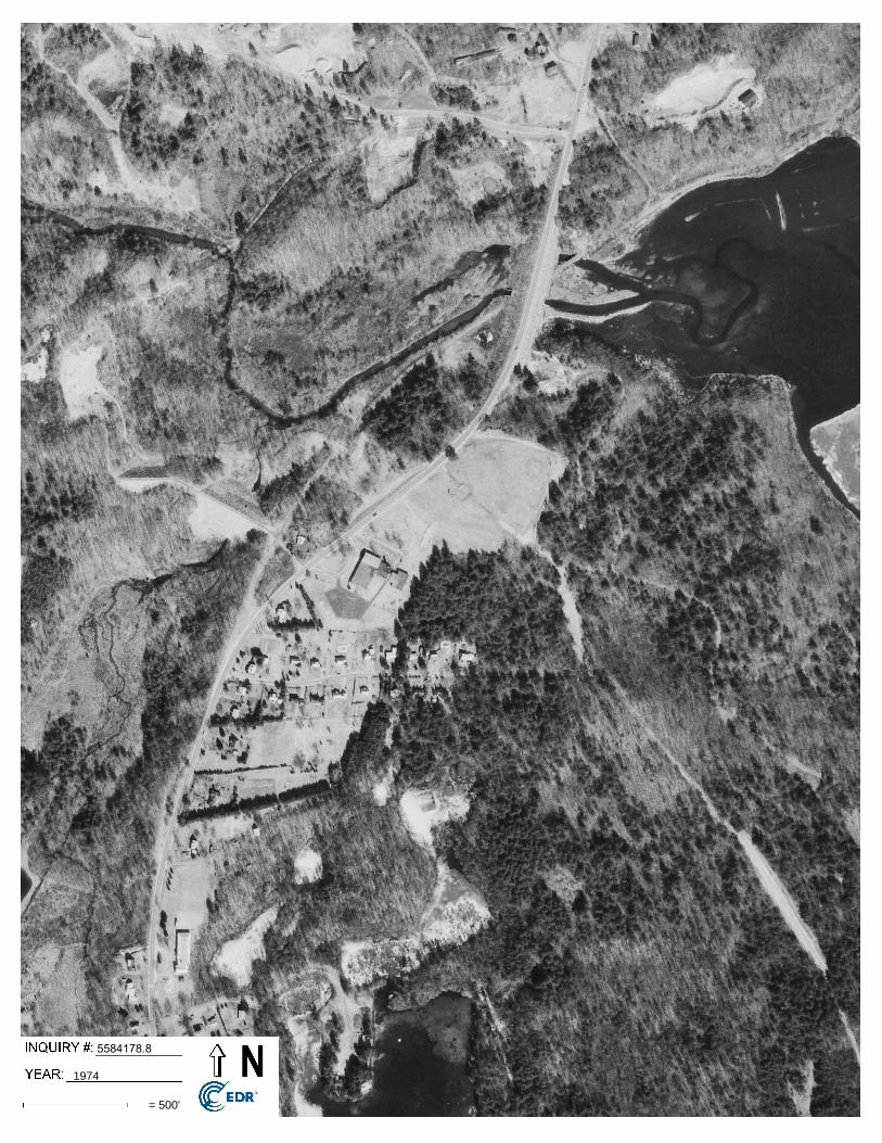
5584178.8
1974
= 500'
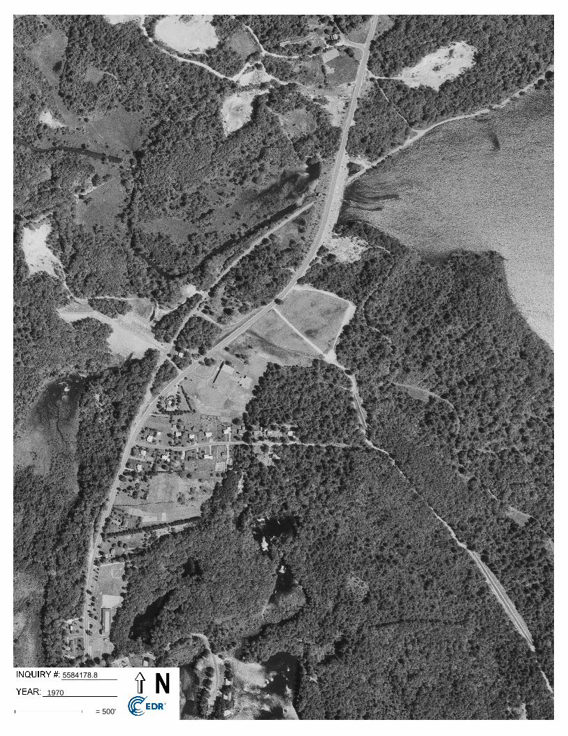
5584178.8
1970
= 500'
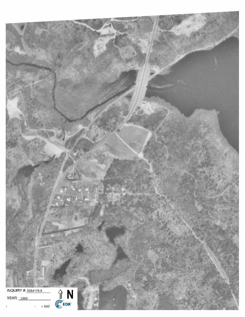
5584178.8
1969
= 500'
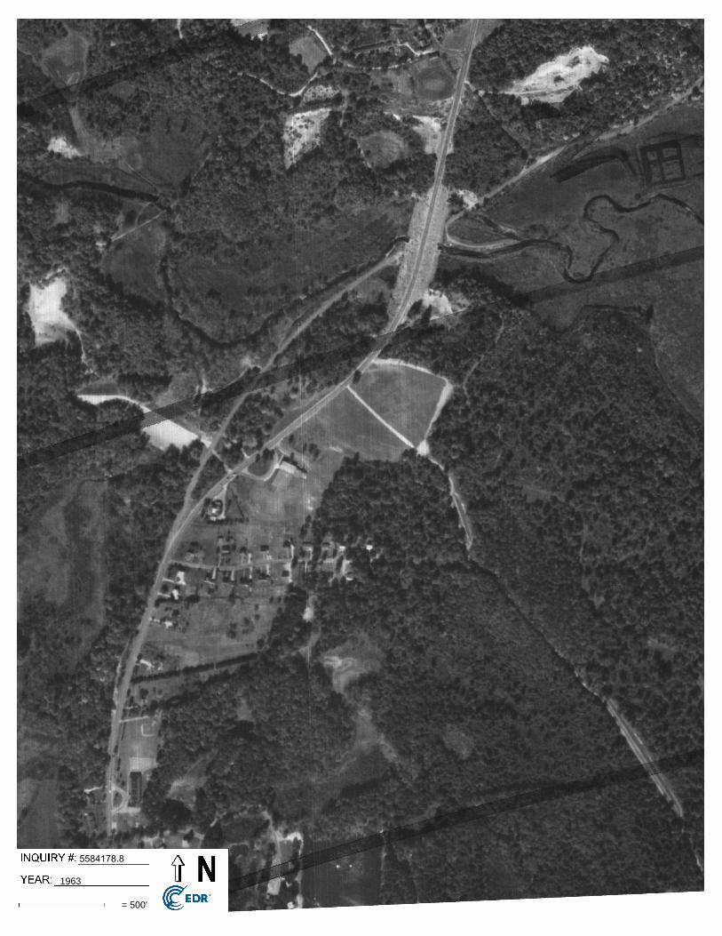
5584178.8
1963
= 500'
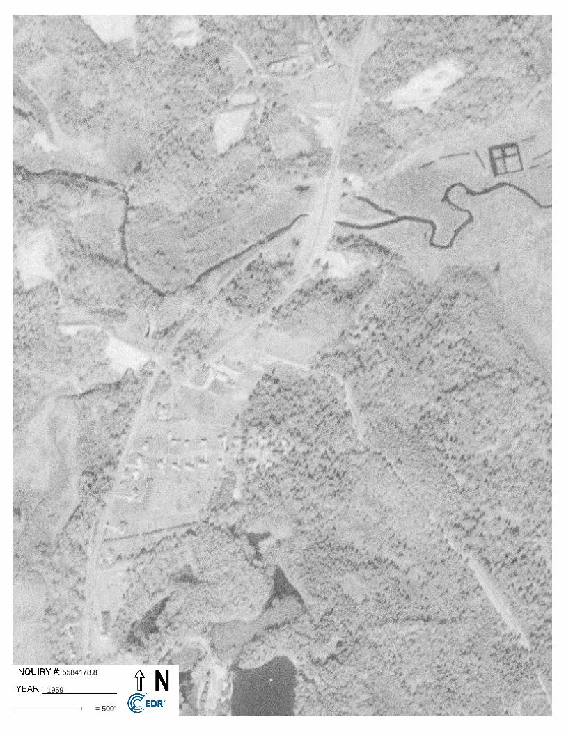
5584178.8
1959
= 500'
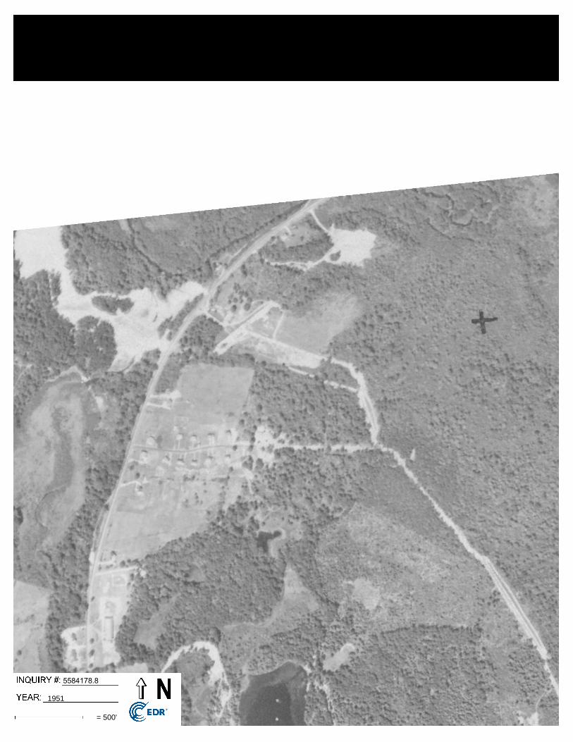
5584178.8
1951
= 500'
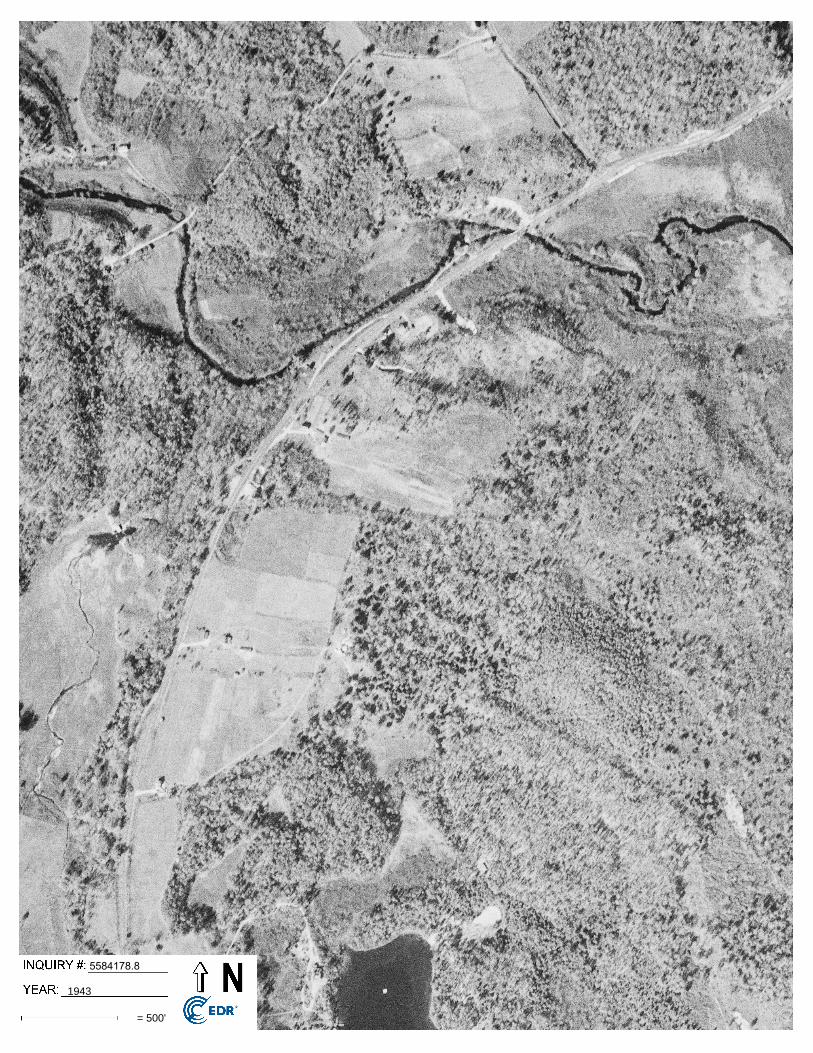
5584178.8
1943
= 500'
5584178.8
1941
= 750'
5584178.8
1934
= 500'

Appendix H
City Directories
Southeast Elementary School
134 Warrenville RdMansfield Center, CT 06250
Inquiry Number: 5584178.5March 08, 2019
The EDR-City Directory Image Report
6 Armstrong RoadShelton, CT 06484800.352.0050www.edrnet.comEnvironmental Data Resources IncEnvironmental Data Resources IncEnvironmental Data Resources IncEnvironmental Data Resources Inc
TABLE OF CONTENTS
SECTION
Executive Summary
Findings
City Directory Images
Thank you for your business. Please contact EDR at 1-800-352-0050
with any questions or comments.
Disclaimer - Copyright and Trademark Notice
This Report contains certain information obtained from a variety of public and other sources reasonably available to Environmental Data Resources, Inc. It cannot be concluded from this Report that coverage information for the target and surrounding properties does not exist from other sources. NO WARRANTY EXPRESSED OR IMPLIED, IS MADE WHATSOEVER IN CONNECTION WITH THIS REPORT. ENVIRONMENTAL DATA RESOURCES, INC. SPECIFICALLY DISCLAIMS THE MAKING OF ANY SUCH WARRANTIES, INCLUDING WITHOUT LIMITATION, MERCHANTABILITY OR FITNESS FOR A PARTICULAR USE OR PURPOSE. ALL RISK IS ASSUMED BY THE USER. IN NO EVENT SHALL ENVIRONMENTAL DATA RESOURCES, INC. BE LIABLE TO ANYONE, WHETHER ARISING OUT OF ERRORS OR OMISSIONS, NEGLIGENCE, ACCIDENT OR ANY OTHER CAUSE, FOR ANY LOSS OR DAMAGE, INCLUDING, WITHOUT LIMITATION, SPECIAL, INCIDENTAL, CONSEQUENTIAL, OR EXEMPLARY DAMAGES. ANY LIABILITY ON THE PART OF ENVIRONMENTAL DATA RESOURCES, INC. IS STRICTLY LIMITED TO A REFUND OF THE AMOUNT PAID FOR THIS REPORT. Purchaser accepts this Report "AS IS". Any analyses, estimates, ratings, environmental risk levels or risk codes provided in this Report are provided for illustrative purposes only, and are not intended to provide, nor should they be interpreted as providing any facts regarding, or prediction orforecast of, any environmental risk for any property. Only a Phase I Environmental Site Assessment performed by an environmental professional can provide information regarding the environmental risk for any property. Additionally, the information provided in this Report is not to be construed as legal advice.
Copyright 2017 by Environmental Data Resources, Inc. All rights reserved. Reproduction in any media or format, in whole or in part, of any report or map of Environmental Data Resources, Inc. or its affiliates is prohibited without prior written permission.
EDR and its logos (including Sanborn and Sanborn Map) are trademarks of Environmental Data Resources, Inc. or its affiliates. All other trademarks used herein are the property of their respective owners.
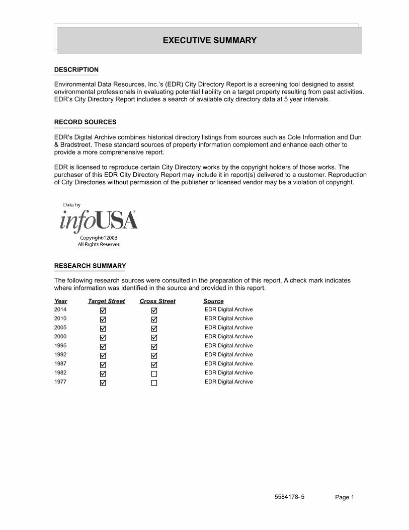
EXECUTIVE SUMMARY
DESCRIPTION
Environmental Data Resources, Inc.’s (EDR) City Directory Report is a screening tool designed to assist environmental professionals in evaluating potential liability on a target property resulting from past activities. EDR’s City Directory Report includes a search of available city directory data at 5 year intervals.
RECORD SOURCES
EDR's Digital Archive combines historical directory listings from sources such as Cole Information and Dun & Bradstreet. These standard sources of property information complement and enhance each other to provide a more comprehensive report.
EDR is licensed to reproduce certain City Directory works by the copyright holders of those works. The purchaser of this EDR City Directory Report may include it in report(s) delivered to a customer. Reproduction of City Directories without permission of the publisher or licensed vendor may be a violation of copyright.
RESEARCH SUMMARY
The following research sources were consulted in the preparation of this report. A check mark indicates where information was identified in the source and provided in this report.
Year Target Street Cross Street Source
2014 þ þ EDR Digital Archive
2010 þ þ EDR Digital Archive
2005 þ þ EDR Digital Archive
2000 þ þ EDR Digital Archive
1995 þ þ EDR Digital Archive
1992 þ þ EDR Digital Archive
1987 þ þ EDR Digital Archive
1982 þ ¨ EDR Digital Archive
1977 þ ¨ EDR Digital Archive
5584178- 5 Page 1
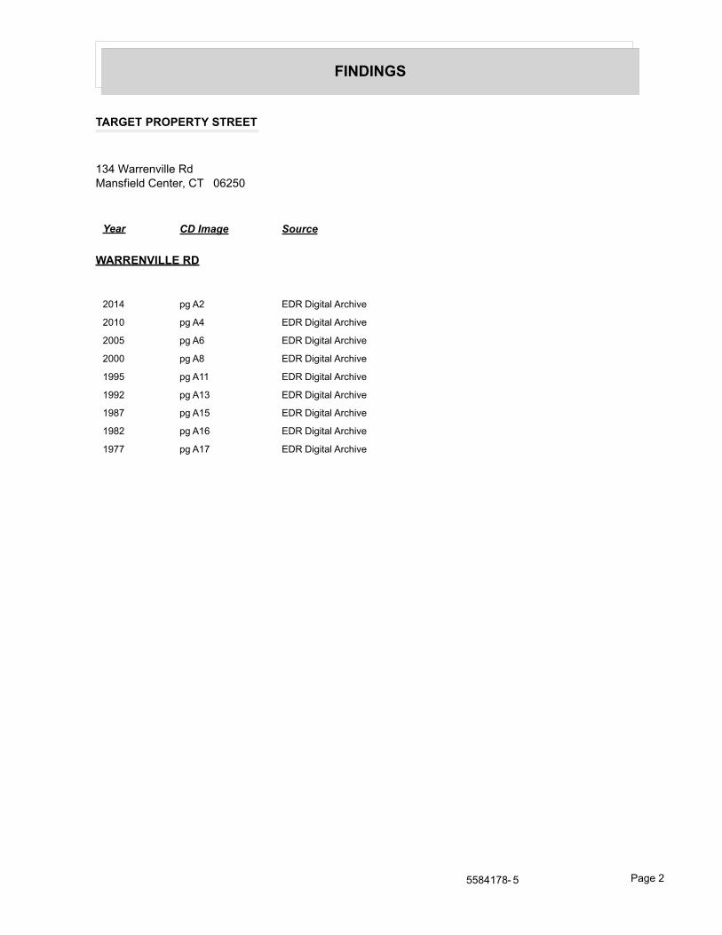
FINDINGS
TARGET PROPERTY STREET
134 Warrenville RdMansfield Center, CT 06250
Year CD Image Source
WARRENVILLE RD
2014 pg A2 EDR Digital Archive
2010 pg A4 EDR Digital Archive
2005 pg A6 EDR Digital Archive
2000 pg A8 EDR Digital Archive
1995 pg A11 EDR Digital Archive
1992 pg A13 EDR Digital Archive
1987 pg A15 EDR Digital Archive
1982 pg A16 EDR Digital Archive
1977 pg A17 EDR Digital Archive
5584178- 5 Page 2
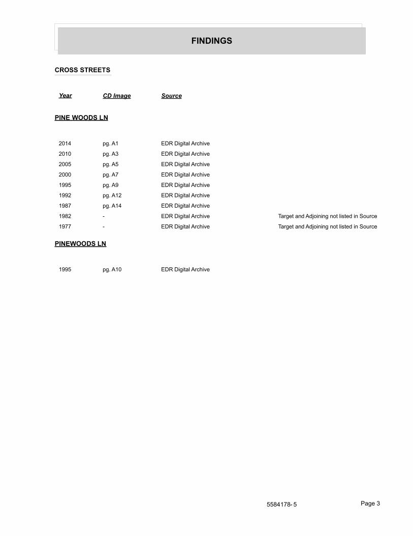
FINDINGS
CROSS STREETS
Year CD Image Source
PINE WOODS LN
2014 pg. A1 EDR Digital Archive
2010 pg. A3 EDR Digital Archive
2005 pg. A5 EDR Digital Archive
2000 pg. A7 EDR Digital Archive
1995 pg. A9 EDR Digital Archive
1992 pg. A12 EDR Digital Archive
1987 pg. A14 EDR Digital Archive
1982 - EDR Digital Archive Target and Adjoining not listed in Source
1977 - EDR Digital Archive Target and Adjoining not listed in Source
PINEWOODS LN
1995 pg. A10 EDR Digital Archive
5584178- 5 Page 3

City Directory Images
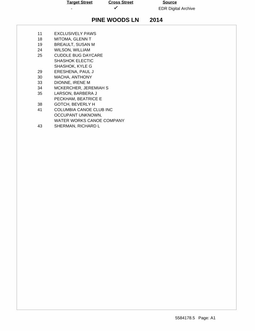
-
PINE WOODS LN
EDR Digital Archive
5584178.5 Page: A1
SourceTarget Street Cross Street
2014
11 EXCLUSIVELY PAWS18 MITOMA, GLENN T19 BREAULT, SUSAN M24 WILSON, WILLIAM25 CUDDLE BUG DAYCARE
SHASHOK ELECTICSHASHOK, KYLE G
29 ERESHENA, PAUL J30 MACHA, ANTHONY33 DIONNE, IRENE M34 MCKERCHER, JEREMIAH S35 LARSON, BARBERA J
PECKHAM, BEATRICE E38 GOTCH, BEVERLY H41 COLUMBIA CANOE CLUB INC
OCCUPANT UNKNOWN,WATER WORKS CANOE COMPANY
43 SHERMAN, RICHARD L
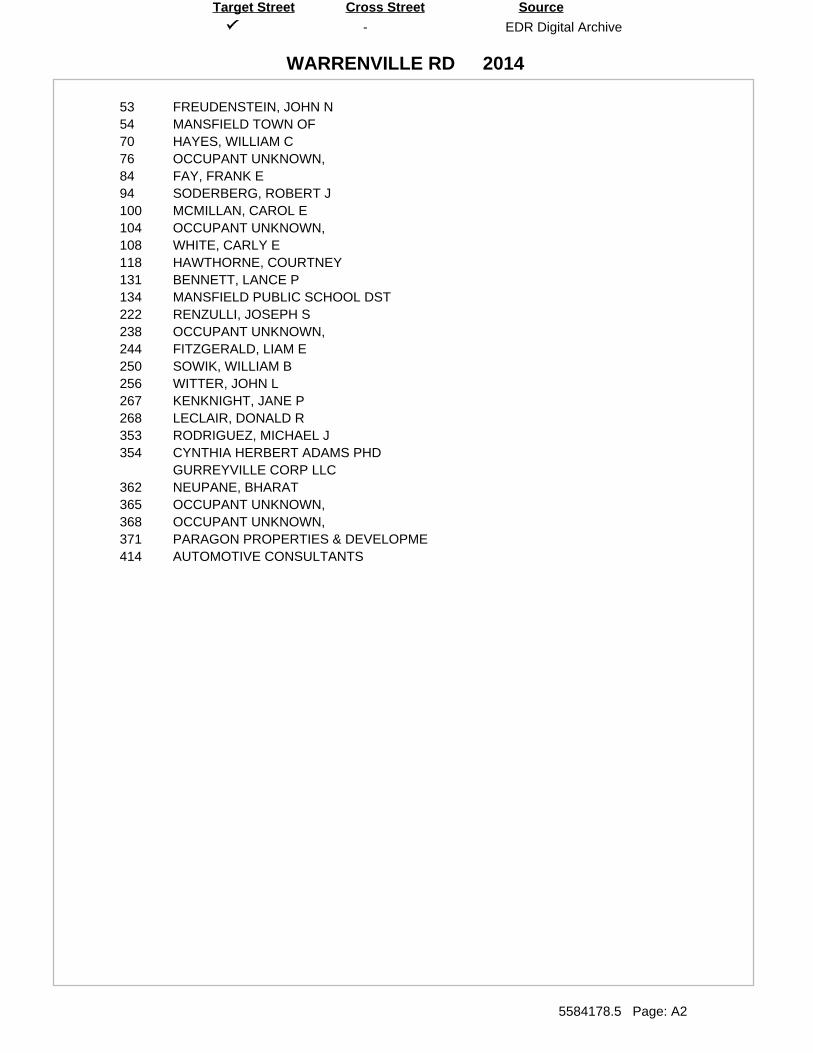
-
WARRENVILLE RD
EDR Digital Archive
5584178.5 Page: A2
SourceTarget Street Cross Street
2014
53 FREUDENSTEIN, JOHN N54 MANSFIELD TOWN OF70 HAYES, WILLIAM C76 OCCUPANT UNKNOWN,84 FAY, FRANK E94 SODERBERG, ROBERT J100 MCMILLAN, CAROL E104 OCCUPANT UNKNOWN,108 WHITE, CARLY E118 HAWTHORNE, COURTNEY131 BENNETT, LANCE P134 MANSFIELD PUBLIC SCHOOL DST222 RENZULLI, JOSEPH S238 OCCUPANT UNKNOWN,244 FITZGERALD, LIAM E250 SOWIK, WILLIAM B256 WITTER, JOHN L267 KENKNIGHT, JANE P268 LECLAIR, DONALD R353 RODRIGUEZ, MICHAEL J354 CYNTHIA HERBERT ADAMS PHD
GURREYVILLE CORP LLC362 NEUPANE, BHARAT365 OCCUPANT UNKNOWN,368 OCCUPANT UNKNOWN,371 PARAGON PROPERTIES & DEVELOPME414 AUTOMOTIVE CONSULTANTS
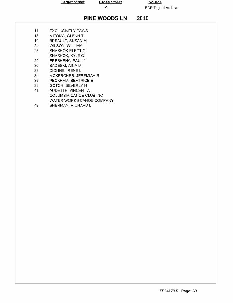
-
PINE WOODS LN
EDR Digital Archive
5584178.5 Page: A3
SourceTarget Street Cross Street
2010
11 EXCLUSIVELY PAWS18 MITOMA, GLENN T19 BREAULT, SUSAN M24 WILSON, WILLIAM25 SHASHOK ELECTIC
SHASHOK, KYLE G29 ERESHENA, PAUL J30 SADESKI, AINA M33 DIONNE, IRENE L34 MCKERCHER, JEREMIAH S35 PECKHAM, BEATRICE E38 GOTCH, BEVERLY H41 AUDETTE, VINCENT A
COLUMBIA CANOE CLUB INCWATER WORKS CANOE COMPANY
43 SHERMAN, RICHARD L
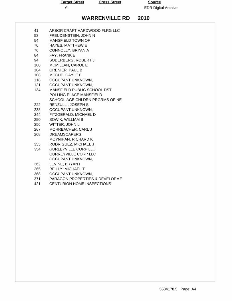
-
WARRENVILLE RD
EDR Digital Archive
5584178.5 Page: A4
SourceTarget Street Cross Street
2010
41 ARBOR CRAFT HARDWOOD FLRG LLC53 FREUDENSTEIN, JOHN N54 MANSFIELD TOWN OF70 HAYES, MATTHEW E76 CONNOLLY, BRYAN A84 FAY, FRANK E94 SODERBERG, ROBERT J100 MCMILLAN, CAROL E104 GRENIER, PAUL B108 MCCUE, GAYLE E118 OCCUPANT UNKNOWN,131 OCCUPANT UNKNOWN,134 MANSFIELD PUBLIC SCHOOL DST
POLLING PLACE MANSFIELDSCHOOL AGE CHLDRN PRGRMS OF NE
222 RENZULLI, JOSEPH S238 OCCUPANT UNKNOWN,244 FITZGERALD, MICHAEL D250 SOWIK, WILLIAM B256 WITTER, JOHN L267 MOHRBACHER, CARL J268 DREAMSCAPERS
MOYNIHAN, RICHARD K353 RODRIGUEZ, MICHAEL J354 GURLEYVILLE CORP LLC
GURREYVILLE CORP LLCOCCUPANT UNKNOWN,
362 LEVINE, BRYAN I365 REILLY, MICHAEL T368 OCCUPANT UNKNOWN,371 PARAGON PROPERTIES & DEVELOPME421 CENTURION HOME INSPECTIONS

-
PINE WOODS LN
EDR Digital Archive
5584178.5 Page: A5
SourceTarget Street Cross Street
2005
11 EXCLUSIVELY PAWS18 MORASCINI, DAVID J19 BREAULT, EDITH L24 CHAINE, A C25 SHASHOK, KYLE G29 MURPHY, STEPHEN P30 HUNTING, SHANNAN K33 DIONNE, WILLIAM A34 MCKERCHER, JEREMIAH S35 PECKHAM, BEATRICE E38 GOTCH, BEVERLY H41 COLUMBIA CANOE CLUB INC
OCCUPANT UNKNOWN,WATER WORKS CANOE COMPANY
43 APPROPRIATE DESIGNS IN ARCHSHERMAN, RICHARD L
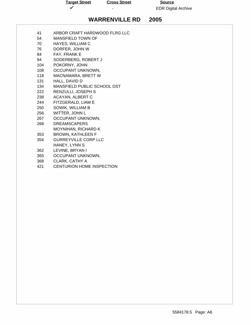
-
WARRENVILLE RD
EDR Digital Archive
5584178.5 Page: A6
SourceTarget Street Cross Street
2005
41 ARBOR CRAFT HARDWOOD FLRG LLC54 MANSFIELD TOWN OF70 HAYES, WILLIAM C76 DORFER, JOHN W84 FAY, FRANK E94 SODERBERG, ROBERT J104 POKORNY, JOHN108 OCCUPANT UNKNOWN,118 MACNAMARA, BRETT W131 HALL, DAVID D134 MANSFIELD PUBLIC SCHOOL DST222 RENZULLI, JOSEPH S238 ACAYAN, ALBERT C244 FITZGERALD, LIAM E250 SOWIK, WILLIAM B256 WITTER, JOHN L267 OCCUPANT UNKNOWN,268 DREAMSCAPERS
MOYNIHAN, RICHARD K353 BROWN, KATHLEEN F354 GURREYVILLE CORP LLC
HANEY, LYNN S362 LEVINE, BRYAN I365 OCCUPANT UNKNOWN,368 CLARK, CATHY A421 CENTURION HOME INSPECTION
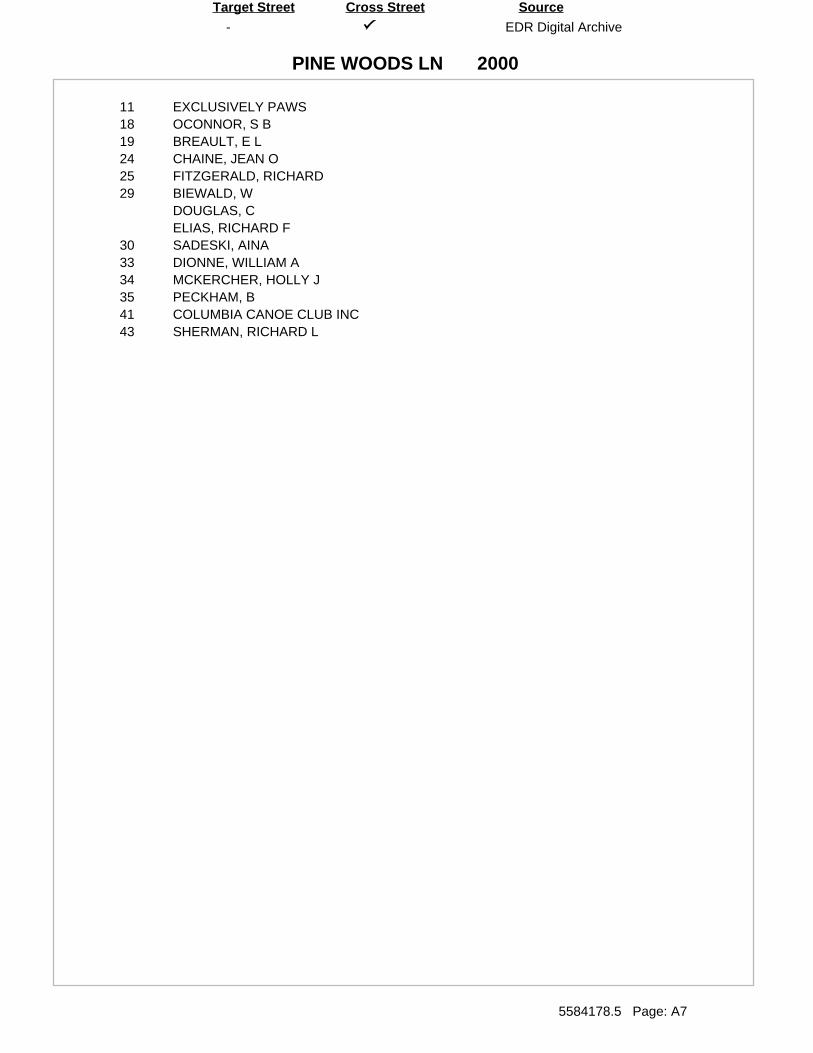
-
PINE WOODS LN
EDR Digital Archive
5584178.5 Page: A7
SourceTarget Street Cross Street
2000
11 EXCLUSIVELY PAWS18 OCONNOR, S B19 BREAULT, E L24 CHAINE, JEAN O25 FITZGERALD, RICHARD29 BIEWALD, W
DOUGLAS, CELIAS, RICHARD F
30 SADESKI, AINA33 DIONNE, WILLIAM A34 MCKERCHER, HOLLY J35 PECKHAM, B41 COLUMBIA CANOE CLUB INC43 SHERMAN, RICHARD L
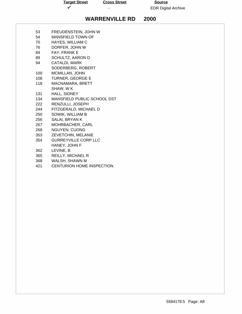
-
WARRENVILLE RD
EDR Digital Archive
5584178.5 Page: A8
SourceTarget Street Cross Street
2000
53 FREUDENSTEIN, JOHN W54 MANSFIELD TOWN OF70 HAYES, WILLIAM C76 DORFER, JOHN W84 FAY, FRANK E89 SCHULTZ, AARON D94 CATALDI, MARK
SODERBERG, ROBERT100 MCMILLAN, JOHN108 TURNER, GEORGE E118 MACNAMARA, BRETT
SHAW, W K131 HALL, SIDNEY134 MANSFIELD PUBLIC SCHOOL DST222 RENZULLI, JOSEPH244 FITZGERALD, MICHAEL D250 SOWIK, WILLIAM B256 SALAI, BRYAN K267 MOHRBACHER, CARL268 NGUYEN, CUONG353 ZEVETCHIN, MELANIE354 GURREYVILLE CORP LLC
HANEY, JOHN F362 LEVINE, B365 REILLY, MICHAEL R368 WALSH, SHAWN M421 CENTURION HOME INSPECTION
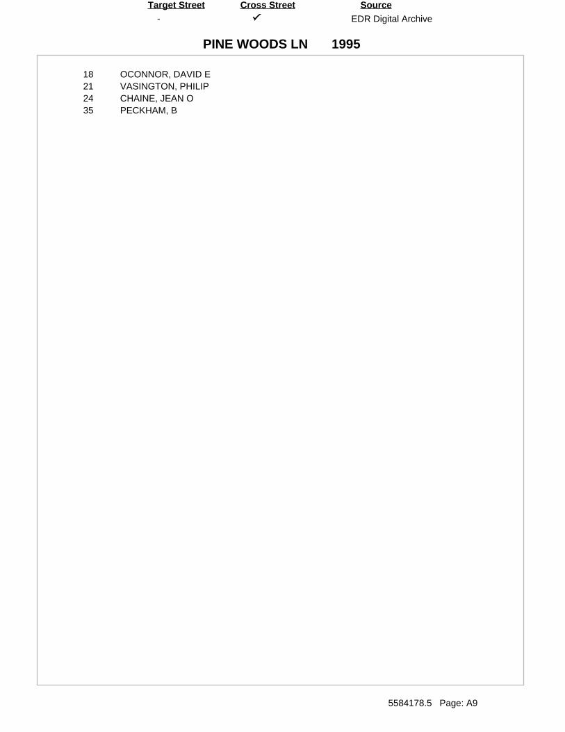
-
PINE WOODS LN
EDR Digital Archive
5584178.5 Page: A9
SourceTarget Street Cross Street
1995
18 OCONNOR, DAVID E21 VASINGTON, PHILIP24 CHAINE, JEAN O35 PECKHAM, B
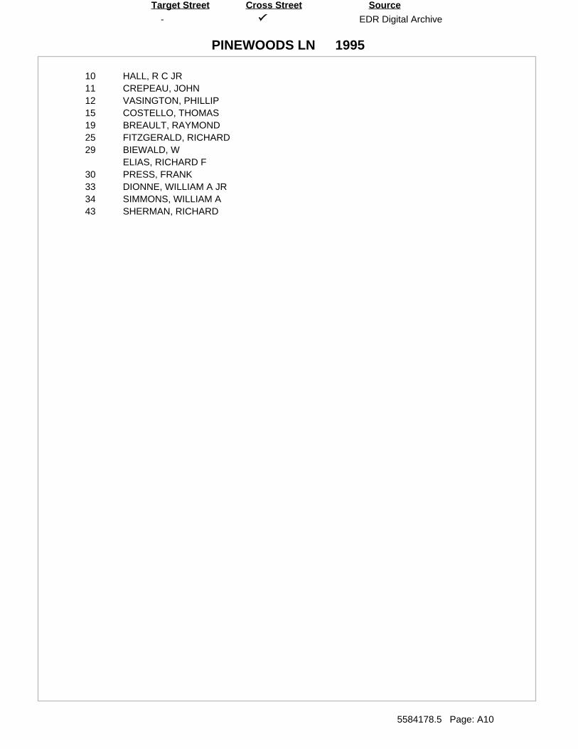
-
PINEWOODS LN
EDR Digital Archive
5584178.5 Page: A10
SourceTarget Street Cross Street
1995
10 HALL, R C JR11 CREPEAU, JOHN12 VASINGTON, PHILLIP15 COSTELLO, THOMAS19 BREAULT, RAYMOND25 FITZGERALD, RICHARD29 BIEWALD, W
ELIAS, RICHARD F30 PRESS, FRANK33 DIONNE, WILLIAM A JR34 SIMMONS, WILLIAM A43 SHERMAN, RICHARD
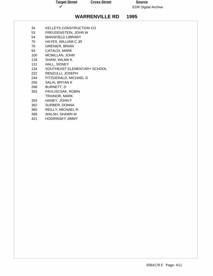
-
WARRENVILLE RD
EDR Digital Archive
5584178.5 Page: A11
SourceTarget Street Cross Street
1995
34 KELLEYS CONSTRUCTION CO53 FREUDENSTEIN, JOHN W54 MANSFIELD LIBRARY70 HAYES, WILLIAM C JR76 GRENIER, BRIAN94 CATALDI, MARK100 MCMILLAN, JOHN118 SHAW, WILMA K131 HALL, SIDNEY134 SOUTHEAST ELEMENTARY SCHOOL222 RENZULLI, JOSEPH244 FITZGERALD, MICHAEL D256 SALAI, BRYAN K268 BURNETT, D353 PAVLISCSAK, ROBIN
TRAINOR, MARK354 HANEY, JOHN F362 SURBER, DONNA365 REILLY, MICHAEL R368 WALSH, SHAWN M421 HODRINSKY JIMMY
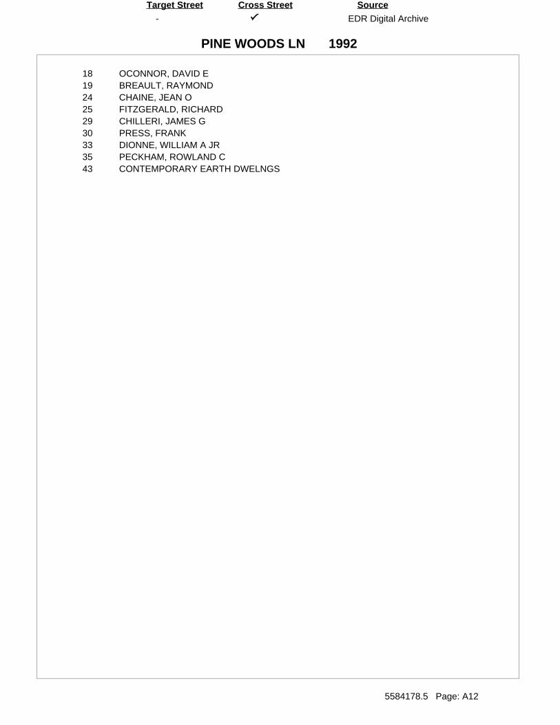
-
PINE WOODS LN
EDR Digital Archive
5584178.5 Page: A12
SourceTarget Street Cross Street
1992
18 OCONNOR, DAVID E19 BREAULT, RAYMOND24 CHAINE, JEAN O25 FITZGERALD, RICHARD29 CHILLERI, JAMES G30 PRESS, FRANK33 DIONNE, WILLIAM A JR35 PECKHAM, ROWLAND C43 CONTEMPORARY EARTH DWELNGS
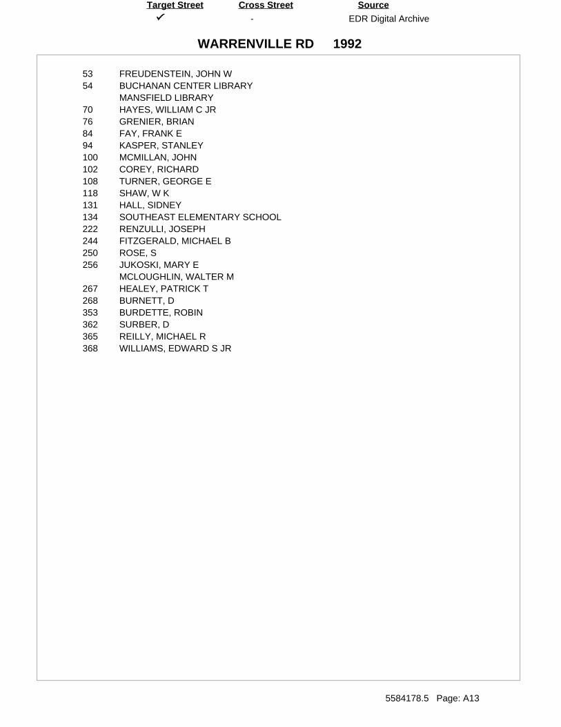
-
WARRENVILLE RD
EDR Digital Archive
5584178.5 Page: A13
SourceTarget Street Cross Street
1992
53 FREUDENSTEIN, JOHN W54 BUCHANAN CENTER LIBRARY
MANSFIELD LIBRARY70 HAYES, WILLIAM C JR76 GRENIER, BRIAN84 FAY, FRANK E94 KASPER, STANLEY100 MCMILLAN, JOHN102 COREY, RICHARD108 TURNER, GEORGE E118 SHAW, W K131 HALL, SIDNEY134 SOUTHEAST ELEMENTARY SCHOOL222 RENZULLI, JOSEPH244 FITZGERALD, MICHAEL B250 ROSE, S256 JUKOSKI, MARY E
MCLOUGHLIN, WALTER M267 HEALEY, PATRICK T268 BURNETT, D353 BURDETTE, ROBIN362 SURBER, D365 REILLY, MICHAEL R368 WILLIAMS, EDWARD S JR
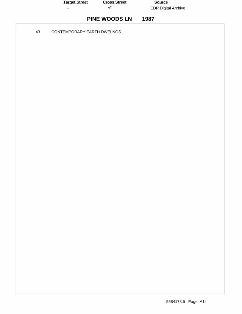
-
PINE WOODS LN
EDR Digital Archive
5584178.5 Page: A14
SourceTarget Street Cross Street
1987
43 CONTEMPORARY EARTH DWELNGS
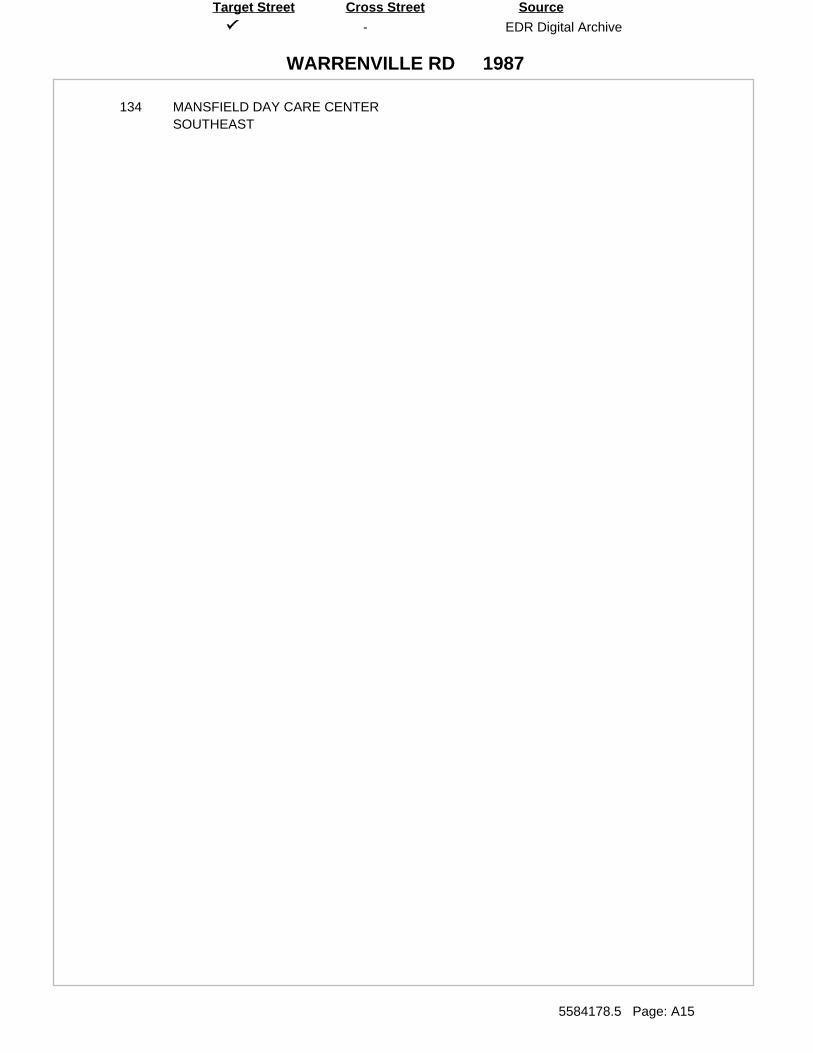
-
WARRENVILLE RD
EDR Digital Archive
5584178.5 Page: A15
SourceTarget Street Cross Street
1987
134 MANSFIELD DAY CARE CENTERSOUTHEAST
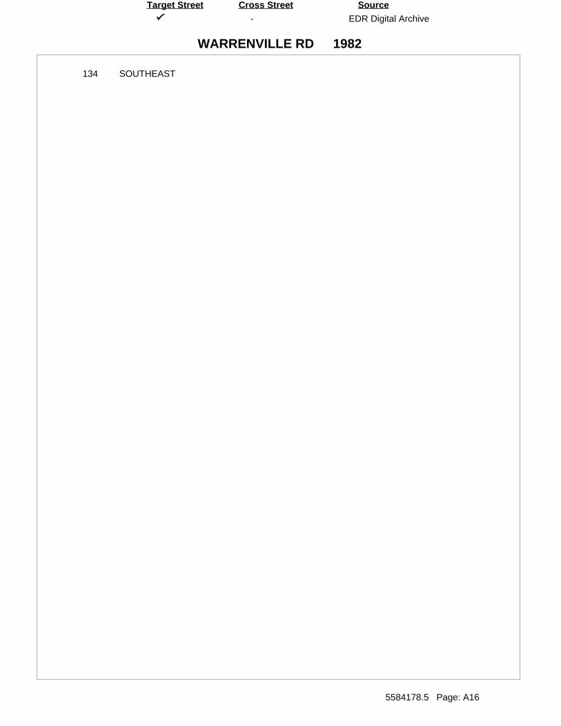
-
WARRENVILLE RD
EDR Digital Archive
5584178.5 Page: A16
SourceTarget Street Cross Street
1982
134 SOUTHEAST
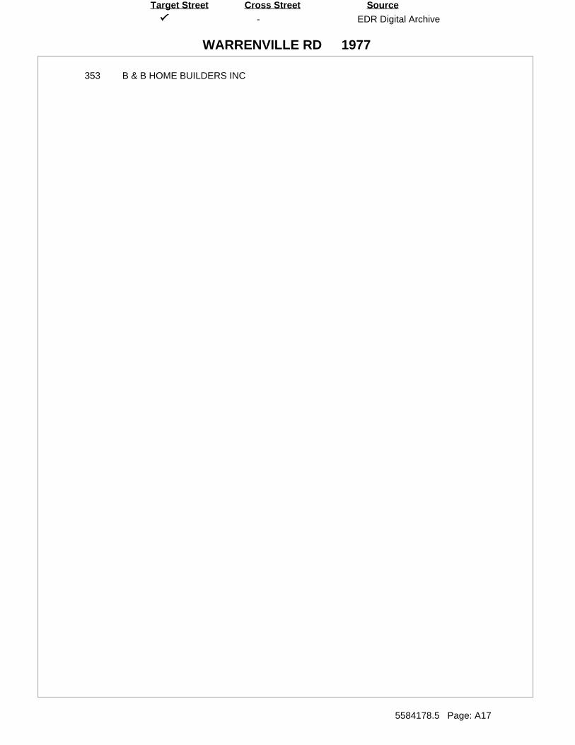
-
WARRENVILLE RD
EDR Digital Archive
5584178.5 Page: A17
SourceTarget Street Cross Street
1977
353 B & B HOME BUILDERS INC

Appendix I
Site Photographs
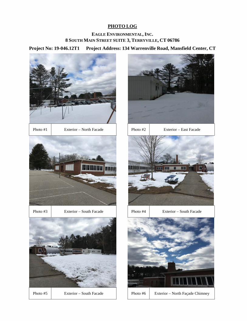
PHOTO LOG EAGLE ENVIRONMENTAL, INC.
8 SOUTH MAIN STREET SUITE 3, TERRYVILLE, CT 06786
Project No: 19-046.12T1 Project Address: 134 Warrenville Road, Mansfield Center, CT
Photo #1 Exterior – North Facade Photo #2 Exterior – East Facade
Photo #3 Exterior – South Facade Photo #4 Exterior – South Facade
Photo #5 Exterior – South Facade Photo #6 Exterior – North Façade Chimney
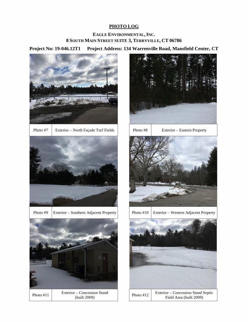
PHOTO LOG EAGLE ENVIRONMENTAL, INC.
8 SOUTH MAIN STREET SUITE 3, TERRYVILLE, CT 06786
Project No: 19-046.12T1 Project Address: 134 Warrenville Road, Mansfield Center, CT
Photo #7 Exterior – North Façade Turf Fields Photo #8 Exterior – Eastern Property
Photo #9 Exterior – Southern Adjacent Property Photo #10 Exterior – Western Adjacent Property
Photo #11 Exterior – Concession Stand (built 2009) Photo #12 Exterior – Concession Stand Septic
Field Area (built 2009)
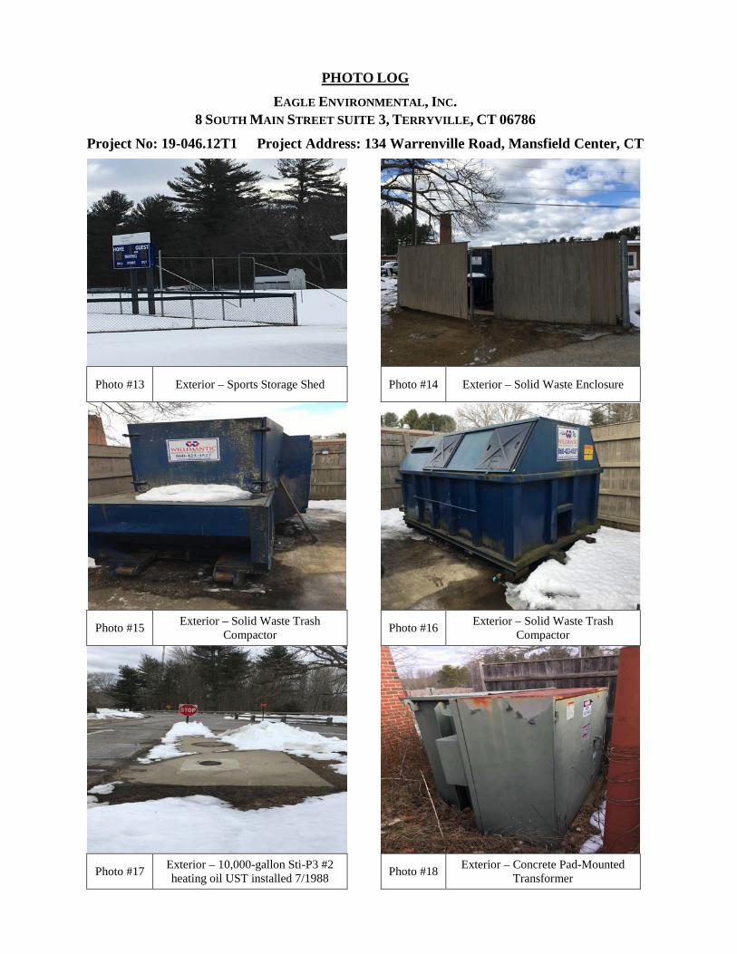
PHOTO LOG EAGLE ENVIRONMENTAL, INC.
8 SOUTH MAIN STREET SUITE 3, TERRYVILLE, CT 06786
Project No: 19-046.12T1 Project Address: 134 Warrenville Road, Mansfield Center, CT
Photo #13 Exterior – Sports Storage Shed Photo #14 Exterior – Solid Waste Enclosure
Photo #15 Exterior – Solid Waste Trash Compactor Photo #16 Exterior – Solid Waste Trash
Compactor
Photo #17 Exterior – 10,000-gallon Sti-P3 #2 heating oil UST installed 7/1988 Photo #18 Exterior – Concrete Pad-Mounted
Transformer
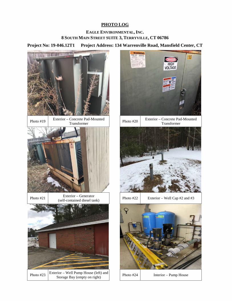
PHOTO LOG EAGLE ENVIRONMENTAL, INC.
8 SOUTH MAIN STREET SUITE 3, TERRYVILLE, CT 06786
Project No: 19-046.12T1 Project Address: 134 Warrenville Road, Mansfield Center, CT
Photo #19 Exterior – Concrete Pad-Mounted Transformer Photo #20 Exterior – Concrete Pad-Mounted
Transformer
Photo #21 Exterior – Generator
(self-contained diesel tank) Photo #22 Exterior – Well Cap #2 and #3
Photo #23 Exterior – Well Pump House (left) and Storage Bay (empty on right) Photo #24 Interior – Pump House

PHOTO LOG EAGLE ENVIRONMENTAL, INC.
8 SOUTH MAIN STREET SUITE 3, TERRYVILLE, CT 06786
Project No: 19-046.12T1 Project Address: 134 Warrenville Road, Mansfield Center, CT
Photo #25 Exterior – Green House at South
Facade Photo #26 Exterior – Green House at South Façade (2) Propane Tanks
Photo #27 Exterior – Septic Tank Access at South Facade Photo #28 Exterior – Septic Tank Access at South
Facade
Photo #29 Exterior – Septic Leaching Field Area
at South Facade Photo #30 Exterior – Monitoring Well #4 at North turf fields
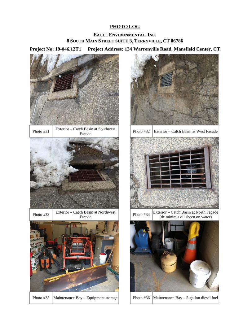
PHOTO LOG EAGLE ENVIRONMENTAL, INC.
8 SOUTH MAIN STREET SUITE 3, TERRYVILLE, CT 06786
Project No: 19-046.12T1 Project Address: 134 Warrenville Road, Mansfield Center, CT
Photo #31 Exterior – Catch Basin at Southwest Facade Photo #32 Exterior – Catch Basin at West Facade
Photo #33 Exterior – Catch Basin at Northwest Facade Photo #34 Exterior – Catch Basin at North Façade
(de minimis oil sheen on water)
Photo #35 Maintenance Bay – Equipment storage Photo #36 Maintenance Bay – 5-gallon diesel fuel
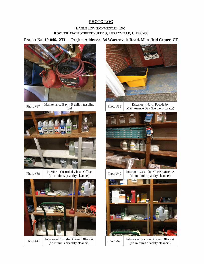
PHOTO LOG EAGLE ENVIRONMENTAL, INC.
8 SOUTH MAIN STREET SUITE 3, TERRYVILLE, CT 06786
Project No: 19-046.12T1 Project Address: 134 Warrenville Road, Mansfield Center, CT
Photo #37 Maintenance Bay – 5-gallon gasoline
fuel Photo #38 Exterior – North Façade by Maintenance Bay (ice melt storage)
Photo #39 Interior – Custodial Closet Office (de minimis quantity cleaners) Photo #40 Interior – Custodial Closet Office A
(de minimis quantity cleaners)
Photo #41 Interior – Custodial Closet Office A (de minimis quantity cleaners) Photo #42 Interior – Custodial Closet Office A
(de minimis quantity cleaners)
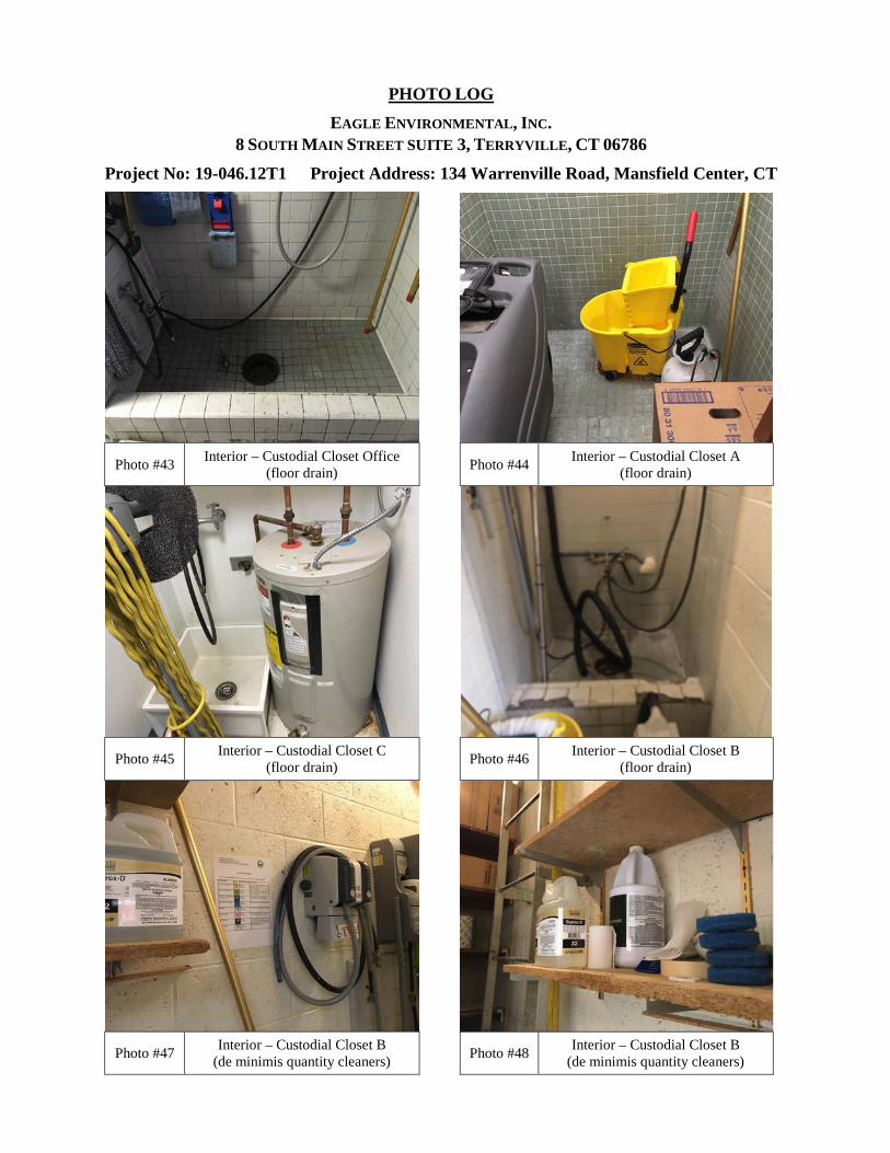
PHOTO LOG EAGLE ENVIRONMENTAL, INC.
8 SOUTH MAIN STREET SUITE 3, TERRYVILLE, CT 06786
Project No: 19-046.12T1 Project Address: 134 Warrenville Road, Mansfield Center, CT
Photo #43 Interior – Custodial Closet Office (floor drain) Photo #44 Interior – Custodial Closet A
(floor drain)
Photo #45 Interior – Custodial Closet C (floor drain) Photo #46 Interior – Custodial Closet B
(floor drain)
Photo #47 Interior – Custodial Closet B (de minimis quantity cleaners) Photo #48 Interior – Custodial Closet B
(de minimis quantity cleaners)
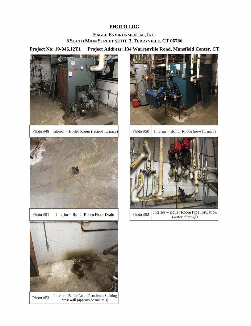
PHOTO LOG EAGLE ENVIRONMENTAL, INC.
8 SOUTH MAIN STREET SUITE 3, TERRYVILLE, CT 06786
Project No: 19-046.12T1 Project Address: 134 Warrenville Road, Mansfield Center, CT
Photo #49 Interior – Boiler Room (retired furnace) Photo #50 Interior – Boiler Room (new furnace)
Photo #51 Interior – Boiler Room Floor Drain Photo #52 Interior – Boiler Room Pipe Insulation (water damage)
Photo #53 Interior – Boiler Room Petroleum Staining west wall (appears de minimis)
Appendix J
FIRM Map
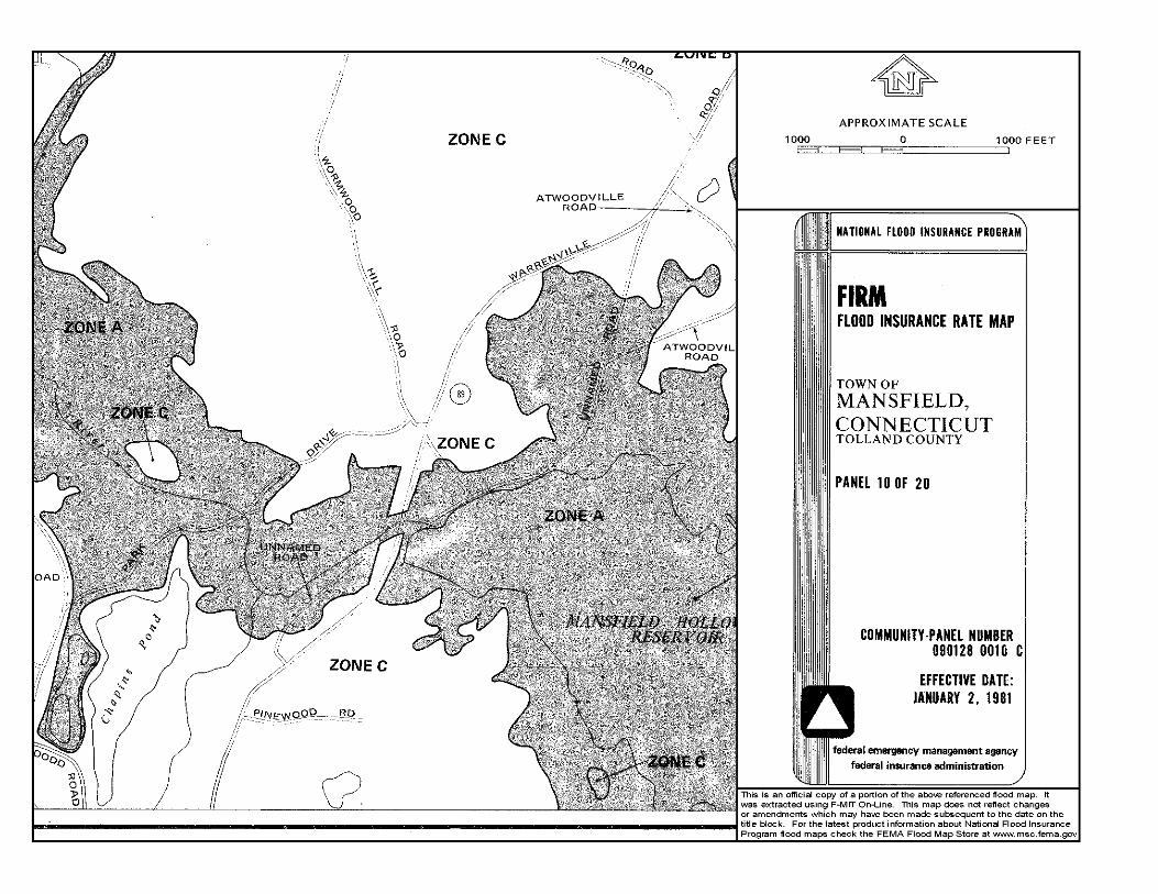
Appendix K
Vapor Encroachment Screen
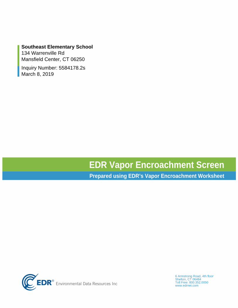
neercS tnemhcaorcnE ropaV RDEteehskroW tnemhcaorcnE ropaV s’RDE gnisu deraperP
6 Armstrong Road, 4th floorShelton, CT 06484Toll Free: 800.352.0050www.edrnet.com
Southeast Elementary School134 Warrenville RdMansfield Center, CT 06250
Inquiry Number: 5584178.2sMarch 8, 2019
Thank you for your business.Please contact EDR at 1-800-352-0050
with any questions or comments.
SECTION PAGE
Executive Summary ES1
Primary Map 2
Secondary Map 3
Map Findings 4
Record Sources and Currency GR-1
Disclaimer - Copyright and Trademark Notice
The EDR Vapor Encroachment Worksheet enables EDR's customers to make certain online modifications that effects maps, textand calculations contained in this Report. As a result, maps, text and calculations contained in this Report may have been somodified. EDR has not taken any action to verify any such modifications, and this report and the findings set forth herein must beread in light of this fact. Environmental Data Resources shall not be responsible for any customer's decision to include or notinclude in any final report any records determined to be within the relevant minimum search distances.
This report contains information obtained from a variety of public and other sources reasonably available to Environmental DataResources, Inc. It cannot be concluded from this Report that coverage information for the target and surrounding properties doesnot exist from other sources. NO WARRANTY EXPRESSED OR IMPLIED, IS MADE WHATSOEVER IN CONNECTION WITHTHIS REPORT. ENVIRONMENTAL DATA RESOURCES, INC. SPECIFICALLY DISCLAIMS THE MAKING OF ANYSUCHWARRANTIES, INCLUDING WITHOUT LIMITATION, MERCHANTABILITY OR FITNESS FOR A PARTICULAR USE ORPURPOSE. ALL RISK IS ASSUMED BY THE USER. IN NO EVENT SHALL ENVIRONMENTAL DATA RESOURCES, INC.BE LIABLE TO ANYONE, WHETHER ARISING OUT OF ERRORS OR OMISSIONS, NEGLIGENCE, ACCIDENT OR ANYOTHER CAUSE, FOR ANY LOSS OR DAMAGE, INCLUDING, WITHOUT LIMITATION, SPECIAL, INCIDENTAL,CONSEQUENTIAL, OR EXEMPLARY DAMAGES.ANY LIABILITY ON THE PART OF ENVIRONMENTAL DATARESOURCES, INC. IS STRICTLY LIMITED TO A REFUND OF THE AMOUNT PAID FOR THIS REPORT.Purchaser accepts this report "AS IS". Any analyses, estimates, ratings, or risk codes provided in this report are provided forillustrative purposes only, and are not intended to provide, nor should they be interpreted as providing any facts regarding, orprediction or forecast of, any environmental risk for any property. Only a Phase I Environmental Site Assessment performed byan environmental professional can produce information regarding the environmental risk for any property. Additionally, theinformation provided in this Report is not to be construed as legal advice.
Copyright 2019 by Environmental Data Resources, Inc. All rights reserved. Reproduction in any media or format, in whole or inpart, of any report or map of Environmental Data Resources, Inc., or its affiliates, is prohibited without prior written permission.
EDR and its logos (including Sanborn and Sanborn Map) are trademarks of Environmental Data Resources, Inc. or its affiliates.All other trademarks used herein are the property of their respective owners.
TABLE OF CONTENTS
TC Page 1
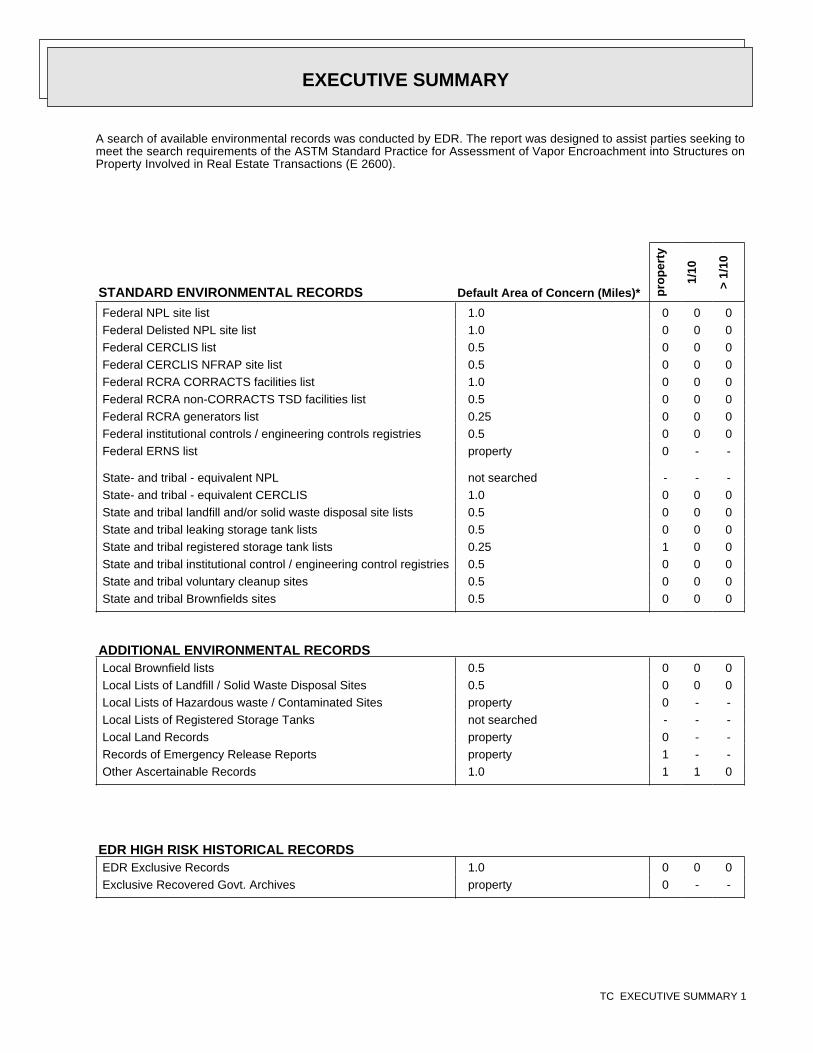
A search of available environmental records was conducted by EDR. The report was designed to assist parties seeking tomeet the search requirements of the ASTM Standard Practice for Assessment of Vapor Encroachment into Structures onProperty Involved in Real Estate Transactions (E 2600).
STANDARD ENVIRONMENTAL RECORDS Default Area of Concern (Miles)* pro
per
ty
1/10
> 1/
10
Federal NPL site list 1.0 0 0 0Federal Delisted NPL site list 1.0 0 0 0Federal CERCLIS list 0.5 0 0 0Federal CERCLIS NFRAP site list 0.5 0 0 0Federal RCRA CORRACTS facilities list 1.0 0 0 0Federal RCRA non-CORRACTS TSD facilities list 0.5 0 0 0Federal RCRA generators list 0.25 0 0 0Federal institutional controls / engineering controls registries 0.5 0 0 0Federal ERNS list property 0 - -
State- and tribal - equivalent NPL not searched - - -State- and tribal - equivalent CERCLIS 1.0 0 0 0State and tribal landfill and/or solid waste disposal site lists 0.5 0 0 0State and tribal leaking storage tank lists 0.5 0 0 0State and tribal registered storage tank lists 0.25 1 0 0State and tribal institutional control / engineering control registries 0.5 0 0 0State and tribal voluntary cleanup sites 0.5 0 0 0State and tribal Brownfields sites 0.5 0 0 0
ADDITIONAL ENVIRONMENTAL RECORDSLocal Brownfield lists 0.5 0 0 0Local Lists of Landfill / Solid Waste Disposal Sites 0.5 0 0 0Local Lists of Hazardous waste / Contaminated Sites property 0 - -Local Lists of Registered Storage Tanks not searched - - -Local Land Records property 0 - -Records of Emergency Release Reports property 1 - -Other Ascertainable Records 1.0 1 1 0
EDR HIGH RISK HISTORICAL RECORDSEDR Exclusive Records 1.0 0 0 0Exclusive Recovered Govt. Archives property 0 - -
EXECUTIVE SUMMARY
TC EXECUTIVE SUMMARY 1
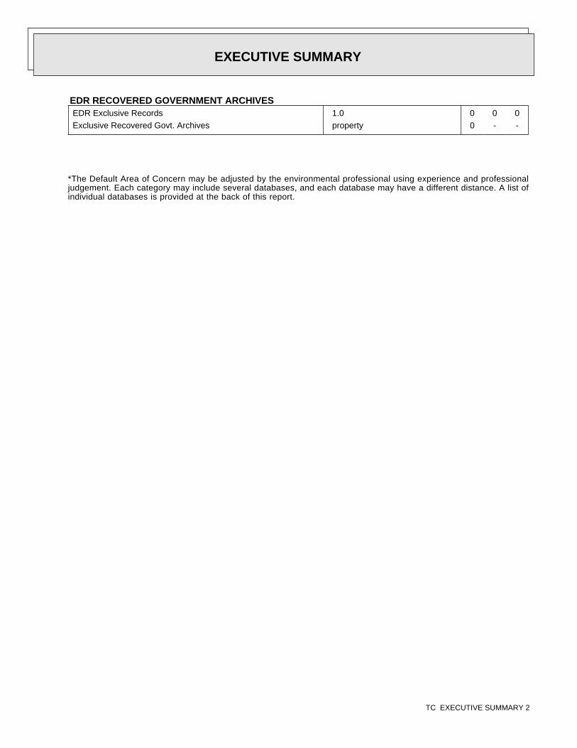
*The Default Area of Concern may be adjusted by the environmental professional using experience and professionaljudgement. Each category may include several databases, and each database may have a different distance. A list ofindividual databases is provided at the back of this report.
EDR RECOVERED GOVERNMENT ARCHIVESEDR Exclusive Records 1.0 0 0 0Exclusive Recovered Govt. Archives property 0 - -
EXECUTIVE SUMMARY
TC EXECUTIVE SUMMARY 2
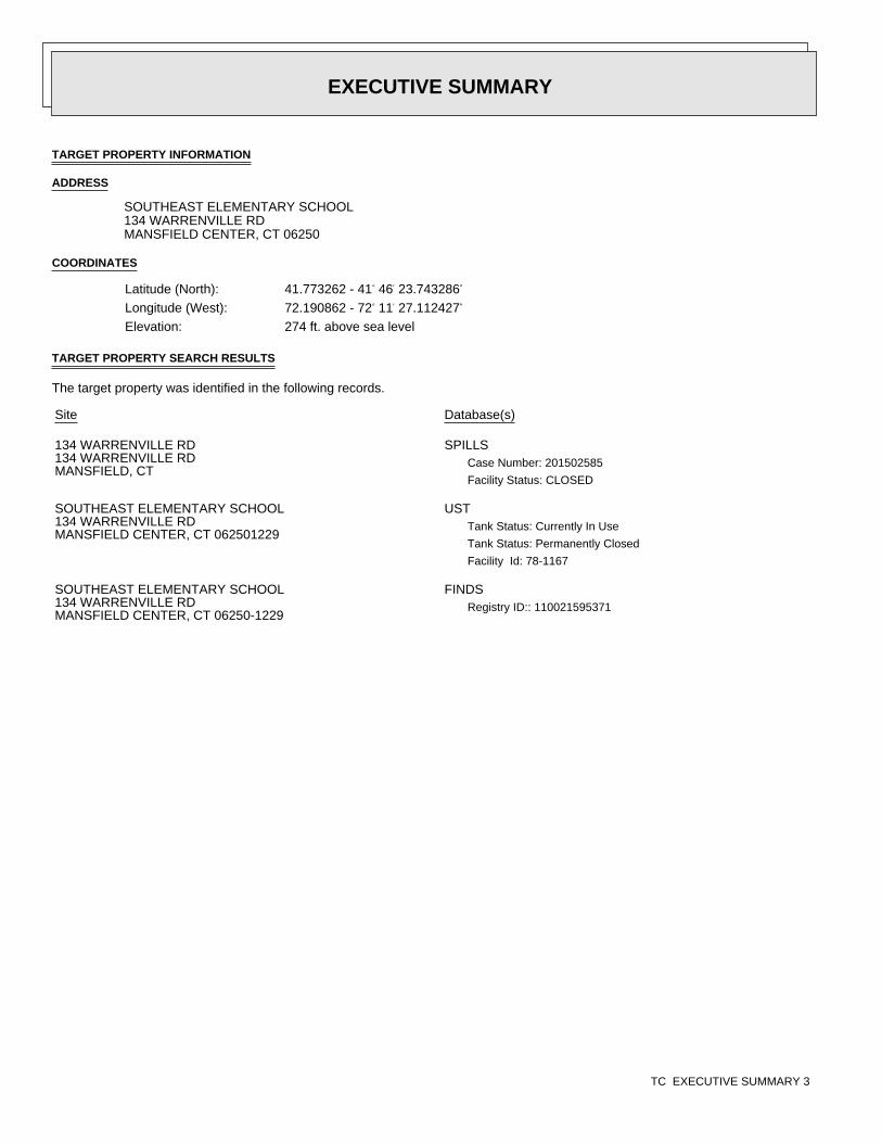
TARGET PROPERTY INFORMATION
ADDRESS
SOUTHEAST ELEMENTARY SCHOOL134 WARRENVILLE RDMANSFIELD CENTER, CT 06250
COORDINATES
TARGET PROPERTY SEARCH RESULTS
The target property was identified in the following records.
Latitude (North): 41.773262 - 41° 46′ 23.743286″
Longitude (West): 72.190862 - 72° 11′ 27.112427″
Elevation: 274 ft. above sea level
Site Database(s)
134 WARRENVILLE RD134 WARRENVILLE RDMANSFIELD, CT
SPILLSCase Number: 201502585
Facility Status: CLOSED
SOUTHEAST ELEMENTARY SCHOOL134 WARRENVILLE RDMANSFIELD CENTER, CT 062501229
USTTank Status: Currently In Use
Tank Status: Permanently Closed
Facility Id: 78-1167
SOUTHEAST ELEMENTARY SCHOOL134 WARRENVILLE RDMANSFIELD CENTER, CT 06250-1229
FINDSRegistry ID:: 110021595371
EXECUTIVE SUMMARY
TC EXECUTIVE SUMMARY 3
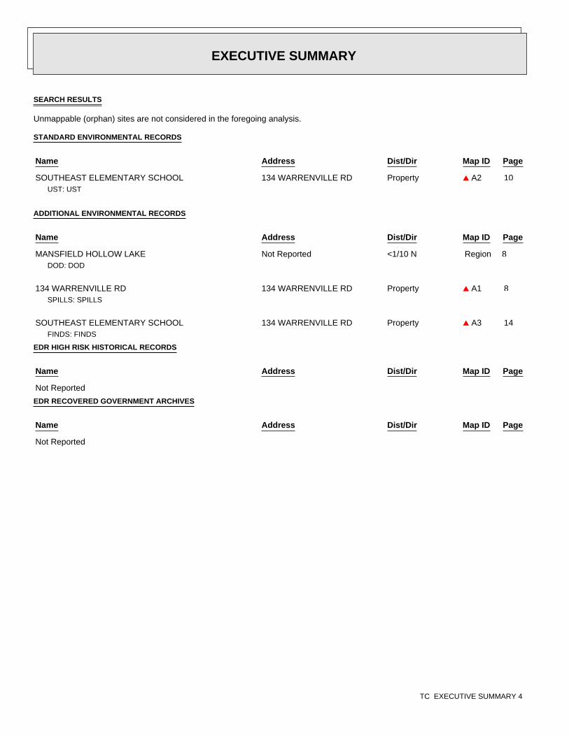
10
8
8
14
SEARCH RESULTS
Unmappable (orphan) sites are not considered in the foregoing analysis.
STANDARD ENVIRONMENTAL RECORDS
ADDITIONAL ENVIRONMENTAL RECORDS
EDR HIGH RISK HISTORICAL RECORDS
EDR RECOVERED GOVERNMENT ARCHIVES
Name Address Dist/Dir Map ID Page
SOUTHEAST ELEMENTARY SCHOOL 134 WARRENVILLE RD Property ▲ A2UST: UST
Name Address Dist/Dir Map ID Page
MANSFIELD HOLLOW LAKE Not Reported <1/10 N RegionDOD: DOD
134 WARRENVILLE RD 134 WARRENVILLE RD Property ▲ A1SPILLS: SPILLS
SOUTHEAST ELEMENTARY SCHOOL 134 WARRENVILLE RD Property ▲ A3FINDS: FINDS
Name Address Dist/Dir Map ID Page
Not Reported
Name Address Dist/Dir Map ID Page
Not Reported
EXECUTIVE SUMMARY
TC EXECUTIVE SUMMARY 4
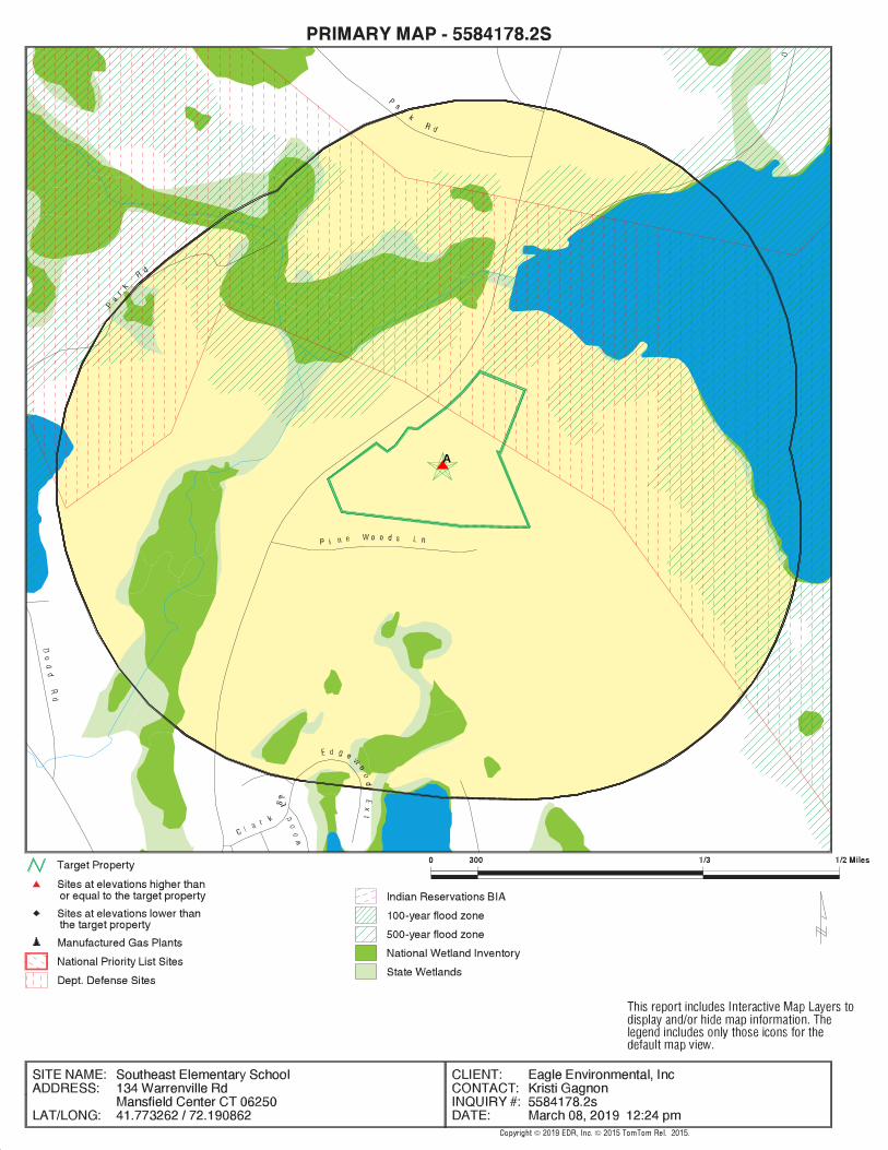
.
BeginOC−start−Wetlands−BeginOC−startBeginOC−start−− State Wetlands−BeginOC−startBeginOC−end−BeginOC−end−− State WetlandsBeginOC−start−− National Wetlands Inventory−BeginOC−startBeginOC−end−BeginOC−end−− National Wetlands InventoryBeginOC−end−BeginOC−end−WetlandsBeginOC−start−Water−BeginOC−startBeginOC−end−BeginOC−end−WaterBeginOC−start−Power Transmission Lines / Oil & Gas Pipelines−BeginOC−startBeginOC−end−BeginOC−end−Power Transmission Lines / Oil & Gas PipelinesBeginOC−start−Flood Zones−BeginOC−startBeginOC−start−− 500 Year Zone−BeginOC−startBeginOC−end−BeginOC−end−− 500 Year ZoneBeginOC−start−− 100 Year Zone−BeginOC−startBeginOC−end−BeginOC−end−− 100 Year ZoneBeginOC−end−BeginOC−end−Flood ZonesBeginOC−start−Streets−BeginOC−startBeginOC−end−BeginOC−end−StreetsBeginOC−start−Railroads−BeginOC−startBeginOC−end−BeginOC−end−RailroadsBeginOC−start−Target Property Location−BeginOC−startBeginOC−end−BeginOC−end−Target Property LocationBeginOC−start−Federal DOD Records−BeginOC−startBeginOC−end−BeginOC−end−Federal DOD RecordsBeginOC−start−Indian Reservations BIA−BeginOC−startBeginOC−end−BeginOC−end−Indian Reservations BIABeginOC−start−National Priority List Records−BeginOC−startBeginOC−end−BeginOC−end−National Priority List RecordsBeginOC−start−Search Rings−BeginOC−startBeginOC−end−BeginOC−end−Search Rings
A
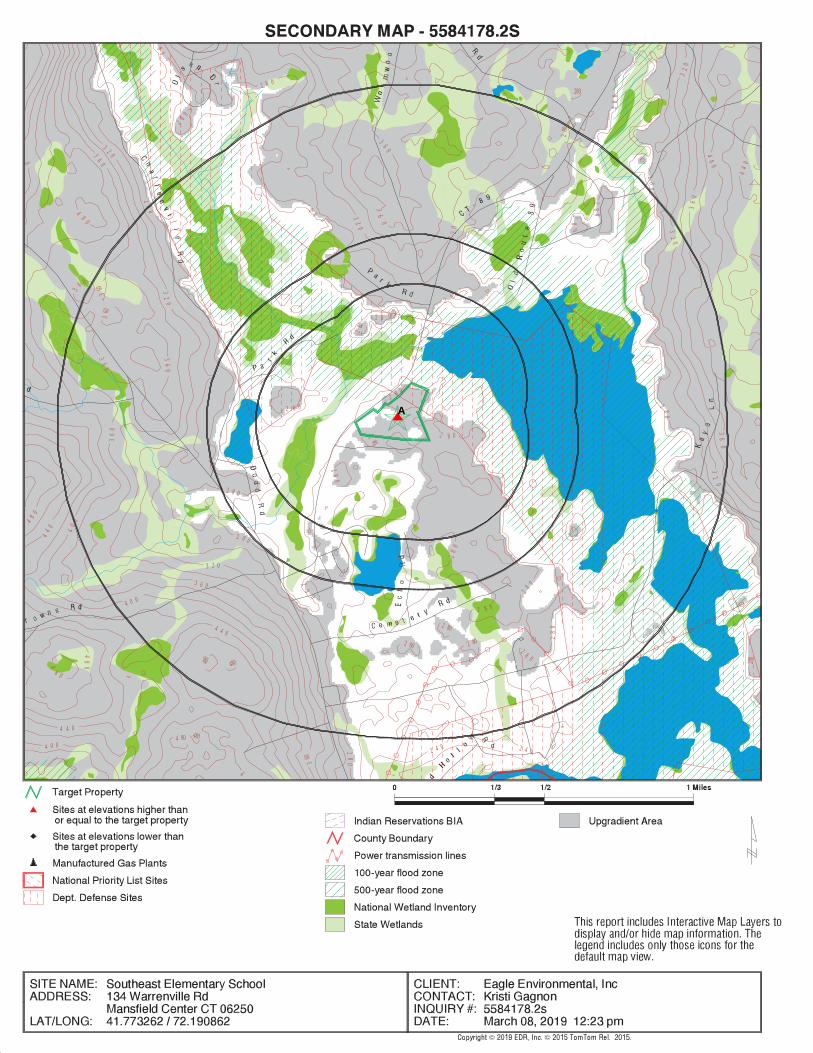
.
BeginOC−start−Wetlands−BeginOC−startBeginOC−start−− State Wetlands−BeginOC−startBeginOC−end−BeginOC−end−− State WetlandsBeginOC−start−− National Wetlands Inventory−BeginOC−startBeginOC−end−BeginOC−end−− National Wetlands InventoryBeginOC−end−BeginOC−end−WetlandsBeginOC−start−Water−BeginOC−startBeginOC−end−BeginOC−end−WaterBeginOC−start−Power Transmission Lines / Oil & Gas Pipelines−BeginOC−startBeginOC−end−BeginOC−end−Power Transmission Lines / Oil & Gas PipelinesBeginOC−start−Flood Zones−BeginOC−startBeginOC−start−− 500 Year Zone−BeginOC−startBeginOC−end−BeginOC−end−− 500 Year ZoneBeginOC−start−− 100 Year Zone−BeginOC−startBeginOC−end−BeginOC−end−− 100 Year ZoneBeginOC−end−BeginOC−end−Flood ZonesBeginOC−start−County Lines−BeginOC−startBeginOC−end−BeginOC−end−County LinesBeginOC−start−Streets−BeginOC−startBeginOC−end−BeginOC−end−StreetsBeginOC−start−Railroads−BeginOC−startBeginOC−end−BeginOC−end−RailroadsBeginOC−start−Contour Lines−BeginOC−start BeginOC−start−Contour Lines−OffBeginOC−start
280
2
8 02 80
280
40 0
3 60
36
0
28
0
28
0
3603
6 0
360
2 8 0
280
44
0
2 8 0
2 8 0
40
0
280
28
0
28
0 28 0
2 8 0
28
0
2 8 0
2 80
28
0
2 80 2 80
480
480
2 8 0
4
8 0
48
04804 80
200
48
0
4 4 0
44
0
0
4 0 0
4
4 4 0
4 0 0
40
0
360
3 6 0
36
0
36
0
36
0
36
0
36
0
36
0
2 4 0 2 4 028
0
2 8 0
2 8 0
28
08
0
2 8 0
2 80
2 8 0
28
0
28
0
2 80
280
3 2 0
32
0
3 2 0
32
03
20
32
0
32
0
32
0
BeginOC−end−BeginOC−end−Contour LinesBeginOC−start−Target Property Location−BeginOC−startBeginOC−end−BeginOC−end−Target Property LocationBeginOC−start−Federal DOD Records−BeginOC−startBeginOC−end−BeginOC−end−Federal DOD RecordsBeginOC−start−Indian Reservations BIA−BeginOC−startBeginOC−end−BeginOC−end−Indian Reservations BIABeginOC−start−National Priority List Records−BeginOC−startBeginOC−end−BeginOC−end−National Priority List RecordsBeginOC−start−Search Rings−BeginOC−startBeginOC−end−BeginOC−end−Search Rings
A
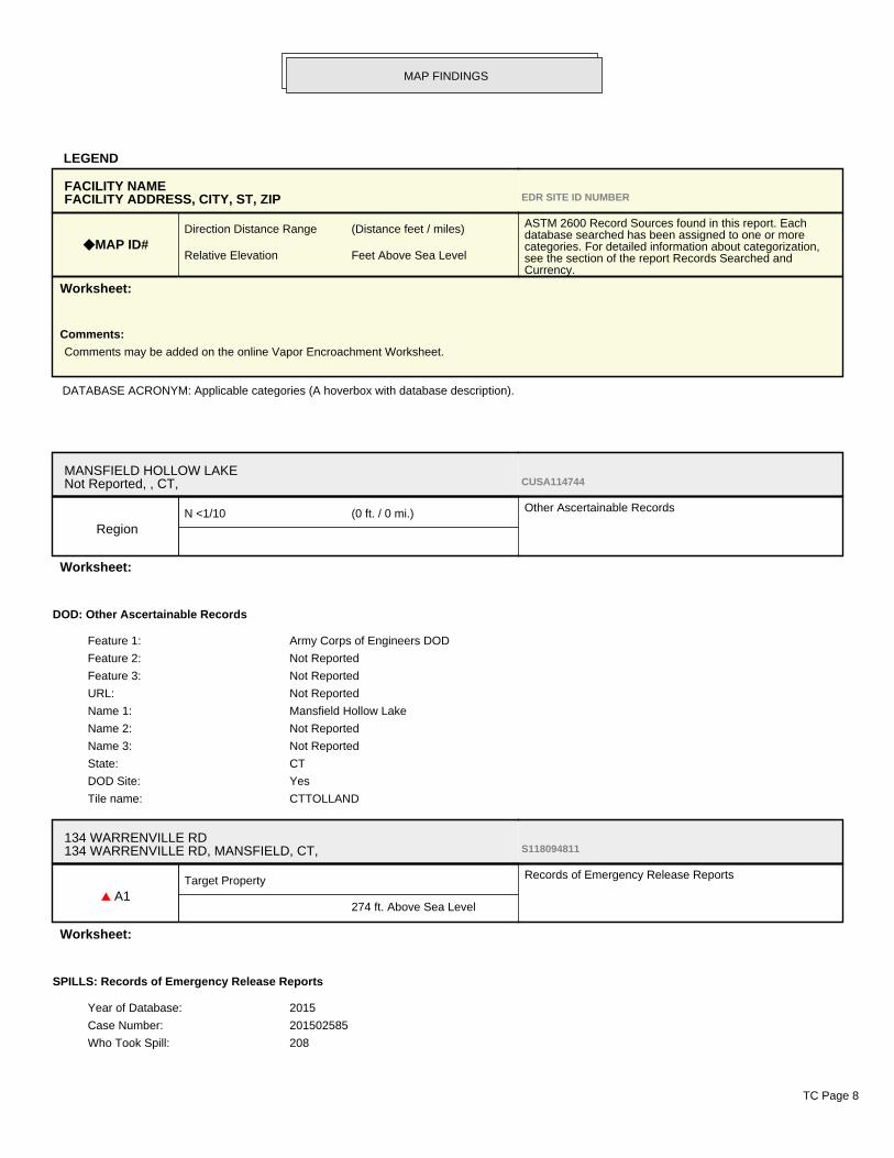
LEGEND
DATABASE ACRONYM: Applicable categories (A hoverbox with database description).
FACILITY NAMEFACILITY ADDRESS, CITY, ST, ZIP EDR SITE ID NUMBER
◆ MAP ID#Direction Distance Range (Distance feet / miles)
Relative Elevation Feet Above Sea Level
ASTM 2600 Record Sources found in this report. Eachdatabase searched has been assigned to one or morecategories. For detailed information about categorization,see the section of the report Records Searched andCurrency.
Worksheet:
Comments:
Comments may be added on the online Vapor Encroachment Worksheet.
MANSFIELD HOLLOW LAKENot Reported, , CT, CUSA114744
RegionN <1/10 (0 ft. / 0 mi.) Other Ascertainable Records
Worksheet:
DOD: Other Ascertainable Records
Feature 1: Army Corps of Engineers DOD
Feature 2: Not Reported
Feature 3: Not Reported
URL: Not Reported
Name 1: Mansfield Hollow Lake
Name 2: Not Reported
Name 3: Not Reported
State: CT
DOD Site: Yes
Tile name: CTTOLLAND
134 WARRENVILLE RD134 WARRENVILLE RD, MANSFIELD, CT, S118094811
▲ A1Target Property
274 ft. Above Sea Level
Records of Emergency Release Reports
Worksheet:
SPILLS: Records of Emergency Release Reports
Year of Database: 2015
Case Number: 201502585
Who Took Spill: 208
MAP FINDINGS
TC Page 8
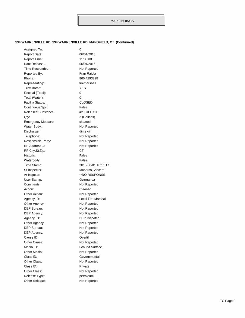
134 WARRENVILLE RD, 134 WARRENVILLE RD, MANSFIELD, CT (Continued)
Assigned To: 0
Report Date: 06/01/2015
Report Time: 11:30:08
Date Release: 06/01/2015
Time Responded: Not Reported
Reported By: Fran Raiola
Phone: 860 4293328
Representing: firemarshall
Terminated: YES
Recovd (Total): 0
Total (Water): 0
Facility Status: CLOSED
Continuous Spill: False
Released Substance: #2 FUEL OIL
Qty: 2 (Gallons)
Emergency Measure: cleaned
Water Body: Not Reported
Discharger: dime oil
Telephone: Not Reported
Responsible Party: Not Reported
RP Address 1: Not Reported
RP City,St,Zip: CT
Historic: False
Waterbody: False
Time Stamp: 2015-06-01 16:11:17
Sr Inspector: Monarca, Vincent
At Inspctor: **NO RESPONSE
User Stamp: Guzmanca
Comments: Not Reported
Action: Cleaned
Other Action: Not Reported
Agency ID: Local Fire Marshal
Other Agency: Not Reported
DEP Bureau: Not Reported
DEP Agency: Not Reported
Agency ID: DEP Dispatch
Other Agency: Not Reported
DEP Bureau: Not Reported
DEP Agency: Not Reported
Cause ID: Overfill
Other Cause: Not Reported
Media ID: Ground Surface
Other Media: Not Reported
Class ID: Governmental
Other Class: Not Reported
Class ID: Private
Other Class: Not Reported
Release Type: petroleum
Other Release: Not Reported
MAP FINDINGS
TC Page 9
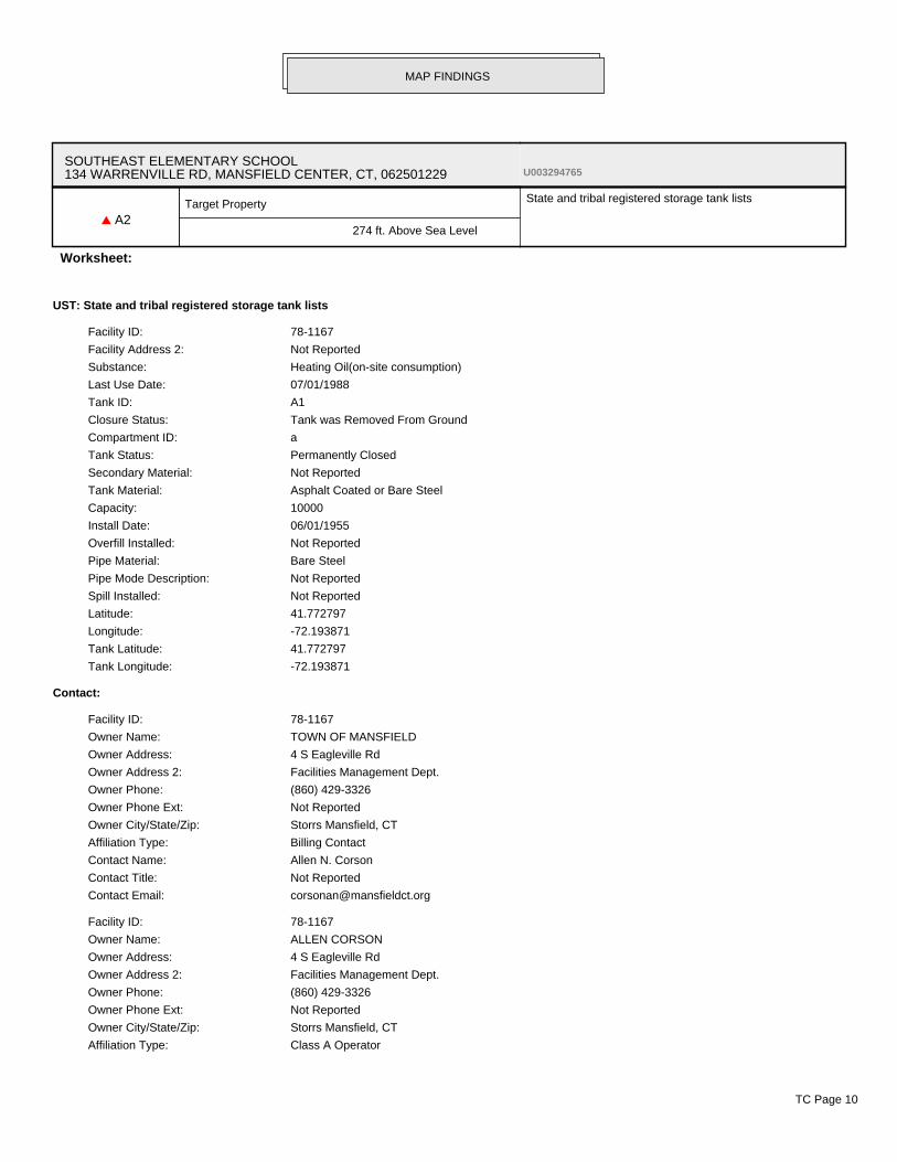
SOUTHEAST ELEMENTARY SCHOOL134 WARRENVILLE RD, MANSFIELD CENTER, CT, 062501229 U003294765
▲ A2Target Property
274 ft. Above Sea Level
State and tribal registered storage tank lists
Worksheet:
UST: State and tribal registered storage tank lists
Facility ID: 78-1167
Facility Address 2: Not Reported
Substance: Heating Oil(on-site consumption)
Last Use Date: 07/01/1988
Tank ID: A1
Closure Status: Tank was Removed From Ground
Compartment ID: a
Tank Status: Permanently Closed
Secondary Material: Not Reported
Tank Material: Asphalt Coated or Bare Steel
Capacity: 10000
Install Date: 06/01/1955
Overfill Installed: Not Reported
Pipe Material: Bare Steel
Pipe Mode Description: Not Reported
Spill Installed: Not Reported
Latitude: 41.772797
Longitude: -72.193871
Tank Latitude: 41.772797
Tank Longitude: -72.193871
Contact:
Facility ID: 78-1167
Owner Name: TOWN OF MANSFIELD
Owner Address: 4 S Eagleville Rd
Owner Address 2: Facilities Management Dept.
Owner Phone: (860) 429-3326
Owner Phone Ext: Not Reported
Owner City/State/Zip: Storrs Mansfield, CT
Affiliation Type: Billing Contact
Contact Name: Allen N. Corson
Contact Title: Not Reported
Contact Email: [email protected]
Facility ID: 78-1167
Owner Name: ALLEN CORSON
Owner Address: 4 S Eagleville Rd
Owner Address 2: Facilities Management Dept.
Owner Phone: (860) 429-3326
Owner Phone Ext: Not Reported
Owner City/State/Zip: Storrs Mansfield, CT
Affiliation Type: Class A Operator
MAP FINDINGS
TC Page 10
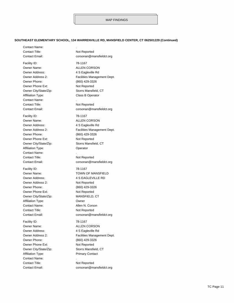
SOUTHEAST ELEMENTARY SCHOOL, 134 WARRENVILLE RD, MANSFIELD CENTER, CT 062501229 (Continued)
Contact Name: .
Contact Title: Not Reported
Contact Email: [email protected]
Facility ID: 78-1167
Owner Name: ALLEN CORSON
Owner Address: 4 S Eagleville Rd
Owner Address 2: Facilities Management Dept.
Owner Phone: (860) 429-3326
Owner Phone Ext: Not Reported
Owner City/State/Zip: Storrs Mansfield, CT
Affiliation Type: Class B Operator
Contact Name: .
Contact Title: Not Reported
Contact Email: [email protected]
Facility ID: 78-1167
Owner Name: ALLEN CORSON
Owner Address: 4 S Eagleville Rd
Owner Address 2: Facilities Management Dept.
Owner Phone: (860) 429-3326
Owner Phone Ext: Not Reported
Owner City/State/Zip: Storrs Mansfield, CT
Affiliation Type: Operator
Contact Name: .
Contact Title: Not Reported
Contact Email: [email protected]
Facility ID: 78-1167
Owner Name: TOWN OF MANSFIELD
Owner Address: 4 S EAGLEVILLE RD
Owner Address 2: Not Reported
Owner Phone: (860) 429-3326
Owner Phone Ext: Not Reported
Owner City/State/Zip: MANSFIELD, CT
Affiliation Type: Owner
Contact Name: Allen N. Corson
Contact Title: Not Reported
Contact Email: [email protected]
Facility ID: 78-1167
Owner Name: ALLEN CORSON
Owner Address: 4 S Eagleville Rd
Owner Address 2: Facilities Management Dept.
Owner Phone: (860) 429-3326
Owner Phone Ext: Not Reported
Owner City/State/Zip: Storrs Mansfield, CT
Affiliation Type: Primary Contact
Contact Name: .
Contact Title: Not Reported
Contact Email: [email protected]
MAP FINDINGS
TC Page 11

SOUTHEAST ELEMENTARY SCHOOL, 134 WARRENVILLE RD, MANSFIELD CENTER, CT 062501229 (Continued)
Facility ID: 78-1167
Owner Name: TOWN OF MANSFIELD
Owner Address: 4 S EAGLEVILLE RD
Owner Address 2: Not Reported
Owner Phone: (860) 429-3326
Owner Phone Ext: Not Reported
Owner City/State/Zip: MANSFIELD, CT
Affiliation Type: Property Owner
Contact Name: Allen N. Corson
Contact Title: Not Reported
Contact Email: [email protected]
Facility ID: 78-1167
Owner Name: TOWN OF MANSFIELD
Owner Address: 4 S EAGLEVILLE RD
Owner Address 2: Not Reported
Owner Phone: (860) 429-3326
Owner Phone Ext: Not Reported
Owner City/State/Zip: MANSFIELD, CT
Affiliation Type: Registrant
Contact Name: Allen N. Corson
Contact Title: Not Reported
Contact Email: [email protected]
Facility ID: 78-1167
Facility Address 2: Not Reported
Substance: Heating Oil(on-site consumption)
Last Use Date: Not Reported
Tank ID: A1R1
Closure Status: Not Reported
Compartment ID: Not Reported
Tank Status: Currently In Use
Secondary Material: Single Walled
Tank Material: Coated & Cathodically Protected Steel (sti-P3)
Capacity: 10000
Install Date: 07/01/1988
Overfill Installed: Not Reported
Pipe Material: Copper
Pipe Mode Description: Containment Sumps @ Tanks,Single Walled
Spill Installed: Not Reported
Latitude: 41.772797
Longitude: -72.193871
Tank Latitude: 41.772797
Tank Longitude: -72.193871
Contact:
Facility ID: 78-1167
Owner Name: TOWN OF MANSFIELD
Owner Address: 4 S Eagleville Rd
Owner Address 2: Facilities Management Dept.
MAP FINDINGS
TC Page 12
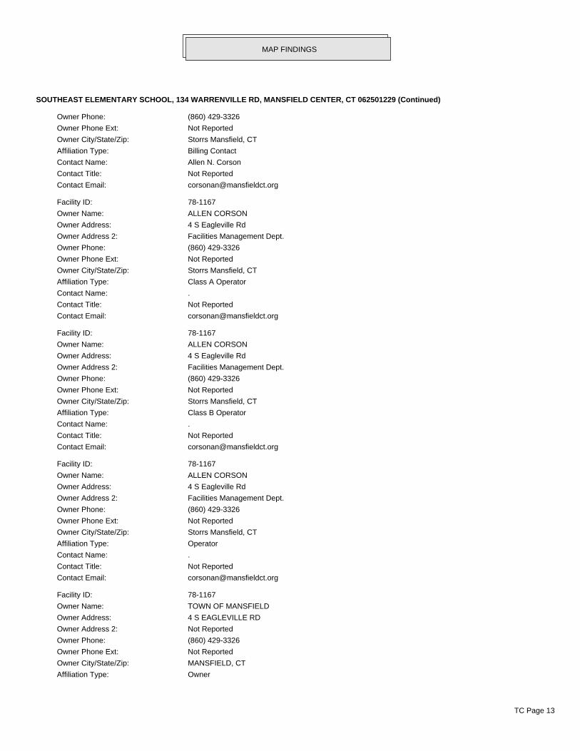
SOUTHEAST ELEMENTARY SCHOOL, 134 WARRENVILLE RD, MANSFIELD CENTER, CT 062501229 (Continued)
Owner Phone: (860) 429-3326
Owner Phone Ext: Not Reported
Owner City/State/Zip: Storrs Mansfield, CT
Affiliation Type: Billing Contact
Contact Name: Allen N. Corson
Contact Title: Not Reported
Contact Email: [email protected]
Facility ID: 78-1167
Owner Name: ALLEN CORSON
Owner Address: 4 S Eagleville Rd
Owner Address 2: Facilities Management Dept.
Owner Phone: (860) 429-3326
Owner Phone Ext: Not Reported
Owner City/State/Zip: Storrs Mansfield, CT
Affiliation Type: Class A Operator
Contact Name: .
Contact Title: Not Reported
Contact Email: [email protected]
Facility ID: 78-1167
Owner Name: ALLEN CORSON
Owner Address: 4 S Eagleville Rd
Owner Address 2: Facilities Management Dept.
Owner Phone: (860) 429-3326
Owner Phone Ext: Not Reported
Owner City/State/Zip: Storrs Mansfield, CT
Affiliation Type: Class B Operator
Contact Name: .
Contact Title: Not Reported
Contact Email: [email protected]
Facility ID: 78-1167
Owner Name: ALLEN CORSON
Owner Address: 4 S Eagleville Rd
Owner Address 2: Facilities Management Dept.
Owner Phone: (860) 429-3326
Owner Phone Ext: Not Reported
Owner City/State/Zip: Storrs Mansfield, CT
Affiliation Type: Operator
Contact Name: .
Contact Title: Not Reported
Contact Email: [email protected]
Facility ID: 78-1167
Owner Name: TOWN OF MANSFIELD
Owner Address: 4 S EAGLEVILLE RD
Owner Address 2: Not Reported
Owner Phone: (860) 429-3326
Owner Phone Ext: Not Reported
Owner City/State/Zip: MANSFIELD, CT
Affiliation Type: Owner
MAP FINDINGS
TC Page 13
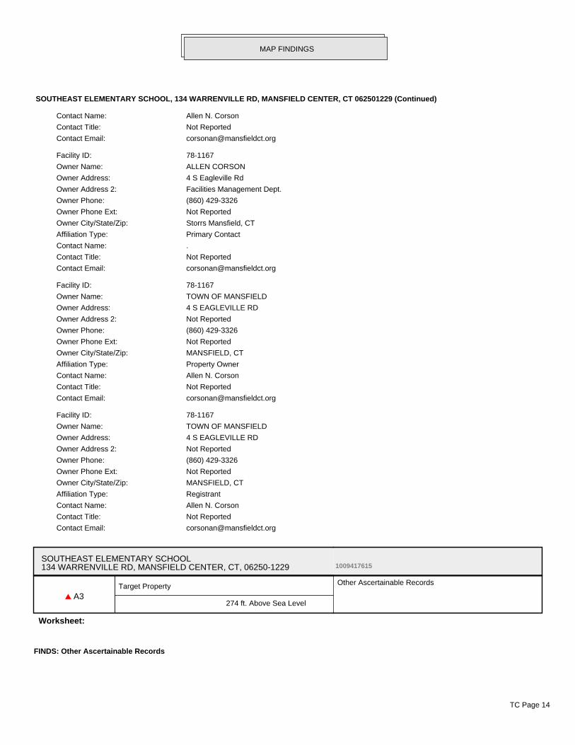
SOUTHEAST ELEMENTARY SCHOOL, 134 WARRENVILLE RD, MANSFIELD CENTER, CT 062501229 (Continued)
Contact Name: Allen N. Corson
Contact Title: Not Reported
Contact Email: [email protected]
Facility ID: 78-1167
Owner Name: ALLEN CORSON
Owner Address: 4 S Eagleville Rd
Owner Address 2: Facilities Management Dept.
Owner Phone: (860) 429-3326
Owner Phone Ext: Not Reported
Owner City/State/Zip: Storrs Mansfield, CT
Affiliation Type: Primary Contact
Contact Name: .
Contact Title: Not Reported
Contact Email: [email protected]
Facility ID: 78-1167
Owner Name: TOWN OF MANSFIELD
Owner Address: 4 S EAGLEVILLE RD
Owner Address 2: Not Reported
Owner Phone: (860) 429-3326
Owner Phone Ext: Not Reported
Owner City/State/Zip: MANSFIELD, CT
Affiliation Type: Property Owner
Contact Name: Allen N. Corson
Contact Title: Not Reported
Contact Email: [email protected]
Facility ID: 78-1167
Owner Name: TOWN OF MANSFIELD
Owner Address: 4 S EAGLEVILLE RD
Owner Address 2: Not Reported
Owner Phone: (860) 429-3326
Owner Phone Ext: Not Reported
Owner City/State/Zip: MANSFIELD, CT
Affiliation Type: Registrant
Contact Name: Allen N. Corson
Contact Title: Not Reported
Contact Email: [email protected]
SOUTHEAST ELEMENTARY SCHOOL134 WARRENVILLE RD, MANSFIELD CENTER, CT, 06250-1229 1009417615
▲ A3Target Property
274 ft. Above Sea Level
Other Ascertainable Records
Worksheet:
FINDS: Other Ascertainable Records
MAP FINDINGS
TC Page 14
SOUTHEAST ELEMENTARY SCHOOL, 134 WARRENVILLE RD, MANSFIELD CENTER, CT 06250-1229 (Continued)
Registry ID: 110021595371
Environmental Interest/Information System:
Connecticut Site Information Management System (SIMS) is part of a suite of web-based applicationsdesigned to allow the Connecticut Department of Environmental Protection (DEP) staff to harmonizeenvironmental interest information from disparate systems in a single agency-wide data repository (knownas CFI). SIMS provides tools for identifying and resolving duplicate data, querying data (using both tabularand geospatial methods), and viewing/maintaining documents associated to the data.
The Click here to access additional FINDS: detail in the EDR Site Report. database containshttp://www.edrnet.com/srf2/FinalSiteReport.aspx?ID=4uA4zEuLzAPx2cPzS8EAI9D3Livzn746zPy5xde29ucDpPXv5SgSj68rl2dfA3uIiC30yD4f3gEAtEiwcvl93fYnql7rB4s8ujsAcG23dzaIEch8m.LUGziw2OOPoTxda5qccj7Pfx20WSFw8CyAUIASsIUD3WkDa53xcBg3iX7vWb4LSuQMAV53QPzSUETJ2K8LOhzoP7aJPpbxNH7Voc.GPm3AHHSKd8FM60hAFPI5u3MqDT33Gn9TVidfv4CAdonNF7Kx1ft65yz5A4djyFB5ZeuSLdIjetO4liu05AyO3C2zEmEzB2ncLBHzn43ltPxAx9G27ecr9PEF2HHSN58BNBVlA5XIl96R.Dbr3kM32JiBMv5y9TcntE7hK8dI6kLzsj3NFyAe5yf7egdyQeUN2additional records for this site. Please contact your EDR Account Executive for more information.
MAP FINDINGS
TC Page 15
ENVIRONMENTAL RECORDS
Federal NPL site listUS NPL National Priority List EPA 12/12/2018 12/28/2018 01/11/2019US Proposed NPL Proposed National Priority List Sites EPA 12/12/2018 12/28/2018 01/11/2019US NPL LIENS Federal Superfund Liens EPA 10/15/1991 02/02/1994 03/30/1994
Federal CERCLIS listUS SEMS Superfund Enterprise Management System EPA 12/12/2018 12/28/2018 01/11/2019
Federal RCRA CORRACTS facilities listUS CORRACTS Corrective Action Report EPA 03/01/2018 03/28/2018 06/22/2018
Federal RCRA TSD facilities listUS RCRA-TSDF RCRA - Treatment, Storage and Disposal Environmental Protection Agency 03/01/2018 03/28/2018 06/22/2018
Federal RCRA generators listUS RCRA-LQG RCRA - Large Quantity Generators Environmental Protection Agency 03/01/2018 03/28/2018 06/22/2018US RCRA-SQG RCRA - Small Quantity Generators Environmental Protection Agency 03/01/2018 03/28/2018 06/22/2018US RCRA-CESQG RCRA - Conditionally Exempt Small Quantity Generators Environmental Protection Agency 03/01/2018 03/28/2018 06/22/2018
Federal institutional controls / engineering controls registriesUS LUCIS Land Use Control Information System Department of the Navy 10/17/2018 10/25/2018 12/07/2018US US ENG CONTROLS Engineering Controls Sites List Environmental Protection Agency 07/31/2018 08/28/2018 09/14/2018US US INST CONTROL Sites with Institutional Controls Environmental Protection Agency 07/31/2018 08/28/2018 09/14/2018
Federal ERNS listUS ERNS Emergency Response Notification System National Response Center, United States Coast 09/24/2018 09/25/2018 11/09/2018
State and tribal - equivalent CERCLISCT SHWS Inventory of Hazardous Disposal Sites Department of Energy & Environmental Protecti 04/23/2010 04/23/2010 05/25/2010CT SDADB Site Discovery and Assessment Database Department of Energy & Environmental Protecti 04/23/2010 04/23/2010 05/25/2010
State and tribal landfill / solid waste disposalCT SWF/LF List of Landfills/Transfer Stations Department of Energy & Environmental Protecti 01/24/2019 01/25/2019 03/04/2019
State and tribal leaking storage tank listsCT LUST Leaking Underground Storage Tank List Department of Energy & Environmental Protecti 01/23/2019 01/25/2019 03/04/2019US INDIAN LUST R5 Leaking Underground Storage Tanks on Indian Land EPA, Region 5 04/12/2018 05/18/2018 07/20/2018US INDIAN LUST R10 Leaking Underground Storage Tanks on Indian Land EPA Region 10 04/12/2018 05/18/2018 07/20/2018US INDIAN LUST R9 Leaking Underground Storage Tanks on Indian Land Environmental Protection Agency 04/10/2018 05/18/2018 07/20/2018US INDIAN LUST R8 Leaking Underground Storage Tanks on Indian Land EPA Region 8 04/25/2018 05/18/2018 07/20/2018US INDIAN LUST R7 Leaking Underground Storage Tanks on Indian Land EPA Region 7 04/24/2018 05/18/2018 07/20/2018US INDIAN LUST R6 Leaking Underground Storage Tanks on Indian Land EPA Region 6 04/01/2018 05/18/2018 07/20/2018US INDIAN LUST R4 Leaking Underground Storage Tanks on Indian Land EPA Region 4 05/08/2018 05/18/2018 07/20/2018US INDIAN LUST R1 Leaking Underground Storage Tanks on Indian Land EPA Region 1 04/13/2018 05/18/2018 07/20/2018
TC5584178.2s Page GR-1
GOVERNMENT RECORDS SEARCHED / DATA CURRENCY TRACKING
St Acronym Full Name Government Agency Gov Date Arvl. Date Active Date
State and tribal registered storage tank listsCT UST Underground Storage Tank Data Department of Energy & Environmental Protecti 12/04/2018 12/18/2018 01/28/2019CT AST Marine Terminals and Tank Information Department of Energy & Environmental Protecti 06/30/2018 08/09/2018 09/10/2018US INDIAN UST R7 Underground Storage Tanks on Indian Land EPA Region 7 04/24/2018 05/18/2018 07/20/2018US INDIAN UST R5 Underground Storage Tanks on Indian Land EPA Region 5 04/12/2018 05/18/2018 07/20/2018US INDIAN UST R4 Underground Storage Tanks on Indian Land EPA Region 4 05/08/2018 05/18/2018 07/20/2018US INDIAN UST R1 Underground Storage Tanks on Indian Land EPA, Region 1 04/13/2018 05/18/2018 07/20/2018US INDIAN UST R8 Underground Storage Tanks on Indian Land EPA Region 8 04/25/2018 05/18/2018 07/20/2018US INDIAN UST R6 Underground Storage Tanks on Indian Land EPA Region 6 04/01/2018 05/18/2018 07/20/2018US INDIAN UST R10 Underground Storage Tanks on Indian Land EPA Region 10 04/12/2018 05/18/2018 07/20/2018US INDIAN UST R9 Underground Storage Tanks on Indian Land EPA Region 9 04/10/2018 05/18/2018 07/20/2018US FEMA UST Underground Storage Tank Listing FEMA 05/15/2017 05/30/2017 10/13/2017
State and tribal institutional control / engineering control registriesCT ENG CONTROLS Engineering Controls Listing Department of Energy & Environmental Protecti 03/05/2013 05/07/2013 06/19/2013CT AUL ELUR Sites Department of Energy & Environmental Protecti 11/14/2018 11/15/2018 12/04/2018
State and tribal voluntary cleanup sitesUS INDIAN VCP R1 Voluntary Cleanup Priority Listing EPA, Region 1 07/27/2015 09/29/2015 02/18/2016US INDIAN VCP R7 Voluntary Cleanup Priority Lisitng EPA, Region 7 03/20/2008 04/22/2008 05/19/2008CT VCP Voluntary Remediation Sites Department of Energy & Environmental Protecti 11/14/2018 11/15/2018 12/04/2018
State and tribal Brownfields sitesCT BROWNFIELDS Brownfields Inventory Connecticut Brownfields Redevelopment Authori 03/25/2016 03/29/2016 05/18/2016CT BROWNFIELDS 2 Brownfields Inventory Department of Energy & Environmental Protecti 08/03/2017 09/20/2017 09/26/2017
Other RecordsUS CONSENT Superfund (CERCLA) Consent Decrees Department of Justice, Consent Decree Library 09/30/2018 10/12/2018 12/07/2018US ROD Records Of Decision EPA 12/12/2018 12/28/2018 01/11/2019US LIENS 2 CERCLA Lien Information Environmental Protection Agency 12/12/2018 12/28/2018 01/11/2019US DEBRIS REGION 9 Torres Martinez Reservation Illegal Dump Site Locations EPA, Region 9 01/12/2009 05/07/2009 09/21/2009CT SWRCY Recycling Facilities Department of Energy & Environmental Protecti 12/07/2018 12/26/2018 01/24/2019US LEAD SMELTER 2 Lead Smelter Sites American Journal of Public Health 04/05/2001 10/27/2010 12/02/2010US LEAD SMELTER 1 Lead Smelter Sites Environmental Protection Agency 12/12/2018 12/28/2018 01/11/2019US 2020 COR ACTION 2020 Corrective Action Program List Environmental Protection Agency 09/30/2017 05/08/2018 07/20/2018US US HIST CDL National Clandestine Laboratory Register Drug Enforcement Administration 09/21/2018 09/21/2018 11/09/2018US PCB TRANSFORMER PCB Transformer Registration Database Environmental Protection Agency 05/24/2017 11/30/2017 12/15/2017US FUSRAP Formerly Utilized Sites Remedial Action Program Department of Energy 08/08/2017 09/11/2018 09/14/2018US EPA WATCH LIST EPA WATCH LIST Environmental Protection Agency 08/30/2013 03/21/2014 06/17/2014US US FIN ASSUR Financial Assurance Information Environmental Protection Agency 08/31/2018 09/25/2018 11/09/2018US US AIRS MINOR Air Facility System Data EPA 10/12/2016 10/26/2016 02/03/2017US SCRD DRYCLEANERS State Coalition for Remediation of Drycleaners Listing Environmental Protection Agency 01/01/2017 02/03/2017 04/07/2017US COAL ASH EPA Coal Combustion Residues Surface Impoundments List Environmental Protection Agency 07/01/2014 09/10/2014 10/20/2014US COAL ASH DOE Steam-Electric Plant Operation Data Department of Energy 12/31/2005 08/07/2009 10/22/2009US US AIRS (AFS) Aerometric Information Retrieval System Facility Subsystem ( EPA 10/12/2016 10/26/2016 02/03/2017US Delisted NPL National Priority List Deletions EPA 12/12/2018 12/28/2018 01/11/2019
TC5584178.2s Page GR-2
GOVERNMENT RECORDS SEARCHED / DATA CURRENCY TRACKING
St Acronym Full Name Government Agency Gov Date Arvl. Date Active Date
US SEMS-ARCHIVE Superfund Enterprise Management System Archive EPA 12/13/2018 12/28/2018 01/11/2019US RCRA NonGen / NLR RCRA - Non Generators / No Longer Regulated Environmental Protection Agency 03/01/2018 03/28/2018 06/22/2018US HMIRS Hazardous Materials Information Reporting System U.S. Department of Transportation 03/26/2018 03/27/2018 06/08/2018US DOT OPS Incident and Accident Data Department of Transporation, Office of Pipeli 10/01/2018 10/30/2018 01/18/2019US US CDL Clandestine Drug Labs Drug Enforcement Administration 09/21/2018 09/21/2018 11/09/2018US US BROWNFIELDS A Listing of Brownfields Sites Environmental Protection Agency 12/17/2018 12/18/2018 01/11/2019US DOD Department of Defense Sites USGS 12/31/2005 11/10/2006 01/11/2007US FEDLAND Federal and Indian Lands U.S. Geological Survey 12/31/2005 02/06/2006 01/11/2007US FUDS Formerly Used Defense Sites U.S. Army Corps of Engineers 01/31/2015 07/08/2015 10/13/2015US UMTRA Uranium Mill Tailings Sites Department of Energy 06/23/2017 10/11/2017 11/03/2017US ODI Open Dump Inventory Environmental Protection Agency 06/30/1985 08/09/2004 09/17/2004US US MINES Mines Master Index File Department of Labor, Mine Safety and Health A 08/01/2018 08/29/2018 10/05/2018US US MINES 2 Ferrous and Nonferrous Metal Mines Database Listing USGS 12/05/2005 02/29/2008 04/18/2008US US MINES 3 Active Mines & Mineral Plants Database Listing USGS 04/14/2011 06/08/2011 09/13/2011US PRP Potentially Responsible Parties EPA 08/13/2018 10/04/2018 11/09/2018US TRIS Toxic Chemical Release Inventory System EPA 12/31/2016 01/10/2018 01/12/2018US TSCA Toxic Substances Control Act EPA 12/31/2016 06/21/2017 01/05/2018US FTTS FIFRA/ TSCA Tracking System - FIFRA (Federal Insecticide, Fu EPA/Office of Prevention, Pesticides and Toxi 04/09/2009 04/16/2009 05/11/2009US FTTS INSP FIFRA/ TSCA Tracking System - FIFRA (Federal Insecticide, Fu EPA 04/09/2009 04/16/2009 05/11/2009US HIST FTTS FIFRA/TSCA Tracking System Administrative Case Listing Environmental Protection Agency 10/19/2006 03/01/2007 04/10/2007US HIST FTTS INSP FIFRA/TSCA Tracking System Inspection & Enforcement Case Lis Environmental Protection Agency 10/19/2006 03/01/2007 04/10/2007US SSTS Section 7 Tracking Systems EPA 12/31/2009 12/10/2010 02/25/2011US ICIS Integrated Compliance Information System Environmental Protection Agency 11/18/2016 11/23/2016 02/10/2017US PADS PCB Activity Database System EPA 09/14/2018 10/11/2018 12/07/2018US MLTS Material Licensing Tracking System Nuclear Regulatory Commission 08/30/2016 09/08/2016 10/21/2016US RADINFO Radiation Information Database Environmental Protection Agency 10/02/2018 10/03/2018 11/09/2018US FINDS Facility Index System/Facility Registry System EPA 11/15/2018 12/05/2018 01/11/2019US RAATS RCRA Administrative Action Tracking System EPA 04/17/1995 07/03/1995 08/07/1995US RMP Risk Management Plans Environmental Protection Agency 10/26/2018 11/06/2018 01/11/2019US BRS Biennial Reporting System EPA/NTIS 12/31/2015 02/22/2017 09/28/2017US PWS Public Water System Data EPA 12/17/2013 01/09/2014 10/15/2014US INDIAN RESERV Indian Reservations USGS 12/31/2014 07/14/2015 01/10/2017US INDIAN ODI Report on the Status of Open Dumps on Indian Lands Environmental Protection Agency 12/31/1998 12/03/2007 01/24/2008CT AIRS Permitted Air Sources Listing Department of Energy & Environmental Protecti 01/09/2019 01/28/2019 02/07/2019CT ASBESTOS Asbestos Notification Listing Department of Public Health 08/01/2018 08/02/2018 09/10/2018CT CDL Clandestine Drug Lab Listing Department of Energy & Environmental Protecti 01/23/2019 01/25/2019 03/04/2019CT CPCS Contaminated or Potentially Contaminated Sites Department of Energy & Environmental Protecti 11/14/2018 11/15/2018 12/04/2018CT DRYCLEANERS Drycleaner Facilities Department of Energy & Environmental Protecti 07/18/2008 08/08/2008 08/27/2008CT ENFORCEMENT Enforcement Case Listing Department of Energy & Environmental Protecti 01/15/2019 01/17/2019 03/04/2019CT Financial Assurance 1 Financial Assurance Information Listing Department of Energy & Environmental Protecti 10/22/2018 10/30/2018 12/04/2018CT Financial Assurance 2 Financial Assurance Information Listing Department of Energy & Environmental Protecti 10/22/2018 10/30/2018 12/03/2018CT LEAD Lead Inspection Database Department of Public Health 03/26/2014 03/27/2014 05/08/2014CT LIENS Environmental Liens Listing Department of Energy & Environmental Protecti 02/11/2019 02/19/2019 03/04/2019CT LWDS Connecticut Leachate and Wastewater Discharge Sites Department of Energy & Environmental Protecti 07/17/2009 10/21/2009 10/30/2009CT CT MANIFEST Hazardous Waste Manifest Data Department of Energy & Environmental Protecti 02/11/2019 02/12/2019 03/04/2019CT NPDES Wastewater Permit Listing Department of Energy & Environmental Protecti 01/17/2019 01/23/2019 03/04/2019CT CT PROPERTY Property Transfer Filings Department of Energy & Environmental Protecti 11/14/2018 11/15/2018 12/04/2018
TC5584178.2s Page GR-3
GOVERNMENT RECORDS SEARCHED / DATA CURRENCY TRACKING
St Acronym Full Name Government Agency Gov Date Arvl. Date Active Date
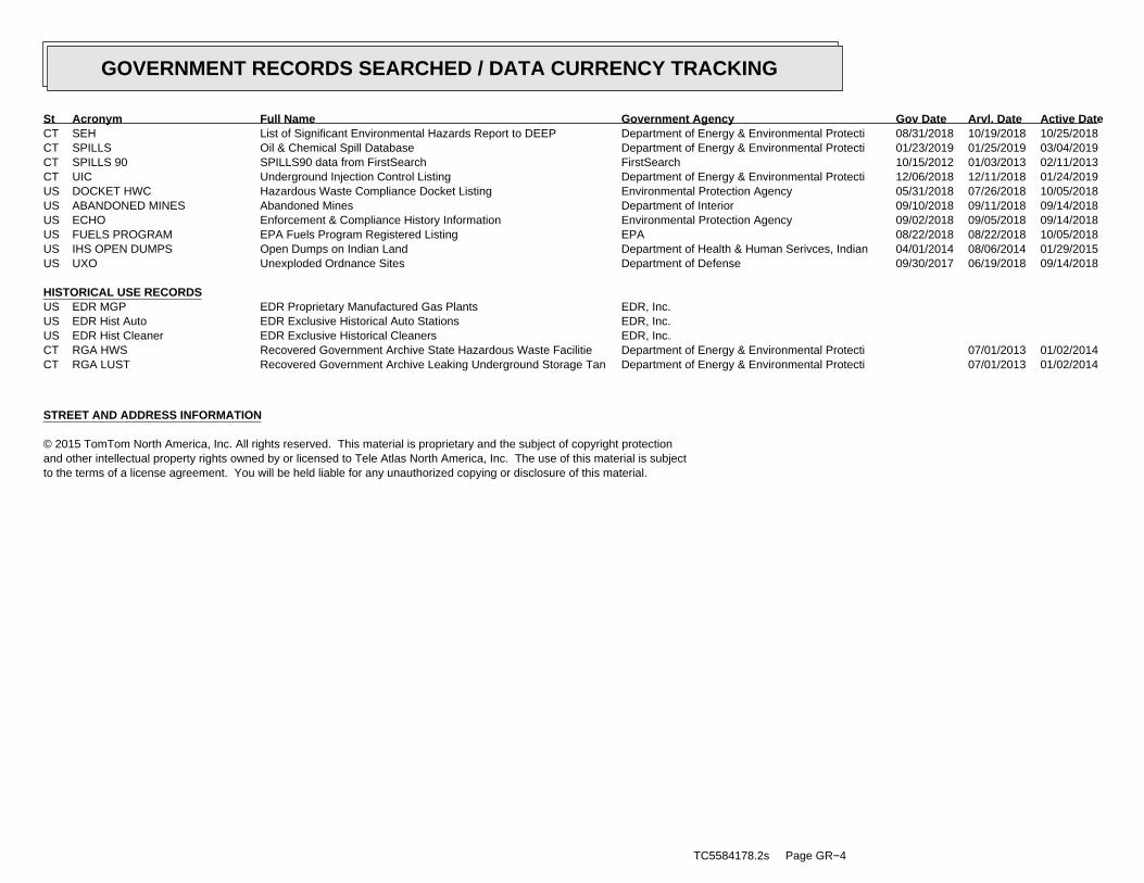
CT SEH List of Significant Environmental Hazards Report to DEEP Department of Energy & Environmental Protecti 08/31/2018 10/19/2018 10/25/2018CT SPILLS Oil & Chemical Spill Database Department of Energy & Environmental Protecti 01/23/2019 01/25/2019 03/04/2019CT SPILLS 90 SPILLS90 data from FirstSearch FirstSearch 10/15/2012 01/03/2013 02/11/2013CT UIC Underground Injection Control Listing Department of Energy & Environmental Protecti 12/06/2018 12/11/2018 01/24/2019US DOCKET HWC Hazardous Waste Compliance Docket Listing Environmental Protection Agency 05/31/2018 07/26/2018 10/05/2018US ABANDONED MINES Abandoned Mines Department of Interior 09/10/2018 09/11/2018 09/14/2018US ECHO Enforcement & Compliance History Information Environmental Protection Agency 09/02/2018 09/05/2018 09/14/2018US FUELS PROGRAM EPA Fuels Program Registered Listing EPA 08/22/2018 08/22/2018 10/05/2018US IHS OPEN DUMPS Open Dumps on Indian Land Department of Health & Human Serivces, Indian 04/01/2014 08/06/2014 01/29/2015US UXO Unexploded Ordnance Sites Department of Defense 09/30/2017 06/19/2018 09/14/2018
HISTORICAL USE RECORDSUS EDR MGP EDR Proprietary Manufactured Gas Plants EDR, Inc.US EDR Hist Auto EDR Exclusive Historical Auto Stations EDR, Inc.US EDR Hist Cleaner EDR Exclusive Historical Cleaners EDR, Inc.CT RGA HWS Recovered Government Archive State Hazardous Waste Facilitie Department of Energy & Environmental Protecti 07/01/2013 01/02/2014CT RGA LUST Recovered Government Archive Leaking Underground Storage Tan Department of Energy & Environmental Protecti 07/01/2013 01/02/2014
STREET AND ADDRESS INFORMATION
© 2015 TomTom North America, Inc. All rights reserved. This material is proprietary and the subject of copyright protectionand other intellectual property rights owned by or licensed to Tele Atlas North America, Inc. The use of this material is subjectto the terms of a license agreement. You will be held liable for any unauthorized copying or disclosure of this material.
TC5584178.2s Page GR−4
GOVERNMENT RECORDS SEARCHED / DATA CURRENCY TRACKING
St Acronym Full Name Government Agency Gov Date Arvl. Date Active Date

MAP FINDINGSMap IDDirection
EDR ID NumberDistanceEPA ID NumberDatabase(s)SiteElevation
4 LWDSREPUBLIC OIL S109937470WSW WARRENVILLE ROAD ROUTE 89 N/A1/8-1/4 MANSFIELD, CT
Relative:Lower
Actual:255 ft.
0.131 mi.691 ft.
LWDS: 3207008Leachate and Wastewater Number: InactiveStatus of the Discharge Activity: GroundLeachate and Waste Flow: Republic Oil Truck OverturnAlias: Not reportedAlias2:
Page: 1

GEOCHECK - PHYSICAL SETTING SOURCE MAP FINDINGS®
Map IDDirectionDistanceElevation EDR ID NumberDatabase
2SSE0 - 1/8 MileHigher
CTC000000000275CT WELLS
Screen DigitizeGismethod:293Well id:752531X:1999Gisdate:Well 1Well:342477Y:ECRWC, PINEWOODS LANE DIVISIONUname:78008System id:DrilledType:ActiveStatus:250Depth ft:BedrockAquifer:6Diam in:0Rckdpth ft:10Pmpcap gpm:0Casdiam in:293Text id:.006Syield mgd:
CTC000000000275Site id:
Page: 1

GEOCHECK - PHYSICAL SETTING SOURCE MAP FINDINGS®
Map IDDirectionDistanceElevation EDR ID NumberDatabase
1West0 - 1/8 MileHigher
CTNC00000000436CT WELLS
Screen DigitizeGismethod:542Well id:752093X:1998Gisdate:WellWell:342948Y:Southeast SchoolSystem:781233System id:ActiveStatus:NTNCSystype:BedrockAquifer:DrilledType:0Rckdpth ft:0Depth ft:0Casdiam in:0Diam in:0Syield mgd:0Pmpcap gpm:CTNC00000000436Site id:CT0781233Newsystem:
Page: 1

GEOCHECK - PHYSICAL SETTING SOURCE MAP FINDINGS®
Map IDDirectionDistanceElevation EDR ID NumberDatabase
5WNW1/2 - 1 MileHigher
CTC000000000274CT WELLS
GPS - EPAGismethod:292Well id:749094X:1993Gisdate:Well 1Well:343881Y:MANSFIELD MOBILE MANORUname:78025System id:DrilledType:ActiveStatus:175Depth ft:BedrockAquifer:0Diam in:0Rckdpth ft:10Pmpcap gpm:0Casdiam in:292Text id:0Syield mgd:
CTC000000000274Site id:
Page: 1

GEOCHECK - PHYSICAL SETTING SOURCE MAP FINDINGS®
Map IDDirectionDistanceElevation EDR ID NumberDatabase
4West1/2 - 1 MileHigher
CTNC00000000636CT WELLS
Screen DigitizeGismethod:1912Well id:749167X:1999Gisdate:WellWell:342939Y:Camp Holiday HillSystem:780912System id:ActiveStatus:TNCSystype:BedrockAquifer:DrilledType:0Rckdpth ft:0Depth ft:0Casdiam in:0Diam in:0Syield mgd:0Pmpcap gpm:CTNC00000000636Site id:CT0780064Newsystem:
Page: 1

GEOCHECK - PHYSICAL SETTING SOURCE MAP FINDINGS®
Map IDDirectionDistanceElevation EDR ID NumberDatabase
7SSW1/2 - 1 MileHigher
USGS40000228453FED USGS
USGS-CTOrganization ID: USGS Connecticut Water Science CenterOrganization Name:
WellType: CT-MS 19Monitor Location: 01100002HUC: Not ReportedDescription: Not ReportedDrainage Area Units: Not ReportedDrainage Area: Not ReportedContrib Drainage Area Unts: Not ReportedContrib Drainage Area:
Sand and gravel aquifers (glaciated regions)Aquifer: Unconfined single aquiferAquifer Type: Drift, StratifiedFormation Type: 21.3Well Depth: 1957Construction Date: 21.3Well Hole Depth: ftWell Depth Units:
ftWell Hole Depth Units: 2005-02-25Level reading date: 835Ground water levels,Number of Measurements: Not ReportedFeet to sea level: 9.30Feet below surface:
Not ReportedNote: 9.34Feet below surface: 2005-01-27Level reading date: Not ReportedNote: Not ReportedFeet to sea level: Not ReportedFeet below surface: 2004-12-28Level reading date: Not ReportedNote: Not ReportedFeet to sea level: 12.14Feet below surface: 2004-11-30Level reading date: Not ReportedNote: Not ReportedFeet to sea level: 12.15Feet below surface: 2004-10-26Level reading date: Not ReportedNote: Not ReportedFeet to sea level: 12.09Feet below surface: 2004-09-30Level reading date: Not ReportedNote: Not ReportedFeet to sea level: 12.17Feet below surface: 2004-08-31Level reading date: Not ReportedNote: Not ReportedFeet to sea level: 11.64Feet below surface: 2004-07-27Level reading date: Not ReportedNote: Not ReportedFeet to sea level: 10.03Feet below surface: 2004-06-30Level reading date: Not ReportedNote: Not ReportedFeet to sea level: 9.12Feet below surface: 2004-05-26Level reading date: Not ReportedNote: Not ReportedFeet to sea level: 8.55Feet below surface: 2004-04-28Level reading date: Not ReportedNote: Not ReportedFeet to sea level: 10.95Feet below surface: 2004-03-31Level reading date: Not ReportedNote: Not ReportedFeet to sea level: 11.11Feet below surface: 2004-02-26Level reading date: Not ReportedNote: Not ReportedFeet to sea level: 10.73Feet below surface: 2004-01-27Level reading date: Not ReportedNote: Not ReportedFeet to sea level: 10.80Feet below surface: 2003-12-23Level reading date: Not ReportedNote: Not ReportedFeet to sea level: 11.97Feet below surface: 2003-11-24Level reading date: Not ReportedNote: Not ReportedFeet to sea level: 12.54Feet below surface: 2003-10-28Level reading date: Not ReportedNote: Not ReportedFeet to sea level: 12.21Feet below surface: 2003-09-29Level reading date: Not ReportedNote: Not ReportedFeet to sea level: 11.55Feet below surface: 2003-08-26Level reading date: Not ReportedNote: Not ReportedFeet to sea level: 10.57Feet below surface: 2003-07-29Level reading date: Not ReportedNote: Not ReportedFeet to sea level:
Page: 1

GEOCHECK - PHYSICAL SETTING SOURCE MAP FINDINGS®
Map IDDirectionDistanceElevation EDR ID NumberDatabase
8.97Feet below surface: 2003-06-25Level reading date: Not ReportedNote: Not ReportedFeet to sea level: 9.47Feet below surface: 2003-05-29Level reading date: Not ReportedNote: Not ReportedFeet to sea level: 9.43Feet below surface: 2003-04-25Level reading date: Not ReportedNote: Not ReportedFeet to sea level: 10.22Feet below surface: 2003-03-26Level reading date: Not ReportedNote: Not ReportedFeet to sea level: 11.25Feet below surface: 2003-02-24Level reading date: Not ReportedNote: Not ReportedFeet to sea level: 11.40Feet below surface: 2003-01-27Level reading date: Not ReportedNote: Not ReportedFeet to sea level: 12.35Feet below surface: 2002-12-26Level reading date: Not ReportedNote: Not ReportedFeet to sea level: 13.85Feet below surface: 2002-11-25Level reading date: Not ReportedNote: Not ReportedFeet to sea level: 14.46Feet below surface: 2002-10-29Level reading date: Not ReportedNote: Not ReportedFeet to sea level: 13.90Feet below surface: 2002-09-24Level reading date: Not ReportedNote: Not ReportedFeet to sea level: 13.30Feet below surface: 2002-08-26Level reading date: Not ReportedNote: Not ReportedFeet to sea level: 12.36Feet below surface: 2002-07-25Level reading date: Not ReportedNote: Not ReportedFeet to sea level: 11.35Feet below surface: 2002-06-25Level reading date: Not ReportedNote: Not ReportedFeet to sea level: 11.80Feet below surface: 2002-05-28Level reading date: Not ReportedNote: Not ReportedFeet to sea level: 11.98Feet below surface: 2002-05-24Level reading date: Not ReportedNote: Not ReportedFeet to sea level: 12.60Feet below surface: 2002-05-16Level reading date: Not ReportedNote: Not ReportedFeet to sea level: 13.01Feet below surface: 2002-05-09Level reading date: Not ReportedNote: Not ReportedFeet to sea level: 12.97Feet below surface: 2002-05-02Level reading date: Not ReportedNote: Not ReportedFeet to sea level: 13.05Feet below surface: 2002-04-29Level reading date: Not ReportedNote: Not ReportedFeet to sea level: 13.14Feet below surface: 2002-04-25Level reading date: Not ReportedNote: Not ReportedFeet to sea level: 13.23Feet below surface: 2002-04-19Level reading date: Not ReportedNote: Not ReportedFeet to sea level: 13.52Feet below surface: 2002-04-12Level reading date: Not ReportedNote: Not ReportedFeet to sea level: 14.70Feet below surface: 2002-04-04Level reading date: Not ReportedNote: Not ReportedFeet to sea level: 14.60Feet below surface: 2002-03-26Level reading date: Not ReportedNote: Not ReportedFeet to sea level: 15.08Feet below surface: 2002-03-21Level reading date: Not ReportedNote: Not ReportedFeet to sea level: 14.99Feet below surface: 2002-03-14Level reading date: Not ReportedNote: Not ReportedFeet to sea level: 15.36Feet below surface: 2002-03-07Level reading date: Not ReportedNote: Not ReportedFeet to sea level: 15.27Feet below surface: 2002-02-27Level reading date: Not ReportedNote: Not ReportedFeet to sea level: 15.19Feet below surface: 2002-01-30Level reading date:
Page: 2

GEOCHECK - PHYSICAL SETTING SOURCE MAP FINDINGS®
Map IDDirectionDistanceElevation EDR ID NumberDatabase
Not ReportedNote: Not ReportedFeet to sea level: 15.00Feet below surface: 2001-12-28Level reading date: Not ReportedNote: Not ReportedFeet to sea level: 14.58Feet below surface: 2001-11-27Level reading date: Not ReportedNote: Not ReportedFeet to sea level: 13.80Feet below surface: 2001-10-26Level reading date: Not ReportedNote: Not ReportedFeet to sea level: 13.24Feet below surface: 2001-09-25Level reading date: Not ReportedNote: Not ReportedFeet to sea level: 12.55Feet below surface: 2001-08-28Level reading date: Not ReportedNote: Not ReportedFeet to sea level: 11.71Feet below surface: 2001-07-30Level reading date: Not ReportedNote: Not ReportedFeet to sea level: 10.52Feet below surface: 2001-06-27Level reading date: Not ReportedNote: Not ReportedFeet to sea level: 10.04Feet below surface: 2001-04-25Level reading date: Not ReportedNote: Not ReportedFeet to sea level: 10.49Feet below surface: 2001-03-27Level reading date: Not ReportedNote: Not ReportedFeet to sea level: 13.00Feet below surface: 2001-02-23Level reading date: Not ReportedNote: Not ReportedFeet to sea level: 13.56Feet below surface: 2001-01-31Level reading date: Not ReportedNote: Not ReportedFeet to sea level: 13.49Feet below surface: 2000-12-26Level reading date: Not ReportedNote: Not ReportedFeet to sea level: 14.27Feet below surface: 2000-11-27Level reading date: Not ReportedNote: Not ReportedFeet to sea level: 13.83Feet below surface: 2000-10-30Level reading date: Not ReportedNote: Not ReportedFeet to sea level: 12.98Feet below surface: 2000-09-26Level reading date: Not ReportedNote: Not ReportedFeet to sea level: 12.35Feet below surface: 2000-08-28Level reading date: Not ReportedNote: Not ReportedFeet to sea level: 11.52Feet below surface: 2000-07-24Level reading date: Not ReportedNote: Not ReportedFeet to sea level: 10.61Feet below surface: 2000-06-26Level reading date: Not ReportedNote: Not ReportedFeet to sea level: 10.34Feet below surface: 2000-05-23Level reading date: Not ReportedNote: Not ReportedFeet to sea level: 9.59Feet below surface: 2000-04-27Level reading date: Not ReportedNote: Not ReportedFeet to sea level: 10.48Feet below surface: 2000-03-28Level reading date: Not ReportedNote: Not ReportedFeet to sea level: 11.75Feet below surface: 2000-02-22Level reading date: Not ReportedNote: Not ReportedFeet to sea level: 11.90Feet below surface: 2000-01-26Level reading date: Not ReportedNote: Not ReportedFeet to sea level: 12.27Feet below surface: 1999-12-27Level reading date: Not ReportedNote: Not ReportedFeet to sea level: 12.87Feet below surface: 1999-11-23Level reading date: Not ReportedNote: Not ReportedFeet to sea level: 13.69Feet below surface: 1999-10-26Level reading date: Not ReportedNote: Not ReportedFeet to sea level: 13.28Feet below surface: 1999-09-23Level reading date: Not ReportedNote: Not ReportedFeet to sea level: 13.50Feet below surface: 1999-08-24Level reading date: Not ReportedNote: Not ReportedFeet to sea level:
Page: 3

GEOCHECK - PHYSICAL SETTING SOURCE MAP FINDINGS®
Map IDDirectionDistanceElevation EDR ID NumberDatabase
12.70Feet below surface: 1999-07-26Level reading date: Not ReportedNote: Not ReportedFeet to sea level: 11.88Feet below surface: 1999-06-25Level reading date: Not ReportedNote: Not ReportedFeet to sea level: 11.00Feet below surface: 1999-05-25Level reading date: Not ReportedNote: Not ReportedFeet to sea level: 10.50Feet below surface: 1999-04-27Level reading date: Not ReportedNote: Not ReportedFeet to sea level: 9.60Feet below surface: 1999-03-25Level reading date: Not ReportedNote: Not ReportedFeet to sea level: 10.51Feet below surface: 1999-02-24Level reading date: Not ReportedNote: Not ReportedFeet to sea level: 11.68Feet below surface: 1999-01-27Level reading date: Not ReportedNote: Not ReportedFeet to sea level: 13.11Feet below surface: 1998-12-24Level reading date: Not ReportedNote: Not ReportedFeet to sea level: 13.35Feet below surface: 1998-11-24Level reading date: Not ReportedNote: Not ReportedFeet to sea level: 12.75Feet below surface: 1998-10-28Level reading date: Not ReportedNote: Not ReportedFeet to sea level: 12.51Feet below surface: 1998-09-29Level reading date: Not ReportedNote: Not ReportedFeet to sea level: 11.74Feet below surface: 1998-08-28Level reading date: Not ReportedNote: Not ReportedFeet to sea level: 12.11Feet below surface: 1998-07-30Level reading date: Not ReportedNote: Not ReportedFeet to sea level: 8.72Feet below surface: 1998-06-30Level reading date: Not ReportedNote: Not ReportedFeet to sea level: 9.98Feet below surface: 1998-05-28Level reading date: Not ReportedNote: Not ReportedFeet to sea level: 9.96Feet below surface: 1998-04-30Level reading date: Not ReportedNote: Not ReportedFeet to sea level: 9.29Feet below surface: 1998-03-30Level reading date: Not ReportedNote: Not ReportedFeet to sea level: 10.51Feet below surface: 1998-02-26Level reading date: Not ReportedNote: Not ReportedFeet to sea level: 11.30Feet below surface: 1998-01-30Level reading date: Not ReportedNote: Not ReportedFeet to sea level: 13.60Feet below surface: 1997-12-31Level reading date: Not ReportedNote: Not ReportedFeet to sea level: 13.90Feet below surface: 1997-11-24Level reading date: Not ReportedNote: Not ReportedFeet to sea level: 14.41Feet below surface: 1997-10-31Level reading date: Not ReportedNote: Not ReportedFeet to sea level: 13.58Feet below surface: 1997-09-26Level reading date: Not ReportedNote: Not ReportedFeet to sea level: 12.85Feet below surface: 1997-08-28Level reading date: Not ReportedNote: Not ReportedFeet to sea level: 12.48Feet below surface: 1997-07-30Level reading date: Not ReportedNote: Not ReportedFeet to sea level: 11.44Feet below surface: 1997-06-27Level reading date: Not ReportedNote: Not ReportedFeet to sea level: 10.60Feet below surface: 1997-05-29Level reading date: Not ReportedNote: Not ReportedFeet to sea level: 9.85Feet below surface: 1997-04-25Level reading date: Not ReportedNote: Not ReportedFeet to sea level: 10.20Feet below surface: 1997-03-28Level reading date:
Page: 4

GEOCHECK - PHYSICAL SETTING SOURCE MAP FINDINGS®
Map IDDirectionDistanceElevation EDR ID NumberDatabase
Not ReportedNote: Not ReportedFeet to sea level: 10.16Feet below surface: 1997-02-27Level reading date: Not ReportedNote: Not ReportedFeet to sea level: 9.80Feet below surface: 1997-01-30Level reading date: Not ReportedNote: Not ReportedFeet to sea level: 9.33Feet below surface: 1996-12-27Level reading date: Not ReportedNote: Not ReportedFeet to sea level: 10.61Feet below surface: 1996-11-29Level reading date: Not ReportedNote: Not ReportedFeet to sea level: 11.40Feet below surface: 1996-10-29Level reading date: Not ReportedNote: Not ReportedFeet to sea level: 12.49Feet below surface: 1996-09-24Level reading date: Not ReportedNote: Not ReportedFeet to sea level: 12.66Feet below surface: 1996-09-12Level reading date: Not ReportedNote: Not ReportedFeet to sea level: 12.35Feet below surface: 1996-08-30Level reading date: Not ReportedNote: Not ReportedFeet to sea level: 12.10Feet below surface: 1996-08-15Level reading date: Not ReportedNote: Not ReportedFeet to sea level: 11.60Feet below surface: 1996-07-30Level reading date: Not ReportedNote: Not ReportedFeet to sea level: 11.12Feet below surface: 1996-06-27Level reading date: Not ReportedNote: Not ReportedFeet to sea level: 10.70Feet below surface: 1996-06-11Level reading date: Not ReportedNote: Not ReportedFeet to sea level: 10.38Feet below surface: 1996-05-30Level reading date: Not ReportedNote: Not ReportedFeet to sea level: 10.02Feet below surface: 1996-05-15Level reading date: Not ReportedNote: Not ReportedFeet to sea level: 9.60Feet below surface: 1996-04-30Level reading date: Not ReportedNote: Not ReportedFeet to sea level: 9.93Feet below surface: 1996-04-12Level reading date: Not ReportedNote: Not ReportedFeet to sea level: 10.13Feet below surface: 1996-03-29Level reading date: Not ReportedNote: Not ReportedFeet to sea level: 10.15Feet below surface: 1996-03-13Level reading date: Not ReportedNote: Not ReportedFeet to sea level: 10.14Feet below surface: 1996-02-28Level reading date: Not ReportedNote: Not ReportedFeet to sea level: 10.25Feet below surface: 1996-02-15Level reading date: Not ReportedNote: Not ReportedFeet to sea level: 10.13Feet below surface: 1996-01-30Level reading date: Not ReportedNote: Not ReportedFeet to sea level: 12.80Feet below surface: 1996-01-10Level reading date: Not ReportedNote: Not ReportedFeet to sea level: 12.37Feet below surface: 1995-12-11Level reading date: Not ReportedNote: Not ReportedFeet to sea level: 12.50Feet below surface: 1995-11-28Level reading date: Not ReportedNote: Not ReportedFeet to sea level: 13.80Feet below surface: 1995-10-31Level reading date: Not ReportedNote: Not ReportedFeet to sea level: 14.15Feet below surface: 1995-10-17Level reading date: Not ReportedNote: Not ReportedFeet to sea level: 14.30Feet below surface: 1995-09-28Level reading date: Not ReportedNote: Not ReportedFeet to sea level: 13.97Feet below surface: 1995-09-15Level reading date: Not ReportedNote: Not ReportedFeet to sea level:
Page: 5

GEOCHECK - PHYSICAL SETTING SOURCE MAP FINDINGS®
Map IDDirectionDistanceElevation EDR ID NumberDatabase
13.56Feet below surface: 1995-08-31Level reading date: Not ReportedNote: Not ReportedFeet to sea level: 13.15Feet below surface: 1995-08-17Level reading date: Not ReportedNote: Not ReportedFeet to sea level: 12.55Feet below surface: 1995-07-30Level reading date: Not ReportedNote: Not ReportedFeet to sea level: 12.20Feet below surface: 1995-07-13Level reading date: Not ReportedNote: Not ReportedFeet to sea level: 11.76Feet below surface: 1995-06-28Level reading date: Not ReportedNote: Not ReportedFeet to sea level: 11.51Feet below surface: 1995-06-20Level reading date: Not ReportedNote: Not ReportedFeet to sea level: 11.06Feet below surface: 1995-05-31Level reading date: Not ReportedNote: Not ReportedFeet to sea level: 10.74Feet below surface: 1995-05-15Level reading date: Not ReportedNote: Not ReportedFeet to sea level: 10.66Feet below surface: 1995-04-26Level reading date: Not ReportedNote: Not ReportedFeet to sea level: 10.50Feet below surface: 1995-04-13Level reading date: Not ReportedNote: Not ReportedFeet to sea level: 10.28Feet below surface: 1995-03-29Level reading date: Not ReportedNote: Not ReportedFeet to sea level: 10.60Feet below surface: 1995-03-08Level reading date: Not ReportedNote: Not ReportedFeet to sea level: 10.82Feet below surface: 1995-02-28Level reading date: Not ReportedNote: Not ReportedFeet to sea level: 10.75Feet below surface: 1995-02-09Level reading date: Not ReportedNote: Not ReportedFeet to sea level: 10.58Feet below surface: 1995-01-29Level reading date: Not ReportedNote: Not ReportedFeet to sea level: 10.92Feet below surface: 1995-01-11Level reading date: Not ReportedNote: Not ReportedFeet to sea level: 11.31Feet below surface: 1994-12-29Level reading date: Not ReportedNote: Not ReportedFeet to sea level: 12.08Feet below surface: 1994-12-13Level reading date: Not ReportedNote: Not ReportedFeet to sea level: 13.13Feet below surface: 1994-11-23Level reading date: Not ReportedNote: Not ReportedFeet to sea level: 13.12Feet below surface: 1994-11-09Level reading date: Not ReportedNote: Not ReportedFeet to sea level: 12.94Feet below surface: 1994-10-31Level reading date: Not ReportedNote: Not ReportedFeet to sea level: 12.55Feet below surface: 1994-10-12Level reading date: Not ReportedNote: Not ReportedFeet to sea level: 12.33Feet below surface: 1994-10-03Level reading date: Not ReportedNote: Not ReportedFeet to sea level: 12.52Feet below surface: 1994-09-15Level reading date: Not ReportedNote: Not ReportedFeet to sea level: 12.06Feet below surface: 1994-08-27Level reading date: Not ReportedNote: Not ReportedFeet to sea level: 12.50Feet below surface: 1994-08-11Level reading date: Not ReportedNote: Not ReportedFeet to sea level: 12.11Feet below surface: 1994-07-25Level reading date: Not ReportedNote: Not ReportedFeet to sea level: 11.68Feet below surface: 1994-07-09Level reading date: Not ReportedNote: Not ReportedFeet to sea level: 11.41Feet below surface: 1994-06-28Level reading date:
Page: 6

GEOCHECK - PHYSICAL SETTING SOURCE MAP FINDINGS®
Map IDDirectionDistanceElevation EDR ID NumberDatabase
Not ReportedNote: Not ReportedFeet to sea level: 11.05Feet below surface: 1994-06-14Level reading date: Not ReportedNote: Not ReportedFeet to sea level: 10.47Feet below surface: 1994-05-25Level reading date: Not ReportedNote: Not ReportedFeet to sea level: 9.99Feet below surface: 1994-05-10Level reading date: Not ReportedNote: Not ReportedFeet to sea level: 9.70Feet below surface: 1994-04-29Level reading date: Not ReportedNote: Not ReportedFeet to sea level: 8.92Feet below surface: 1994-03-30Level reading date: Not ReportedNote: Not ReportedFeet to sea level: 9.61Feet below surface: 1994-03-16Level reading date: Not ReportedNote: Not ReportedFeet to sea level: 10.32Feet below surface: 1994-02-25Level reading date: Not ReportedNote: Not ReportedFeet to sea level: 10.56Feet below surface: 1994-02-15Level reading date: Not ReportedNote: Not ReportedFeet to sea level: 11.06Feet below surface: 1994-01-27Level reading date: Not ReportedNote: Not ReportedFeet to sea level: 11.20Feet below surface: 1994-01-14Level reading date: Not ReportedNote: Not ReportedFeet to sea level: 11.06Feet below surface: 1993-12-29Level reading date: Not ReportedNote: Not ReportedFeet to sea level: 11.98Feet below surface: 1993-12-15Level reading date: Not ReportedNote: Not ReportedFeet to sea level: 13.68Feet below surface: 1993-12-09Level reading date: Not ReportedNote: Not ReportedFeet to sea level: 13.96Feet below surface: 1993-11-29Level reading date: Not ReportedNote: Not ReportedFeet to sea level: 14.16Feet below surface: 1993-11-15Level reading date: Not ReportedNote: Not ReportedFeet to sea level: 14.11Feet below surface: 1993-10-29Level reading date: Not ReportedNote: Not ReportedFeet to sea level: 14.07Feet below surface: 1993-10-15Level reading date: Not ReportedNote: Not ReportedFeet to sea level: 13.86Feet below surface: 1993-09-29Level reading date: Not ReportedNote: Not ReportedFeet to sea level: 13.84Feet below surface: 1993-09-14Level reading date: Not ReportedNote: Not ReportedFeet to sea level: 13.46Feet below surface: 1993-08-30Level reading date: Not ReportedNote: Not ReportedFeet to sea level: 12.45Feet below surface: 1993-07-30Level reading date: Not ReportedNote: Not ReportedFeet to sea level: 12.08Feet below surface: 1993-07-16Level reading date: Not ReportedNote: Not ReportedFeet to sea level: 11.52Feet below surface: 1993-06-29Level reading date: Not ReportedNote: Not ReportedFeet to sea level: 11.01Feet below surface: 1993-06-17Level reading date: Not ReportedNote: Not ReportedFeet to sea level: 10.32Feet below surface: 1993-05-28Level reading date: Not ReportedNote: Not ReportedFeet to sea level: 9.91Feet below surface: 1993-05-17Level reading date: Not ReportedNote: Not ReportedFeet to sea level: 9.42Feet below surface: 1993-04-28Level reading date: Not ReportedNote: Not ReportedFeet to sea level: 9.38Feet below surface: 1993-04-16Level reading date: Not ReportedNote: Not ReportedFeet to sea level:
Page: 7

GEOCHECK - PHYSICAL SETTING SOURCE MAP FINDINGS®
Map IDDirectionDistanceElevation EDR ID NumberDatabase
9.40Feet below surface: 1993-03-31Level reading date: Not ReportedNote: Not ReportedFeet to sea level: 10.40Feet below surface: 1993-03-19Level reading date: Not ReportedNote: Not ReportedFeet to sea level: 10.72Feet below surface: 1993-03-10Level reading date: Not ReportedNote: Not ReportedFeet to sea level: 10.80Feet below surface: 1993-03-05Level reading date: Not ReportedNote: Not ReportedFeet to sea level: 10.64Feet below surface: 1993-02-25Level reading date: Not ReportedNote: Not ReportedFeet to sea level:10.51Feet below surface:1993-02-19Level reading date:Not ReportedNote:Not ReportedFeet to sea level:10.41Feet below surface:1993-01-28Level reading date:Not ReportedNote:Not ReportedFeet to sea level:10.35Feet below surface:1993-01-15Level reading date:Not ReportedNote:Not ReportedFeet to sea level:10.62Feet below surface:1992-12-28Level reading date:Not ReportedNote:Not ReportedFeet to sea level:13.26Feet below surface:1992-11-27Level reading date:Not ReportedNote:Not ReportedFeet to sea level:13.68Feet below surface:1992-11-06Level reading date:Not ReportedNote:Not ReportedFeet to sea level:13.52Feet below surface:1992-10-29Level reading date:Not ReportedNote:Not ReportedFeet to sea level:13.30Feet below surface:1992-10-19Level reading date:Not ReportedNote:Not ReportedFeet to sea level:12.88Feet below surface:1992-09-29Level reading date:Not ReportedNote:Not ReportedFeet to sea level:12.70Feet below surface:1992-09-21Level reading date:Not ReportedNote:Not ReportedFeet to sea level:12.52Feet below surface:1992-09-15Level reading date:Not ReportedNote:Not ReportedFeet to sea level:12.23Feet below surface:1992-08-31Level reading date:Not ReportedNote:Not ReportedFeet to sea level:11.98Feet below surface:1992-08-21Level reading date:Not ReportedNote:Not ReportedFeet to sea level:12.14Feet below surface:1992-08-12Level reading date:Not ReportedNote:Not ReportedFeet to sea level:12.06Feet below surface:1992-08-07Level reading date:Not ReportedNote:Not ReportedFeet to sea level:11.72Feet below surface:1992-07-28Level reading date:Not ReportedNote:Not ReportedFeet to sea level:11.61Feet below surface:1992-07-22Level reading date:Not ReportedNote:Not ReportedFeet to sea level:11.36Feet below surface:1992-07-08Level reading date:Not ReportedNote:Not ReportedFeet to sea level:11.22Feet below surface:1992-06-29Level reading date:Not ReportedNote:Not ReportedFeet to sea level:11.02Feet below surface:1992-06-18Level reading date:Not ReportedNote:Not ReportedFeet to sea level:11.05Feet below surface:1992-05-29Level reading date:Not ReportedNote:Not ReportedFeet to sea level:10.82Feet below surface:1992-05-20Level reading date:Not ReportedNote:Not ReportedFeet to sea level:10.58Feet below surface:1992-05-08Level reading date:Not ReportedNote:Not ReportedFeet to sea level:10.45Feet below surface:1992-04-29Level reading date:
Page: 8

GEOCHECK - PHYSICAL SETTING SOURCE MAP FINDINGS®
Map IDDirectionDistanceElevation EDR ID NumberDatabase
Not ReportedNote:Not ReportedFeet to sea level:10.39Feet below surface:1992-04-20Level reading date:Not ReportedNote:Not ReportedFeet to sea level:9.76Feet below surface:1992-03-31Level reading date:Not ReportedNote:Not ReportedFeet to sea level:10.56Feet below surface:1992-03-26Level reading date:Not ReportedNote:Not ReportedFeet to sea level:10.48Feet below surface:1992-03-17Level reading date:Not ReportedNote:Not ReportedFeet to sea level:10.69Feet below surface:1992-02-28Level reading date:Not ReportedNote:Not ReportedFeet to sea level:10.67Feet below surface:1992-02-21Level reading date:Not ReportedNote:Not ReportedFeet to sea level:10.76Feet below surface:1992-02-10Level reading date:Not ReportedNote:Not ReportedFeet to sea level:10.37Feet below surface:1992-01-30Level reading date:Not ReportedNote:Not ReportedFeet to sea level:10.94Feet below surface:1992-01-13Level reading date:Not ReportedNote:Not ReportedFeet to sea level:10.85Feet below surface:1991-12-31Level reading date:Not ReportedNote:Not ReportedFeet to sea level:10.81Feet below surface:1991-12-09Level reading date:Not ReportedNote:Not ReportedFeet to sea level:11.19Feet below surface:1991-11-26Level reading date:Not ReportedNote:Not ReportedFeet to sea level:11.69Feet below surface:1991-11-18Level reading date:Not ReportedNote:Not ReportedFeet to sea level:11.82Feet below surface:1991-11-04Level reading date:Not ReportedNote:Not ReportedFeet to sea level:11.71Feet below surface:1991-10-29Level reading date:Not ReportedNote:Not ReportedFeet to sea level:11.58Feet below surface:1991-10-22Level reading date:Not ReportedNote:Not ReportedFeet to sea level:11.61Feet below surface:1991-10-11Level reading date:Not ReportedNote:Not ReportedFeet to sea level:11.75Feet below surface:1991-09-30Level reading date:Not ReportedNote:Not ReportedFeet to sea level:12.23Feet below surface:1991-09-24Level reading date:Not ReportedNote:Not ReportedFeet to sea level:12.10Feet below surface:1991-09-17Level reading date:Not ReportedNote:Not ReportedFeet to sea level:12.46Feet below surface:1991-09-12Level reading date:Not ReportedNote:Not ReportedFeet to sea level:11.93Feet below surface:1991-08-26Level reading date:Not ReportedNote:Not ReportedFeet to sea level:12.85Feet below surface:1991-08-16Level reading date:Not ReportedNote:Not ReportedFeet to sea level:12.44Feet below surface:1991-07-30Level reading date:Not ReportedNote:Not ReportedFeet to sea level:12.24Feet below surface:1991-07-23Level reading date:Not ReportedNote:Not ReportedFeet to sea level:11.66Feet below surface:1991-07-08Level reading date:Not ReportedNote:Not ReportedFeet to sea level:10.90Feet below surface:1991-06-20Level reading date:Not ReportedNote:Not ReportedFeet to sea level:10.55Feet below surface:1991-06-11Level reading date:Not ReportedNote:Not ReportedFeet to sea level:
Page: 9

GEOCHECK - PHYSICAL SETTING SOURCE MAP FINDINGS®
Map IDDirectionDistanceElevation EDR ID NumberDatabase
9.89Feet below surface:1991-05-31Level reading date:Not ReportedNote:Not ReportedFeet to sea level:9.64Feet below surface:1991-05-16Level reading date:Not ReportedNote:Not ReportedFeet to sea level:9.81Feet below surface:1991-04-30Level reading date:Not ReportedNote:Not ReportedFeet to sea level:9.73Feet below surface:1991-04-25Level reading date:Not ReportedNote:Not ReportedFeet to sea level:9.64Feet below surface:1991-04-15Level reading date:Not ReportedNote:Not ReportedFeet to sea level:9.27Feet below surface:1991-03-28Level reading date:Not ReportedNote:Not ReportedFeet to sea level:9.50Feet below surface:1991-03-20Level reading date:Not ReportedNote:Not ReportedFeet to sea level:9.43Feet below surface:1991-03-14Level reading date:Not ReportedNote:Not ReportedFeet to sea level:9.62Feet below surface:1991-03-05Level reading date:Not ReportedNote:Not ReportedFeet to sea level:10.21Feet below surface:1991-02-27Level reading date:Not ReportedNote:Not ReportedFeet to sea level:10.10Feet below surface:1991-02-15Level reading date:Not ReportedNote:Not ReportedFeet to sea level:10.18Feet below surface:1991-02-06Level reading date:Not ReportedNote:Not ReportedFeet to sea level:10.08Feet below surface:1991-01-30Level reading date:Not ReportedNote:Not ReportedFeet to sea level:10.44Feet below surface:1991-01-15Level reading date:Not ReportedNote:Not ReportedFeet to sea level:10.34Feet below surface:1991-01-02Level reading date:Not ReportedNote:Not ReportedFeet to sea level:10.50Feet below surface:1990-12-27Level reading date:Not ReportedNote:Not ReportedFeet to sea level:10.74Feet below surface:1990-12-18Level reading date:Not ReportedNote:Not ReportedFeet to sea level:11.33Feet below surface:1990-11-29Level reading date:Not ReportedNote:Not ReportedFeet to sea level:11.19Feet below surface:1990-11-19Level reading date:Not ReportedNote:Not ReportedFeet to sea level:11.35Feet below surface:1990-10-31Level reading date:Not ReportedNote:Not ReportedFeet to sea level:11.50Feet below surface:1990-10-26Level reading date:Not ReportedNote:Not ReportedFeet to sea level:12.15Feet below surface:1990-10-16Level reading date:Not ReportedNote:Not ReportedFeet to sea level:13.02Feet below surface:1990-10-04Level reading date:Not ReportedNote:Not ReportedFeet to sea level:12.82Feet below surface:1990-09-26Level reading date:Not ReportedNote:Not ReportedFeet to sea level:12.61Feet below surface:1990-09-17Level reading date:Not ReportedNote:Not ReportedFeet to sea level:12.33Feet below surface:1990-09-05Level reading date:Not ReportedNote:Not ReportedFeet to sea level:12.14Feet below surface:1990-08-28Level reading date:Not ReportedNote:Not ReportedFeet to sea level:12.04Feet below surface:1990-08-21Level reading date:Not ReportedNote:Not ReportedFeet to sea level:11.99Feet below surface:1990-08-07Level reading date:
Page: 10

GEOCHECK - PHYSICAL SETTING SOURCE MAP FINDINGS®
Map IDDirectionDistanceElevation EDR ID NumberDatabase
Not ReportedNote:Not ReportedFeet to sea level:11.71Feet below surface:1990-07-30Level reading date:Not ReportedNote:Not ReportedFeet to sea level:10.93Feet below surface:1990-07-09Level reading date:Not ReportedNote:Not ReportedFeet to sea level:10.32Feet below surface:1990-06-28Level reading date:Not ReportedNote:Not ReportedFeet to sea level:10.03Feet below surface:1990-06-21Level reading date:Not ReportedNote:Not ReportedFeet to sea level:9.68Feet below surface:1990-06-15Level reading date:Not ReportedNote:Not ReportedFeet to sea level:9.42Feet below surface:1990-05-29Level reading date:Not ReportedNote:Not ReportedFeet to sea level:9.26Feet below surface:1990-05-23Level reading date:Not ReportedNote:Not ReportedFeet to sea level:9.53Feet below surface:1990-05-10Level reading date:Not ReportedNote:Not ReportedFeet to sea level:9.63Feet below surface:1990-04-30Level reading date:Not ReportedNote:Not ReportedFeet to sea level:9.78Feet below surface:1990-04-09Level reading date:Not ReportedNote:Not ReportedFeet to sea level:9.78Feet below surface:1990-03-29Level reading date:Not ReportedNote:Not ReportedFeet to sea level:9.76Feet below surface:1990-03-19Level reading date:Not ReportedNote:Not ReportedFeet to sea level:9.51Feet below surface:1990-02-21Level reading date:Not ReportedNote:Not ReportedFeet to sea level:9.73Feet below surface:1990-02-14Level reading date:Not ReportedNote:Not ReportedFeet to sea level:10.98Feet below surface:1990-01-19Level reading date:Not ReportedNote:Not ReportedFeet to sea level:10.76Feet below surface:1989-12-28Level reading date:Not ReportedNote:Not ReportedFeet to sea level:10.16Feet below surface:1989-12-12Level reading date:Not ReportedNote:Not ReportedFeet to sea level:9.86Feet below surface:1989-11-30Level reading date:Not ReportedNote:Not ReportedFeet to sea level:9.86Feet below surface:1989-11-13Level reading date:Not ReportedNote:Not ReportedFeet to sea level:11.37Feet below surface:1989-09-25Level reading date:Not ReportedNote:Not ReportedFeet to sea level:11.24Feet below surface:1989-09-19Level reading date:Not ReportedNote:Not ReportedFeet to sea level:10.85Feet below surface:1989-09-08Level reading date:Not ReportedNote:Not ReportedFeet to sea level:10.40Feet below surface:1989-08-28Level reading date:Not ReportedNote:Not ReportedFeet to sea level:10.08Feet below surface:1989-08-14Level reading date:Not ReportedNote:Not ReportedFeet to sea level:10.58Feet below surface:1989-08-03Level reading date:Not ReportedNote:Not ReportedFeet to sea level:10.42Feet below surface:1989-07-28Level reading date:Not ReportedNote:Not ReportedFeet to sea level:10.28Feet below surface:1989-07-14Level reading date:Not ReportedNote:Not ReportedFeet to sea level:10.04Feet below surface:1989-07-05Level reading date:Not ReportedNote:Not ReportedFeet to sea level:
Page: 11

GEOCHECK - PHYSICAL SETTING SOURCE MAP FINDINGS®
Map IDDirectionDistanceElevation EDR ID NumberDatabase
9.49Feet below surface:1989-06-21Level reading date:Not ReportedNote:Not ReportedFeet to sea level:9.67Feet below surface:1989-06-15Level reading date:Not ReportedNote:Not ReportedFeet to sea level:9.83Feet below surface:1989-05-31Level reading date:Not ReportedNote:Not ReportedFeet to sea level:9.74Feet below surface:1989-05-23Level reading date:Not ReportedNote:Not ReportedFeet to sea level:9.93Feet below surface:1989-05-10Level reading date:Not ReportedNote:Not ReportedFeet to sea level:10.27Feet below surface:1989-04-27Level reading date:Not ReportedNote:Not ReportedFeet to sea level:10.31Feet below surface:1989-04-21Level reading date:Not ReportedNote:Not ReportedFeet to sea level:11.24Feet below surface:1989-04-07Level reading date:Not ReportedNote:Not ReportedFeet to sea level:11.66Feet below surface:1989-03-31Level reading date:Not ReportedNote:Not ReportedFeet to sea level:11.98Feet below surface:1989-03-22Level reading date:Not ReportedNote:Not ReportedFeet to sea level:11.95Feet below surface:1989-03-15Level reading date:Not ReportedNote:Not ReportedFeet to sea level:11.94Feet below surface:1989-03-02Level reading date:Not ReportedNote:Not ReportedFeet to sea level:12.02Feet below surface:1989-02-24Level reading date:Not ReportedNote:Not ReportedFeet to sea level:12.43Feet below surface:1989-02-16Level reading date:Not ReportedNote:Not ReportedFeet to sea level:12.28Feet below surface:1989-01-31Level reading date:Not ReportedNote:Not ReportedFeet to sea level:12.19Feet below surface:1989-01-20Level reading date:Not ReportedNote:Not ReportedFeet to sea level:12.20Feet below surface:1989-01-10Level reading date:Not ReportedNote:Not ReportedFeet to sea level:12.05Feet below surface:1988-12-28Level reading date:Not ReportedNote:Not ReportedFeet to sea level:11.99Feet below surface:1988-12-14Level reading date:Not ReportedNote:Not ReportedFeet to sea level:12.05Feet below surface:1988-12-08Level reading date:Not ReportedNote:Not ReportedFeet to sea level:12.47Feet below surface:1988-11-28Level reading date:Not ReportedNote:Not ReportedFeet to sea level:13.78Feet below surface:1988-11-15Level reading date:Not ReportedNote:Not ReportedFeet to sea level:14.02Feet below surface:1988-11-02Level reading date:Not ReportedNote:Not ReportedFeet to sea level:14.01Feet below surface:1988-10-27Level reading date:Not ReportedNote:Not ReportedFeet to sea level:13.99Feet below surface:1988-10-18Level reading date:Not ReportedNote:Not ReportedFeet to sea level:13.66Feet below surface:1988-10-12Level reading date:Not ReportedNote:Not ReportedFeet to sea level:13.33Feet below surface:1988-09-30Level reading date:Not ReportedNote:Not ReportedFeet to sea level:13.21Feet below surface:1988-09-26Level reading date:Not ReportedNote:Not ReportedFeet to sea level:12.95Feet below surface:1988-09-16Level reading date:
Page: 12

GEOCHECK - PHYSICAL SETTING SOURCE MAP FINDINGS®
Map IDDirectionDistanceElevation EDR ID NumberDatabase
Not ReportedNote:Not ReportedFeet to sea level:12.74Feet below surface:1988-09-07Level reading date:Not ReportedNote:Not ReportedFeet to sea level:12.58Feet below surface:1988-08-31Level reading date:Not ReportedNote:Not ReportedFeet to sea level:12.41Feet below surface:1988-08-25Level reading date:Not ReportedNote:Not ReportedFeet to sea level:12.21Feet below surface:1988-08-17Level reading date:Not ReportedNote:Not ReportedFeet to sea level:12.01Feet below surface:1988-08-08Level reading date:Not ReportedNote:Not ReportedFeet to sea level:11.69Feet below surface:1988-07-27Level reading date:Not ReportedNote:Not ReportedFeet to sea level:11.71Feet below surface:1988-07-25Level reading date:Not ReportedNote:Not ReportedFeet to sea level:12.13Feet below surface:1988-07-21Level reading date:Not ReportedNote:Not ReportedFeet to sea level:11.99Feet below surface:1988-07-15Level reading date:Not ReportedNote:Not ReportedFeet to sea level:11.85Feet below surface:1988-07-11Level reading date:Not ReportedNote:Not ReportedFeet to sea level:11.63Feet below surface:1988-07-05Level reading date:Not ReportedNote:Not ReportedFeet to sea level:11.32Feet below surface:1988-06-27Level reading date:Not ReportedNote:Not ReportedFeet to sea level:11.04Feet below surface:1988-06-20Level reading date:Not ReportedNote:Not ReportedFeet to sea level:10.82Feet below surface:1988-06-14Level reading date:Not ReportedNote:Not ReportedFeet to sea level:10.57Feet below surface:1988-06-07Level reading date:Not ReportedNote:Not ReportedFeet to sea level:10.41Feet below surface:1988-06-01Level reading date:Not ReportedNote:Not ReportedFeet to sea level:10.67Feet below surface:1988-05-24Level reading date:Not ReportedNote:Not ReportedFeet to sea level:10.67Feet below surface:1988-05-18Level reading date:Not ReportedNote:Not ReportedFeet to sea level:10.60Feet below surface:1988-05-12Level reading date:Not ReportedNote:Not ReportedFeet to sea level:10.62Feet below surface:1988-05-02Level reading date:Not ReportedNote:Not ReportedFeet to sea level:10.95Feet below surface:1988-04-27Level reading date:Not ReportedNote:Not ReportedFeet to sea level:10.77Feet below surface:1988-04-19Level reading date:Not ReportedNote:Not ReportedFeet to sea level:10.70Feet below surface:1988-04-13Level reading date:Not ReportedNote:Not ReportedFeet to sea level:10.62Feet below surface:1988-04-05Level reading date:Not ReportedNote:Not ReportedFeet to sea level:10.90Feet below surface:1988-03-29Level reading date:Not ReportedNote:Not ReportedFeet to sea level:11.40Feet below surface:1988-03-23Level reading date:Not ReportedNote:Not ReportedFeet to sea level:11.33Feet below surface:1988-03-16Level reading date:Not ReportedNote:Not ReportedFeet to sea level:11.42Feet below surface:1988-03-07Level reading date:Not ReportedNote:Not ReportedFeet to sea level:
Page: 13

GEOCHECK - PHYSICAL SETTING SOURCE MAP FINDINGS®
Map IDDirectionDistanceElevation EDR ID NumberDatabase
11.58Feet below surface:1988-02-29Level reading date:Not ReportedNote:Not ReportedFeet to sea level:11.85Feet below surface:1988-02-23Level reading date:Not ReportedNote:Not ReportedFeet to sea level:12.46Feet below surface:1988-02-17Level reading date:Not ReportedNote:Not ReportedFeet to sea level:12.93Feet below surface:1988-02-08Level reading date:Not ReportedNote:Not ReportedFeet to sea level:13.30Feet below surface:1988-02-01Level reading date:Not ReportedNote:Not ReportedFeet to sea level:13.45Feet below surface:1988-01-26Level reading date:Not ReportedNote:Not ReportedFeet to sea level:13.63Feet below surface:1988-01-19Level reading date:Not ReportedNote:Not ReportedFeet to sea level:13.54Feet below surface:1988-01-08Level reading date:Not ReportedNote:Not ReportedFeet to sea level:Not ReportedFeet below surface:1987-12-31Level reading date:
Not ReportedFeet to sea level:An obstruction was encountered in the well above the water surface (no water level recorded).Note:
13.57Feet below surface:1987-12-24Level reading date:Not ReportedNote:Not ReportedFeet to sea level:13.67Feet below surface:1987-12-17Level reading date:Not ReportedNote:Not ReportedFeet to sea level:13.70Feet below surface:1987-12-10Level reading date:Not ReportedNote:Not ReportedFeet to sea level:13.80Feet below surface:1987-12-02Level reading date:Not ReportedNote:Not ReportedFeet to sea level:13.88Feet below surface:1987-11-27Level reading date:Not ReportedNote:Not ReportedFeet to sea level:13.99Feet below surface:1987-11-20Level reading date:Not ReportedNote:Not ReportedFeet to sea level:13.98Feet below surface:1987-11-13Level reading date:Not ReportedNote:Not ReportedFeet to sea level:13.87Feet below surface:1987-11-04Level reading date:Not ReportedNote:Not ReportedFeet to sea level:13.74Feet below surface:1987-10-26Level reading date:Not ReportedNote:Not ReportedFeet to sea level:13.62Feet below surface:1987-10-20Level reading date:Not ReportedNote:Not ReportedFeet to sea level:13.52Feet below surface:1987-10-13Level reading date:Not ReportedNote:Not ReportedFeet to sea level:13.41Feet below surface:1987-10-07Level reading date:Not ReportedNote:Not ReportedFeet to sea level:13.40Feet below surface:1987-09-28Level reading date:Not ReportedNote:Not ReportedFeet to sea level:13.31Feet below surface:1987-09-21Level reading date:Not ReportedNote:Not ReportedFeet to sea level:13.26Feet below surface:1987-09-14Level reading date:Not ReportedNote:Not ReportedFeet to sea level:13.13Feet below surface:1987-09-08Level reading date:Not ReportedNote:Not ReportedFeet to sea level:12.97Feet below surface:1987-08-31Level reading date:Not ReportedNote:Not ReportedFeet to sea level:12.61Feet below surface:1987-08-25Level reading date:Not ReportedNote:Not ReportedFeet to sea level:12.65Feet below surface:1987-08-19Level reading date:Not ReportedNote:Not ReportedFeet to sea level:
Page: 14

GEOCHECK - PHYSICAL SETTING SOURCE MAP FINDINGS®
Map IDDirectionDistanceElevation EDR ID NumberDatabase
12.38Feet below surface:1987-08-10Level reading date:Not ReportedNote:Not ReportedFeet to sea level:12.05Feet below surface:1987-07-30Level reading date:Not ReportedNote:Not ReportedFeet to sea level:11.54Feet below surface:1987-07-15Level reading date:Not ReportedNote:Not ReportedFeet to sea level:11.33Feet below surface:1987-07-08Level reading date:Not ReportedNote:Not ReportedFeet to sea level:11.08Feet below surface:1987-06-30Level reading date:Not ReportedNote:Not ReportedFeet to sea level:10.95Feet below surface:1987-06-25Level reading date:Not ReportedNote:Not ReportedFeet to sea level:10.59Feet below surface:1987-06-06Level reading date:Not ReportedNote:Not ReportedFeet to sea level:9.99Feet below surface:1987-05-28Level reading date:Not ReportedNote:Not ReportedFeet to sea level:9.61Feet below surface:1987-05-18Level reading date:Not ReportedNote:Not ReportedFeet to sea level:9.38Feet below surface:1987-05-11Level reading date:Not ReportedNote:Not ReportedFeet to sea level:9.24Feet below surface:1987-04-30Level reading date:Not ReportedNote:Not ReportedFeet to sea level:8.95Feet below surface:1987-04-20Level reading date:Not ReportedNote:Not ReportedFeet to sea level:8.51Feet below surface:1987-04-09Level reading date:Not ReportedNote:Not ReportedFeet to sea level:9.51Feet below surface:1987-04-02Level reading date:Not ReportedNote:Not ReportedFeet to sea level:10.61Feet below surface:1987-03-25Level reading date:Not ReportedNote:Not ReportedFeet to sea level:10.45Feet below surface:1987-03-19Level reading date:Not ReportedNote:Not ReportedFeet to sea level:10.41Feet below surface:1987-03-10Level reading date:Not ReportedNote:Not ReportedFeet to sea level:11.06Feet below surface:1987-02-25Level reading date:Not ReportedNote:Not ReportedFeet to sea level:10.92Feet below surface:1987-02-20Level reading date:Not ReportedNote:Not ReportedFeet to sea level:10.71Feet below surface:1987-02-13Level reading date:Not ReportedNote:Not ReportedFeet to sea level:10.50Feet below surface:1987-02-04Level reading date:Not ReportedNote:Not ReportedFeet to sea level:10.34Feet below surface:1987-01-28Level reading date:Not ReportedNote:Not ReportedFeet to sea level:10.25Feet below surface:1987-01-22Level reading date:Not ReportedNote:Not ReportedFeet to sea level:11.14Feet below surface:1986-12-26Level reading date:Not ReportedNote:Not ReportedFeet to sea level:12.00Feet below surface:1986-12-19Level reading date:Not ReportedNote:Not ReportedFeet to sea level:12.90Feet below surface:1986-12-05Level reading date:Not ReportedNote:Not ReportedFeet to sea level:13.77Feet below surface:1986-11-28Level reading date:Not ReportedNote:Not ReportedFeet to sea level:14.45Feet below surface:1986-11-17Level reading date:Not ReportedNote:Not ReportedFeet to sea level:14.44Feet below surface:1986-11-13Level reading date:
Page: 15

GEOCHECK - PHYSICAL SETTING SOURCE MAP FINDINGS®
Map IDDirectionDistanceElevation EDR ID NumberDatabase
Not ReportedNote:Not ReportedFeet to sea level:14.44Feet below surface:1986-11-04Level reading date:Not ReportedNote:Not ReportedFeet to sea level:14.31Feet below surface:1986-10-28Level reading date:Not ReportedNote:Not ReportedFeet to sea level:14.09Feet below surface:1986-10-16Level reading date:Not ReportedNote:Not ReportedFeet to sea level:13.75Feet below surface:1986-09-30Level reading date:Not ReportedNote:Not ReportedFeet to sea level:13.60Feet below surface:1986-09-24Level reading date:Not ReportedNote:Not ReportedFeet to sea level:13.41Feet below surface:1986-09-16Level reading date:Not ReportedNote:Not ReportedFeet to sea level:13.24Feet below surface:1986-09-09Level reading date:Not ReportedNote:Not ReportedFeet to sea level:13.12Feet below surface:1986-09-04Level reading date:Not ReportedNote:Not ReportedFeet to sea level:13.02Feet below surface:1986-08-26Level reading date:Not ReportedNote:Not ReportedFeet to sea level:12.79Feet below surface:1986-08-19Level reading date:Not ReportedNote:Not ReportedFeet to sea level:12.94Feet below surface:1986-08-12Level reading date:Not ReportedNote:Not ReportedFeet to sea level:12.55Feet below surface:1986-07-29Level reading date:Not ReportedNote:Not ReportedFeet to sea level:12.36Feet below surface:1986-07-22Level reading date:Not ReportedNote:Not ReportedFeet to sea level:12.01Feet below surface:1986-07-08Level reading date:Not ReportedNote:Not ReportedFeet to sea level:11.77Feet below surface:1986-06-27Level reading date:Not ReportedNote:Not ReportedFeet to sea level:11.71Feet below surface:1986-06-23Level reading date:Not ReportedNote:Not ReportedFeet to sea level:11.48Feet below surface:1986-06-09Level reading date:Not ReportedNote:Not ReportedFeet to sea level:11.26Feet below surface:1986-05-27Level reading date:Not ReportedNote:Not ReportedFeet to sea level:10.96Feet below surface:1986-05-14Level reading date:Not ReportedNote:Not ReportedFeet to sea level:10.72Feet below surface:1986-05-07Level reading date:Not ReportedNote:Not ReportedFeet to sea level:10.52Feet below surface:1986-04-29Level reading date:Not ReportedNote:Not ReportedFeet to sea level:10.25Feet below surface:1986-04-14Level reading date:Not ReportedNote:Not ReportedFeet to sea level:10.08Feet below surface:1986-04-02Level reading date:Not ReportedNote:Not ReportedFeet to sea level:10.04Feet below surface:1986-03-20Level reading date:Not ReportedNote:Not ReportedFeet to sea level:10.53Feet below surface:1986-03-14Level reading date:Not ReportedNote:Not ReportedFeet to sea level:10.42Feet below surface:1986-03-06Level reading date:Not ReportedNote:Not ReportedFeet to sea level:10.24Feet below surface:1986-02-26Level reading date:Not ReportedNote:Not ReportedFeet to sea level:10.43Feet below surface:1986-02-10Level reading date:Not ReportedNote:Not ReportedFeet to sea level:
Page: 16

GEOCHECK - PHYSICAL SETTING SOURCE MAP FINDINGS®
Map IDDirectionDistanceElevation EDR ID NumberDatabase
10.88Feet below surface:1986-01-31Level reading date:Not ReportedNote:Not ReportedFeet to sea level:11.60Feet below surface:1986-01-23Level reading date:Not ReportedNote:Not ReportedFeet to sea level:11.59Feet below surface:1986-01-17Level reading date:Not ReportedNote:Not ReportedFeet to sea level:11.41Feet below surface:1986-01-10Level reading date:Not ReportedNote:Not ReportedFeet to sea level:11.53Feet below surface:1986-01-03Level reading date:Not ReportedNote:Not ReportedFeet to sea level:11.35Feet below surface:1985-12-24Level reading date:Not ReportedNote:Not ReportedFeet to sea level:11.29Feet below surface:1985-12-11Level reading date:Not ReportedNote:Not ReportedFeet to sea level:11.35Feet below surface:1985-12-06Level reading date:Not ReportedNote:Not ReportedFeet to sea level:11.78Feet below surface:1985-11-27Level reading date:Not ReportedNote:Not ReportedFeet to sea level:12.04Feet below surface:1985-11-20Level reading date:Not ReportedNote:Not ReportedFeet to sea level:12.44Feet below surface:1985-11-15Level reading date:Not ReportedNote:Not ReportedFeet to sea level:12.68Feet below surface:1985-11-04Level reading date:Not ReportedNote:Not ReportedFeet to sea level:12.52Feet below surface:1985-10-28Level reading date:Not ReportedNote:Not ReportedFeet to sea level:12.40Feet below surface:1985-10-21Level reading date:Not ReportedNote:Not ReportedFeet to sea level:12.22Feet below surface:1985-10-10Level reading date:Not ReportedNote:Not ReportedFeet to sea level:12.11Feet below surface:1985-10-01Level reading date:Not ReportedNote:Not ReportedFeet to sea level:12.05Feet below surface:1985-09-25Level reading date:Not ReportedNote:Not ReportedFeet to sea level:11.93Feet below surface:1985-09-17Level reading date:Not ReportedNote:Not ReportedFeet to sea level:12.20Feet below surface:1985-09-09Level reading date:Not ReportedNote:Not ReportedFeet to sea level:12.45Feet below surface:1985-08-28Level reading date:Not ReportedNote:Not ReportedFeet to sea level:12.44Feet below surface:1985-08-23Level reading date:Not ReportedNote:Not ReportedFeet to sea level:12.18Feet below surface:1985-08-13Level reading date:Not ReportedNote:Not ReportedFeet to sea level:12.12Feet below surface:1985-08-07Level reading date:Not ReportedNote:Not ReportedFeet to sea level:12.26Feet below surface:1985-08-02Level reading date:Not ReportedNote:Not ReportedFeet to sea level:12.73Feet below surface:1985-07-29Level reading date:Not ReportedNote:Not ReportedFeet to sea level:12.96Feet below surface:1985-07-22Level reading date:Not ReportedNote:Not ReportedFeet to sea level:12.89Feet below surface:1985-07-17Level reading date:Not ReportedNote:Not ReportedFeet to sea level:12.68Feet below surface:1985-07-08Level reading date:Not ReportedNote:Not ReportedFeet to sea level:12.58Feet below surface:1985-07-03Level reading date:
Page: 17

GEOCHECK - PHYSICAL SETTING SOURCE MAP FINDINGS®
Map IDDirectionDistanceElevation EDR ID NumberDatabase
Not ReportedNote:Not ReportedFeet to sea level:12.43Feet below surface:1985-06-24Level reading date:Not ReportedNote:Not ReportedFeet to sea level:12.35Feet below surface:1985-06-17Level reading date:Not ReportedNote:Not ReportedFeet to sea level:12.25Feet below surface:1985-06-07Level reading date:Not ReportedNote:Not ReportedFeet to sea level:12.16Feet below surface:1985-05-30Level reading date:Not ReportedNote:Not ReportedFeet to sea level:12.07Feet below surface:1985-05-23Level reading date:Not ReportedNote:Not ReportedFeet to sea level:11.94Feet below surface:1985-05-17Level reading date:Not ReportedNote:Not ReportedFeet to sea level:11.93Feet below surface:1985-05-10Level reading date:Not ReportedNote:Not ReportedFeet to sea level:12.11Feet below surface:1985-04-30Level reading date:Not ReportedNote:Not ReportedFeet to sea level:12.00Feet below surface:1985-04-23Level reading date:Not ReportedNote:Not ReportedFeet to sea level:11.98Feet below surface:1985-04-19Level reading date:Not ReportedNote:Not ReportedFeet to sea level:11.86Feet below surface:1985-04-10Level reading date:Not ReportedNote:Not ReportedFeet to sea level:11.79Feet below surface:1985-04-01Level reading date:Not ReportedNote:Not ReportedFeet to sea level:11.80Feet below surface:1985-03-26Level reading date:Not ReportedNote:Not ReportedFeet to sea level:11.91Feet below surface:1985-03-19Level reading date:Not ReportedNote:Not ReportedFeet to sea level:12.40Feet below surface:1985-03-07Level reading date:Not ReportedNote:Not ReportedFeet to sea level:12.43Feet below surface:1985-02-28Level reading date:Not ReportedNote:Not ReportedFeet to sea level:12.48Feet below surface:1985-02-21Level reading date:Not ReportedNote:Not ReportedFeet to sea level:12.55Feet below surface:1985-02-15Level reading date:Not ReportedNote:Not ReportedFeet to sea level:12.88Feet below surface:1985-02-05Level reading date:Not ReportedNote:Not ReportedFeet to sea level:12.71Feet below surface:1985-01-28Level reading date:Not ReportedNote:Not ReportedFeet to sea level:12.61Feet below surface:1985-01-21Level reading date:Not ReportedNote:Not ReportedFeet to sea level:12.43Feet below surface:1985-01-10Level reading date:Not ReportedNote:Not ReportedFeet to sea level:12.43Feet below surface:1985-01-02Level reading date:Not ReportedNote:Not ReportedFeet to sea level:12.57Feet below surface:1984-12-24Level reading date:Not ReportedNote:Not ReportedFeet to sea level:12.61Feet below surface:1984-12-17Level reading date:Not ReportedNote:Not ReportedFeet to sea level:12.63Feet below surface:1984-12-12Level reading date:Not ReportedNote:Not ReportedFeet to sea level:12.82Feet below surface:1984-12-05Level reading date:Not ReportedNote:Not ReportedFeet to sea level:12.73Feet below surface:1984-11-26Level reading date:Not ReportedNote:Not ReportedFeet to sea level:
Page: 18

GEOCHECK - PHYSICAL SETTING SOURCE MAP FINDINGS®
Map IDDirectionDistanceElevation EDR ID NumberDatabase
12.57Feet below surface:1984-11-19Level reading date:Not ReportedNote:Not ReportedFeet to sea level:12.71Feet below surface:1984-11-13Level reading date:Not ReportedNote:Not ReportedFeet to sea level:12.89Feet below surface:1984-11-05Level reading date:Not ReportedNote:Not ReportedFeet to sea level:13.00Feet below surface:1984-10-29Level reading date:Not ReportedNote:Not ReportedFeet to sea level:12.97Feet below surface:1984-10-22Level reading date:Not ReportedNote:Not ReportedFeet to sea level:12.79Feet below surface:1984-10-15Level reading date:Not ReportedNote:Not ReportedFeet to sea level:12.66Feet below surface:1984-10-10Level reading date:Not ReportedNote:Not ReportedFeet to sea level:12.50Feet below surface:1984-10-01Level reading date:Not ReportedNote:Not ReportedFeet to sea level:12.30Feet below surface:1984-09-24Level reading date:Not ReportedNote:Not ReportedFeet to sea level:12.10Feet below surface:1984-09-17Level reading date:Not ReportedNote:Not ReportedFeet to sea level:11.37Feet below surface:1984-09-10Level reading date:Not ReportedNote:Not ReportedFeet to sea level:11.69Feet below surface:1984-09-04Level reading date:Not ReportedNote:Not ReportedFeet to sea level:11.39Feet below surface:1984-08-27Level reading date:Not ReportedNote:Not ReportedFeet to sea level:11.09Feet below surface:1984-08-20Level reading date:Not ReportedNote:Not ReportedFeet to sea level:10.82Feet below surface:1984-08-13Level reading date:Not ReportedNote:Not ReportedFeet to sea level:10.56Feet below surface:1984-08-06Level reading date:Not ReportedNote:Not ReportedFeet to sea level:10.17Feet below surface:1984-07-30Level reading date:Not ReportedNote:Not ReportedFeet to sea level:10.07Feet below surface:1984-07-26Level reading date:Not ReportedNote:Not ReportedFeet to sea level:9.78Feet below surface:1984-06-27Level reading date:Not ReportedNote:Not ReportedFeet to sea level:10.00Feet below surface:1984-05-29Level reading date:Not ReportedNote:Not ReportedFeet to sea level:9.22Feet below surface:1984-04-26Level reading date:Not ReportedNote:Not ReportedFeet to sea level:9.07Feet below surface:1984-03-28Level reading date:Not ReportedNote:Not ReportedFeet to sea level:9.84Feet below surface:1984-02-27Level reading date:Not ReportedNote:Not ReportedFeet to sea level:10.62Feet below surface:1984-01-31Level reading date:Not ReportedNote:Not ReportedFeet to sea level:10.23Feet below surface:1983-12-28Level reading date:Not ReportedNote:Not ReportedFeet to sea level:12.34Feet below surface:1983-11-28Level reading date:Not ReportedNote:Not ReportedFeet to sea level:13.33Feet below surface:1983-10-31Level reading date:Not ReportedNote:Not ReportedFeet to sea level:13.37Feet below surface:1983-09-27Level reading date:Not ReportedNote:Not ReportedFeet to sea level:12.46Feet below surface:1983-08-26Level reading date:
Page: 19

GEOCHECK - PHYSICAL SETTING SOURCE MAP FINDINGS®
Map IDDirectionDistanceElevation EDR ID NumberDatabase
Not ReportedNote:Not ReportedFeet to sea level:11.50Feet below surface:1983-07-26Level reading date:Not ReportedNote:Not ReportedFeet to sea level:10.37Feet below surface:1983-06-27Level reading date:Not ReportedNote:Not ReportedFeet to sea level:9.73Feet below surface:1983-05-26Level reading date:Not ReportedNote:Not ReportedFeet to sea level:7.85Feet below surface:1983-04-26Level reading date:Not ReportedNote:Not ReportedFeet to sea level:9.07Feet below surface:1983-03-28Level reading date:Not ReportedNote:Not ReportedFeet to sea level:10.28Feet below surface:1983-02-23Level reading date:Not ReportedNote:Not ReportedFeet to sea level:11.47Feet below surface:1983-01-25Level reading date:Not ReportedNote:Not ReportedFeet to sea level:12.52Feet below surface:1982-12-28Level reading date:Not ReportedNote:Not ReportedFeet to sea level:12.57Feet below surface:1982-11-22Level reading date:Not ReportedNote:Not ReportedFeet to sea level:12.90Feet below surface:1982-10-27Level reading date:Not ReportedNote:Not ReportedFeet to sea level:12.36Feet below surface:1982-09-27Level reading date:Not ReportedNote:Not ReportedFeet to sea level:11.53Feet below surface:1982-08-25Level reading date:Not ReportedNote:Not ReportedFeet to sea level:10.77Feet below surface:1982-07-27Level reading date:Not ReportedNote:Not ReportedFeet to sea level:9.38Feet below surface:1982-06-28Level reading date:Not ReportedNote:Not ReportedFeet to sea level:10.65Feet below surface:1982-05-26Level reading date:Not ReportedNote:Not ReportedFeet to sea level:9.79Feet below surface:1982-04-27Level reading date:Not ReportedNote:Not ReportedFeet to sea level:10.34Feet below surface:1982-03-25Level reading date:Not ReportedNote:Not ReportedFeet to sea level:10.19Feet below surface:1982-02-23Level reading date:Not ReportedNote:Not ReportedFeet to sea level:10.50Feet below surface:1982-01-26Level reading date:Not ReportedNote:Not ReportedFeet to sea level:12.70Feet below surface:1981-12-28Level reading date:Not ReportedNote:Not ReportedFeet to sea level:14.24Feet below surface:1981-11-24Level reading date:Not ReportedNote:Not ReportedFeet to sea level:14.27Feet below surface:1981-10-28Level reading date:Not ReportedNote:Not ReportedFeet to sea level:13.92Feet below surface:1981-09-25Level reading date:Not ReportedNote:Not ReportedFeet to sea level:13.15Feet below surface:1981-08-27Level reading date:Not ReportedNote:Not ReportedFeet to sea level:12.17Feet below surface:1981-07-29Level reading date:Not ReportedNote:Not ReportedFeet to sea level:11.45Feet below surface:1981-06-25Level reading date:Not ReportedNote:Not ReportedFeet to sea level:11.05Feet below surface:1981-05-27Level reading date:Not ReportedNote:Not ReportedFeet to sea level:10.85Feet below surface:1981-04-27Level reading date:Not ReportedNote:Not ReportedFeet to sea level:
Page: 20

GEOCHECK - PHYSICAL SETTING SOURCE MAP FINDINGS®
Map IDDirectionDistanceElevation EDR ID NumberDatabase
11.23Feet below surface:1981-03-24Level reading date:Not ReportedNote:Not ReportedFeet to sea level:12.44Feet below surface:1981-02-25Level reading date:Not ReportedNote:Not ReportedFeet to sea level:13.70Feet below surface:1981-01-26Level reading date:Not ReportedNote:Not ReportedFeet to sea level:13.23Feet below surface:1980-12-29Level reading date:Not ReportedNote:Not ReportedFeet to sea level:13.88Feet below surface:1980-11-25Level reading date:Not ReportedNote:Not ReportedFeet to sea level:13.60Feet below surface:1980-10-28Level reading date:Not ReportedNote:Not ReportedFeet to sea level:13.21Feet below surface:1980-09-25Level reading date:Not ReportedNote:Not ReportedFeet to sea level:12.27Feet below surface:1980-08-25Level reading date:Not ReportedNote:Not ReportedFeet to sea level:12.15Feet below surface:1980-07-29Level reading date:Not ReportedNote:Not ReportedFeet to sea level:11.30Feet below surface:1980-06-24Level reading date:Not ReportedNote:Not ReportedFeet to sea level:10.35Feet below surface:1980-05-27Level reading date:Not ReportedNote:Not ReportedFeet to sea level:9.67Feet below surface:1980-04-25Level reading date:Not ReportedNote:Not ReportedFeet to sea level:10.21Feet below surface:1980-03-27Level reading date:Not ReportedNote:Not ReportedFeet to sea level:12.50Feet below surface:1980-02-25Level reading date:Not ReportedNote:Not ReportedFeet to sea level:11.98Feet below surface:1980-01-28Level reading date:Not ReportedNote:Not ReportedFeet to sea level:12.02Feet below surface:1979-12-27Level reading date:Not ReportedNote:Not ReportedFeet to sea level:11.84Feet below surface:1979-11-28Level reading date:Not ReportedNote:Not ReportedFeet to sea level:12.33Feet below surface:1979-10-24Level reading date:Not ReportedNote:Not ReportedFeet to sea level:12.42Feet below surface:1979-09-24Level reading date:Not ReportedNote:Not ReportedFeet to sea level:11.94Feet below surface:1979-08-24Level reading date:Not ReportedNote:Not ReportedFeet to sea level:11.61Feet below surface:1979-07-24Level reading date:Not ReportedNote:Not ReportedFeet to sea level:10.47Feet below surface:1979-06-25Level reading date:Not ReportedNote:Not ReportedFeet to sea level:9.93Feet below surface:1979-05-29Level reading date:Not ReportedNote:Not ReportedFeet to sea level:10.07Feet below surface:1979-04-24Level reading date:Not ReportedNote:Not ReportedFeet to sea level:9.79Feet below surface:1979-03-26Level reading date:Not ReportedNote:Not ReportedFeet to sea level:10.22Feet below surface:1979-02-23Level reading date:Not ReportedNote:Not ReportedFeet to sea level:10.12Feet below surface:1979-01-24Level reading date:Not ReportedNote:Not ReportedFeet to sea level:13.27Feet below surface:1978-12-21Level reading date:Not ReportedNote:Not ReportedFeet to sea level:13.85Feet below surface:1978-11-28Level reading date:
Page: 21

GEOCHECK - PHYSICAL SETTING SOURCE MAP FINDINGS®
Map IDDirectionDistanceElevation EDR ID NumberDatabase
Not ReportedNote:Not ReportedFeet to sea level:13.30Feet below surface:1978-10-23Level reading date:Not ReportedNote:Not ReportedFeet to sea level:12.88Feet below surface:1978-09-25Level reading date:Not ReportedNote:Not ReportedFeet to sea level:11.98Feet below surface:1978-08-24Level reading date:Not ReportedNote:Not ReportedFeet to sea level:11.52Feet below surface:1978-07-21Level reading date:Not ReportedNote:Not ReportedFeet to sea level:10.82Feet below surface:1978-06-22Level reading date:Not ReportedNote:Not ReportedFeet to sea level:10.22Feet below surface:1978-05-23Level reading date:Not ReportedNote:Not ReportedFeet to sea level:9.47Feet below surface:1978-04-24Level reading date:Not ReportedNote:Not ReportedFeet to sea level:9.83Feet below surface:1978-03-24Level reading date:Not ReportedNote:Not ReportedFeet to sea level:10.00Feet below surface:1978-02-21Level reading date:Not ReportedNote:Not ReportedFeet to sea level:9.70Feet below surface:1978-01-23Level reading date:Not ReportedNote:Not ReportedFeet to sea level:10.06Feet below surface:1977-12-20Level reading date:Not ReportedNote:Not ReportedFeet to sea level:10.32Feet below surface:1977-11-21Level reading date:Not ReportedNote:Not ReportedFeet to sea level:10.08Feet below surface:1977-10-25Level reading date:Not ReportedNote:Not ReportedFeet to sea level:12.89Feet below surface:1977-09-26Level reading date:Not ReportedNote:Not ReportedFeet to sea level:12.53Feet below surface:1977-08-24Level reading date:Not ReportedNote:Not ReportedFeet to sea level:12.14Feet below surface:1977-07-25Level reading date:Not ReportedNote:Not ReportedFeet to sea level:11.07Feet below surface:1977-06-27Level reading date:Not ReportedNote:Not ReportedFeet to sea level:9.79Feet below surface:1977-05-23Level reading date:Not ReportedNote:Not ReportedFeet to sea level:9.88Feet below surface:1977-04-25Level reading date:Not ReportedNote:Not ReportedFeet to sea level:10.04Feet below surface:1977-03-25Level reading date:Not ReportedNote:Not ReportedFeet to sea level:13.99Feet below surface:1977-02-23Level reading date:Not ReportedNote:Not ReportedFeet to sea level:13.77Feet below surface:1977-01-25Level reading date:Not ReportedNote:Not ReportedFeet to sea level:13.50Feet below surface:1976-12-28Level reading date:Not ReportedNote:Not ReportedFeet to sea level:13.59Feet below surface:1976-11-22Level reading date:Not ReportedNote:Not ReportedFeet to sea level:13.34Feet below surface:1976-10-22Level reading date:Not ReportedNote:Not ReportedFeet to sea level:12.86Feet below surface:1976-09-24Level reading date:Not ReportedNote:Not ReportedFeet to sea level:12.12Feet below surface:1976-08-23Level reading date:Not ReportedNote:Not ReportedFeet to sea level:12.23Feet below surface:1976-07-26Level reading date:Not ReportedNote:Not ReportedFeet to sea level:
Page: 22

GEOCHECK - PHYSICAL SETTING SOURCE MAP FINDINGS®
Map IDDirectionDistanceElevation EDR ID NumberDatabase
11.47Feet below surface:1976-06-23Level reading date:Not ReportedNote:Not ReportedFeet to sea level:10.45Feet below surface:1976-05-25Level reading date:Not ReportedNote:Not ReportedFeet to sea level:10.13Feet below surface:1976-04-26Level reading date:Not ReportedNote:Not ReportedFeet to sea level:9.85Feet below surface:1976-03-25Level reading date:Not ReportedNote:Not ReportedFeet to sea level:9.77Feet below surface:1976-02-24Level reading date:Not ReportedNote:Not ReportedFeet to sea level:10.16Feet below surface:1976-01-26Level reading date:Not ReportedNote:Not ReportedFeet to sea level:10.27Feet below surface:1975-12-26Level reading date:Not ReportedNote:Not ReportedFeet to sea level:10.85Feet below surface:1975-11-20Level reading date:Not ReportedNote:Not ReportedFeet to sea level:11.70Feet below surface:1975-10-23Level reading date:Not ReportedNote:Not ReportedFeet to sea level:13.24Feet below surface:1975-09-24Level reading date:Not ReportedNote:Not ReportedFeet to sea level:12.82Feet below surface:1975-08-25Level reading date:Not ReportedNote:Not ReportedFeet to sea level:11.62Feet below surface:1975-07-25Level reading date:Not ReportedNote:Not ReportedFeet to sea level:10.94Feet below surface:1975-06-25Level reading date:Not ReportedNote:Not ReportedFeet to sea level:10.63Feet below surface:1975-05-20Level reading date:Not ReportedNote:Not ReportedFeet to sea level:10.20Feet below surface:1975-04-21Level reading date:Not ReportedNote:Not ReportedFeet to sea level:10.14Feet below surface:1975-03-21Level reading date:Not ReportedNote:Not ReportedFeet to sea level:10.57Feet below surface:1975-02-24Level reading date:Not ReportedNote:Not ReportedFeet to sea level:10.30Feet below surface:1975-01-23Level reading date:Not ReportedNote:Not ReportedFeet to sea level:10.77Feet below surface:1974-12-26Level reading date:Not ReportedNote:Not ReportedFeet to sea level:12.08Feet below surface:1974-11-22Level reading date:Not ReportedNote:Not ReportedFeet to sea level:12.29Feet below surface:1974-10-24Level reading date:Not ReportedNote:Not ReportedFeet to sea level:12.95Feet below surface:1974-09-23Level reading date:Not ReportedNote:Not ReportedFeet to sea level:13.39Feet below surface:1974-08-27Level reading date:Not ReportedNote:Not ReportedFeet to sea level:12.43Feet below surface:1974-07-24Level reading date:Not ReportedNote:Not ReportedFeet to sea level:11.32Feet below surface:1974-06-21Level reading date:Not ReportedNote:Not ReportedFeet to sea level:10.34Feet below surface:1974-05-20Level reading date:Not ReportedNote:Not ReportedFeet to sea level:9.61Feet below surface:1974-04-24Level reading date:Not ReportedNote:Not ReportedFeet to sea level:9.60Feet below surface:1974-03-22Level reading date:Not ReportedNote:Not ReportedFeet to sea level:9.83Feet below surface:1974-02-20Level reading date:
Page: 23

GEOCHECK - PHYSICAL SETTING SOURCE MAP FINDINGS®
Map IDDirectionDistanceElevation EDR ID NumberDatabase
Not ReportedNote:Not ReportedFeet to sea level:9.75Feet below surface:1974-01-22Level reading date:Not ReportedNote:Not ReportedFeet to sea level:9.43Feet below surface:1973-12-27Level reading date:Not ReportedNote:Not ReportedFeet to sea level:11.87Feet below surface:1973-11-26Level reading date:Not ReportedNote:Not ReportedFeet to sea level:11.88Feet below surface:1973-10-23Level reading date:Not ReportedNote:Not ReportedFeet to sea level:11.43Feet below surface:1973-09-25Level reading date:Not ReportedNote:Not ReportedFeet to sea level:10.92Feet below surface:1973-08-22Level reading date:Not ReportedNote:Not ReportedFeet to sea level:11.14Feet below surface:1973-07-24Level reading date:Not ReportedNote:Not ReportedFeet to sea level:10.71Feet below surface:1973-06-21Level reading date:Not ReportedNote:Not ReportedFeet to sea level:10.05Feet below surface:1973-05-22Level reading date:Not ReportedNote:Not ReportedFeet to sea level:9.64Feet below surface:1973-04-23Level reading date:Not ReportedNote:Not ReportedFeet to sea level:9.87Feet below surface:1973-03-23Level reading date:Not ReportedNote:Not ReportedFeet to sea level:9.67Feet below surface:1973-02-22Level reading date:Not ReportedNote:Not ReportedFeet to sea level:9.82Feet below surface:1973-01-22Level reading date:Not ReportedNote:Not ReportedFeet to sea level:9.33Feet below surface:1972-12-20Level reading date:Not ReportedNote:Not ReportedFeet to sea level:10.04Feet below surface:1972-11-22Level reading date:Not ReportedNote:Not ReportedFeet to sea level:11.91Feet below surface:1972-10-25Level reading date:Not ReportedNote:Not ReportedFeet to sea level:11.61Feet below surface:1972-09-25Level reading date:Not ReportedNote:Not ReportedFeet to sea level:10.96Feet below surface:1972-08-22Level reading date:Not ReportedNote:Not ReportedFeet to sea level:9.77Feet below surface:1972-07-24Level reading date:Not ReportedNote:Not ReportedFeet to sea level:9.17Feet below surface:1972-06-21Level reading date:Not ReportedNote:Not ReportedFeet to sea level:9.41Feet below surface:1972-05-22Level reading date:Not ReportedNote:Not ReportedFeet to sea level:9.75Feet below surface:1972-04-21Level reading date:Not ReportedNote:Not ReportedFeet to sea level:8.89Feet below surface:1972-03-24Level reading date:Not ReportedNote:Not ReportedFeet to sea level:10.69Feet below surface:1972-02-23Level reading date:Not ReportedNote:Not ReportedFeet to sea level:11.10Feet below surface:1972-01-24Level reading date:Not ReportedNote:Not ReportedFeet to sea level:11.70Feet below surface:1971-12-28Level reading date:Not ReportedNote:Not ReportedFeet to sea level:13.23Feet below surface:1971-11-23Level reading date:Not ReportedNote:Not ReportedFeet to sea level:12.98Feet below surface:1971-10-21Level reading date:Not ReportedNote:Not ReportedFeet to sea level:
Page: 24

GEOCHECK - PHYSICAL SETTING SOURCE MAP FINDINGS®
Map IDDirectionDistanceElevation EDR ID NumberDatabase
12.77Feet below surface:1971-09-27Level reading date:Not ReportedNote:Not ReportedFeet to sea level:12.94Feet below surface:1971-08-26Level reading date:Not ReportedNote:Not ReportedFeet to sea level:12.34Feet below surface:1971-07-23Level reading date:Not ReportedNote:Not ReportedFeet to sea level:11.18Feet below surface:1971-06-22Level reading date:Not ReportedNote:Not ReportedFeet to sea level:10.44Feet below surface:1971-05-21Level reading date:Not ReportedNote:Not ReportedFeet to sea level:10.45Feet below surface:1971-04-23Level reading date:Not ReportedNote:Not ReportedFeet to sea level:10.58Feet below surface:1971-03-25Level reading date:Not ReportedNote:Not ReportedFeet to sea level:11.84Feet below surface:1971-02-24Level reading date:Not ReportedNote:Not ReportedFeet to sea level:11.29Feet below surface:1971-01-25Level reading date:Not ReportedNote:Not ReportedFeet to sea level:12.63Feet below surface:1970-12-23Level reading date:Not ReportedNote:Not ReportedFeet to sea level:13.84Feet below surface:1970-11-24Level reading date:Not ReportedNote:Not ReportedFeet to sea level:13.98Feet below surface:1970-10-23Level reading date:Not ReportedNote:Not ReportedFeet to sea level:13.39Feet below surface:1970-09-23Level reading date:Not ReportedNote:Not ReportedFeet to sea level:12.86Feet below surface:1970-08-24Level reading date:Not ReportedNote:Not ReportedFeet to sea level:11.75Feet below surface:1970-07-22Level reading date:Not ReportedNote:Not ReportedFeet to sea level:10.34Feet below surface:1970-06-22Level reading date:Not ReportedNote:Not ReportedFeet to sea level:9.69Feet below surface:1970-05-21Level reading date:Not ReportedNote:Not ReportedFeet to sea level:9.58Feet below surface:1970-04-27Level reading date:Not ReportedNote:Not ReportedFeet to sea level:9.58Feet below surface:1970-02-19Level reading date:Not ReportedNote:Not ReportedFeet to sea level:9.84Feet below surface:1970-01-22Level reading date:Not ReportedNote:Not ReportedFeet to sea level:11.20Feet below surface:1969-12-23Level reading date:Not ReportedNote:Not ReportedFeet to sea level:12.46Feet below surface:1969-11-24Level reading date:Not ReportedNote:Not ReportedFeet to sea level:12.99Feet below surface:1969-10-22Level reading date:Not ReportedNote:Not ReportedFeet to sea level:12.40Feet below surface:1969-09-25Level reading date:Not ReportedNote:Not ReportedFeet to sea level:12.20Feet below surface:1969-08-25Level reading date:Not ReportedNote:Not ReportedFeet to sea level:11.91Feet below surface:1969-07-22Level reading date:Not ReportedNote:Not ReportedFeet to sea level:11.29Feet below surface:1969-06-23Level reading date:Not ReportedNote:Not ReportedFeet to sea level:9.51Feet below surface:1969-05-21Level reading date:Not ReportedNote:Not ReportedFeet to sea level:10.38Feet below surface:1969-04-21Level reading date:
Page: 25

GEOCHECK - PHYSICAL SETTING SOURCE MAP FINDINGS®
Map IDDirectionDistanceElevation EDR ID NumberDatabase
Not ReportedNote:Not ReportedFeet to sea level:12.43Feet below surface:1969-03-21Level reading date:Not ReportedNote:Not ReportedFeet to sea level:12.50Feet below surface:1969-02-25Level reading date:Not ReportedNote:Not ReportedFeet to sea level:12.35Feet below surface:1969-01-22Level reading date:Not ReportedNote:Not ReportedFeet to sea level:12.45Feet below surface:1968-12-26Level reading date:Not ReportedNote:Not ReportedFeet to sea level:13.47Feet below surface:1968-11-22Level reading date:Not ReportedNote:Not ReportedFeet to sea level:13.34Feet below surface:1968-10-21Level reading date:Not ReportedNote:Not ReportedFeet to sea level:12.58Feet below surface:1968-09-24Level reading date:Not ReportedNote:Not ReportedFeet to sea level:11.63Feet below surface:1968-08-28Level reading date:Not ReportedNote:Not ReportedFeet to sea level:10.28Feet below surface:1968-07-22Level reading date:Not ReportedNote:Not ReportedFeet to sea level:9.84Feet below surface:1968-06-26Level reading date:Not ReportedNote:Not ReportedFeet to sea level:10.61Feet below surface:1968-05-22Level reading date:Not ReportedNote:Not ReportedFeet to sea level:10.20Feet below surface:1968-04-25Level reading date:Not ReportedNote:Not ReportedFeet to sea level:10.21Feet below surface:1968-03-27Level reading date:Not ReportedNote:Not ReportedFeet to sea level:11.79Feet below surface:1968-02-27Level reading date:Not ReportedNote:Not ReportedFeet to sea level:12.28Feet below surface:1968-01-30Level reading date:Not ReportedNote:Not ReportedFeet to sea level:12.79Feet below surface:1967-12-28Level reading date:Not ReportedNote:Not ReportedFeet to sea level:13.75Feet below surface:1967-11-30Level reading date:Not ReportedNote:Not ReportedFeet to sea level:13.25Feet below surface:1967-10-26Level reading date:Not ReportedNote:Not ReportedFeet to sea level:12.76Feet below surface:1967-09-28Level reading date:Not ReportedNote:Not ReportedFeet to sea level:11.72Feet below surface:1967-08-29Level reading date:Not ReportedNote:Not ReportedFeet to sea level:10.40Feet below surface:1967-07-26Level reading date:Not ReportedNote:Not ReportedFeet to sea level:10.11Feet below surface:1967-06-28Level reading date:Not ReportedNote:Not ReportedFeet to sea level:9.72Feet below surface:1967-05-22Level reading date:Not ReportedNote:Not ReportedFeet to sea level:9.53Feet below surface:1967-04-25Level reading date:Not ReportedNote:Not ReportedFeet to sea level:11.33Feet below surface:1967-03-31Level reading date:Not ReportedNote:Not ReportedFeet to sea level:13.19Feet below surface:1967-02-27Level reading date:Not ReportedNote:Not ReportedFeet to sea level:13.63Feet below surface:1967-01-25Level reading date:Not ReportedNote:Not ReportedFeet to sea level:14.42Feet below surface:1966-12-28Level reading date:Not ReportedNote:Not ReportedFeet to sea level:
Page: 26

GEOCHECK - PHYSICAL SETTING SOURCE MAP FINDINGS®
Map IDDirectionDistanceElevation EDR ID NumberDatabase
14.24Feet below surface:1966-11-30Level reading date:Not ReportedNote:Not ReportedFeet to sea level:15.12Feet below surface:1966-10-27Level reading date:Not ReportedNote:Not ReportedFeet to sea level:14.75Feet below surface:1966-09-27Level reading date:Not ReportedNote:Not ReportedFeet to sea level:15.14Feet below surface:1966-08-31Level reading date:Not ReportedNote:Not ReportedFeet to sea level:13.93Feet below surface:1966-08-30Level reading date:Not ReportedNote:Not ReportedFeet to sea level:13.18Feet below surface:1966-07-28Level reading date:Not ReportedNote:Not ReportedFeet to sea level:12.39Feet below surface:1966-06-29Level reading date:Not ReportedNote:Not ReportedFeet to sea level:11.74Feet below surface:1966-05-26Level reading date:Not ReportedNote:Not ReportedFeet to sea level:12.07Feet below surface:1966-04-27Level reading date:Not ReportedNote:Not ReportedFeet to sea level:11.96Feet below surface:1966-03-30Level reading date:Not ReportedNote:Not ReportedFeet to sea level:14.12Feet below surface:1966-02-23Level reading date:Not ReportedNote:Not ReportedFeet to sea level:15.72Feet below surface:1966-01-26Level reading date:Not ReportedNote:Not ReportedFeet to sea level:15.39Feet below surface:1965-12-29Level reading date:Not ReportedNote:Not ReportedFeet to sea level:15.11Feet below surface:1965-11-24Level reading date:Not ReportedNote:Not ReportedFeet to sea level:15.12Feet below surface:1965-10-28Level reading date:Not ReportedNote:Not ReportedFeet to sea level:14.28Feet below surface:1965-09-27Level reading date:Not ReportedNote:Not ReportedFeet to sea level:13.64Feet below surface:1965-08-30Level reading date:Not ReportedNote:Not ReportedFeet to sea level:13.25Feet below surface:1965-07-28Level reading date:Not ReportedNote:Not ReportedFeet to sea level:12.94Feet below surface:1965-06-30Level reading date:Not ReportedNote:Not ReportedFeet to sea level:11.95Feet below surface:1965-05-27Level reading date:Not ReportedNote:Not ReportedFeet to sea level:11.82Feet below surface:1965-04-29Level reading date:Not ReportedNote:Not ReportedFeet to sea level:11.75Feet below surface:1965-03-30Level reading date:Not ReportedNote:Not ReportedFeet to sea level:12.88Feet below surface:1965-02-23Level reading date:Not ReportedNote:Not ReportedFeet to sea level:14.04Feet below surface:1965-01-27Level reading date:Not ReportedNote:Not ReportedFeet to sea level:14.77Feet below surface:1964-12-29Level reading date:Not ReportedNote:Not ReportedFeet to sea level:15.19Feet below surface:1964-11-25Level reading date:Not ReportedNote:Not ReportedFeet to sea level:14.64Feet below surface:1964-10-27Level reading date:Not ReportedNote:Not ReportedFeet to sea level:14.51Feet below surface:1964-09-28Level reading date:Not ReportedNote:Not ReportedFeet to sea level:13.49Feet below surface:1964-08-26Level reading date:
Page: 27

GEOCHECK - PHYSICAL SETTING SOURCE MAP FINDINGS®
Map IDDirectionDistanceElevation EDR ID NumberDatabase
Not ReportedNote:Not ReportedFeet to sea level:12.40Feet below surface:1964-07-28Level reading date:Not ReportedNote:Not ReportedFeet to sea level:11.55Feet below surface:1964-06-26Level reading date:Not ReportedNote:Not ReportedFeet to sea level:9.10Feet below surface:1964-05-26Level reading date:Not ReportedNote:Not ReportedFeet to sea level:9.44Feet below surface:1964-04-26Level reading date:Not ReportedNote:Not ReportedFeet to sea level:10.84Feet below surface:1964-03-30Level reading date:Not ReportedNote:Not ReportedFeet to sea level:11.62Feet below surface:1964-02-26Level reading date:Not ReportedNote:Not ReportedFeet to sea level:13.52Feet below surface:1964-01-29Level reading date:Not ReportedNote:Not ReportedFeet to sea level:14.82Feet below surface:1963-12-27Level reading date:Not ReportedNote:Not ReportedFeet to sea level:15.24Feet below surface:1963-11-27Level reading date:Not ReportedNote:Not ReportedFeet to sea level:15.08Feet below surface:1963-10-30Level reading date:Not ReportedNote:Not ReportedFeet to sea level:14.55Feet below surface:1963-09-26Level reading date:Not ReportedNote:Not ReportedFeet to sea level:13.84Feet below surface:1963-08-27Level reading date:Not ReportedNote:Not ReportedFeet to sea level:12.84Feet below surface:1963-07-31Level reading date:Not ReportedNote:Not ReportedFeet to sea level:12.09Feet below surface:1963-06-26Level reading date:Not ReportedNote:Not ReportedFeet to sea level:11.71Feet below surface:1963-05-29Level reading date:Not ReportedNote:Not ReportedFeet to sea level:11.43Feet below surface:1963-05-01Level reading date:Not ReportedNote:Not ReportedFeet to sea level:11.22Feet below surface:1963-03-29Level reading date:Not ReportedNote:Not ReportedFeet to sea level:13.45Feet below surface:1963-02-28Level reading date:Not ReportedNote:Not ReportedFeet to sea level:13.96Feet below surface:1963-01-29Level reading date:Not ReportedNote:Not ReportedFeet to sea level:14.15Feet below surface:1962-12-29Level reading date:Not ReportedNote:Not ReportedFeet to sea level:14.11Feet below surface:1962-11-29Level reading date:Not ReportedNote:Not ReportedFeet to sea level:14.43Feet below surface:1962-10-29Level reading date:Not ReportedNote:Not ReportedFeet to sea level:14.28Feet below surface:1962-09-29Level reading date:Not ReportedNote:Not ReportedFeet to sea level:13.41Feet below surface:1962-08-29Level reading date:Not ReportedNote:Not ReportedFeet to sea level:12.63Feet below surface:1962-07-30Level reading date:Not ReportedNote:Not ReportedFeet to sea level:11.75Feet below surface:1962-06-30Level reading date:Not ReportedNote:Not ReportedFeet to sea level:11.05Feet below surface:1962-06-02Level reading date:Not ReportedNote:Not ReportedFeet to sea level:10.12Feet below surface:1962-05-02Level reading date:Not ReportedNote:Not ReportedFeet to sea level:
Page: 28

GEOCHECK - PHYSICAL SETTING SOURCE MAP FINDINGS®
Map IDDirectionDistanceElevation EDR ID NumberDatabase
10.39Feet below surface:1962-04-02Level reading date:Not ReportedNote:Not ReportedFeet to sea level:12.07Feet below surface:1962-03-01Level reading date:Not ReportedNote:Not ReportedFeet to sea level:11.87Feet below surface:1962-01-30Level reading date:Not ReportedNote:Not ReportedFeet to sea level:13.80Feet below surface:1961-12-30Level reading date:Not ReportedNote:Not ReportedFeet to sea level:13.62Feet below surface:1961-11-30Level reading date:Not ReportedNote:Not ReportedFeet to sea level:13.18Feet below surface:1961-10-28Level reading date:Not ReportedNote:Not ReportedFeet to sea level:12.78Feet below surface:1961-09-29Level reading date:Not ReportedNote:Not ReportedFeet to sea level:12.14Feet below surface:1961-08-31Level reading date:Not ReportedNote:Not ReportedFeet to sea level:11.79Feet below surface:1961-08-02Level reading date:Not ReportedNote:Not ReportedFeet to sea level:10.14Feet below surface:1961-06-30Level reading date:Not ReportedNote:Not ReportedFeet to sea level:9.15Feet below surface:1961-06-01Level reading date:Not ReportedNote:Not ReportedFeet to sea level:9.40Feet below surface:1961-04-28Level reading date:Not ReportedNote:Not ReportedFeet to sea level:9.72Feet below surface:1961-03-30Level reading date:Not ReportedNote:Not ReportedFeet to sea level:10.57Feet below surface:1961-02-28Level reading date:Not ReportedNote:Not ReportedFeet to sea level:12.20Feet below surface:1961-02-01Level reading date:Not ReportedNote:Not ReportedFeet to sea level:11.65Feet below surface:1960-12-30Level reading date:Not ReportedNote:Not ReportedFeet to sea level:11.64Feet below surface:1960-11-30Level reading date:Not ReportedNote:Not ReportedFeet to sea level:11.70Feet below surface:1960-10-27Level reading date:Not ReportedNote:Not ReportedFeet to sea level:11.45Feet below surface:1960-09-27Level reading date:Not ReportedNote:Not ReportedFeet to sea level:12.15Feet below surface:1960-08-31Level reading date:Not ReportedNote:Not ReportedFeet to sea level:11.43Feet below surface:1960-08-02Level reading date:Not ReportedNote:Not ReportedFeet to sea level:10.77Feet below surface:1960-06-30Level reading date:Not ReportedNote:Not ReportedFeet to sea level:9.78Feet below surface:1960-06-01Level reading date:Not ReportedNote:Not ReportedFeet to sea level:9.30Feet below surface:1960-04-29Level reading date:Not ReportedNote:Not ReportedFeet to sea level:9.62Feet below surface:1960-04-01Level reading date:Not ReportedNote:Not ReportedFeet to sea level:9.97Feet below surface:1960-01-29Level reading date:Not ReportedNote:Not ReportedFeet to sea level:10.14Feet below surface:1959-12-30Level reading date:Not ReportedNote:Not ReportedFeet to sea level:11.02Feet below surface:1959-12-01Level reading date:Not ReportedNote:Not ReportedFeet to sea level:12.51Feet below surface:1959-10-30Level reading date:
Page: 29

GEOCHECK - PHYSICAL SETTING SOURCE MAP FINDINGS®
Map IDDirectionDistanceElevation EDR ID NumberDatabase
Not ReportedNote:Not ReportedFeet to sea level:13.22Feet below surface:1959-09-30Level reading date:Not ReportedNote:Not ReportedFeet to sea level:12.73Feet below surface:1959-09-01Level reading date:Not ReportedNote:Not ReportedFeet to sea level:11.67Feet below surface:1959-07-31Level reading date:Not ReportedNote:Not ReportedFeet to sea level:11.24Feet below surface:1959-06-30Level reading date:Not ReportedNote:Not ReportedFeet to sea level:10.28Feet below surface:1959-05-29Level reading date:Not ReportedNote:Not ReportedFeet to sea level:9.41Feet below surface:1959-04-29Level reading date:Not ReportedNote:Not ReportedFeet to sea level:10.03Feet below surface:1959-03-28Level reading date:Not ReportedNote:Not ReportedFeet to sea level:10.84Feet below surface:1959-02-27Level reading date:Not ReportedNote:Not ReportedFeet to sea level:11.04Feet below surface:1959-01-30Level reading date:Not ReportedNote:Not ReportedFeet to sea level:11.12Feet below surface:1958-12-30Level reading date:Not ReportedNote:Not ReportedFeet to sea level:11.53Feet below surface:1958-11-28Level reading date:Not ReportedNote:Not ReportedFeet to sea level:11.66Feet below surface:1958-10-31Level reading date:Not ReportedNote:Not ReportedFeet to sea level:12.15Feet below surface:1958-09-27Level reading date:Not ReportedNote:Not ReportedFeet to sea level:11.71Feet below surface:1958-08-29Level reading date:Not ReportedNote:Not ReportedFeet to sea level:11.41Feet below surface:1958-08-02Level reading date:Not ReportedNote:Not ReportedFeet to sea level:11.17Feet below surface:1958-06-28Level reading date:Not ReportedNote:Not ReportedFeet to sea level:9.84Feet below surface:1958-05-27Level reading date:Not ReportedNote:Not ReportedFeet to sea level:
Page: 30

MAP FINDINGSMap IDDirection
EDR ID NumberDistanceEPA ID NumberDatabase(s)SiteElevation
A3 FINDSSOUTHEAST ELEMENTARY SCHOOL 1009417615Target 134 WARRENVILLE RD N/AProperty MANSFIELD CENTER, CT 06250
Actual:274 ft.
Site 3 of 3 in cluster A
FINDS:
110021595371Registry ID:
Environmental Interest/Information SystemConnecticut Site Information Management System (SIMS) is part of asuite of web-based applications designed to allow the ConnecticutDepartment of Environmental Protection (DEP) staff to harmonizeenvironmental interest information from disparate systems in a singleagency-wide data repository (known as CFI). SIMS provides tools foridentifying and resolving duplicate data, querying data (using bothtabular and geospatial methods), and viewing/maintaining documentsassociated to the data.
Click this hyperlink while viewing on your computer to access additional FINDS: detail in the EDR Site Report.
Page: 1

GEOCHECK - PHYSICAL SETTING SOURCE MAP FINDINGS®
Map IDDirectionDistanceElevation EDR ID NumberDatabase
3WSW1/8 - 1/4 MileLower
USGS40000228512FED USGS
USGS-CTOrganization ID: USGS Connecticut Water Science CenterOrganization Name:
WellType: CT-MS 29Monitor Location: 01100002HUC: Not ReportedDescription: Not ReportedDrainage Area Units: Not ReportedDrainage Area: Not ReportedContrib Drainage Area Unts: Not ReportedContrib Drainage Area:
New England crystalline-rock aquifersAquifer: Non-Carbonate Crystalline BedrockFormation Type:
Not ReportedConstruction Date: Not ReportedAquifer Type: ftWell Depth Units: 152Well Depth: Not ReportedWell Hole Depth Units: Not ReportedWell Hole Depth:
Page: 1

MAP FINDINGSMap IDDirection
EDR ID NumberDistanceEPA ID NumberDatabase(s)SiteElevation
A1 SPILLS S118094811Target 134 WARRENVILLE RD N/AProperty MANSFIELD, CT
Actual:274 ft.
Site 1 of 3 in cluster A
SPILLS: 2015Year of Database: 201502585Case Number: 208Who Took Spill: 0Assigned To: 06/01/2015Report Date: 11:30:08Report Time: 06/01/2015Date Release: Not reportedTime Responded: Fran RaiolaReported By: 860 4293328Phone: firemarshallRepresenting: YESTerminated: 0Recovd (Total): 0Total (Water): CLOSEDFacility Status: FalseContinuous Spill: #2 FUEL OILReleased Substance: 2 (Gallons)Qty: cleanedEmergency Measure: Not reportedWater Body: dime oilDischarger: Not reportedTelephone: Not reportedResponsible Party: Not reportedRP Address 1: CTRP City,St,Zip: FalseHistoric: FalseWaterbody: 2015-06-01 16:11:17Time Stamp: Monarca, VincentSr Inspector: **NO RESPONSEAt Inspctor: GuzmancaUser Stamp: Not reportedComments:CleanedAction:Not reportedOther Action:Local Fire MarshalAgency ID:Not reportedOther Agency:Not reportedDEP Bureau:Not reportedDEP Agency:DEP DispatchAgency ID:Not reportedOther Agency:Not reportedDEP Bureau:Not reportedDEP Agency:OverfillCause ID:Not reportedOther Cause:Ground SurfaceMedia ID:Not reportedOther Media:GovernmentalClass ID:Not reportedOther Class:PrivateClass ID:Not reportedOther Class:petroleumRelease Type:Not reportedOther Release:
Page: 1

MAP FINDINGSMap IDDirection
EDR ID NumberDistanceEPA ID NumberDatabase(s)SiteElevation
DOD DODMANSFIELD HOLLOW LAKE CUSA114744Region N/A
MANSFIELD HOLLOW LAKE (County), CT < 1/81 ft.
DOD:Army Corps of Engineers DODFeature 1:Not reportedFeature 2:Not reportedFeature 3:Not reportedURL:Mansfield Hollow LakeName 1:Not reportedName 2:Not reportedName 3:CTState:YesDOD Site:CTTOLLANDTile name:
Page: 1

ORPHAN SUMMARY
City EDR ID Site Name Site Address Zip Database(s)
Count: 3 records
MANSFIELD S109822279 CUMBERLAND FARMS #805 (FORMER REPUBLIC OIL 1660 STORRS ROAD (ROUTE 195 AND ROUTE 44) 06250 LUSTAND STORRS TEXACO
MANSFIELD S105456686 DUFFY RESIDENCE 1097 STORRS RD. 06268 LUST, CPCSMANSFIELD CENTER S110775136 CHARLES MORNEAU 699 STORRS - COMMERCIAL PROPERTY 06250 LUST, CPCS
TC5584178.2s Page 1 of 1

DETAILED ORPHAN LISTING
EDR ID NumberEPA ID NumberDatabase(s)Site
TrueEmergency: Not reportedDate Referred: FalseOffsite Source: Not reportedReferral Source: Not reportedDepartment Contact 2: William WarzechiaDepartment Contact 1: Not reportedSite Contact Type: Not reportedSite Contact Fax: Not reportedSite Contact Phone: Not reportedSite Contact City 2: Not reportedSite Contact Add 2: Not reportedSite Contact Address: Tyree Organization Ltd.Site Contact: 78Facility City Num: Senior Project Manager2nd Contact Type: 41378927762nd Contact Fax Number: 41378965302nd Contact Phone Number: Agawam2nd Contact City 2: Not reported2nd Contact Address 2: MA 010012nd Contact City,St,Zip: 588 Silver Street2nd Contact Address: [email protected] Contact EMail: Alexandra Riddle (ATC Group Services, LLC)2nd Contact: UNKNOWNSite Contact City,St,Zip: Not reportedContact EMail: Not reportedContact Info: 387UST Event Id: Not reportedLUST Owner Id: 5499UST Owner Id: 0Monthly Report Id: Not reportedCase Log Id: Not reportedOld SITS Number: Not reportedCost Recovery Spill Case #: 106UST Site Id: 201204730Site Case Id: Not reportedEntry Date: 09/26/1989Incident Date: TrueRemoval: FalseOverfill: FalsePiping: TrueTank: FalseLeak: FalseNo Release: Not reportedOther Release: FalseOther: TrueGasoline: TrueDiesel: TrueMotor Fuel: TrueEPA Reportable: Not reportedProcessing Status: Cleanup InitiatedLust Status: 28414LUST Case Id: 1208UST Facility Id: 388LUST Id:
LUST:
MANSFIELD, CT 062501660 STORRS ROAD (ROUTE 195 AND ROUTE 44) N/A
LUSTCUMBERLAND FARMS #805 (FORMER REPUBLIC OIL AND STORRS TEXACO S109822279
ORPHAN DETAIL TC5584178.2s Page 1

DETAILED ORPHAN LISTING
EDR ID NumberEPA ID NumberDatabase(s)Site
TrueGround Water Gauging: TrueSample MWS: TruePotable Well Sample: FalseSurvey: FalseGeo Probe: TrueSoil Excavate: FalseSite Inspect: FalseSoil Gas: TrueSoil Sample: TrueGround Water Sample: TrueInstall Micro Wells: FalseCellar Borings: NoFund Recovered: NoFund Judgment: NoFund Outlayed: NoFund Obligated: NoFund Planned: Not reportedFund Date: 0Free Product Inches: Not reportedAreas Of Concern: 2.63-7.10 ftbgGround Water Depth: NorthwestGround Water Flow Direction: Semi-AnnuallyReceptor: GAGround Water Classification: Not reportedGeo Setting: Not reportedDrastic: Not reportedHydro Basin: Not reportedGround Water Gradient: Not reportedGround Water Direction: Not reportedPopulation Setting: Not reportedAffected Population: Not reportedAnnual Precipitation: Not reportedArea Lextent: Not reportedFollow Update: 30Investigator Id: 8002259702Resp Party Phone 2: Not reportedResp Party Address 2: Martin Hilfinger (Project Manager for Connecticut)Resp Party Name 2: 7814591093Resp Party Fax: 5082704448Resp Party Phone: Not reportedResp Party Town Number: Framingham, MA 017025401Resp Party City,St,Zip: 100 Crossing BoulevardResp Party Address: Cumberland Farms, Inc.Resp Party Name: [email protected] EMail: TrueResponsible Party: FalseRelocation: FalseAlternate Water Supply: FalseFollow Up Flag: FalseOCSRD Complete: FalseCost Recvry Prgm Candidate: FalseNo LUST Site: FalseCommercial HF - Size Unk: FalseCommercial HF > 2100 Gal.: FalseCommercial HF < 2100 Gal.: FalseCommercial Heating Fuel: FalsePrivate Heating Fuel:
S109822279CUMBERLAND FARMS #805 (FORMER REPUBLIC OIL AND STORRS TEXACO (Continued)
ORPHAN DETAIL TC5584178.2s Page 2

DETAILED ORPHAN LISTING
EDR ID NumberEPA ID NumberDatabase(s)Site
Not reportedWork Performed: LUST FilesOpen LUST Cases:2012-04730 Spills Files, UST Enforcement Files, Cleanup Fund Files, FileNet, andRunning Comments: Not reportedRelease Desc: Consent Order WC5077 (Remediation Division)NOV Comments: granofels rusty-weathering, medium grained schist, with gray medium-grained gravelBedrock Geology: Bigelow Brook Formation, a gray, Surficial Geology: brown medium to fine sand with traces ofLocation Desc: to the east of site. Site is serviced by a potable water well. Unnamed stream is ~300 ftGW Comments: Not reportedFollowUp: Not reportedEnvironmental Impact: Received:10/14/1999The questionnaire was returned with minor changes. Action: General Correspondence Issued:10/14/1999Correspondence: 09/19/2017Date Stamp: ForrestA/forrestlaiuppaaUser Stamp: 0Lph Wells: 6No Wells: Not reportedReferred To: FalseDEP Closure Letter: FalseClosure Req Rpt: FalseQrtly Gwater Mon Rpts: FalseRem Sys Monitoring Rpt: Not reportedClosure Date: Not reportedRem Sys Install Date: FalseRem Sys Install: FalseDEP App Letter 2: FalseCorrect Action Plan: FalseDEP App Letter 1: FalseRelease Invest Rpt: FalseStop All NOV Actions: Not reportedNOV Referred To Ag: Not reportedNOV Admin Order: Not reportedNOV Compliance Sched: 1991-03-26 00:00:00NOV Issued Date: 1990-09-26 00:00:00NOV Disc Date: Not reportedNOV Closed: Not reportedNOV Received: Not reportedNOV Due: Not reportedNOV Issued: NoneNOV Action: TrueActive: FalseSoil Venting:
S109822279CUMBERLAND FARMS #805 (FORMER REPUBLIC OIL AND STORRS TEXACO (Continued)
FalseMotor Fuel: FalseEPA Reportable: Not reportedProcessing Status: Lust CompletedLust Status: 29487LUST Case Id: Not reportedUST Facility Id: 1378LUST Id:
LUST:
MANSFIELD, CT 06268CPCS1097 STORRS RD. N/A LUSTDUFFY RESIDENCE S105456686
ORPHAN DETAIL TC5584178.2s Page 3

DETAILED ORPHAN LISTING
EDR ID NumberEPA ID NumberDatabase(s)Site
FalseAlternate Water Supply: FalseFollow Up Flag: FalseOCSRD Complete: FalseCost Recvry Prgm Candidate: FalseNo LUST Site: FalseCommercial HF - Size Unk: FalseCommercial HF > 2100 Gal.: FalseCommercial HF < 2100 Gal.: FalseCommercial Heating Fuel: TruePrivate Heating Fuel: FalseEmergency: Not reportedDate Referred: FalseOffsite Source: Not reportedReferral Source: Not reportedDepartment Contact 2: Not reportedDepartment Contact 1: Not reportedSite Contact Type: Not reportedSite Contact Fax: Not reportedSite Contact Phone: Not reportedSite Contact City 2: Not reportedSite Contact Add 2: Not reportedSite Contact Address: Not reportedSite Contact: 78Facility City Num: Not reported2nd Contact Type: Not reported2nd Contact Fax Number: Not reported2nd Contact Phone Number: Not reported2nd Contact City 2: Not reported2nd Contact Address 2: UNKNOWN2nd Contact City,St,Zip: Not reported2nd Contact Address: Not reported2nd Contact EMail: Not reported2nd Contact: UNKNOWNSite Contact City,St,Zip: Not reportedContact EMail: Not reportedContact Info: 1377UST Event Id: Not reportedLUST Owner Id: Not reportedUST Owner Id: 0Monthly Report Id: Not reportedCase Log Id: Not reportedOld SITS Number: Not reportedCost Recovery Spill Case #: Not reportedUST Site Id: Not reportedSite Case Id: Not reportedEntry Date: 11/16/1994Incident Date: FalseRemoval: FalseOverfill: FalsePiping: FalseTank: FalseLeak: FalseNo Release: Not reportedOther Release: FalseOther: FalseGasoline: FalseDiesel:
S105456686DUFFY RESIDENCE (Continued)
ORPHAN DETAIL TC5584178.2s Page 4

DETAILED ORPHAN LISTING
EDR ID NumberEPA ID NumberDatabase(s)Site
Not reportedNOV Compliance Sched: Not reportedNOV Issued Date: Not reportedNOV Disc Date: Not reportedNOV Closed: Not reportedNOV Received: Not reportedNOV Due: Not reportedNOV Issued: NoneNOV Action: FalseActive: FalseSoil Venting: FalseGround Water Gauging: FalseSample MWS: FalsePotable Well Sample: FalseSurvey: FalseGeo Probe: FalseSoil Excavate: FalseSite Inspect: FalseSoil Gas: FalseSoil Sample: FalseGround Water Sample: FalseInstall Micro Wells: FalseCellar Borings: NoFund Recovered: NoFund Judgment: NoFund Outlayed: NoFund Obligated: NoFund Planned: Not reportedFund Date: Not reportedFree Product Inches: Not reportedAreas Of Concern: Not reportedGround Water Depth: Not reportedGround Water Flow Direction: Not reportedReceptor: Not reportedGround Water Classification: Not reportedGeo Setting: Not reportedDrastic: Not reportedHydro Basin: Not reportedGround Water Gradient: Not reportedGround Water Direction: Not reportedPopulation Setting: Not reportedAffected Population: Not reportedAnnual Precipitation: Not reportedArea Lextent: Not reportedFollow Update: 26Investigator Id: Not reportedResp Party Phone 2: Not reportedResp Party Address 2: Not reportedResp Party Name 2: Not reportedResp Party Fax: Not reportedResp Party Phone: UNKNOWNResp Party Town Number: Not reportedResp Party City,St,Zip: Not reportedResp Party Address: Not reportedResp Party Name: Not reportedResponsible EMail: FalseResponsible Party: FalseRelocation:
S105456686DUFFY RESIDENCE (Continued)
ORPHAN DETAIL TC5584178.2s Page 5

DETAILED ORPHAN LISTING
EDR ID NumberEPA ID NumberDatabase(s)Site
Leaking Underground Storage Tanks CompletedSite Type Definition: Not reportedComments: Not reportedProgram: Not reportedPTP Form: Lust Completed (DEP’s significant hazard definition)Lust Status: 4Lust Status code: LUSTSite Type:
CPCS:
Not reportedWork Performed: Not reportedRunning Comments: Not reportedRelease Desc: Not reportedNOV Comments: Not reportedLocation Desc: Not reportedGW Comments: Not reportedFollowUp: Not reportedEnvironmental Impact: Not reportedCorrespondence: Not reportedDate Stamp: Not reportedUser Stamp: Not reportedLph Wells: Not reportedNo Wells: Not reportedReferred To: FalseDEP Closure Letter: FalseClosure Req Rpt: FalseQrtly Gwater Mon Rpts: FalseRem Sys Monitoring Rpt: Not reportedClosure Date: Not reportedRem Sys Install Date: FalseRem Sys Install: FalseDEP App Letter 2: FalseCorrect Action Plan: FalseDEP App Letter 1: FalseRelease Invest Rpt: FalseStop All NOV Actions: Not reportedNOV Referred To Ag: Not reportedNOV Admin Order:
S105456686DUFFY RESIDENCE (Continued)
FalseTank: FalseLeak: FalseNo Release: Not reportedOther Release: FalseOther: FalseGasoline: FalseDiesel: FalseMotor Fuel: FalseEPA Reportable: Not reportedProcessing Status: Lust CompletedLust Status: 32511LUST Case Id: 1204UST Facility Id: 4339LUST Id:
LUST:
MANSFIELD CENTER, CT 06250CPCS699 STORRS - COMMERCIAL PROPERTY N/A LUSTCHARLES MORNEAU S110775136
ORPHAN DETAIL TC5584178.2s Page 6

DETAILED ORPHAN LISTING
EDR ID NumberEPA ID NumberDatabase(s)Site
UNKNOWNResp Party Town Number: Not reportedResp Party City,St,Zip: Not reportedResp Party Address: Not reportedResp Party Name: Not reportedResponsible EMail: FalseResponsible Party: FalseRelocation: FalseAlternate Water Supply: FalseFollow Up Flag: TrueOCSRD Complete: FalseCost Recvry Prgm Candidate: FalseNo LUST Site: FalseCommercial HF - Size Unk: FalseCommercial HF > 2100 Gal.: TrueCommercial HF < 2100 Gal.: TrueCommercial Heating Fuel: FalsePrivate Heating Fuel: FalseEmergency: Not reportedDate Referred: FalseOffsite Source: Not reportedReferral Source: Not reportedDepartment Contact 2: Not reportedDepartment Contact 1: Not reportedSite Contact Type: Not reportedSite Contact Fax: Not reportedSite Contact Phone: Not reportedSite Contact City 2: Not reportedSite Contact Add 2: Not reportedSite Contact Address: Not reportedSite Contact: 78Facility City Num: Not reported2nd Contact Type: Not reported2nd Contact Fax Number: Not reported2nd Contact Phone Number: Not reported2nd Contact City 2: Not reported2nd Contact Address 2: UNKNOWN2nd Contact City,St,Zip: Not reported2nd Contact Address: Not reported2nd Contact EMail: Not reported2nd Contact: UNKNOWNSite Contact City,St,Zip: Not reportedContact EMail: Not reportedContact Info: 4442UST Event Id: Not reportedLUST Owner Id: 5499UST Owner Id: 0Monthly Report Id: Not reportedCase Log Id: Not reportedOld SITS Number: Not reportedCost Recovery Spill Case #: Not reportedUST Site Id: 9605020Site Case Id: Not reportedEntry Date: 10/01/1996Incident Date: FalseRemoval: FalseOverfill: FalsePiping:
S110775136CHARLES MORNEAU (Continued)
ORPHAN DETAIL TC5584178.2s Page 7

DETAILED ORPHAN LISTING
EDR ID NumberEPA ID NumberDatabase(s)Site
FalseDEP App Letter 2: FalseCorrect Action Plan: FalseDEP App Letter 1: FalseRelease Invest Rpt: FalseStop All NOV Actions: Not reportedNOV Referred To Ag: Not reportedNOV Admin Order: Not reportedNOV Compliance Sched: Not reportedNOV Issued Date: Not reportedNOV Disc Date: Not reportedNOV Closed: Not reportedNOV Received: Not reportedNOV Due: Not reportedNOV Issued: NoneNOV Action: FalseActive: FalseSoil Venting: FalseGround Water Gauging: FalseSample MWS: FalsePotable Well Sample: FalseSurvey: FalseGeo Probe: FalseSoil Excavate: FalseSite Inspect: FalseSoil Gas: FalseSoil Sample: FalseGround Water Sample: FalseInstall Micro Wells: FalseCellar Borings: NoFund Recovered: NoFund Judgment: NoFund Outlayed: NoFund Obligated: NoFund Planned: Not reportedFund Date: Not reportedFree Product Inches: Not reportedAreas Of Concern: Not reportedGround Water Depth: Not reportedGround Water Flow Direction: Not reportedReceptor: Not reportedGround Water Classification: Not reportedGeo Setting: Not reportedDrastic: Not reportedHydro Basin: Not reportedGround Water Gradient: Not reportedGround Water Direction: Not reportedPopulation Setting: Not reportedAffected Population: Not reportedAnnual Precipitation: Not reportedArea Lextent: Not reportedFollow Update: 20Investigator Id: Not reportedResp Party Phone 2: Not reportedResp Party Address 2: Not reportedResp Party Name 2: Not reportedResp Party Fax: Not reportedResp Party Phone:
S110775136CHARLES MORNEAU (Continued)
ORPHAN DETAIL TC5584178.2s Page 8

DETAILED ORPHAN LISTING
EDR ID NumberEPA ID NumberDatabase(s)Site
Leaking Underground Storage Tanks CompletedSite Type Definition: Commercial, Unknown Amount - Tank & Soil Removal #2 Heating Oil 1,000k - Contaminated Soil - Well Water 75 Ft,Comments: Not reportedProgram: Not reportedPTP Form: Lust Completed (DEP’s significant hazard definition)Lust Status: 4Lust Status code: LUSTSite Type:
CPCS:
Not reportedWork Performed: Commercial, UNKNOWN AMOUNT - TANK & SOIL REMOVAL #2 HEATING OIL 1,000K - CONTAMINATED SOIL - WELL WATER 75 FT,Running Comments: Not reportedRelease Desc: Not reportedNOV Comments: Not reportedLocation Desc: Not reportedGW Comments: Not reportedFollowUp: Not reportedEnvironmental Impact: Not reportedCorrespondence: Not reportedDate Stamp: Not reportedUser Stamp: Not reportedLph Wells: Not reportedNo Wells: Not reportedReferred To: FalseDEP Closure Letter: FalseClosure Req Rpt: FalseQrtly Gwater Mon Rpts: FalseRem Sys Monitoring Rpt: Not reportedClosure Date: Not reportedRem Sys Install Date: FalseRem Sys Install:
S110775136CHARLES MORNEAU (Continued)
ORPHAN DETAIL TC5584178.2s Page 9

MAP FINDINGSMap IDDirection
EDR ID NumberDistanceEPA ID NumberDatabase(s)SiteElevation
A2 USTSOUTHEAST ELEMENTARY SCHOOL U003294765Target 134 WARRENVILLE RD N/AProperty MANSFIELD CENTER, CT 06250
Actual:274 ft.
Site 2 of 3 in cluster A
UST: 78-1167Facility ID: Not reportedFacility Address 2: Heating Oil(on-site consumption)Substance: 07/01/1988Last Use Date: A1Tank ID: Tank was Removed From GroundClosure Status: aCompartment ID: Permanently ClosedTank Status: Not reportedSecondary Material: Asphalt Coated or Bare SteelTank Material: 10000Capacity: 06/01/1955Install Date: Not reportedOverfill Installed: Bare SteelPipe Material: Not reportedPipe Mode Description: Not reportedSpill Installed: 41.772797Latitude: -72.193871Longitude: 41.772797Tank Latitude: -72.193871Tank Longitude:
Contact: 78-1167Facility ID: TOWN OF MANSFIELDOwner Name: 4 S Eagleville RdOwner Address: Facilities Management Dept.Owner Address 2: (860) 429-3326Owner Phone: Not reportedOwner Phone Ext: Storrs Mansfield, CTOwner City/State/Zip: Billing ContactAffiliation Type: Allen N. CorsonContact Name: Not reportedContact Title: [email protected] Email:
78-1167Facility ID: ALLEN CORSONOwner Name: 4 S Eagleville RdOwner Address: Facilities Management Dept.Owner Address 2: (860) 429-3326Owner Phone: Not reportedOwner Phone Ext: Storrs Mansfield, CTOwner City/State/Zip: Class A OperatorAffiliation Type: .Contact Name: Not reportedContact Title: [email protected] Email:
78-1167Facility ID: ALLEN CORSONOwner Name: 4 S Eagleville RdOwner Address: Facilities Management Dept.Owner Address 2: (860) 429-3326Owner Phone: Not reportedOwner Phone Ext: Storrs Mansfield, CTOwner City/State/Zip:
Page: 1

MAP FINDINGSMap IDDirection
EDR ID NumberDistanceEPA ID NumberDatabase(s)SiteElevation
Class B OperatorAffiliation Type: .Contact Name: Not reportedContact Title: [email protected] Email:
78-1167Facility ID: ALLEN CORSONOwner Name: 4 S Eagleville RdOwner Address: Facilities Management Dept.Owner Address 2: (860) 429-3326Owner Phone: Not reportedOwner Phone Ext: Storrs Mansfield, CTOwner City/State/Zip: OperatorAffiliation Type: .Contact Name: Not reportedContact Title: [email protected] Email:
78-1167Facility ID: TOWN OF MANSFIELDOwner Name: 4 S EAGLEVILLE RDOwner Address: Not reportedOwner Address 2: (860) 429-3326Owner Phone: Not reportedOwner Phone Ext: MANSFIELD, CTOwner City/State/Zip: OwnerAffiliation Type: Allen N. CorsonContact Name: Not reportedContact Title: [email protected] Email:
78-1167Facility ID: ALLEN CORSONOwner Name: 4 S Eagleville RdOwner Address: Facilities Management Dept.Owner Address 2: (860) 429-3326Owner Phone: Not reportedOwner Phone Ext: Storrs Mansfield, CTOwner City/State/Zip: Primary ContactAffiliation Type: .Contact Name: Not reportedContact Title: [email protected] Email:
78-1167Facility ID: TOWN OF MANSFIELDOwner Name: 4 S EAGLEVILLE RDOwner Address: Not reportedOwner Address 2: (860) 429-3326Owner Phone: Not reportedOwner Phone Ext: MANSFIELD, CTOwner City/State/Zip: Property OwnerAffiliation Type: Allen N. CorsonContact Name: Not reportedContact Title: [email protected] Email:
78-1167Facility ID: TOWN OF MANSFIELDOwner Name: 4 S EAGLEVILLE RDOwner Address: Not reportedOwner Address 2:
(860) 429-3326Owner Phone: Not reportedOwner Phone Ext:
Page: 2

MAP FINDINGSMap IDDirection
EDR ID NumberDistanceEPA ID NumberDatabase(s)SiteElevation
MANSFIELD, CTOwner City/State/Zip: RegistrantAffiliation Type: Allen N. CorsonContact Name: Not reportedContact Title: [email protected] Email:
78-1167Facility ID: Not reportedFacility Address 2: Heating Oil(on-site consumption)Substance: Not reportedLast Use Date: A1R1Tank ID: Not reportedClosure Status: Not reportedCompartment ID: Currently In UseTank Status: Single WalledSecondary Material: Coated & Cathodically Protected Steel (sti-P3)Tank Material: 10000Capacity: 07/01/1988Install Date: Not reportedOverfill Installed: CopperPipe Material: Containment Sumps @ Tanks,Single WalledPipe Mode Description: Not reportedSpill Installed: 41.772797Latitude: -72.193871Longitude: 41.772797Tank Latitude: -72.193871Tank Longitude:
Contact: 78-1167Facility ID: TOWN OF MANSFIELDOwner Name: 4 S Eagleville RdOwner Address: Facilities Management Dept.Owner Address 2: (860) 429-3326Owner Phone: Not reportedOwner Phone Ext: Storrs Mansfield, CTOwner City/State/Zip: Billing ContactAffiliation Type: Allen N. CorsonContact Name: Not reportedContact Title: [email protected] Email:
78-1167Facility ID: ALLEN CORSONOwner Name: 4 S Eagleville RdOwner Address: Facilities Management Dept.Owner Address 2: (860) 429-3326Owner Phone: Not reportedOwner Phone Ext: Storrs Mansfield, CTOwner City/State/Zip: Class A OperatorAffiliation Type: .Contact Name: Not reportedContact Title: [email protected] Email:
78-1167Facility ID: ALLEN CORSONOwner Name: 4 S Eagleville RdOwner Address:
Facilities Management Dept.Owner Address 2: (860) 429-3326Owner Phone: Not reportedOwner Phone Ext: Storrs Mansfield, CTOwner City/State/Zip:
Page: 3

MAP FINDINGSMap IDDirection
EDR ID NumberDistanceEPA ID NumberDatabase(s)SiteElevation
Class B OperatorAffiliation Type: .Contact Name: Not reportedContact Title: [email protected] Email:
78-1167Facility ID: ALLEN CORSONOwner Name: 4 S Eagleville RdOwner Address: Facilities Management Dept.Owner Address 2: (860) 429-3326Owner Phone: Not reportedOwner Phone Ext: Storrs Mansfield, CTOwner City/State/Zip: OperatorAffiliation Type: .Contact Name: Not reportedContact Title: [email protected] Email:
78-1167Facility ID: TOWN OF MANSFIELDOwner Name: 4 S EAGLEVILLE RDOwner Address: Not reportedOwner Address 2: (860) 429-3326Owner Phone: Not reportedOwner Phone Ext: MANSFIELD, CTOwner City/State/Zip: OwnerAffiliation Type: Allen N. CorsonContact Name: Not reportedContact Title: [email protected] Email:
78-1167Facility ID: ALLEN CORSONOwner Name: 4 S Eagleville RdOwner Address: Facilities Management Dept.Owner Address 2: (860) 429-3326Owner Phone: Not reportedOwner Phone Ext: Storrs Mansfield, CTOwner City/State/Zip: Primary ContactAffiliation Type: .Contact Name: Not reportedContact Title: [email protected] Email:
78-1167Facility ID: TOWN OF MANSFIELDOwner Name: 4 S EAGLEVILLE RDOwner Address: Not reportedOwner Address 2: (860) 429-3326Owner Phone: Not reportedOwner Phone Ext: MANSFIELD, CTOwner City/State/Zip: Property OwnerAffiliation Type: Allen N. CorsonContact Name: Not reportedContact Title: [email protected] Email:
78-1167Facility ID: TOWN OF MANSFIELDOwner Name: 4 S EAGLEVILLE RDOwner Address: Not reportedOwner Address 2: (860) 429-3326Owner Phone: Not reportedOwner Phone Ext:
Page: 4

MAP FINDINGSMap IDDirection
EDR ID NumberDistanceEPA ID NumberDatabase(s)SiteElevation
MANSFIELD, CTOwner City/State/Zip: RegistrantAffiliation Type: Allen N. CorsonContact Name: Not reportedContact Title: [email protected] Email:
Page: 5

MAP FINDINGSMap IDDirection
EDR ID NumberDistanceEPA ID NumberDatabase(s)SiteElevation
5 LUSTMANSFIELD TRANSFER STATION AND LANDFILL S115593475NNE 221 WARRENVILLE ROAD N/A1/4-1/2 MANSFIELD, CT 06250
Relative:Higher
Actual:294 ft.
0.312 mi.1650 ft.
LUST: 0LUST Id: 11933UST Facility Id: 60553LUST Case Id: Lust CompletedLust Status: Not reportedProcessing Status: FalseEPA Reportable: FalseMotor Fuel: FalseDiesel: FalseGasoline: FalseOther: Not reportedOther Release: TrueNo Release: FalseLeak: TrueTank: FalsePiping: FalseOverfill: TrueRemoval: 10/25/2013Incident Date: 11/15/2013Entry Date: 0Site Case Id: 0UST Site Id: 0Cost Recovery Spill Case #: 0Old SITS Number: 0Case Log Id: 0Monthly Report Id: 8463UST Owner Id: Not reportedLUST Owner Id: 0UST Event Id: Not reportedContact Info: Not reportedContact EMail: UNKNOWNSite Contact City,St,Zip: Sally Kropp (Kropp Environmental Contractors, Inc.)2nd Contact: Not reported2nd Contact EMail: P.O. Box 2582nd Contact Address: 71, CT 062492nd Contact City,St,Zip: 32 Exeter Road2nd Contact Address 2: Lebanon2nd Contact City 2: 86064299522nd Contact Phone Number: 86064299532nd Contact Fax Number: President2nd Contact Type:
78Facility City Num: Not reportedSite Contact: Not reportedSite Contact Address: Not reportedSite Contact Add 2: Not reportedSite Contact City 2: Not reportedSite Contact Phone: Not reportedSite Contact Fax: Not reportedSite Contact Type: Not reportedDepartment Contact 1: Not reportedDepartment Contact 2: Not reportedReferral Source: FalseOffsite Source: Not reportedDate Referred:
Page: 1

MAP FINDINGSMap IDDirection
EDR ID NumberDistanceEPA ID NumberDatabase(s)SiteElevation
FalseEmergency: TruePrivate Heating Fuel: FalseCommercial Heating Fuel: FalseCommercial HF < 2100 Gal.: FalseCommercial HF > 2100 Gal.: FalseCommercial HF - Size Unk: FalseNo LUST Site: FalseCost Recvry Prgm Candidate: FalseOCSRD Complete: FalseFollow Up Flag: FalseAlternate Water Supply: FalseRelocation: FalseResponsible Party: Not reportedResponsible EMail: Town of MansfieldResp Party Name: 4 South Eagleville RoadResp Party Address: Mansfield, CT 06268Resp Party City,St,Zip: 78Resp Party Town Number: Not reportedResp Party Phone: Not reportedResp Party Fax: Bill Hammon (Contact)Resp Party Name 2: Not reportedResp Party Address 2: Not reportedResp Party Phone 2: 0Investigator Id: Not reportedFollow Update: Not reportedArea Lextent: Not reportedAnnual Precipitation: Not reportedAffected Population: Not reportedPopulation Setting: Not reportedGround Water Direction: Not reportedGround Water Gradient: Not reportedHydro Basin: Not reportedDrastic: Not reportedGeo Setting: GAAGround Water Classification: Not reportedReceptor: Not reportedGround Water Flow Direction: Not reportedGround Water Depth: Not reportedAreas Of Concern: 0Free Product Inches: Not reportedFund Date: NoFund Planned: NoFund Obligated: NoFund Outlayed:
NoFund Judgment: NoFund Recovered: FalseCellar Borings: FalseInstall Micro Wells: FalseGround Water Sample: TrueSoil Sample: FalseSoil Gas: FalseSite Inspect: FalseSoil Excavate: FalseGeo Probe: FalseSurvey: FalsePotable Well Sample: FalseSample MWS: FalseGround Water Gauging: FalseSoil Venting:
Page: 2

MAP FINDINGSMap IDDirection
EDR ID NumberDistanceEPA ID NumberDatabase(s)SiteElevation
TrueActive: NoneNOV Action: Not reportedNOV Issued: Not reportedNOV Due: Not reportedNOV Received: Not reportedNOV Closed: Not reportedNOV Disc Date: Not reportedNOV Issued Date: Not reportedNOV Compliance Sched: Not reportedNOV Admin Order: Not reportedNOV Referred To Ag: FalseStop All NOV Actions: FalseRelease Invest Rpt: FalseDEP App Letter 1: FalseCorrect Action Plan: FalseDEP App Letter 2: FalseRem Sys Install: Not reportedRem Sys Install Date: Not reportedClosure Date: FalseRem Sys Monitoring Rpt: FalseQrtly Gwater Mon Rpts: FalseClosure Req Rpt: FalseDEP Closure Letter: Not reportedReferred To: 0No Wells: 0Lph Wells: Allison Forrest/forrestaUser Stamp: 08/07/2014Date Stamp: Not reportedCorrespondence: Not reportedEnvironmental Impact: Not reportedFollowUp: Not reportedGW Comments: Not reportedLocation Desc: Not reportedNOV Comments: Not reportedRelease Desc: Spills Files and UST Enforcement FilesRunning Comments: Not reportedWork Performed:
Page: 3

GEOCHECK - PHYSICAL SETTING SOURCE MAP FINDINGS®
Map IDDirectionDistanceElevation EDR ID NumberDatabase
6SSW1/2 - 1 MileLower
CT0780402FRDS PWS
CTState: 01Epa region: FRANK HADDADPwsname: CT0780402Pwsid: CTStateserved: Not ReportedCityserved: 09013Fipscounty: Not ReportedZipserved: 25Retpopsrvd: ClosedStatus: GroundwaterPsource longname: 1Pwssvcconn: unknownOwner: TNCWSPwstype: Not ReportedContactorgname: FRANK HADDADContact: Not ReportedContactaddress1: 203-429-4490Contactphone: MANSFIELDContactcity: 957 STORRS RDContactaddress2: 06250Contactzip: CTContactstate:
IPwsactivitycode: System Owner/Responsible PartyPWS type: CT0780402PWS ID: Not ReportedPWS address: ALTNAVEIGH RESTAURANTPWS name: CTPWS state: MANSFIELDPWS city: CT0780402PWS ID: 06250PWS zip: 7706Date system activated: ActiveActivity status: 00000035Retail population: Not ReportedDate system deactivated: Not ReportedSystem address: FRANK HADDADSystem name: MANSFIELDSystem city: 957 STORRS RDSystem address: 06250System zip: CTSystem state: UntreatedTreatment: Under 101 PersonsPopulation served: 0721154Longitude: 414555Latitude:
Page: 1

GEOCHECK - PHYSICAL SETTING SOURCE MAP FINDINGS®
Map IDDirectionDistanceElevation EDR ID NumberDatabase
8South1/2 - 1 MileLower
CTNC00000000163CT WELLS
EPA-GPSGismethod:185Well id:752381X:1993Gisdate:WellWell:337801Y:Mt Hope Montessori SchoolSystem:780122System id:ActiveStatus:NTNCSystype:BedrockAquifer:DrilledType:0Rckdpth ft:0Depth ft:0Casdiam in:0Diam in:0Syield mgd:0Pmpcap gpm:CTNC00000000163Site id:CT0780122Newsystem:
Page: 1


