We hope you enjoy the tour. Have a safe trip!
Lick Creek Demonstration/Research ForestInterpretive Auto TourBitterroot National Forest
Welcome!
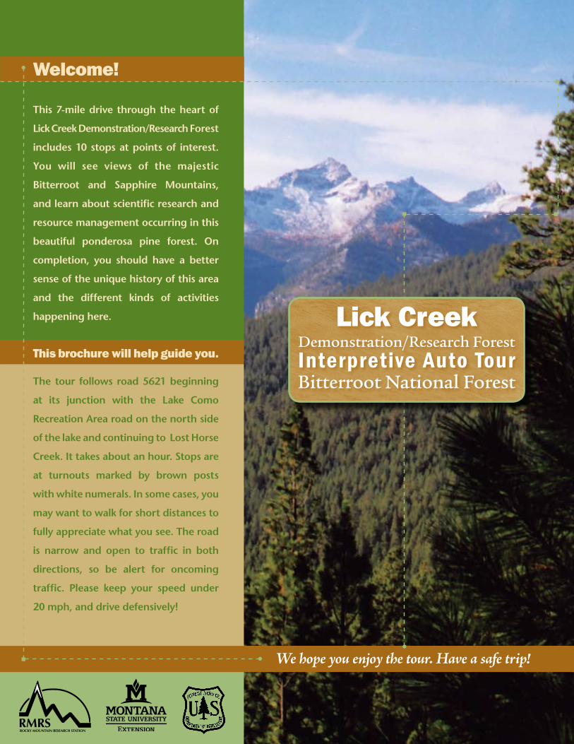
This 7-mile drive through the heart of
Lick Creek Demonstration/Research Forest
includes 10 stops at points of interest.
You will see views of the majestic
Bitterroot and Sapphire Mountains,
and learn about scientific research and
resource management occurring in this
beautiful ponderosa pine forest. On
completion, you should have a better
sense of the unique history of this area
and the different kinds of activities
happening here.
This brochure will help guide you.
The tour follows road 5621 beginning
at its junction with the Lake Como
Recreation Area road on the north side
of the lake and continuing to Lost Horse
Creek. It takes about an hour. Stops are
at turnouts marked by brown posts
with white numerals. In some cases, you
may want to walk for short distances to
fully appreciate what you see. The road
is narrow and open to traffic in both
directions, so be alert for oncoming
traffic. Please keep your speed under
20 mph, and drive defensively!
ROCKY MOUNTAIN RESEARCH STATIONRMRS
�
Lick Creek Demonstration/Research ForestInterpretive Auto TourBitterroot National Forest
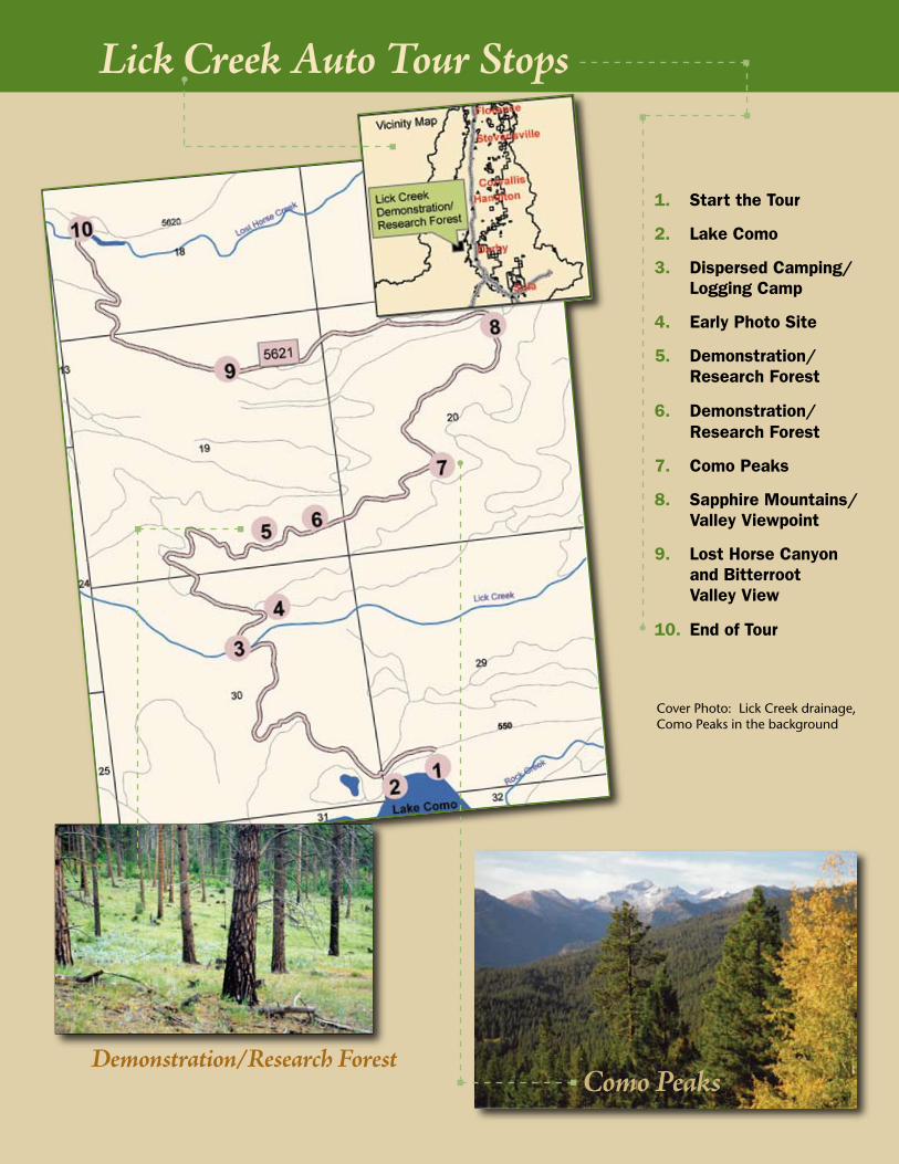
1. StarttheTour
�. LakeComo
3. DispersedCamping/LoggingCamp
4. EarlyPhotoSite
5. Demonstration/ResearchForest
6. Demonstration/ResearchForest
7. ComoPeaks
8. SapphireMountains/ValleyViewpoint
9. LostHorseCanyonandBitterrootValleyView
10. EndofTour
Como Peaks
Lick Creek Auto Tour Stops
Cover Photo: Lick Creek drainage, Como Peaks in the background
Demonstration/Research Forest
1
Lick Creek Demonstration/Research ForestInterpretive Auto TourBitterroot National Forest
Stop 2. Lake Como
1. Start of the Tour. The route winds from Lake
Como, through Lick Creek Demonstration/Research Forest,
to a spectacular end at Lost Horse Creek. From there you may return
along the tour route or make a loop, returning on Lost Horse Creek Road to Highway 93, then south (right) to Lake Como road. When stopping use turnouts or pull over to the far right side of the road. We hope you will enjoy learning about current as well as historical research and management in this beautiful forest area. The distance to Stop 2 is 0.2 miles.
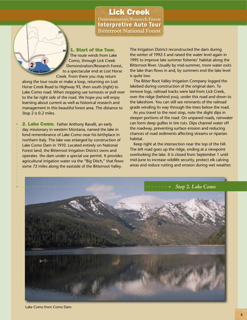
2. Lake Como. Father Anthony Ravalli, an early day missionary in western Montana, named the lake in fond remembrance of Lake Como near his birthplace in northern Italy. The lake was enlarged by construction of Lake Como Dam in 1910. Located entirely on National Forest land, the Bitterroot Irrigation District owns and operates the dam under a special use permit. It provides agricultural irrigation water via the “Big Ditch,” that flows some 72 miles along the eastside of the Bitterroot Valley.
The Irrigation District reconstructed the dam during the winter of 1992-3 and raised the water level again in 1995 to improve late summer fisheries’ habitat along the Bitterroot River. Usually by mid-summer, more water exits the lake than flows in and, by summers end the lake level is quite low.
The Bitter Root Valley Irrigation Company logged the lakebed during construction of the original dam. To remove logs, railroad tracks were laid from Lick Creek, over the ridge (behind you), under this road and down to the lakeshore. You can still see remnants of the railroad grade winding its way through the trees below the road.
As you travel to the next stop, note the slight dips in steeper portions of the road. On unpaved roads, rainwater can form deep gullies in tire ruts. Dips channel water off the roadway, preventing surface erosion and reducing chances of road sediments affecting streams or riparian habitat.
Keep right at the intersection near the top of the hill. The left road goes up the ridge, ending at a viewpoint overlooking the lake. It is closed from September 1 until mid-June to increase wildlife security, protect elk calving areas and reduce rutting and erosion during wet weather.
Lake Como from Como Dam
�
Lick Creek Demonstration/Research ForestInterpretive Auto TourBitterroot National Forest
Just past the intersection, notice the trails created by wildlife going up the bank into the trees as they go to and from the natural mineral deposit nearby. This “lick” gives the area its name. Bedrock forming the Bitterroot Range is low in nutritive value, and wildlife need these natural mineral concentrations for an important part of their diet. Stop 3 is 1.1 miles.
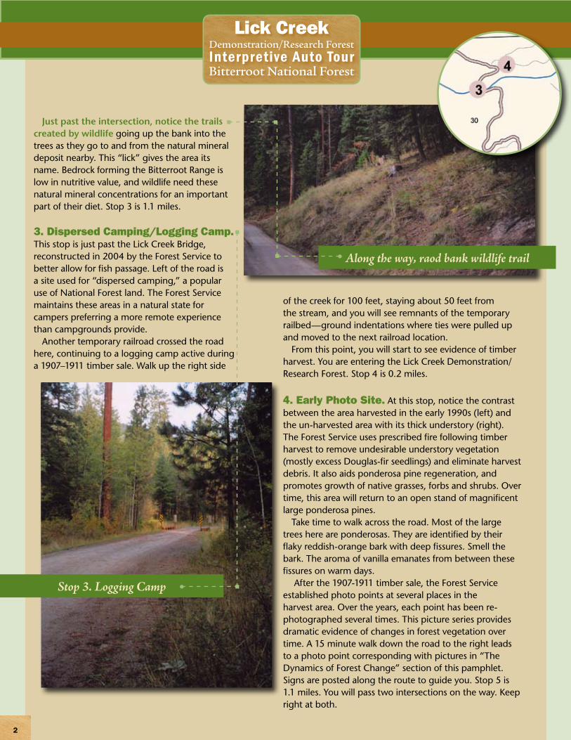
3. Dispersed Camping/Logging Camp. This stop is just past the Lick Creek Bridge, reconstructed in 2004 by the Forest Service to better allow for fish passage. Left of the road is a site used for “dispersed camping,” a popular use of National Forest land. The Forest Service maintains these areas in a natural state for campers preferring a more remote experience than campgrounds provide.
Another temporary railroad crossed the road here, continuing to a logging camp active during a 1907–1911 timber sale. Walk up the right side
of the creek for 100 feet, staying about 50 feet from the stream, and you will see remnants of the temporary railbed—ground indentations where ties were pulled up and moved to the next railroad location.
From this point, you will start to see evidence of timber harvest. You are entering the Lick Creek Demonstration/Research Forest. Stop 4 is 0.2 miles.
4. Early Photo Site. At this stop, notice the contrast between the area harvested in the early 1990s (left) and the un-harvested area with its thick understory (right). The Forest Service uses prescribed fire following timber harvest to remove undesirable understory vegetation (mostly excess Douglas-fir seedlings) and eliminate harvest debris. It also aids ponderosa pine regeneration, and promotes growth of native grasses, forbs and shrubs. Over time, this area will return to an open stand of magnificent large ponderosa pines.
Take time to walk across the road. Most of the large trees here are ponderosas. They are identified by their flaky reddish-orange bark with deep fissures. Smell the bark. The aroma of vanilla emanates from between these fissures on warm days.
After the 1907-1911 timber sale, the Forest Service established photo points at several places in the harvest area. Over the years, each point has been re-photographed several times. This picture series provides dramatic evidence of changes in forest vegetation over time. A 15 minute walk down the road to the right leads to a photo point corresponding with pictures in “The Dynamics of Forest Change” section of this pamphlet. Signs are posted along the route to guide you. Stop 5 is 1.1 miles. You will pass two intersections on the way. Keep right at both.
Stop 3. Logging Camp
Along the way, raod bank wildlife trail
3
Lick Creek Demonstration/Research ForestInterpretive Auto TourBitterroot National Forest
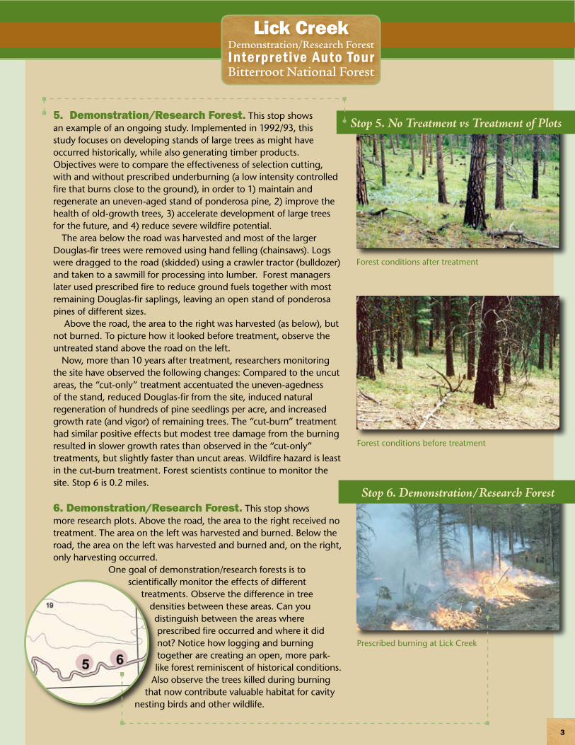
5. Demonstration/Research Forest. This stop shows an example of an ongoing study. Implemented in 1992/93, this study focuses on developing stands of large trees as might have occurred historically, while also generating timber products. Objectives were to compare the effectiveness of selection cutting, with and without prescribed underburning (a low intensity controlled fire that burns close to the ground), in order to 1) maintain and regenerate an uneven-aged stand of ponderosa pine, 2) improve the health of old-growth trees, 3) accelerate development of large trees for the future, and 4) reduce severe wildfire potential.
The area below the road was harvested and most of the larger Douglas-fir trees were removed using hand felling (chainsaws). Logs were dragged to the road (skidded) using a crawler tractor (bulldozer) and taken to a sawmill for processing into lumber. Forest managers later used prescribed fire to reduce ground fuels together with most remaining Douglas-fir saplings, leaving an open stand of ponderosa pines of different sizes.
Above the road, the area to the right was harvested (as below), but not burned. To picture how it looked before treatment, observe the untreated stand above the road on the left.
Now, more than 10 years after treatment, researchers monitoring the site have observed the following changes: Compared to the uncut areas, the “cut-only” treatment accentuated the uneven-agedness of the stand, reduced Douglas-fir from the site, induced natural regeneration of hundreds of pine seedlings per acre, and increased growth rate (and vigor) of remaining trees. The “cut-burn” treatment had similar positive effects but modest tree damage from the burning resulted in slower growth rates than observed in the “cut-only” treatments, but slightly faster than uncut areas. Wildfire hazard is least in the cut-burn treatment. Forest scientists continue to monitor the site. Stop 6 is 0.2 miles.
6. Demonstration/Research Forest. This stop shows more research plots. Above the road, the area to the right received no treatment. The area on the left was harvested and burned. Below the road, the area on the left was harvested and burned and, on the right, only harvesting occurred.
One goal of demonstration/research forests is to scientifically monitor the effects of different
treatments. Observe the difference in tree densities between these areas. Can you distinguish between the areas where prescribed fire occurred and where it did not? Notice how logging and burning together are creating an open, more park-like forest reminiscent of historical conditions.
Also observe the trees killed during burning that now contribute valuable habitat for cavity
nesting birds and other wildlife.
Forest conditions before treatment
Stop 5. No Treatment vs Treatment of Plots
Forest conditions after treatment
Stop 6. Demonstration/Research Forest
Prescribed burning at Lick Creek
4
Lick Creek Demonstration/Research ForestInterpretive Auto TourBitterroot National Forest
Tree growth response is not the only thing researchers are investigating. For instance,
one study analyzed soil samples both before and after
treatments and discovered a short-term fertilization effect from burning.
A different study found thinning improved the general health of remaining trees giving them better resistance to disease and insect attacks. Another measured the effects of various treatments on wildlife browse plants and found that fire stimulated willow growth but killed many bitterbrush plants.
In another, visitors were asked to rate their responses to visual impacts of various treatments. Most found the forest appearance unappealing right after treatment, but were impressed with the aesthetic improvement over time. Because of the loose, flaky nature of ponderosa pine bark, charring caused by burning eventually fades. Likewise, re-growth of ground vegetation reduces the visual impact of burning over the years. The Forest is planning harvest and underburning here on a 20-30 year rotation to mimic natural fire cycles, sustain forest health and productivity, and provide multiple resource values such as timber products, wildlife habitat and recreational opportunities. Stop 7 is 0.7 miles.
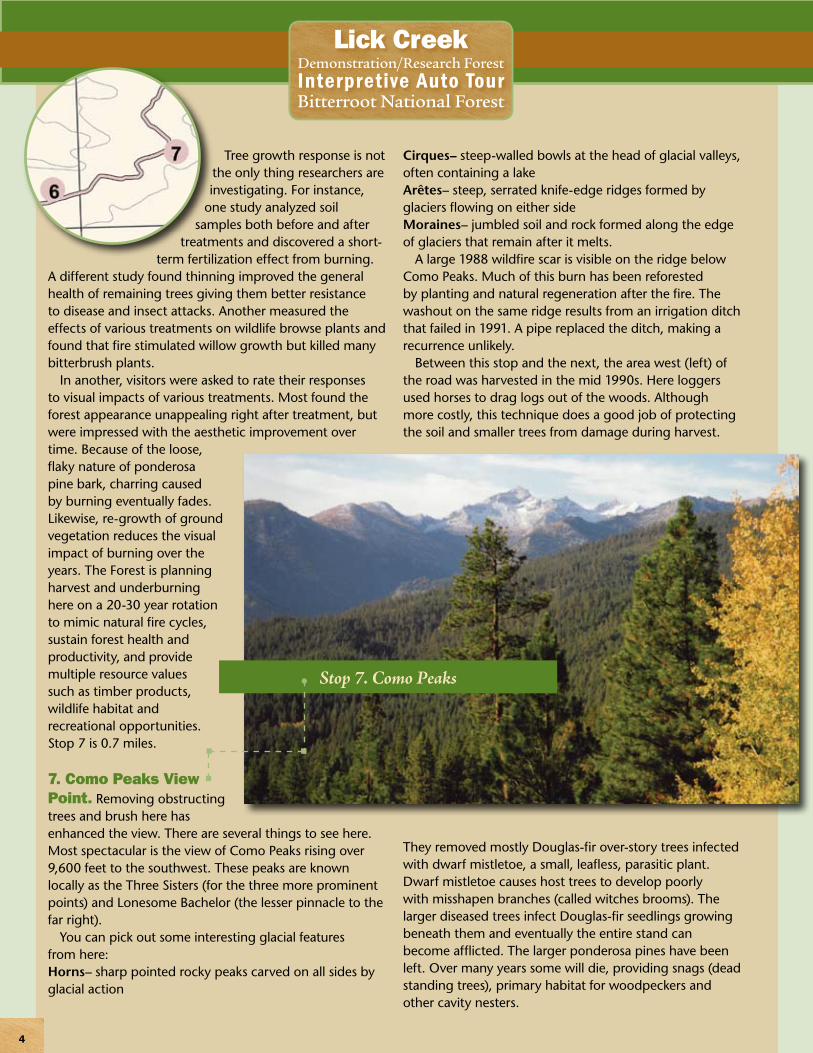
7. Como Peaks View Point. Removing obstructing trees and brush here has enhanced the view. There are several things to see here. Most spectacular is the view of Como Peaks rising over 9,600 feet to the southwest. These peaks are known locally as the Three Sisters (for the three more prominent points) and Lonesome Bachelor (the lesser pinnacle to the far right).
You can pick out some interesting glacial features from here:Horns– sharp pointed rocky peaks carved on all sides by glacial action
Cirques– steep-walled bowls at the head of glacial valleys, often containing a lakeArêtes– steep, serrated knife-edge ridges formed by glaciers flowing on either sideMoraines– jumbled soil and rock formed along the edge of glaciers that remain after it melts.
A large 1988 wildfire scar is visible on the ridge below Como Peaks. Much of this burn has been reforested by planting and natural regeneration after the fire. The washout on the same ridge results from an irrigation ditch that failed in 1991. A pipe replaced the ditch, making a recurrence unlikely.
Between this stop and the next, the area west (left) of the road was harvested in the mid 1990s. Here loggers used horses to drag logs out of the woods. Although more costly, this technique does a good job of protecting the soil and smaller trees from damage during harvest.
They removed mostly Douglas-fir over-story trees infected with dwarf mistletoe, a small, leafless, parasitic plant. Dwarf mistletoe causes host trees to develop poorly with misshapen branches (called witches brooms). The larger diseased trees infect Douglas-fir seedlings growing beneath them and eventually the entire stand can become afflicted. The larger ponderosa pines have been left. Over many years some will die, providing snags (dead standing trees), primary habitat for woodpeckers and other cavity nesters.
Stop 7. Como Peaks
5
Lick Creek Demonstration/Research ForestInterpretive Auto TourBitterroot National Forest
Also, this area previously received much unauthorized off-road vehicle use. The now rehabilitated 4-wheeler trail is still evident coming down the ridge and across the road. Use like this has negative effects on wildlife and compacts soil, forming ruts that easily erode and can spread weeds as well as destroy cultural resource sites. The Bitterroot Forest now manages off-road vehicle use, limiting it to areas of minimal impact. It is restricted here to prevent further damage and permit the forest to heal. Stop 8 is 0.8 miles.
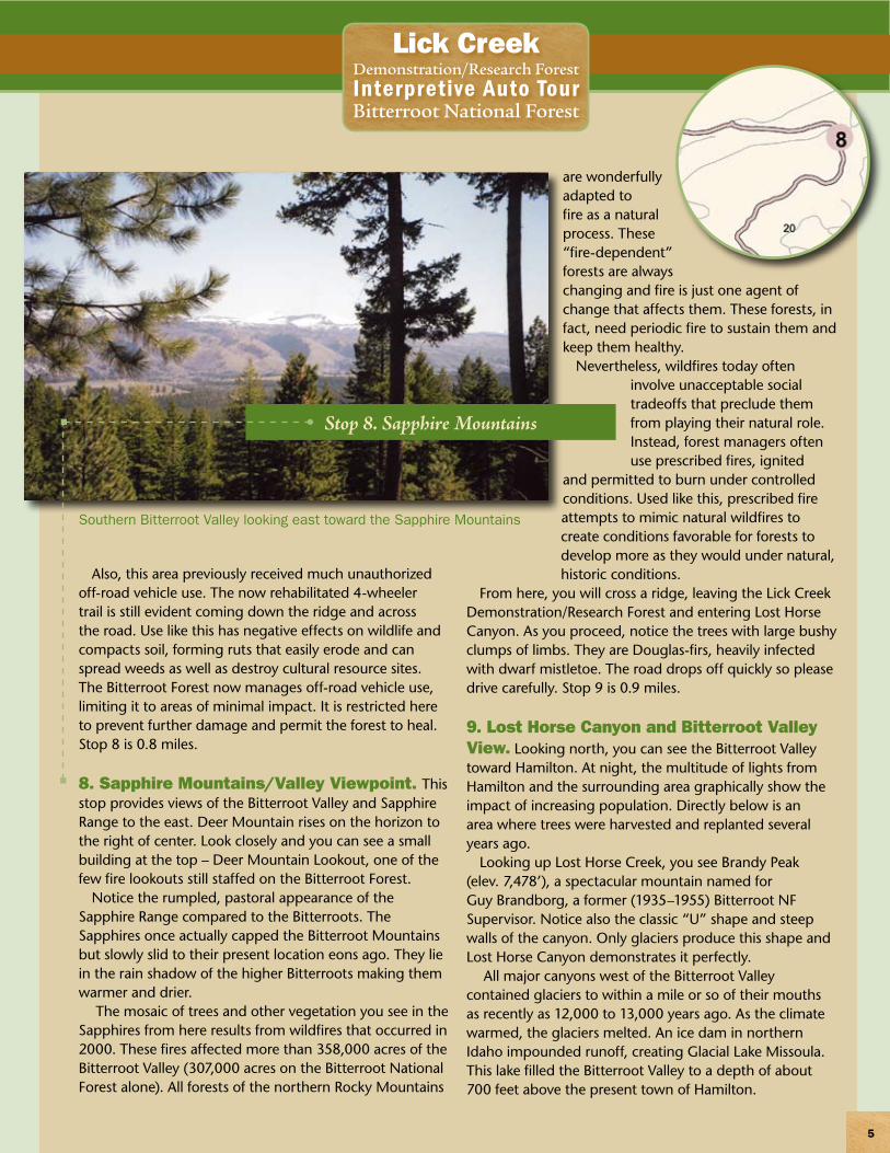
8. Sapphire Mountains/Valley Viewpoint. This stop provides views of the Bitterroot Valley and Sapphire Range to the east. Deer Mountain rises on the horizon to the right of center. Look closely and you can see a small building at the top – Deer Mountain Lookout, one of the few fire lookouts still staffed on the Bitterroot Forest.
Notice the rumpled, pastoral appearance of the Sapphire Range compared to the Bitterroots. The Sapphires once actually capped the Bitterroot Mountains but slowly slid to their present location eons ago. They lie in the rain shadow of the higher Bitterroots making them warmer and drier.
The mosaic of trees and other vegetation you see in the Sapphires from here results from wildfires that occurred in 2000. These fires affected more than 358,000 acres of the Bitterroot Valley (307,000 acres on the Bitterroot National Forest alone). All forests of the northern Rocky Mountains
are wonderfully adapted to fire as a natural process. These “fire-dependent” forests are always changing and fire is just one agent of change that affects them. These forests, in fact, need periodic fire to sustain them and keep them healthy.
Nevertheless, wildfires today often involve unacceptable social tradeoffs that preclude them from playing their natural role. Instead, forest managers often use prescribed fires, ignited
and permitted to burn under controlled conditions. Used like this, prescribed fire attempts to mimic natural wildfires to create conditions favorable for forests to develop more as they would under natural, historic conditions.
From here, you will cross a ridge, leaving the Lick Creek Demonstration/Research Forest and entering Lost Horse Canyon. As you proceed, notice the trees with large bushy clumps of limbs. They are Douglas-firs, heavily infected with dwarf mistletoe. The road drops off quickly so please drive carefully. Stop 9 is 0.9 miles.
9. Lost Horse Canyon and Bitterroot Valley View. Looking north, you can see the Bitterroot Valley toward Hamilton. At night, the multitude of lights from Hamilton and the surrounding area graphically show the impact of increasing population. Directly below is an area where trees were harvested and replanted several years ago.
Looking up Lost Horse Creek, you see Brandy Peak (elev. 7,478’), a spectacular mountain named for Guy Brandborg, a former (1935–1955) Bitterroot NF Supervisor. Notice also the classic “U” shape and steep walls of the canyon. Only glaciers produce this shape and Lost Horse Canyon demonstrates it perfectly.
All major canyons west of the Bitterroot Valley contained glaciers to within a mile or so of their mouths as recently as 12,000 to 13,000 years ago. As the climate warmed, the glaciers melted. An ice dam in northern Idaho impounded runoff, creating Glacial Lake Missoula. This lake filled the Bitterroot Valley to a depth of about 700 feet above the present town of Hamilton.
Stop 8. Sapphire Mountains
Southern Bitterroot Valley looking east toward the Sapphire Mountains
With continued warming, lake waters melted the ice dam. When it broke, the lake drained rapidly down the Columbia
River to the Pacific Ocean. Within a few years the ice dam re-formed,
as did the lake. Geologists tell us this process may have recurred over 40 times
during 2,500 years at the end of the last ice age. Warming finally prevented the re-formation of the dam (and lake), allowing the types of forests we see now to establish and flourish.
Across Lost Horse Creek, on the opposite side of the canyon, notice burned trees that resulted from a person-caused fire in July 2000. This 120 acre fire was a precursor to the extensive lightning-caused “Fires of 2000” only a
few weeks that affected much of the Bitterroot Forest later. It is 1.4 miles to stop 10, the end of the tour.
10. End of Tour. The tour ends at the intersection with Lost Horse Road. Here you can either turn around and retrace the route to Lake Como, or turn right and return to Highway 93 (5 miles). You may also turn left and go up Lost Horse Canyon. This road continues for about 15 miles, terminating at Twin Lakes near the Bitterroot divide. This road is not maintained for use by passenger cars.
We hope you enjoyed the tour. We encourage you to retake it in succeeding years to observe different research treatments and the vegetation changes that occur over time here in the Lick Creek Demonstration/Research Forest.
Lake Como
Lick Creek Demonstration/Research ForestInterpretive Auto TourBitterroot National Forest
6
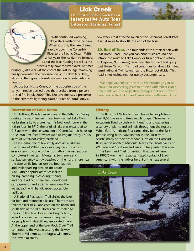
Recreation at Lake Como Fr. Anthony Ravalli a missionary in the Bitterroot Valley
during the mid-nineteenth century, named Lake Como for its similarity to a lake near his boyhood home in the Italian Alps. In 1910, the original lake was expanded to 913 acres with the construction of Como Dam. It holds up to 35,600 acre-feet of water used to irrigate nearly 17,000 acres of Bitterroot Valley farmland.
Lake Como, one of few easily accessible lakes in the Bitterroot Valley, provides enjoyment for almost everyone—truly one of the most attractive recreational complexes in western Montana. Swimmers and sunbathers enjoy sandy beaches on the north shore near the dam while boaters use the boat-launch and trailer parking area on the south side. Other popular activities include hiking, camping, picnicking, fishing, and horse riding. There are 3 developed campgrounds and 2 picnic areas near the water, each with handicapped accessible facilities.
A National Recreation Trail circles the lake for foot and mountain bike use. There are two trailhead facilities—one each on the north and south side of the lake. Horses are restricted to the south lake trail. Horse handling facilities, including a unique horse-mounting platform for people with disabilities, are located there. At the upper end of the lake, Rock Creek Trail continues to the west accessing the Selway-Bitterroot Wilderness, the largest wilderness in the lower 48 states.
HistoryThe Bitterroot Valley has been home to people for at
least 8,000 years and likely much longer. Those early occupants lived by their wits, hunting and gathering a variety of plants and animals throughout the region. When Euro-Americans first came, they found the Salish people living here. Now known as the “Bitterroot Salish” many of their descendants live on the Flathead Reservation north of Missoula. Nez Perce, Kootenai, Pend d’Oreille and Shoshone Indians also frequented this area.
The Lewis and Clark Expedition that passed here in 1805/6 was the first substantiated contact of Euro-Americans with the natives here. For the next several
7
Lick Creek Demonstration/Research ForestInterpretive Auto TourBitterroot National Forest
decades, trappers and traders from the British-owned Northwest, and later Hudson Bay Company worked the area, but none stayed. In the 1840s, Jesuit priests established St. Mary’s Mission near Stevensville, but it was not until 1855 that the U S government made treaties with local tribes (Stevens Treaty).
Euro-American occupation accelerated in the 1860s when gold was discovered, first in Idaho, then in Montana. By 1865, most of the valley’s 100 Euro-American residents were growing produce for regional mining districts. By 1900, there were 891 farms and ranches in Ravalli County and over 177,000 acres in cultivation.
The lumber industry developed in the Bitterroot Valley in the 1880s. The railroad arrived in 1885 and, in 1890, Butte’s Copper King Marcus Daly constructed a lumber mill in Hamilton. Alarmed by unregulated timber cutting on public lands, Congress established the Bitterroot Forest Reserve in 1897 as part of a plan to conserve western forests. In 1905, the fledgling Forest Service assumed management responsibilities, and despite minor boundary changes, the Bitterroot National Forest still contains much of the original Reserve.
The Lick Creek Timber Sale (1907–1911) was the first large National Forest timber sale (2,135 acres) in a ponderosa pine forest and attracted national attention. The Big Blackfoot Milling Company, a subsidiary of the Anaconda Copper Company, purchased the timber, producing 37,600,000 board feet of timber. During harvest operations, workers lived in logging camps in the woods. One was located within the Demonstration/Research Forest.
Loggers used horses to skid timber downhill to landings. There, they loaded logs onto railcars to be hauled to the mill by steam engines. As they harvested each area, they pulled the track and ties and moved them to a newly built railroad bed. Along with horse skidding trails, old railroad beds together with footprints of railroad ties removed
long ago, are still visible in the side draws of Lick Creek. During construction of railroad grades, horses pulled large, shovel-shaped pans (known as “slips” or “fresnos”) to move soil and rock. One of these, discovered here at Lick Creek, is on display at the Visitor Information Center next to Darby Ranger Station in Darby.
The Lick Creek Demonstration/Research Forest, officially established in February 1991, is a cooperative agreement between the Bitterroot National Forest and Rocky Mountain (formerly Intermountain) Research Station in Missoula. It evolved through the work of Bitterroot Forest employees in partnership with research scientists, private individuals, special interest groups, and county officials to plan the management of natural resources here. The group developed a vision, a desired future condition for the area. Forest managers then prepared a list of projects that, over time, would best move toward that condition. These included establishing the Demonstration/Research Forest, various interpretative sites and other projects, some of which are discussed on the auto tour. Researchers participated by establishing studies that examined the impact of management activities on the forest ecosystem.
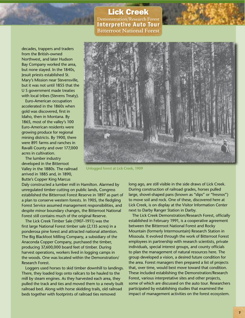
Unlogged forest at Lick Creek, 1909
Lick Creek Demonstration/Research ForestInterpretive Auto TourBitterroot National Forest
8
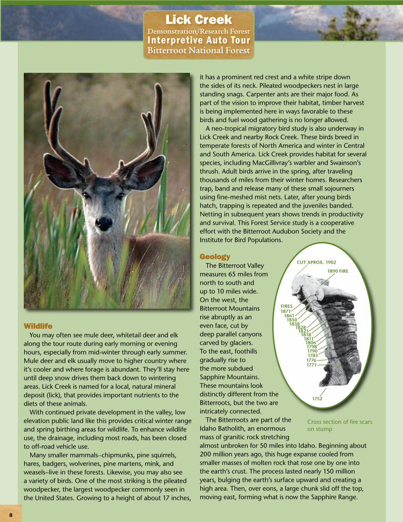
WildlifeYou may often see mule deer, whitetail deer and elk
along the tour route during early morning or evening hours, especially from mid-winter through early summer. Mule deer and elk usually move to higher country where it’s cooler and where forage is abundant. They’ll stay here until deep snow drives them back down to wintering areas. Lick Creek is named for a local, natural mineral deposit (lick), that provides important nutrients to the diets of these animals.
With continued private development in the valley, low elevation public land like this provides critical winter range and spring birthing areas for wildlife. To enhance wildlife use, the drainage, including most roads, has been closed to off-road vehicle use.
Many smaller mammals–chipmunks, pine squirrels, hares, badgers, wolverines, pine martens, mink, and weasels–live in these forests. Likewise, you may also see a variety of birds. One of the most striking is the pileated woodpecker, the largest woodpecker commonly seen in the United States. Growing to a height of about 17 inches,
it has a prominent red crest and a white stripe down the sides of its neck. Pileated woodpeckers nest in large standing snags. Carpenter ants are their major food. As part of the vision to improve their habitat, timber harvest is being implemented here in ways favorable to these birds and fuel wood gathering is no longer allowed.
A neo-tropical migratory bird study is also underway in Lick Creek and nearby Rock Creek. These birds breed in temperate forests of North America and winter in Central and South America. Lick Creek provides habitat for several species, including MacGillivray’s warbler and Swainson’s thrush. Adult birds arrive in the spring, after traveling thousands of miles from their winter homes. Researchers trap, band and release many of these small sojourners using fine-meshed mist nets. Later, after young birds hatch, trapping is repeated and the juveniles banded. Netting in subsequent years shows trends in productivity and survival. This Forest Service study is a cooperative effort with the Bitterroot Audubon Society and the Institute for Bird Populations.
GeologyThe Bitterroot Valley
measures 65 miles from north to south and up to 10 miles wide. On the west, the Bitterroot Mountains rise abruptly as an even face, cut by deep parallel canyons carved by glaciers. To the east, foothills gradually rise to the more subdued Sapphire Mountains. These mountains look distinctly different from the Bitterroots, but the two are intricately connected.
The Bitterroots are part of the Idaho Batholith, an enormous mass of granitic rock stretching almost unbroken for 50 miles into Idaho. Beginning about 200 million years ago, this huge expanse cooled from smaller masses of molten rock that rose one by one into the earth’s crust. The process lasted nearly 150 million years, bulging the earth’s surface upward and creating a high area. Then, over eons, a large chunk slid off the top, moving east, forming what is now the Sapphire Range.
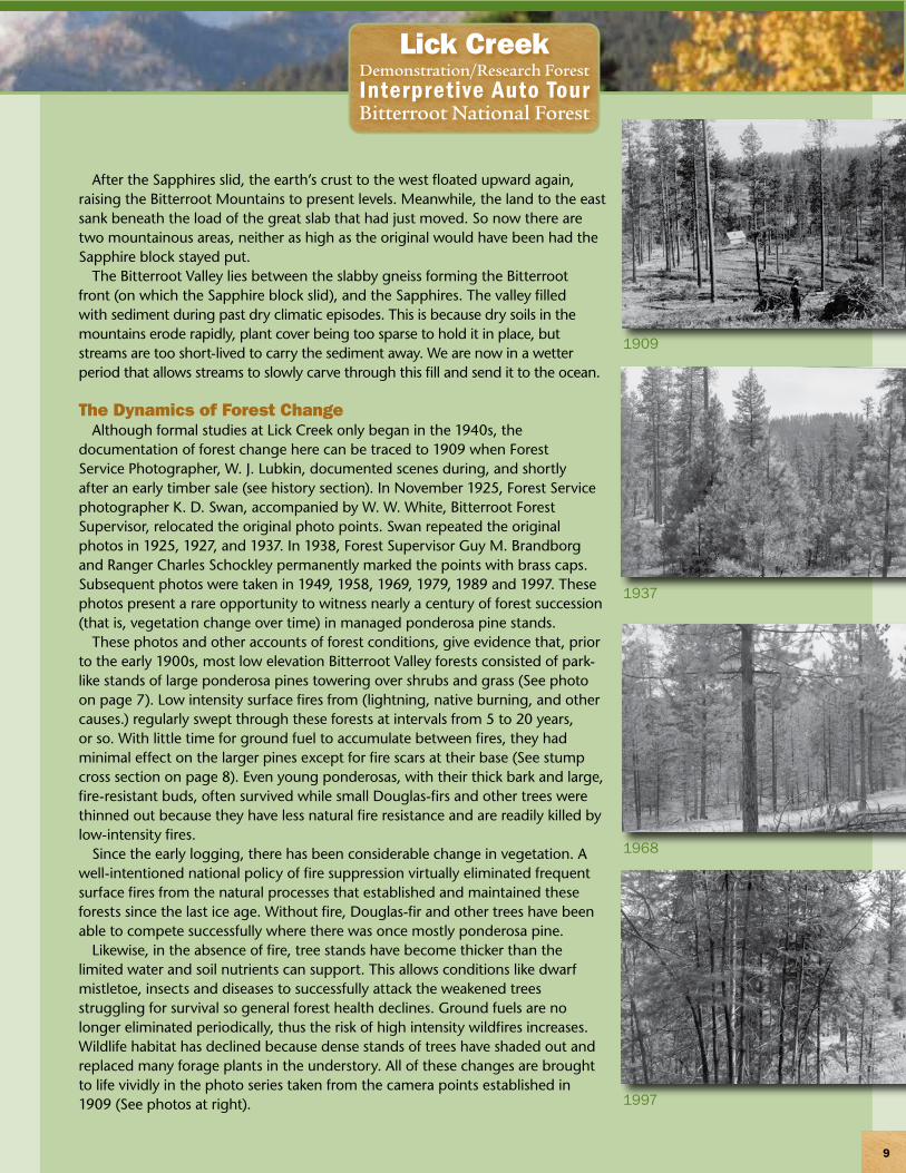
Cross section of fire scars on stump
CUT APROX. 1902
1890 FIRE
FIRES1871
186118501838
18281821
181818111806179817901783
17761771
1752
9
Lick Creek Demonstration/Research ForestInterpretive Auto TourBitterroot National Forest
After the Sapphires slid, the earth’s crust to the west floated upward again, raising the Bitterroot Mountains to present levels. Meanwhile, the land to the east sank beneath the load of the great slab that had just moved. So now there are two mountainous areas, neither as high as the original would have been had the Sapphire block stayed put.
The Bitterroot Valley lies between the slabby gneiss forming the Bitterroot front (on which the Sapphire block slid), and the Sapphires. The valley filled with sediment during past dry climatic episodes. This is because dry soils in the mountains erode rapidly, plant cover being too sparse to hold it in place, but streams are too short-lived to carry the sediment away. We are now in a wetter period that allows streams to slowly carve through this fill and send it to the ocean.
The Dynamics of Forest ChangeAlthough formal studies at Lick Creek only began in the 1940s, the
documentation of forest change here can be traced to 1909 when Forest Service Photographer, W. J. Lubkin, documented scenes during, and shortly after an early timber sale (see history section). In November 1925, Forest Service photographer K. D. Swan, accompanied by W. W. White, Bitterroot Forest Supervisor, relocated the original photo points. Swan repeated the original photos in 1925, 1927, and 1937. In 1938, Forest Supervisor Guy M. Brandborg and Ranger Charles Schockley permanently marked the points with brass caps. Subsequent photos were taken in 1949, 1958, 1969, 1979, 1989 and 1997. These photos present a rare opportunity to witness nearly a century of forest succession (that is, vegetation change over time) in managed ponderosa pine stands.
These photos and other accounts of forest conditions, give evidence that, prior to the early 1900s, most low elevation Bitterroot Valley forests consisted of park-like stands of large ponderosa pines towering over shrubs and grass (See photo on page 7). Low intensity surface fires from (lightning, native burning, and other causes.) regularly swept through these forests at intervals from 5 to 20 years, or so. With little time for ground fuel to accumulate between fires, they had minimal effect on the larger pines except for fire scars at their base (See stump cross section on page 8). Even young ponderosas, with their thick bark and large, fire-resistant buds, often survived while small Douglas-firs and other trees were thinned out because they have less natural fire resistance and are readily killed by low-intensity fires.
Since the early logging, there has been considerable change in vegetation. A well-intentioned national policy of fire suppression virtually eliminated frequent surface fires from the natural processes that established and maintained these forests since the last ice age. Without fire, Douglas-fir and other trees have been able to compete successfully where there was once mostly ponderosa pine.
Likewise, in the absence of fire, tree stands have become thicker than the limited water and soil nutrients can support. This allows conditions like dwarf mistletoe, insects and diseases to successfully attack the weakened trees struggling for survival so general forest health declines. Ground fuels are no longer eliminated periodically, thus the risk of high intensity wildfires increases. Wildlife habitat has declined because dense stands of trees have shaded out and replaced many forage plants in the understory. All of these changes are brought to life vividly in the photo series taken from the camera points established in 1909 (See photos at right).
1909
1937
1968
1997
Forest Research and the Bitterroot Ecosystem Management Research ProjectForest researchers began studying implications of various timber harvest methods at Lick Creek in the 1940s,
continuing through the 1960s. More recently, researchers are addressing the undesirable changes in forest conditions described earlier. Formal ecosystem research began in 1990 as forest scientists together with Bitterroot National Forest managers began working together to provide sustainable answers to forest health and fire hazard problems threatening these low elevation ponderosa pine forests. Examples demonstrated here include experiments to determine how to best improve forest health and productivity, reduce the likelihood of severe wildfire, enhance wildlife habitat and improve forest appearances. Methods include tree thinning and prescribed fire. Selective thinning leaves a significant number of large ponderosa pines on the landscape and prescribed fire thins small, competing trees and reduces surface fuels. Native shrubs and grasses will once again occupy their normal habitats, improving forest health and providing forage and cover for wildlife.
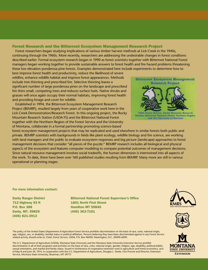
Established in 1994, the Bitterroot Ecosystem Management Research Project (BEMRP), resulted largely from years of cooperative work here in the Lick Creek Demonstration/Research Forest. In this ongoing project, the Rocky Mountain Research Station (USDA FS) and the Bitterroot National Forest together with the Northern Region of the Forest Service and the University of Montana, collaborate in a formal partnership promoting science-based forest ecosystem management projects that may be replicated and used elsewhere in similar forests both public and private. BEMRP scientists with backgrounds in fields like plant ecology, wildlife biology and fire science, are working with land managers and the public to evaluate ecosystem responses and big picture (landscape) approaches to forest management decisions that consider “all pieces of the puzzle.” BEMRP research includes all biological and physical aspects of the ecosystem and features computer modeling to compare potential outcomes of management decisions. Since natural resource management involves social tradeoffs, the human dimension is intertwined into all aspects of the work. To date, there have been over 160 published studies resulting from BEMRP. Many more are still in various operational or planning stages.
Formoreinformationcontact:
DarbyRangerDistrict BitterrootNationalForestSupervisor’sOffice71�Highway93N 1801NorthFirstStreetP.O.Box388 HamiltonMT59840Darby,MT,598�9 (406)363-7161(406)8�1-3913
The policy of the United States Department of Agriculture Forest Service prohibits discrimination on the basis of race, color, national origin, age, religion, sex, or disability, familial status or political affiliation. Persons believing they have been discriminated against in any Forest Service related activity should write to: Chief, Forest Service, USDA, P.O. Box 96090, Washington, D.C. 20090-6090.
The U.S. Department of Agriculture (USDA), Montana State University and the Montana State University Extension Service prohibit discrimination in all of their programs and activities on the basis of race, color, national origin, gender, religion, age, disability, political beliefs, sexual orientation, and marital and family status. Issued in furtherance of cooperative extension work in agriculture and home economics, acts of May 8 and June 30, 1914, in cooperation with the U.S. Department of Agriculture, Douglas L. Steele, Vice Provost and Director, Extension Service, Montana State University, Bozeman, MT 59717.
ROCKY MOUNTAIN RESEARCH STATIONRMRS


