1
CHAPTER-8
TOPOGRAPHIC SURVEYING AND
MAPPING
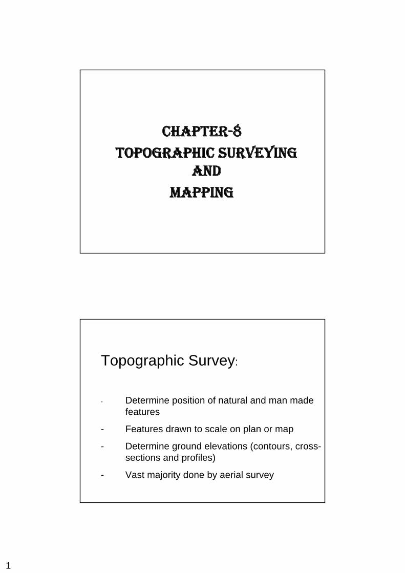
Topographic Survey:
- Determine position of natural and man made features
- Features drawn to scale on plan or map
- Determine ground elevations (contours, cross-sections and profiles)
- Vast majority done by aerial survey
2
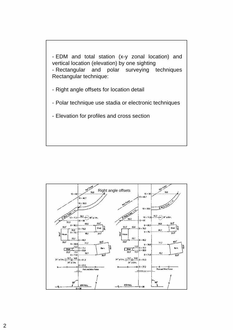
- EDM and total station (x-y zonal location) and vertical location (elevation) by one sighting - Rectangular and polar surveying techniques Rectangular technique:
- Right angle offsets for location detail
- Polar technique use stadia or electronic techniques
- Elevation for profiles and cross section
Right angle offsets
3
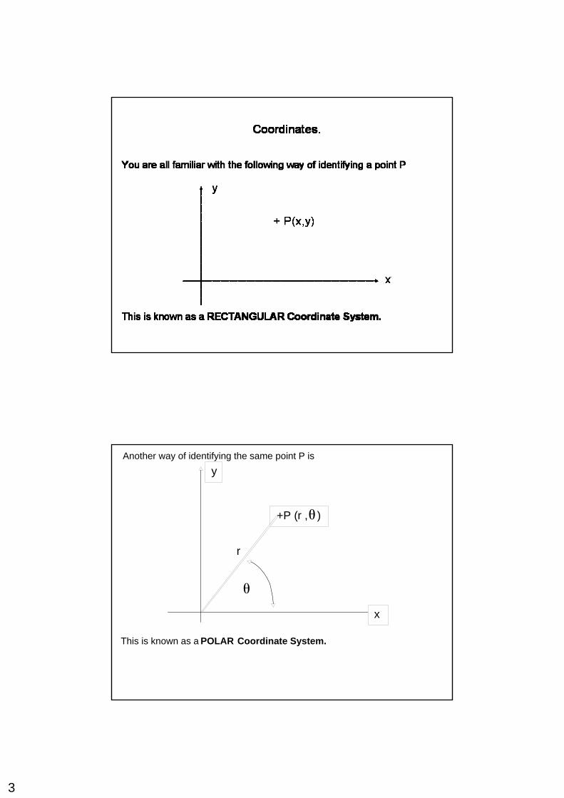
Another way of identifying the same point P is
This is known as a POLAR Coordinate System.
+P (r , )
y
x
r
θ
θ
4
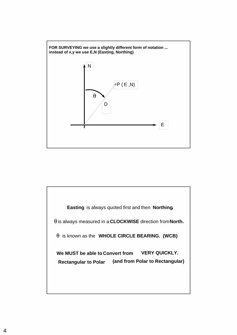
FOR SURVEYING we use a slightly different form of notation ...instead of x,y we use E,N (Easting, Northing)
+P ( E ,N)
N
E
Dθ
Easting is always quoted first and then Northing.
is always measured in a CLOCKWISE direction fromNorth.θ
is known as the WHOLE CIRCLE BEARING. (WCB)θ
We MUST be able to Convert from
Rectangular to Polar (and from Polar to Rectangular)
VERY QUICKLY.
5
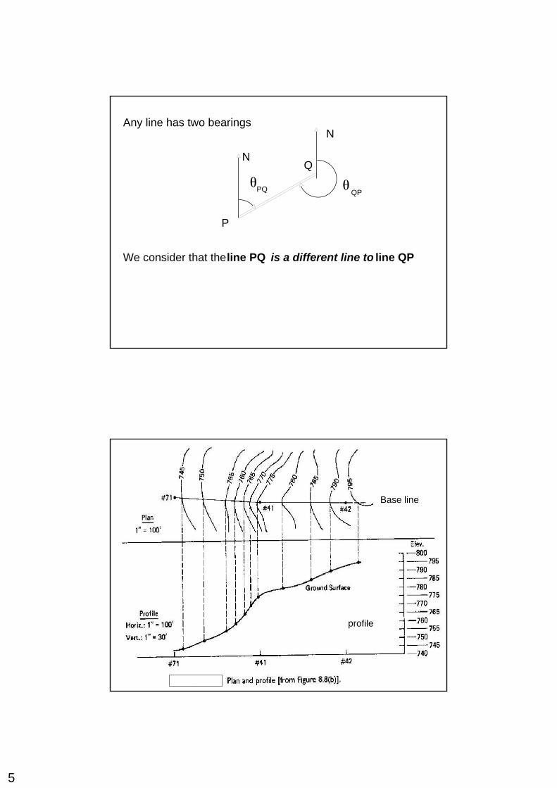
Any line has two bearingsN
N
θPQ QP
Q
P
θ
lineWe consider that the PQ is a different line to line QP
profile
Base line
6
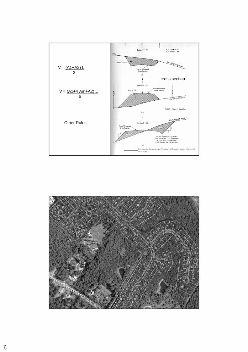
V = (A1+A2) L2
V = (A1+4 Am+A2) L6
Other Rules
cross section
7
Scales and Precision:
Scale: Ratio between plan distance and ground distanceConsistent through the planEquivalences e.g. 1” = 50’Fractions e.g. 1 : 500
Table 8.1Small scale and intermediate scale done by aerial survey
Precision
- If points to be plotted on at scale 1:500 → precision 0.25 m- If points to be plotted on at scale 1:20,000 → precision 10 m
- Some details can be precisely determined → e.g. bldg corner - Some details cannot precisely determined → e.g. stream
banks - Some details can be determined with moderate precision → e.g.
single large tree
8
Details that can be well defined is located with more precision than required just for plotting because:
o It take little efforto Uniform practiceo Some details are shown as layout dimensions
- If area contain only natural feature, stadia is used- All topographic surveys are tied into both horizontal and vertical control (Benchmark)- Horizontal control could be:
- Closed transverse- Transverse from coordinate grid monuments- Close to another coordinate grid monuments- Route centerline- Assumed baseline
9
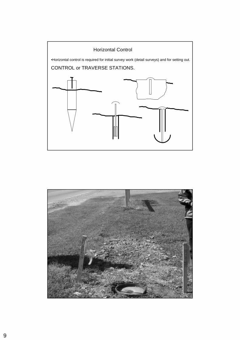
Horizontal Control
•Horizontal control is required for initial survey work (detail surveys) and for setting out.
CONTROL or TRAVERSE STATIONS.
10
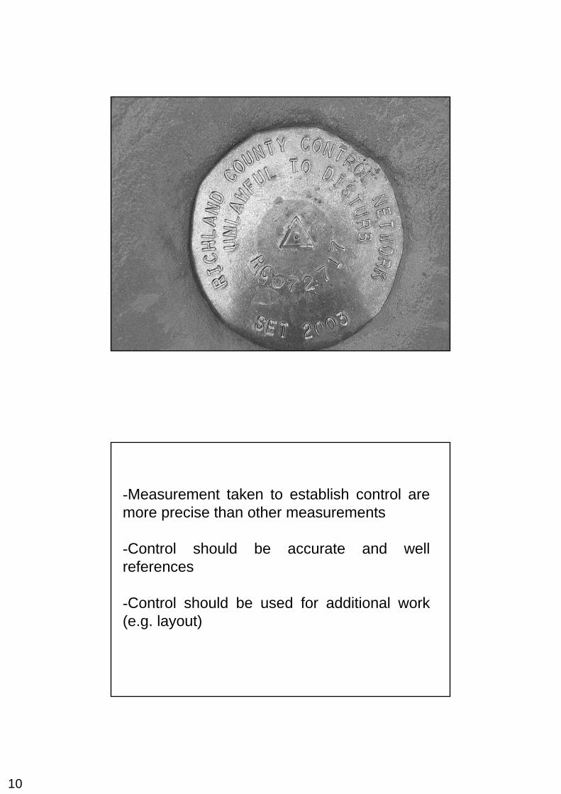
-Measurement taken to establish control are more precise than other measurements
-Control should be accurate and well references
-Control should be used for additional work (e.g. layout)
11
Location by Right Angle Offset
-Used in all topographic survey except mapping
-Provide location of details and area elevation taken by X-section
-Measure distance to base line and station on baseline
-Baseline laid by stakes (nails),
-Sketch in note book
-Tape can be laid on baseline if terrain is smooth
-Details on both sides of baseline or make split baselines
-Penta prism or (swing-arm technique (Appx.)
-SAT good result for short of test 15 m otherwise use penta prism or transit
12
Cross Section and Profile
-Cross section to the baseline
-Profile along the baseline
-Elevation plotted as spot elevation, contours or end area for construction quantity estimation
-Intervals 20/30 in. – in changing terrain 10-15 m + any sudden change in terrain (top, bottom of slops)
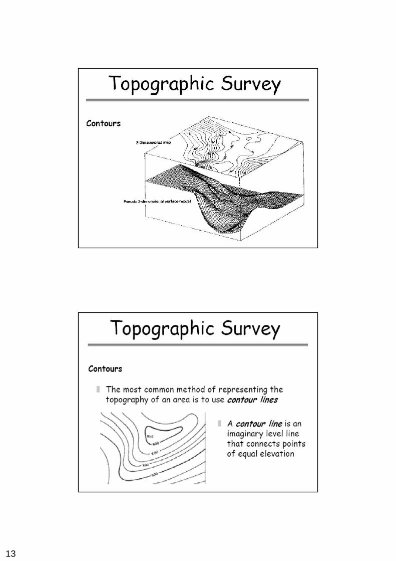
13
14
15
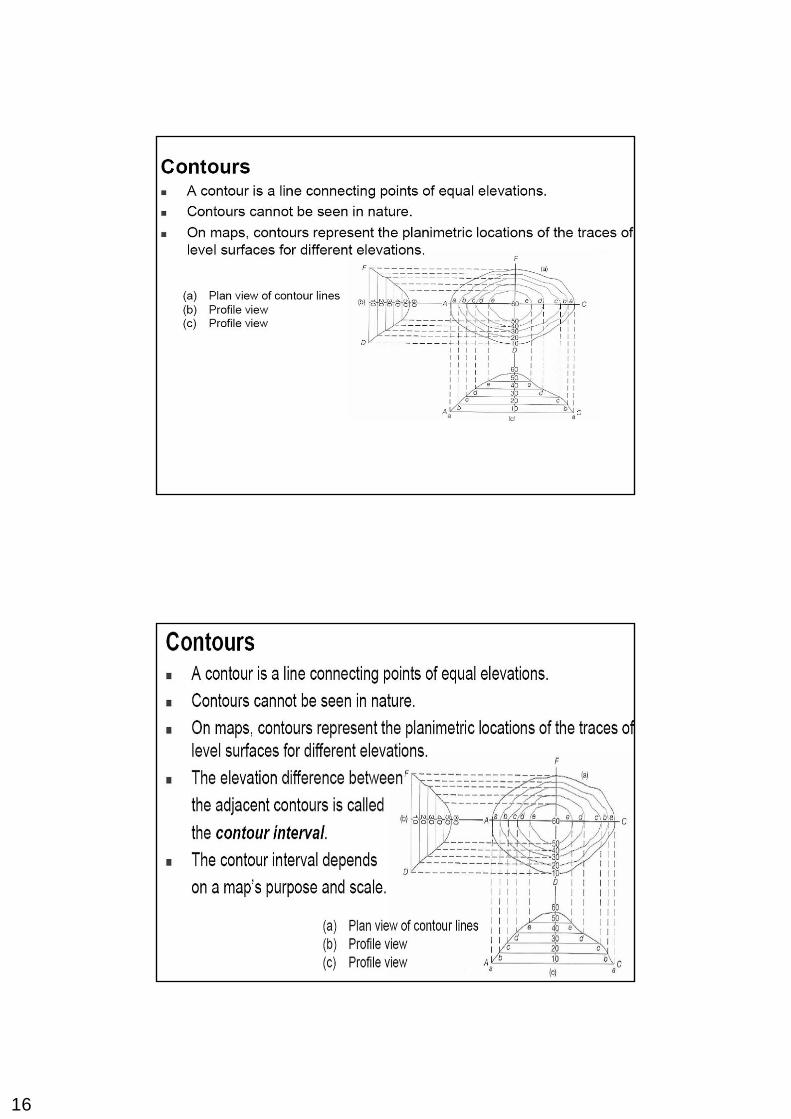
16
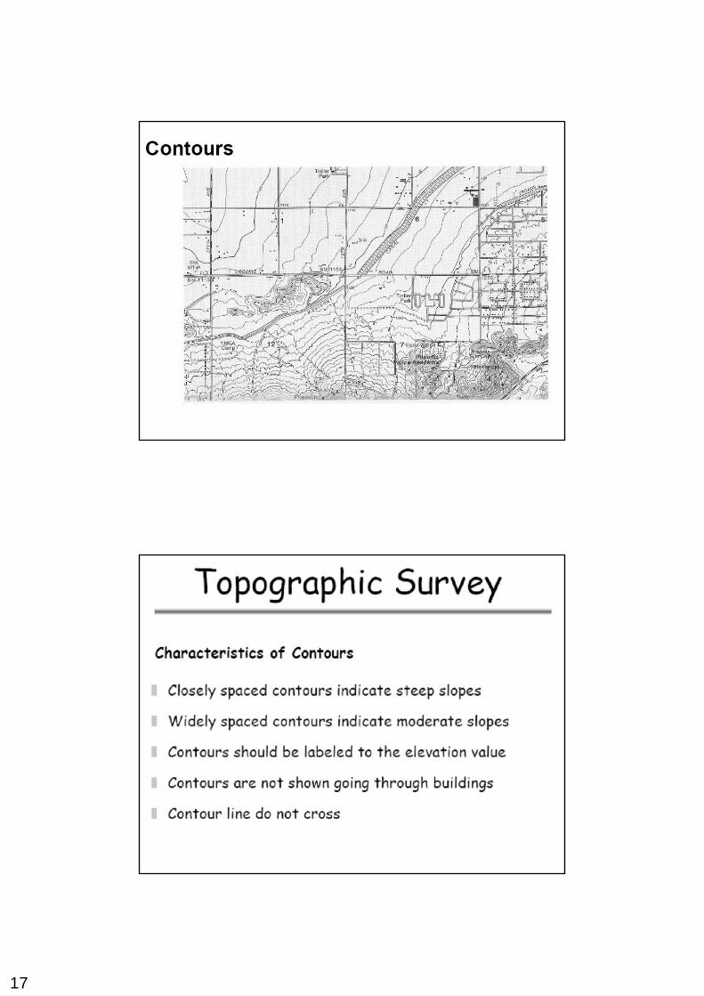
17
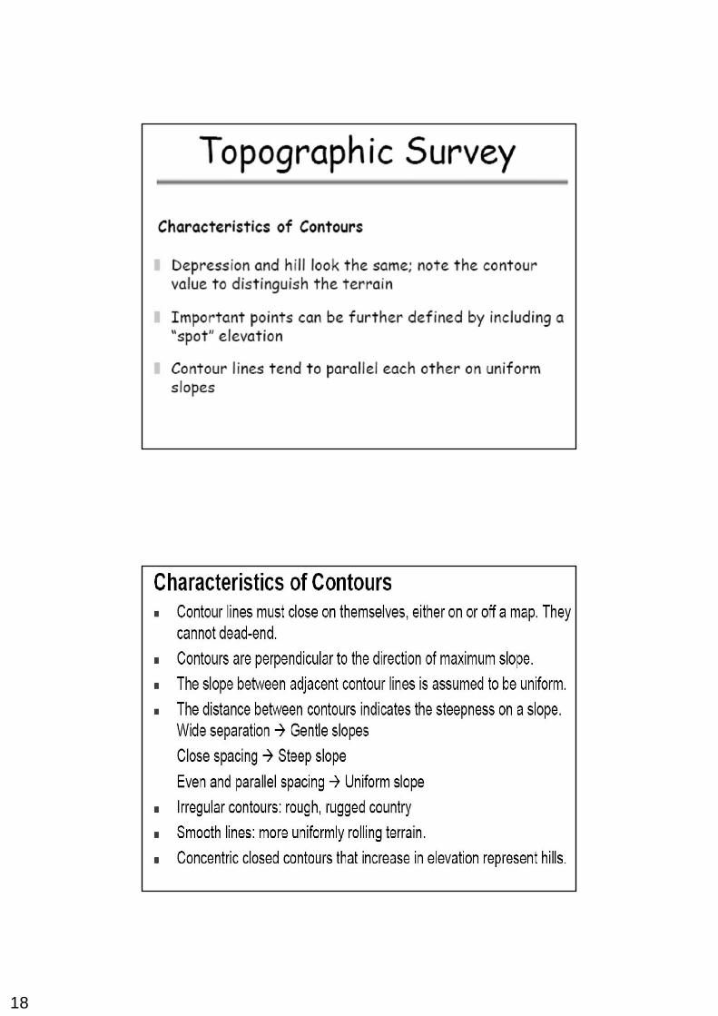
18
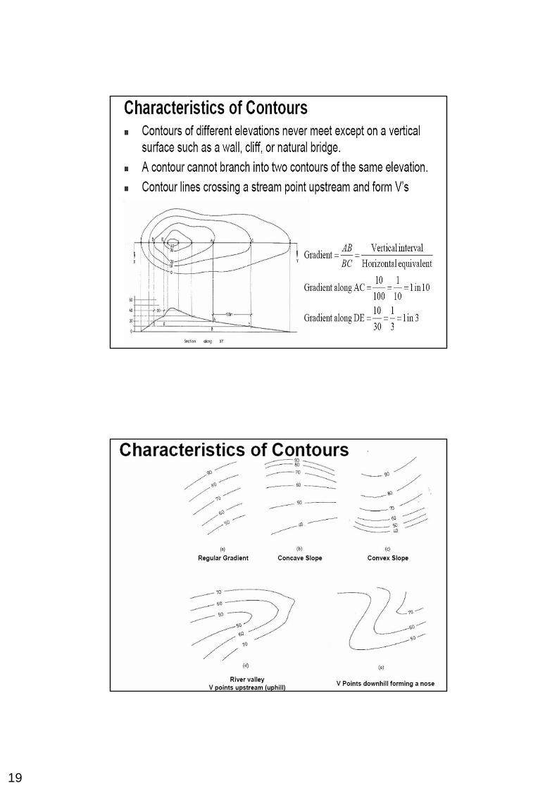
19
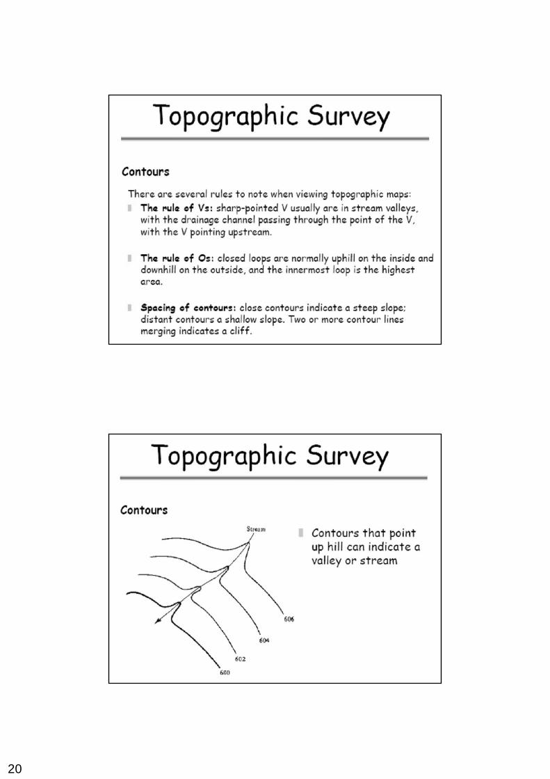
20
21
22
23
24
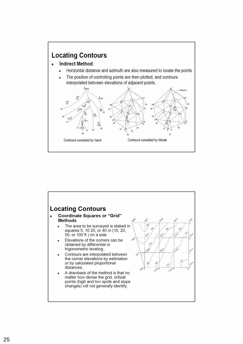
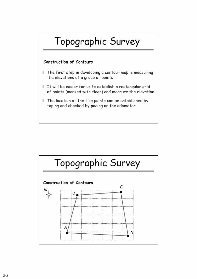
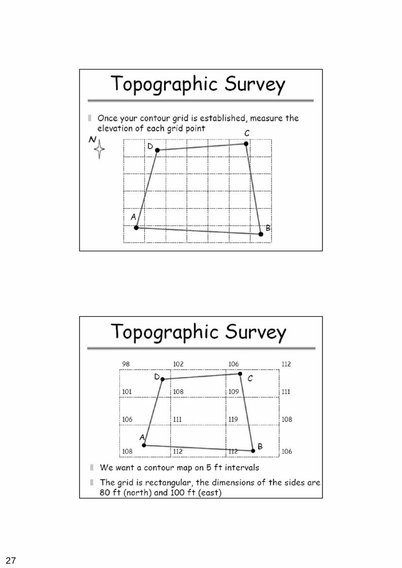
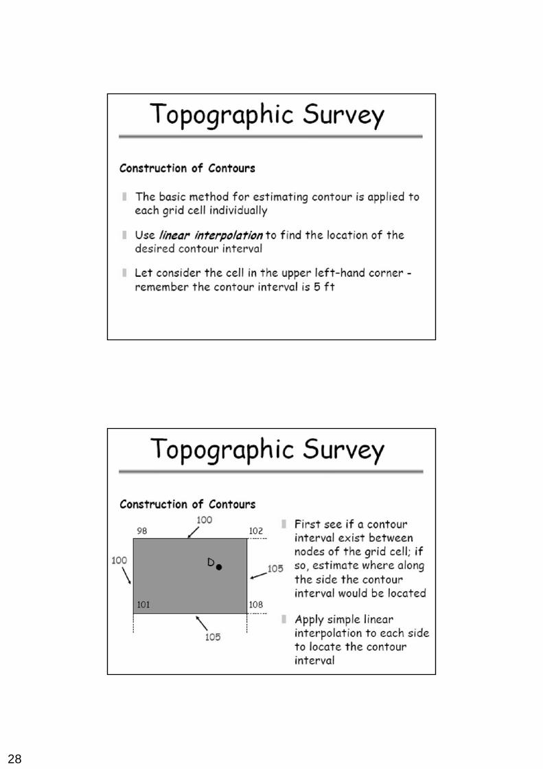
25
26
27
28
29
30
31
32
33


