Download - ATI CBDP in Darjeeling Himalayas

Community Based
Disaster Management Programme
Few Attempt with Community participation
and
Technology application.
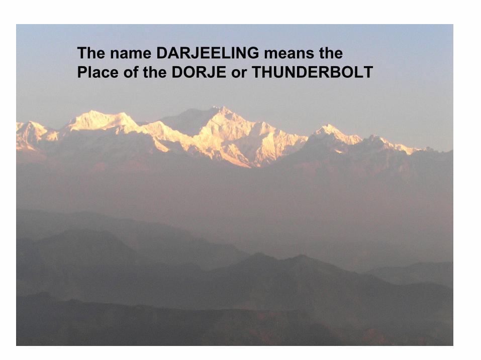
The name DARJEELING means the Place of the DORJE or THUNDERBOLT
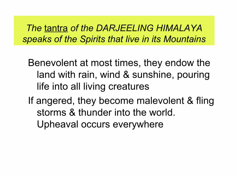
The tantra of the DARJEELING HIMALAYA speaks of the Spirits that live in its Mountains
Benevolent at most times, they endow the land with rain, wind & sunshine, pouring life into all living creatures
If angered, they become malevolent & fling storms & thunder into the world. Upheaval occurs everywhere
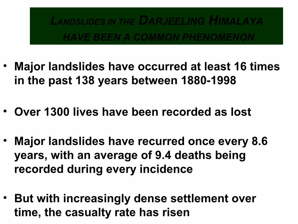
LANDSLIDES IN THE DARJEELING HIMALAYA
HAVE BEEN A COMMON PHENOMENON
• Major landslides have occurred at least 16 times in the past 138 years between 1880-1998
• Over 1300 lives have been recorded as lost
• Major landslides have recurred once every 8.6 years, with an average of 9.4 deaths being recorded during every incidence
• But with increasingly dense settlement over time, the casualty rate has risen
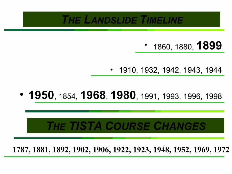
THE LANDSLIDE TIMELINE
• 1860, 1880, 1899
• 1910, 1932, 1942, 1943, 1944
• 1950, 1854, 1968, 1980, 1991, 1993, 1996, 1998
THE TISTA COURSE CHANGES
1787, 1881, 1892, 1902, 1906, 1922, 1923, 1948, 1952, 1969, 1972

THE UNSOLVED RIDDLE • 1779 - Major Rennel’s first maps show the
Tista draining into the GANGA
• 1787 - The river switched course completely during the Great Tista Flood to drain into the BRAHMAPUTRA
• DID FAR WORSE LANDSLIDES HIT
DARJEELING & SIKKIM IN 1787 ?
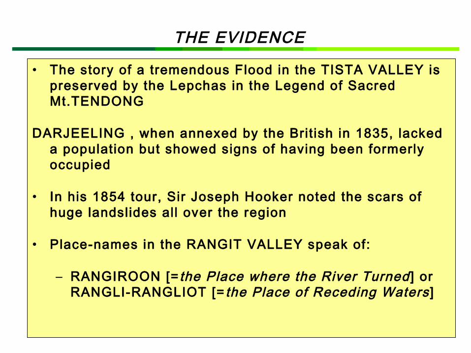
• The story of a tremendous Flood in the TISTA VALLEY is preserved by the Lepchas in the Legend of Sacred Mt.TENDONG
DARJEELING , when annexed by the Brit ish in 1835, lacked a population but showed signs of having been formerly occupied
• In his 1854 tour, Sir Joseph Hooker noted the scars of huge landslides all over the region
• Place-names in the RANGIT VALLEY speak of:
– RANGIROON [=the Place where the River Turned] or RANGLI-RANGLIOT [=the Place of Receding Waters ]
THE EVIDENCE
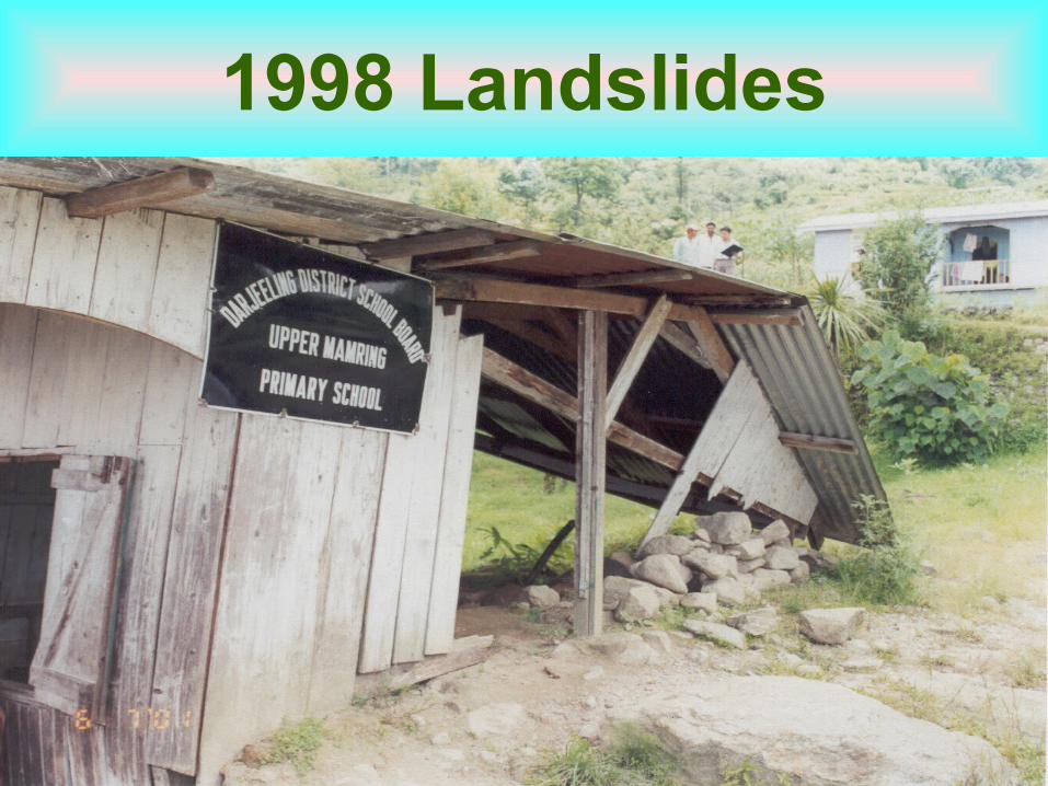
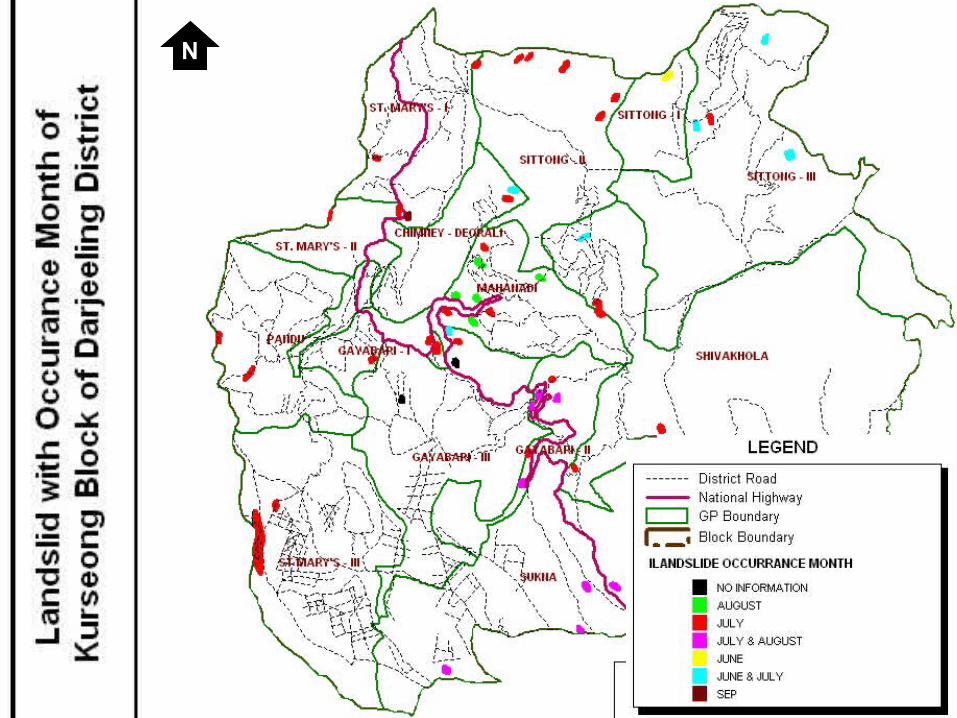
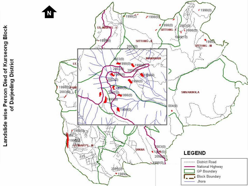
1998 Landslides
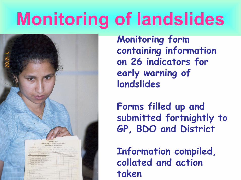
Monitoring of landslidesMonitoring form containing information on 26 indicators for early warning of landslides
Forms filled up and submitted fortnightly to GP, BDO and District
Information compiled, collated and action taken
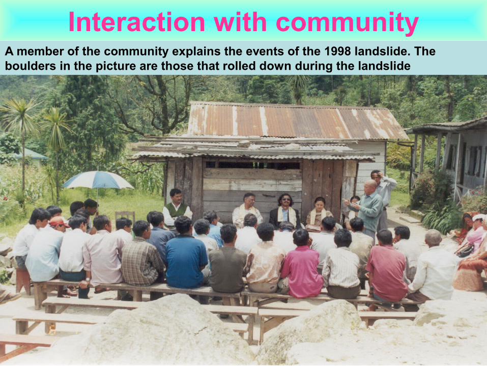
Interaction with communityA member of the community explains the events of the 1998 landslide. The boulders in the picture are those that rolled down during the landslide
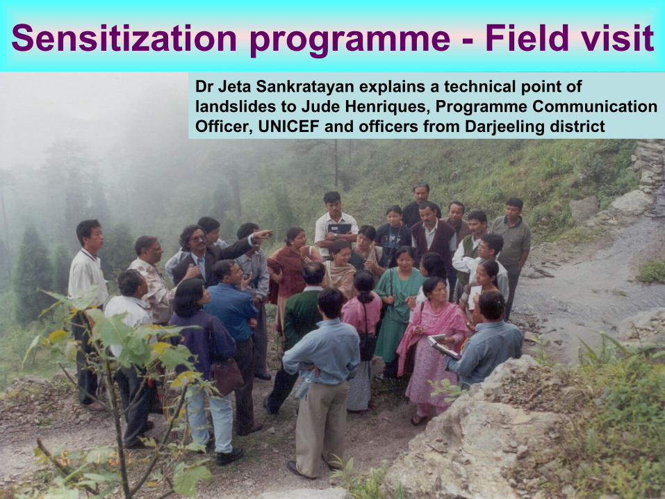
Sensitization programme - Field visitDr Jeta Sankratayan explains a technical point of landslides to Jude Henriques, Programme Communication Officer, UNICEF and officers from Darjeeling district
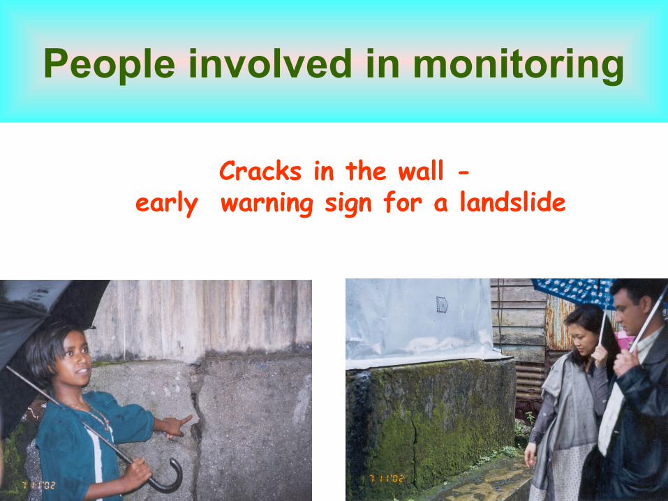
People involved in monitoring
Cracks in the wall - early warning sign for a landslide
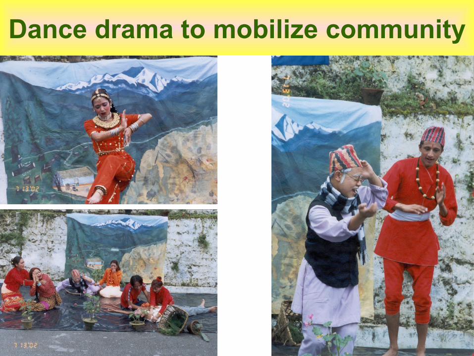
Dance drama to mobilize community
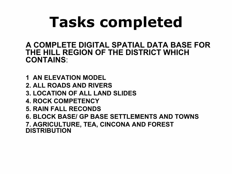
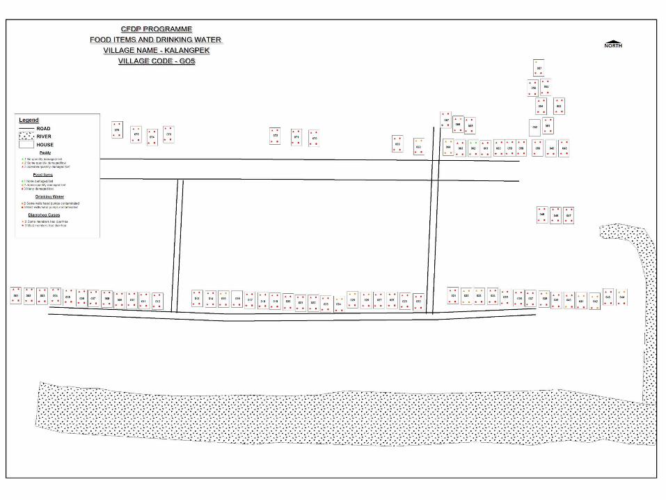
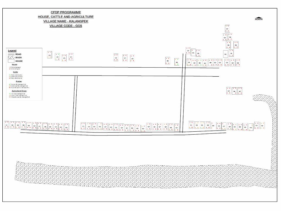
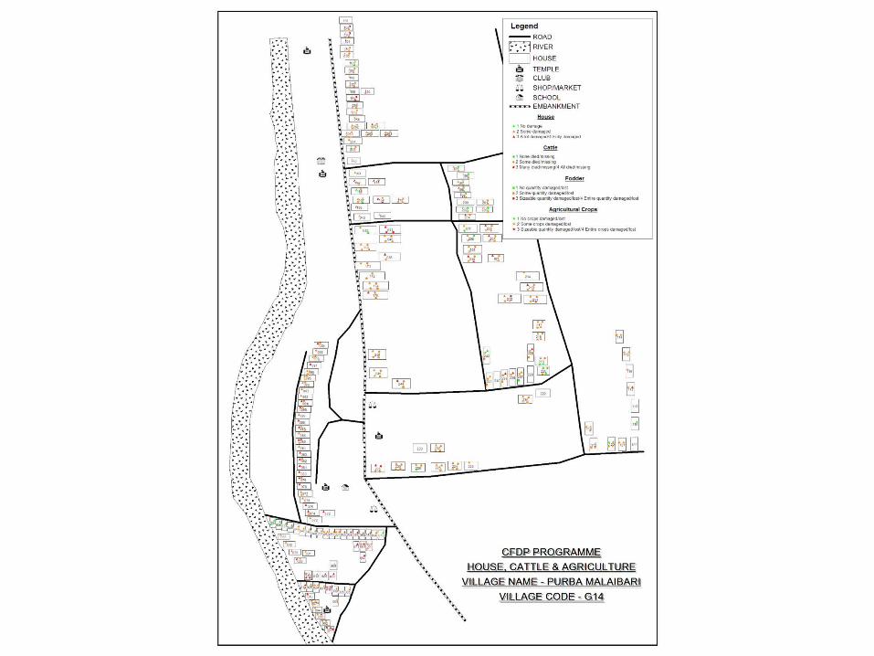
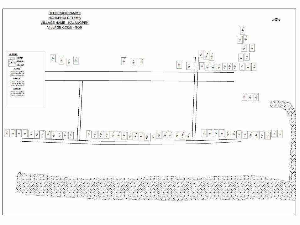
Tasks completedA COMPLETE DIGITAL SPATIAL DATA BASE FOR THE HILL REGION OF THE DISTRICT WHICH CONTAINS:
1 AN ELEVATION MODEL2. ALL ROADS AND RIVERS3. LOCATION OF ALL LAND SLIDES 4. ROCK COMPETENCY5. RAIN FALL RECONDS6. BLOCK BASE/ GP BASE SETTLEMENTS AND TOWNS7. AGRICULTURE, TEA, CINCONA AND FOREST DISTRIBUTION
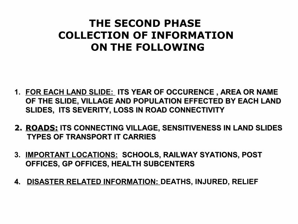
THE SECOND PHASE COLLECTION OF INFORMATION
ON THE FOLLOWING
1. FOR EACH LAND SLIDE: ITS YEAR OF OCCURENCE , AREA OR NAME ITS YEAR OF OCCURENCE , AREA OR NAME OF THE SLIDE, VILLAGE AND POPULATION EFFECTED BY EACH LAND OF THE SLIDE, VILLAGE AND POPULATION EFFECTED BY EACH LAND SLIDES, ITS SEVERITY, LOSS IN ROAD CONNECTIVITYSLIDES, ITS SEVERITY, LOSS IN ROAD CONNECTIVITY
2.2. ROADS:ROADS: ITS CONNECTING VILLAGE, SENSITIVENESS IN LAND SLIDES ITS CONNECTING VILLAGE, SENSITIVENESS IN LAND SLIDES TYPES OF TRANSPORT IT CARRIESTYPES OF TRANSPORT IT CARRIES
3. IMPORTANT LOCATIONS: SCHOOLS, RAILWAY SYATIONS, POST SCHOOLS, RAILWAY SYATIONS, POST OFFICES, GP OFFICES, HEALTH SUBCENTERSOFFICES, GP OFFICES, HEALTH SUBCENTERS
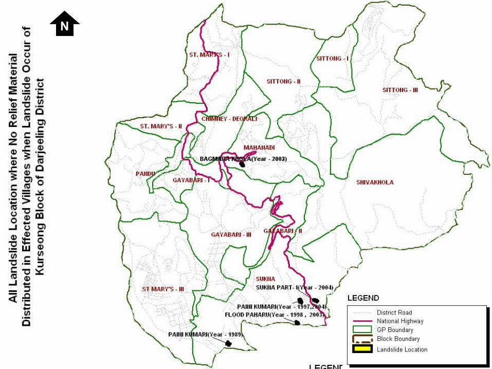
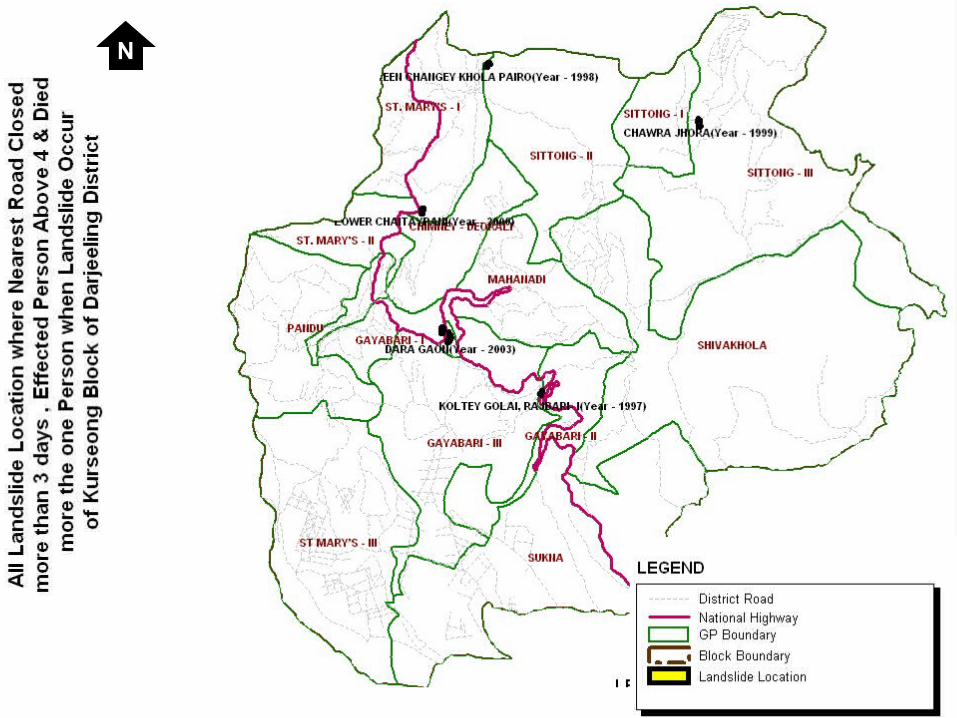
4. 4. DISASTER RELATED INFORMATION: DEATHS, INJURED, RELIEF
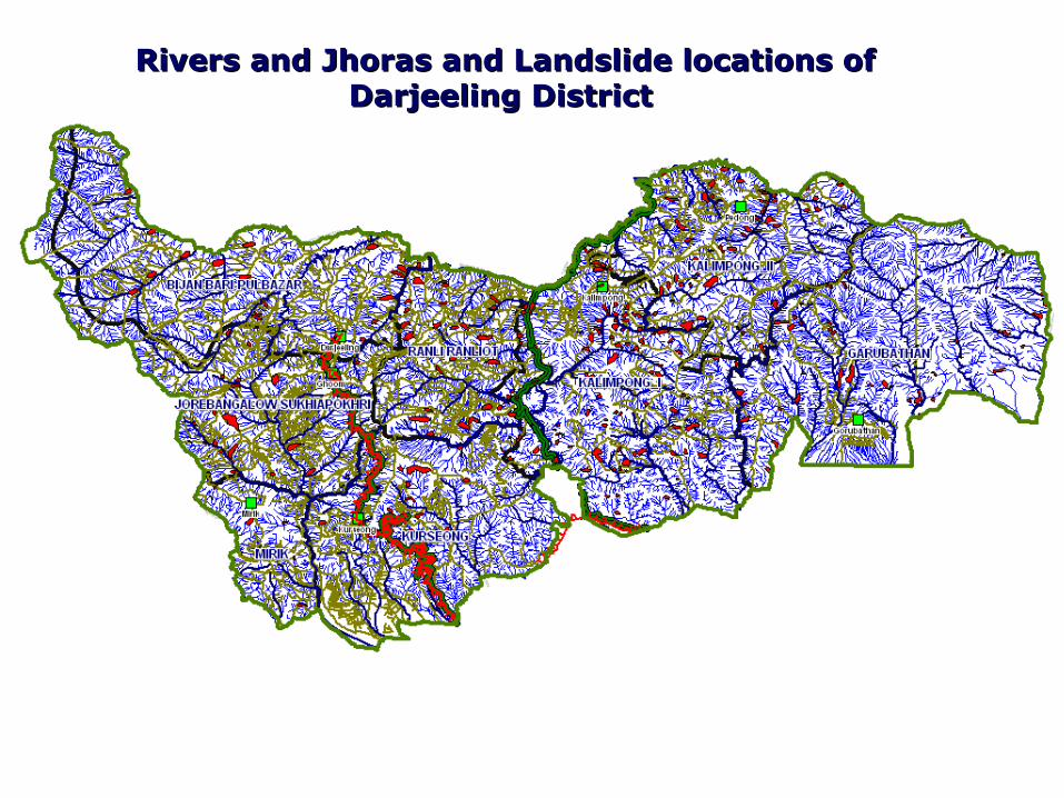
Rivers and Jhoras and Landslide locations of Rivers and Jhoras and Landslide locations of Darjeeling District Darjeeling District
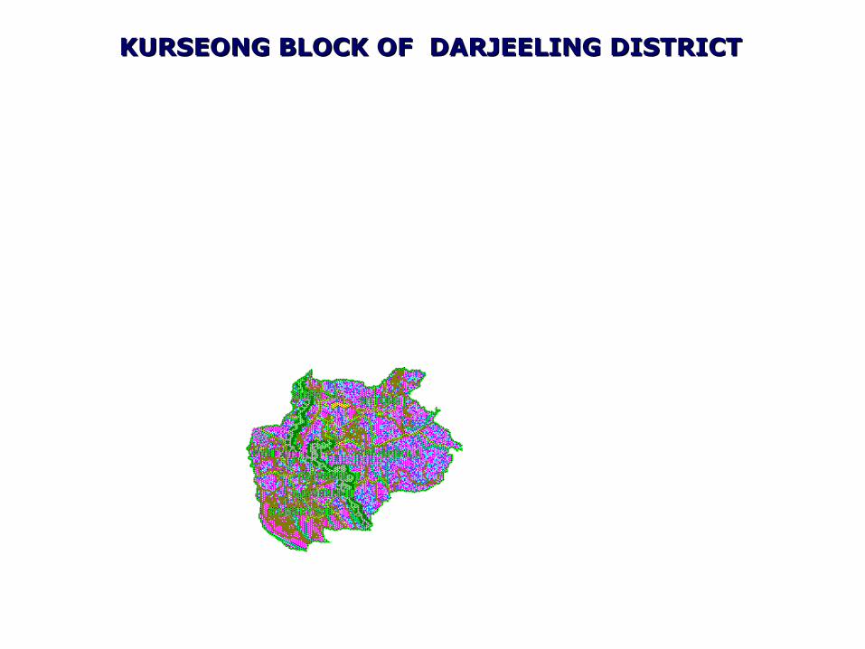
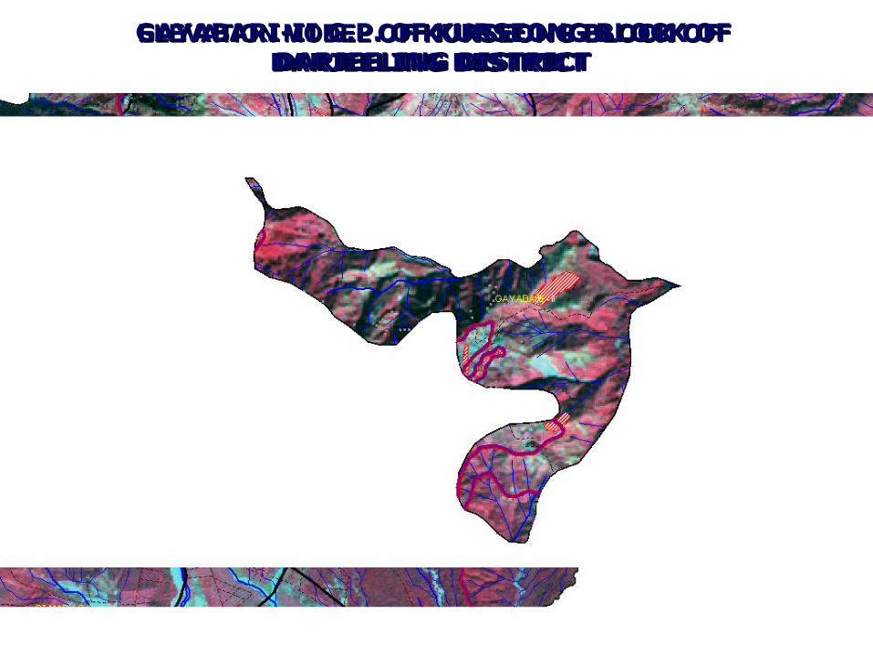
KURSEONG BLOCK OF DARJEELING DISTRICT KURSEONG BLOCK OF DARJEELING DISTRICT
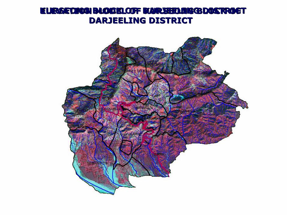
KURSEONG BLOCK OF DARJEELING DISTRICT KURSEONG BLOCK OF DARJEELING DISTRICT ELEVATION MODEL OF KURSEONG BLOCK OF ELEVATION MODEL OF KURSEONG BLOCK OF DARJEELING DISTRICT DARJEELING DISTRICT
ELEVATION MODELELEVATION MODEL OF KURSEONG BLOCK OF OF KURSEONG BLOCK OF DARJEELING DISTRICT DARJEELING DISTRICT
GAYABARI-II G.P. OF KURSEONG BLOCK OF GAYABARI-II G.P. OF KURSEONG BLOCK OF DARJEELING DISTRICT DARJEELING DISTRICT
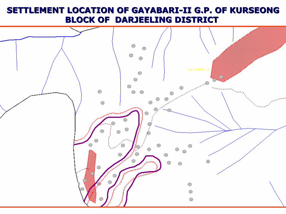
SETTLEMENT LOCATION OF GAYABARI-II G.P. OF KURSEONG SETTLEMENT LOCATION OF GAYABARI-II G.P. OF KURSEONG BLOCK OF DARJEELING DISTRICT BLOCK OF DARJEELING DISTRICT
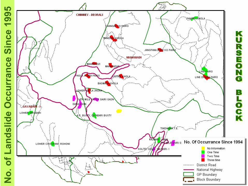
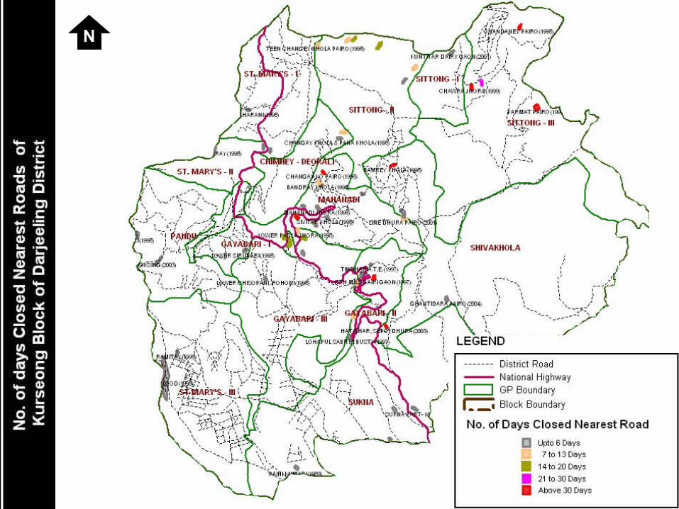
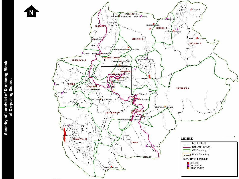
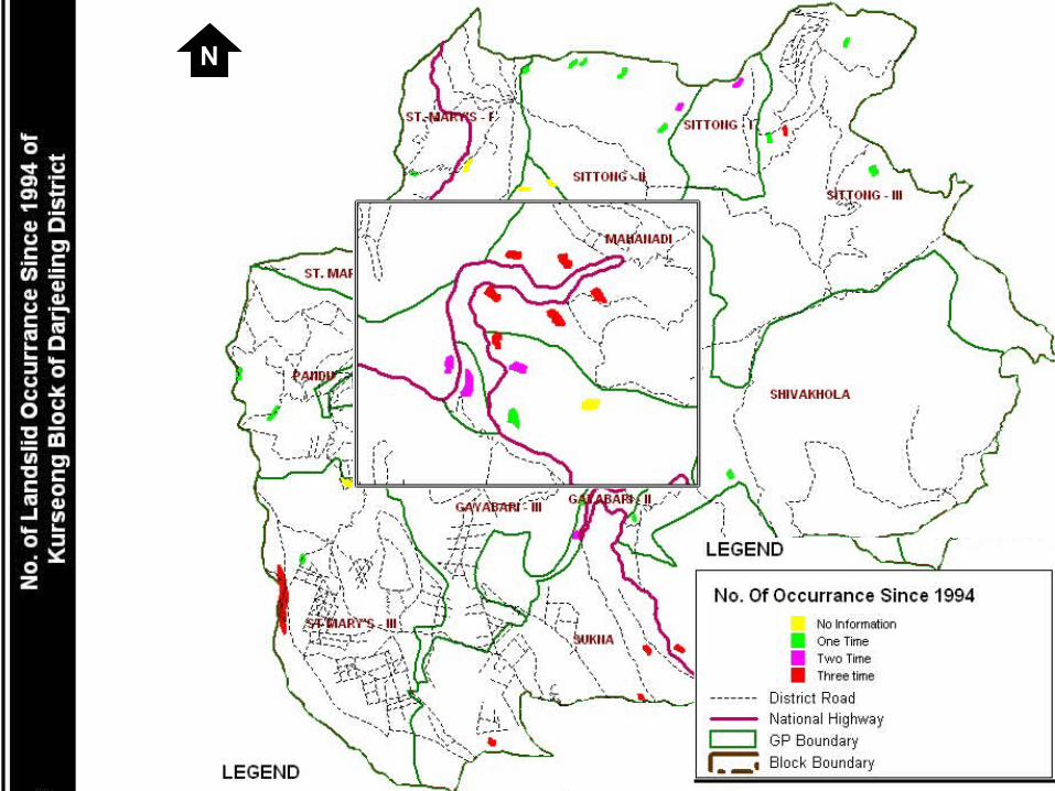
No
. o
f L
and
slid
e O
ccu
rran
ce S
ince
199
5
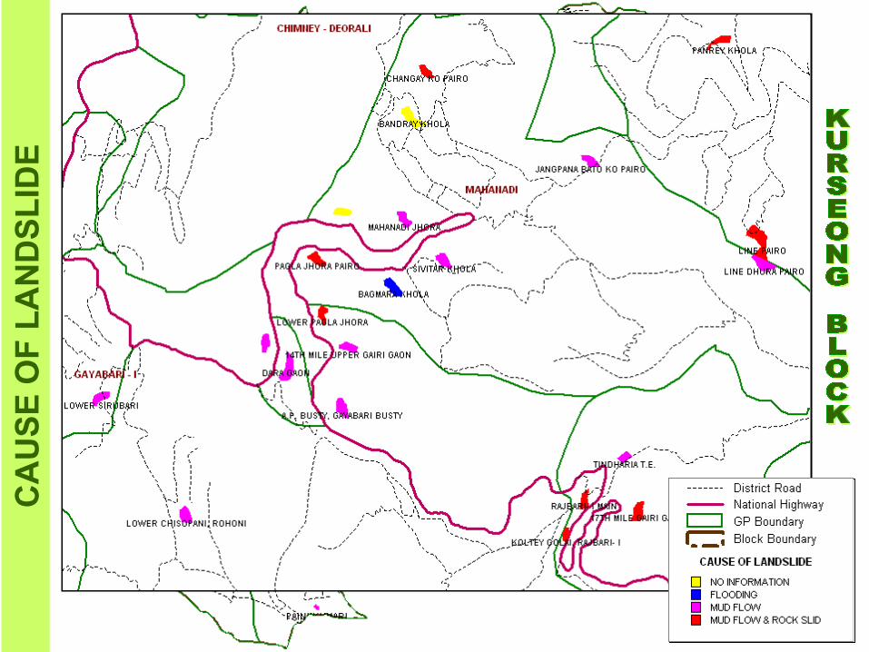
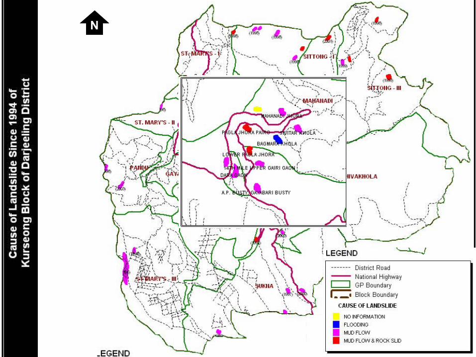
CA
US
E O
F L
AN
DS
LID
E
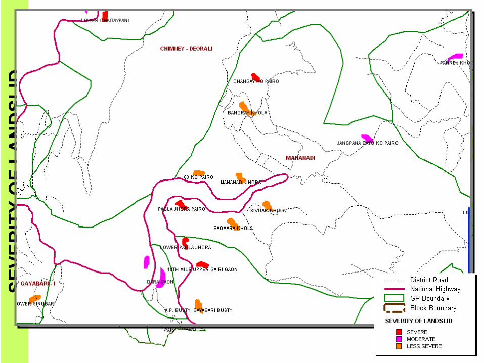
SE
VE
RIT
Y O
F L
AN
DS
LID
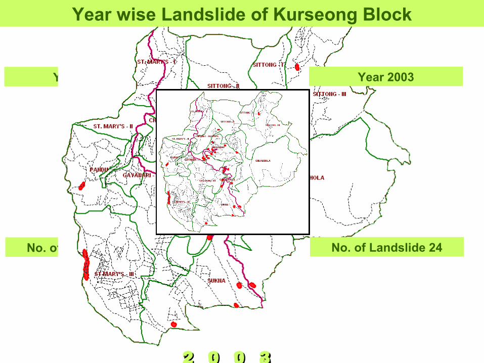
No. of Landslide 36
Year 1998
No. of Landslide 10
Year 2002
No. of Landslide 24
Year 2003
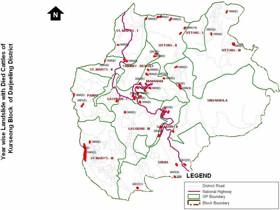
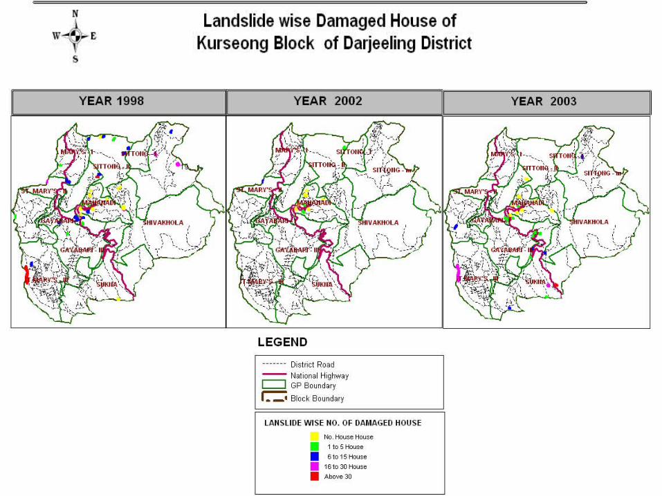
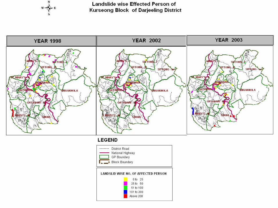
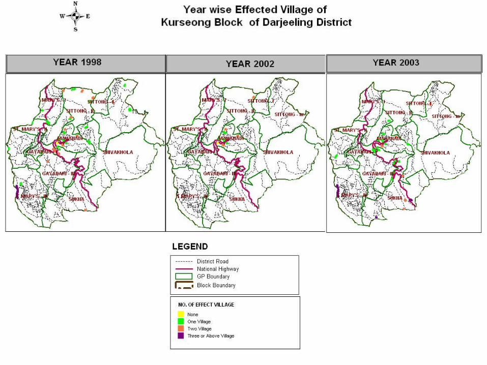
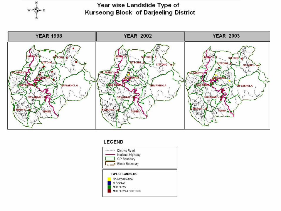
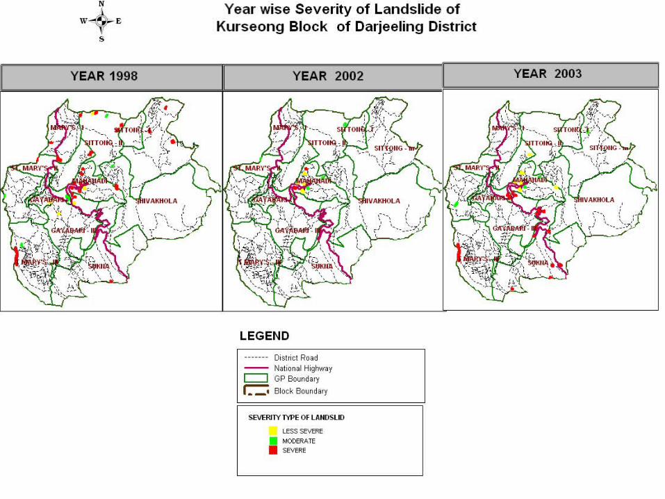
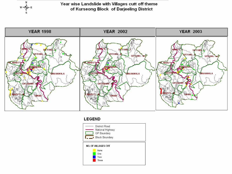
Year wise Landslide of Kurseong Block
1 9 9 81 9 9 82 0 0 22 0 0 22 0 0 32 0 0 3
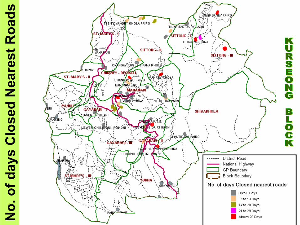
No
. of
day
s C
lose
d N
ea
res
t R
oa
ds
N
N
N
N
N
N
N
N
N
N
Few examples of other areas with
community as the main driver
Case Study: Assam

PLANNINNG
POLICIES
PLANNINNG POLICIES
What it should be
What it is Now
=Development
?


