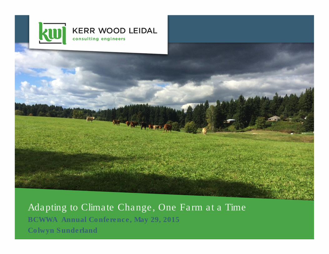
Adapting to Climate Change, One Farm at a TimeBCWWA Annual Conference, May 29, 2015
Colwyn Sunderland
2Overview
1. Background
2. Farm Water Planning Toolkit
3. Piloting
4. What Have We Learned So Far?
5. What Next?
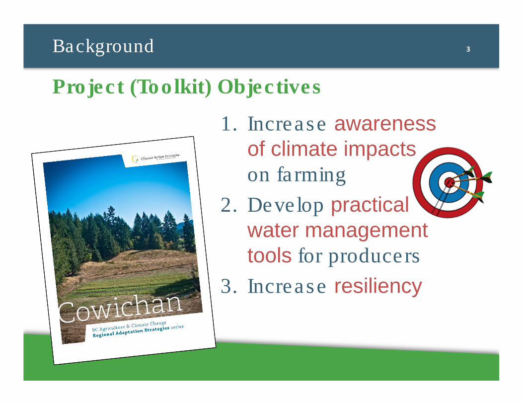
3Background
1. Increase awareness of climate impacts on farming
2. Develop practical water management tools for producers
3. Increase resiliency
Project (Toolkit) Objectives
4Project Partners
Cowichan Regional Adaptation Strategies
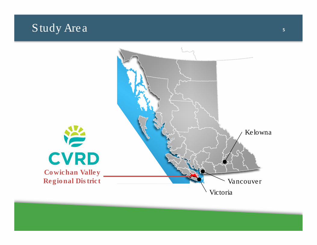
5Study Area
Cowichan Valley
Regional District
Victoria
Vancouver
Kelowna
6
WATER MANAGEMENT STRATEGIES MODULE
Integrated Farm Water Planning Pilot Strategies
Notes
Resources
5)Raise land
If you can not relocate a building, raise the land to the flood plain elevation. Contact local government to discuss. Drainage Ref #7
6) Build a dike/pump station
Drainage Ref #7, 8, & 9
Strategies to Address High Water Table 7) Upgrade downstream conditions to lower groundwater table
The groundwater table may be higher due to water ponding downstream of your farm. Assess
the downstream conditions to determine options.
Consult with a Drainage Specialist. Drainage Ref # 7
8) Maintain subsurface drainage
Drainage Ref #7 & 10
9) Install subsurface drainage
Drainage Ref #7, 11 to 13
10) Drainage Pump to lower water level & berming
Drainage Ref #9
Strategies to Address Local Flooding Issues11) Assess the capacity of the on-farm drainage system. Review how the on-farm drainage
system is operating to understand if issues can be addressed with maintenance or if drainage upgrades are required.
Consult with a drainage specialist, or complete a visual inspection during a storm event to look for issues. Drainage Ref #2
12) Assess the capacity of the downstream drainage system. If the downstream system does not have capacity to pass storm events, the water may backwater onto your property. Assessment would review downstream channels, culverts and discharge
locations. Assessment would determine if issues can be addressed with maintenance or if upgrades are required.
Consult with a drainage specialist, or complete a visual inspection during a storm event to look for issues. Drainage Ref #213) Grade land to prevent ponding.
Drainage Ref #7
14) Maintain drainage ditches
Drainage Ref #7 & 14
15) Invasive species management
Drainage (continued)
FARM WATER PLANNING TOOLKIT
Page 37 of 41
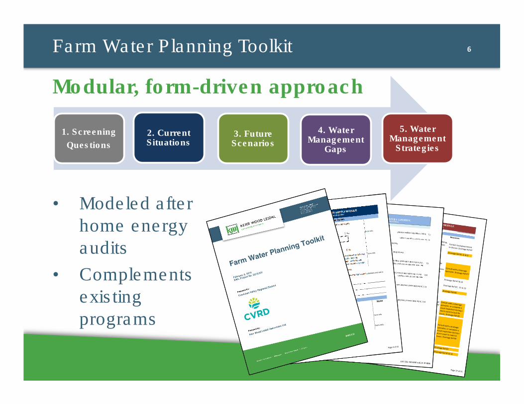
Farm Water Planning Toolkit
• Modeled after
home energy
audits
• Complements
existing
programs
Modular, form-driven approachCURRENT SITUATIONS – WATER USE MODULE
Integrated Farm Water Planning Pilot
Source
7)Is your irrigation usage metered?
� Yes � No
Farm Info
8)What is your irrigation usage?
Farm Info/Meter
Peak Day
Box 6
Annual Demand
Box 7
9)What is the estimated peak irrigation
flow rate requirement for your region?
Appendix C Table
2.3
Box 8
10)What is the estimated annual crop
requirement for your region?
Appendix C Table
2.4
Box 9
11)Calculated peak crop demand.
See Calculated
Irrigations Demand
Box 10
12)Calculated annual crop demand.See Calculated
Irrigations Demand
Box 11
Irrigation (continued)
FARM WATER PLANNING TOOLKIT
Page 19 of 41
CURRENT SITUATIONS – WATER USE MODULE
Integrated Farm Water Planning Pilot
Source
7)Is your irrigation usage metered?
� Yes � No
Farm Info
8)What is your irrigation usage?
Farm Info/Meter
Peak Day
Box 6
Annual Demand
Box 7
9)What is the estimated peak irrigation
flow rate requirement for your region?
Appendix C Table
2.3
Box 8
10)What is the estimated annual crop
requirement for your region?
Appendix C Table
2.4
Box 9
11)Calculated peak crop demand.
See Calculated
Irrigations Demand
Box 10
12)Calculated annual crop demand.See Calculated
Irrigations Demand
Box 11
Irrigation (continued)
FARM WATER PLANNING TOOLKIT
Page 19 of 41
CURRENT SITUATIONS – WATER SUPPLY MODULE
Integrated Farm Water Planning Pilot
1) Is the volume you are able to use from the
regional/municipal system limited?� Yes � No
Farm Info
a) If yes, what is the peak use limit?Box 1
2) Are you metered?
� Yes � No
3) How are you charged for water?� Fixed rate (not based on volume) Farm Info
� Volume based - flat rate
� Volume based - inclining rate
� Volume based - seasonally rates
Comments
Source
1) What is the total volume of water you can
withdraw from your wells annually? (i.e. well
capacity)
Farm Info
Box 2
2) Do you have a Well Log?
� Yes � NoFarm Info
Groundwater Sources
Regional/Municipal Water System
Complete this section if you are supplied by a regional/municipal water supply
If you are supplied by other water sources proceed to the relevant sections.
If all of your water is supplied from a regional/municipal water system, assume that water limitations are not a
concern, and proceed to Storage Module.
Complete this section if you have a groundwater source.
FARM WATER PLANNING TOOLKIT
Page 4 of 41
1. Screening
Questions
2. Current Situations
3. Future Scenarios
4. Water Management
Gaps
5. Water Management
Strategies
7
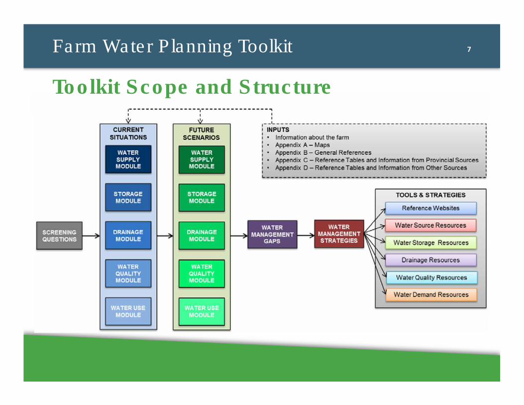
Farm Water Planning Toolkit
Toolkit Scope and Structure
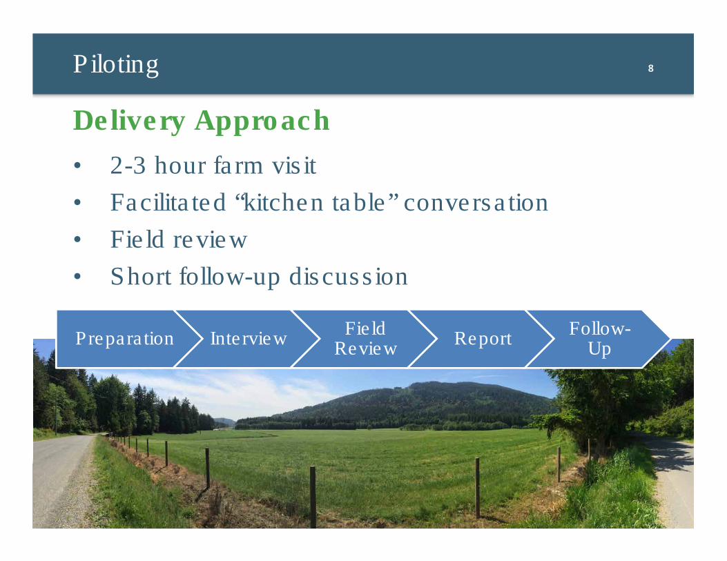
8Piloting
• 2-3 hour farm visit
• Facilitated “kitchen table” conversation
• Field review
• Short follow-up discussion
Delivery Approach
Preparation InterviewField
ReviewReport
Follow-Up
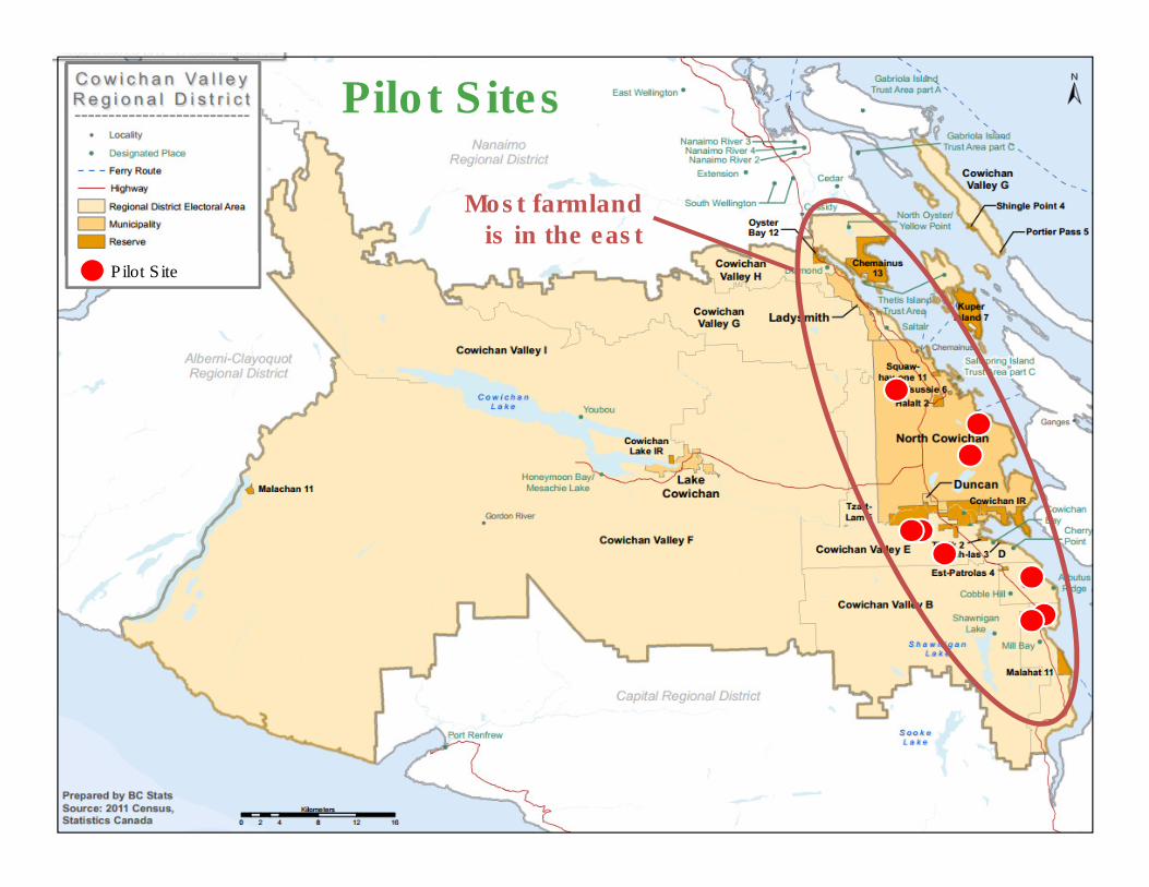
91. BackgroundPilot Sites
Most farmland is in the east
Pilot Site
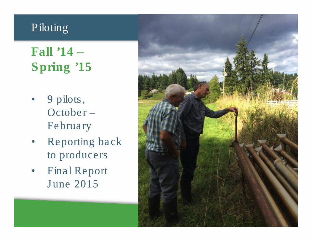
10Piloting
• 9 pilots,
October –
February
• Reporting back
to producers
• Final Report
June 2015
Fall ’14 –Spring ’15
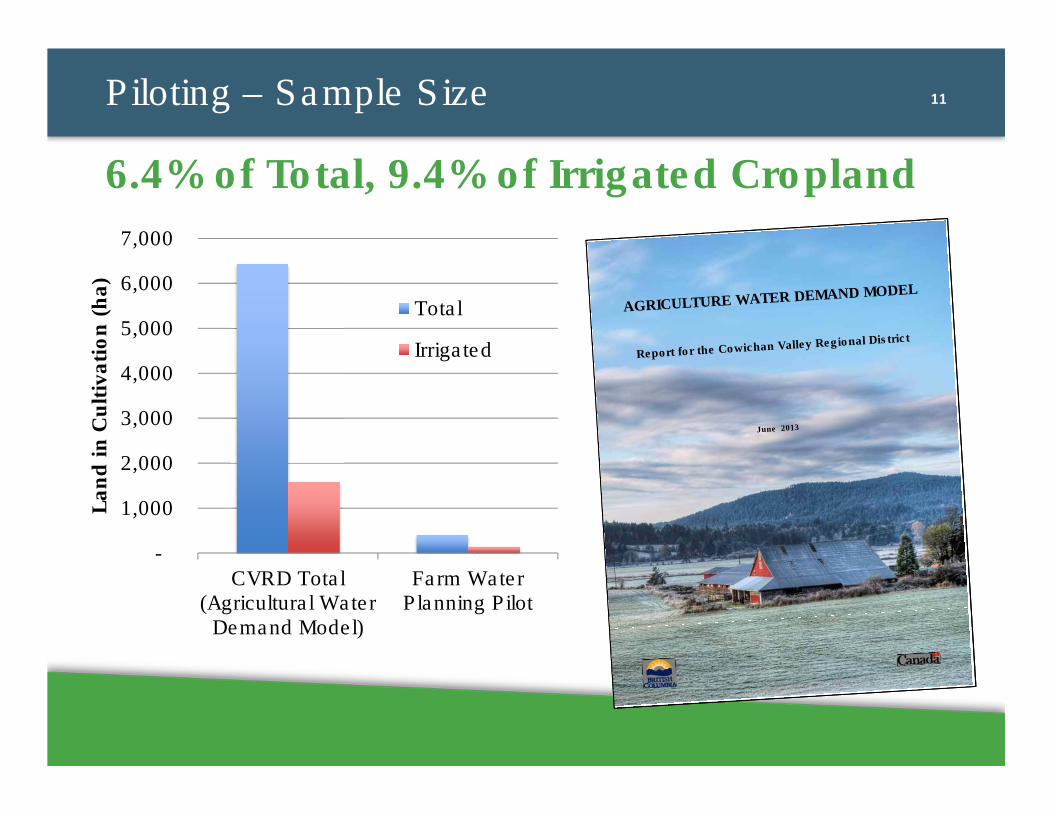
11Piloting – Sample Size
6.4% of Total, 9.4% of Irrigated Cropland
AGRICULTURE WATER DEMAND MODEL
Report for the Cowichan Valley Regional District
June 2013
AGRICULTURE WATER DEMAND MODEL
Report for the Cowichan Valley Regional District
June 2013
-
1,000
2,000
3,000
4,000
5,000
6,000
7,000
CVRD Total(Agricultural Water
Demand Model)
Farm WaterPlanning Pilot
Lan
d i
n C
ult
ivati
on
(h
a)
Total
Irrigated
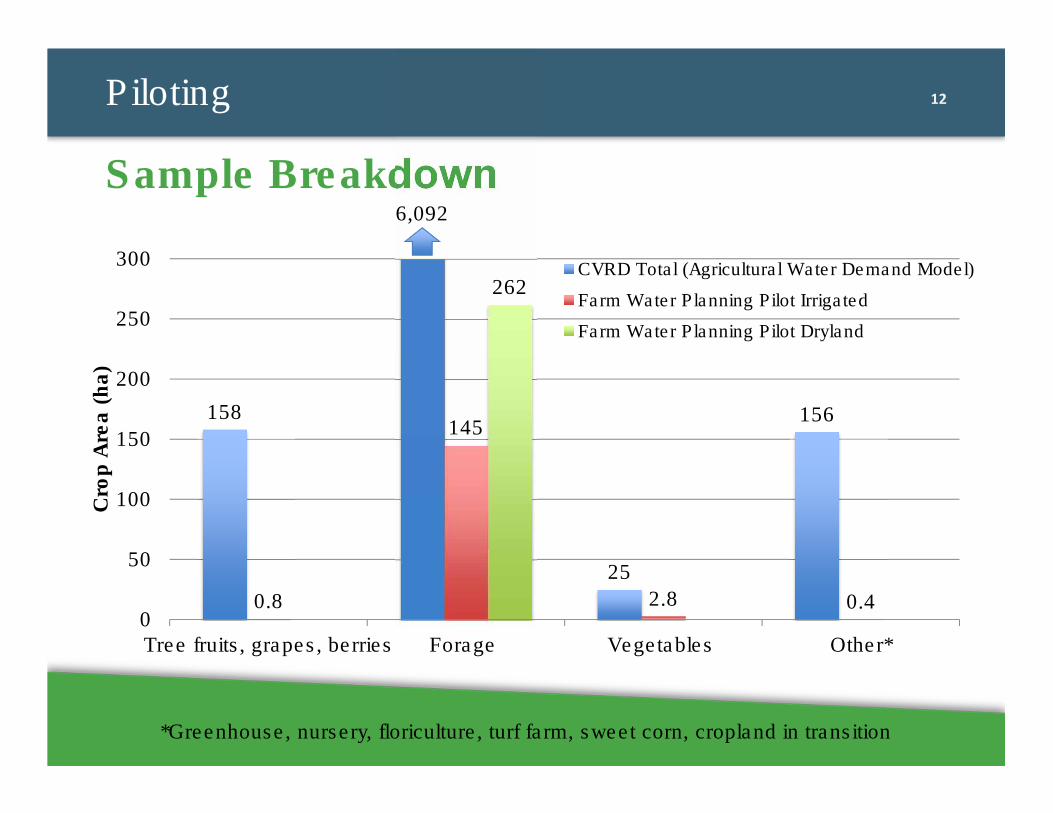
12Piloting
Sample Breakdown
158
25
156
0.8
145
2.8 0.4
262
0
50
100
150
200
250
300
Tree fruits, grapes, berries Forage Vegetables Other*
Cro
p A
rea (
ha)
CVRD Total (Agricultural Water Demand Model)
Farm Water Planning Pilot Irrigated
Farm Water Planning Pilot Dryland
6,092
*Greenhouse, nursery, floriculture, turf farm, sweet corn, cropland in transition
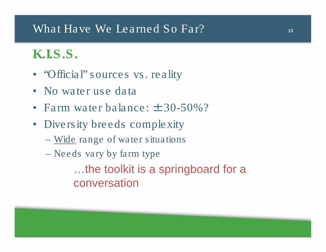
13What Have We Learned So Far?
• “Official” sources vs. reality
• No water use data
• Farm water balance: ±30-50%?
• Diversity breeds complexity
– Wide range of water situations
– Needs vary by farm type
…the toolkit is a springboard for a
conversation
K.I.S.S.
14What Have We Learned So Far?
Actual Water Use vs. Theoretical Need
297
740
309
767
310 305
113 109
0
100
200
300
400
500
600
700
800
900
Allcultivated
land,1997
Allcultivated
land,2003
Forage,1997
Forage,2003
Irrigatedland
IrrigatedForage
Allcultivated
land
All forage
Average crop water demand (DemandModel)
Estimated average water use intensity,2014 (Farm Water Planning Pilot)
An
nu
al
Wate
r U
se I
nte
nsit
y (
mm
)
15
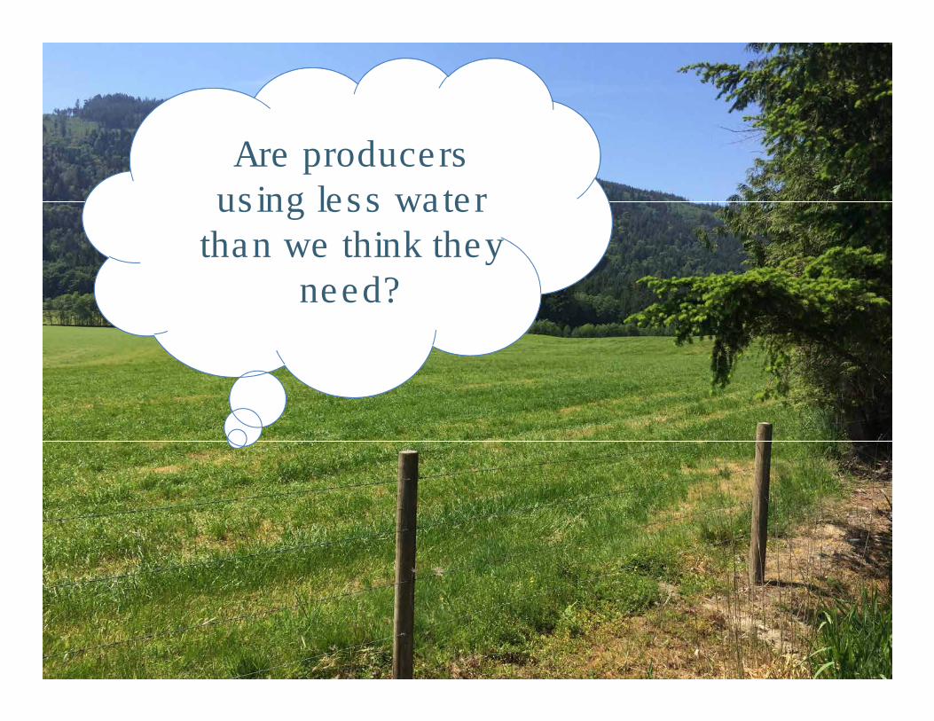
Are producers using less water
than we think they need?
16What Have We Learned So Far?
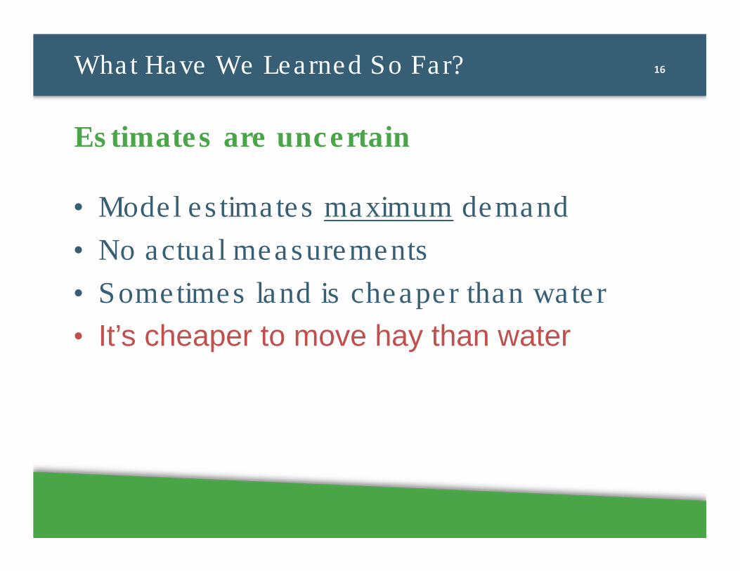
Estimates are uncertain
• Model estimates maximum demand
• No actual measurements
• Sometimes land is cheaper than water
• It’s cheaper to move hay than water
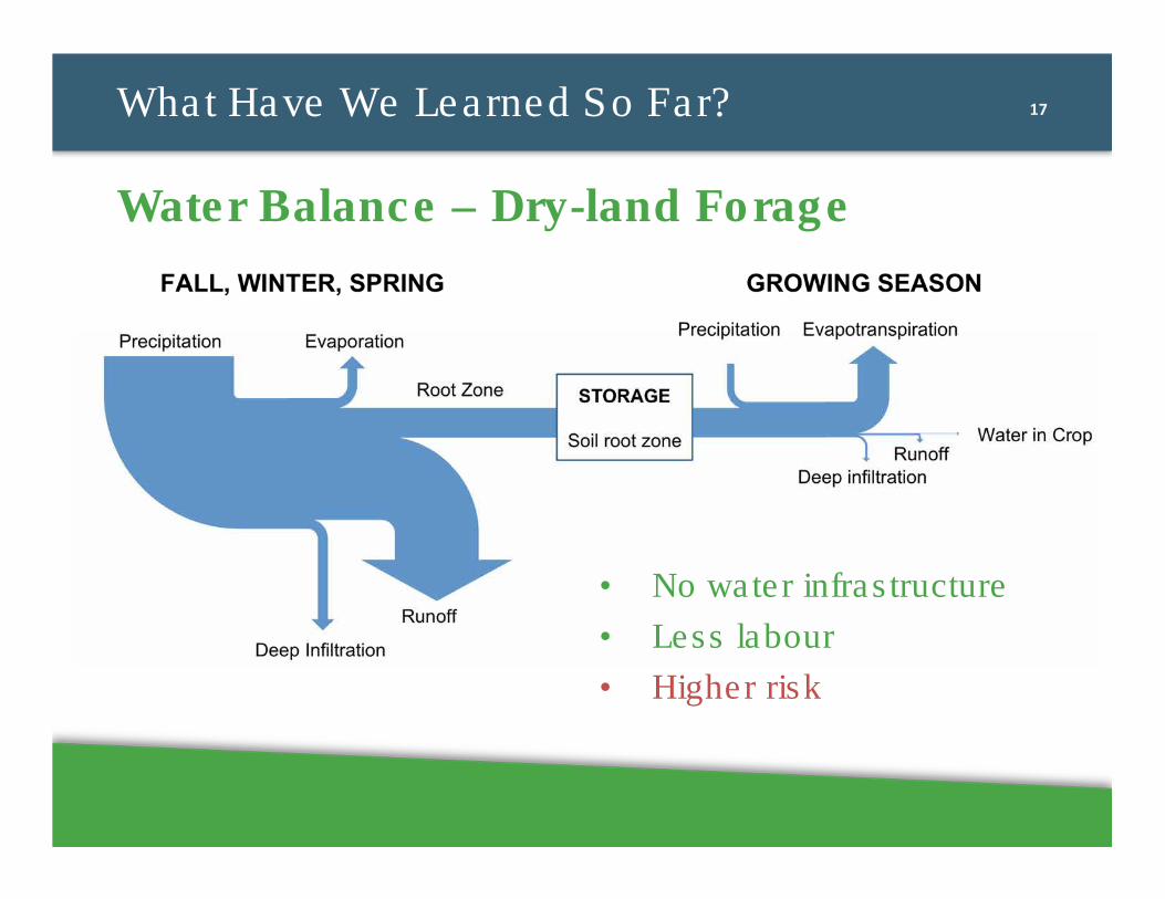
17What Have We Learned So Far?
Water Balance – Dry-land Forage
• No water infrastructure
• Less labour
• Higher risk
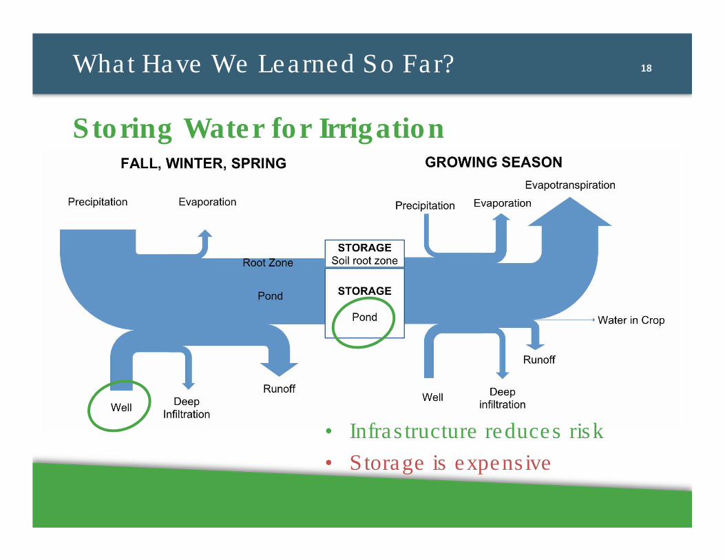
18What Have We Learned So Far?
Storing Water for Irrigation
• Infrastructure reduces risk
• Storage is expensive
19What Have We Learned So Far?
• Runoff water quality risk
• Drainage issues need outside help
• Land use, demographic and macro-economic changes: bigger risks than climate change?
• Irrigation assessments worthwhile?
Climate change is just one of the issues
20What Have We Learned So Far?
• Monitoring and trending builds resiliency:
� Water usage
� Pond/groundwater levels
� Water quality
� Any observed changes
Can’t Manage What You Don’t Measure
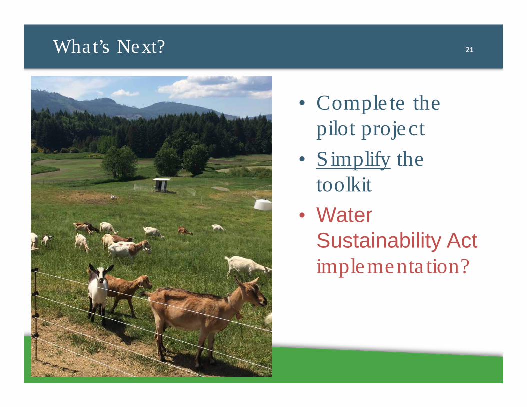
21What’s Next?
• Complete the pilot project
• Simplify the toolkit
• Water Sustainability Act implementation?

22
Thank Moooo!


