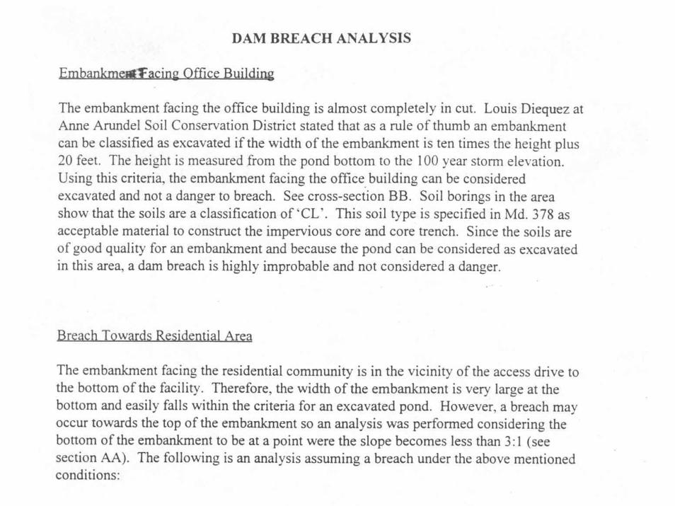
dam breach / hazard class analysis · dam breach • the minimum peak discharge of the breach...
TRANSCRIPT
DAM BREACH / HAZARD CLASS ANALYSIS
Warren Johnson, P.E.Civil Engineer
Frederick, Maryland
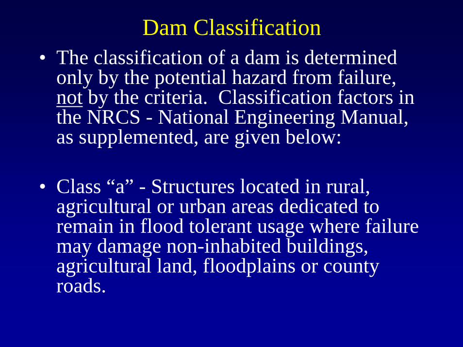
Dam Classification
• Structure Hazard Classification -Documentation of the classification of dams is required.
• Documentation is to include but is not limited to location and description of dam, configuration of the valley, description of existing development (houses, utilities, highways, railroads, farm or commercial buildings, and other pertinent improvements), potential for future development, and recommended classification.
Dam Classification Documentation
• Qmax discharge.• Description of Dam.• Description of all roads, structures and utilities
down stream of pond.• Map showing pond, downstream structures, cross
section locations and proposed breach wave.• All appropriate, routing, computations and
supporting cross sections.• Conclusion.
Dam Classification• The class (“a”, “b”, and “c”) as contained in
this document is related to the potential hazard to life and property that might result from a sudden major breach of the earth embankment.
The classification of a dam is the responsibility of the designer, and subject to review and concurrence of the approving authority.
Dam Classification• The classification of a dam is determined
only by the potential hazard from failure, not by the criteria. Classification factors in the NRCS - National Engineering Manual, as supplemented, are given below:
• Class “a” - Structures located in rural, agricultural or urban areas dedicated to remain in flood tolerant usage where failure may damage non-inhabited buildings, agricultural land, floodplains or county roads.
Dam Classification
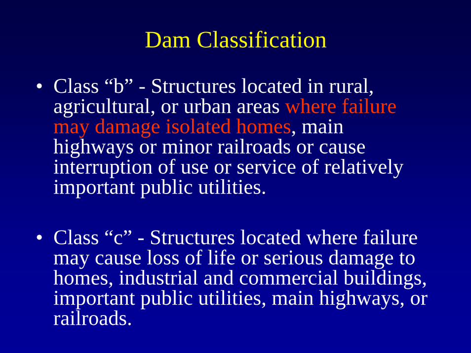
• Class “b” - Structures located in rural, agricultural, or urban areas where failure may damage isolated homes, main highways or minor railroads or cause interruption of use or service of relatively important public utilities.
• Class “c” - Structures located where failure may cause loss of life or serious damage to homes, industrial and commercial buildings, important public utilities, main highways, or railroads.
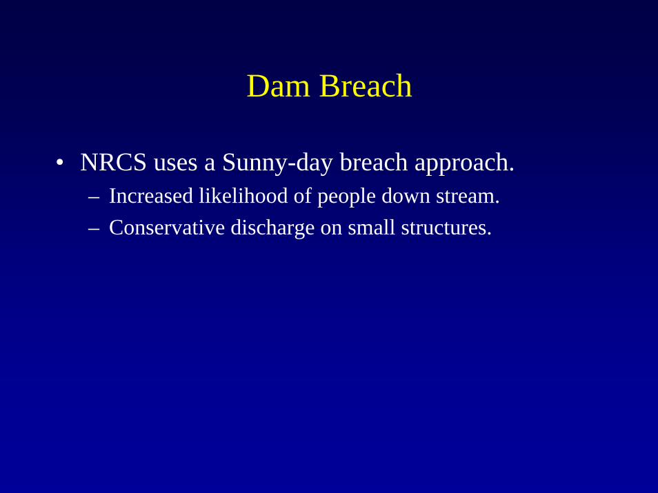
Dam Breach
• NRCS uses a Sunny-day breach approach.– Increased likelihood of people down stream.– Conservative discharge on small structures.
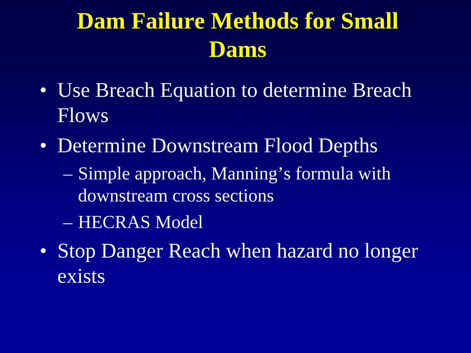
Dam Failure Methods for Small Dams
• Use Breach Equation to determine Breach Flows
• Determine Downstream Flood Depths– Simple approach, Manning’s formula with
downstream cross sections – HECRAS Model
• Stop Danger Reach when hazard no longer exists
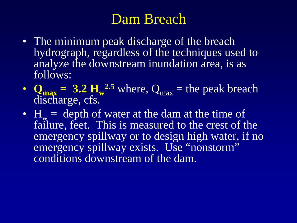
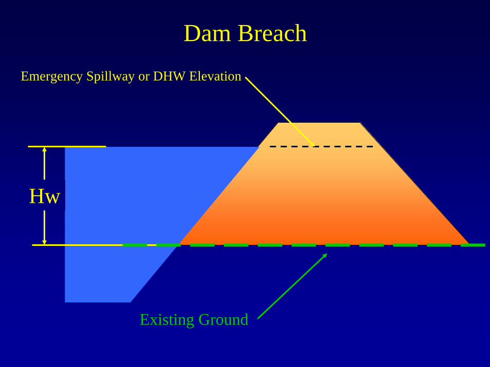
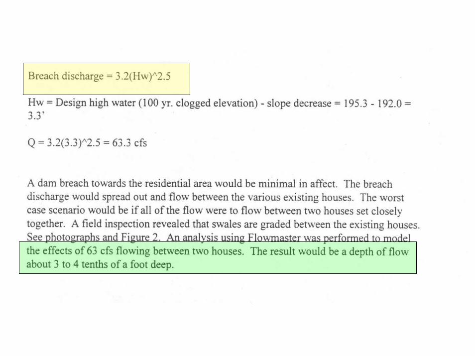
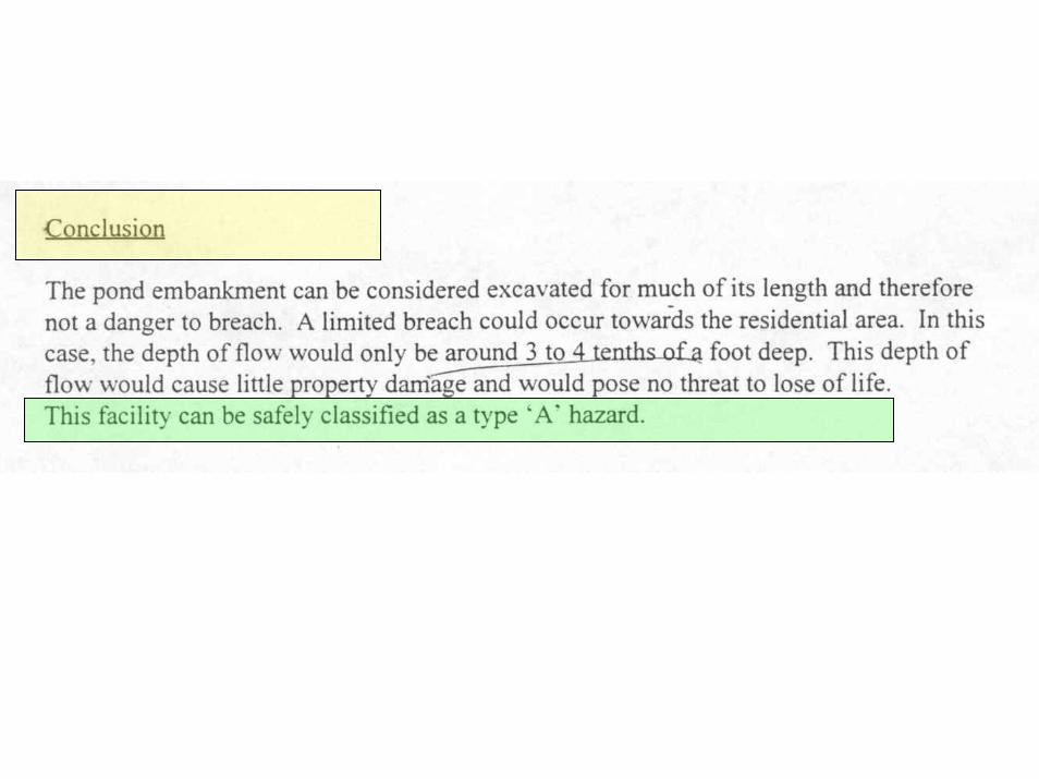
Dam Breach• The minimum peak discharge of the breach
hydrograph, regardless of the techniques used to analyze the downstream inundation area, is as follows:
• Qmax = 3.2 Hw2.5 where, Qmax = the peak breach
discharge, cfs.• Hw = depth of water at the dam at the time of
failure, feet. This is measured to the crest of the emergency spillway or to design high water, if no emergency spillway exists. Use “nonstorm”conditions downstream of the dam.
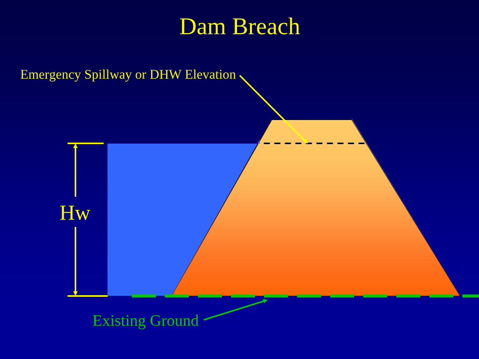
Dam Breach
Emergency Spillway or DHW Elevation
Hw
Existing Ground
Dam Breach
Hw
Emergency Spillway or DHW Elevation
Excavate for Barrel
Existing Ground
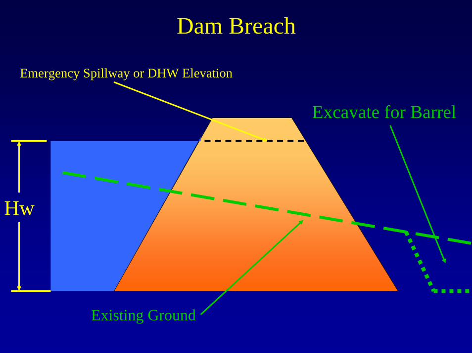
Dam Breach
Hw
Emergency Spillway or DHW Elevation
Existing Ground
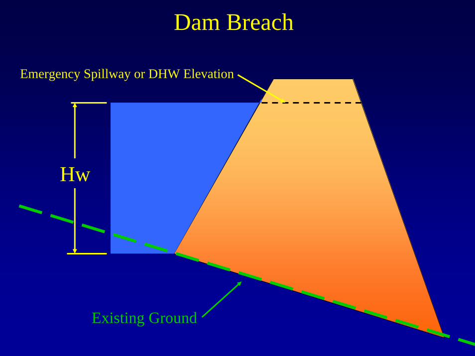
Dam BreachEmergency Spillway or DHW Elevation
Hw
Existing Ground
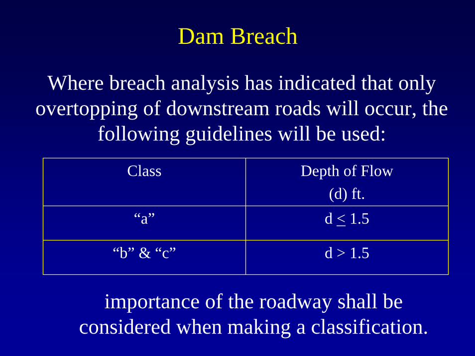
Dam Breach
Where breach analysis has indicated that only overtopping of downstream roads will occur, the
following guidelines will be used:
Class Depth of Flow(d) ft.
“a” d < 1.5
“b” & “c” d > 1.5
importance of the roadway shall be considered when making a classification.

Flood Danger for Cars
0.00
0.50
1.00
1.50
2.00
2.50
3.00
3.50
0.0 2.0 4.0 6.0 8.0 10.0 12.0 14.0 16.0
Velocity [fps]
Floo
d D
epth
[ft
]
Low Danger Judgement Zone High Danger
Low Danger Zone
High Danger Zone
Judgement Zone
Dam Breach
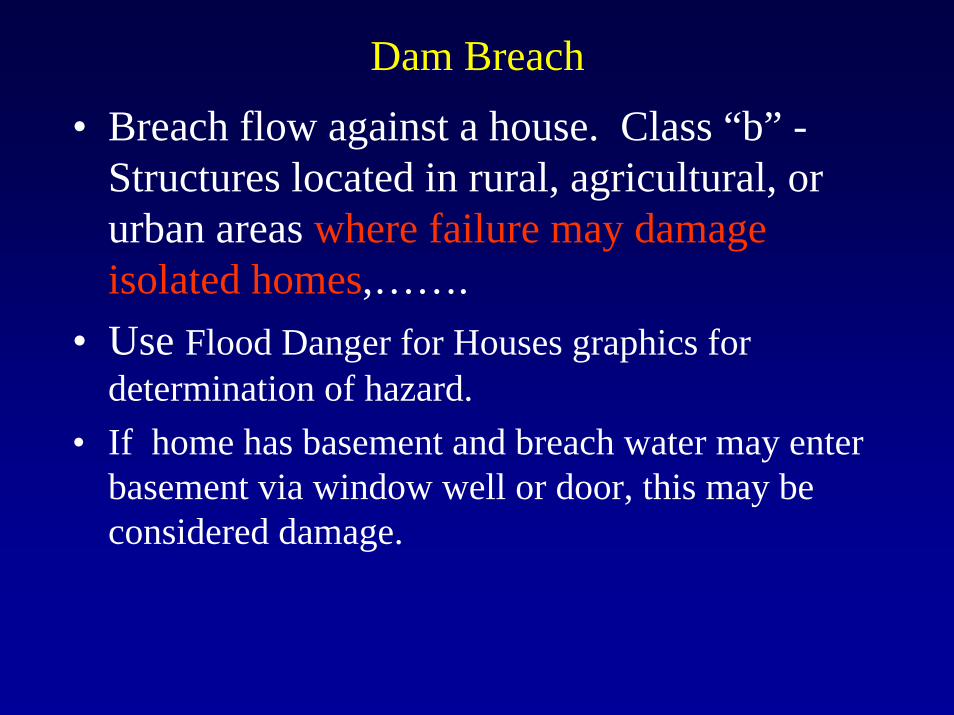
• Breach flow against a house. Class “b” -Structures located in rural, agricultural, or urban areas where failure may damageisolated homes,…….
• Use Flood Danger for Houses graphics for determination of hazard.
• If home has basement and breach water may enter basement via window well or door, this may be considered damage.
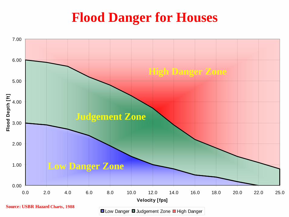
Flood Danger for Houses
0.00
1.00
2.00
3.00
4.00
5.00
6.00
7.00
0.0 2.0 4.0 6.0 8.0 10.0 12.0 14.0 16.0 18.0 20.0 22.0 25.0
Velocity [fps]
Floo
d D
epth
[ft
]
Low Danger Judgement Zone High Danger
Low Danger Zone
High Danger Zone
Judgement Zone
Source: USBR Hazard Charts, 1988
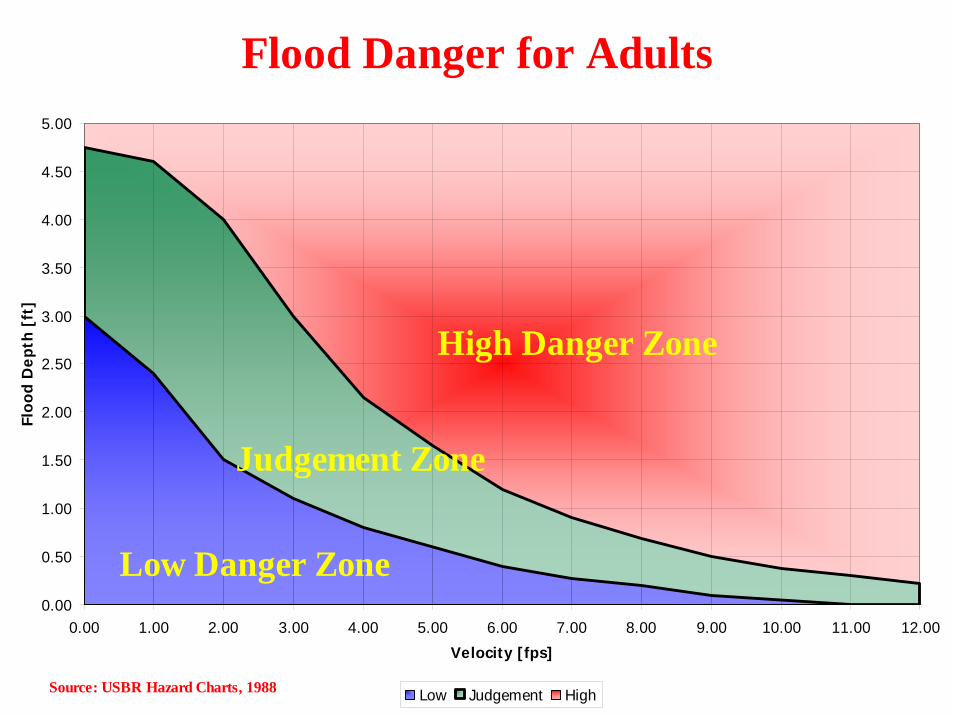
Flood Danger for Adults
0.00
0.50
1.00
1.50
2.00
2.50
3.00
3.50
4.00
4.50
5.00
0.00 1.00 2.00 3.00 4.00 5.00 6.00 7.00 8.00 9.00 10.00 11.00 12.00
Velocity [fps]
Floo
d D
epth
[ft
]
Low Judgement High
Low Danger Zone
High Danger Zone
Judgement Zone
Source: USBR Hazard Charts, 1988
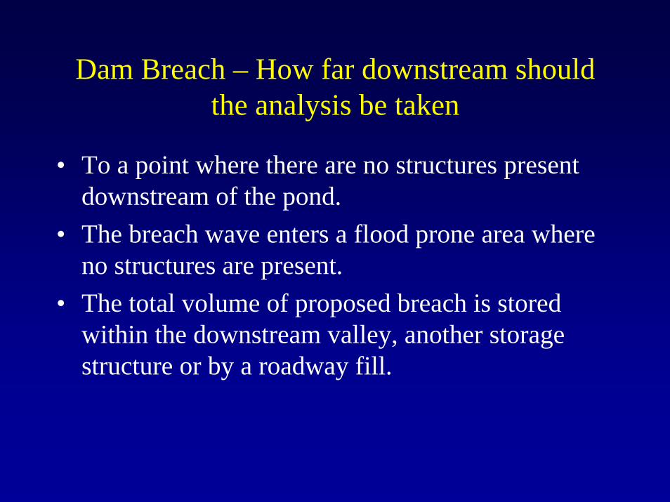
Dam Breach – How far downstream should the analysis be taken
• To a point where there are no structures present downstream of the pond.
• The breach wave enters a flood prone area where no structures are present.
• The total volume of proposed breach is stored within the downstream valley, another storage structure or by a roadway fill.
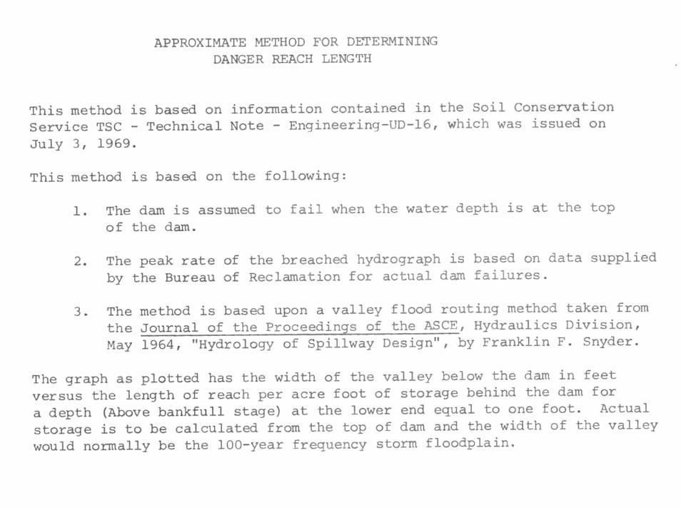
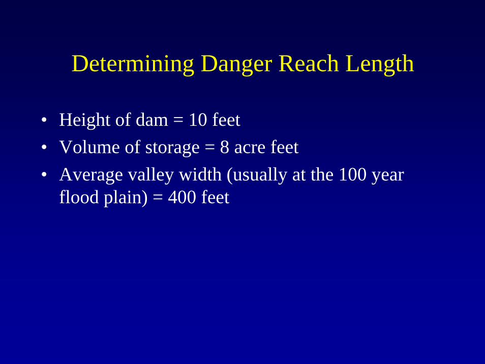
Determining Danger Reach Length
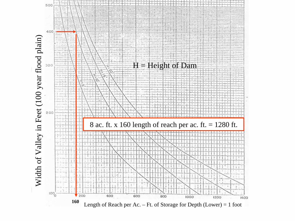
• Height of dam = 10 feet• Volume of storage = 8 acre feet• Average valley width (usually at the 100 year
flood plain) = 400 feet
Wid
th o
f Val
ley
in F
eet (
100
year
floo
d pl
ain)
H = Height of Dam
Length of Reach per Ac. – Ft. of Storage for Depth (Lower) = 1 foot
8 ac. ft. x 160 length of reach per ac. ft. = 1280 ft.
160
Example Dam Breach Analysis

Breach Wave Map
SWM Facility
Proposed Breach
Houses / Road
Dam Classification
• Other things to look out for.
Dam Classification
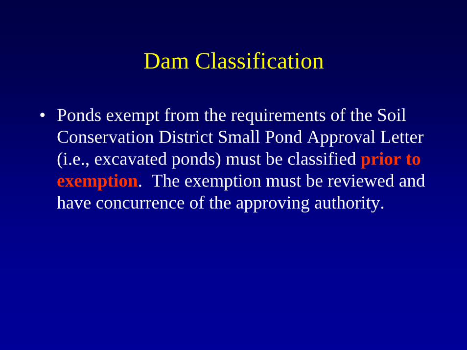
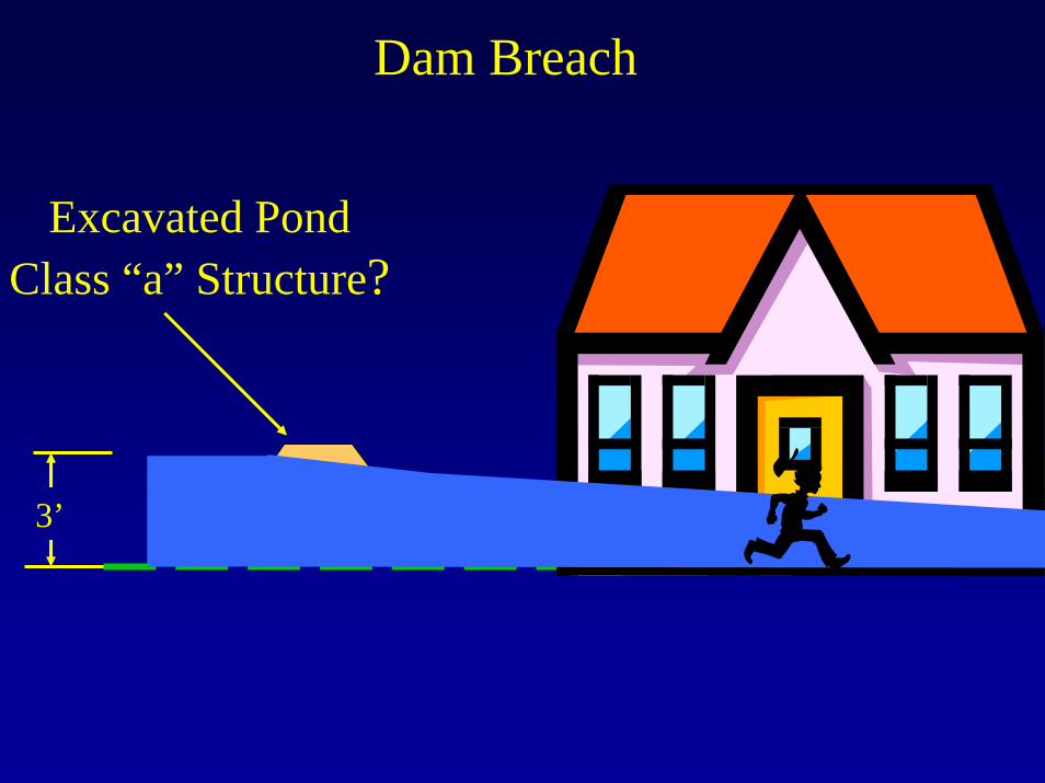
• Ponds exempt from the requirements of the Soil Conservation District Small Pond Approval Letter (i.e., excavated ponds) must be classified prior to exemption. The exemption must be reviewed and have concurrence of the approving authority.
Dam Breach
3’
Excavated PondClass “a” Structure?
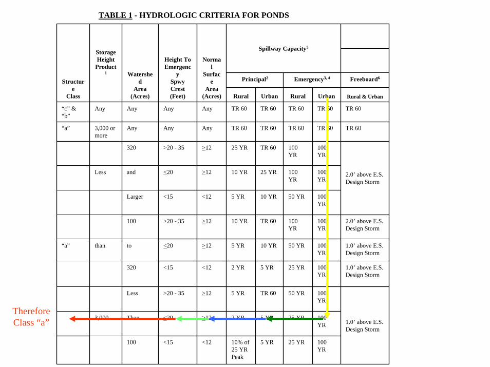
TABLE 1 - HYDROLOGIC CRITERIA FOR PONDS
Spillway Capacity5
Principal2 Emergency3, 4 Freeboard6
Rural Urban Rural Urban Rural & Urban
“c” & “b”
Any Any Any Any TR 60 TR 60 TR 60 TR 60 TR 60
“a” 3,000 ormore
Any Any Any TR 60 TR 60 TR 60 TR 60 TR 60
320 >20 - 35 >12 25 YR TR 60 100 YR
100 YR
Less and <20 >12 10 YR 25 YR 100 YR
100 YR
Larger <15 <12 5 YR 10 YR 50 YR 100 YR
100 >20 - 35 >12 10 YR TR 60 100 YR
100 YR
2.0’ above E.S.Design Storm
“a” than to <20 >12 5 YR 10 YR 50 YR 100 YR
1.0’ above E.S.Design Storm
320 <15 <12 2 YR 5 YR 25 YR 100 YR
1.0’ above E.S.Design Storm
Less >20 - 35 >12 5 YR TR 60 50 YR 100 YR
3,000 Than <20 >12 2 YR 5 YR 25 YR 100 YR
100 <15 <12 10% of 25 YR Peak
5 YR 25 YR 100 YR
1.0’ above E.S.Design Storm
Structure
Class
StorageHeight
Product1 Watershe
dArea
(Acres)
Height ToEmergenc
ySpwy Crest(Feet)
Normal
Surface
Area(Acres)
2.0’ above E.S.Design Storm
ThereforeClass “a”
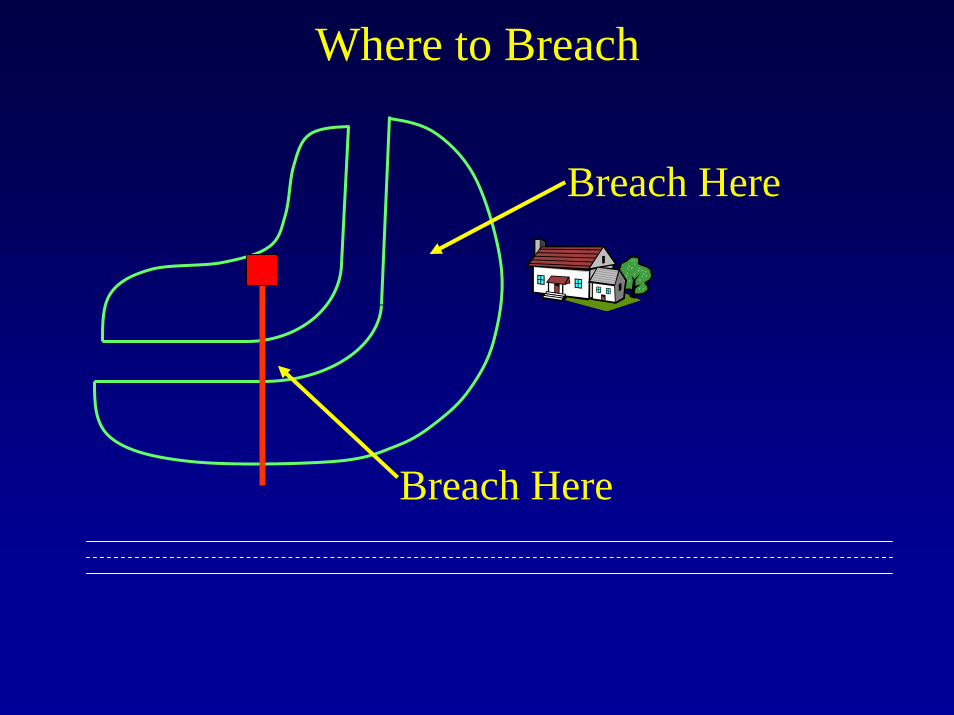
Where to Breach
Breach Here
Breach Here
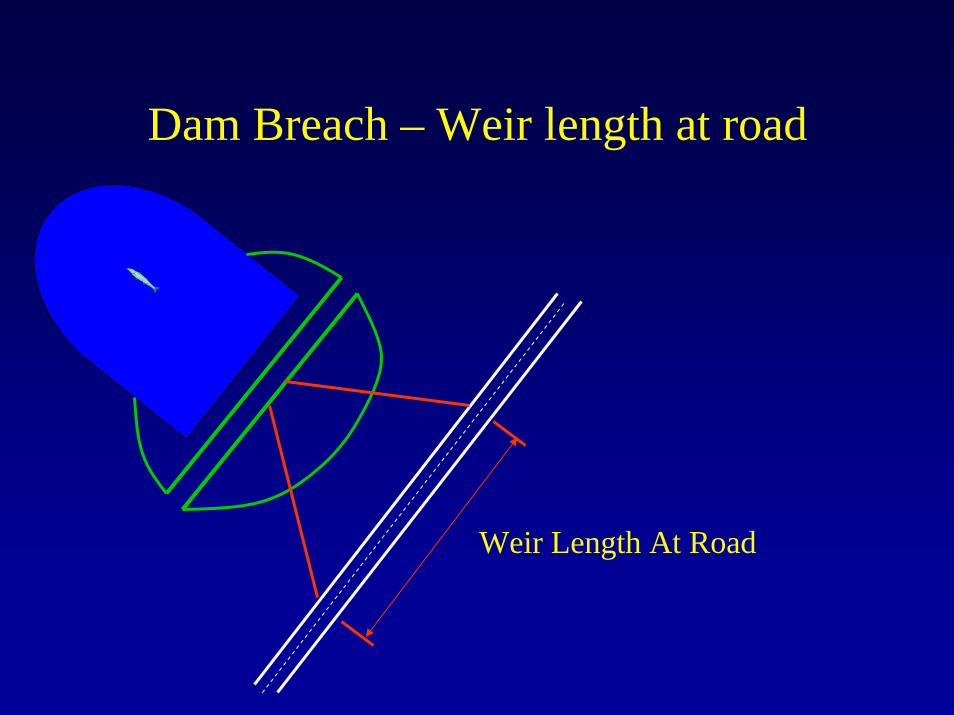
Dam Breach – Weir length at road
Weir Length At Road
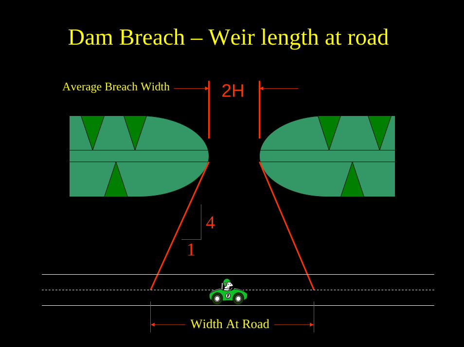
Dam Breach – Weir length at road
2HAverage Breach Width
41
Width At Road
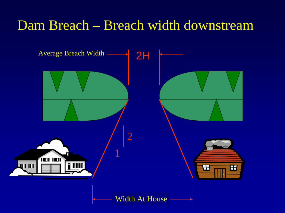
Dam Breach – Breach width downstream
2HAverage Breach Width
21
Width At House
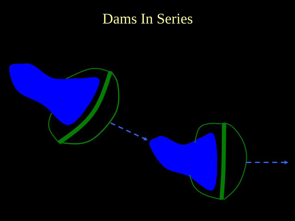
Dams In Series
Dams in Series - Considerations
• Effects of the proposed breach, from the upstream pond, on the downstream pond.
• Potential breach of downstream pond.• Effects of breach of from both ponds.
Potential for Downstream Development
• Zoning• Land use Plans• Pathway for breach