coutour & topography
TRANSCRIPT
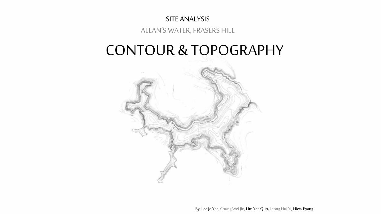
CONTOUR & TOPOGRAPHY
SITE ANALYSISALLAN’S WATER, FRASERS HILL
By: Lee Jo Yee, Chung Wei Jin, Lim Yee Qun, Leong Hui Yi, Hiew Eyang
By: Lee Jo Yee, Chung Wei Jin, Lim Yee Qun, Leong Hui Yi, Hiew Eyang
IntroductionContour & Topography
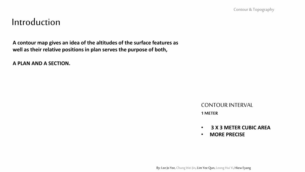
CONTOUR INTERVAL 1 METER
• 3 X 3 METER CUBIC AREA• MORE PRECISE
A contour map gives an idea of the altitudes of the surface features as well as their relative positions in plan serves the purpose of both,
A PLAN AND A SECTION.
By: Lee Jo Yee, Chung Wei Jin, Lim Yee Qun, Leong Hui Yi, Hiew Eyang
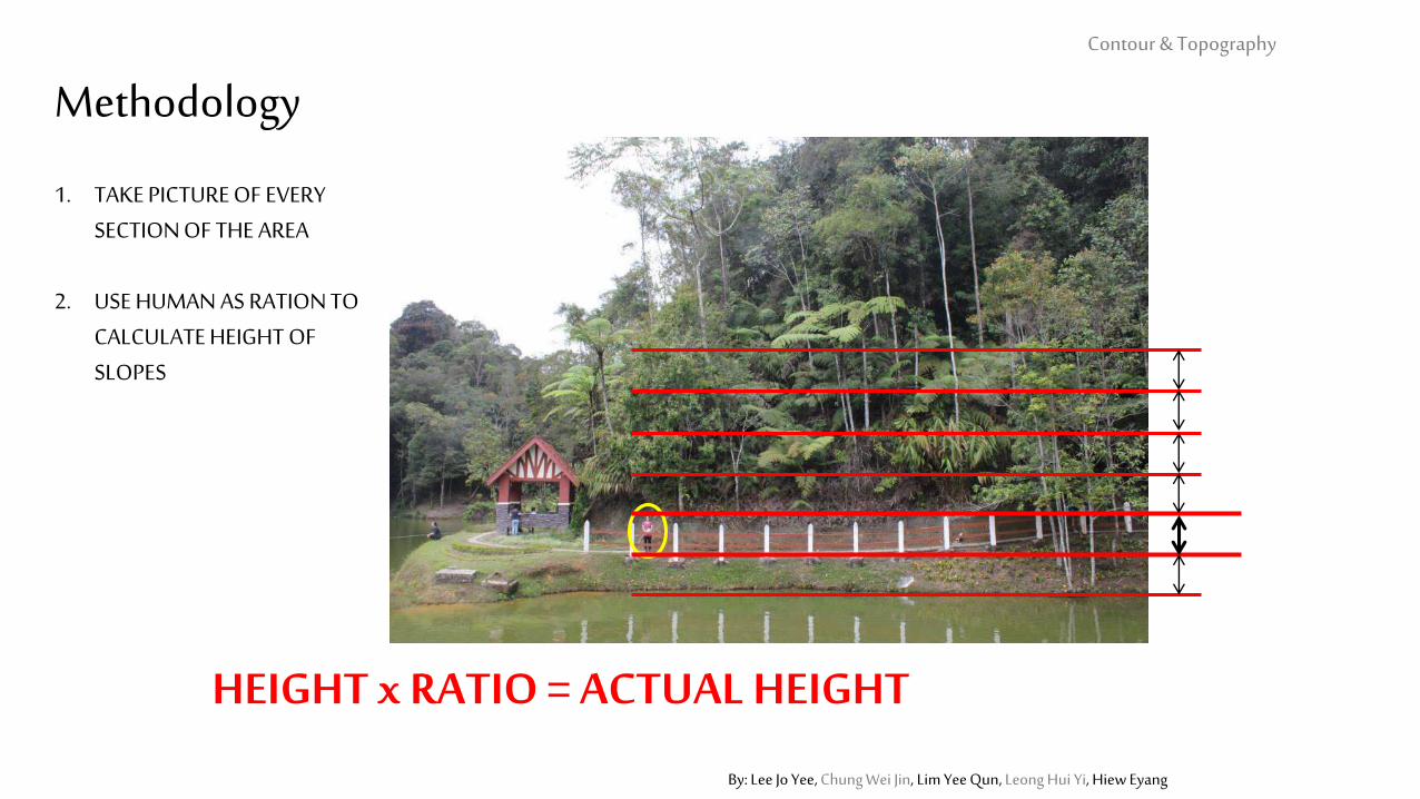
Methodology
1. TAKE PICTURE OF EVERY SECTION OF THE AREA
2. USE HUMAN AS RATION TO CALCULATE HEIGHT OF SLOPES
HEIGHT x RATIO = ACTUAL HEIGHT
Contour & Topography
By: Lee Jo Yee, Chung Wei Jin, Lim Yee Qun, Leong Hui Yi, Hiew Eyang
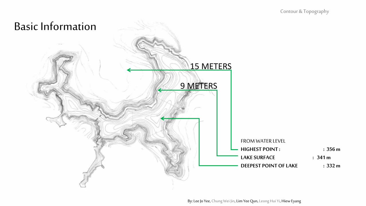
FROM WATER LEVELHIGHEST POINT : : 356 mLAKE SURFACE : 341 mDEEPEST POINT OF LAKE : 332 m
Basic InformationContour & Topography
9 METERS
15 METERS
By: Lee Jo Yee, Chung Wei Jin, Lim Yee Qun, Leong Hui Yi, Hiew Eyang
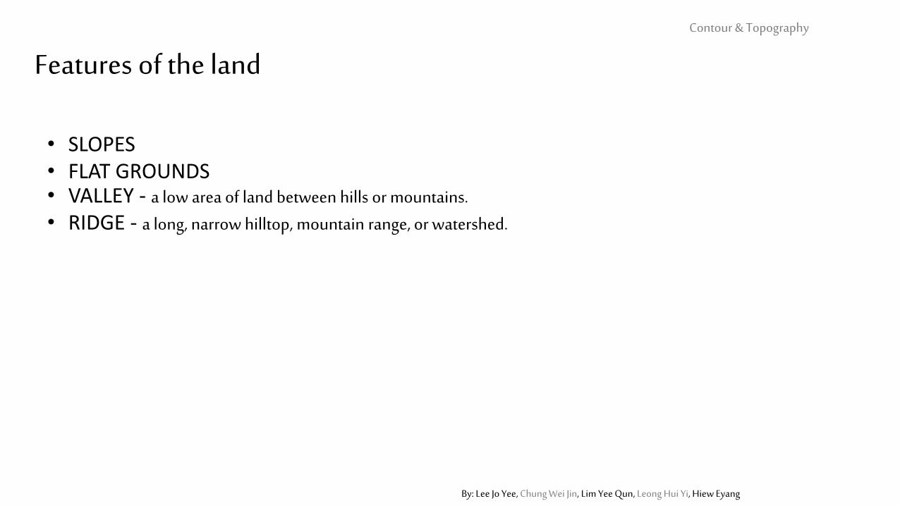
Features of the landContour & Topography
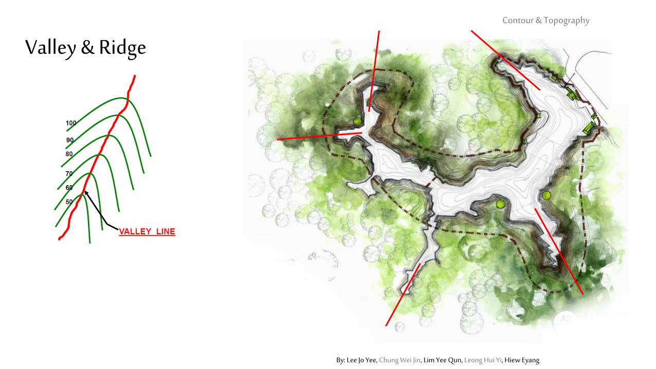
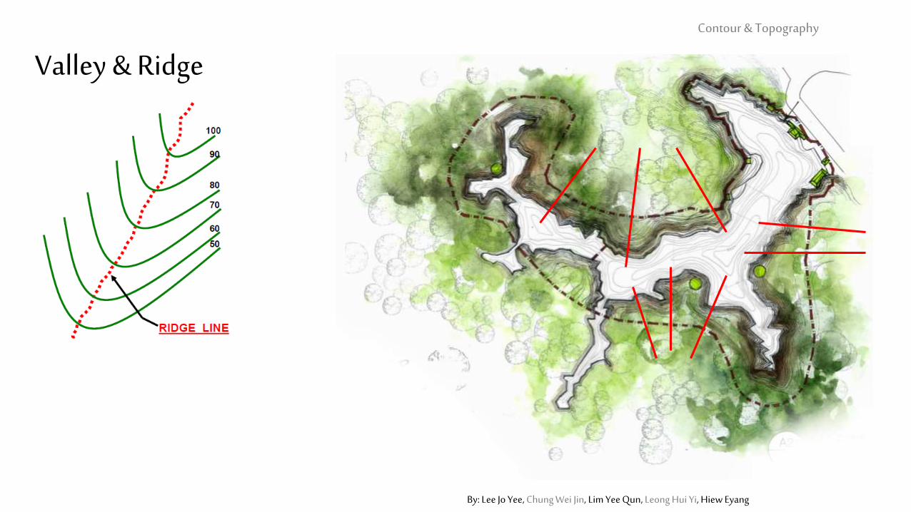
• SLOPES• FLAT GROUNDS• VALLEY - a low area of land between hills or mountains.• RIDGE - a long, narrow hilltop, mountain range, or watershed.
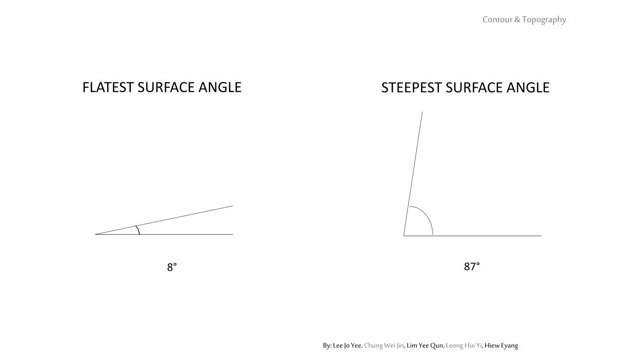
STEEPEST SURFACE ANGLEFLATEST SURFACE ANGLE
87°8°
Contour & Topography
By: Lee Jo Yee, Chung Wei Jin, Lim Yee Qun, Leong Hui Yi, Hiew Eyang
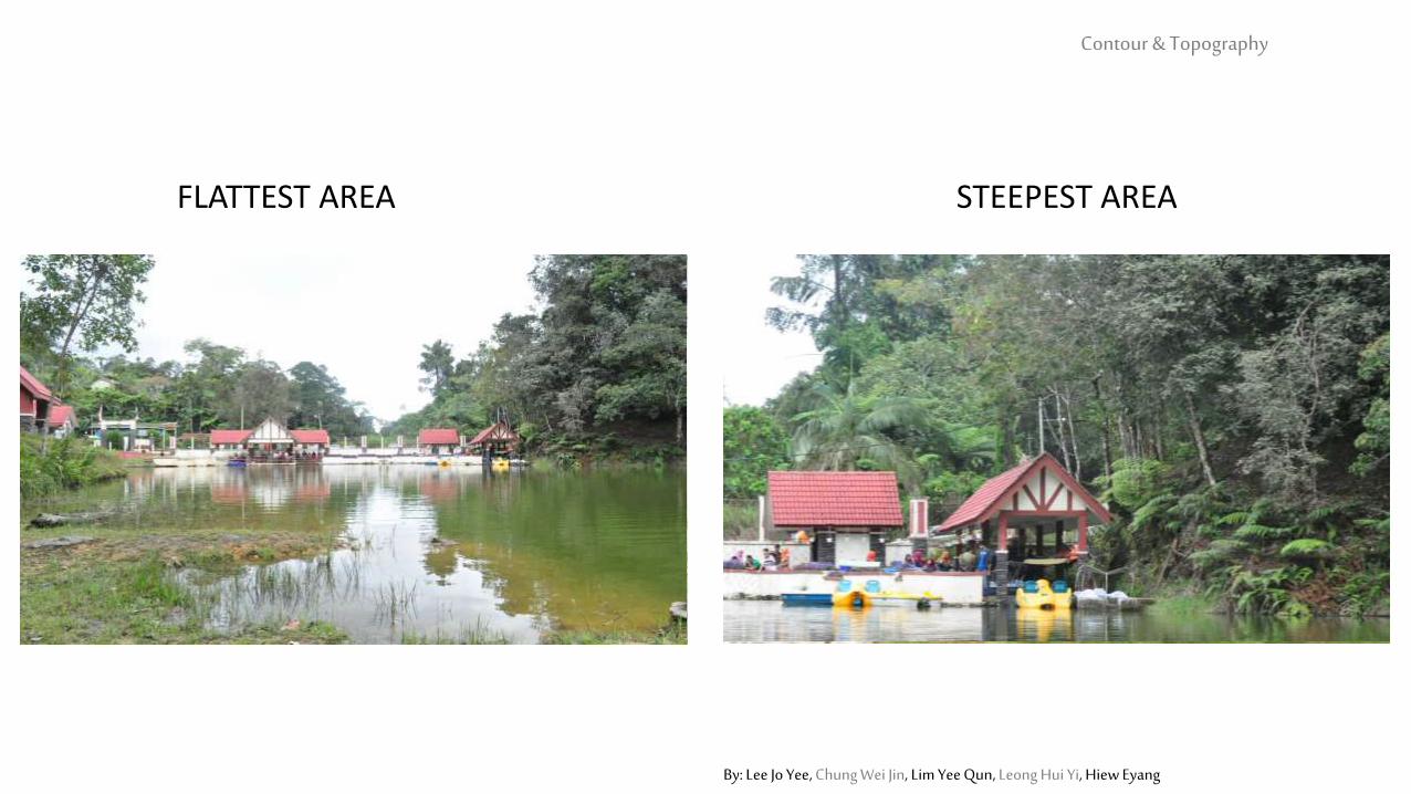
STEEPEST AREAFLATTEST AREA
Contour & Topography
By: Lee Jo Yee, Chung Wei Jin, Lim Yee Qun, Leong Hui Yi, Hiew Eyang
STEEPEST AREAFLATTEST AREA
Contour & Topography
By: Lee Jo Yee, Chung Wei Jin, Lim Yee Qun, Leong Hui Yi, Hiew Eyang
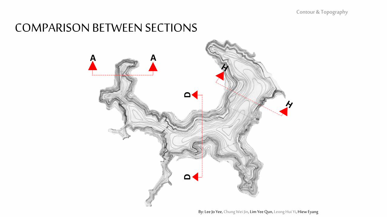
A A
DD
Contour & Topography
By: Lee Jo Yee, Chung Wei Jin, Lim Yee Qun, Leong Hui Yi, Hiew Eyang
COMPARISON BETWEEN SECTIONS
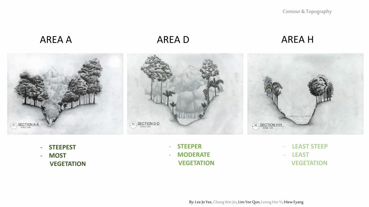
AREA A AREA D AREA H
- LEAST STEEP- LEAST
VEGETATION
- STEEPER- MODERATE
VEGETATION
- STEEPEST- MOST
VEGETATION
Contour & Topography
By: Lee Jo Yee, Chung Wei Jin, Lim Yee Qun, Leong Hui Yi, Hiew Eyang
By: Lee Jo Yee, Chung Wei Jin, Lim Yee Qun, Leong Hui Yi, Hiew Eyang
Valley & Ridge Contour & Topography
By: Lee Jo Yee, Chung Wei Jin, Lim Yee Qun, Leong Hui Yi, Hiew Eyang
Valley & Ridge Contour & Topography
By: Lee Jo Yee, Chung Wei Jin, Lim Yee Qun, Leong Hui Yi, Hiew Eyang
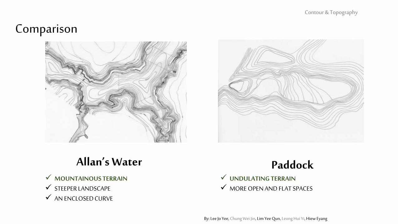
Comparison
Allan’s Water Paddock MOUNTAINOUS TERRAIN STEEPER LANDSCAPE AN ENCLOSED CURVE
UNDULATING TERRAIN MORE OPEN AND FLAT SPACES
Contour & Topography
By: Lee Jo Yee, Chung Wei Jin, Lim Yee Qun, Leong Hui Yi, Hiew Eyang
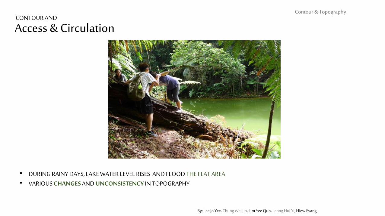
Access & Circulation
• DURING RAINY DAYS, LAKE WATER LEVEL RISES AND FLOOD THE FLAT AREA• VARIOUS CHANGES AND UNCONSISTENCY IN TOPOGRAPHY
Contour & Topography CONTOUR AND
By: Lee Jo Yee, Chung Wei Jin, Lim Yee Qun, Leong Hui Yi, Hiew Eyang
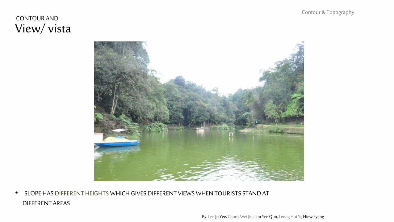
View/ vista
• SLOPE HAS DIFFERENT HEIGHTS WHICH GIVES DIFFERENT VIEWS WHEN TOURISTS STAND AT DIFFERENT AREAS
Contour & Topography CONTOUR AND
By: Lee Jo Yee, Chung Wei Jin, Lim Yee Qun, Leong Hui Yi, Hiew Eyang
CONTOUR & TOPOGRRAPHY
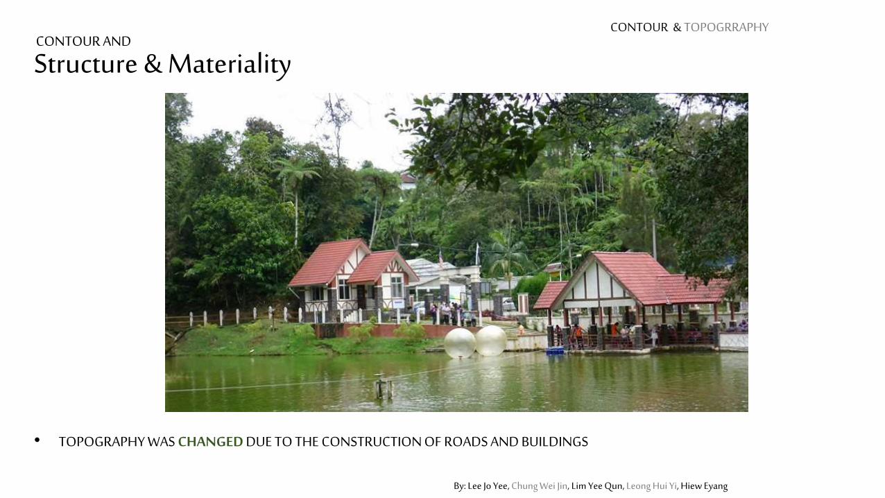
Structure & Materiality
• TOPOGRAPHY WAS CHANGED DUE TO THE CONSTRUCTION OF ROADS AND BUILDINGS
CONTOUR AND
By: Lee Jo Yee, Chung Wei Jin, Lim Yee Qun, Leong Hui Yi, Hiew Eyang
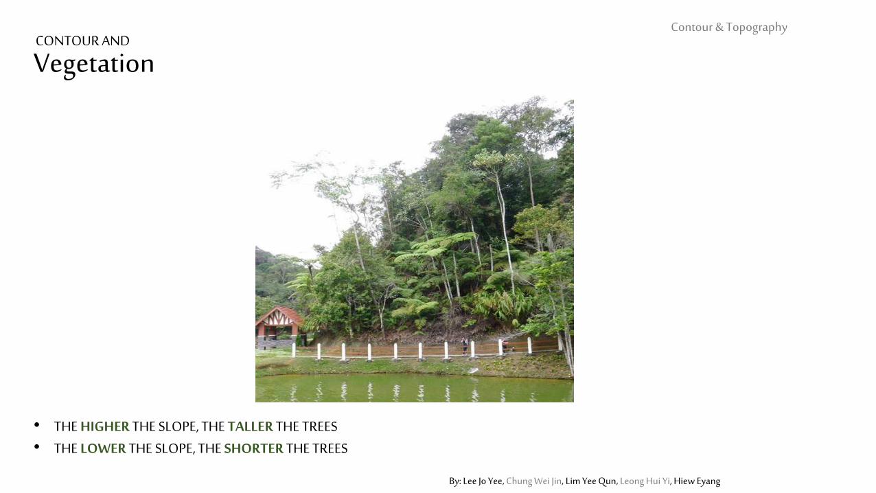
Vegetation
• THE HIGHER THE SLOPE, THE TALLER THE TREES• THE LOWER THE SLOPE, THE SHORTER THE TREES
Contour & Topography CONTOUR AND
Contour & Topography
By: Jolene Hor, Te Li Theng, Koay Hui May, Choong Lai Mun, Ooi Zhi-Qian
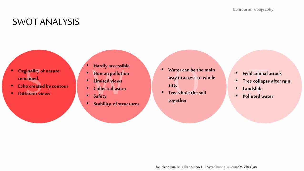
SWOT ANALYSIS
• Orginality of nature remained.
• Echo created by contour• Different views
• Hardly accessible • Human pollution• Limited views• Collected water• Safety• Stability of structures
• Water can be the main way to access to whole site.
• Trees hole the soil together
• Wild animal attack• Tree collapse after rain• Landslide• Polluted water
Contour & Topography
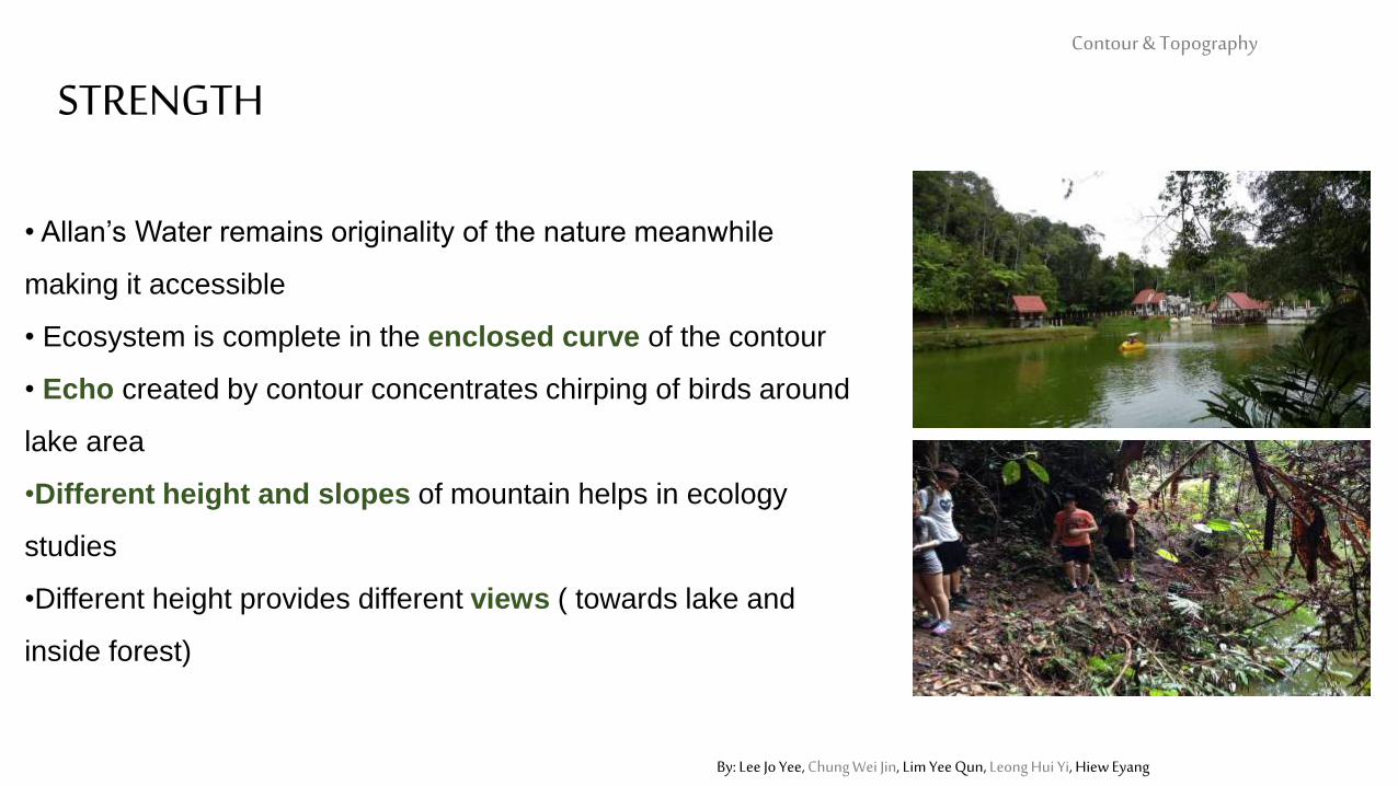
STRENGTH
By: Lee Jo Yee, Chung Wei Jin, Lim Yee Qun, Leong Hui Yi, Hiew Eyang
• Allan’s Water remains originality of the nature meanwhile
making it accessible
• Ecosystem is complete in the enclosed curve of the contour
• Echo created by contour concentrates chirping of birds around
lake area
•Different height and slopes of mountain helps in ecology
studies
•Different height provides different views ( towards lake and
inside forest)
Contour & Topography
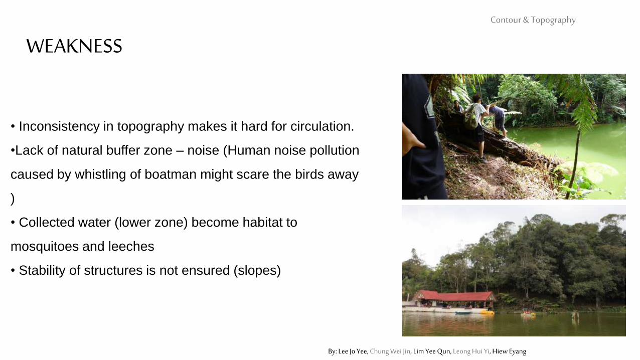
WEAKNESS
By: Lee Jo Yee, Chung Wei Jin, Lim Yee Qun, Leong Hui Yi, Hiew Eyang
• Inconsistency in topography makes it hard for circulation.
•Lack of natural buffer zone – noise (Human noise pollution
caused by whistling of boatman might scare the birds away
)
• Collected water (lower zone) become habitat to
mosquitoes and leeches
• Stability of structures is not ensured (slopes)
OPPORTUNITYContour & Topography
By: Lee Jo Yee, Chung Wei Jin, Lim Yee Qun, Leong Hui Yi, Hiew Eyang
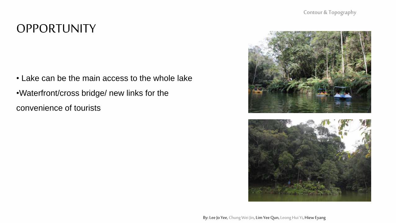
• Lake can be the main access to the whole lake
•Waterfront/cross bridge/ new links for the
convenience of tourists
Contour & Topography
THREAT
By: Lee Jo Yee, Chung Wei Jin, Lim Yee Qun, Leong Hui Yi, Hiew Eyang
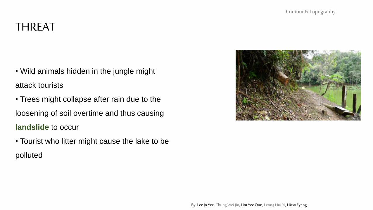
• Wild animals hidden in the jungle might
attack tourists
• Trees might collapse after rain due to the
loosening of soil overtime and thus causing
landslide to occur
• Tourist who litter might cause the lake to be
polluted