conservation society of pohnpei - equator initiative · undp equator initiative case study series...
TRANSCRIPT
Equator Initiative Case StudiesLocal sustainable development solutions for people, nature, and resilient communities
Federated States of Micronesia
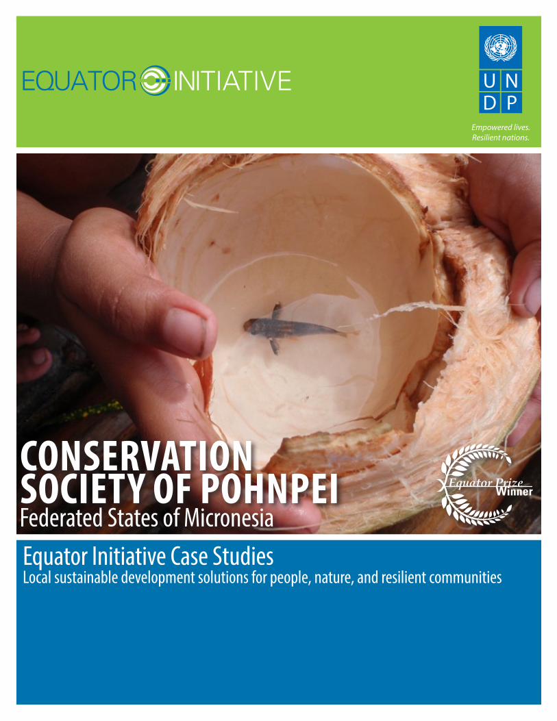
CONSERVATION SOCIETY OF POHNPEI
Empowered lives. Resilient nations.
UNDP EQUATOR INITIATIVE CASE STUDY SERIESLocal and indigenous communities across the world are advancing innovative sustainable development solutions that work for people and for nature. Few publications or case studies tell the full story of how such initiatives evolve, the breadth of their impacts, or how they change over time. Fewer still have undertaken to tell these stories with community practitioners themselves guiding the narrative.
To mark its 10-year anniversary, the Equator Initiative aims to fill this gap. The following case study is one in a growing series that details the work of Equator Prize winners – vetted and peer-reviewed best practices in community-based environmental conservation and sustainable livelihoods. These cases are intended to inspire the policy dialogue needed to take local success to scale, to improve the global knowledge base on local environment and development solutions, and to serve as models for replication. Case studies are best viewed and understood with reference to ‘The Power of Local Action: Lessons from 10 Years of the Equator Prize’, a compendium of lessons learned and policy guidance that draws from the case material.
Click on the map to visit the Equator Initiative’s searchable case study database.
EditorsEditor-in-Chief: Joseph CorcoranManaging Editor: Oliver HughesContributing Editors: Dearbhla Keegan, Matthew Konsa, Erin Lewis, Whitney Wilding
Contributing WritersEdayatu Abieodun Lamptey, Erin Atwell, Toni Blackman, Jonathan Clay, Joseph Corcoran, Larissa Currado, Sarah Gordon, Oliver Hughes, Wen-Juan Jiang, Sonal Kanabar, Dearbhla Keegan, Matthew Konsa, Rachael Lader, Patrick Lee, Erin Lewis, Jona Liebl, Mengning Ma, Mary McGraw, Gabriele Orlandi, Brandon Payne, Juliana Quaresma, Peter Schecter, Martin Sommerschuh, Whitney Wilding, Luna Wu
DesignOliver Hughes, Dearbhla Keegan, Matthew Konsa, Amy Korngiebel, Kimberly Koserowski, Erin Lewis, John Mulqueen, Lorena de la Parra, Brandon Payne, Mariajosé Satizábal G.
AcknowledgementsThe Equator Initiative acknowledges with gratitude the Conservation Society of Pohnpei, and in particular the guidance and inputs of Patterson Shed and Eugene Joseph. All photo credits courtesy of Conservation Society of Pohnpei. Maps courtesy of CIA World Factbook and Wikipedia.
Suggested CitationUnited Nations Development Programme. 2012. Conservation Society of Pohnpei, Federated States of Micronesia. Equator Initiative Case Study Series. New York, NY.
PROJECT SUMMARYSince 1998, the Conservation Society of Pohnpei has worked to improve the ecological and social sustainability of a network of seven marine protected areas around the island of Pohnpei in the Federated States of Micronesia. Through environmental education and biological monitoring programmes, the initiative has coordinated marine conservation efforts across Pohnpei, while encouraging a diverse suite of alternative livelihood activities for local communities to reduce human pressures on scarce marine resources. In recent years, the organization has supported MPA sites to introduce innovative monitoring and enforcement systems that combine modern and traditional approaches.
The organization also operates an environmental education program which reaches more than 8,000 students in 27 schools across the island, has engaged in conservation of important terrestrial forests and watersheds, and has partnered in initiatives to eradicate invasive species.
KEY FACTSEQUATOR PRIZE WINNER: 2008
FOUNDED: 1998
LOCATION: Pohnpei island
BENEFICIARIES: Pohnpei Island communities
BIODIVERSITY: 11 Marine Protected Areas
3
CONSERVATION SOCIETY OF POHNPEI Federated States of Micronesia
TABLE OF CONTENTS
Background and Context 4
Key Activities and Innovations 6
Biodiversity Impacts 8
Socioeconomic Impacts 11
Policy Impacts 12
Sustainability 13
Replication 14
Partners 14
4
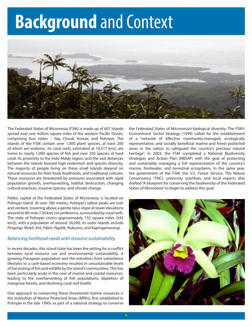
The Federated States of Micronesia (FSM) is made up of 607 islands spread over one million square miles of the western Pacific Ocean, comprising four states – Yap, Chuuk, Kosrae, and Pohnpei. The islands of the FSM contain over 1,000 plant species, at least 200 of which are endemic. Its coral reefs, estimated at 14,517 km2, are home to nearly 1,000 species of fish and over 350 species of hard coral. Its proximity to the Indo-Malay region, and the vast distances between the islands favored high endemism and species diversity. The majority of people living on these small islands depend on natural resources for their food, livelihoods, and traditional cultures. These resources are threatened by pressures associated with rapid population growth, overharvesting, habitat destruction, changing cultural practices, invasive species, and climate change.
Palikir, capital of the Federated States of Micronesia, is located on Pohnpei Island. At over 780 metres, Pohnpei’s tallest peaks are lush and verdant, towering above a gentle talus slope at lower elevations around its 80-mile (130 km) circumference, surrounded by coral reefs. The state of Pohnpei covers approximately 133 square miles (345 km2), with a population of around 34,000; its outer islands include Pingelap, Mokil, Ant, Pakin, Ngatik, Nukuoro, and Kapingamarangi.
Balancing livelihood needs with resource sustainability
In recent decades, this island state has been the setting for a conflict between local resource use and environmental sustainability. A growing Ponapean population and the transition from subsistence lifestyles to a cash-based economy resulted in unsustainable levels of harvesting of fish and wildlife by the island’s communities. This has been particularly acute in the case of marine and coastal resources, leading to the overharvesting of fish populations, depletion of mangrove forests, and declining coral reef health.
One approach to conserving these threatened marine resources is the institution of Marine Protected Areas (MPAs), first established in Pohnpei in the late 1990s as part of a national strategy to conserve
the Federated States of Micronesia’s biological diversity. The FSM’s Environment Sector Strategy (1999) called for the establishment of a “network of effective community-managed, ecologically representative, and socially beneficial marine and forest protected areas in the nation to safeguard the country’s precious natural heritage”. In 2003, the FSM completed a National Biodiversity Strategies and Action Plan (NBSAP) with the goal of protecting and sustainably managing a full representation of the country’s marine, freshwater, and terrestrial ecosystems. In the same year, the government of the FSM, the U.S. Forest Service, The Nature Conservancy (TNC), university scientists, and local experts also drafted “A blueprint for conserving the biodiversity of the Federated States of Micronesia” to begin to address this goal.
Background and Context
55
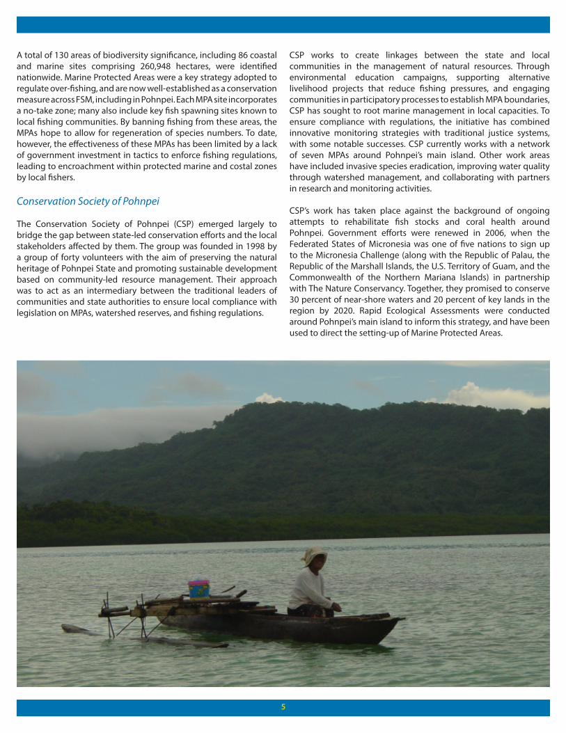
A total of 130 areas of biodiversity significance, including 86 coastal and marine sites comprising 260,948 hectares, were identified nationwide. Marine Protected Areas were a key strategy adopted to regulate over-fishing, and are now well-established as a conservation measure across FSM, including in Pohnpei. Each MPA site incorporates a no-take zone; many also include key fish spawning sites known to local fishing communities. By banning fishing from these areas, the MPAs hope to allow for regeneration of species numbers. To date, however, the effectiveness of these MPAs has been limited by a lack of government investment in tactics to enforce fishing regulations, leading to encroachment within protected marine and costal zones by local fishers.
Conservation Society of Pohnpei
The Conservation Society of Pohnpei (CSP) emerged largely to bridge the gap between state-led conservation efforts and the local stakeholders affected by them. The group was founded in 1998 by a group of forty volunteers with the aim of preserving the natural heritage of Pohnpei State and promoting sustainable development based on community-led resource management. Their approach was to act as an intermediary between the traditional leaders of communities and state authorities to ensure local compliance with legislation on MPAs, watershed reserves, and fishing regulations.
CSP works to create linkages between the state and local communities in the management of natural resources. Through environmental education campaigns, supporting alternative livelihood projects that reduce fishing pressures, and engaging communities in participatory processes to establish MPA boundaries, CSP has sought to root marine management in local capacities. To ensure compliance with regulations, the initiative has combined innovative monitoring strategies with traditional justice systems, with some notable successes. CSP currently works with a network of seven MPAs around Pohnpei’s main island. Other work areas have included invasive species eradication, improving water quality through watershed management, and collaborating with partners in research and monitoring activities.
CSP’s work has taken place against the background of ongoing attempts to rehabilitate fish stocks and coral health around Pohnpei. Government efforts were renewed in 2006, when the Federated States of Micronesia was one of five nations to sign up to the Micronesia Challenge (along with the Republic of Palau, the Republic of the Marshall Islands, the U.S. Territory of Guam, and the Commonwealth of the Northern Mariana Islands) in partnership with The Nature Conservancy. Together, they promised to conserve 30 percent of near-shore waters and 20 percent of key lands in the region by 2020. Rapid Ecological Assessments were conducted around Pohnpei’s main island to inform this strategy, and have been used to direct the setting-up of Marine Protected Areas.
6
Key Activities and Innovations
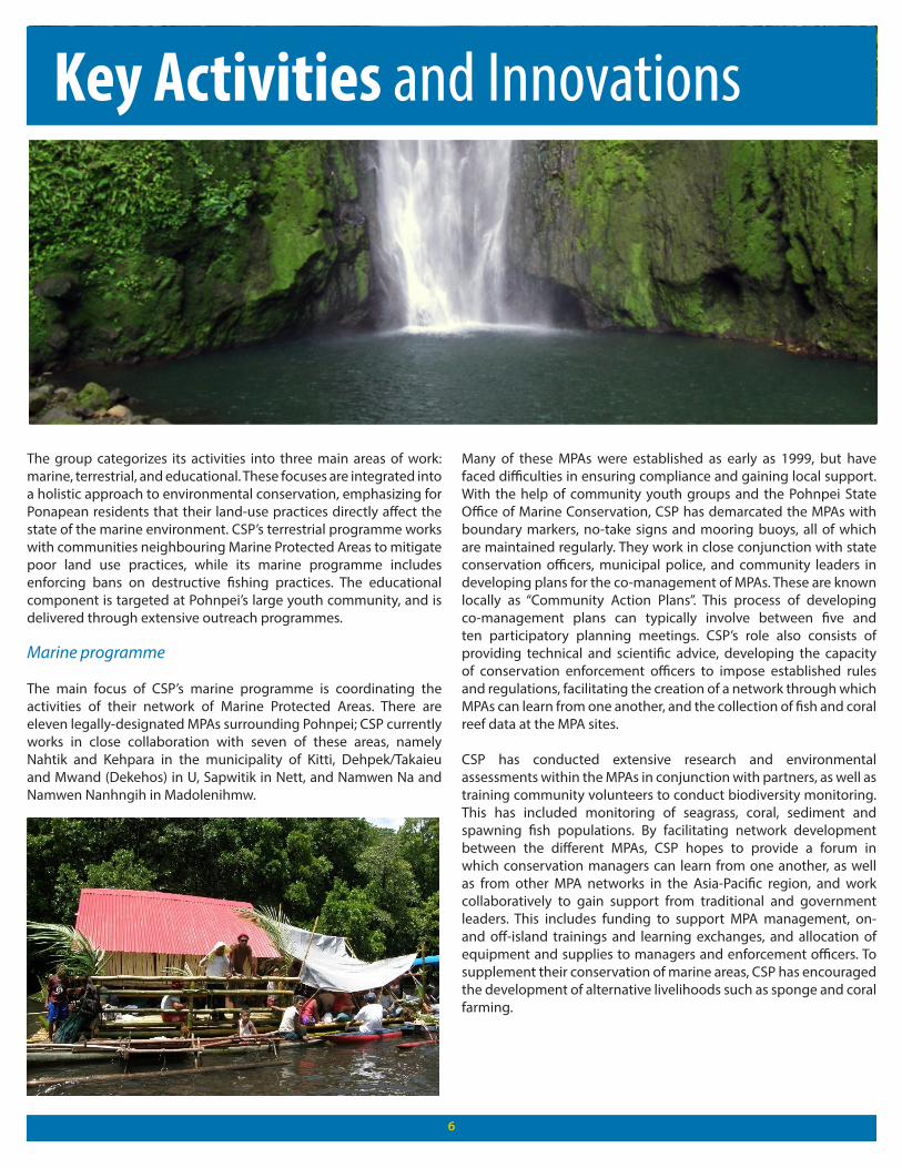
The group categorizes its activities into three main areas of work: marine, terrestrial, and educational. These focuses are integrated into a holistic approach to environmental conservation, emphasizing for Ponapean residents that their land-use practices directly affect the state of the marine environment. CSP’s terrestrial programme works with communities neighbouring Marine Protected Areas to mitigate poor land use practices, while its marine programme includes enforcing bans on destructive fishing practices. The educational component is targeted at Pohnpei’s large youth community, and is delivered through extensive outreach programmes.
Marine programme
The main focus of CSP’s marine programme is coordinating the activities of their network of Marine Protected Areas. There are eleven legally-designated MPAs surrounding Pohnpei; CSP currently works in close collaboration with seven of these areas, namely Nahtik and Kehpara in the municipality of Kitti, Dehpek/Takaieu and Mwand (Dekehos) in U, Sapwitik in Nett, and Namwen Na and Namwen Nanhngih in Madolenihmw.
Many of these MPAs were established as early as 1999, but have faced difficulties in ensuring compliance and gaining local support. With the help of community youth groups and the Pohnpei State Office of Marine Conservation, CSP has demarcated the MPAs with boundary markers, no-take signs and mooring buoys, all of which are maintained regularly. They work in close conjunction with state conservation officers, municipal police, and community leaders in developing plans for the co-management of MPAs. These are known locally as “Community Action Plans”. This process of developing co-management plans can typically involve between five and ten participatory planning meetings. CSP’s role also consists of providing technical and scientific advice, developing the capacity of conservation enforcement officers to impose established rules and regulations, facilitating the creation of a network through which MPAs can learn from one another, and the collection of fish and coral reef data at the MPA sites.
CSP has conducted extensive research and environmental assessments within the MPAs in conjunction with partners, as well as training community volunteers to conduct biodiversity monitoring. This has included monitoring of seagrass, coral, sediment and spawning fish populations. By facilitating network development between the different MPAs, CSP hopes to provide a forum in which conservation managers can learn from one another, as well as from other MPA networks in the Asia-Pacific region, and work collaboratively to gain support from traditional and government leaders. This includes funding to support MPA management, on- and off-island trainings and learning exchanges, and allocation of equipment and supplies to managers and enforcement officers. To supplement their conservation of marine areas, CSP has encouraged the development of alternative livelihoods such as sponge and coral farming.
7
As well as maintaining this MPA network, CSP has advocated for the creation of new protected areas, with notable success in the case of Ant Atoll, a neighbouring privately-owned island. New legislation established the Ant Atoll Biosphere Reserve in 2010. The momentum for community-based marine management has also led to three MPAs being created on Pakin Atoll, another local island.
Terrestrial programme
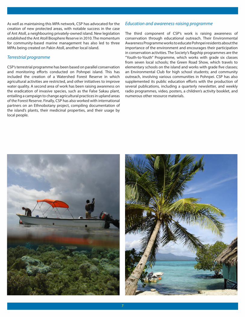
CSP’s terrestrial programme has been based on parallel conservation and monitoring efforts conducted on Pohnpei island. This has included the creation of a Watershed Forest Reserve in which agricultural activities are restricted, and other initiatives to improve water quality. A second area of work has been raising awareness on the eradication of invasive species, such as the False Sakau plant, entailing a campaign to change agricultural practices in upland areas of the Forest Reserve. Finally, CSP has also worked with international partners on an Ethnobotany project, compiling documentation of the island’s plants, their medicinal properties, and their usage by local people.
Education and awareness-raising programme
The third component of CSP’s work is raising awareness of conservation through educational outreach. Their Environmental Awareness Programme works to educate Pohnpei residents about the importance of the environment and encourages their participation in conservation activities. The Society’s flagship programmes are the “Youth-to-Youth” Programme, which works with grade six classes from seven local schools; the Green Road Show, which travels to elementary schools on the island and works with grade five classes; an Environmental Club for high school students; and community outreach, involving various communities in Pohnpei. CSP has also supplemented its public education efforts with the production of several publications, including a quarterly newsletter, and weekly radio programmes, video, posters, a children’s activity booklet, and numerous other resource materials.
8
Impacts
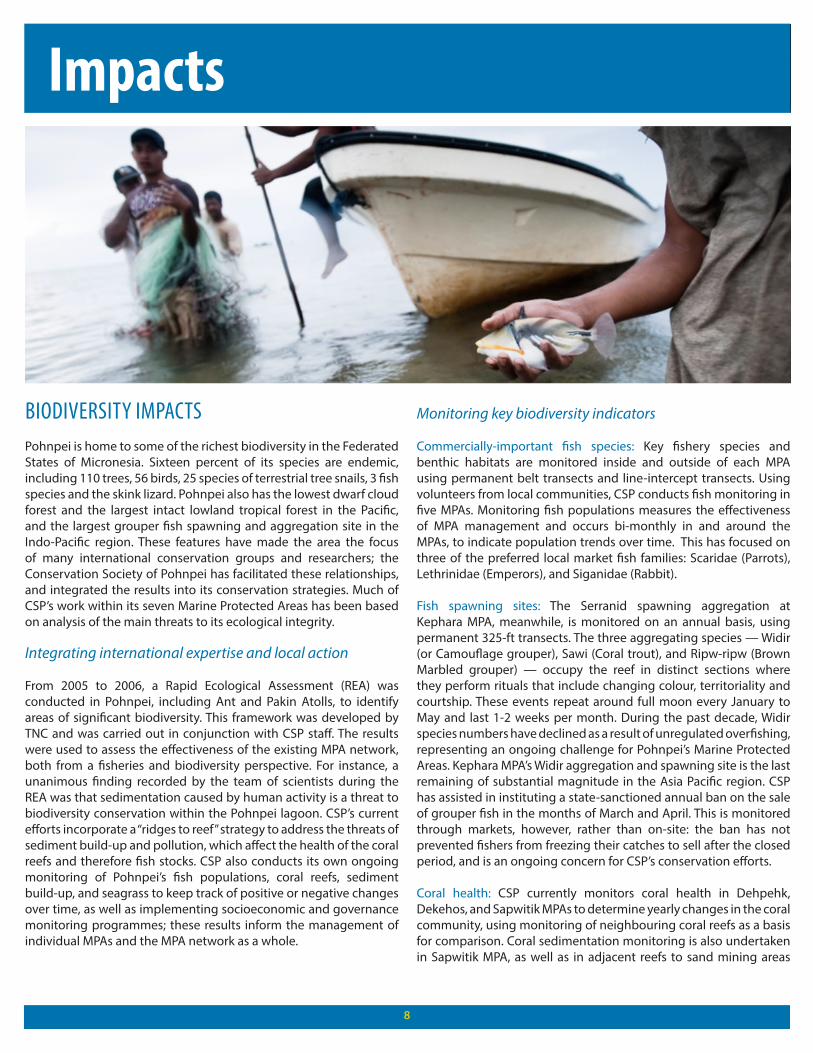
BIODIVERSITY IMPACTSPohnpei is home to some of the richest biodiversity in the Federated States of Micronesia. Sixteen percent of its species are endemic, including 110 trees, 56 birds, 25 species of terrestrial tree snails, 3 fish species and the skink lizard. Pohnpei also has the lowest dwarf cloud forest and the largest intact lowland tropical forest in the Pacific, and the largest grouper fish spawning and aggregation site in the Indo-Pacific region. These features have made the area the focus of many international conservation groups and researchers; the Conservation Society of Pohnpei has facilitated these relationships, and integrated the results into its conservation strategies. Much of CSP’s work within its seven Marine Protected Areas has been based on analysis of the main threats to its ecological integrity.
Integrating international expertise and local action
From 2005 to 2006, a Rapid Ecological Assessment (REA) was conducted in Pohnpei, including Ant and Pakin Atolls, to identify areas of significant biodiversity. This framework was developed by TNC and was carried out in conjunction with CSP staff. The results were used to assess the effectiveness of the existing MPA network, both from a fisheries and biodiversity perspective. For instance, a unanimous finding recorded by the team of scientists during the REA was that sedimentation caused by human activity is a threat to biodiversity conservation within the Pohnpei lagoon. CSP’s current efforts incorporate a “ridges to reef” strategy to address the threats of sediment build-up and pollution, which affect the health of the coral reefs and therefore fish stocks. CSP also conducts its own ongoing monitoring of Pohnpei’s fish populations, coral reefs, sediment build-up, and seagrass to keep track of positive or negative changes over time, as well as implementing socioeconomic and governance monitoring programmes; these results inform the management of individual MPAs and the MPA network as a whole.
Monitoring key biodiversity indicators
Commercially-important fish species: Key fishery species and benthic habitats are monitored inside and outside of each MPA using permanent belt transects and line-intercept transects. Using volunteers from local communities, CSP conducts fish monitoring in five MPAs. Monitoring fish populations measures the effectiveness of MPA management and occurs bi-monthly in and around the MPAs, to indicate population trends over time. This has focused on three of the preferred local market fish families: Scaridae (Parrots), Lethrinidae (Emperors), and Siganidae (Rabbit).
Fish spawning sites: The Serranid spawning aggregation at Kephara MPA, meanwhile, is monitored on an annual basis, using permanent 325-ft transects. The three aggregating species — Widir (or Camouflage grouper), Sawi (Coral trout), and Ripw-ripw (Brown Marbled grouper) — occupy the reef in distinct sections where they perform rituals that include changing colour, territoriality and courtship. These events repeat around full moon every January to May and last 1-2 weeks per month. During the past decade, Widir species numbers have declined as a result of unregulated overfishing, representing an ongoing challenge for Pohnpei’s Marine Protected Areas. Kephara MPA’s Widir aggregation and spawning site is the last remaining of substantial magnitude in the Asia Pacific region. CSP has assisted in instituting a state-sanctioned annual ban on the sale of grouper fish in the months of March and April. This is monitored through markets, however, rather than on-site: the ban has not prevented fishers from freezing their catches to sell after the closed period, and is an ongoing concern for CSP’s conservation efforts.
Coral health: CSP currently monitors coral health in Dehpehk, Dekehos, and Sapwitik MPAs to determine yearly changes in the coral community, using monitoring of neighbouring coral reefs as a basis for comparison. Coral sedimentation monitoring is also undertaken in Sapwitik MPA, as well as in adjacent reefs to sand mining areas
in order to measure water quality. All samples are collected, dried, and weights are recorded. The resulting data is plotted to determine sediment load throughout the year.
Seagrass: Seagrass monitoring has been carried out on Pohnpei since 2001 by researchers from the College of Micronesia. In 2007, CSP partnered with this team at two existing sampling sites, Ipwal-Sokehs and Rohi-Kitti, and included a new site at Sapwitik Island MPA. Results from this research contribute to SeagrassNet, an international monitoring programme that documents coastal habitats worldwide.
Ecological monitoring informing conservation practice
These ongoing monitoring processes help to inform the regulation of activities within the Marine Protected Areas. Methods for ensuring compliance with the protected areas’ regulations have included traditional ceremonies held in conjunction with community members, village leaders, NGO representatives, CSP staff, and municipal government representatives, in which trespassers ask village chiefs for forgiveness. Cultural norms around shame and punishment, dictated by a person’s rank within their village community hierarchy, are a potentially powerful tool to ensure compliance. This process of traditional justice has been promoted by CSP in Enipein community, part of the Nahtik Marine Protected Area.
CSP has also assisted Nahtik MPA in finding innovative ways to monitor compliance within their no-take zone. In 2007, with a grant of USD 20,650 from the UNDP-implemented GEF Small Grants Programme, local community conservation officers built a bamboo raft, complete with roof, cooking area and outhouse, from which to monitor illegal fishing within the MPA. This also allows monitoring during the night, when incursions would otherwise go undetected. The combination of re-introducing traditional justice systems and encouraging modern-day innovations has proved to be highly successful in the case of Nahtik MPA.
Combating environmental challenges on Pohnpei Island
Terrestrial resource management has supplemented CSP’s marine programme. The creation of a Watershed Forest Reserve to protect Pohnpei’s upland forest has been a major initiative undertaken by CSP, while recent work has focused on the Nanpil and Sehnpehn Watershed. The project studies the correlations between stream flow, sediment load and rainfall, using gauge measurement and monitoring studies. These activities provide solid information on the effects of land-clearing activities on the quality of the watershed and the sedimentation runoff levels to the coral reefs. CSP is also working with communities to establish community-based Mangrove Forest Reserves. This process has consisted of participatory workshops, zoning demarcation, and monitoring mechanisms. Another concern is the control of invasive species. CSP works with the Pohnpei Invasive Species Task Force to eradicate and raise awareness on alien species.
False Sakau: A primary threat to biodiversity in Pohnpei is the illegal growing of False Sakau (Piper Arithrium) in the Watershed Forest
Reserve. Sakau is used to produce a traditional beverage with a calming effect that has been widely consumed in Pohnpei and other South Pacific islands for centuries. Once restricted only to the aristocracy, this root drink has become widely popular in Pohnpei. Traditionally the crop was grown mainly in the lowlands, but demand has become so high that people are increasingly moving illegally into the uplands forest reserve and clearing trees to plant sakau, where it grows faster.
To discourage sakau farmers from encroaching on watershed reserve land, CSP has developed the “Grow Low” campaign. Farmers are taught new and more effective techniques for growing sakau in the lowlands, given sakau seedlings to start their new farms, and are also given vegetable seedlings and training in growing vegetables to supplement their income. To date, CSP has worked with over 3,000 sakau farmers. The incentives offered by the programme, in conjunction with a strong compliance system, proved to be effective in decreasing the number of new forest clearings from 2002 onwards. In 2007, with a USD 50,000 grant from the GEF Small Grants Programme, CSP implemented a two-year programme incorporating the distribution of vegetable seedlings to sakau farmers as a means of generating alternative income sources in a shorter period of time. It was envisaged that this project would bring sufficient income and better nutrition to sakau farmers, further reducing the number and size of forest clearings in the Watershed Forest Reserve. While the work has continued using funding from the European Union, the alternative livelihoods component has not taken hold. Sakau continues to be grown, largely as a result of its cultural importance for Ponapeans. It is used in traditional ceremonies throughout people’s life cycles, and has continued to expand from a preserve of the richer elite to a widely-shared practice. CSP’s work did have success in moving sakau growing out of the island’s important forest watersheds, however.
Monitoring forest watershed integrity: Since 2001, the Watershed Forest Reserve monitoring programme has focused on thirteen forest areas. These areas have been monitored for human incursions, and especially clearing forest areas for land plots to plant crops. Run-off from clearings in the forest reserve adds to sedimentation, damaging Pohnpei’s coral reefs. A few community members from each area are taught measuring and evaluating techniques, including the use of GPS technology, and are responsible for quarterly monitoring of forest activities in these areas along with CSP staff and municipal police. Recent monitoring results have shown that CSP’s terrestrial strategies are having a positive effect. Within the first year, there was a 50% decrease in forest clearing. The clearest results were in areas where the watershed boundary lines were already demarcated, such as U and Madolenihmw. This demonstrated that having clearly demarcated watershed boundary lines is an effective strategy to discourage intrusions. From a high of six hundred forest clearings in 2002, plots fell to twenty-eight in January 2004, while in April 2005 there was a single clearing recorded. In 2006, there were eight new forest clearings, followed by only five new clearings in 2007.
Terrestrial invasive species: Invasive species targeted by CSP for eradication include the Ivy Gourd (Coccinia grandis), Chain of Love (Antigonon leptopus), Mile-a-minute (mikania micrantha), and the
9
Brown Tree Snake (Boiga irregularis), an invasive species that has famously devastated native bird populations in Guam. Through participation in a high-level advisory group, the Regional Invasive Species Council (RISC), the Federated States of Micronesia and other Micronesian nations are drafting a bio-security plan to address the spread of invasive species in the region. Through awareness-raising about these threats, CSP can play a role in a locally-adapted plan as part of this regional strategy, which hopes to eradicate 100% of these species by the end of 2012. CSP has implemented its invasive species programmes with the support of the Critical Ecosystem Partnership Fund (CEPF). It has also helped to coordinate a three-year strategic action plan for the Invasive Species Taskforce of Pohnpei (iSTOP), a multi-agency group aimed at protecting the island from the threat of invasive species.
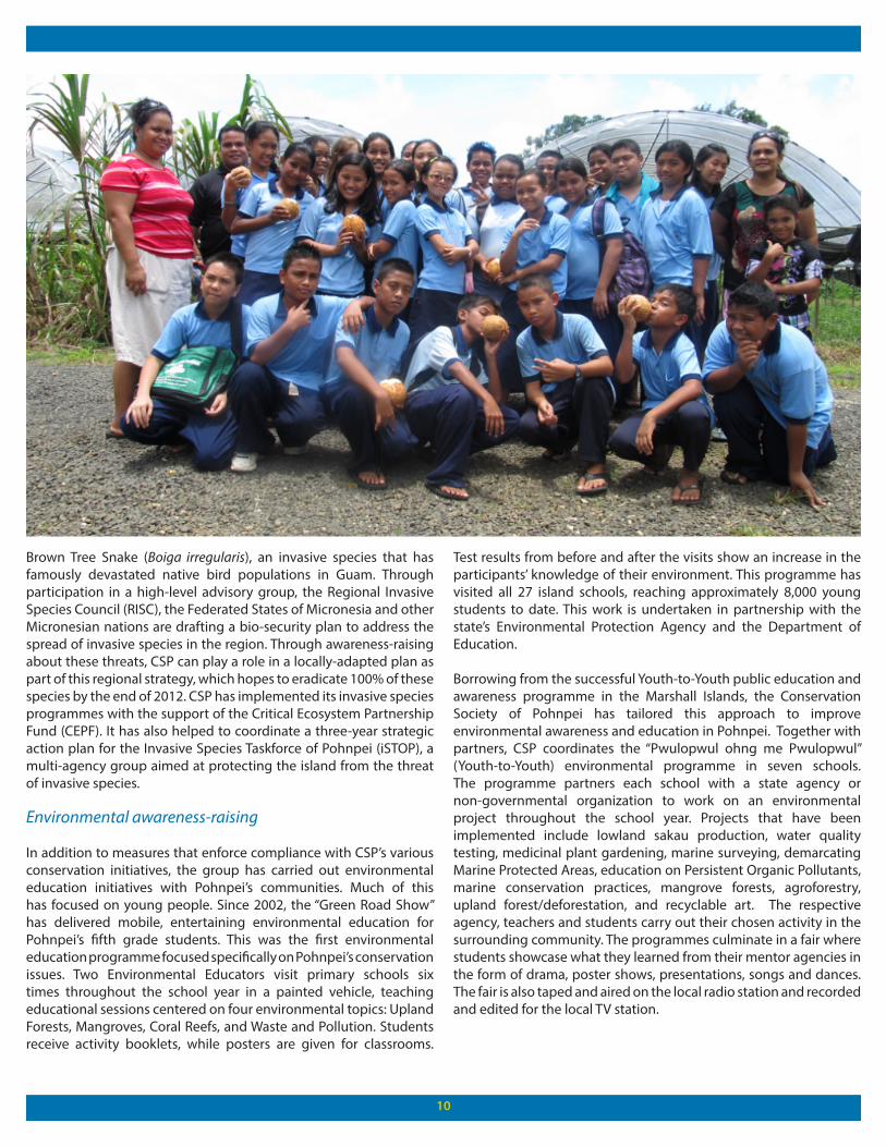
Environmental awareness-raising
In addition to measures that enforce compliance with CSP’s various conservation initiatives, the group has carried out environmental education initiatives with Pohnpei’s communities. Much of this has focused on young people. Since 2002, the “Green Road Show” has delivered mobile, entertaining environmental education for Pohnpei’s fifth grade students. This was the first environmental education programme focused specifically on Pohnpei’s conservation issues. Two Environmental Educators visit primary schools six times throughout the school year in a painted vehicle, teaching educational sessions centered on four environmental topics: Upland Forests, Mangroves, Coral Reefs, and Waste and Pollution. Students receive activity booklets, while posters are given for classrooms.
Test results from before and after the visits show an increase in the participants’ knowledge of their environment. This programme has visited all 27 island schools, reaching approximately 8,000 young students to date. This work is undertaken in partnership with the state’s Environmental Protection Agency and the Department of Education.
Borrowing from the successful Youth-to-Youth public education and awareness programme in the Marshall Islands, the Conservation Society of Pohnpei has tailored this approach to improve environmental awareness and education in Pohnpei. Together with partners, CSP coordinates the “Pwulopwul ohng me Pwulopwul” (Youth-to-Youth) environmental programme in seven schools. The programme partners each school with a state agency or non-governmental organization to work on an environmental project throughout the school year. Projects that have been implemented include lowland sakau production, water quality testing, medicinal plant gardening, marine surveying, demarcating Marine Protected Areas, education on Persistent Organic Pollutants, marine conservation practices, mangrove forests, agroforestry, upland forest/deforestation, and recyclable art. The respective agency, teachers and students carry out their chosen activity in the surrounding community. The programmes culminate in a fair where students showcase what they learned from their mentor agencies in the form of drama, poster shows, presentations, songs and dances. The fair is also taped and aired on the local radio station and recorded and edited for the local TV station.
10
11
An Environment Club, formed by CSP in 2004, targets high school students. Activities in 2005 included participation in CSP’s RARE Conservation flagship species campaign, raising awareness of the Pohnpei Mangrove Crab (Elimoang), as well as radio programme production, video making, mural painting, community outreach and environmental songs. Summer marine environmental camps have given students the opportunity to participate in coral identification, fish monitoring, GPS techniques and Marine Protected Areas exploration. In 2007, CSP held its first terrestrial summer camp, at which students learned about the Watershed Forest Reserve, Ethnobotany, forestry, and bird surveys, and were able to hike Nahnalaud, the highest mountain in Pohnpei.
In 2010, a Youth Environmental Ambassadors Summer Camp was held on Black Coral Island. The Society’s Marine programme and the Marine Conservation Unit led the students through three days of interactive sessions on marine conservation and environmental laws and regulations in Pohnpei. The students were also given a tour of the Nahtik Marine Protected Area, including the permanent monitoring raft. These extensive environmental education and outreach efforts are integral to the organization’s long-term strategy of equipping Pohnpei’s youth with the knowledge and technical skills to value and conserve their island’s natural and cultural heritage.
SOCIOECONOMIC IMPACTSThe socioeconomic benefits of CSP’s work have been felt through their sustainable aquaculture programme, an ethnobotany project documenting knowledge on medicinal plants and their usage by local people, and water quality monitoring.
Diversifying marine-based livelihoods
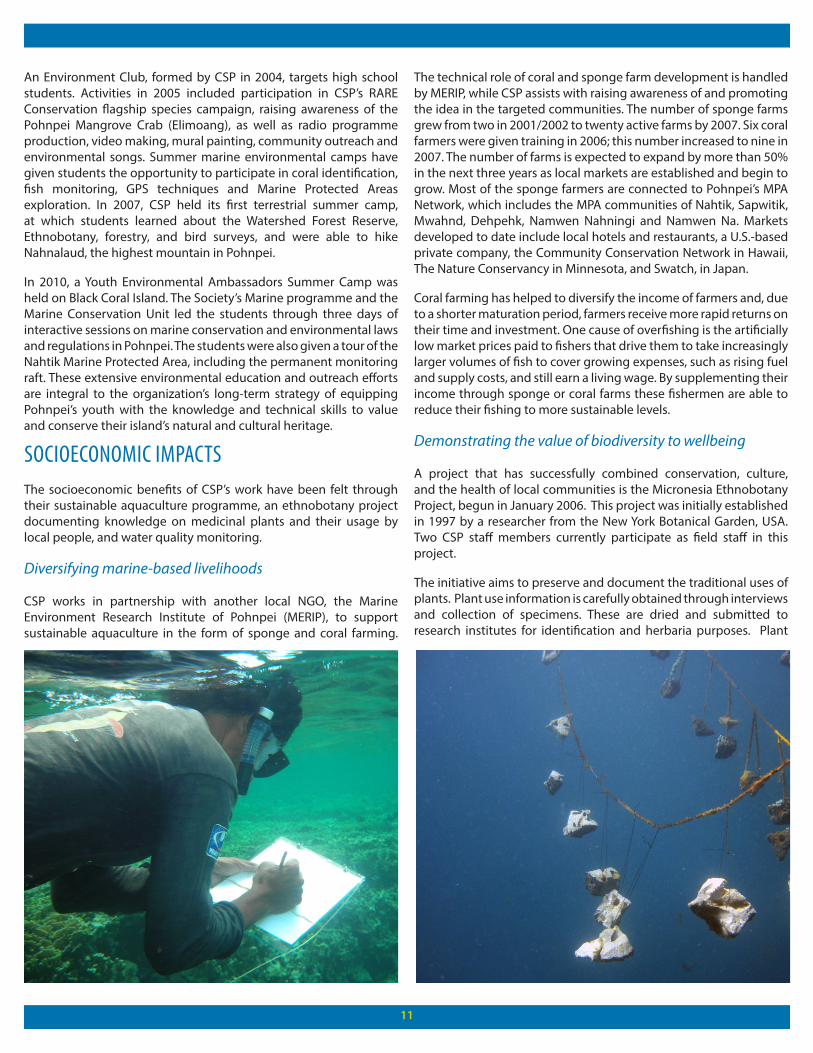
CSP works in partnership with another local NGO, the Marine Environment Research Institute of Pohnpei (MERIP), to support sustainable aquaculture in the form of sponge and coral farming.
The technical role of coral and sponge farm development is handled by MERIP, while CSP assists with raising awareness of and promoting the idea in the targeted communities. The number of sponge farms grew from two in 2001/2002 to twenty active farms by 2007. Six coral farmers were given training in 2006; this number increased to nine in 2007. The number of farms is expected to expand by more than 50% in the next three years as local markets are established and begin to grow. Most of the sponge farmers are connected to Pohnpei’s MPA Network, which includes the MPA communities of Nahtik, Sapwitik, Mwahnd, Dehpehk, Namwen Nahningi and Namwen Na. Markets developed to date include local hotels and restaurants, a U.S.-based private company, the Community Conservation Network in Hawaii, The Nature Conservancy in Minnesota, and Swatch, in Japan.
Coral farming has helped to diversify the income of farmers and, due to a shorter maturation period, farmers receive more rapid returns on their time and investment. One cause of overfishing is the artificially low market prices paid to fishers that drive them to take increasingly larger volumes of fish to cover growing expenses, such as rising fuel and supply costs, and still earn a living wage. By supplementing their income through sponge or coral farms these fishermen are able to reduce their fishing to more sustainable levels.
Demonstrating the value of biodiversity to wellbeing
A project that has successfully combined conservation, culture, and the health of local communities is the Micronesia Ethnobotany Project, begun in January 2006. This project was initially established in 1997 by a researcher from the New York Botanical Garden, USA. Two CSP staff members currently participate as field staff in this project.
The initiative aims to preserve and document the traditional uses of plants. Plant use information is carefully obtained through interviews and collection of specimens. These are dried and submitted to research institutes for identification and herbaria purposes. Plant
12
specimens are also returned and stored at the College of Micronesia herbarium in Palikir. The project’s findings have been documented in two books: A Primary Health Care Manual and Ethnobotany of Pohnpei: Plants, People and Island Culture. The Primary Health Care Manual has included local plant uses for common ailments and was made available to health care professionals on Pohnpei in the many dispensaries around the island. Ethnobotany of Pohnpei, Plants, People and Island Culture serves as a record of Pohnpei’s traditional plant knowledge. The latter was published in January 2009, copyrighted in the name of Pohnpei’s traditional leaders and the Pohnpei State government, ensuring that this knowledge remains the property of Pohnpei’s people.
A second health benefit of CSP’s work has been in improved water quality for Pohnpei’s citizens. The Nanpil River is a vital source of drinking water for nearly 60 percent of Pohnpei’s residents. CSP targeted the river’s water quality in the community of Nett in an eighteen-month project funded by the European Union, from 2008-10. This project was varied in its scope and activities: one of the main components was the continuation of the “Grow Low” Sakau campaign, which encouraged farmers to plant in the lowlands rather than in the watershed forest reserve, while a team also identified over 34 sources of contamination, mostly piggeries or pit toilets, along the river banks. CSP, in conjunction with the Environmental Protection Agency, tested water at five different locations and found levels of E. coli and Enterococci to be extremely high in some sites. With the support of the Federated States of Micronesia’s Integrated Water Resource Management fund, CSP has identified good practices in animal and human waste management to help counteract this threat. The fund has also helped support public awareness and education activities comprising community meetings, radio announcements, and posters. CSP has identified resources to remove half of these sources of contamination from Nanpil, as well as expanding to assess tributary rivers and streams, using geographic information system (GIS) mapping of these sites to develop action plans for further contaminant removal.
Socioeconomic and governance monitoring within MPA communities provides feedback on how the MPA is affecting people’s lives and monitors the communities’ understanding of the value of MPAs and their involvement in their management. Information from all of these monitoring activities is used to strategically manage the MPA network and to further formulate sound management policy.
POLICY IMPACTSCSP’s success in coordinating conservation activities within Pohnpei has led to it playing a lead role in conservation within the Federated States of Micronesia. One success in this area has been the designation of Ant Atoll as a biosphere reserve, while CSP has also contributed experts to national research bodies.
Collaborative creation of a new MPA
Ant Atoll is one of the most significant islands in Micronesia, and was identified as one of twenty-four “Priority Action Areas” in the Federated States of Micronesia’s National Biodiversity Strategic
Action Plan (NBSAP). During the Rapid Ecological Assessment conducted in 2006, the Ant channel was recorded as having one of the highest levels of biodiversity in Pohnpei, with an estimate of over 165 species of fish, 25 bird species, and 13 species of reptiles, including the green turtle (Chelonia mydas) and hawksbill turtle (Eretmochelys imbricata). One of the islets on the atoll, Wolouna, is home to one of the last intact seabird rookeries in the region. The atoll’s main channel into its 742 km lagoon is a spawning and aggregation site for three grouper species (Plectropomus areolatus, Epinephelus fuscoguttatus, and Epinephelus polyphekadion), while the surrounding coral reefs hold healthy populations of giant clams (Hippopus hippopus, Tridagna Maxima, and Derasa).
In October 2007, Ant Atoll was nominated to become the nation’s second Biosphere Reserve, following the Utwe/Walung Biosphere Reserve in Kosrae; the reserve gained official status in 2010. This was the result of a ten-year partnership between CSP, the Nanpei Family, which owns the island, UNESCO’s Man And Biosphere (MAB) Programme, and both Pohnpei State and Federated States of Micronesian governments. The reserve will contribute to the conservation of substantial ecosystem, species, and genetic biological diversity.
Unlike Pohnpei’s other MPAs, Ant Atoll Biosphere consists of three zones: Core Zones, where strict protection measures will be applied to protect the key areas for fish spawning, turtles, and bird nesting; Buffer Zones, adjacent to the core zones, in which fishing activities are regulated and tourist activities can be developed; and Transition Zones, allowing for better management of fish stocks through monitoring. The ongoing management of its fish stocks will serve as an important test case for the Federated States of Micronesia’s fishing policies.
Contributing expertise to policy processes
With climate change and its effects already being experienced in many areas of the Federated States of Micronesia, the national government commissioned a team of experts to compile a set of baseline data for the country. Three members of CSP’s Marine Programme and one member of their Terrestrial Programme were included in the team, which gathered information on a variety of issues related to the outer atolls, including soil composition and health, reef surveys, disaster preparedness, and invasive species.
Finally, CSP’s monitoring activities have also contributed to a body of research managed by SeagrassNet. This international monitoring programme documents the status of seagrass resources worldwide, as well as threats to this important marine ecosystem. The programme started in 2001 in the Western Pacific and now includes 60 sites in 20 countries; a global monitoring protocol and web-based data reporting system have been established. SeagrassNet’s ultimate aim is to preserve the seagrass ecosystems by increasing scientific knowledge and public awareness of this threatened coastal resource.
13
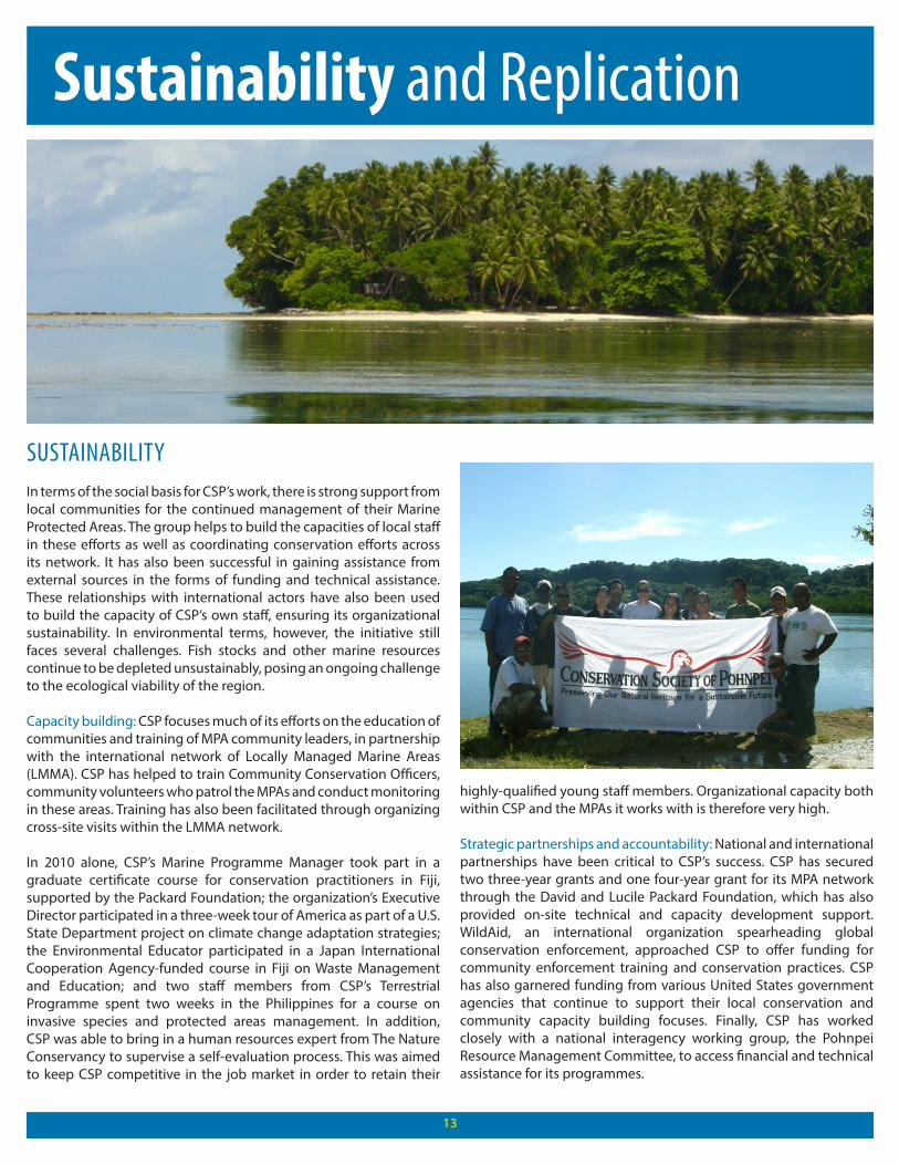
Sustainability and Replication
SUSTAINABILITYIn terms of the social basis for CSP’s work, there is strong support from local communities for the continued management of their Marine Protected Areas. The group helps to build the capacities of local staff in these efforts as well as coordinating conservation efforts across its network. It has also been successful in gaining assistance from external sources in the forms of funding and technical assistance. These relationships with international actors have also been used to build the capacity of CSP’s own staff, ensuring its organizational sustainability. In environmental terms, however, the initiative still faces several challenges. Fish stocks and other marine resources continue to be depleted unsustainably, posing an ongoing challenge to the ecological viability of the region.
Capacity building: CSP focuses much of its efforts on the education of communities and training of MPA community leaders, in partnership with the international network of Locally Managed Marine Areas (LMMA). CSP has helped to train Community Conservation Officers, community volunteers who patrol the MPAs and conduct monitoring in these areas. Training has also been facilitated through organizing cross-site visits within the LMMA network.
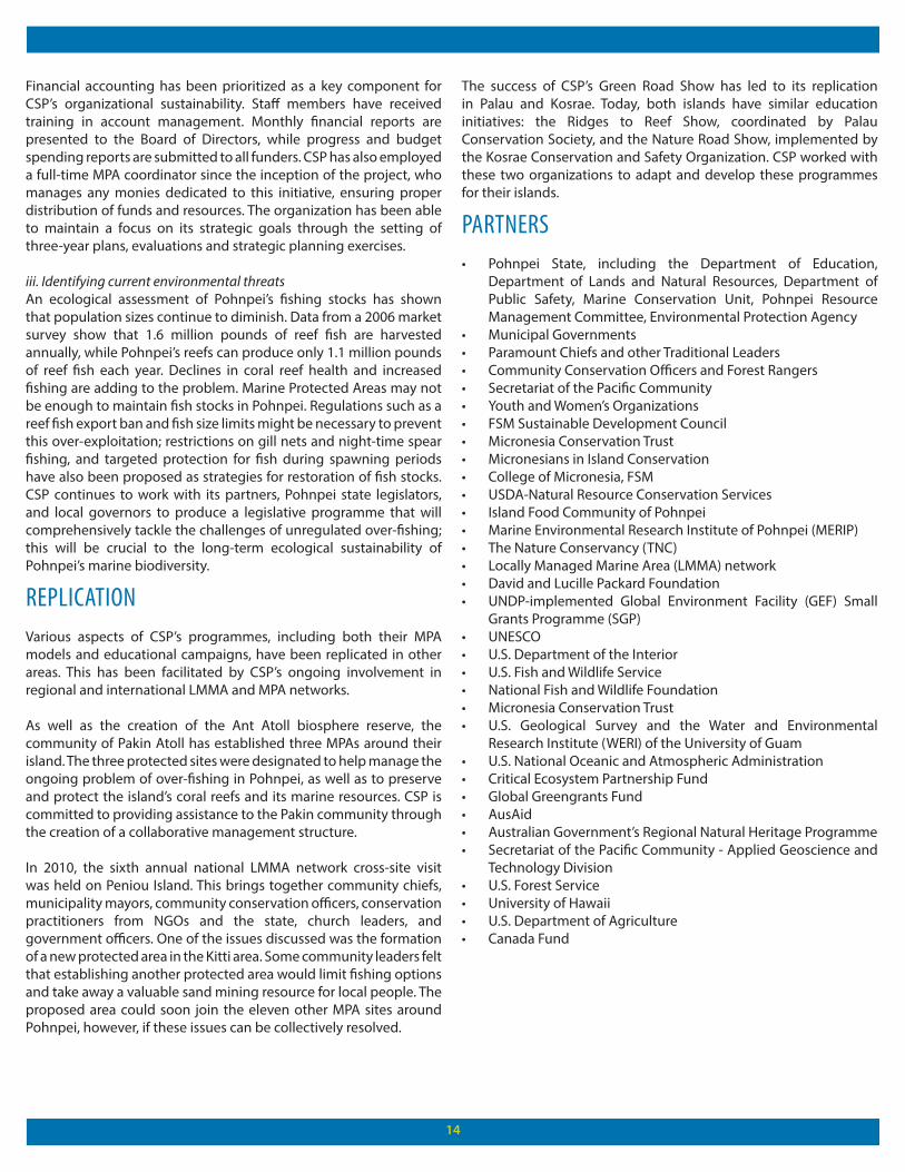
In 2010 alone, CSP’s Marine Programme Manager took part in a graduate certificate course for conservation practitioners in Fiji, supported by the Packard Foundation; the organization’s Executive Director participated in a three-week tour of America as part of a U.S. State Department project on climate change adaptation strategies; the Environmental Educator participated in a Japan International Cooperation Agency-funded course in Fiji on Waste Management and Education; and two staff members from CSP’s Terrestrial Programme spent two weeks in the Philippines for a course on invasive species and protected areas management. In addition, CSP was able to bring in a human resources expert from The Nature Conservancy to supervise a self-evaluation process. This was aimed to keep CSP competitive in the job market in order to retain their
highly-qualified young staff members. Organizational capacity both within CSP and the MPAs it works with is therefore very high.
Strategic partnerships and accountability: National and international partnerships have been critical to CSP’s success. CSP has secured two three-year grants and one four-year grant for its MPA network through the David and Lucile Packard Foundation, which has also provided on-site technical and capacity development support. WildAid, an international organization spearheading global conservation enforcement, approached CSP to offer funding for community enforcement training and conservation practices. CSP has also garnered funding from various United States government agencies that continue to support their local conservation and community capacity building focuses. Finally, CSP has worked closely with a national interagency working group, the Pohnpei Resource Management Committee, to access financial and technical assistance for its programmes.
1414
Financial accounting has been prioritized as a key component for CSP’s organizational sustainability. Staff members have received training in account management. Monthly financial reports are presented to the Board of Directors, while progress and budget spending reports are submitted to all funders. CSP has also employed a full-time MPA coordinator since the inception of the project, who manages any monies dedicated to this initiative, ensuring proper distribution of funds and resources. The organization has been able to maintain a focus on its strategic goals through the setting of three-year plans, evaluations and strategic planning exercises.
iii. Identifying current environmental threatsAn ecological assessment of Pohnpei’s fishing stocks has shown that population sizes continue to diminish. Data from a 2006 market survey show that 1.6 million pounds of reef fish are harvested annually, while Pohnpei’s reefs can produce only 1.1 million pounds of reef fish each year. Declines in coral reef health and increased fishing are adding to the problem. Marine Protected Areas may not be enough to maintain fish stocks in Pohnpei. Regulations such as a reef fish export ban and fish size limits might be necessary to prevent this over-exploitation; restrictions on gill nets and night-time spear fishing, and targeted protection for fish during spawning periods have also been proposed as strategies for restoration of fish stocks. CSP continues to work with its partners, Pohnpei state legislators, and local governors to produce a legislative programme that will comprehensively tackle the challenges of unregulated over-fishing; this will be crucial to the long-term ecological sustainability of Pohnpei’s marine biodiversity.
REPLICATIONVarious aspects of CSP’s programmes, including both their MPA models and educational campaigns, have been replicated in other areas. This has been facilitated by CSP’s ongoing involvement in regional and international LMMA and MPA networks.
As well as the creation of the Ant Atoll biosphere reserve, the community of Pakin Atoll has established three MPAs around their island. The three protected sites were designated to help manage the ongoing problem of over-fishing in Pohnpei, as well as to preserve and protect the island’s coral reefs and its marine resources. CSP is committed to providing assistance to the Pakin community through the creation of a collaborative management structure.
In 2010, the sixth annual national LMMA network cross-site visit was held on Peniou Island. This brings together community chiefs, municipality mayors, community conservation officers, conservation practitioners from NGOs and the state, church leaders, and government officers. One of the issues discussed was the formation of a new protected area in the Kitti area. Some community leaders felt that establishing another protected area would limit fishing options and take away a valuable sand mining resource for local people. The proposed area could soon join the eleven other MPA sites around Pohnpei, however, if these issues can be collectively resolved.
The success of CSP’s Green Road Show has led to its replication in Palau and Kosrae. Today, both islands have similar education initiatives: the Ridges to Reef Show, coordinated by Palau Conservation Society, and the Nature Road Show, implemented by the Kosrae Conservation and Safety Organization. CSP worked with these two organizations to adapt and develop these programmes for their islands.
PARTNERS• Pohnpei State, including the Department of Education,
Department of Lands and Natural Resources, Department of Public Safety, Marine Conservation Unit, Pohnpei Resource Management Committee, Environmental Protection Agency
• Municipal Governments • Paramount Chiefs and other Traditional Leaders • Community Conservation Officers and Forest Rangers • Secretariat of the Pacific Community• Youth and Women’s Organizations • FSM Sustainable Development Council • Micronesia Conservation Trust • Micronesians in Island Conservation • College of Micronesia, FSM • USDA-Natural Resource Conservation Services• Island Food Community of Pohnpei • Marine Environmental Research Institute of Pohnpei (MERIP) • The Nature Conservancy (TNC)• Locally Managed Marine Area (LMMA) network• David and Lucille Packard Foundation• UNDP-implemented Global Environment Facility (GEF) Small
Grants Programme (SGP)• UNESCO• U.S. Department of the Interior• U.S. Fish and Wildlife Service• National Fish and Wildlife Foundation • Micronesia Conservation Trust• U.S. Geological Survey and the Water and Environmental
Research Institute (WERI) of the University of Guam• U.S. National Oceanic and Atmospheric Administration• Critical Ecosystem Partnership Fund• Global Greengrants Fund• AusAid • Australian Government’s Regional Natural Heritage Programme • Secretariat of the Pacific Community - Applied Geoscience and
Technology Division • U.S. Forest Service• University of Hawaii• U.S. Department of Agriculture • Canada Fund
Click the thumbnails below to read more case studies like this:
Equator InitiativeEnvironment and Energy GroupUnited Nations Development Programme (UNDP)304 East 45th Street, 6th FloorNew York, NY 10017Tel: +1 646 781-4023 www.equatorinitiative.org
The United Nations Development Programme (UNDP) is the UN’s global development network, advocating for change and connecting countries to knowledge, experience and resources to help people build a better life.
The Equator Initiative brings together the United Nations, governments, civil society, businesses and grassroots organizations to recognize and advance local sustainable development solutions for people, nature and resilient communities.
©2012 by Equator Initiative All rights reserved
FURTHER REFERENCE
• Fuder, J. 2010. ‘Pohnpei’s diminishing reef fish need protection.’ http://archives.pireport.org/archive/2010/October/10-14-cm.htm• Conservation Society of Pohnpei website http://www.serehd.org/Home.html