compass early safety warning system (esws)
TRANSCRIPT

COMPASS Early Safety Warning System (ESWS)
SESAR/JU WP-E COMPASS Projecthttp://www.compass-sesarju.eu
Dimitris Kolovos, Richard PaigeDepartment of Computer Science
University of York{dimitris.kolovos, richard.paige}@york.ac.uk

Usage Scenario
• ESWS has access to flight plans of flights crossing a particular sector on a particular day (from 00:00 to 24:00)
• ESWS also has access to other sources of information such as ACC headers, meteorological data etc.
• ESWS analyses this data and provides early safety warnings to the user– Based on user-defined patterns expressed using a
dedicated pattern language (EPL)
• Early Safety Warnings are warnings about complex events which, if left to develop, can compromise the safe operation of the ATM system

Slide 3
Slide bar allowing the userto move to different timesin the day.
Map that providesa visual overview of thesector.
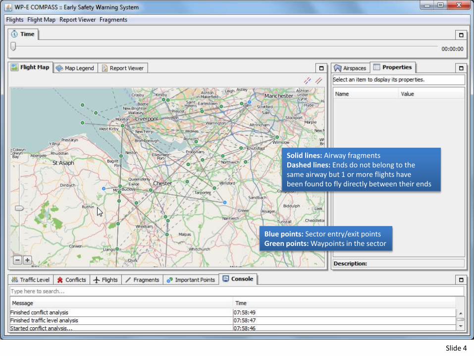
Slide 4
Blue points: Sector entry/exit pointsGreen points: Waypoints in the sector
Solid lines: Airway fragmentsDashed lines: Ends do not belong to thesame airway but 1 or more flights have been found to fly directly between their ends

Slide 5
Airway fragments highlighted according todirectionality,Blue fragments: UnidirectionalRed fragments: Bidirectional
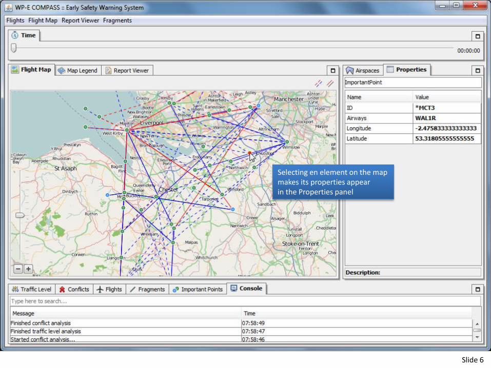
Slide 6
Selecting en element on the mapmakes its properties appearin the Properties panel

Slide 7
User moved time slider to 09:36:00
The positions of flights that have crossedor will cross the sector are displayed on the map.

Slide 8
Selecting a flight makes its properties appear inthe Properties view

Slide 9
The Traffic Level view displaysthe number of flights in the sectorat each time during the day.

Slide 10
The Fragments viewdisplays the number of flightsthat will be crossing each fragment during the day.
Double-clicking on afragment reveals its endson the map

Slide 11
The Fragments viewdisplays the number of flightsthat will be crossing each important point during the day.

Slide 12
The Airspaces viewallows users to switchbetween airspaces (sectors)

Slide 13
We switch to theEHAMTA sector

Slide 14
The conflicts view displaysthe results of conflict analysis

Slide 15
Double-clicking on a conflictloads a detail report of theconflict and highlights the involvedflights on the map.

Slide 16
In the report, users caninteract with the evolutionof the conflict in time

Slide 17
Users can also exploreother conflicts that are happening at the same time

Slide 18

Slide 19
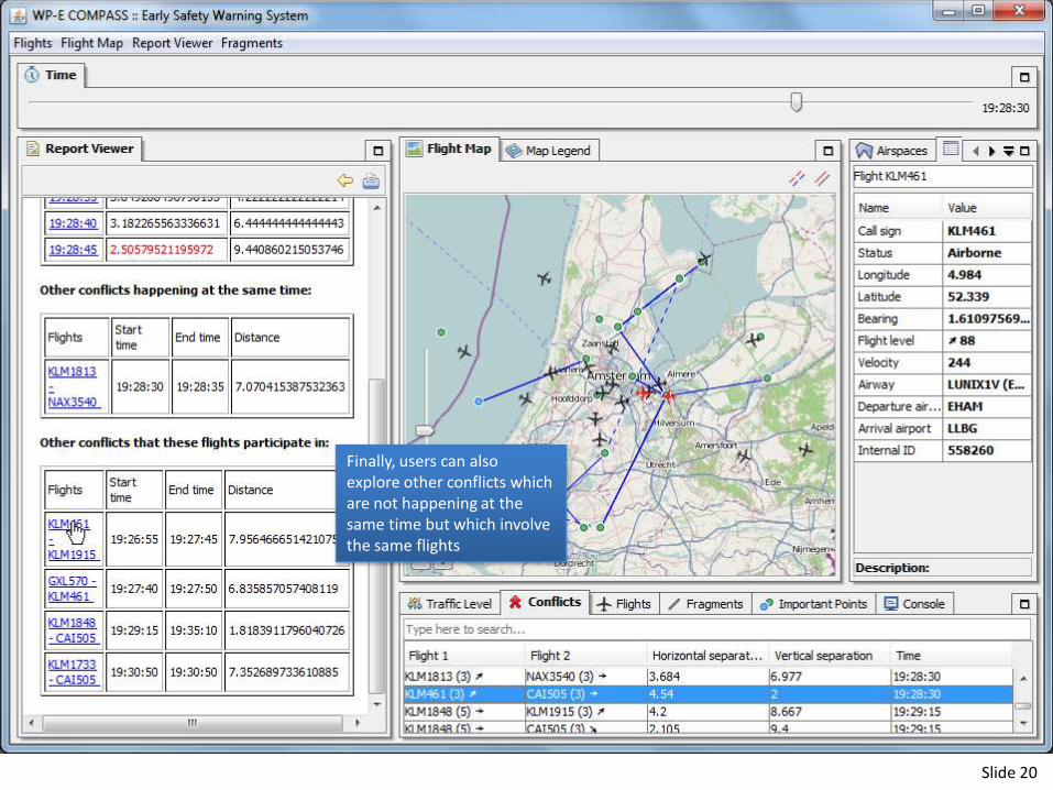
Slide 20
Finally, users can alsoexplore other conflicts whichare not happening at thesame time but which involvethe same flights

Slide 21

Slide 22
Users can specify arbitrarypatterns using the Epsilon Pattern Language

Slide 23
This pattern checks for flights withsimilar call signs (common source of confusion)
This pattern checks for conflicts thatoccur at the same time (challenging to handle)

Slide 24
This pattern checks for conflicts thathappen while the occupancy of thesector is particularly high
This pattern checks for conflicts thatinvolve ascending/descending flights

Slide 25
This pattern checks for periods inthe day with low visibility and strong winds

Slide 26
Patterns can be matched against the state of the sectorover the 24hrs period

Slide 27
The user can explore identifiedmatches through a dedicated view

Slide 28
Pattern matches are also groupedby the elements of the airspace thatare involved in them to supportroot cause analysis