colorado avalanche path mapping gis database 2012 avalanche path mapping... · avalanche school...
TRANSCRIPT
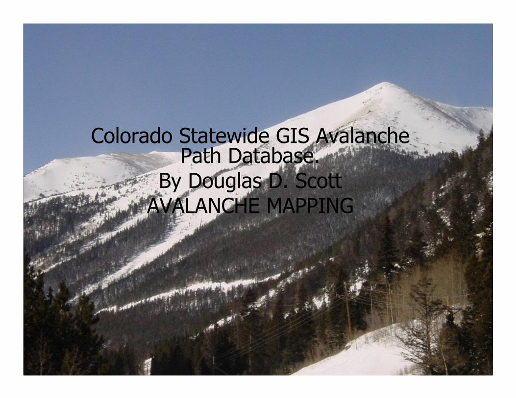
Colorado Statewide GIS Avalanche Path Database.
By Douglas D. ScottAVALANCHE MAPPING
Page 1
• For many years the Swiss, Canadian and other snow scientists have been using GIS to monitor and document avalanche occurrences, snow profiles, and weather.
• The United States has had limited GIS use for this discipline. Until recently almost all avalanche and snowpit data observations were recorded on hard copy and did not have a digital spatial component.
• Current advances in technologies have made GIS affordable and reasonable to implement and distribute. This paper presents the techniques for building the avalanche atlas maps and geospatial databases, sourced from legacy and newly collected data for the State of Colorado and else where in the West.
• These technology advances make it possible to bring observations and data into a GIS for referencing, modeling, and sharing.
• Historical avalanche path data is loaded into a database that can be related to the old hard copy snowpit and weather data.
• These data layers can be displayed over other GIS base layers such as DEM, DRG, DOQ, NAIP, soils/geology, and vegetation cover.
• Integration of real time weather and snow profile data can be added to this for analysis.
• Digital data collection tools can help load new data directly in to the GIS Database with little hand entry.
Page 2
• The majority of the weather data is often in digital and can be linked or loaded to the avalanche and snowpit profile database as well.
• GIS base data layers such as DRG, DOQ and Satellite Imagery, provide visual information and the ability to identify avalanche terrain. These can also help in referencing the topography of the avalanche areas.
• High resolution DEMs allow various terrain analyses: mean slope, minimum slope, maximum slope, mean aspect, and curvature. When the avalanche path data is overlaid on the DEM it can be analyzed using neighbor modeling.
Page 3
• Other important GIS data layers used in avalanche analysis are:
• Hydrographic (rivers, streams and lakes) data shows drainages where avalanches could be constricted by potential terrain traps.
• Geology and Vegetation layers are often combined with slope angles and curvature to help gauge friction parameters of destructive force from the various sizes of volume of the avalanche release.
• Tree ring data can help document and predict the frequency and sizes of avalanches along their tracks.
• Building, Zoning and Road data can define potential areas that will suffer destruction.
Page 4
• Since 1950 avalanches have killed more people in Colorado than any other natural hazard, and in the United States, Colorado accounts for one-third of all avalanche deaths. This shows the need for better ways to store, deliver and represent Avalanche Information
• This past winter of 07-08 we had a fair amount of snow; it was a short but intense four month season, Highway 550 was closed for over fifteen days due to high avalanche hazard, mitigation and the struggle to regain the road. There were 111 natural avalanches that hit the road, they were 1’ to 30’ deep and covered 7,401’ of highway. CDOT/CAIC triggered 178 slides that put debris 1’ to 16’ deep and covered 11,777’ of road.
Page 5
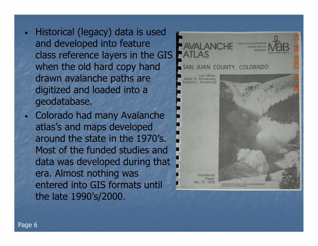
• Historical (legacy) data is used and developed into feature class reference layers in the GIS when the old hard copy hand drawn avalanche paths are digitized and loaded into a geodatabase.
• Colorado had many Avalanche atlas’s and maps developed around the state in the 1970’s. Most of the funded studies and data was developed during that era. Almost nothing was entered into GIS formats until the late 1990’s/2000.
Page 6
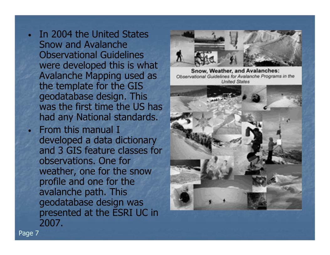
• In 2004 the United States Snow and Avalanche Observational Guidelines were developed this is what Avalanche Mapping used as the template for the GIS geodatabase design. This was the first time the US has had any National standards.
• From this manual I developed a data dictionary and 3 GIS feature classes for observations. One for weather, one for the snow profile and one for the avalanche path. This geodatabase design was presented at the ESRI UC in 2007.
Page 7
Page 8
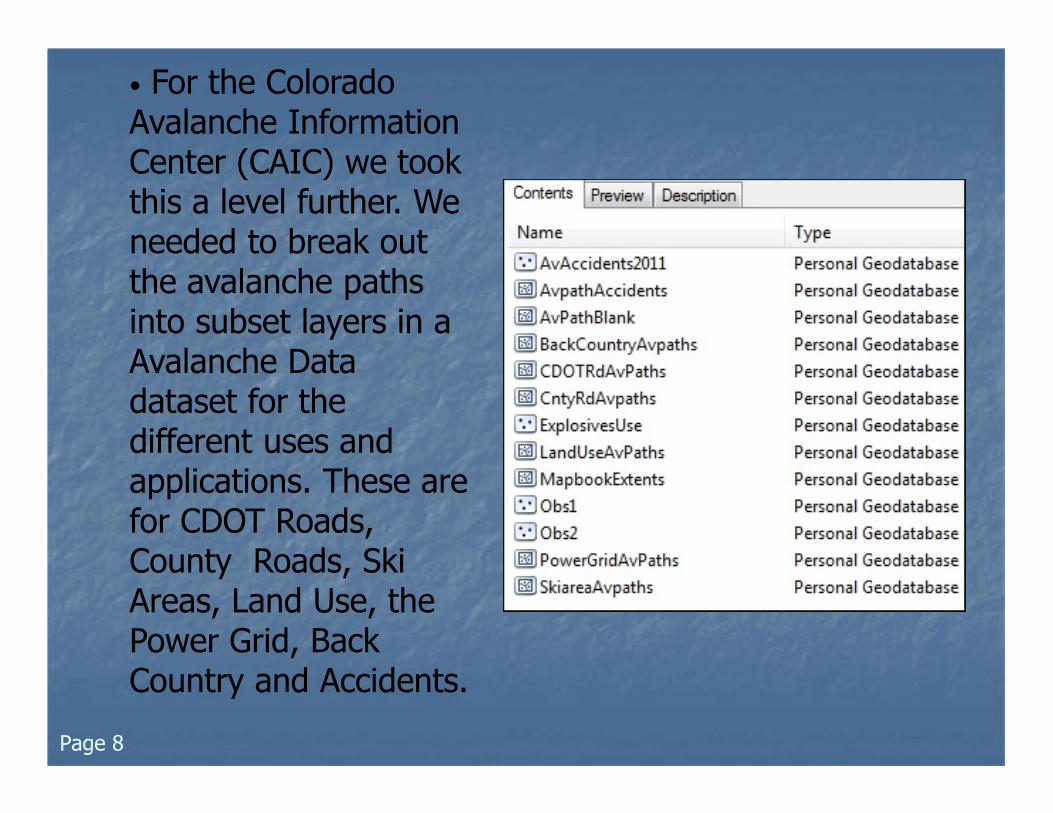
• For the Colorado Avalanche Information Center (CAIC) we took this a level further. We needed to break out the avalanche paths into subset layers in a Avalanche Data dataset for the different uses and applications. These are for CDOT Roads, County Roads, Ski Areas, Land Use, the Power Grid, Back Country and Accidents.
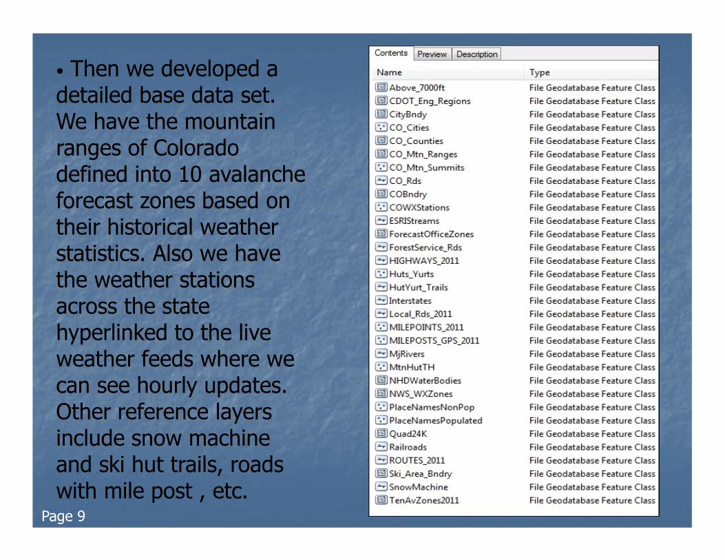
• Then we developed a detailed base data set. We have the mountain ranges of Colorado defined into 10 avalanche forecast zones based on their historical weather statistics. Also we have the weather stations across the state hyperlinked to the live weather feeds where we can see hourly updates. Other reference layers include snow machine and ski hut trails, roads with mile post , etc.
Page 9
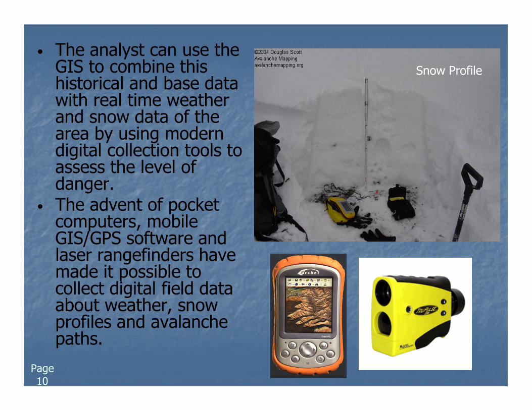
• The analyst can use the GIS to combine this historical and base data with real time weather and snow data of the area by using modern digital collection tools to assess the level of danger.
• The advent of pocket computers, mobile GIS/GPS software and laser rangefinders have made it possible to collect digital field data about weather, snow profiles and avalanche paths.
Snow Profile
Page 10
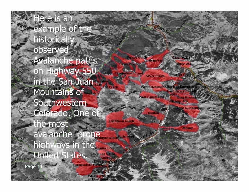
• Here is an example of the historically observed Avalanche paths on Highway 550 in the San Juan Mountains of Southwestern Colorado. One of the most avalanche prone highways in the United States.
Page 11
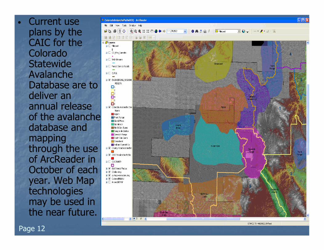
• Current use plans by the CAIC for the Colorado Statewide Avalanche Database are to deliver an annual release of the avalanche database and mapping through the use of ArcReader in October of each year. Web Map technologies may be used in the near future.
Page 12
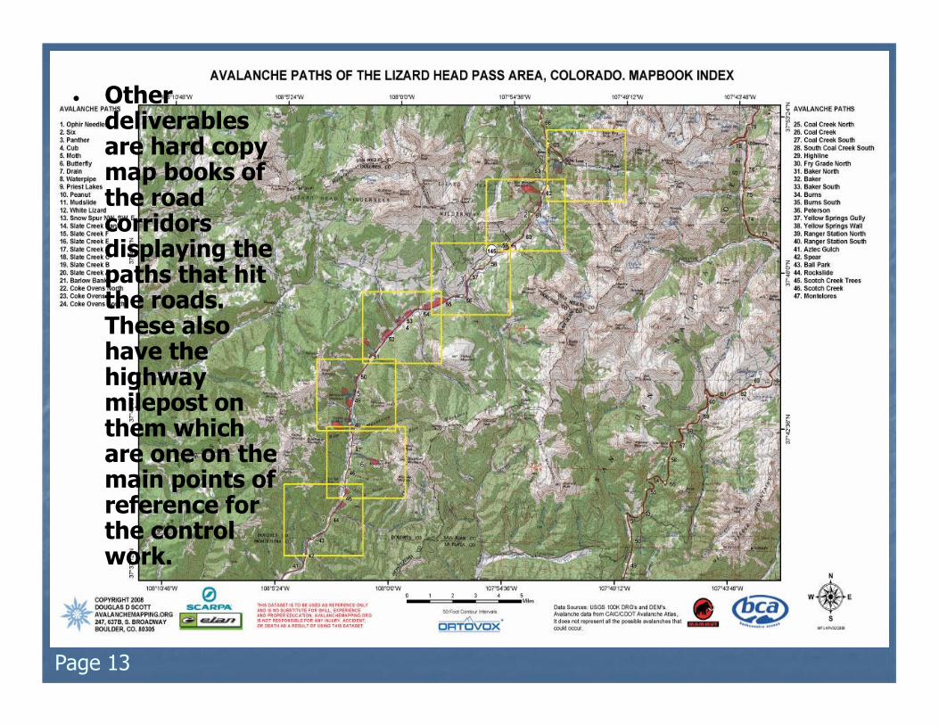
• Other deliverables are hard copy map books of the road corridors displaying the paths that hit the roads. These also have the highway milepost on them which are one on the main points of reference for the control work.
Page 13
Page 14
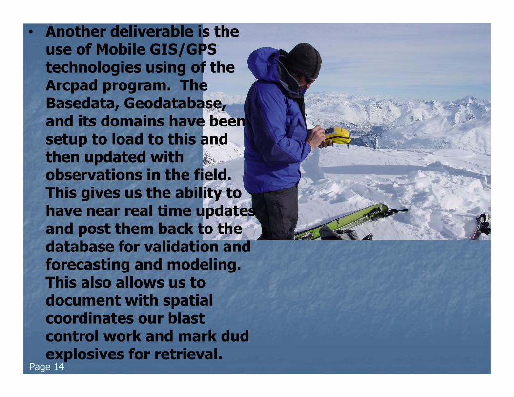
• Another deliverable is the use of Mobile GIS/GPS technologies using of the Arcpad program. The Basedata, Geodatabase, and its domains have been setup to load to this and then updated with observations in the field. This gives us the ability to have near real time updates and post them back to the database for validation and forecasting and modeling. This also allows us to document with spatial coordinates our blast control work and mark dud explosives for retrieval.
• In conclusion, it is apparent there are many benefits to using GIS and digital data technologies for avalanche and snow science. This presentation documented the various types of GIS layers and databases developed and used in avalanche mapping and documentation and their uses and deployment of the information for the CAIC/CDOT. The deliverables have been design so that even the none GIS users have access and the ability to utilize this information and data.
Page 15
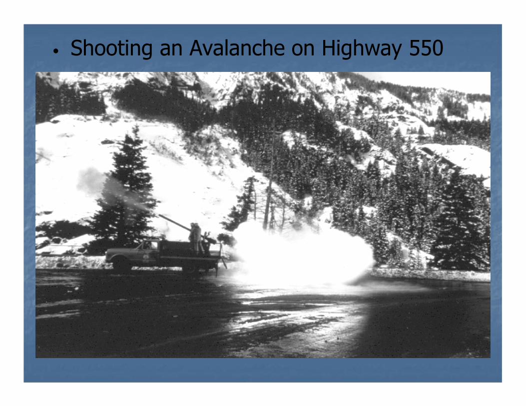
• Shooting an Avalanche on Highway 550
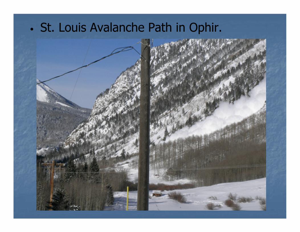
• St. Louis Avalanche Path in Ophir.
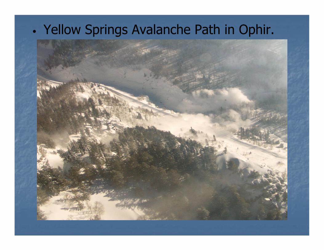
• Yellow Springs Avalanche Path in Ophir.
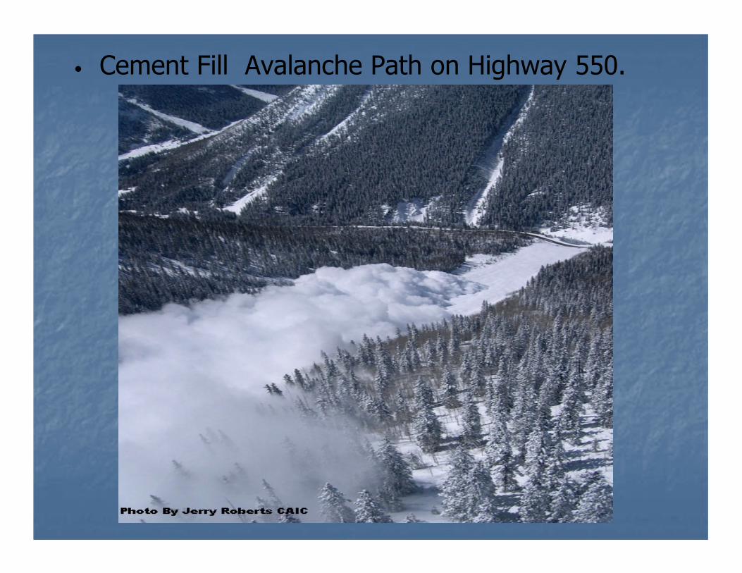
• Cement Fill Avalanche Path on Highway 550.
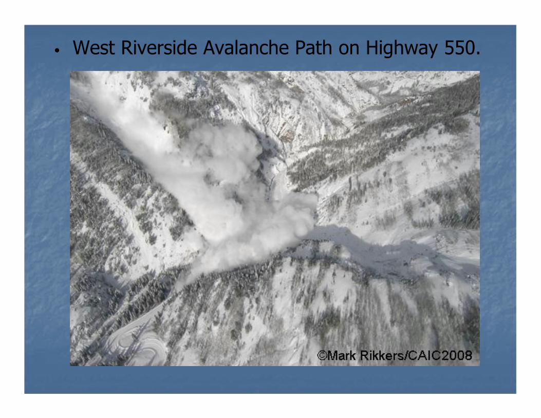
• West Riverside Avalanche Path on Highway 550.
References:• From the Colorado Avalanche Information Center website “CAIC”.• Stoffel, A., Brabec, B., Stockli, U., 2001: GIS Applications at the Swiss Federal
Institute of Snow and Avalanche Research.• Maggioni, M., Gruber, U., Stoffel, A., 2002: Definition and Characterisation of
Potential Avalanche Release Areas. Swiss Federal Institute of Snow and Avalanche Research.
• McLaren, S., 2000: Suitability Mapping of Avalanche Trigger Sites on the North Shore Mountains, Vancouver using a Digital Elevation Model and GIS. UniGIS, Simon Fraser University.
• Tracy, L., 2001: GIS in Avalanche Hazard Management. Iceland Meteorological Office.
• Gruber, U., 2001: Using GIS for Avalanche Hazard Mapping in Switzerland.• Comunello, G., Ciolli, M., Cherubini, P., 2001: Mapping Avalanche Risk using
GIS and Dendrochronological Techniques. From, Conference “Tree Rings and People”, Davos, Switzerland.
• McCollister, C., Birkeland, K., Hansen, K., Aspinall, R., Comey, R., 2002. Exploring Mulit-scale Spatial Patterns in Historical Avalanche Data, Jackson Hole Mountain Resort, Wyoming. Presented 2002 International Snow Science Workshop.
• Canadian Avalanche Association, 2002: Guidelines for Snow Avalanche Risk Determination and Mapping in Canada.
• Canadian Avalanche Association, 2004: The Course Profile for; “The Introduction to Snow Avalanche Mapping Course.”
• Jerry Roberts, 2008: “Red Mountain Pass-Chief Ouray Highway A History of Forecasting and Mitigation”.
Biography:
DOUGLAS SCOTTDirector
AVALANCHE MAPPING637 B, S BROADWAY, #247BOULDER, CO. 80305
Currently I work as the GIS and Mapping manager for CH2M Hill and am the Owner/Director of Avalanche Mapping. I was formerly a ski patrolman and helicopter ski guide with a Level II American Avalanche School certificate and 37 years of winter mountaineering experience in North America and Europe. I am an Certified/Authorized ESRI Instructor and have completed the Statewide Avalanche Paths GIS project for the Colorado Avalanche Information Center and Colorado Geologic Survey in 2007 the project is now in update mode with additional data added every year.
©AVALANCHEMAPPING.ORG 2012