coastal change from a massive sediment … coastal change from a massive sediment input: dam...
TRANSCRIPT

1
COASTAL CHANGE FROM A MASSIVE SEDIMENT INPUT: DAM REMOVAL, ELWHA RIVER, WASHINGTON, USA
JONATHAN A. WARRICK1, GUY GELFENBAUM2, ANDREW W. STEVENS3,
IAN M. MILLER4, GEORGE M. KAMINSKY5, AND MELISSA M. FOLEY6
1. U.S. Geological Survey, 400 Natural Bridges Dr., Santa Cruz, CA 95060, USA. [email protected]
2. U.S. Geological Survey, 400 Natural Bridges Dr., Santa Cruz, CA 95060, USA. [email protected]
3. U.S. Geological Survey, 400 Natural Bridges Dr., Santa Cruz, CA 95060, USA. [email protected]
4. Washington Sea Grant, 1502 E. Lauridsen Blvd. #82, Port Angeles, WA 98362, USA. [email protected]
5. Washington State Department of Ecology, P.O. Box 47600, Olympia, WA 98504-7600, USA. [email protected]
6. U.S. Geological Survey, 400 Natural Bridges Dr., Santa Cruz, CA 95060, USA. [email protected]
Abstract: The removal of two large dams on the Elwha River, Washington, provides an ideal opportunity to study coastal morphodynamics during increased sediment supply. The dam removal project exposed ~21 million cubic meters (~30 million tonnes) of sediment in the former reservoirs, and this sediment was allowed to erode by natural river processes. Elevated rates of sand and gravel sediment transport in the river occurred during dam removal. Most of the sediment was transported to the coast, and this renewed sediment supply resulted in hundreds of meters of seaward expansion of the river delta since 2011. Our most recent survey in January 2015 revealed that a cumulative ~3.5 million m3 of sediment deposition occurred at the delta since the beginning of the dam removal project, and that aggradation had exceeded 8 m near the river mouth. Some of the newly deposited sediment has been shaped by waves and currents into a series of subaerial berms that appear to move shoreward with time.
Introduction
The Elwha River of Washington has been the site of the largest dam removal project in U.S. history (Duda et al. 2011). Two large dams were removed from this river to reintroduce spawning salmon populations to the upper watershed, which lies within the boundaries of Olympic National Park. Dam removal commenced in 2011 and resulted in exposure of massive volumes of sediment deposited in the two reservoirs; approximately 21 million m3, or ~30 million tonnes, of gravel, sand and mud were exposed during the project (Randle et al. 2015). Elwha Dam, which was formerly 32 m high and stored ~5 million m3 of sediment, was removed in a staged process between Sept. 2011 and March 2012 (Figure 1). Glines Canyon Dam, which was 64 m high and stored ~16 million
161 23/03/2015
9 pp

2
m3 of sediment, was removed during a three-year process between Sept. 2011 and Oct. 2014 (Figure 1).
During the first two years of dam removal, roughly one-third of the original sediment (~10.5 million tons) was eroded by the river and transported to river reaches downstream of the dams (Randle et al. 2015). Although this renewed sediment supply caused widespread changes in the fluvial morphology, ~90% of the new sediment supply was discharged to the coast at the mouth of the Elwha River (East et al. 2015; Warrick et al. 2015). The coastal landforms changed measurably following the addition of new sediment, and ~2.5 million m3 of net deposition was measured by the fall of 2013 (Gelfenbaum et al. 2015).
Here we expand on the observations of Gelfenbaum et al. (2015) by presenting results from three additional coastal surveys conducted in 2014 and 2015 (Figure 1). The goals of this paper are to report on the continued morphologic evolution of the Elwha River delta and to compute and evaluate volumetric change of the delta since the 2013 survey data reported by Gelfenabum et al. (2015).
Fig. 1. Time series of general conditions and coastal surveys of the Elwha River study site. Included in this figure are: river discharge measured at USGS Station 12045500 (blue line), dam removal schedule highlights (brown text), and the dates of the coastal surveys (red arrows and orange symbols). The time intervals (Year 1, Year 2, Year 3, and Recent) based on the coastal survey dates and are used throughout this paper.
161 23/03/2015
3
Methods
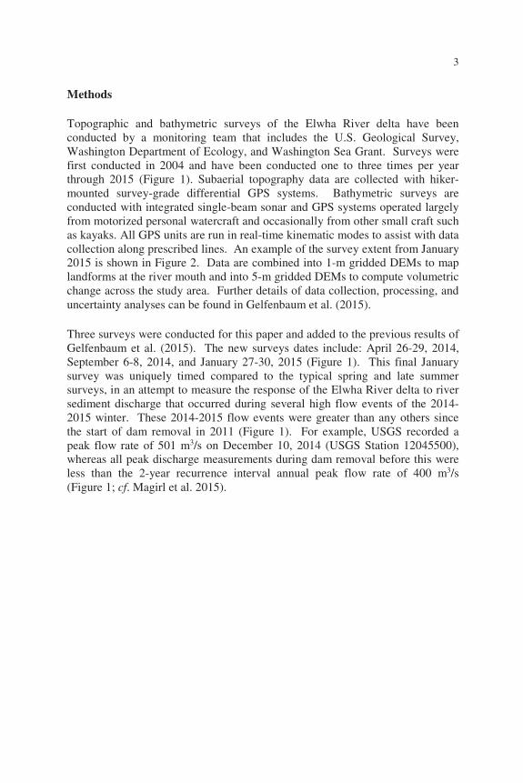
Topographic and bathymetric surveys of the Elwha River delta have been conducted by a monitoring team that includes the U.S. Geological Survey, Washington Department of Ecology, and Washington Sea Grant. Surveys were first conducted in 2004 and have been conducted one to three times per year through 2015 (Figure 1). Subaerial topography data are collected with hiker-mounted survey-grade differential GPS systems. Bathymetric surveys are conducted with integrated single-beam sonar and GPS systems operated largely from motorized personal watercraft and occasionally from other small craft such as kayaks. All GPS units are run in real-time kinematic modes to assist with data collection along prescribed lines. An example of the survey extent from January 2015 is shown in Figure 2. Data are combined into 1-m gridded DEMs to map landforms at the river mouth and into 5-m gridded DEMs to compute volumetric change across the study area. Further details of data collection, processing, and uncertainty analyses can be found in Gelfenbaum et al. (2015).
Three surveys were conducted for this paper and added to the previous results of Gelfenbaum et al. (2015). The new surveys dates include: April 26-29, 2014, September 6-8, 2014, and January 27-30, 2015 (Figure 1). This final January survey was uniquely timed compared to the typical spring and late summer surveys, in an attempt to measure the response of the Elwha River delta to river sediment discharge that occurred during several high flow events of the 2014-2015 winter. These 2014-2015 flow events were greater than any others since the start of dam removal in 2011 (Figure 1). For example, USGS recorded a peak flow rate of 501 m3/s on December 10, 2014 (USGS Station 12045500), whereas all peak discharge measurements during dam removal before this were less than the 2-year recurrence interval annual peak flow rate of 400 m3/s (Figure 1; cf. Magirl et al. 2015).
161 23/03/2015

4
Fig. 2. Map of the topography and bathymetry sampling for the January 2015 survey of the Elwha River delta. Also included are the locations of geodetic control monuments, sound velocity profiles to correct the sonar soundings, and seafloor sediment samples for grain-size analyses.
Results
Maps of the topographic and bathymetric data document the seaward expansion of the Elwha River delta during the dam removal project (Figure 3). As documented by Gelfenbaum et al. (2015) the seaward growth in the river mouth region during 2011-2013 was largely related to the rate of sand and gravel export from the river. By September 2013, new river mouth bars were observed hundreds of meters offshore of the previous shoreline (Figure 3).
During 2014 the river mouth bars were observed to extend up to higher elevations (~3 m versus ~1 m during September 2013; Figure 3), and the bars encompassed a new tidal basin on the eastern side of the river mouth that included a small sinuous channel. During the summer of 2014 the eastern extent of the river mouth bar attached to the shoreline (Figure 3), which eliminated regular tidal water exchange through this eastern portion of the bar.
Following the high river flows of December 2014 and January 2015, the Elwha River cut through portions of the river mouth bars and deposited new lobes of sediment offshore of the two primary river mouth distributaries (Figure 3).
161 23/03/2015

5
Fig. 3. Maps of the Elwha River mouth morphology from the gridded topographic and bathymetric survey data showing the change since the start of dam removal. Data are shown in 1-m DEMs and the vertical datum is NAVD88, for which zero elevation is 13 cm higher than the MLLW datum at NOAA Tide Station 9444090 in Port Angeles.
161 23/03/2015

6
The changes between these surveys can be visualized with elevation change maps provided in Figure 4 and a sediment volume balance provided in Figure 5. The maps reveal that while net deposition in excess of 2 m was measured offshore of the river mouth between Sept. 2011 and Sept. 2012 (“Year 1”), these changes were localized to a region ~200 m from the river mouth and to a small region ~1.5 km east of the river mouth (cf. Gelfenbaum et al. 2015). Although there was measurable deposition along the delta during this first year, the total volume change in the region was not significantly different from zero largely owing to the continued erosion of the shoreline east of the river mouth and the inherent uncertainties in the measurements (Figure 5; cf. Gelfenbaum et al. 2015).
Fig. 4. Maps of elevation change in the Elwha River mouth morphology since the start of dam removal from the data shown in Fig. 3. Changes below the detection limit are shown in gray color and denoted “N.D.”. Survey dates used in these maps include Sept. 2011, Sept. 2012, Sept. 2013, Sept. 2014, and Jan. 2015 as shown in Fig. 3 and denoted in Fig. 1.
161 23/03/2015

7
Fig. 5. Time-dependent changes in the sediment volume within and offshore of the Elwha River mouth. Survey dates are shown with dots, and uncertainty in the volume calculations are shown with shading. Intervals of time shown in Fig. 3 are highlighted with text.
Sediment deposition increased markedly during the second year (“Year 2”) of dam removal as exhibited by widespread change around the delta and ~2.5 million m3 of volume change (Figures 4 and 5). These changes have been documented by Gelfenbaum et al. (2015) and were caused by the release of sand and gravel over the greatly reduced Glines Canyon Dam structure after its reservoir was completely drained (cf. Figure 1; Magirl et al. 2015)
During the third year (“Year 3”), net sediment deposition decreased to ~430,000 m3, which was less than 20% of the net deposition during the second year of the dam removal project (Figure 5). Net changes during this third year included both a seaward building of the river mouth delta and erosion of large areas on the lateral portions of the new delta (Figure 4). These erosional areas during the third year were generally offshore of growing beach and river mouth bars, which are observable in Figure 3, leading to a hypothesis that wave-generated sediment transport processes were redistributing sediment shoreward.
During the most recent interval of time, which extends from Sept. 2014 to Jan. 2015, the total volume change was ~580,000 m3, which although higher than the total net change in the third year, was only about 25% of the change during year 2 (Figure 5). Similar to the third year, the most recent changes have resulted in lobes of deposition offshore of the primary river channels and broad regions of erosion adjacent to the channels (Figure 4). These patterns appear to be consistent with continued shoreward transport of the river mouth bars.
161 23/03/2015

8
Discussion and Conclusions
During the roughly 3.5 years of time since dam removal started on the Elwha River, our coastal surveying has measured ~3.5 million m3 of volumetric change within and around the Elwha River mouth delta (Figure 5). The rate of change has fluctuated with time and has included an interval of rapid deposition during the second year of the project (~2.5 million m3) followed by more moderate rates of deposition through January 2015 (~1 million m3).
Although the 2014-2015 winter resulted in the largest river flow rates since dam removal commenced (Figure 1), the amount of net deposition at the Elwha River delta following these high flows was only ~25% of those measured during the second year of the project (Figure 5). This suggests that the Elwha River has been exporting less sand and gravel with time following the massive influx during year two (cf. Magirl et al. 2015). Yet, it is important to note that the net deposition during year three and the recent interval of time, which were ~400,000 to at least 600,000 m3/yr, exceed the calculated background mean sand and gravel loads of the river (~100,000 m3/yr; cf. Randle et al. 2015) by many fold. This suggests that the Elwha River delta was still receiving elevated rates of sediment supply during 2014-2015 related to the dam removal project.
Acknowledgements
This work is funded by the U.S. Geological Survey’s (USGS) Coastal Habitats in Puget Sound (CHIPS) Project and the USGS Coastal and Marine Geology Program. Additional support was provided from the Environmental Protection Agency (EPA), the Puget Sound Partnership, and the USGS Mendenhall Program. The Lower Elwha Klallam Tribe and its staff is thanked for access to their lands and waters and support for this work.
References
Duda, J. J., Warrick, J. A., Magirl, C. S. (2011). Coastal and lower Elwha River, Washington, prior to dam removal — history, status, and defining characteristics. In: Duda, J.J., Warrick, J.A., Magirl, C.S. (Eds.), Coastal Habitats of the Elwha River, Washington—Biological and Physical Patterns and Processes Prior to Dam Removal. U.S. Geological Survey Scientific Investigations Report 2011-5120, pp. 1–26.
161 23/03/2015

9
East, A. E., Pess, G. R., Bountry, J. A., Magirl, C. S., Ritchie, A. C., Logan, J. B., Randle, T. J., Mastin, M. C., Minear, J. T., Duda, J. J., Liermann, M. C., McHenry, M. L., Beechie, T. J., and Shafroth, P. B. (2015). Large-scale dam removal on the Elwha River, Washington, USA: river channel and floodplain geomorphic change, Geomorphology, http://dx.doi.org/10.1016/j.geomorph.2014.08.028
Gelfenbaum, G., Stevens, A. W., Miller, I. M., Warrick, J. A., Ogston, A. S., and Eidam, E. (2015). Large-scale dam removal on the Elwha River, Washington, USA: coastal geomorphic change, Geomorphology, http://dx.doi.org/10.1016/j.geomorph.2015.01.002
Magirl C. S., Hilldale, R. C., Curran, C. A., Duda, J. J., Straub, T. D., Domanski, M., and Foreman, J. R. (2015). Large-scale dam removal on the Elwha River, Washington, USA: fluvial sediment load, Geomorphology, http://dx.doi.org/10.1016/j.geomorph.2014.12.032
Randle, T. J., Bountry, J. A., Ritchie, A. C., and Wille, K. (2015). Large-scale dam removal on the Elwha River, Washington, USA: erosion of reservoir sediment, Geomorphology, http://dx.doi.org/10.1016/j.geomorph.2014.12.045
Warrick, J.A., Bountry, J. A., East, A. E., Magirl, C. S., Randle, T. J., Gelfenbaum, G., Ritchie, A. C., Pess, G. R., Leung, V., and Duda, J. J. (2015). Large-scale dam removal on the Elwha River, Washington, USA: source-to-sink sediment budget and synthesis, Geomorphology, http://dx.doi.org/10.1016/j.geomorph.2015.01.010
161 23/03/2015