census tracts geographic products branch u.s. census bureau
TRANSCRIPT
Census Tracts
Geographic Products Branch
U.S. Census Bureau
Overview
• Definition of a census tract
• History of census tracts
• How census tracts are updated each decade
• How to compare census tract boundaries decade to decade
2
Definition
• Census tracts are small, relatively permanent statistical subdivisions of a county.– Uniquely numbered in each county with a
numeric code
• Census tracts average about 4,000 inhabitants– Minimum Population – 1,200– Maximum Population – 8,000
3
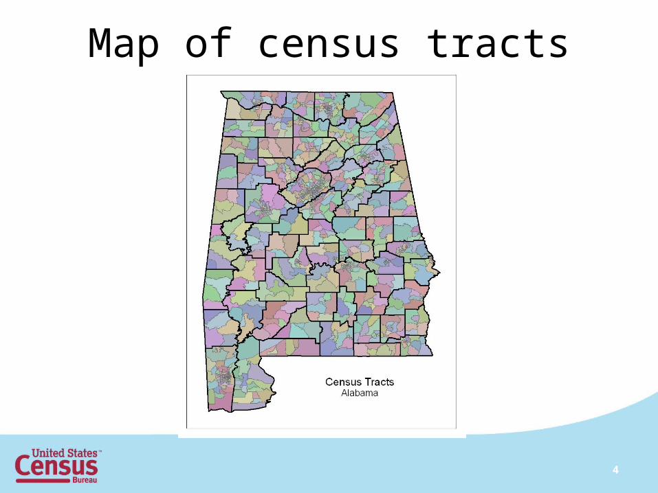
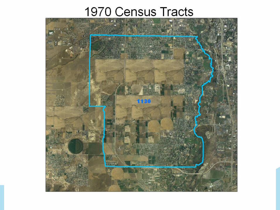
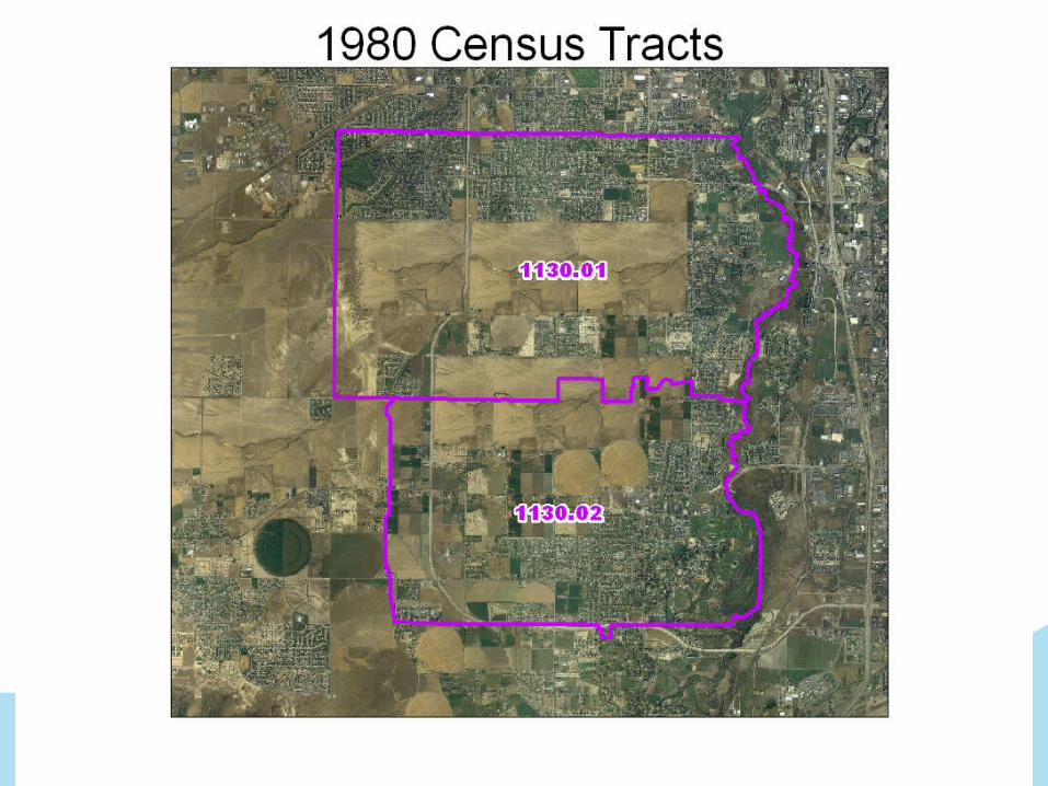
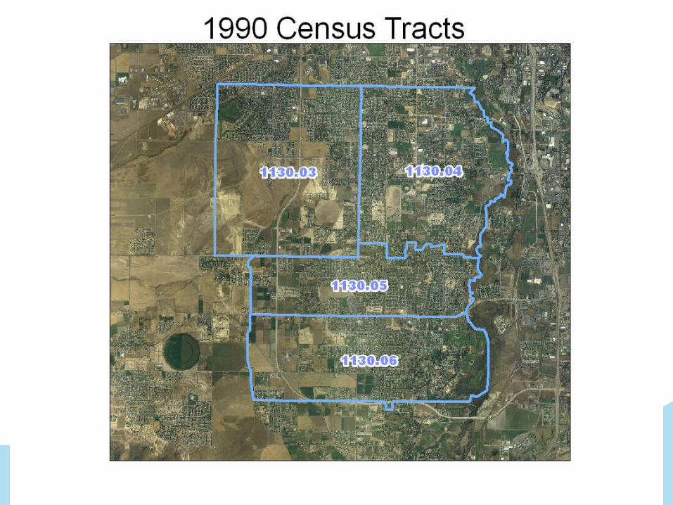
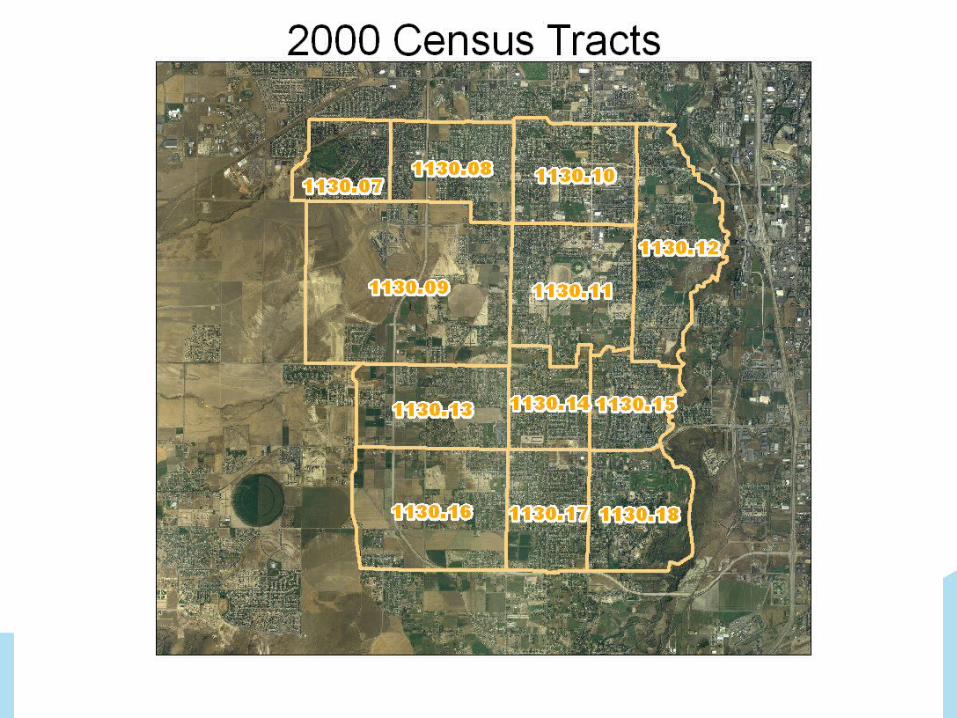
Map of census tracts
4
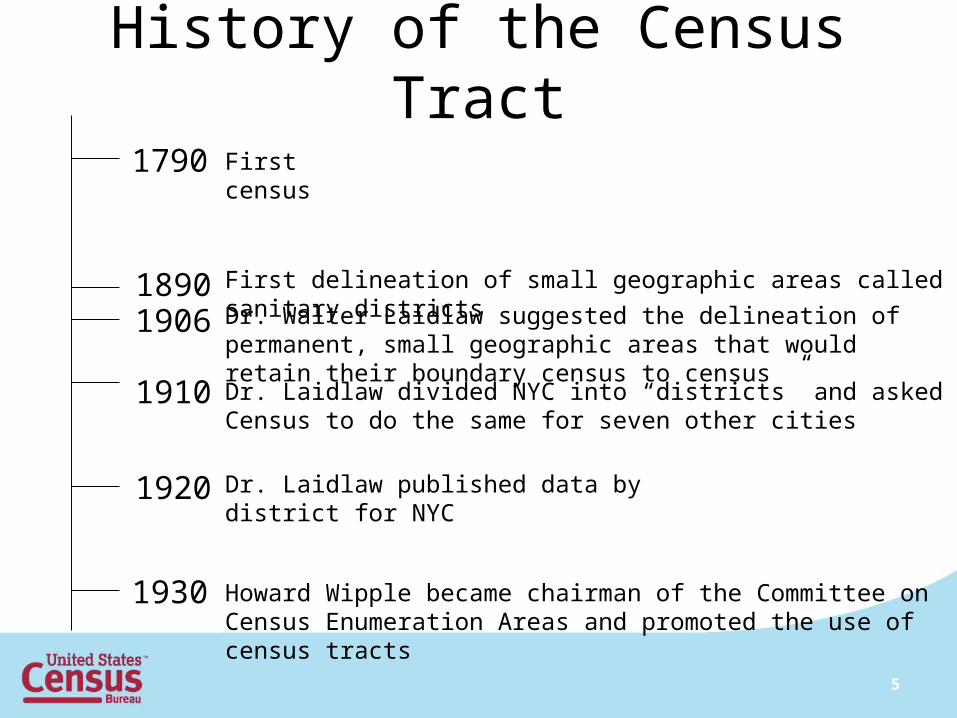
History of the Census Tract
1790 First census
1890 First delineation of small geographic areas called sanitary districts
1906
1910
Dr. Walter Laidlaw suggested the delineation of permanent, small geographic areas that would retain their boundary census to census
Dr. Laidlaw divided NYC into “districts” and asked Census to do the same for seven other cities
1920 Dr. Laidlaw published data by district for NYC
1930 Howard Wipple became chairman of the Committee on Census Enumeration Areas and promoted the use of census tracts
5
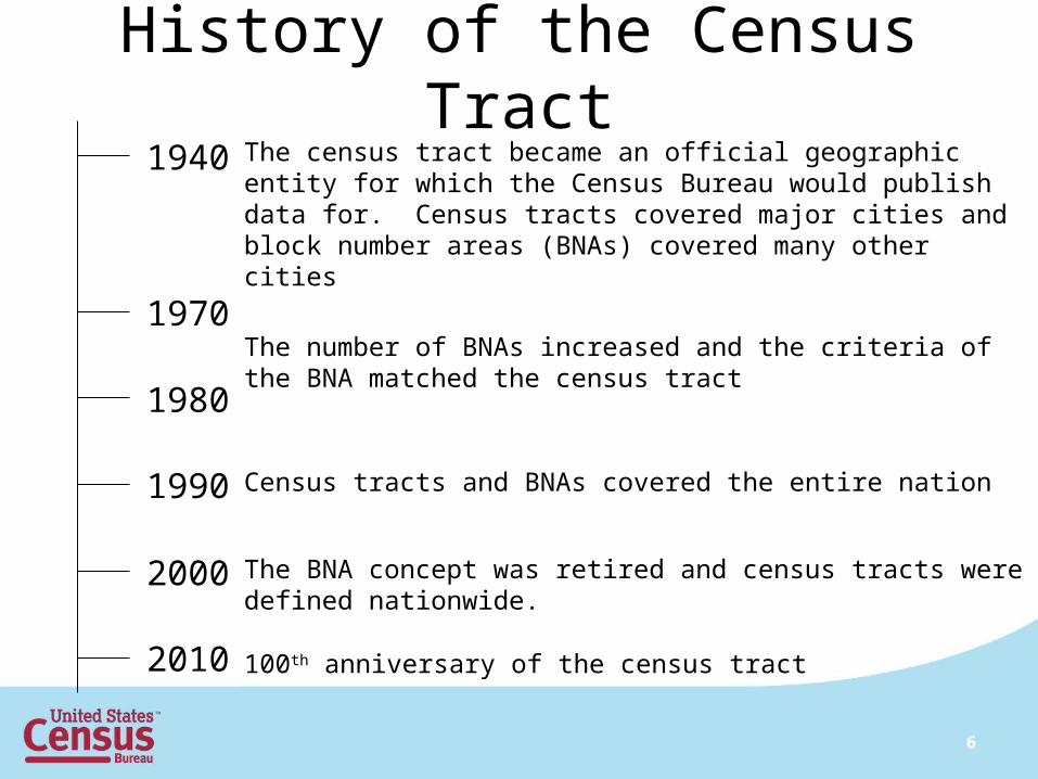
History of the Census Tract1940 The census tract became an official geographic entity for which the
Census Bureau would publish data for. Census tracts covered major cities and block number areas (BNAs) covered many other cities
1970
1980
The number of BNAs increased and the criteria of the BNA matched the census tract
Census tracts and BNAs covered the entire nation1990
2000 The BNA concept was retired and census tracts were defined nationwide.
100th anniversary of the census tract2010
6
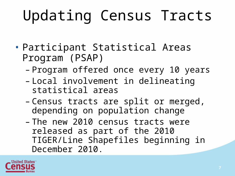
Updating Census Tracts
• Participant Statistical Areas Program (PSAP)– Program offered once every 10 years– Local involvement in delineating statistical
areas– Census tracts are split or merged, depending
on population change– The new 2010 census tracts were released as
part of the 2010 TIGER/Line Shapefiles beginning in December 2010.
7
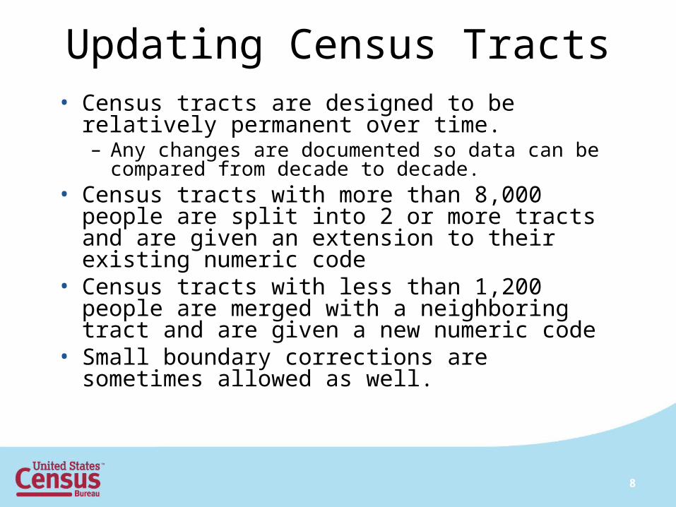
Updating Census Tracts• Census tracts are designed to be relatively
permanent over time.– Any changes are documented so data can be
compared from decade to decade.• Census tracts with more than 8,000 people are split
into 2 or more tracts and are given an extension to their existing numeric code
• Census tracts with less than 1,200 people are merged with a neighboring tract and are given a new numeric code
• Small boundary corrections are sometimes allowed as well.
8
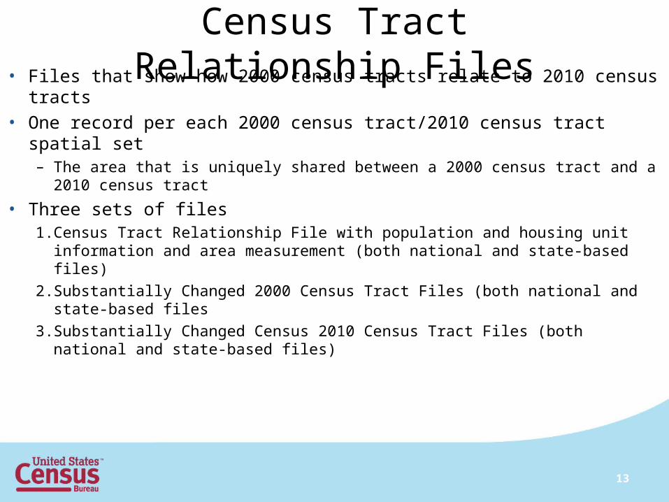
Census Tract Relationship Files• Files that show how 2000 census tracts relate to 2010 census tracts
• One record per each 2000 census tract/2010 census tract spatial set– The area that is uniquely shared between a 2000 census tract and a 2010
census tract
• Three sets of files1. Census Tract Relationship File with population and housing unit information
and area measurement (both national and state-based files)
2. Substantially Changed 2000 Census Tract Files (both national and state-based files
3. Substantially Changed Census 2010 Census Tract Files (both national and state-based files)
13
14
15
16
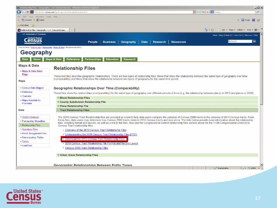
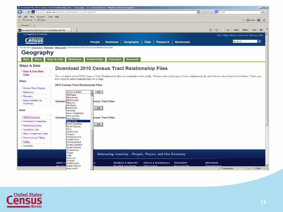
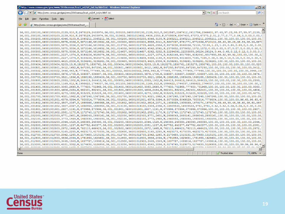
17
18
19
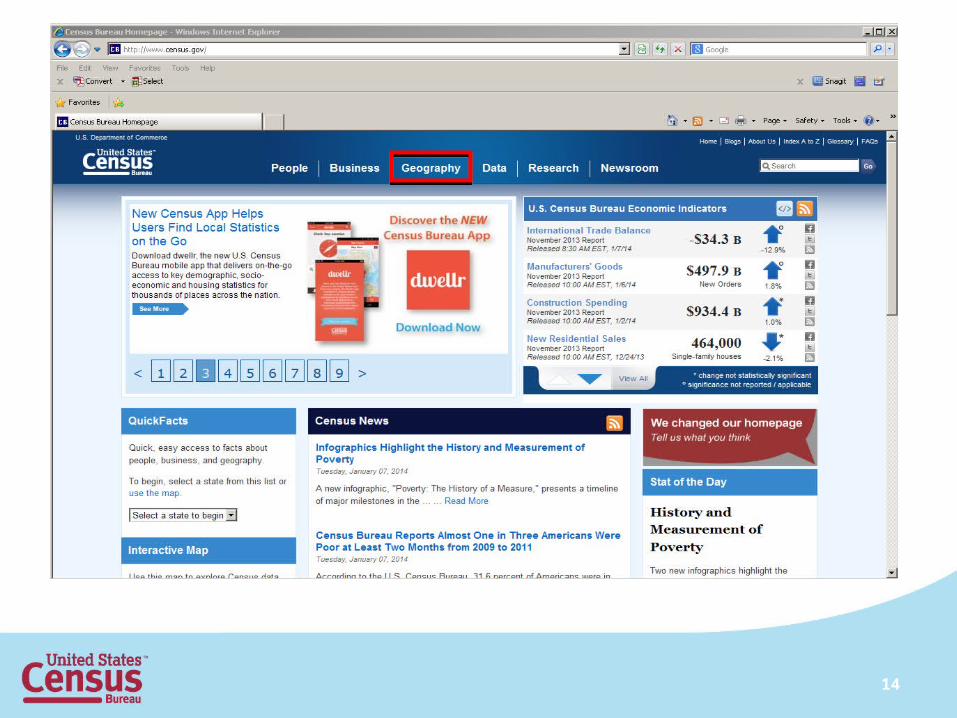
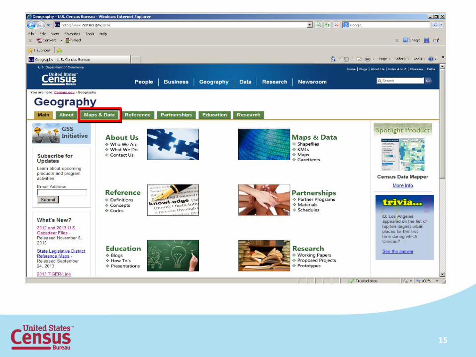
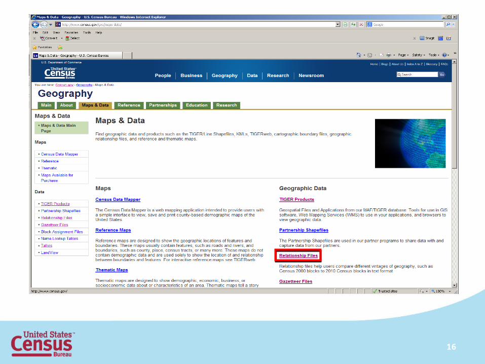
• To visualize the tract relationship files, you can use our TIGER/Line shapefiles or the tract outline PDF maps.
• The TIGER/Line shapefiles can be found at http://www.census.gov/geo/maps-data/data/tiger.html
• The census tract reference maps can be found at http://www.census.gov/geo/maps-data/
20
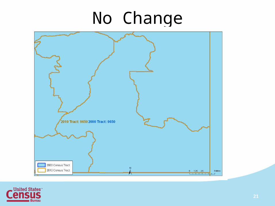
No Change
21
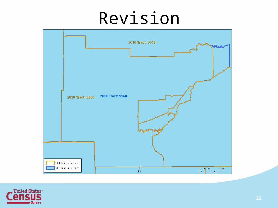
Revision
22
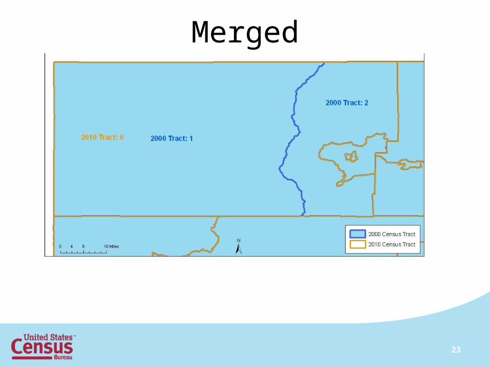
Merged
23
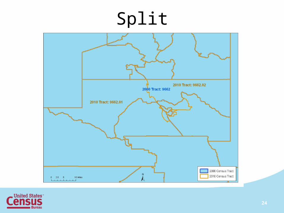
Split
24