by steve burton max maughan ian quarrington burton max maughan ian quarrington the derbyshire...
TRANSCRIPT

A Walker's Guide
BySteve BurtonMax MaughanIan Quarrington
TTT HHH EEE DDD EEE RRR BBB YYY SSS HHH III RRR EEEGGG RRR III TTT SSS TTT OOO NNN EEE WWW AAAYYY
A Walker's Guide
By Steve Burton
Max Maughan
Ian Quarrington
(Members of the Derby Group of the Ramblers'Association)
The Derbyshire Gritstone Way
First published by Thornhill Press, 24 Moorend RoadCheltenham
Copyright Derby Group Ramblers, 1980
ISBN 0 904110 88 5
The maps are based upon the relevant Ordnance SurveyMaps with the permission of the controller of Her Majesty's
Stationery Office, Crown Copyright reserved
CONTENTS
Foreward.............................................................................................................................. 5
Introduction......................................................................................................................... 6
Derby - Breadsall................................................................................................................. 8
Breadsall - Eaton Park Wood............................................................................................ 13
Eaton Park Wood - Milford............................................................................................... 14
Milford - Belper ................................................................................................................ 16
Belper - Ridgeway............................................................................................................. 18
Ridgeway - Whatstandwell............................................................................................... 20
Whatstandwell - Bilberry Knoll ....................................................................................... 22
Bilberry Knoll - Cuckoostone Lane ................................................................................. 24
Cuckoostone Lane - GR 300658 ....................................................................................... 26
GR 300658 - Chatsworth Park .......................................................................................... 27
Chatsworth Park - Curbar Edge ........................................................................................ 28
Curbar Edge - Upper Padley............................................................................................. 32
Upper Padley - Stanage Edge ............................................................................................ 34
Stanage Edge - Yorkshire Bridge ...................................................................................... 36
Yorkshire Bridge - Lose Hill............................................................................................. 38
Lose Hill - Edale ............................................................................................................... 40
LIST OF ACCOMMODATION....................................................................................... 43
CAMPSITES.................................................................................................................. 43
YOUTH HOSTELS ....................................................................................................... 43
BED & BREAKFAST................................................................................................... 44
Places of Interest on or near the route............................................................................... 45
Useful Names & Addresses............................................................................................... 48
THE RAMBLERS'ASSOCIATION................................................................................. 49
THE COUNTRY CODE................................................................................................... 50
Key to Symbols on Maps .................................................................................................. 51
Whilst every effort has been made to ensure the accuracy of information contained in thisguide, neither the authors nor the publisher can accept responsibility for the consequencesof any inaccuracies. All the tracks and paths shown are, to the best of knowledge, rightsof way. Access Land on rare occasions may be closed. If in doubt check with the PeakPark Planning Board.
We would like to record grateful thanks to those who helped us, in particular PhyllisOldknow for typing the manuscript; English Sewing Ltd. and Seven Trent WaterAuthority for information concerning their establishments, and members of theDerbyshire Area Ramblers' Association for their advice and encouragement.
S.B.
M.J.M
I.N.Q

FOREWARD
by Phillip Whitehead, M.P.
It was in the lifetime of many ramblers who are still active that the struggle for access tothe Derbyshire Peak began to be won. The Ramblers' Association has done much to bringhome to the people of Derbyshire and visitors from far afield the heritage of history andlandscape on our doorstep. This guide to the Gritstone Way is not only an appropriatereminder of Footpath Heritage Week in 1980; it also meets the need for a guide whichwill link town and country, peakland, city and dales, in a route which all can attempt,either in stages or as a whole.
Living as I do at Rowsley, the midway point of this route; I always regret how manypeople storm through the towns and villages of the Derwent Valley, in their eagerness toget to the real beauties of the northern hills and stately homes. This guide has a surertouch. It will lead the discerning walker through much of the past which has shaped usall, and more unexpected beauty, which too many of us see only through the haze of ourexhaust fumes.
This guidebook will be read with pleasure, carried with profit, and retained with a sharpand lasting memory of the unexpected delights of the Gritstone Way. Some will want torefer to it on a passing visit where only a short walk is possible. Others I hope will setthemselves a week end or longer to do as much of the whole route as they can, divertingto the places of note along the way, until the moment comes for the last stage, theexhilarating climb up to Win Hill and then along the ridge to Mam Tor. When you do thatyou will understand why Lord Byron wrote that there are things in Derbyshire asbeautiful as any thing you will see in Switzerland. All there for the taking, on your owndoorstep, free as the clean air you will be breathing.
INTRODUCTION
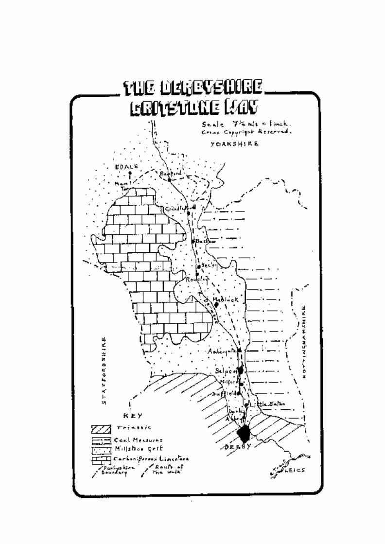
The concept of a continuous walking route along the gritstone from Derby to Edale wasformulated by members of the Derbyshire Area Ramblers' Association in 1970.
As information on the route was very limited, Derby Group of the Ramblers' Associationdecided to resurvey the route and write a guide as their contribution to Footpath HeritageWeek 1980. Problems such as new housing, broken footbridges, etc., have beenencountered and the route now described circumvents the majority of these problems andoffers the walker a very varied 56 miles.
Geologically Derbyshire consists mainly of two rock types, Carboniferous Limestone andMillstone Grit, both formed during the Carboniferous Period about 300 million years'ago. Soon after this, these rocks were uplifted and folded into a dome structure called ananticline, which, after erosion, exposed the limestone in the centre of the dome and theMillstone Grit along the sides. The latter consists of shales and coarse sandstones, and thesandstones, being more resistant, have weathered out to form upstanding scarps or"edges" running from north to south on the western and eastern sides of Derbyshire. It isalong this series of eastern gritstone edges that the route of the Derbyshire Gritstone Wayruns (hence its name).
Both Derby and Edale are easily accessible, rail and bus connections being available. Theroute lends, itself to be walked in a variety of ways, depending on the walker's ability andpersonal preference - either in easy stages, staying at hotels, guest houses or camping, byincorporating the route in a number of loops taking in adjoining countryside, or as achallenge walk, backpacking.
REMEMBER that although the route described is on rights-of-way or Access Land, youare crossing private farmland or moors, and the Country Code should be observed.

DERBY - BREADSALL
The walk begins in Derby. Excavations have revealed that settlements existed in Romantimes by the River Derwent on the northern side of the present City Centre. There aretraces of Saxon and Danish occupations, and by the Middle Ages a number of religioushouses were established, including All Saints, now the Cathedral. The IndustrialRevolution came early to Derby - John and Thomas Lombe's Silk Mill being erected in1717. Other textile mills followed. Derby china works was founded in 1755 (becoming'Royal Crown' in 1890).
The railways arrived in 1839, the latter providing the basic skills which led to Derbybecoming a renowned centre for engineering. City status was bestowed in 1977.
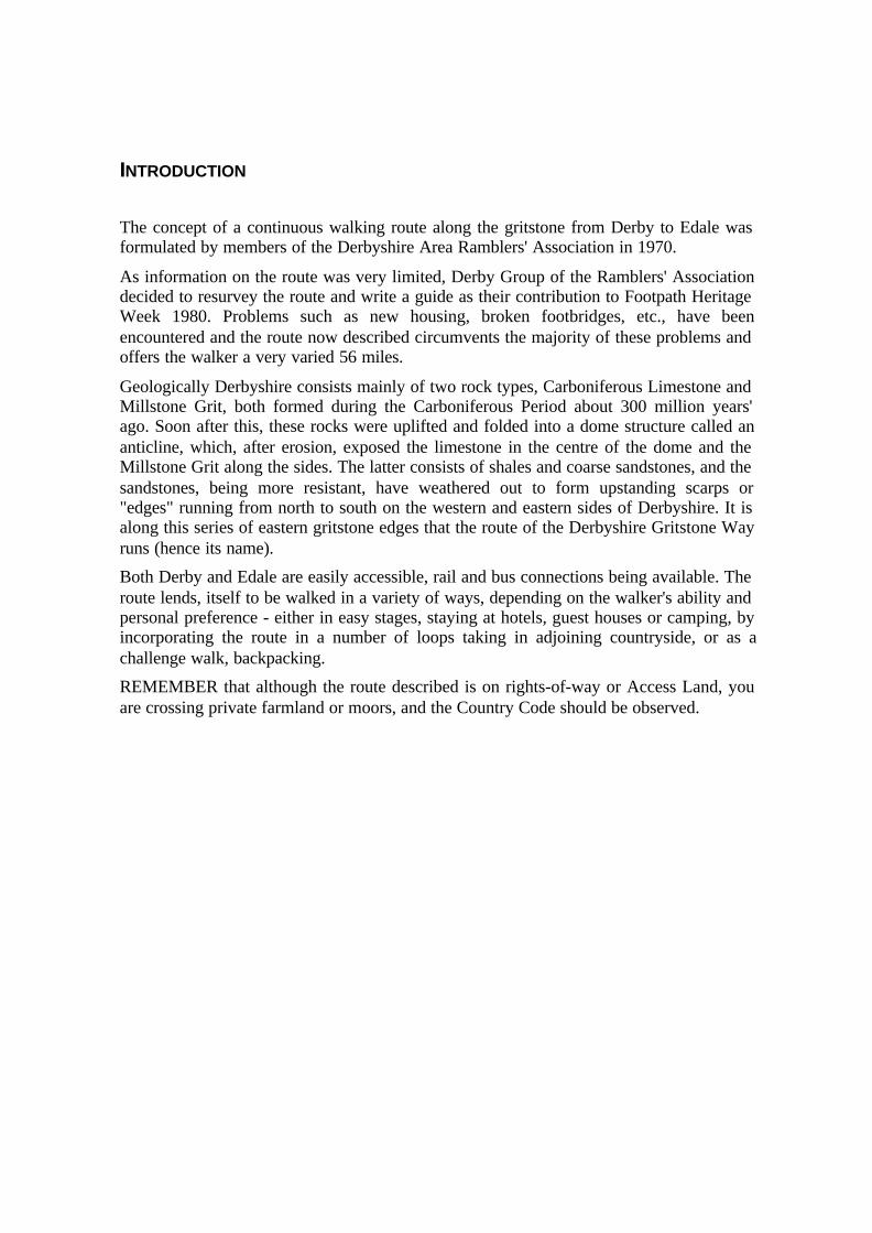
Start at All Saints, Derby's Cathedral, the most striking feature of which, is the lofty 178foot sixteenth century tower. The rest of the Cathedral was rebuilt by James Gibbs in theeighteenth century and contains a number of interesting sculptures. There is a fineexample of Robert Bakewell's ironwork - a screen stretching the width of the building.Note also Bess of Hardwick's monument, an elaborate epitaph to a powerful and muchmarried countess.
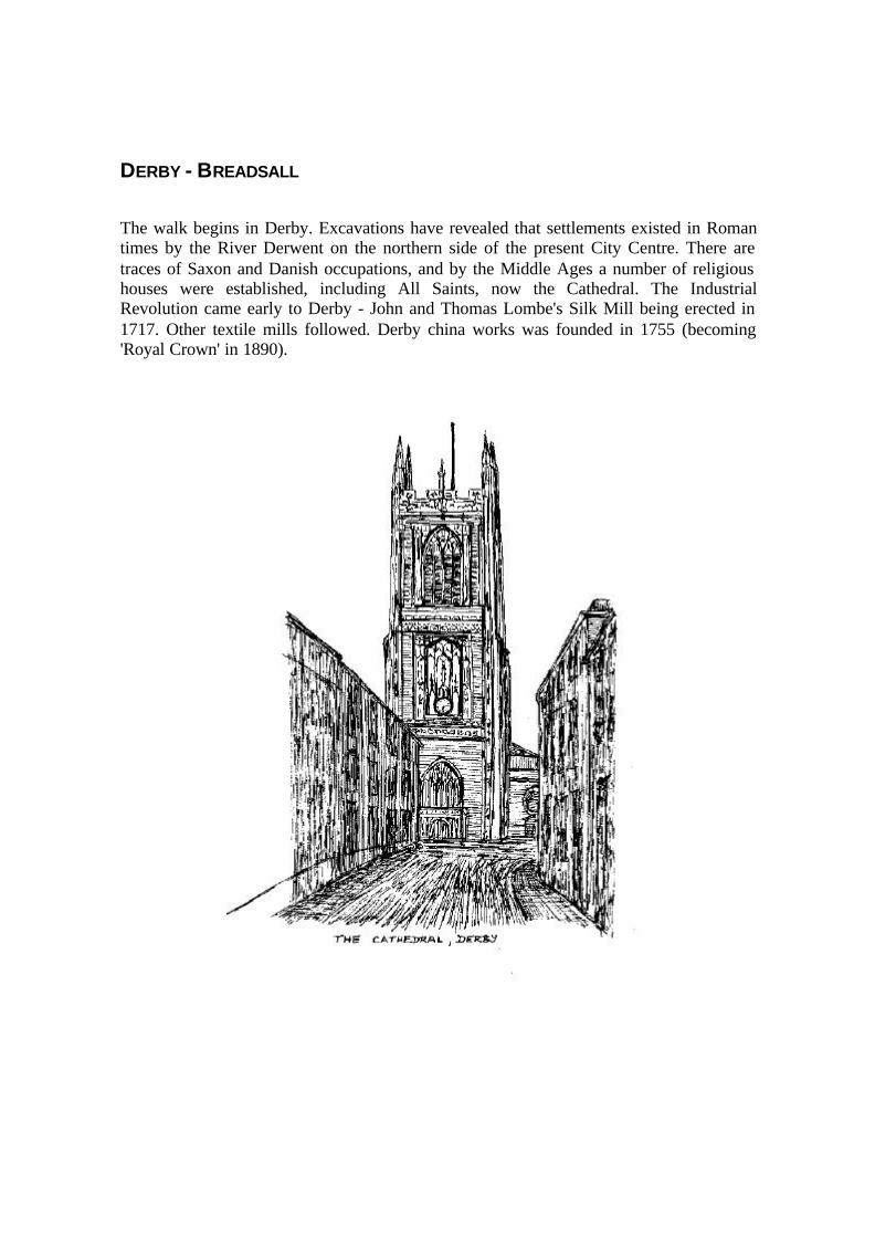
Make your way to the river, passing Derby Industrial Museum. The exhibits are housedin a building constructed in 1910 on the site of Lombe's original silk mill, which wasgutted by fire. Some of the original foundation arches can be seen on the site facing theriver. The exhibits include a collection of Rolls-Royce aero engines and displaysillustrate Derbyshire's industrial development.

After passing under the Inner Ring Road, St. Mary's Bridge will be seen on your right. Abridge existed here in medieval times and a fine example of a Bridge Chapel still exists.
Walk towards St. Mary's Church in Bridge Gate but turn right, before reaching thechurch, along North Parade. Cross the route of a former railway line and proceed alongDarley Grove.
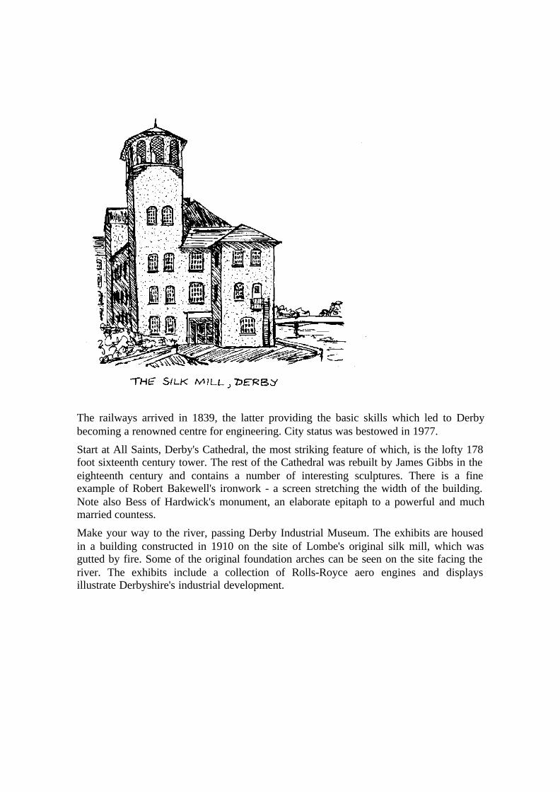
Darley Abbey Village is soon reached. Take New Row down to the river and make forthe Toll Bridge.
Darley Abbey was founded in the twelfth century as an Augustinian Priory. The mainsurviving structure has recently been converted into a public house. In 1783 Walter Evansestablished cotton mills on the opposite bank of the river. Houses were built around theabbey site to accommodate the workers.
Pass through the mill complex, taking the public footpath on the left, and follow the rivernorthwards for about half-a-mile. Bear right over the railway and continue up thebridleway to the junction of the A61 and Croft Lane. Walk up Croft Lane to BreadsallVillage. The church here has a fine fourteenth century steeple which is a prominentlandmark.

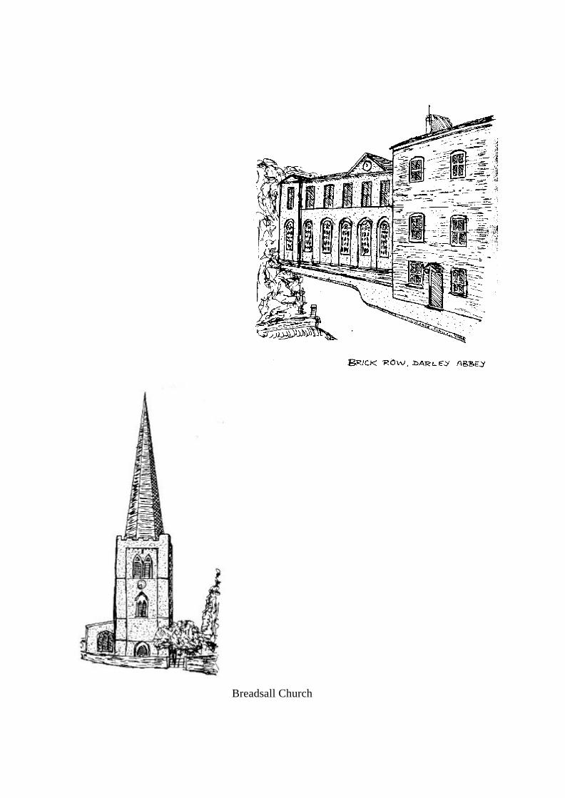
Breadsall Church
BREADSALL - EATON PARK WOOD
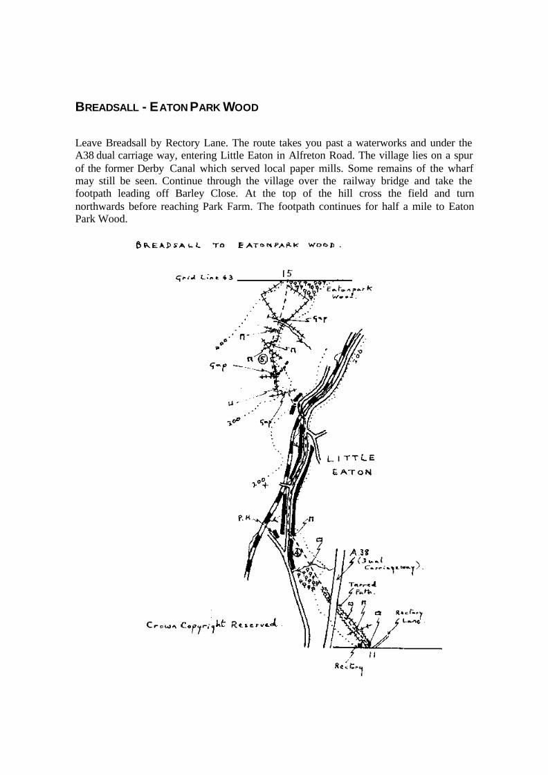
Leave Breadsall by Rectory Lane. The route takes you past a waterworks and under theA38 dual carriage way, entering Little Eaton in Alfreton Road. The village lies on a spurof the former Derby Canal which served local paper mills. Some remains of the wharfmay still be seen. Continue through the village over the railway bridge and take thefootpath leading off Barley Close. At the top of the hill cross the field and turnnorthwards before reaching Park Farm. The footpath continues for half a mile to EatonPark Wood.

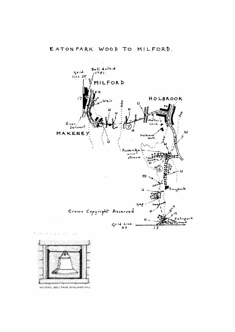
EATON PARK WOOD - M ILFORD
Continue to Holbrook, crossing the line of the Derwent Aqueduct. This aqueduct is anarterial route for water supplies to South Derbyshire, Leicester and Nottingham. Thesources are the Derwent Valley reservoirs which lie in the High Peak between Glossopand Sheffield. These reservoirs are fed, either naturally or by diversion from adjoiningcatchments, by the Rivers Derwent, Ashop, Alport and Noe. Water from the reservoirs isfirst treated and then fed into the aqueduct - a system of steel or cast iron pipes up to 48inches in diameter. The green iron gates you will see from time to time on fieldboundaries lie above the pipelines and allow access for inspection and repair purposes.
In the village turn left up Mellors Lane, thence via a footpath to Makeney. Follow theroad to Milford, crossing the River Derwent. Notice the entrance to the cotton mill wherea bell is displayed. The inscription on the bell reads - "Wm. Chapman of London, Fecit1781." It is thought that the bell was originally housed in one of the older Strutt mills atNottingham or Milford and then transferred to the cruciform fireproof warehouse atMilford. The latter was built by Strutt in 1792 and stood on the opposite side of the mainroad to the present mill. It was demolished in 1964.
MILFORD - BELPER
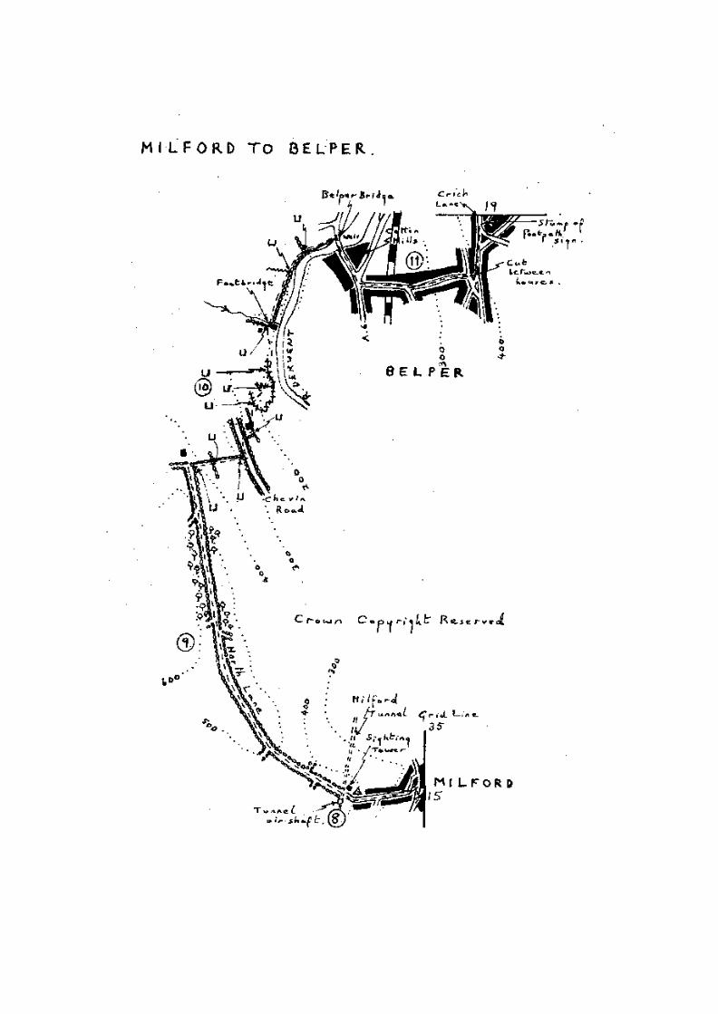
Walk up Sunny Hill and along the bridleway across the golf course. The square gritstonetower on the right is a sighting tower built by George Stephenson during the constructionof the railway tunnel in 1839.
Follow the bridleway across the Chevin, where fine views may be had of Belper. In thedistance Crich Stand may be seen. This is a memorial to the Sherwood Foresters andstands on a limestone quarry edge. Crich is also the home of a Tramway Museum open tothe public during the summer.
Just before the bridleway makes a sharp left turn to Farnah Green, take the footpath to theright down the hill and join Chevin Road for 100 yards. Then take the footpath in front ofSwiss House, which leads down to the river. Continue along the water meadows toBelper Bridge.
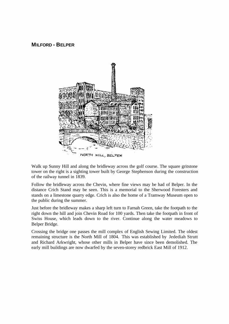
Crossing the bridge one passes the mill complex of English Sewing Limited. The oldestremaining structure is the North Mill of 1804. This was established by Jedediah Struttand Richard Arkwright, whose other mills in Belper have since been demolished. Theearly mill buildings are now dwarfed by the seven-storey redbrick East Mill of 1912.
BELPER - RIDGEWAY
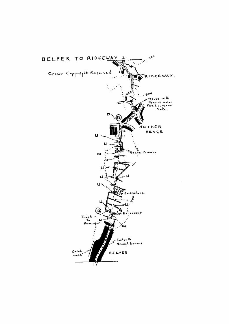
Walk up Long Row, past the industrial housing of the 1790s and leave Belper by CrichLane.
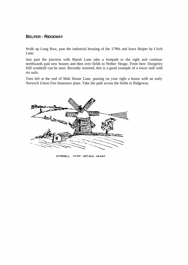
Just past the junction with Marsh Lane take a footpath to the right and continuenorthwards past new houses and then over fields to Nether Heage. From here DungeleyHill windmill can be seen. Recently restored, this is a good example of a tower mill withsix sails.
Turn left at the end of Malt House Lane, passing on your right a house with an earlyNorwich Union Fire Insurance plate. Take the path across the fields to Ridgeway.

RIDGEWAY - WHATSTANDWELL
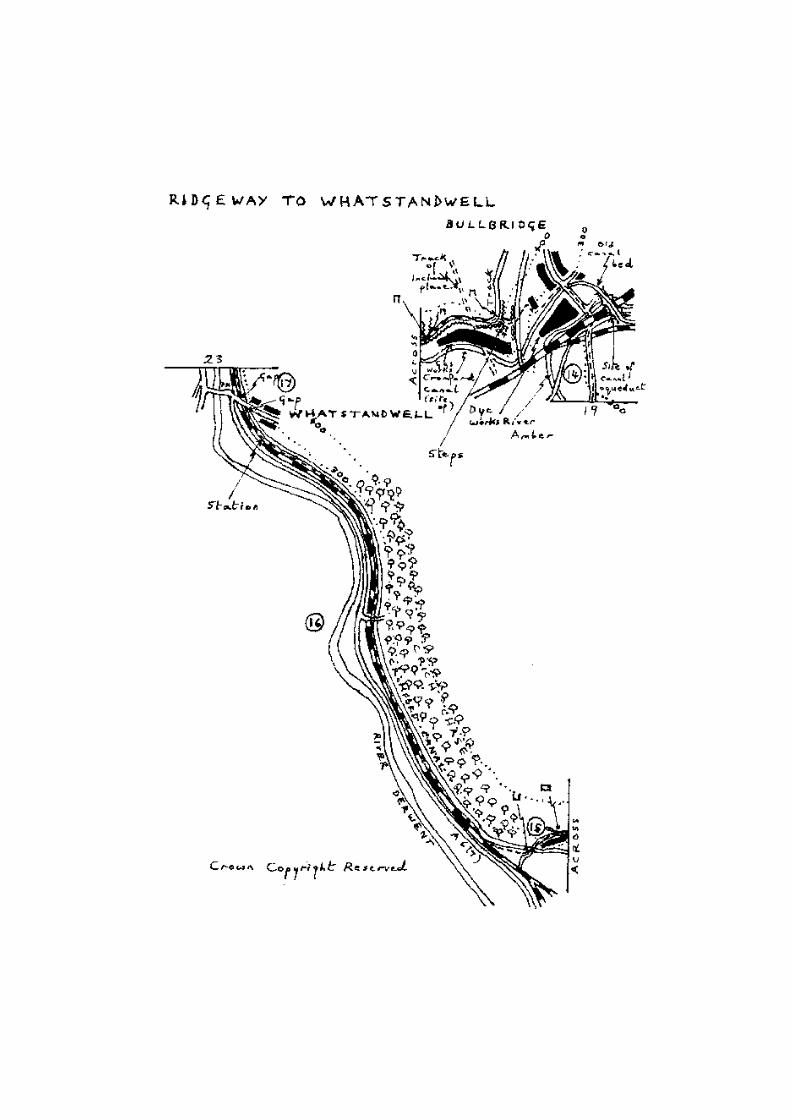
Proceed on towards Bullbridge. At the main road, turn left, under the railway bridge.Cross the river and continue up the hill to the canal bridge. Take the canal tow path onthe 1eft.
Continue past the dyeworks and the gas plant - the footpath follows the boundary fences.You will pass traces of Stephenson's incline built in 1842 to connect lime quarries atCrich with kilns in Ambergate. The system operated by gravity, the descending fullwagons being counter-balanced by raising empty ones.
Soon the Cromford Canal is reached and the route now follows the tow path toWhatstandwell.
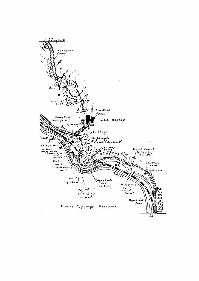
WHATSTANDWELL - BILBERRY KNOLL
Continue along the towpath to High Peak Junction where the line of the old Cromfordand High Peak Railway meets the canal. En route, about one mile beyond Whatstandwell,the canal passes through Gregory Tunnel. Walking through the tunnel is optional as thereis an alternative path over the top.
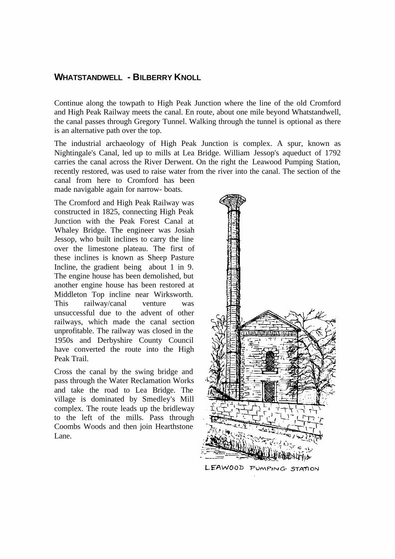
The industrial archaeology of High Peak Junction is complex. A spur, known asNightingale's Canal, led up to mills at Lea Bridge. William Jessop's aqueduct of 1792carries the canal across the River Derwent. On the right the Leawood Pumping Station,recently restored, was used to raise water from the river into the canal. The section of thecanal from here to Cromford has beenmade navigable again for narrow- boats.
The Cromford and High Peak Railway wasconstructed in 1825, connecting High PeakJunction with the Peak Forest Canal atWhaley Bridge. The engineer was JosiahJessop, who built inclines to carry the lineover the limestone plateau. The first ofthese inclines is known as Sheep PastureIncline, the gradient being about 1 in 9.The engine house has been demolished, butanother engine house has been restored atMiddleton Top incline near Wirksworth.This railway/canal venture wasunsuccessful due to the advent of otherrailways, which made the canal sectionunprofitable. The railway was closed in the1950s and Derbyshire County Councilhave converted the route into the HighPeak Trail.
Cross the canal by the swing bridge andpass through the Water Reclamation Worksand take the road to Lea Bridge. Thevillage is dominated by Smedley's Millcomplex. The route leads up the bridlewayto the left of the mills. Pass throughCoombs Woods and then join HearthstoneLane.

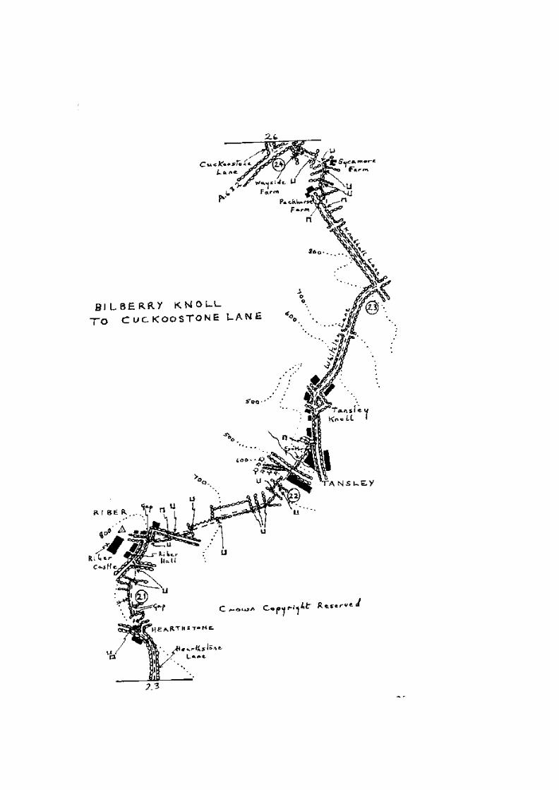
BILBERRY KNOLL - CUCKOOSTONE LANE
On reaching Bilberry Knoll make for Riber Castle, a nineteeth century folly built for JohnSmedley as a residence. After his death it became a school, then a food store and is now azoo.
The Matlocks maywarrant a diversion.Lying in a limestonegorge hewn out by theRiver Derwent, theyare popular withtourists. The area isfamous for its cavesand lead mining andMatlock Bath is nowthe home of PeakDistrict MiningMuseum.
Further south liesCromford, the site of
several early cotton mills. TheMasson Mill on the A6 wasbuilt by Richard Arkwright in1783. The Arkwright Mill of1772 is situated opposite theCromford Meadows. Arkwrightwas also responsible for theindustrial housing in NorthStreet and the Greyhound Inn.
The route passes Riber Hall, anearly seventeenth century house.Just beyond, a footpath leadsacross fields to Tansley Knoll.Take Whitelea Lane out of thevillage and after about half-a-mile turn left and follow theridge along Knabhall Lane.Then continue past PackhorseFarm and across fields toWayside Farm to joinCuckoostone Lane.
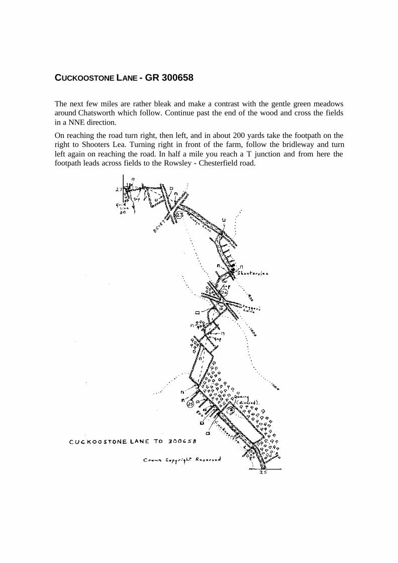
CUCKOOSTONE LANE - GR 300658
The next few miles are rather bleak and make a contrast with the gentle green meadowsaround Chatsworth which follow. Continue past the end of the wood and cross the fieldsin a NNE direction.
On reaching the road turn right, then left, and in about 200 yards take the footpath on theright to Shooters Lea. Turning right in front of the farm, follow the bridleway and turnleft again on reaching the road. In half a mile you reach a T junction and from here thefootpath leads across fields to the Rowsley - Chesterfield road.

GR 300658 - CHATSWORTH PARK
Follow the Rowsley road downhill for just over a mile, and take the bridleway on theright through Rowsley Wood. In about 350 yards take the indistinct track to the left.When you reach the edge of the wood bear right uphill towards the small footbridge overa stream. Cross it and pass the quarries and follow the tracks downhill towards Beeley.
Opposite the church enter Chatsworth Park by taking the footpath to One Arch Bridge.Cross Chatsworth Park along the designated footpath to Baslow. You pass first theremains of an eighteenth century cornmill which was operating as late as 1952.
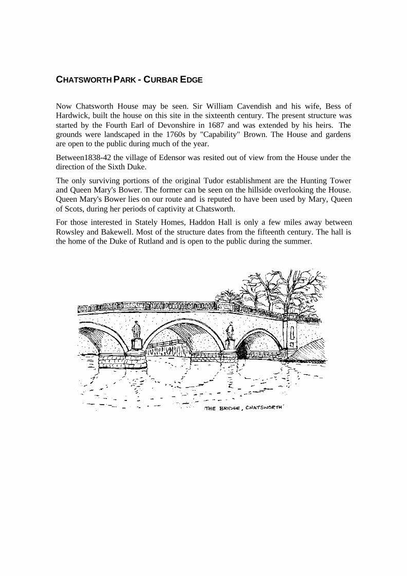
CHATSWORTH PARK - CURBAR EDGE
Now Chatsworth House may be seen. Sir William Cavendish and his wife, Bess ofHardwick, built the house on this site in the sixteenth century. The present structure wasstarted by the Fourth Earl of Devonshire in 1687 and was extended by his heirs. Thegrounds were landscaped in the 1760s by "Capability" Brown. The House and gardensare open to the public during much of the year.
Between1838-42 the village of Edensor was resited out of view from the House under thedirection of the Sixth Duke.
The only surviving portions of the original Tudor establishment are the Hunting Towerand Queen Mary's Bower. The former can be seen on the hillside overlooking the House.Queen Mary's Bower lies on our route and is reputed to have been used by Mary, Queenof Scots, during her periods of captivity at Chatsworth.
For those interested in Stately Homes, Haddon Hall is only a few miles away betweenRowsley and Bakewell. Most of the structure dates from the fifteenth century. The hall isthe home of the Duke of Rutland and is open to the public during the summer.
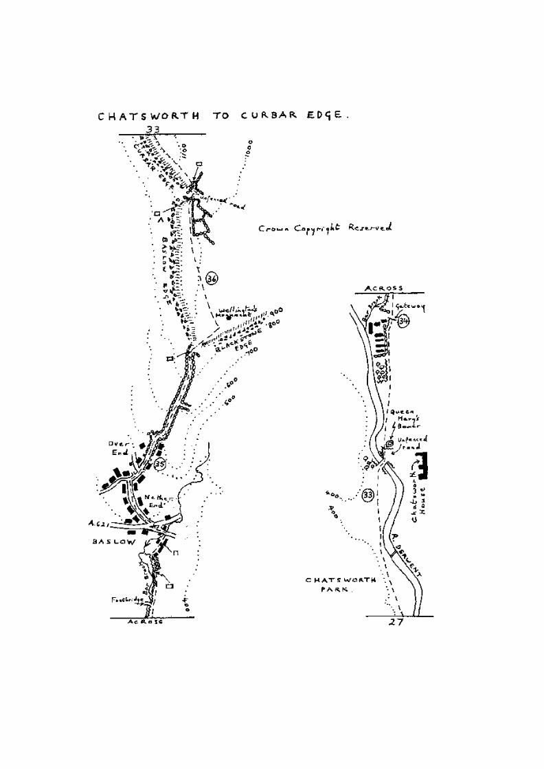
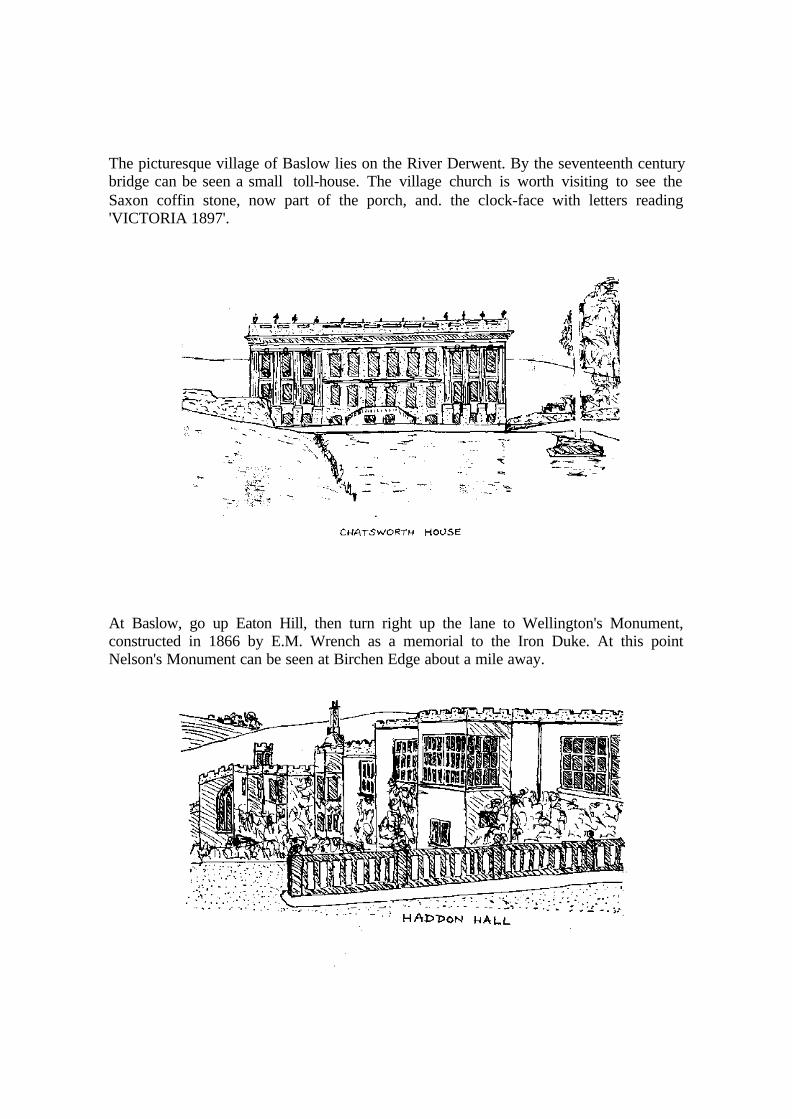
The picturesque village of Baslow lies on the River Derwent. By the seventeenth centurybridge can be seen a small toll-house. The village church is worth visiting to see theSaxon coffin stone, now part of the porch, and. the clock-face with letters reading'VICTORIA 1897'.
At Baslow, go up Eaton Hill, then turn right up the lane to Wellington's Monument,constructed in 1866 by E.M. Wrench as a memorial to the Iron Duke. At this pointNelson's Monument can be seen at Birchen Edge about a mile away.

From Wellington's Monument the route follows Derbyshire's eastern gritstone edges -Baslow, Curbar, Froggatt, Burbage and Stanage - names well known in British climbingcircles.
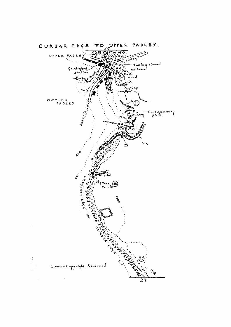
CURBAR EDGE - UPPER PADLEY
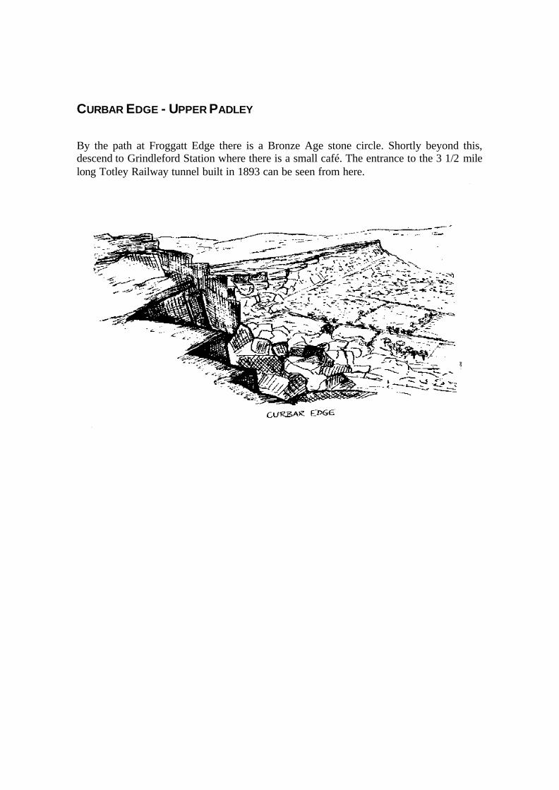
By the path at Froggatt Edge there is a Bronze Age stone circle. Shortly beyond this,descend to Grindleford Station where there is a small café. The entrance to the 3 1/2 milelong Totley Railway tunnel built in 1893 can be seen from here.
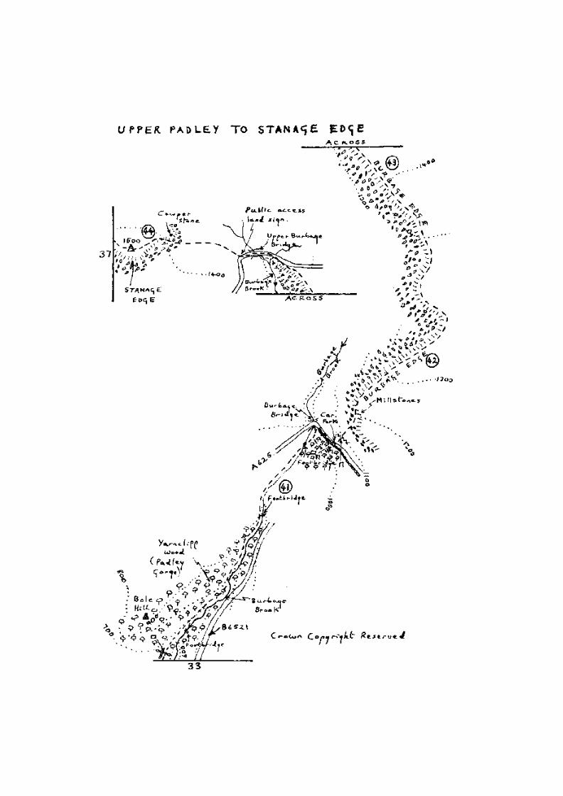
UPPER PADLEY - STANAGE EDGE
The route now passes up Padley Gorge, a relic oak woodland noted for its bird life,especially pied flycatchers. These are summer visitors and several pairs breed in the nestboxes provided. A publication on the nature trail is available from the Peak Park PlanningBoard.
Emerging from the woodland, continue along Burbage Brook. On the right one can seeLongshaw Lodge, formerly the property of the Duke of Rutland and now owned by theNational Trust.
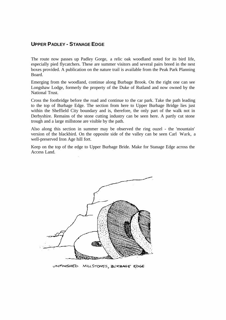
Cross the footbridge before the road and continue to the car park. Take the path leadingto the top of Burbage Edge. The section from here to Upper Burbage Bridge lies justwithin the Sheffield City boundary and is, therefore, the only part of the walk not inDerbyshire. Remains of the stone cutting industry can be seen here. A partly cut stonetrough and a large millstone are visible by the path.
Also along this section in summer may be observed the ring ouzel - the 'mountain'version of the blackbird. On the opposite side of the valley can be seen Carl Wark, awell-preserved Iron Age hill fort.
Keep on the top of the edge to Upper Burbage Bride. Make for Stanage Edge across theAccess Land.

STANAGE EDGE - YORKSHIRE BRIDGE
Stanage Edge offers extensive views of the surrounding countryside. In the valleytowards Hathersage lies North Lees Hall, a sixteenth century manor house. The storygoes that Robert Eyre, who lived at Highlow Hall, had seven sons. He supervised theconstruction of houses for them within sighting distance, so that signals could be used forcommunication. North Less Hall is one of the seven, and is thought to be the setting ofMarsh End in Jane Eyre by Charlotte Bronte.
Hathersage churchyard is reputed to be the burial place of Little John and a cave knownas Robin Hood's Cave is situated half way up Stanage Edge.
Leave Stanage Edge by the track leading to Dennis Knoll and take the lane to YorkshireBridge.

YORKSHIRE BRIDGE - LOSE HILL
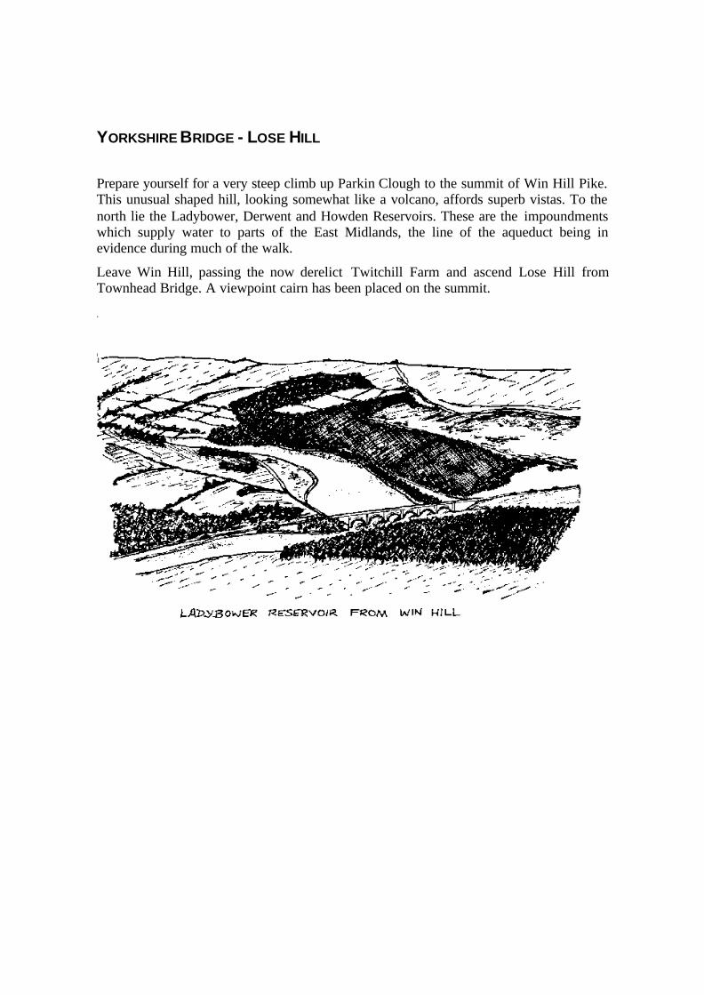
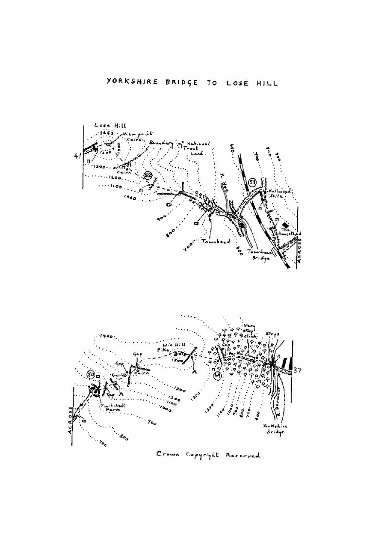
Prepare yourself for a very steep climb up Parkin Clough to the summit of Win Hill Pike.This unusual shaped hill, looking somewhat like a volcano, affords superb vistas. To thenorth lie the Ladybower, Derwent and Howden Reservoirs. These are the impoundmentswhich supply water to parts of the East Midlands, the line of the aqueduct being inevidence during much of the walk.
Leave Win Hill, passing the now derelict Twitchill Farm and ascend Lose Hill fromTownhead Bridge. A viewpoint cairn has been placed on the summit.

LOSE HILL - EDALE
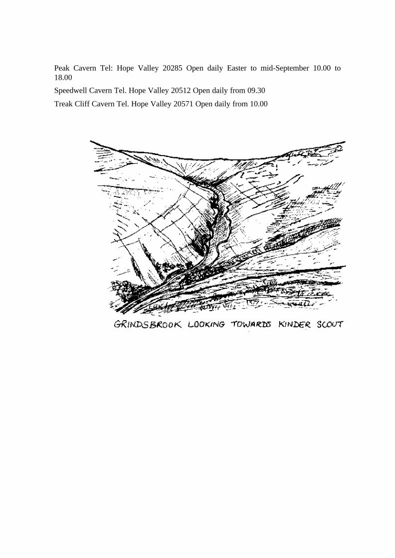
The route from Lose Hill to Mam Tor is one of the finest ridge walks in Derbyshire.From the ridge you can see the valley of the River Noe with Edale nestling below KinderScout. Continue over Back Tor, where there is a relic of scots pine forest passing HollinsCross, which is part of an ancient trackway through the col (the lowest point on theridge). Another viewpoint cairn has been placed here.
We now come to the final climb on the walk (and the highest point) - the summit of MamTor. The name Mam Tor is derived from the Celtic, meaning Mother Mountain, and itssummit is crowned by an Iron Age hill fort. It is also known as the Shivering Mountainbecause the face, being composed of alternate layers of sandstone and shale, issusceptible to landslips. Back Tor is also an example of a landslip.
Between Mam Tor and Castleton are several mines in the limestone. They were used forthe extraction of galena (lead ore) and the three gangue minerals (fluorspar, barytes andcalcite) since Roman times. Now the extractions are limited to the blue or yellow form offluorspar called Blue John. It is thought that the name Blue John is derived from theFrench 'bleu et jaune'. Four caverns are open to the public.
From Mam Tor descend to Edale via Greenlands. Fieldhead, the National ParkInformation Centre, marks the terminal point of the Derbyshire Gritstone way. Edale isendowed with a cafe and two hostelries for thirst quenching, and if you wish to do a littlemore walking, then proceed to Grindsbrook and the start of the Pennine Way.


LIST OF ACCOMMODATION
CAMPSITES
Whatstandwell Haytop Farm
GR 330541 Ambergate 2063
Whatstandwell Merebrook Caravan Company
GR 330550 Ambergate 2154
Matlock Moor Wayside Farm
GR 321620 Matlock 2967
Matlock Moor Packhorse Farm
GR 323617 Matlock 2781
Baslow Erie Campsite Byne Memorial Campsite
GR 275726 Moorside Farm
Edale Waterside Farm
GR 118849 Barber Booth
Edale Fieldhead
GR 125856 Edale (requires advance booking)
Edale Coopers Camp & Caravan Site
GR 123859 Newfold Farm, Edale Hope Valley 70372
YOUTH HOSTELS
Shining Cliff, Ambergate GR 335522
Matlock Bath GR 295585
Fly Hill, Bakewell GR 215686

The Edge, Eyam GR 219769
Castleton Road, Hathersage GR 226815
Castleton Hall GR 150828
Rowland Cote, Nether Booth. GR 140866
Edale
BED & BREAKFAST
Establishments are best identified by consulting either the R.A. Bed & Breakfast Guideor a local Tourist Information Centre.
PLACES OF INTEREST ON OR NEAR THE ROUTE
DERBY
Derby Industrial Museum Tel: Derby 31111
Open Tuesday-Friday 10.00 to 17.45
Saturdays 1 0.00 to 16.45
Closed-Mondays, Sundays and Bank Holidays
Derby Museum and Art Gallery Tel: Derby 31111
Open Tuesday-Friday 10.00 to 18.00
Open Saturdays 10.00 to 17.00
Closed Mondays, Sundays and Bank Holidays
Kedleston Hall (4 miles NW of Derby) Tel: Derby 840396
Open Bank Holidays and Sundays during the summer
CRICH
Crich Tramway Museum Tel: Ambergate 2565
Open April-October: Saturdays, Sunday and Bank Holidays 10.30 to 17.30
June-August: Tuesday, Wednesday and Thursday 1 0. 00 to 16.30
Crich Stand-Open daily
CROMFORD
Leawood Pumping Station: Details of open days from Cromford Canal Society Ltd., OldWharf, Mill Road, Cromford. Tel: Wirksworth 3727
Middleton Top Engine House. Tel. Wirksworth 3204
Open Sundays. In steam first Saturday in each month

MATLOCK
Peak District Mining Museum Tel. Matlock 3835
Open daily
Heights of Abraham Tel: Matlock 2365
Open daily
Riber Castle (Zoo) Tel: Matlock 2073
Open daily
Great Rutland Cavern
Open daily Easter to October: 10.00 to 18.00
Great Masson Cavern
Open Sundays and Bank Holidays Easter to October and daily in August. 11.00 to 18.00
BAKEWELL
Old House Museum Tel: Bakewell 3647
Open daily Easter to October: 14.30 to 17.00
Haddon Hall Tel: Bakewell 2855
Open April to September, Tuesdays to Saturdays and Bank Holidays: 11.00 to 18.00
BASLOW
Chatsworth House Tel: Baslow 2204
Open April to October most days
CASTLETON
Peveril Castle Open daily
Blue John Cavern Tel: Hope Valley 20642 Open daily: 09.30 to 18.00
Peak Cavern Tel: Hope Valley 20285 Open daily Easter to mid-September 10.00 to18.00
Speedwell Cavern Tel. Hope Valley 20512 Open daily from 09.30
Treak Cliff Cavern Tel. Hope Valley 20571 Open daily from 10.00

USEFUL NAMES & ADDRESSES
Peak Park Information Centre Fieldhead Edale Nr Sheffield
Trent Motor Traction National Bus Co. Uttoxeter Road, Derby
Peak National Park Information Centre Market Hall, Bridge Street, Bakewell, Derbyshire
Tourist Information Centre The Strand, Derby
Peak Park Planning Board Aldern House Bakewell, Derbyshire
Tourist Information Centre The Pavilion Matlock Bath
Youth Hostels Association Trevelyan House St. Albans Herts ALI 2DY
The National Trust PO Box 30 Beckenham Kent

THE RAMBLERS'ASSOCIATION
The Ramblers' Association is a national organisation for all those interested in preservingpublic paths. It has over 30,000 individual members but needs more.
Up and down the country there are now over 160 local groups of the Ramblers'Association. When you become a member, you are eligible to join your local RA Groupand take part in its activities at no extra subscription.
What does a local group do?
It organises a programme of walks and social events for its members.
It looks after the local footpaths by opposing closures unfavourable to ramblers and byhelping to keep paths waymarked and clear of undergrowth.
R.A. membership is open to all.
Full details can be obtained from The Ramblers' Association, 1 /5 Wandsworth Road,London SW5 2LJ

THE COUNTRY CODE
Enjoy the countryside and respect its life and work
Guard against all risk of fire
Fasten all gates
Keep dogs under close control
Keep to public paths across farmland
Use gates and stiles to cross fences, hedges and walls
Leave livestock, crops and machinery alone
Take your litter home
Help to keep all water clean
Conserve wildlife, plants and trees
Take special care on country roads
Make as little noise as you can
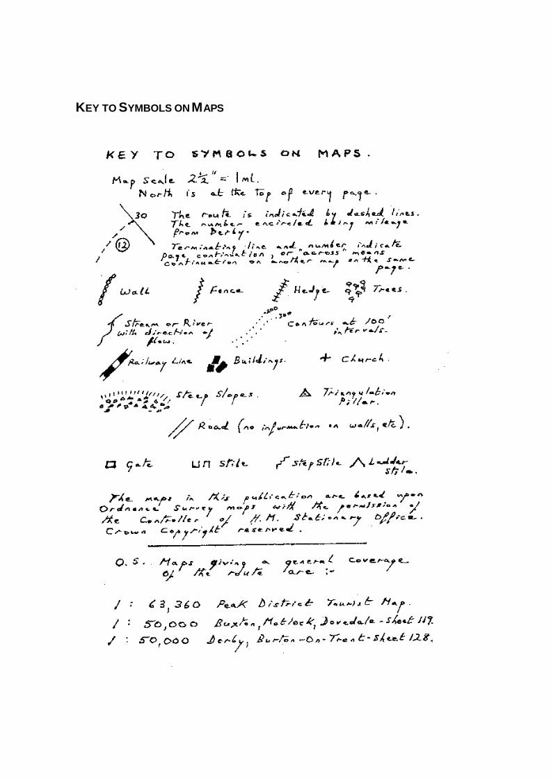
KEY TO SYMBOLS ON MAPS